2022 Vol. 40, No. 1
Display Method:
2022, 40(1): 1-21.
doi: 10.14027/j.issn.1000-0550.2020.085
Abstract:
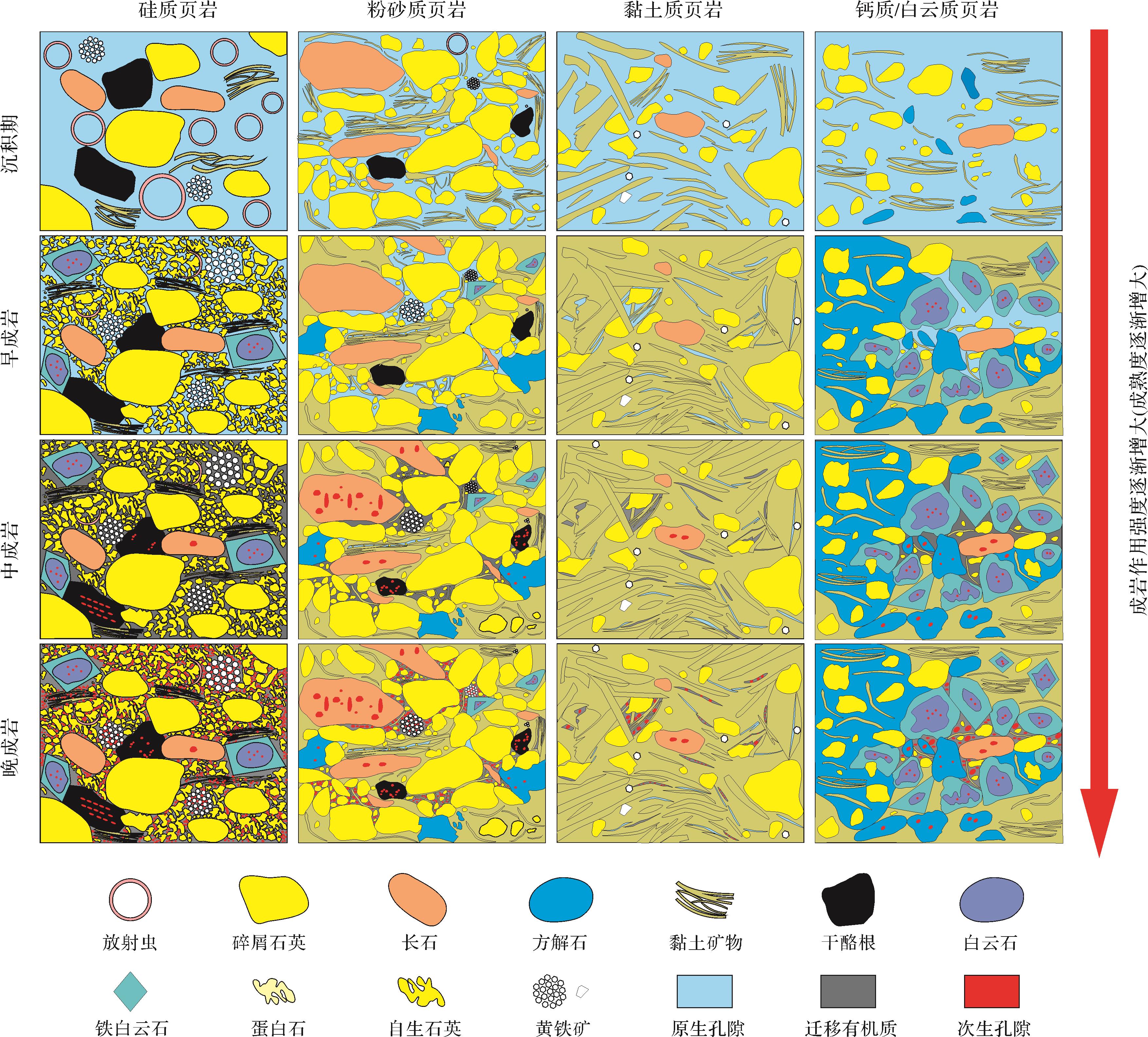
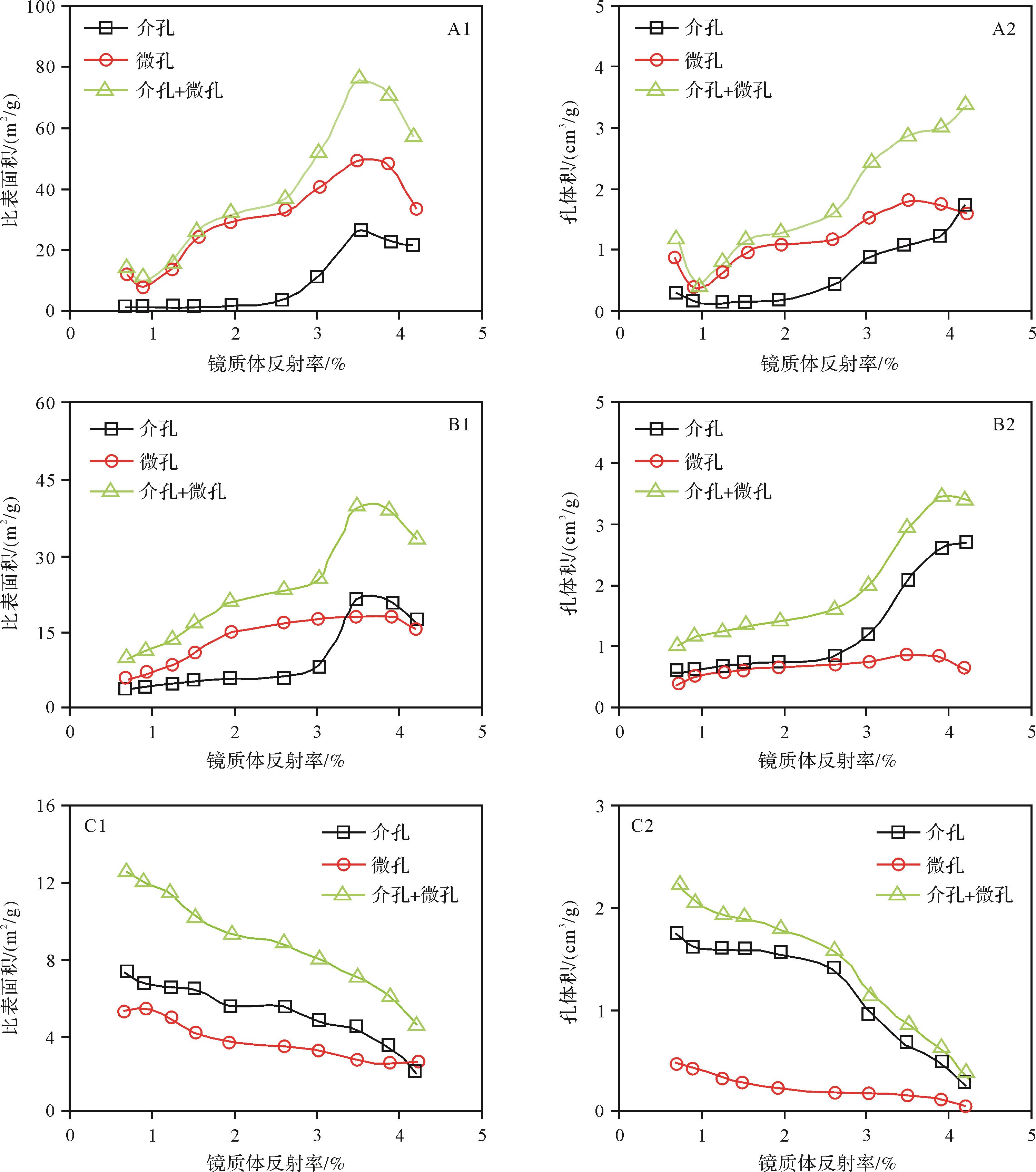
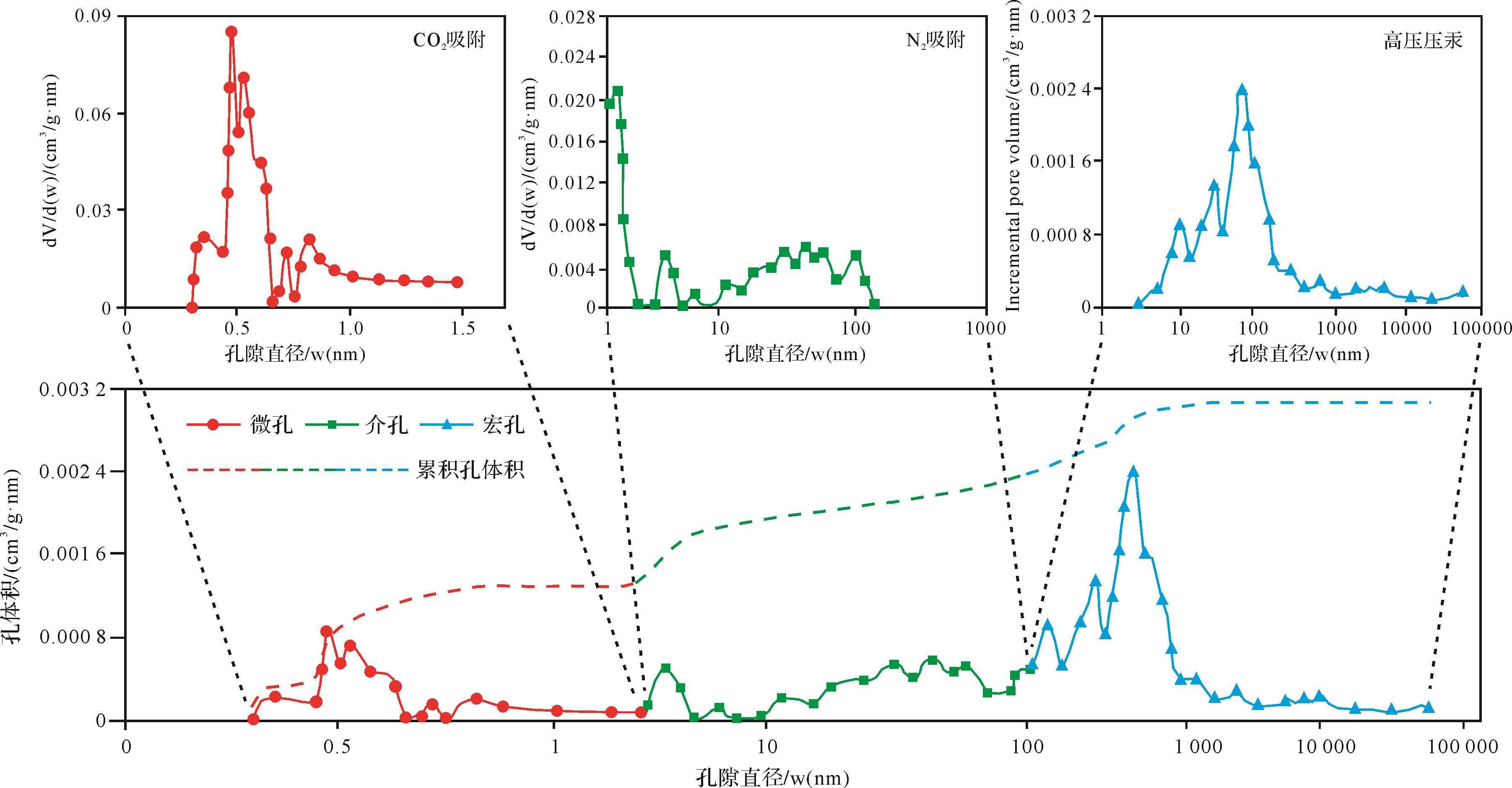
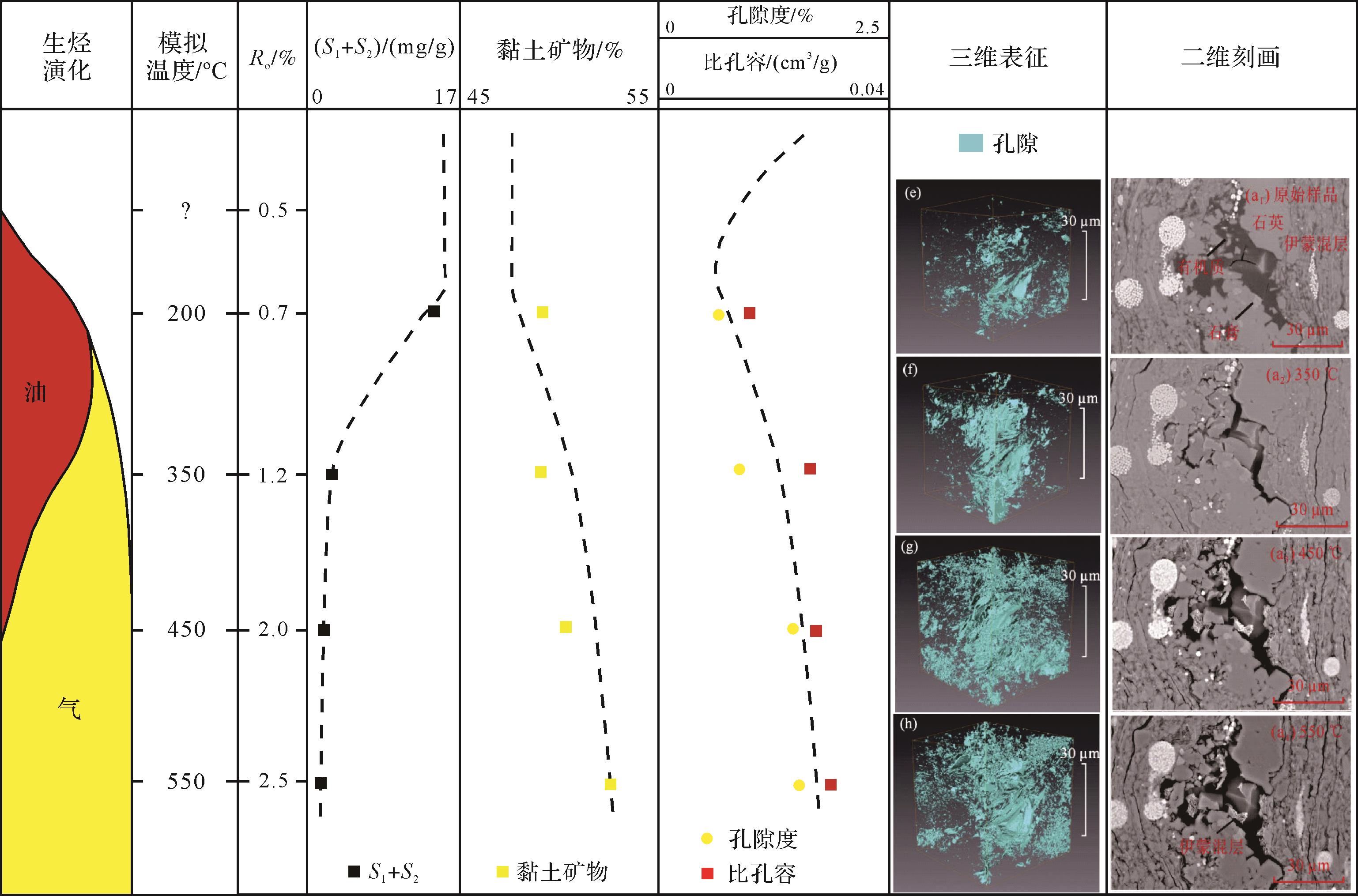
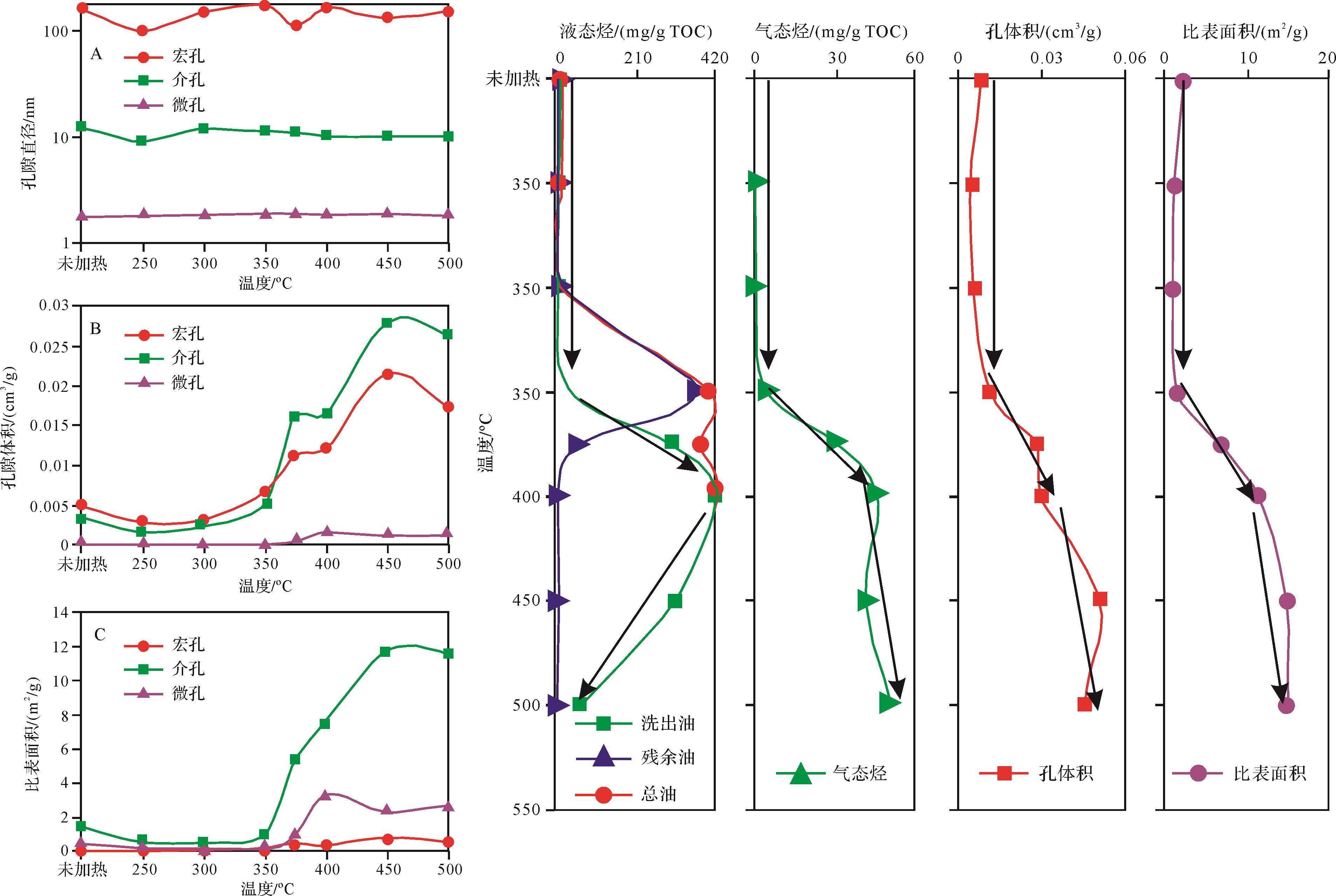
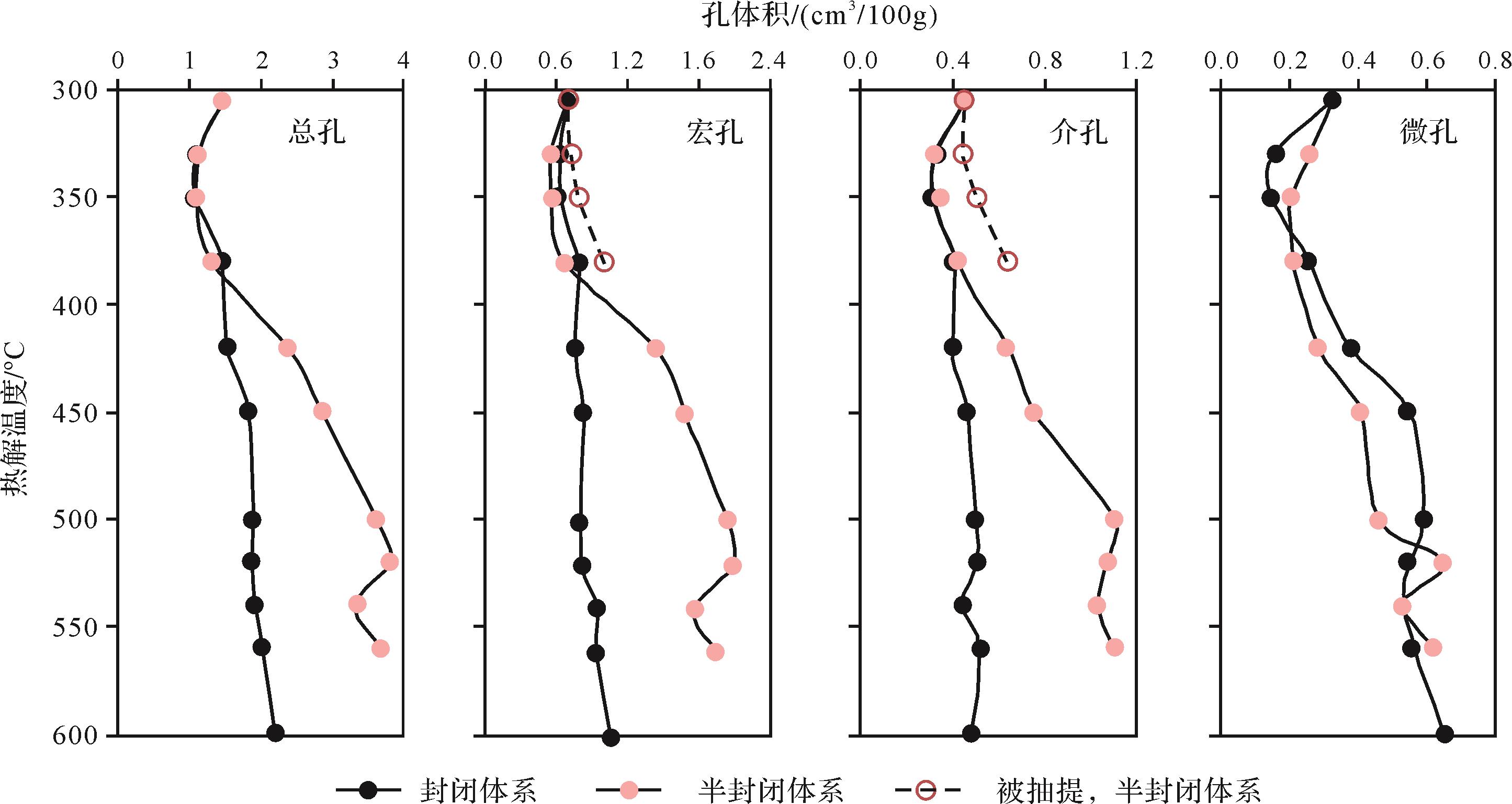
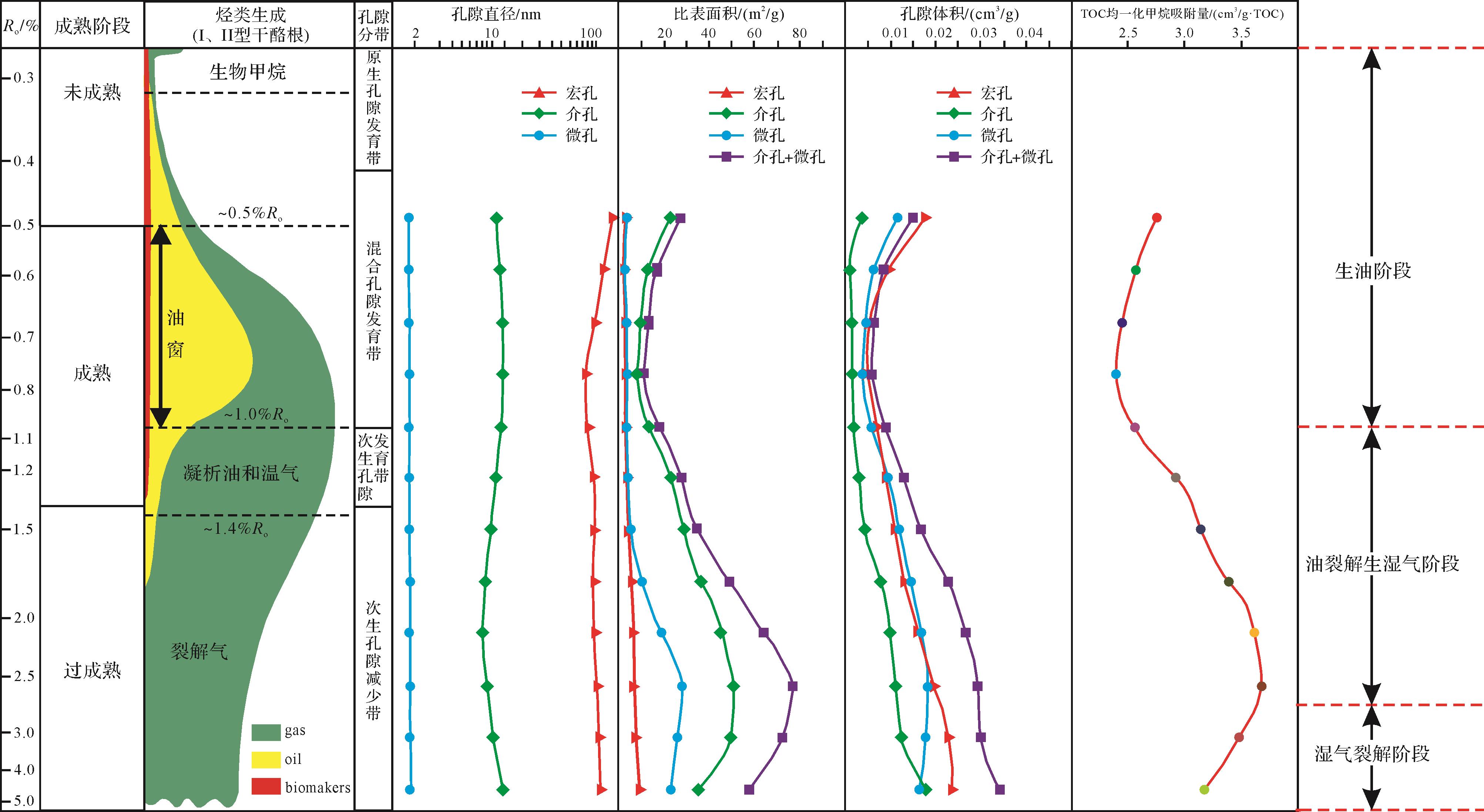
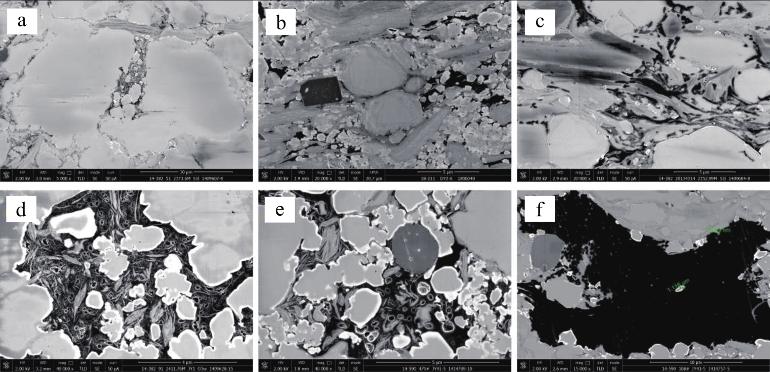
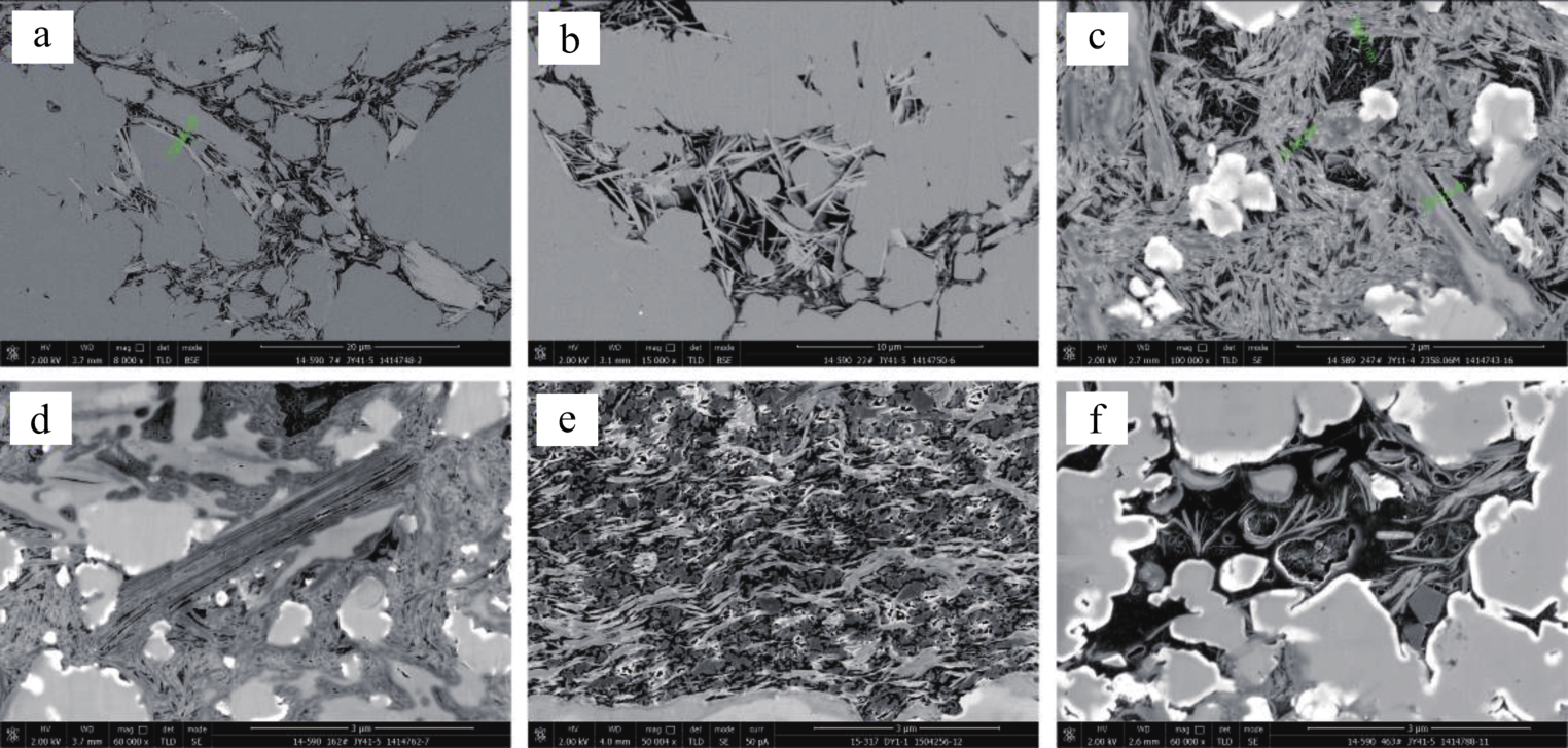
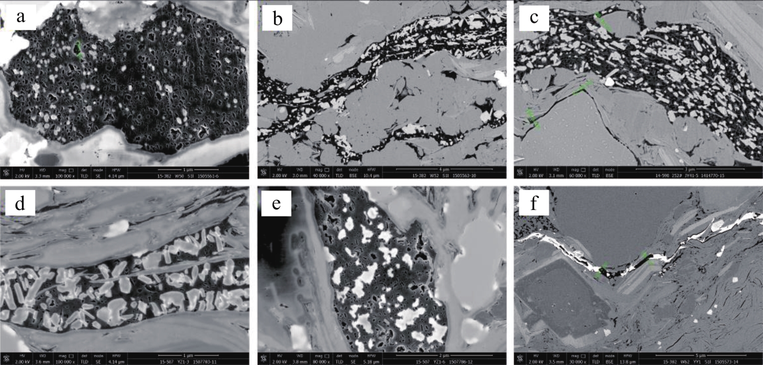
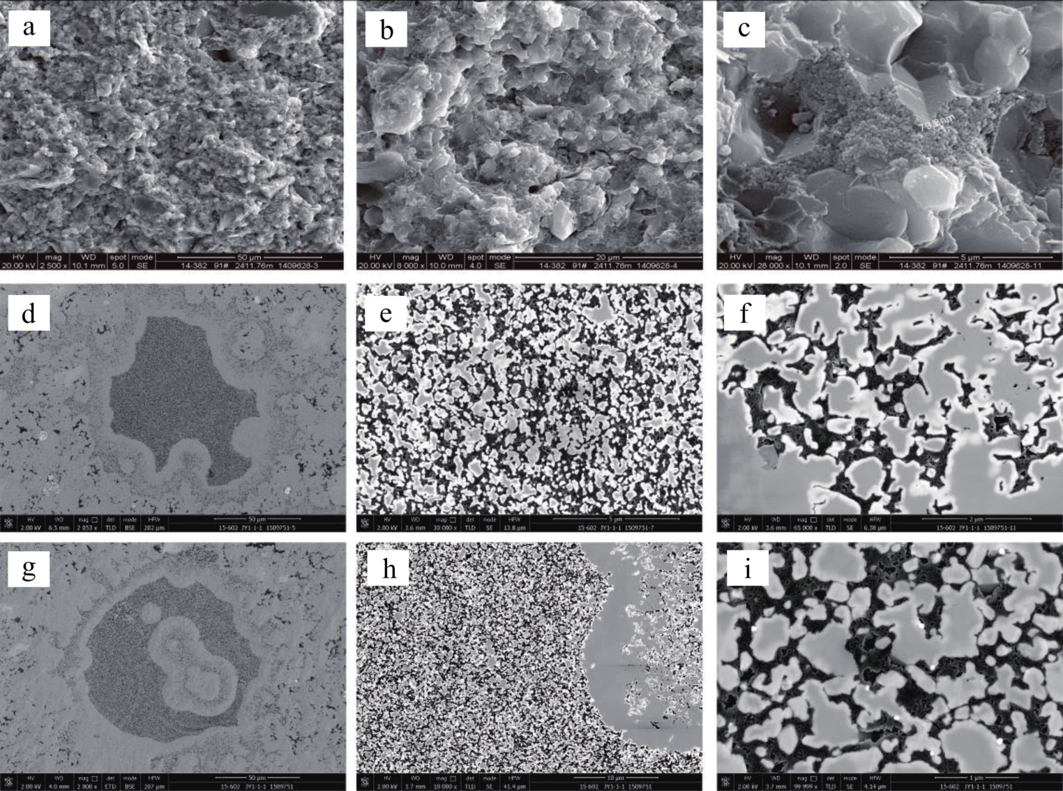
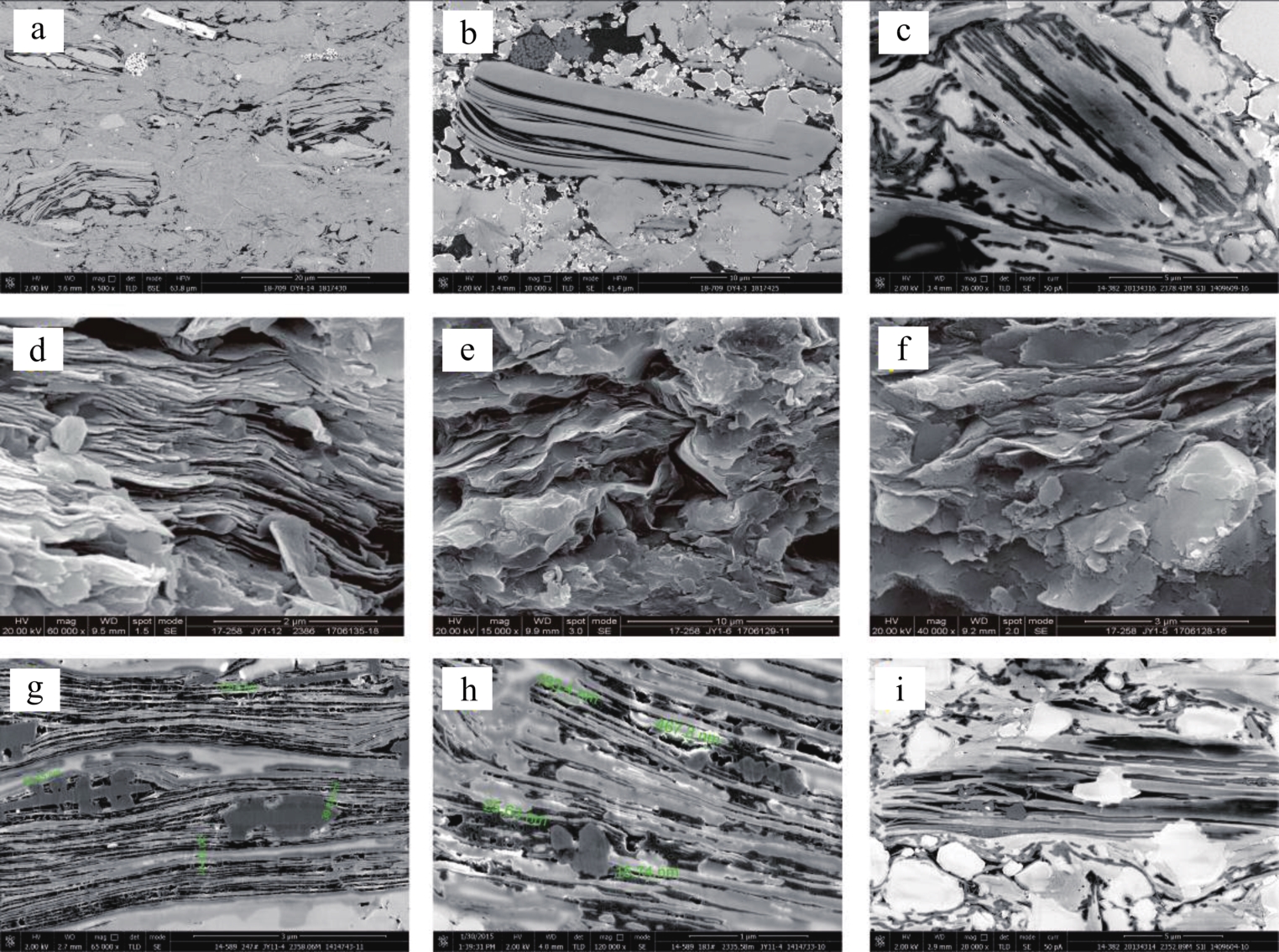
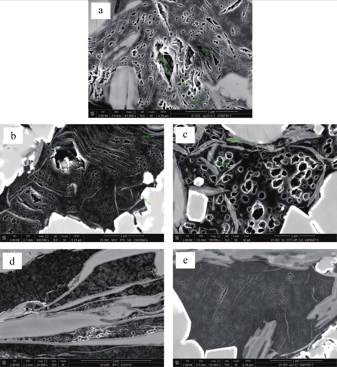
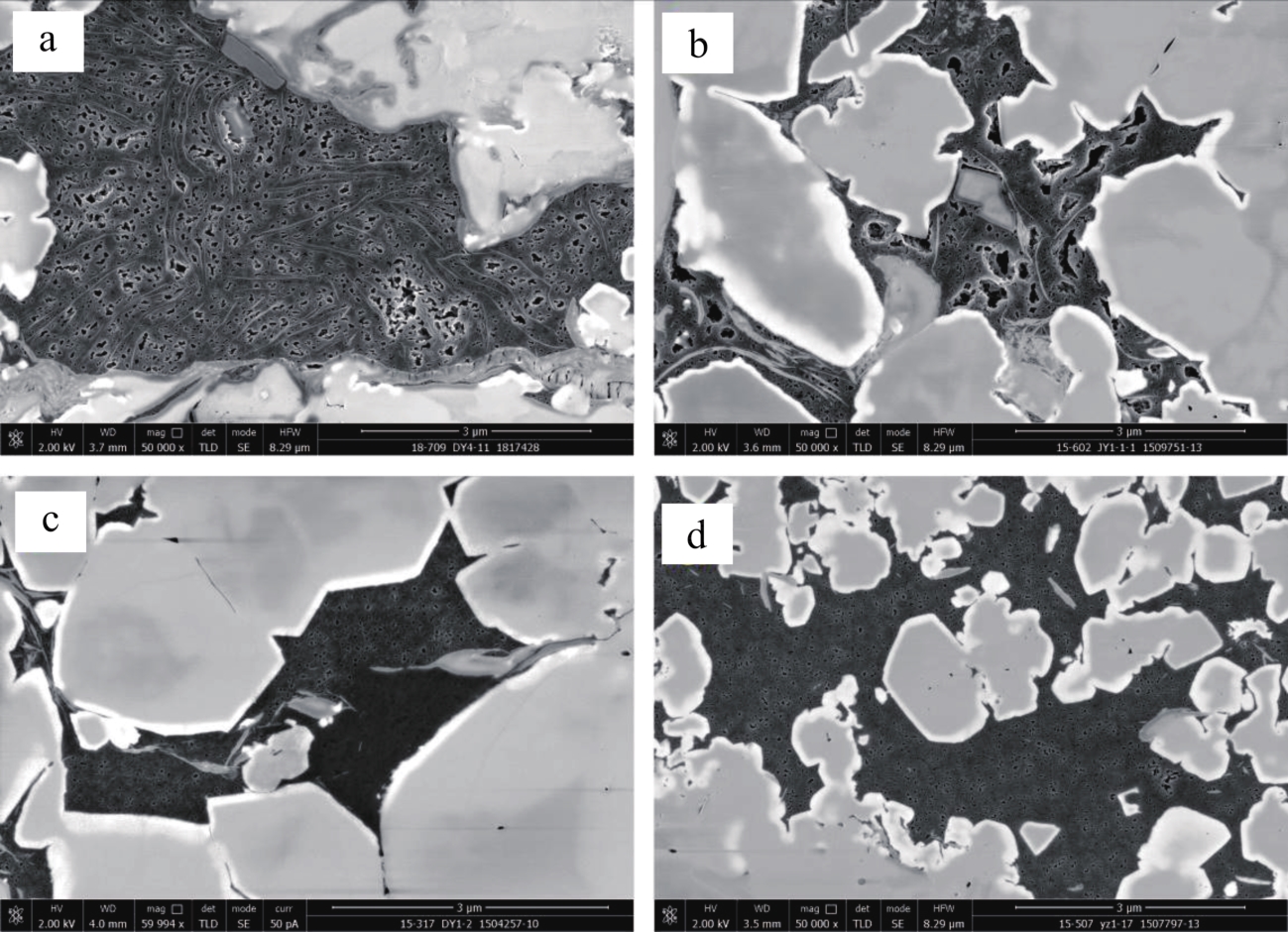
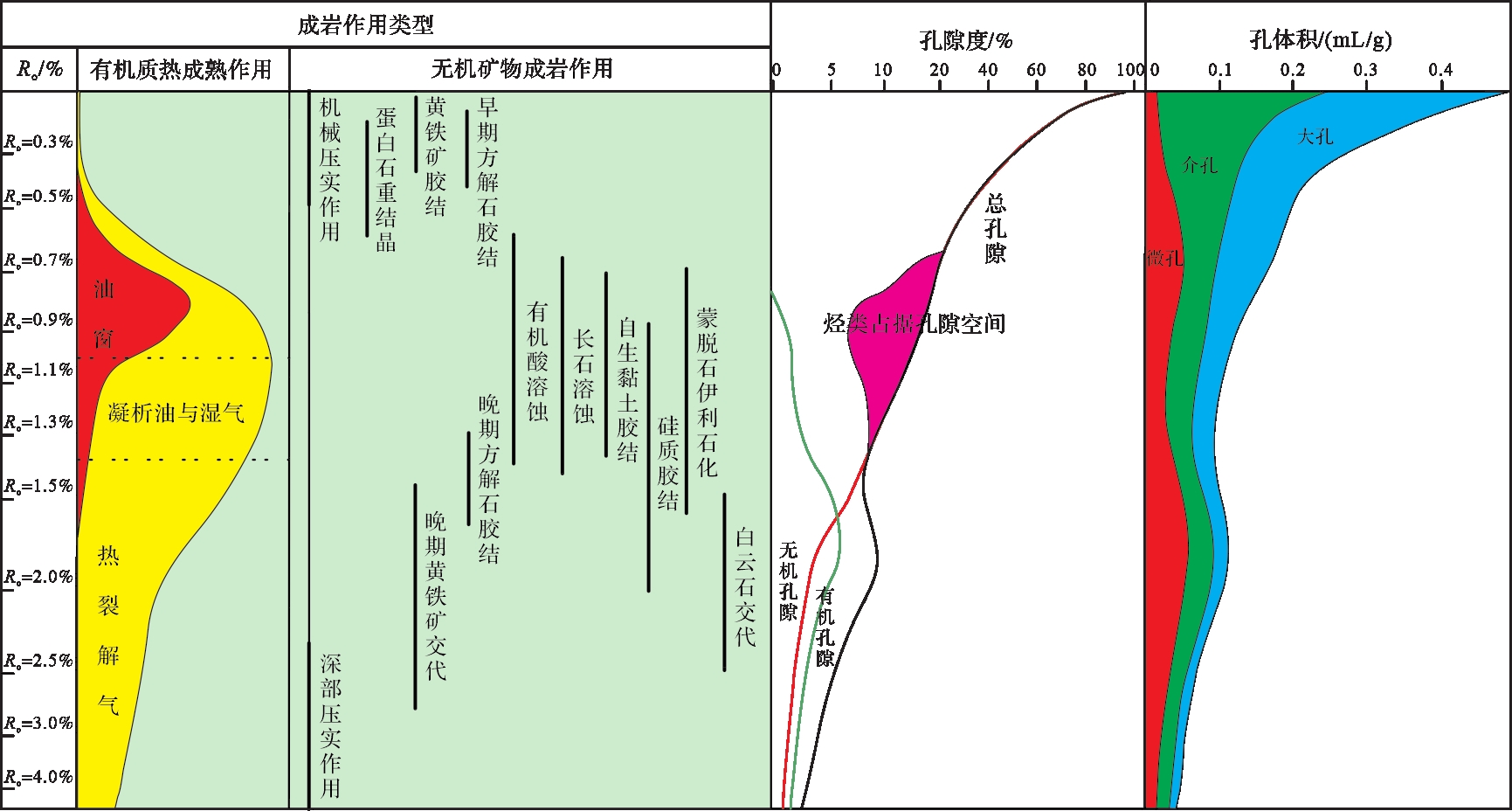
Research on evolution characteristics and models of organic-rich shale pore system are helpful for improving shale oil and gas micro- and nanoscale reservoir geological theory, to further reveal shale oil and gas enrichment and accumulation mechanisms, and to promote overall shale oil and gas geological evaluation, exploration and development. This study reviews the pore system characteristics and the factors affecting the evolution of organic-rich shale. The research and development history of the complex pore system in shale are briefly described, and the pore system evolution characteristics of natural and simulated matured shale are analyzed. The pore system evolution models of organic-rich shale in China and elsewhere are summarized, and the prospect of the current research situation of pore system is put forward. Due to the small pore size, poor connectivity and dense structure of organic-rich shale, the pores are more difficult than the conventional oil and gas reservoir to classify and identify. They are commonly found in quartz, feldspar, calcite, clay minerals, etc., and may be also formed in organic matter. Research on complex shale pore systems have gone through the stages of scientific exploration, theoretical formation and practical development. The development of micro- and nanoscale pores is controlled by both thermal mature hydrocarbon generation and diagenesis, and their formation and evolution are also affected by both internal and external factors. Among the external factors, the sedimentary environment and structural background jointly determine the basic conditions for the development of shale micro- and nanoscale pore systems. Of the internal influencing factors, lithological change and mineral composition influence fracturing properties and pore structure characteristics of shale, both of which will cause the pore space in shale increase or decrease to a certain extent. TOC content and kerogen type affect pore volume and surface area of organic matter, while the thermal maturity of organic matter restricts the evolution trend of different pore types. There is no simple positive or negative correlation between thermal maturity and the pores in a shale reservoir, and there is also considerable disagreement about the cause of nanopore variation with change of thermal maturity. This paper also reviews the progress and current status of research into pore system evolution in natural and simulated matured shale, and summarizes the typical evolution models of pore system in natural and simulated matured shale, analyzing the main influencing factors in the evolution process of these pore systems. It is believed that samples of different types of organic matter and from different depositional environments should be selected for deeper research. The qualitative and quantitative analysis of the main controlling factors and evolution of organic-rich shale should be strengthened. Simulated systems and simulation experiment conditions need to be improved to make them much more similar to actual geological conditions. The accuracy and range of measuring micro- and nanoscale pore systems with different maturity sequences should be improved.
2022, 40(1): 22-33.
doi: 10.14027/j.issn.1000-0550.2020.123
Abstract:
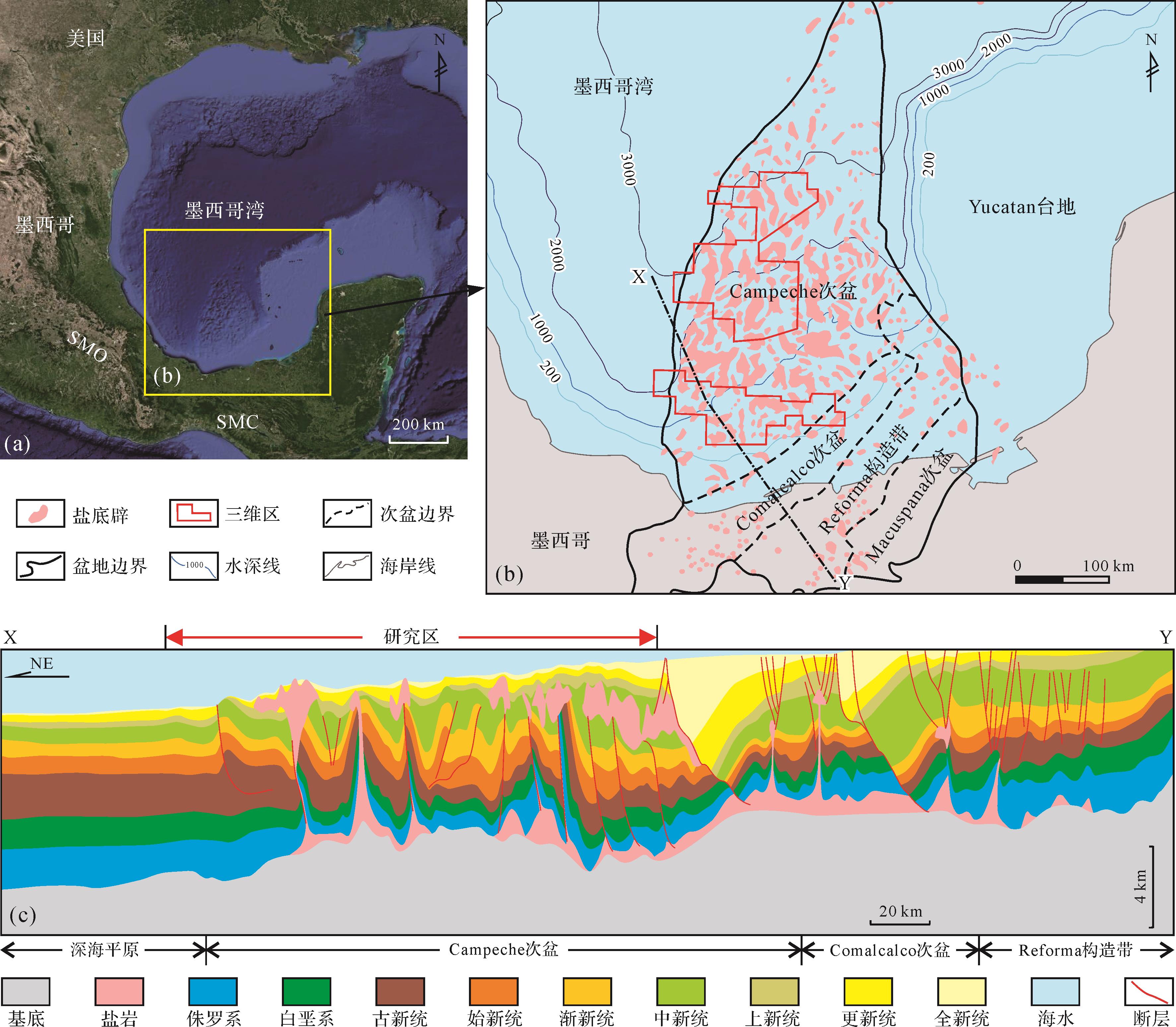
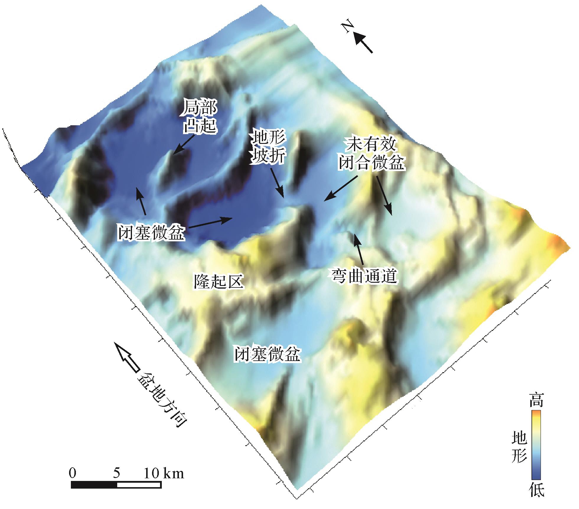
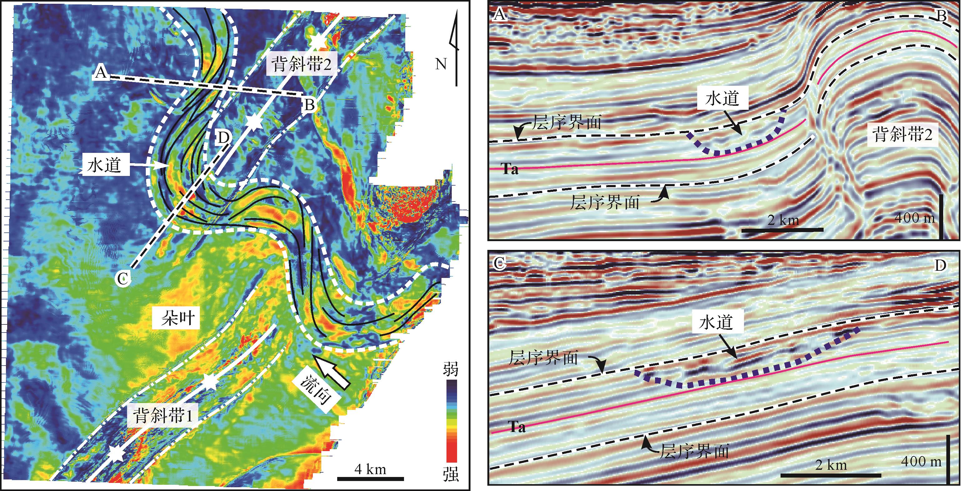
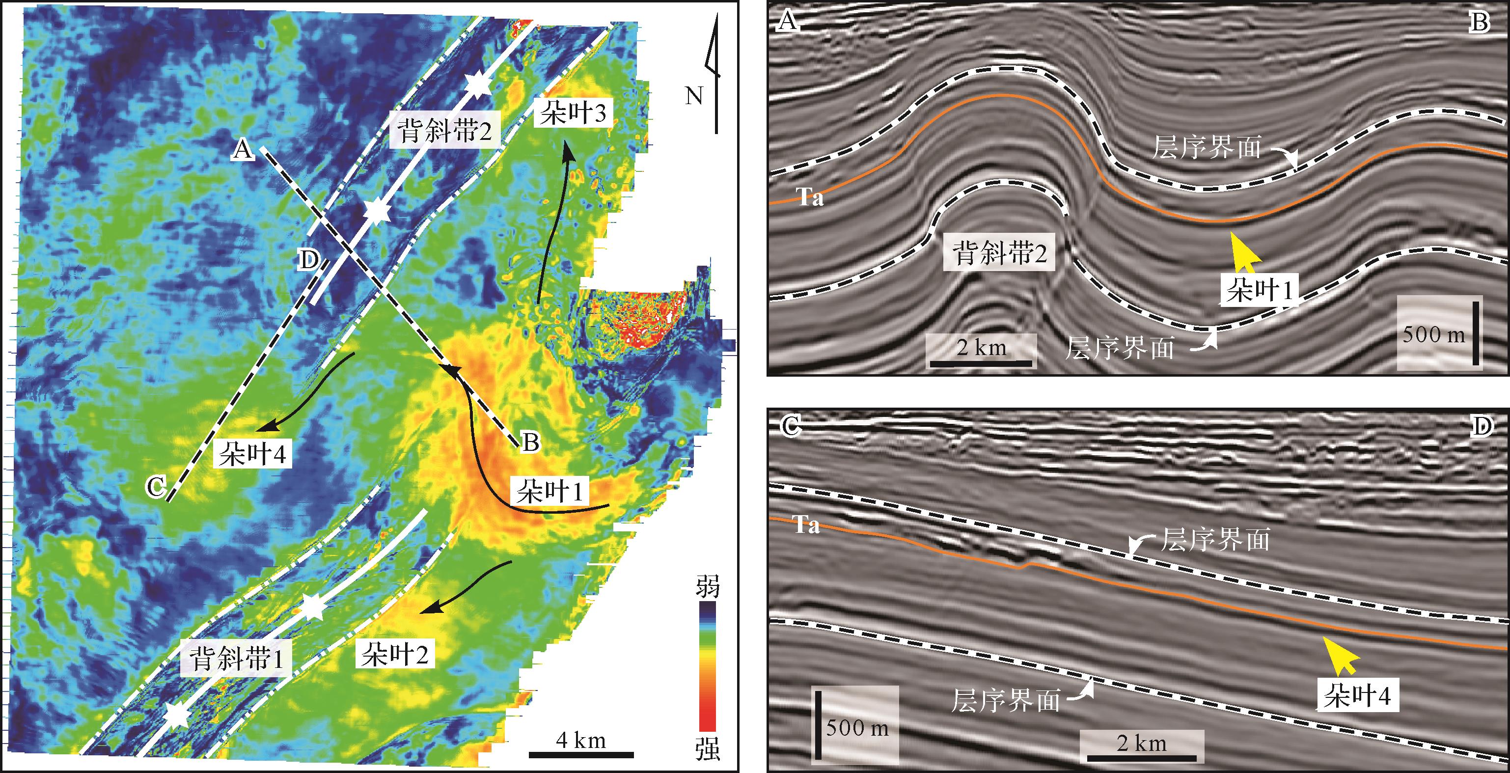
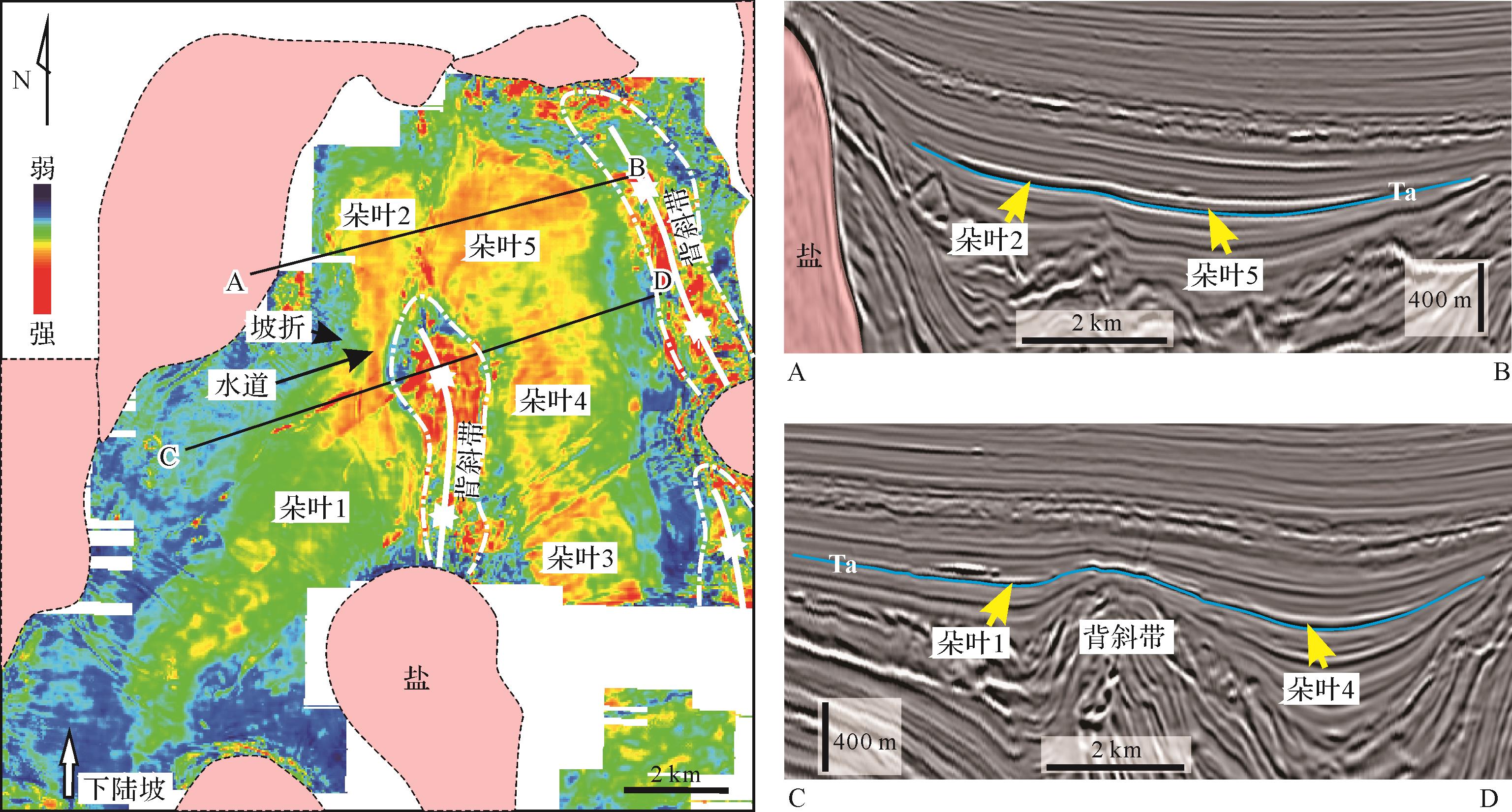
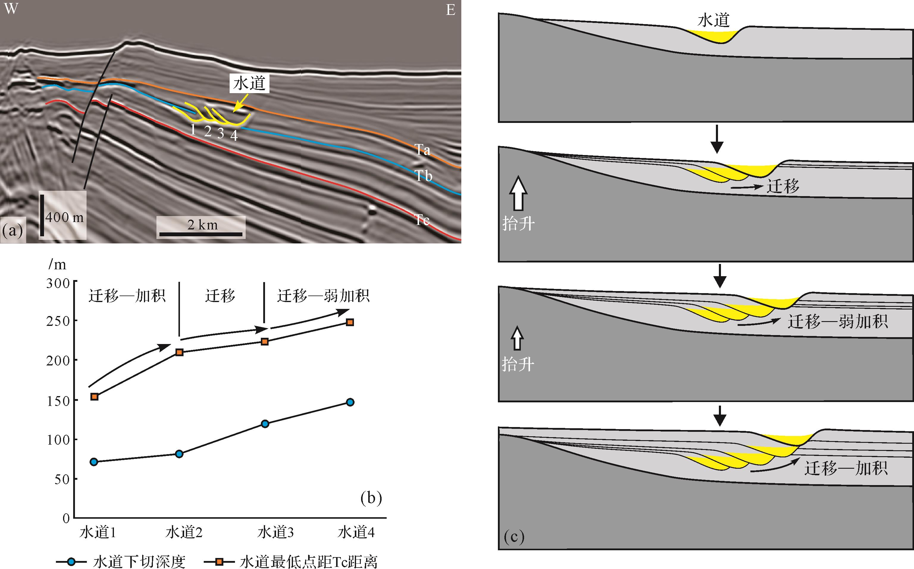
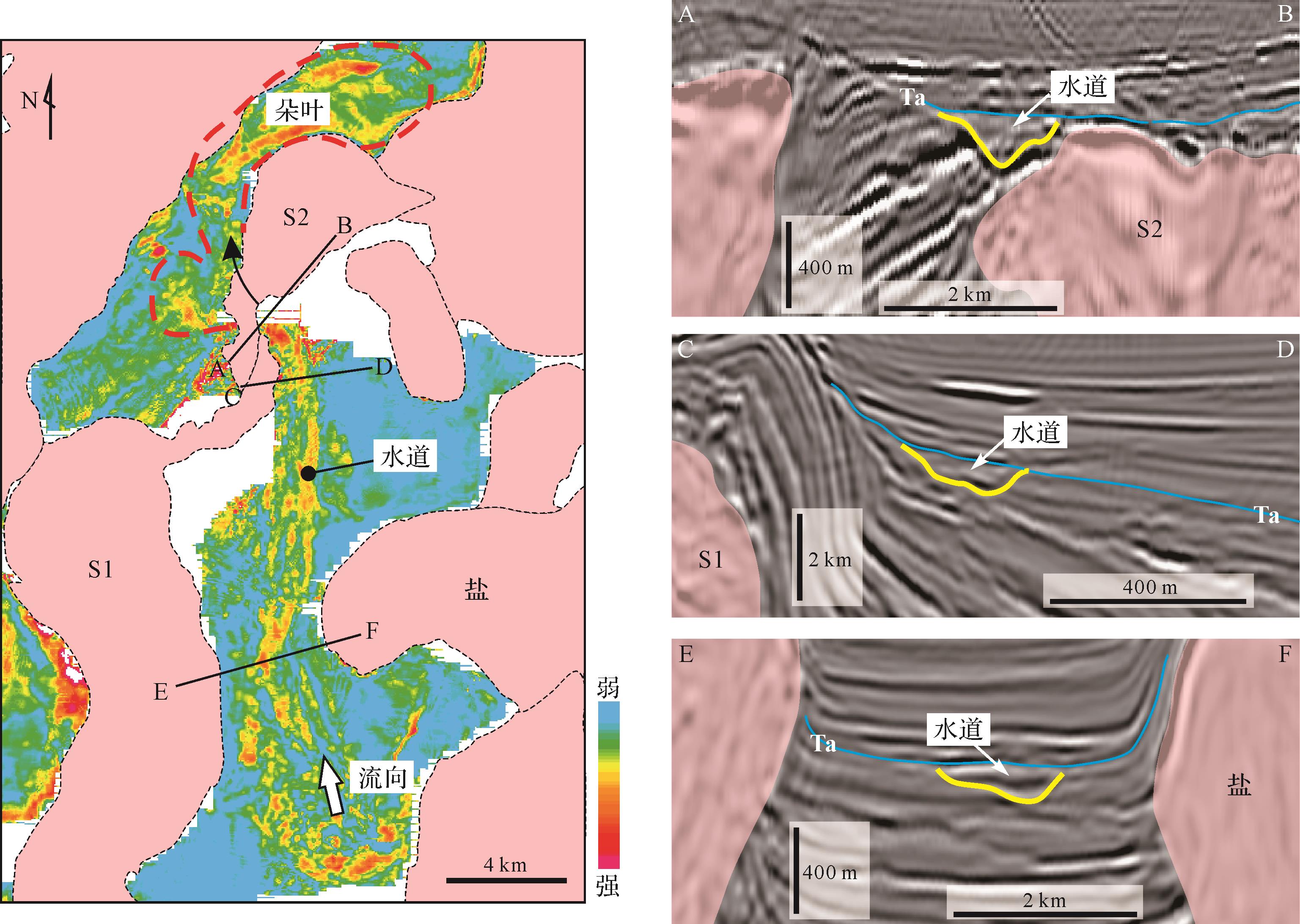
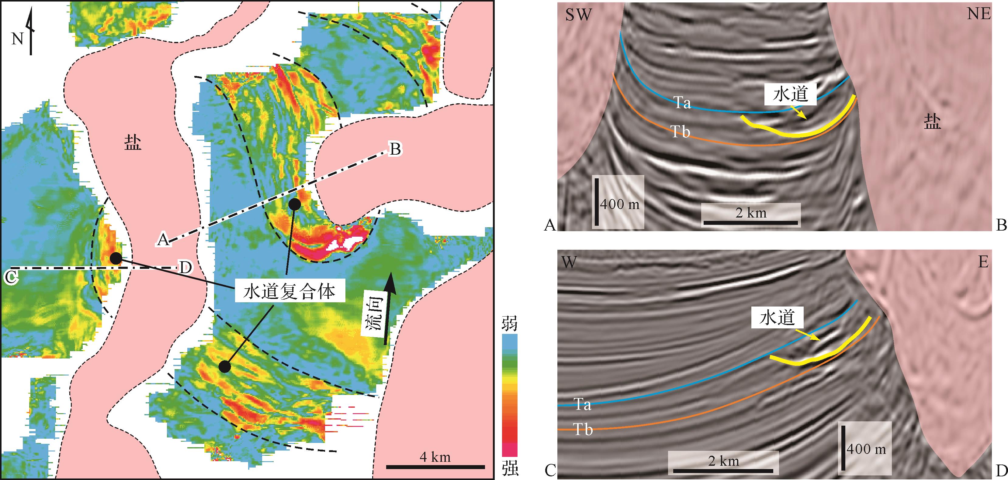
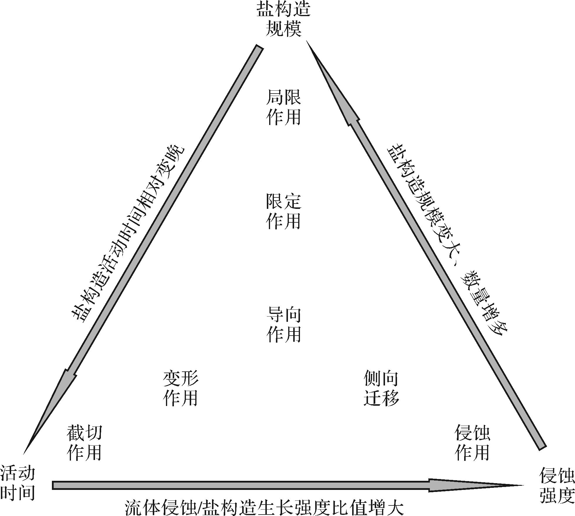
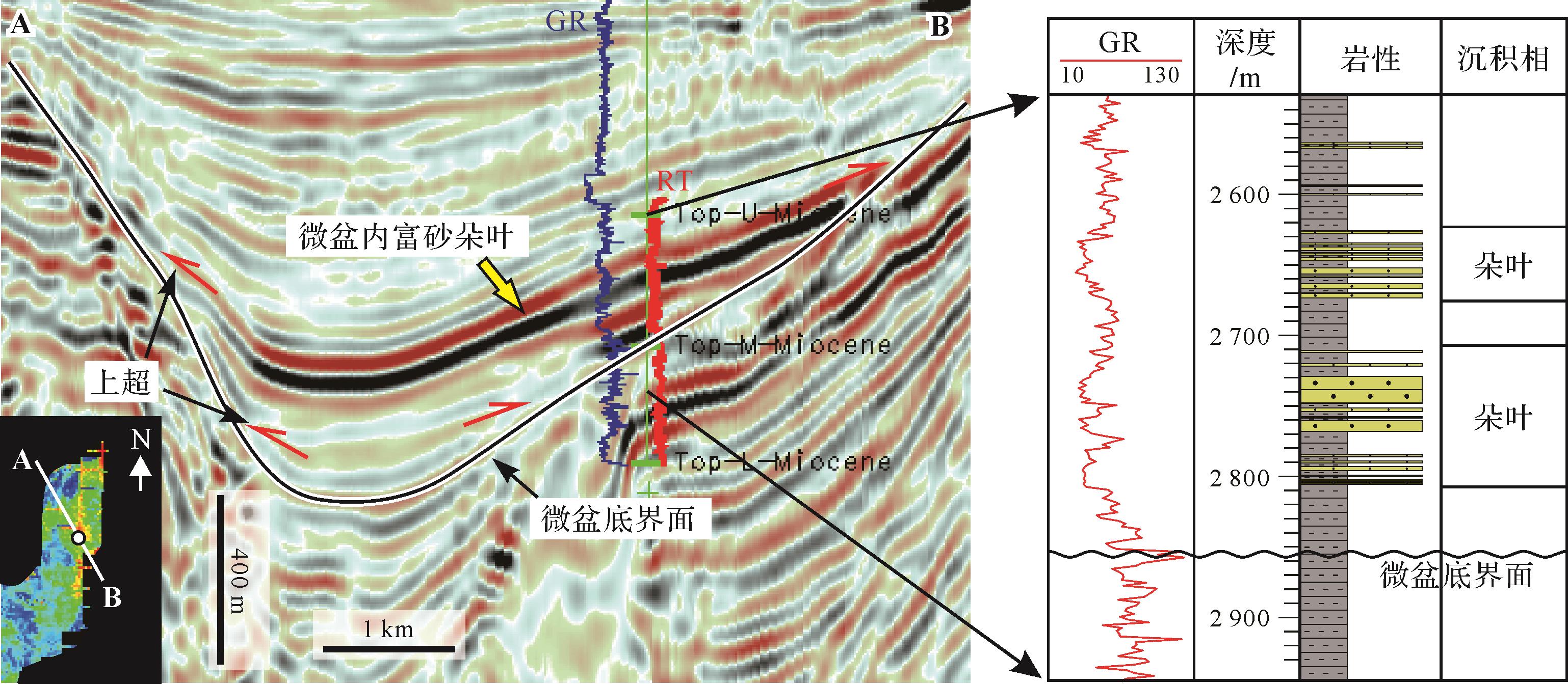
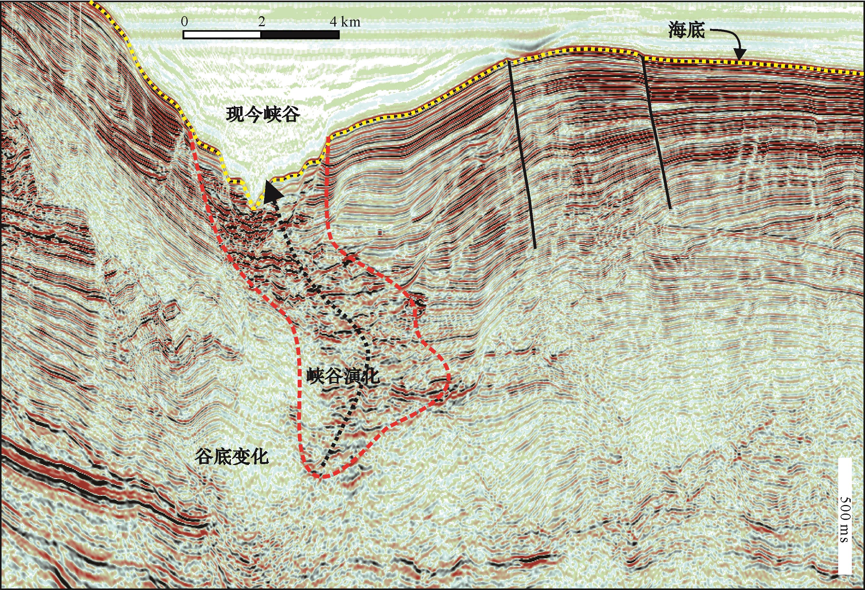
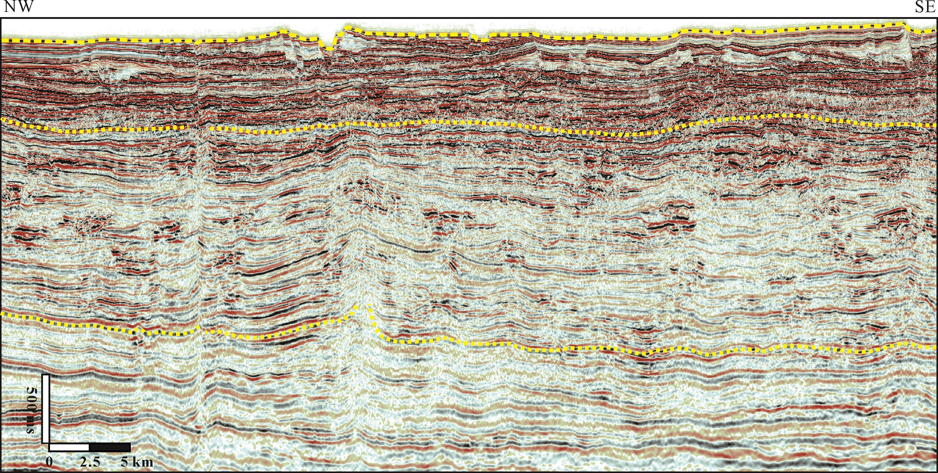
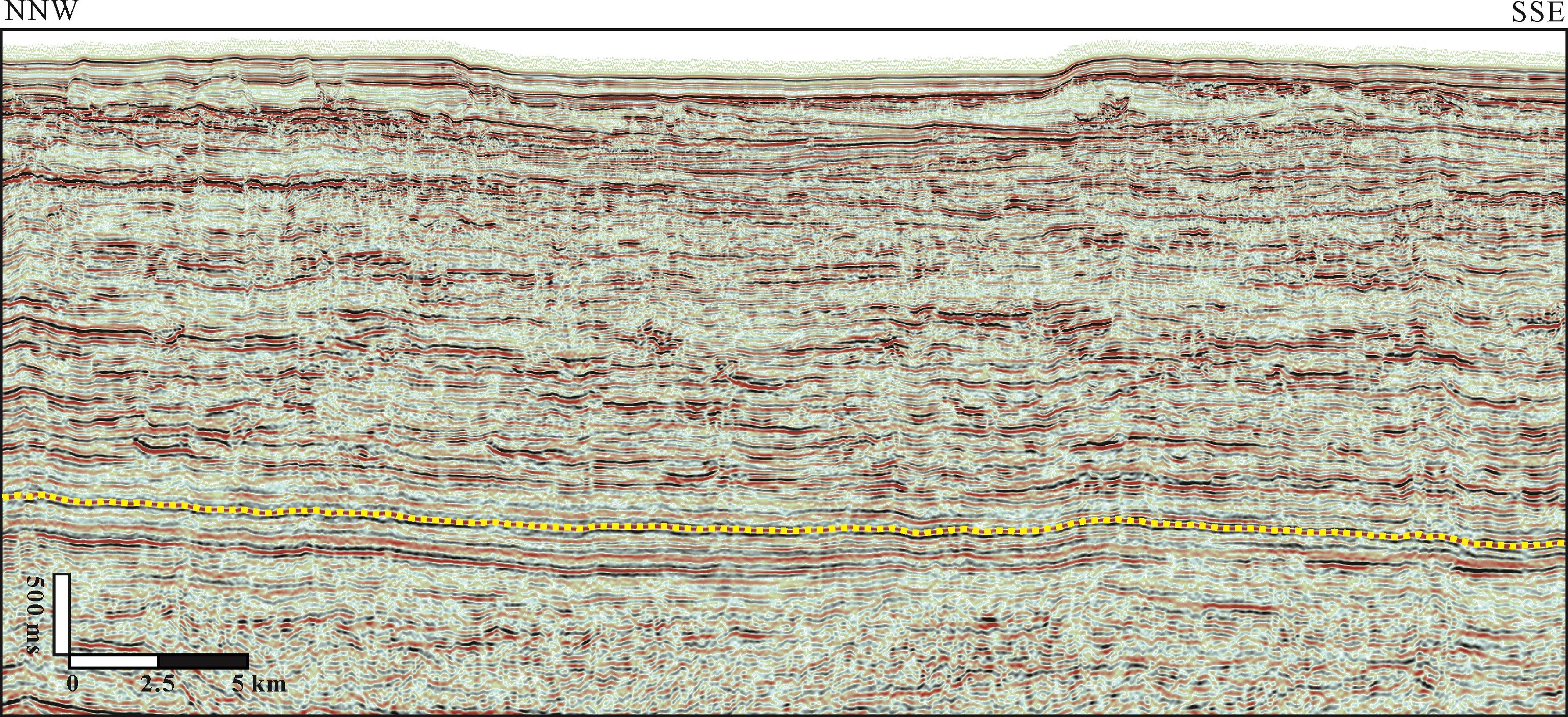
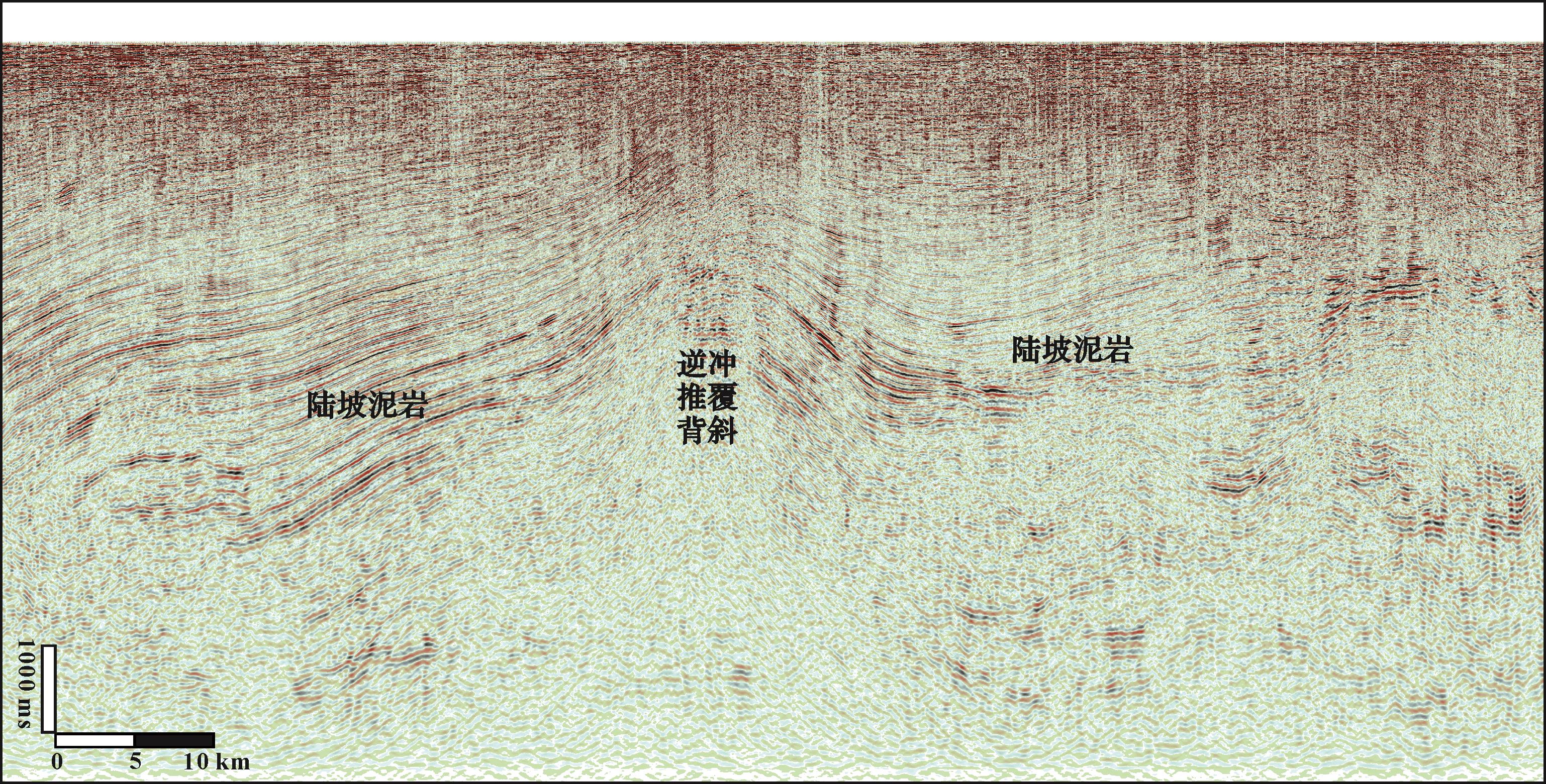
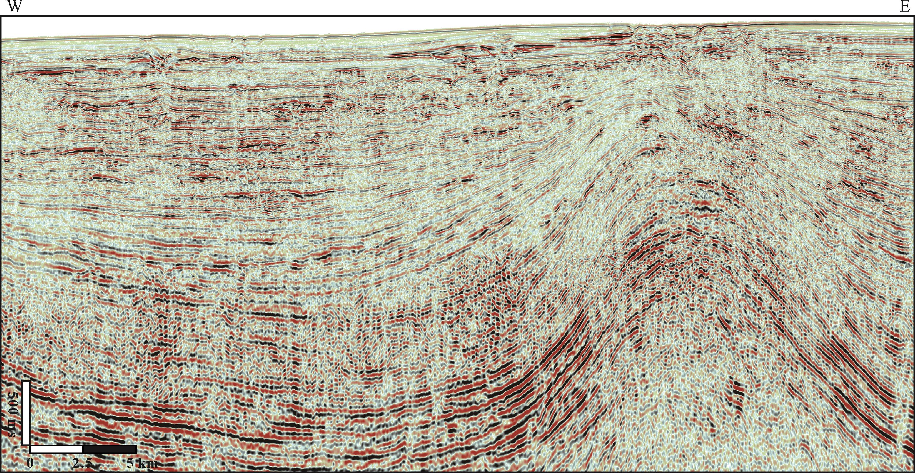
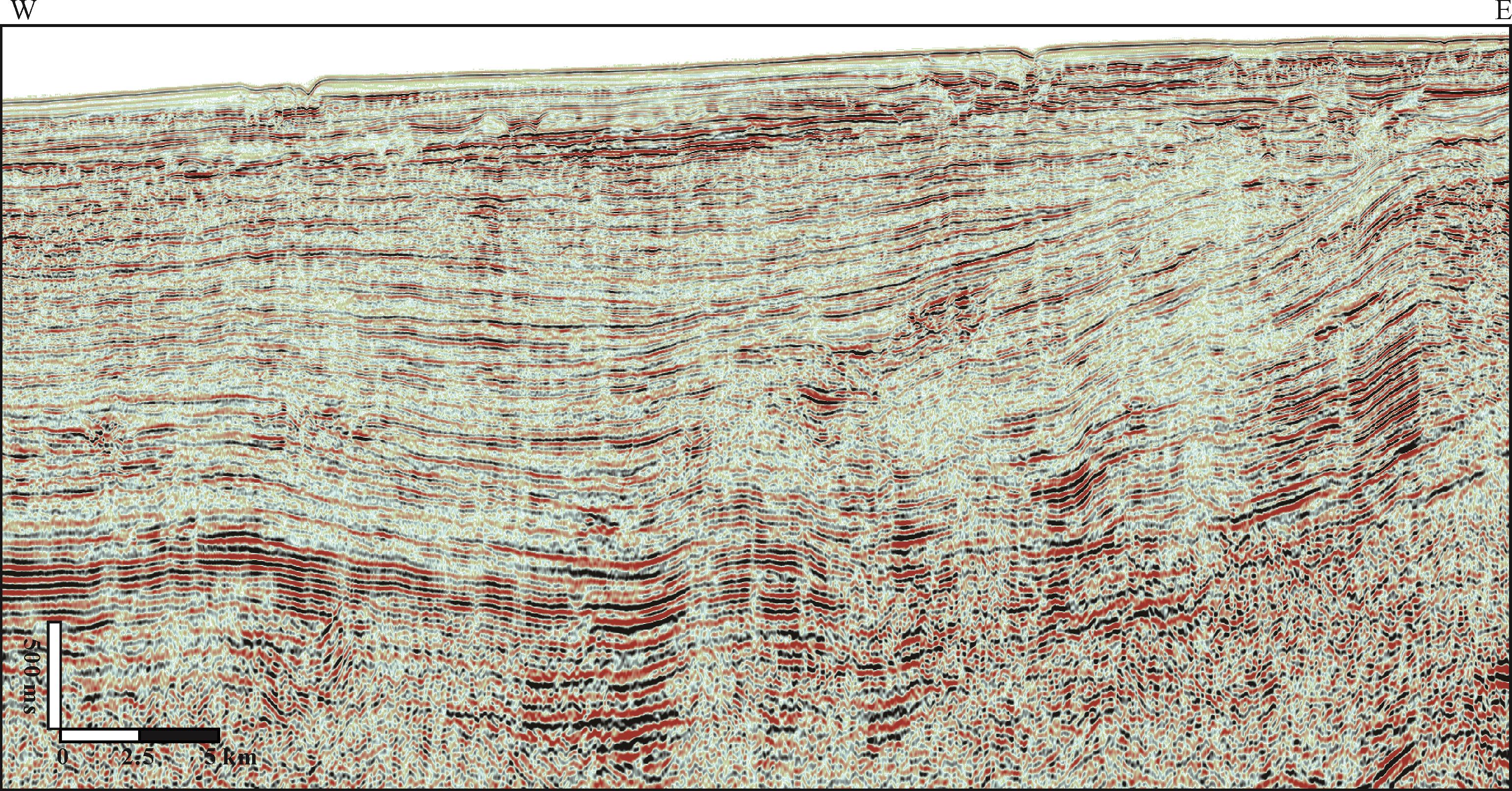
In passive continental margin basins with salt tectonics, the determination of sedimentary coupling characteristics between salt tectonic activity and deep-water gravity flow events is the basis for the prediction and evaluation of relatively high-quality reservoirs and “sweet spot” areas in such basins. In this paper, the interaction types and response characteristics between Miocene deep-water sediments and salt structures in the Sureste Basin in the Gulf of Mexico are analyzed by means of integrated drilling and core analysis and the detailed interpretation of high-resolution three-dimensional seismic data. In addition, the genesis of different action modes and the significance of hydrocarbon exploration are discussed. The results show that the lower continental slope of the Sureste Basin develops a series of geomorphic units related to salt tectonic activities, such as a mini-basin, topographic slope break, local uplift, and connected tortuous corridors, etc. For this topographically complex slope, deep-water gravity flow depositions and salt structures form a variety of interaction modes and matching relationships. The early and syndepositional active salt structures can not only direct or limit gravity flow, forming various interaction types, such as guidance, confinement, blocking, and lateral deflection, but also be eroded by gravity flows to form an unconformity. The reconstruction of deep water deposition by salt activities in the late period shows two styles of truncation and deformation. Different interactions are likely controlled by the nature and erosional power of the gravity flow, the size, quantity, and orientation of the salt structure, and the timing and intensity of the salt structure growth. Blocking, erosion, and truncation correspond to three end-member classes of interaction between the salt structure and deep water deposition. Early and syndepositional salt tectonic activities affect the quality and distribution of deep water clastic reservoirs, and late salt tectonic activities are crucial to the formation of structural and structure-lithologic traps.
2022, 40(1): 34-46.
doi: 10.14027/j.issn.1000-0550.2021.057
Abstract:
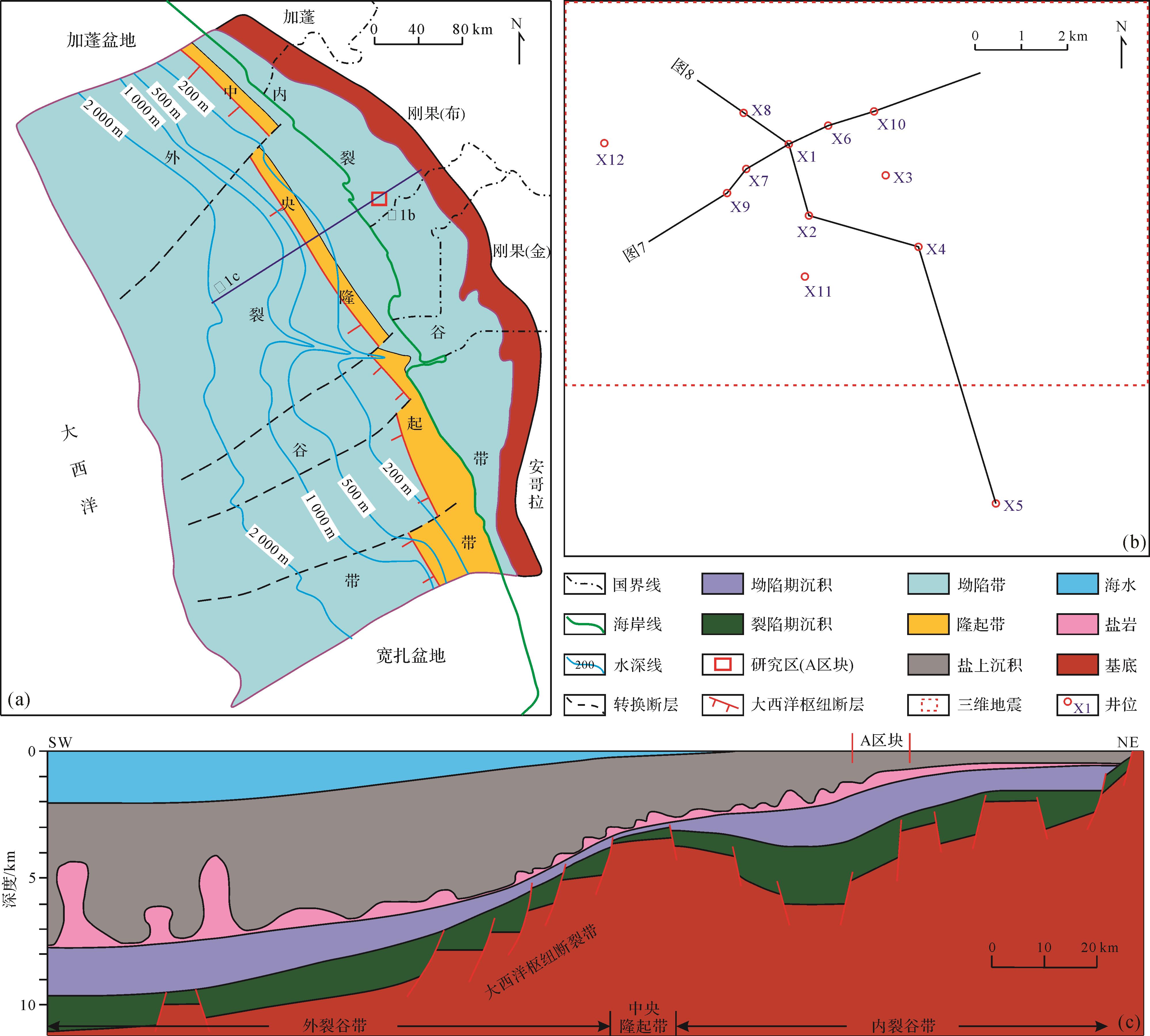
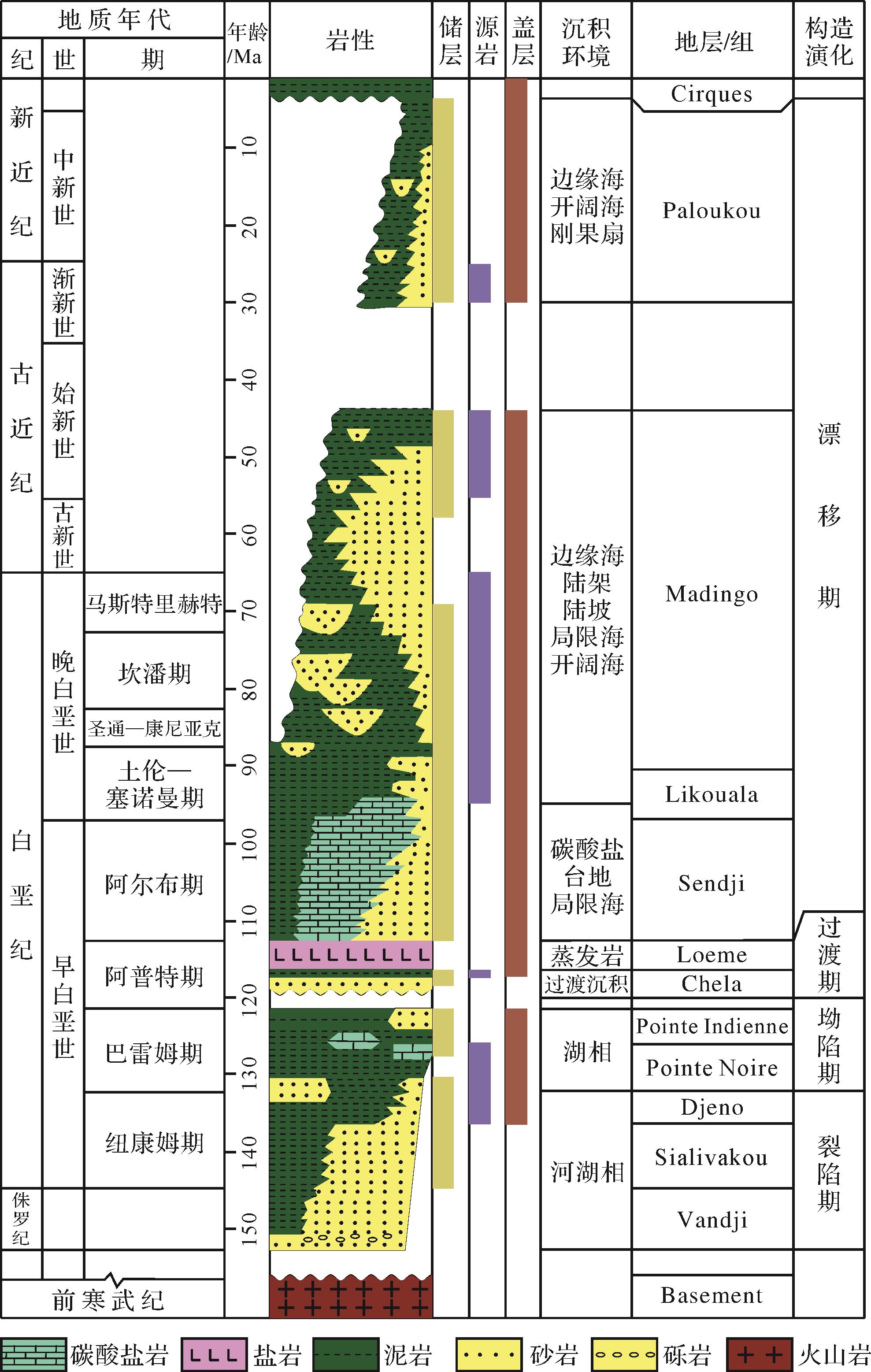
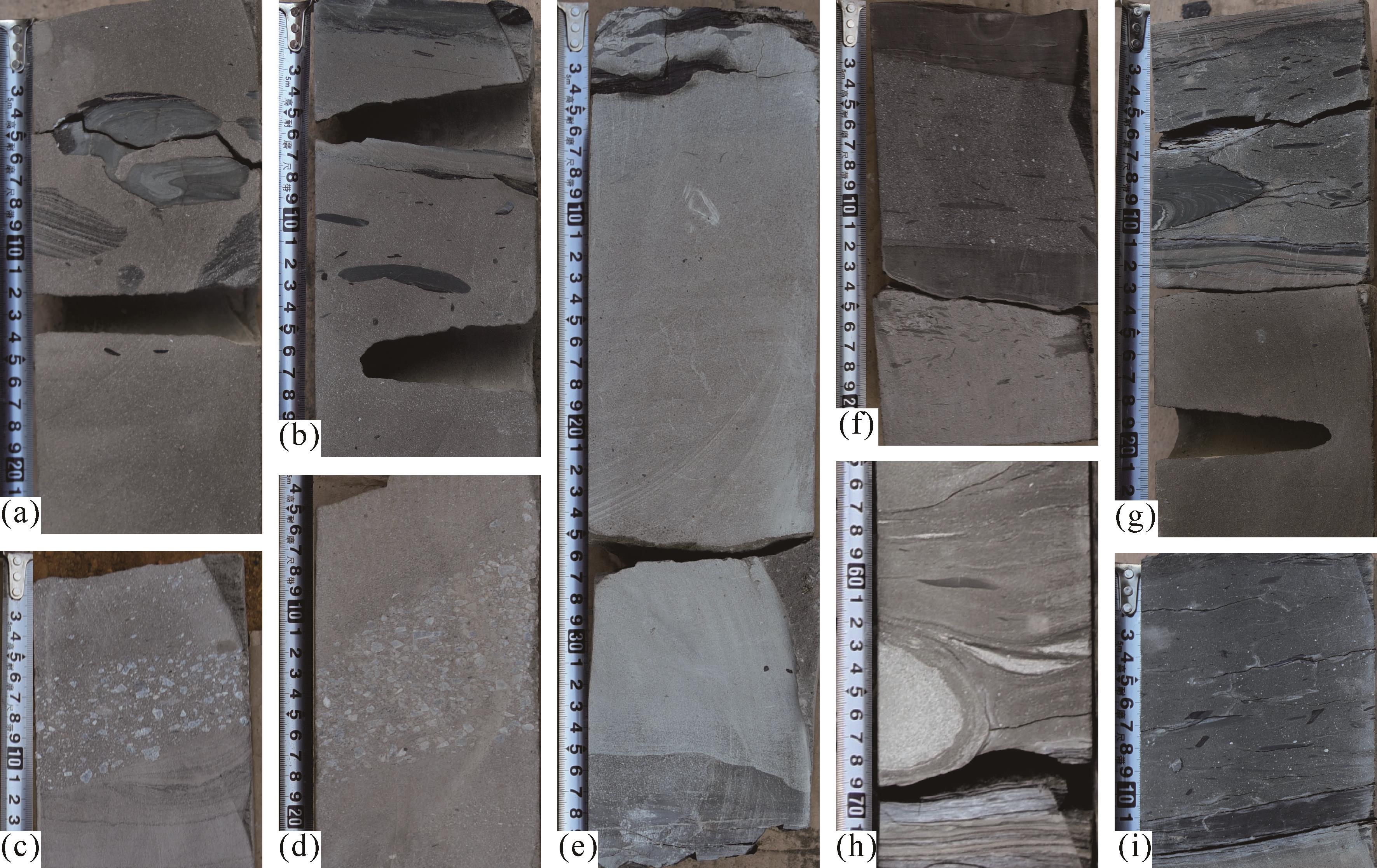
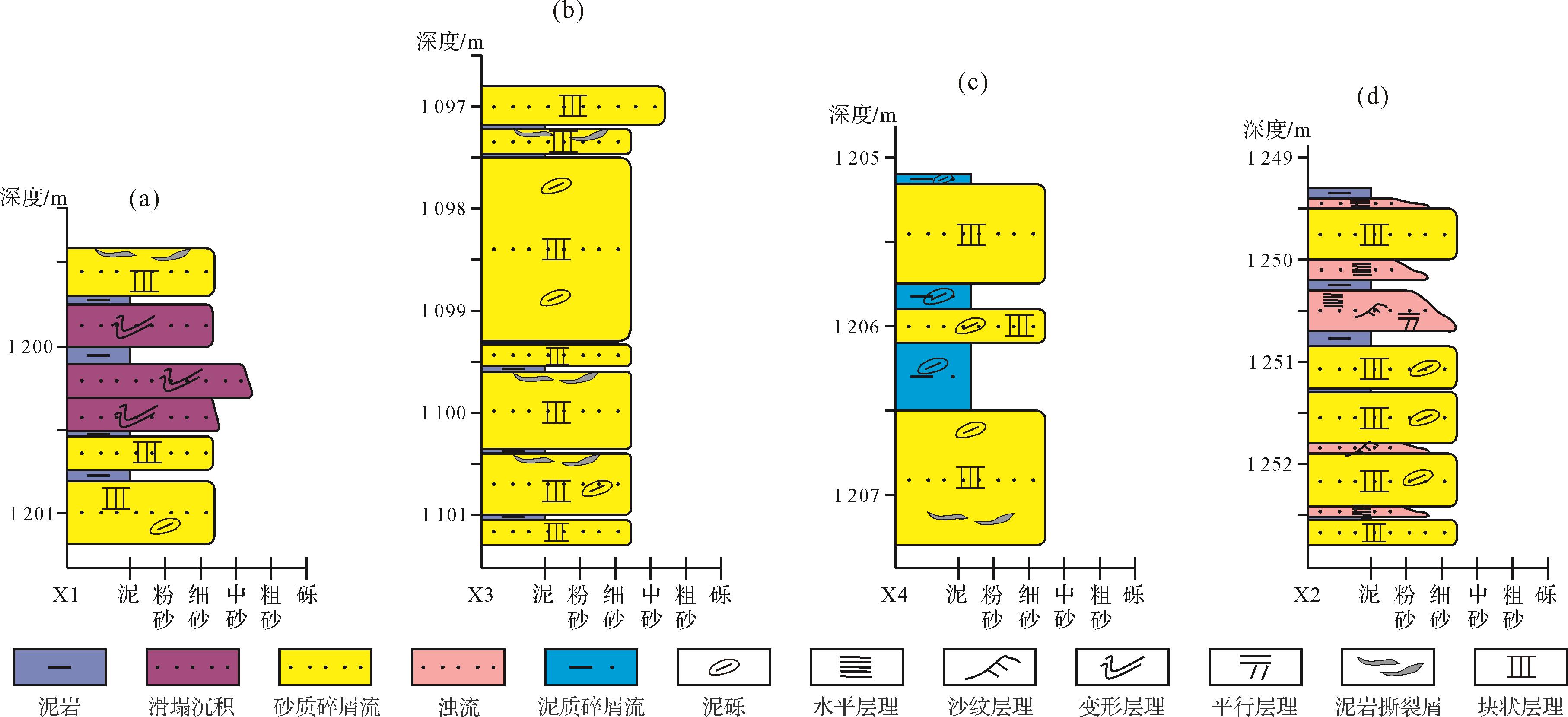
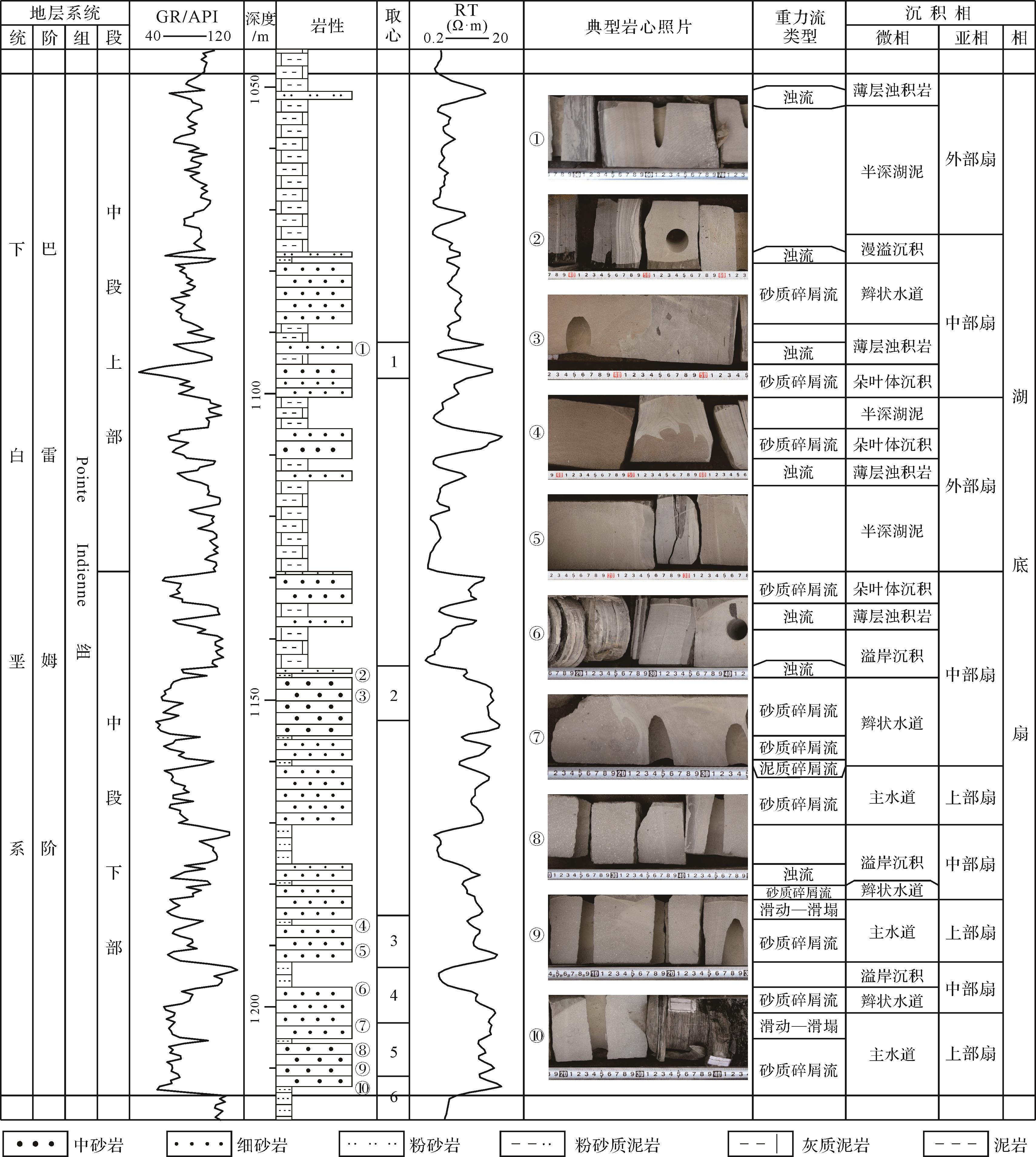
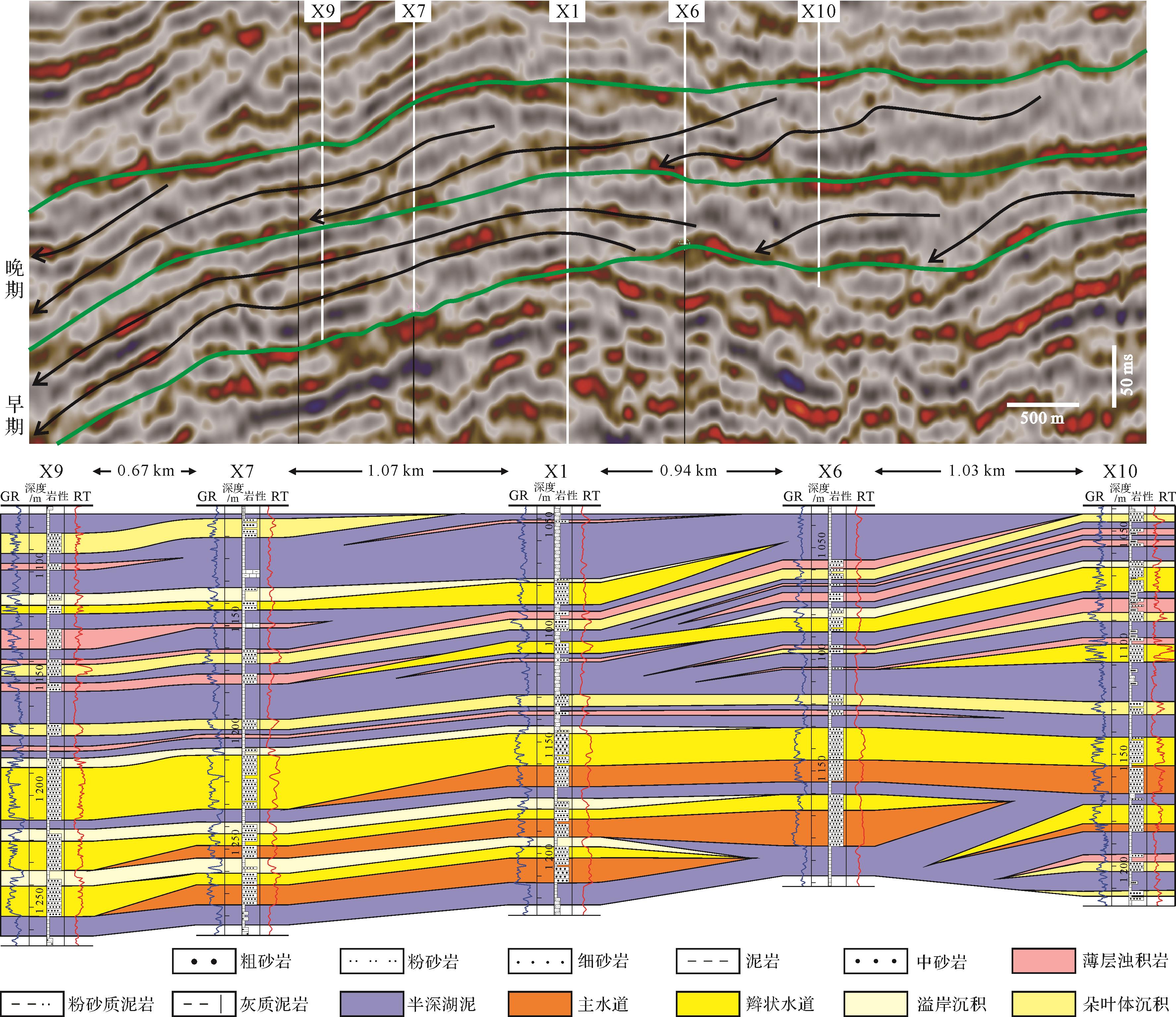
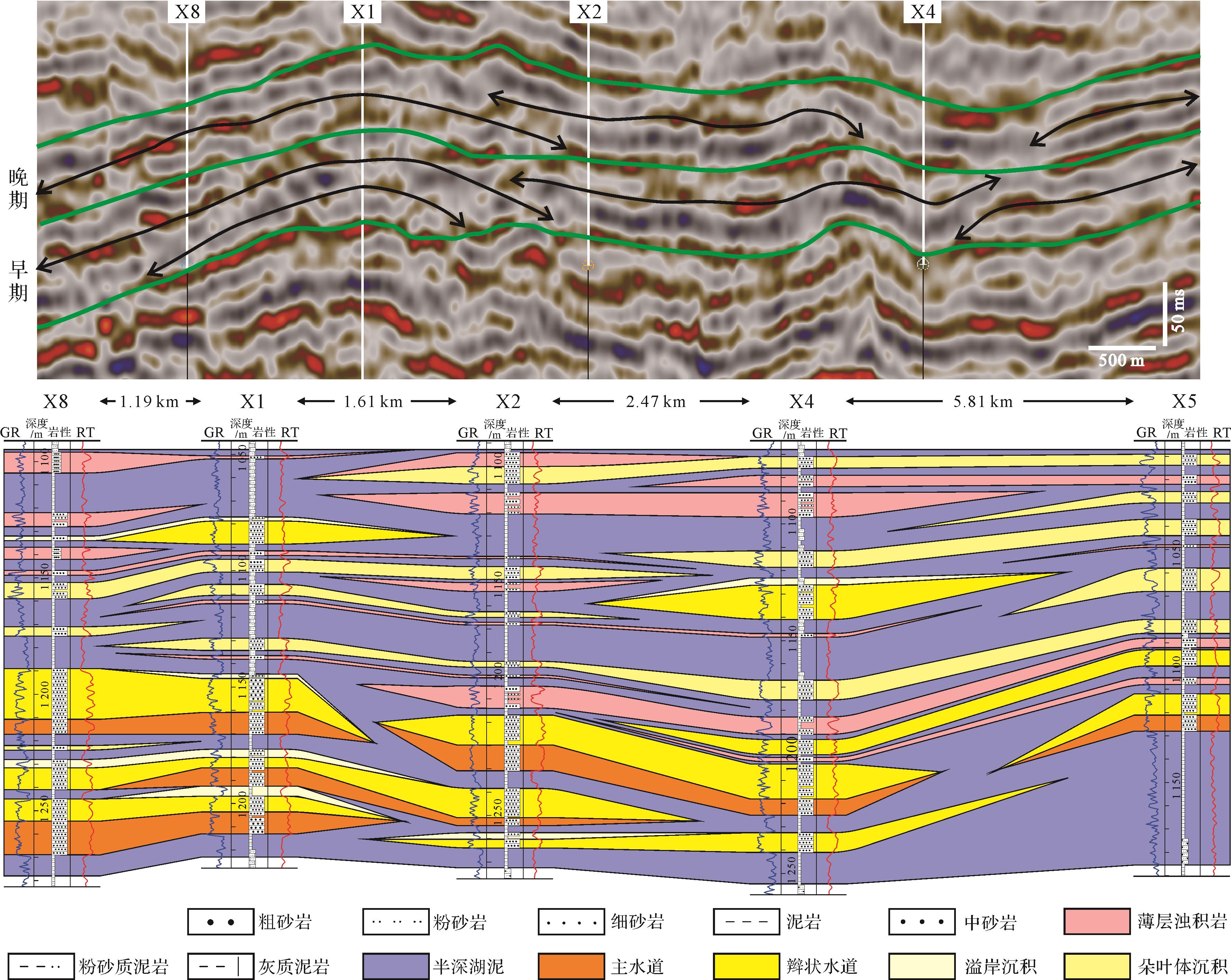
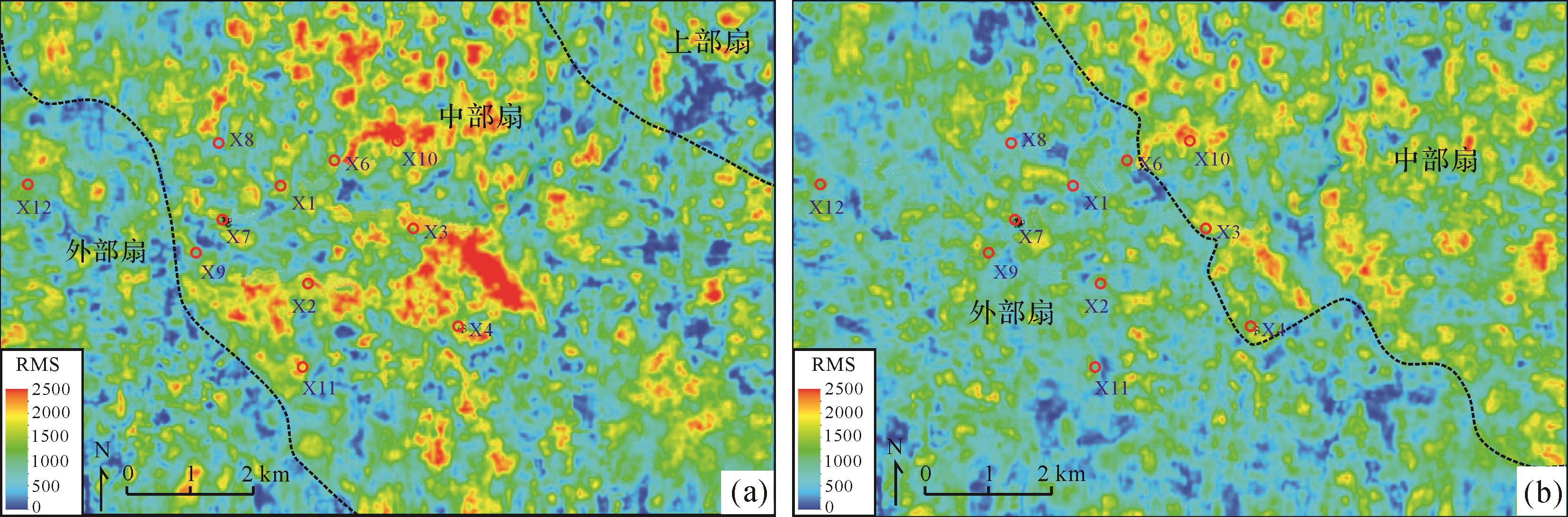
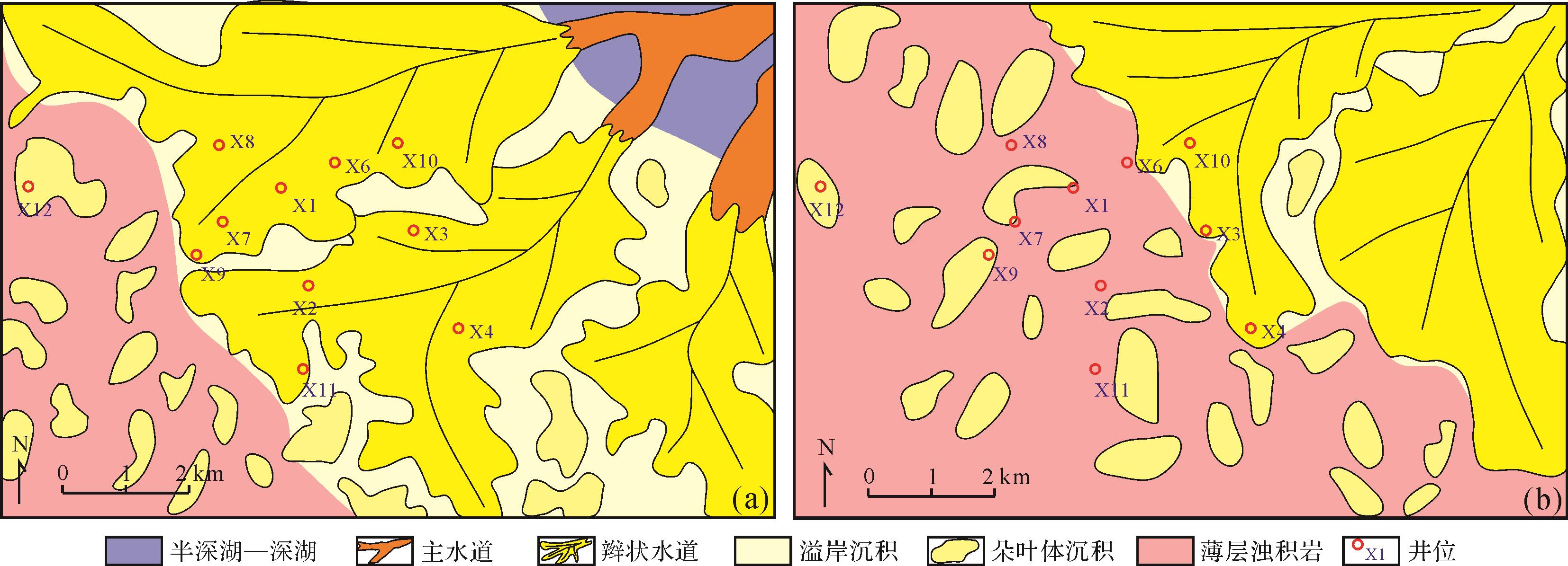
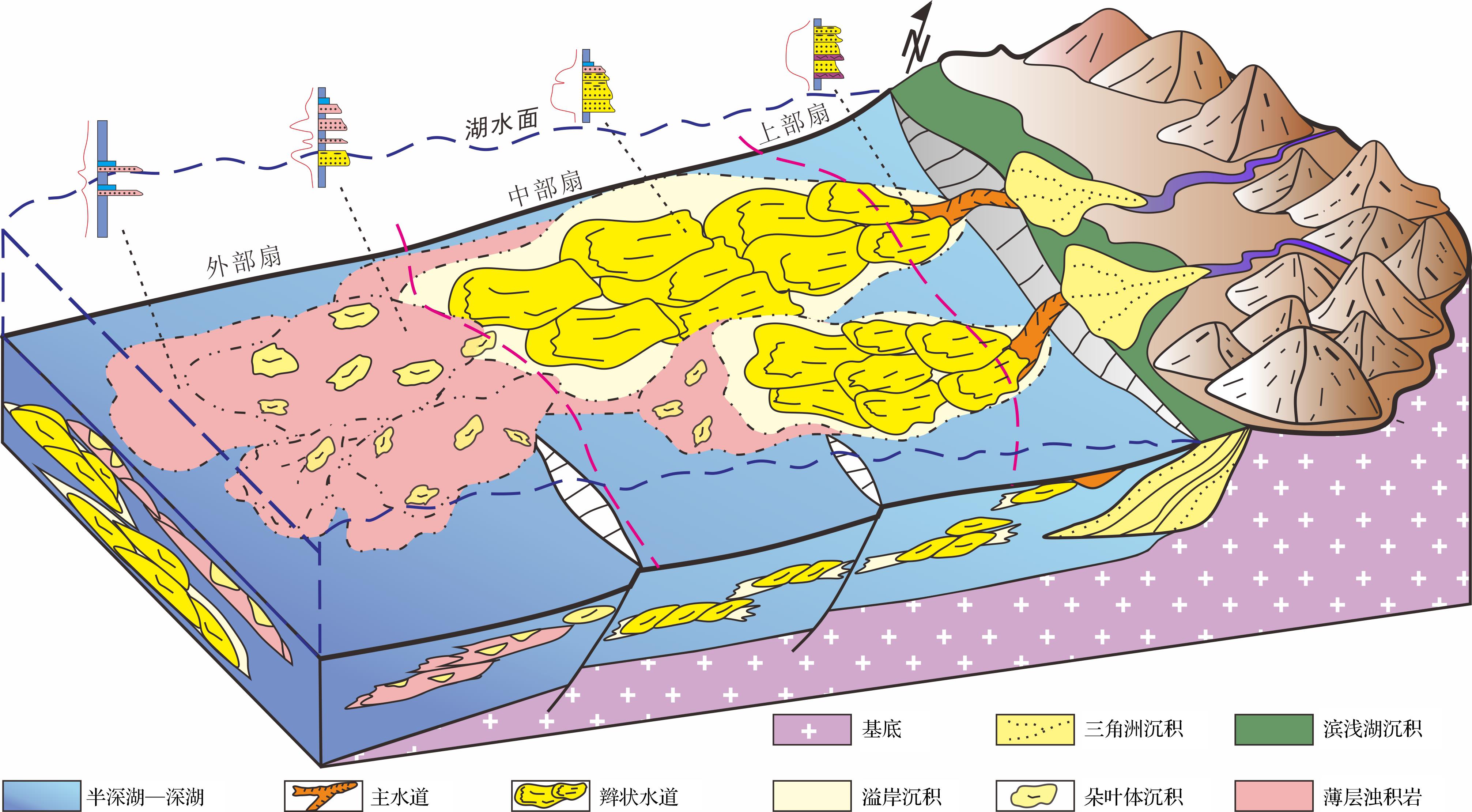
Core observation, drilling and logging data analysis, mapping of sedimentary facies, and application of correlation theory were used in this investigation of the deep-water sedimentology and seismic sedimentology, gravity flow types, depositional characteristics and vertical sedimentary associations to develop a depositional model of the deep-water gravity flow deposits in the Cretaceous Pointe Indienne Formation of Block A, Lower Congo Basin. It was concluded that sandy debris flow, muddy debris flow, turbidity current and slide-slump deposits were developed in the study area. On this evidence, the depositional model consists of the following: flow deposits of sandy debris consisting mainly of massive bedded fine sandstone, but containing large floating mud gravel and torn mudstone debris; flow deposits of muddy debris, mainly of argillaceous clastics and containing a small amount of dark mudstone clastics and sandy mass, which have developed into an “argillaceous parcel” structure; turbidites characterized by a well-developed or incomplete Bouma sequence; and slide-slump deposits in which obvious shear slip planes, rotating flame structures, twisted and disordered distributions of sandstone and fold deformation were all observed. Analysis of the dynamics revealed four types of vertical sedimentary association in the gravity flow deposits. The two most common types are multi-stage superimposed sandy debris flows, and sandy debris flow superimposed upon turbidity flow. These are characterized by braided channel deposits and lobe body deposits. The deep-water gravity flow deposits in the study area occurred as an upper, middle and outer fan deposit. The upper fan consists mostly of main channel deposits characterized by slump deposits with deformed structures, and massive sandy debris flow deposits. The middle fan is mainly made up of braided channel deposits and overflow bank deposits characterized by massive sandy debris flows with floating mud gravel and relatively thick sand-bodies. The outer fan occurs mainly as lobe body deposits and thin turbidites in both complete and incomplete Bouma sequences, and with relatively thin sand-bodies.

2022, 40(1): 47-59.
doi: 10.14027/j.issn.1000-0550.2021.058
Abstract:
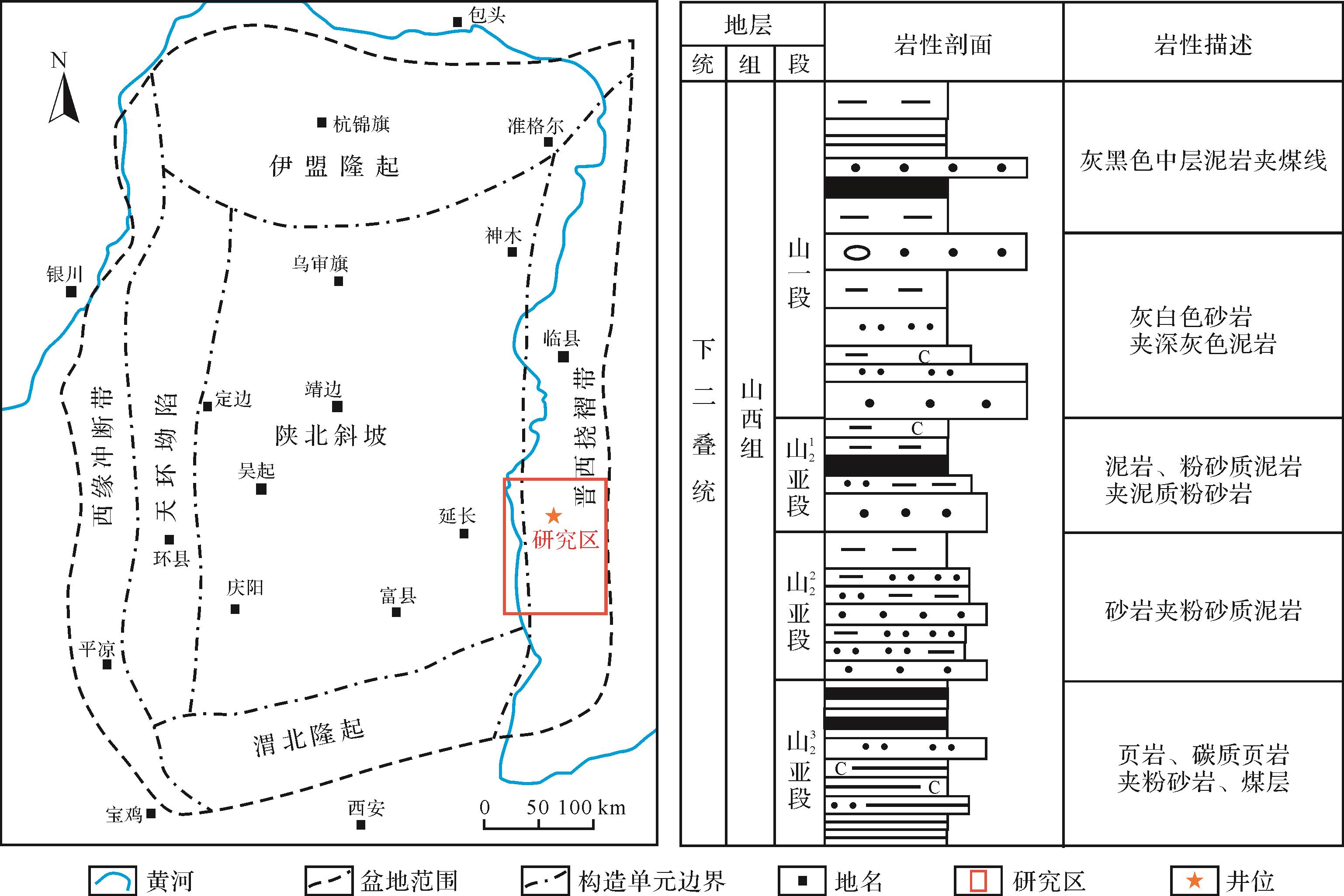
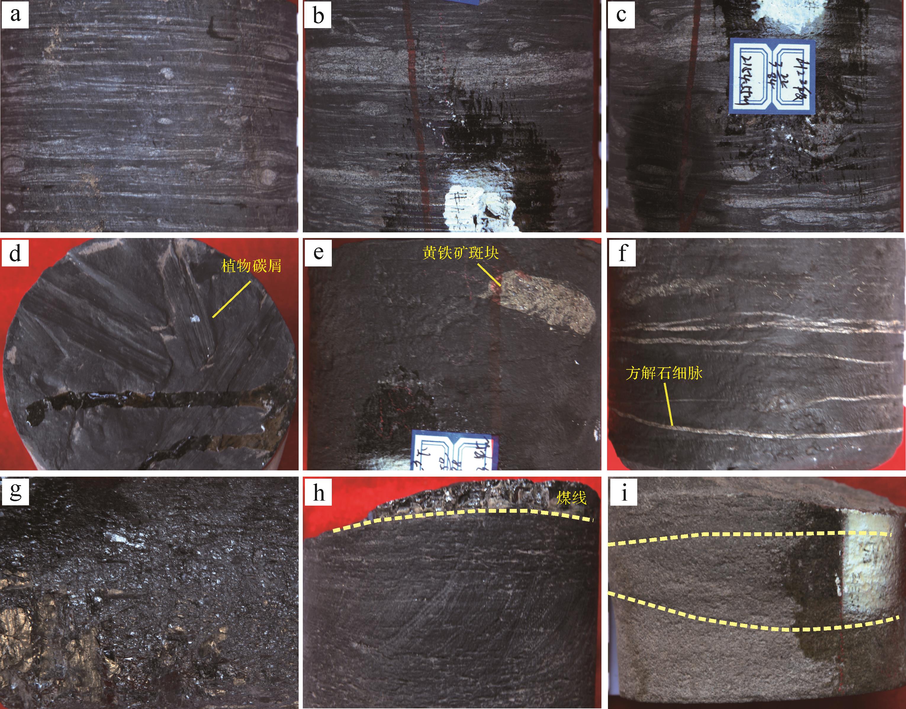
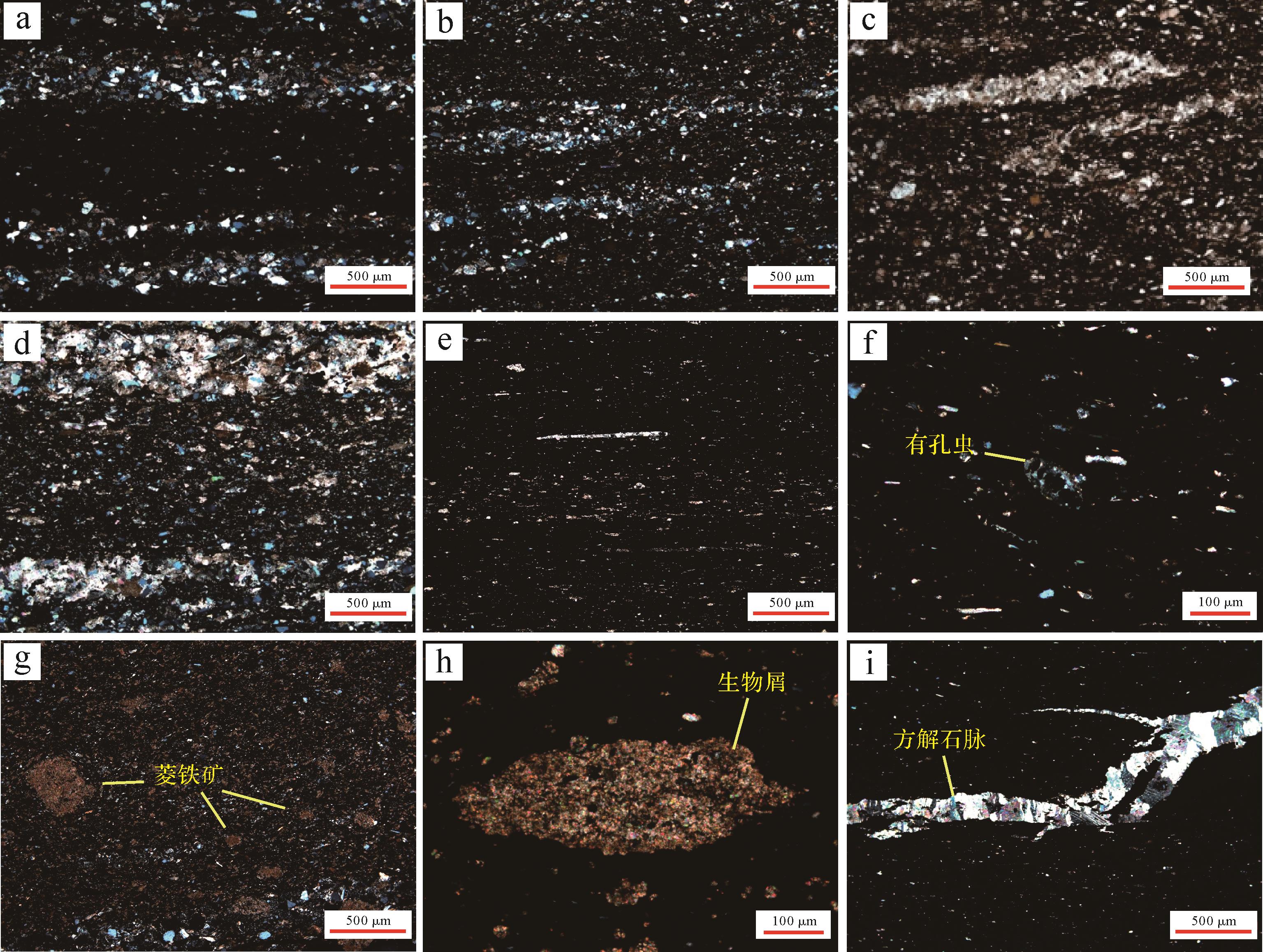
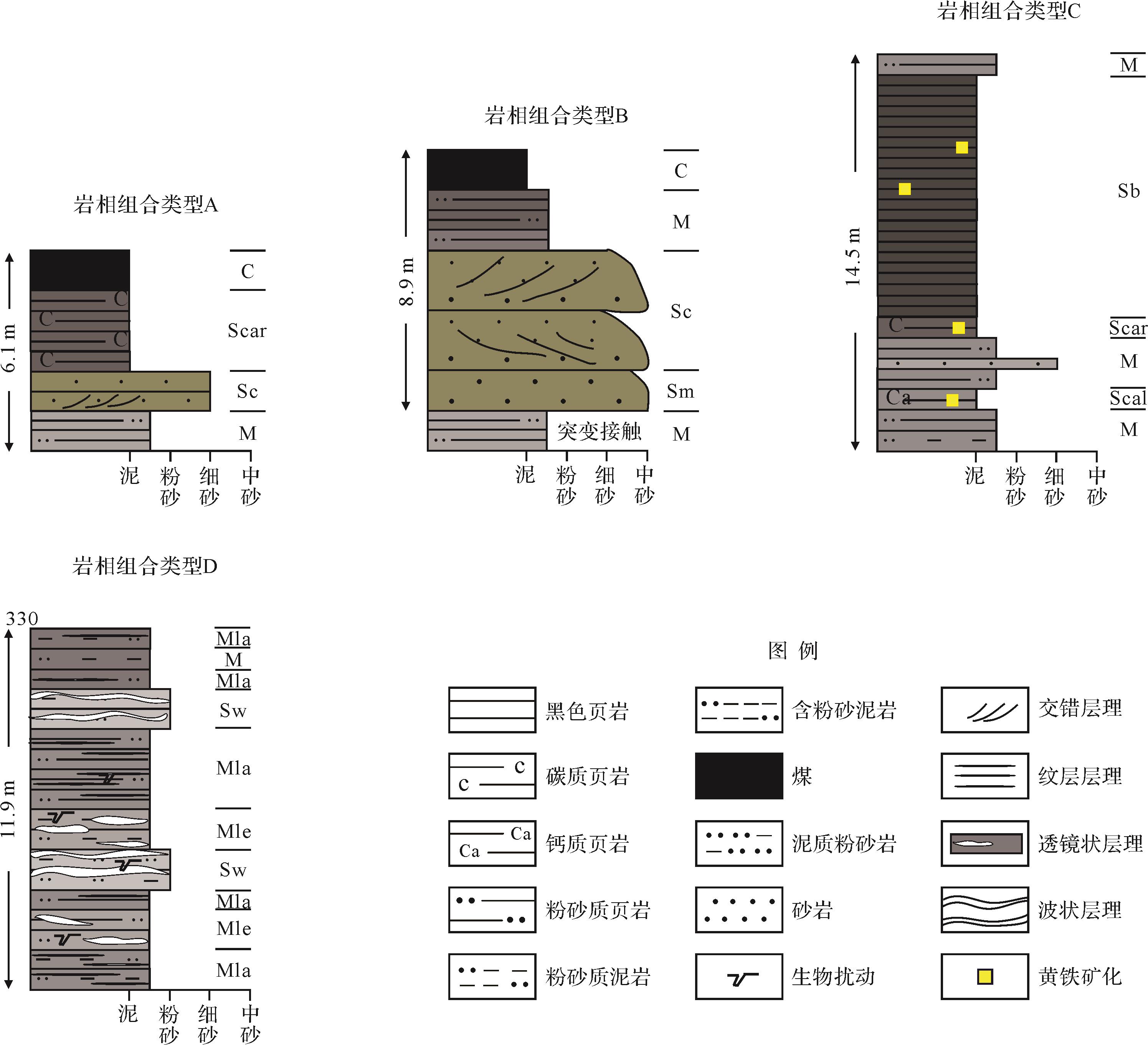
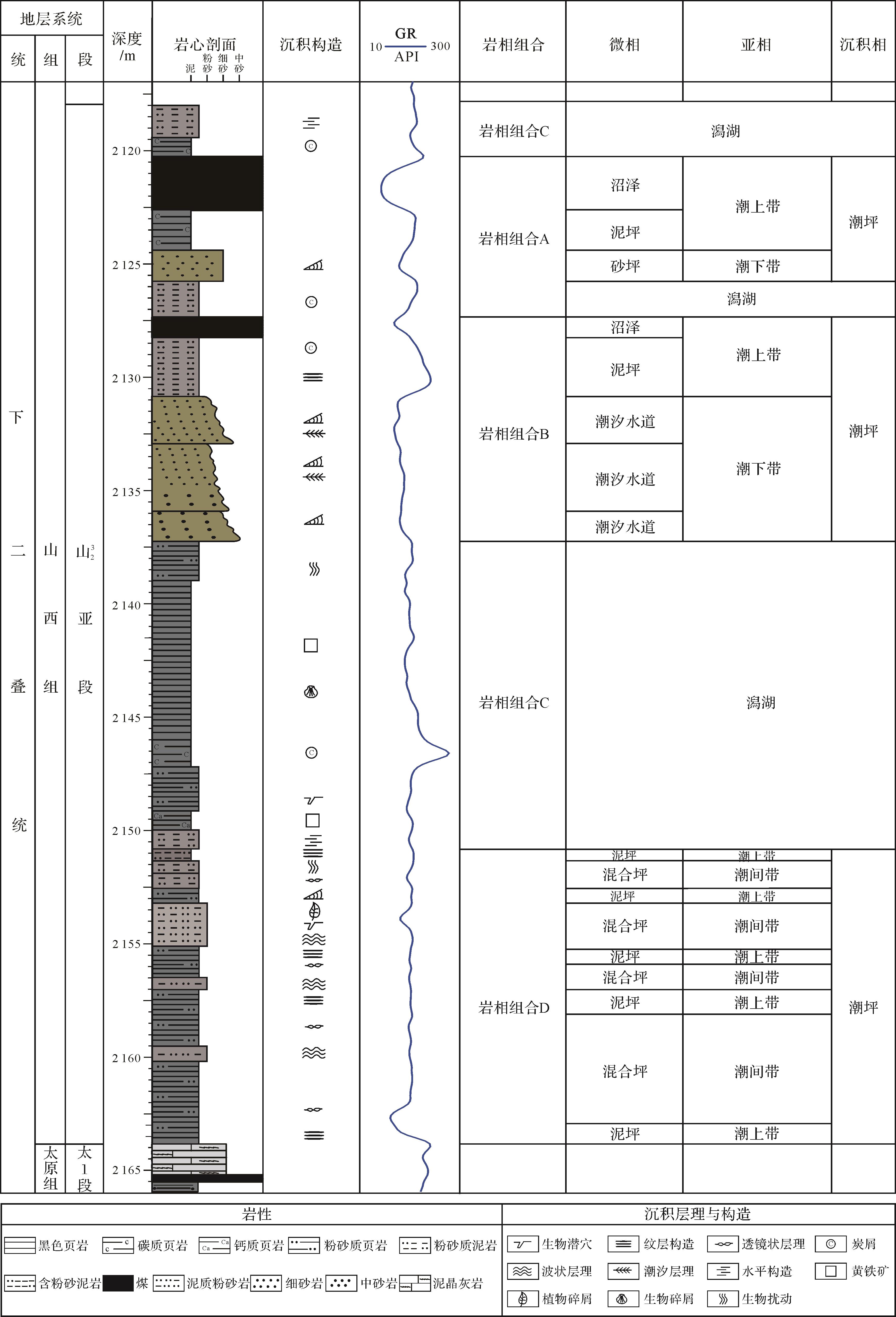
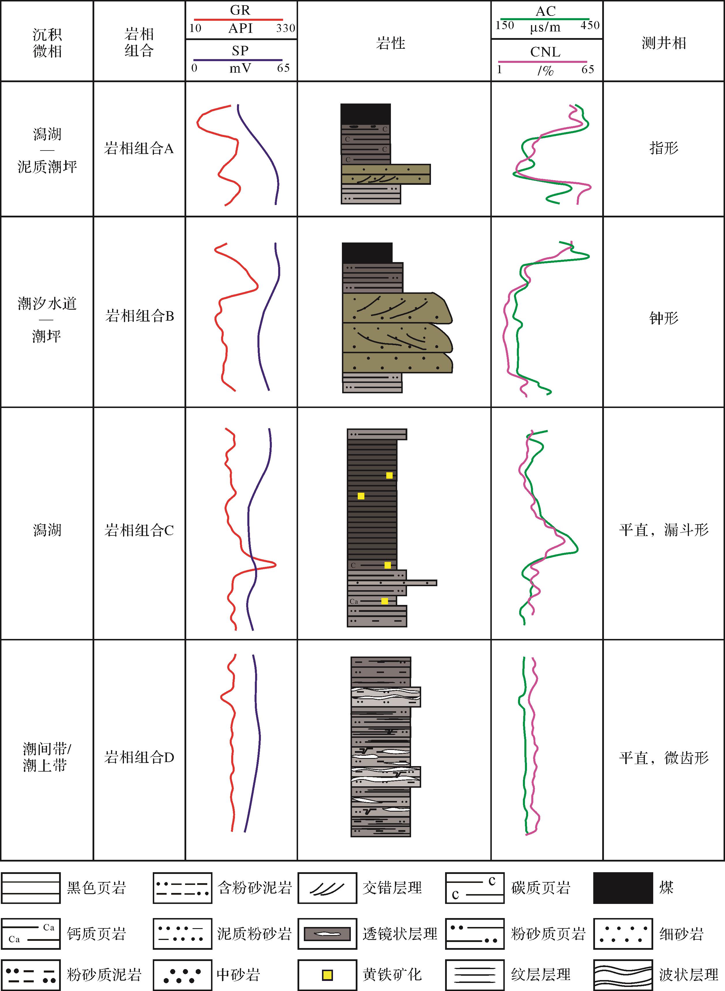
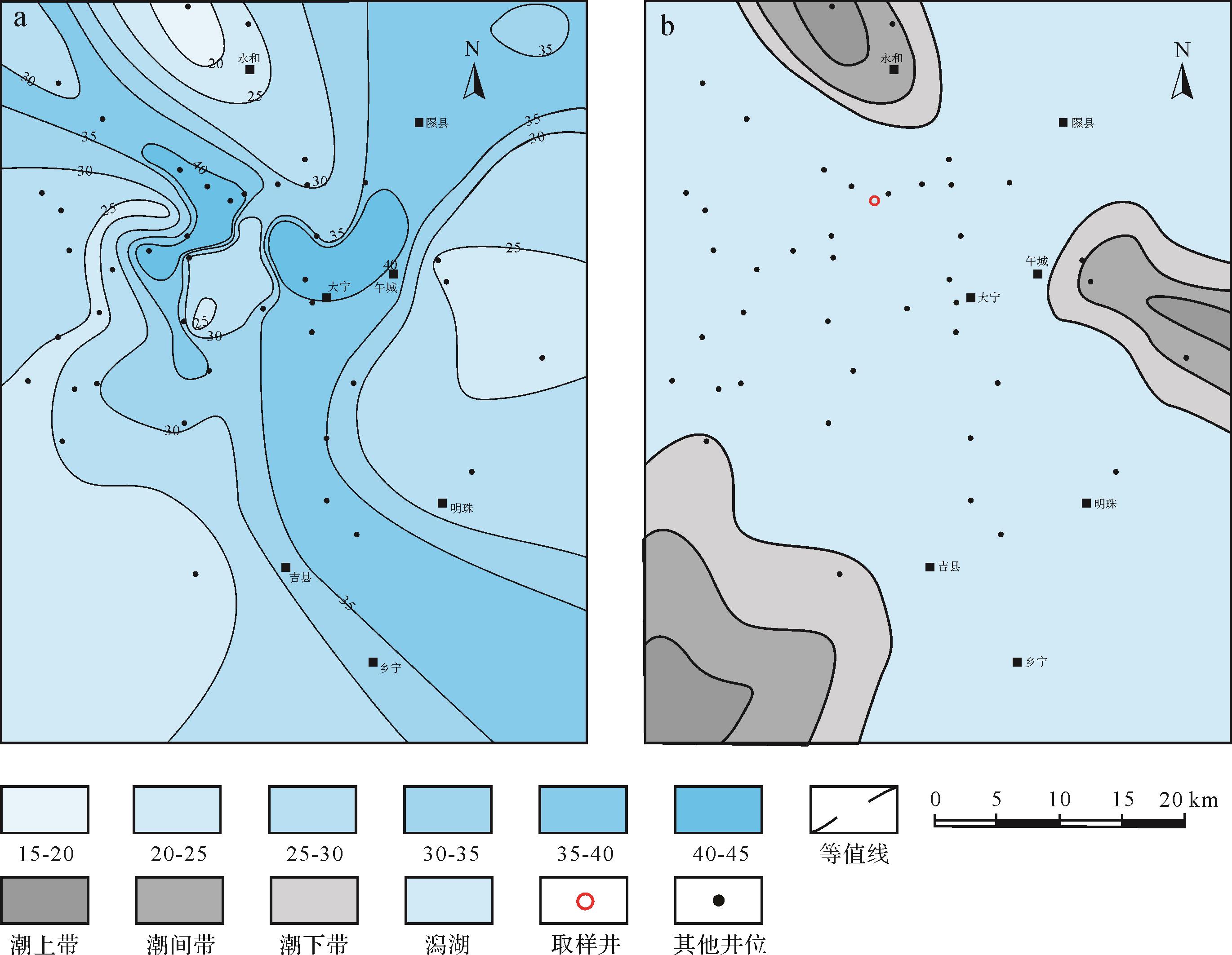
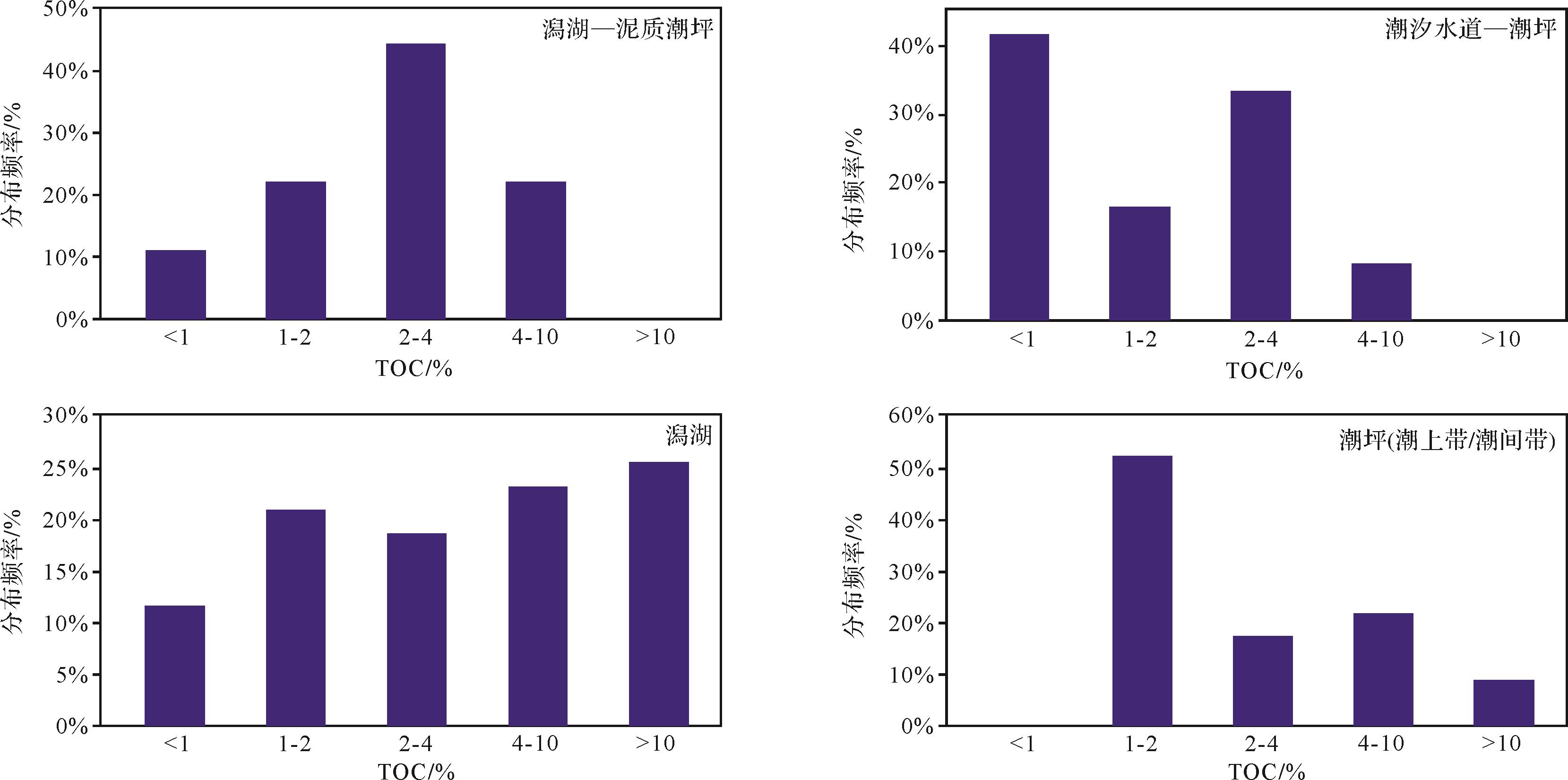
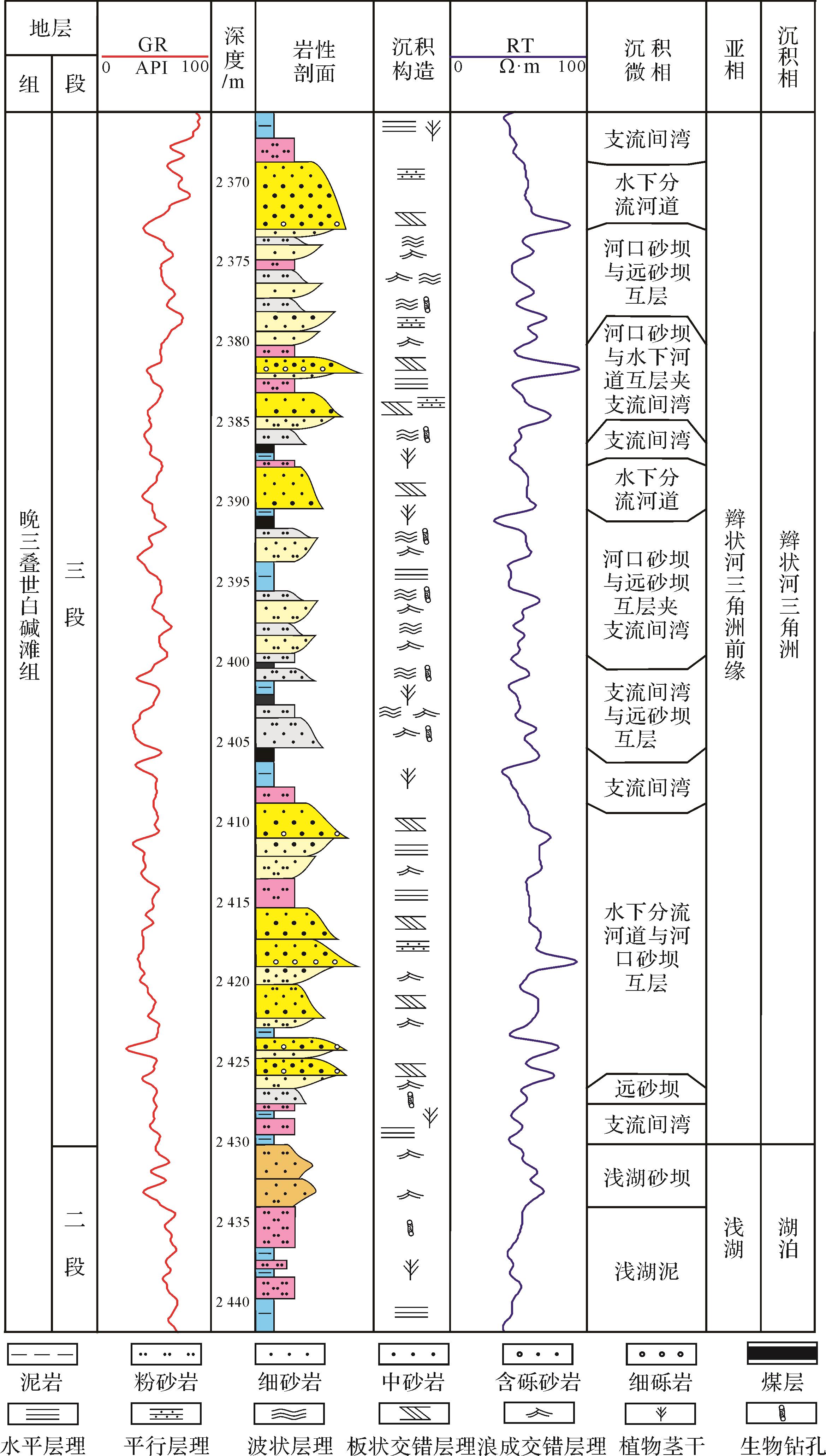
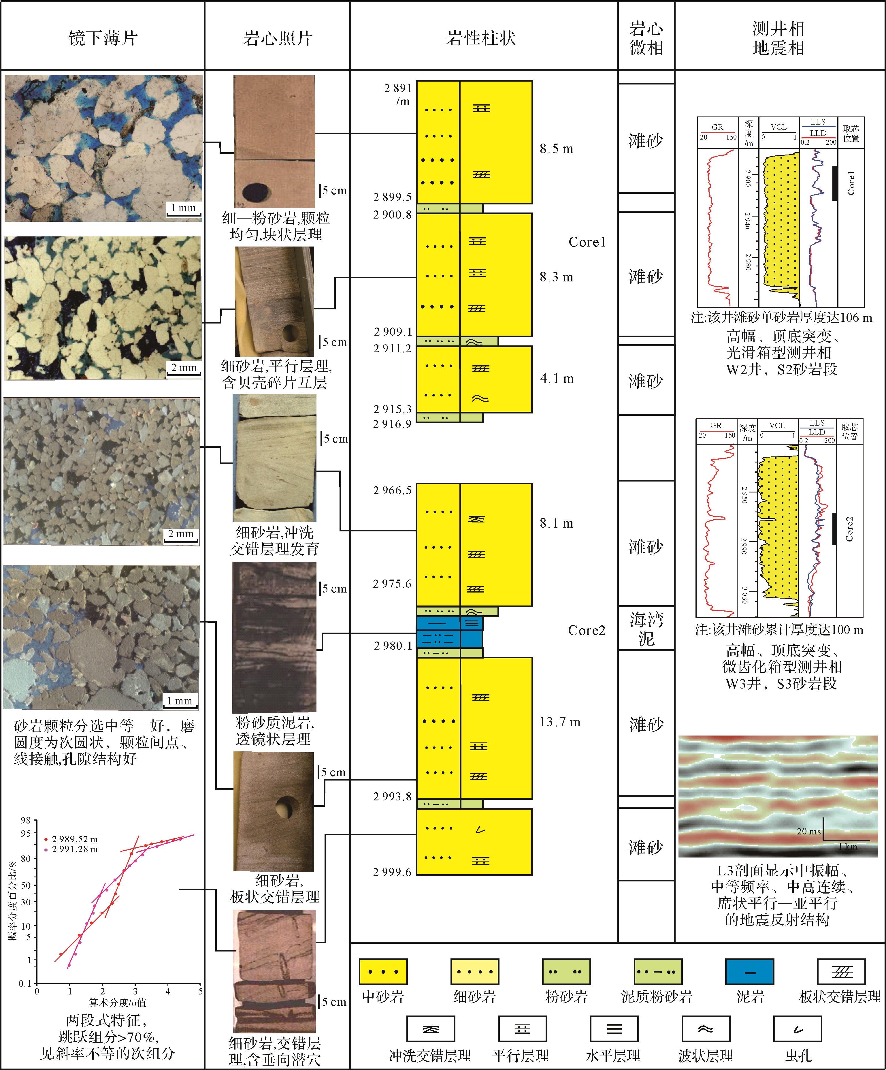
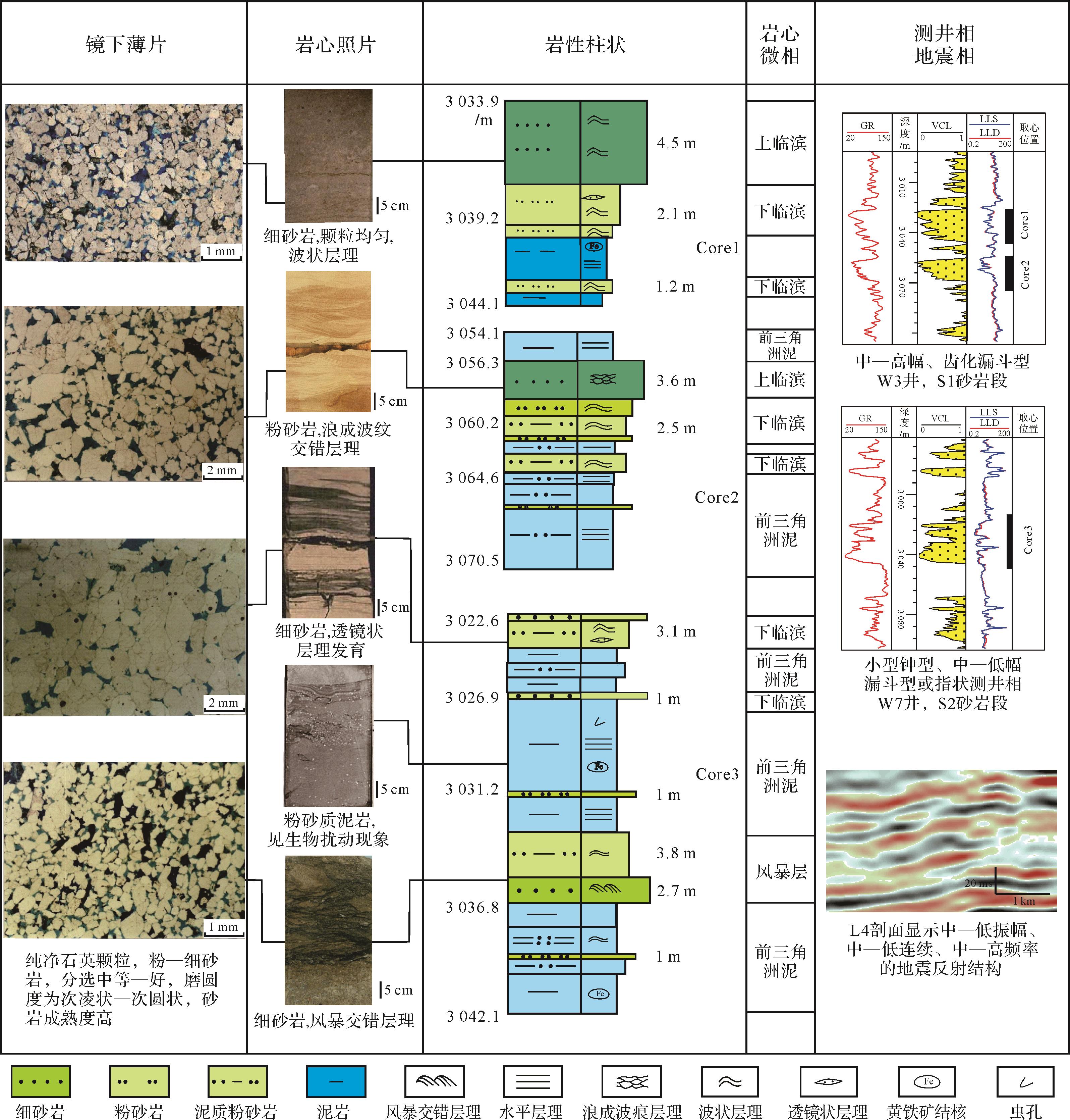
A s ystematic study was conducted using cores, rock thin sections and drill logging data to identify lithofacies in the Daning-Jixian region of the Shanxi Formation and establish their association and sedimentary facies. Ten types of lithofacies were identified: massive silty mudstone or shale, silt-bearing mudstone or shale with small ripples, silty mudstone or shale with lenticular bedding, calcareous shale, coal, carbonaceous shale, black shale, muddy siltstone with wave bedding, middleto fine sandstone with tidal cross-bedding, and massive middle size sandstone. In additon, ten lithofacies were classified into four associations that reflect four depositional environments: tidal flat deposits (supratidal to intertidal zones), lagoon deposits, tidal channel to tidal flat deposits and lagoon-tidal flat deposits. The study area lies within a marine-continental transitional facies sedimentary environment, the central part is a lagoon deposit, the southwestern and eastern parts comprise two barrier islands and a sand bar deposition area and barrier island, and in the north, a delta front transitioning to a tidal flat in the direction of the lake. The lithofacies association in the deep lagoon and tidal flat deposits(supra /intertidal zones) are favorable for the development of a high-TOC shale gas reservoir.
2022, 40(1): 60-72.
doi: 10.14027/j.issn.1000-0550.2020.086
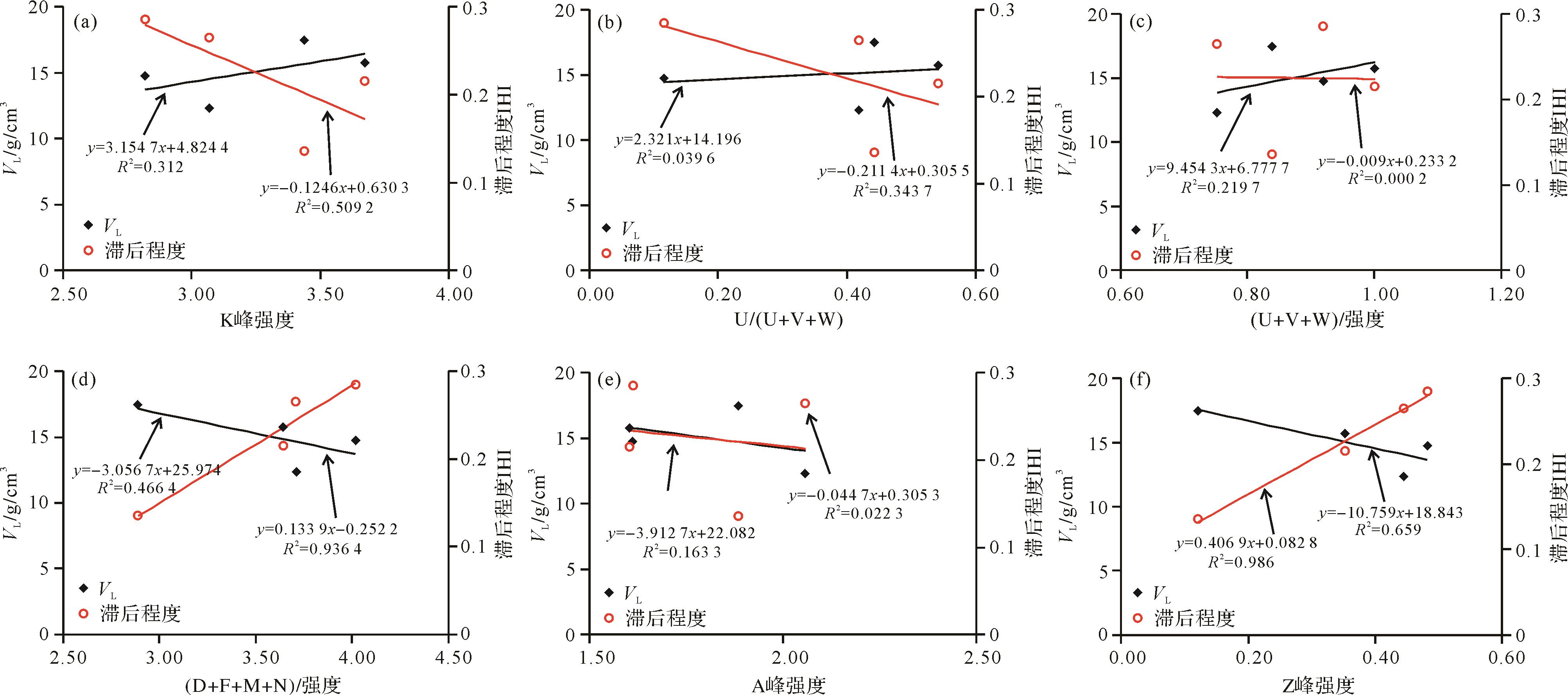
Abstract:
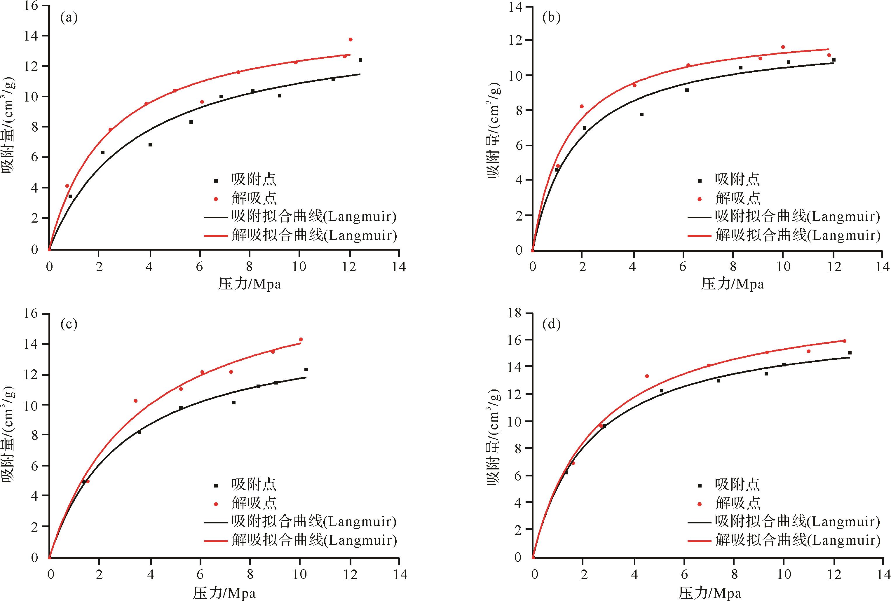
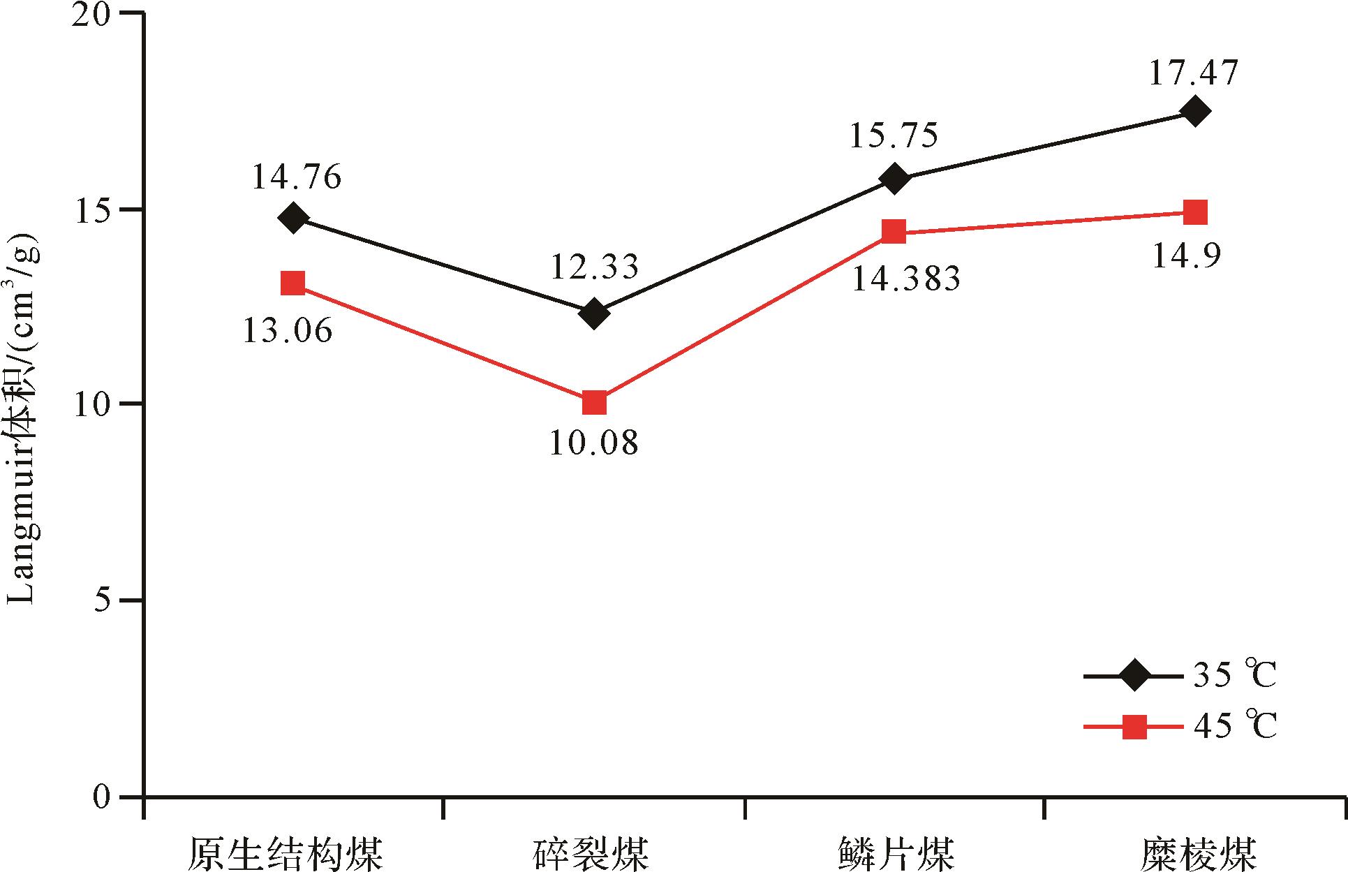
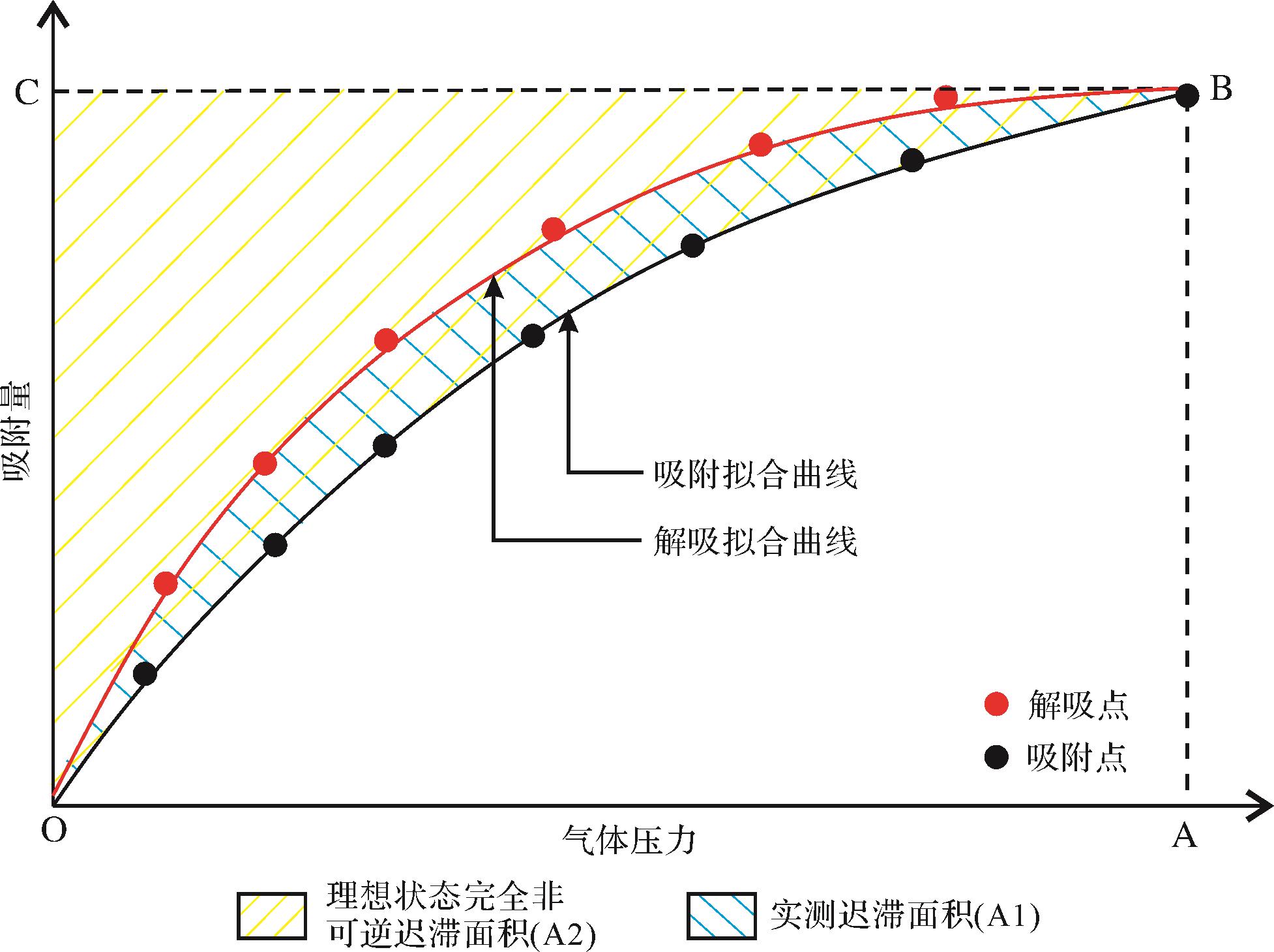
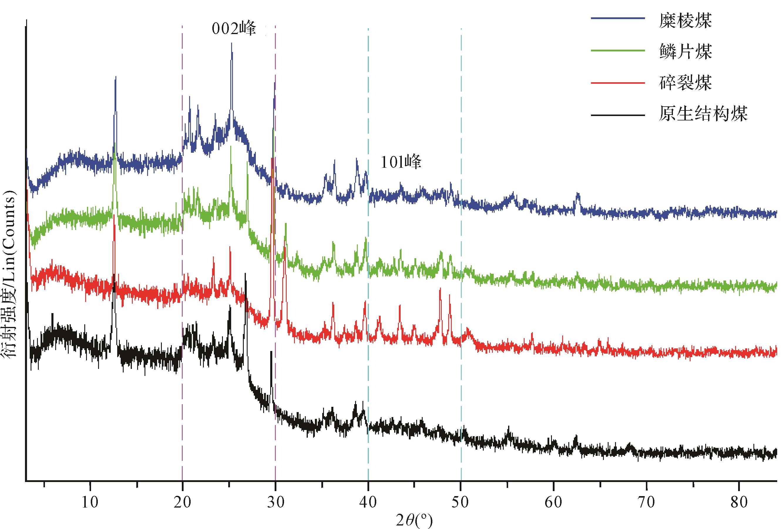
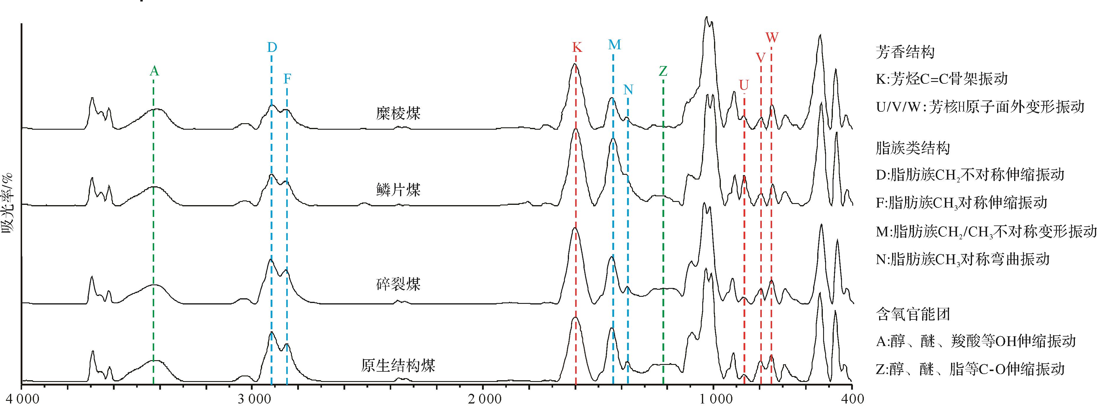
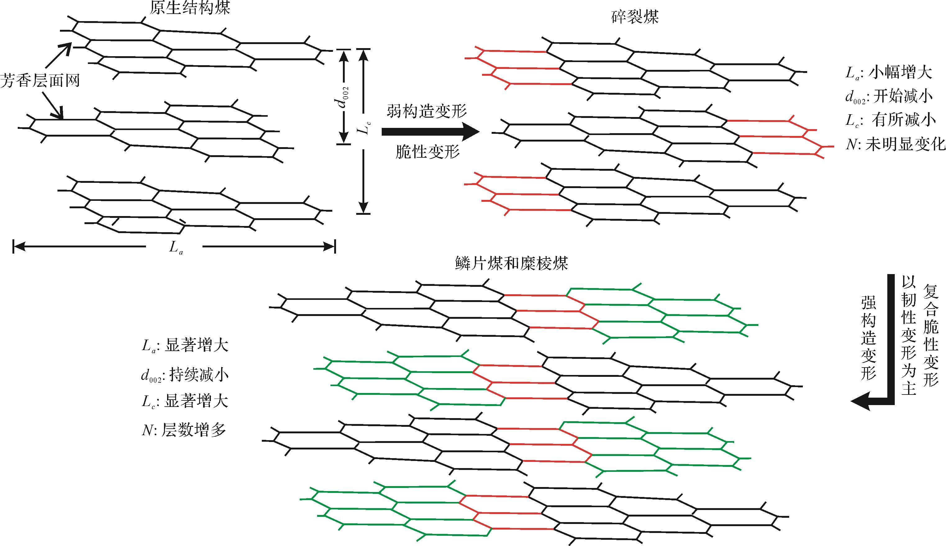
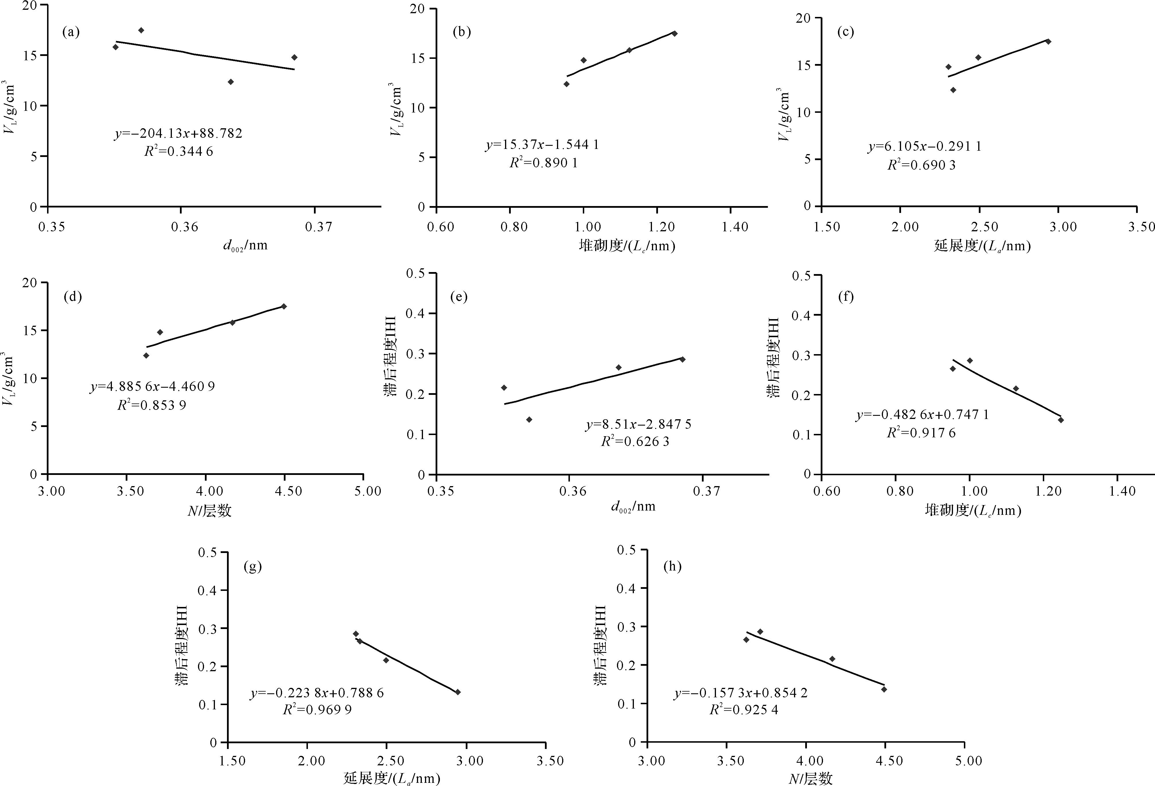
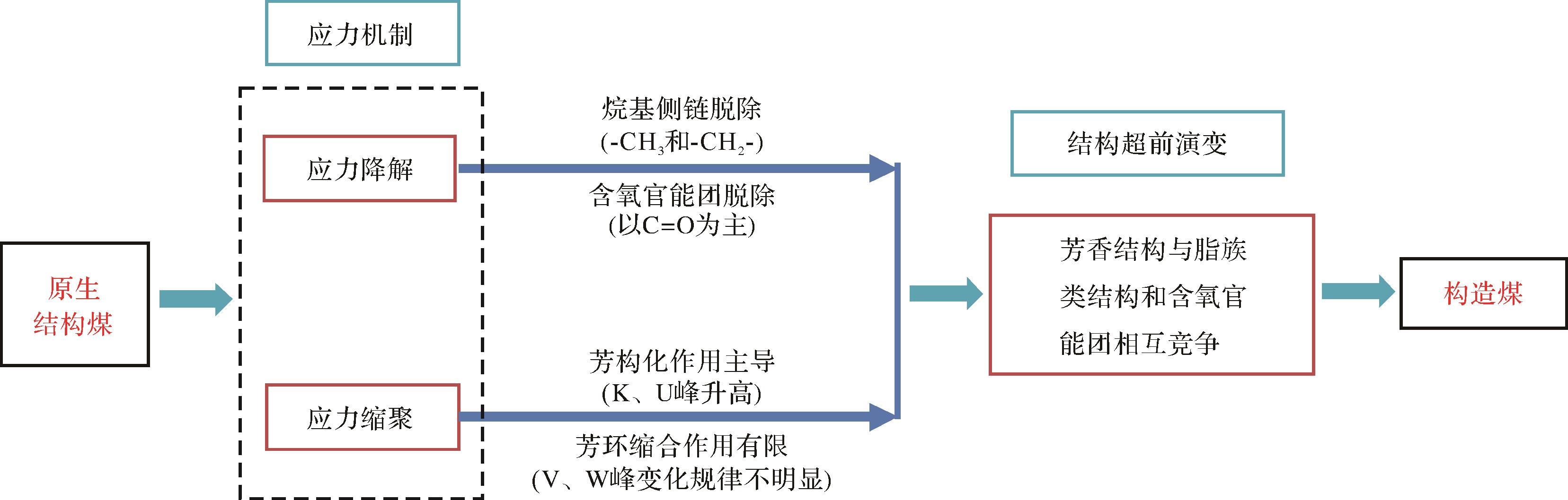
Four medium-rank coal samples with different degrees of tectonic deformation were studied to determine their isothermal adsorption/desorption evolution and geochemical mechanisms in isothermal CH4 adsorption/desorption experiments, X-ray diffraction (XRD) and Fourier transform infrared spectroscopy (FT-IR) tests. It was found that their isothermal CH4 adsorption and desorption curves showed a trend of initial rapid increase, gradually stabilizing with increasing pressure. This is consistent with the characteristics of a type I isotherm and the Langmuir model. With increasing coal deformation, the Langmuir volume had an increasing trend, and the degree of adsorption/desorption hysteresis decreased steadily. With increasing deformation, the dimension of the aromatic layer network gradually decreased and the unit extendability gradually increased. The unit stacking degree and the number of stacking layers changed in stages during deformation of the coal. The stress sensitivity of the coal crystal nucleus was stronger in the transverse direction than in the longitudinal direction, and was therefore affected more obviously by structural deformation. At the same time, with increasing deformation, the aromatic C=C skeleton clearly increased. The degree of condensation of the aromatic ring was higher than in the initial structure of the coal, while some aliphatic structures and the C=O structure steadily decreased. With increasing deformation, the rearrangement of aromatic structure, the degree of orientation of the macromolecular structure, and the degree of ordering all increased. The increase in short-range ordering of the coal crystal nucleus helps to improve the adsorption force of coal to CH4 molecules, and the structural stress mainly affects adsorptive capacity by changing the side chains of the macromolecular structure and oxygen-containing functional groups.
2022, 40(1): 73-87.
doi: 10.14027/j.issn.1000-0550.2021.125
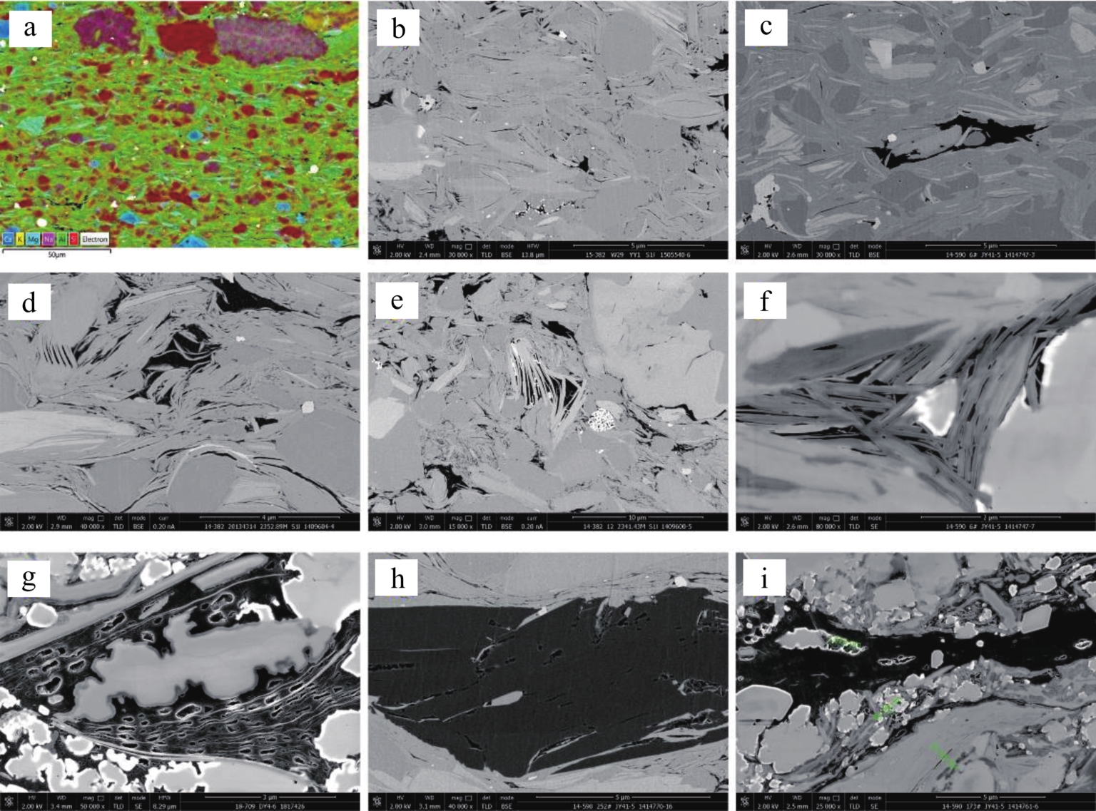
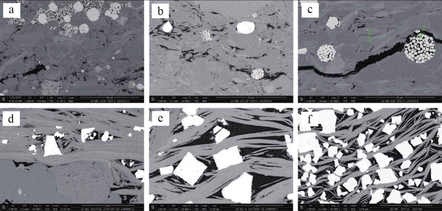
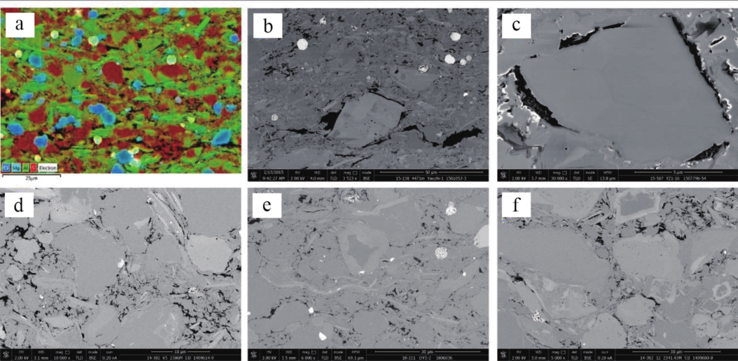
Abstract:
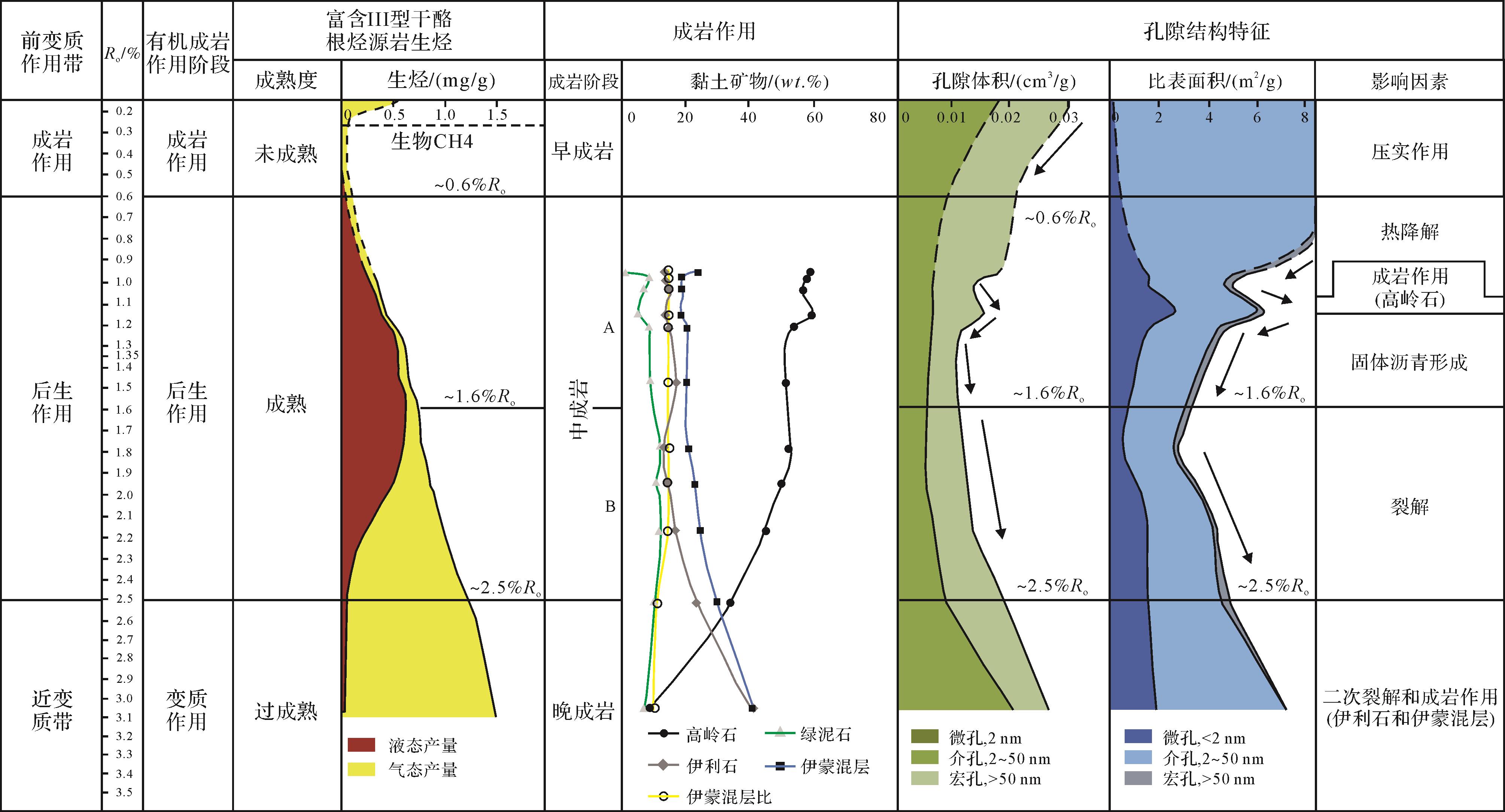
The effect of diagenesis on organic matter enriched shale characteristics of the Wufeng Formation-Longmachi Formation in Sichuan Basin is very complicated and plays an important role in the development and preservation of inorganic and organic matter. In the early and middle diagenesis stage, argillaceous shales were subjected mainly to intense mechanical compaction, pyrite and carbonate cementation, and illitization, which resulted in the loss of many primary inorganic pores. While siliceous shales mainly experienced mechanical compaction and the recrystallization of biological opal, some primary inorganic pores were preserved due to the inhibition of compaction. After entering the hydrocarbon generation window, the thermal evolution of organic matter became the governing factor of diagenesis, in which liquid hydrocarbon was generated and thermally cracked in the high-over mature stage, accompanied by the formation of organic pores. There was much residual porosity in siliceous shale, leading to much stranded hydrocarbon and organic pores, while less stranded hydrocarbon and organic pores are found in argillaceous shale. Thermal maturity in most areas of Sichuan Basin is in the range of 2.0%-3.0%, within the scope of the “organic pore generation window”. As decompression and pressure balance readjustment occurred in the tectonic uplift stage, the organic pores are transformed and destroyed by deep burial compaction and tectonic compaction, and fluid overpressure is favored for the preservation of organic pores. Shales of the Wufeng Formation-Longmachi Formation experienced four important diagenesis stages, i.e., inorganic pores lost in the early diagenesis stage, hydrocarbon generation and expulsion in the middle diagenesis stage, organic pore generation in the late diagenesis stage, and pore transformation in the tectonic uplift stage. The total porosity was reduced to its minimum value in the early period of liquid hydrocarbon cracking and increased gradually in a major period of thermal cracking, maximizing at a Ro that was about 2.0%-3.0% and reducing after 3.0%. With good fluid overpressure in the tectonic uplift stage, total porosity remained stable as pore structure changed slightly.
2022, 40(1): 88-105.
doi: 10.14027/j.issn.1000-0550.2020.102
Abstract:
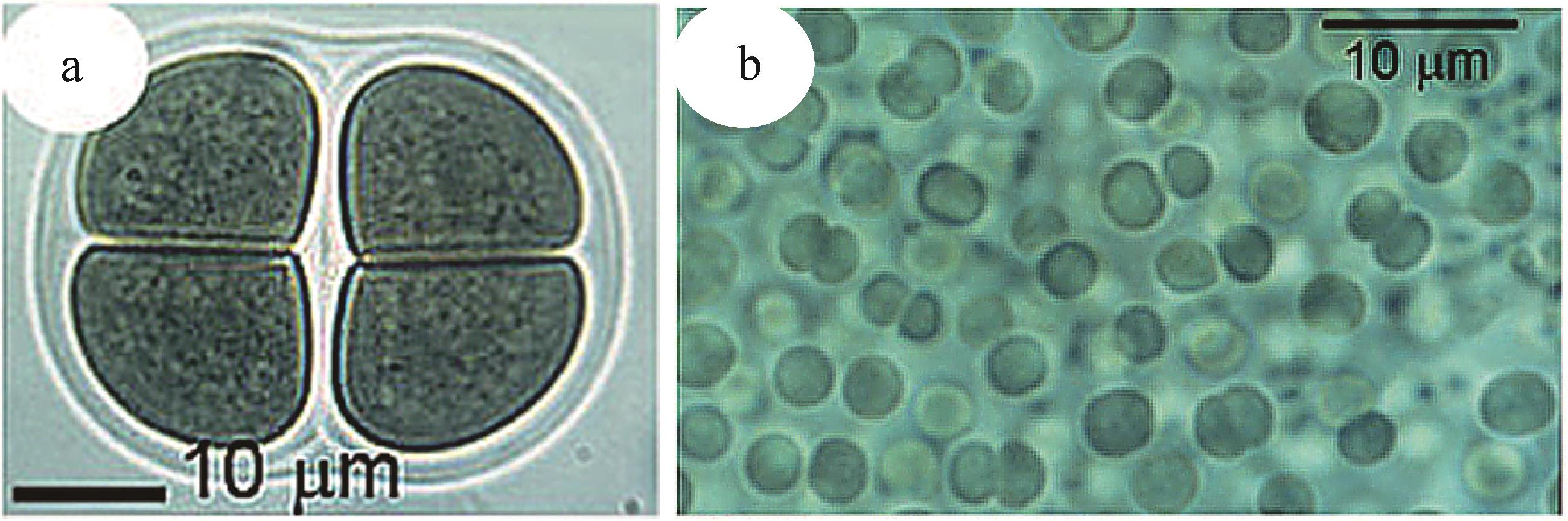
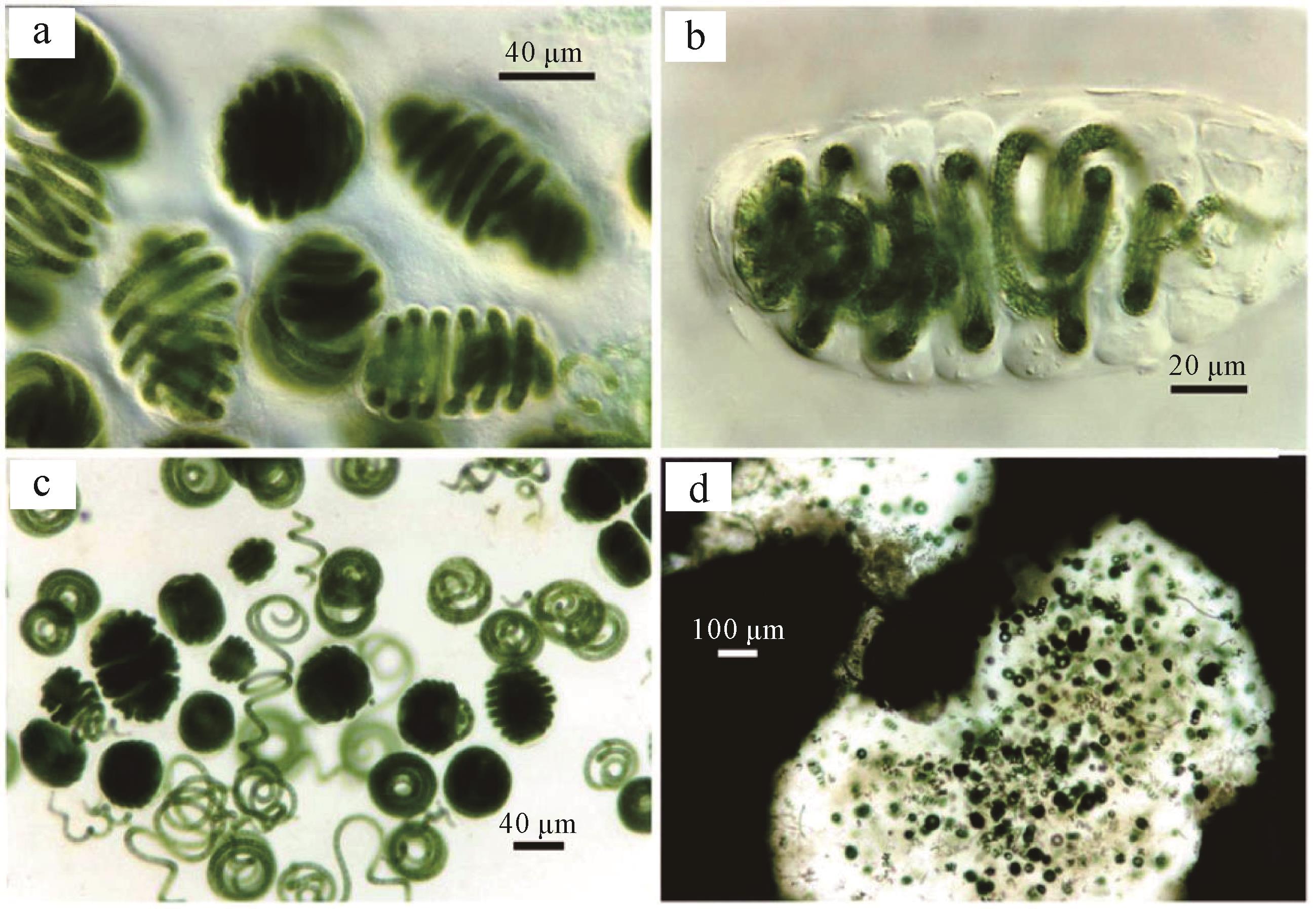
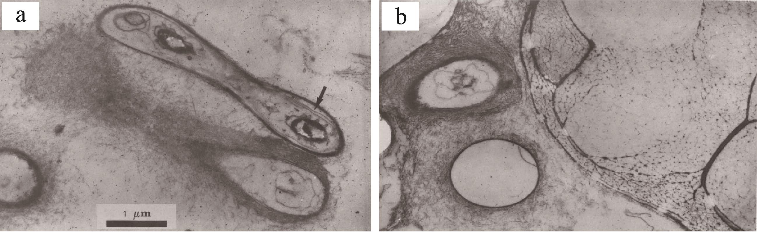
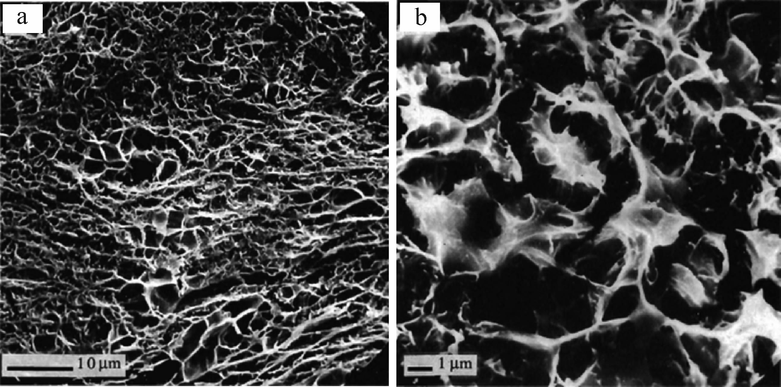
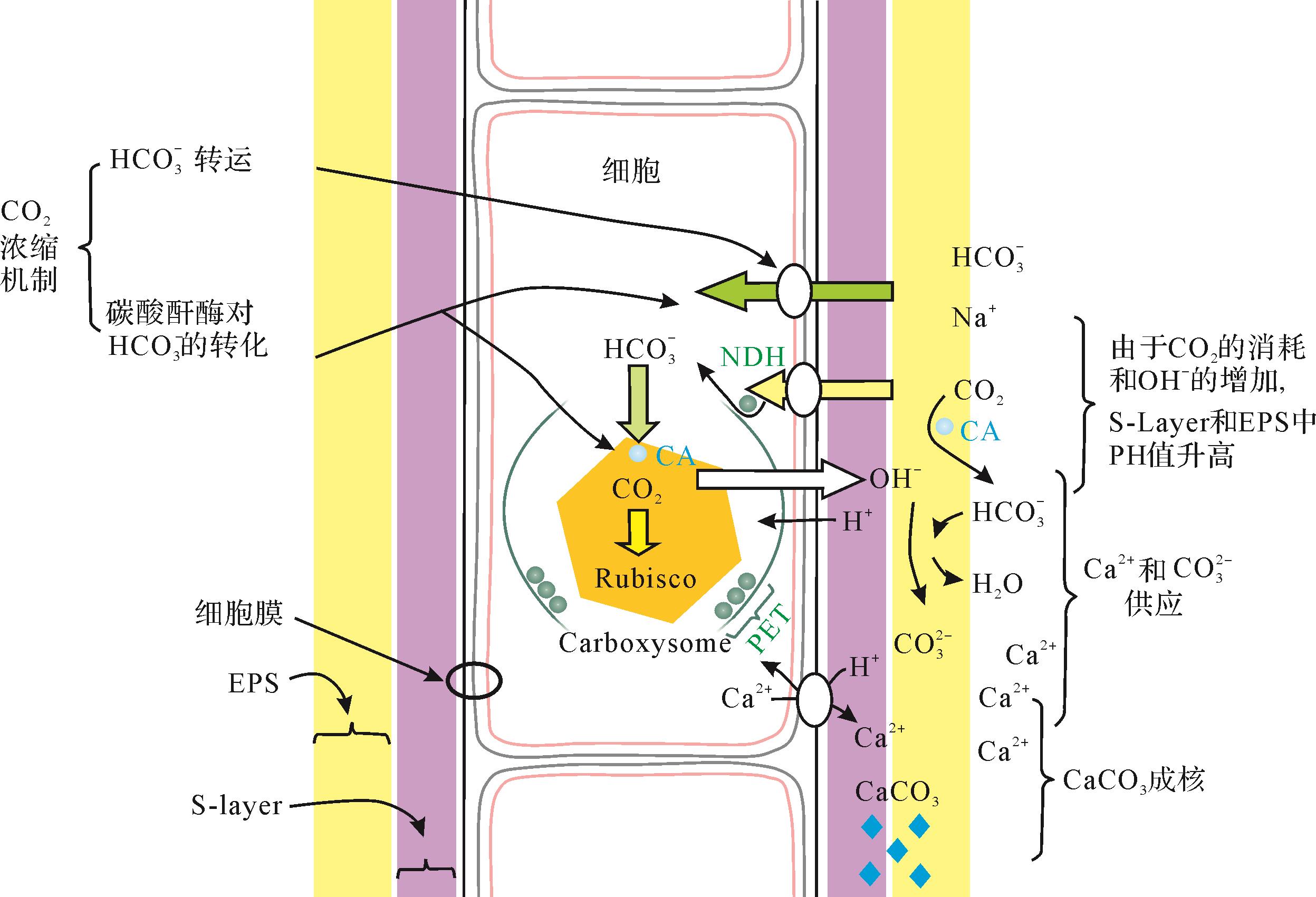
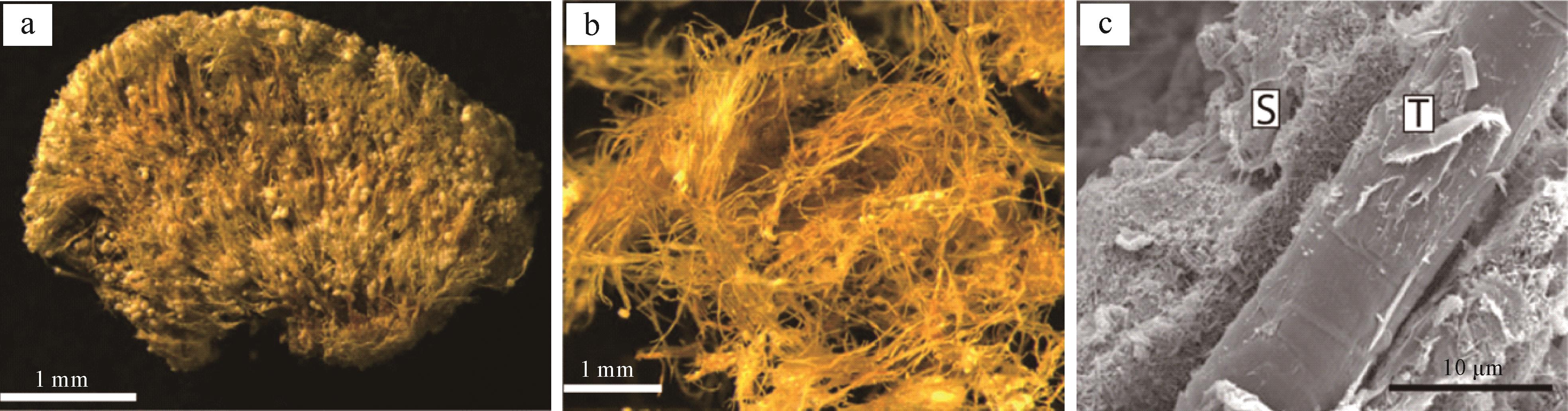
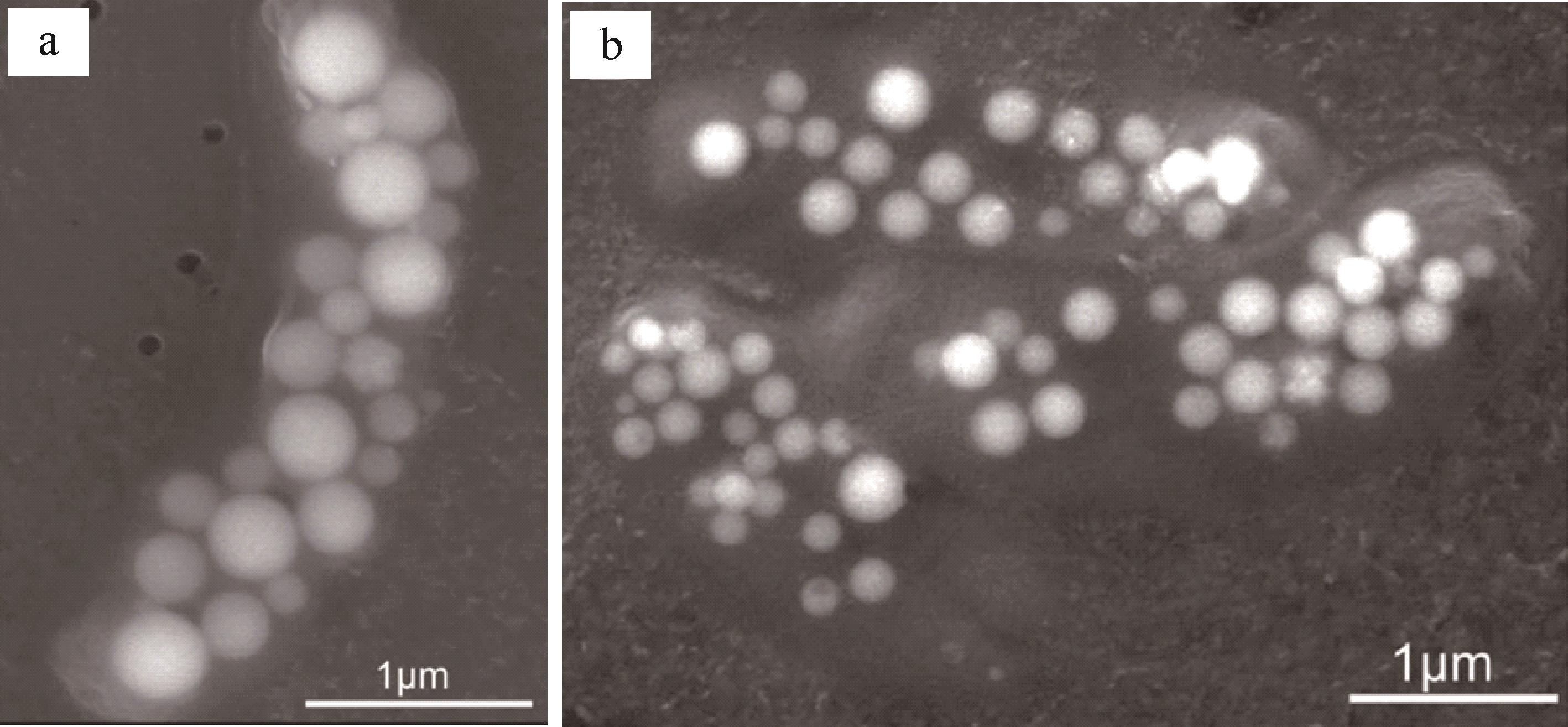
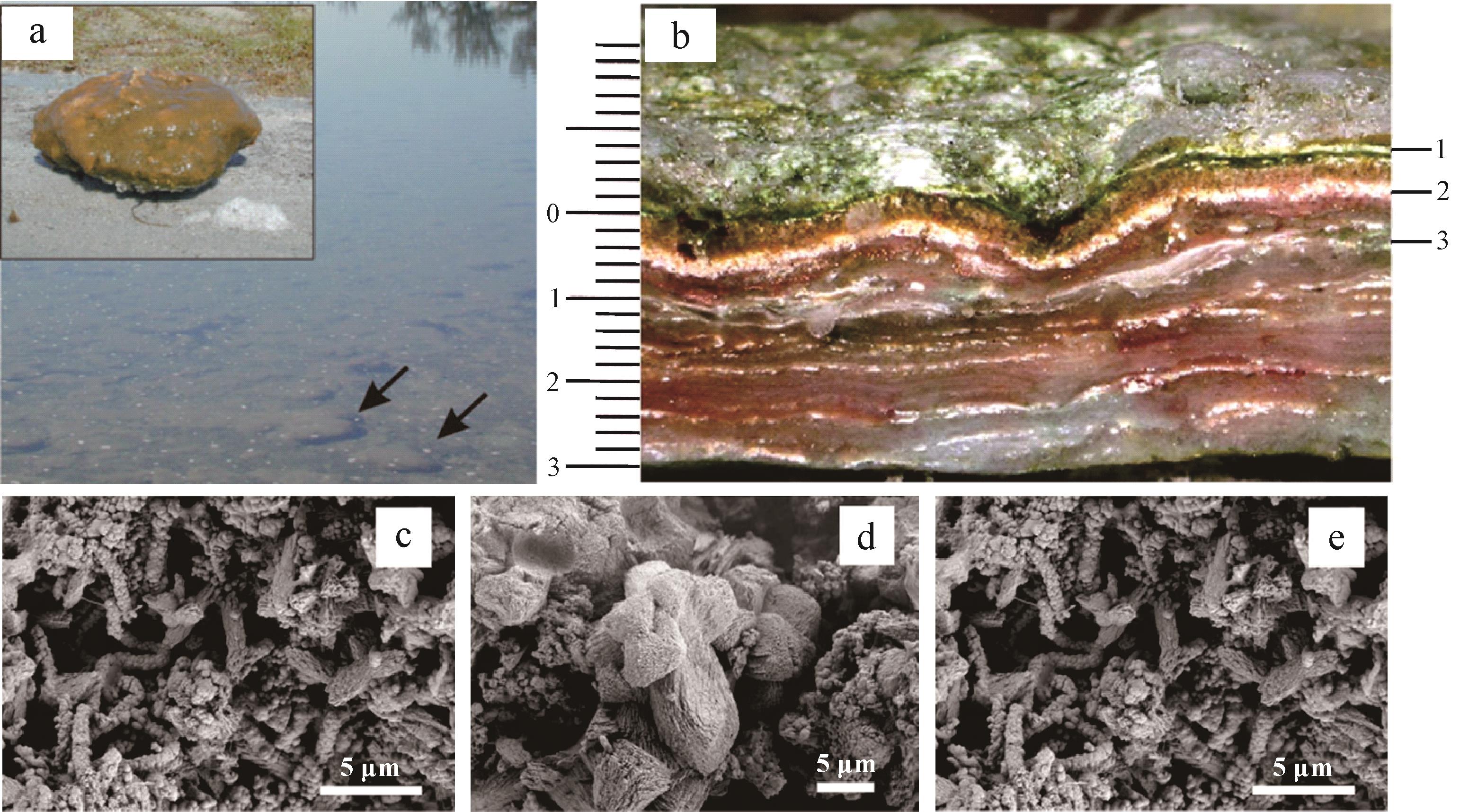
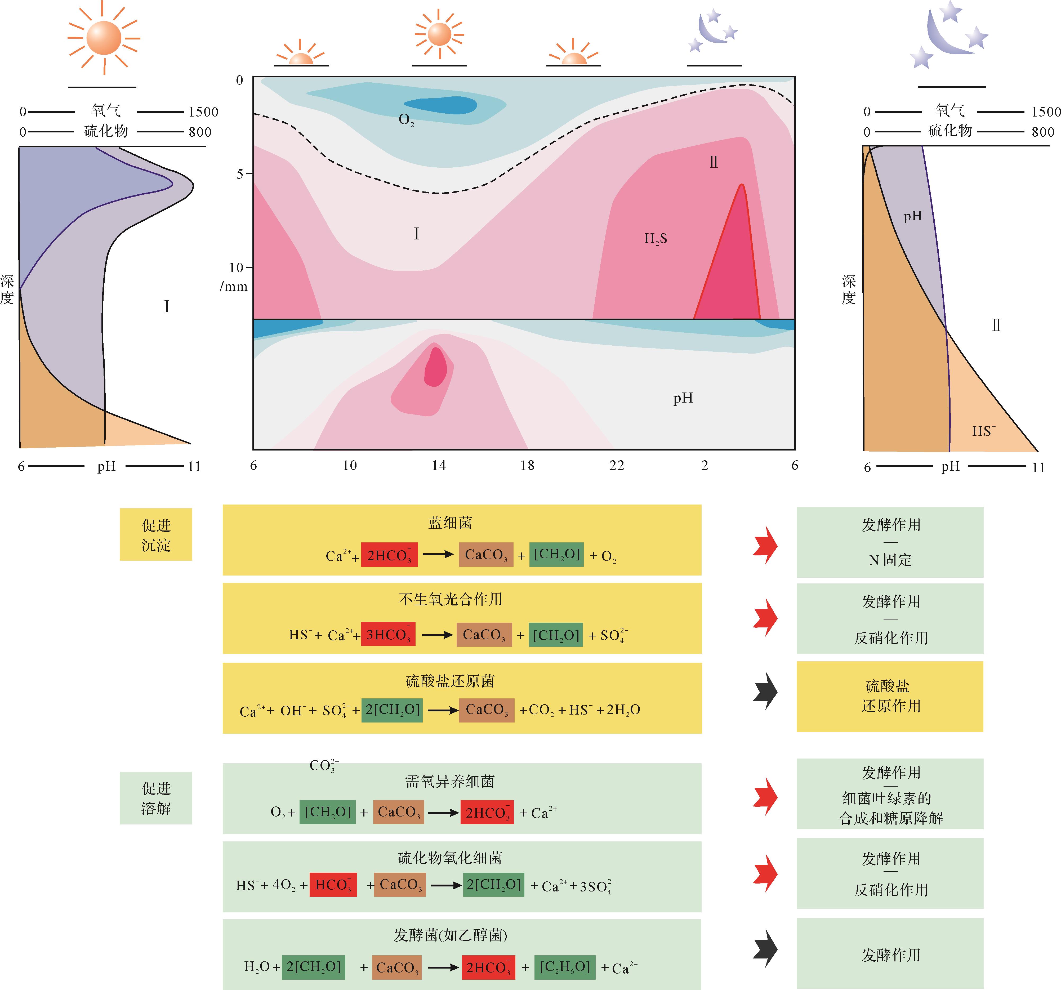
Cyanobacteria, which have a fossil record of 3.5 billion years, have continued to flourish up to the present day. Cyanobacterial metabolic processes have influenced the ecological evolution of the earth. Scientific questions related to cyanobacteria, such as the “Precambrian enigma”, have challenged researchers. The extracellular polymeric substances of cyanobacteria play a crucial role in cyanobacterial calcification. The main characteristics of cyanobacteria and extracellular polymeric substances are systematically introduced in this study, following an analysis of several reports in the research literature from China and elsewhere. Reports of previous studies on the calcification process related to photosynthesis and the degradation process of cyanobacteria were reviewed and summarized. The role of extracellular polymeric substances of cyanobacteria in its calcification process was analyzed. The geological significance and future research prospects are addressed to provide references and clarifications regarding scientific questions about the calcification of cyanobacteria and microbial mats.
2022, 40(1): 106-118.
doi: 10.14027/j.issn.1000-0550.2020.090
Abstract:
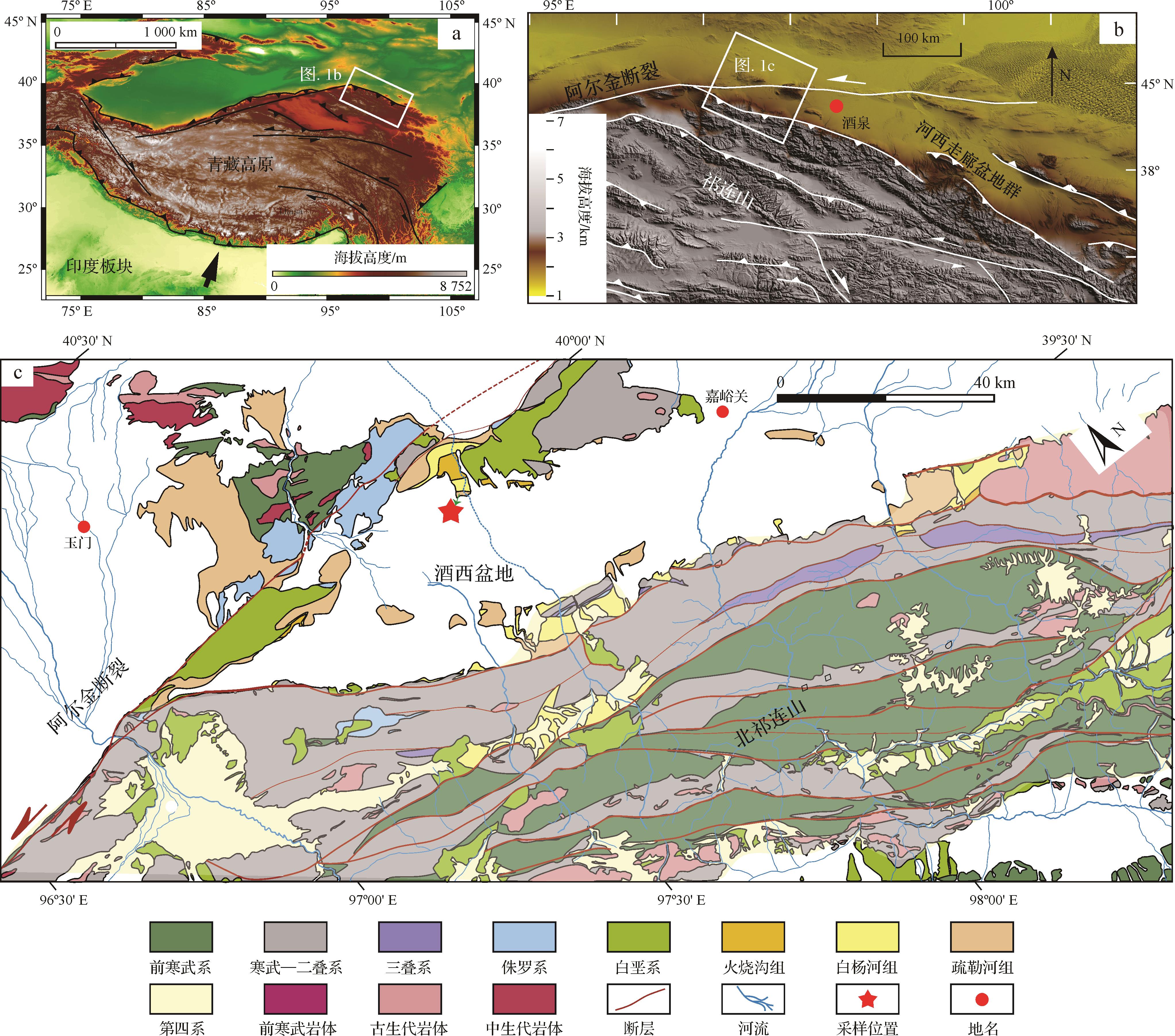
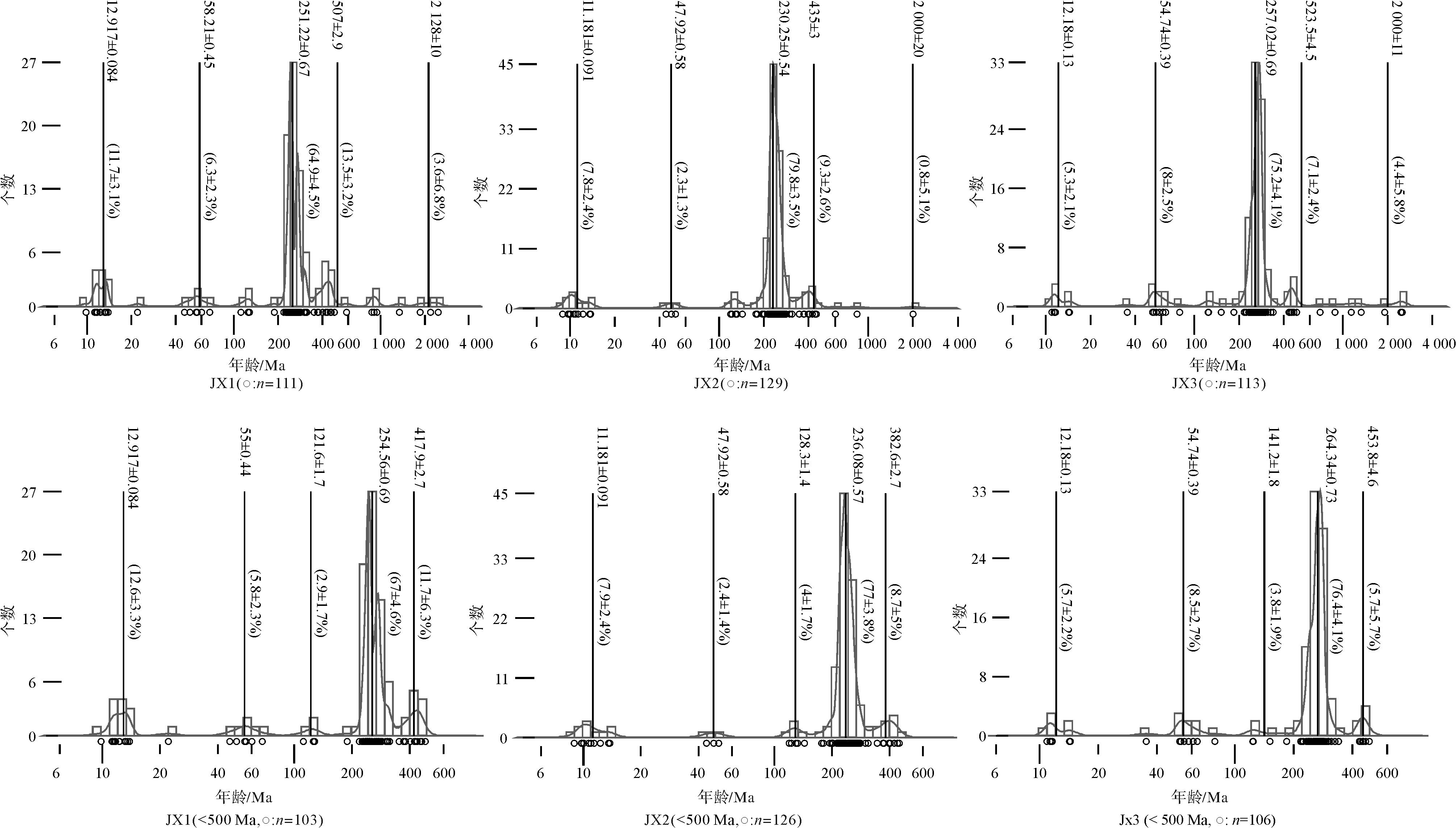
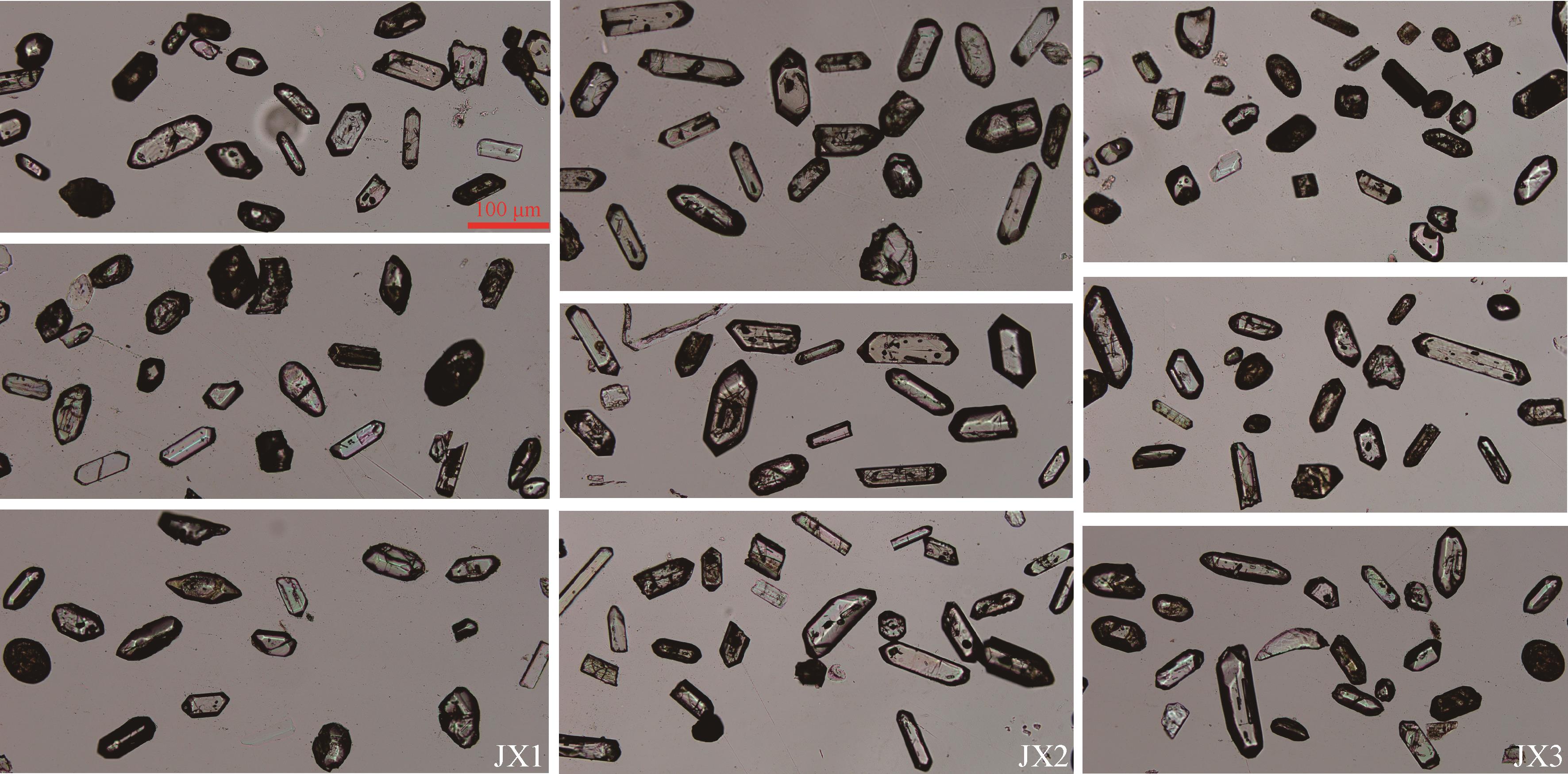
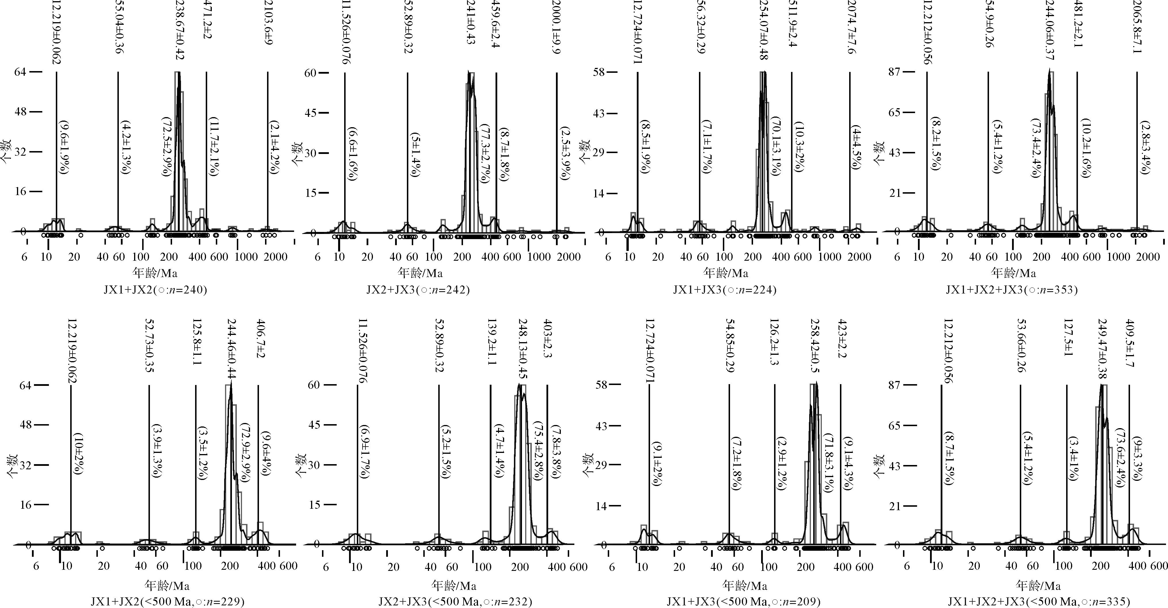
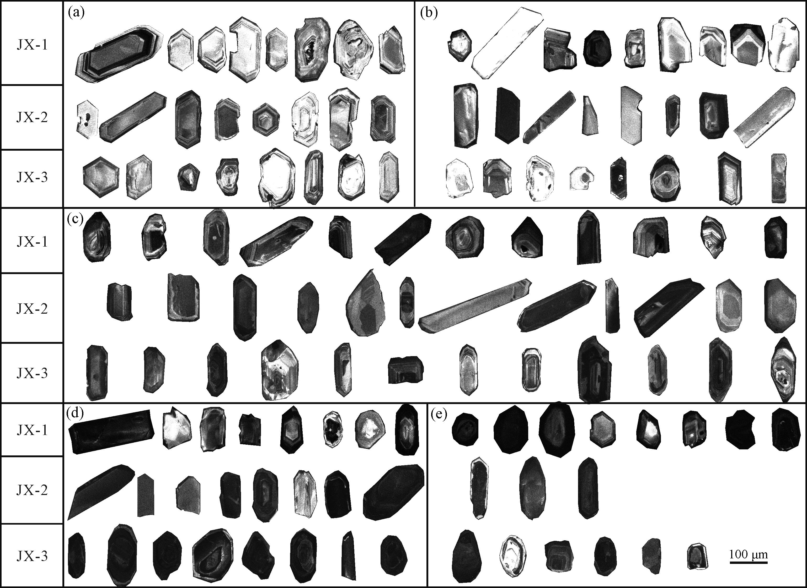
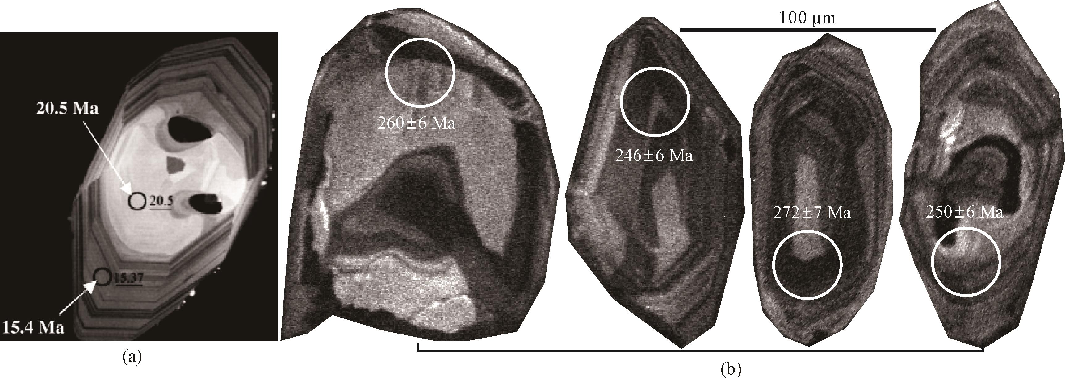
Inductively coupled plasma mass spectrometry (ICP-MS) U-Pb detrital zircon geochronology is an important means of determining the age of sedimentary strata and trace the source of sediments, and also reveal the history of regional tectonic evolution, and is widely used in geological and geographical work. In recent years the development of single-grain detrital zircon dating has doubled the amount of data available. However, there are differences or contradictions between the original data obtained by different research groups in adjacent areas, or even within the same area. How to obtain and process the data efficiently and rigorously and reveal the rich geological information contained in the data is attracting increased research attention, but few studies have been conducted on related aspects. This study considered the example of sandstone detrital zircons of the Cenozoic Shulehe Formation in the Jiuxi Basin on the NE Tibetan Plateau. A horizontal and vertical comparison of a reasonable number of zircon particles (“zircons”) in the test data was conducted using standard experimental procedures. The test points were selected by combining the external morphologies and internal structures of the zircons. Single-particle cathodoluminescence (CL) imaging of the zircons was found to have appreciable potential for data testing, analysis and application. The specific approach is as follows: (1) Standard heavy mineral sorting procedures should be adopted for pre-processing zircons for U-Pb dating, to maintain the complete distribution of individual zircons in the collected detrital sample and avoid the loss or deviation of age components. When selecting particles for dating, the characteristics of all the zircon grains examined under stereomicroscope and scanning electron microscope should be closely combined to obtain the optimal effective number of ages of individual zircons in order to improve the efficiency, accuracy and integrity of the data. (2) During data processing, analysis and application, it is necessary to correct, or eliminate, abnormal data in combination with the CL image of the individual zircon, in order to avoid meaningless “mixed ages” caused when the laser ablation point or ion beam crosses different growth zones. The study provides basic technical support for the processing and application of “big data” procedures in detrital zircon U-Pb geochronology, and provides a new perspective for effectively discriminating the quality of U-Pb data and applying it to geoscientific research reasonably and accurately.
2022, 40(1): 119-135.
doi: 10.14027/j.issn.1000-0550.2020.087
Abstract:
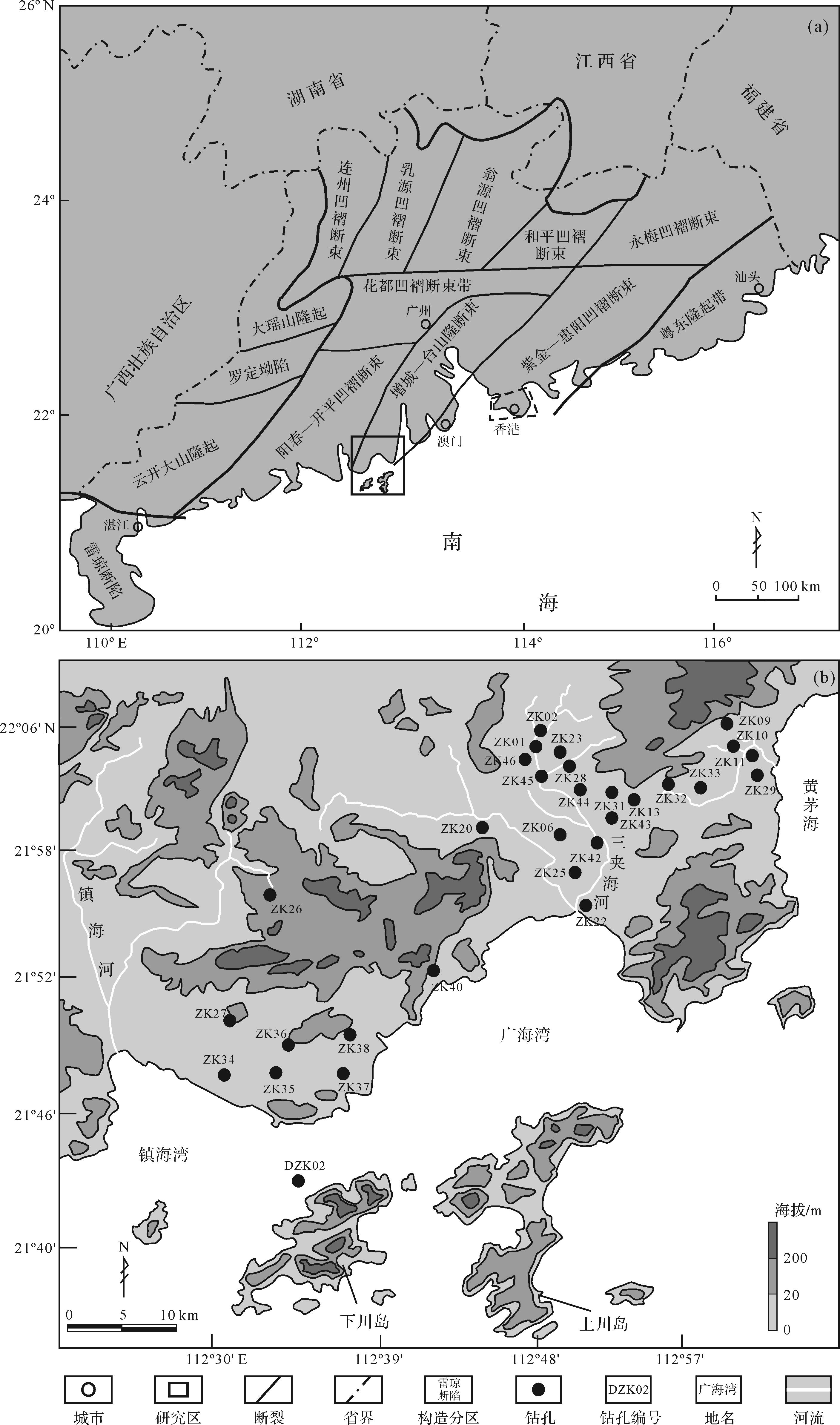
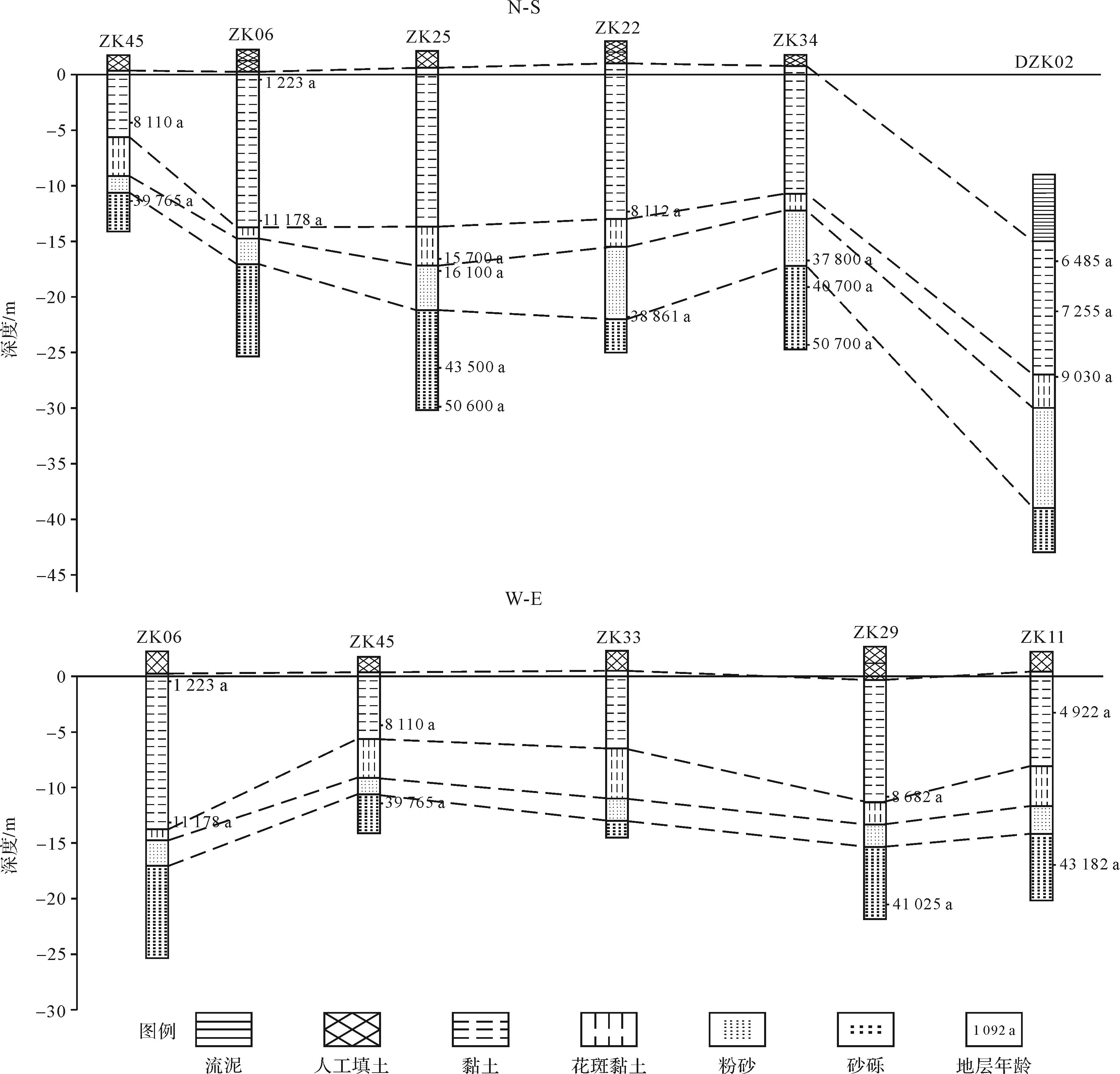
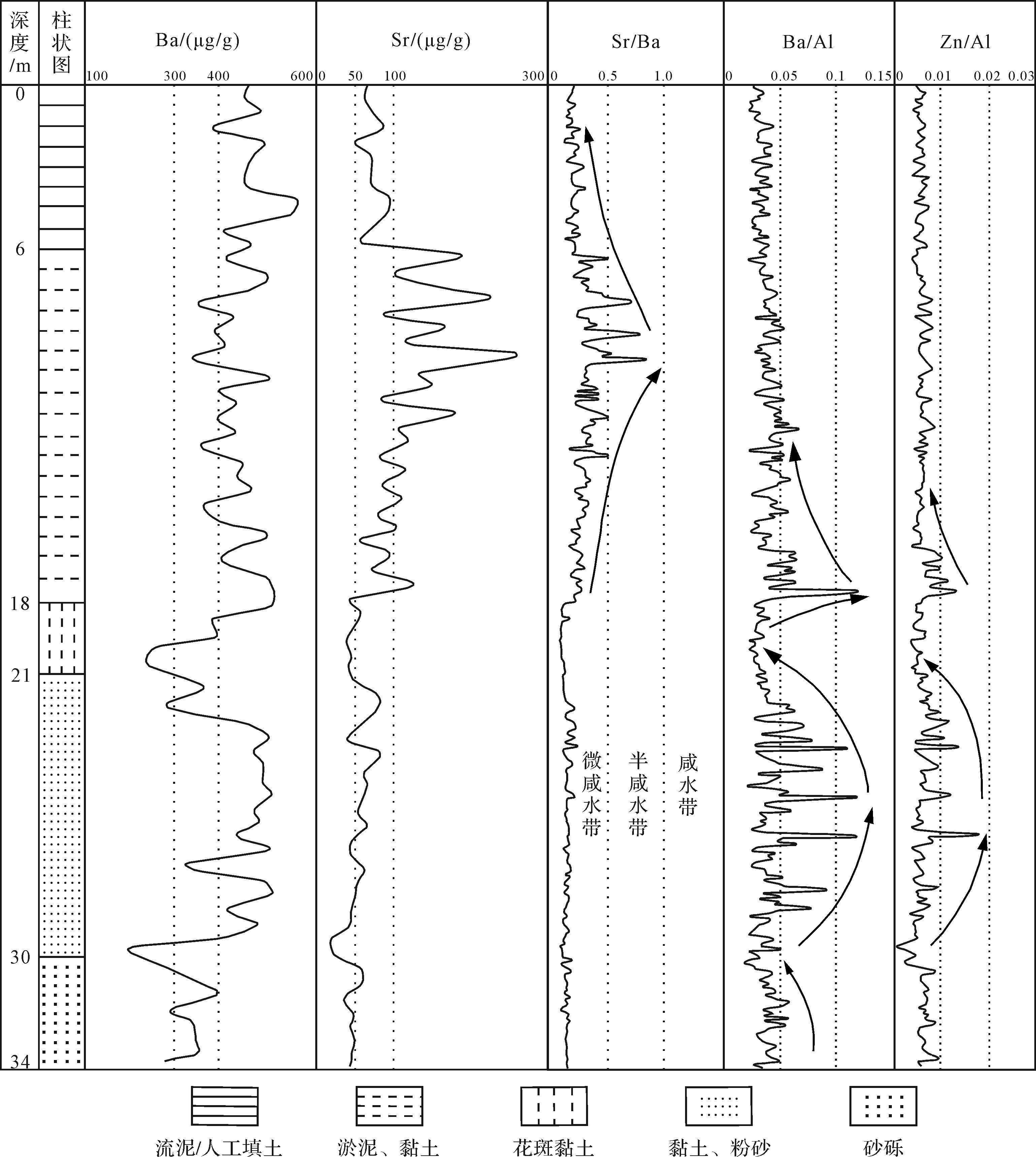
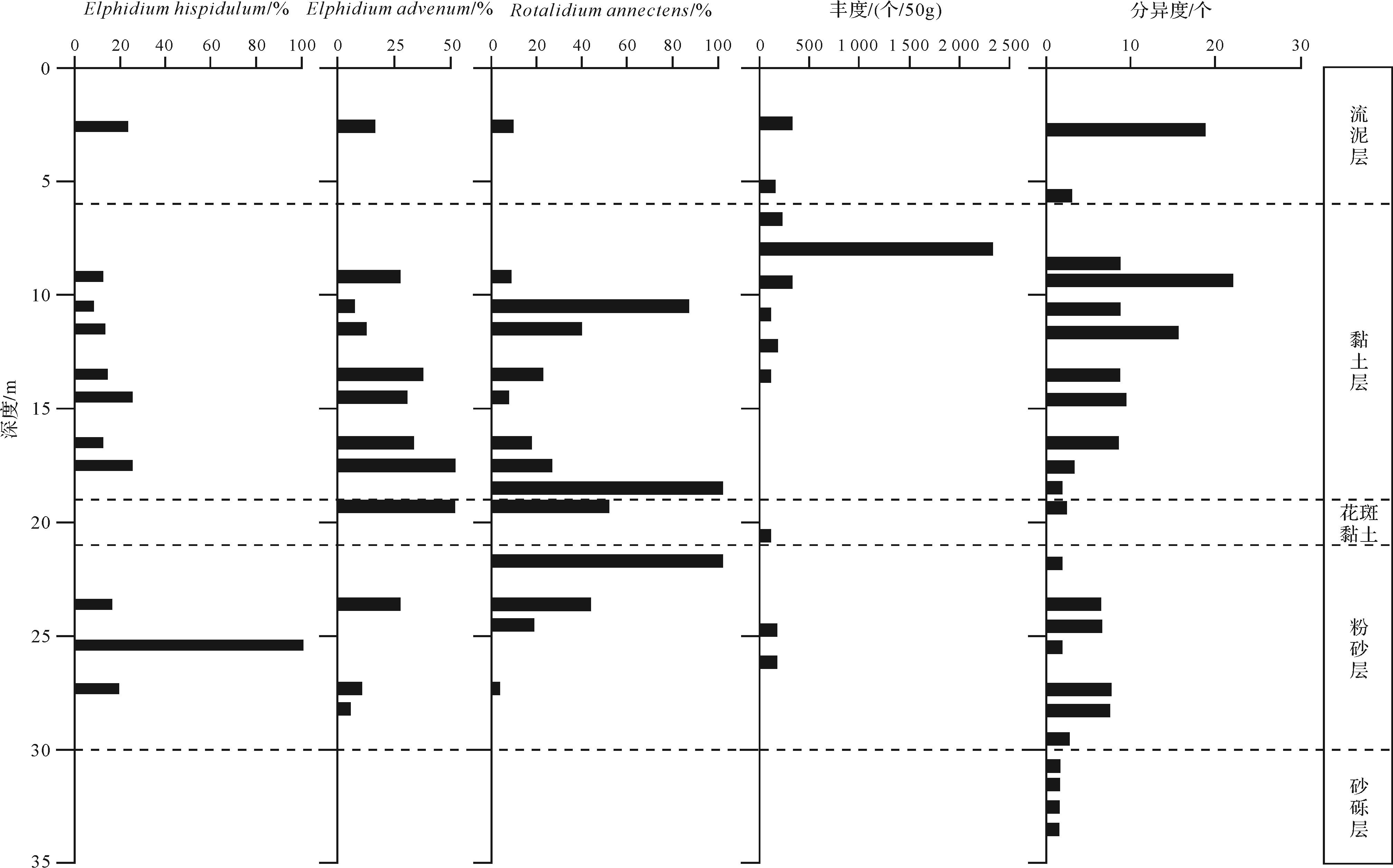
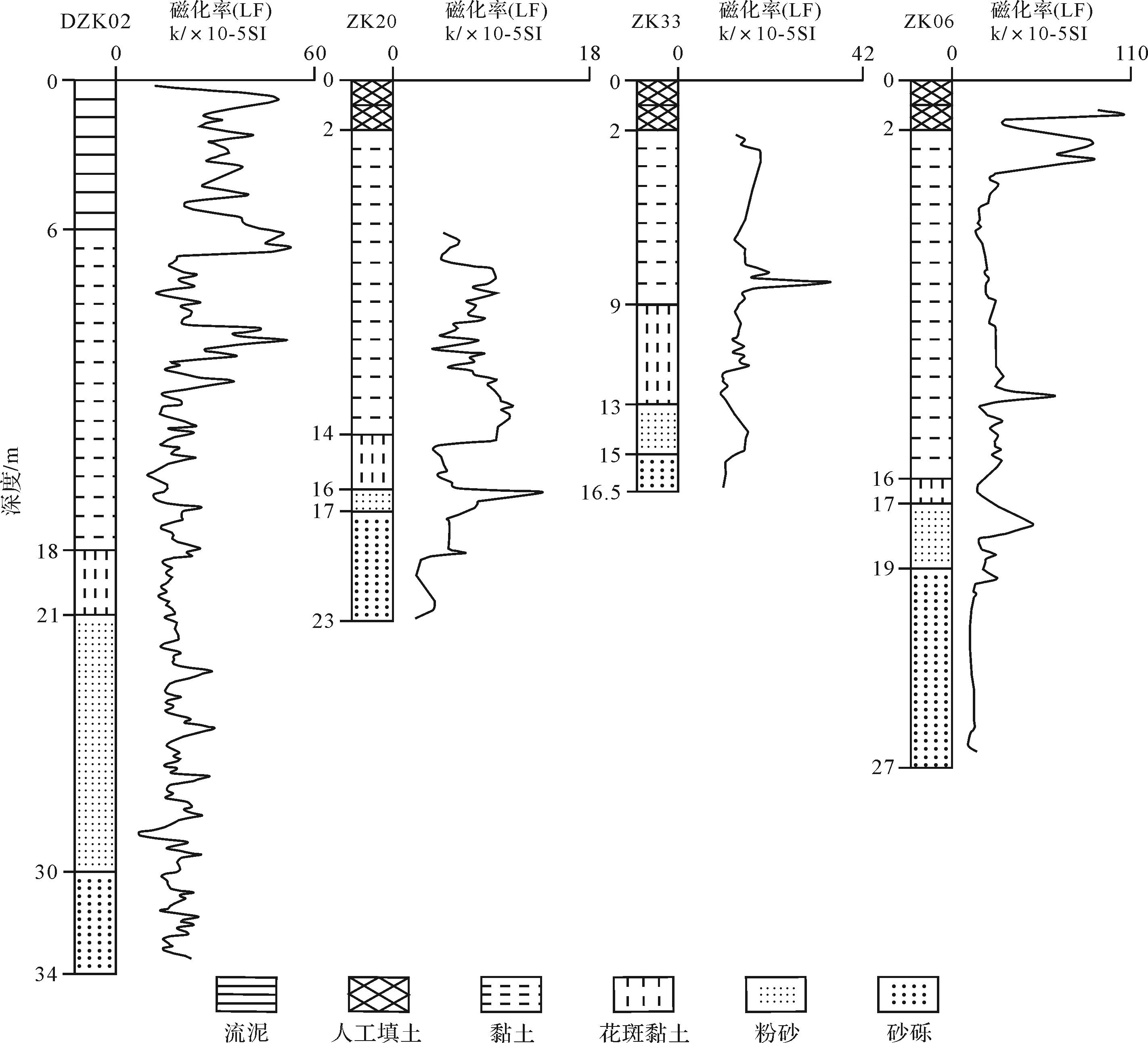
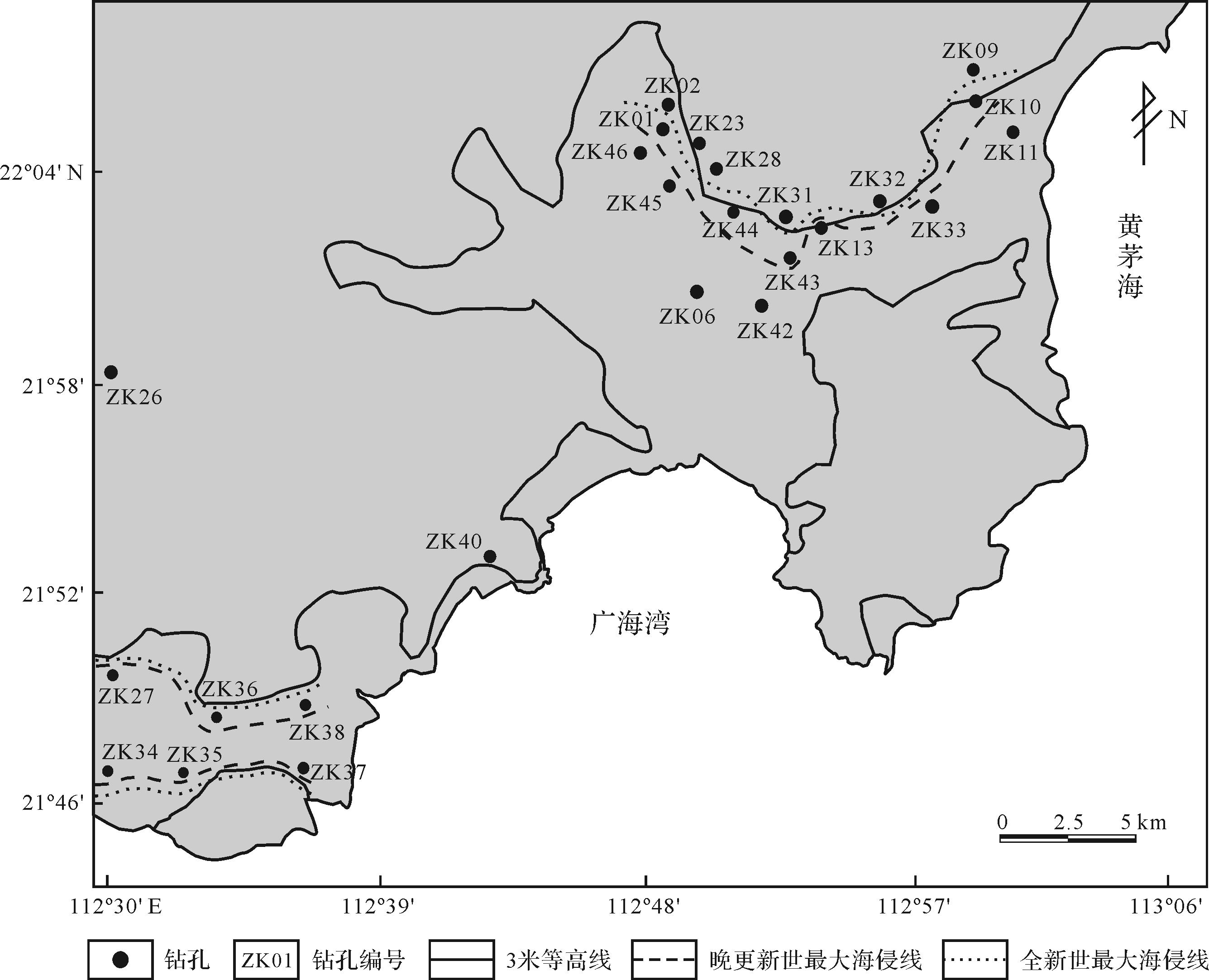
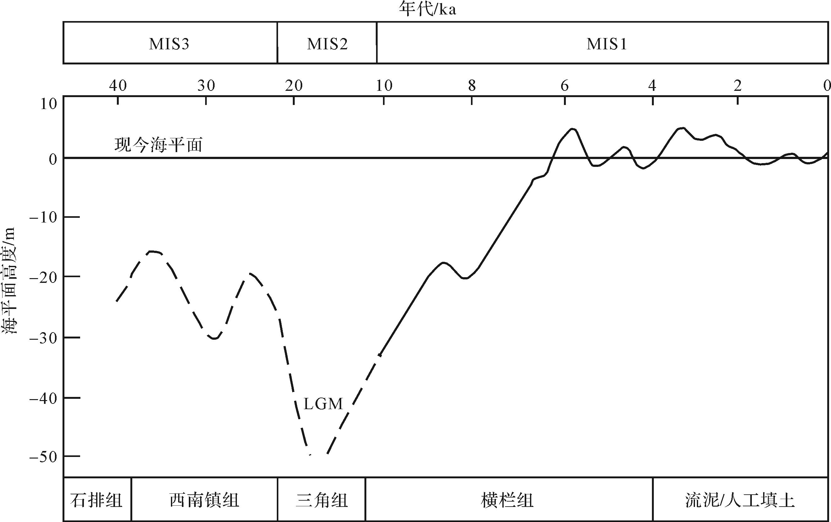
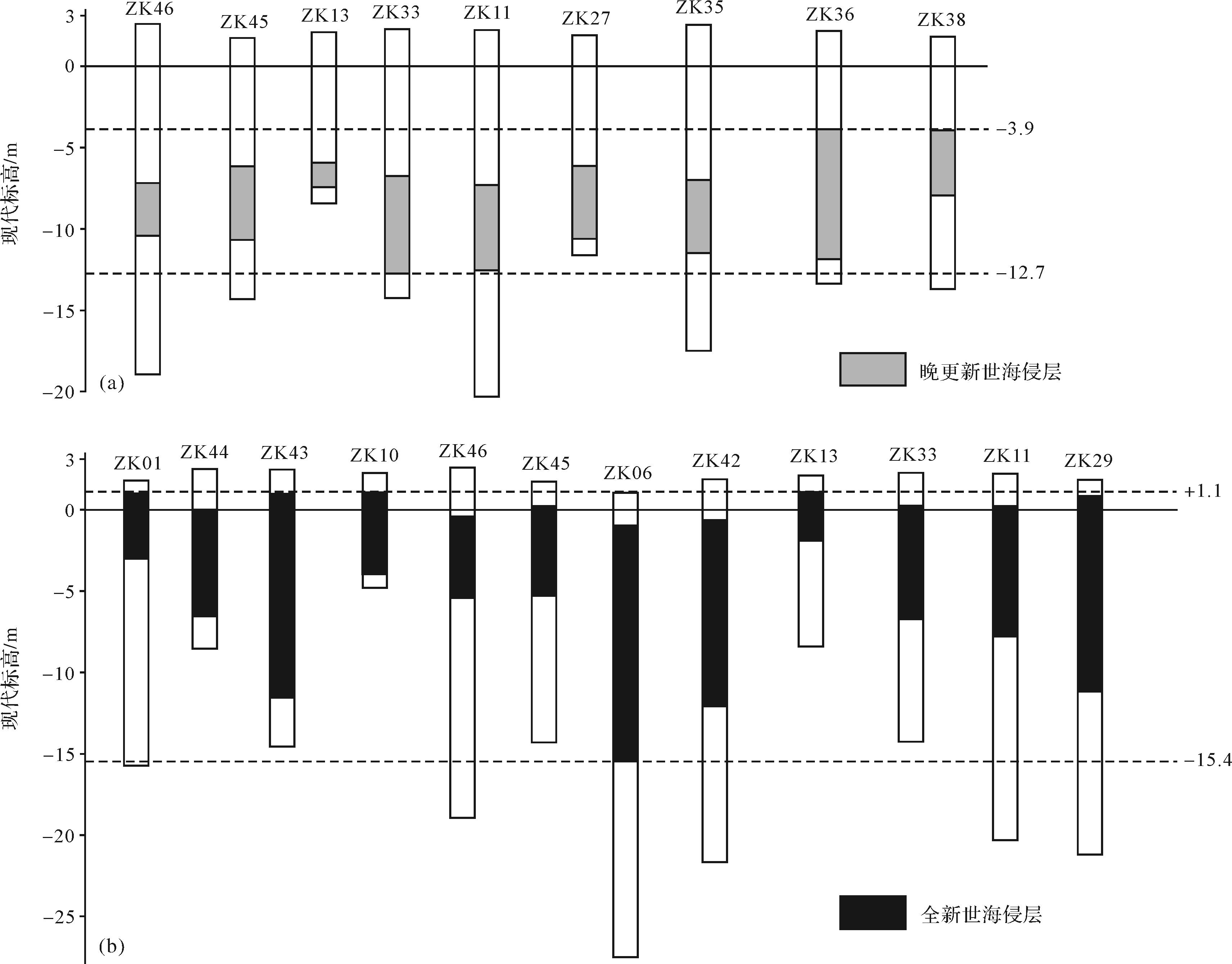
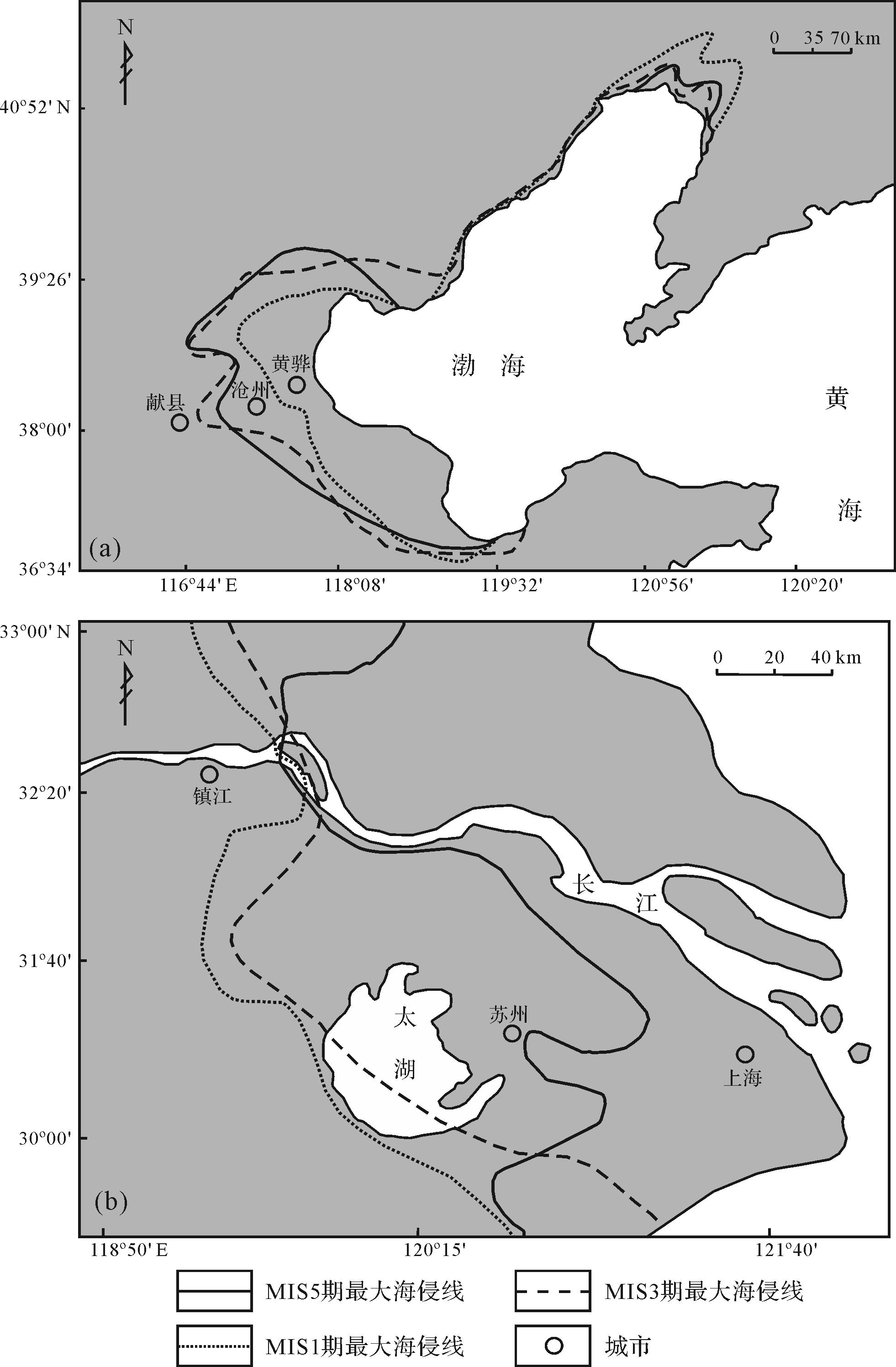
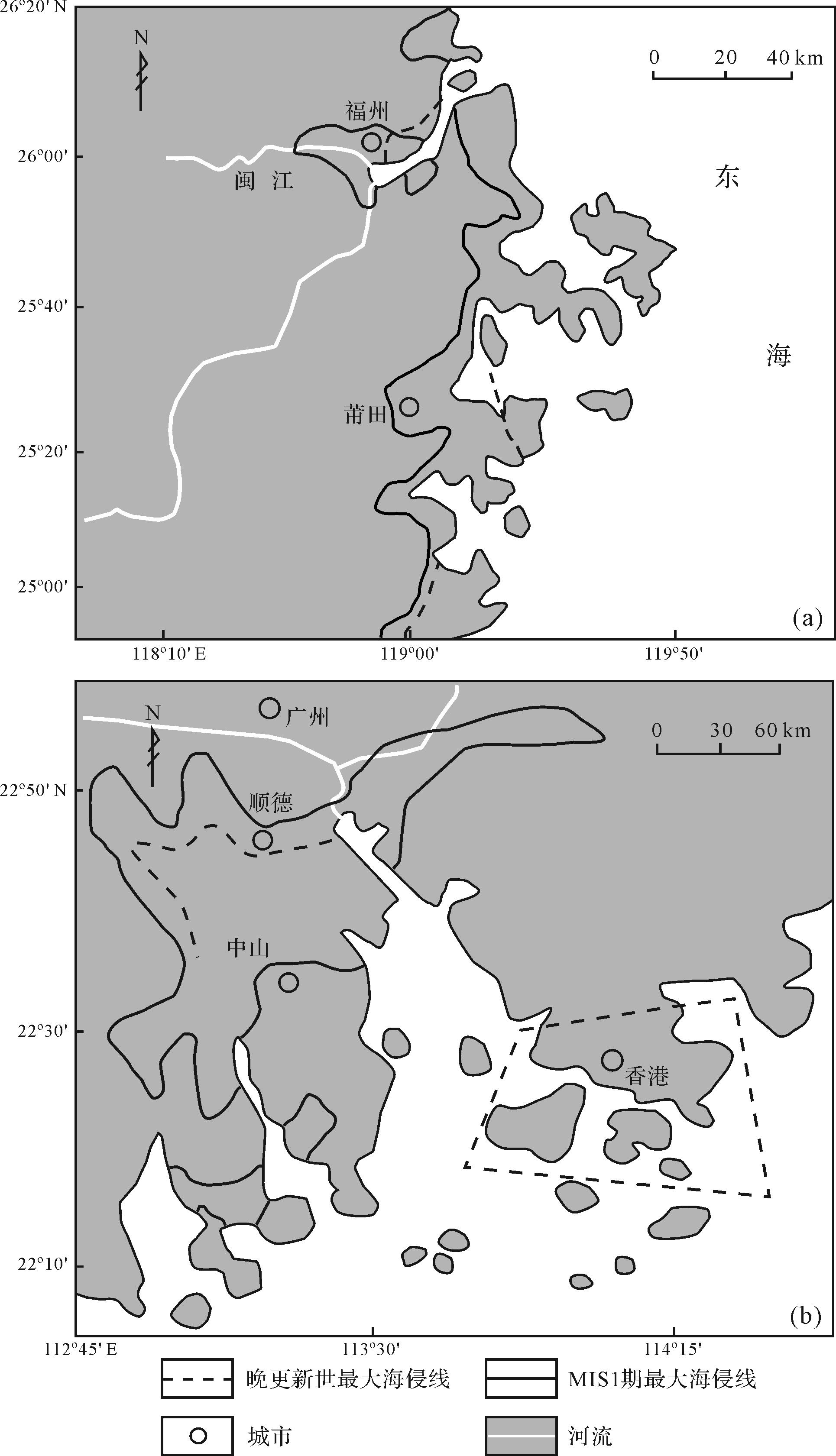
A series of intense sea⁃land interactions and transgression/regression geological events occurred in coastal areas from the beginning of the Quaternary, influenced by global climate and sea-level changes. These have left rich information about the sedimentary environment evolution in the transgression records. Based on 30 new drilled holes at the western margin of the Pearl River Delta, combined with 14C and OSL dating, geochemistry, micropaleontology and magnetic susceptibility, sedimentary evolution and the reconstruction of the maximum transgression coastline was completed. This study found the following:(1) The study area is divided into four sedimentary units from bottom to top: consecutive fluvial⁃marine alternating sedimentary environments in the middle to late Pleistocene; a regressive exposed environment in the Last Glacial Period; and coastal and shallow marine sedimentary environments in the Holocene. Two major marine transgression events occurred during the MIS3 and MIS1 high sea-level periods.(2) The maximum landward positions of the transgressions inland from the present shoreline were about 15.4 km in the Late Pleistoceneand 16.3 km in the Holocene. This similarity in distance and trend, which is inconsistent with the global pattern of sea-level change, was probably caused by tectonic uplift in addition to global climate fluctuation. The elevation and age data of the two-stage transgression sediments reveals that from the Late Pleistocene the whole area was experiencing tectonic uplift at a rate of +0.51 mm/a. The whole area has been in a tectonic subsidence state at a rate of -0.61 mm/a since the Holocene. The reconstructed maximum transgressions of the MIS3 and MIS1 coastlines are consistent with the current 2.8 m and 3 m contour lines in the research area. In addition, due to neotectonic movement, the transgression frequency and maximum range in the Late Quaternary may be summarized as “north powerful and south weak” in China’s coastal regions. Transgressive intensity differences in the same area at different times were not fully consistent with “early weak, later powerful” characteristics, the main reason being that, besides the tectonic differences in different tectonic units, the changes in sea level and sediment supply influenced the intensity of transgression to a certain extent.
2022, 40(1): 136-148.
doi: 10.14027/j.issn.1000-0550.2020.082
Abstract:
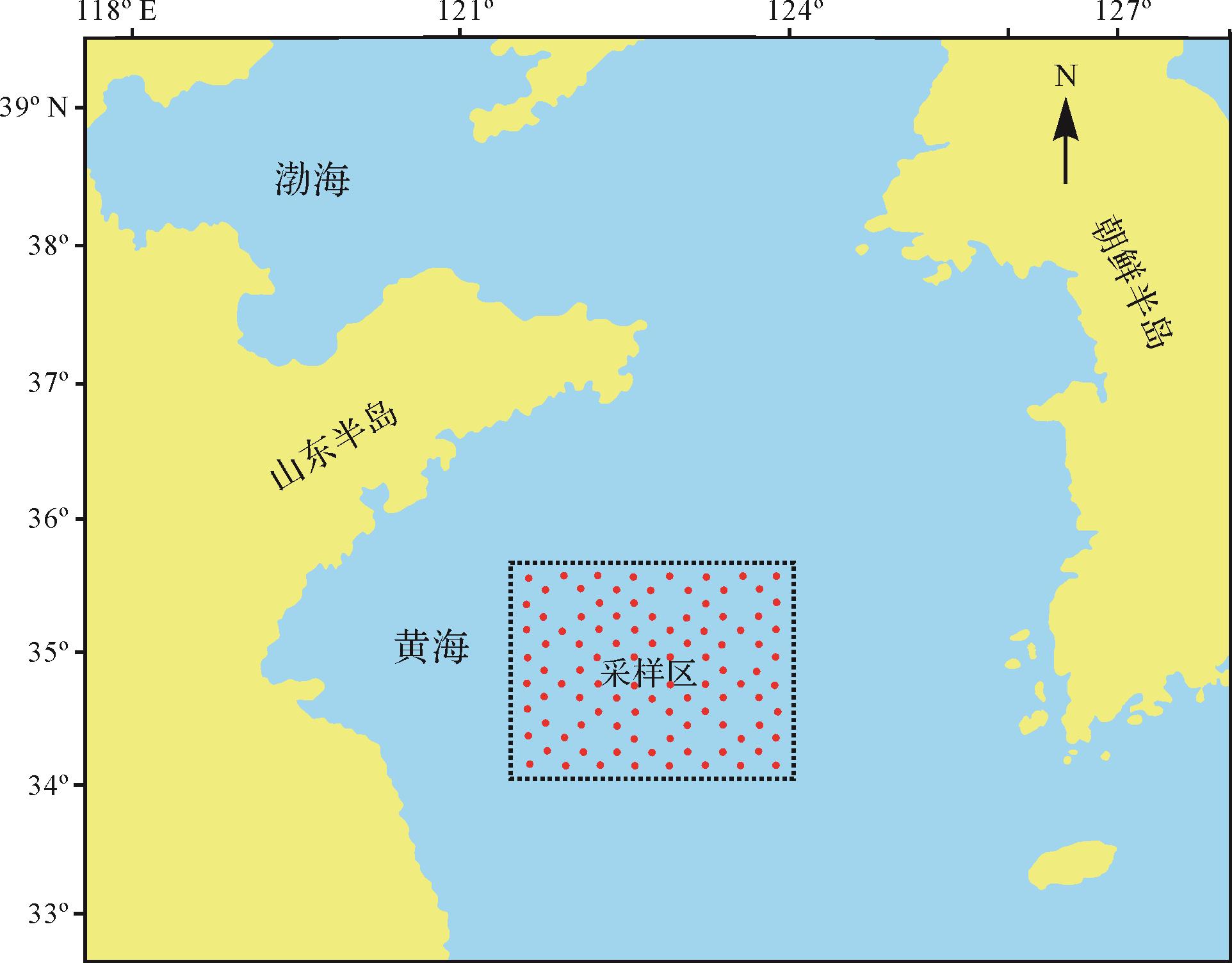
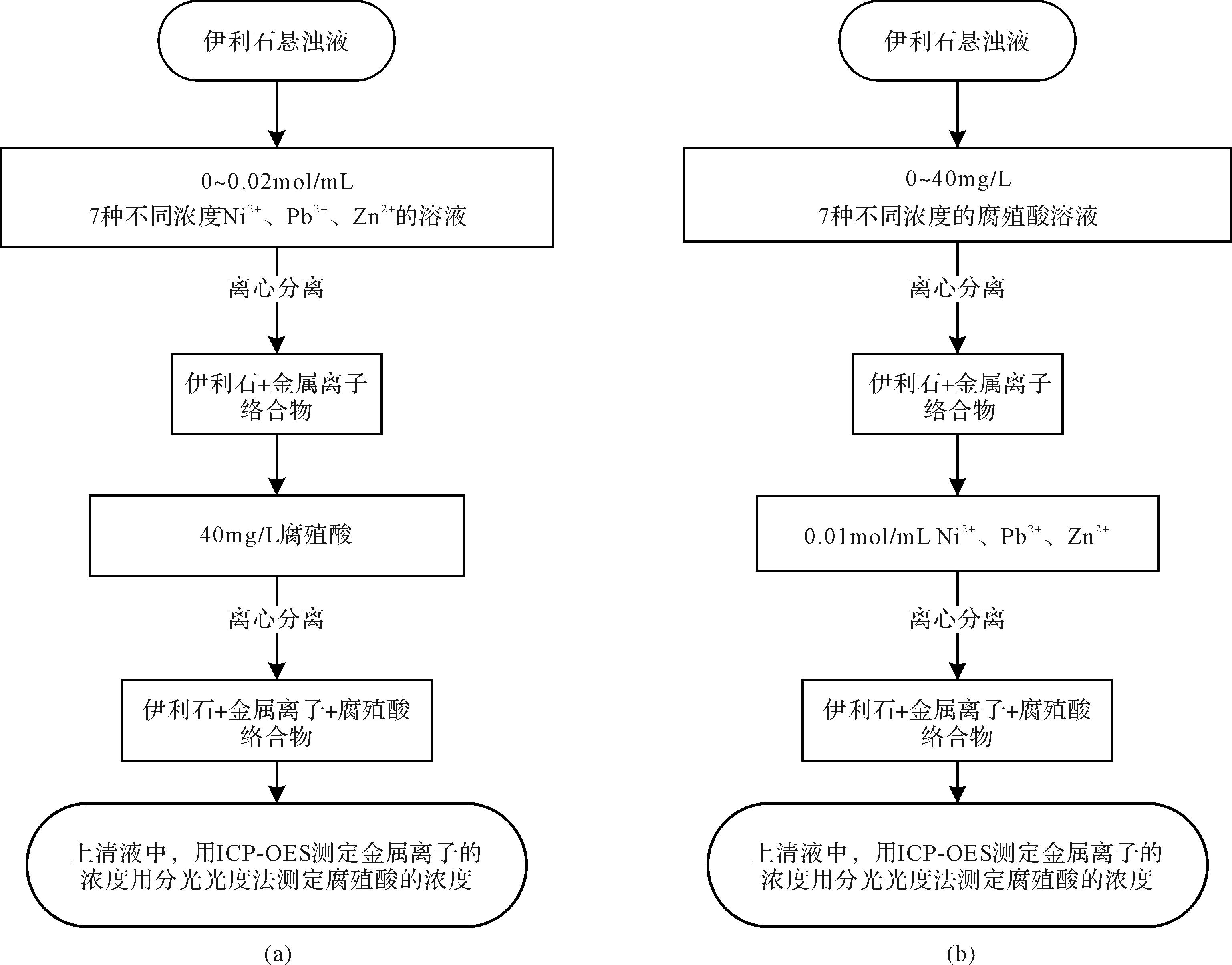
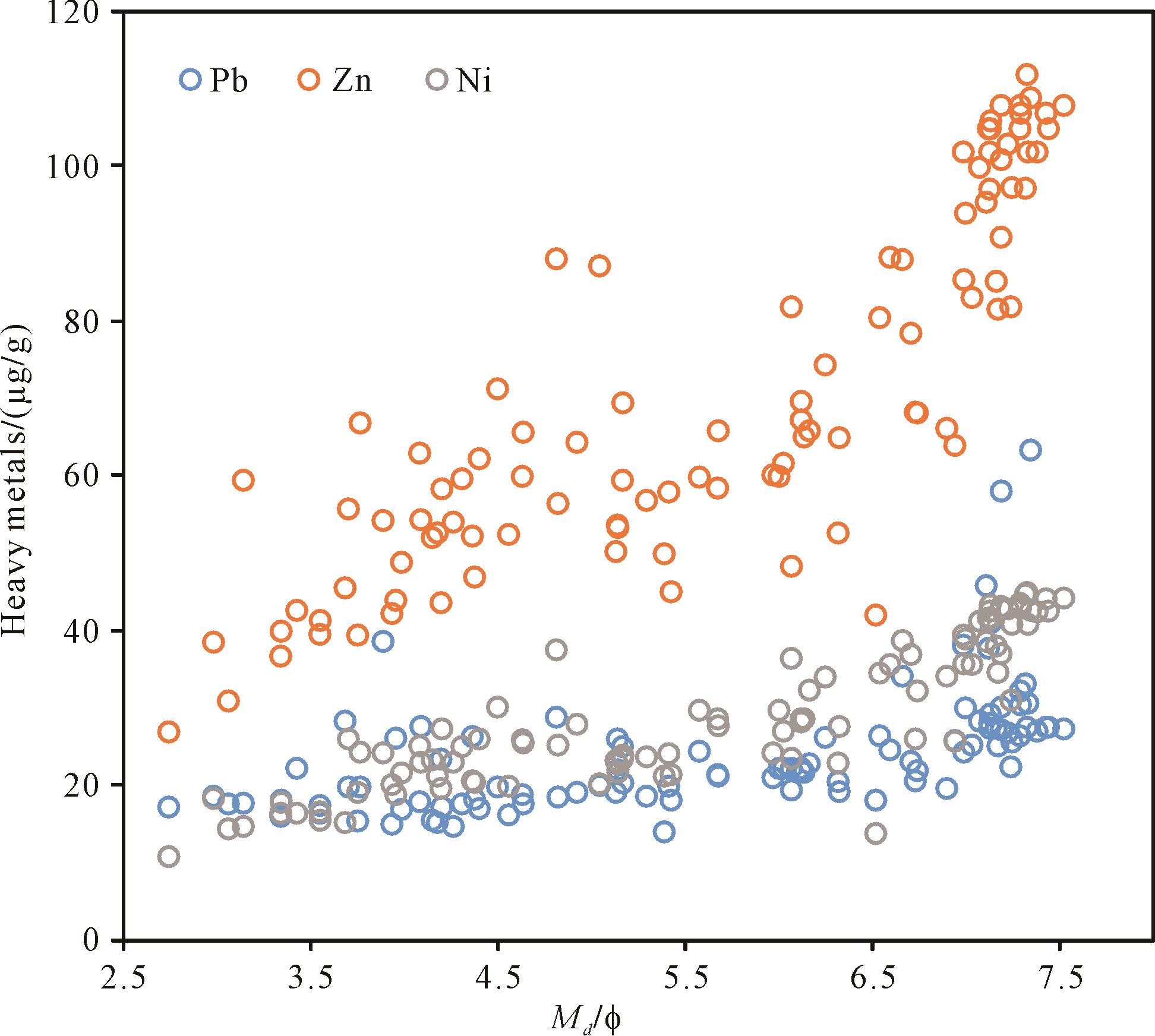
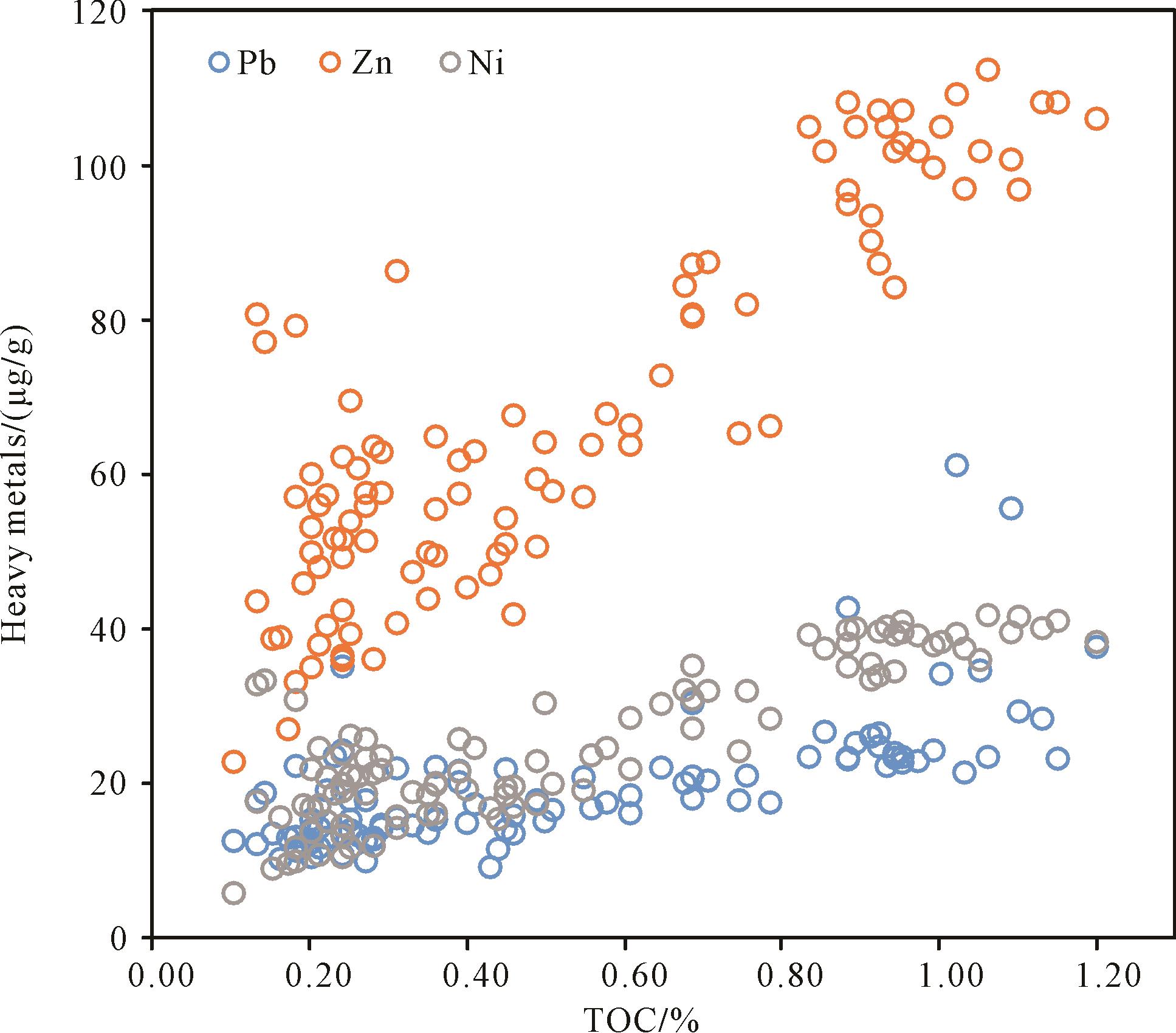
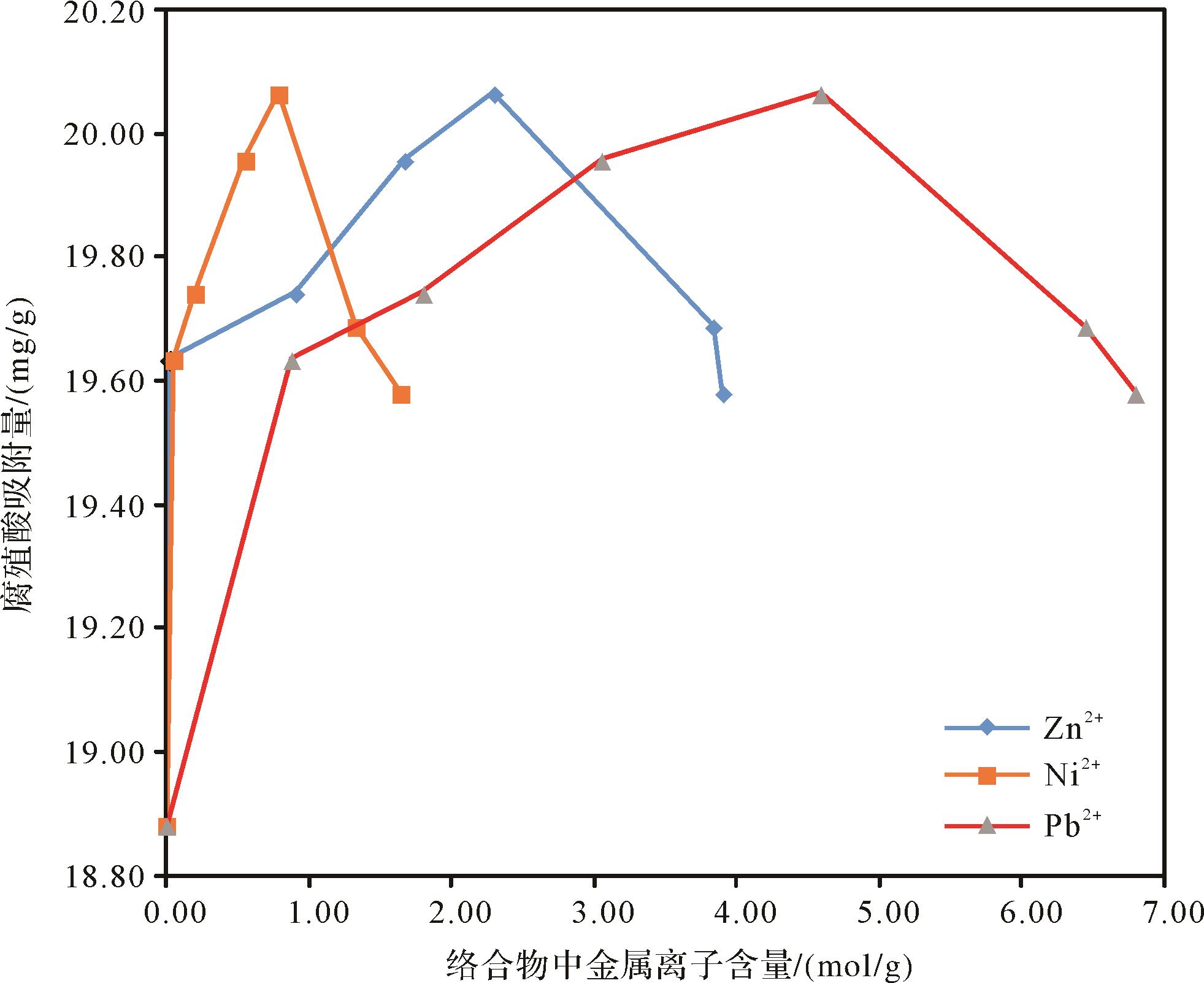
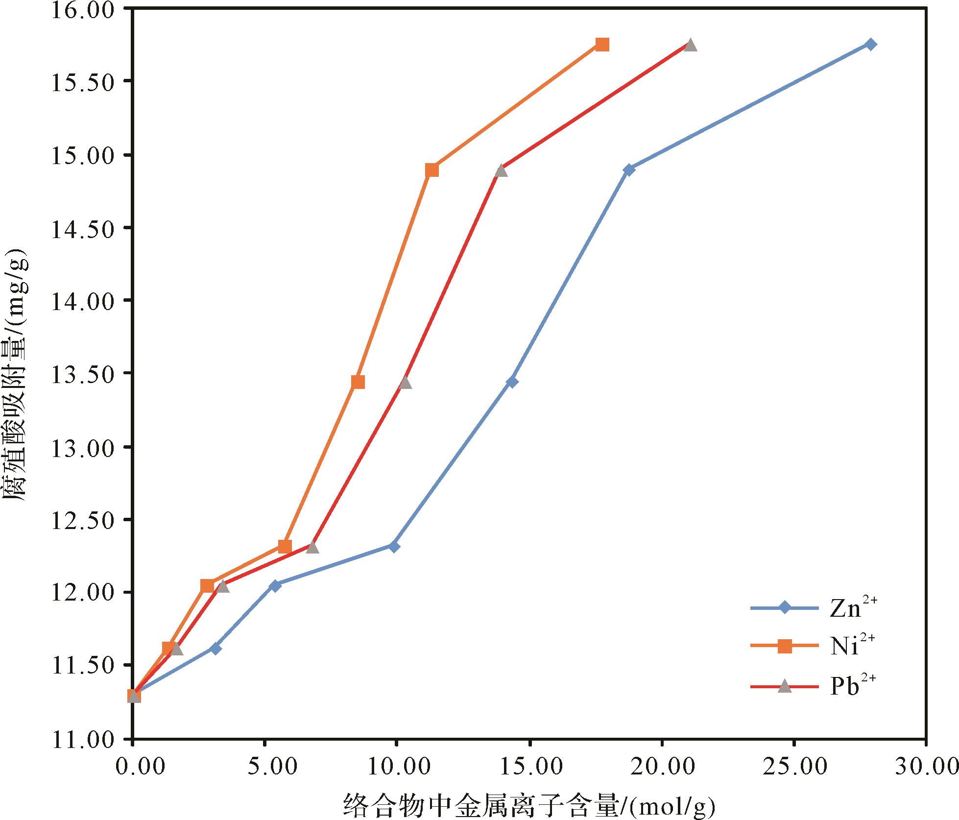
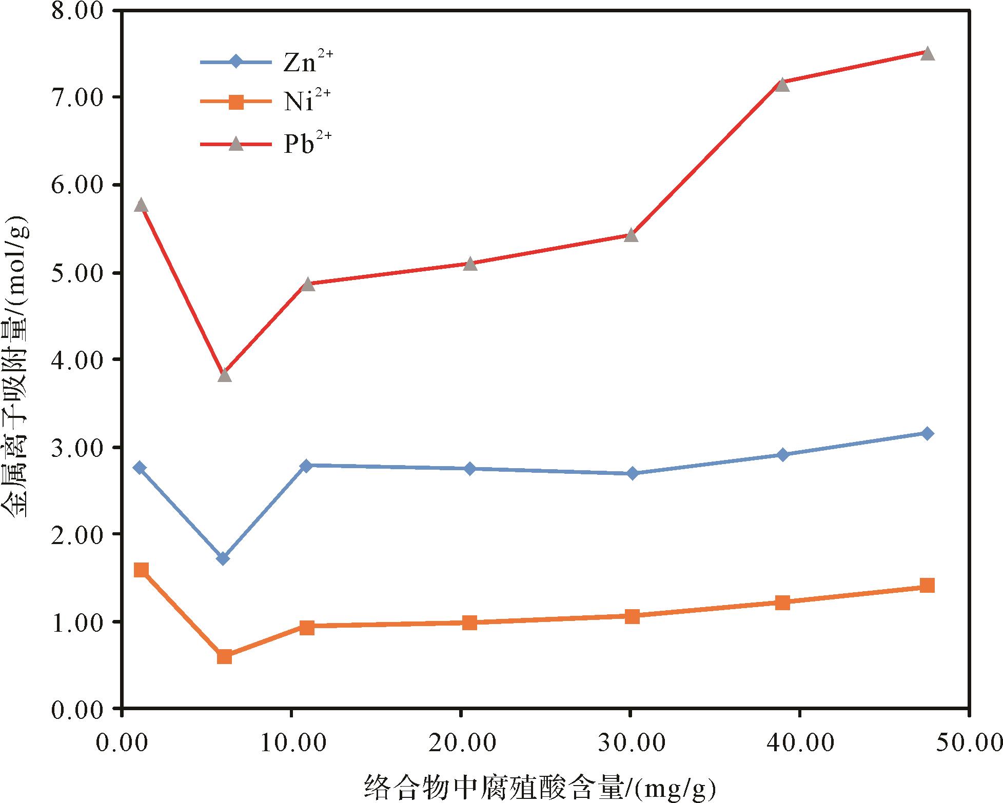
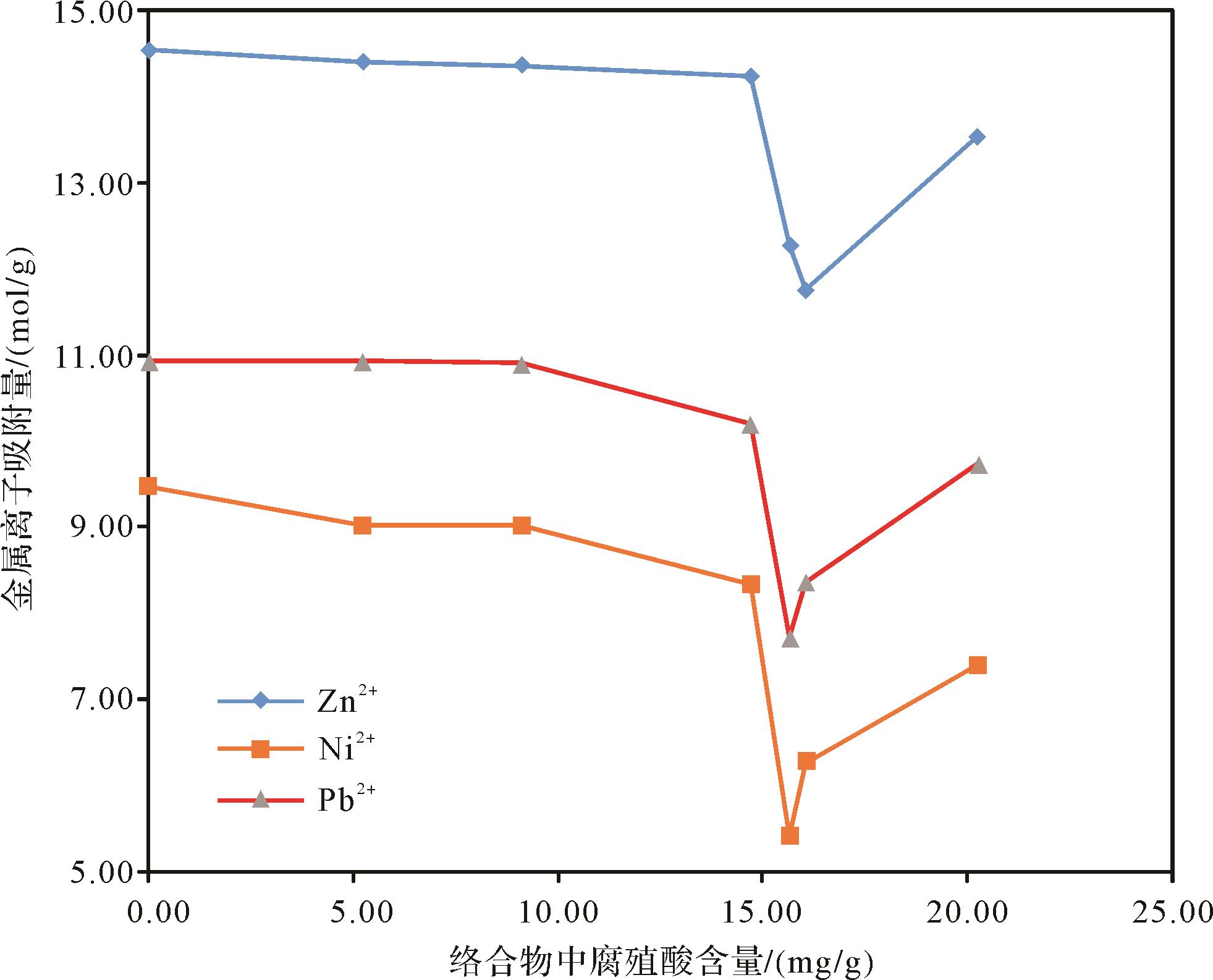
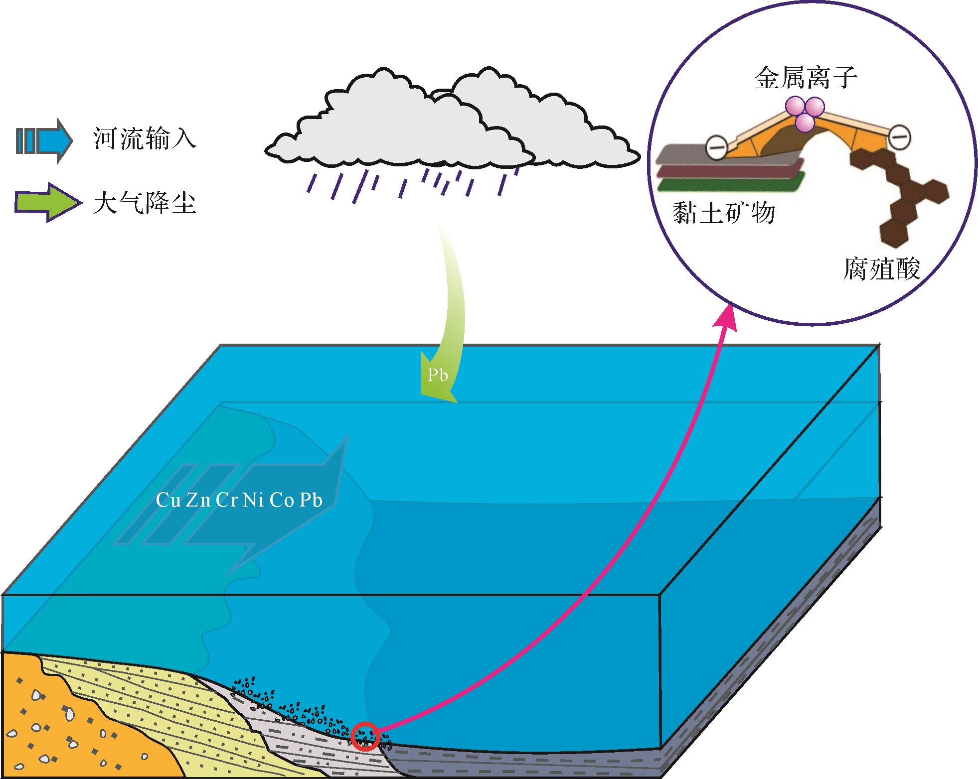
Continental margin sediments are an important ocean carbon repository of the estuary-continental shelf. Clay minerals as carriers adsorb organic matter and metal elements on their surface or between layers. It is usually expressed as a highly positive correlation between grain size, organic matter and metallic element content. This study analyzed the distribution and interrelationship of sediment grain size, total organic carbon, and major and trace elements in the middle of the South Yellow Sea. The study was further conducted for adsorption simulation experiments on metallic elements, organic matter and clay minerals. The experiments indicated that the correct amount of Zn2+, Ni2+, Pb2+ under acidic conditions (pH = 4) significantly promoted the adsorption of humic acid (the main component of organic matter) by illite. The humic acid adsorption reached 20.06 mg/g, within which the addition of metallic ions increased the adsorptive capacity of humic acid by 6.25%. The metals under alkaline conditions (pH = 8) also promoted the adsorption of humic acid by illite, and the adsorption of humic acid reached 15.7 mg/g. The addition of metallic ions increased the adsorption of humic acid by 38.9%. The cationic bond bridging of metallic ions promoted the adsorption of humic acid by illite, and the adsorption amount of humic acid in an acidic environment was higher than in an alkaline environment. It is confirmed that the participation of metallic elements has an obvious promoting effect on the adsorption of humic acid by illite at the edge of the shelf, and is conducive to the formation of a marginal sea “carbon pool” in the global carbon-cycle process. In addition, ocean acidification may reduce the amount of dissolved organic matter and increase heavy-metal ion concentration, which would pose a threat to the balance of the marine ecosystem in a shelf-margin sea.
2022, 40(1): 149-165.
doi: 10.14027/j.issn.1000-0550.2020.098
Abstract:
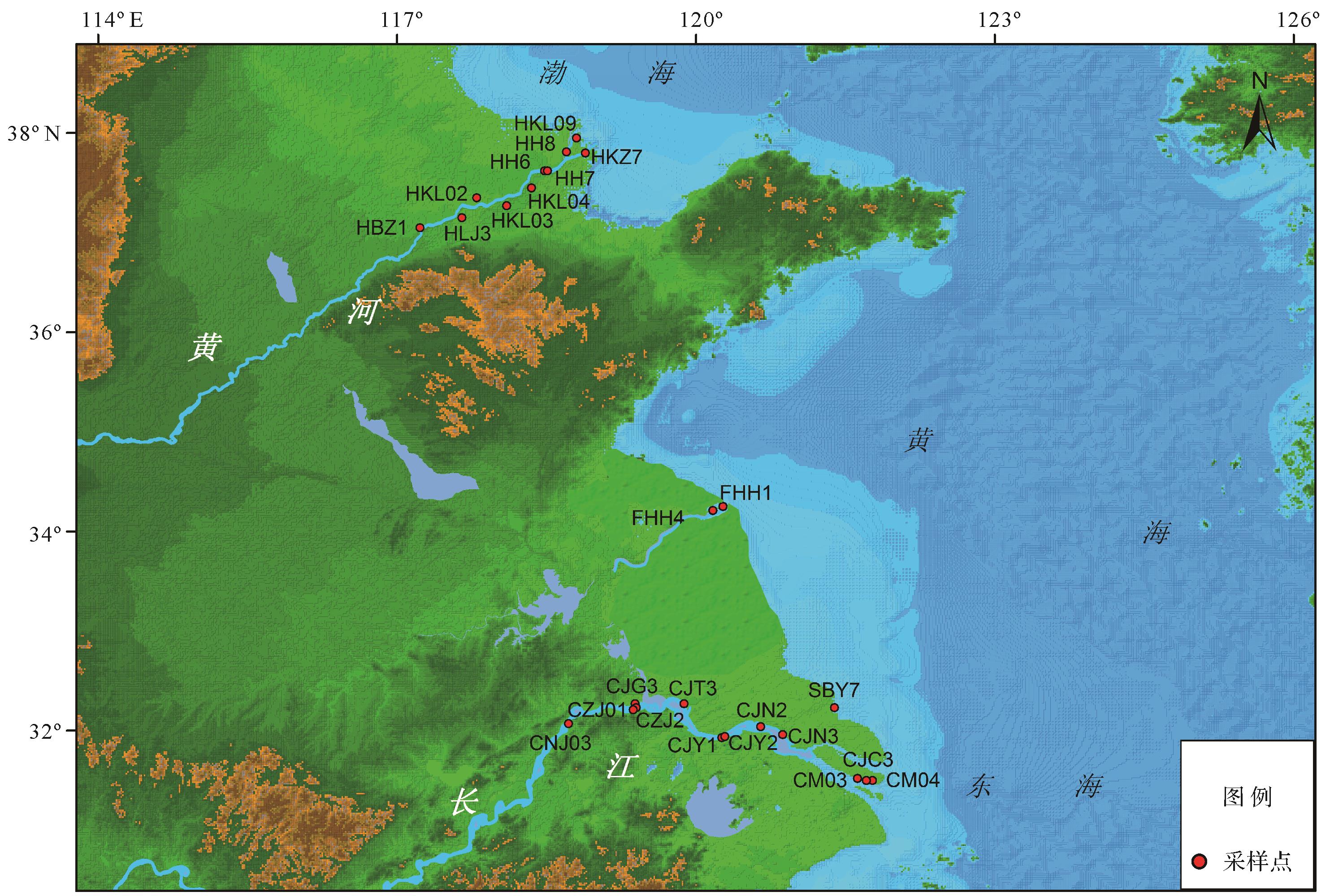
Samples from 26 locations on the Huanghe River Estuary, the Changjiang River Estuary, the abandoned Huanghe River Estuary and the northern Jiangsu coast were analyzed to identify the provenances of amphibole in sediments from the Huanghe and Changjiang Rivers. Thirty-eight groups of different-size detrital amphibole particles were tested by element geochemistry (ICP-OES and ICP-MS). Fifty major and trace element contents were obtained for every amphibole group. The results show homologous amphibole element content for the different particle sizes. Except for the relatively large deviation of a few large ion-active elements, most of the element content differences are relatively small. This indicates that the provenances of the amphiboles from the Huanghe River and Changjiang River have individual characteristics in common. The collective geochemistry of amphibole from the two estuaries showed high Ca, Mg, low Na, K content. The large-ion lithophile elements occupy the A and B sites of the amphibole structure, and the constant elements K, Na, Ca and trace elements Sr , Ba, Rb, Pb, Th, U etc. are closely related, and have a wide range of isomorphism. These large-ion trace elements fluctuate greatly in the homologous samples, with medium to large average differences between heterogeneous samples. The high-field-strength profile elements (e.g., Zr, Hf, Sc, Y, REE, Nb, Ta, etc.) have undergone complex isomorphic substitution in the structure of the amphibole; the constant elements (e.g., Fe, Mg, Al, Ti and Mn) occupy the C sites. Their content is relatively stable, with only small internal variation in homologous samples. In heterogeneous samples the content of various elements and the ratio between elements differ greatly, especially the contents of Be, Y, Zr, Hf and Sm, and the ratios of Zr/Sc, Zr/Rb, Zr/Nb, Zr/Y, Y/Hf, K/Nb, Sc/Hf, Y/Nb and Rb/Hf. These show significant group differences in the amphiboles from the Huanghe River and from the Changjiang River, which is useful for indicating provenance. Scatter plots of the ratios between multiple-group elements act to qualitatively identify source minerals, and multiple high field-strength trace element content allows a quantitative assessment of the provenance by using chemical mass balance source analysis and a least-squares algorithm.
2022, 40(1): 166-181.
doi: 10.14027/j.issn.1000-0550.2020.089
Abstract:
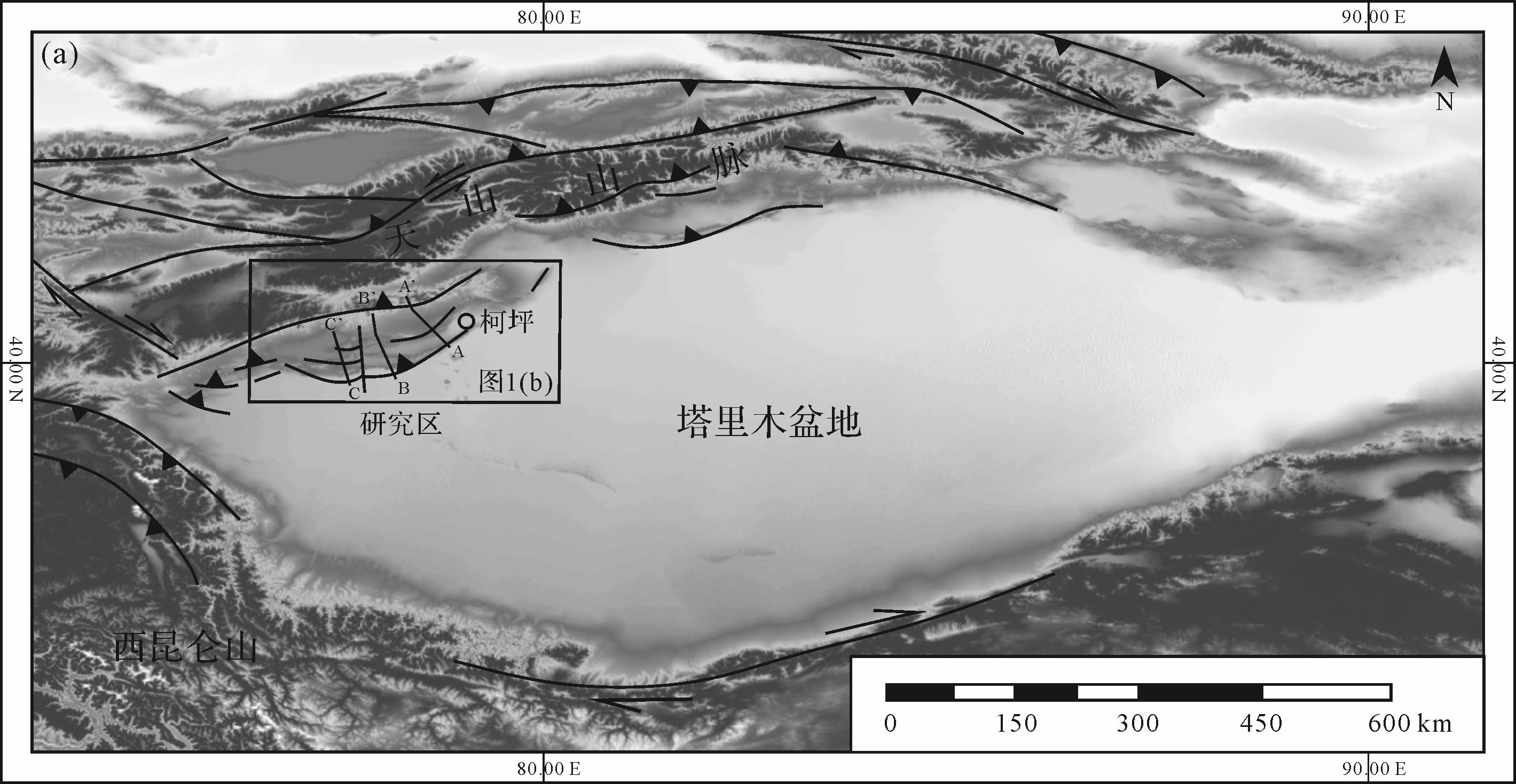
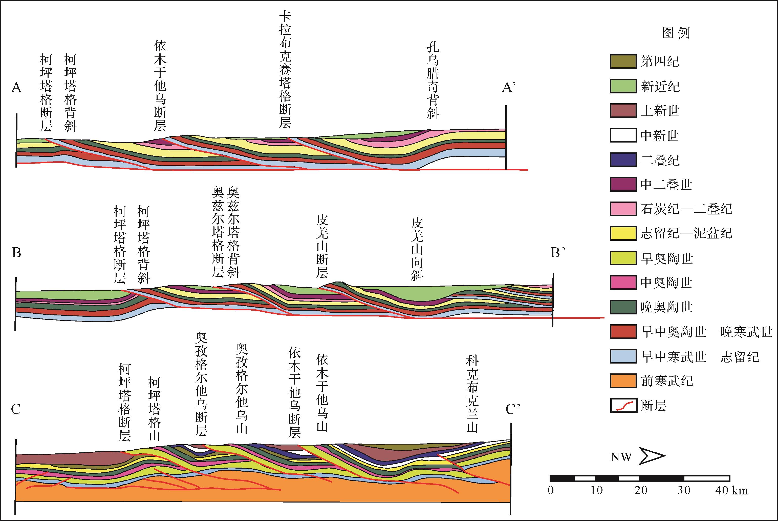
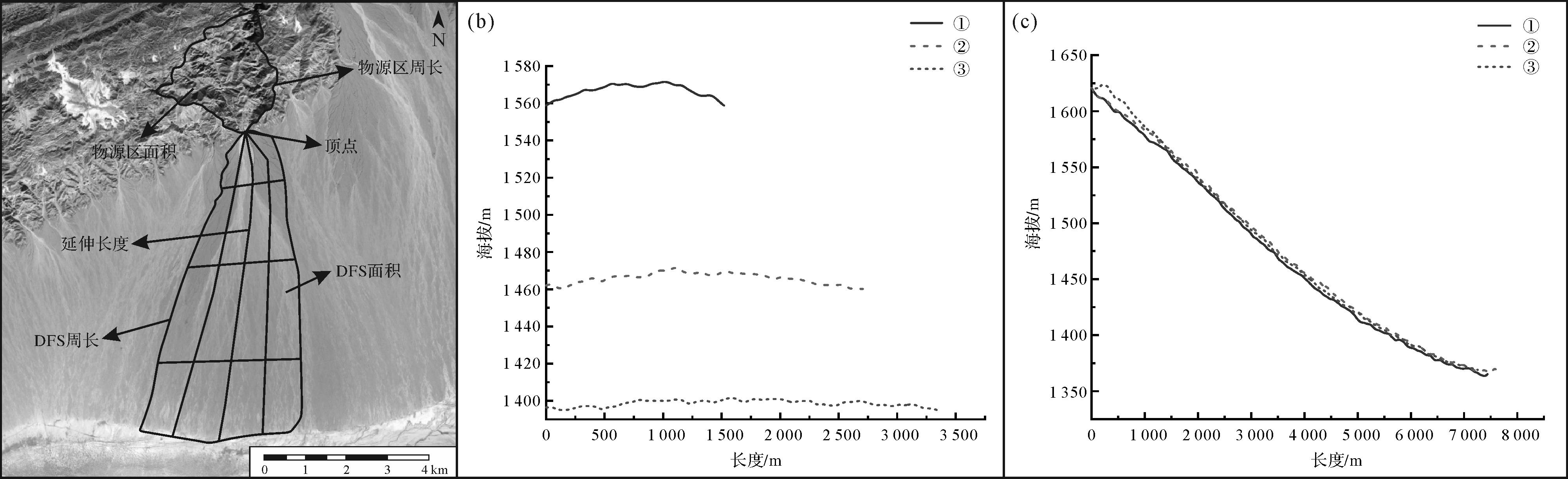
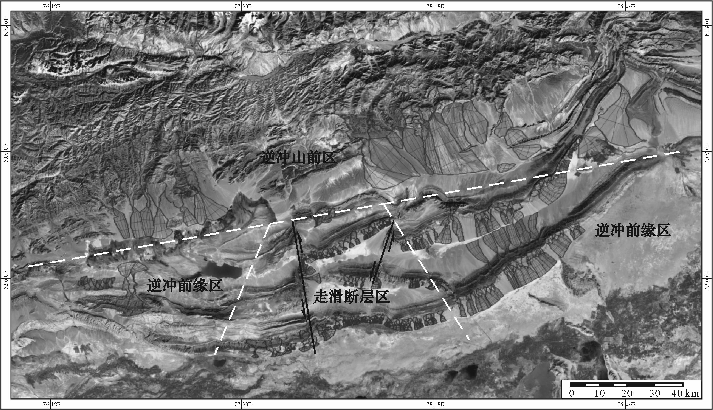
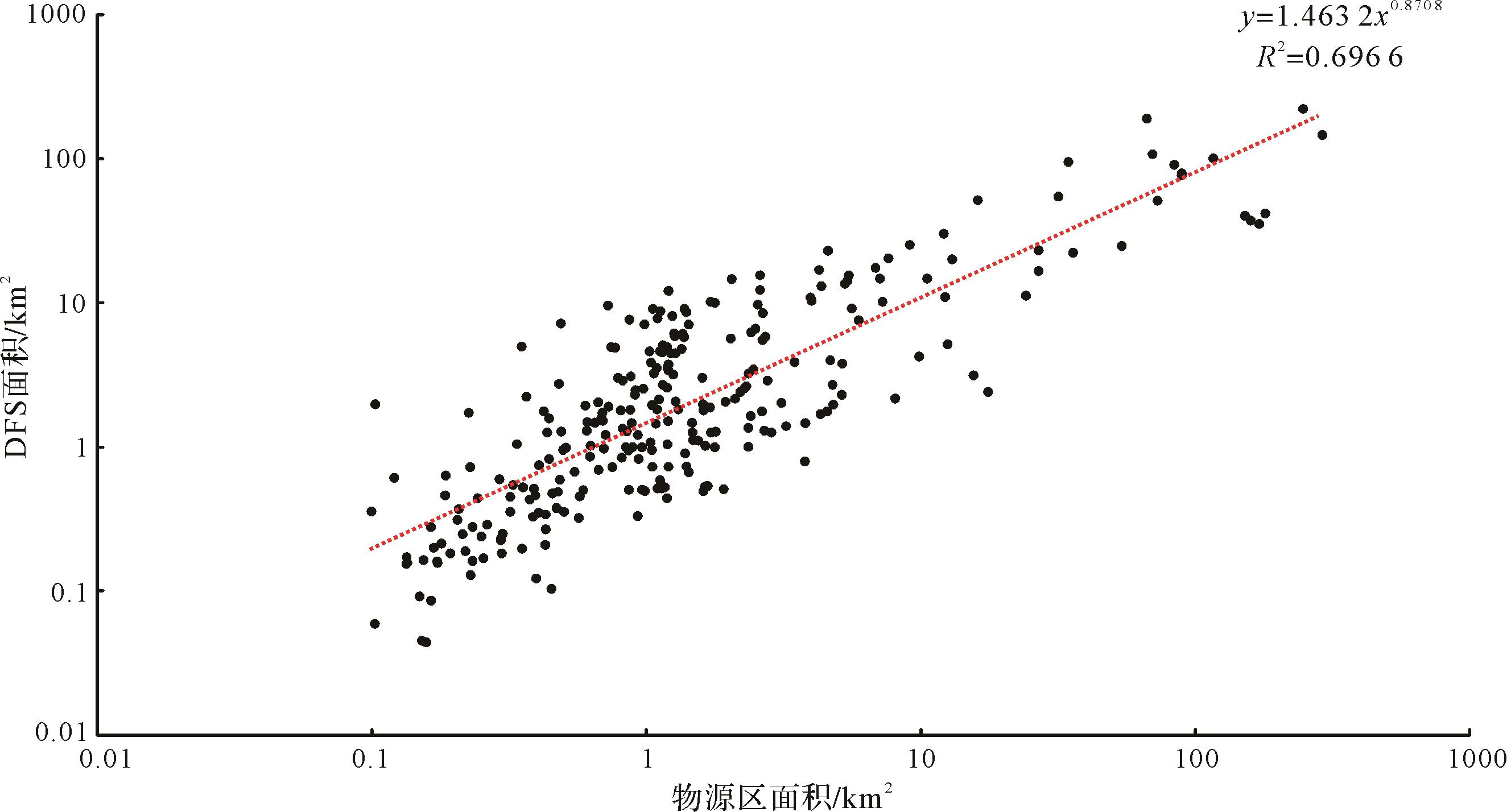
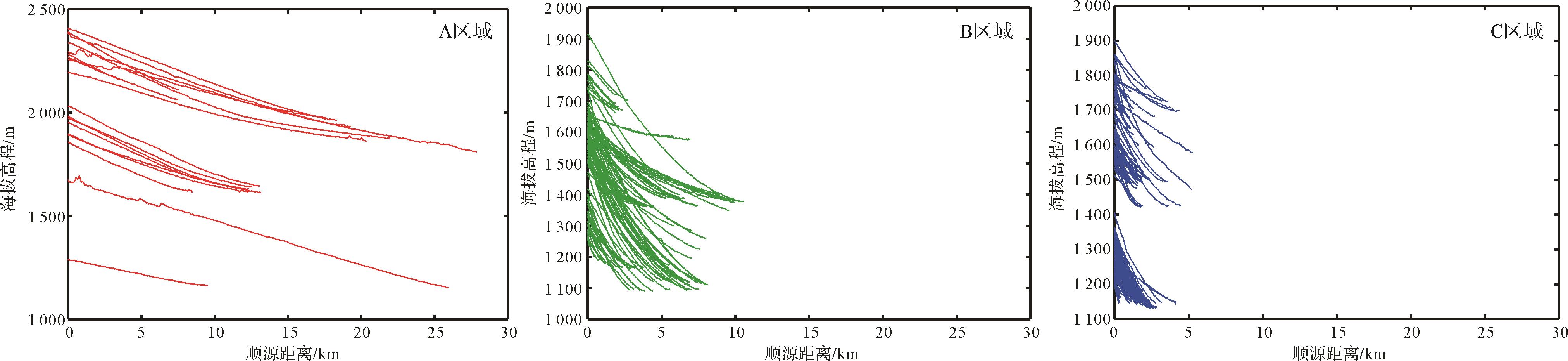
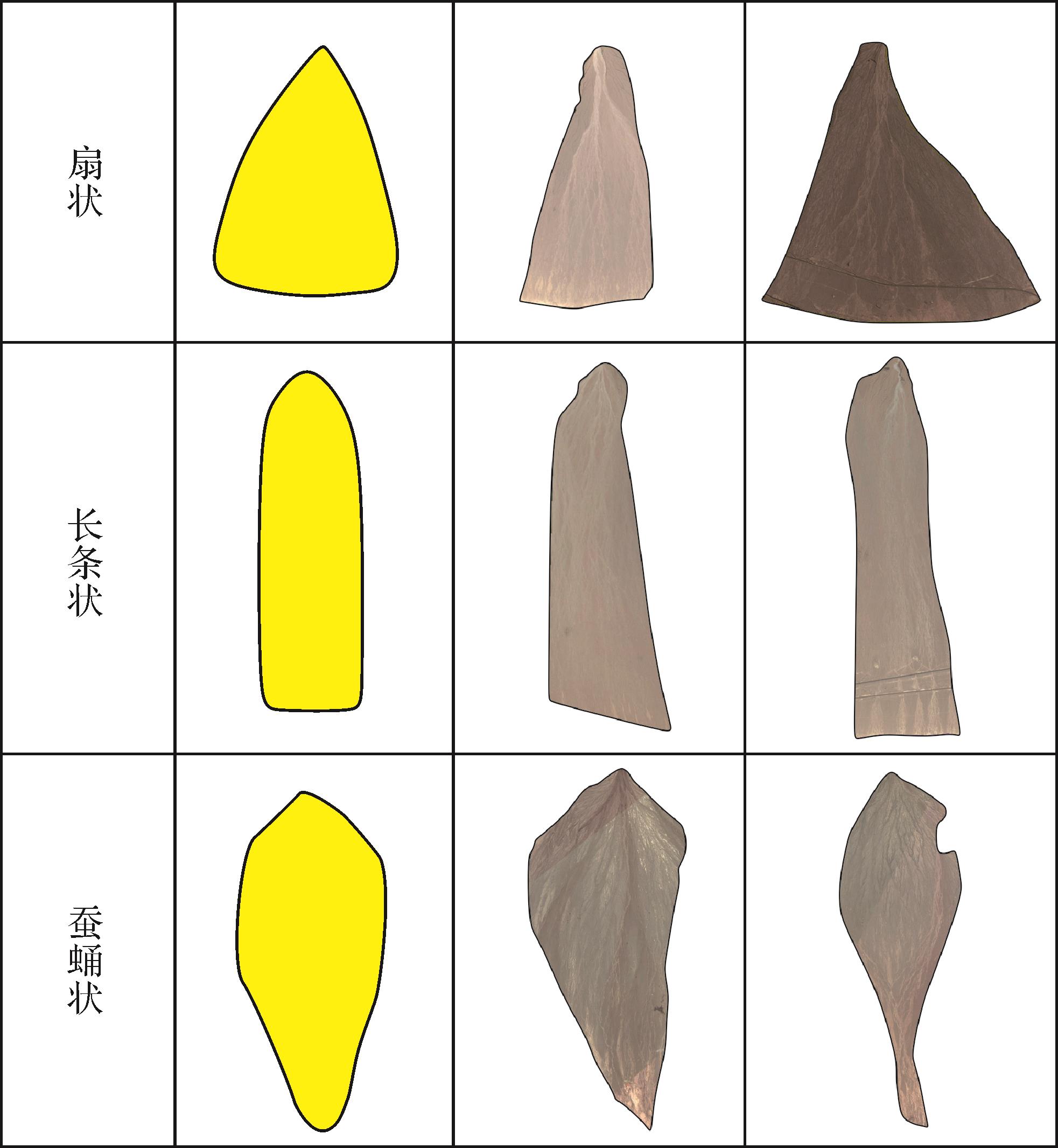
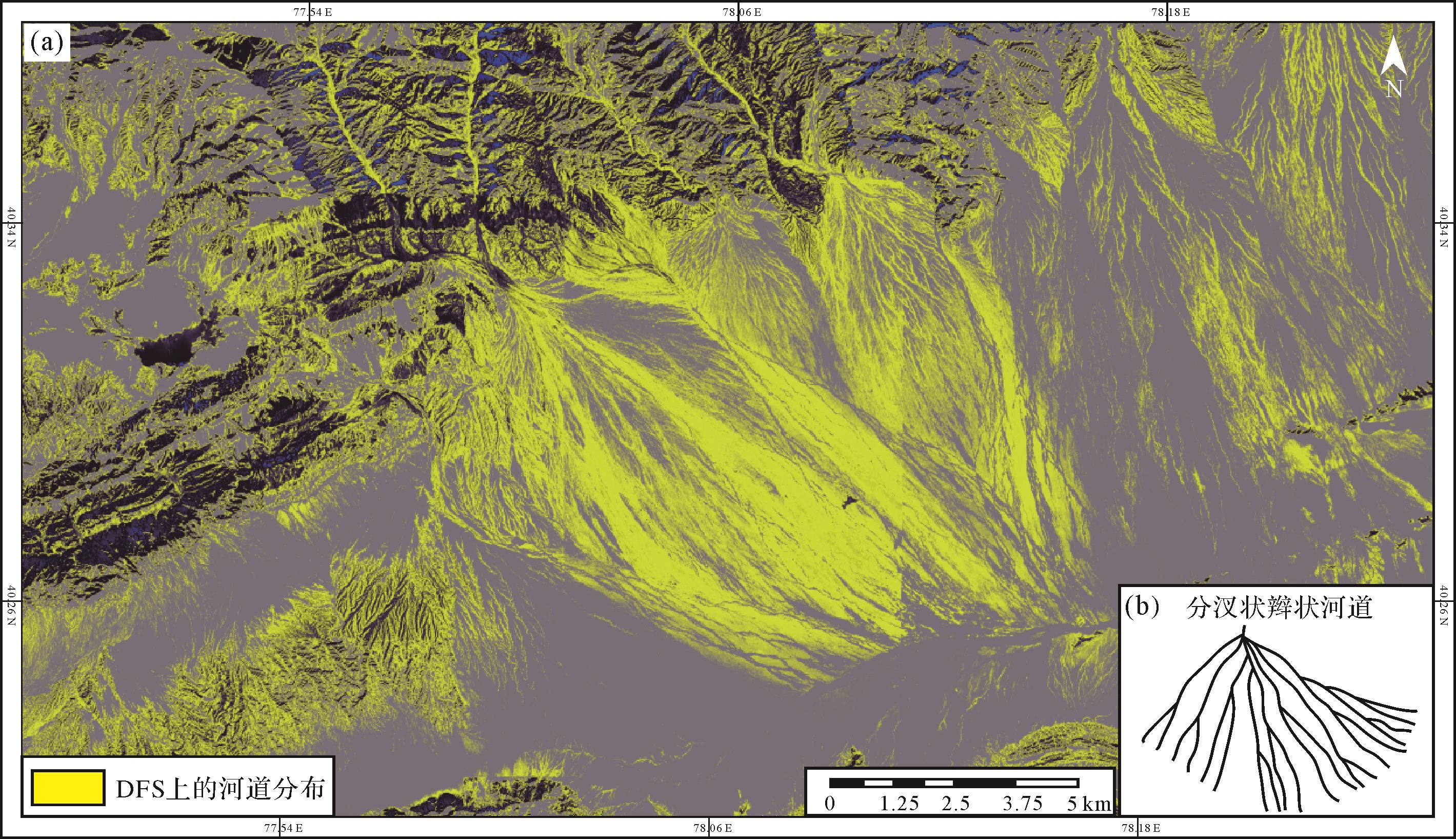
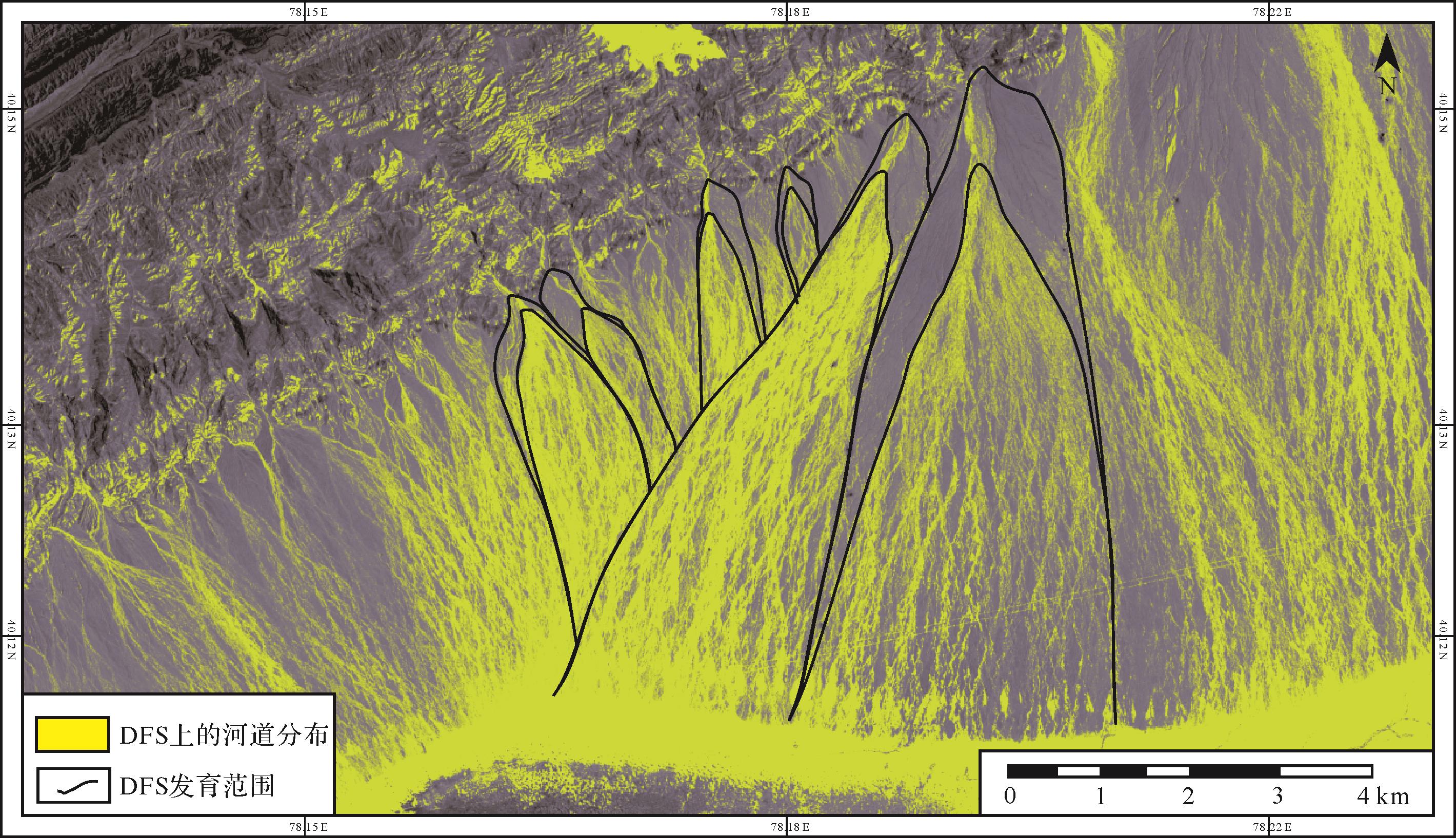
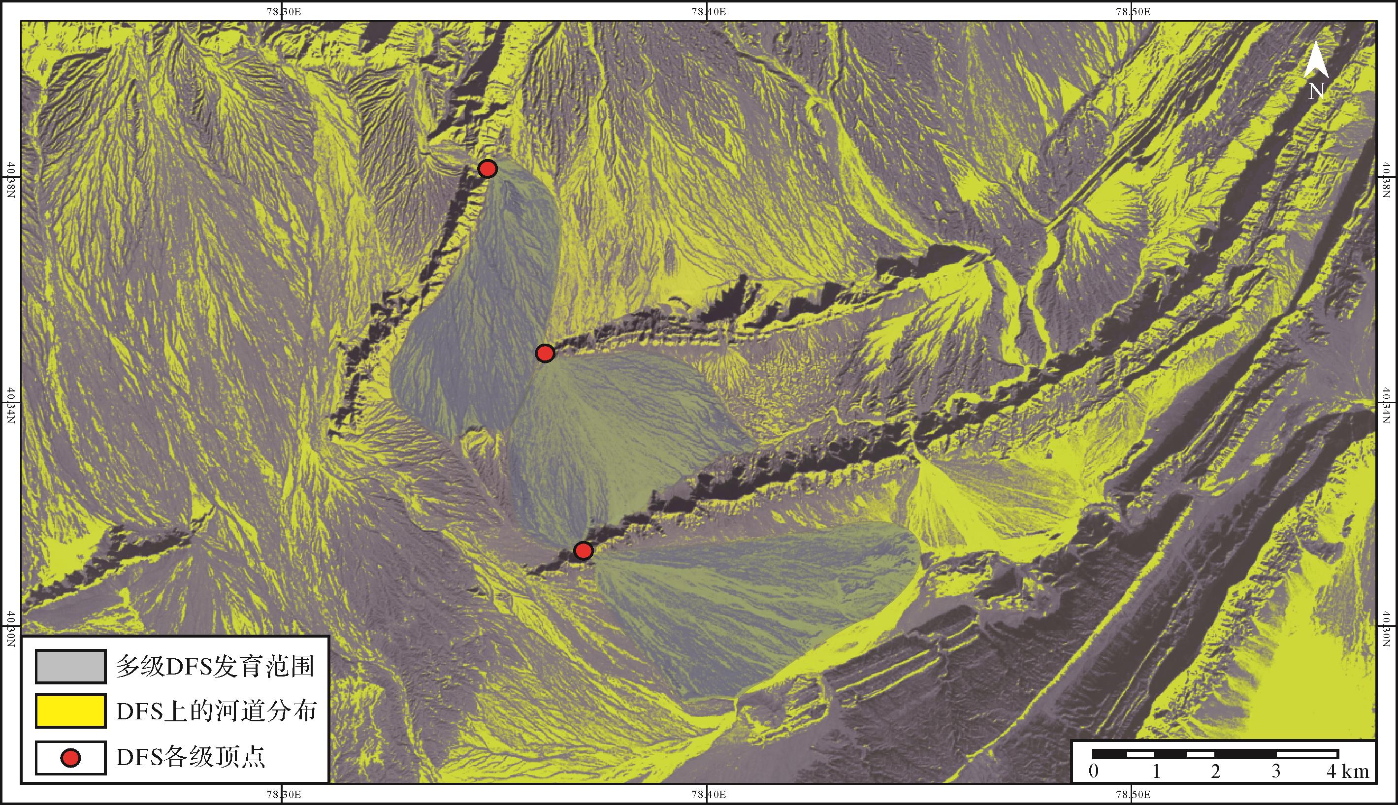
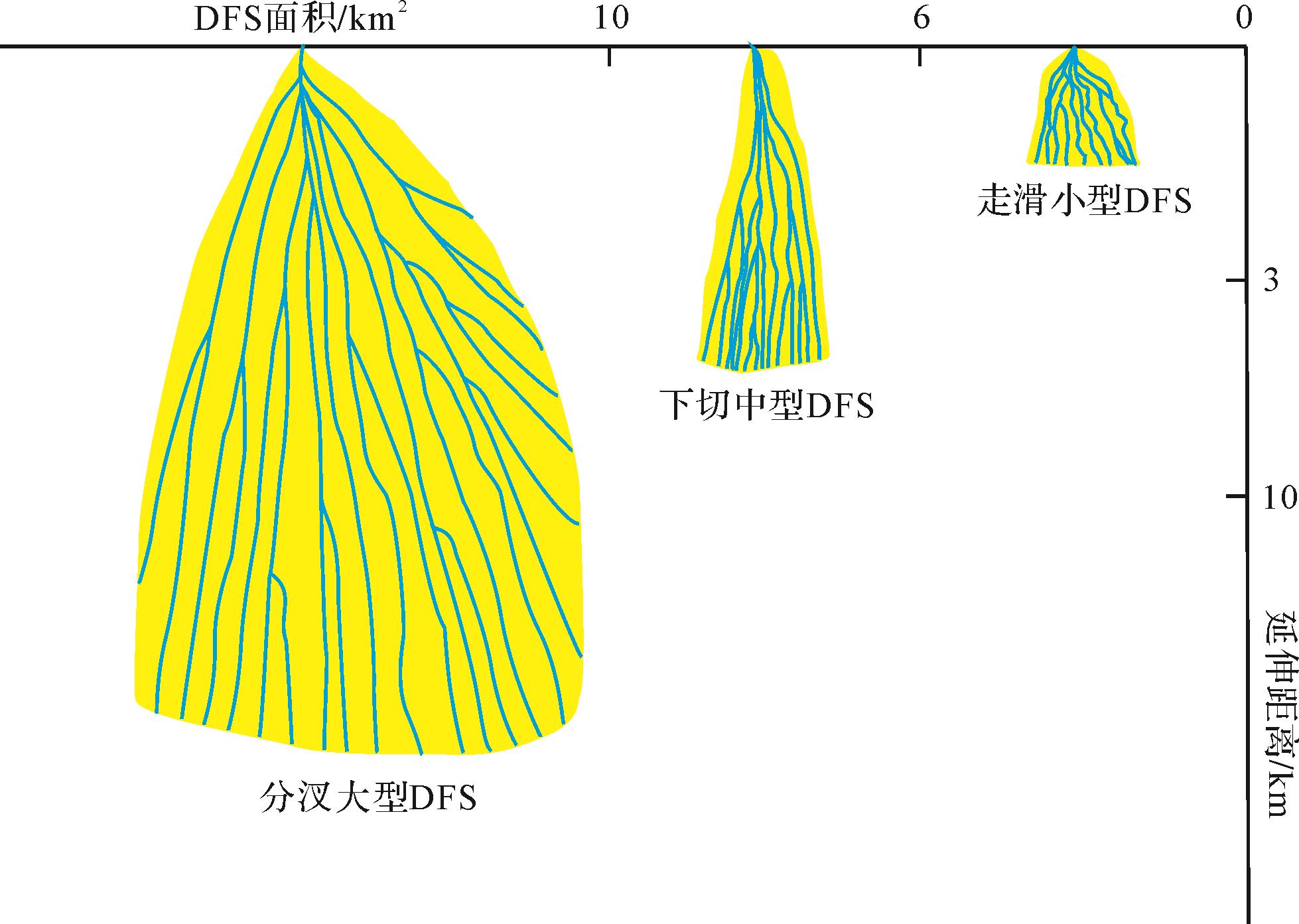
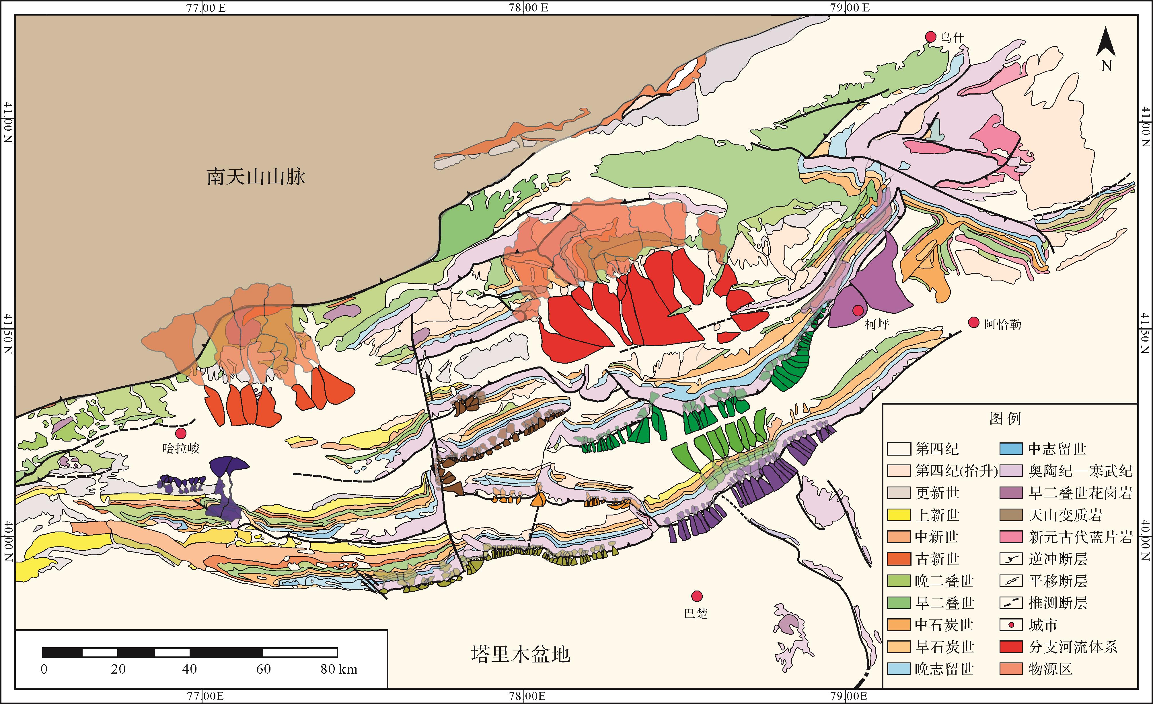
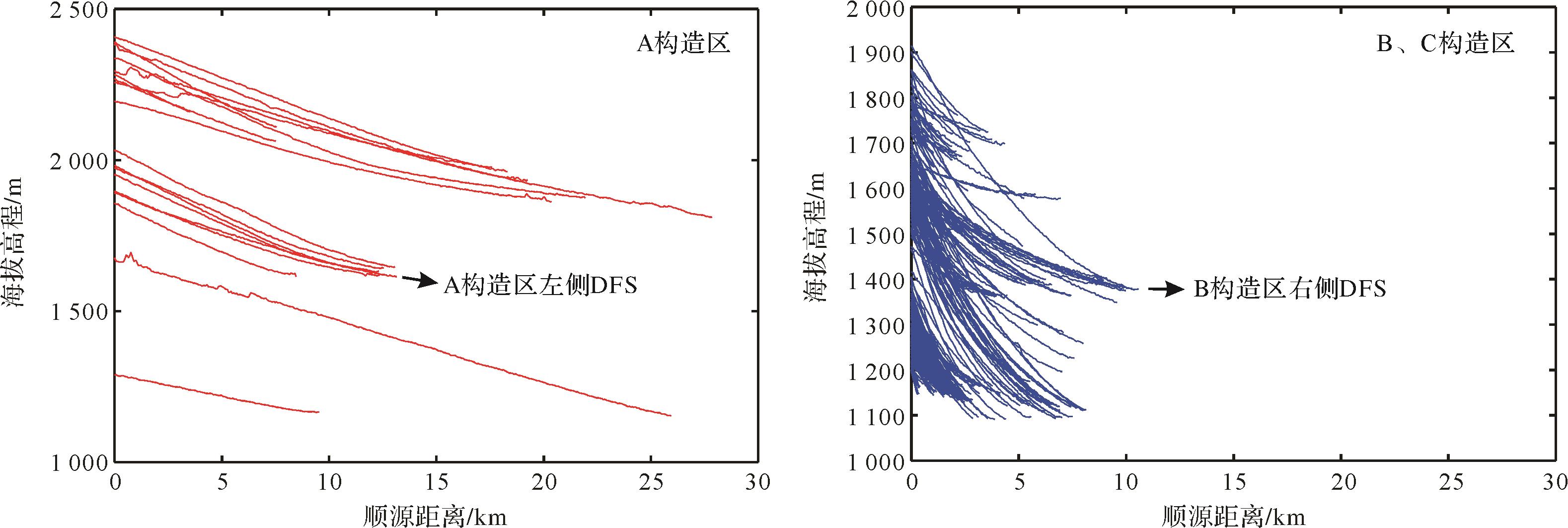
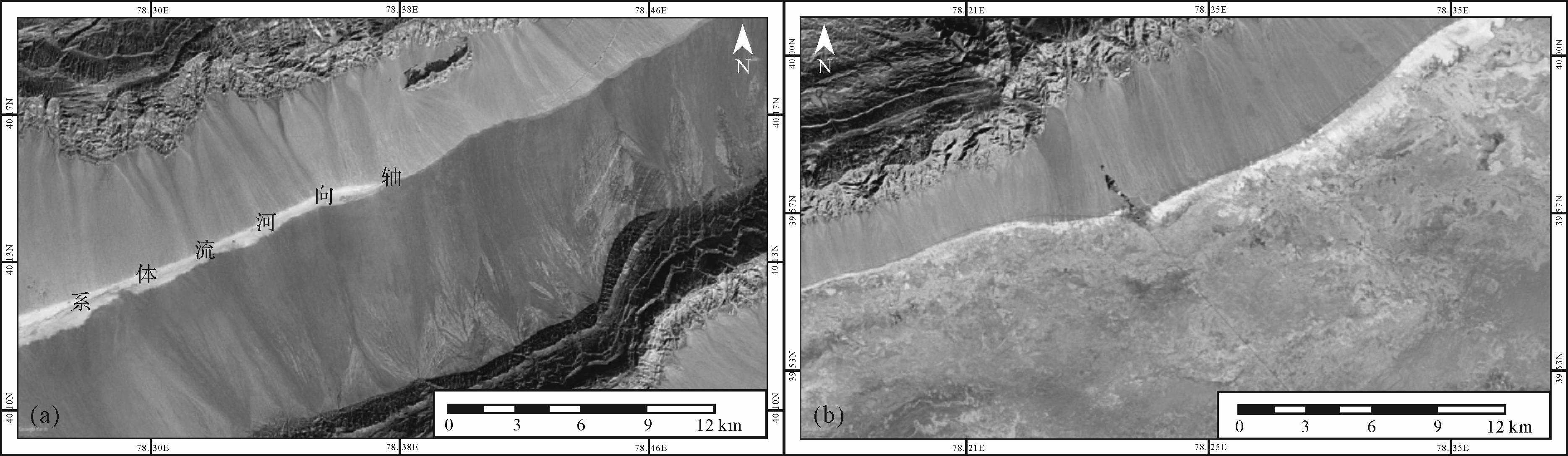
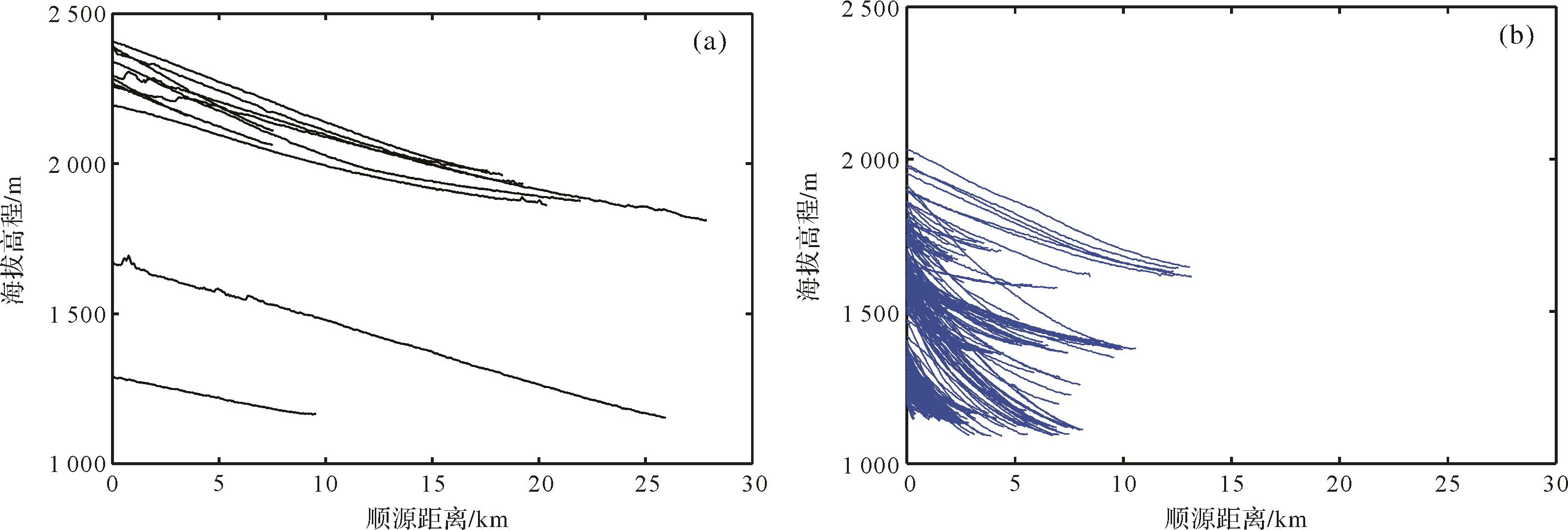
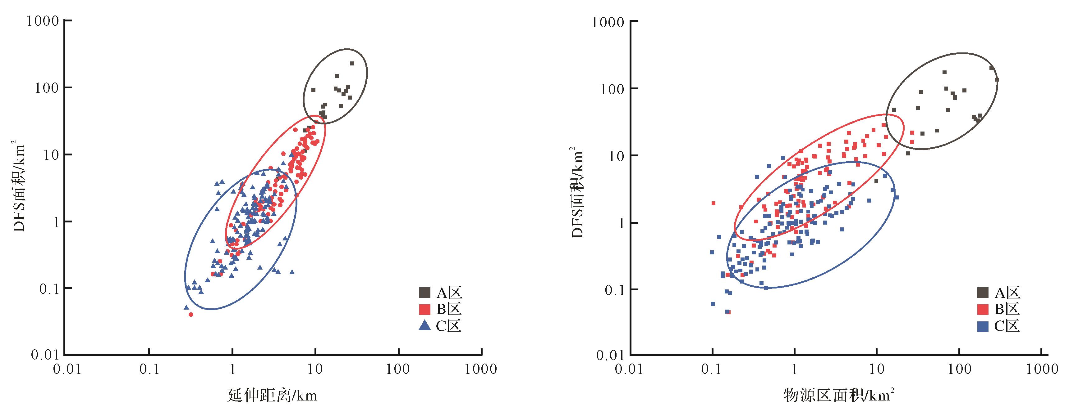
Tectonic movement is an important factor in the development of distributive fluvial systems (DFS) and their effect on sedimentary systems, and has been the object of numerous studies. Previously, basin types have been studied (e.g., compressive, tensile, and strike-slip). However, fewer studies have been carried out on the effect on sedimentary systems of thrust belts at the edge of compressive basins, especially alluvial fan DFS which are a common development in the thrust belt. To study the influence of the thrust on DFS development, global landscape images provided by Google Earth were combined with a digital elevation model and other data. Surveys and sedimentological analyses were carried out to investigate the factors influencing DFS development and geometry in the thrust fault zone. A total of 256 DFS were identified in the study area. The branched river system developed in the Keping area extends for 0.26-24.58 km; the DFS area ranges from 0.044 to 221.987 km2. The source area varies between 0.1 and 290 km2. The slope of the DFS ranges from 0.011° to 0.182°. In most cases, braided rivers have developed in the Keping area, with significantly different degrees of undercutting. The main influencing factors in the development of DFS in this area are source supply, climate, hydrology and tectonic history. The size of the source area is positively correlated with the size of the DFS. Climate (rainfall and evaporation) and hydrological properties (distribution of drainage areas) affect the development of DFS. In the study area the DFS is much larger than other drainage areas. Tectonism has determined the sediment deposition area and accommodation space, slope, etc., and the distribution and development of the DFS. This study indicates that the tectonic effect was the main influence on the distribution and development of the DFS in the Keping area: the thrust of the nappe has affected the size and slope of the DFS. The size of the source area also depends on the amount of stratum uplift, being larger when more of the stratum is exposed, and a greater DFS area implies a larger source area. The Keping area was divided into three regions based on structural characteristics. The DFS of each structural region is clearly different. Where the source area at the front of the thrust zone is large, the scale of the DFS is correspondingly large. It is mainly fan-shaped, with small slope and slight undercut. Where the front of the thrust area is smaller, the DFS is also smaller and steeper, and the degree of undercutting increases. Areas with strike-slip faults are affected by the faults such that the source area and DFS are significantly smaller, and the DFS is mainly fan-shaped. Where the average slope is steepest, the average extension distance is smallest and the degree of undercutting is significant.

2022, 40(1): 182-191.
doi: 10.14027/j.issn.1000-0550.2020.071
Abstract:
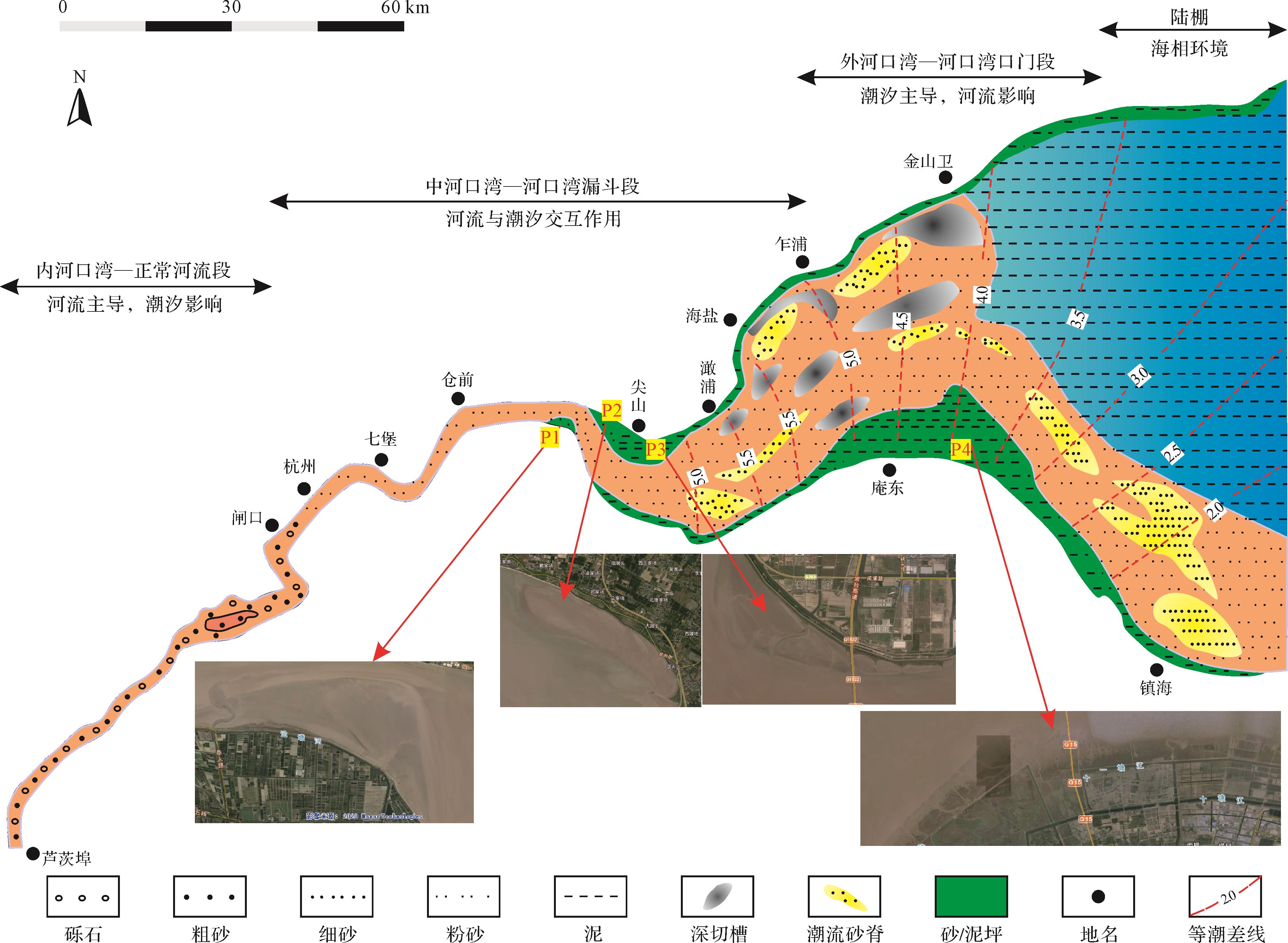
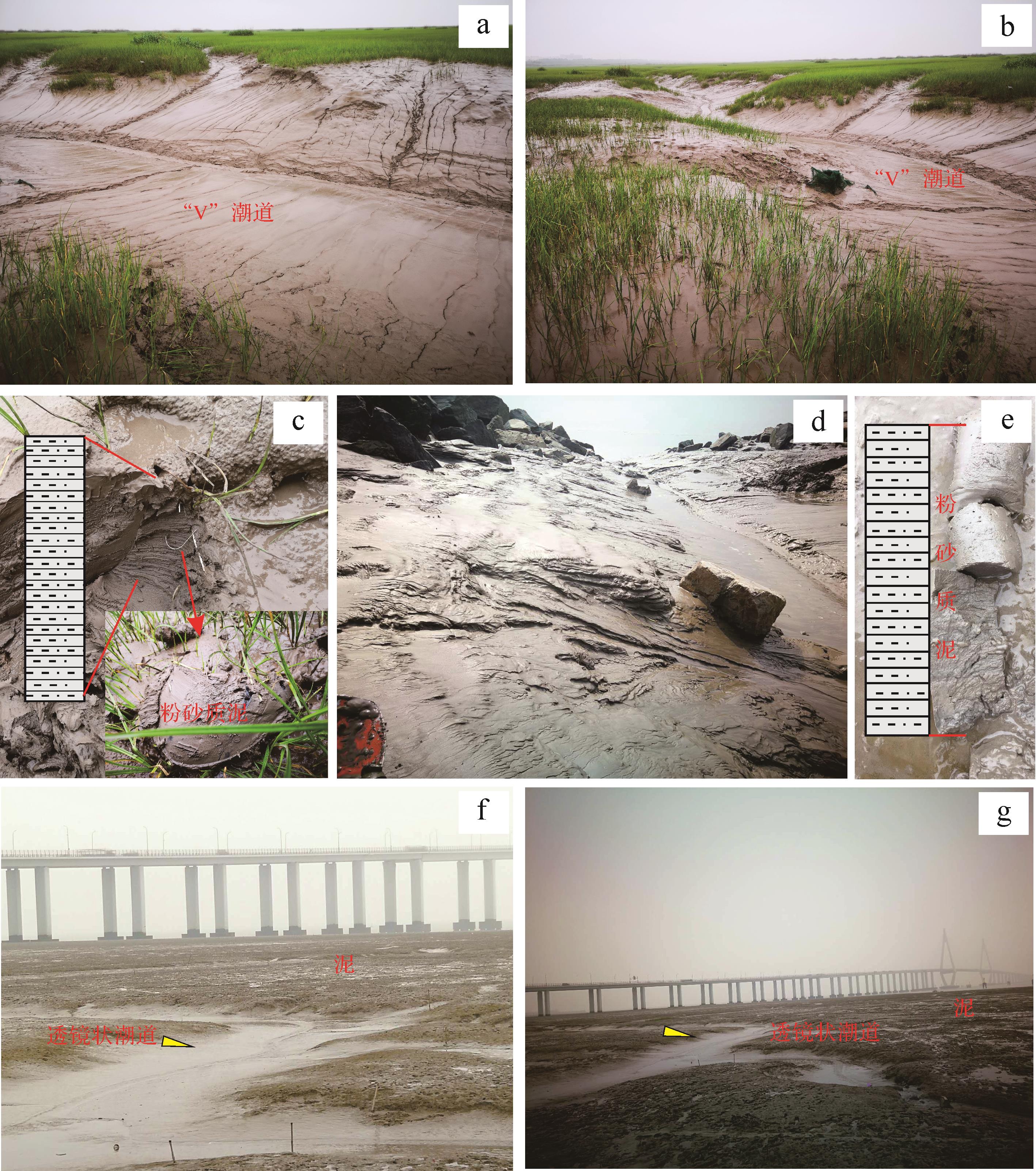
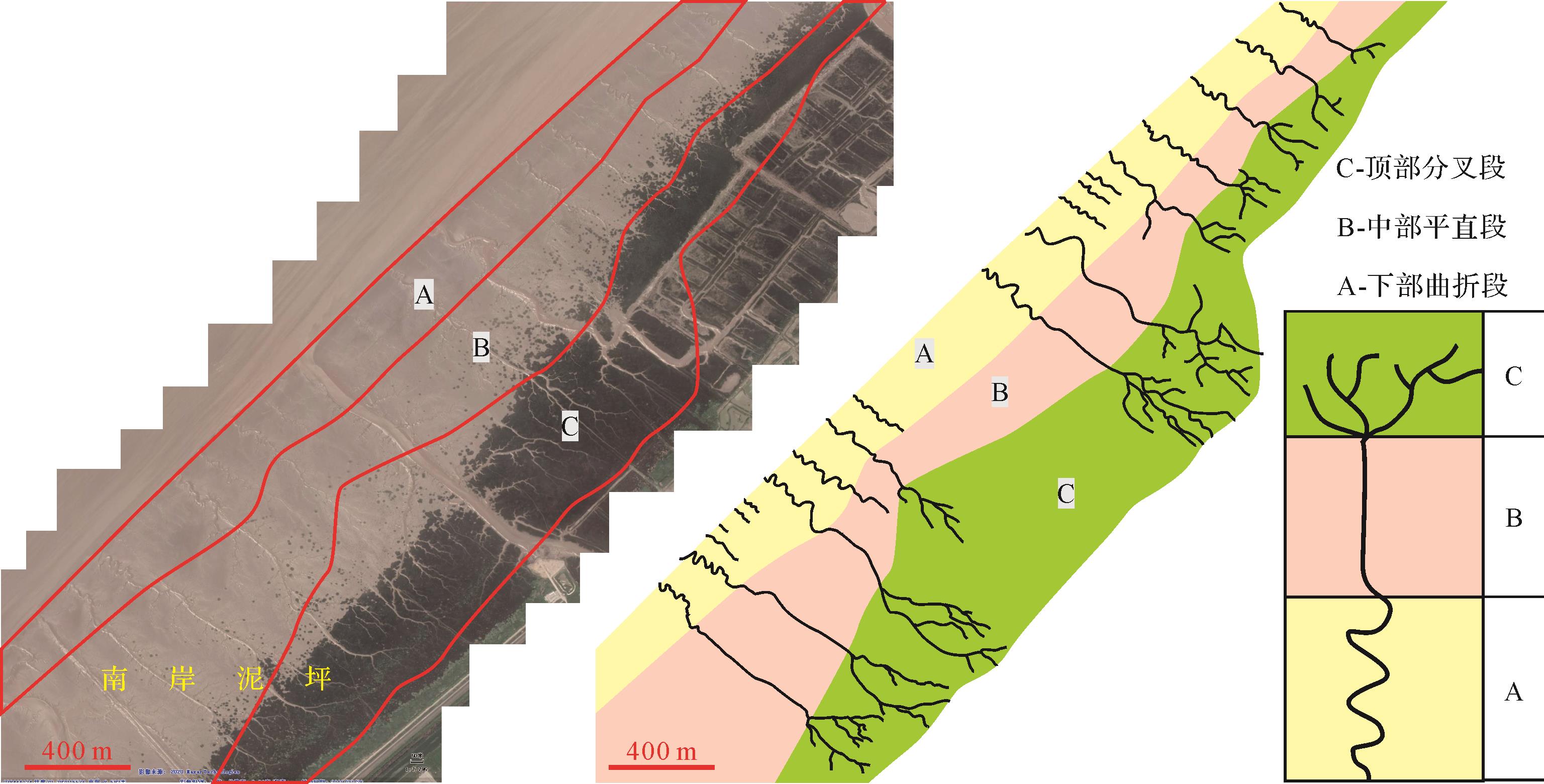
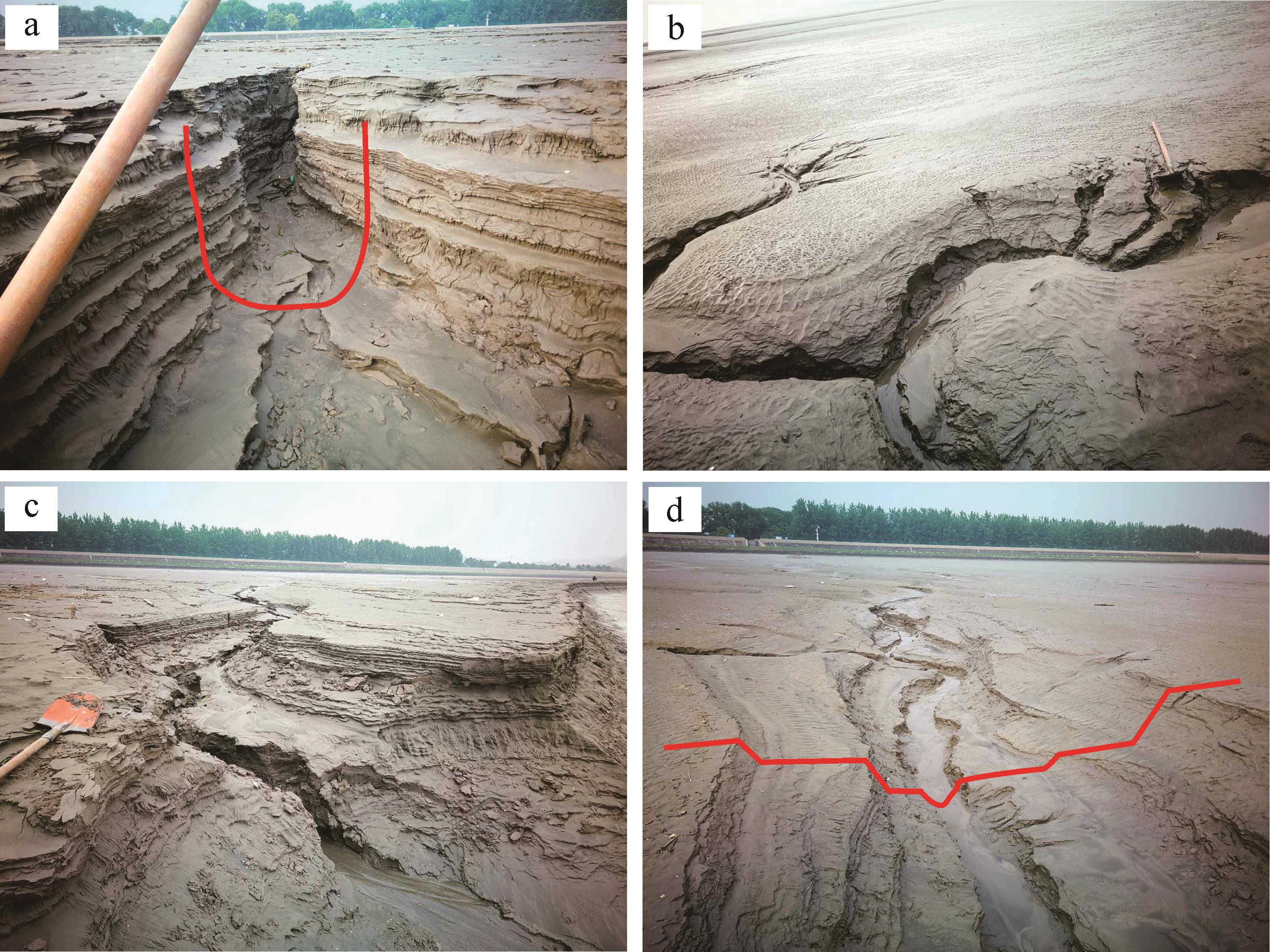
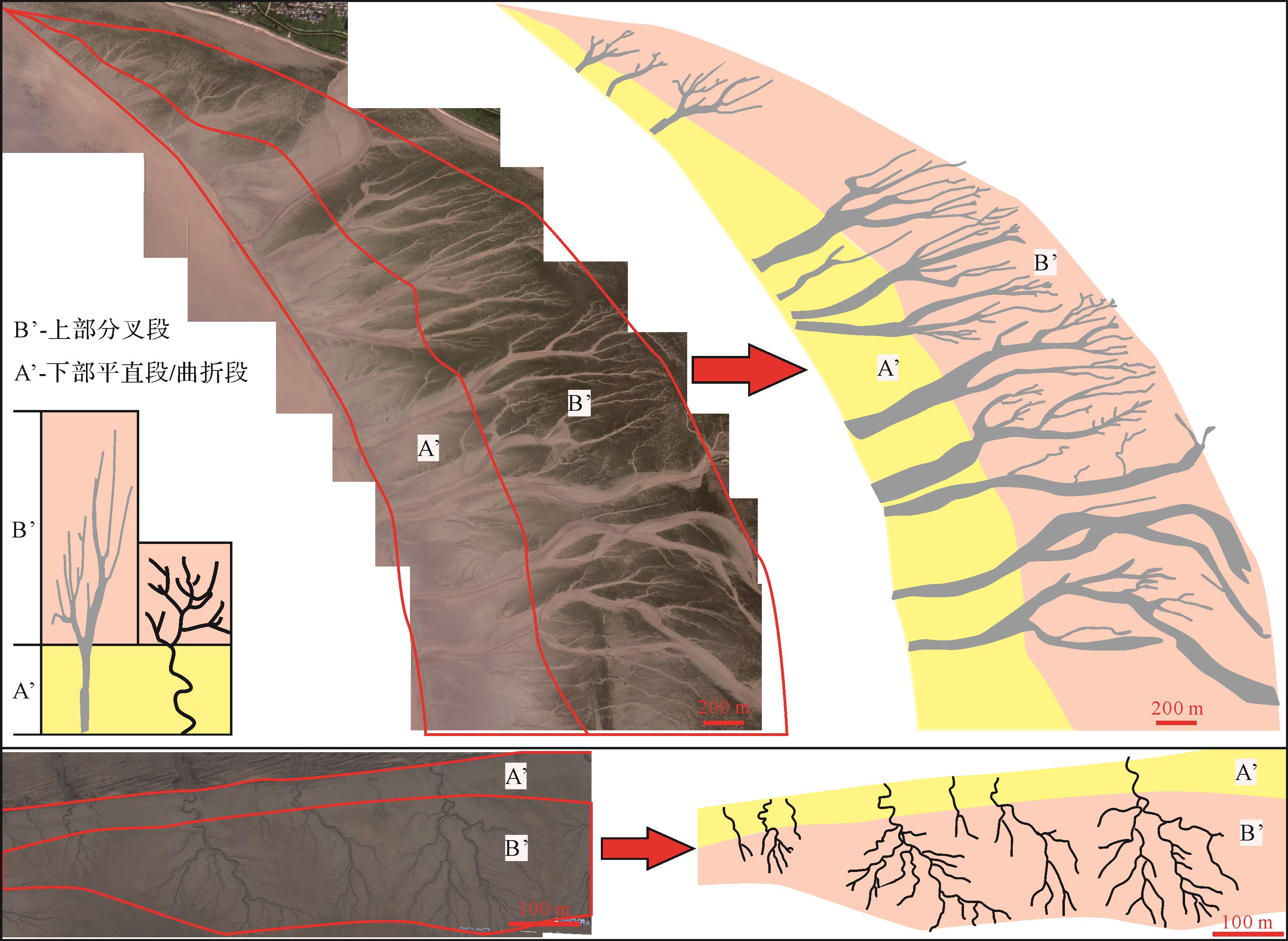
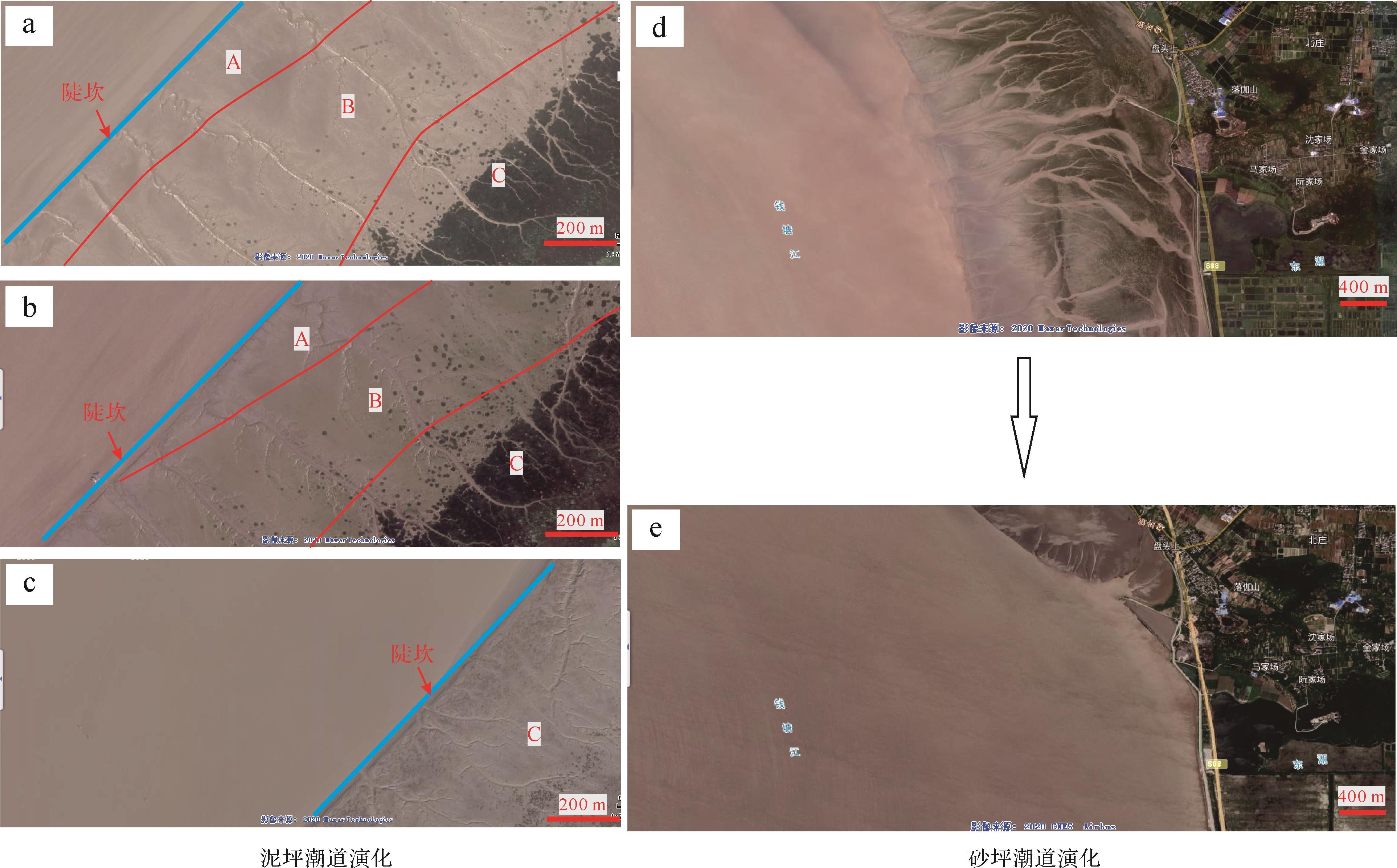
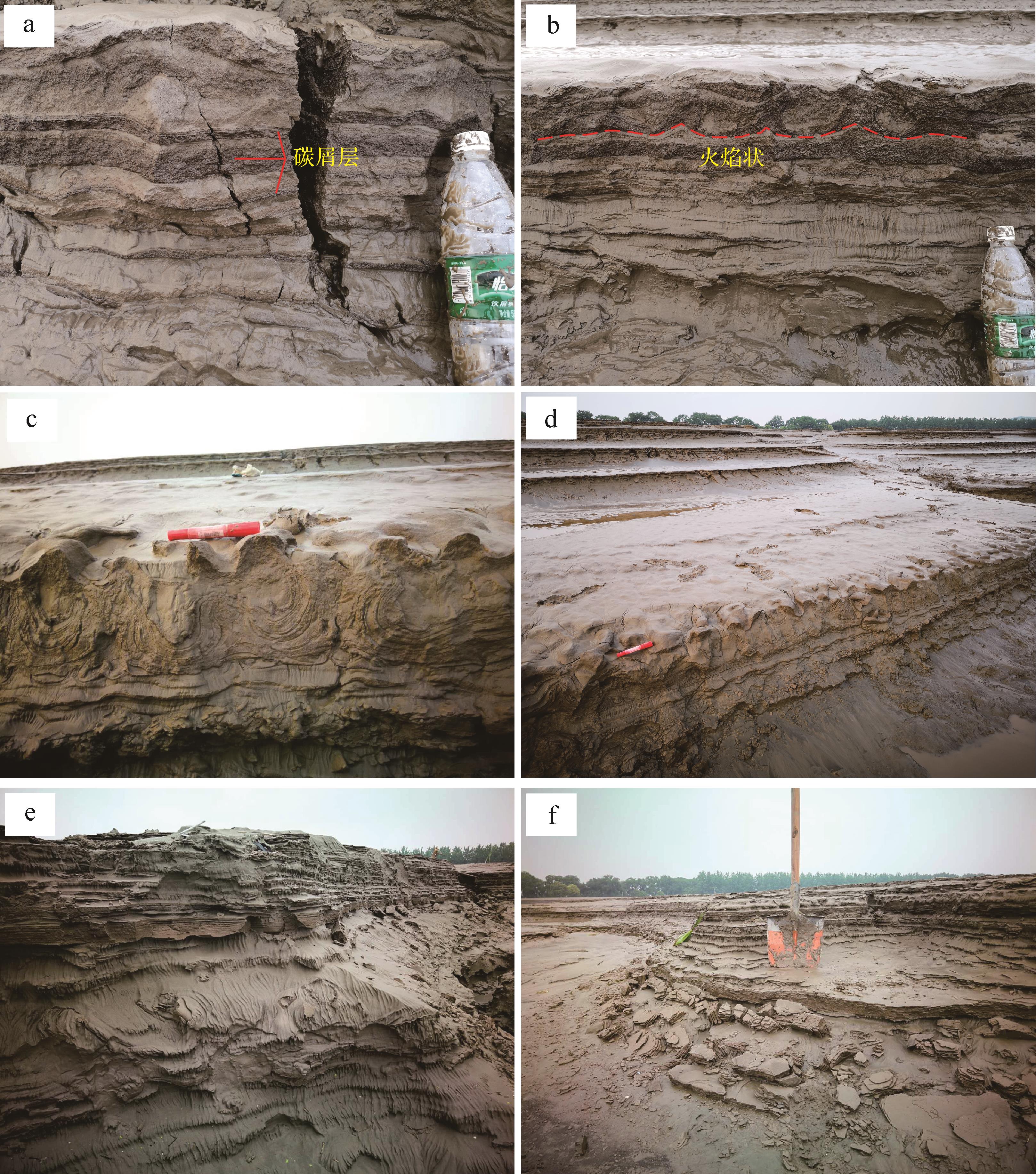
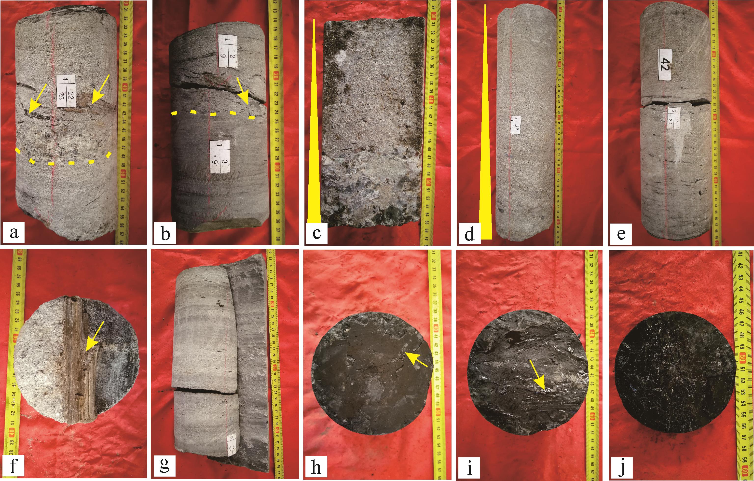
Sand bodies in estuary bays favor the development of oil and gas reservoirs, but identifying them may be difficult due to complex hydrodynamic changes. This study of the modern Qiantang River Estuary Bay shows that the tidal channels in a tidal flat environment are useful as an alternative means of identifying ancient estuary bays. Field observations and satellite mapping describe in detail the development of a tidal channel in the tidal flat environment, and its geological significance is discussed. The study shows that the cross-sectional shape of the mudtidal channel is mainly V-shaped and broadly lenticular. In plan, the pattern of tidal channels is divided from sea to land into a zigzag section A, a straight section B, and a tree-branching section C. The cross-section of sand flat tidal channels is mainly a stepped U-shape. The pattern of sand-flat tidal channels, from sea to land, is divided into a zigzag or straight A’ segment and a tree-shaped bifurcated B’ segment. The A’ segment is flat, and may be straight or tortuous depending on the scale of the shape of the tidal channel. Certain sedimentary structures are common in sandy tidal flats (e.g., charcoal layers, convoluted bedding, indications of liquefied flow, collapse structures, ripple marks). The differences in shape and size of tidal channels are mainly due to the slope, sediment size, estuary morphology and relative sea level; steeper slopes and lower sea levels are more likely to develop a complete sequence of tidal channels. Overall, the characteristics of different types of tidal flats in estuary bays, together with their sedimentary structure, provide a reference for identifying ancient estuary bays and determining their geological evolution.
2022, 40(1): 192-202.
doi: 10.14027/j.issn.1000-0550.2020.074
Abstract:
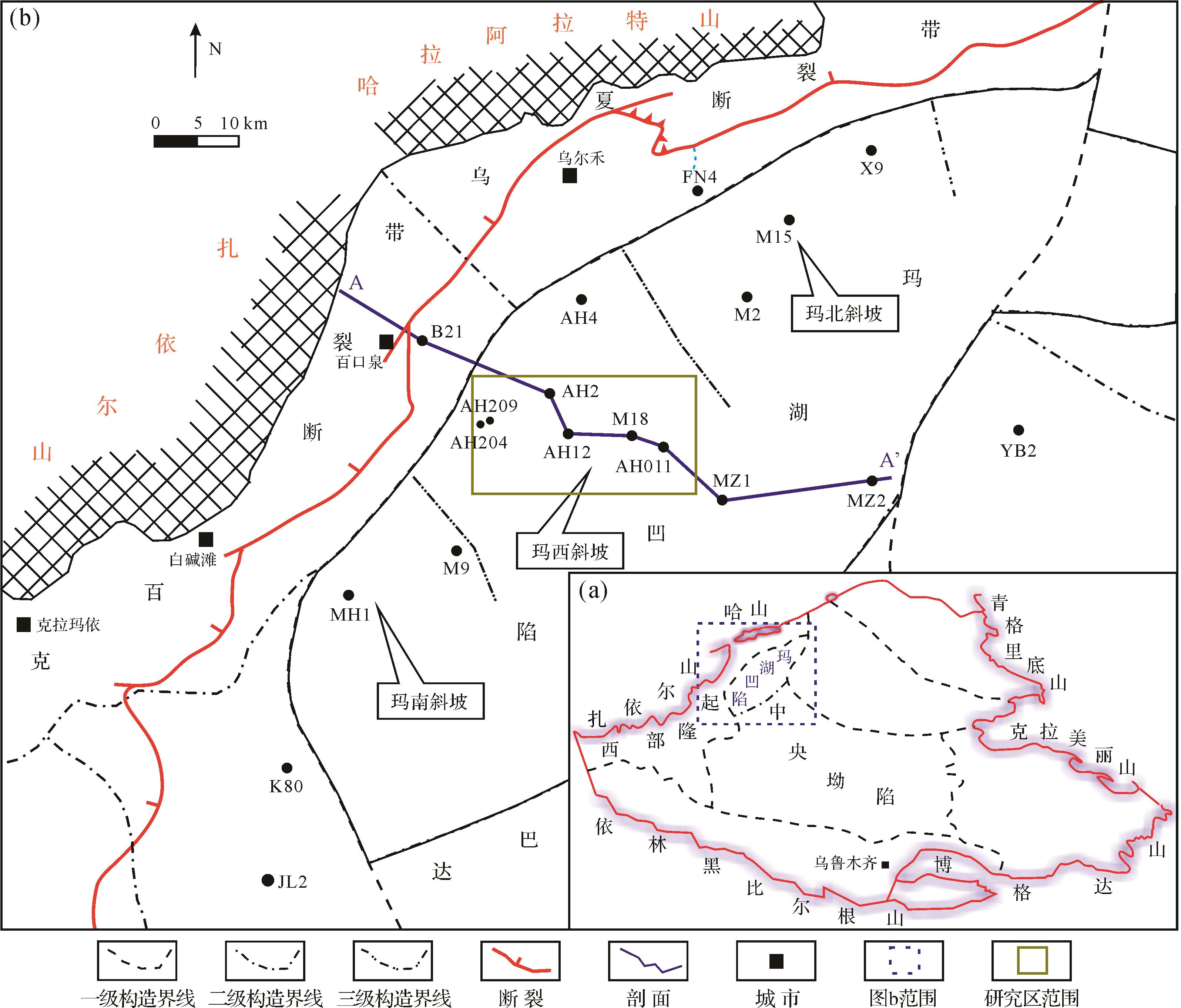
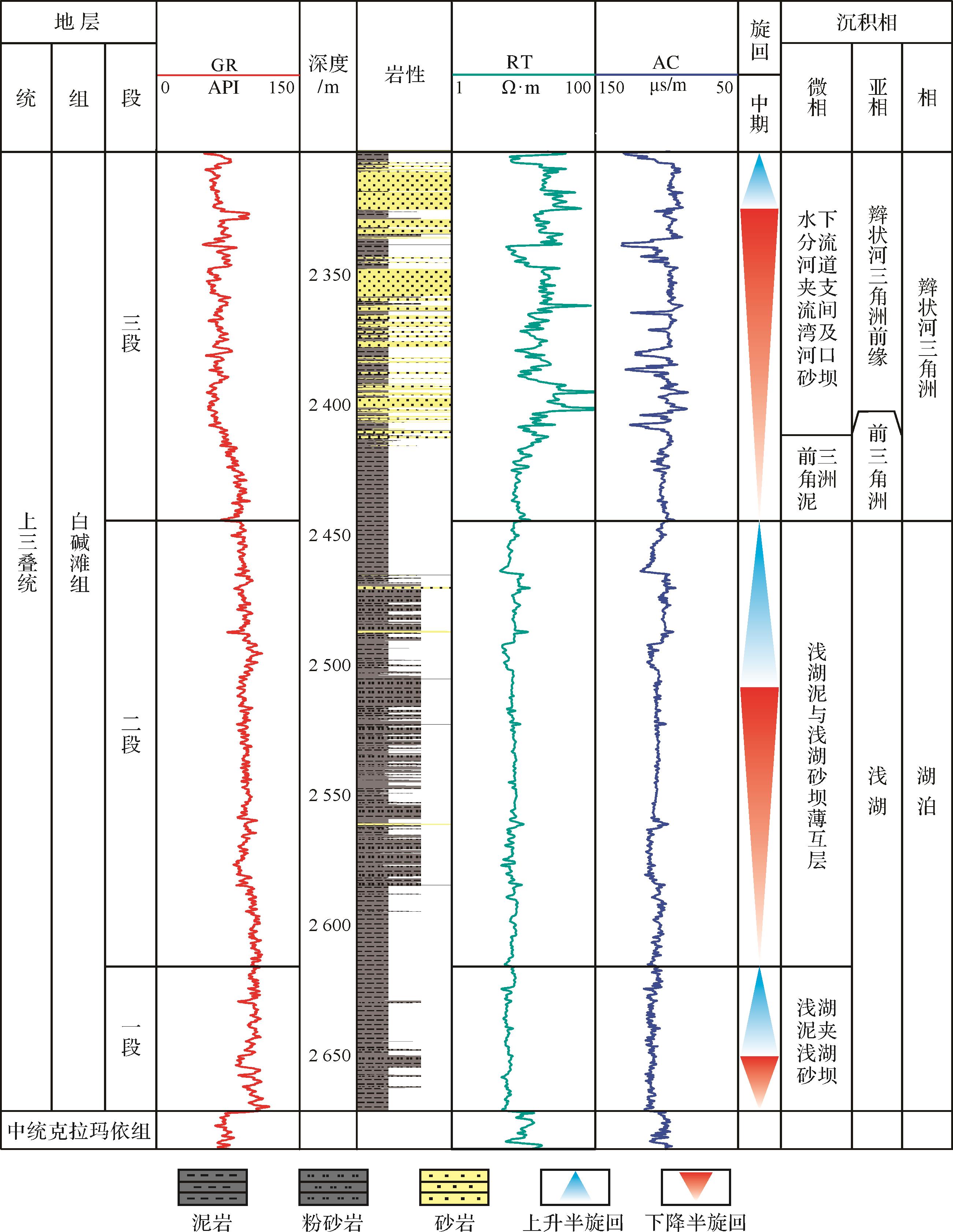
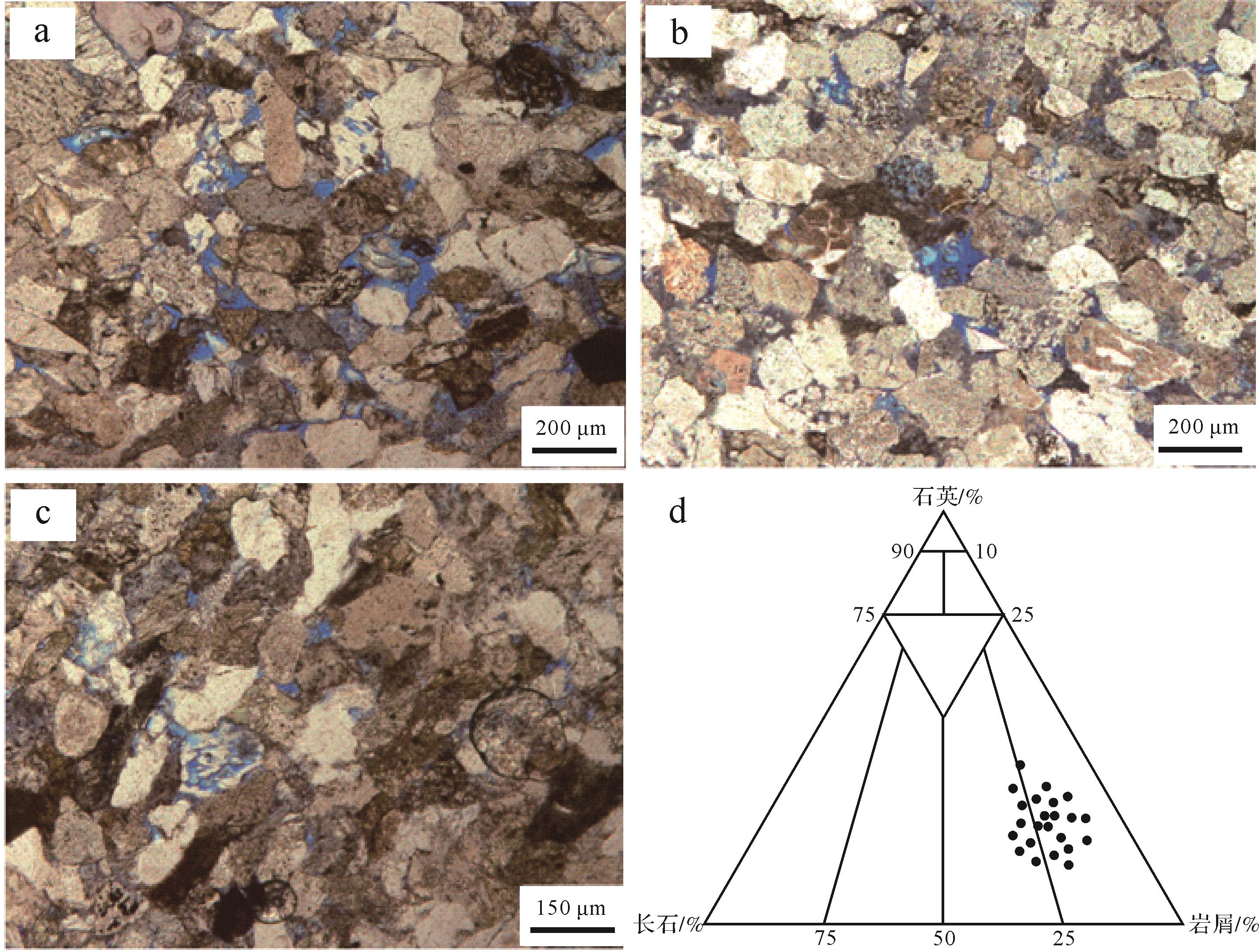
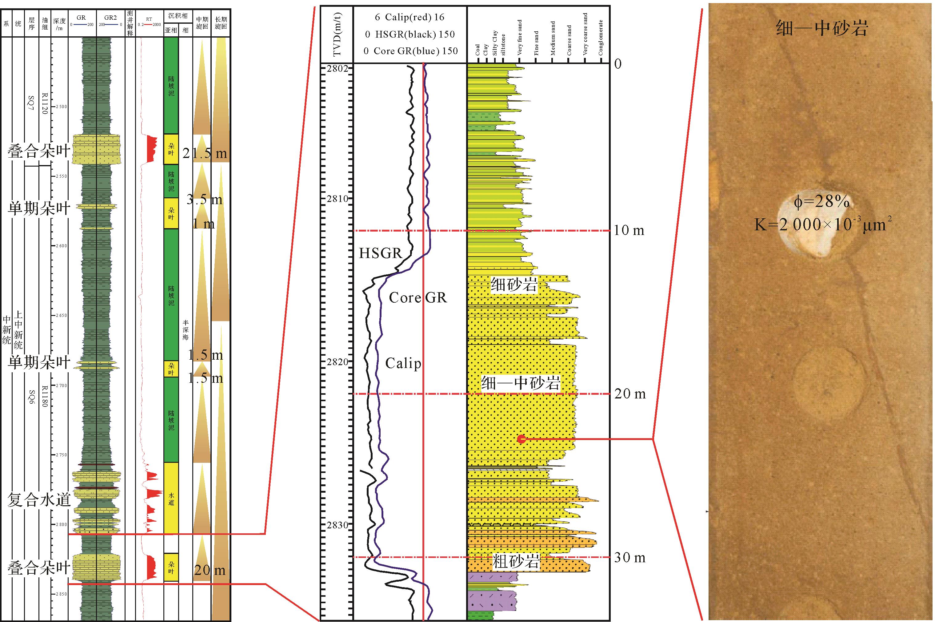
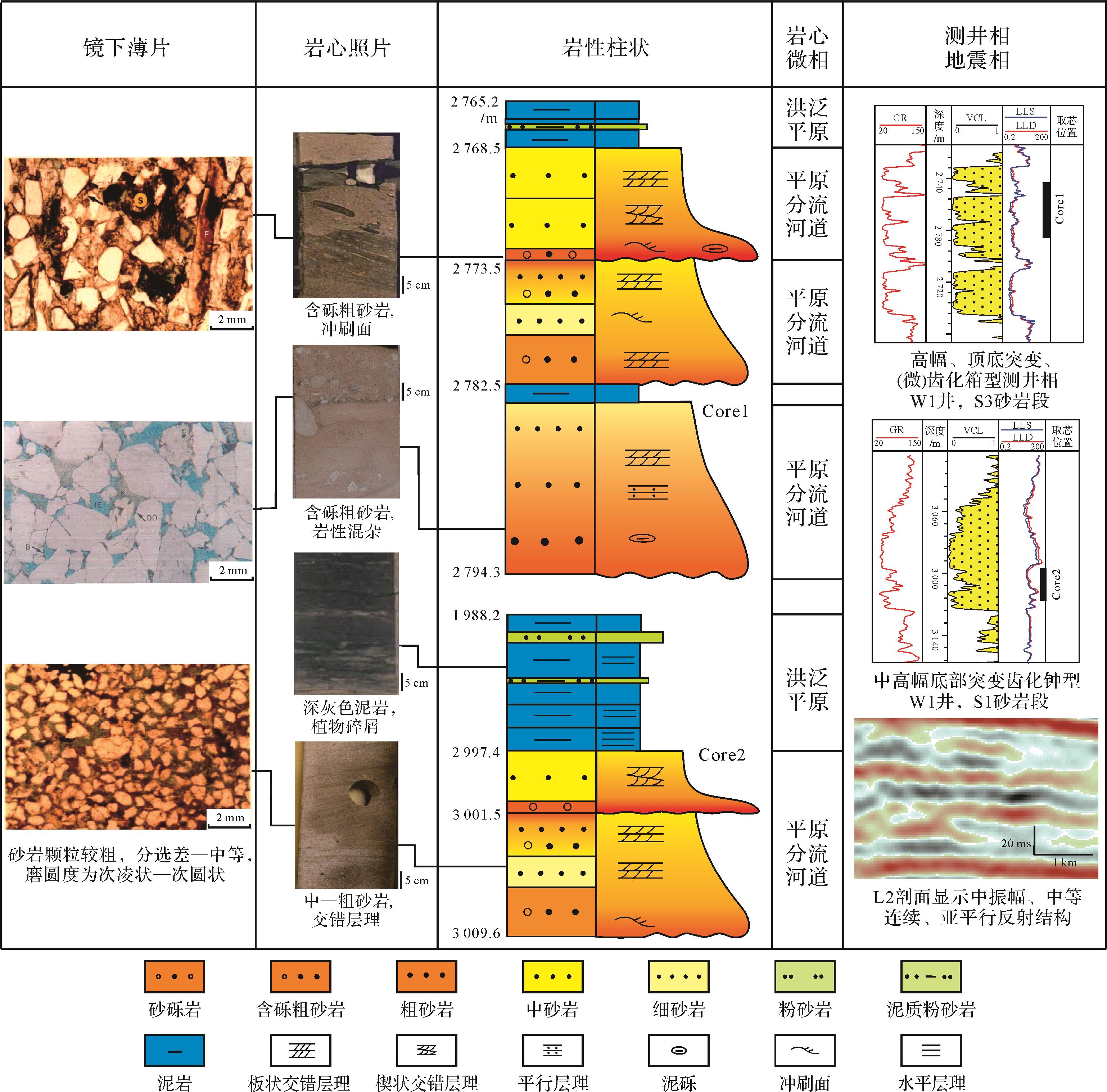
Hydrocarbon resources have previously been discovered in the Triassic Baijiantan Formation sandstone in the slope area of the Mahu Depression, but the depositional genesis has not been reported to date. The present study used core pattern observation, rock composition analysis and grain-size analysis combined with logging and drilling data, among other techniques, to determine the sedimentary facies type and evolutionary processes of the Baijiantan Formation. The development of a braided river delta and lake facies was established, which comprise a braided river delta front, and pro-delta and shallow-lake subfacies. Seven microfacies were recognized in the subaqueous distributary braided channel, mouth bar, distal bar and shallow lake bar. A continuous progradational process from shallow lake to braided river delta front was very clearly observed extending from the first to the third member. Ideal trap and hydrocarbon reservoirs conditions have been developed by favorable high-quality subaqueous distributary braided channel sandstone over the greater part of the third member, with a Triassic–Jurassic unconformity and overlying Jurassic mudstone and normal faults. It is recommended that this area should be the primary target of hydrocarbon exploration on the western slope area of the Mahu Depression. This study also has significant theoretical implications for subsequent hydrocarbon exploration in the area.
2022, 40(1): 203-216.
doi: 10.14027/j.issn.1000-0550.2020.061
Abstract:
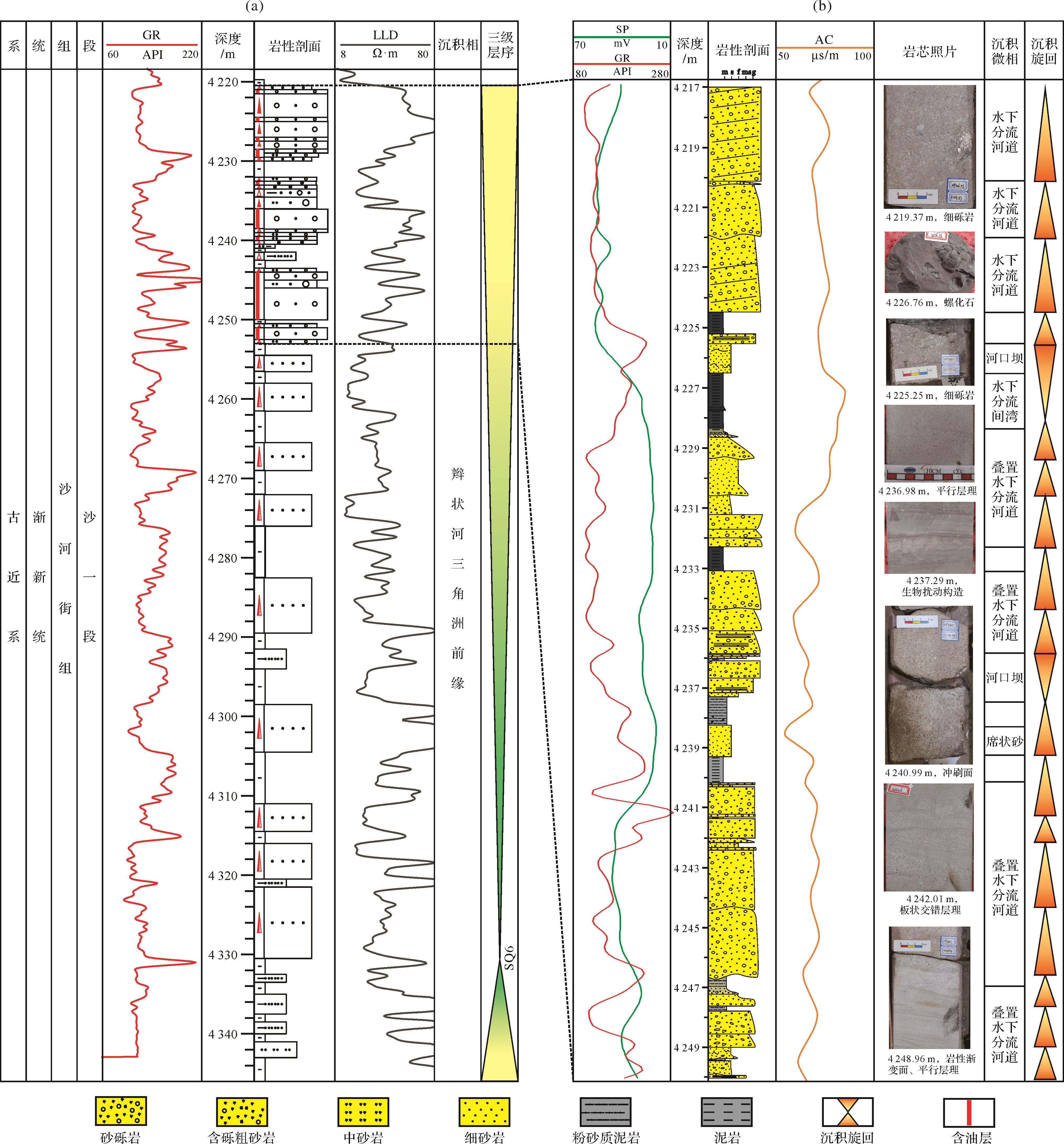
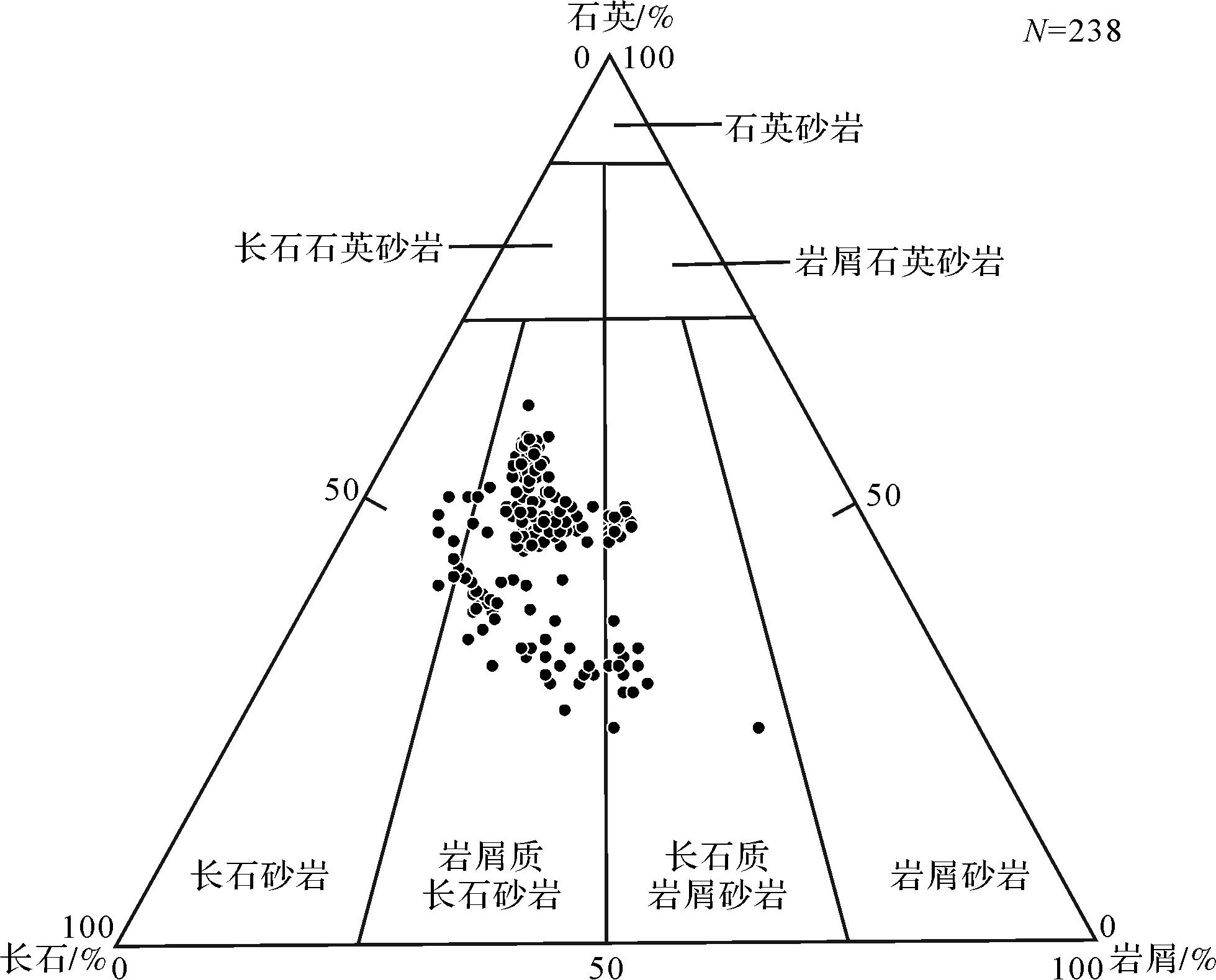
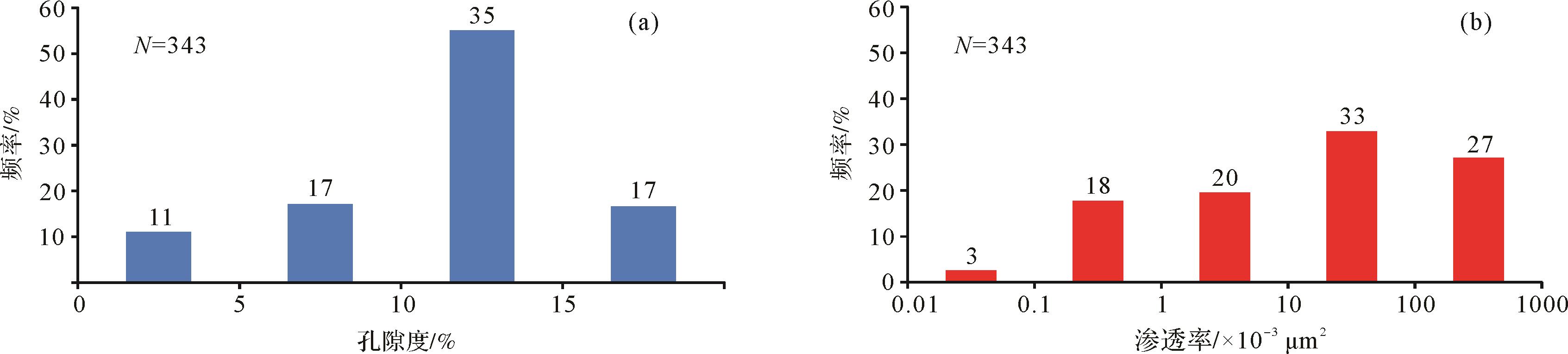
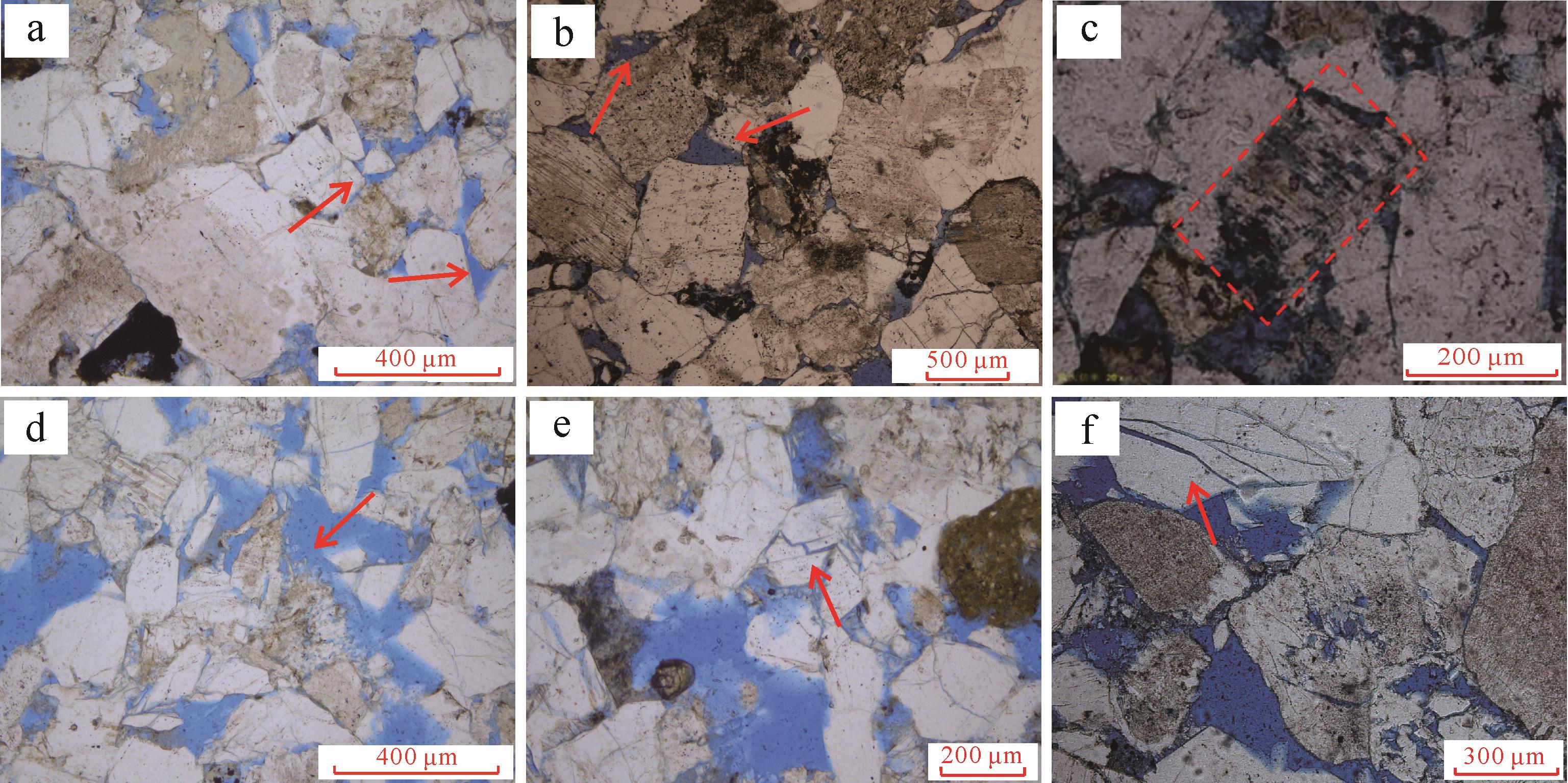
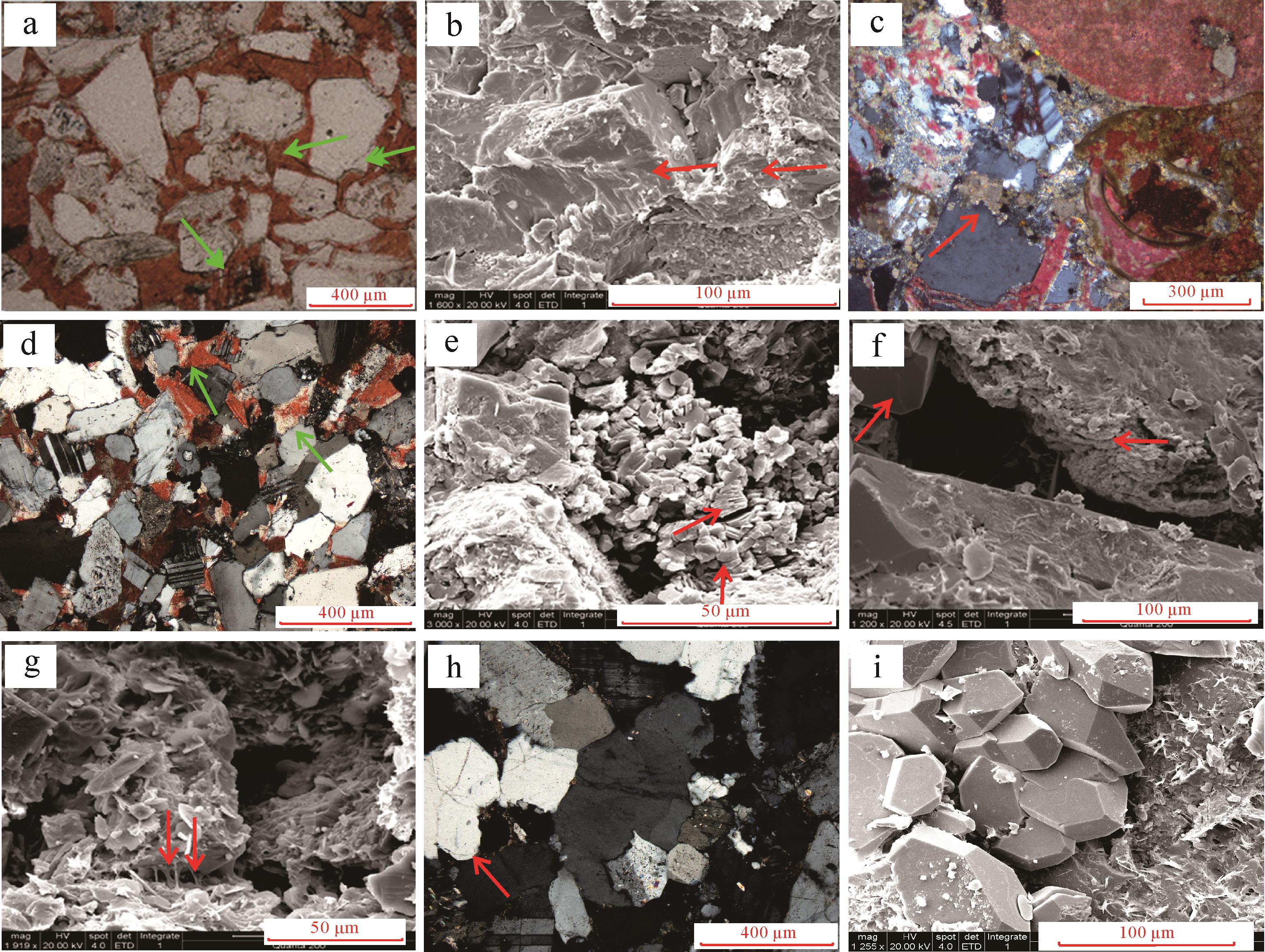
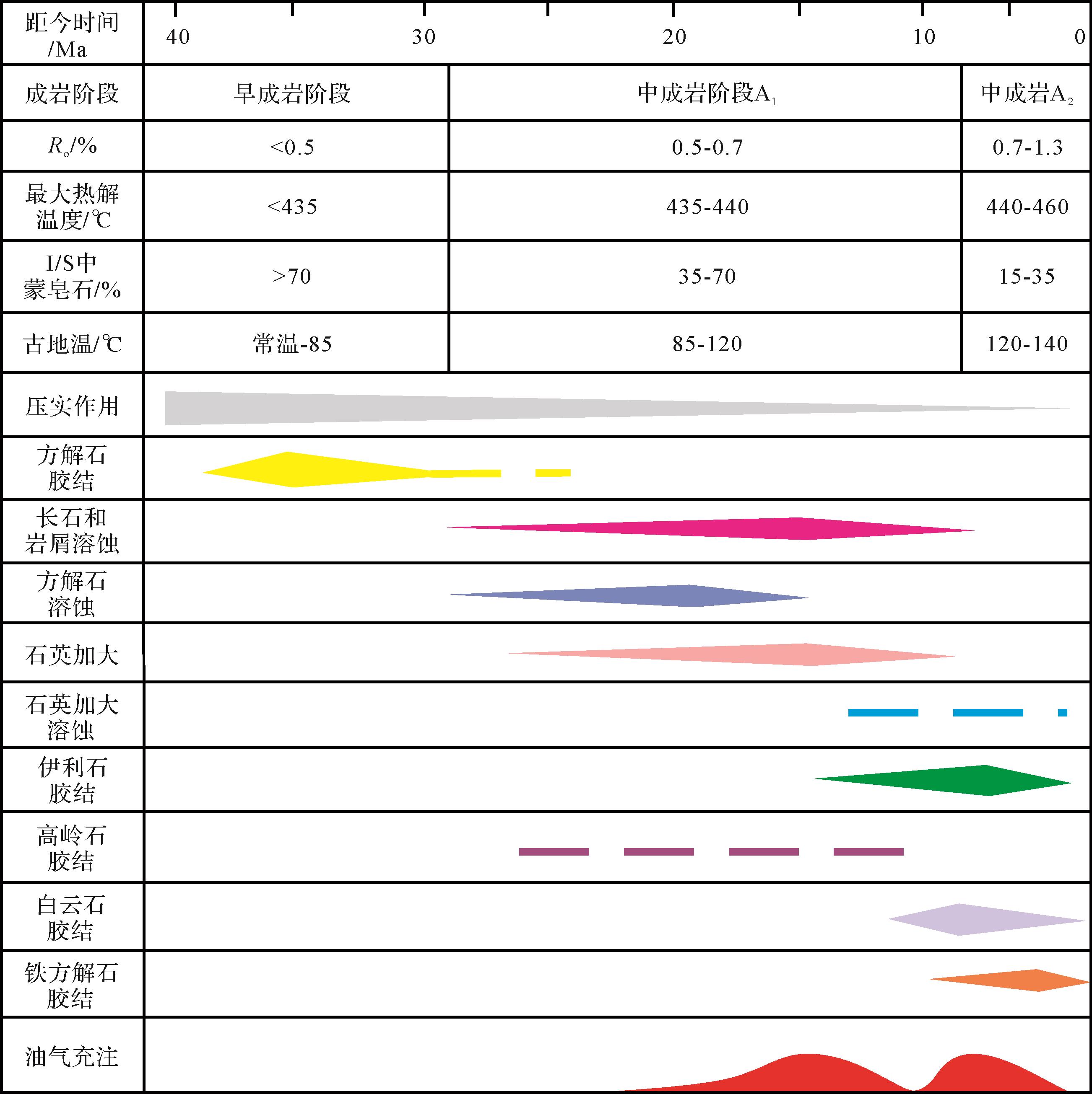
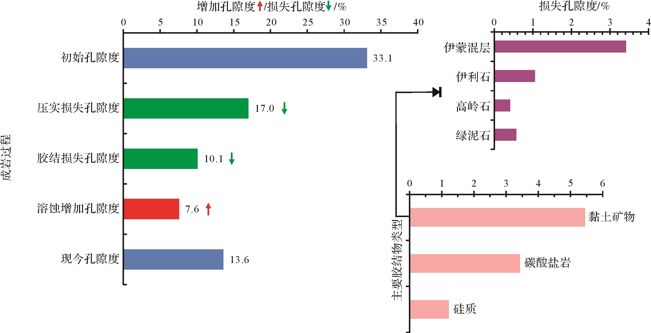
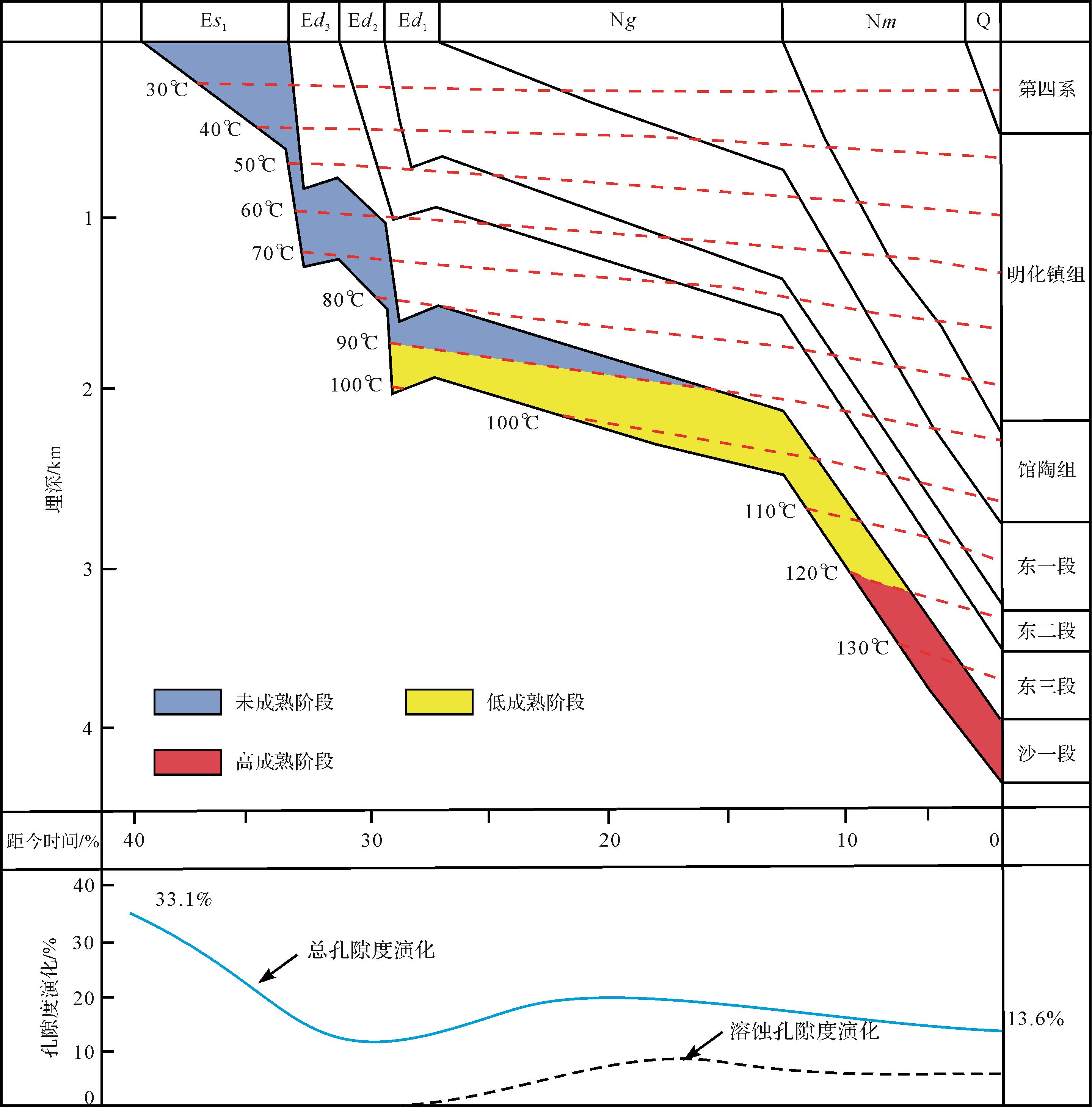
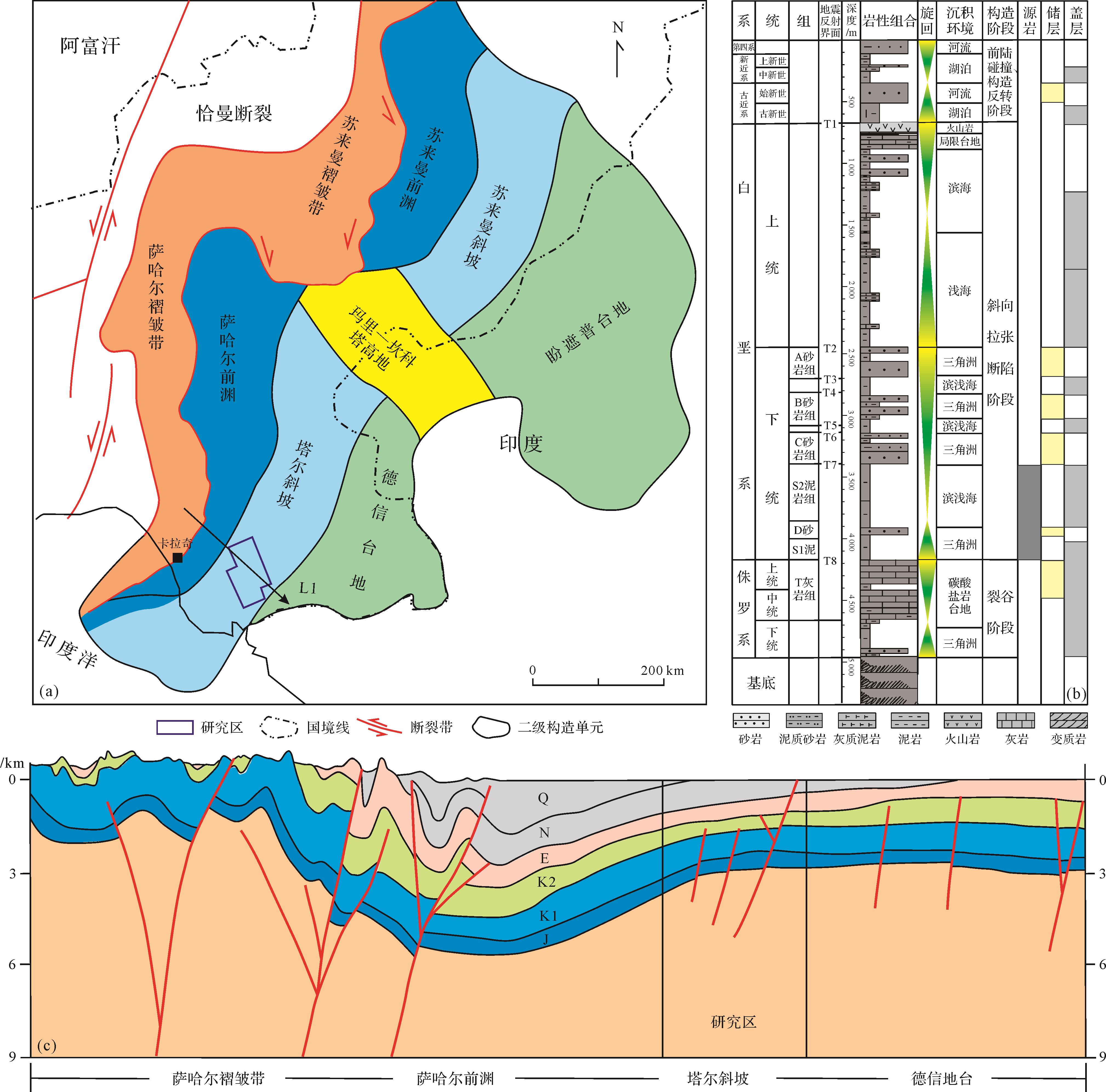
Sedimentary and petrological analysis, thin section observation and other data were selected to systematically depict the physical and diagenetic features of the first member of the Shahejie Formation (Es1) in the No. 3 structural belt of the Nanpu Sag, Bohai Bay Basin. The intensities of different diagenetic processes are revealed, the diagenetic evolution sequence is reconstructed, and the effects of different diageneses on the reservoir are quantitatively analyzed. The results show that the sedimentary environment of the Es1 Formation was a braided river delta front, which is currently in the mesodiagenesis A2 stage. The average porosity and permeability are 12.4% and 92.3×10⁻³ μm2, respectively. The reservoir has successively experienced compaction, early cementation, dissolution and late cementation. Compaction was the main diagenetic process for porosity reduction, accounting for about 17% loss of porosity. The dissolution process clearly improved the porosity, causing 7.6% porosity increase. The porosity evolution path and quality of deep reservoir are predicted, and ultimately establish the porosity evolution model, providing a reliable reference for subsequent petroleum exploration and development.


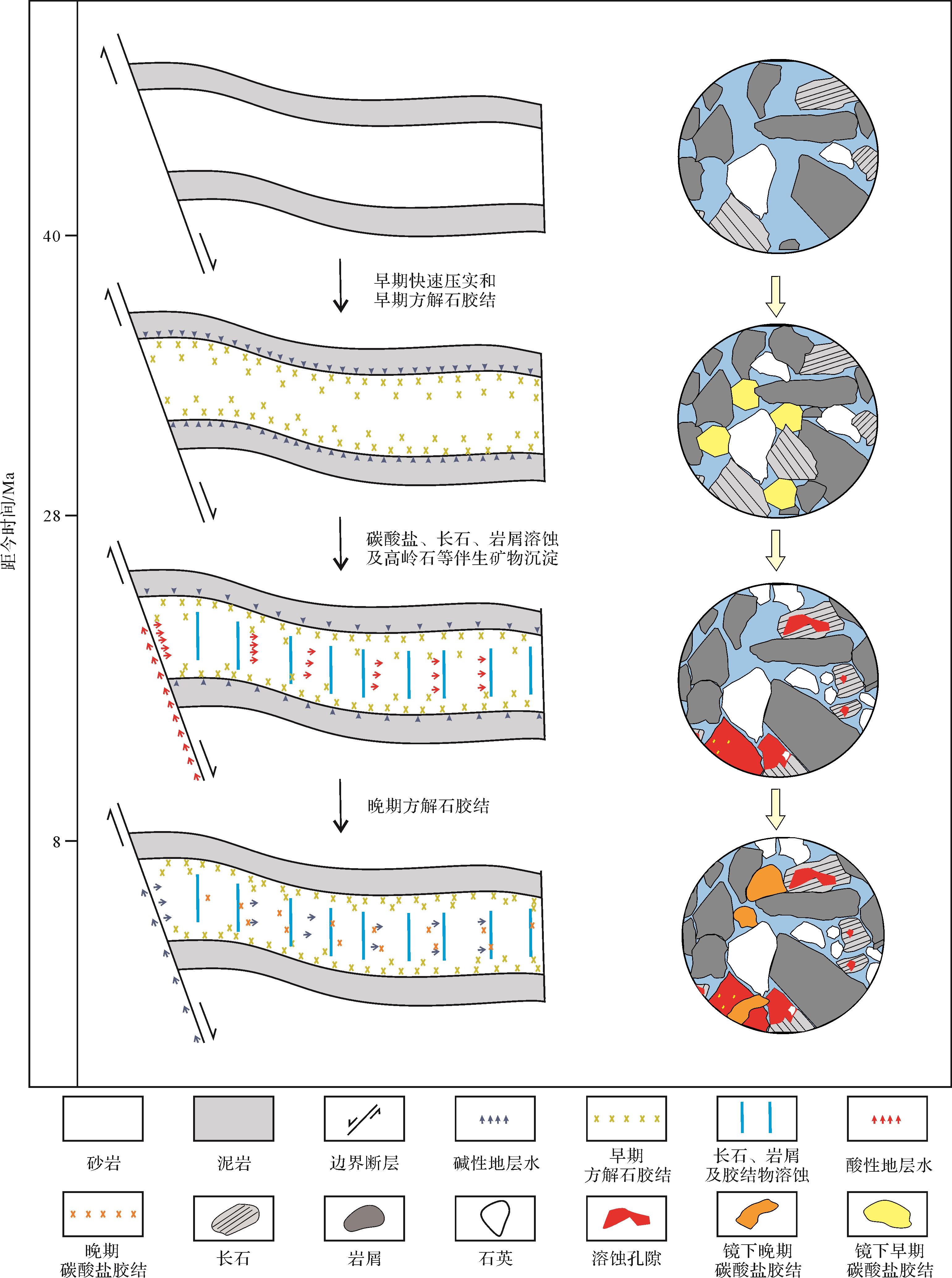
2022, 40(1): 217-228.
doi: 10.14027/j.issn.1000-0550.2020.065
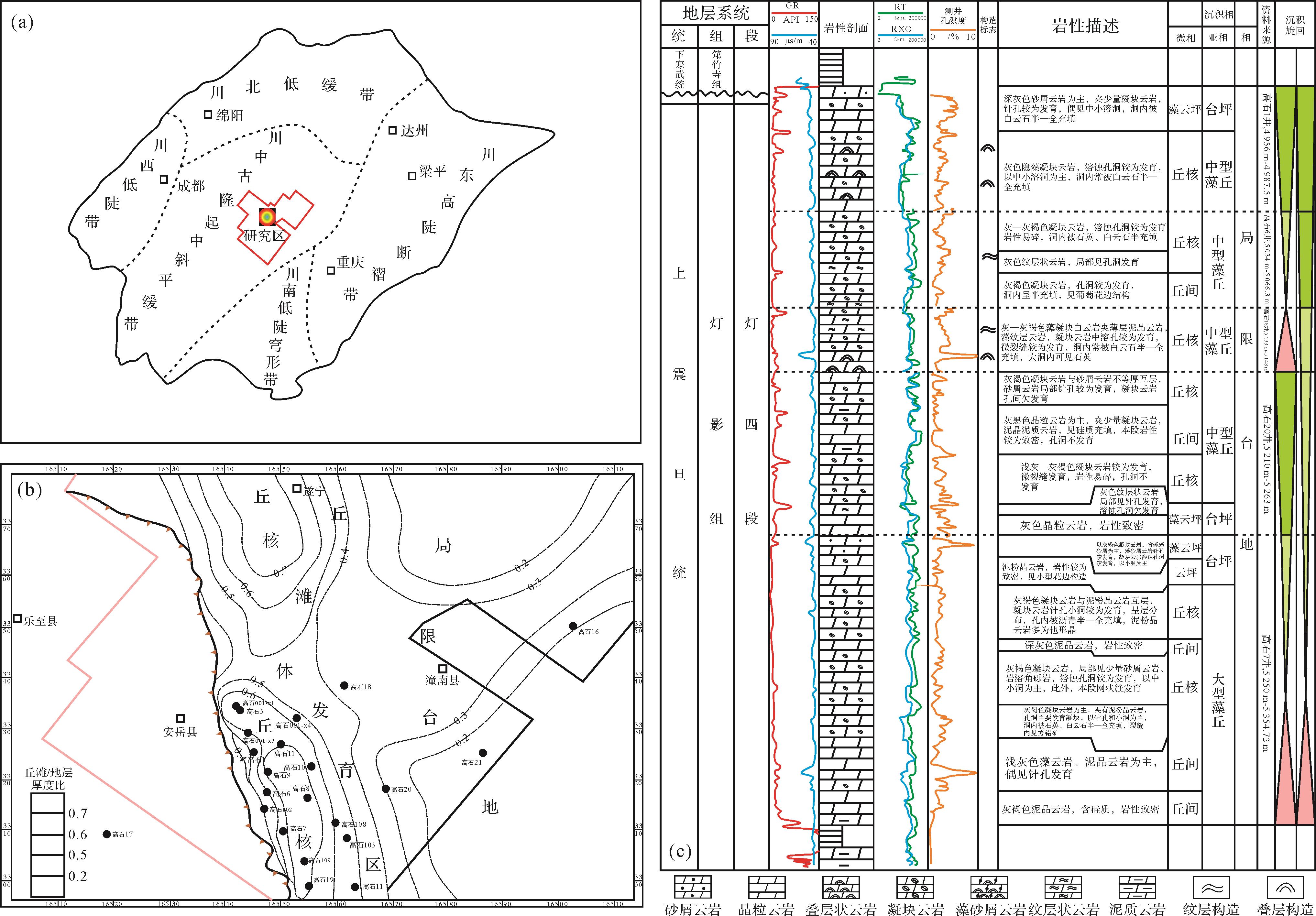
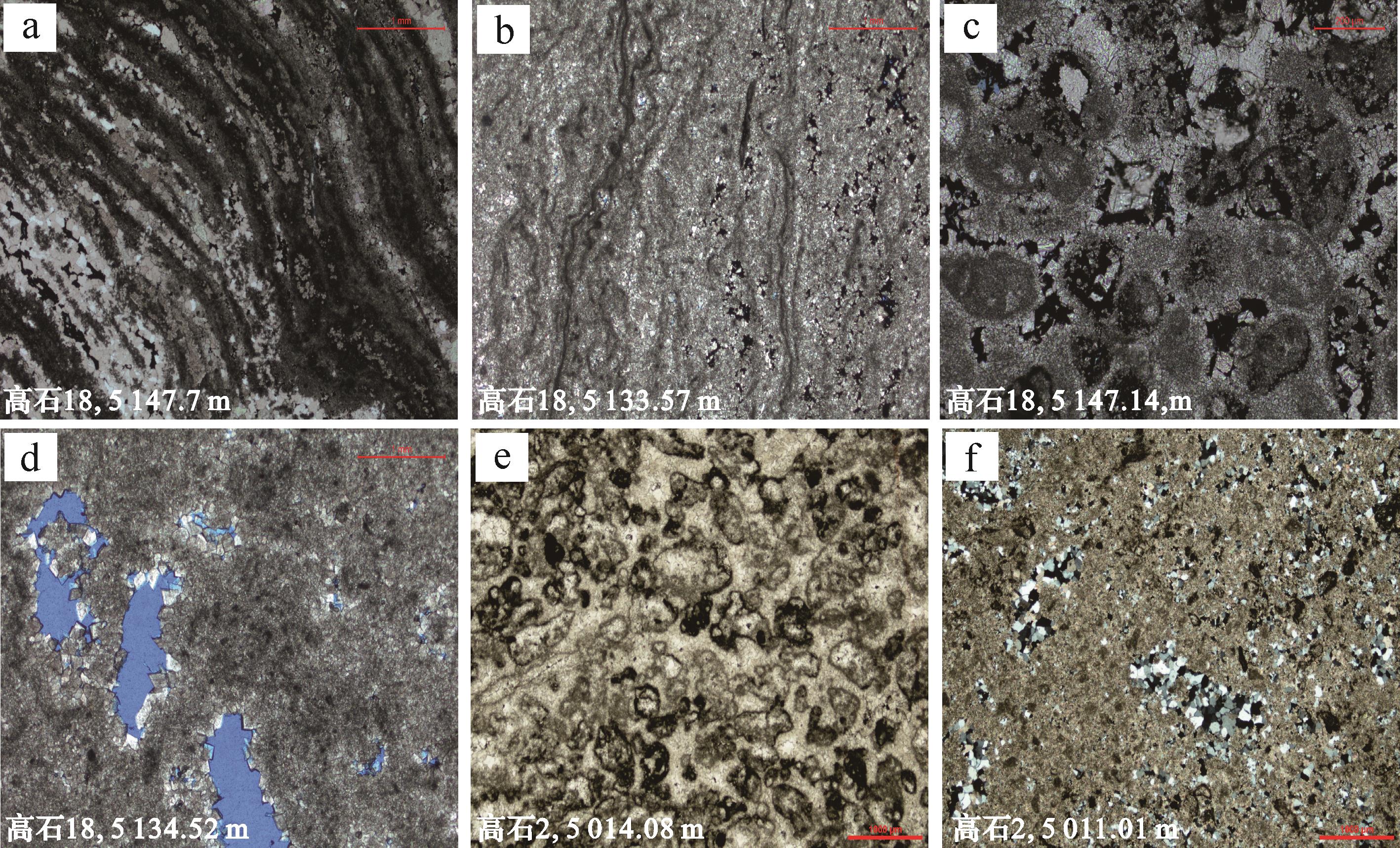
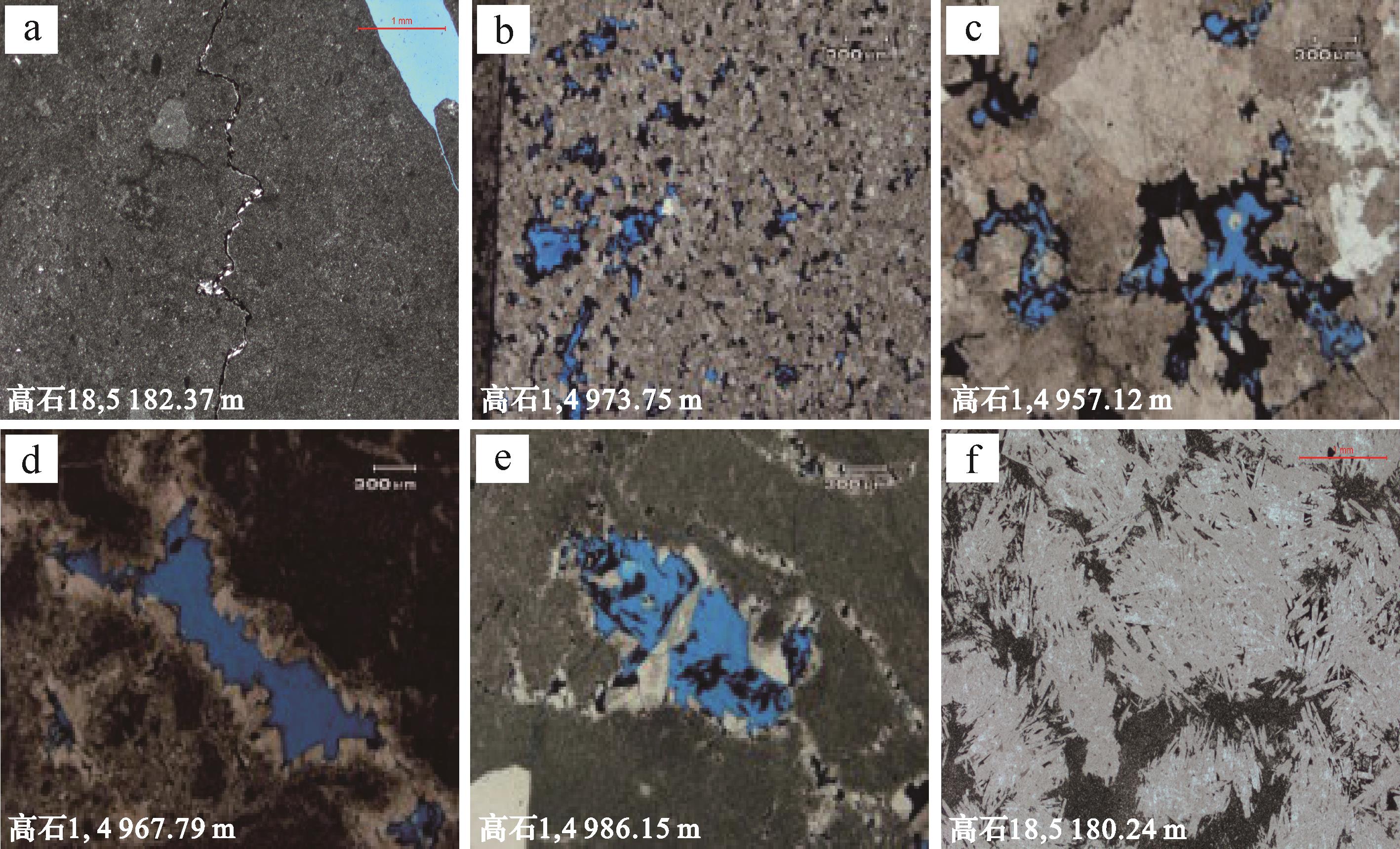
Abstract:
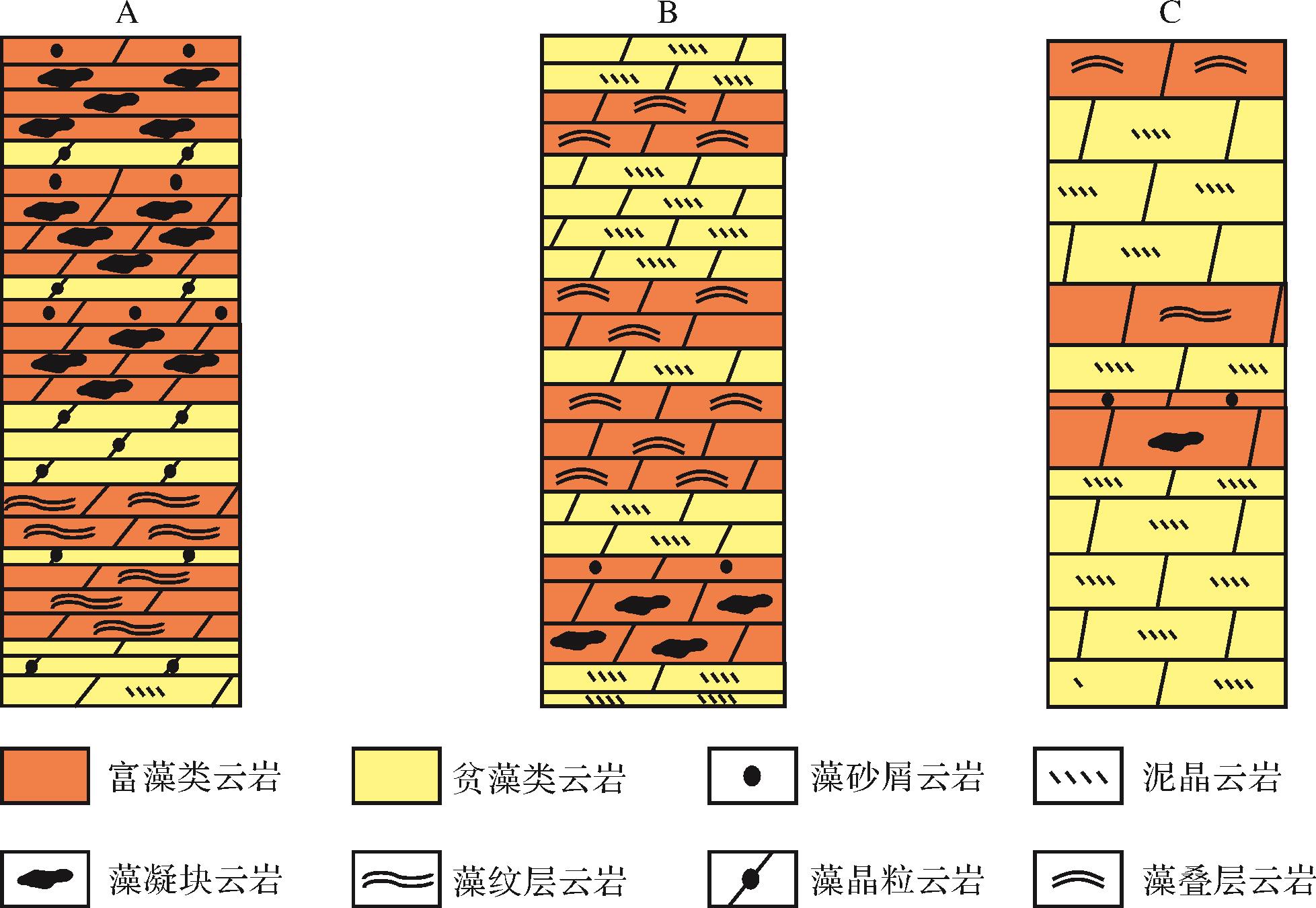
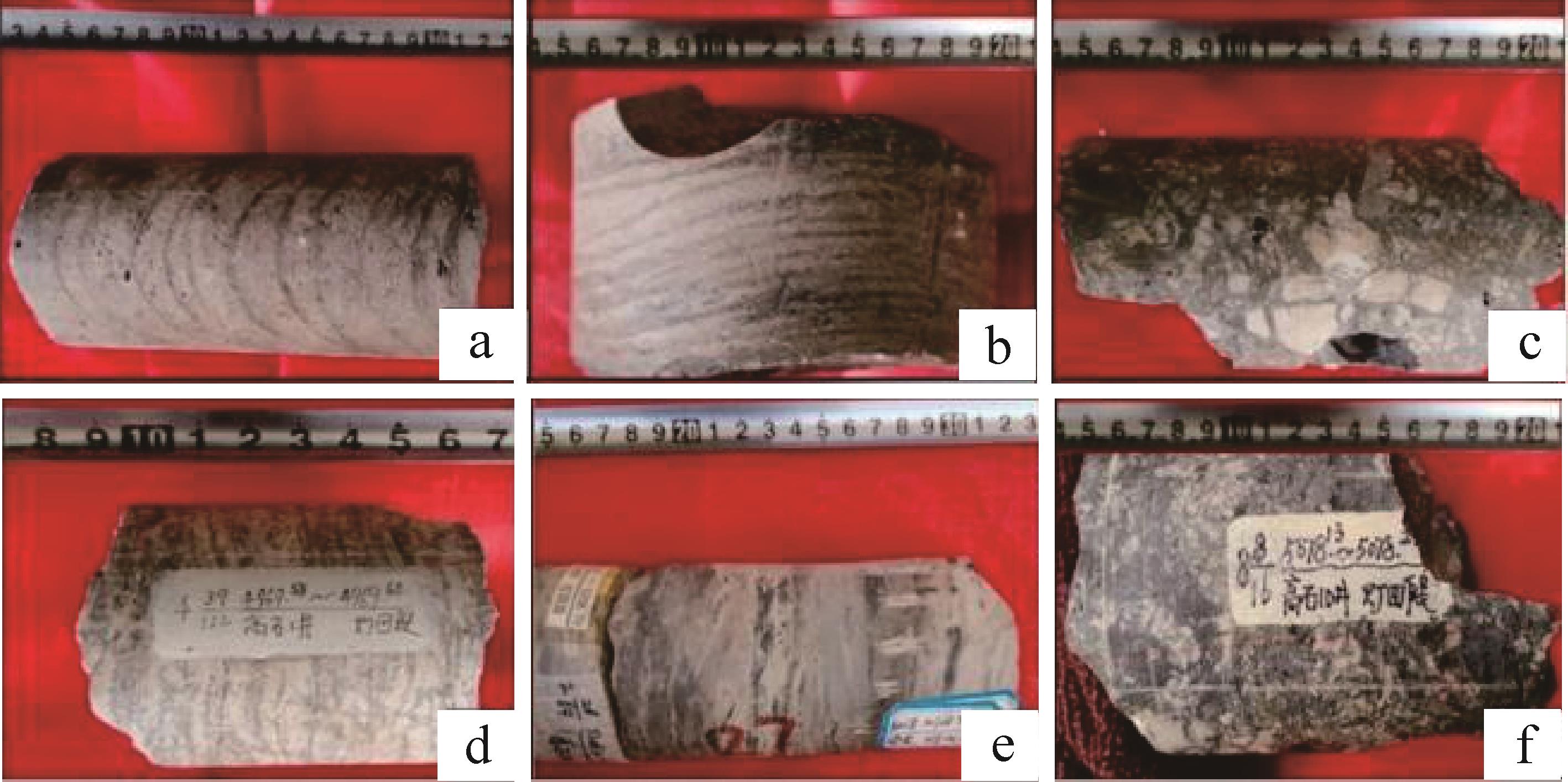
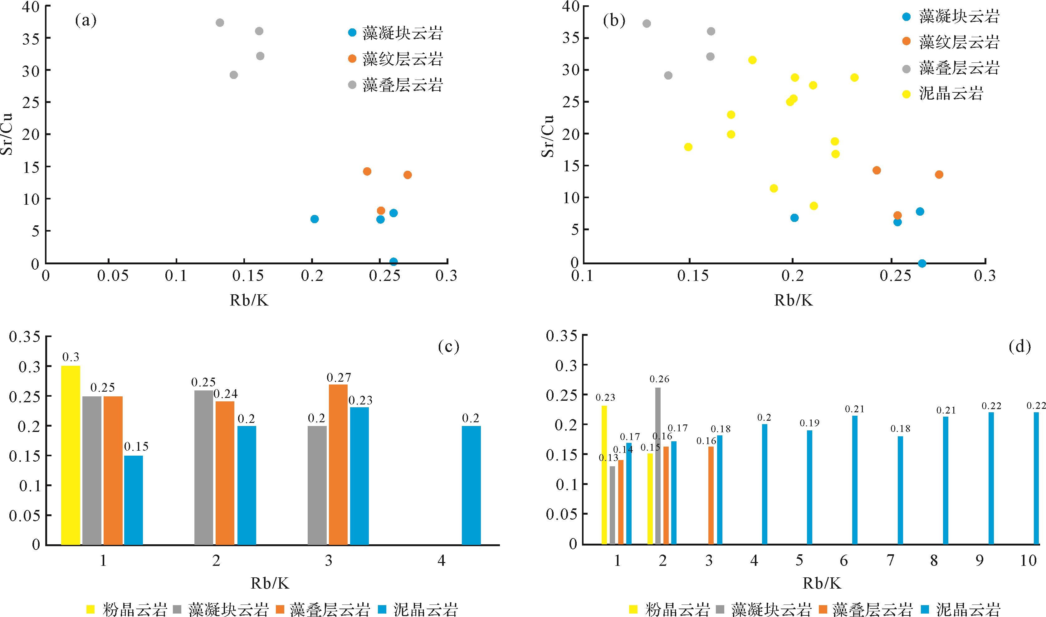
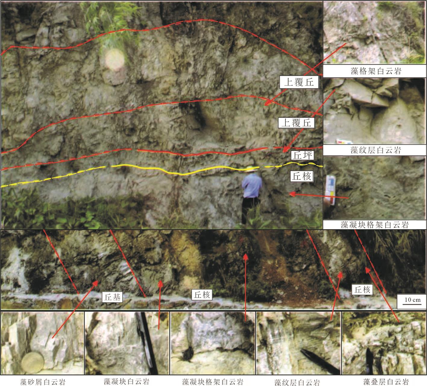
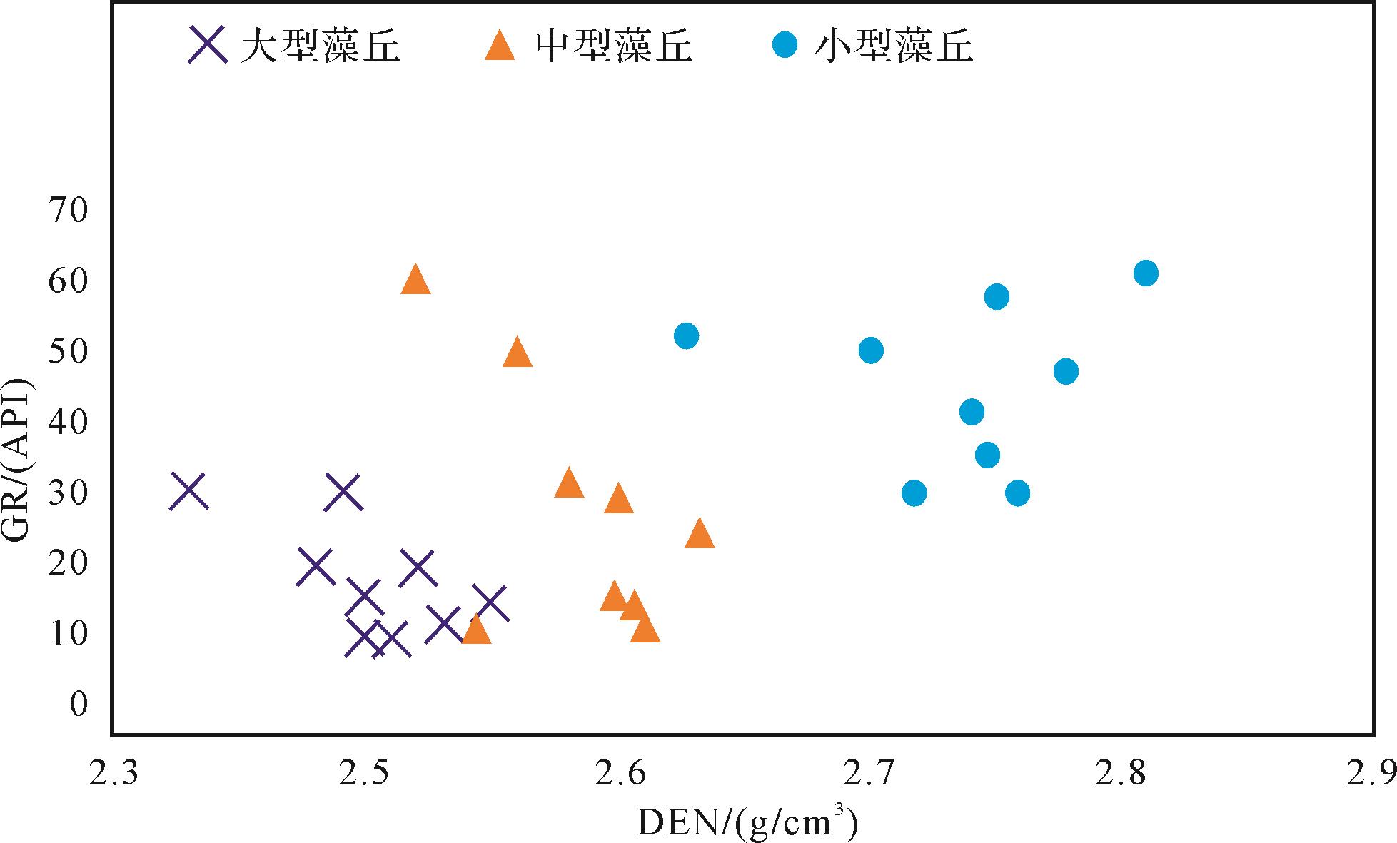
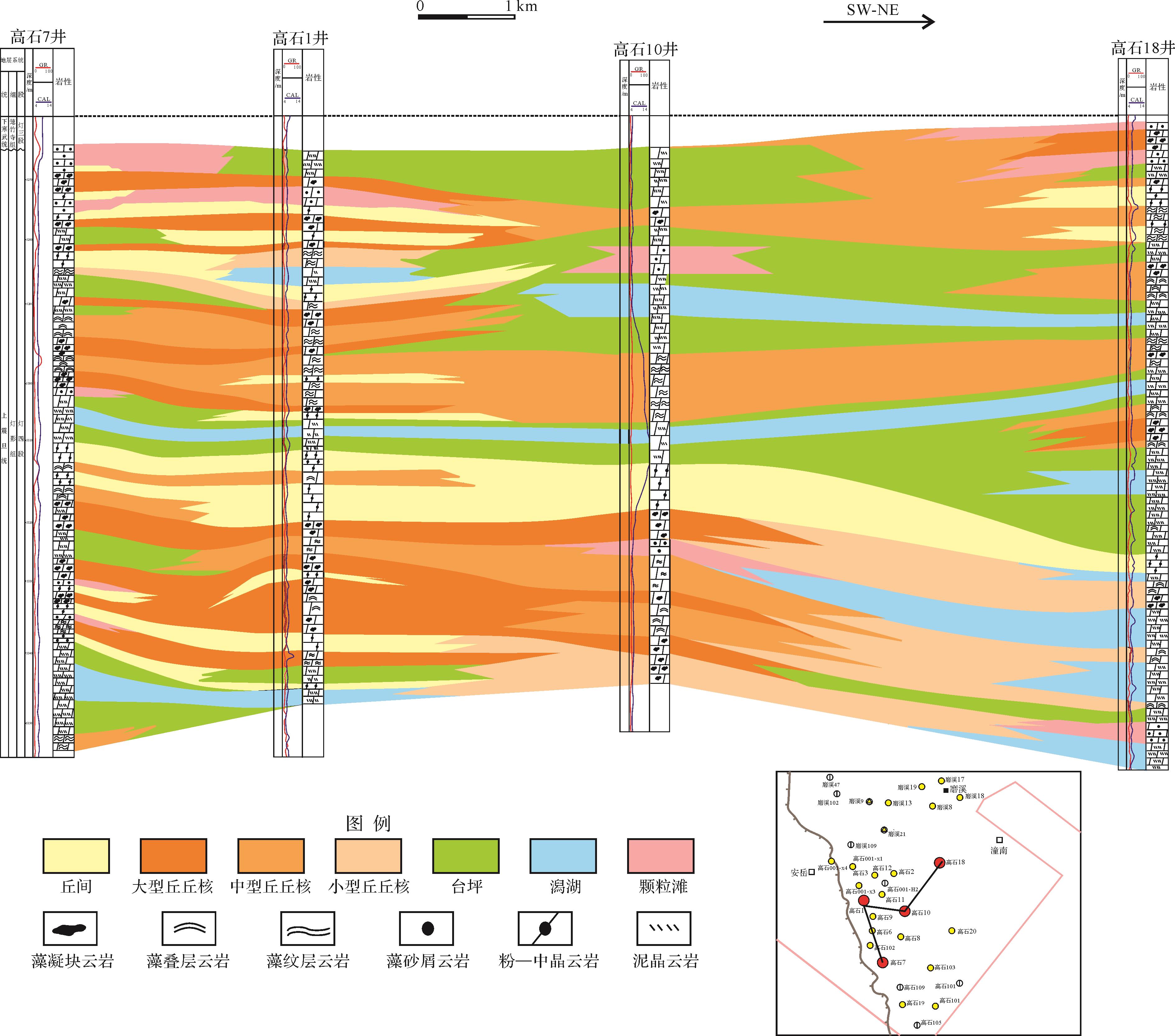
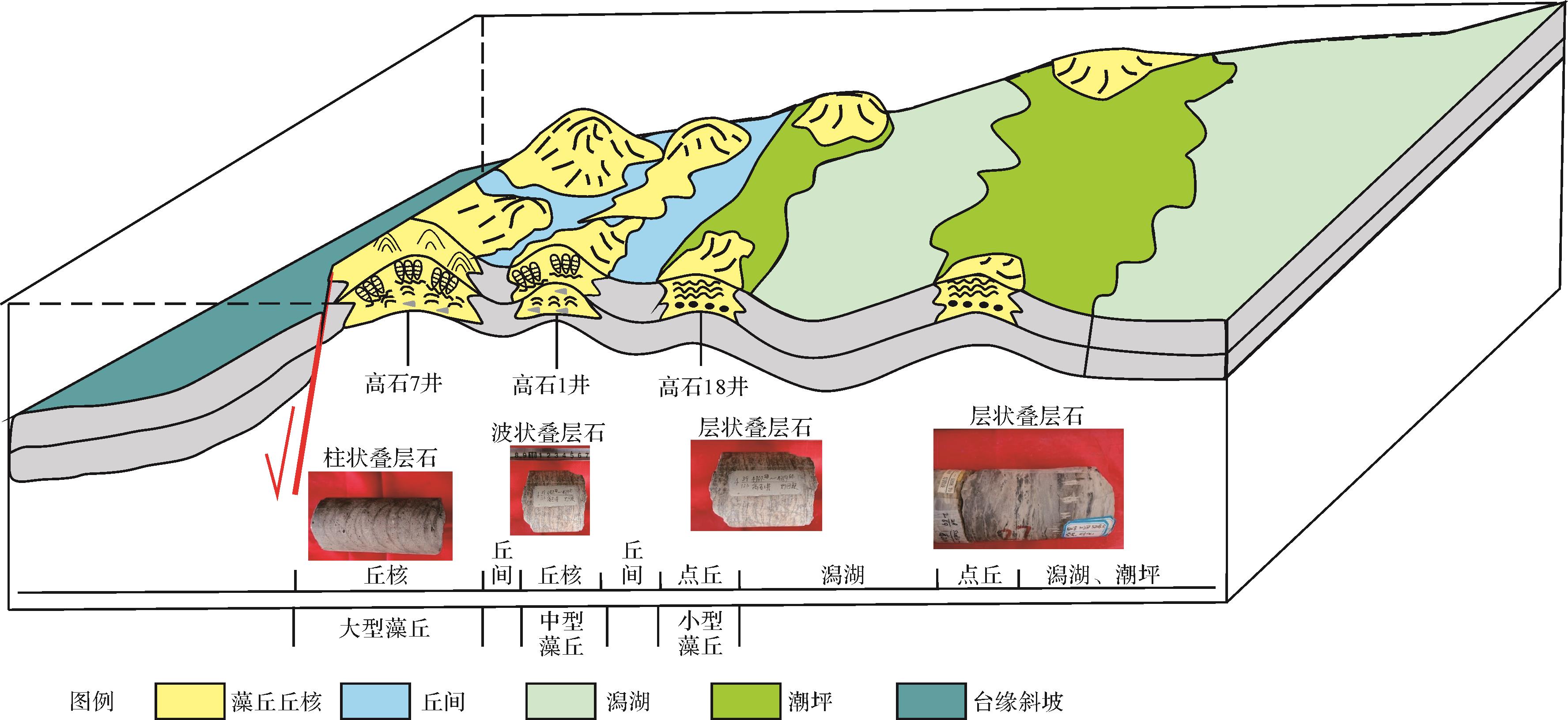
Considerable hydrocarbon resources are present in the 4th member of the Sinian Dengying Formation, at the platform margin in the Gaoshiti area of the Sichuan Basin. Therefore, it is particularly important to discuss the algal mound developments in that area, since they are the basis of the formation of high-quality hydrocarbon reservoirs. Analysis of cores, thin-section identification and logging data have elaborated the algal mound types and sedimentary models of the Deng 4 member in detail. The results show: (1) Algae-rich dolomite is the main type of algal mound foundation and nucleus, having algal frame, stromatolitic structures, algal laminated structures and algal sponge layer structures. Algae-poor dolomite was developed in shallow open marine zones, tidal flats and lagoons, and is predominantly crystalline dolomite containing some gypsum. (2) The lithological combination, sedimentary structure and geochemical parameters indicate that algal mounds may be categorized as large algae mounds, medium-sized stable algae mounds, and small algae mounds which occur in low-energy environments. The large algae mounds were developed in the high-energy band lying outside the platform margin of a low-salinity water body, and have a Rb/K ratio of approximately 1.3⁃2.0. The medium-sized stable mounds are located from the medial margin of the platform to the interior of the platform, formed in higher-salinity and shallower water; their Rb/K ratio is > 2.0. (3) A sedimentary model of algal mounds and their periphery was established; the study also clarified the types and lateral extents of the mounds. These findings may guide exploration for favorable areas in the inner platform.
2022, 40(1): 229-243.
doi: 10.14027/j.issn.1000-0550.2020.093
Abstract:
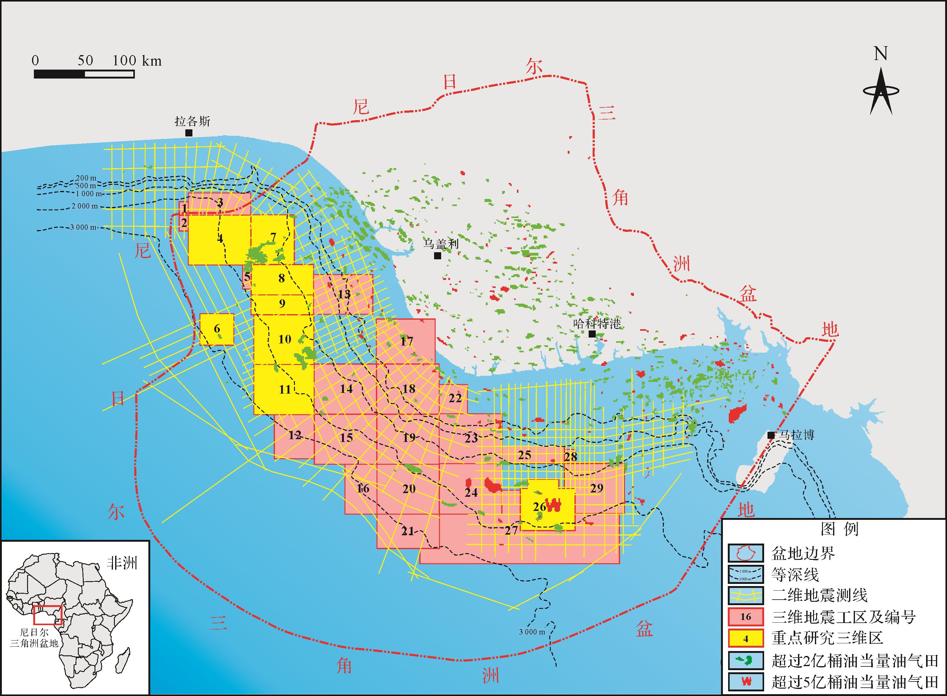
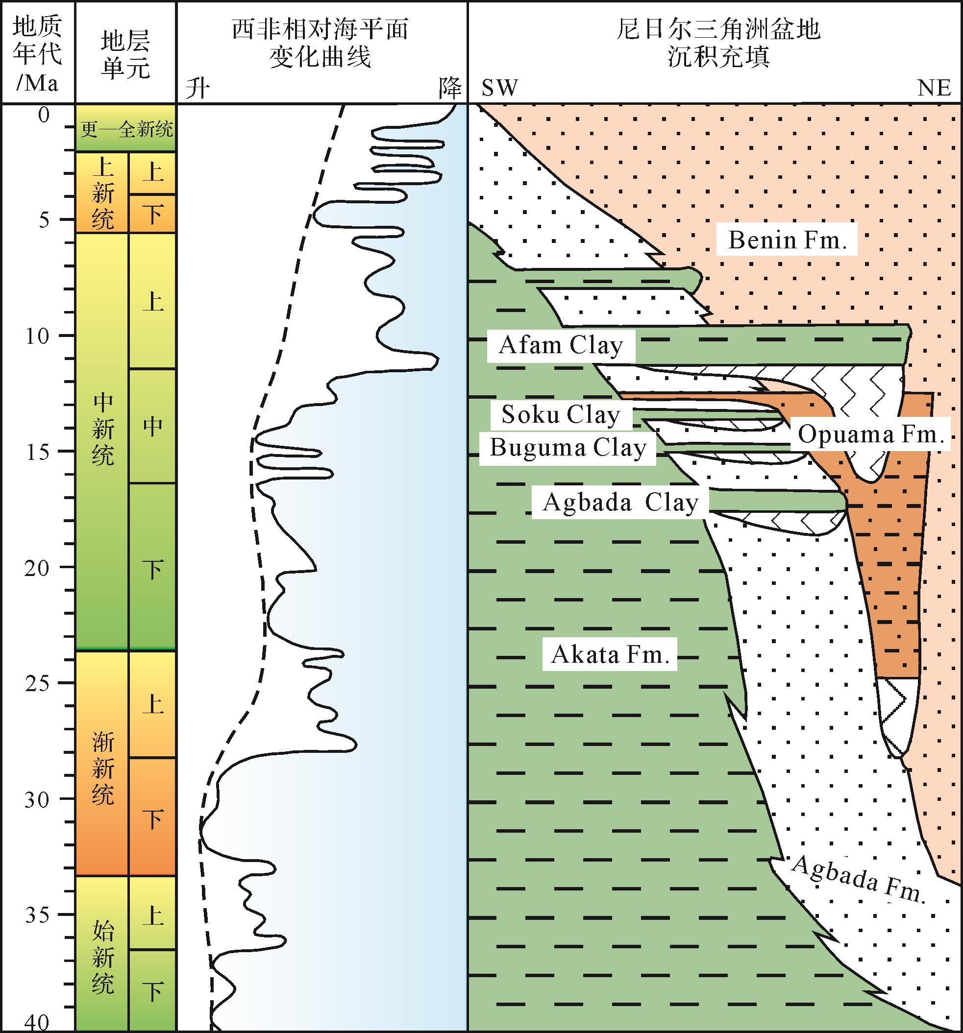
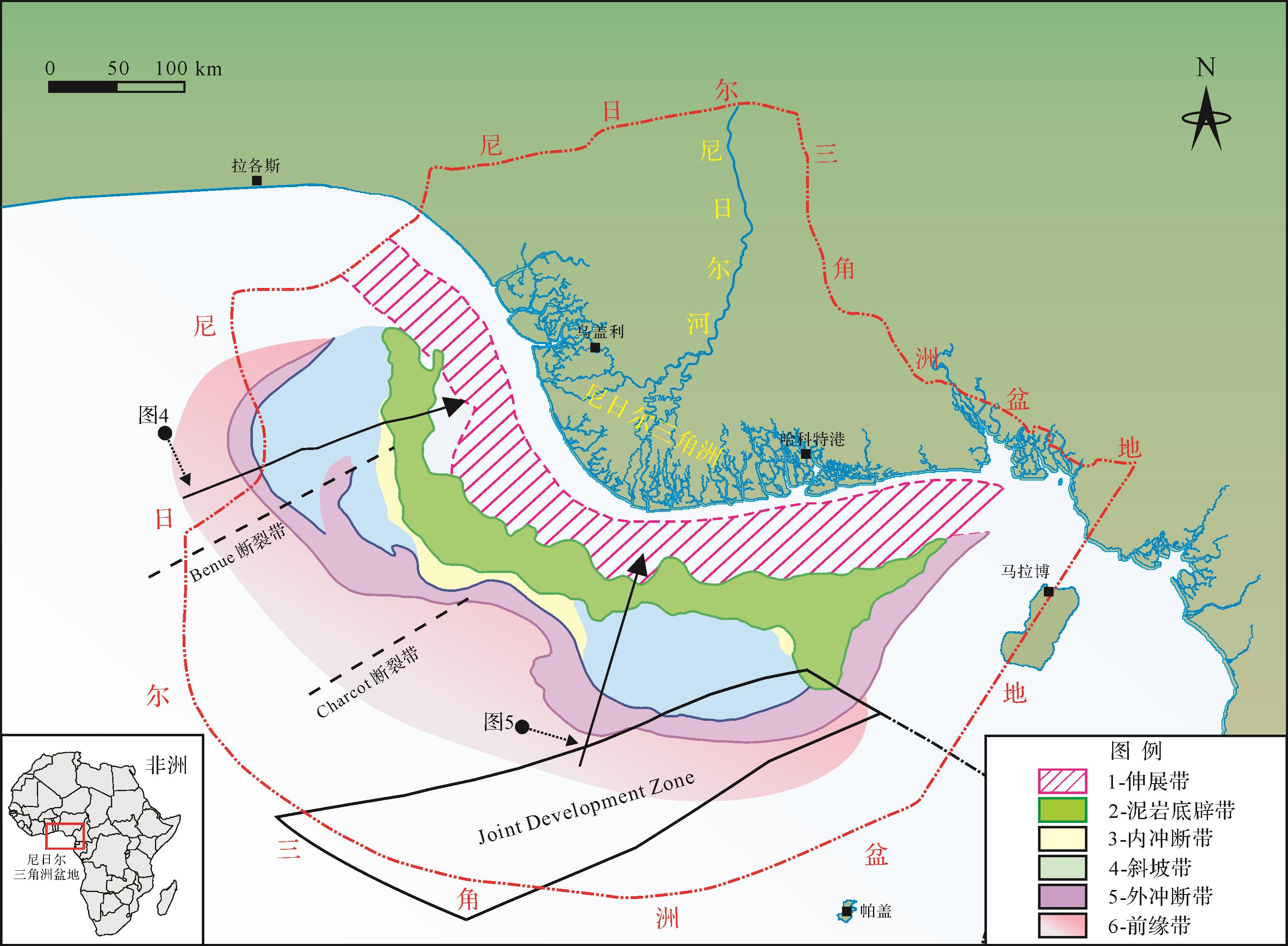
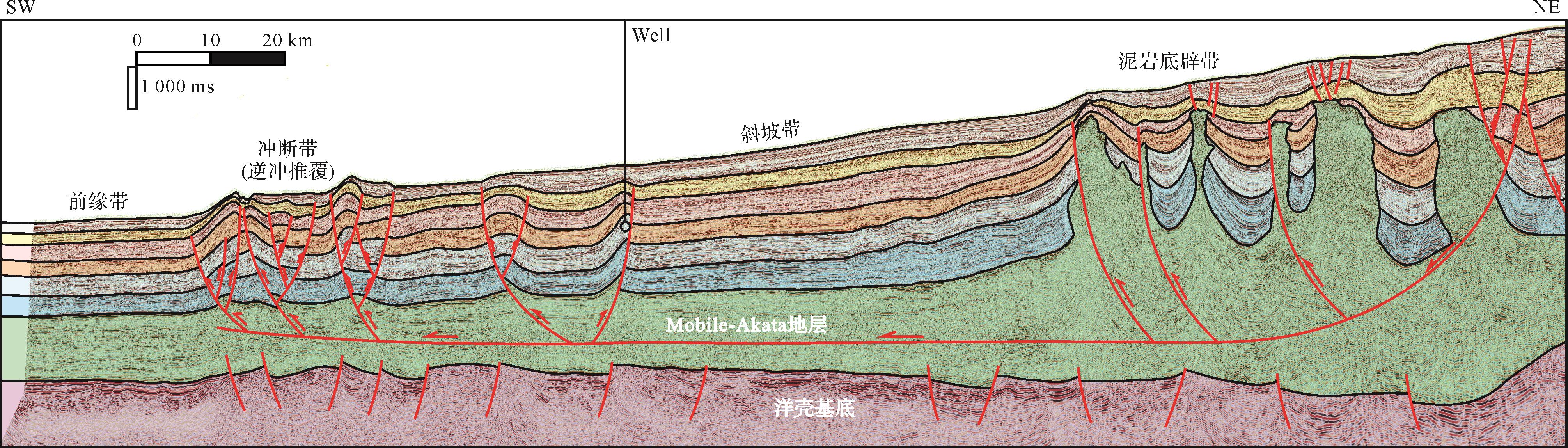
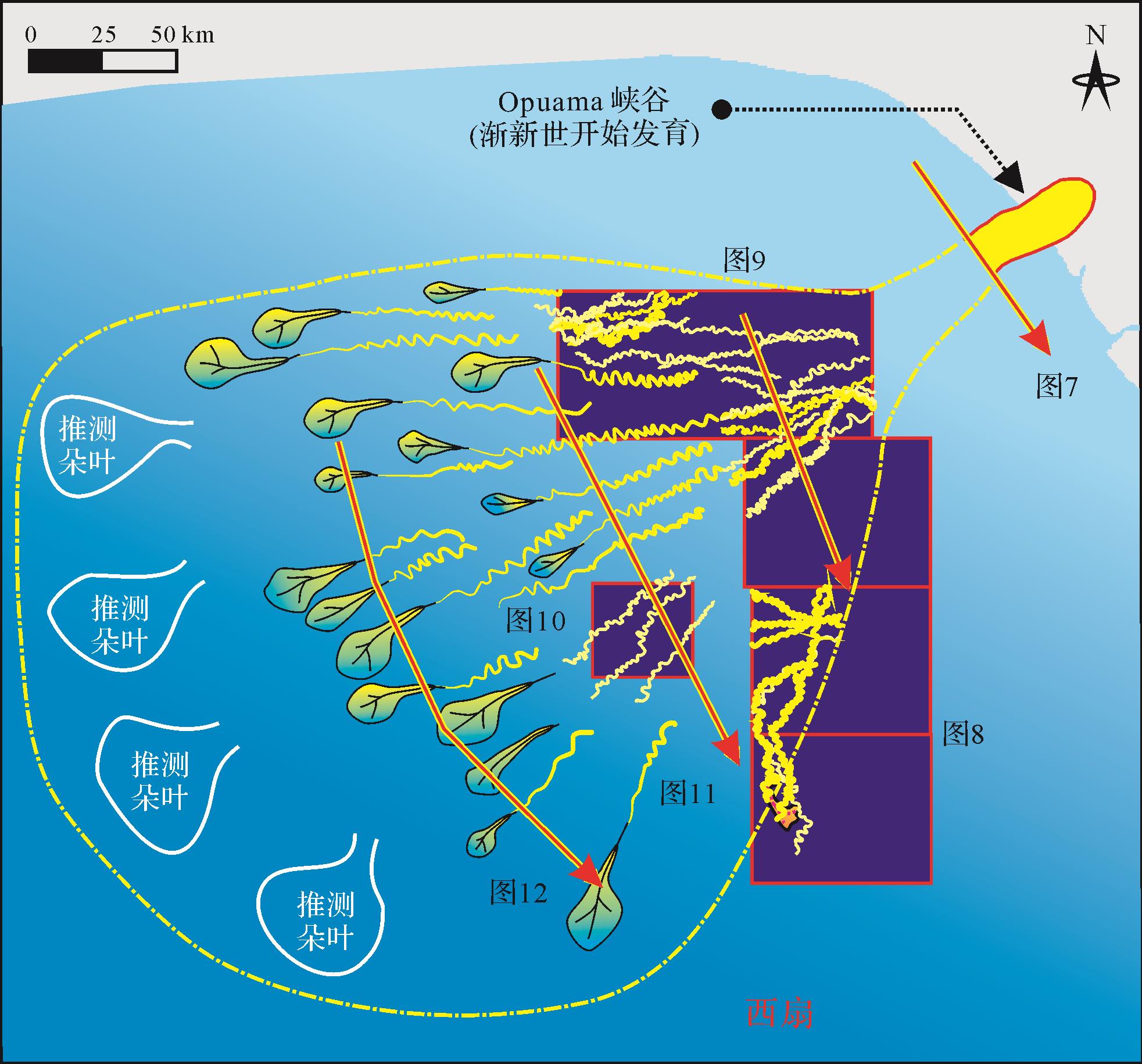
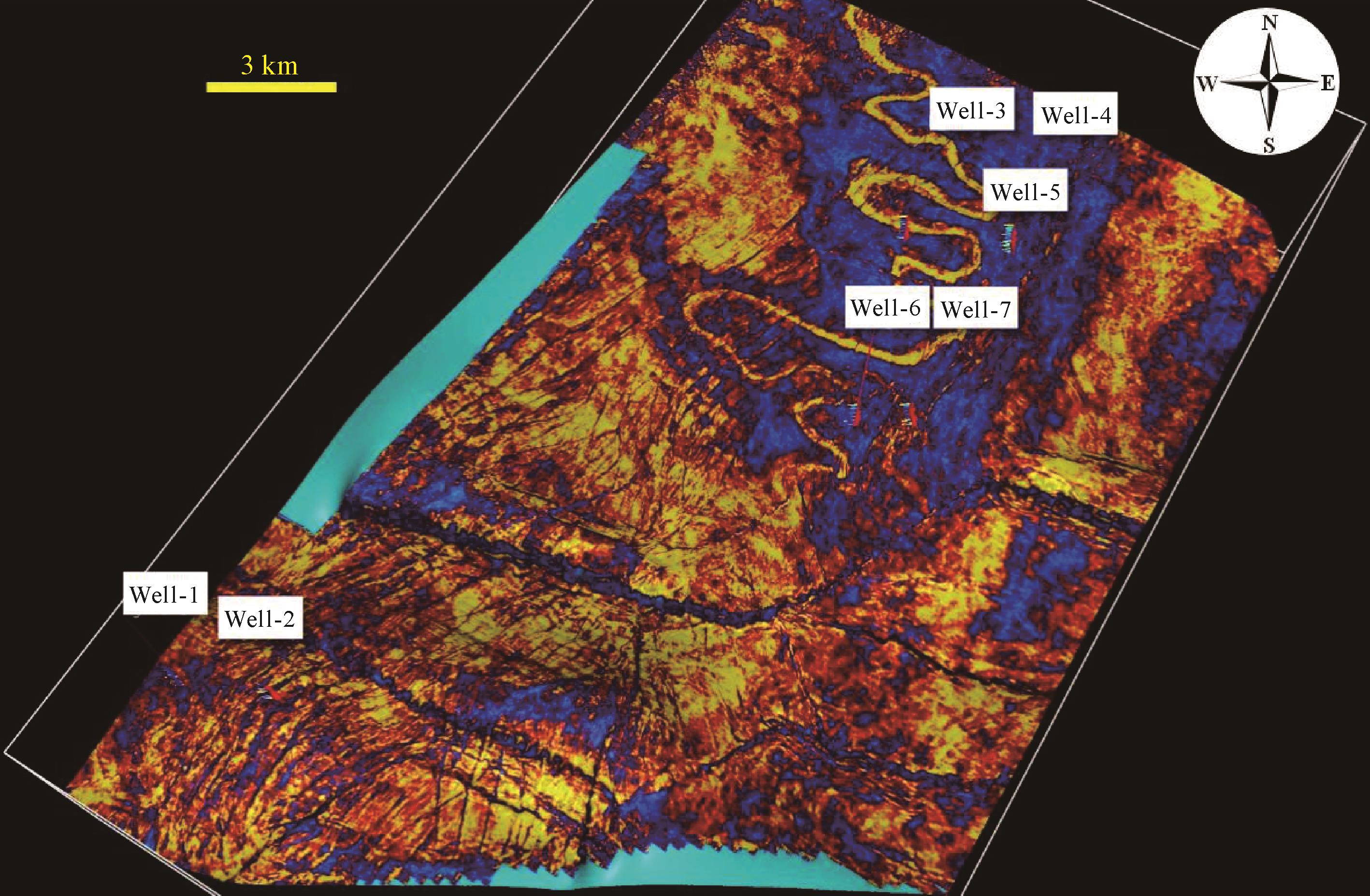
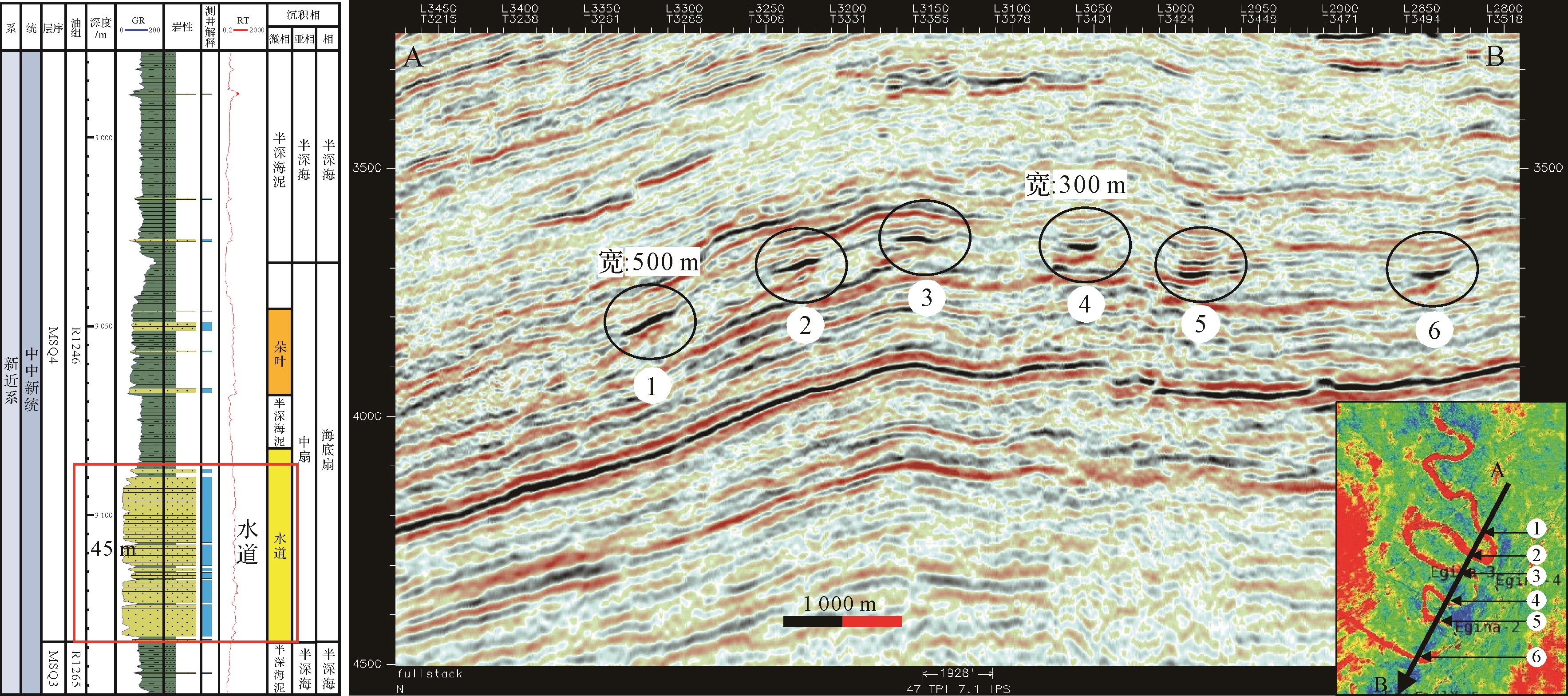
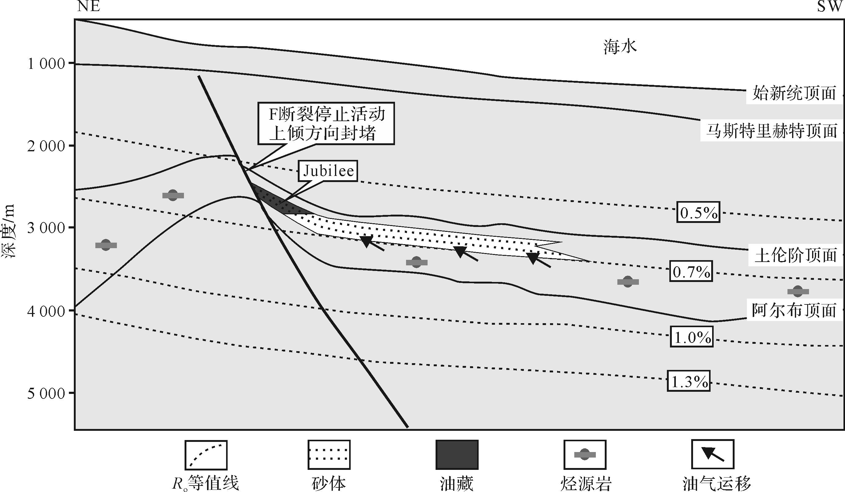
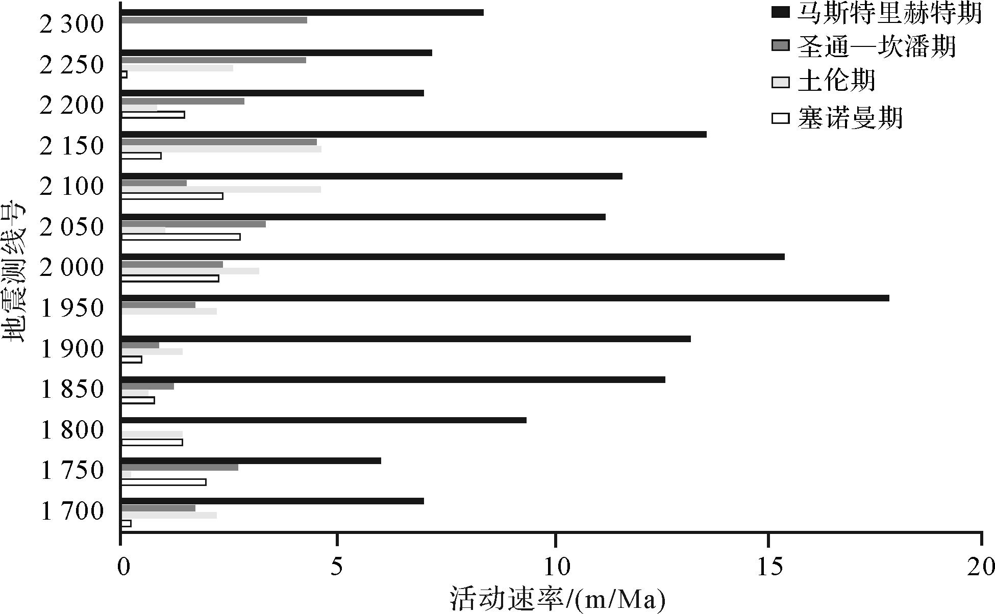
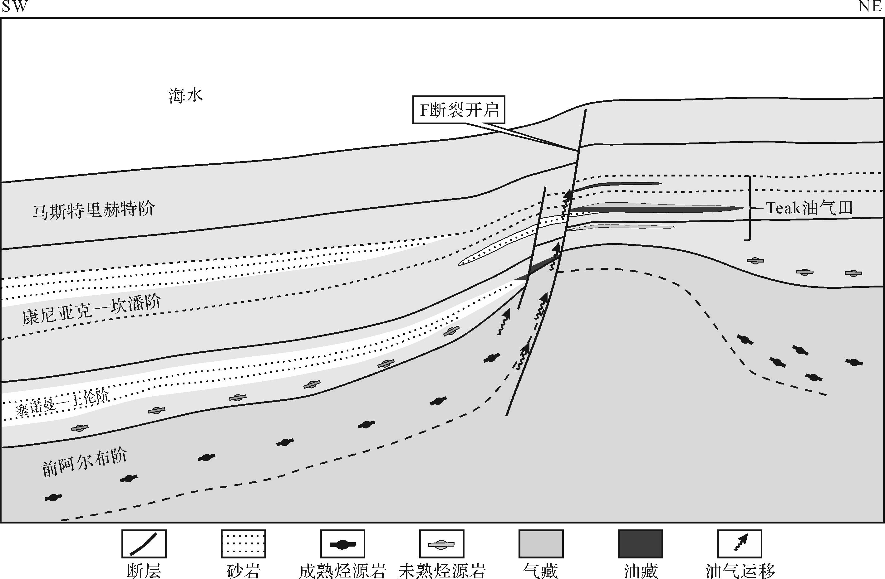
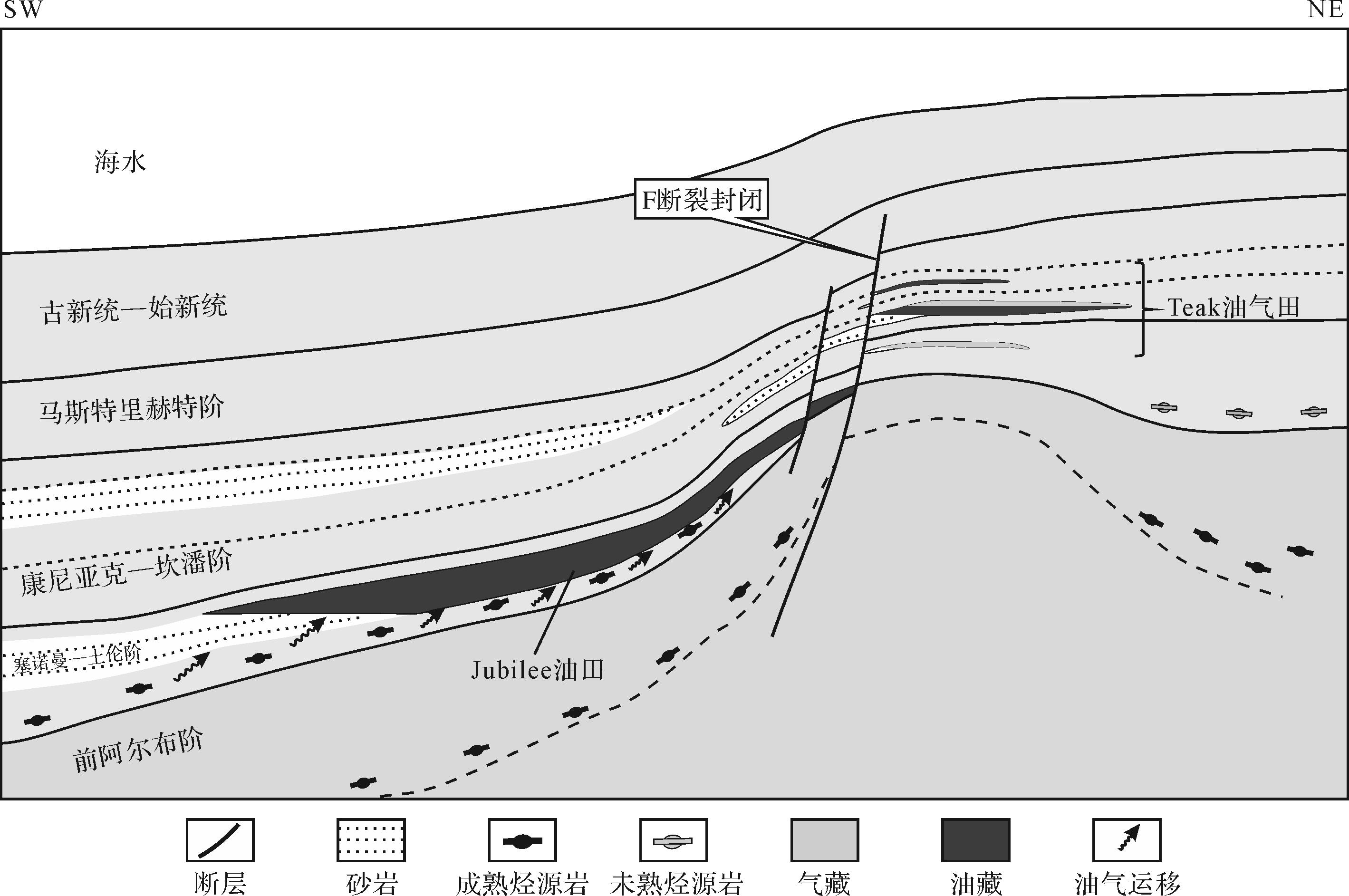
The Niger Delta Basin is rich in deep-water oil and gas reserves. However, both the number of plays at billion level and the total recoverable reserves in the eastern areas are double those in the western areas, which represents a huge distinction. Therefore, studies of their characteristics and differences have particular value, both industrial and theoretical. Based on the analysis of a large quantity of seismic, well-log and core data for the basin, it is proposed that the deep-water fan in the western region is mainly sourced from the delta, forming a deep-water fan with branches (‘rooted deep-water fan’) on the deep-water abyssal plain as a result of transporting large-scale canyons. The eastern deep-water fan is also sourced from the delta, but due to the lack of large-scale canyons, the source material slid down the continental slope from the bathyal zone to the abyssal plain, forming a fan-shaped deposit without a deep root (‘rootless deep-water fan’). This type of fan has a short transportation distance and is mainly composed of lobes and channelized lobes; mudstone diapirs and thrust nappes form structural lithological traps with large filling areas and thick reservoirs. In summary, the main reason for the different oil and gas distributios in the eastern and western deep-water areas of the Niger Delta Basin, apart from structural factors, is whether or not a canyon was the conduit for transporting the material from the source. Different sedimentary types correspondingly formed in the eastern and western regions and the two kinds of deep-water traps developed.

2022, 40(1): 244-254.
doi: 10.14027/j.issn.1000-0550.2020.084
Abstract:
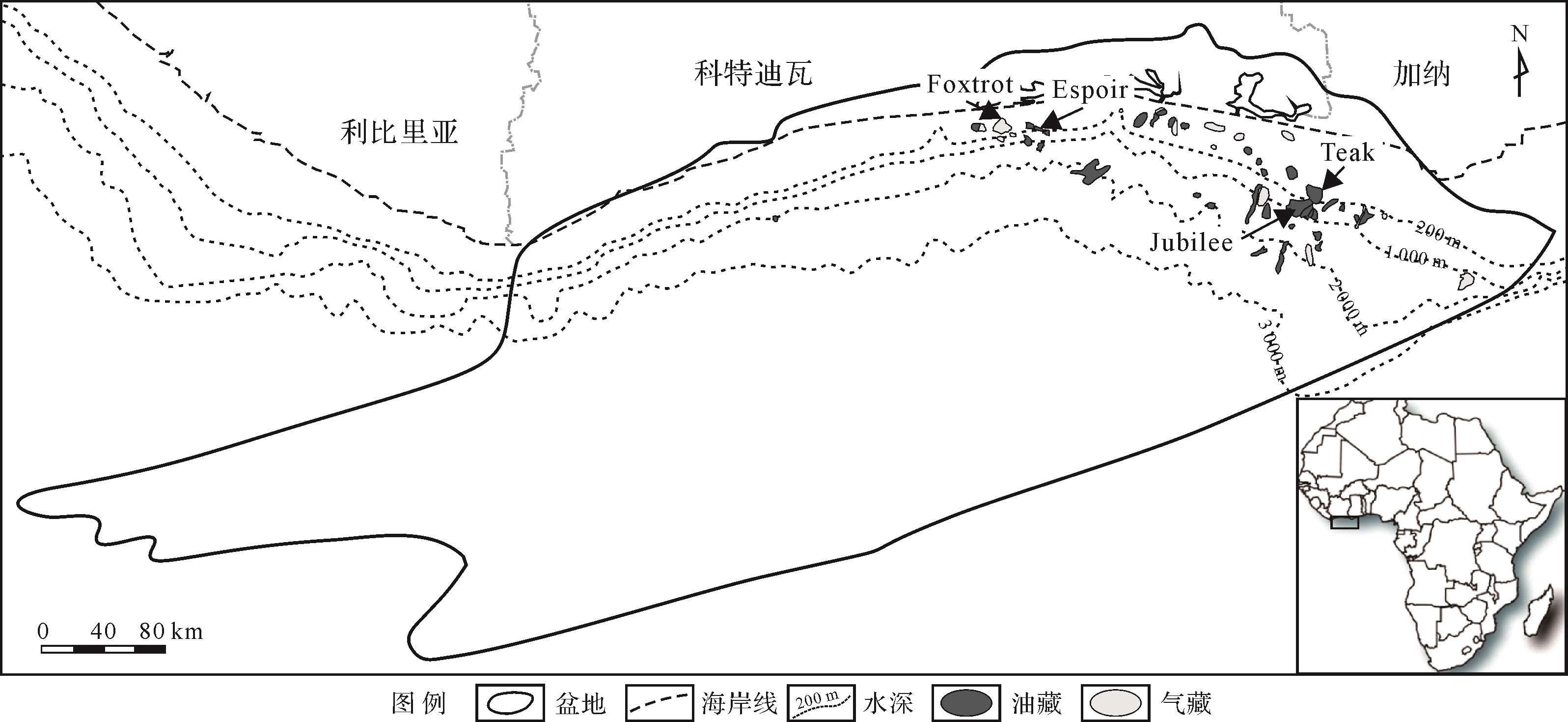
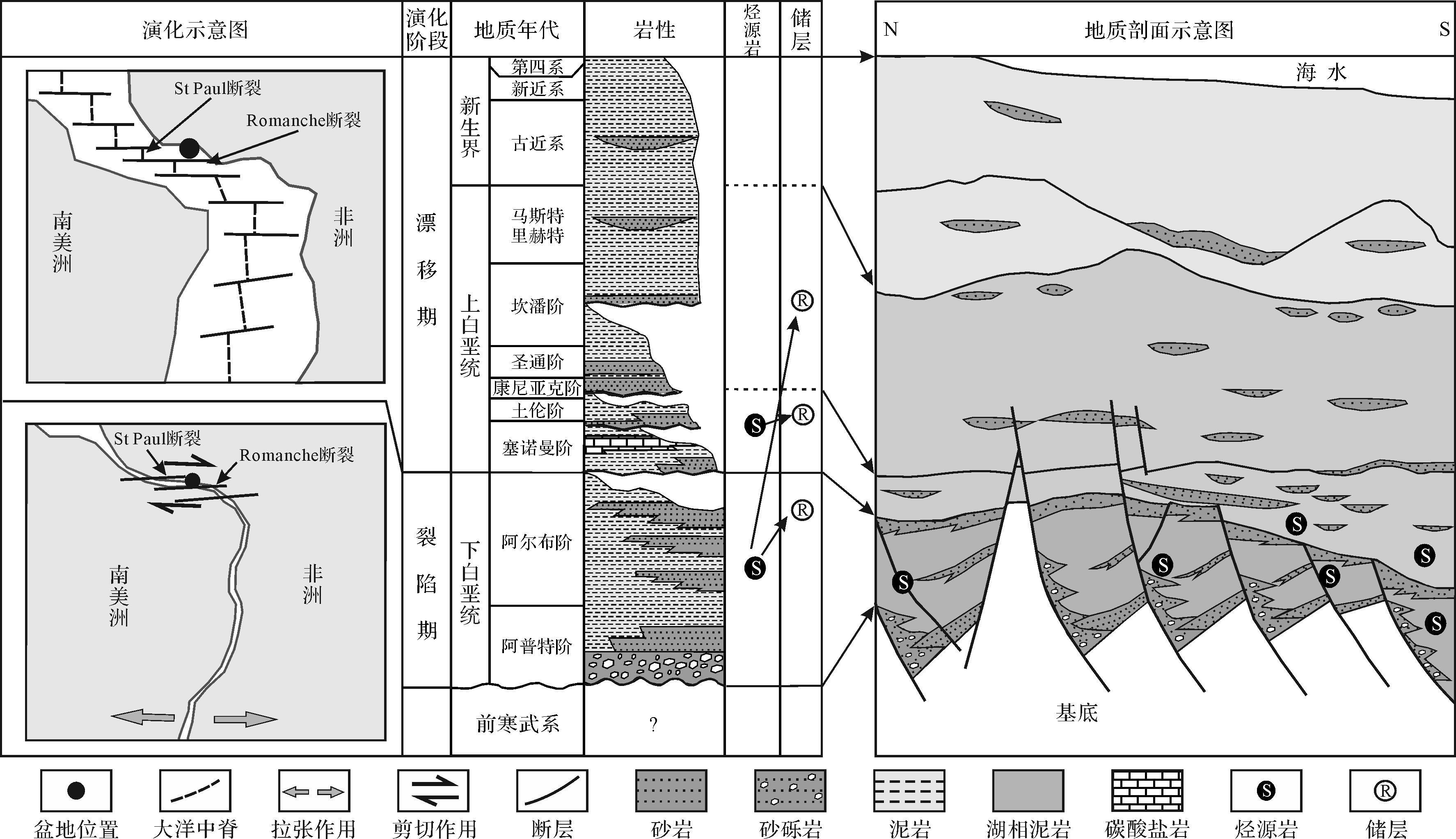
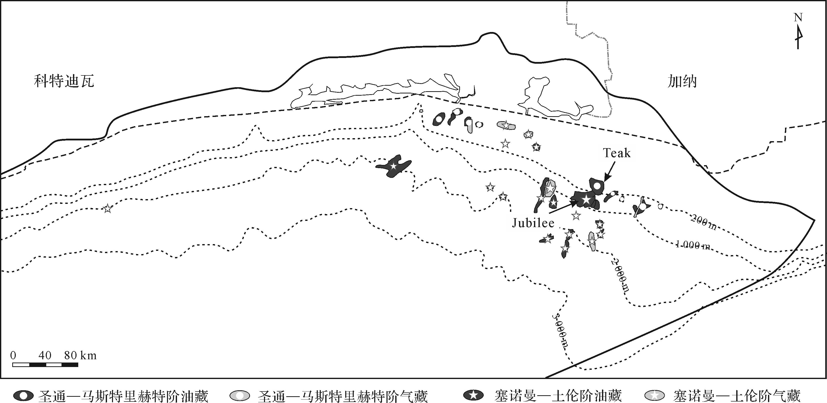
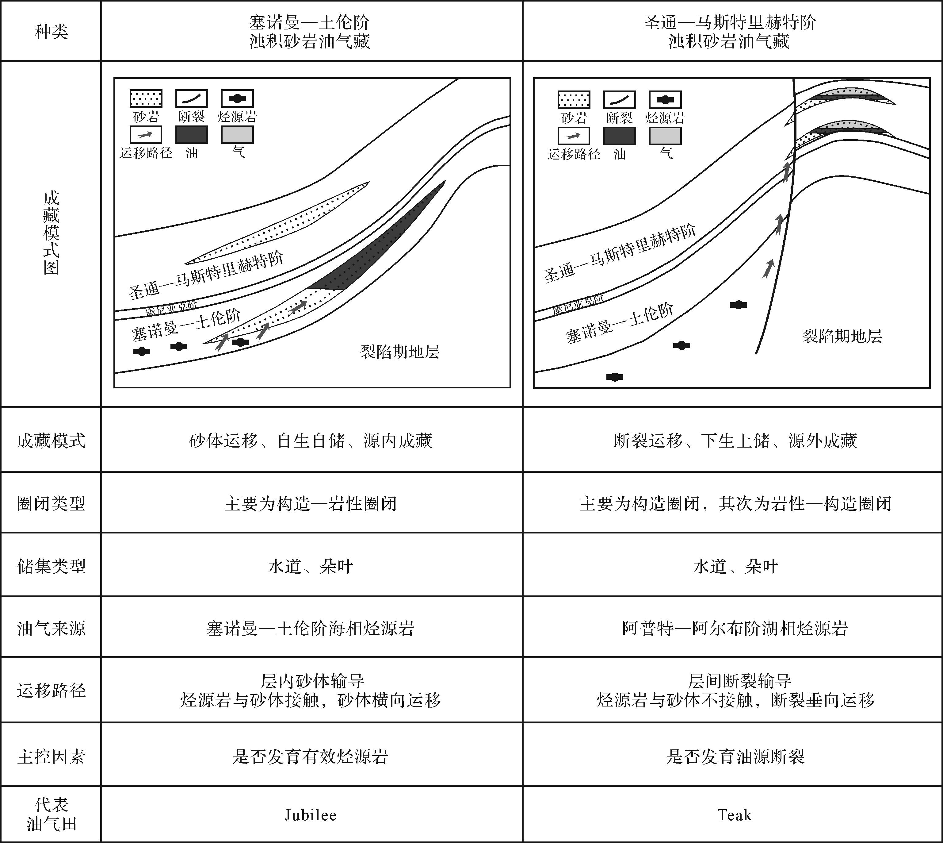
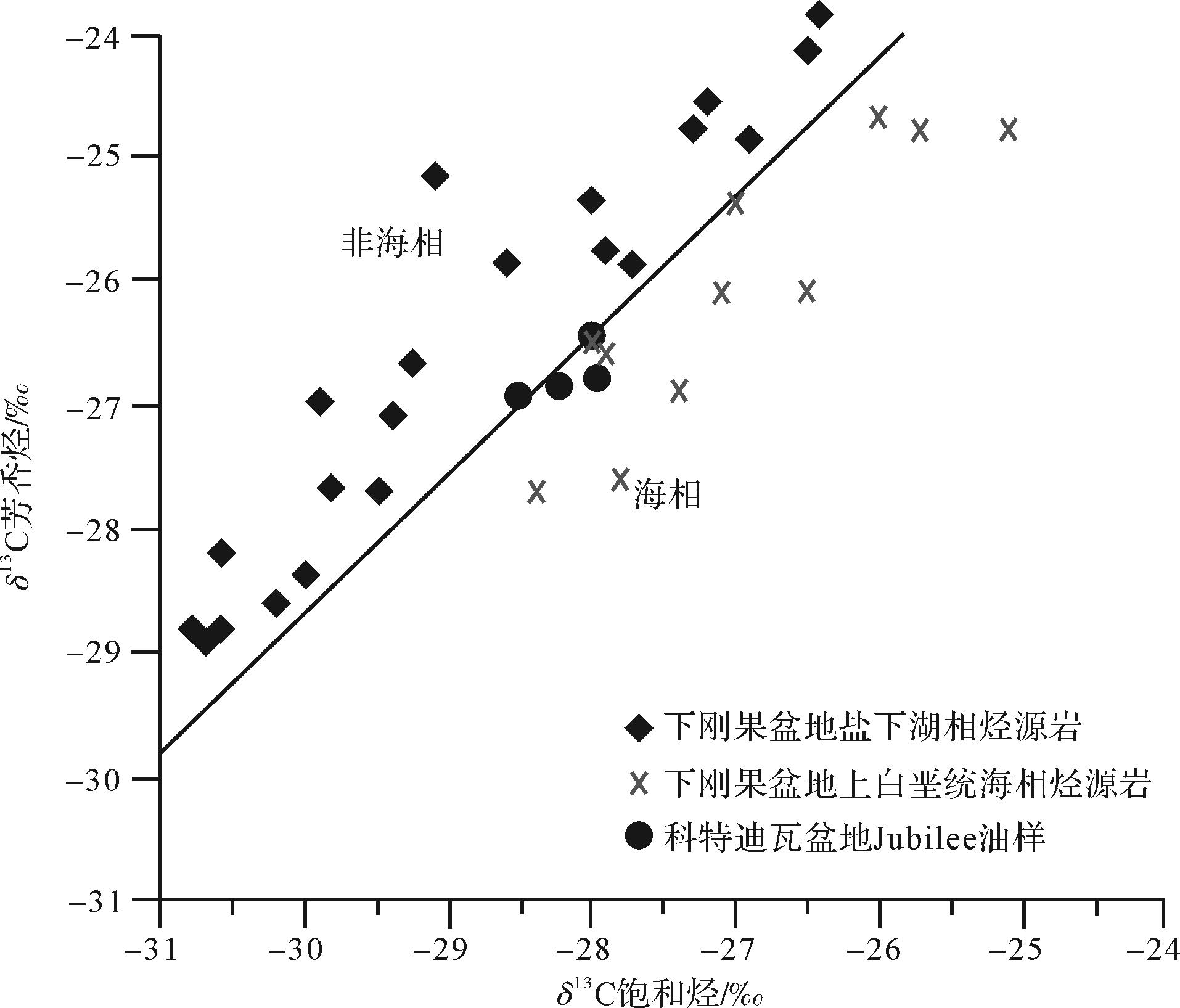
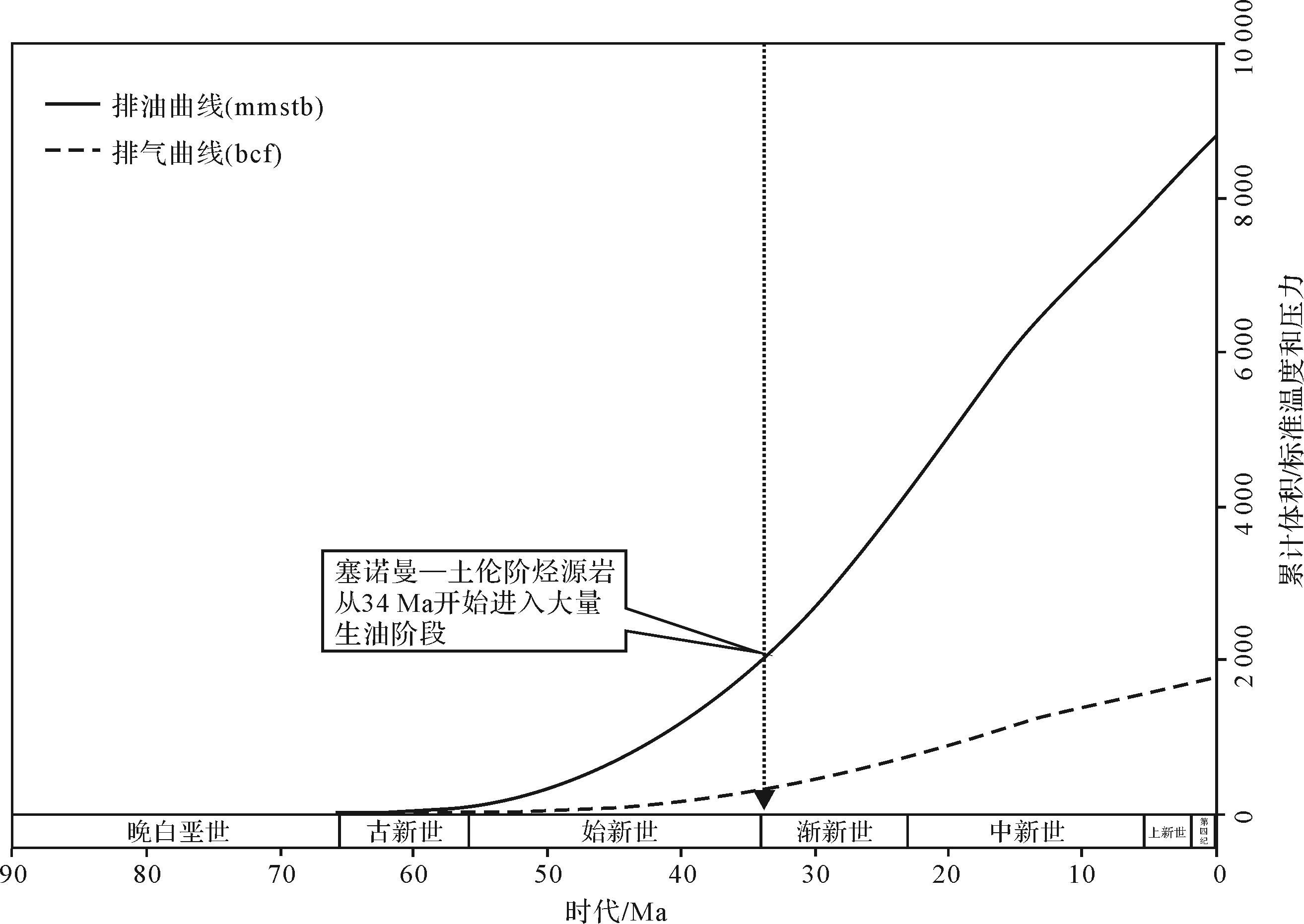
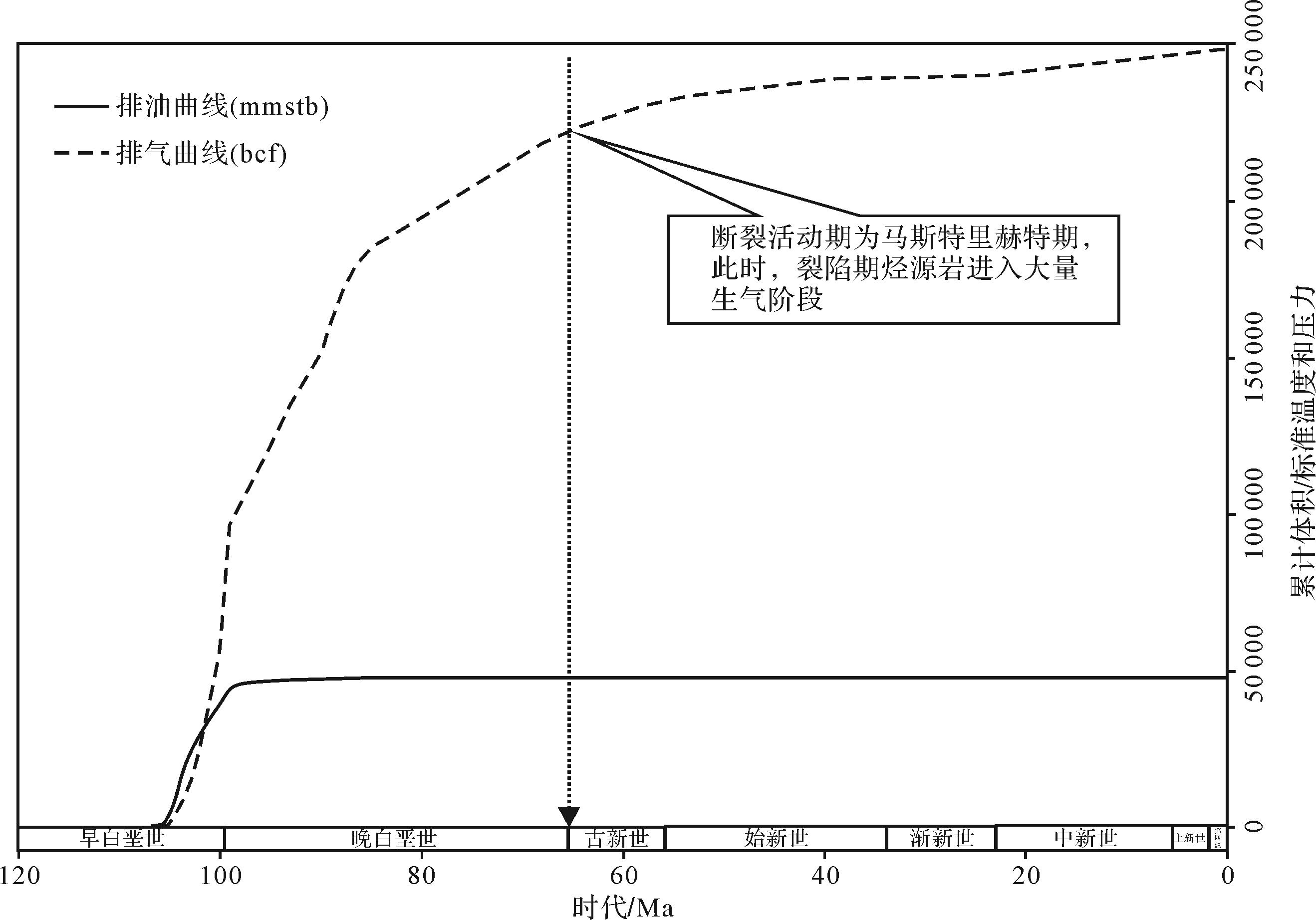
Deep-waterturbidite is the main focusof current world petroleum exploration. Based on seismic data,well data and geochemical data, the difference of hydrocarbon accumulation of deep-water turbidite sandstone in the Côte d’Ivoire Basin was comprehensively analyzed.The research showed that the Côte d’Ivoire Basin developed a rifting period(Lower Cretaceous) and a drift period(Upper Cretaceous⁃present).High-quality marine source rock was developed in the Cenomanian⁃Turonian, and lacustrine source rock was developed in the Aptian⁃Albian. The drift sequence is the main exploration target of the basin. Two types of turbidite sandstone hydrocarbon accumulations were developed.Cenomanian⁃Turonian turbidite sand accumulations were characterized by“migration along sand,self-generation and self-storage, accumulation in source”. The hydrocarbon of the accumulations is mainly sourced from Cenomanian⁃Turonian source rock.The extensively distributed turbidite sand was the hydrocarbon migration pathway.The expulsiontime of the source rock controlled the hydrocarbon accumulation period.Whether mature source rock existed is the main controlling factor for theaccumulation type.Santonian⁃Maastrichtian turbidite sandstone accumulations were characterized by“migration along fault,lower-generation and upper-storage,accumulation out of source”. The hydrocarbons of Santonian⁃Maastrichtian turbidite sandstone accumulations were mainly sourced from Aptian⁃Albian lacustrine source rocks during the rifting period, with faults beingthe main pathway of hydrocarbon migration. The active period of faults controlled the migration and accumulation time of oil and gas. Whether faults existed is the main controlling factor for this type of accumulation.

2022, 40(1): 255-266.
doi: 10.14027/j.issn.1000-0550.2020.069
Abstract:
Wave-controlled deltas are important reservoir types and are potential exploration targets in marine and land interaction deposition. At present, few studies have been reported in the industry regarding microfacies division, sedimentary mechanisms or modeling. Taking N Block in Pakistan as an example, sedimentary facies division and models of marine delta affected by wave flow were studied based on core logging, seismic and test data. In the Cretaceous, N Block had a high-energy coastal zone in which the delta estuary was damaged, transformed and redistributed by strong wave action, coastal currents and storm waves, forming the sedimentary wave-controlled delta. It is represented by a circum-shoreline bar extending from the delta plain to the ocean. Its framework is clearly different from usual delta facies. Underwater distributary channels and mouth bar microfacies have not been developed in the proximal delta front, and a composite sandy beach was formed on both sides of the estuary, with thick layers of pure sandstone parallel to the coastline distributed contiguously over large areas and with wide-extension scale sedimentary characteristics, which is the skeletal sandbody. The distal delta front is always washed and disturbed by waves, forming flat interbedded sheets of sand and mud. In plan, it presents a large area with a lobe shape towards the sea. Vertically, a reverse cycle of upward coarsening was formed. The sedimentary sequence is incomplete, and shows destructive characteristics. Finally, the sedimentary model of a wave-controlled delta in an sample area is summarized, providing a basis for detailed evaluation of sedimentary delta reservoirs.
2022, 40(1): 267-280.
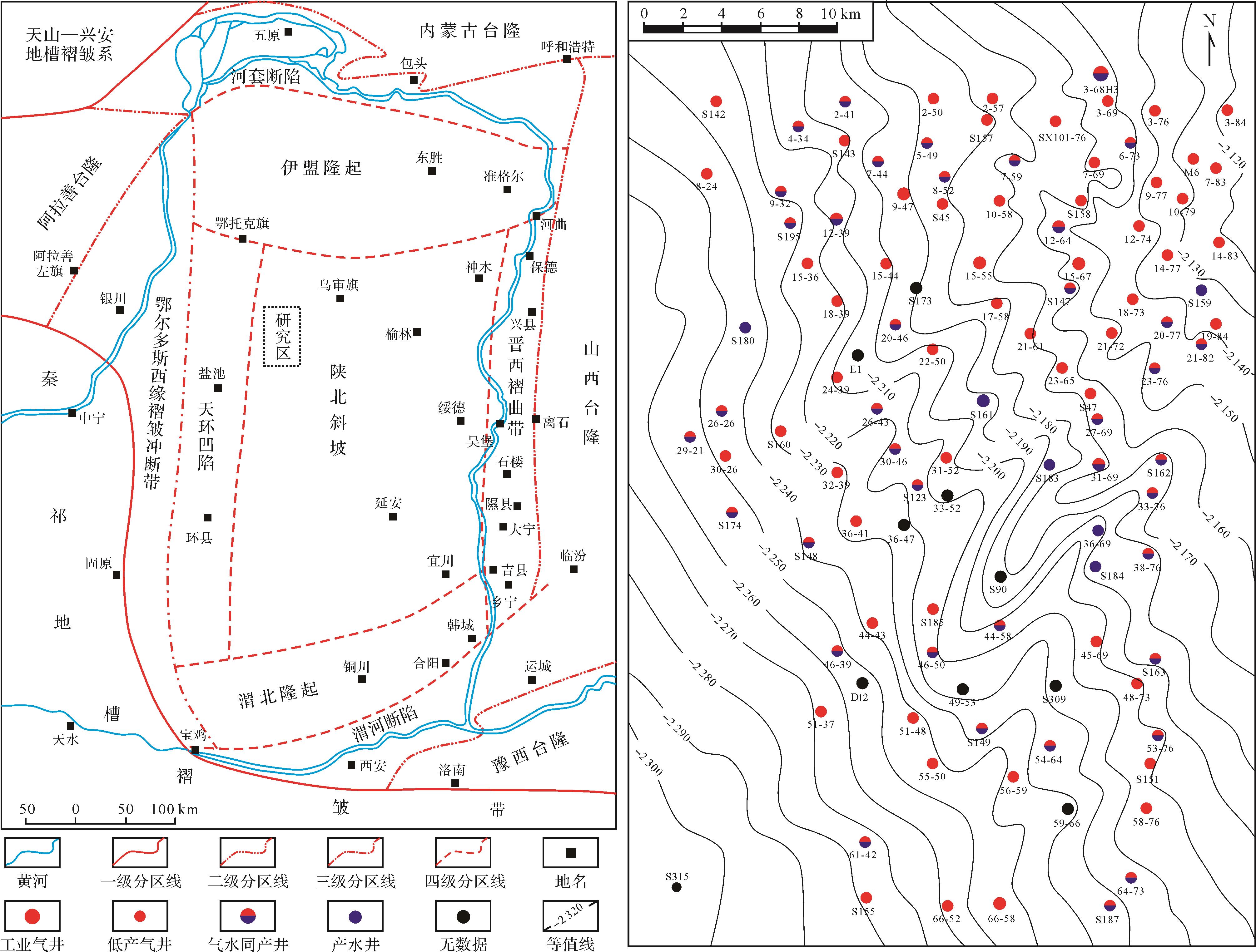
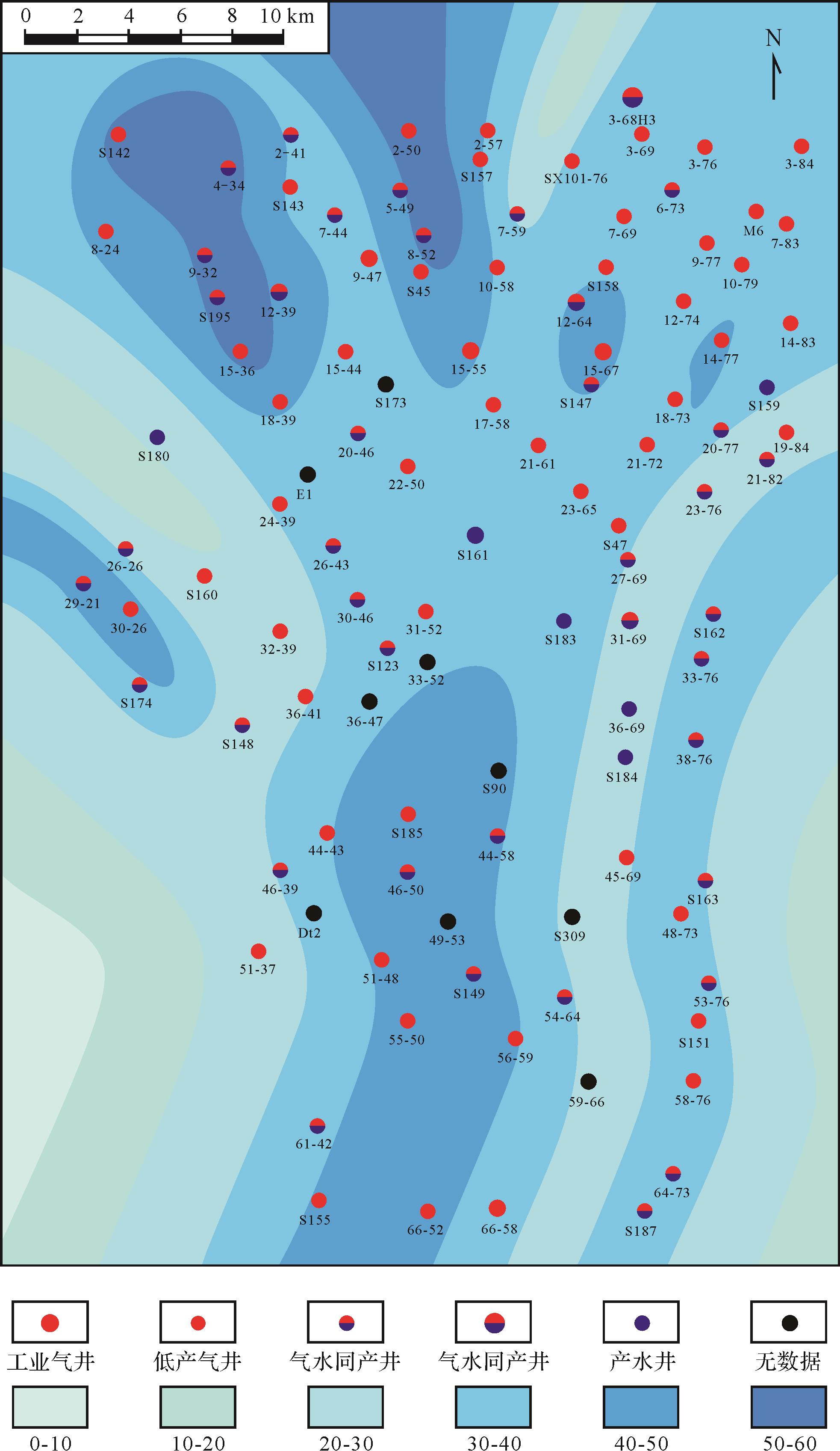
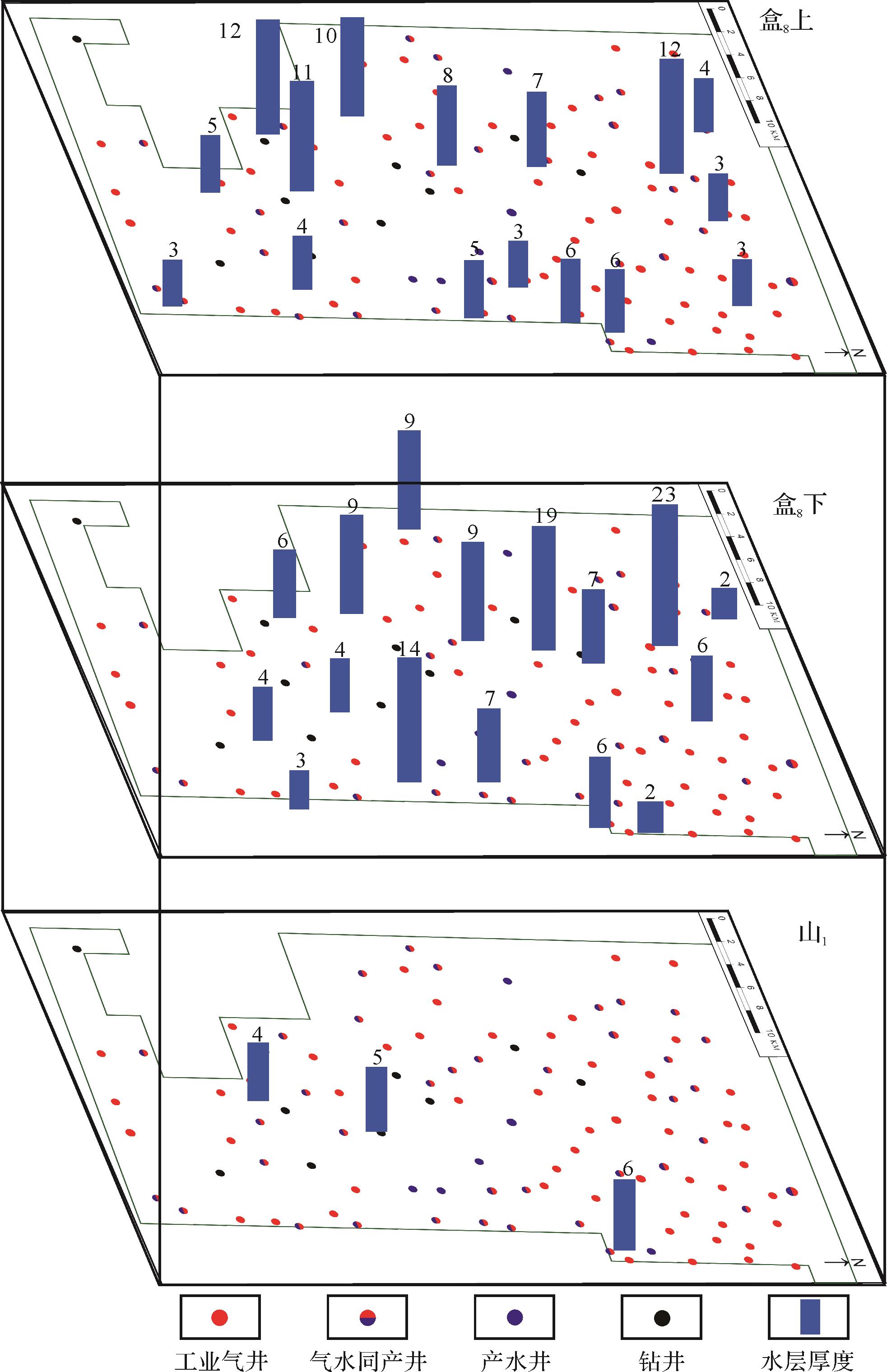
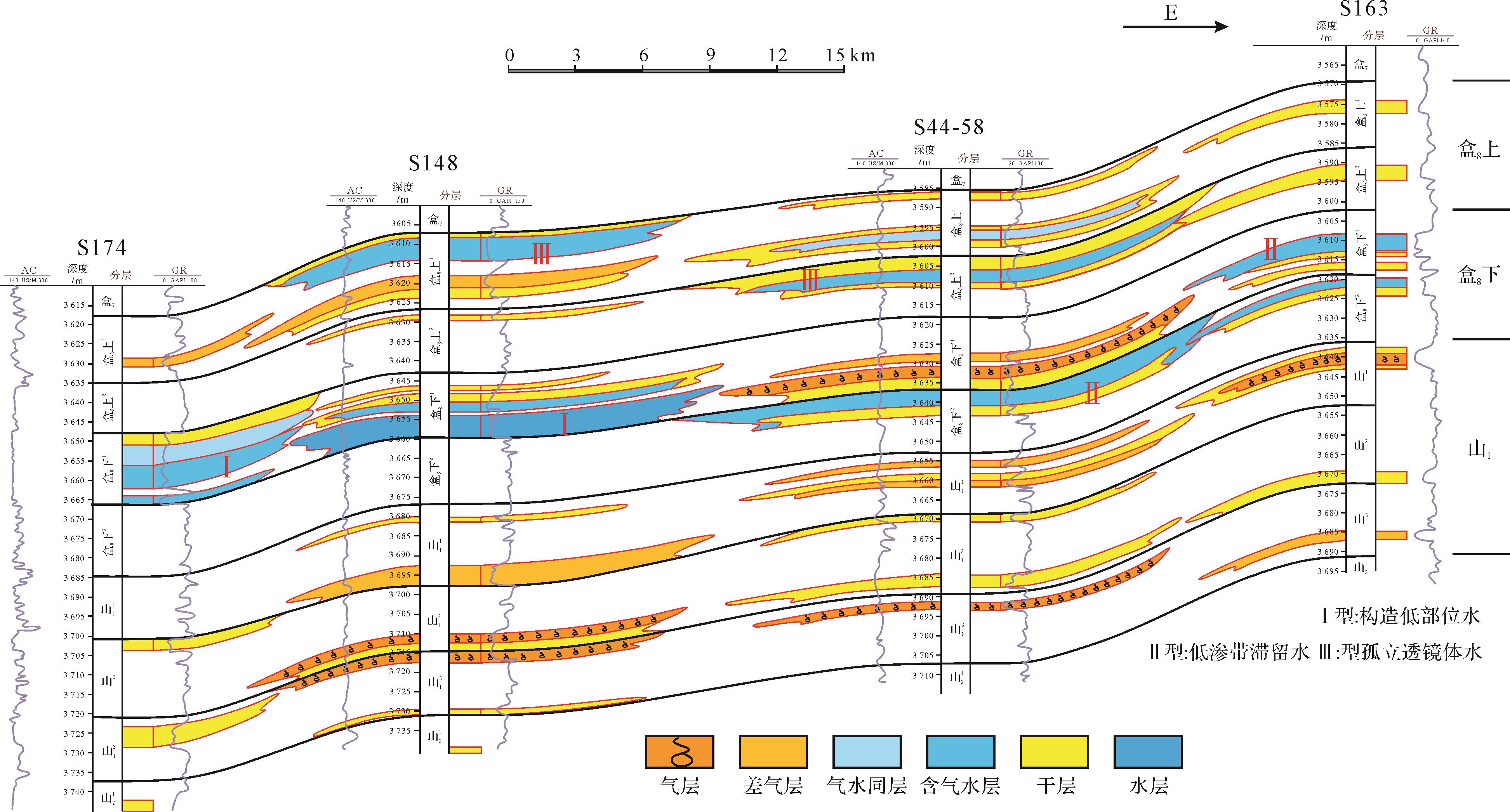
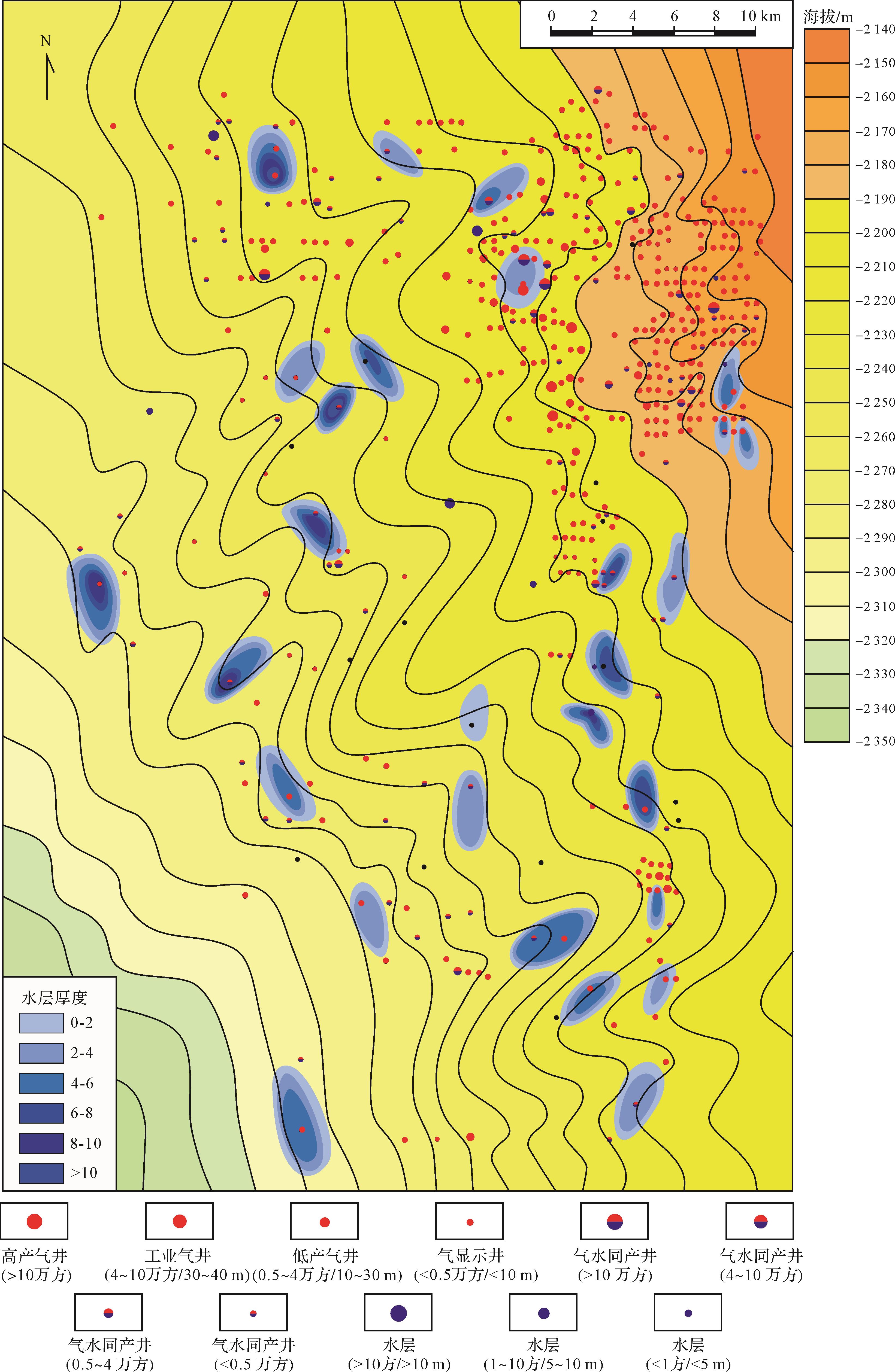
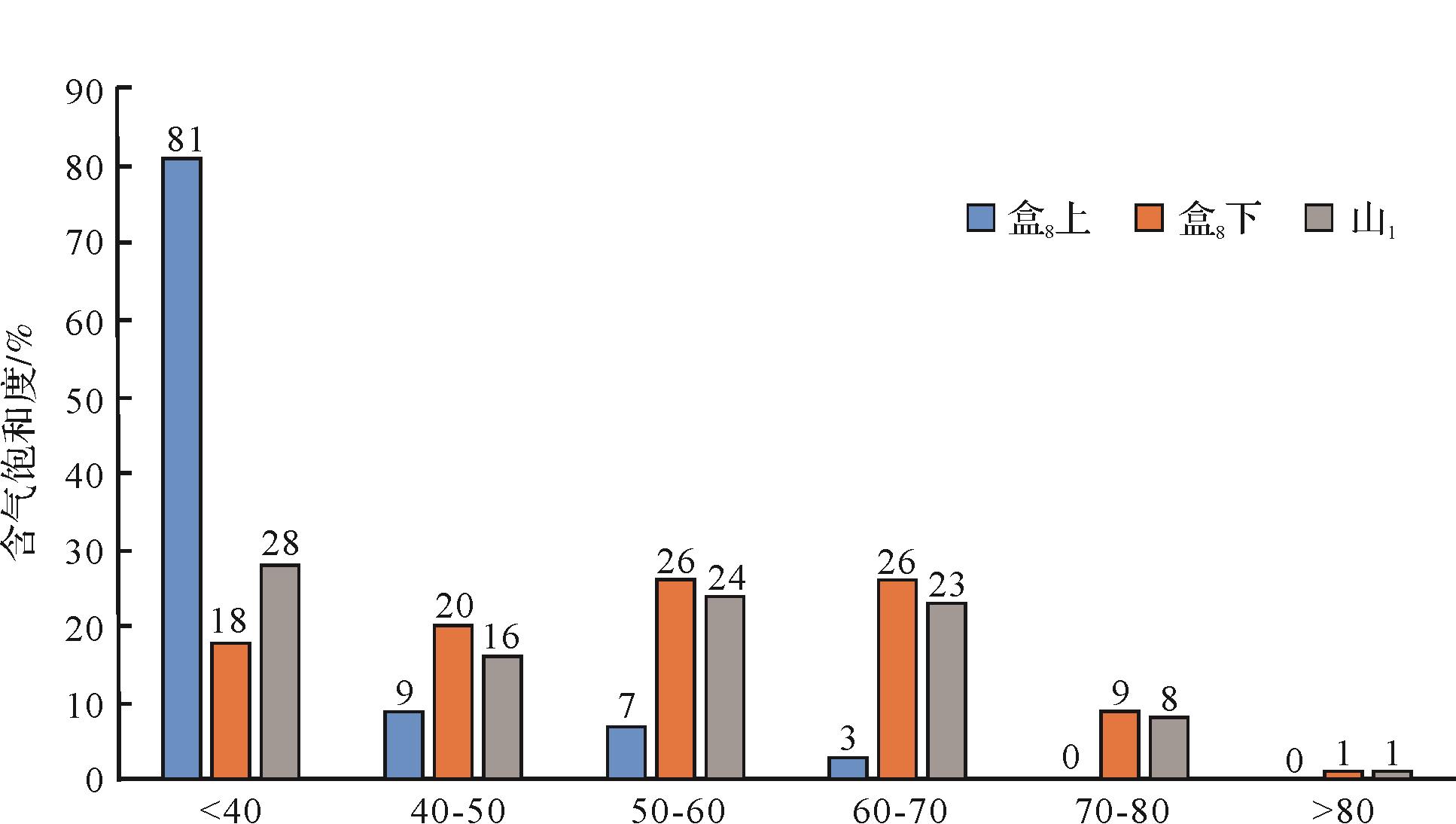
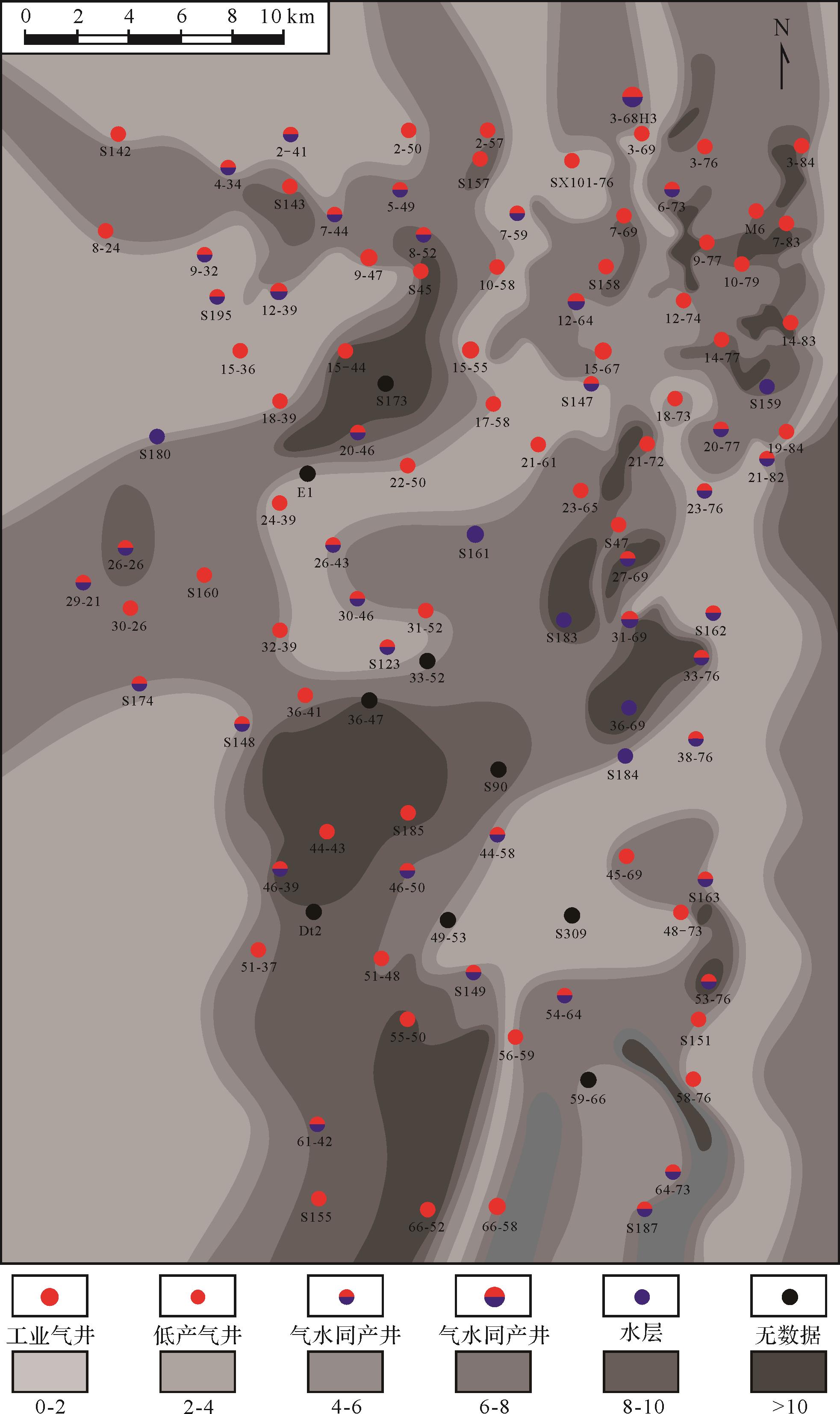
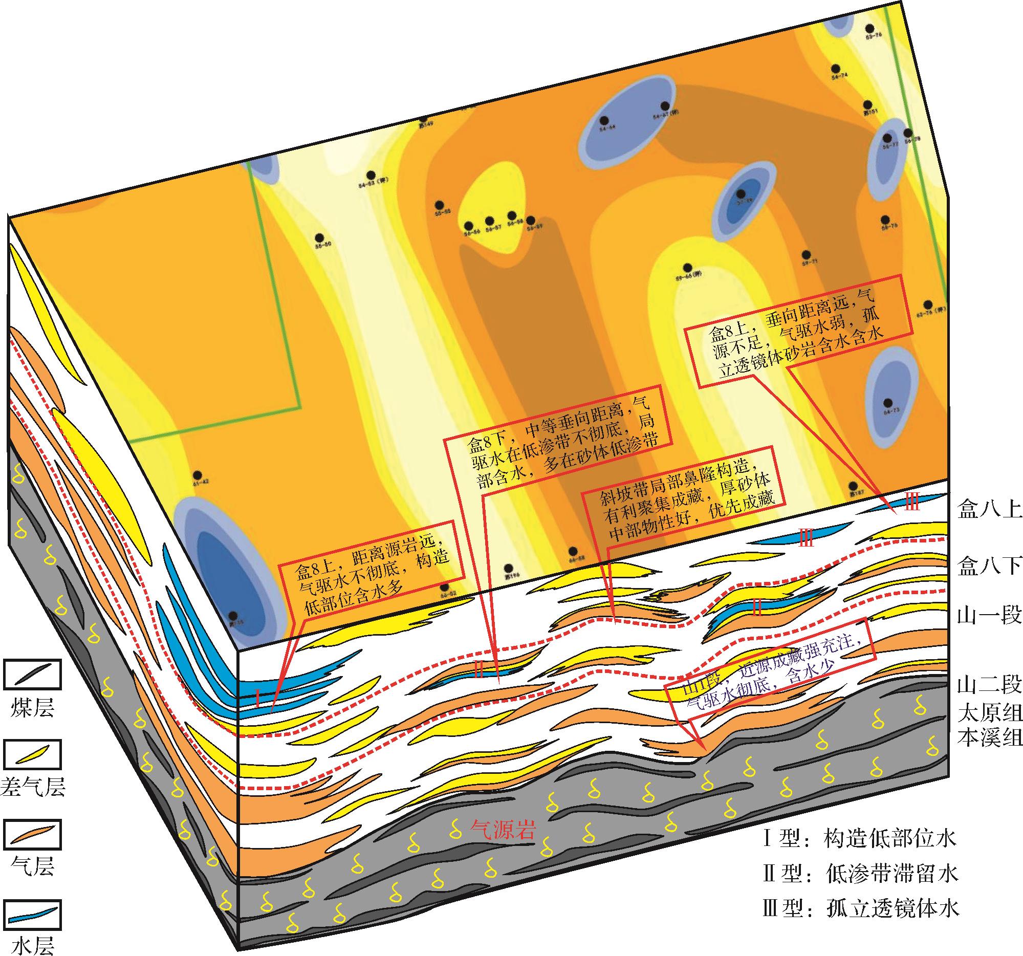
doi: 10.14027/j.issn.1000-0550.2020.079
Abstract:
Severe water production of gas wells in the western Sulige gas field restricts the development of gas production from the dense sandstone in this area. The unclear nature of the origin, distribution and behavior of the groundwater have been a a key scientific problem. In this study, the stratigraphic water properties and geochemical characteristics were analyzed from a large amount of logging data and the collection of dynamic production data. The results show that (1) the stratigraphic water is highly saline at the level of brine, as a whole; (2) the water is mainly CaCl2 type; and (3) its pH is weakly acid. The following conclusions were drawn from the study. (1) The stratigraphic water stems mainly from a buried metamorphic source, and the good state of its preservation in the groundwater is also beneficial for the preservation of natural gas. (2) The spatial distribution of the stratigraphic water is consistent with that of the lower gas (S1 sub-member) and upper water (H8u sub-member) and east gas⁃west water. (3) In the study area, the water is mainly of three types: low-structure water (type I), low permeability zone retention water (type II) and isolated lens water (type III). (4) The lower part of the western structure contains mostly type I water; the H8l sub-member, the edge of the sand body and the gently sloping zone form the low-permeability zone that retains type II water; and the H8u sub-member and the highest part of the eastern zone of the study area contain mostly type III isolated lenses of water. (5) Gas in the dense sandstone of the western Sulige gas field has the characteristics of near-source reservoir formation; and (6) the main factors controlling the gas⁃water distribution include the hydrocarbon supply potential of the gas source rocks, the physical properties of the reservoir, the vertical migration distance, and its tectonic location, among other factors. These findings, which have clarified the origin of the groundwater, its distribution and controlling factors, and have established the gas⁃water distribution and natural gas accumulation mode, can be used to guide water-avoidance in the gas field.