2021 Vol. 39, No. 3
Display Method:
2021, 39(3): 515-524.
doi: 10.14027/j.issn.1000-0550.2020.109
Abstract:
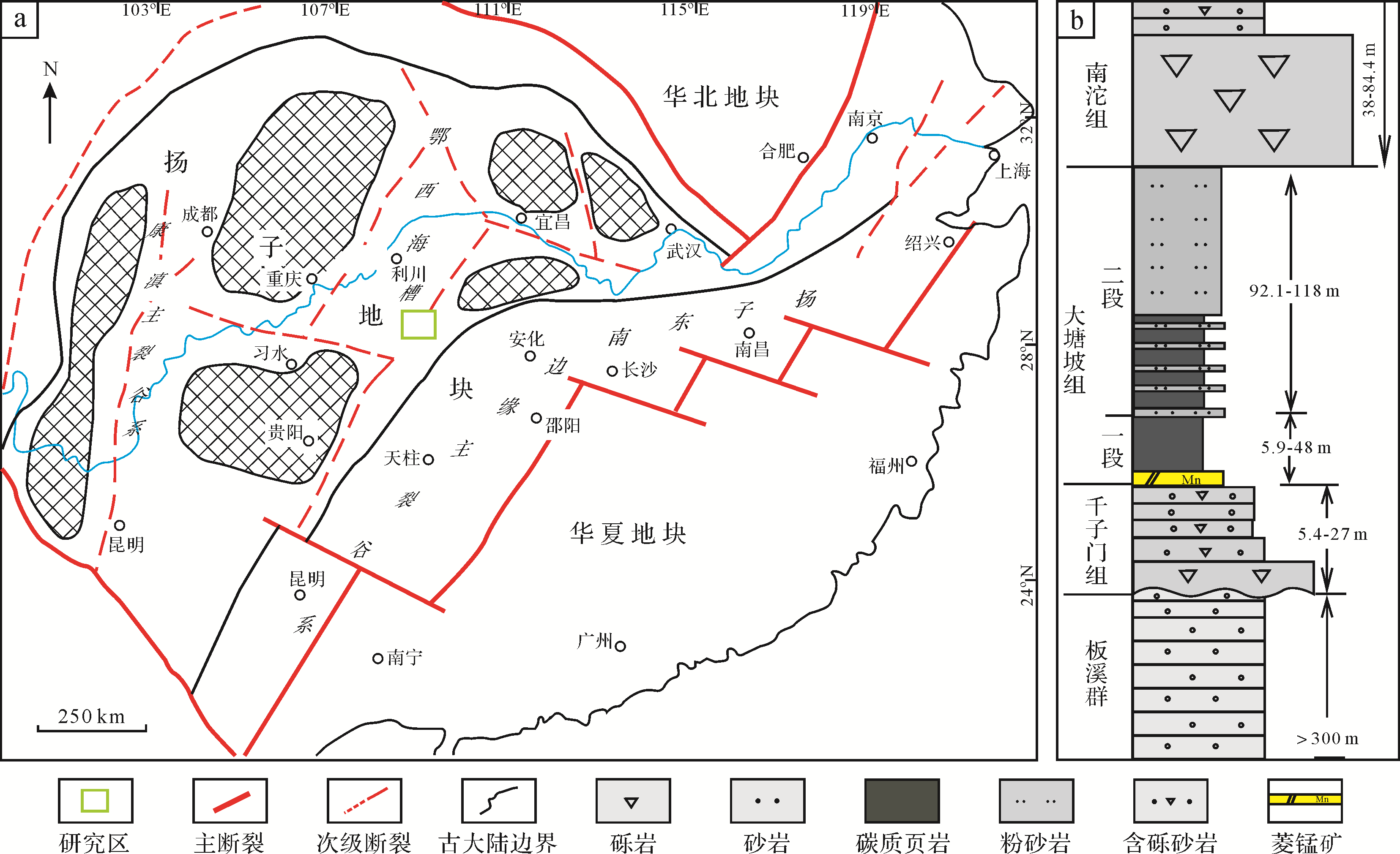
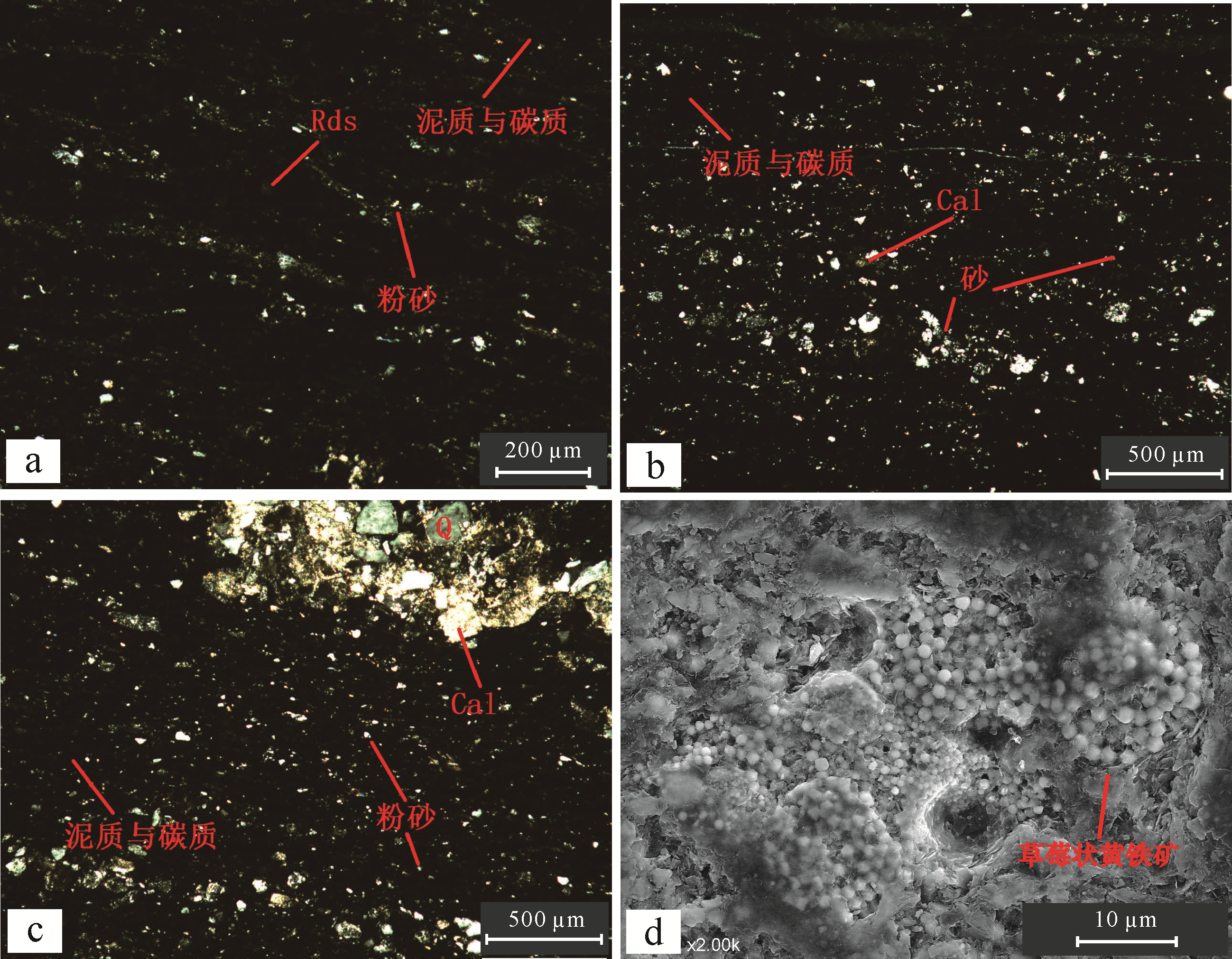
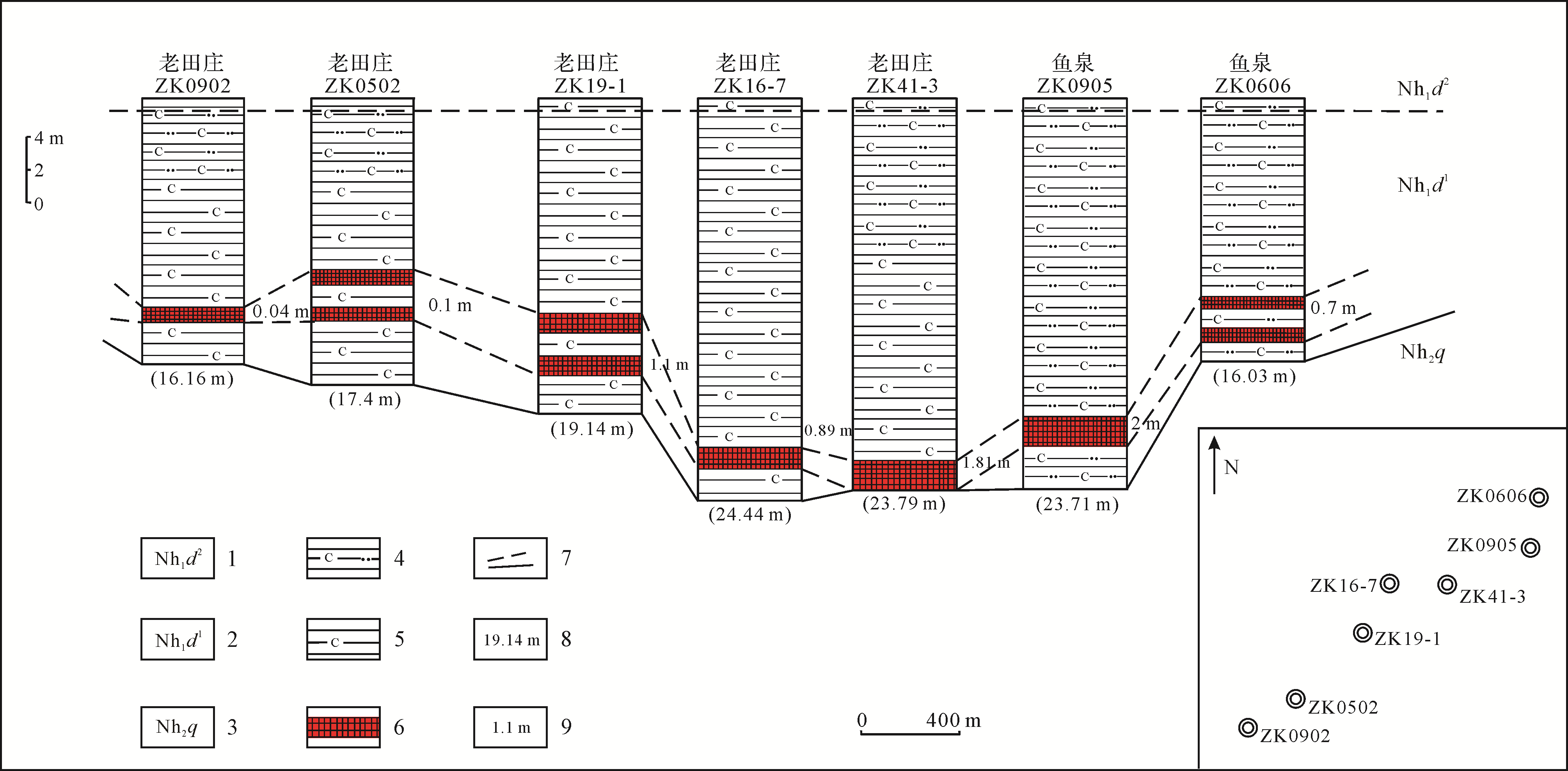
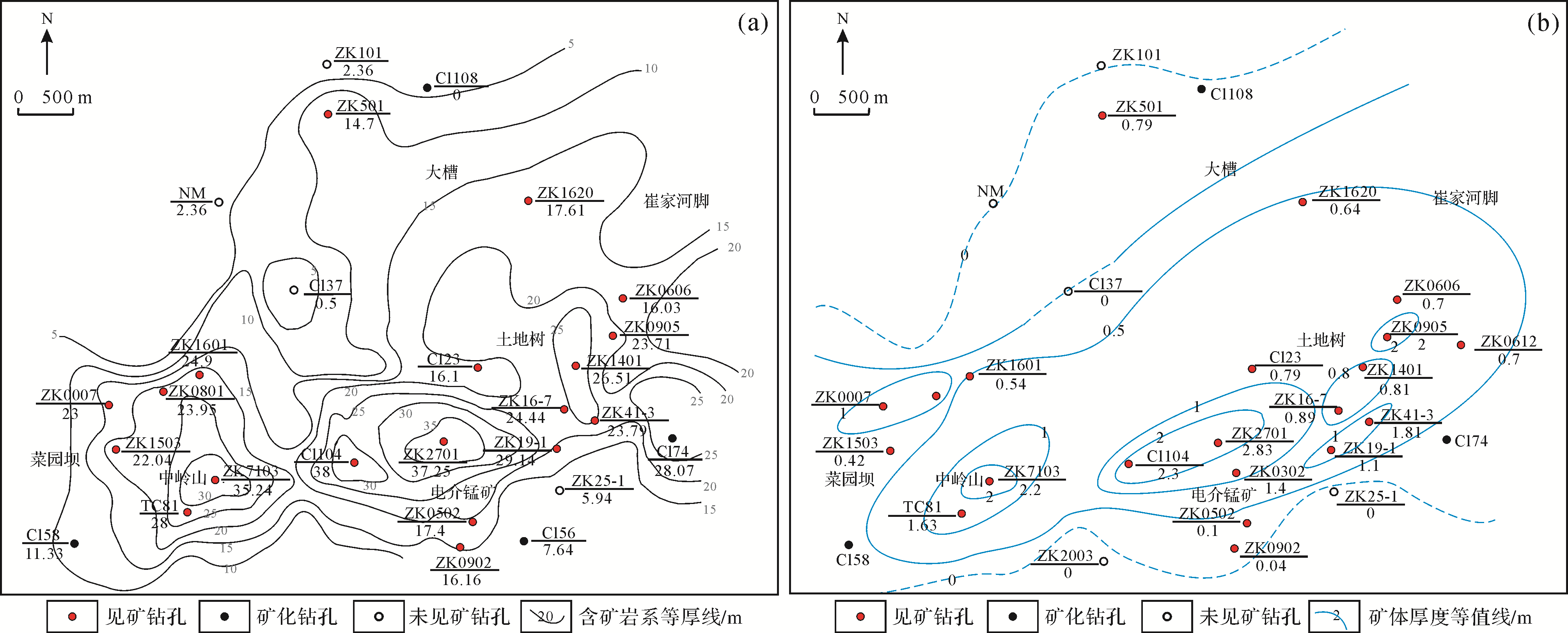
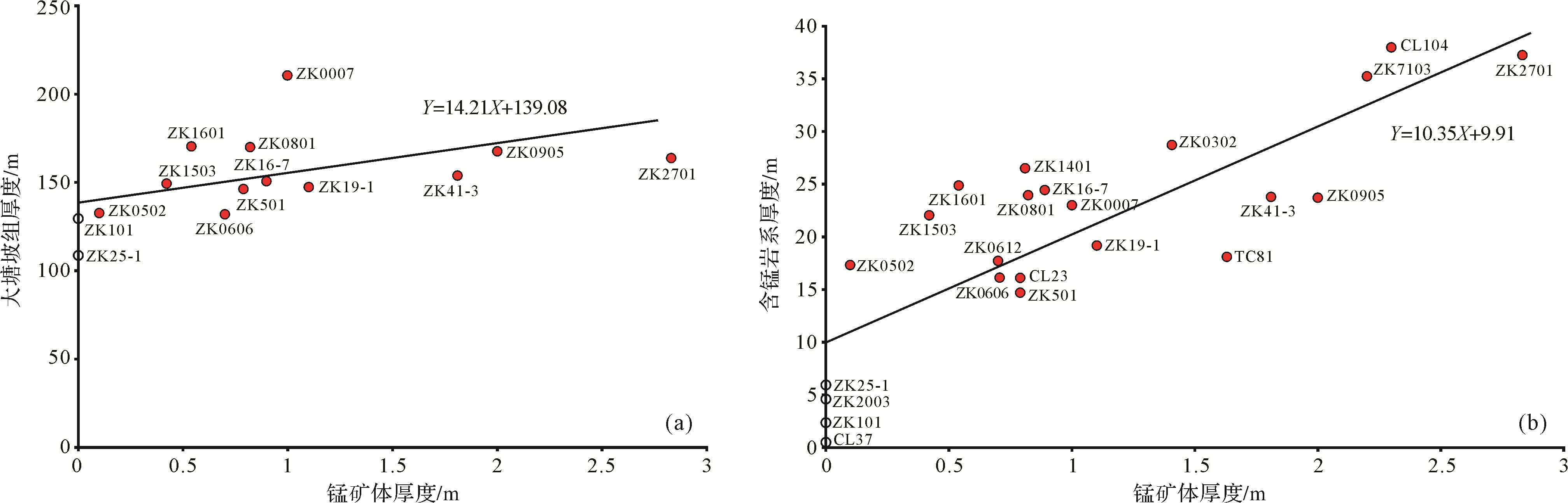
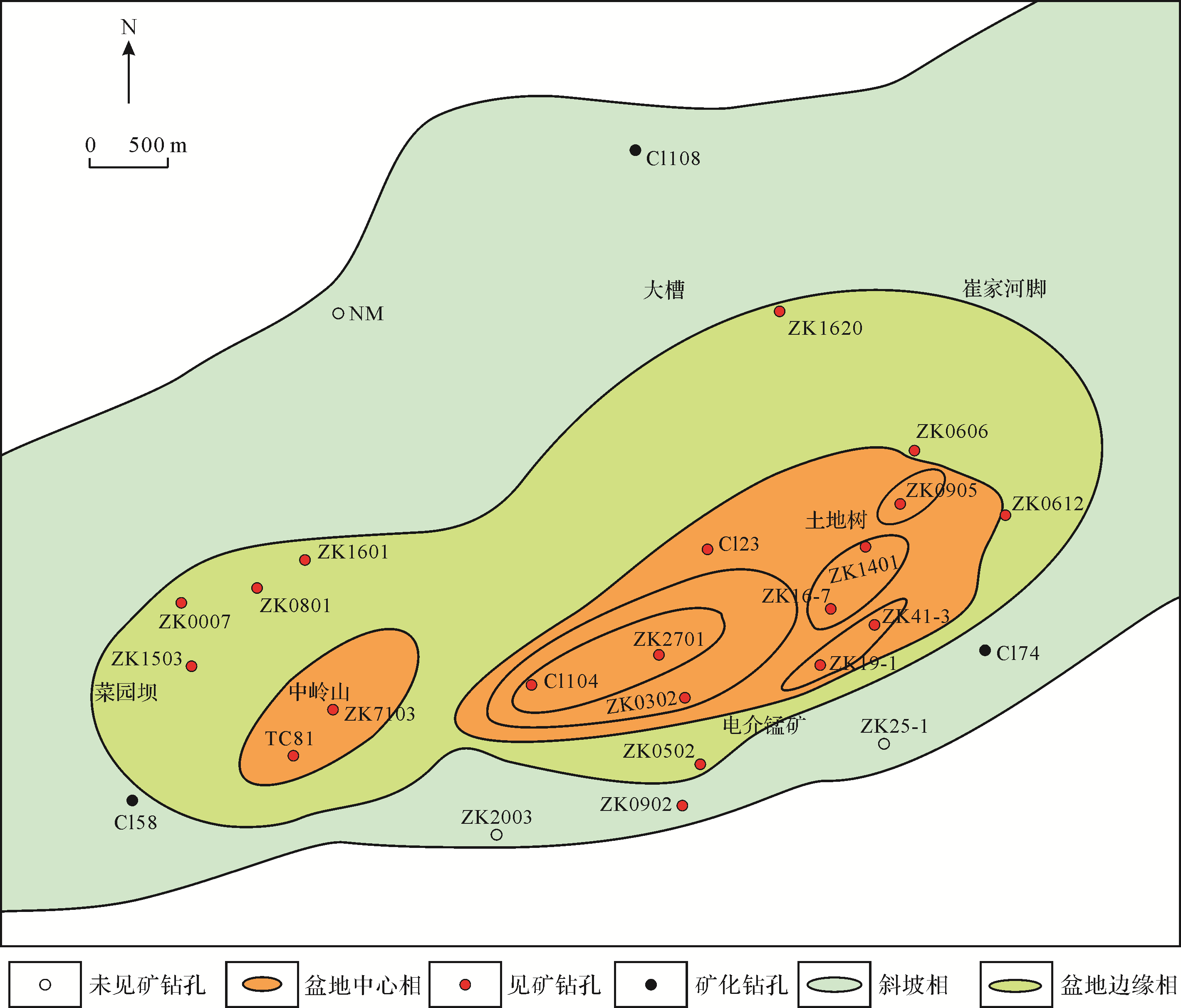
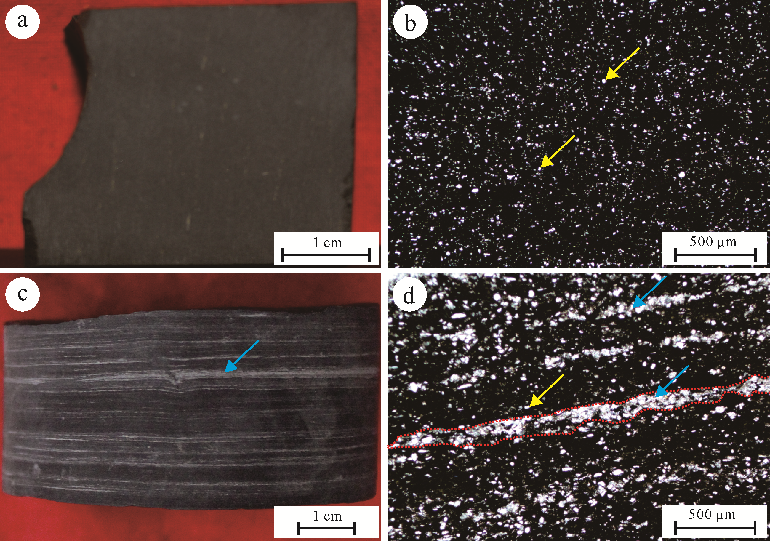
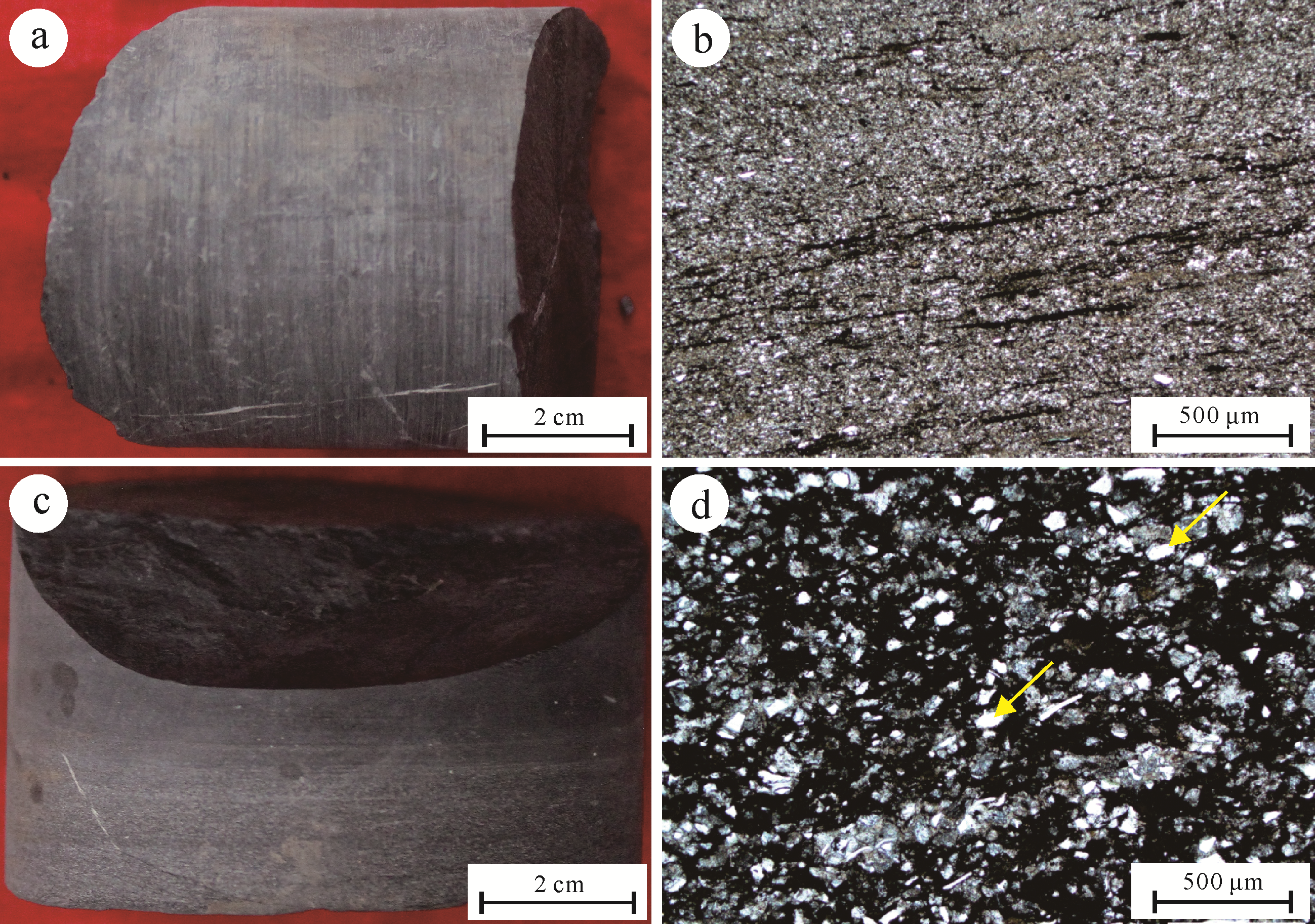
Based on the systematic analysis of a large number of borehole data in the Xiaochayuan manganese mining area in Xiushan, Chongqing, field geological surveys, laboratory sedimentology, and geochemical analysis have shown that the sediment thickness of the central facies of the basin is large, with TOC, U, Mo, V, δ34Spy is high, and the content of framboidal pyrite is high, indicating anoxic water conditions, and the grade and thickness of manganese ore are large. Toward the basin edge and slope facies, the thickness of the sediments decreases, and the content of TOC, U, Mo, V, and δ34Spy decreases, indicating that the degree of hypoxia in the water body is weakened, and the grade and thickness of manganese ore decrease. The change of manganese ore body thickness is consistent with that of manganese-bearing rock series, and they have a positive correlation. The distribution direction of the ore bodies in the Xiaochayuan mining area is basically the same as the long axis direction of the Xiaochayuan secondary graben basin, which is about 60° northeast. Therefore, the output of manganese deposits in Xiaochayuan mining area is controlled by secondary graben basins and sedimentary facies belts. The hypoxic basin central facies is the best mineralization, followed by the basin edge facies, and the slope facies mineralization is poor.

2021, 39(3): 525-539.
doi: 10.14027/j.issn.1000-0550.2020.073
Abstract:
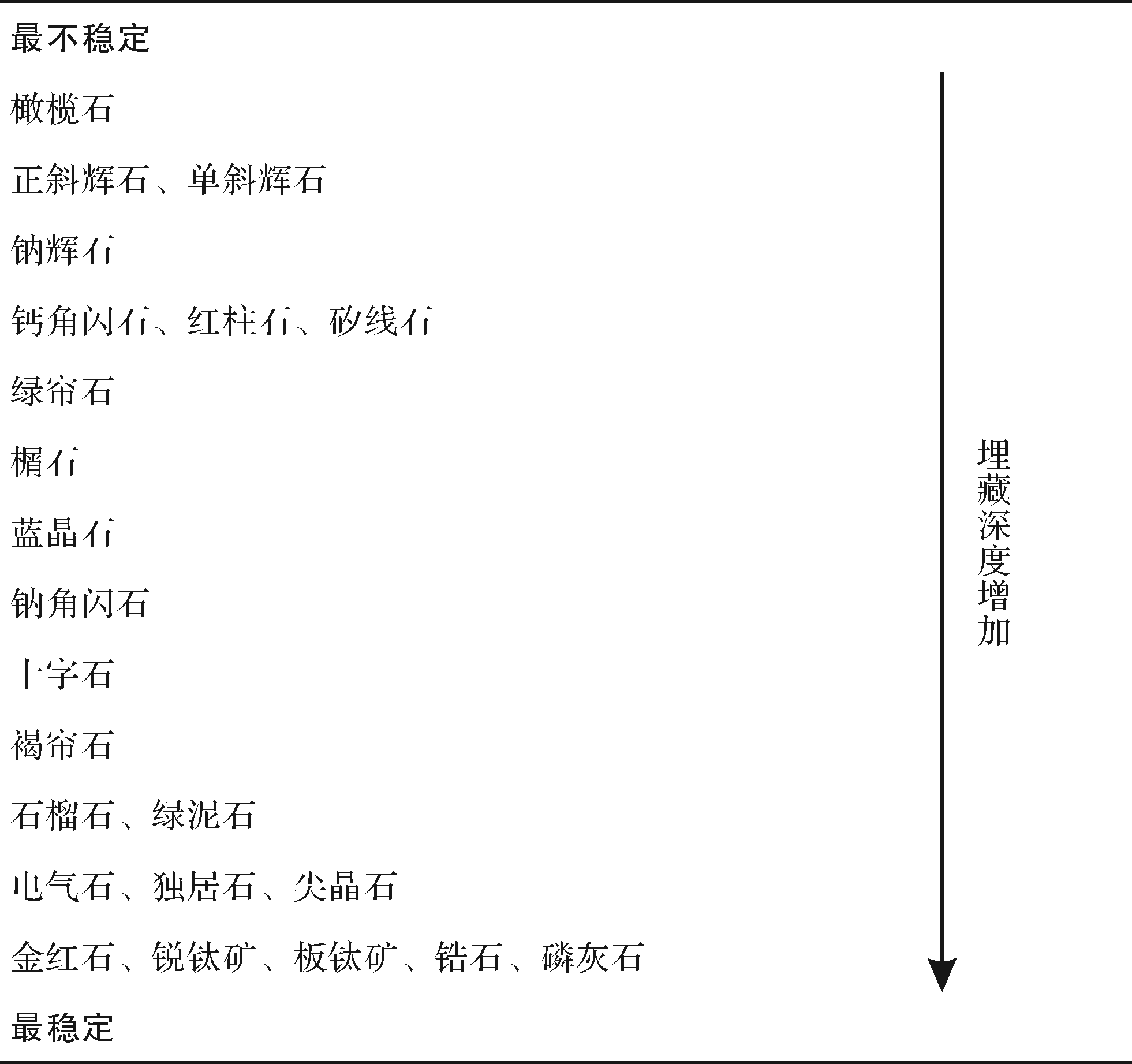
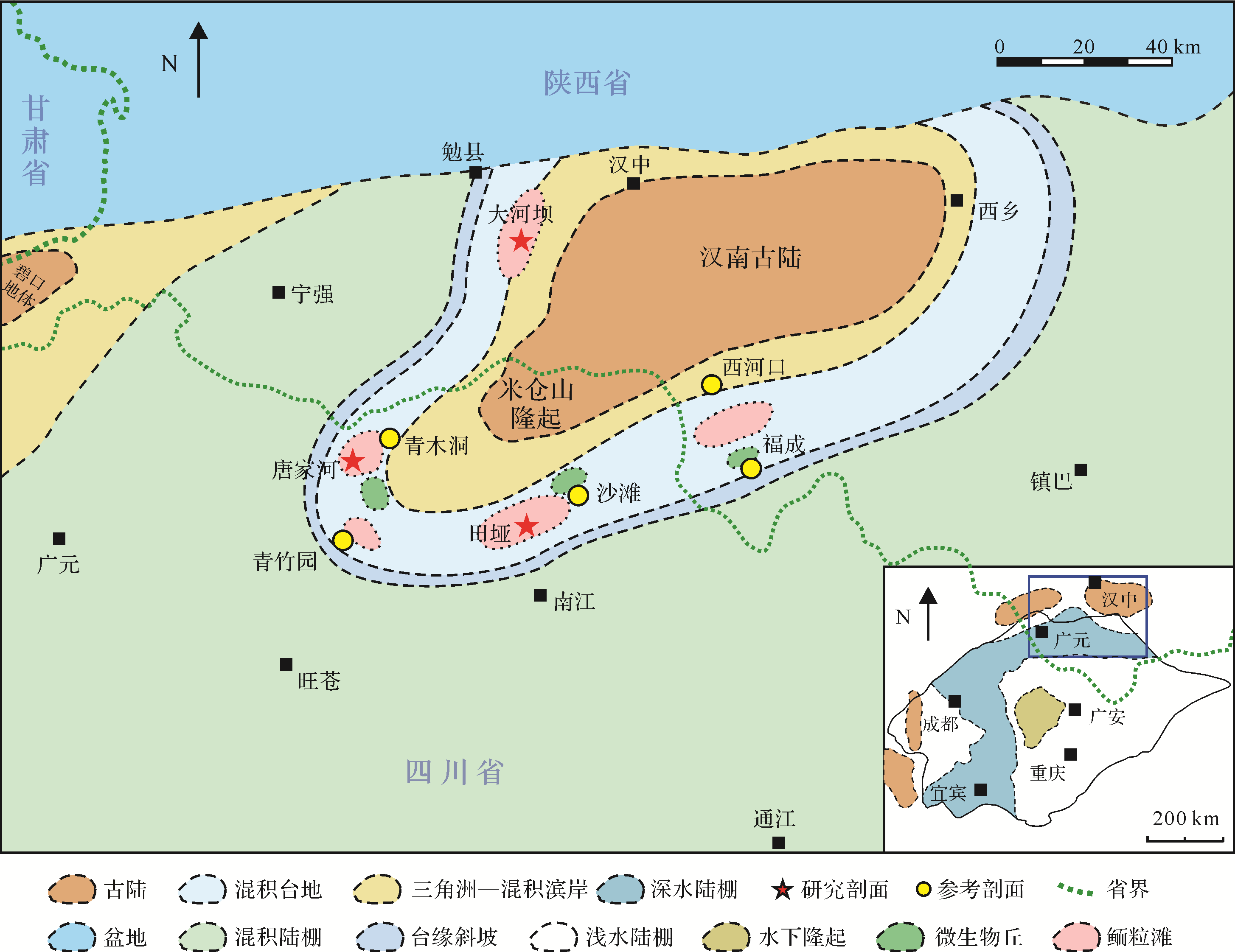
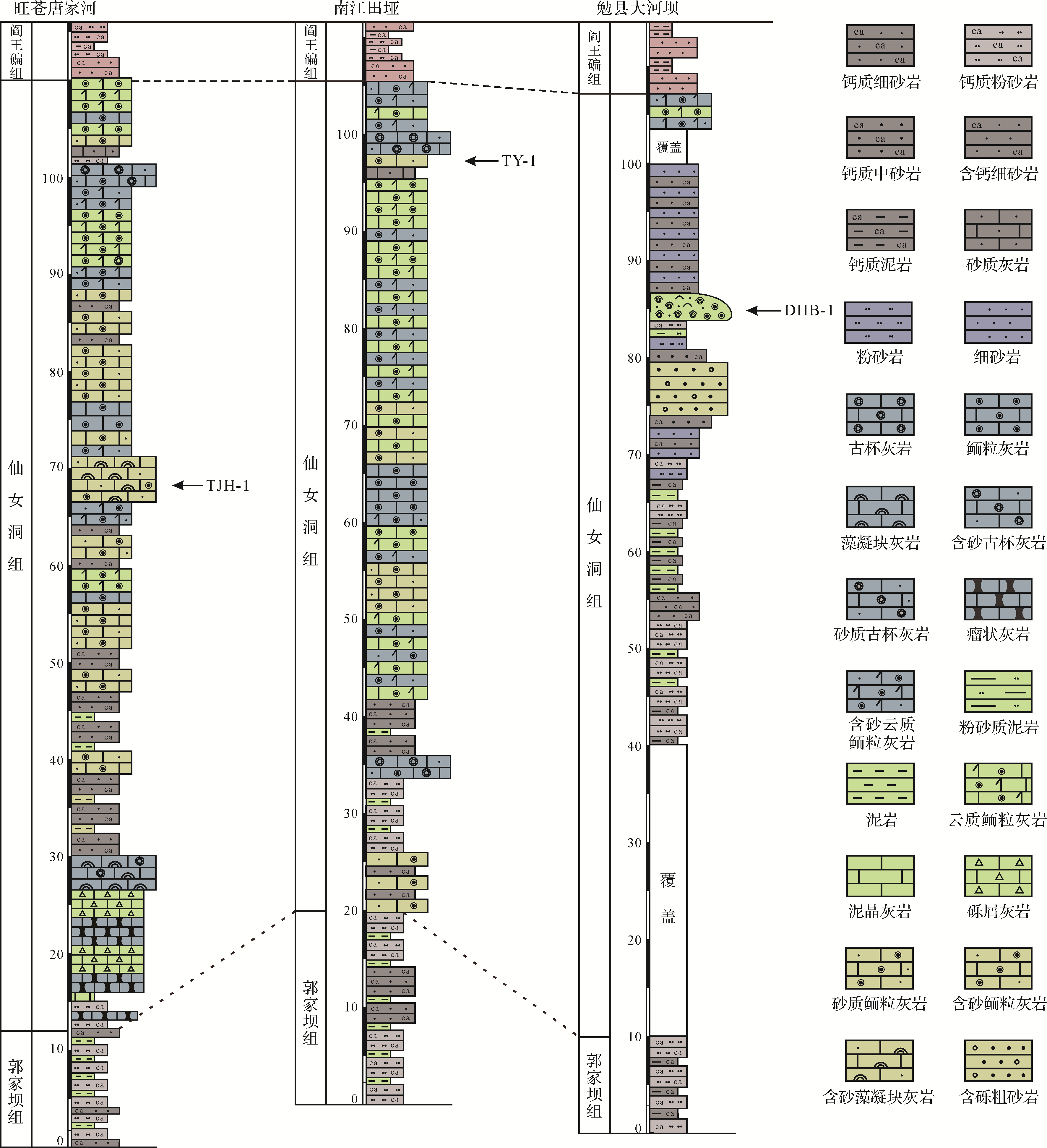
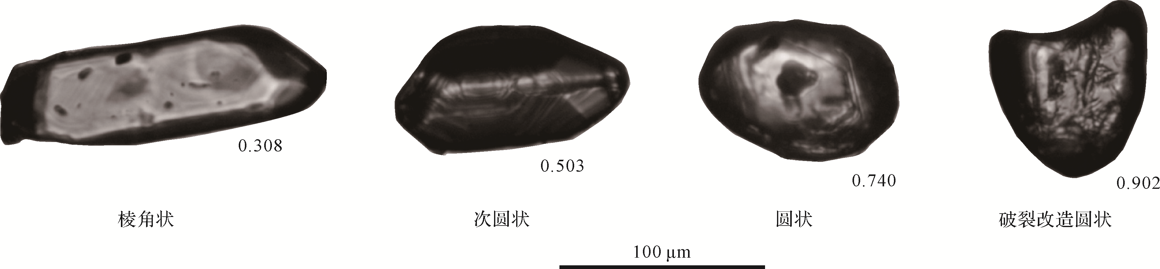
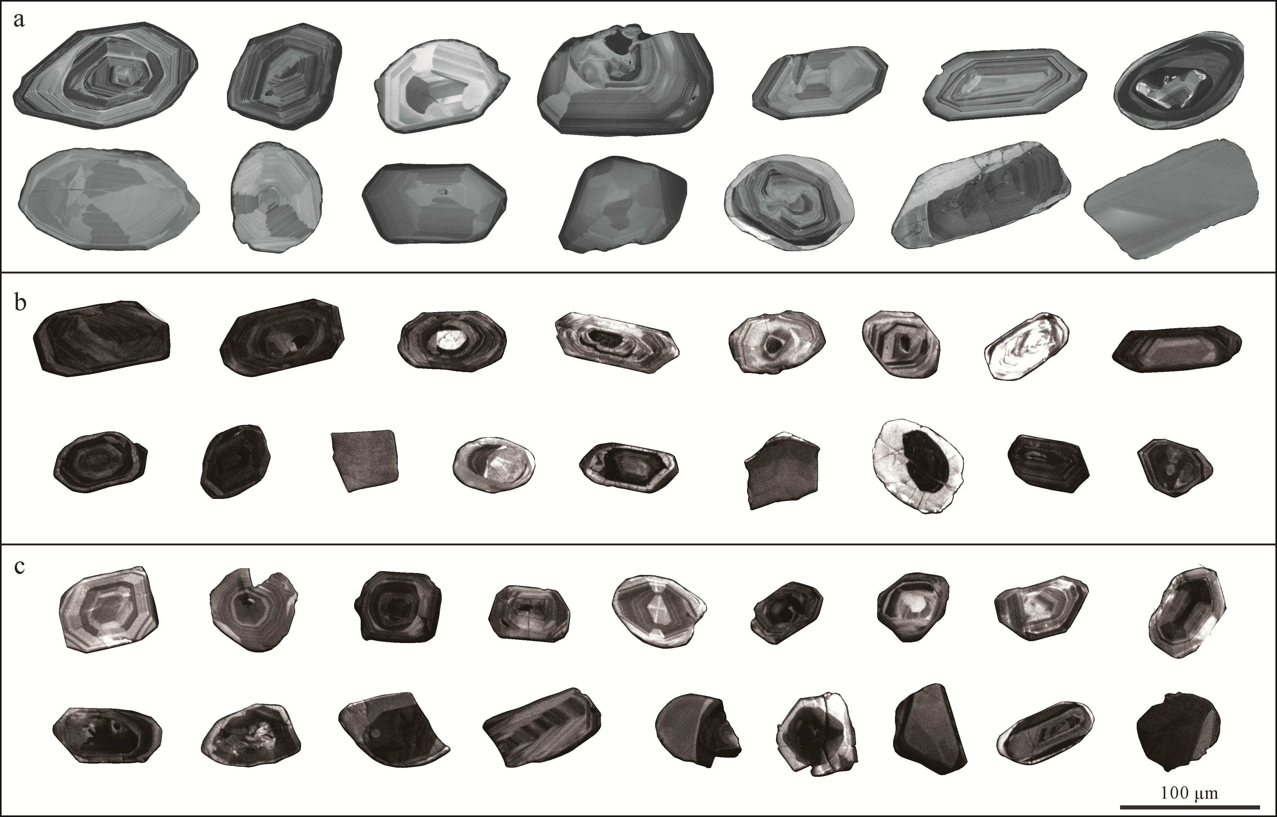
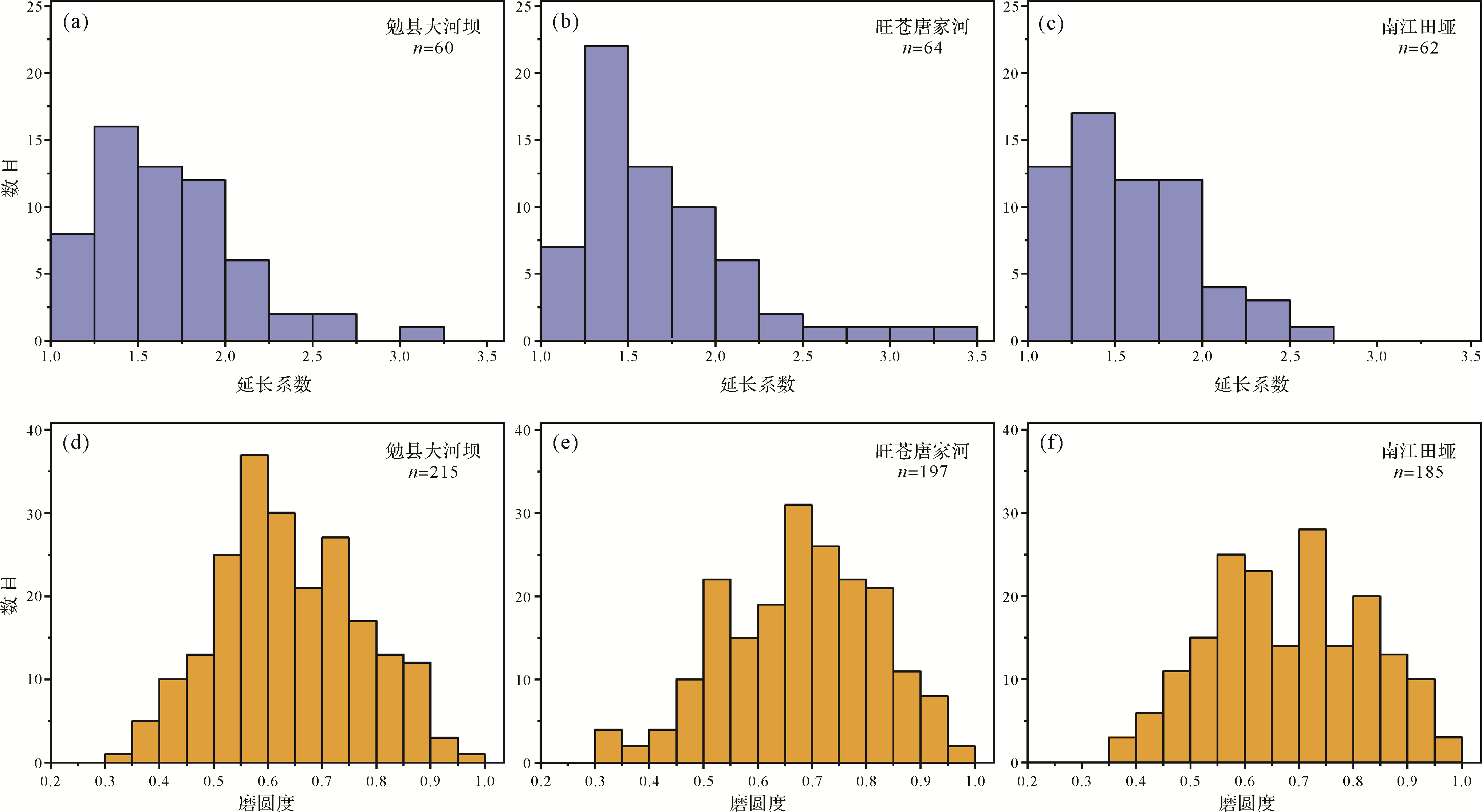
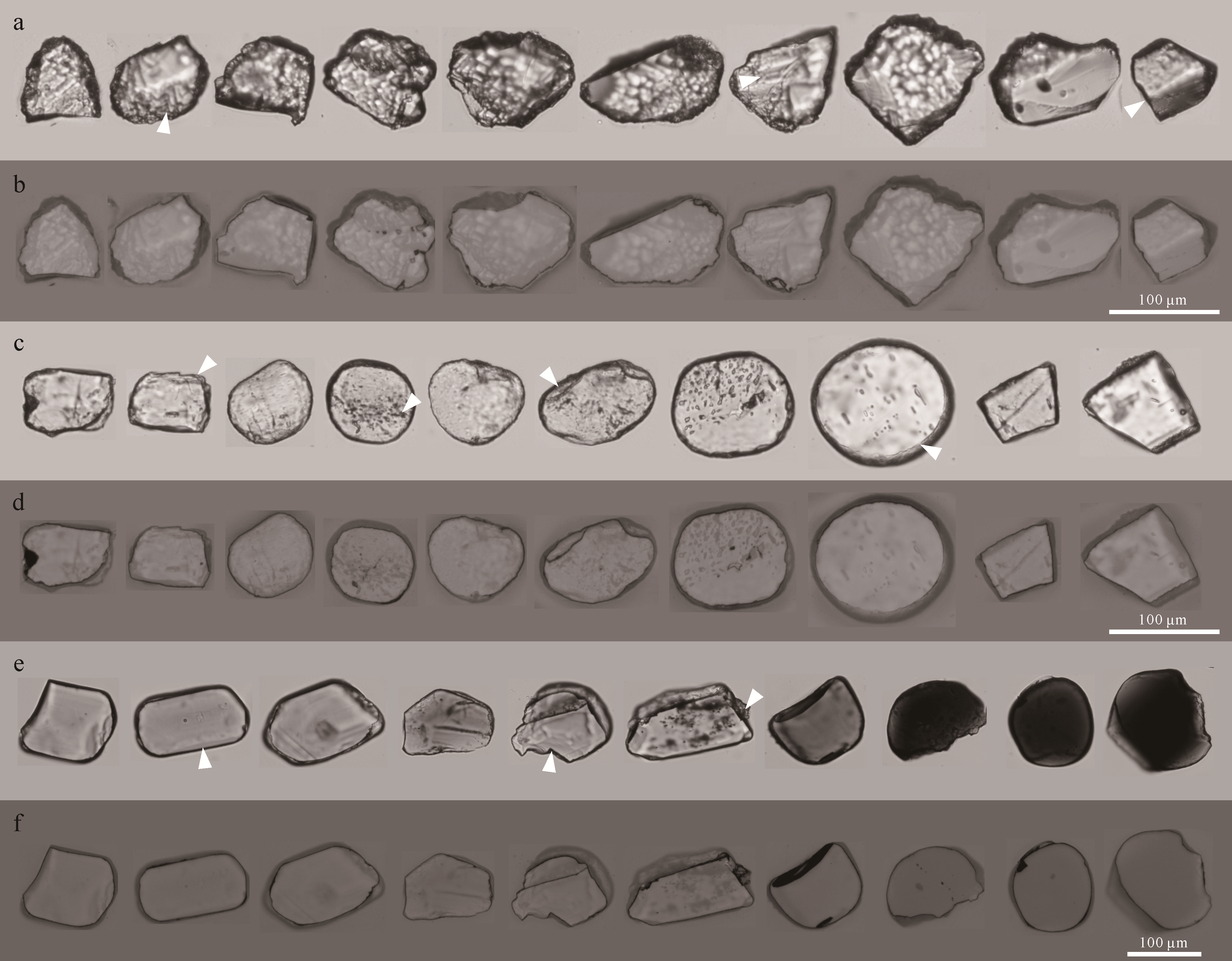
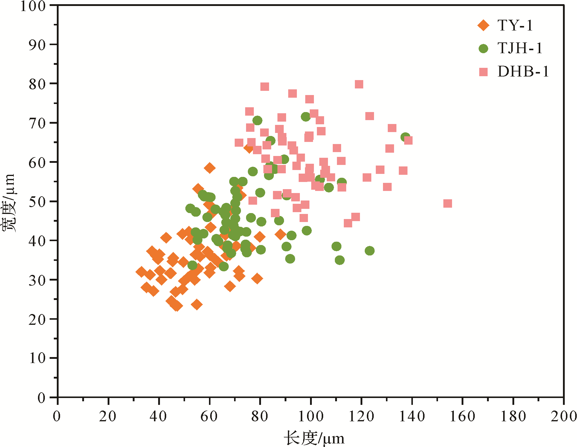
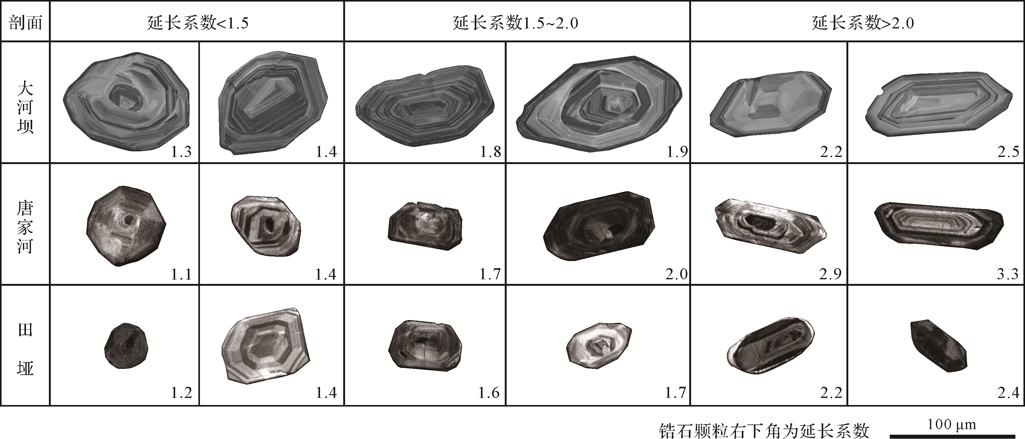
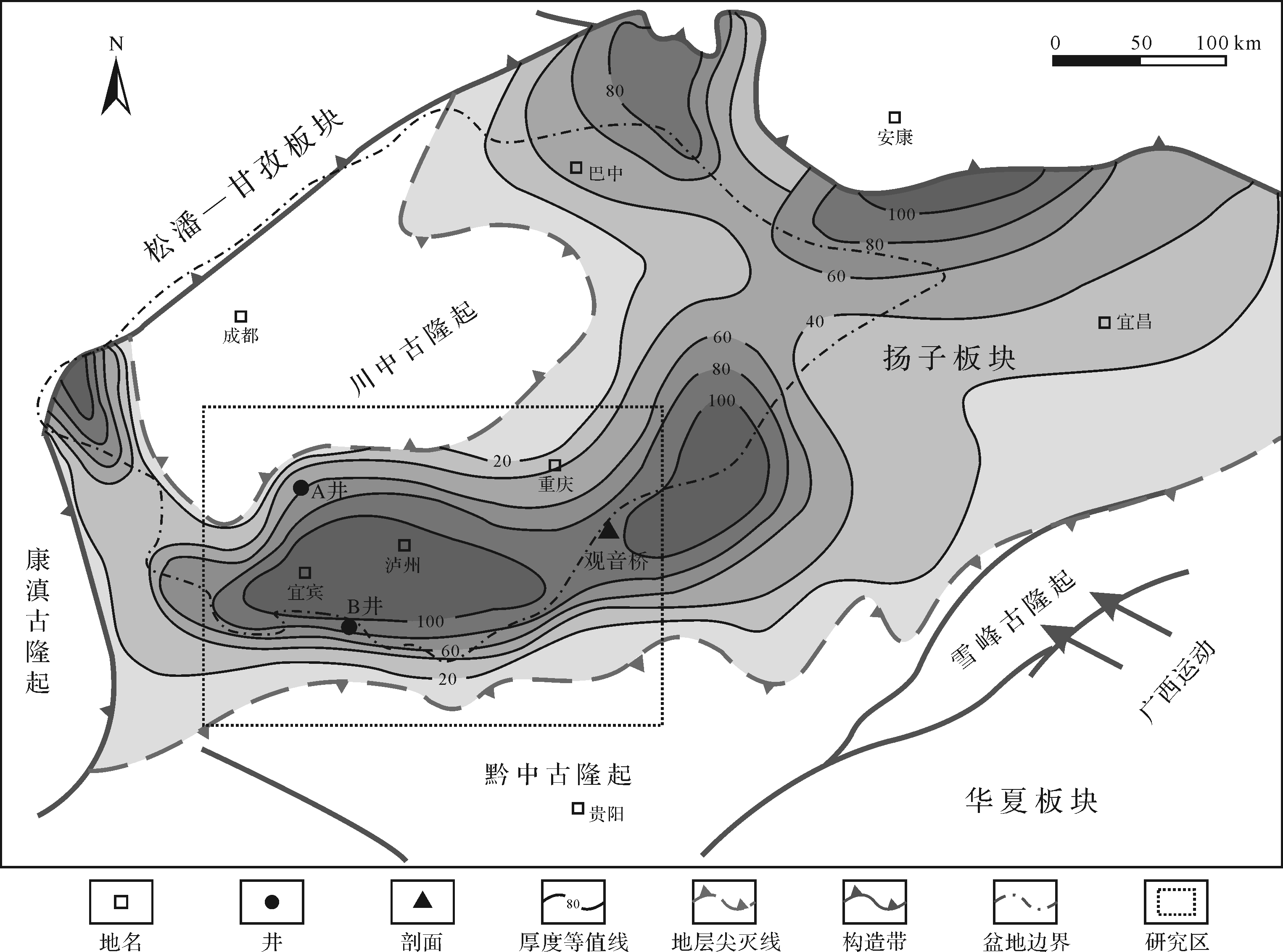
The mixed siliciclastic-carbonate rocks can provide clues for understanding both the carbonate sedimentation and the sources of terrigenous particles. Accordingly, these rocks have received increasingly attention in the fields of studies on sedimentary dynamics, paleogeography, paleoclimatology, and provenance analysis. It should be noted that, affected by the nature of the particles, as well as the hydrodynamic, weathering, and diagenetic conditions, the content of the terrigenous fractions in the mixed siliciclastic-carbonate rocks is changeable and the particle size is generally small. Metastable-unstable heavy minerals may be lost during the weathering and diagenetic processes in varying degrees. Therefore, some traditional provenance analysis methods to indicate the source of original terrestrial compositions may not be applicable. In this work, systemic petrological and morphological studies were conducted on silt-sized heavy minerals in the mixed siliciclastic-carbonate systems of Lower Cambrian (Stage 3) in the Hannan-Micangshan area. The composition, morphological (grain size, elongation, and roundness), weathering and diagenetic characteristics of heavy minerals in different sedimentary environments have been preliminarily explored. The results show that the percentage of terrigenous particles in the coastal environments was much higher than those of the shelf margins, and the proportion of easily weathered heavy minerals also decreases in the rimmed shelf. On the other hand, the particle size and elongation of detrital zircon in the stable heavy minerals on the platform margin are markedly smaller than those in the coastal environment, and the roundness of zircon becomes better under the same level of elongation. In addition, this study also found that there were relatively continuous shallow-water, high-energy ooid shoals and archaeocyath-microbial mounds developed along the Hannan-Micangshan area. These evidence indicates that the Hannan Massif had being developed during the Cambrian Age 3 and could provide large amounts of terrigenous material to the northern Upper Yangtze area. The Lower Cambrian of the northern Sichuan Basin is a potential replacement for oil and gas exploration in the Sichuan Basin. It is of great value to clarify the provenance of the Canglangpuian for understanding the Early Cambrian paleogeography of the northern Upper Yangtze area of the South China Block.

2021, 39(3): 540-549.
doi: 10.14027/j.issn.1000-0550.2020.092
Abstract:
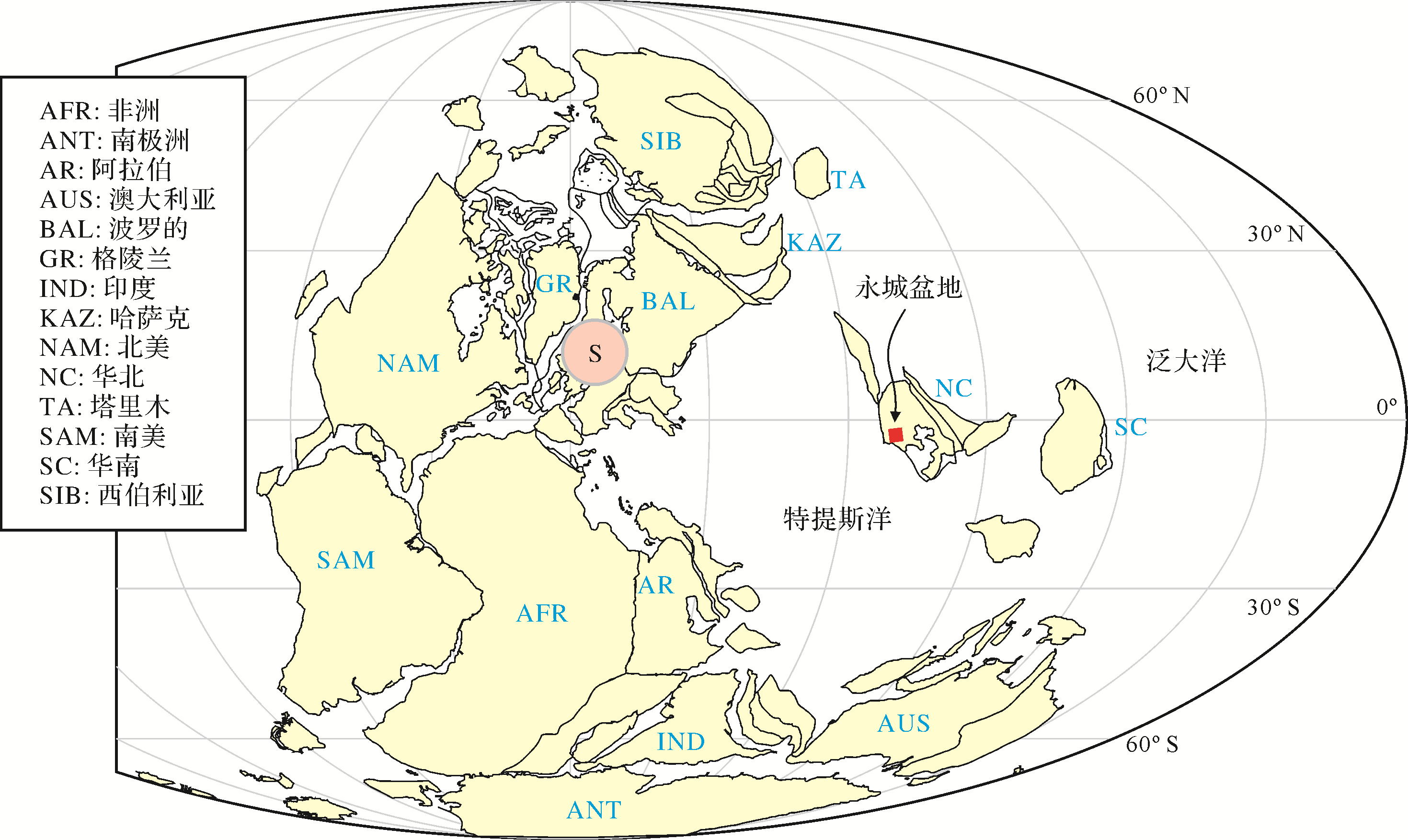
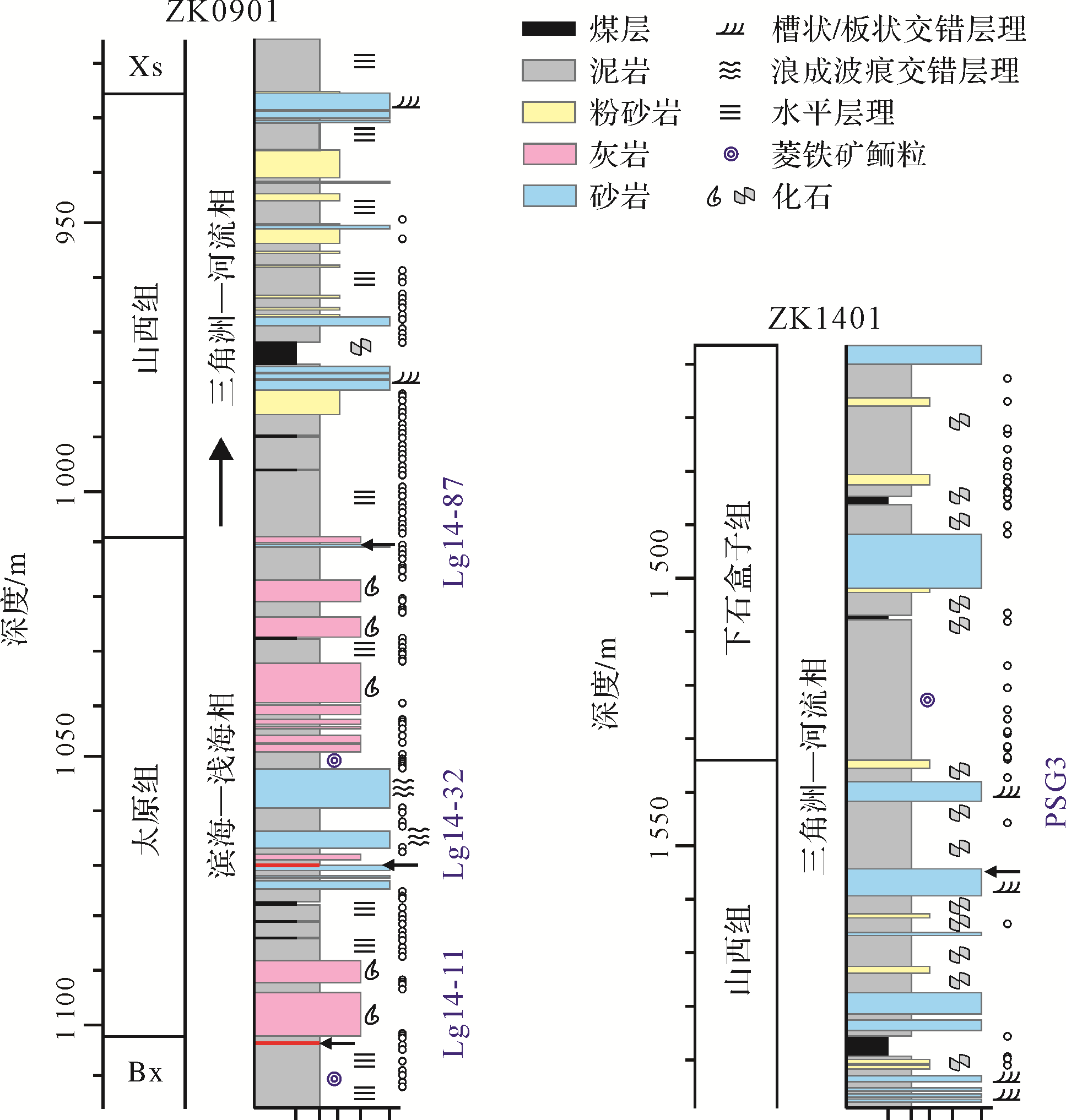
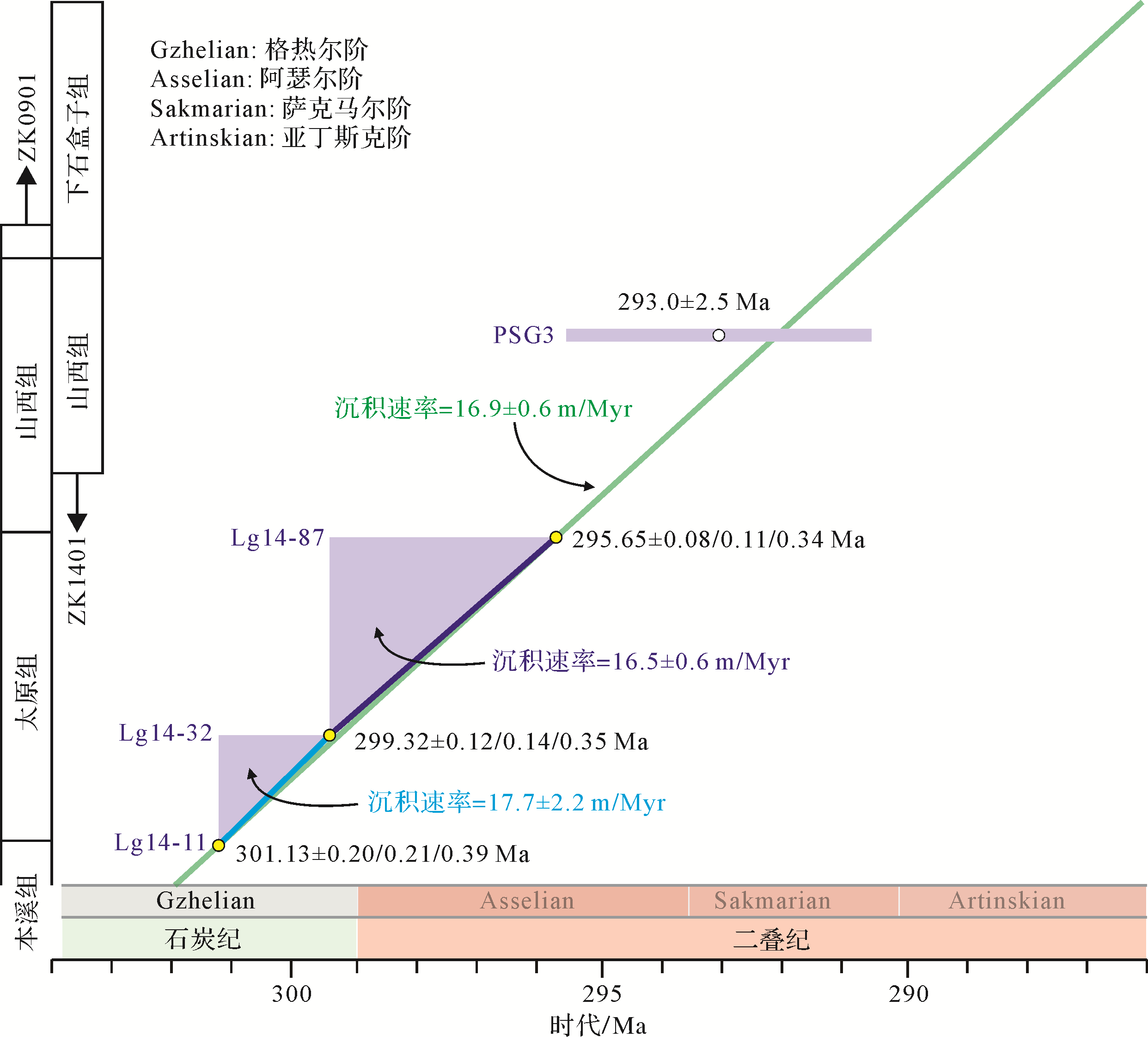
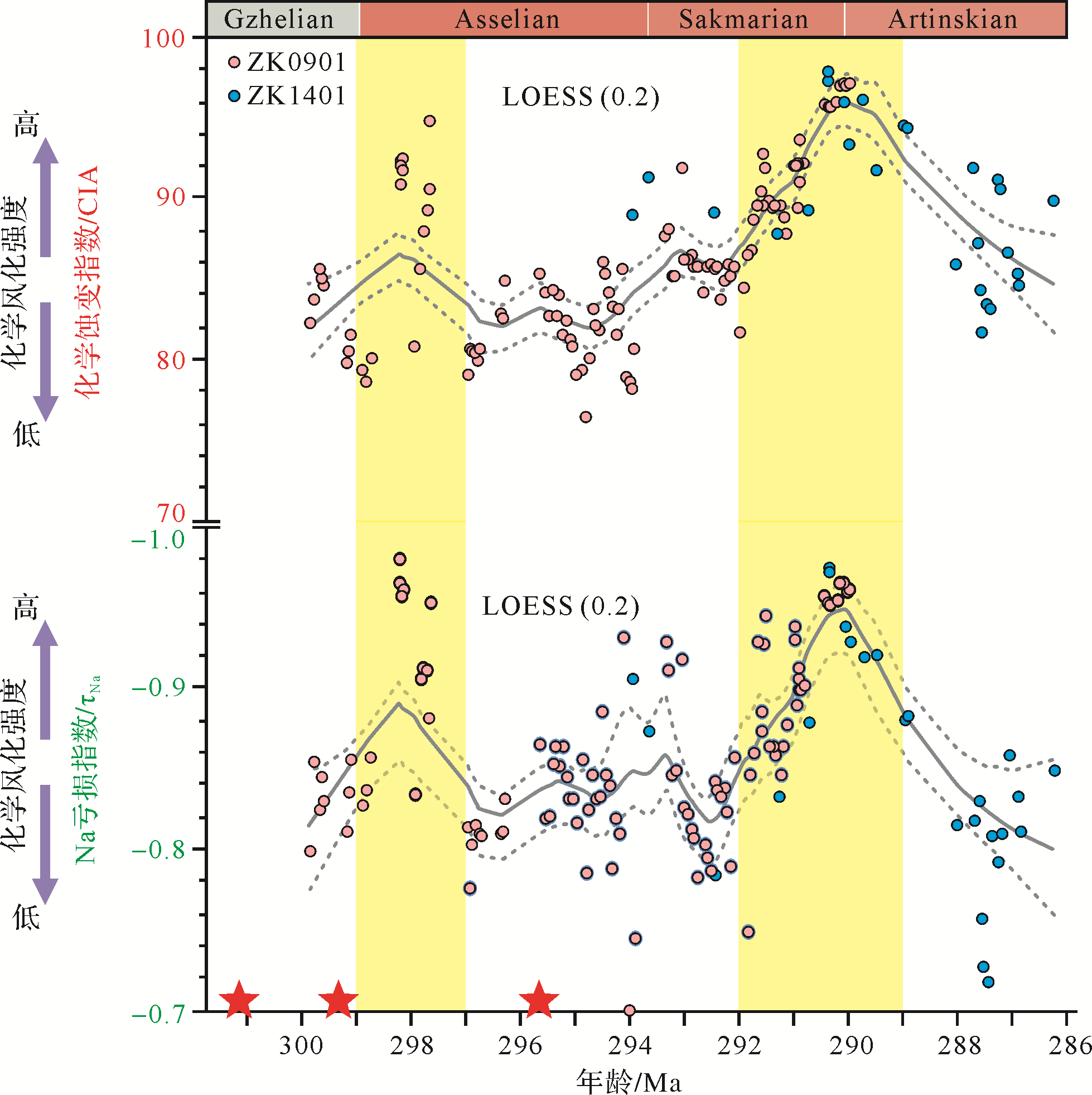
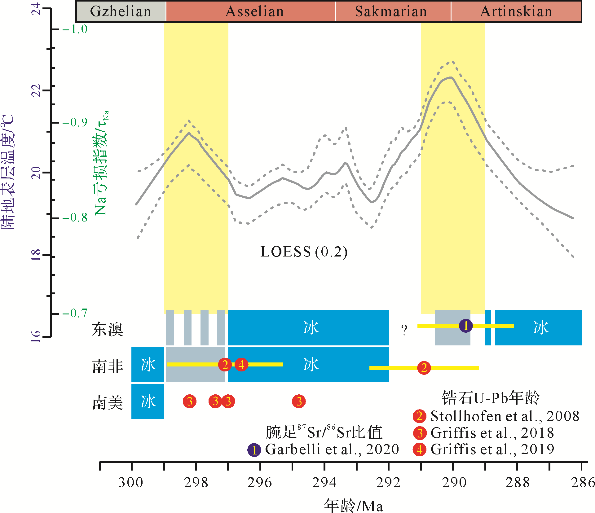
Earth has experienced multiple greenhouse and icehouse periods and their inter-transformations, and extreme climatic events (e.g., ‘snowball’ Earth, hyperthermal hothouse) in its geological past. The Permian was a critical period for the evolution from the late Paleozoic ice age to the Mesozoic greenhouse. One of the main challenges to understanding climate evolution in the Permian has been the acquisition of high-precision age-constrained quantitative data regarding successive paleoclimate changes. This work reviews geochronological and geochemical weathering data reported in recent studies of Permo-Carboniferous coal-bearing successions in southern North China. From this data, a high-precision chronostratigraphic framework is established for strata from the Benxi Formation through to the Taiyuan and Shanxi to Xiashihezi Formations, tracking chemical weathering trends in mudrock-source regions in southern North China. The weathering trends correlate very well with the glacial-deglacial sequence in high-latitude Gondwana continents. The proposed land surface MAT (mean temperature) - τNa (sodium depletion index) transfer function reconstructs the MAT variations for southern North China in the time interval ~300-286 Ma. The MAT curve reflects climate warming during the earliest Asselian and late Sakmarian deglaciations, and indicates climate cooling with the initiation of the Asselian and subsequent Artinskian glaciations.
2021, 39(3): 550-570.
doi: 10.14027/j.issn.1000-0550.2020.072
Abstract:
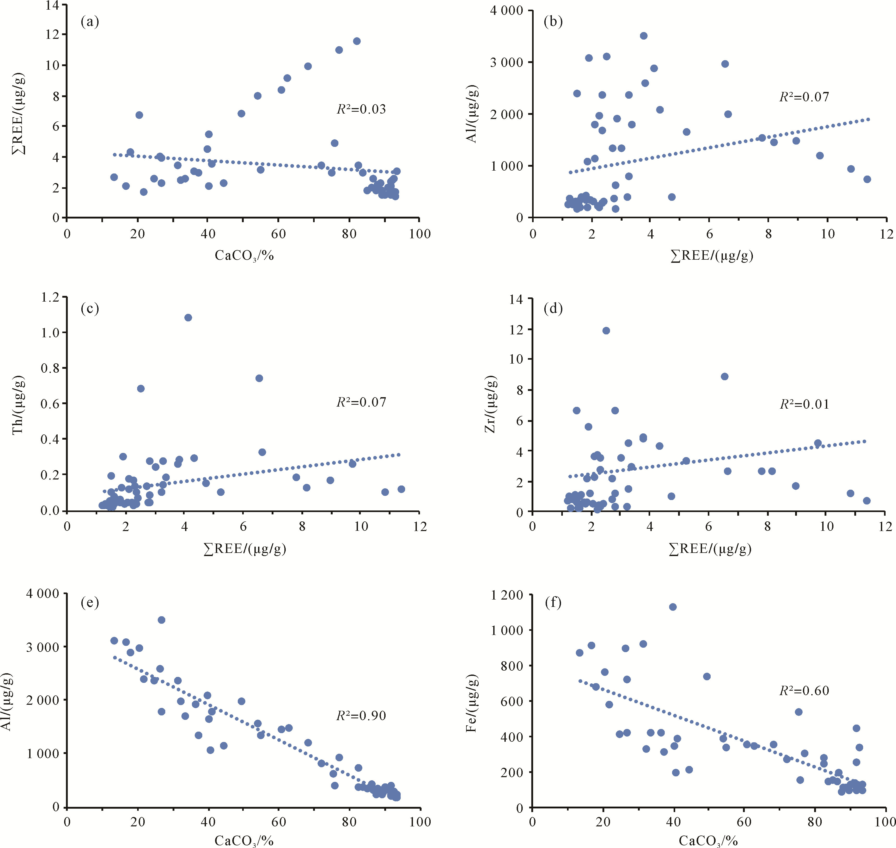
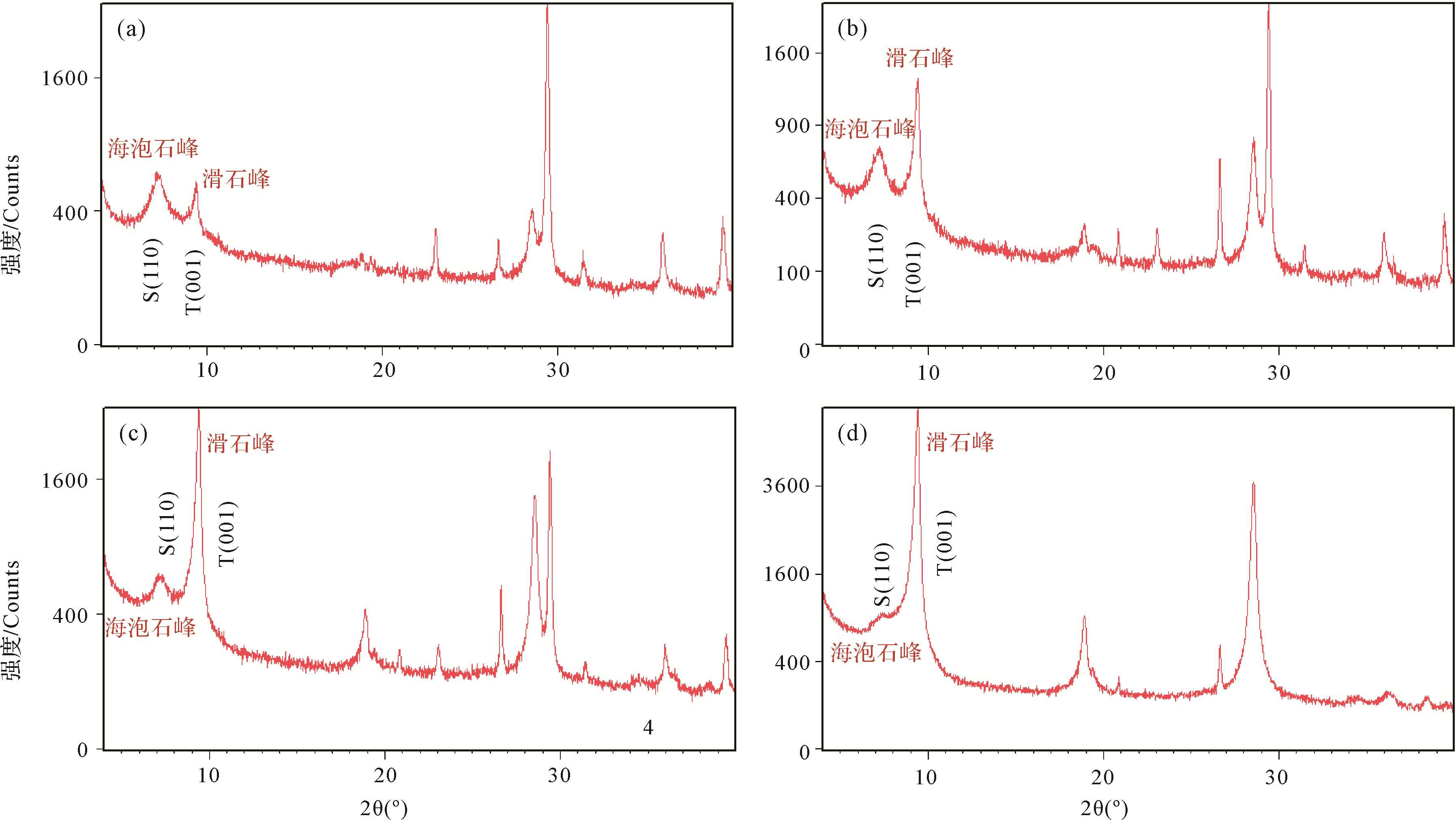
Terrigenous fine-grained components developed on the platform settings can record massive amounts of information on source-to-sink processes and palaeoenvironmental evolutions, which can be used as an archive for the reconstruction of ancient climate and provenance. Yet, authigenic clays are visible in carbonate rocks, and their formation mechanism and diagenetic effect deserve more attention. Here, the authigenic marl components developed in carbonate rocks of the Maokou Formation (Middle Permian) at the Shangsi section have been studied in order to understand their origin and formation processes. The argillaceous component is mainly composed of the diagenetic clay mineral sepiolite, and a small amount of talc and montmorillonite. The source of Mg in sepiolite is speculated to be derived from the pore water inherited from seawater and the release of metastable carbonate minerals (e.g., high-Mg calcites), while Si may be sourced from the supply of hydrothermal fluid diffused from an active fault on the upper Yangtze platform. In addition, talc and montmorillonite minerals are likely derived from the alteration of sepiolite during the burial phase based on petrological and mineralogical evidence. Even so, a small amount of montmorillonite may originate from volcanic materials. In sum, authigenic argillaceous components are very common in the strata of the Maokou Formation, which are widely mixed with terrigenous fine-grained fractions in sedimentary records. These diagenetic clays would potentially affect the reliability of palaeoclimatic and palaeoenvironmental analyses if their contamination effects cannot be eliminated. In addition, the study of authigenic clays has potential significance in the understanding of diagenetic process and the identification of diagenetic geochemical signatures.


2021, 39(3): 571-592.
doi: 10.14027/j.issn.1000-0550.2021.004
Abstract:
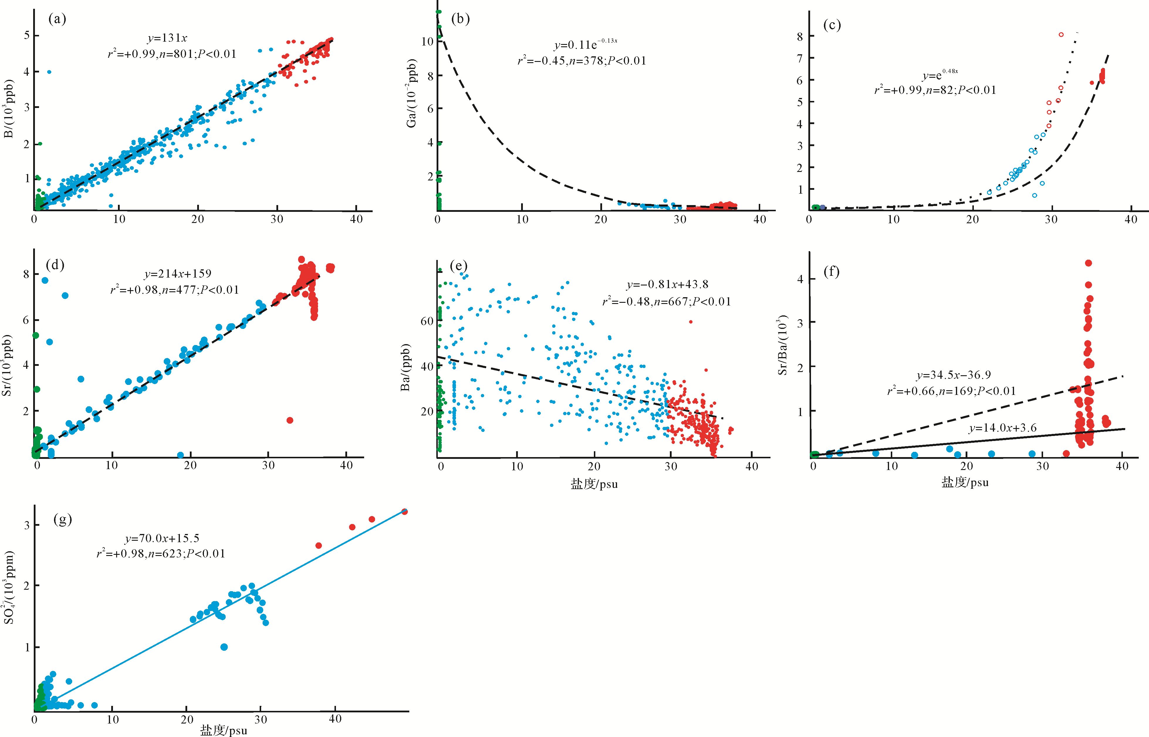
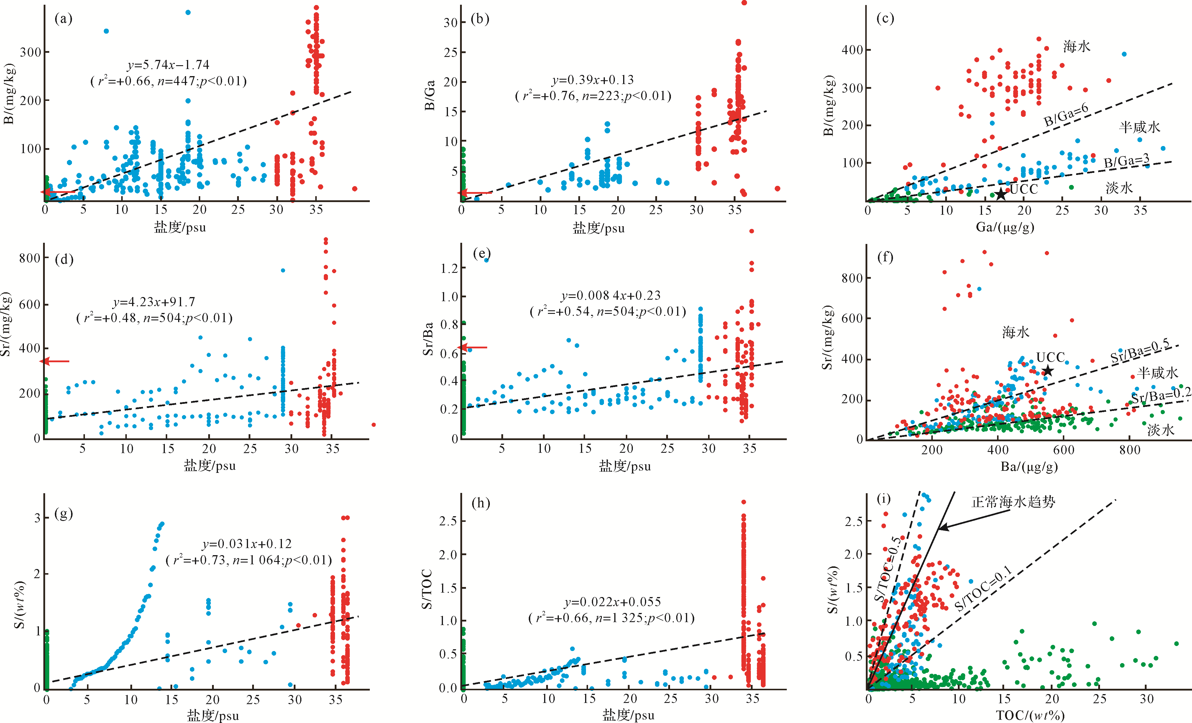
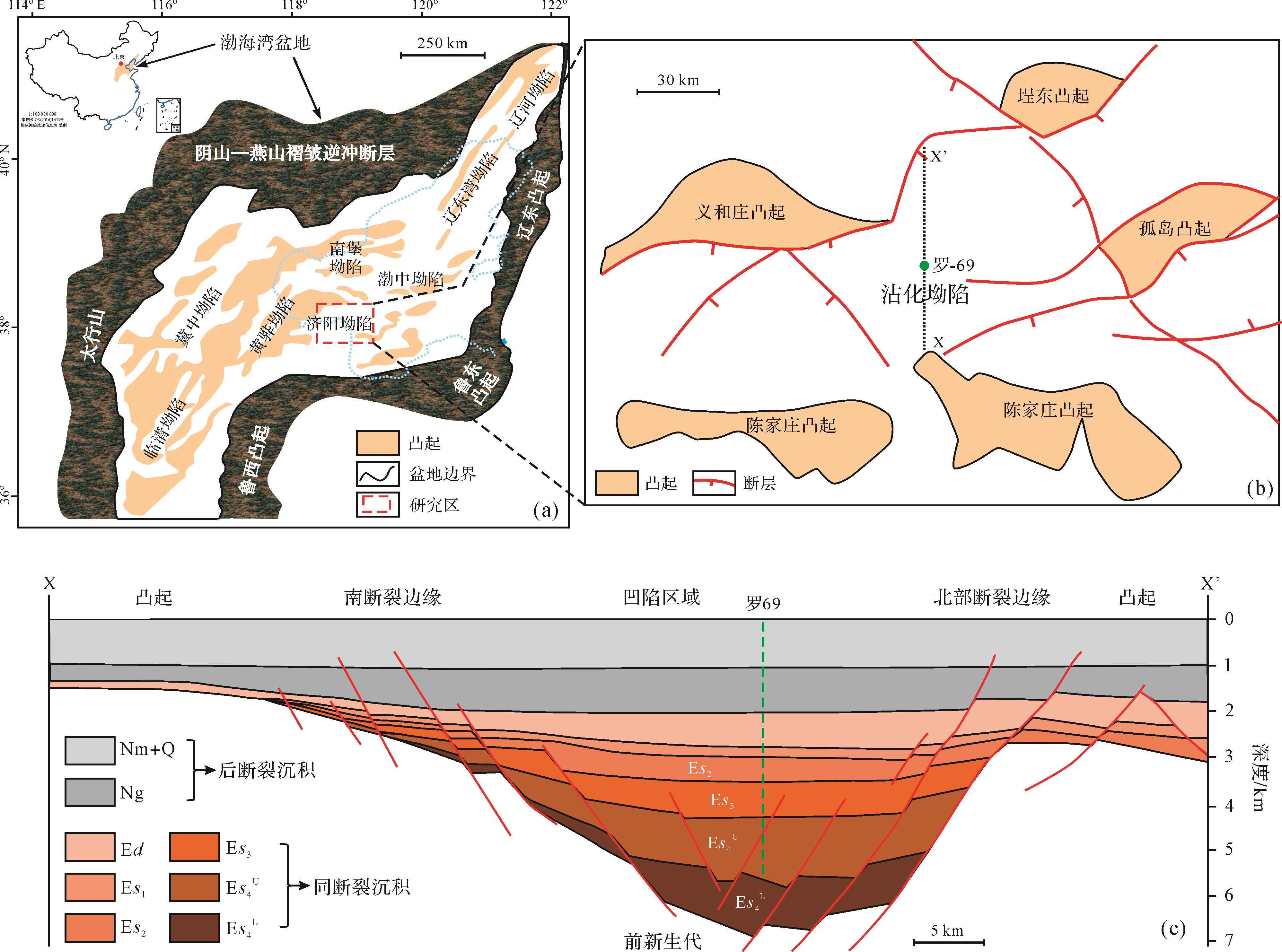
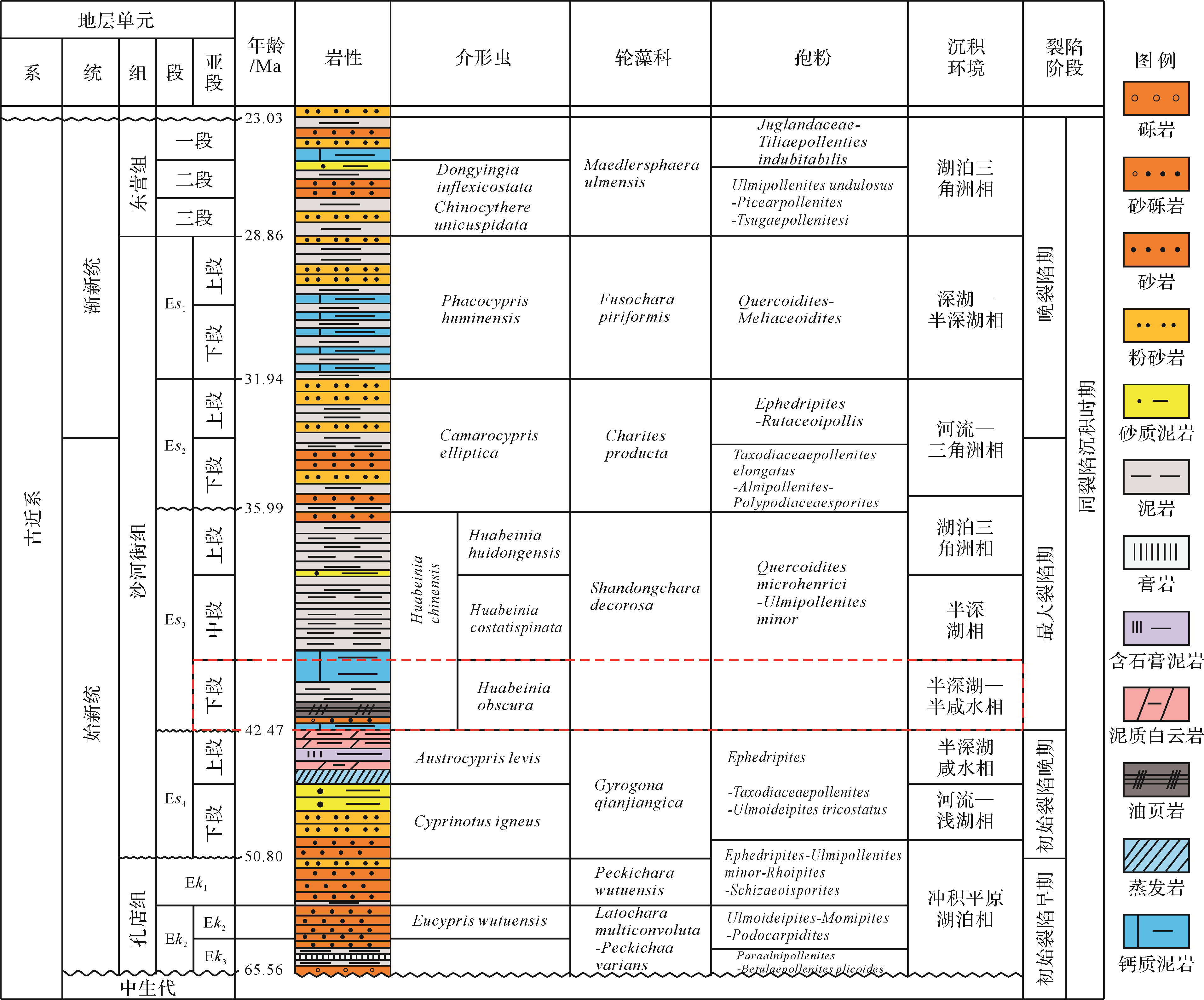
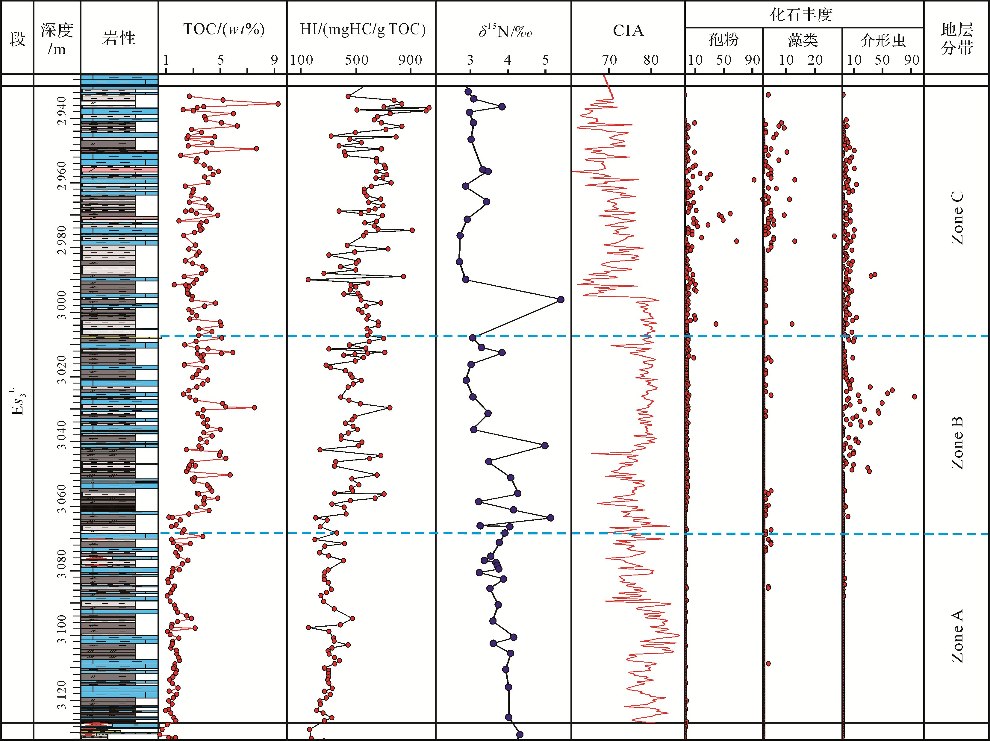
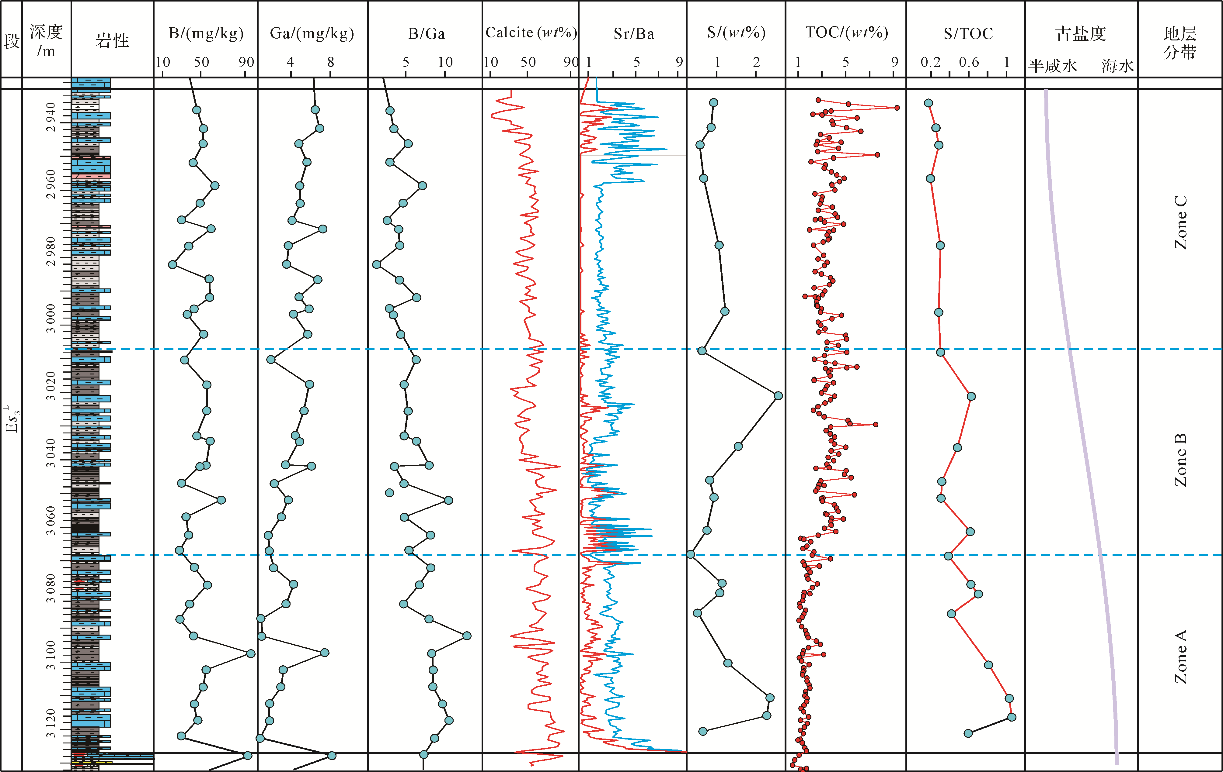
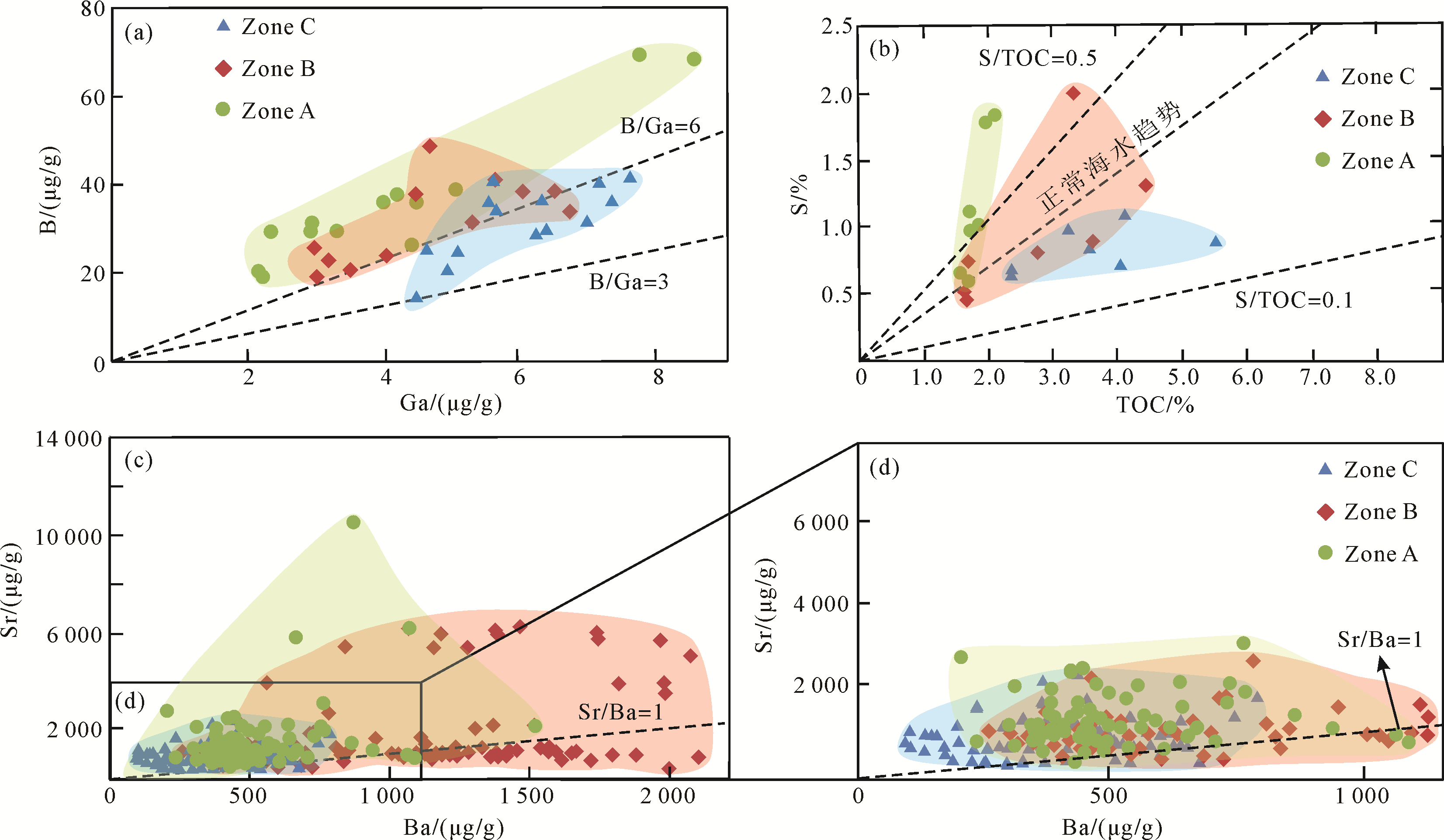
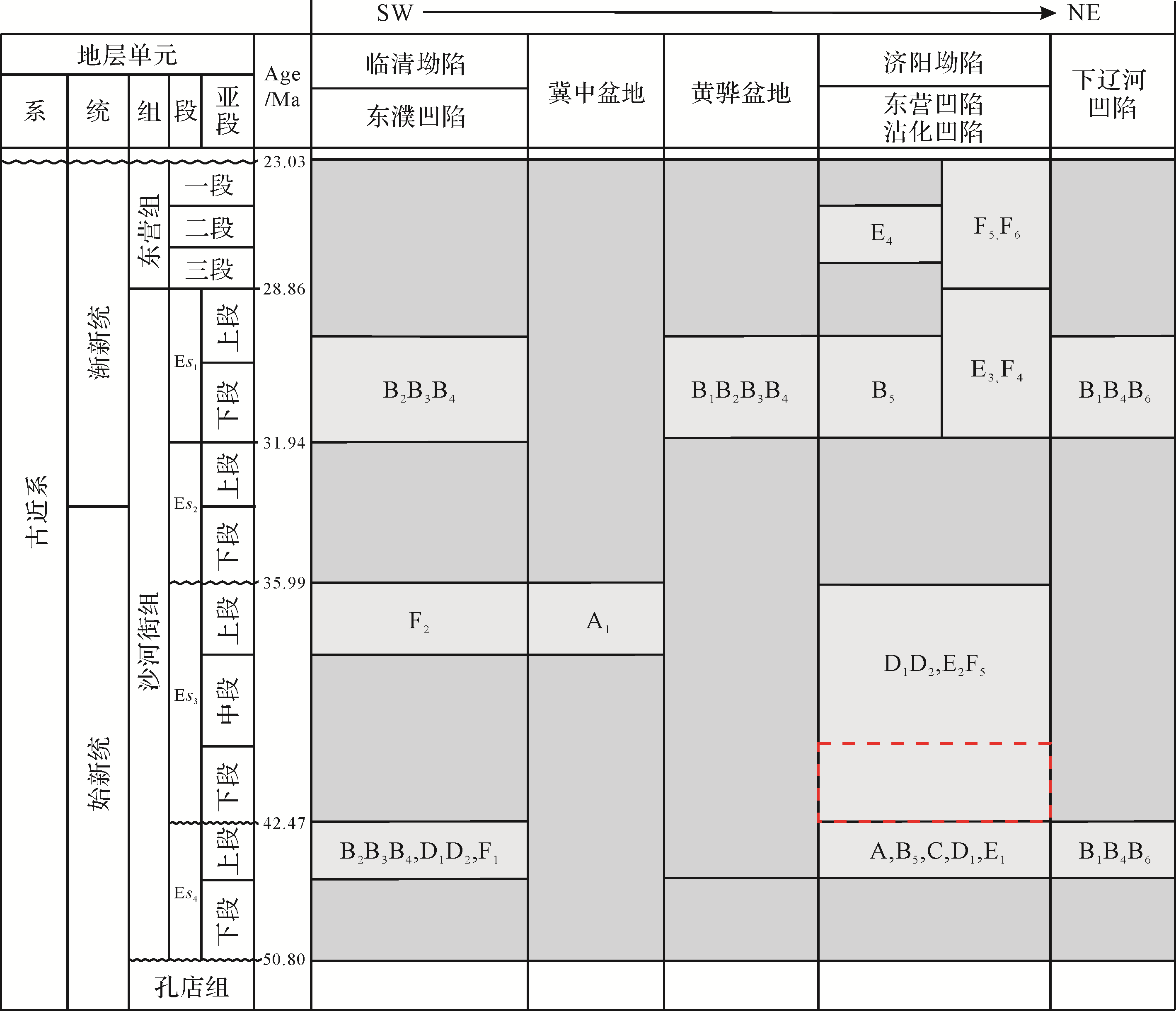
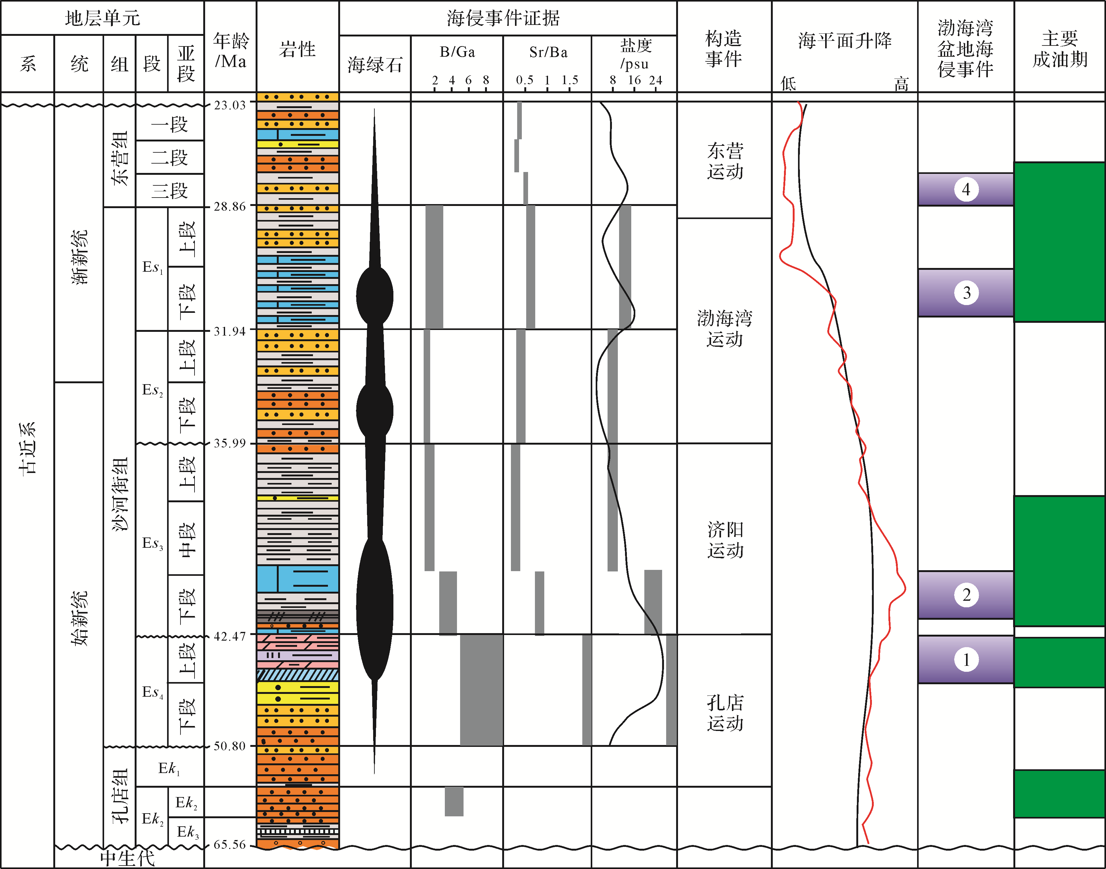
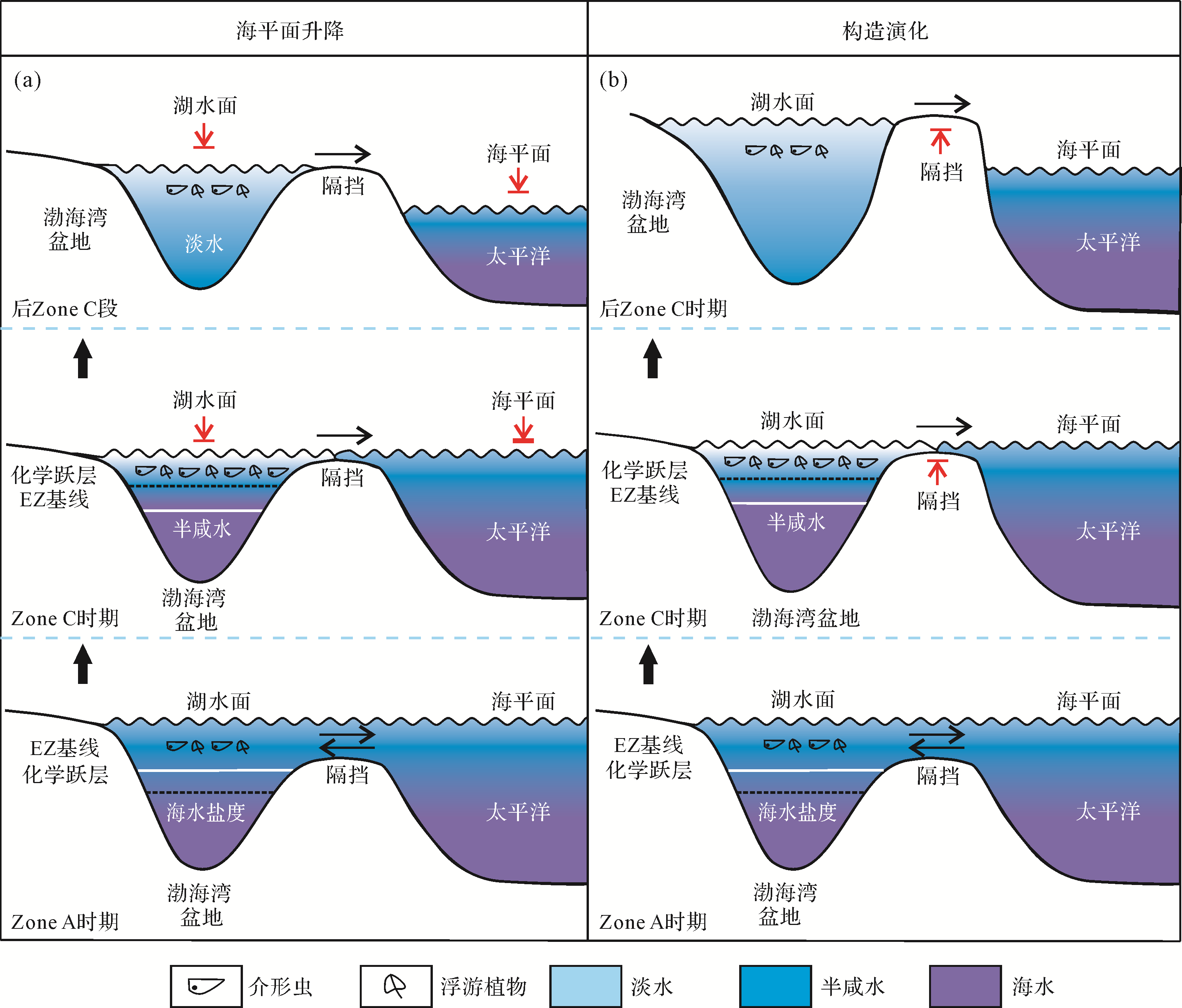
Salinity is a fundamental property of watermasses that is useful in paleoenvironmental and paleoecological studies, yet the theory of application of geochemical proxies to paleosalinity reconstruction is underdeveloped. Here, we explore the use of three elemental ratios for paleosalinity reconstruction: boron/gallium (B/Ga), strontium/barium (Sr/Ba), and sulfur/total organic carbon (S/TOC) ratios. A large set of modern aqueous and sedimentary chemical data was compiled representing a range of salinity facies (i.e., freshwater, brackish, marine) in order to test the relationships of these proxies to ambient watermass salinity and to determine their viability for paleosalinity analysis. Sediment data were limited to fine-grained siliciclastic units (muds/shales/mudstones) without significant carbonate content, in which the elements of interest were mainly acquired through adsorption of dissolved species to forge a connection between elemental proxy values and watermass chemistry. In modern systems, watermass salinity is correlated with these proxies, yielding r of +0.99 and +0.76 for aqueous and sediment B/Ga, +0.66 and +0.54 for aqueous and sediment Sr/Ba, +0.98 for aqueous sulfate, and +0.66 for sedimentary S/TOC. These relationships establish the basis for using these elemental ratios as paleosalinity proxies. Elemental crossplots permitted estimation of approximate salinity thresholds for each proxy: (1) B/Ga is < 3 in fresh water, 3⁃6 in brackish water, and > 6 in marine facies; (2) Sr/Ba is < 0.2 in fresh water, 0.2⁃0.5 in brackish water, and > 0.5 in marine facies; and (3) S/TOC is < 0.1 in fresh water and > 0.1 in brackish water and marine facies. In order to address the marine influence on sediment accumulation and to identify variations in paleosalinity during deposition of the Mid-Eocene lower Es3 (Es3L) member of the Shahejie Formation, this study analyzed multiple paleosalinity proxies (B/Ga, Sr/Ba and S/TOC) in fine-grained siliciclastic (argillaceous) sediments of the Luo69 drillcore from the Dongying Depression. All three proxies yielded similar paleosalinity interpretations, with peak salinity and marine influence (i.e., maximum B/Ga, Sr/ Ba and S/TOC values) occurring at the base of the Es3L member, and progressively declining salinities, representing a shift toward brackish conditions, upsection over an interval of 185.5 m representing ~2.2 Myr of sedimentation. This paleosalinity record suggests gradual long-term variations that were probably due to changes in tectonically controlled gateways linking the Bohai Bay Basin to the Yellow Sea. In addition to analysis of the Mid-Eocene Es3L member, published data on the stratigraphic distribution of marine fossils, glauconite, and elemental paleosalinity proxies are applied to evaluate the history of marine incursions into the Bohai Bay lake system throughout the mid- to late Paleogene (~50⁃24 Ma). This analysis revealed four intervals of probable major marine incursions dating to the Early Eocene, the Middle Eocene, the Early Oligocene, and the Late Oligocene.

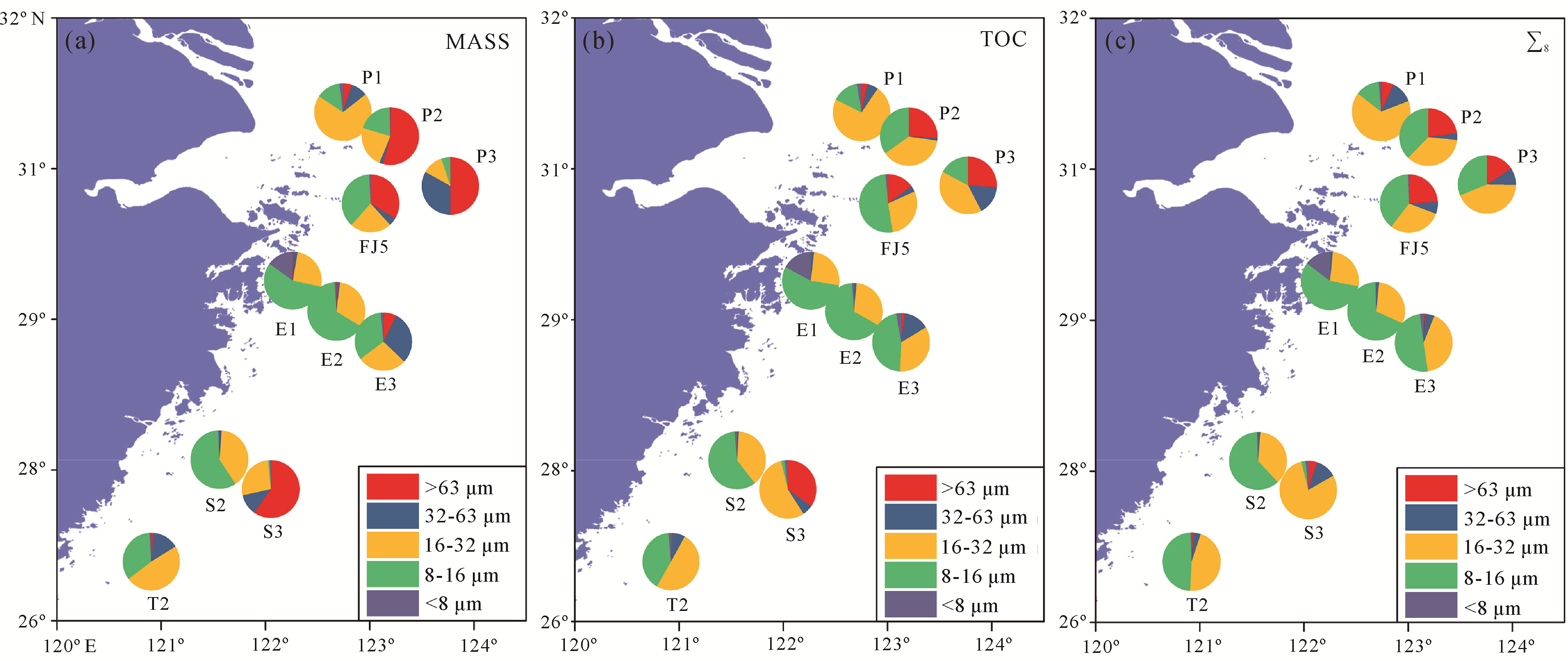
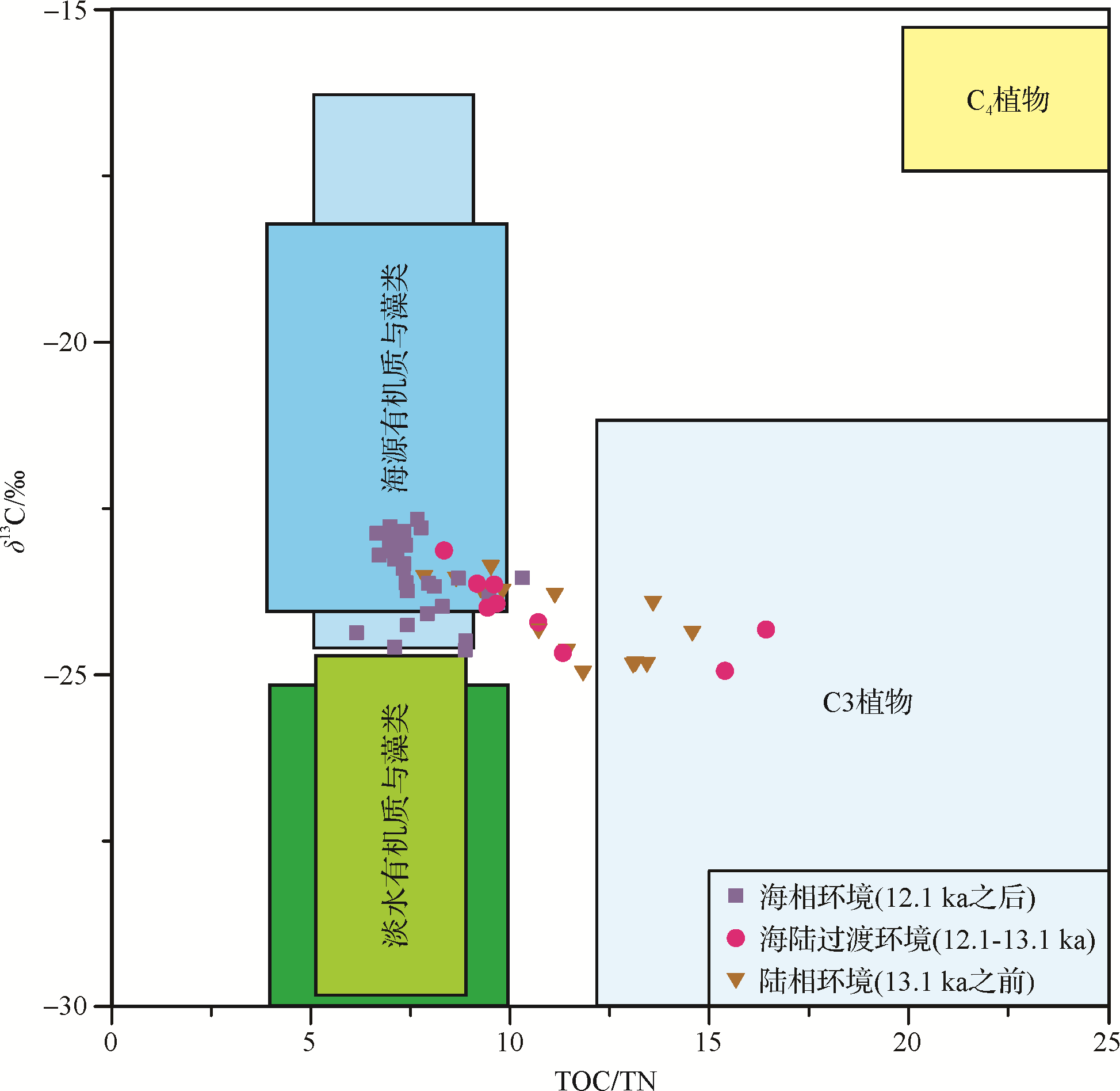
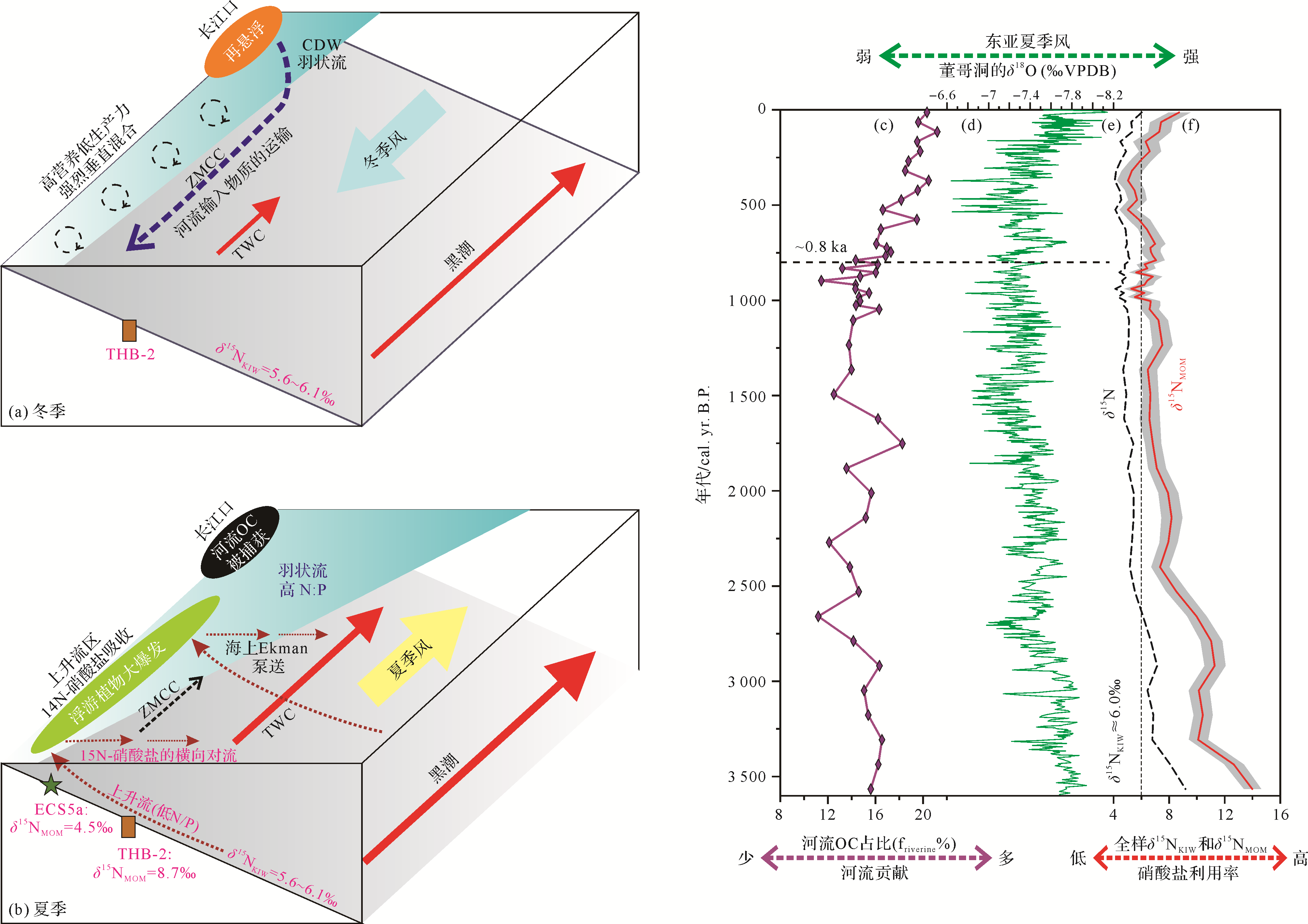
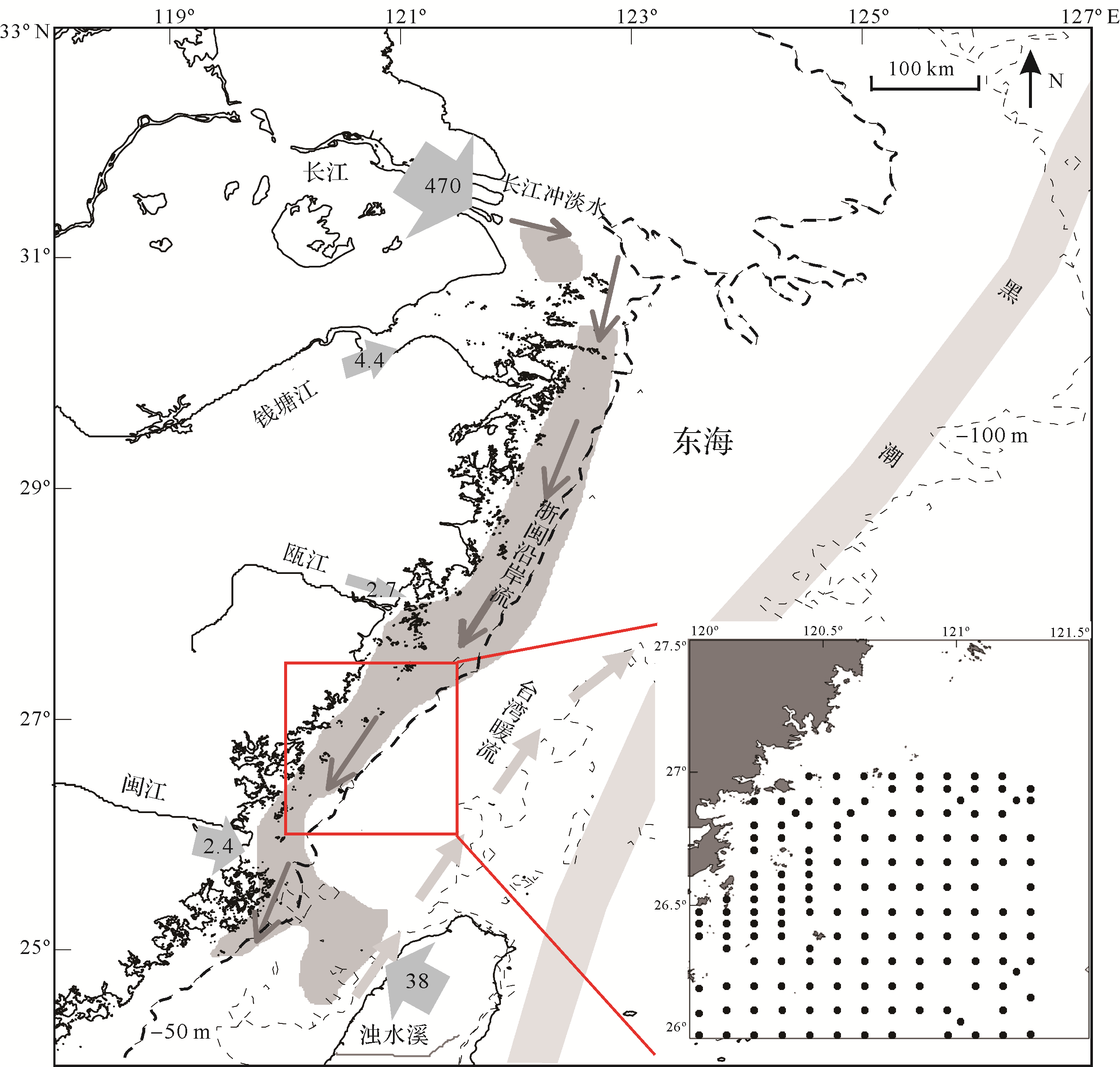
2021, 39(3): 593-609.
doi: 10.14027/j.issn.1000-0550.2020.080
Abstract:
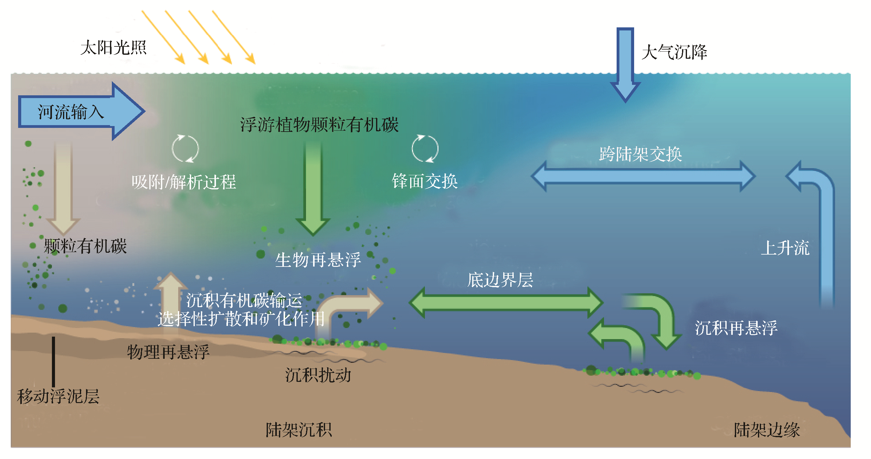
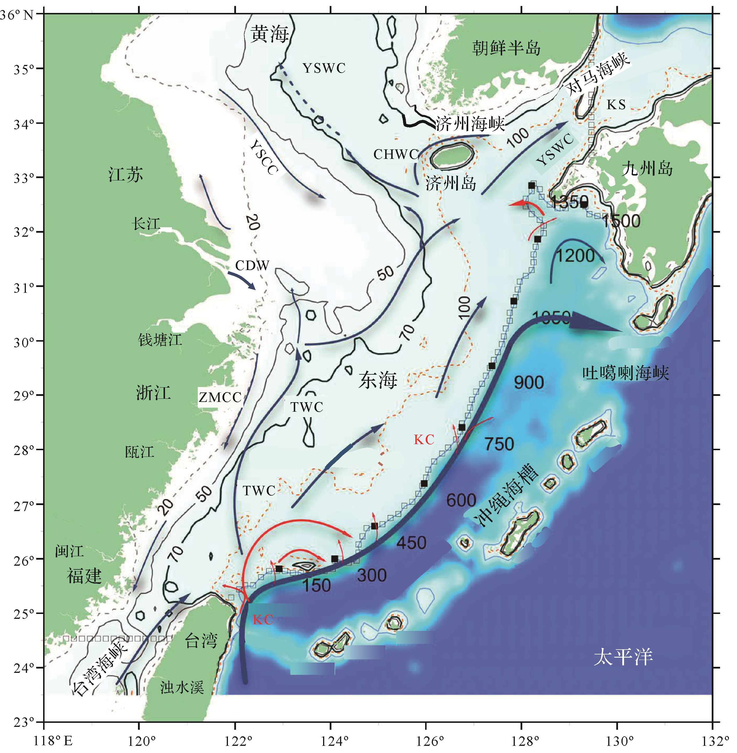
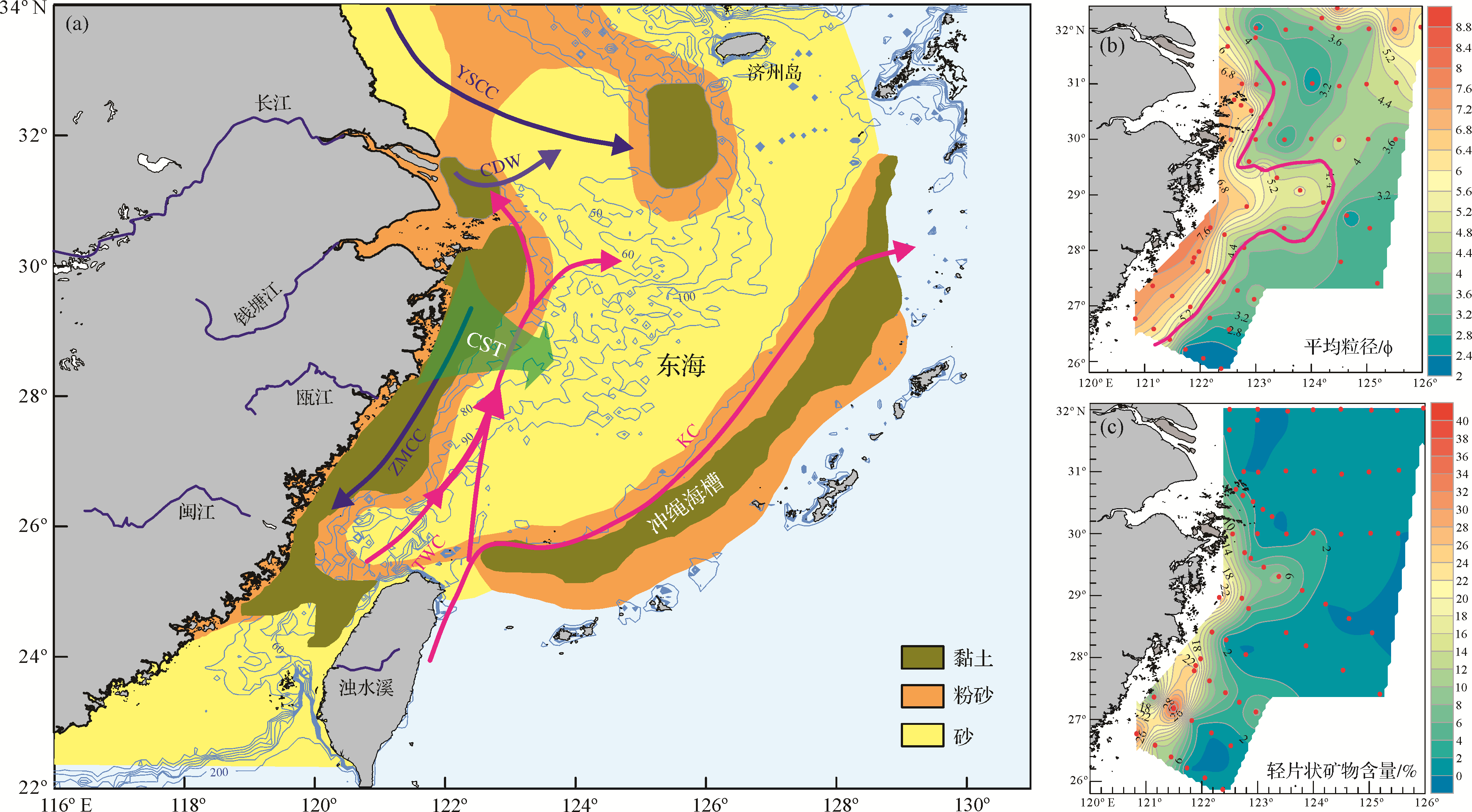
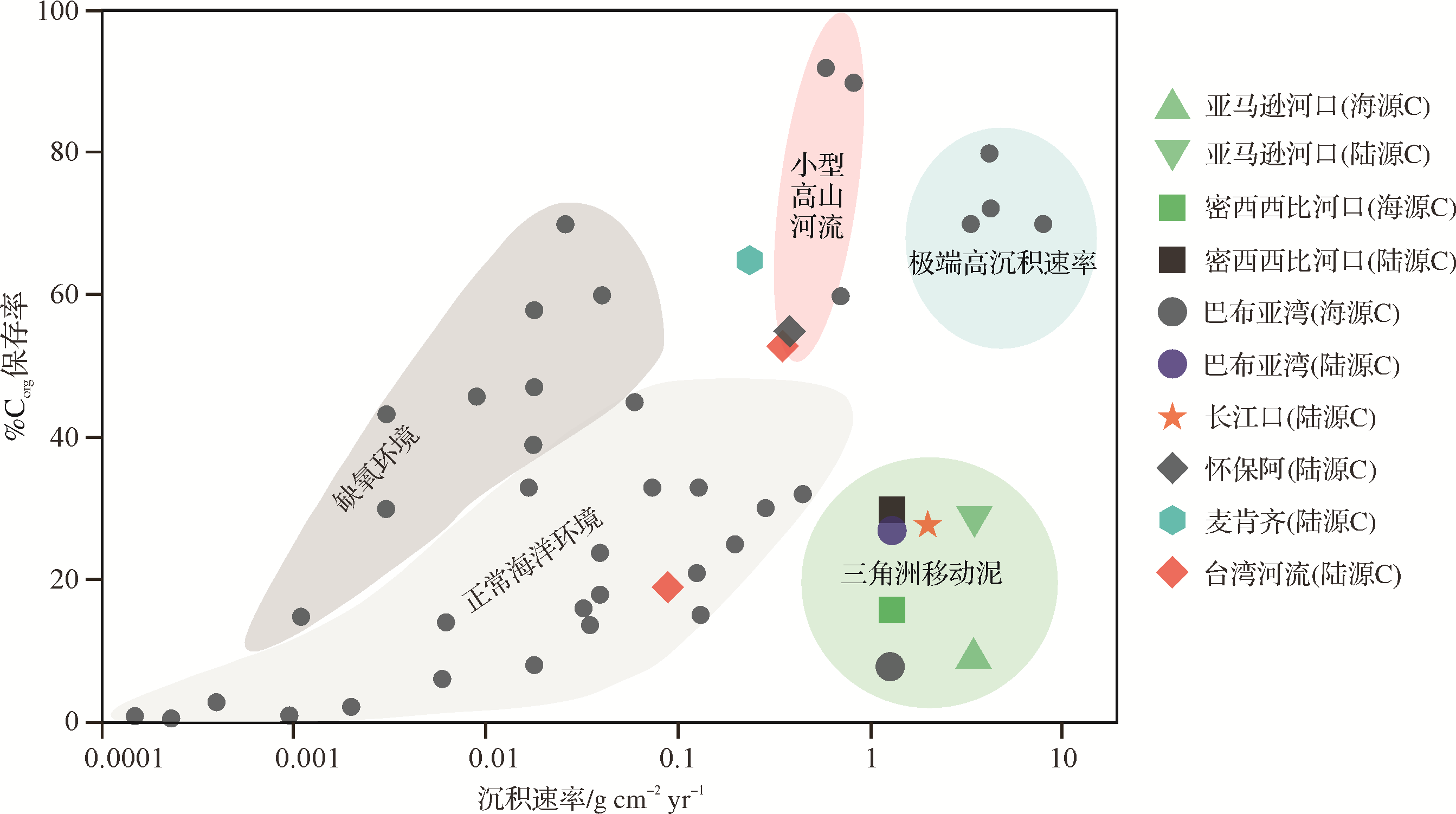
Continental marginal seas are the main sites for deposition and burial of organic carbon from different sources with different properties, and they play an important role in the global biogeochemical carbon cycle. The inner shelf of the East China Sea (ECS) accepts a large amount of terrestrial organic carbon with high primary productivity and is an ideal site for the study of the source, transport and burial of sedimentary organic carbon. This comprehensive analysis of the literature gives a brief review of related sedimentological studies, with the aim of providing references for future research. Bulk analyses (TOC/TN, δ13C, etc.) and biomarkers (n-alkanes, sterols, lignin, etc.), among other methods, have indicated that the source of organic carbon in this location is affected by the sedimentary environment. The terrestrial components increase significantly landward from the sea and have seasonal characteristics. The inner shelf sediments of the ECS have a macroscopic transport characteristic best described as "storing in Summer and transporting in Winter" along the coast, and this dynamic process affects the coastal transport path and final destination of terrestrial organic carbon. There exists a "tongue⁃shaped" zone of transported terrigenous organic carbon near latitude 29°N in the ECS, which may be accompanied by cross⁃shelf transport of terrestrial organic carbon, affecting the source⁃sink process of deep⁃sea organic carbon. In addition, human activity and extreme climatic events have also significantly affected the records of the deposition processes of the sediment and organic carbon; such factors need further study. The inner shelf of the ECS is an important area of buried terrigenous organic carbon. Its burial efficiency has been influenced by the source, the content and the sedimentation rate, and is related to the mineralization path of the organic matter during the early diagenetic process. The geochemical characteristics of the organic carbon contained in the sediments are also useful for reconstructing long-term sea-level change, primary productivity, paleoceanography and paleoclimate evolution, thus providing a basis for clarifying the environmental evolution of the ECS inner shelf during its geological history.
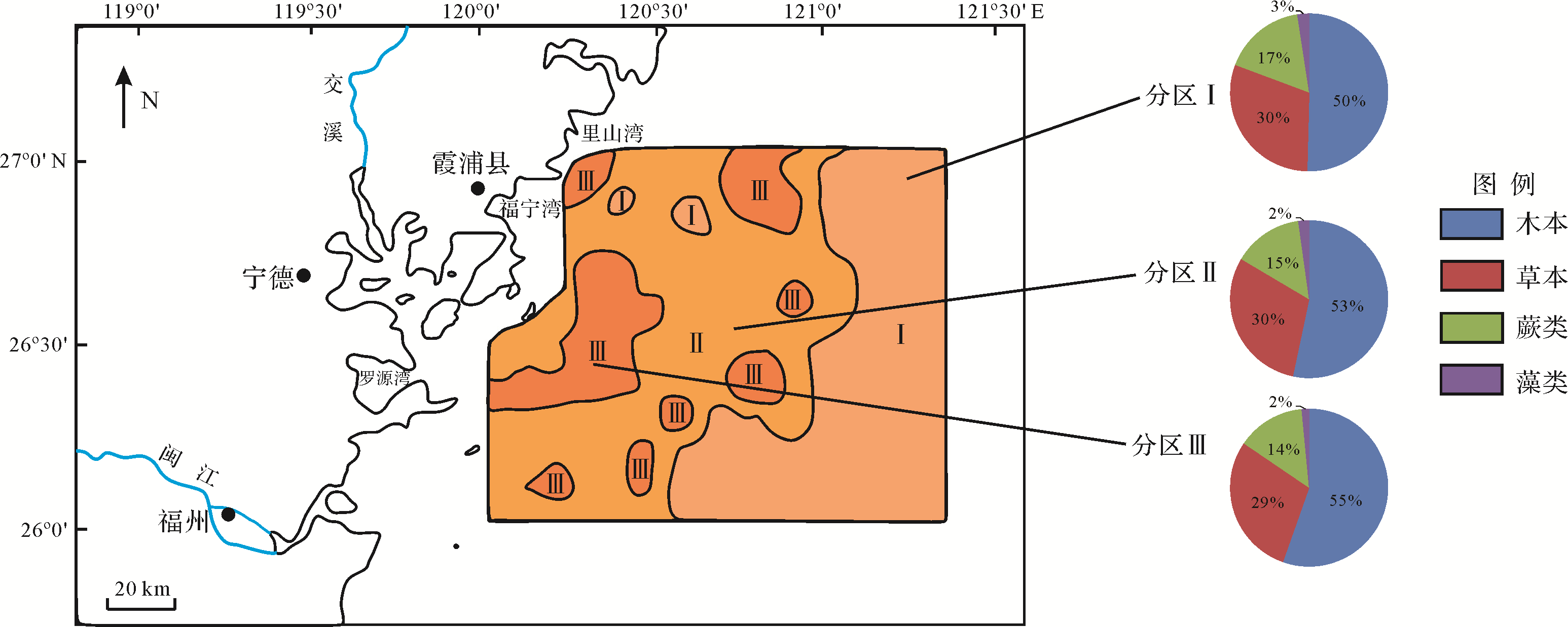
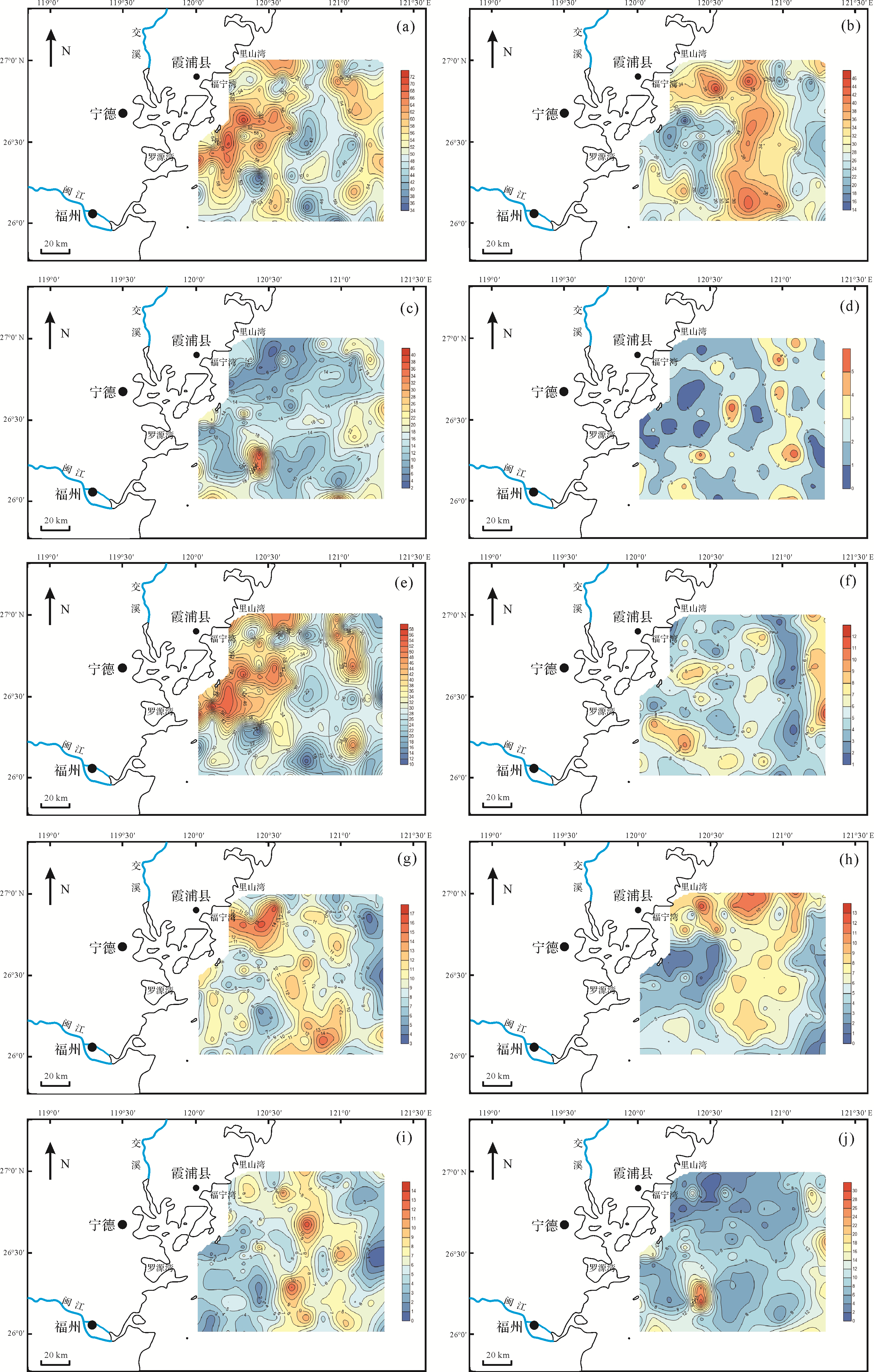
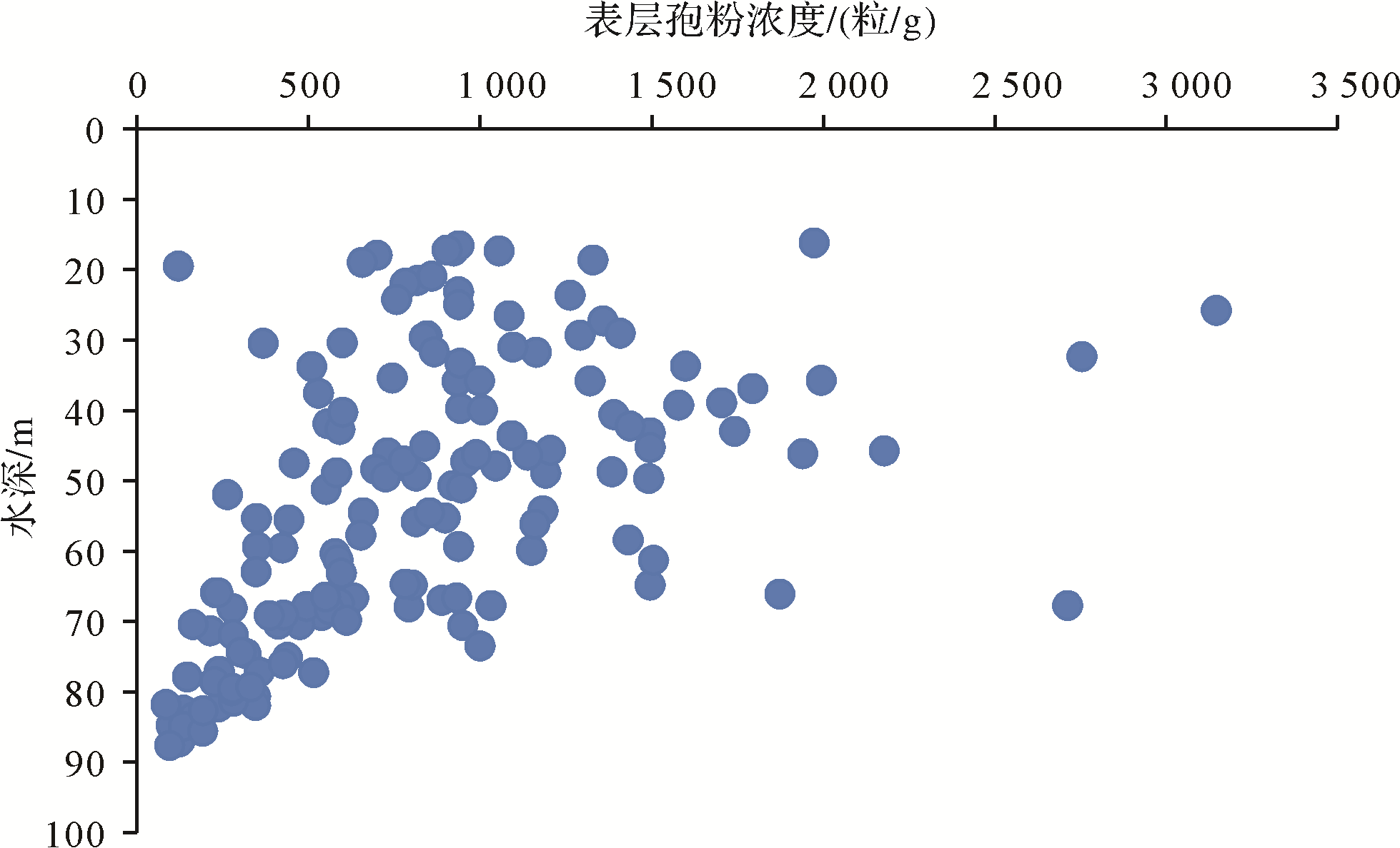
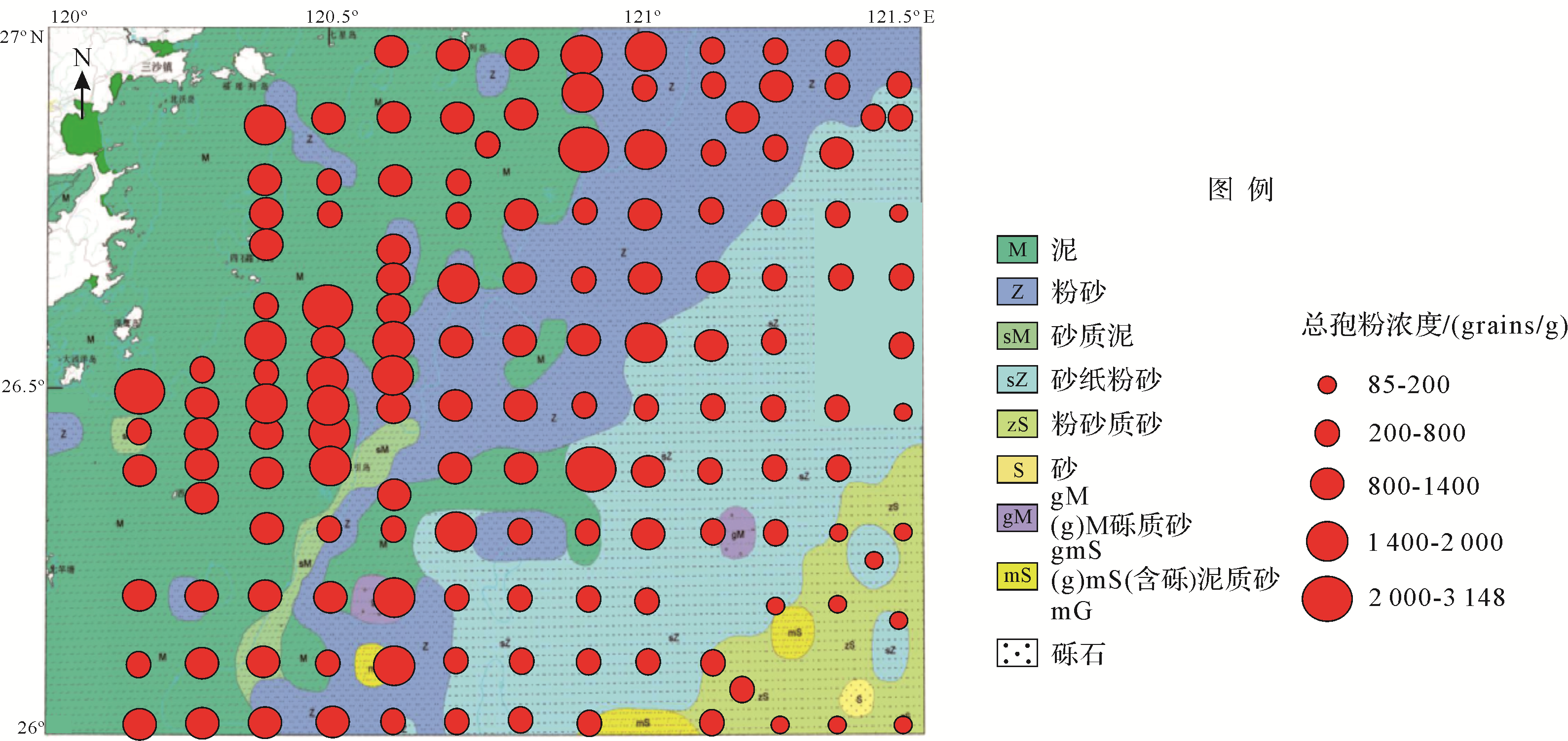
2021, 39(3): 610-620.
doi: 10.14027/j.issn.1000-0550.2020.113
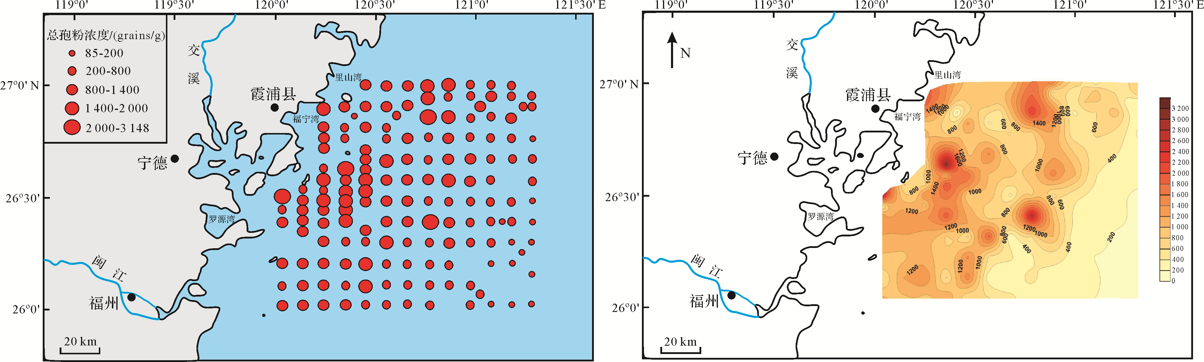
Abstract:
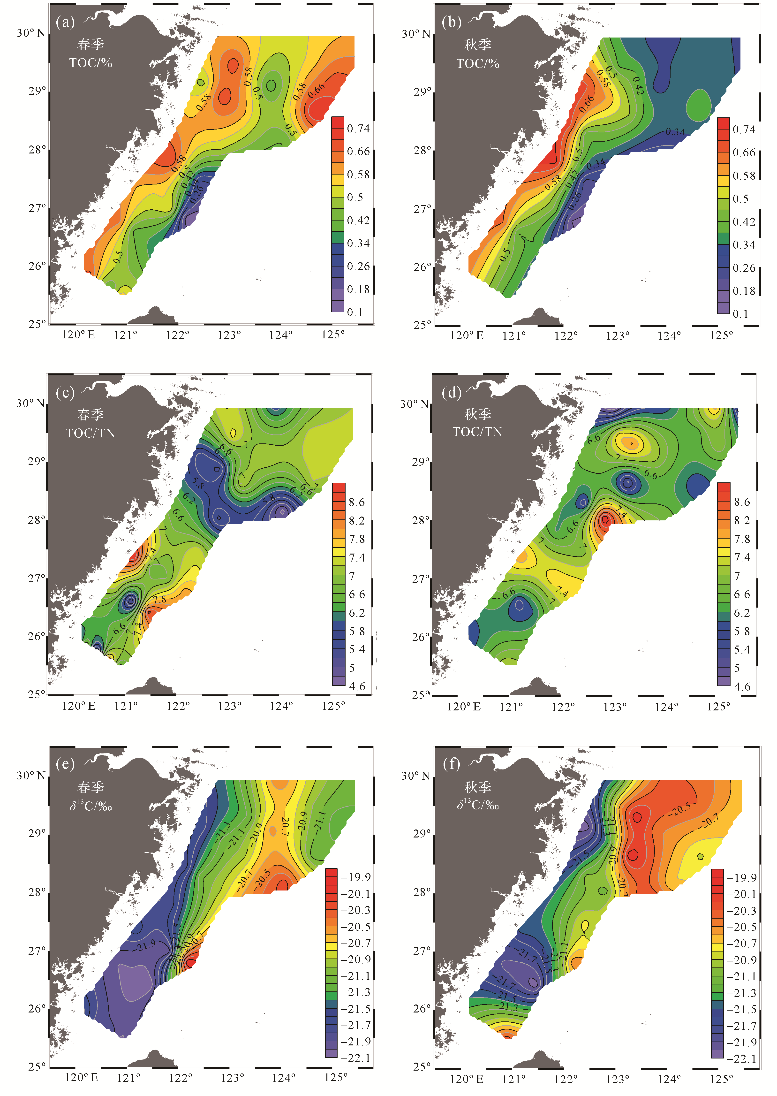
The mud belt is a unique geomorphological unit that originated along the East China Sea Inner Shelf during the Holocene high sea level, which contains abundant high resolution information of sedimentary environment and paleoclimate. Pollen analysis is an effective proxy from the mud belt for researching the modern environment and has contributed to reconstructing the paleoenvironment. Based on 150 surficial sediments acquired from the mud belt, the characteristics and distribution mechanism of pollen were analyzed, as well as its influence factors. The results indicate that there are 93 types of pollen, including 47 arboreal pollen, 28 terrestrial herbaceous pollen, 12 fern spores, and 6 alga spores. Pinus pollen is the predominant component in pollen concentration. The pollen concentration is distributed parallel to the coastline, showing a decreasing trend seaward. Furthermore, the pollen in the research area originated from the local area and is transported to the ocean by the rivers, such as the Changjiang River, Oujiang River, and Minjiang River. The distribution of pollen concentration is controlled by the sediment type, especially the mud type, and the local ocean currents. The results present the modern depositional environment and influence factors contributing to the reconstruction of the paleoenvironment for the mud belt within the Holocene.

2021, 39(3): 621-630.
doi: 10.14027/j.issn.1000-0550.2020.048
Abstract:
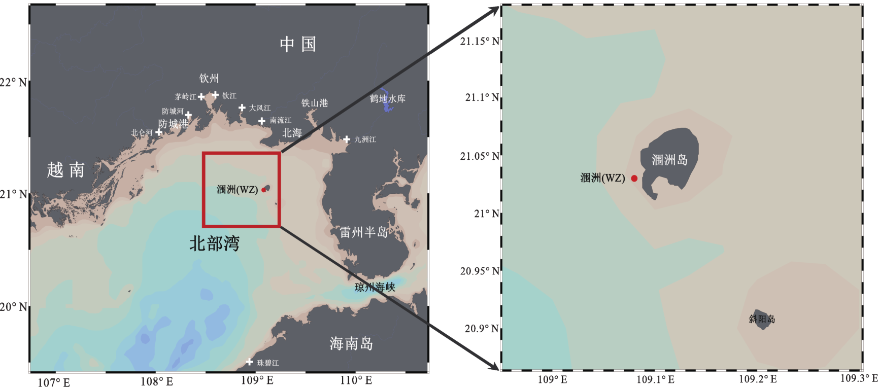
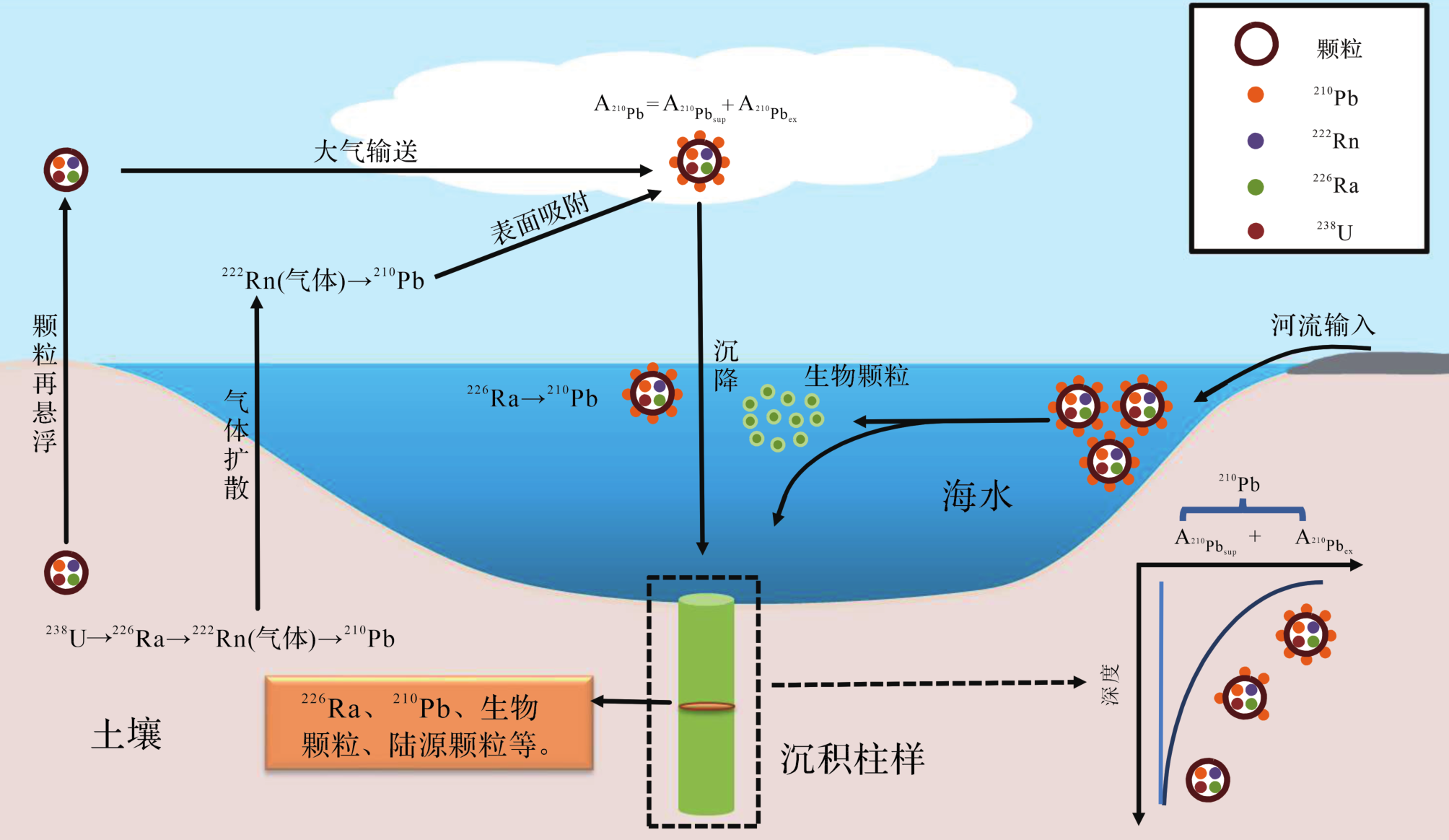
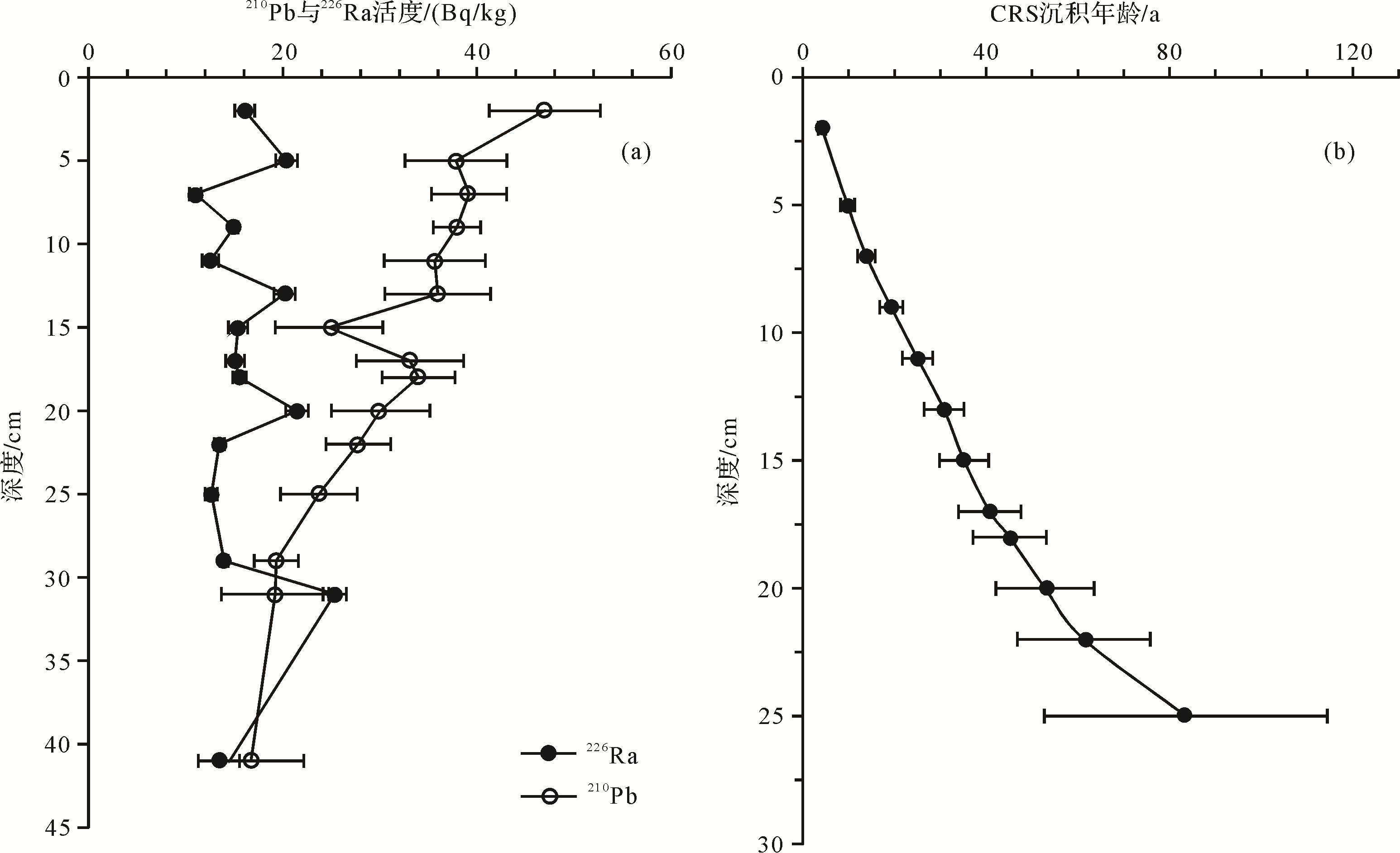
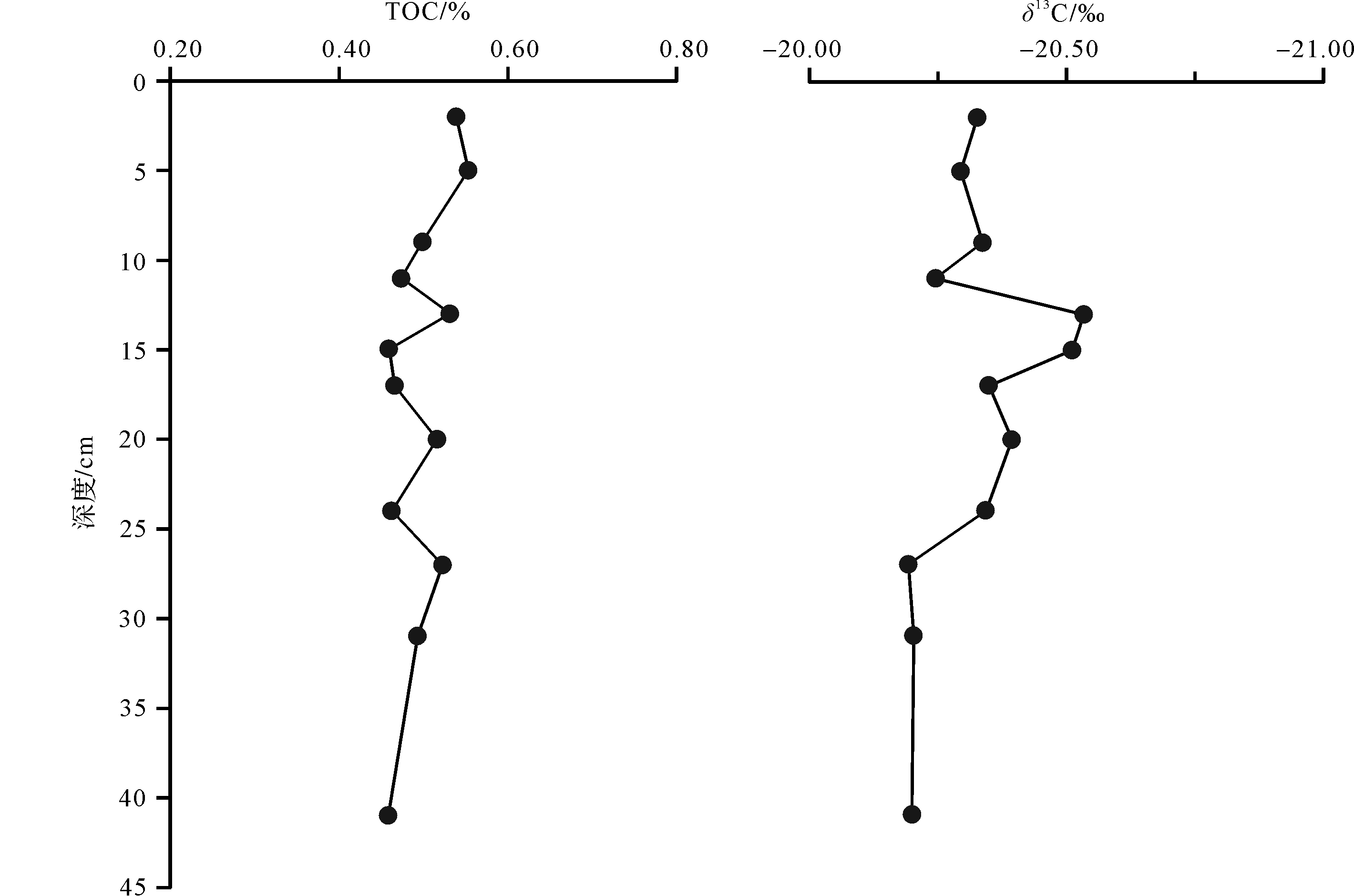
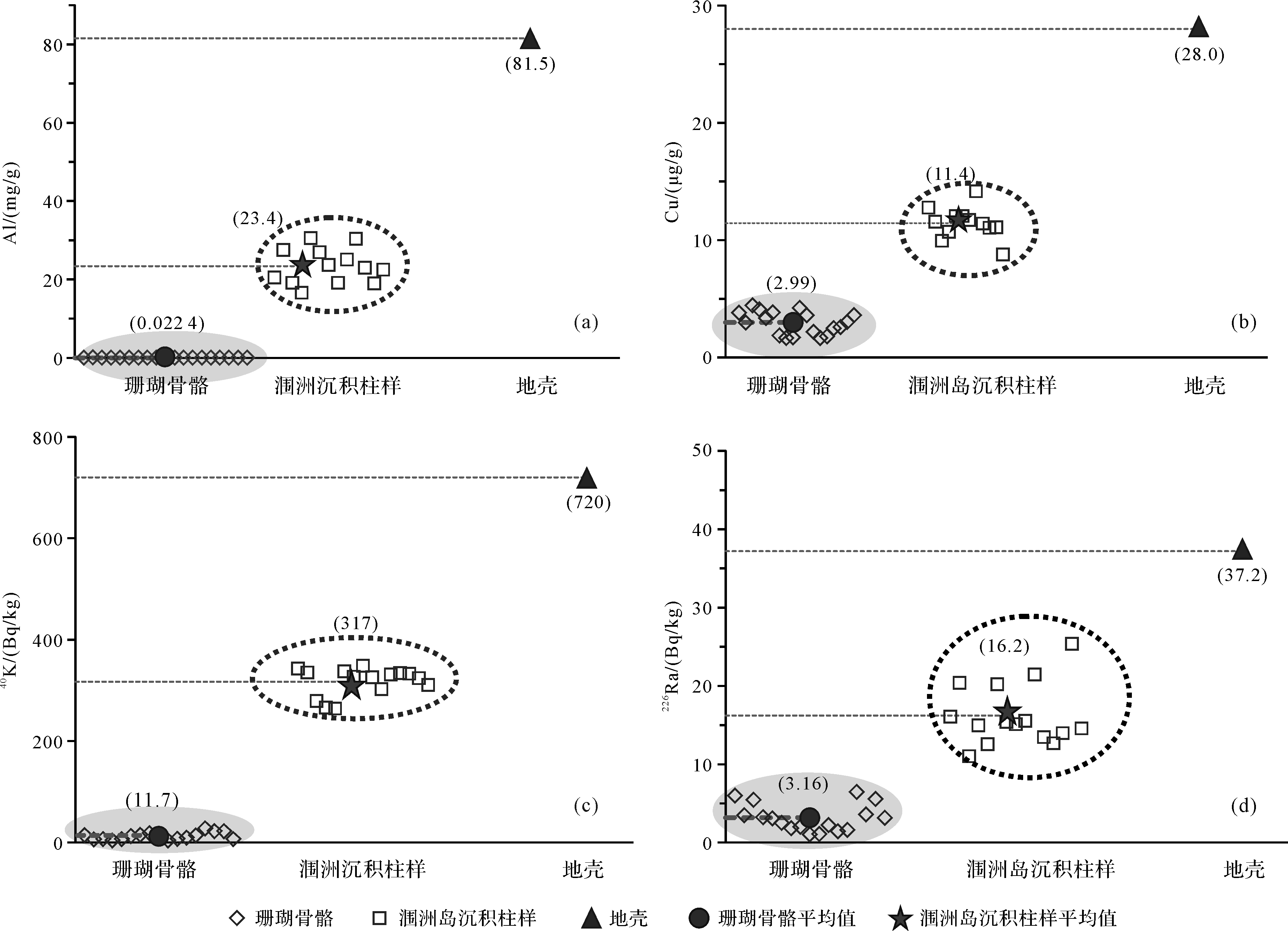
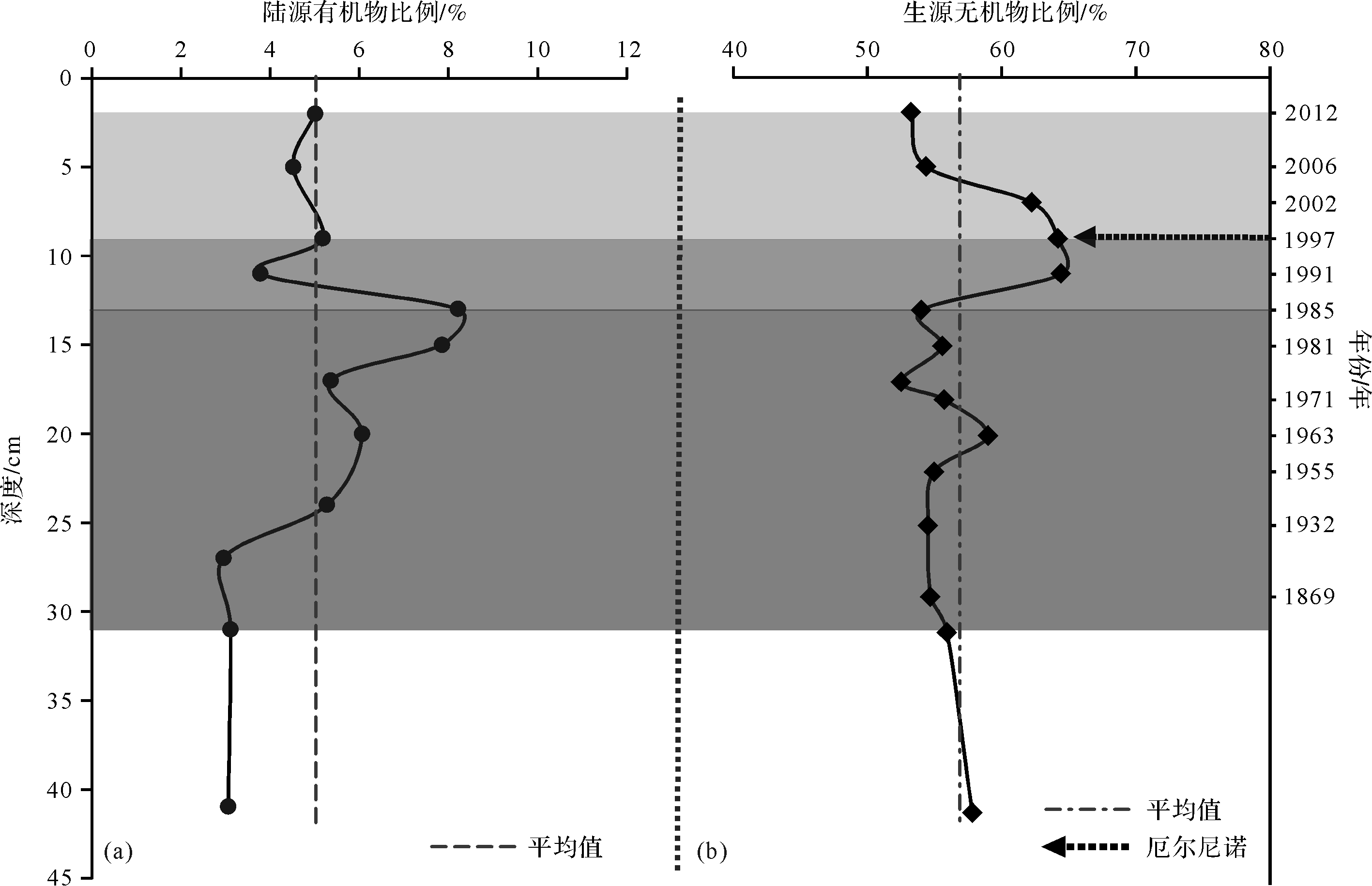
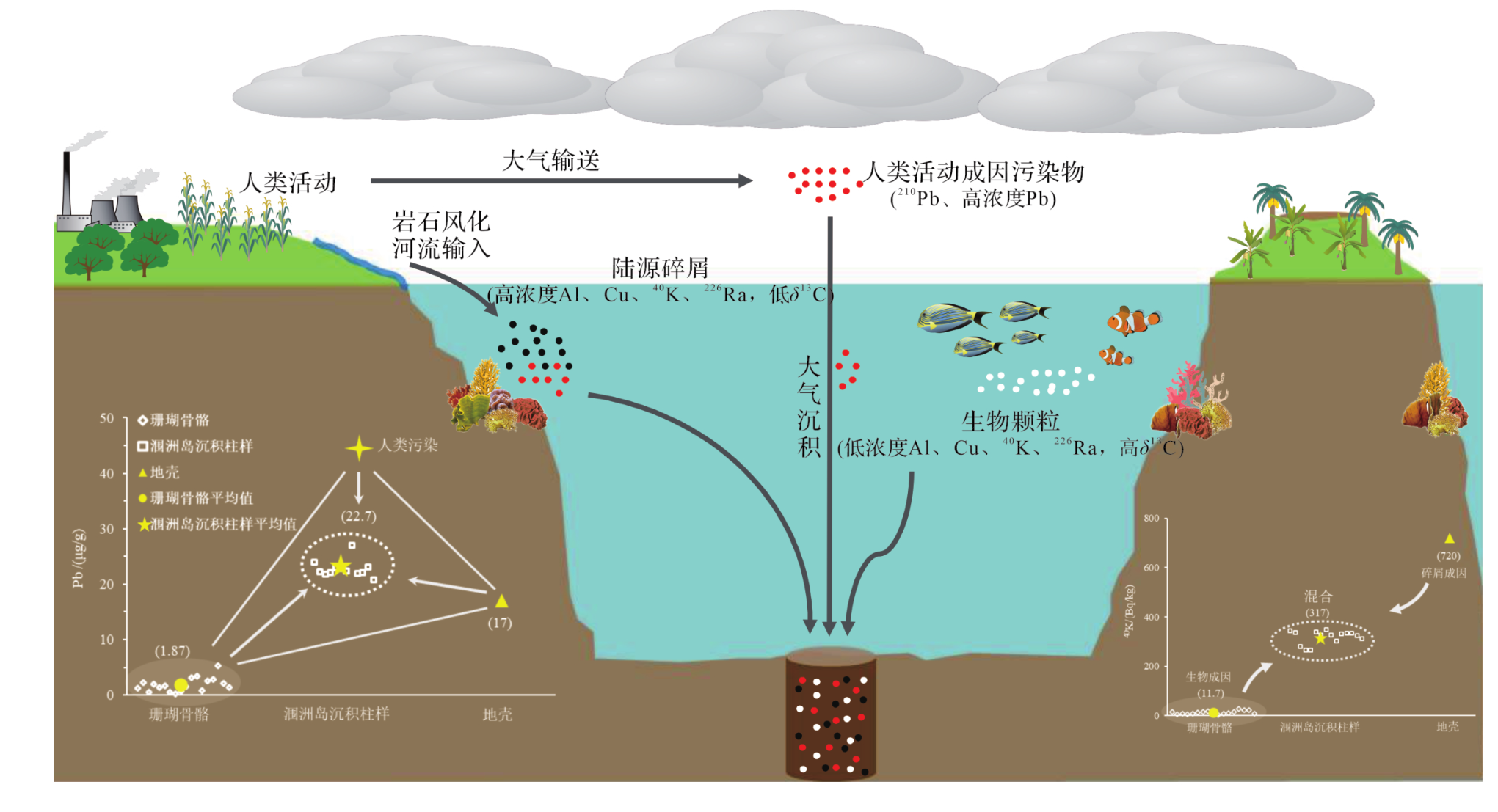
Sediment source is a key topic in marine sedimentology. In this study, sources of organic carbon and inorganic materials in a 210Pb-dated sediment core near southwest Weizhou Island, Beibu Gulf were studied using proxies for elements, stable isotopes, and radionuclides. The average contributions of marine and terrigenous organic carbon were 95.0% and 5.0% based on δ13C of total organic carbon (TOC) in the sediment core. Correspondingly, the mean contributions of biogenic and terrigenous inorganic materials in the sediment core were 64.1% and 35.9% based on multi-proxies of Al, Cu, 40K, and 226Ra. However, Pb in the sediment core could not be accounted for by the mixing of Pb in coral skeletons and crust, indicating that an additional contribution was derived from human activity. Historical contributions of δ13C-derived terrigenous organic carbon and 40K-derived biogenic inorganic material were constructed in the sediment core, indicating the impacts of human activity and climate change (El Nino). Overall, multi-proxies of δ13C, Al, Cu, 40K, and 226Ra were explored for source identification in the core. Our results provide scientific basis for ecology and environment managements in the sea areas near Weizhou Island, Beibu Gulf.

2021, 39(3): 631-644.
doi: 10.14027/j.issn.1000-0550.2020.120
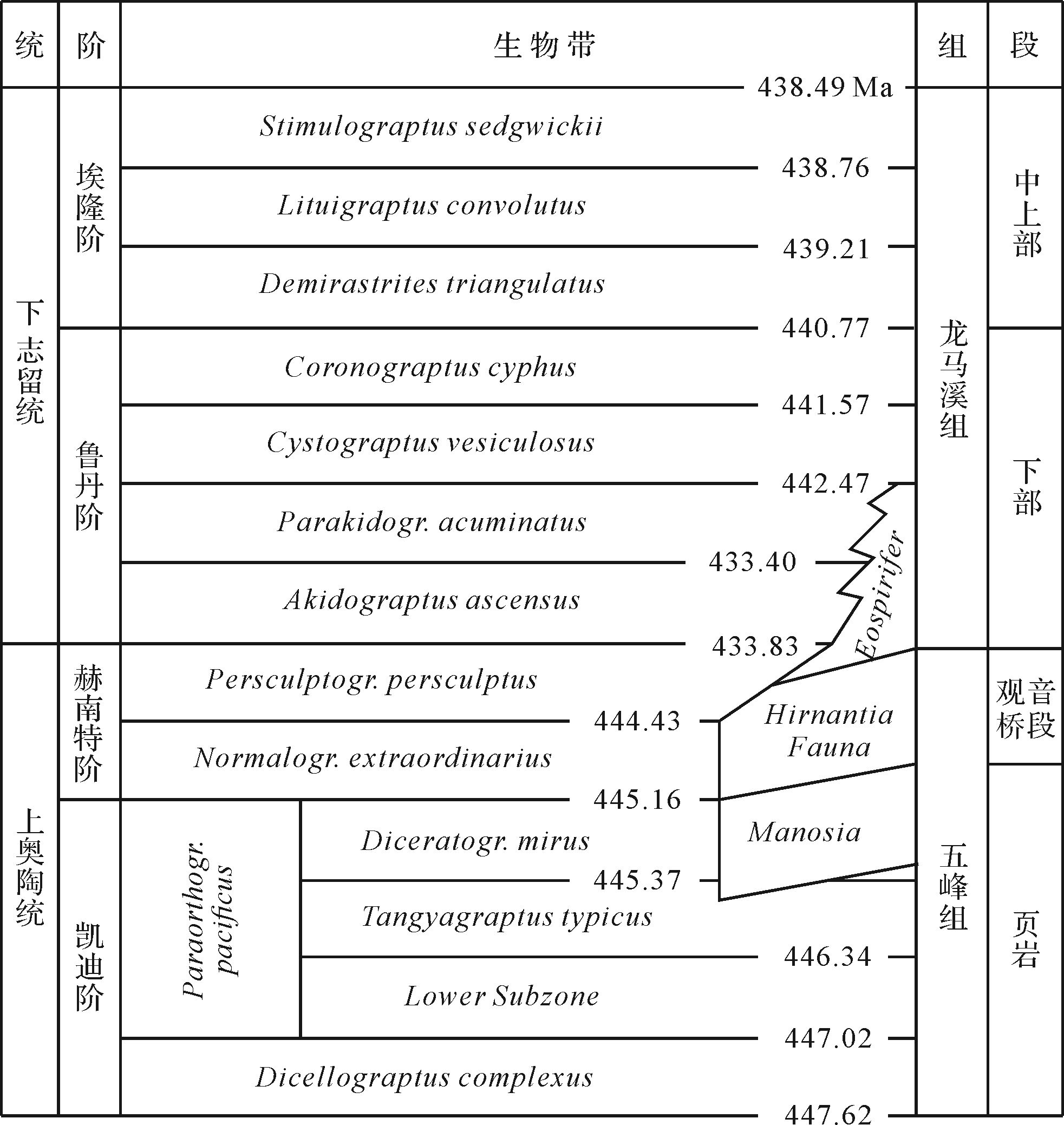
Abstract:
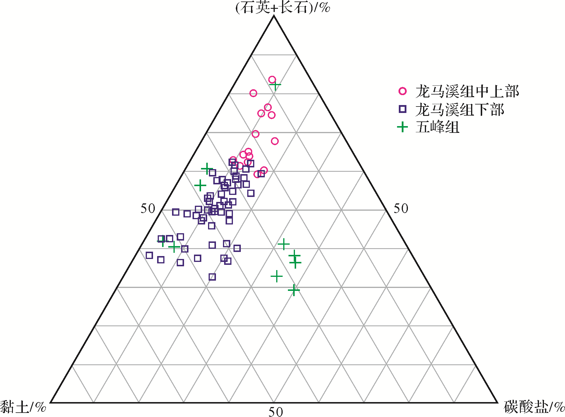
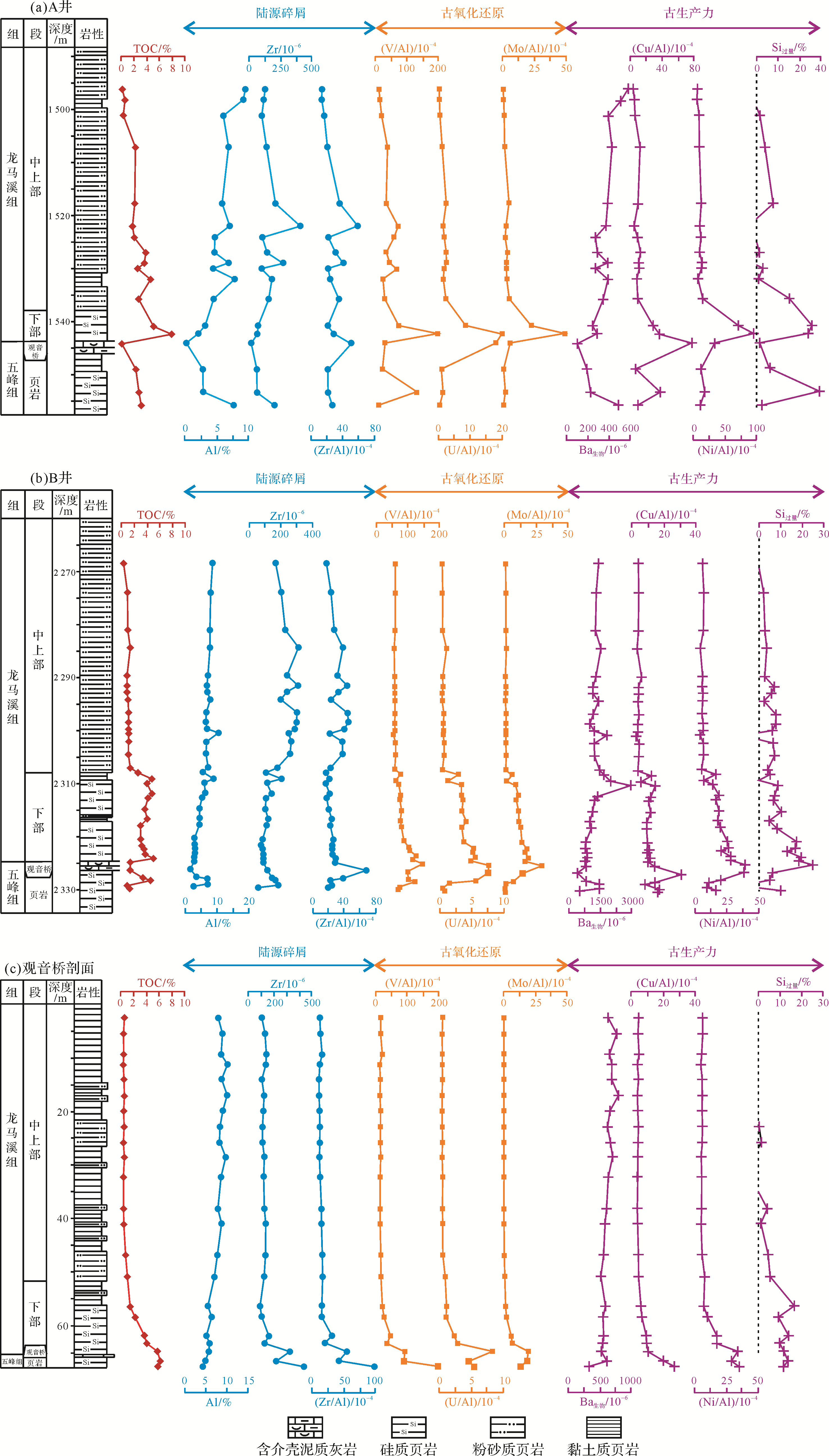
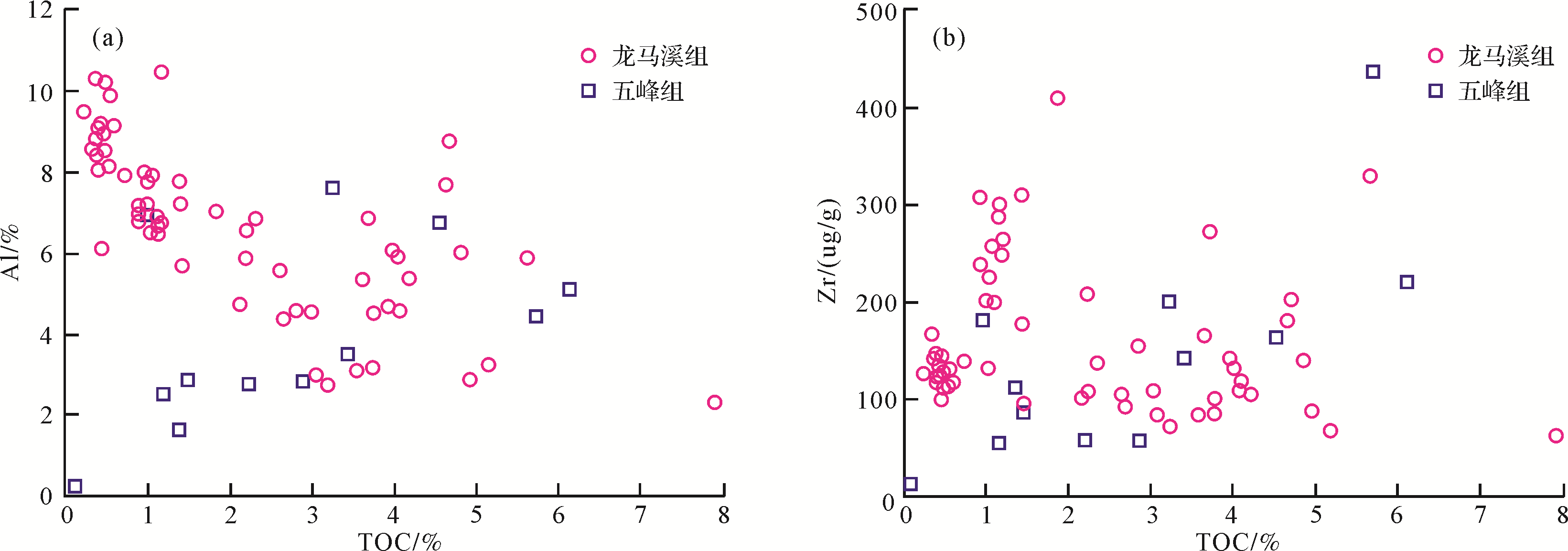
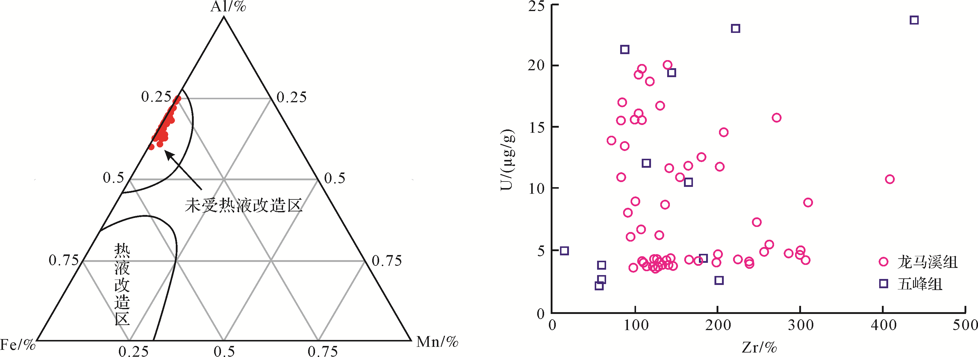
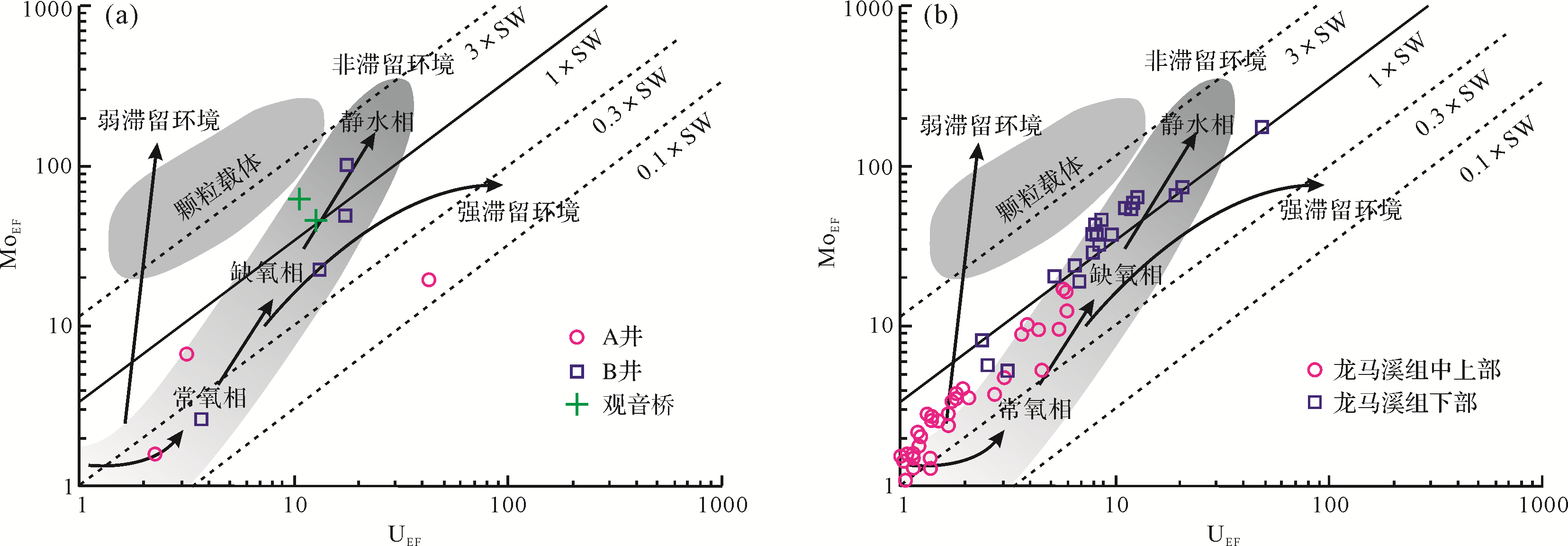
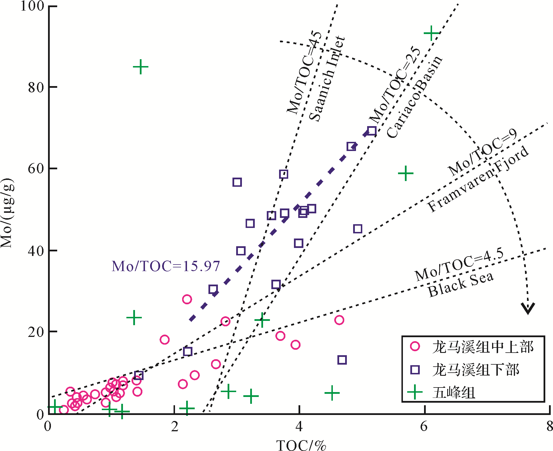
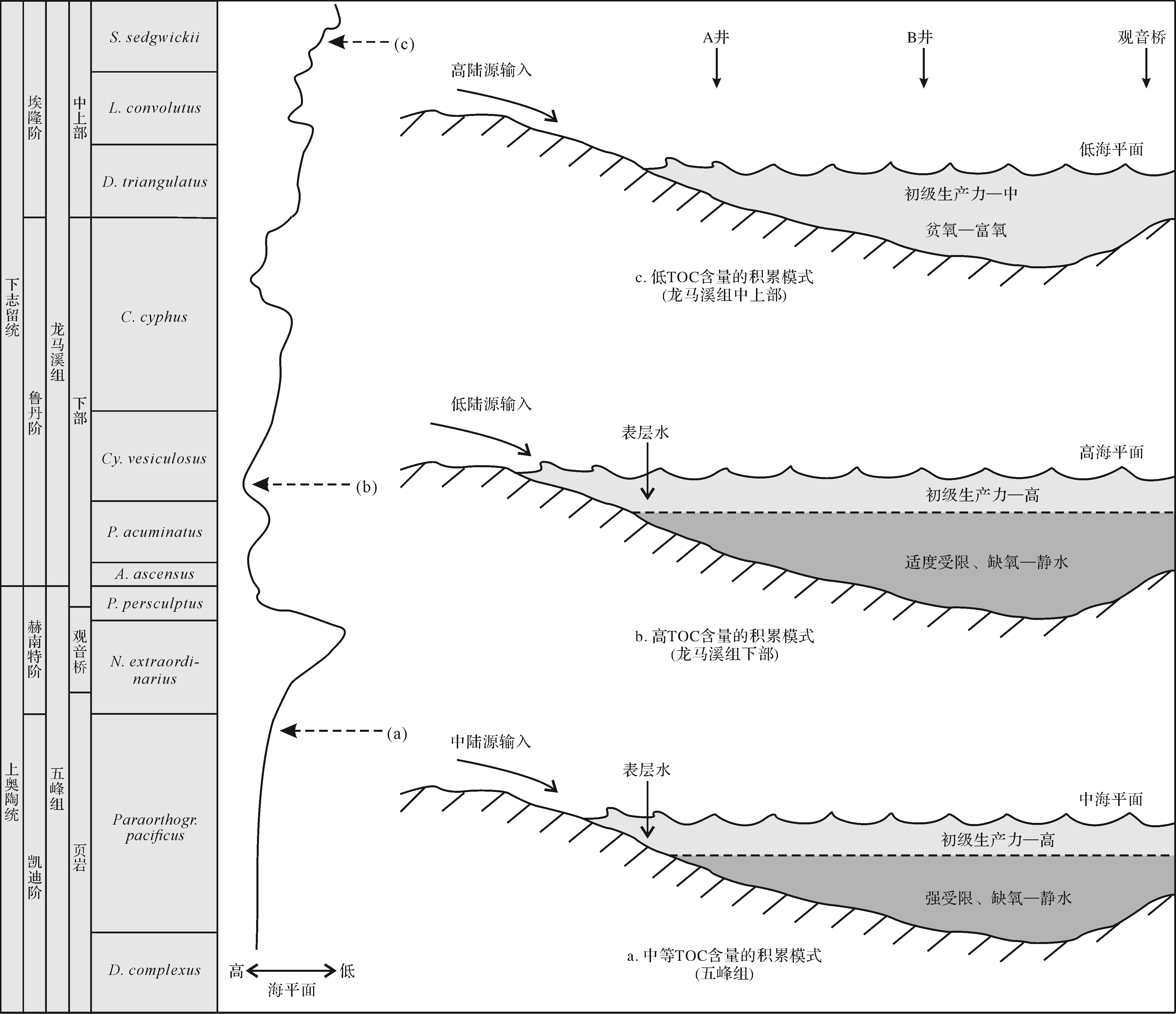
The petrological and geochemical data of the Wufeng-Longmaxi Formations in the southern Sichuan Basin were recorded to restore the paleoenvironment and explore the mechanism of organic matter accumulation. The study shows that the Wufeng-Longmaxi Formations in the southern Sichuan Basin mainly developed siliceous shale, silty shale, argillaceous shale, and shell-bearing lime mudstone/muddy limestone. The average total organic carbon (TOC) of the Wufeng Formation is 3.36%, the TOC of the lower Longmaxi Formation is the highest, with an average of 3.99%, and the TOC of the middle and upper parts is low, with an average of 1.22%. Paleoproductivity proxies (Babio, Cu/Al, Ni/Al, and Siexcess) indicate that during most of the Ordovician-Silurian period (except for the Hirnantian period), the surface water in the southern Sichuan Basin had a high primary productivity. The terrigenous influx proxies (Al, Zr, and Zr/Al) indicate that the terrigenous influx in the Wufeng period was moderate and varied greatly. The early Longmaxi period had a continuous low value, but it gradually increased in the middle and late periods. The correlation between redox-sensitive trace elements (Mo/Al, U/Al, and V/Al) and Mo-TOC shows that, during the Wufeng period, the ocean developed a strong restricted anoxic-euxinic environment. The water mass in the early stage of the Longmaxi maintained anoxic-euxinic conditions, the level of restriction was weakened, and the ocean evolved into an oxic environment in the middle and late periods. In the Late Ordovician, a favorable anoxic-euxinic environment and high productivity developed in the ocean, but the large amount of terrigenous influx weakened the organic matter accumulation. In the Early Silurian, sea level fluctuations caused multiple environmental parameters to coordinately change, which resulted in significant differences in the concentration of organic matter.


2021, 39(3): 645-655.
doi: 10.14027/j.issn.1000-0550.2020.106
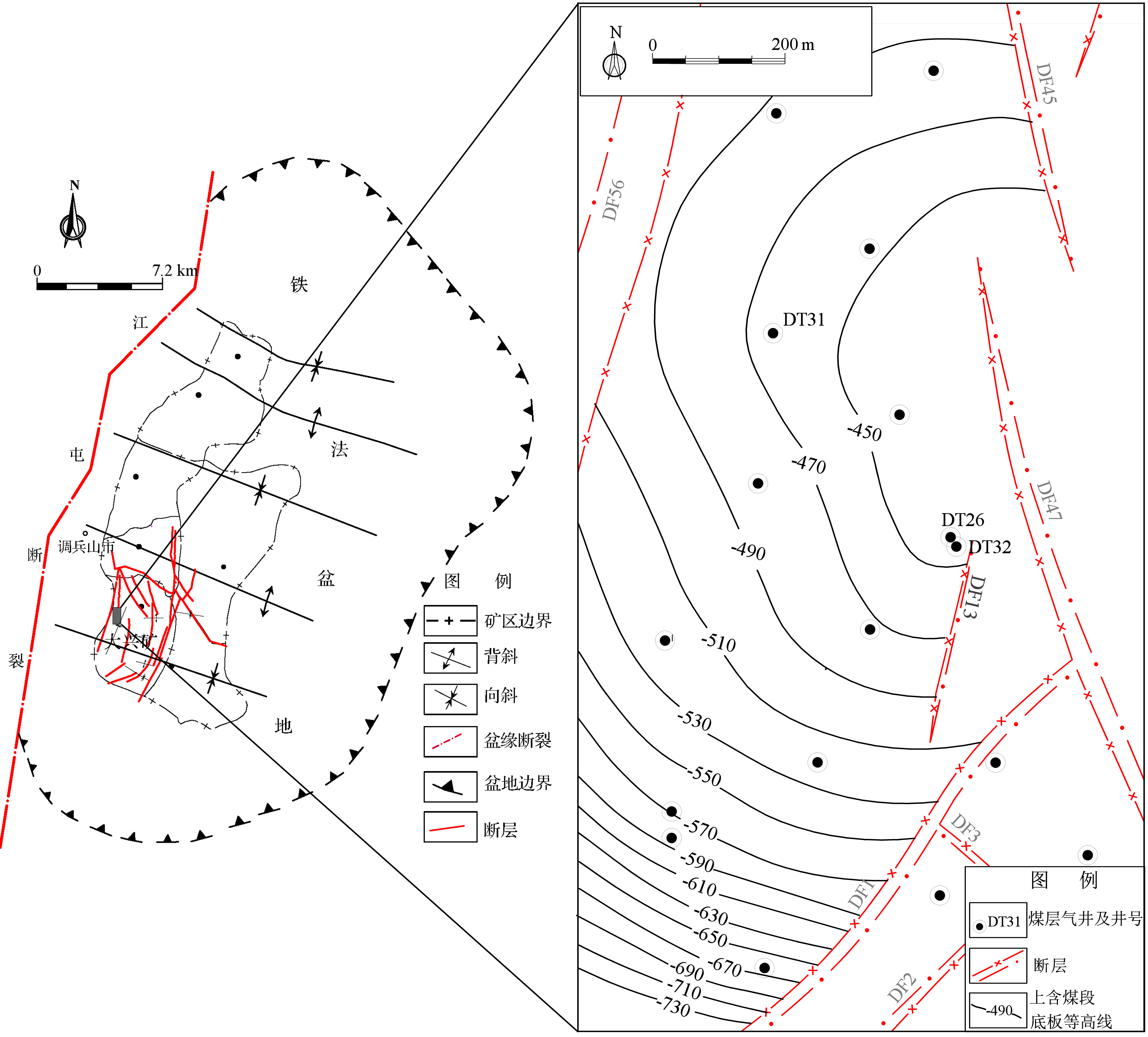
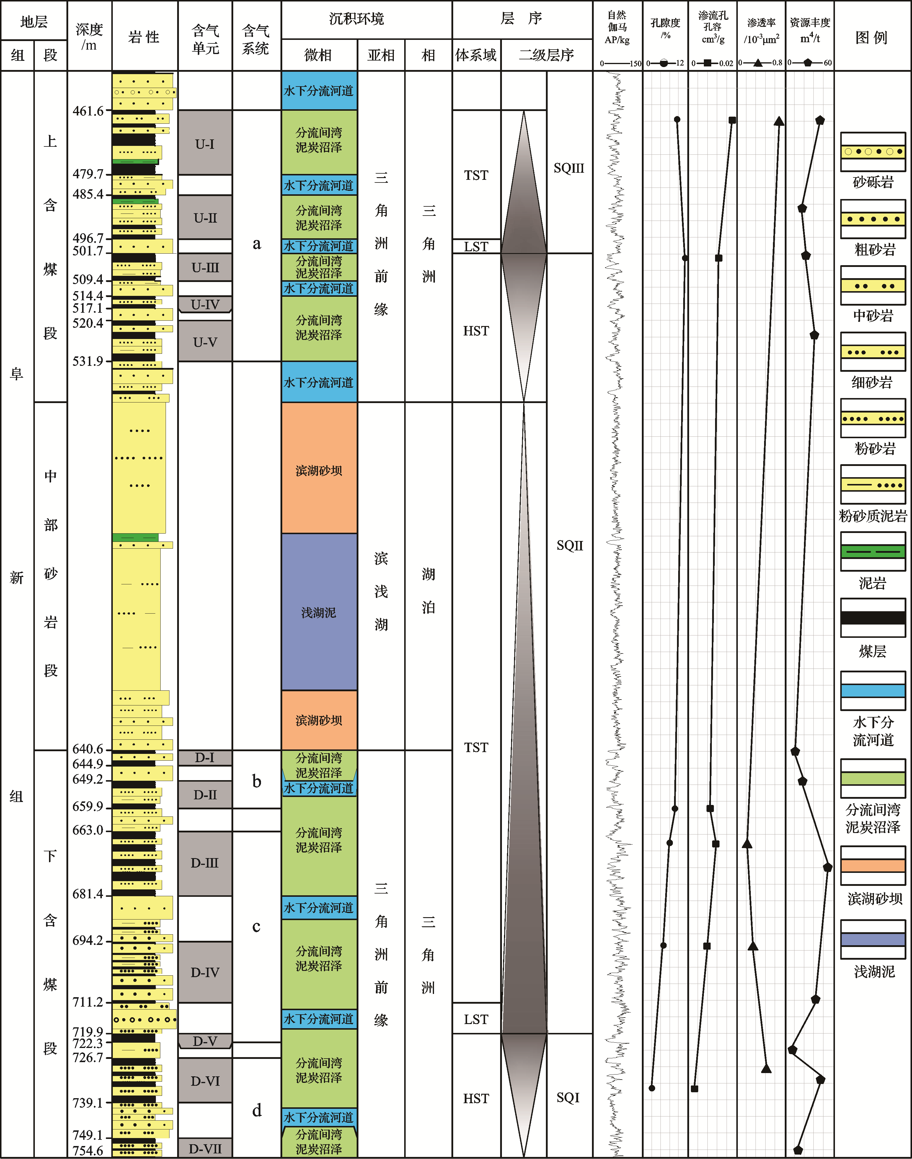
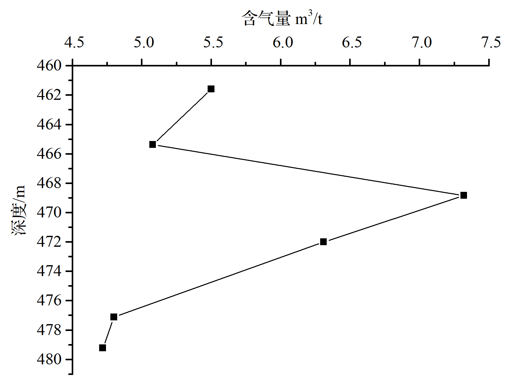
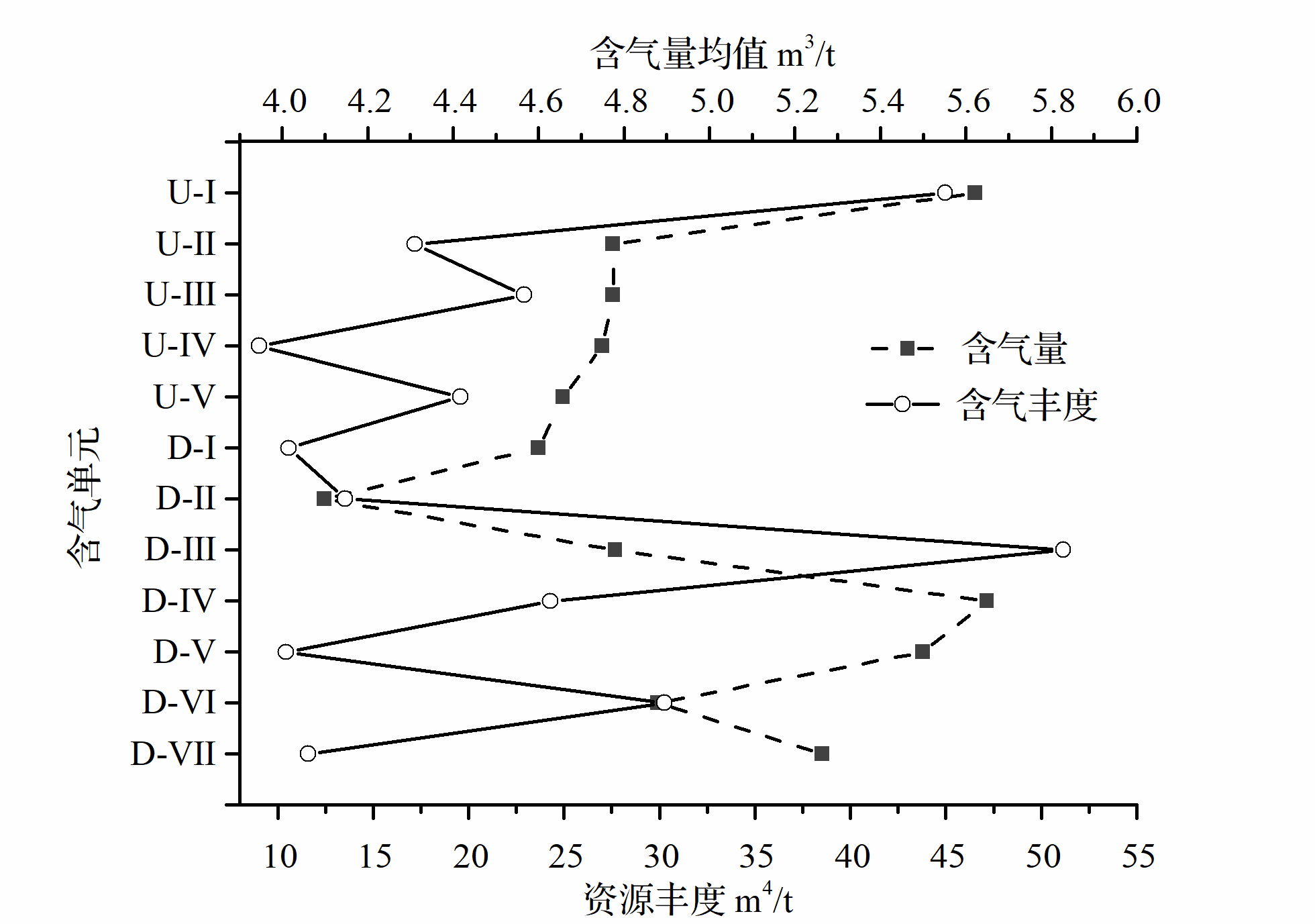
Abstract:
The characteristics of multi-gas-bearing systems affect the outcome of commingling the production of coalbed methane (CBM) from multiple strata. In this case study, multiple superimposed gas-bearing systems in the Fuxin Formation, Tiefa Basin, are categorized by their stratigraphical sequence and the properties of the non-gas-bearing strata lying between the gas-containing units. The gas-bearing characteristics, seepage conditions and fluid pressures of each CBM system were analyzed to consider the effect of separate and commingled production of gas from the upper and lower coal sections. It was found that each of the five gas-containing units in the upper coal-bearing section are all part of a single gas-bearing system, whereas the seven gas-containing units in the lower coal-bearing section comprised three distinct gas-bearing systems. A transgressive lacustrine system tract had resulted in a relatively large abundance of CBM gas-bearing units at the delta front. In the study area, thick, stable water- and gas-barrier layers of lake-shore and shallow-lake subfacies form the strata between the gas-bearing systems. With greater burial depth, the reservoir porosity, average seepage pore volume, fracture development and reservoir seepage capacity of each gas-bearing layer all decrease significantly. The large difference in reservoir pressure and critical desorption pressure between the upper and lower coal-bearing sections occur because they belong to different gas-bearing systems. The supply of both water and gas in the upper and lower sections are not synchronized in commingled production of the upper and lower coal sections, causing very significant interference in gas and water production. Commingled production of CBM, from best to general, is: (i) from the upper coal-bearing section; (ii) from the upper-plus-lower coal-bearing sections; and (iii) production from the lower coal-bearing section only. Production (i) is best because its various gas-containing units form a single compatible gas-bearing system, and its reservoirs also have the obvious advantages of rich gas content and high permeability.
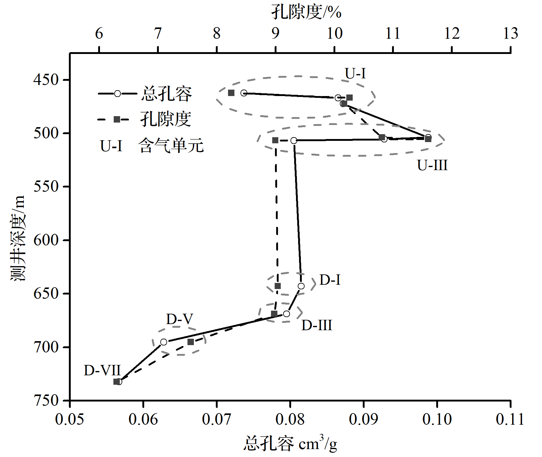
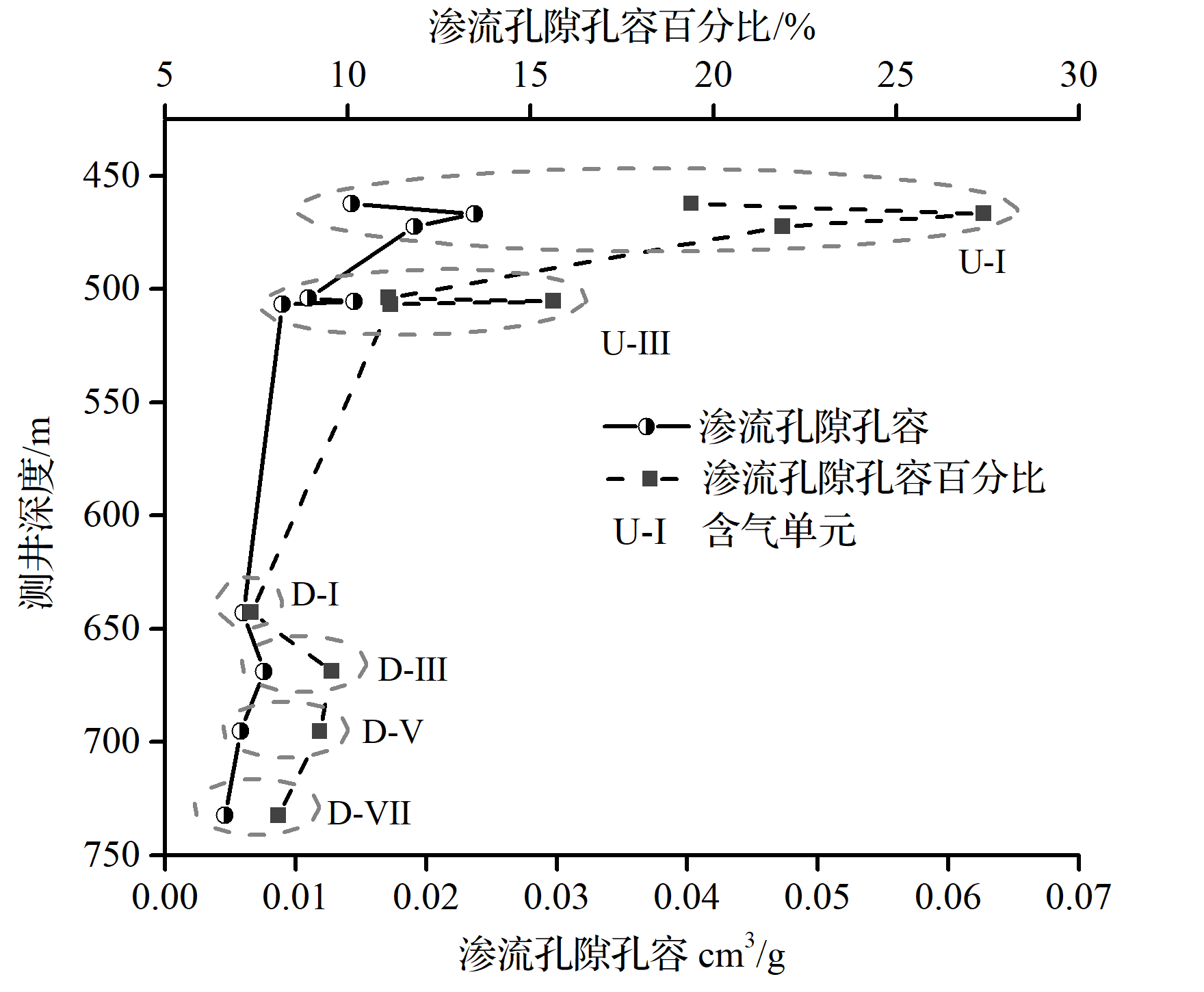
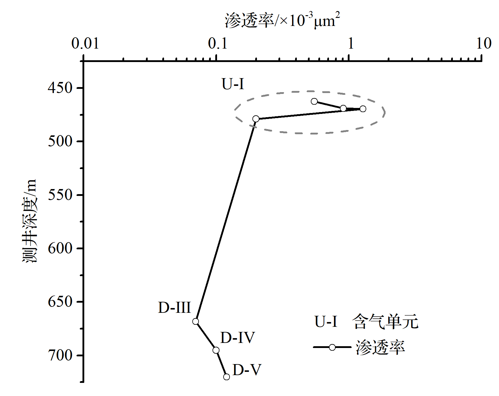
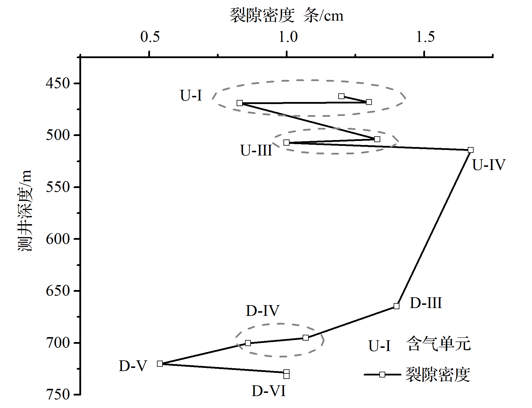
2021, 39(3): 656-671.
doi: 10.14027/j.issn.1000-0550.2020.038
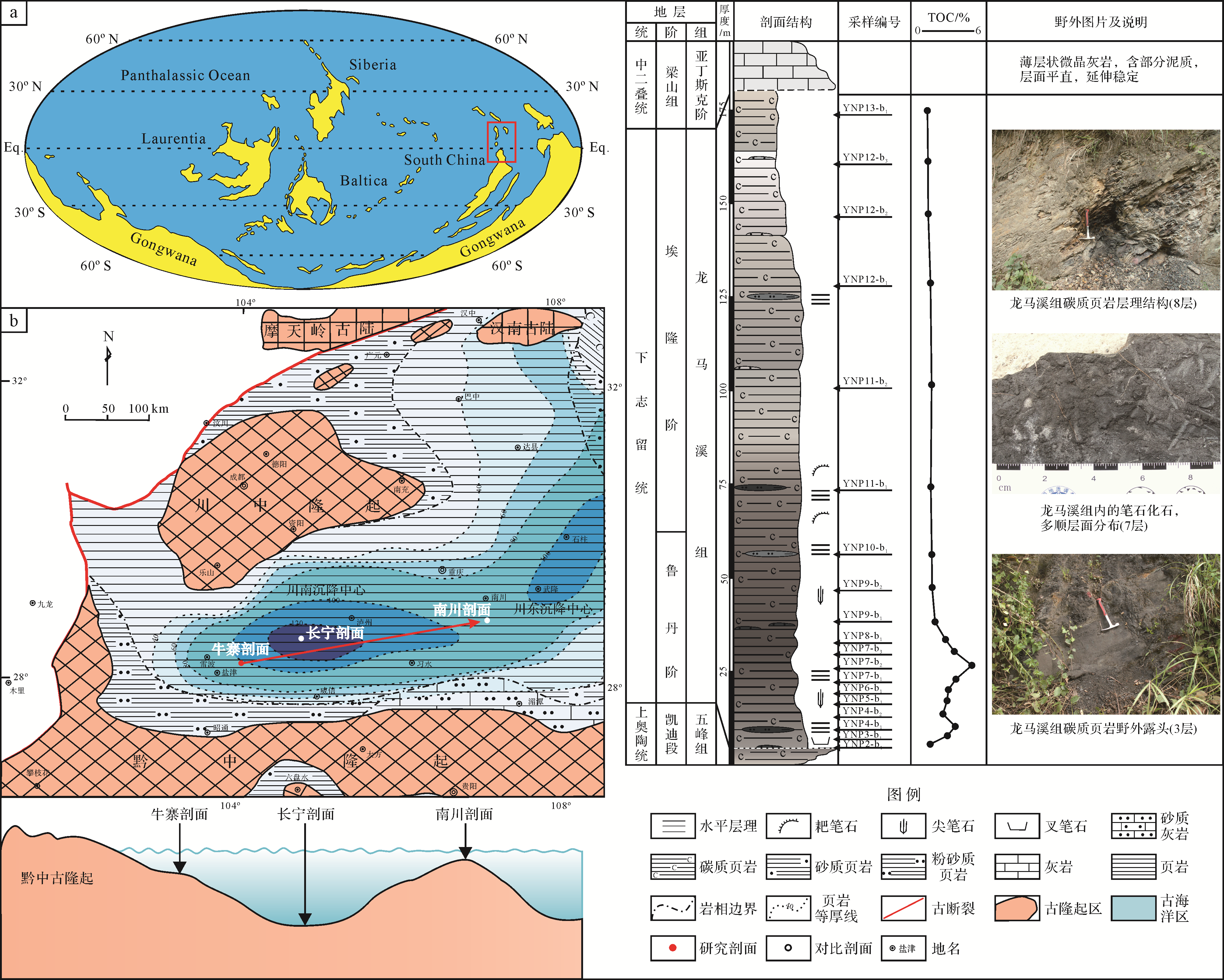
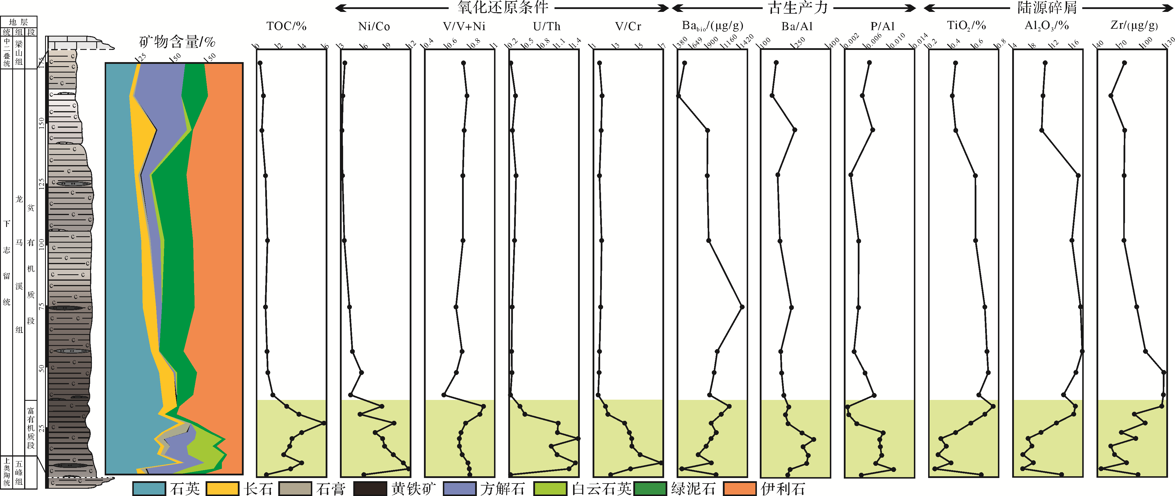
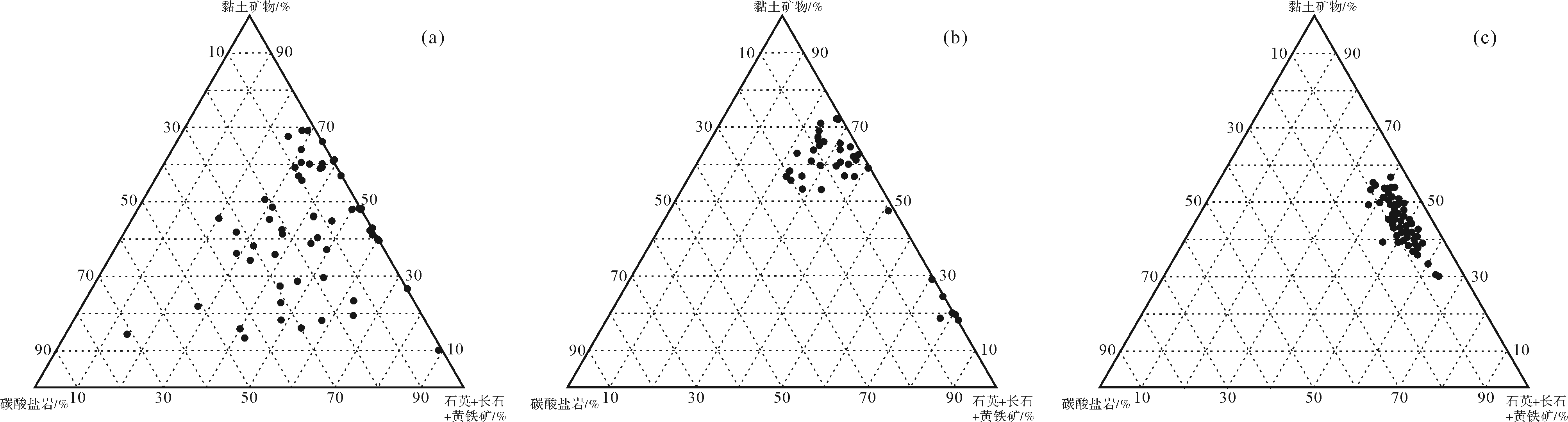
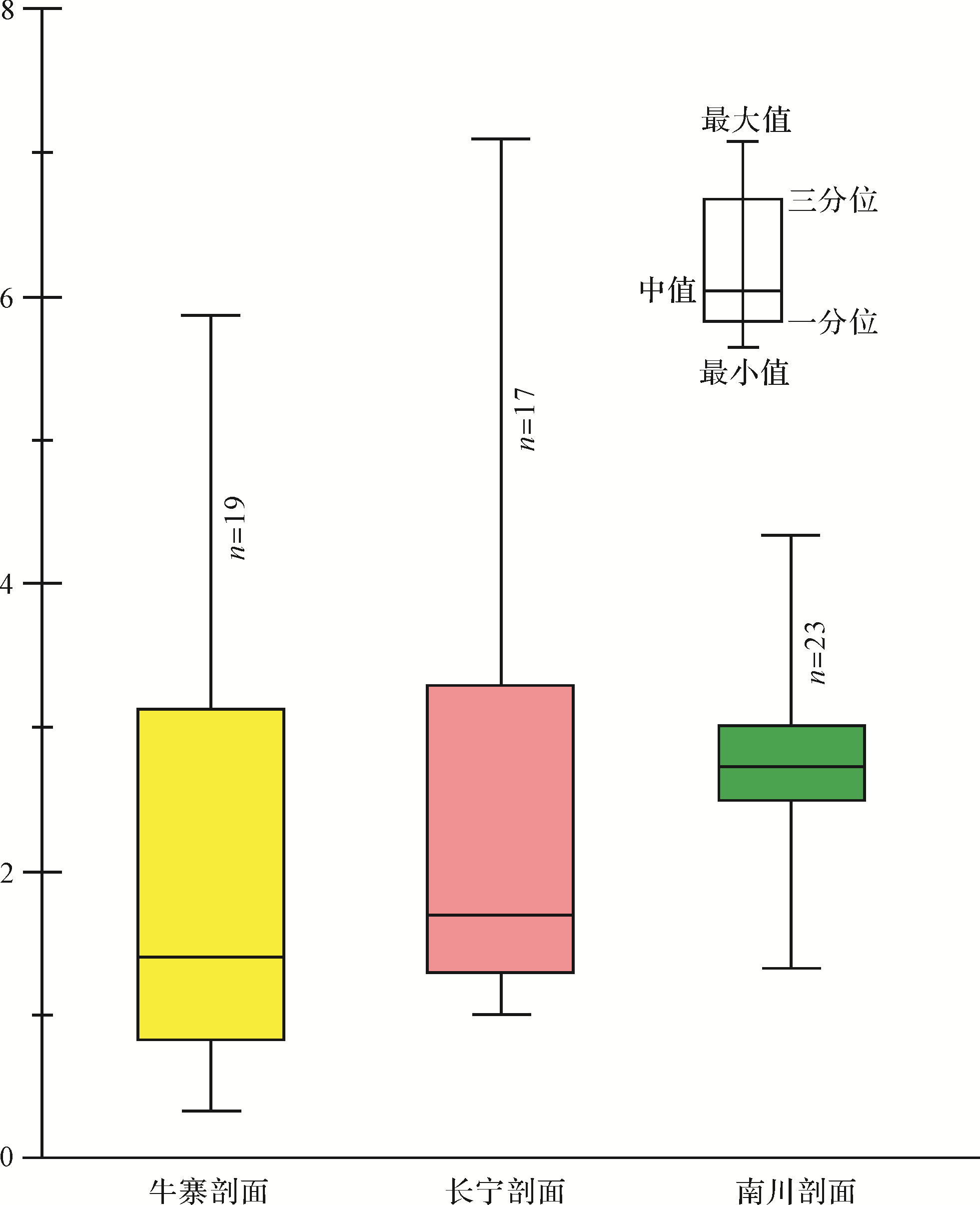
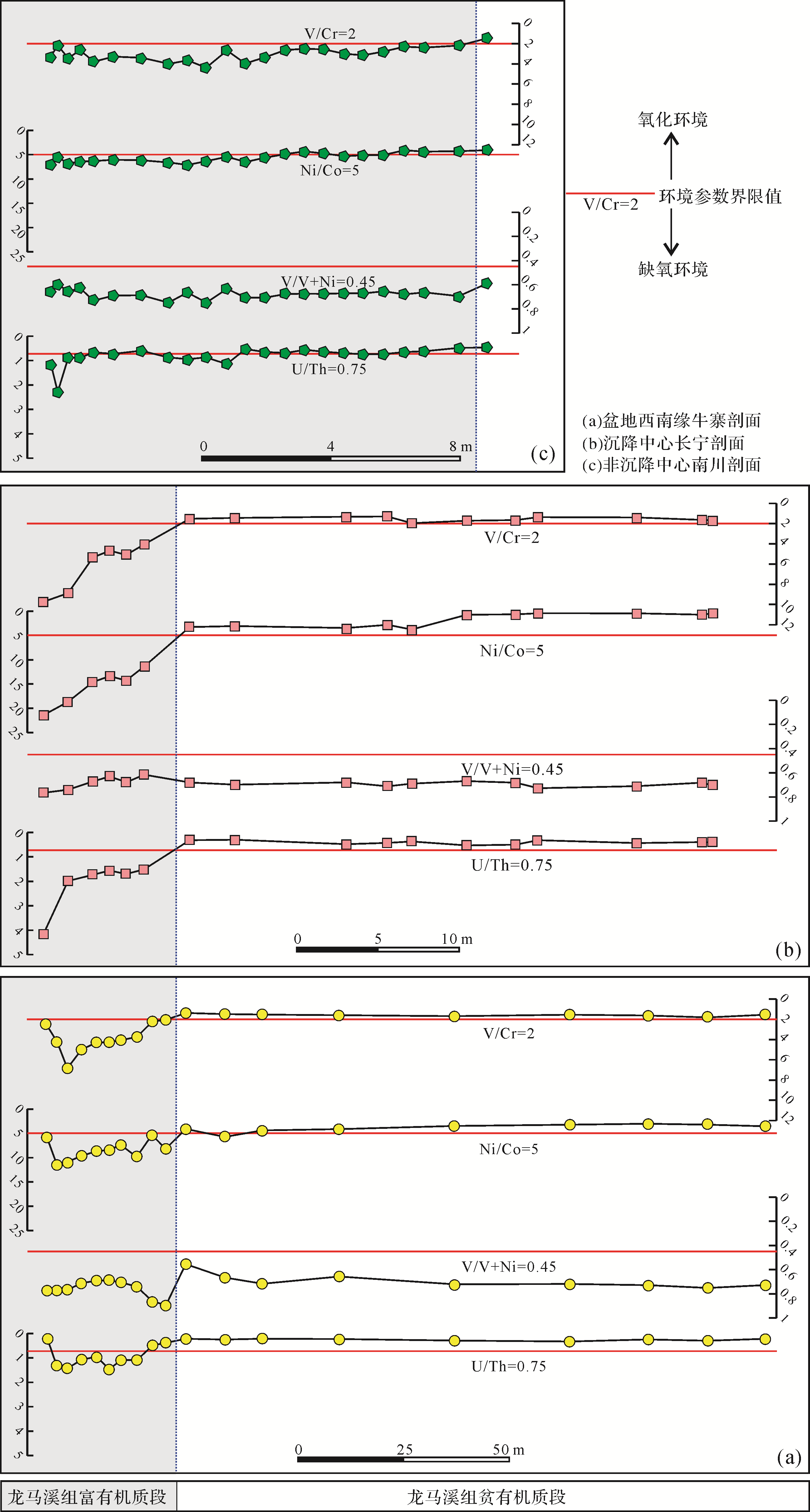
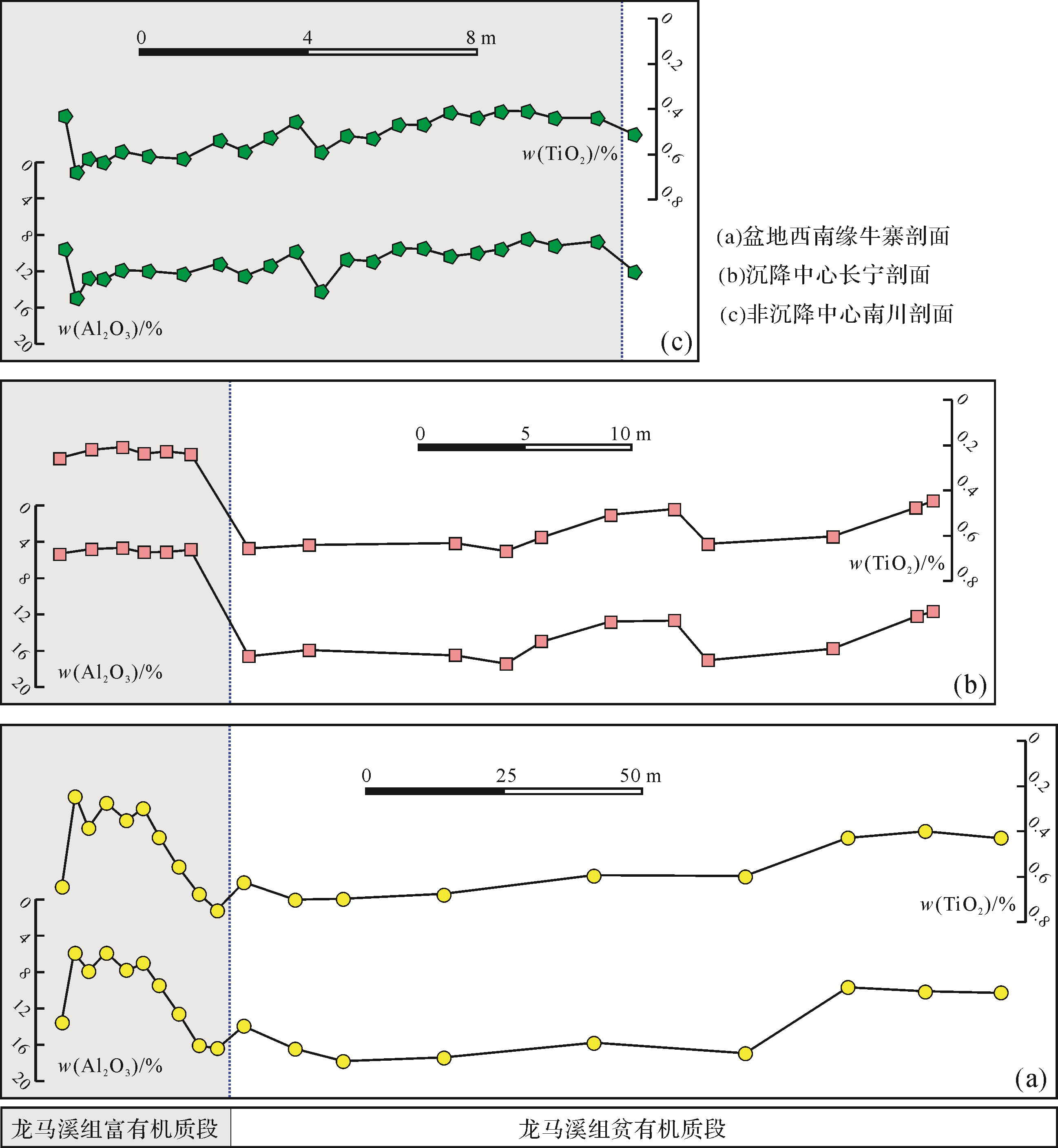
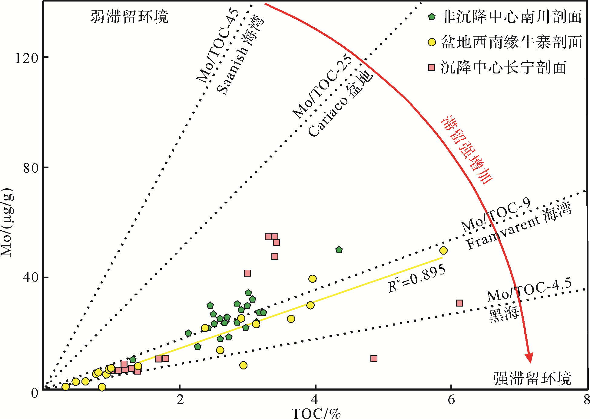
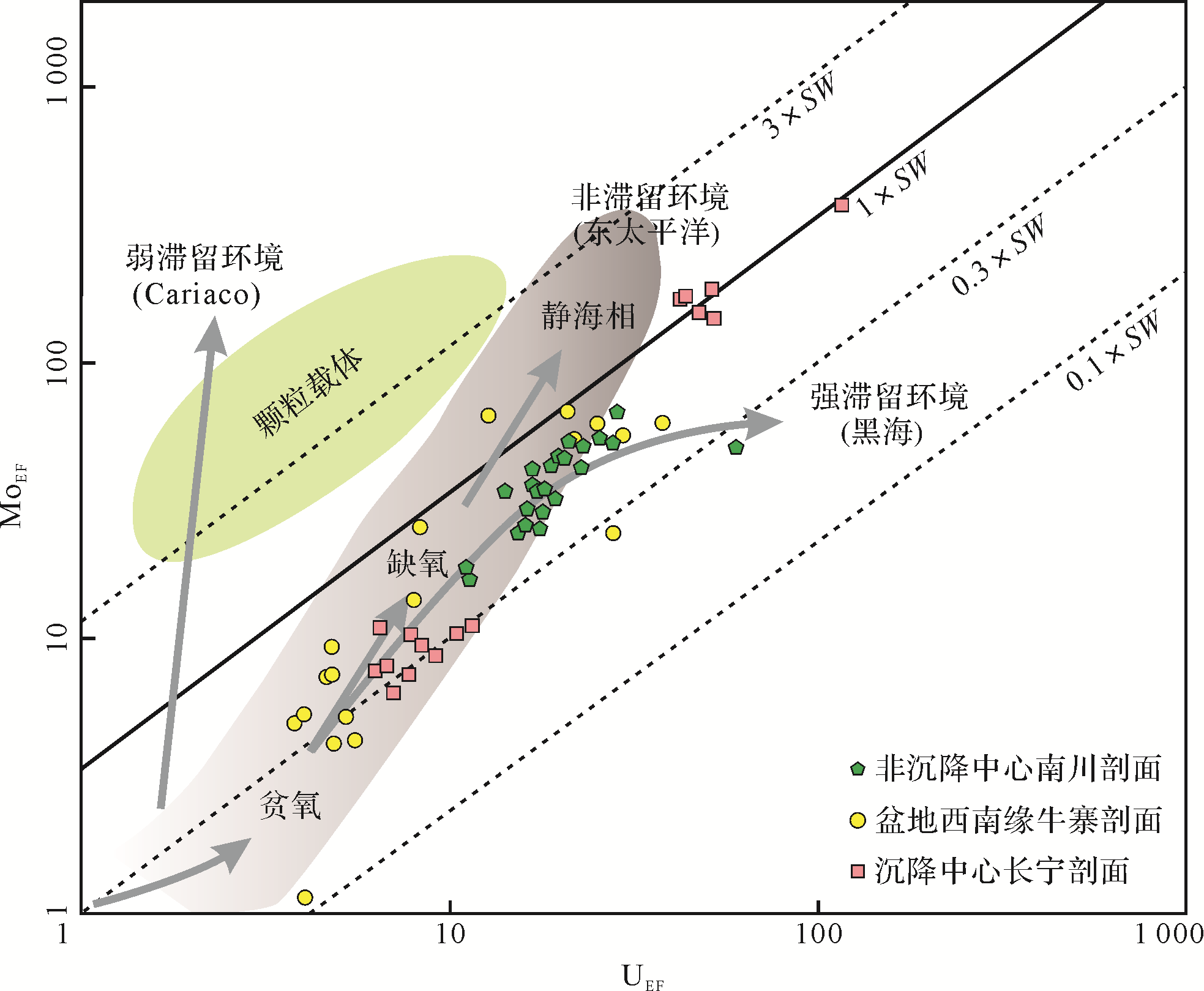
Abstract:
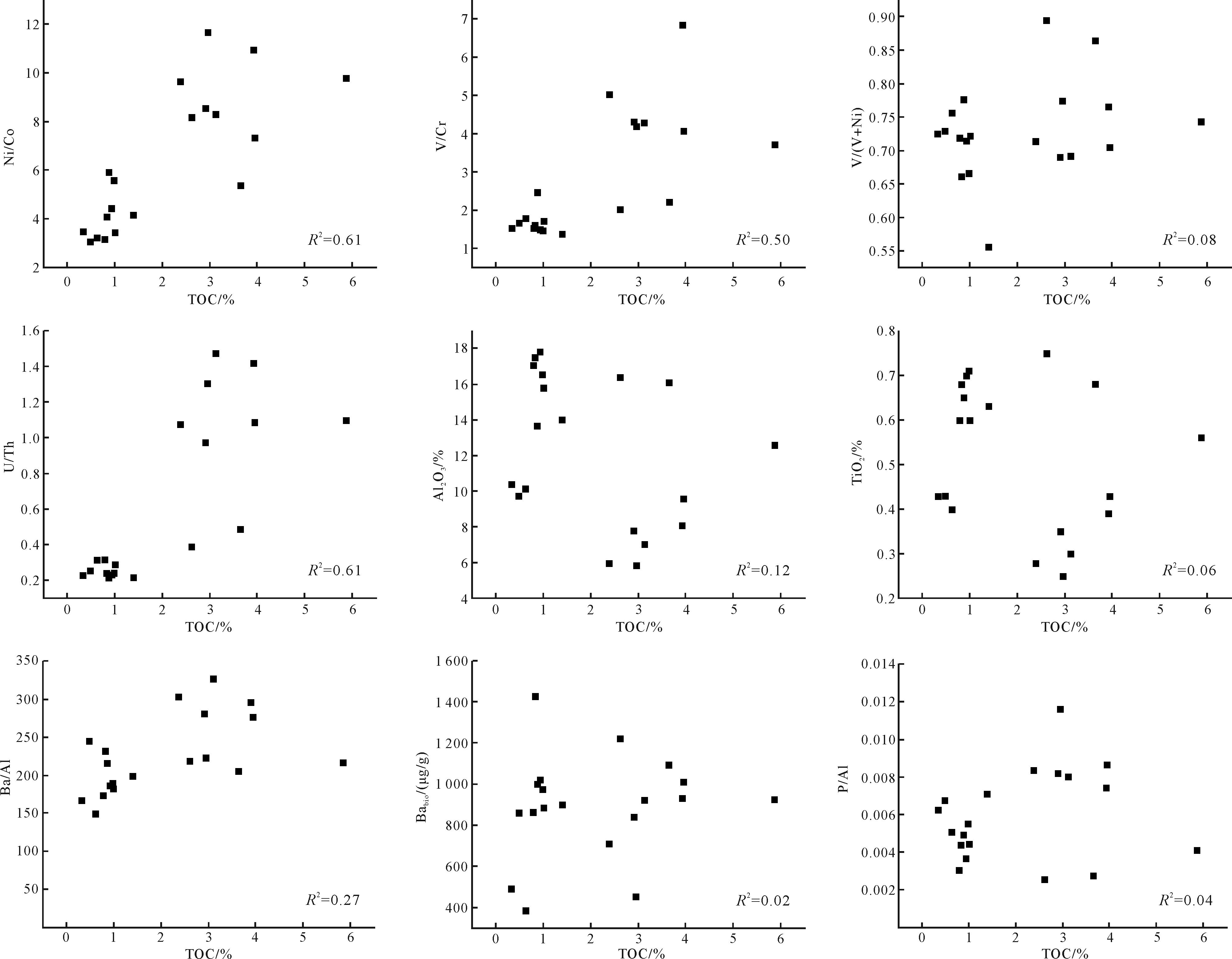
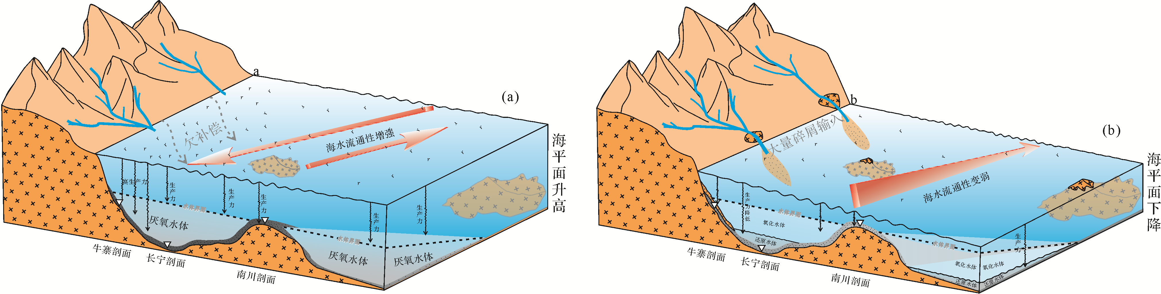
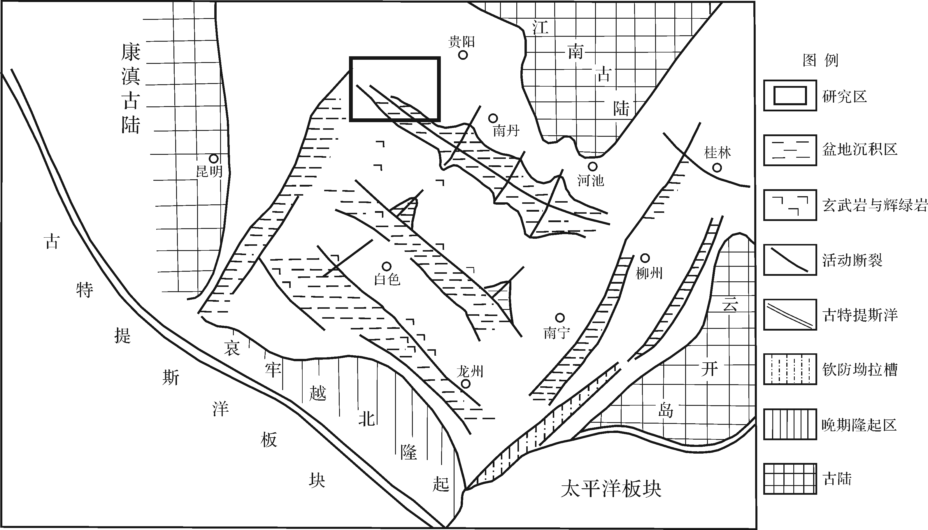
Based on the differences in the behavioral characteristics of chemical elements, the content or ratio of TOC, major elements and trace elements was used to discriminate the formation of fine-grained sedimentary rocks of the Early Silurian Longmaxi Formation in Niuzhai section of Yanjin, at the southwestern margin of the Sichuan Basin. Paleoproductivity, redox conditions, input of terrestrial supply and the degree of basin water retention, and other environmental characteristics are compared. Paleoenvironmental parameters of the Longmaxi Formation in the South Sichuan Subsidence Center (Changning section) and Nanchuan Underwater Uplift Area (Nanchuan section) are compared. Differences in organic matter enrichment of fine-grained sedimentary rocks in the stranded basin of the Yangtze Sea in the Early Silurian. The results show that the Early Silurian fine-grained sedimentary rocks in the Niuzhai area of Yanjin are mainly black carbonaceous shales, gray shales and black mudstones, and the organic-rich materials are mainly concentrated in the lower section of the Longmaxi Formation, with an average TOC content of 2.73%. Babio shows that the Longmaxi Formation in this area had higher productivity in the early stage. Ni/Co, V/(V+Ni), U/Th, and V/Cr ratios revealed that the Longmaxi Formation gradually transitioned from a hypoxic environment at the bottom to an oxidizing environment at the top; TiO2, Al2O3 and Zr indicate that the supply of terrigenous debris in the lower segment of the Longmaxi Formation increased significantly; the Mo/TOC value and the U-Mo covariance model map indicate that the southwestern margin of the Sichuan Basin was in a moderately stagnant environment during the Early Silurian. Compared with the Changning and Nanchuan profiles, it is found that TOC in the southwestern margin of the basin has a significant positive correlation with redox conditions; it has a weak positive correlation with the retention of the basin water body; it has a weak positive correlation with the injection of terrigenous debris and primary productivity There is no obvious correlation, indicating that the anoxic reduction sedimentary environment is the main factor affecting the organic matter enrichment of the black shale of the Longmaxi Formation in this area.
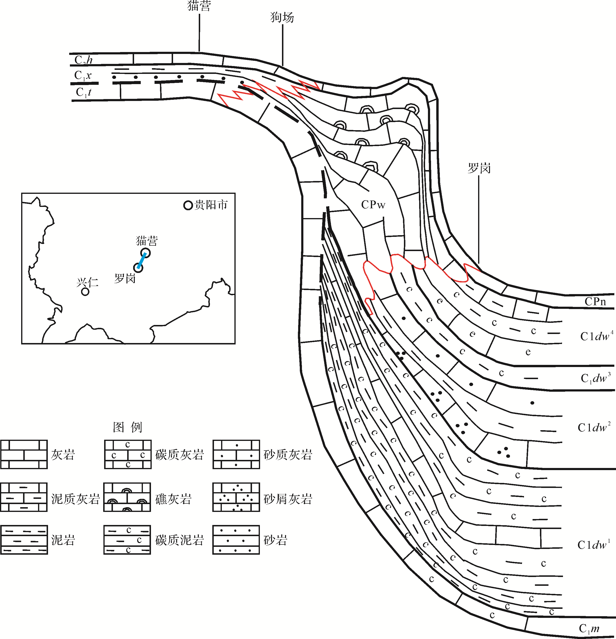
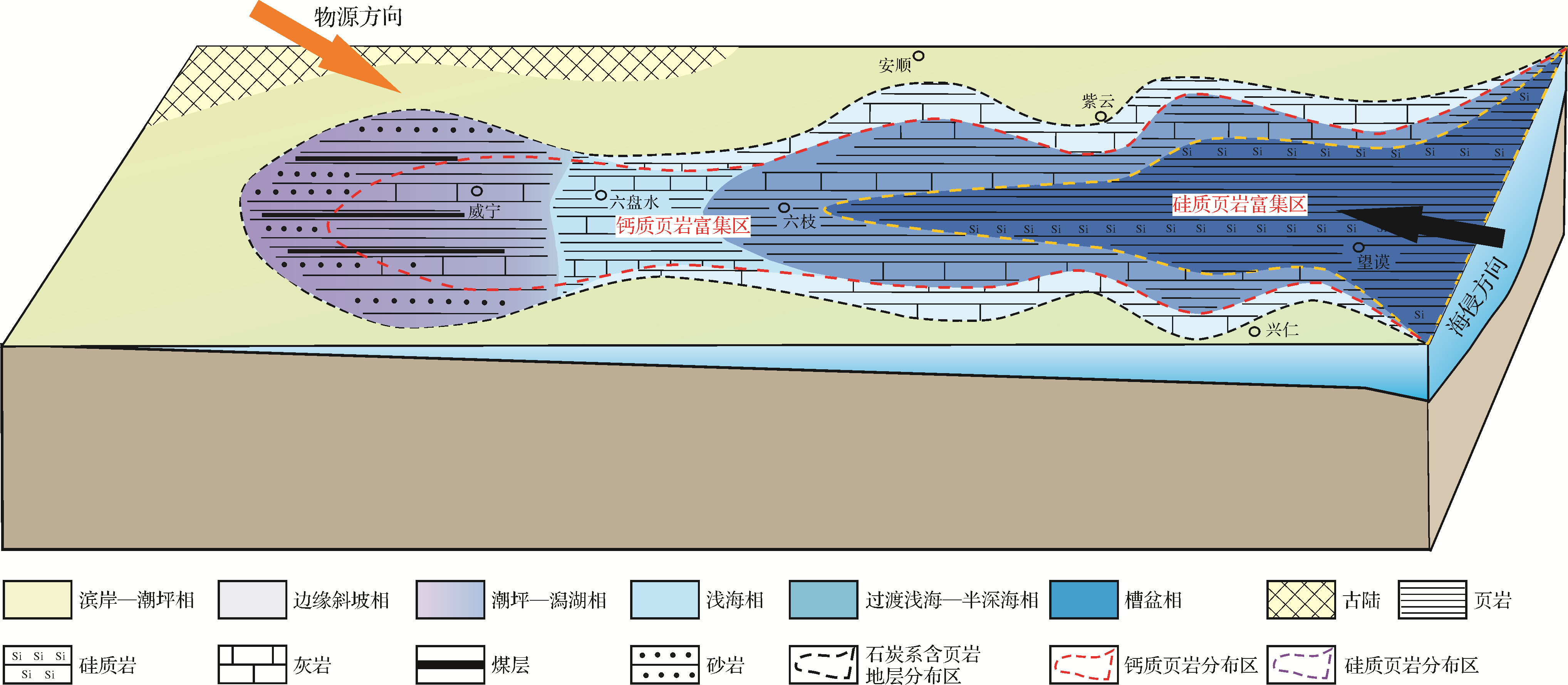
2021, 39(3): 672-685.
doi: 10.14027/j.issn.1000-0550.2020.114
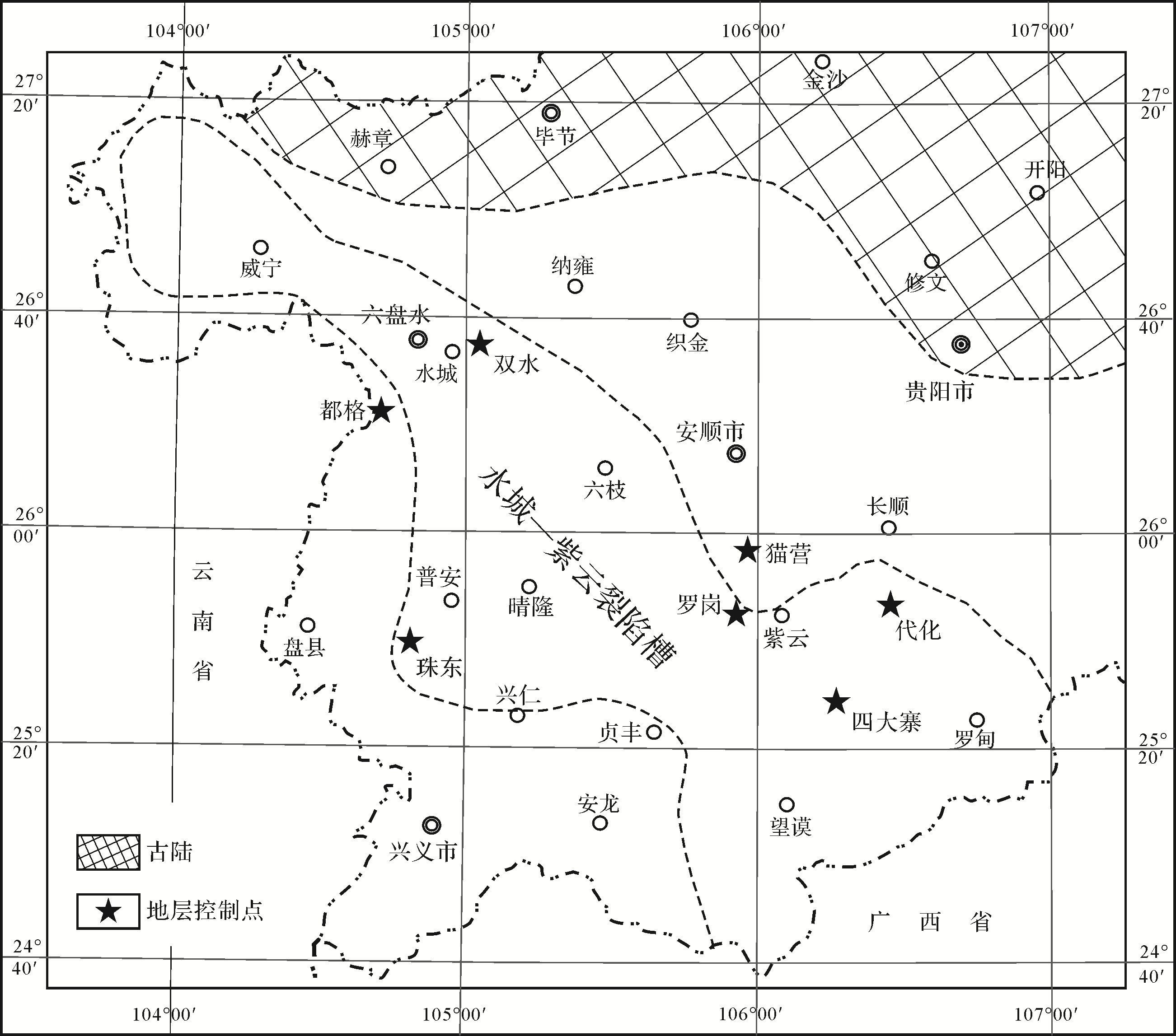
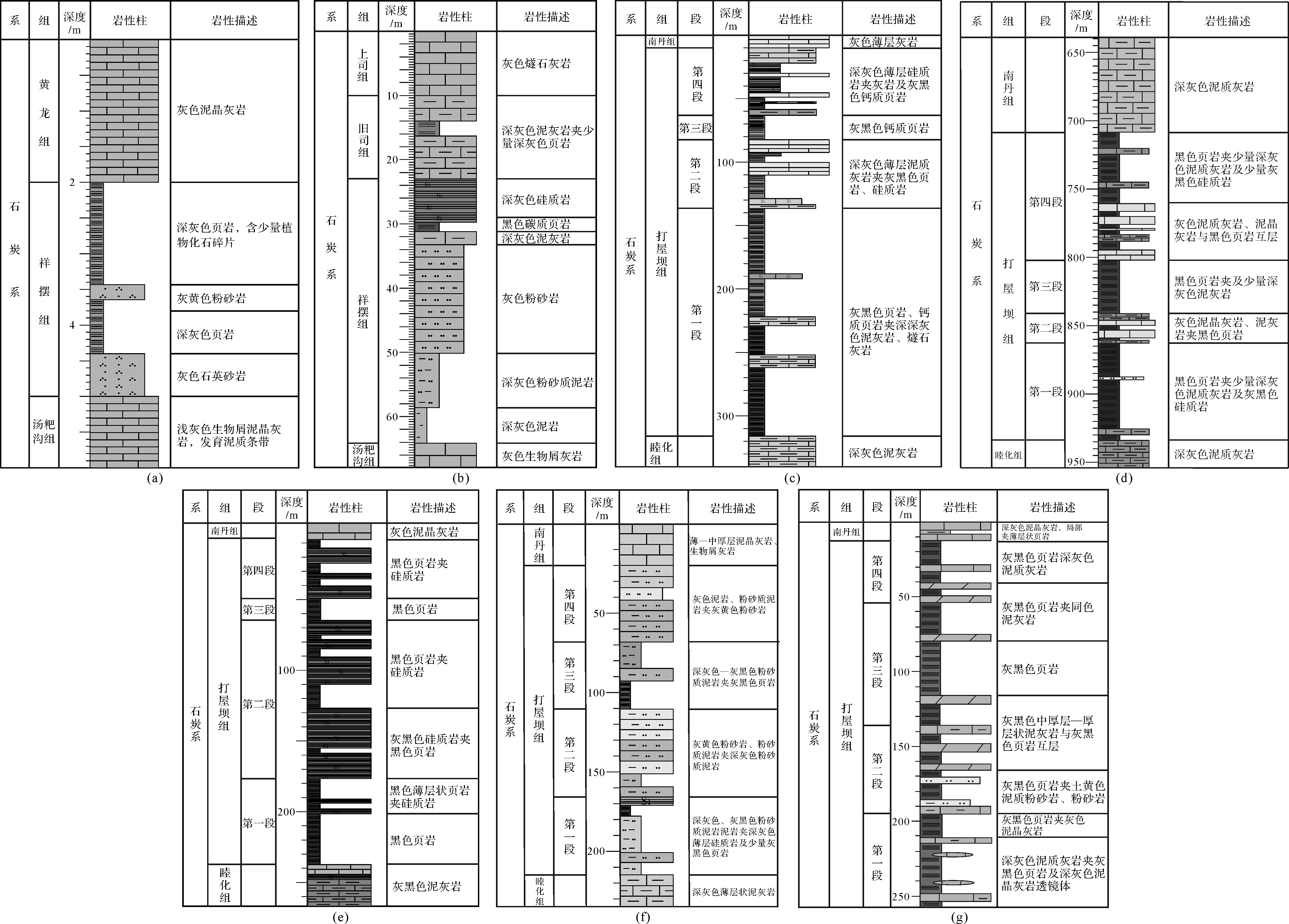
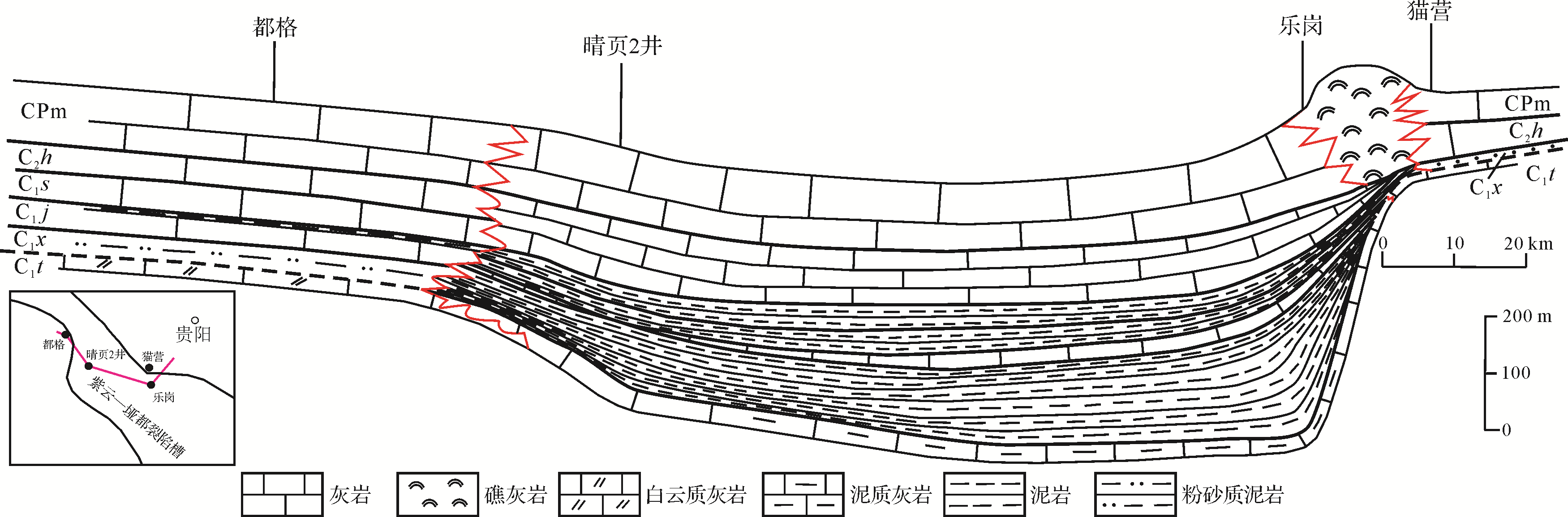
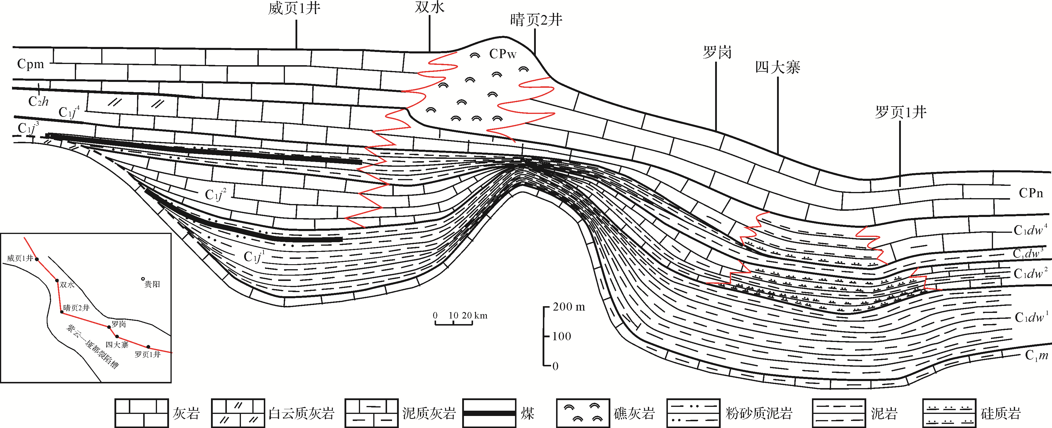
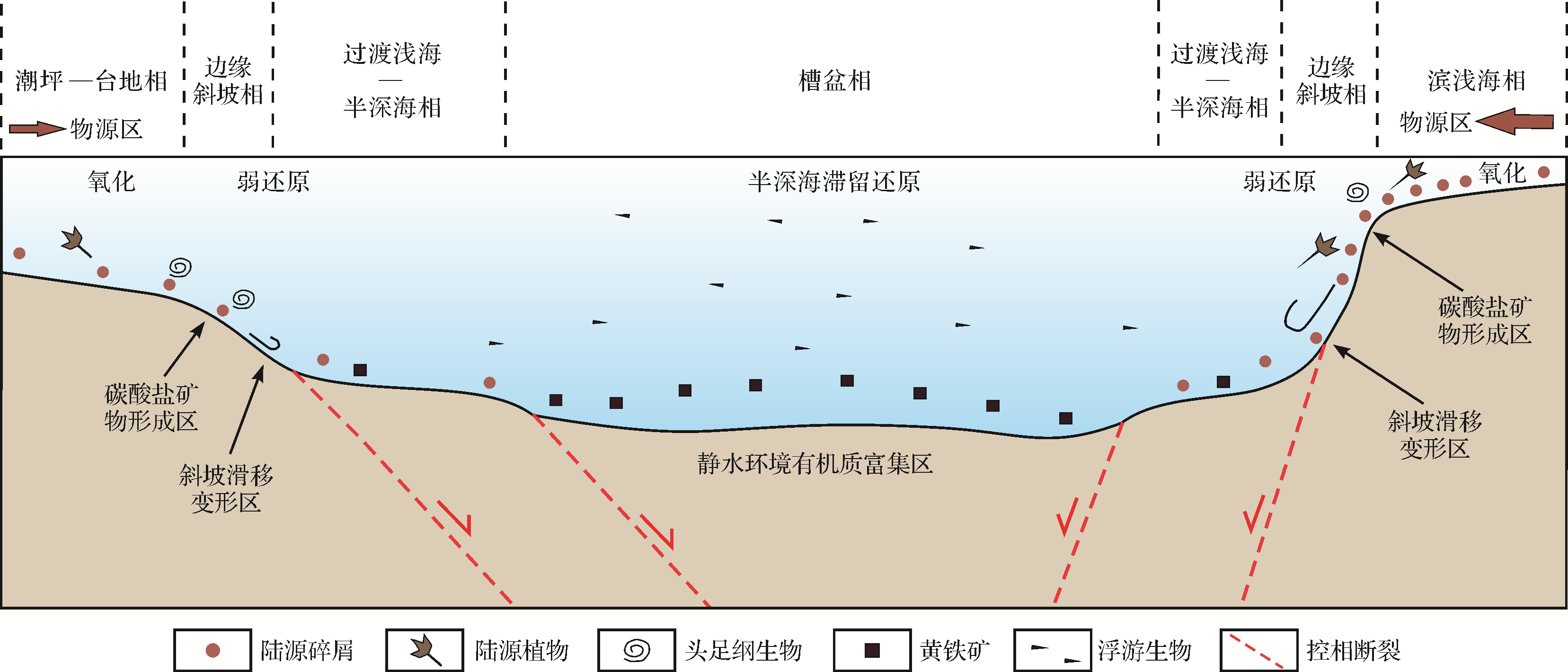
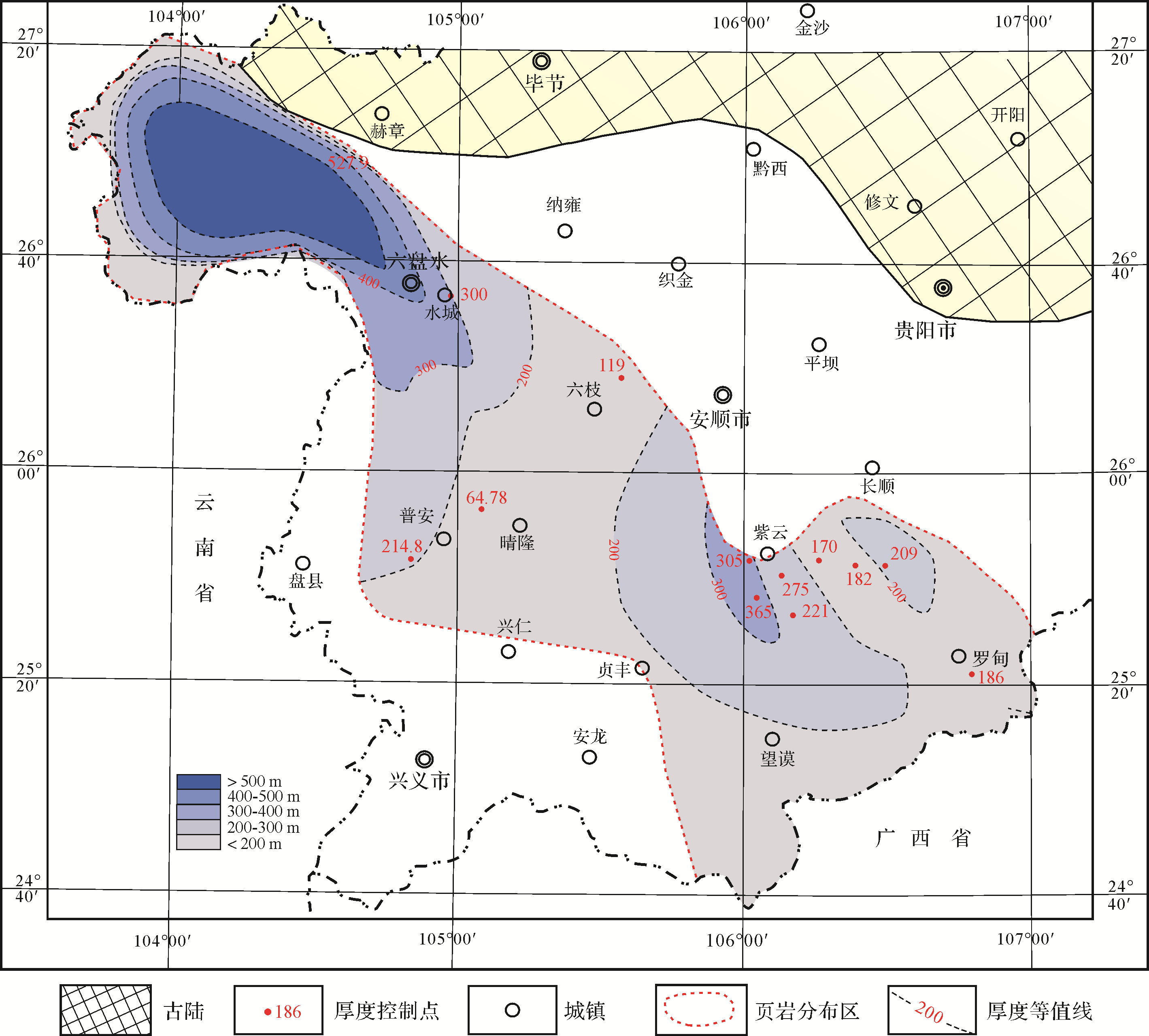
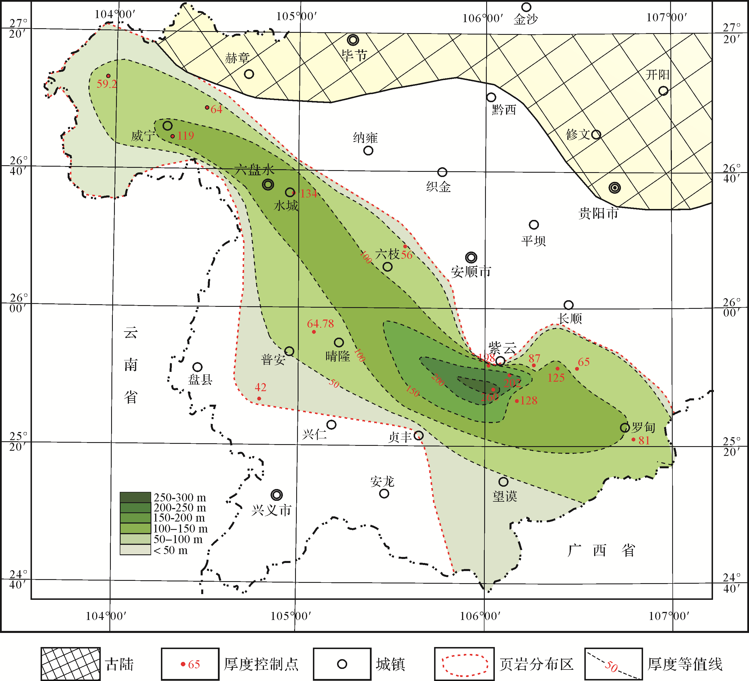
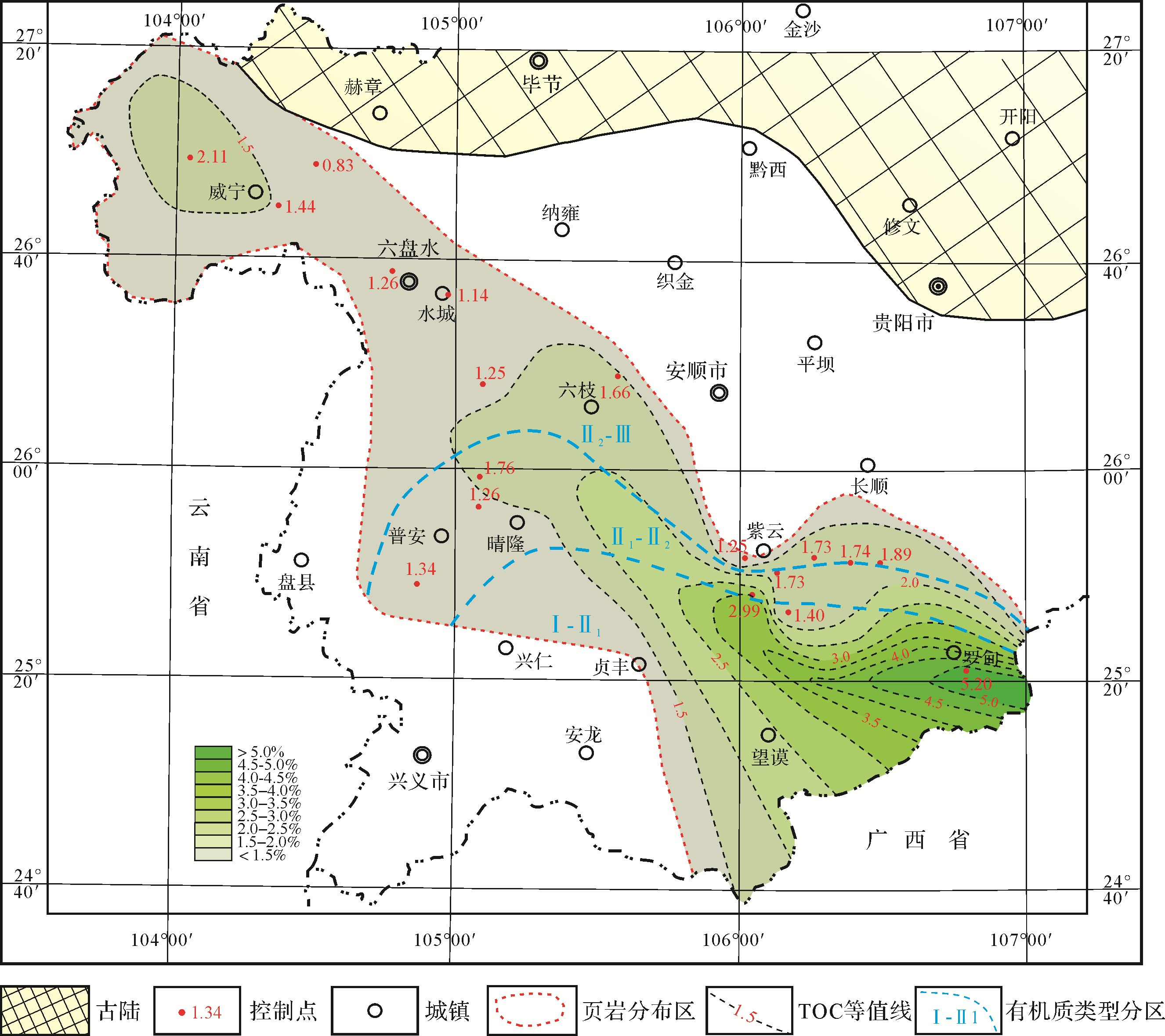
Abstract:
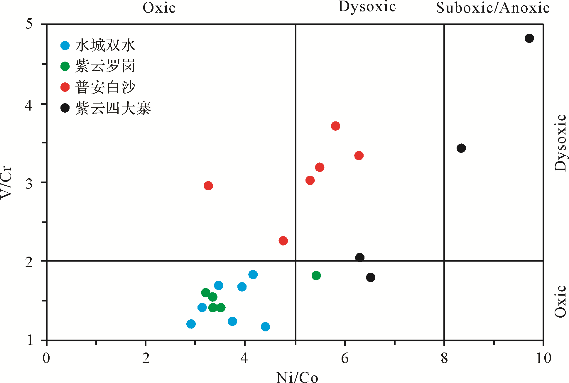
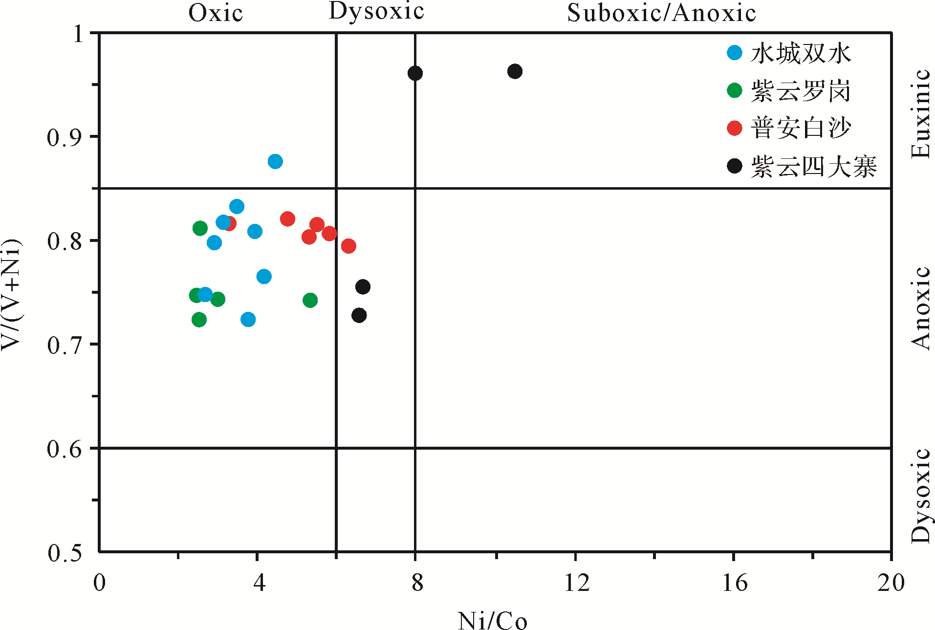
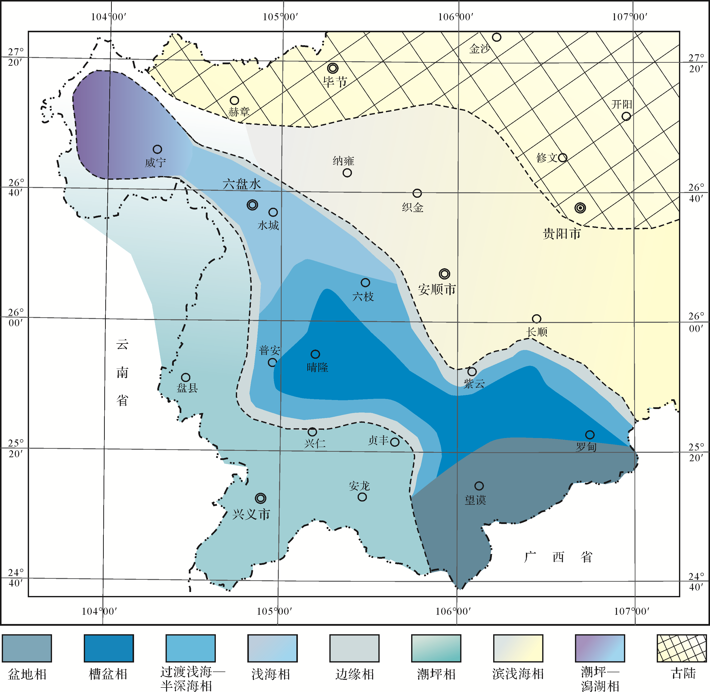
With the strengthening of shale gas exploration in recent years, breakthroughs have been made in some areas, and a certain scale of production capacity has been built. However, the resource support capacity is still insufficient. It is necessary to further study the sedimentary environment and shale enrichment law of newly discovered shale strata in recent years to further expand the exploration horizon and scope of shale gas. As a newly discovered shale gas target layer, the Carboniferous black shale in Guizhou has good shale gas exploration prospects. However, due to the control of the Shuicheng-Ziyun rift, the sedimentary phase transition is complex. Therefore, the study of the sedimentary facies and sedimentary model of the shale and the summary of the characteristics of shale enrichment and deposition are conducive to the promotion of shale gas exploration. The study reveals that the Carboniferous shale strata in Guizhou Province can be divided into the two sides of the rifting trough, slope facies, transitional shallow to semi deep sea facies in the trough, trough basin facies in the rifting trough, uplifted shallow sea facies in the Shuicheng area, and tidal flat lagoon facies deposition in the Weining area. The model of the rifting margin trough basin retention sedimentation is summarized. Formation thickness, development of black shale, total organic carbon content (TOC), and kerogen type are greatly influenced by the provenance supply area of the sedimentary model, while shallow marine, shallow semi deep marine, trough basin, and lagoon basin are favorable areas for the deposition and enrichment of the black shale.

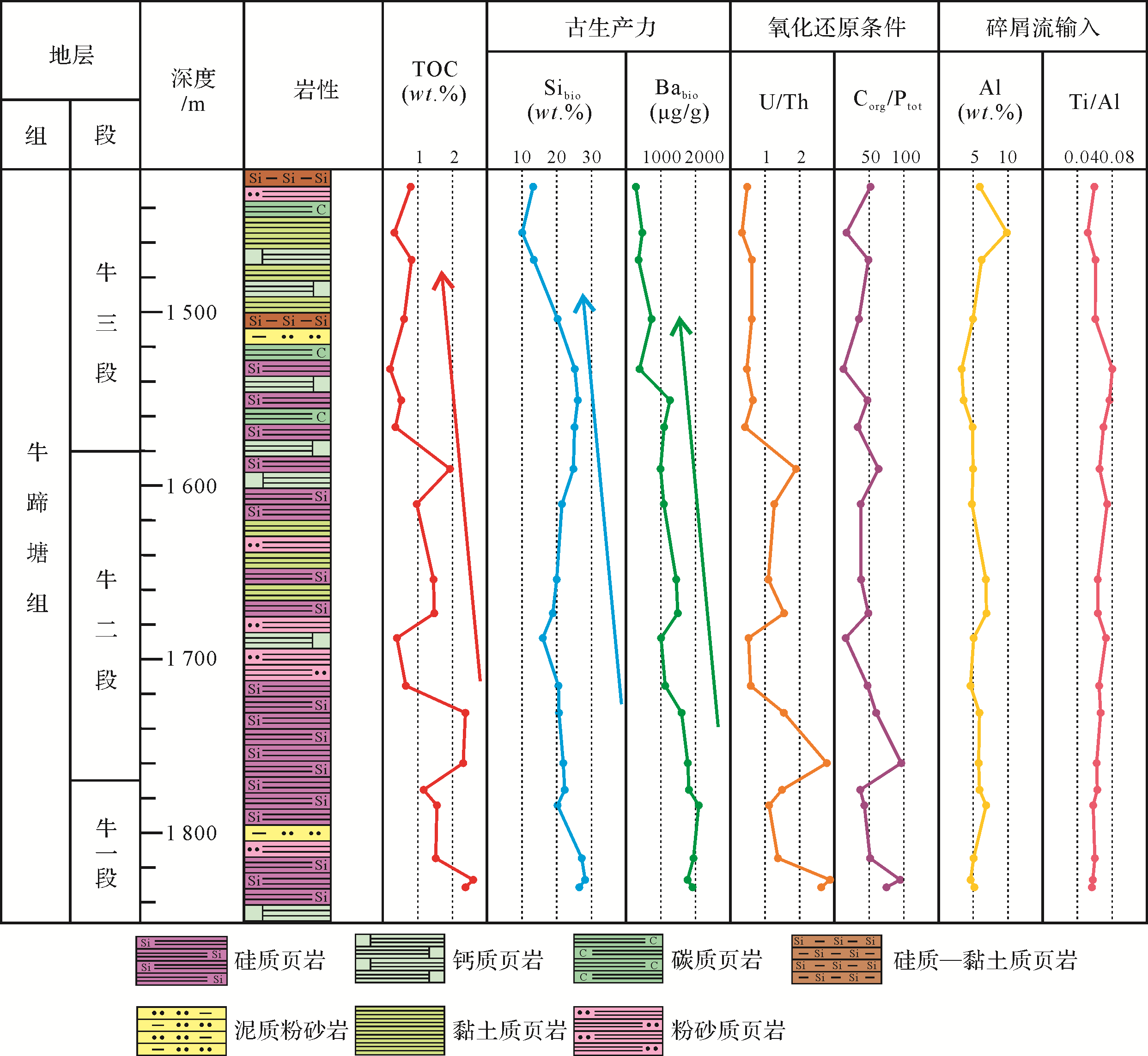
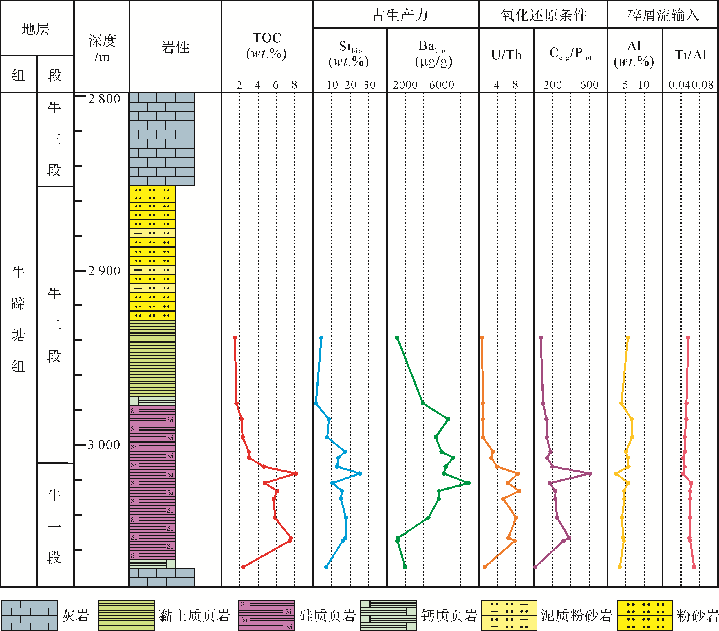
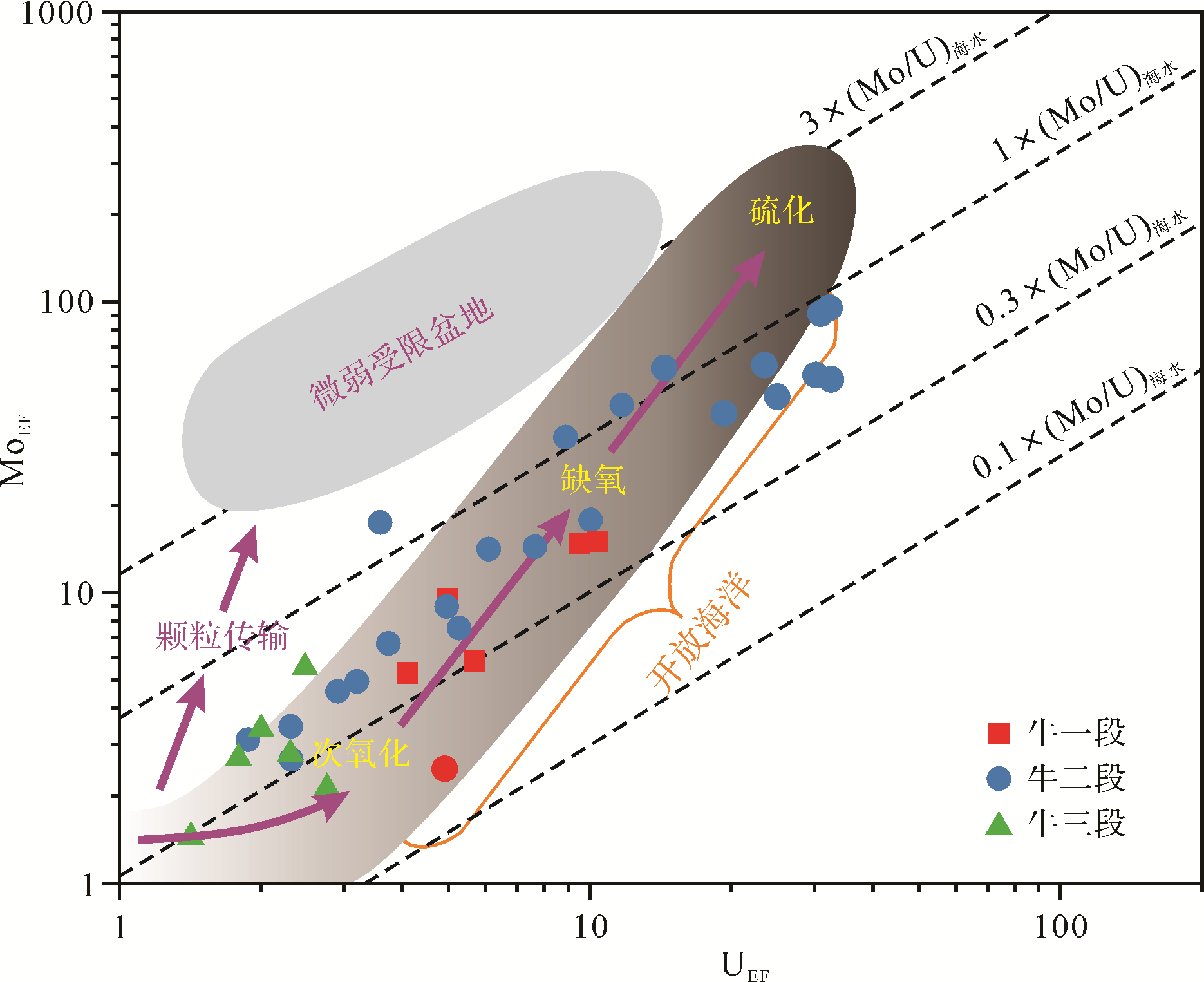
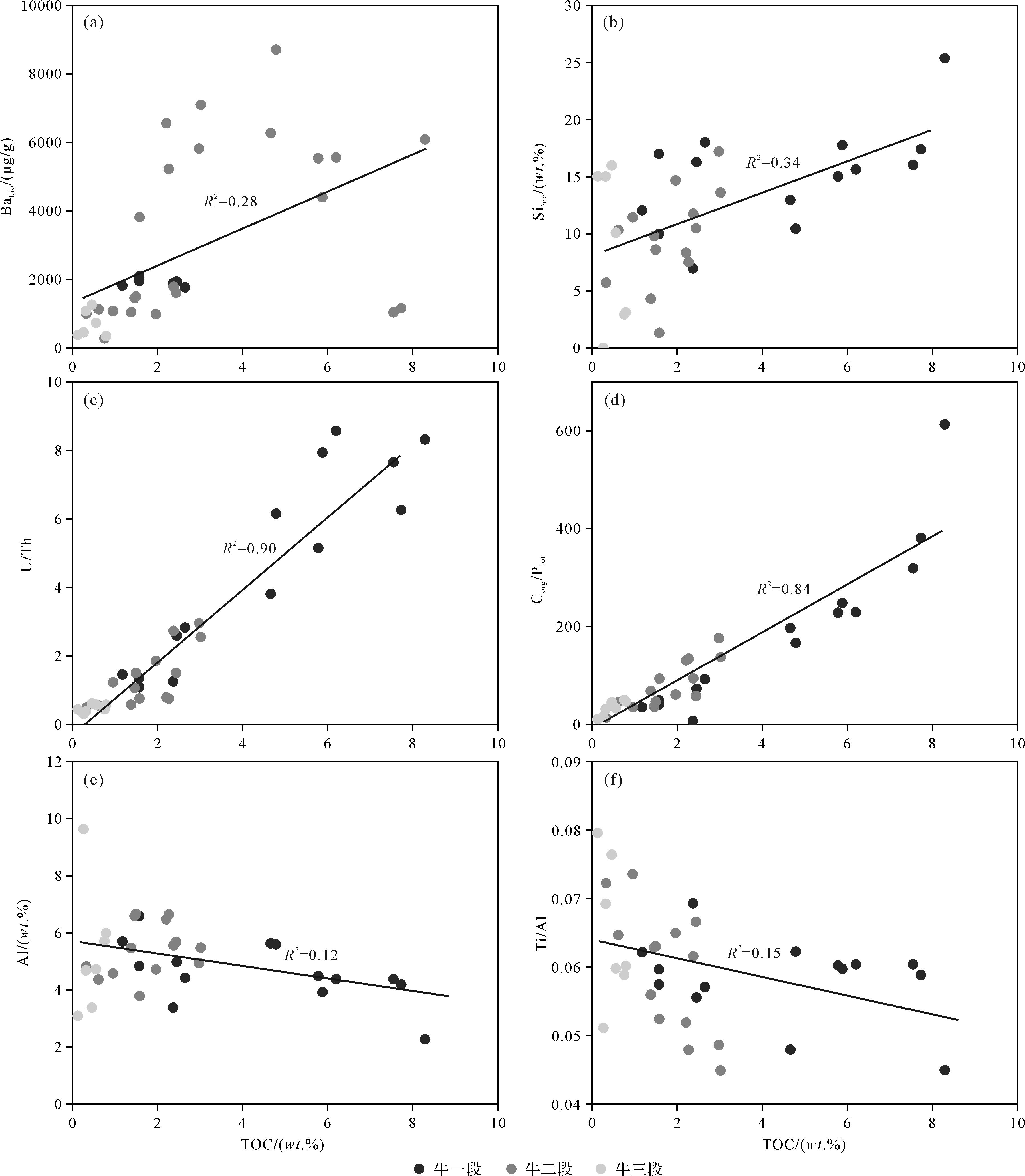
2021, 39(3): 686-703.
doi: 10.14027/j.issn.1000-0550.2020.107
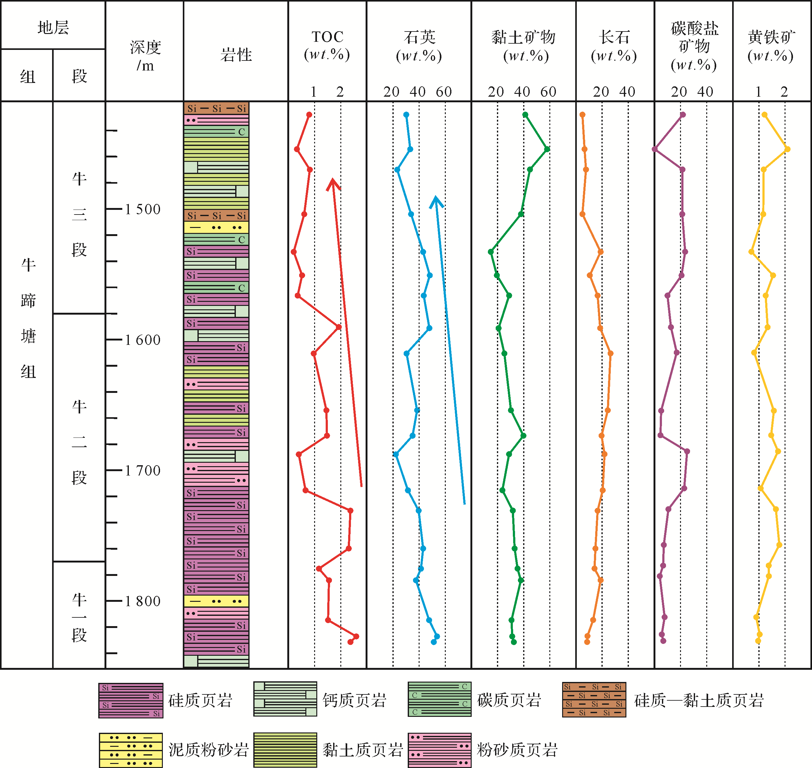
Abstract:
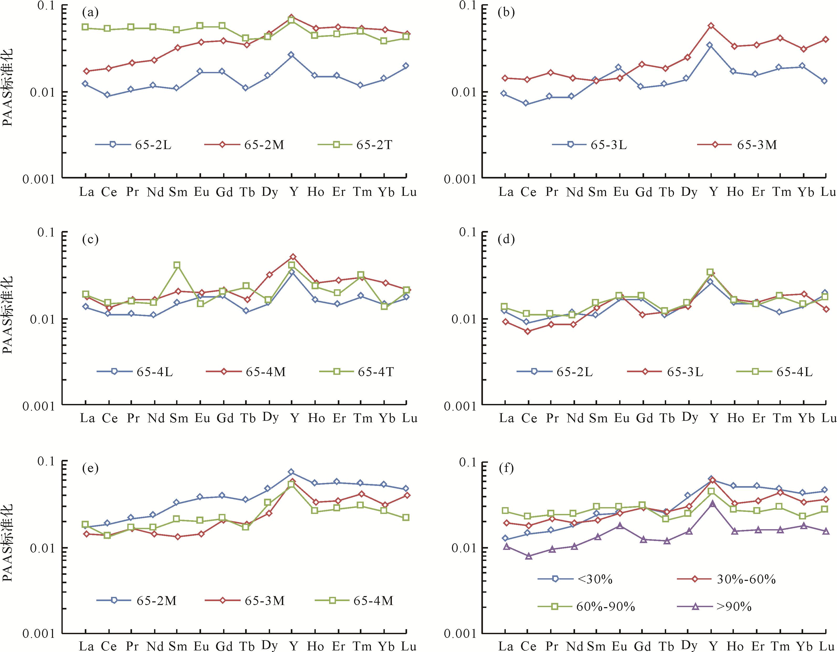
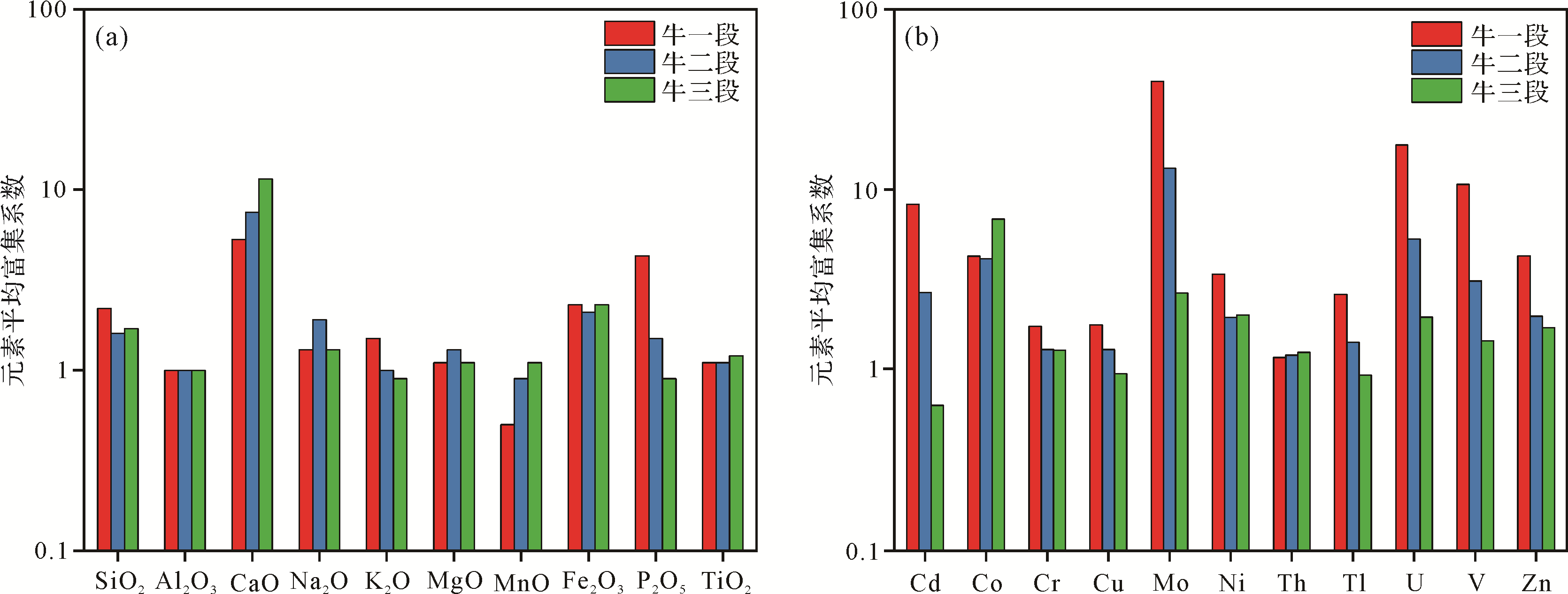
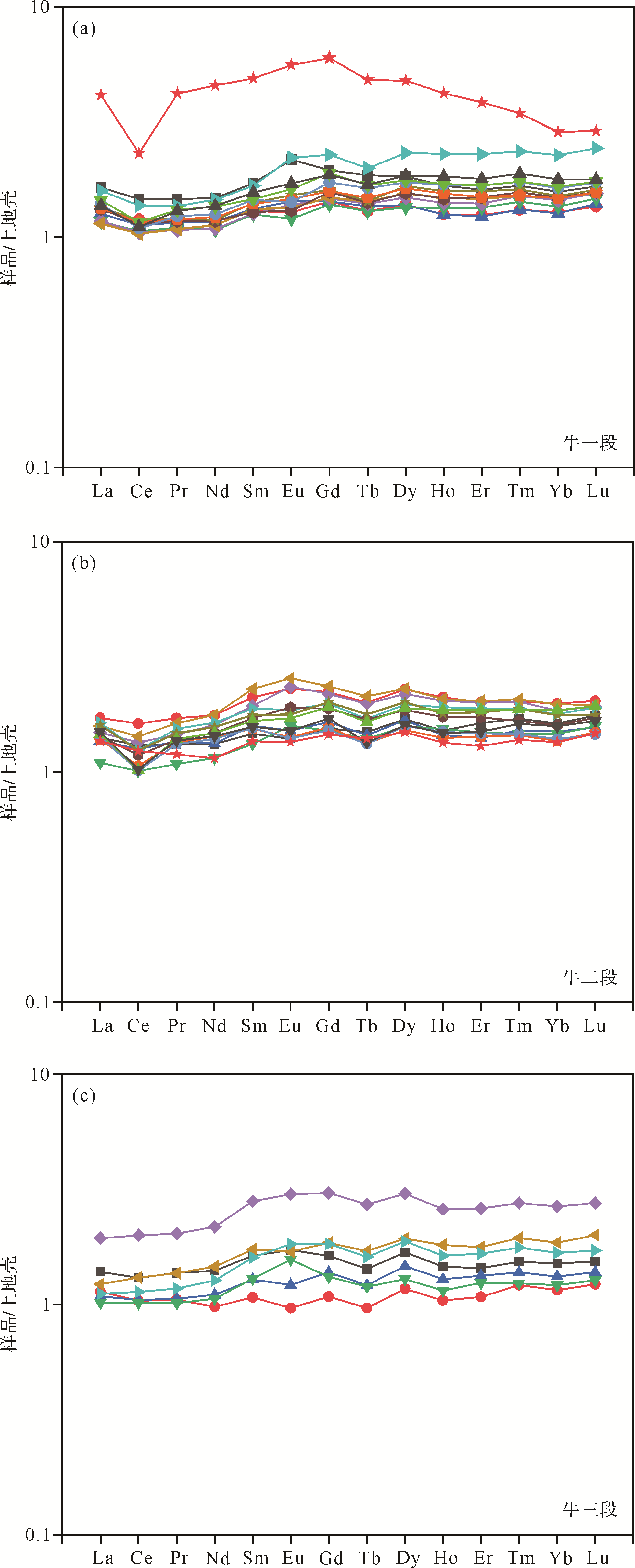
The Lower Cambrian Niutitang Formation is a target layer for marine shale gas exploration and development in southern China. However, little is known about the paleo-environment of shale deposition and its influence on organic matter accumulation in the Niutitang Formation. Using TOC content, XRD mineralogical analysis and sedimentary geochemical analysis, this study revealed the sedimentary paleo-environment of the region as part of an investigation into the accumulation mechanisms of organic matter. It was found that the lower part of the shale in the Niu 2 member is rich in organic matter, and has the highest quartz content. The major elements Ca and P are significantly enriched in the Niu 1 member. The major elements Ca and Fe are significantly enriched in the Niu 2 and Niu 3 members. The redox-sensitive trace elements Mo and U are most highly enriched in the Niu 2 member. No clear Eu anomaly occurs in any of these shales. Light rare earth elements (LREE) are more abundant than heavy REEs (HREE). Siliceous shale was deposited as high-paleoproductivity and low-input terrigenous debris in anoxic bottom water conditions. Calcareous shale was deposited as high-paleoproductivity but relatively low-input terrigenous debris in dysoxic–oxic bottom water conditions. Argillaceous shale and siliceous-clay mixed shale were deposited as low-paleoproductivity, high-input terrigenous debris in oxic bottom water conditions. The stratigraphic distribution of the paleoenvironment proxies Babio, Sibio, U/Th, Corg/Ptot, Al and Ti/Al indicate decreasing paleoproductivity, increasing oxic conditions and increasing detrital flux during deposition from the lower to upper members of the Niutitang Formation. The anoxic bottom water condition was a key factor in the development of organic-rich shales in the Niutitang Formation.

2021, 39(3): 704-712.
doi: 10.14027/j.issn.1000-0550.2020.078
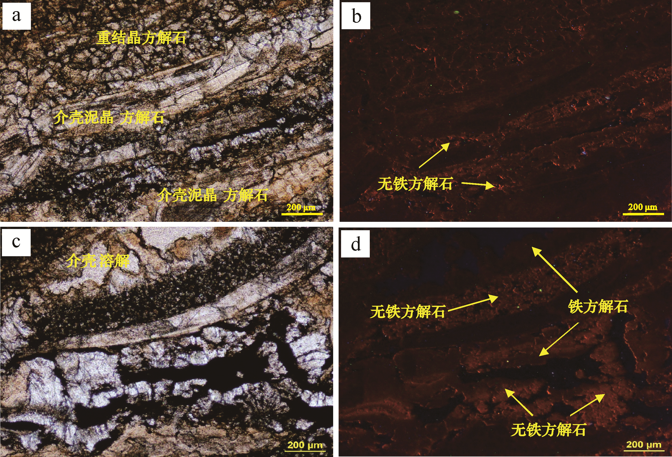
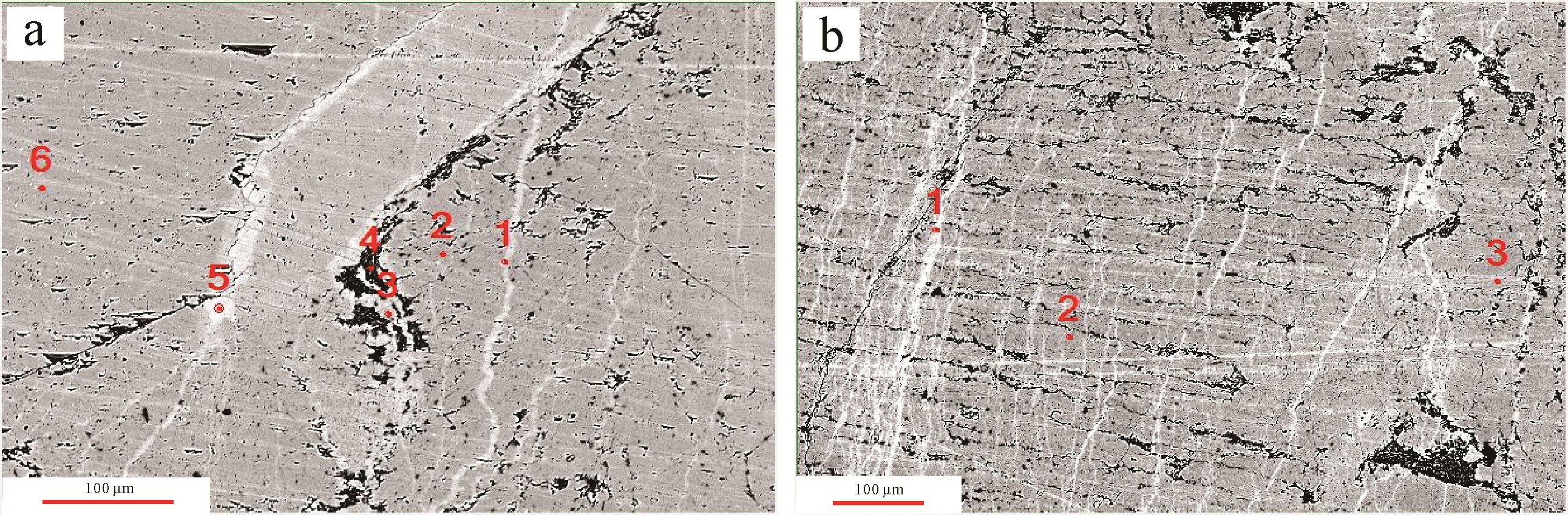
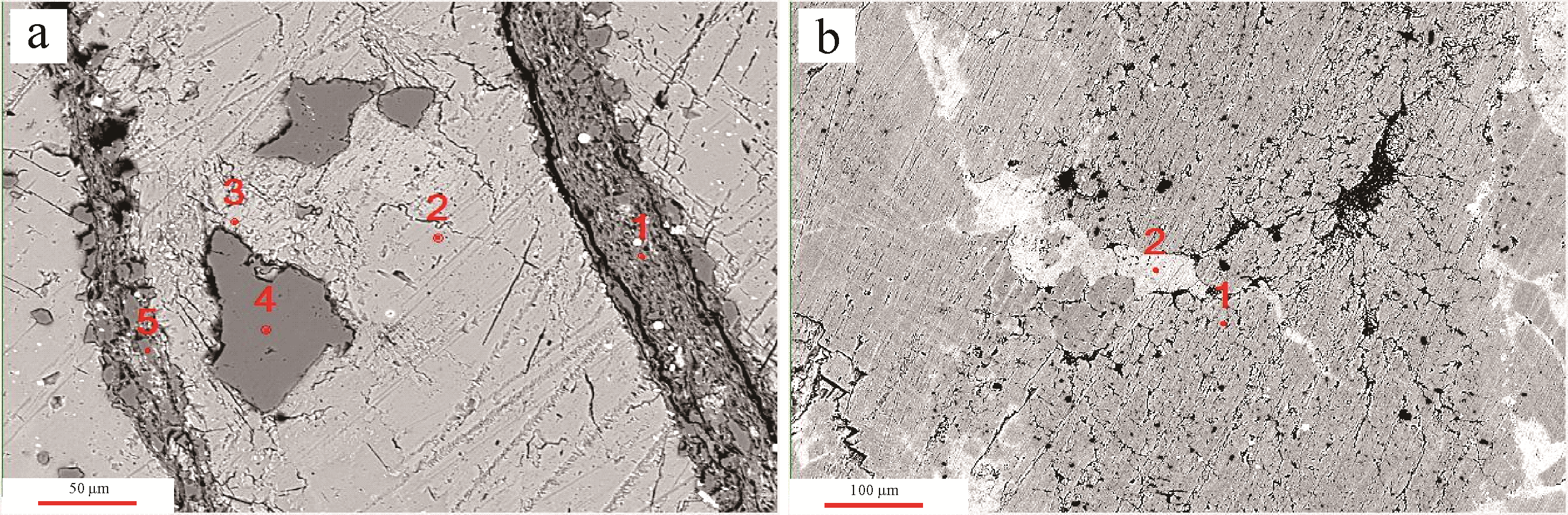
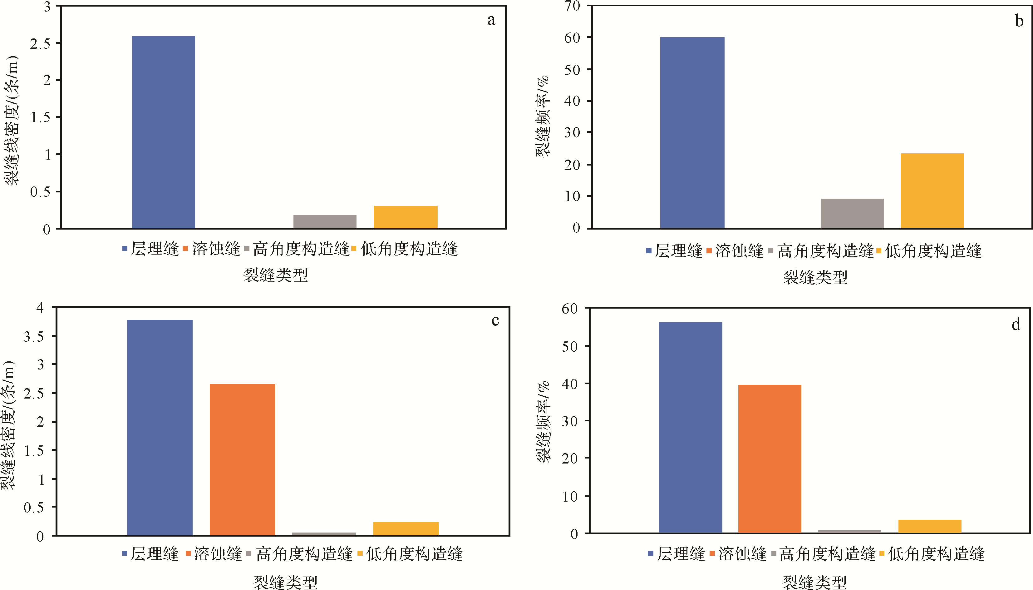
Abstract:
Shell mudstone interbedded with limestone from the Da′anzhai member of Sichuan Basin was studied in this investigation of the genesis of calcite in nonmarine shale and its influence on reservoirs. X-ray diffraction (XRD) analysis and observation of thin sections and cores, cathodoluminescence, and electron probe microanalysis (EPMA) test methods were used to identify the calcites transformed by aragonite, and those formed by cementation and recrystallization. In the syngenetic and early diagenetic period, aragonite in the shells was transformed into micritic non-ferroan calcite, evident as orange-yellow cathode luminescence. In the early diagenetic period, the first generation of non-ferroan calcite cement was formed at the edges of the shells. In late diagenesis, granular ferroan calcite cement was formed in the intergranular pores, and the cathode luminescence appears dark. Some micritic calcite in the shells was transformed into pitted fine crystalline or columnar calcite. Depending on its form, the calcite underwent transformation, compaction, dissolution, cementation and recrystallization in the diagenetic evolution process. Dissolution improves the physical properties of the reservoir, but compaction, cementation and recrystallization processes destroy the reservoir space. Measures of fracture density indicate that the most highly developed lamellation fractures are found in the Da′anzhai member in the Yuanba area, whereas mainly lamellation fractures and dissolution fractures are found in the Da′anzhai member of the Fuling area. The study shows that the presence of calcite shells has benefited the formation of the latter fracture types.

2021, 39(3): 713-722.
doi: 10.14027/j.issn.1000-0550.2020.028
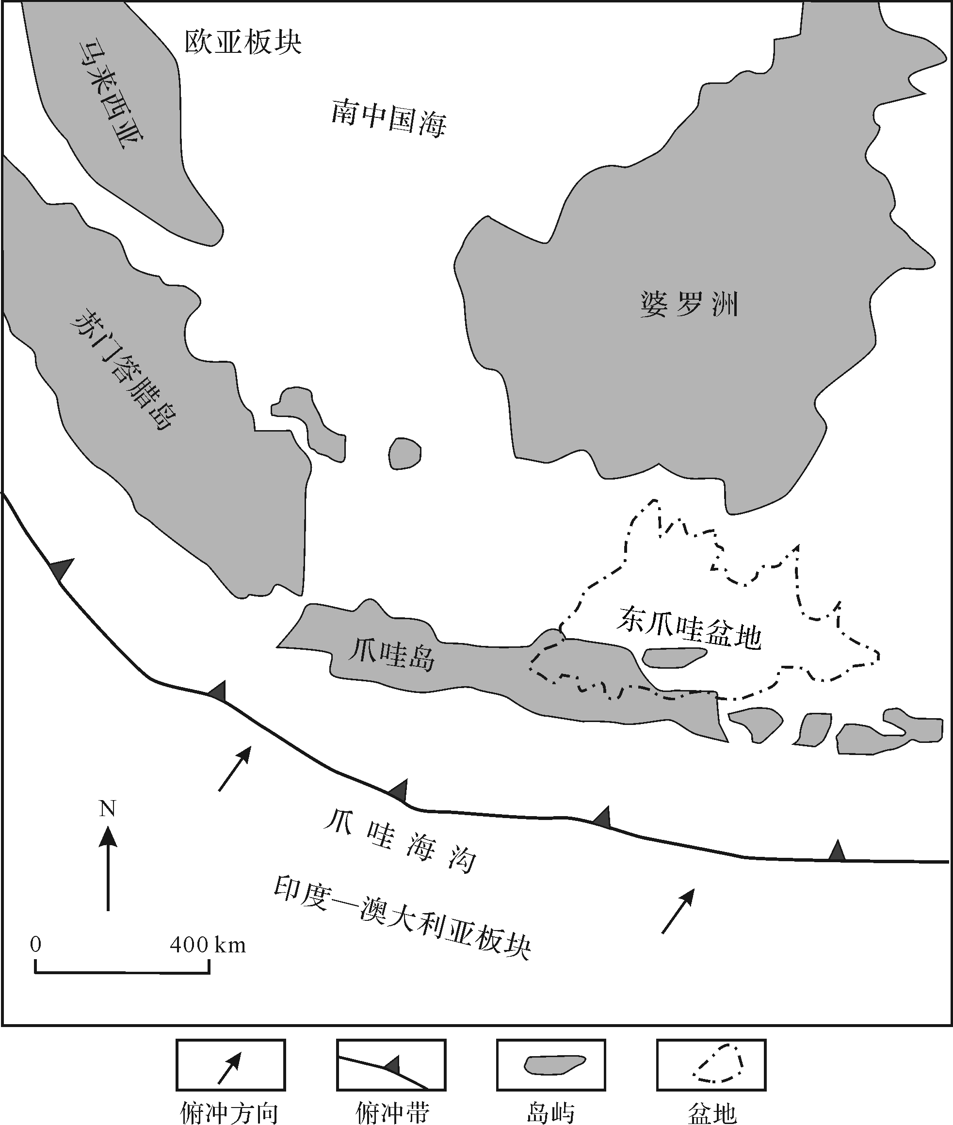
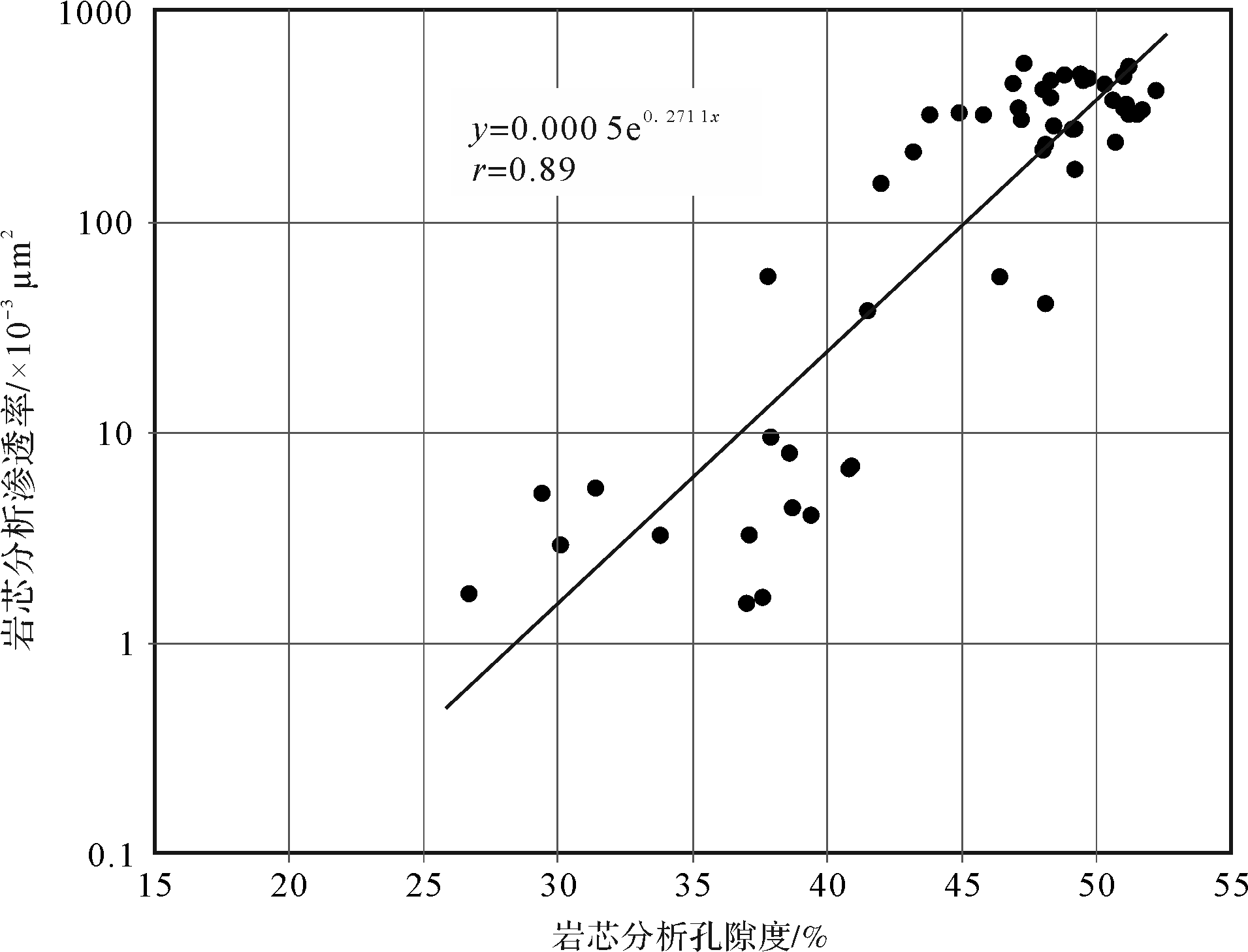
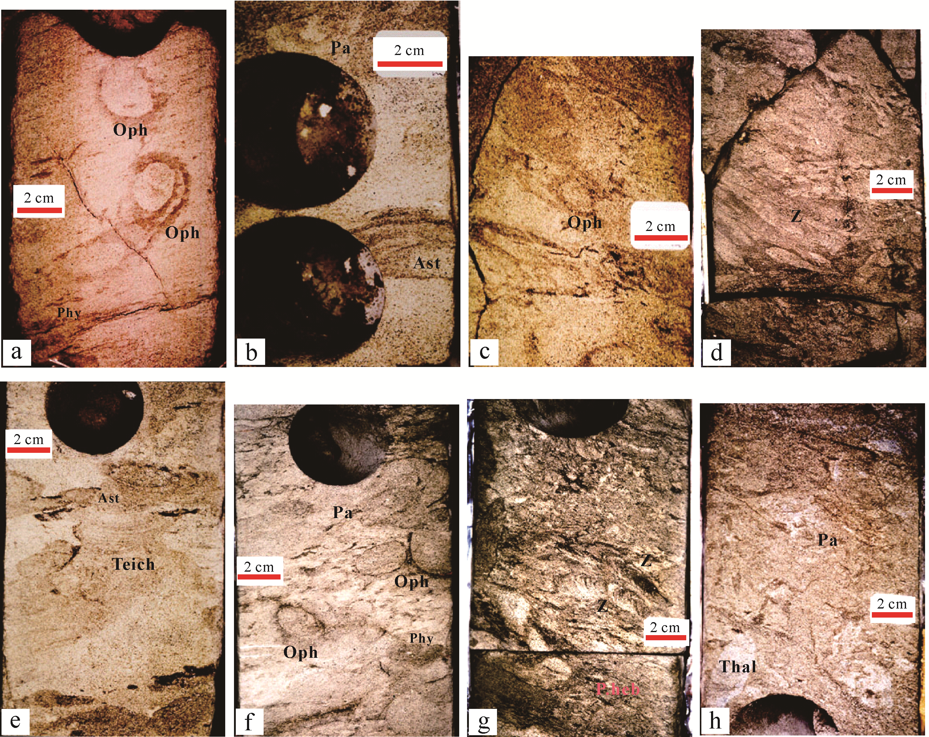
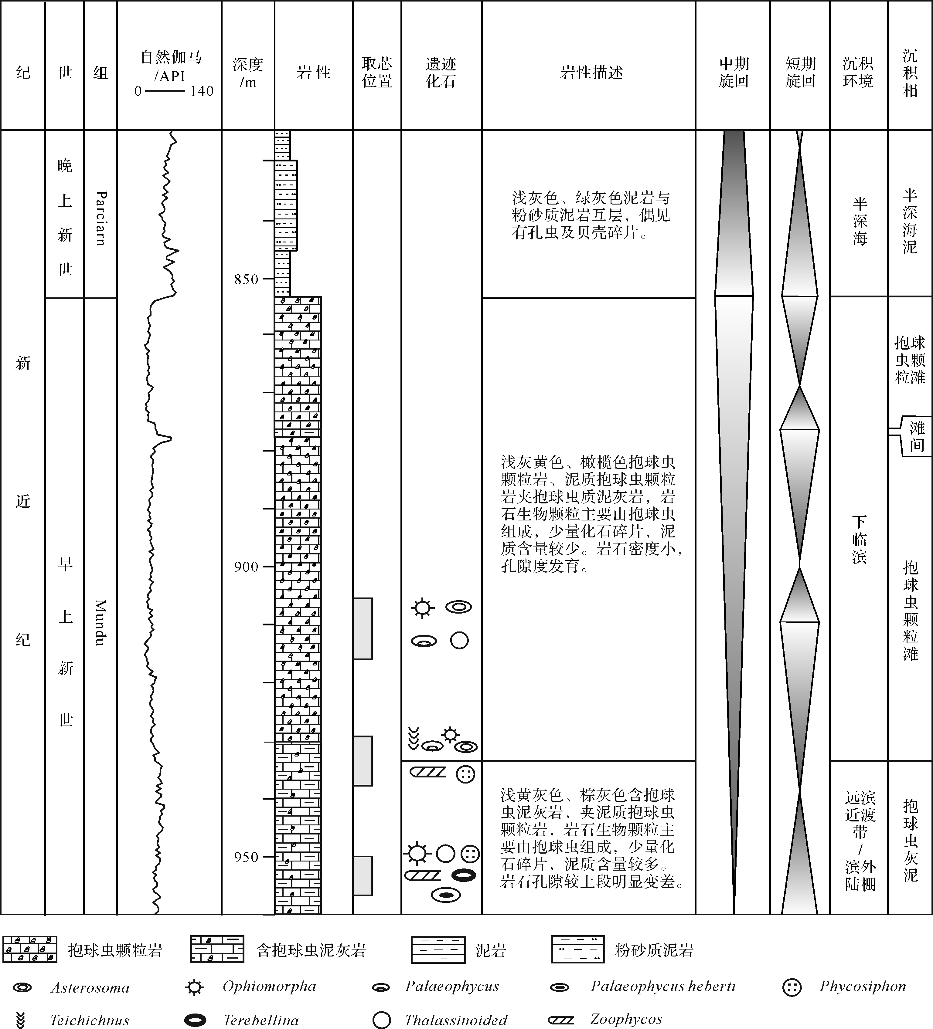
Abstract:
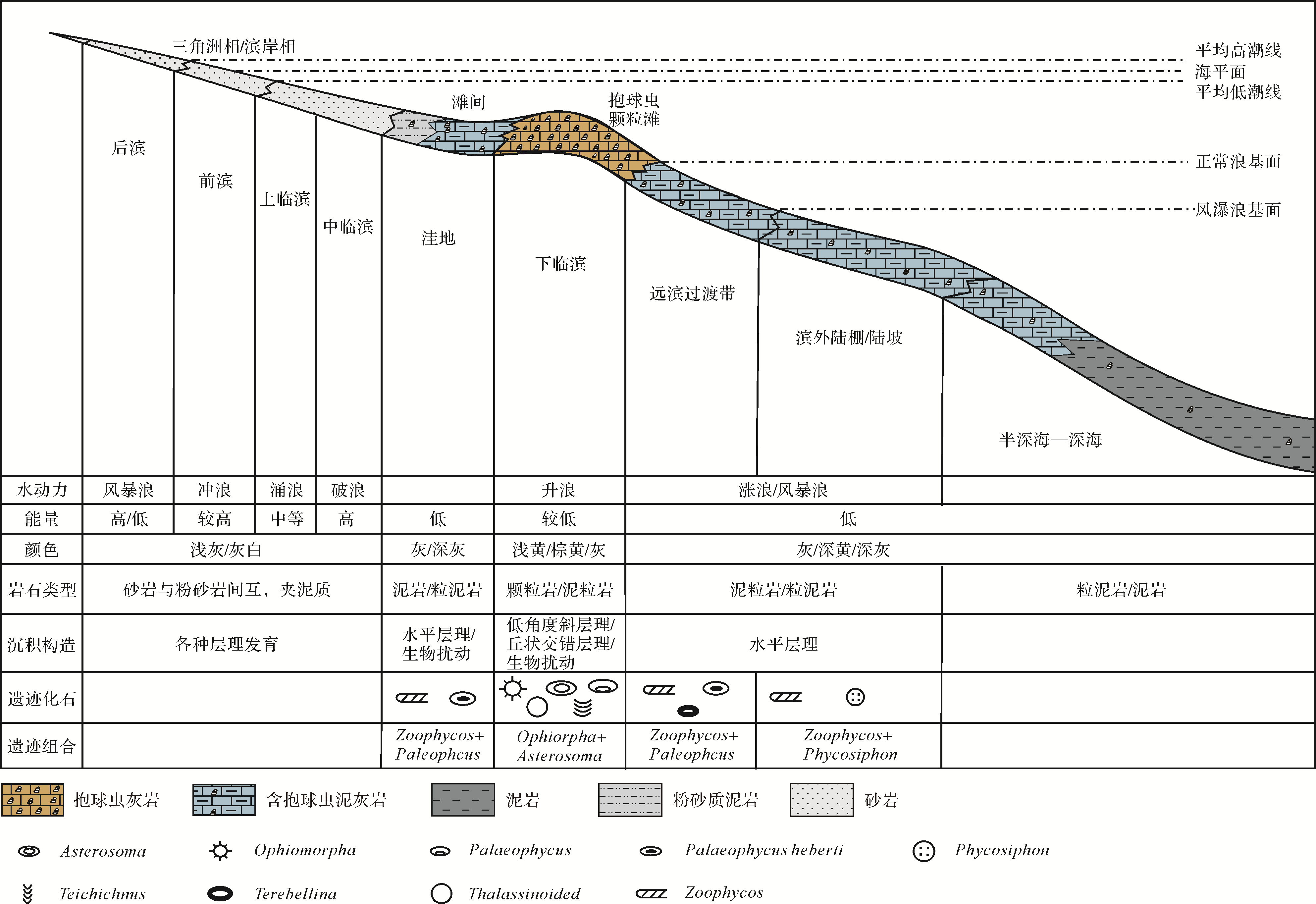
Globigerinid limestone is one of the main reservoirs in oil⁃gas reservoirs discovered in the East Java Basin, and also one of the main exploration targets. Developed in the Pliocene, Globigerinid limestone reservoirs are characterized by high porosity and medium⁃high permeability. However, the formation conditions and sedimentary environment of this kind of limestone reservoir are not well understood due to the lack of reliable facies markers, which affects the exploration for this kind of reservoir. Based on trace fossils preserved in the formation, a total of eight ichnogenera were identified: Ophiomorpha, Asterosoma, Palaeophycus, Thalassinoides, Phycosiphon, Zoophycos, Teichichnus and Terebellina. According to their ethological and morphological features together with the lithological characteristics of the host rock, three ichnoassemblages were established: (1) Ophiomorpha⁃Asterosoma ichnoassemblage, which developed in Globigerinid grainstone and packstone, represents grain beach deposition in the lower shoreface environment with medium⁃low hydrodynamic energy; (2) Ophiomorpha⁃Palaeophycus ichnoassemblage, which developed in Globigerinid packstone and wackestone, occurs in inner shelf lowland or offshore environments with normal marine and storm⁃induced depositions; (3) Zoophycos⁃Phycosiphon ichnoassemblage, which developed in wackestone and mudstone, represents an outer⁃shelf environment. Combining the paleosedimentary environment with the ichnogenera and ichnoassemblages, it is proposed that Globigerinid limestone was deposited in lower shoreface to outer⁃shelf environments, and its sedimentary model was also established. For the Globigerinid limestone in the study area, these conclusions have great significance, not only regarding its depositional genesis, controlling factors and distribution, but also for oil and gas exploration in this type of reservoir.

2021, 39(3): 723-738.
doi: 10.14027/j.issn.1000-0550.2020.049
Abstract:
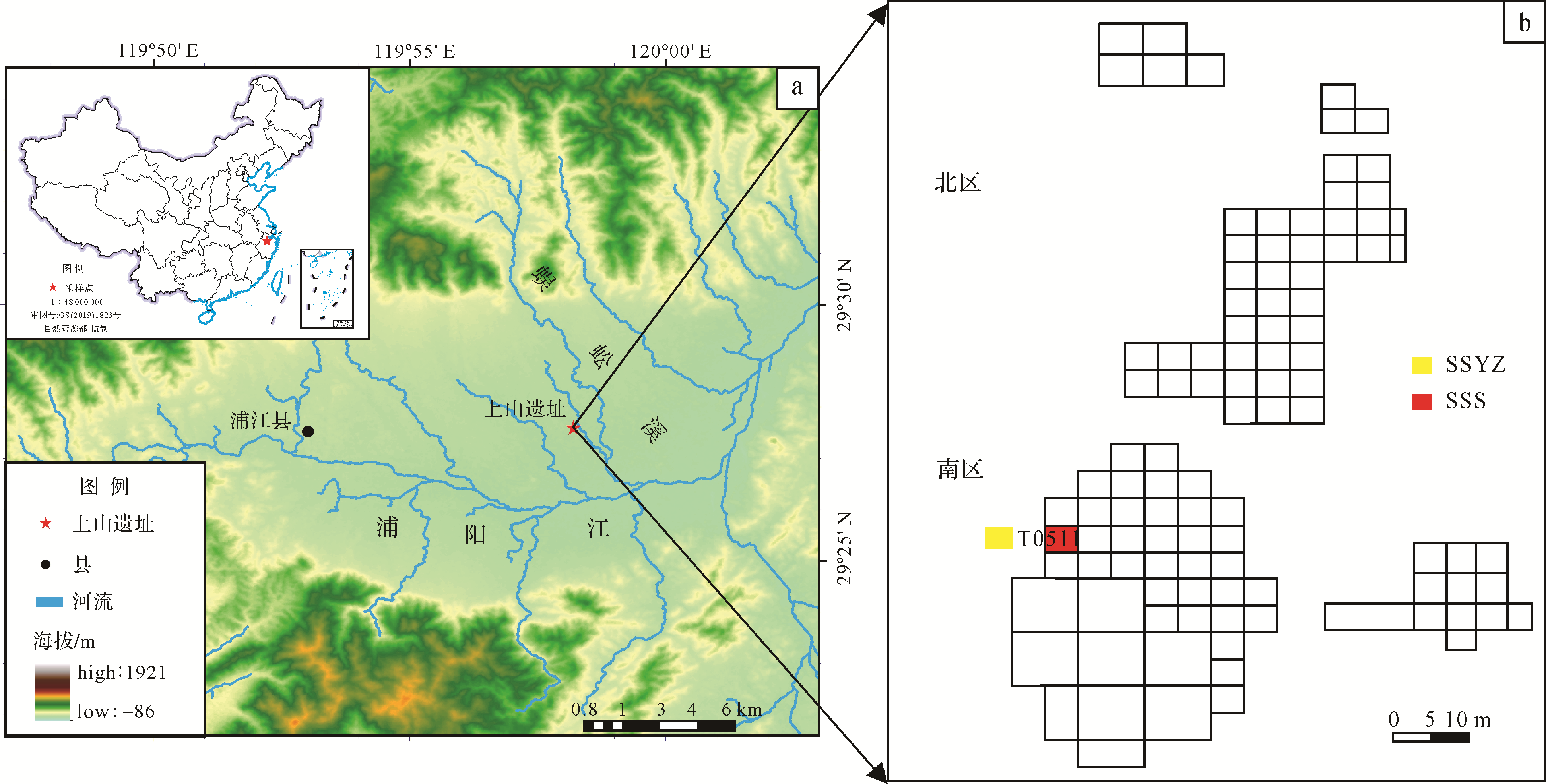
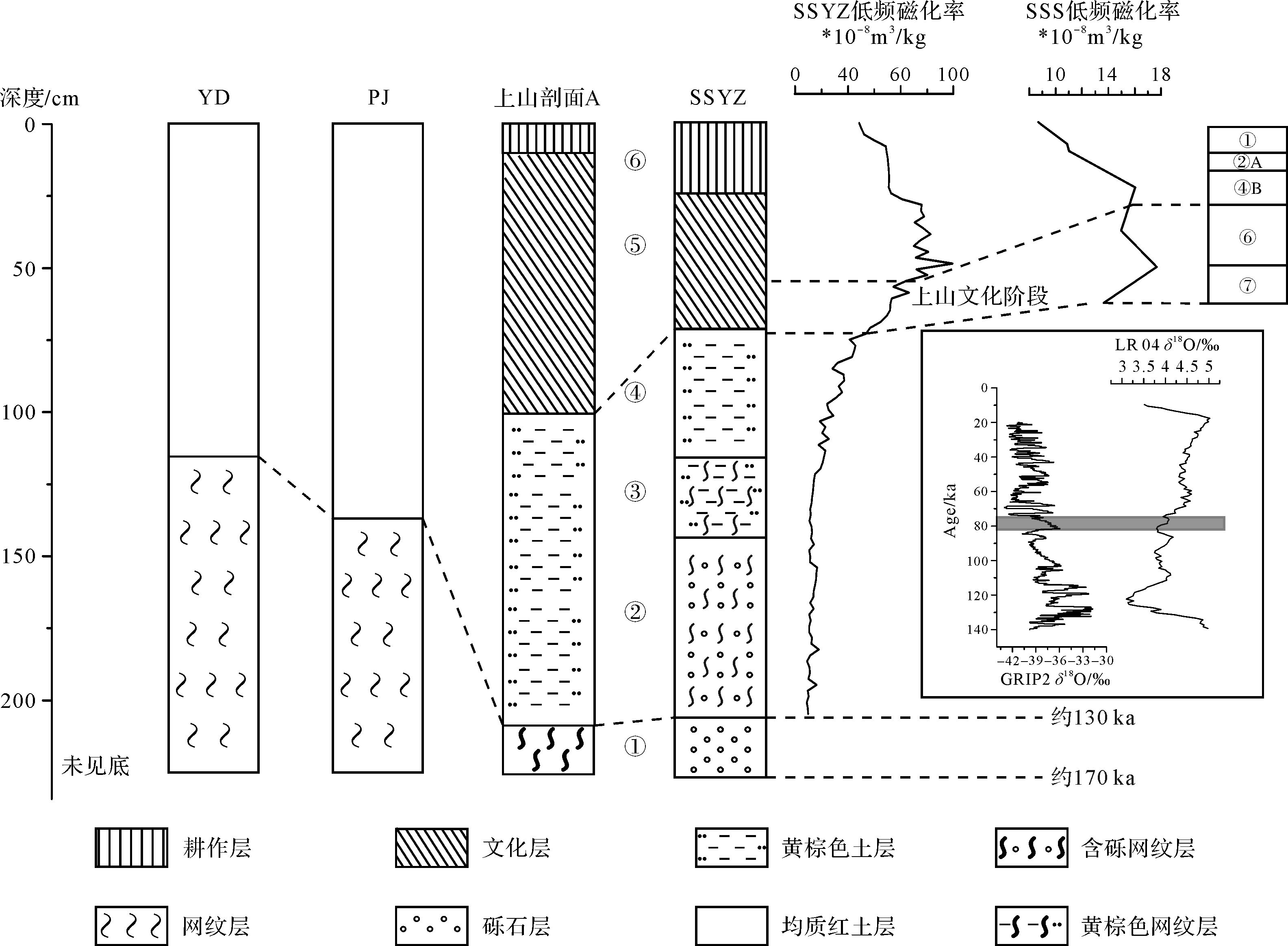
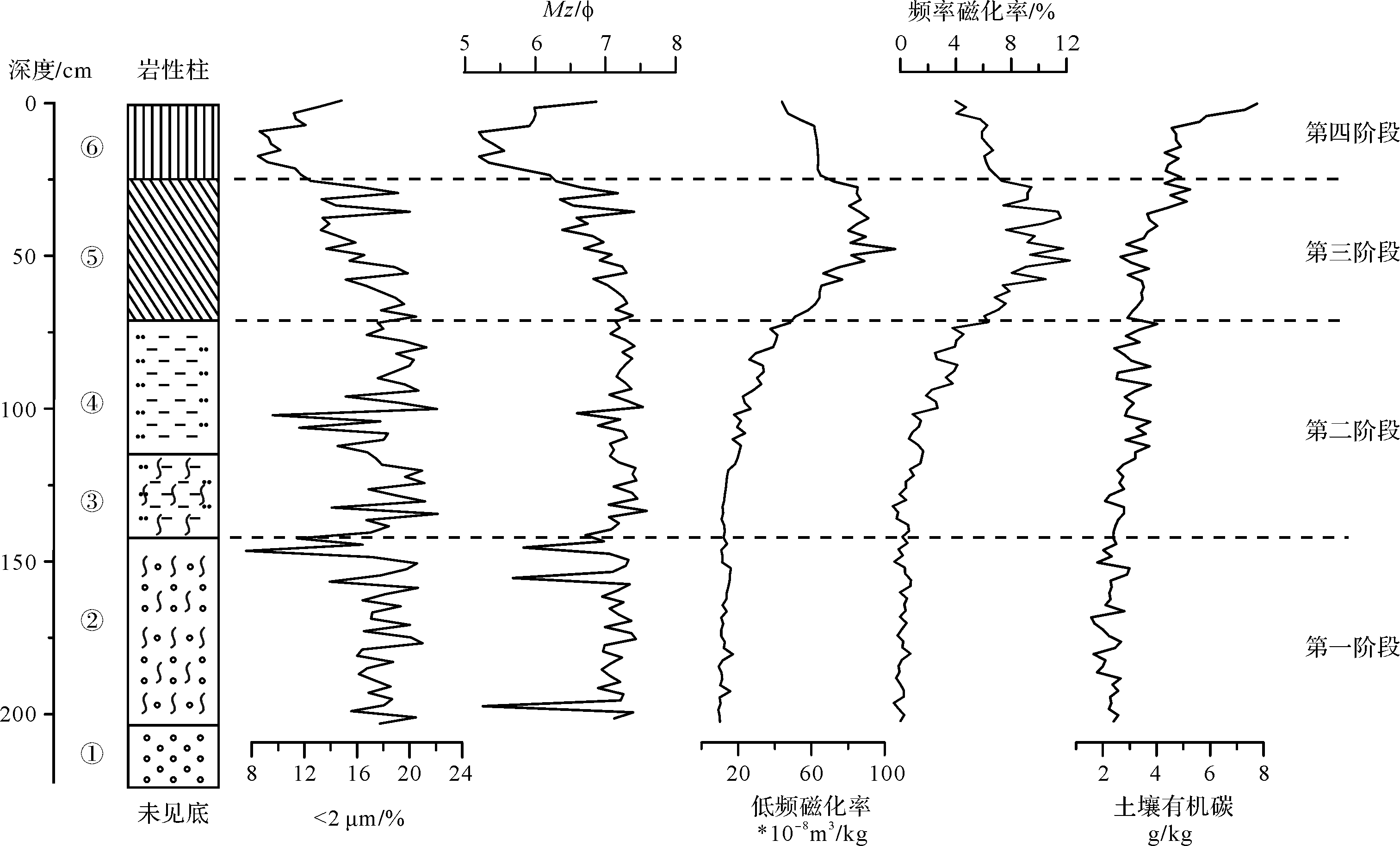
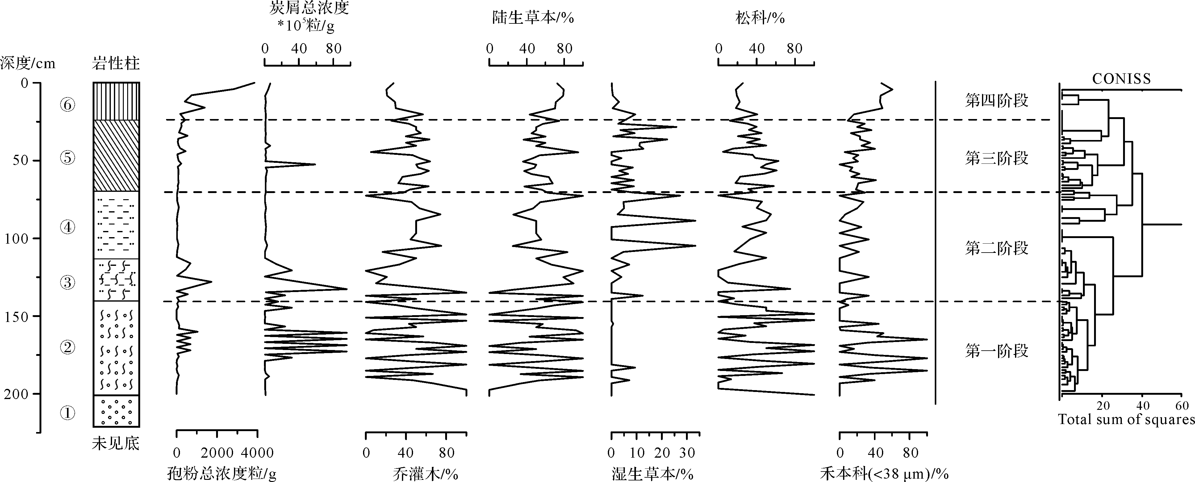
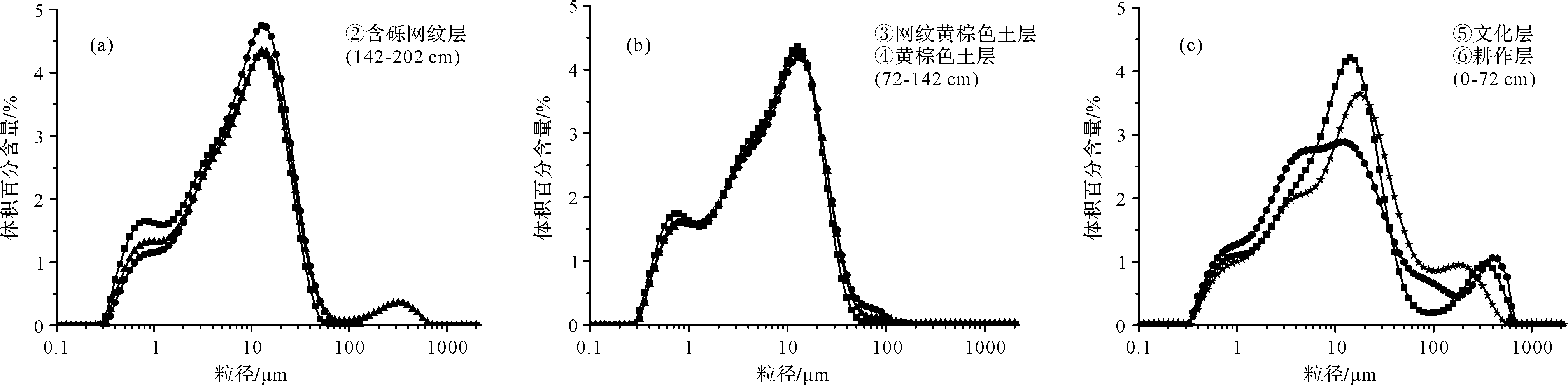
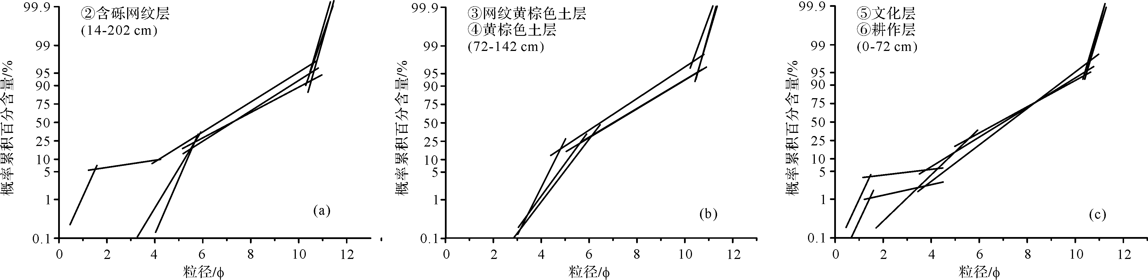
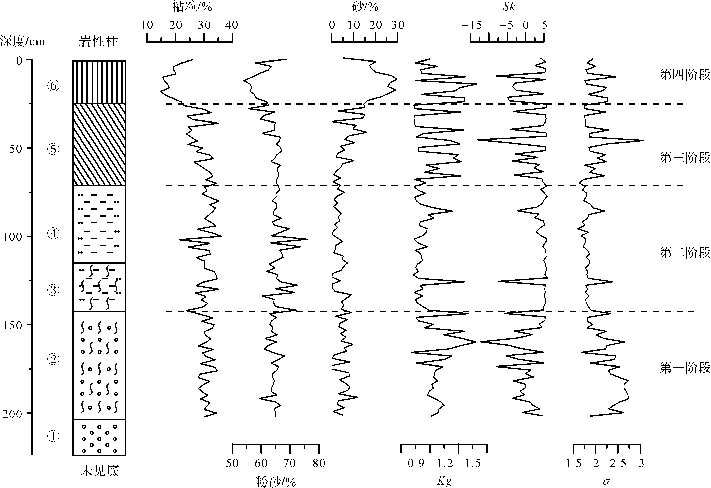
The Shangshan Site, a representative archaeological site of the Shangshan Culture (11.5~8.5 ka), is located on the northern bank and the second terrace of the Puyang River in the upper reaches of the Qiantang River. It is the earliest Neolithic Site ever found in the lower reaches of the Yangtze River. The carbonized pottery and rice remains explored at the Shangshan site reveal the important position of rice farming during the early and middle period of the Shangshan Culture, as well as the origin of rice farming in the lower reaches of the Yangtze River, and even eastern China. Recently, many studies have been conducted on the Shangshan Site, mainly focusing on the cultural features of the site, unearthed remains, and other research perspectives. However, there is currently a lack of a systematic study on how the environmental background duration impacts the evolution of the Shangshan Culture. Based on the measurement of grain size, magnetic susceptibility (MS), soil total organic carbon (TOC), and sporopollen and charcoal analysis in samples taken from the SSYZ section and the ash pit in the exploration area, in combination with the archaeological materials and regional climate background, this paper aims to investigate the variation of sedimentary environment in and around the Shangshan Site and study the environmental background in the human-land relationship evolution history for prehistoric times in Zhejiang province. The results indicated that: (1) Since the Late Pleistocene (130 ka ~ modern), regions in and around the Shangshan Site experienced four sedimentary evolution stages, including flood plain (202~142 cm), dust accumulation (142~72 cm), archaeological cultural layer (72~24 cm), and modern farming (24~0 cm). (2) Times when dust accumulation was the turning stage of sedimentary evolution in and around the Shangshan Site. During this stage, the climate and environment were dry, and dust accumulated on the second terrace of the river, which resulted in terrain rise and eventually free from the influence of floods. Additionally, the material composition, mainly composed of silt, laid the parent material foundation for early rice agriculture. (3) The MS of the SSYZ section increased from the bottom to the top, and the low-frequency and high-frequency magnetic susceptibility reached their peak for this section in the cultural layer. It was consistent with the variation trend of MS from the excavation cultural layer in the ash pit of the exploration area, reflecting the influence of human activities on the MS and the existence of cultural layer of the Shangshan Culture. (4) During 130~11 ka B.P., the concentration of sporopollen and charcoal increased and then decreased, the pollen percentage of trees and shrubs decreased, while the upland herbs slightly increased, and the pollen percentage of wetland herbs increased significantly, suggesting that the overall background of paleoclimate and paleoenvironment in and around the Shangshan site was favorable, but experienced greater fluctuations and experienced a deteriorating trend, and the vegetation coverage was higher but showed a decreasing trend. Furthermore, the impact of water from river or other water area increased, which could add support for the subsequent human activities. The temperature rose, the water and heat conditions improved, the plant resources were richer, the content of TOC in soil gradually increased, and the soil fertility also improved during the Holocene, which were all conducive to the existence and development of human activities. The geographical location near the river was beneficial to the ancestors of the Shangshan Culture, allowing them to obtain irrigation water and stone materials. The natural environment of the Shangshan Site was suitable for human living, and ultimately gave birth to the earliest Chinese rice-farming agricultural culture. The reduction of trees and shrubs and the increased population of upland and wetland herbs could be the result of the utilization of plant resources and other types of human activities.
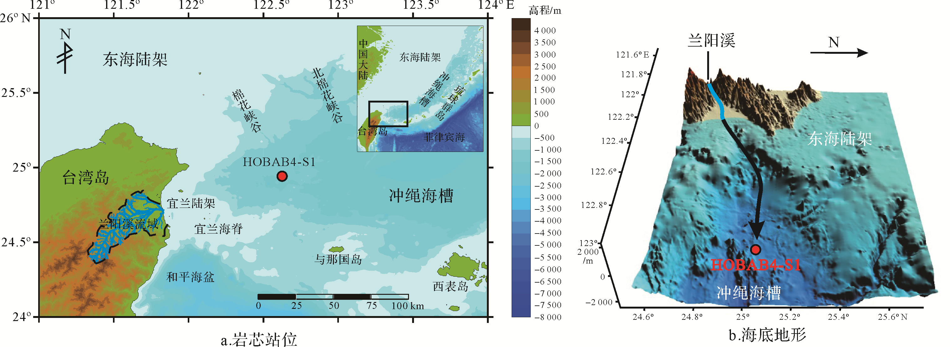
2021, 39(3): 739-750.
doi: 10.14027/j.issn.1000-0550.2020.018
Abstract:
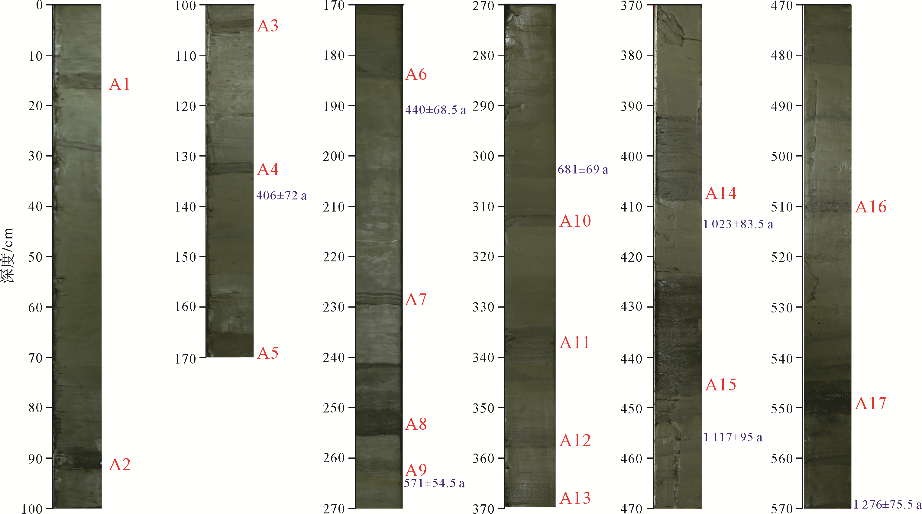
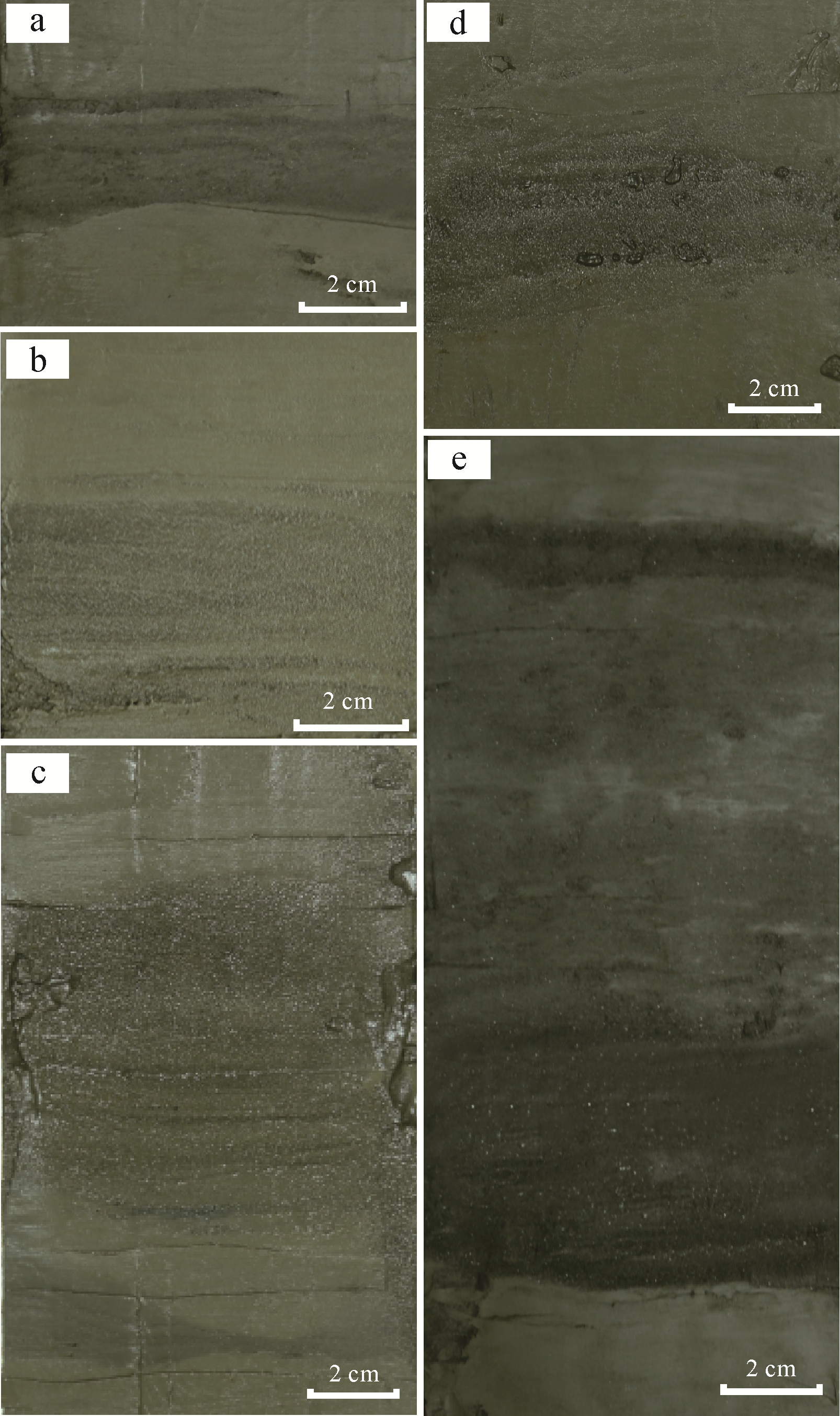
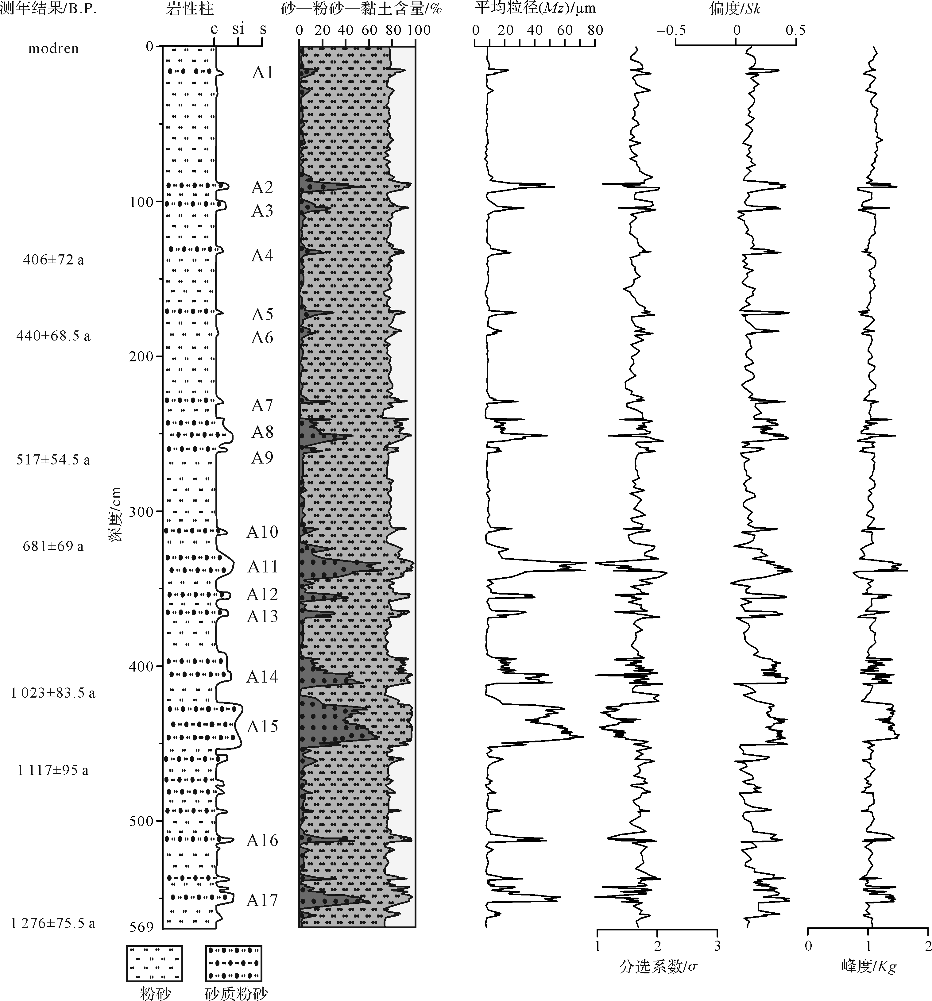
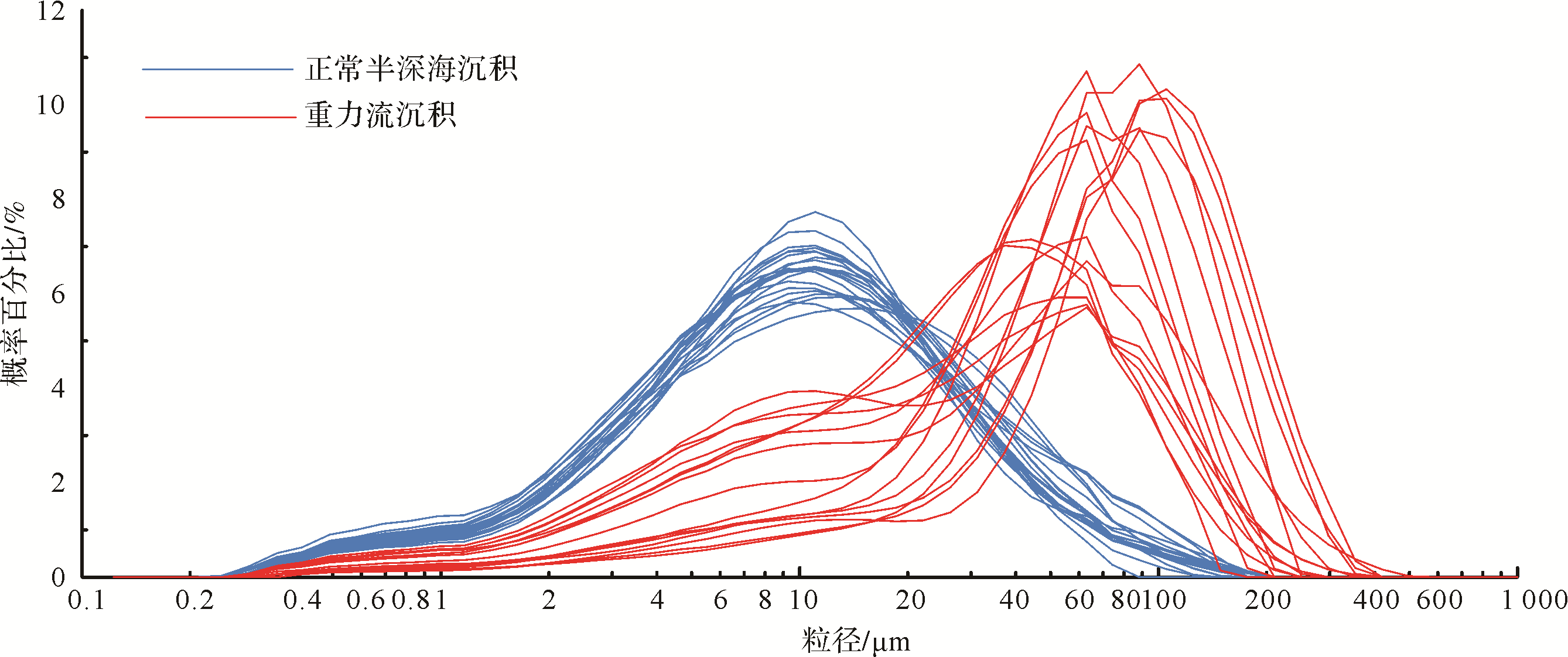
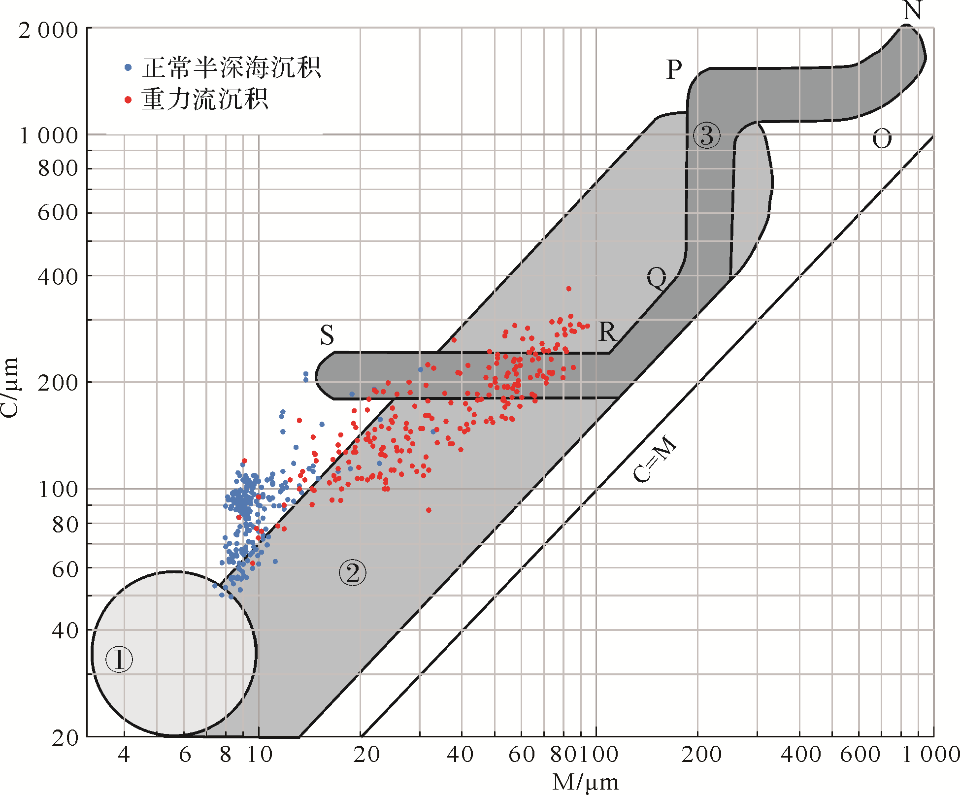
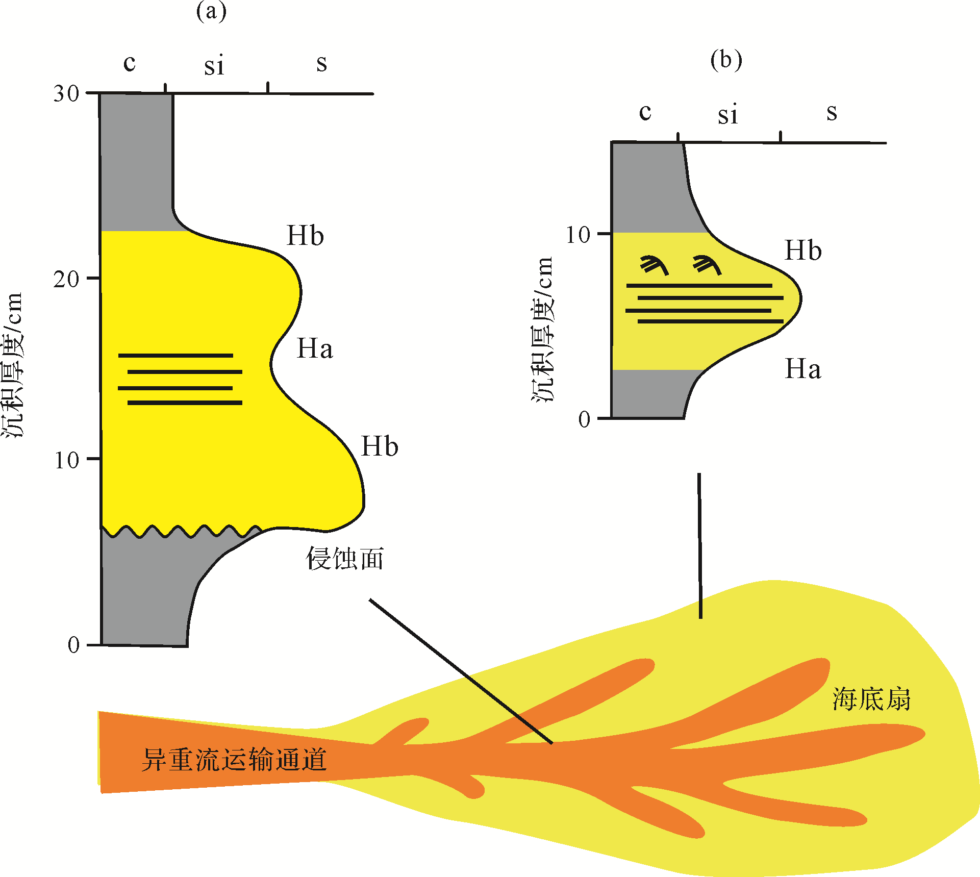
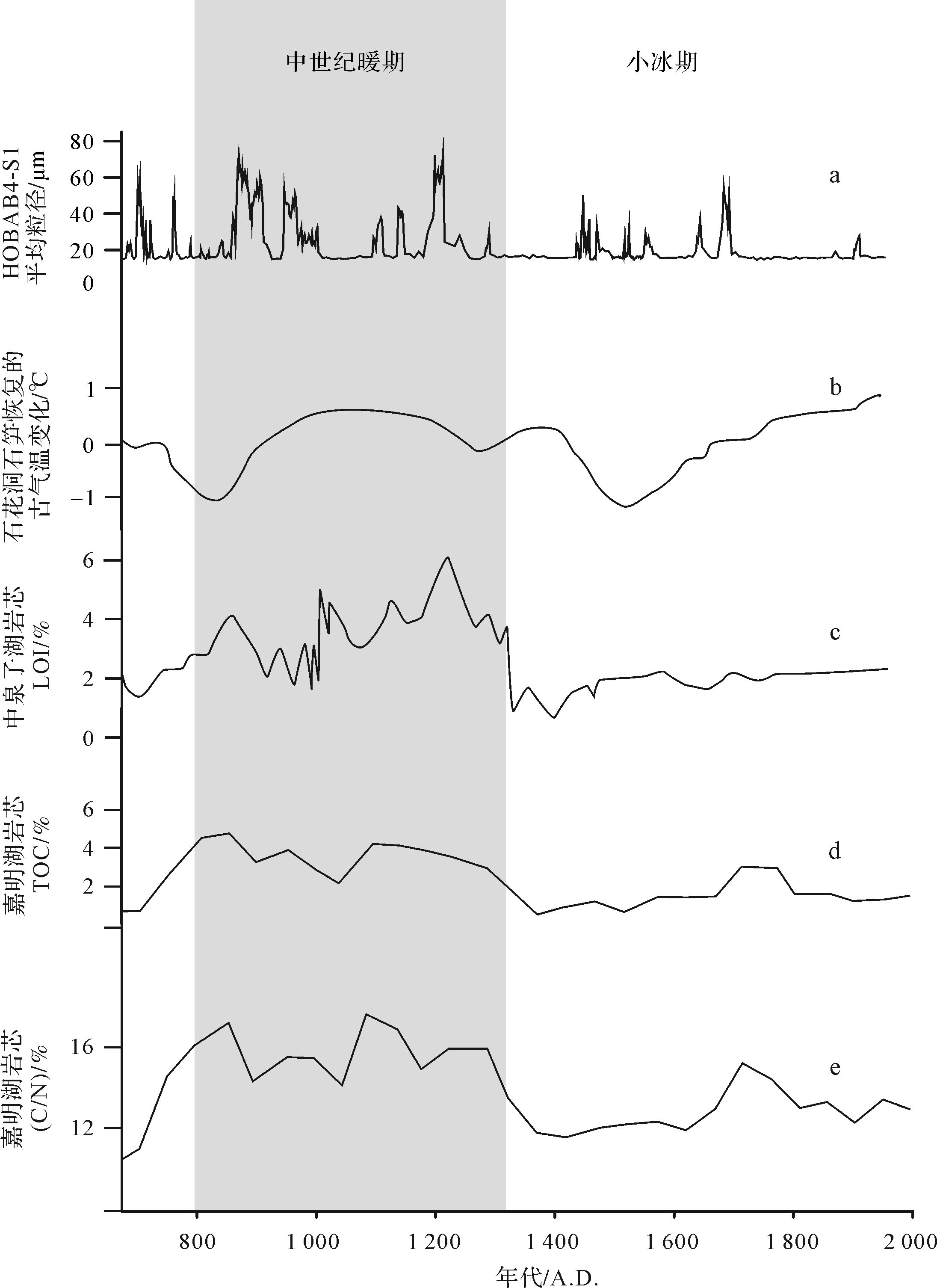
In a case study of core HOBAB4⁃S1 from the southwestern Okinawa Trough, the sedimentary characteristics and paleoclimatic significance of hyperpycnal flow deposits were examined using laser particle size analysis and AMS14C age dating. The results show that there are 17 segments of hyperpycnal flow deposits in the core, consisting mainly of sandy silt. The grain⁃size accumulation curve shows a 70⁃130 μm centered unimodal distribution. The sample point distribution on a C⁃M pattern is roughly parallel to the C = M baseline; below the PQ segment, they have the characteristics of gravity flow deposits, indicating that the sediment was transported as gravity⁃flow suspensions. Parallel bedding, climbing ripple bedding and graded bedding are present within the hyperpycnal flow deposits. Two types of hyperpycnal flow deposit were recognized: (i) thick hyperpycnal flow deposits with basal erosional contacts, with pairs of basal coarsening⁃up units and top fining⁃up units, indicating a proximal sedimentary environment; and (ii) thin hyperpycnal flow deposits with only one pair of basal coarsening⁃up units and top fining⁃up units, indicating a distal sedimentary environment. There was an increase of hyperpycnal flow deposits between 800 A.D. and 1 300 A.D., which indicates that the climate at that time was marked by high temperature and high humidity, typhoons, and frequent floods and heavy rainfall. This is evidence of the Medieval Warm Period in East Asia.

2021, 39(3): 751-766.
doi: 10.14027/j.issn.1000-0550.2020.022
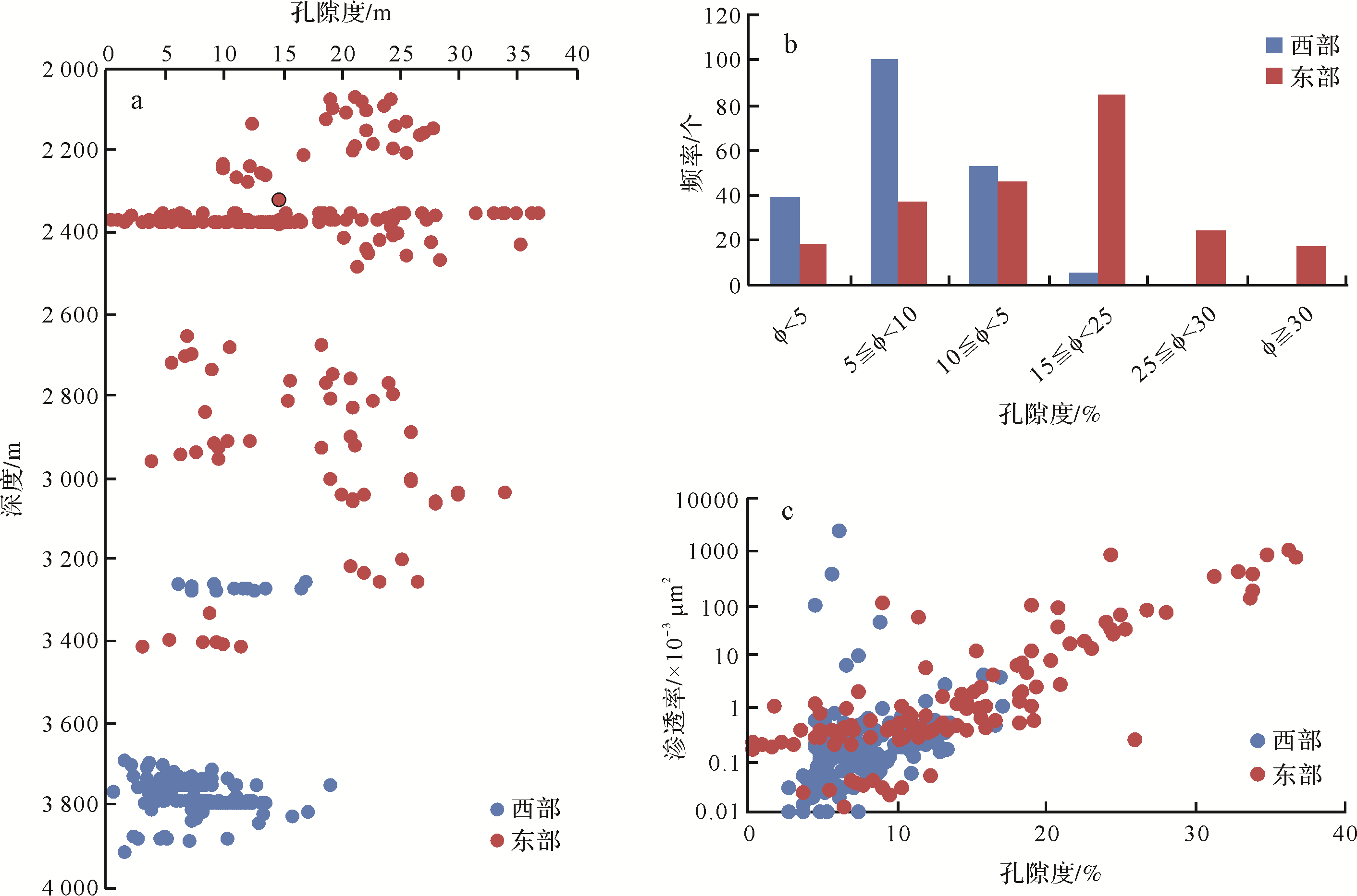
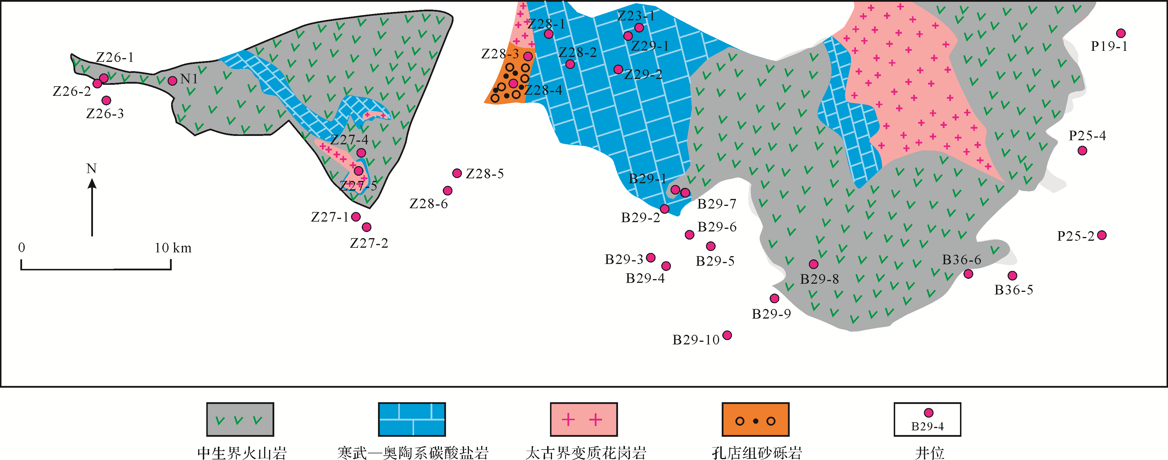
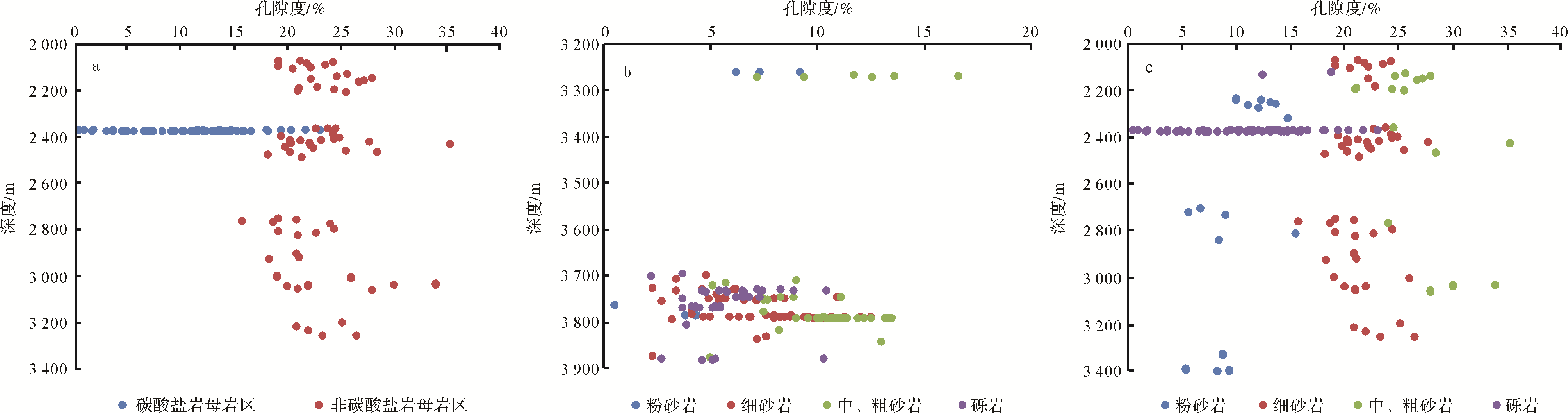
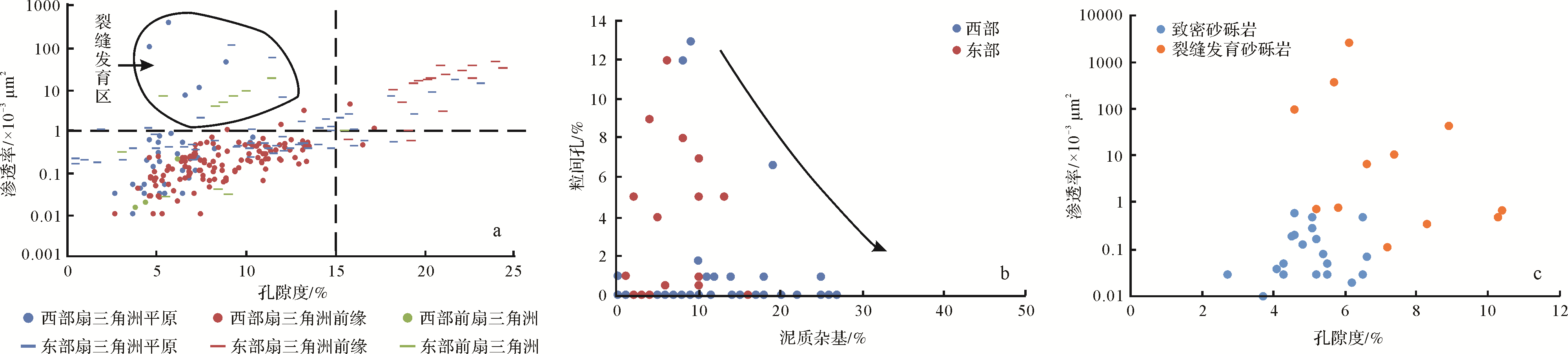
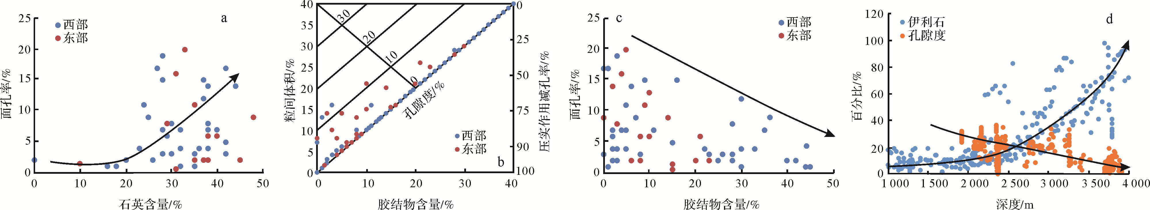
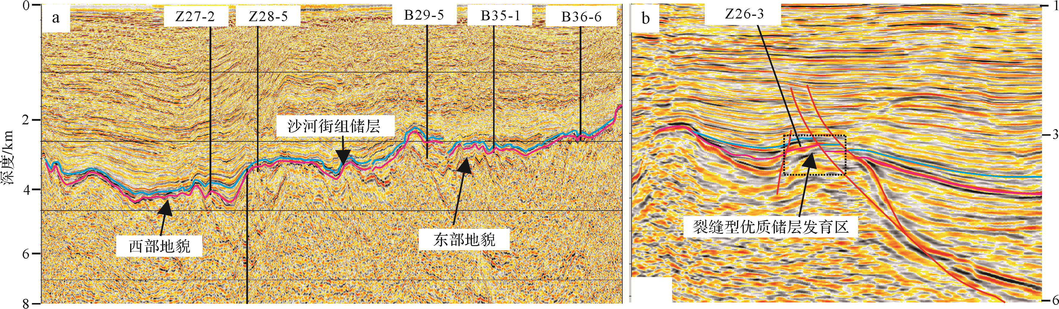
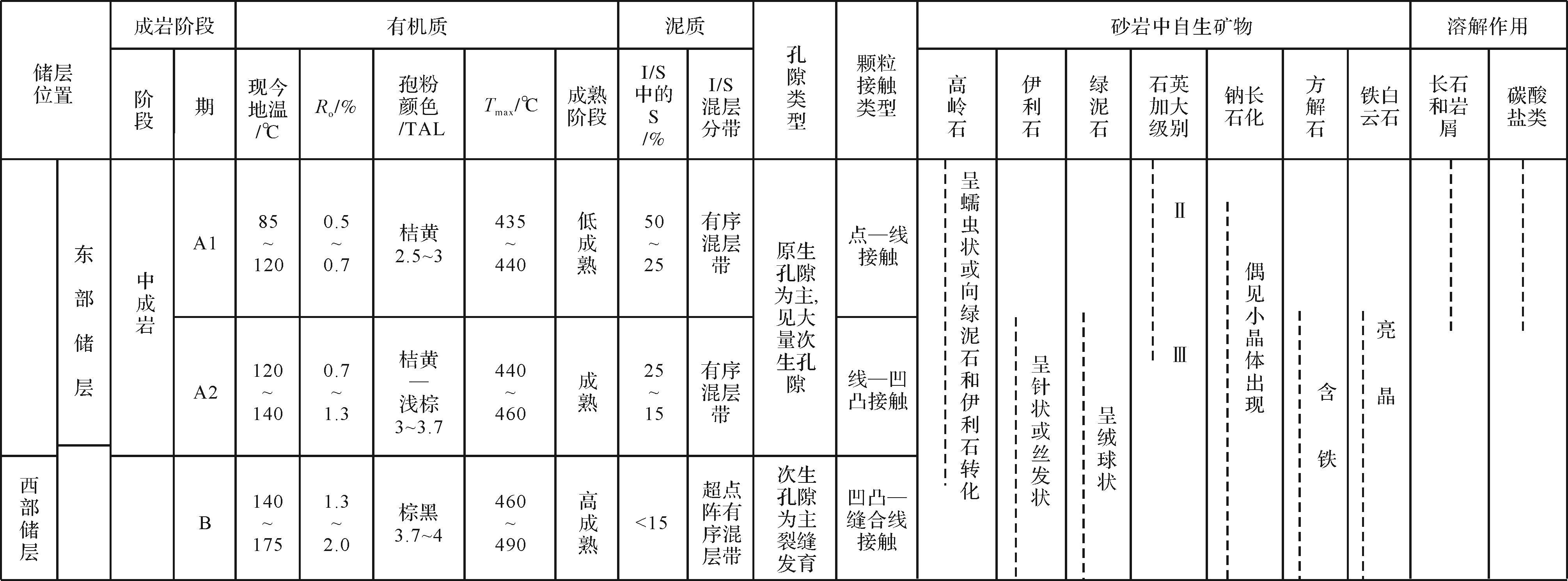
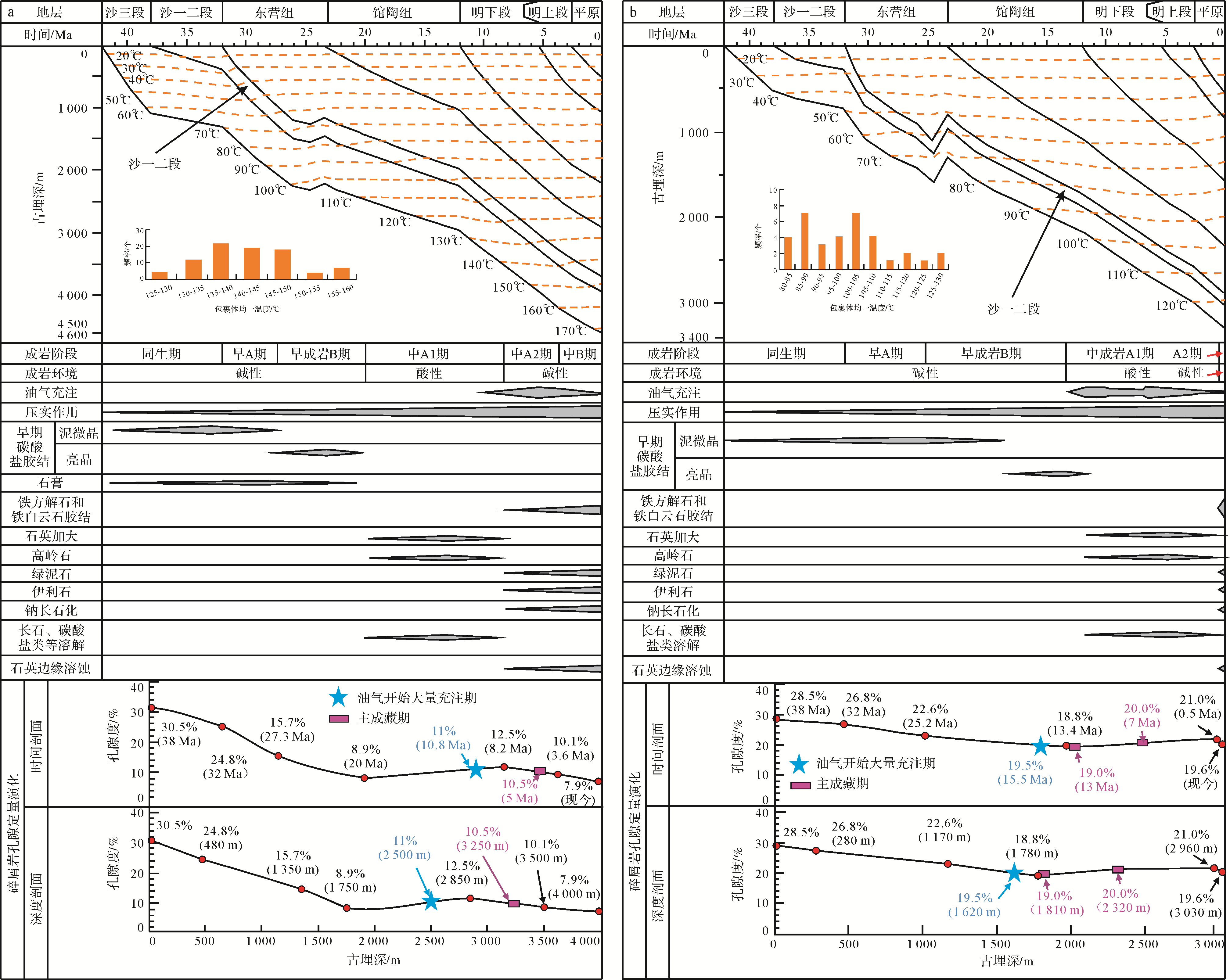
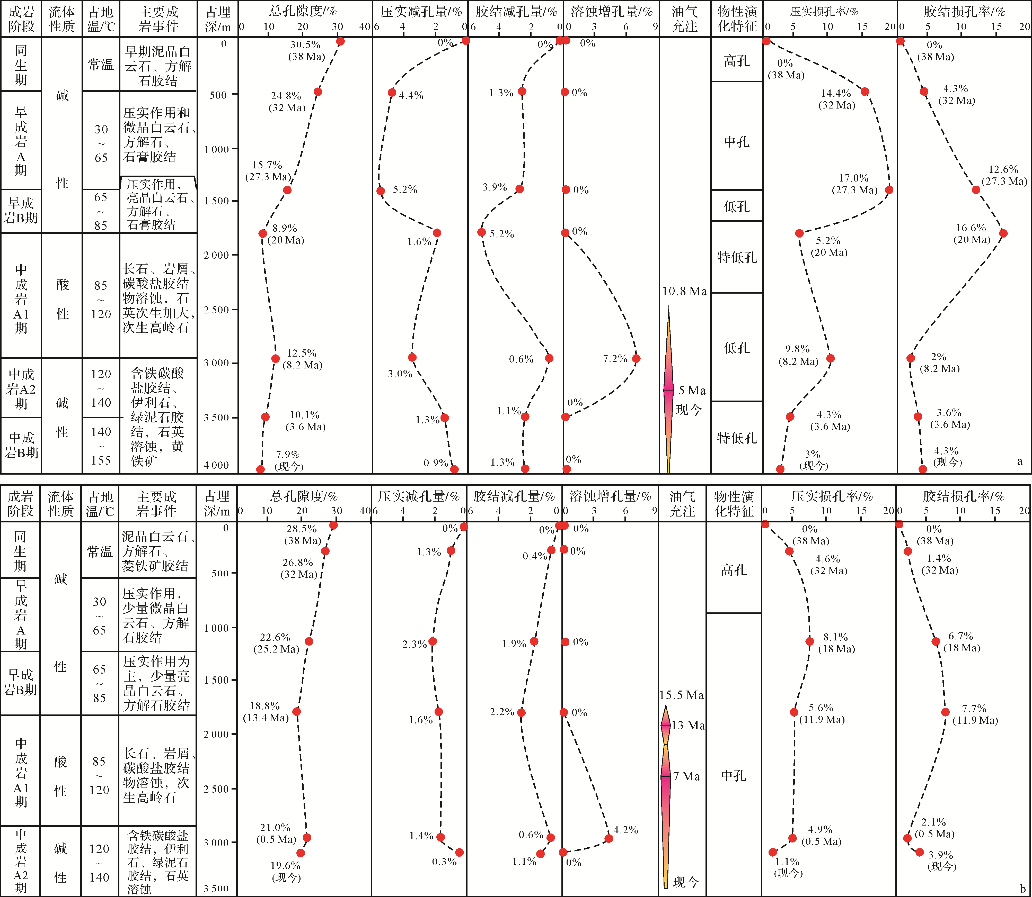
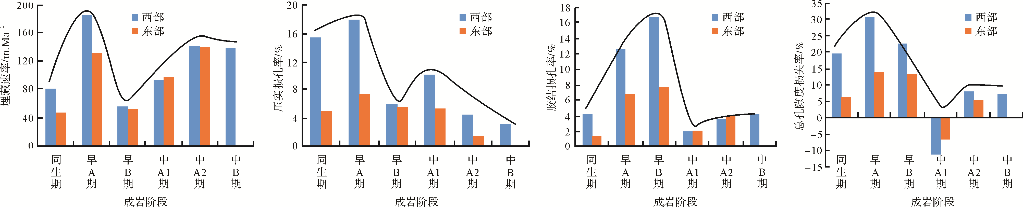
Abstract:
Relatively few studies have been conducted on the genesis of the high⁃quality reservoirs in the Shahejie Formation at the northern margin of the Huanghekou Sag, which has severely hindered further exploration and evaluation in the area. This study examined the genesis of high⁃quality reservoirs in the Es1+2 in this area using data from thin sections, physical properties, clay minerals, inclusions and burial history, and the evolution of reservoir porosity at different locations is quantitatively discussed. In the study area it was found that (1) reservoirs dominated by fan delta glutenite were developed in the Es1+2. Those in the western area have poor physical properties, being dominated by very low porosity and low permeability. The eastern reservoirs have better physical properties, with mainly mesopores and low permeability, but contain localized zones with both low porosity and low permeability. (2) Granite and medium⁃acid volcanic parent rock development areas at similar depths were the main parent rock types for high⁃quality reservoir development. In the fan⁃delta frontal subaqueous distributary channel, coarse sandstone is the main sedimentary facies and rock type for the development of high⁃quality reservoirs. Differential compaction and cementation were the main diagenetic influences on reservoir physical properties at various locations in the study area. The intense compaction and cementation in the western area resulted in the poor physical properties, although the structural properties of the fractures are good. Relatively weak compaction and cementation in the eastern area have resulted in favorable physical properties. (3) The reservoirs in the western part of the study area are now at the medium diagenetic stage B of the Mesozoic; those in the east have just entered the medium diagenetic stage A2 phase of the Mesozoic. The diagenetic evolution had similarities, but its process and intensity were evidently different: although the diagenetic stage of oil and gas charging was the same, the filling periods differed. Reservoirs at different locations have different degrees of porosity loss or increase at each diagenetic stage, with the highest degree of porosity loss most evident in the western reservoir. Differential compaction and cementation caused by tectonic activity controlled the reservoir properties. Strong compaction and cementation were the root cause of densification in the western reservoirs, which exhibit the characteristics of dense edge formation.


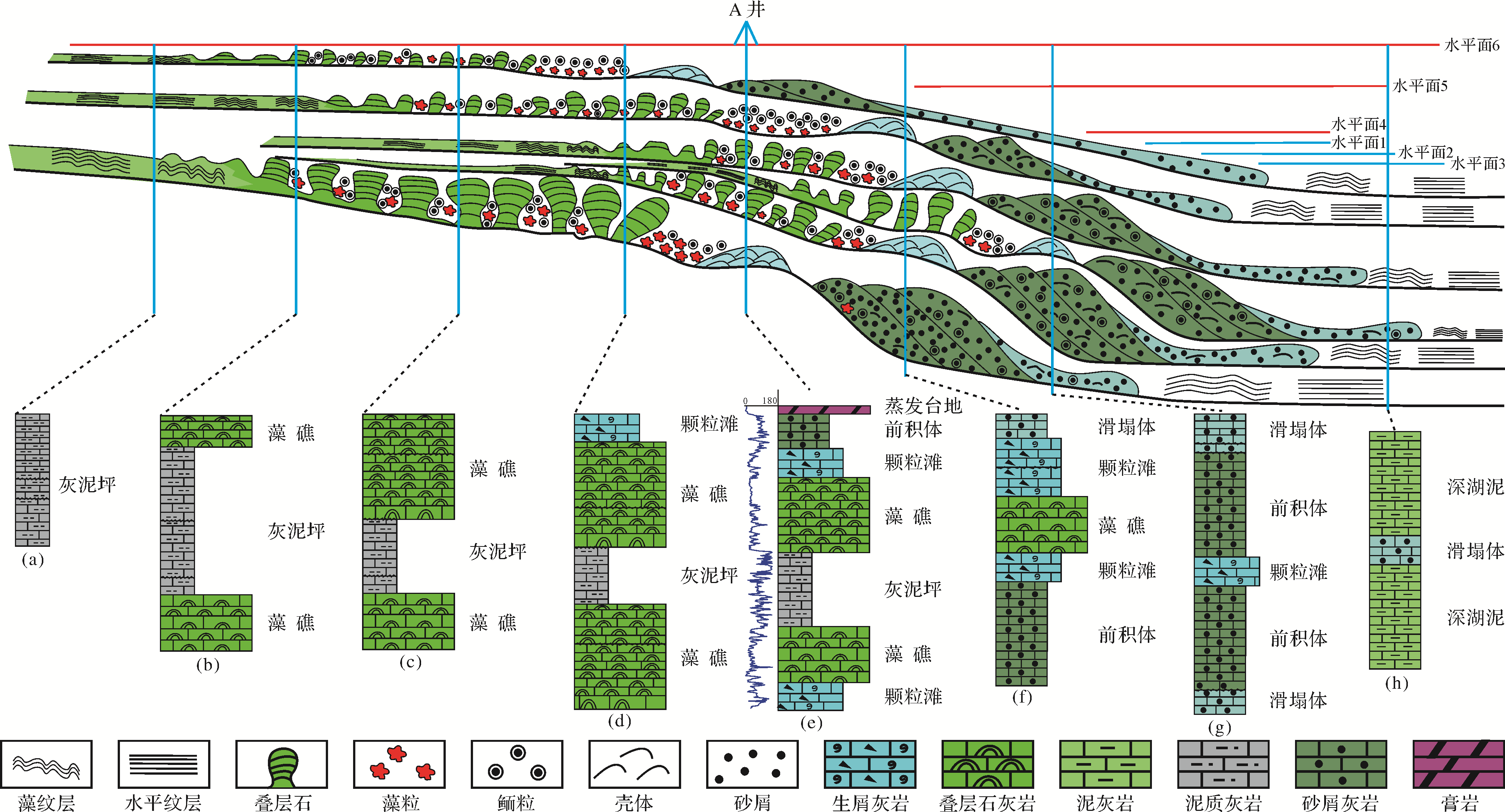
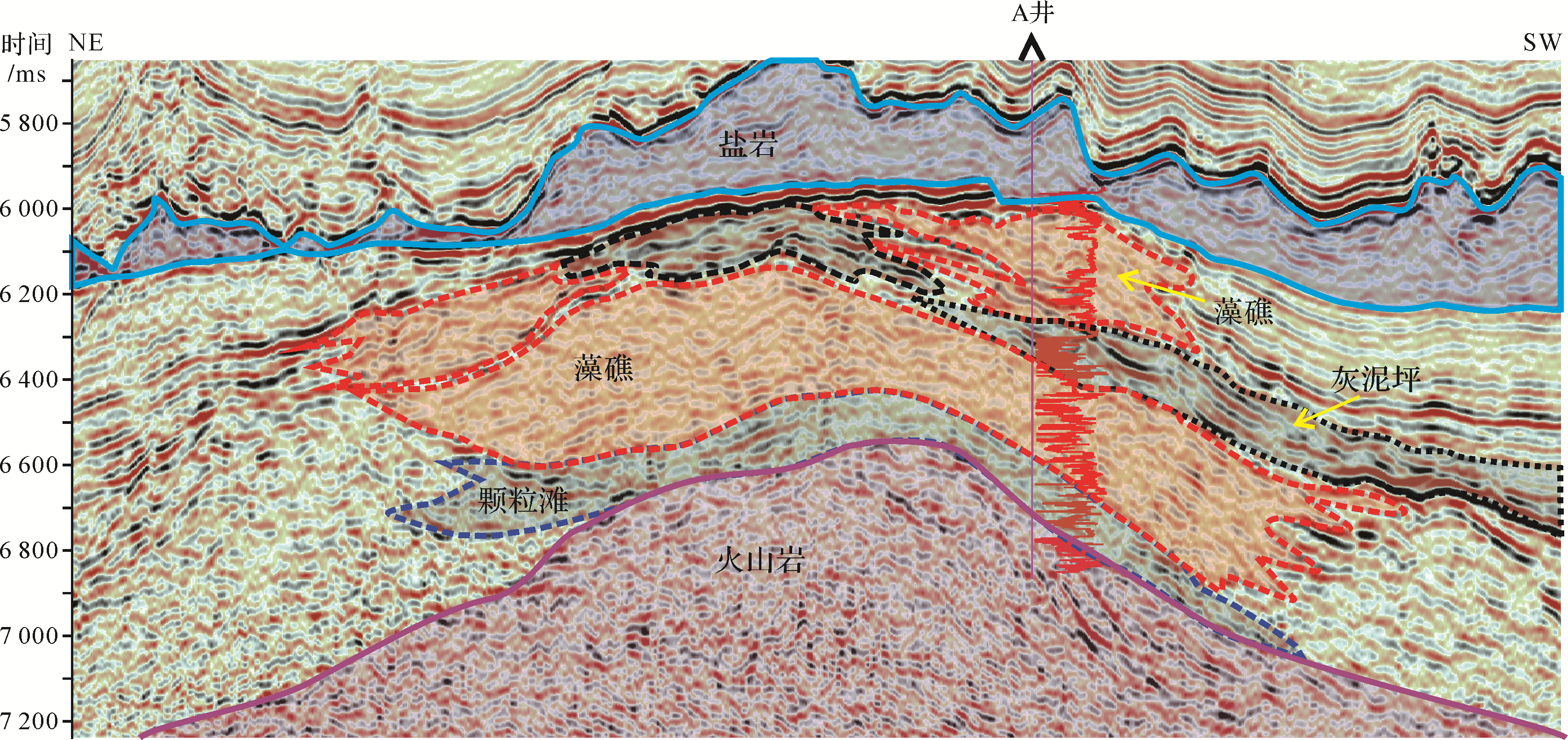
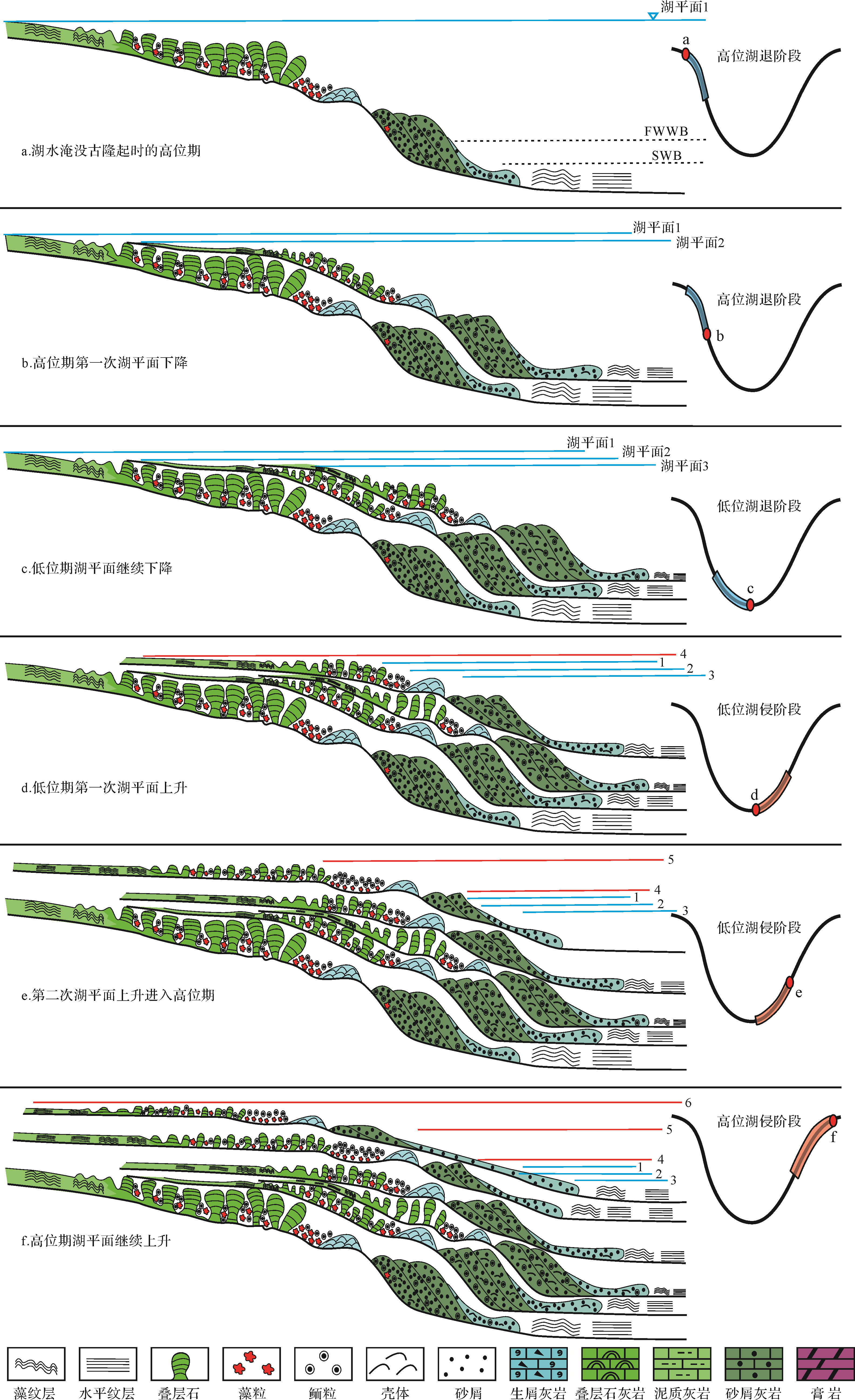
2021, 39(3): 767-780.
doi: 10.14027/j.issn.1000-0550.2020.025
Abstract:
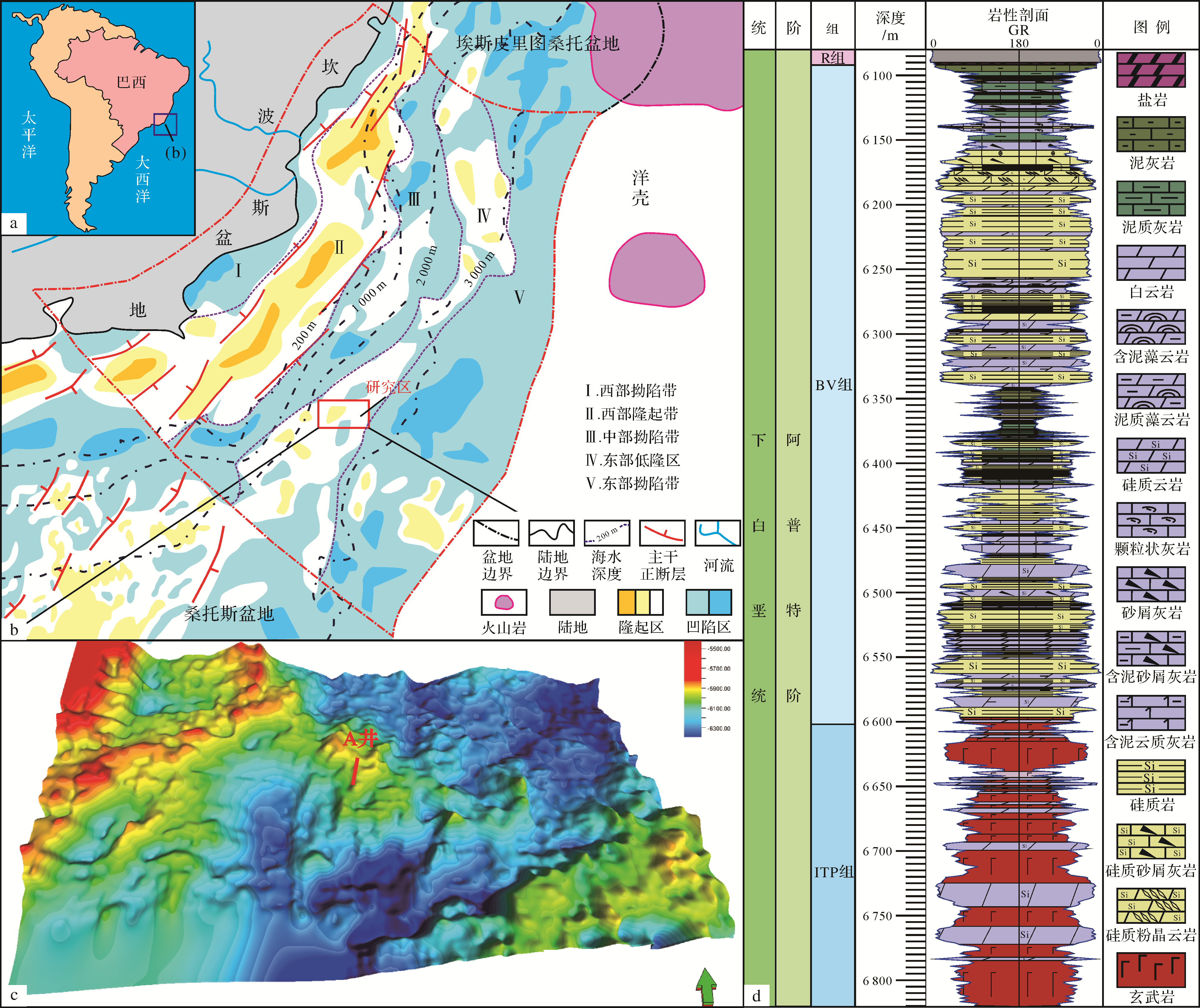
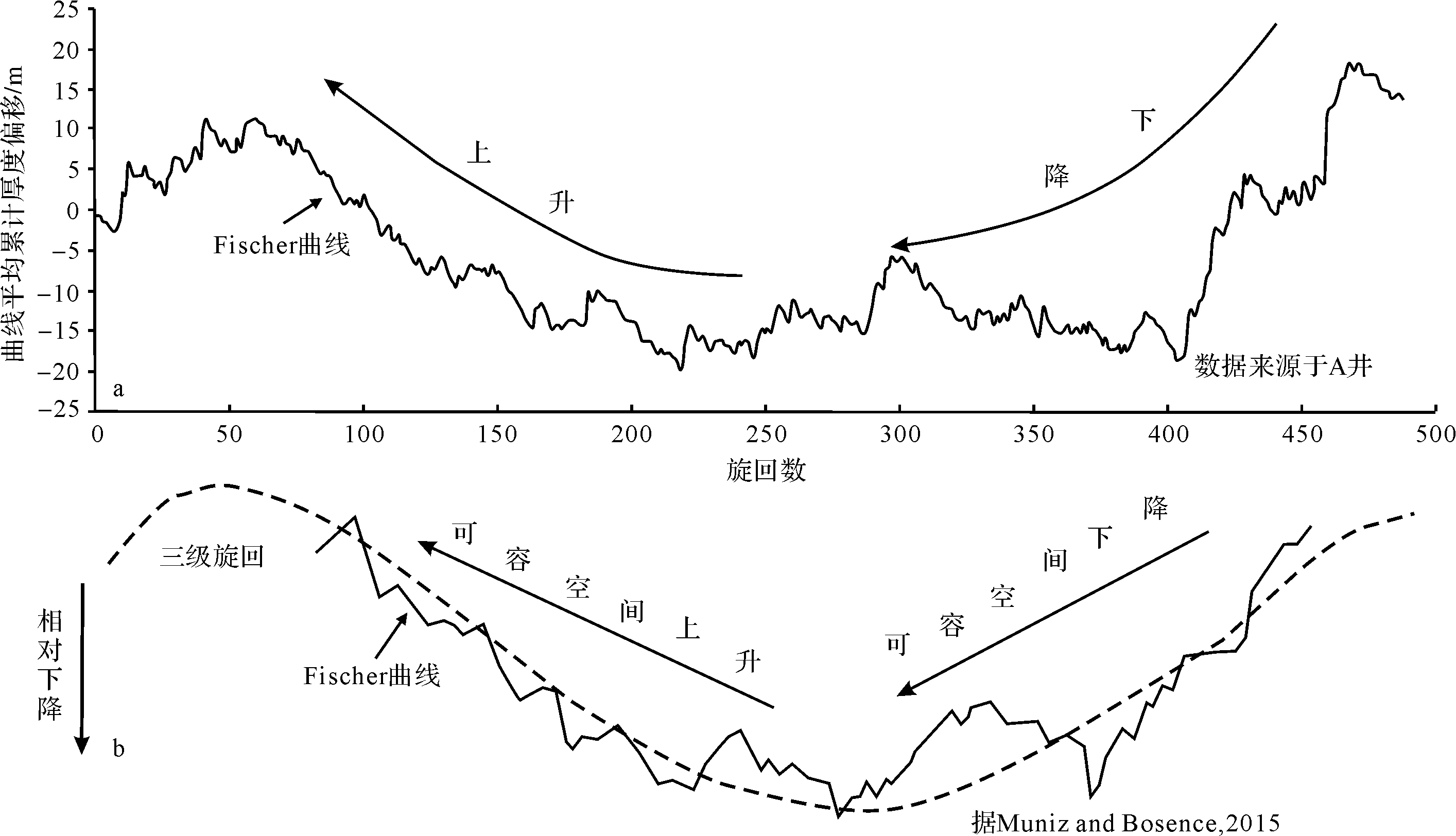
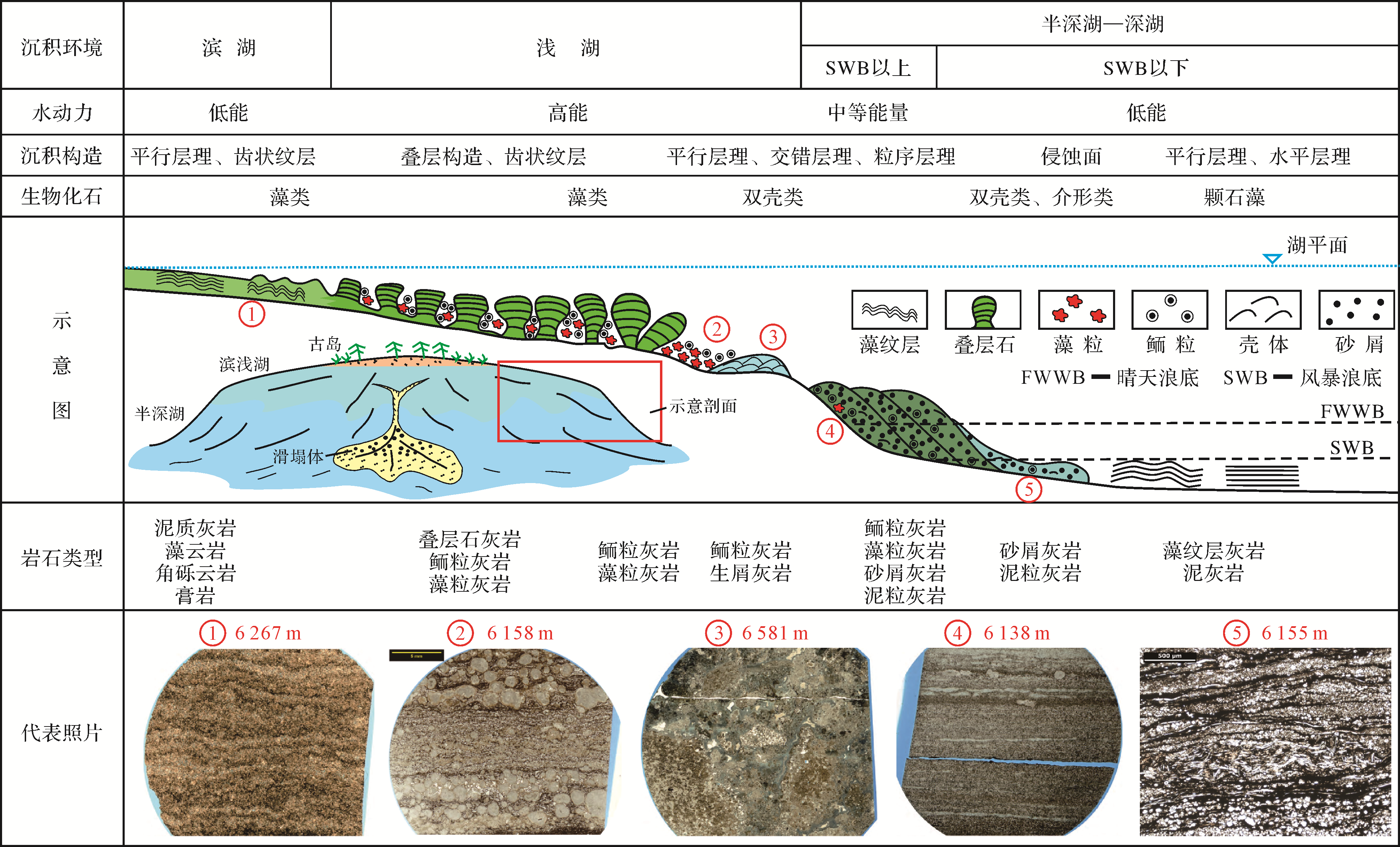
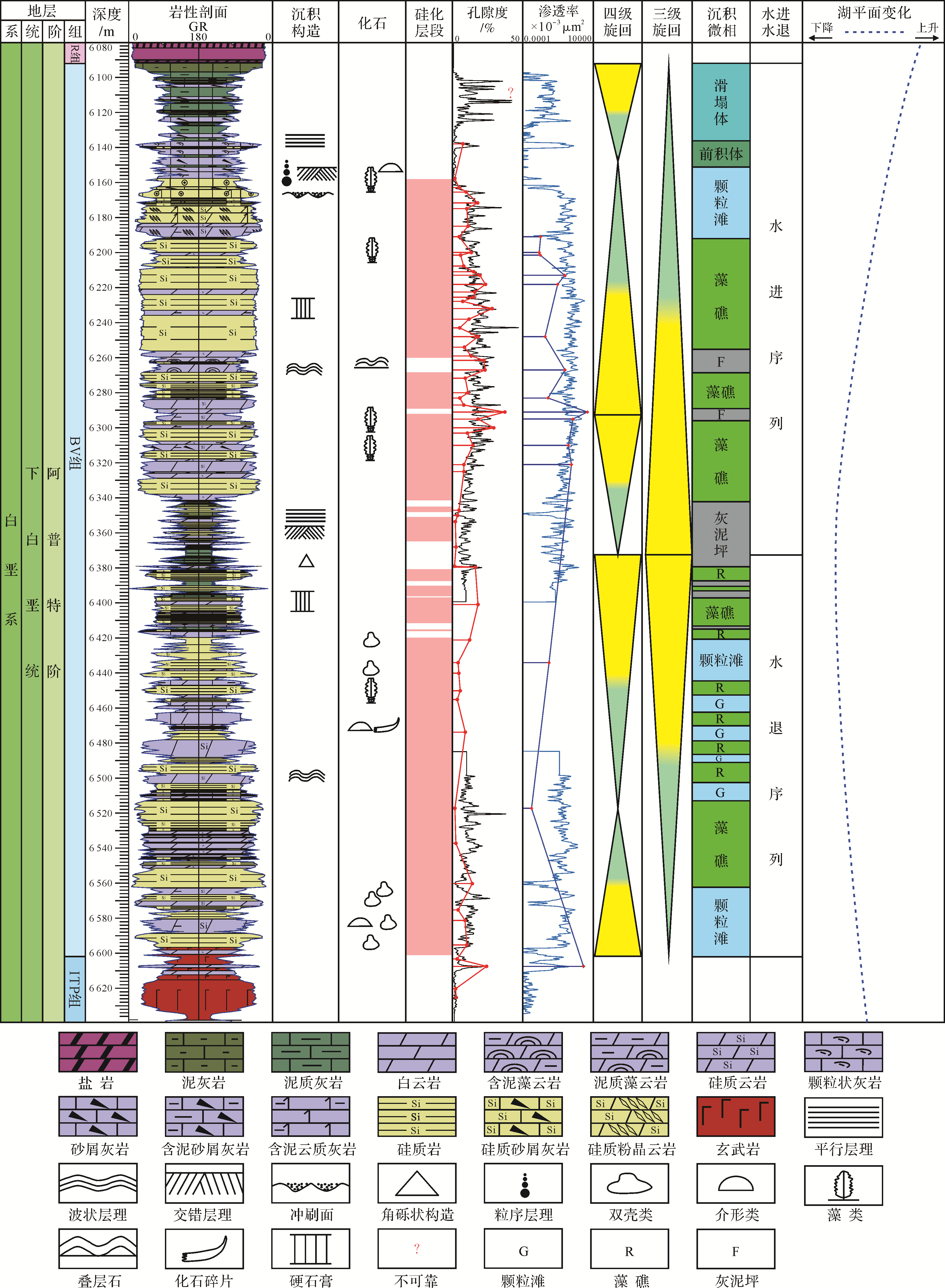
The Lower Cretaceous lake carbonates of the Great Campos Basin in southeastern Brazil are rich in hydrocarbon resources. A study of the silicified carbonates that have produced the sedimentary microfacies in the eastern Campos Basin, and modeling the deposition of the initial carbonates in this area, poses challenges for deepwater petroleum exploration. In this study, the silicified carbonates were analyzed by integrating paleogeomorphology, sidewall core thin sections and well⁃logging data to determine the original paleohydrology, changes of lake level, and microfacies. The main factors controlling the lake carbonates in the study area were then clarified and a sedimentation model was established. A Fischer Plot was used to estimate the accommodation space within the study area. This was identified as initially decreasing then increasing third⁃order cycles, indicating corresponding lowering and rising water levels in the lake. The periphery of the paleohighs in the central lake were interpreted as distally steepened ramps in which five microfacies developed: a muddy limestone flat, an algal reef, a grain beach, beach progradations, and slump bodies. The paleogeomorphological study showed that the algal reef and grain beach developed in an area of relatively deep water in the structural high. The changes in lake level caused lateral and vertical superposition of the reef and shoal. During carbonate deposition, the level of the lake decreased at least twice and increased three times. Four evolutionary stages were evident: highstand lake level retreat, lowstand retreat, lowstand lake level intrusion and highstand intrusion. The findings of this study provide a significant basis for an analysis of the original silicification and evolution of the lake carbonates and the discovery of effective reservoirs in the silicified carbonates.