Current Issue
2026 Vol. 44, No. 5
Display Method:
2026, 44(5): 1589-1610.
doi: 10.14027/j.issn.1000-0550.2026.036
Abstract:
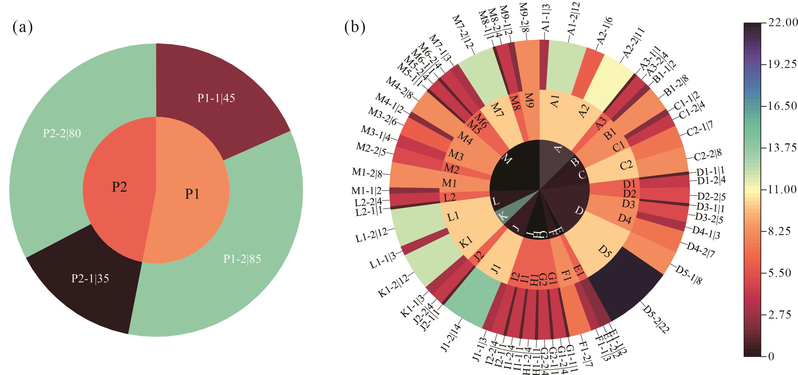
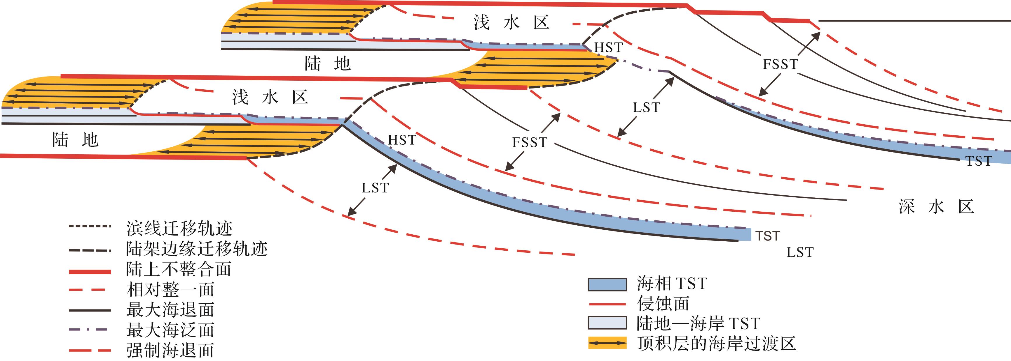
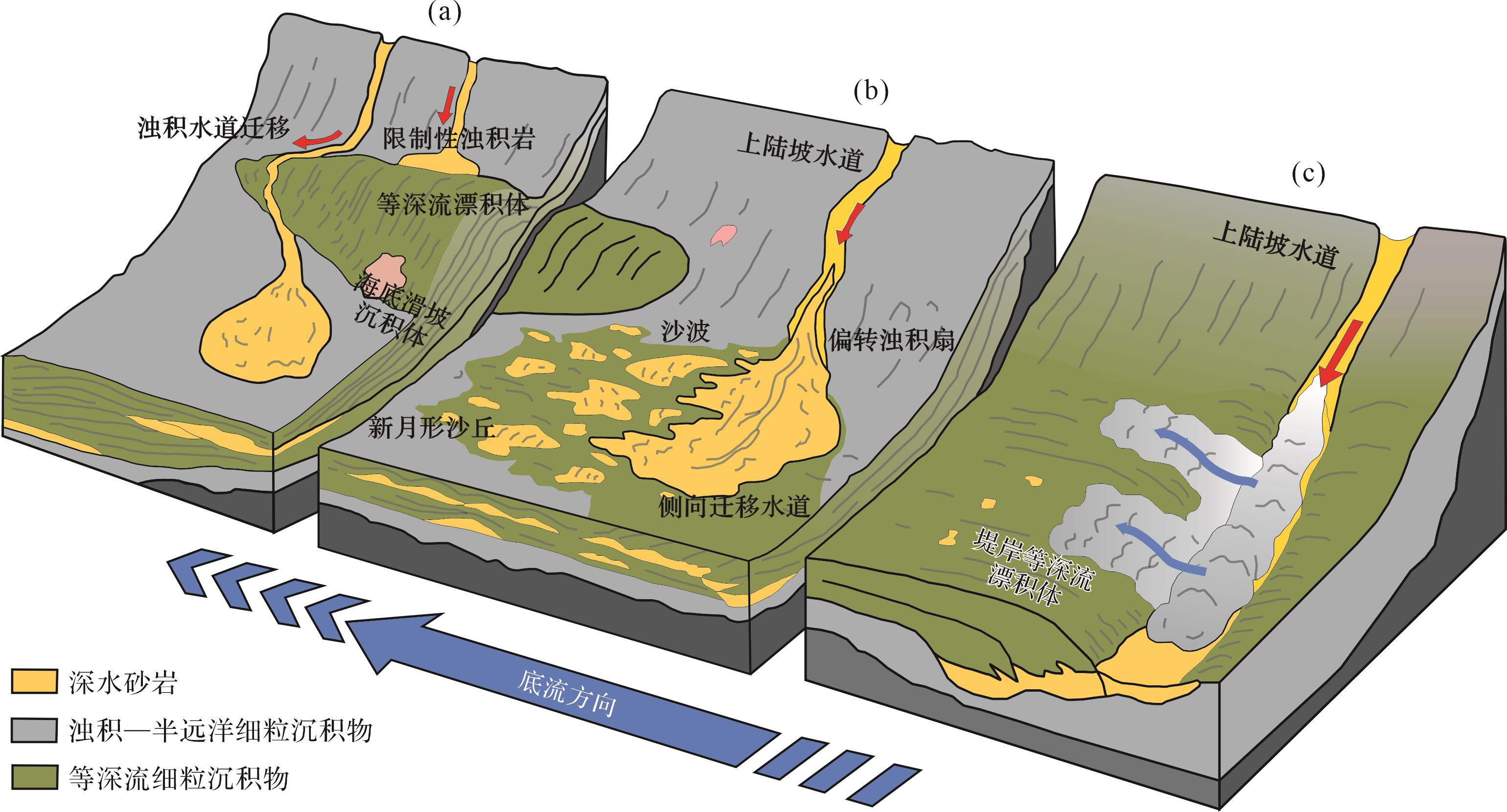
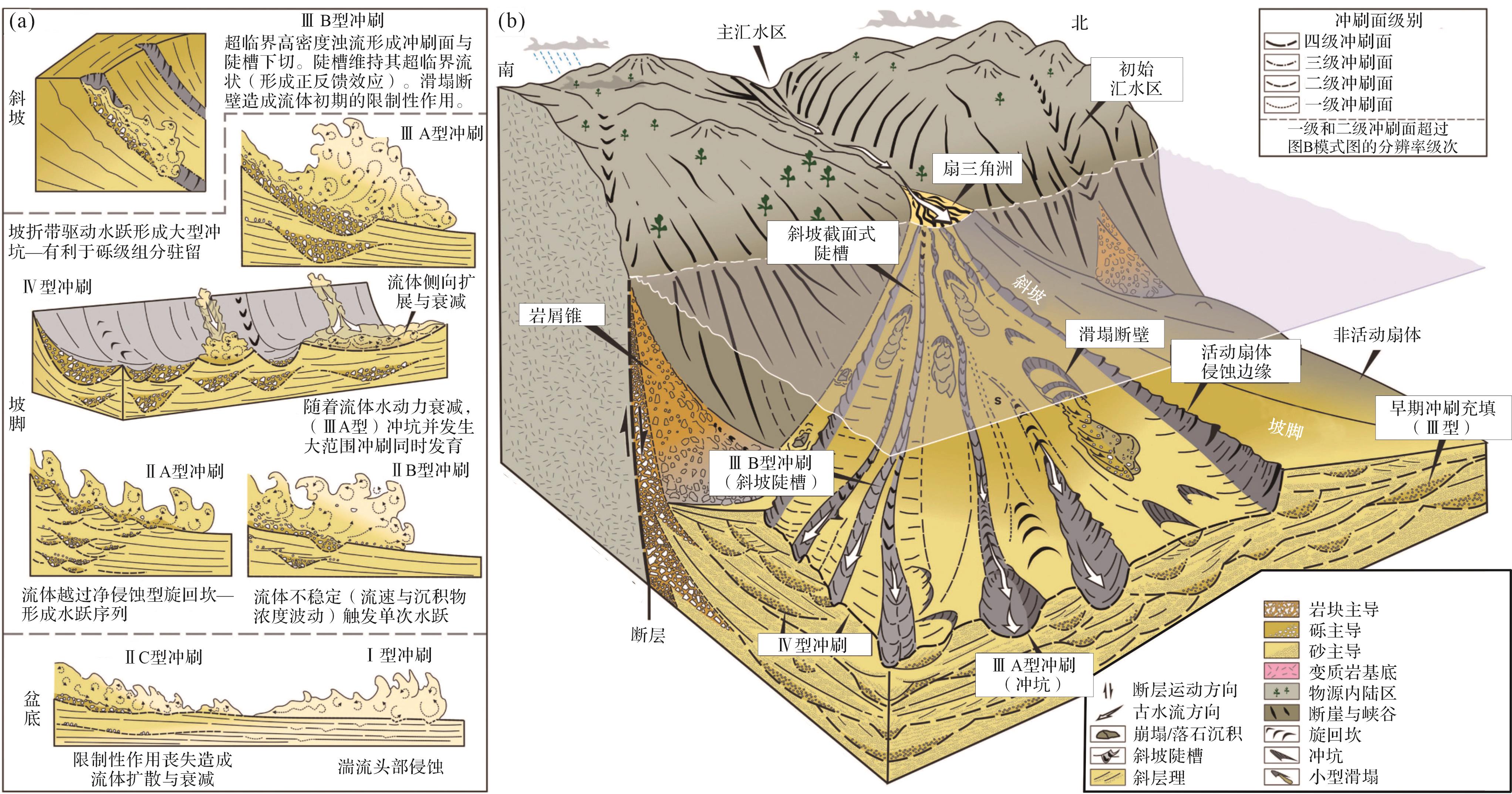
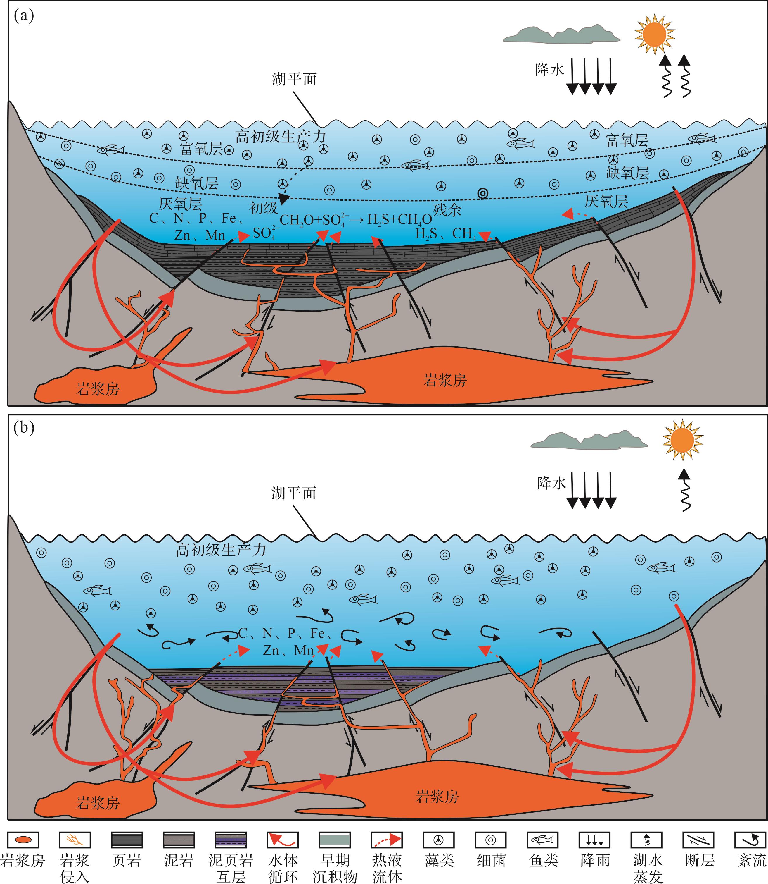
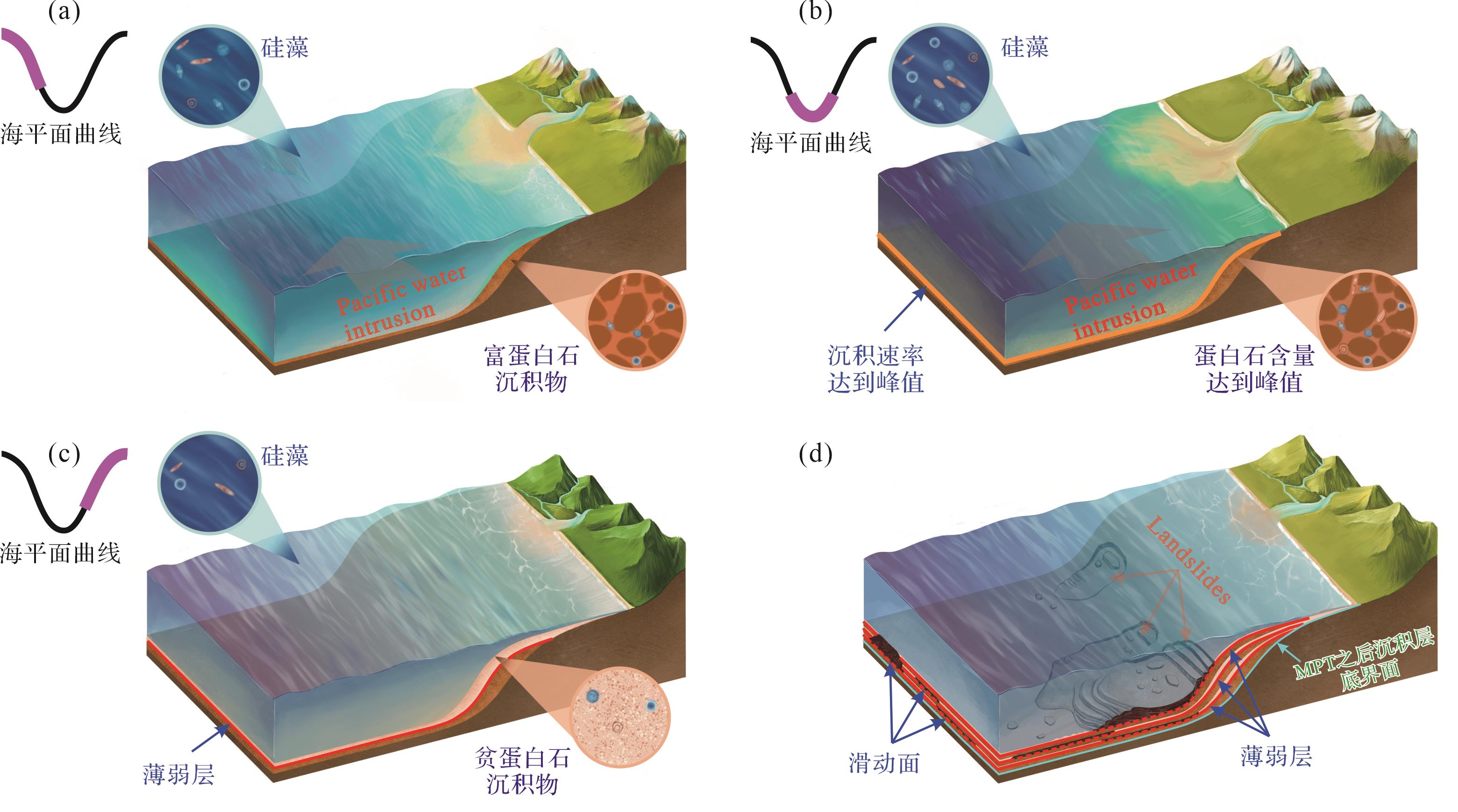
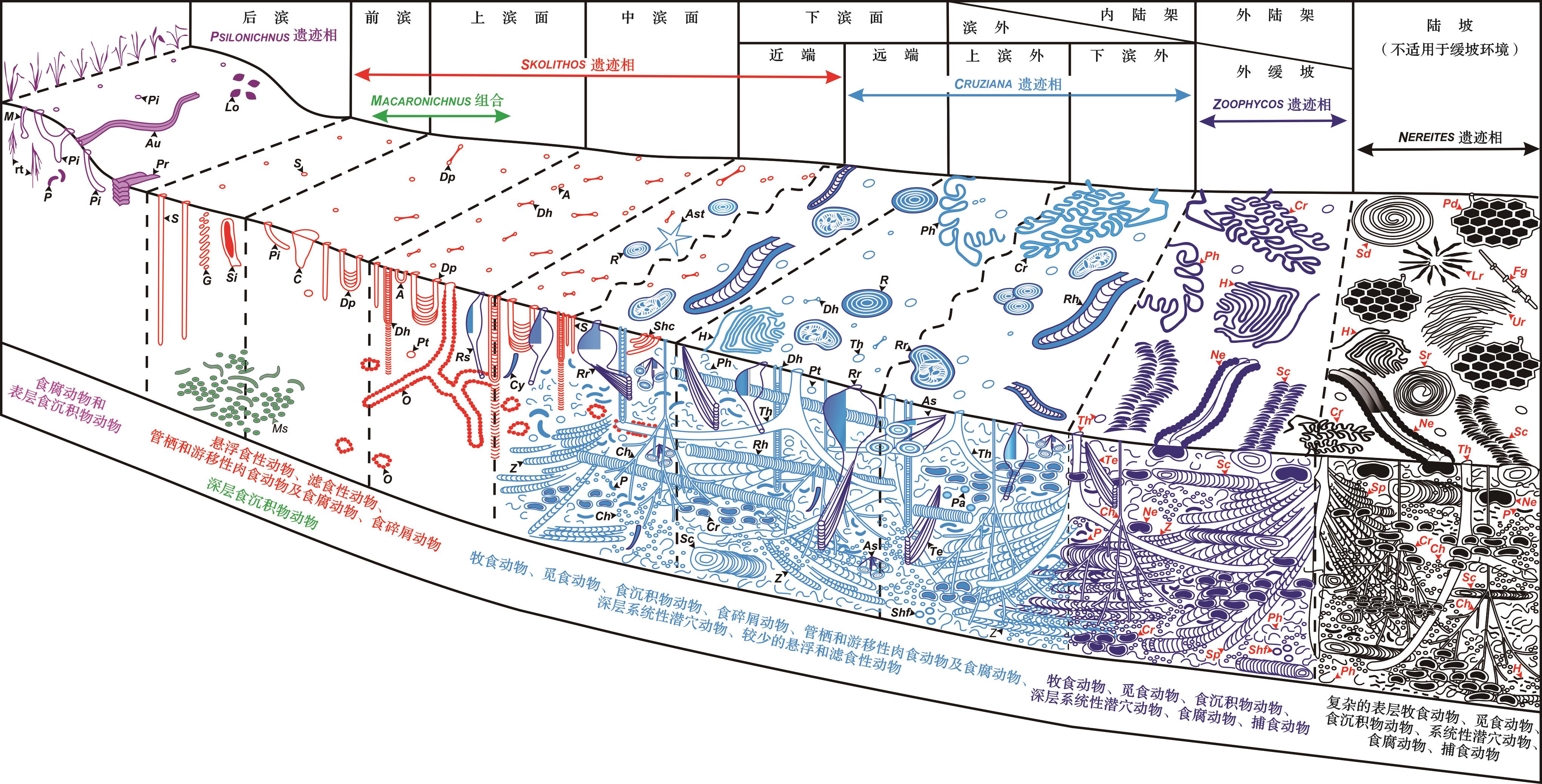
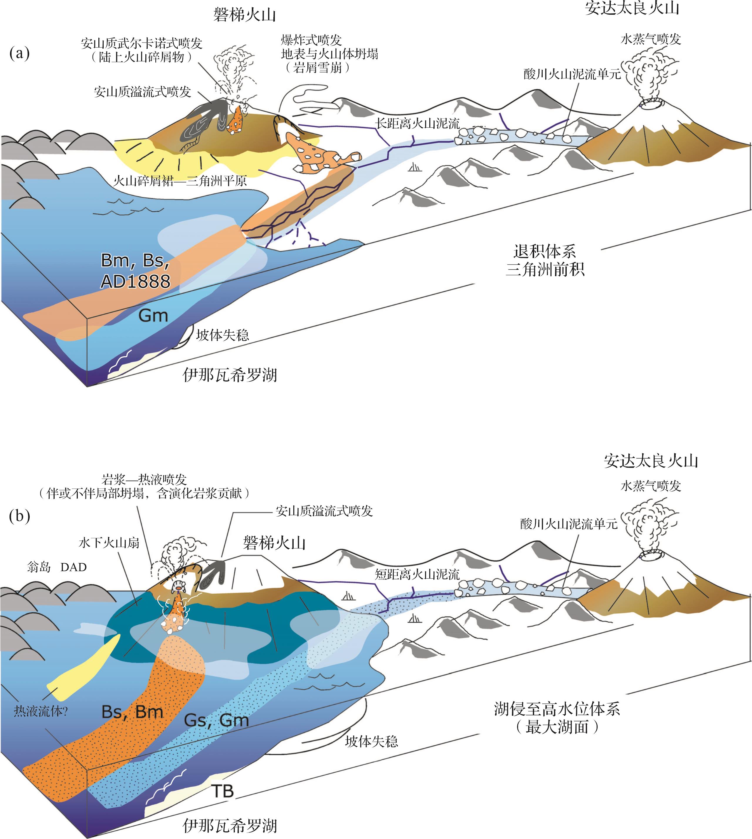
Significance The highly anticipated 22nd International Sedimentological Congress (ISC) was held in Wellington, New Zealand, 25th-30th in January 2026. Progress The focal points of the congress encompassed a wide array of topics, primarily including the coupling effects of tectonics and sea-level fluctuations, the characterization of tectonic geomorphology and source-to-sink systems, modern continental sedimentary processes and lacustrine sequence stratigraphy, glacial processes and distributive fluvial systems, the spatiotemporal evolution of coastal and shelf deposition, carbonate platform-slope-basin systems and depositional diagenesis, contour currents and deep-water mixed depositional systems, deep-water gravity flow sedimentary processes in lacustrine basins and active continental margins, mudstone sedimentation and black shale sedimentology, the depositional characteristics and prediction of geological hazards, deep-time biosphere-geosphere interactions, marine and continental volcaniclastic deposition and diagenesis, planetary sedimentology, physical and numerical modeling of sedimentary processes, as well as the green energy transition and carbon sequestration, deep-time digital sedimentology and AI methods. Conclusions and Prospects A comprehensive analysis of the cutting-edge dynamics and focal issues from the 22nd ISC indicates that future sedimentological research in China should continuously promote the integration of multi-disciplinary sedimentosphere studies. Emphasis should be placed on elucidating sedimentary mechanisms and their numerical modeling, the quantitative characterization and coupling relationships of source-to-sink system elements, and the advancement of deep-time digital intelligent Earth and intelligent paleogeography. The ultimate goal is to establish a sedimentological theoretical framework featuring China's unique regional geological characteristics, thereby making significant scientific contributions to ensuring the nation's energy and resource security.
Significance The highly anticipated 22nd International Sedimentological Congress (ISC) was held in Wellington, New Zealand, 25th-30th in January 2026. Progress The focal points of the congress encompassed a wide array of topics, primarily including the coupling effects of tectonics and sea-level fluctuations, the characterization of tectonic geomorphology and source-to-sink systems, modern continental sedimentary processes and lacustrine sequence stratigraphy, glacial processes and distributive fluvial systems, the spatiotemporal evolution of coastal and shelf deposition, carbonate platform-slope-basin systems and depositional diagenesis, contour currents and deep-water mixed depositional systems, deep-water gravity flow sedimentary processes in lacustrine basins and active continental margins, mudstone sedimentation and black shale sedimentology, the depositional characteristics and prediction of geological hazards, deep-time biosphere-geosphere interactions, marine and continental volcaniclastic deposition and diagenesis, planetary sedimentology, physical and numerical modeling of sedimentary processes, as well as the green energy transition and carbon sequestration, deep-time digital sedimentology and AI methods. Conclusions and Prospects A comprehensive analysis of the cutting-edge dynamics and focal issues from the 22nd ISC indicates that future sedimentological research in China should continuously promote the integration of multi-disciplinary sedimentosphere studies. Emphasis should be placed on elucidating sedimentary mechanisms and their numerical modeling, the quantitative characterization and coupling relationships of source-to-sink system elements, and the advancement of deep-time digital intelligent Earth and intelligent paleogeography. The ultimate goal is to establish a sedimentological theoretical framework featuring China's unique regional geological characteristics, thereby making significant scientific contributions to ensuring the nation's energy and resource security.
2026, 44(5): 1611-1626.
doi: 10.14027/j.issn.1000-0550.2025.031
Abstract:
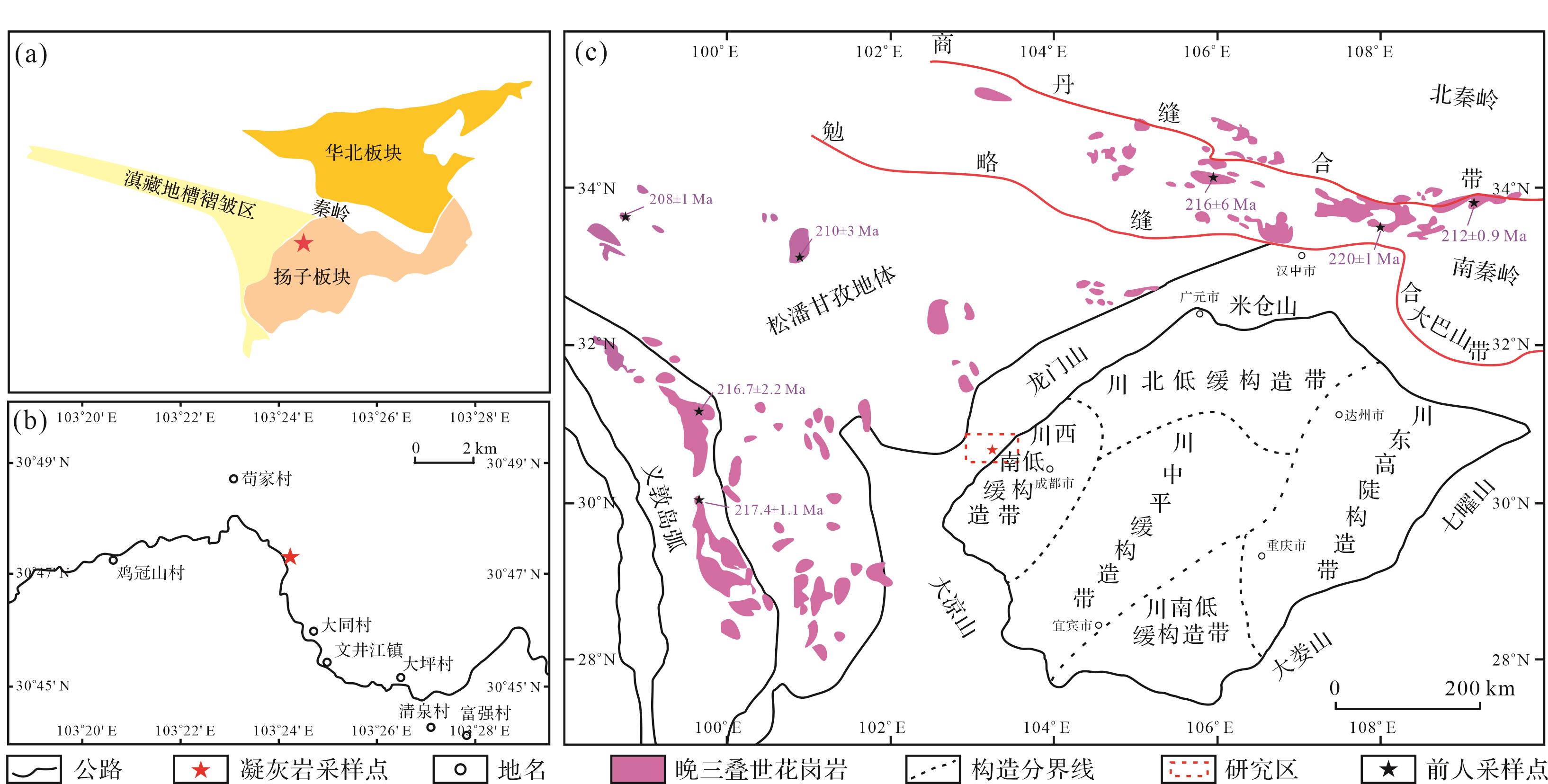
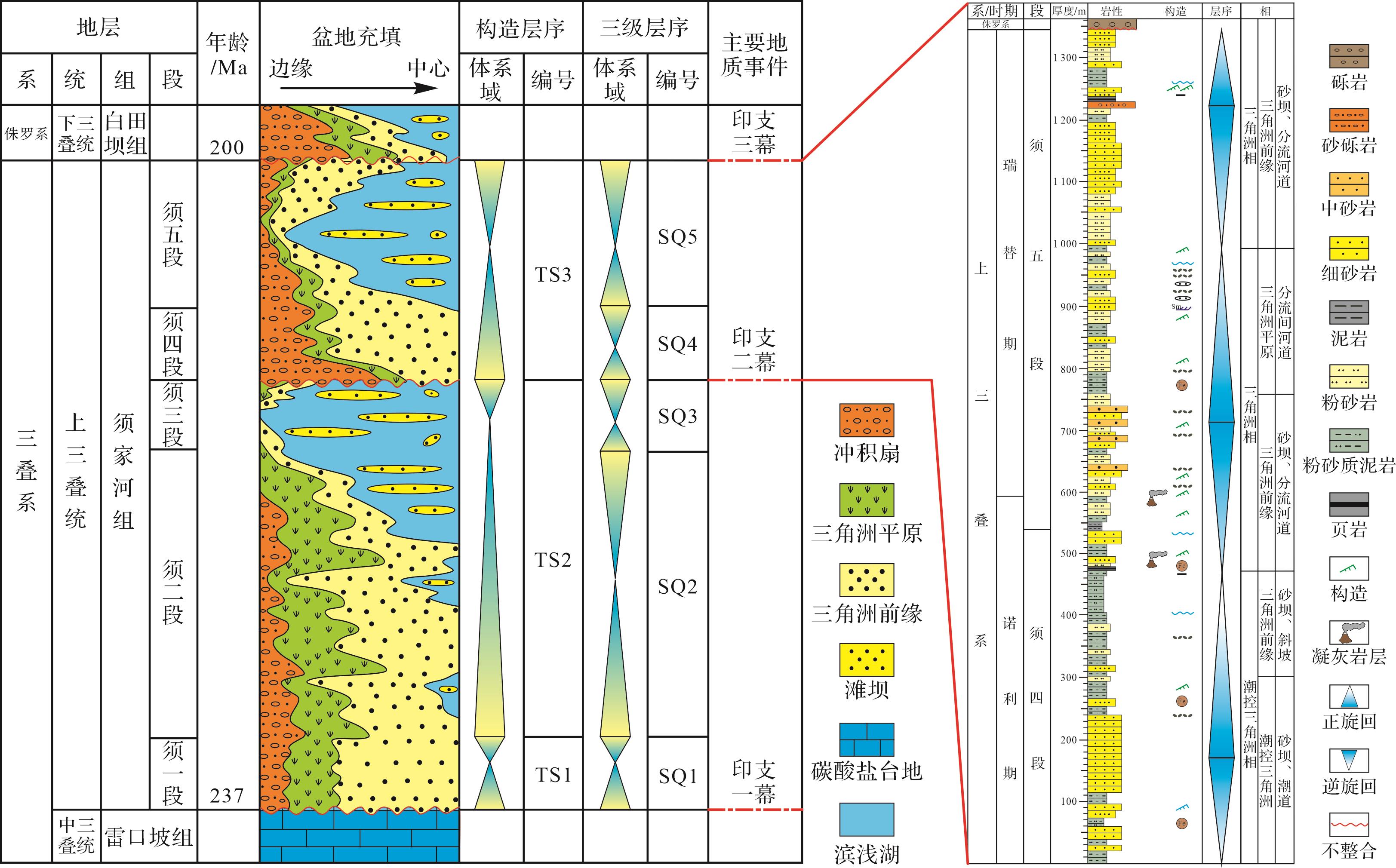
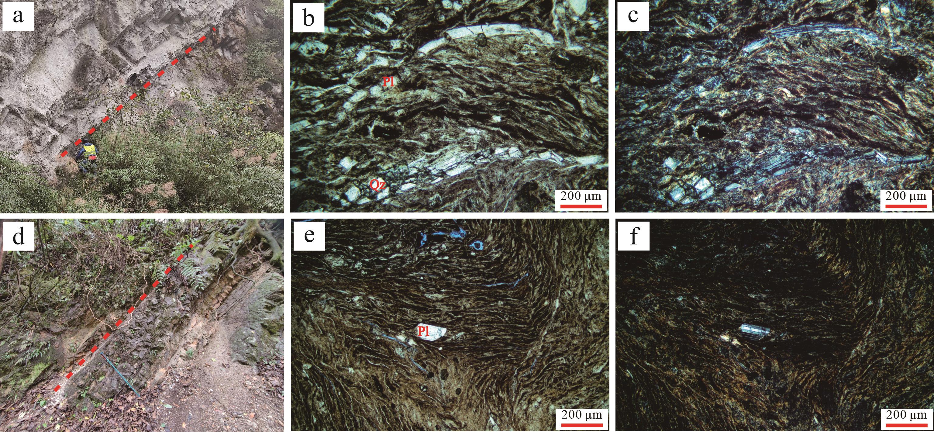
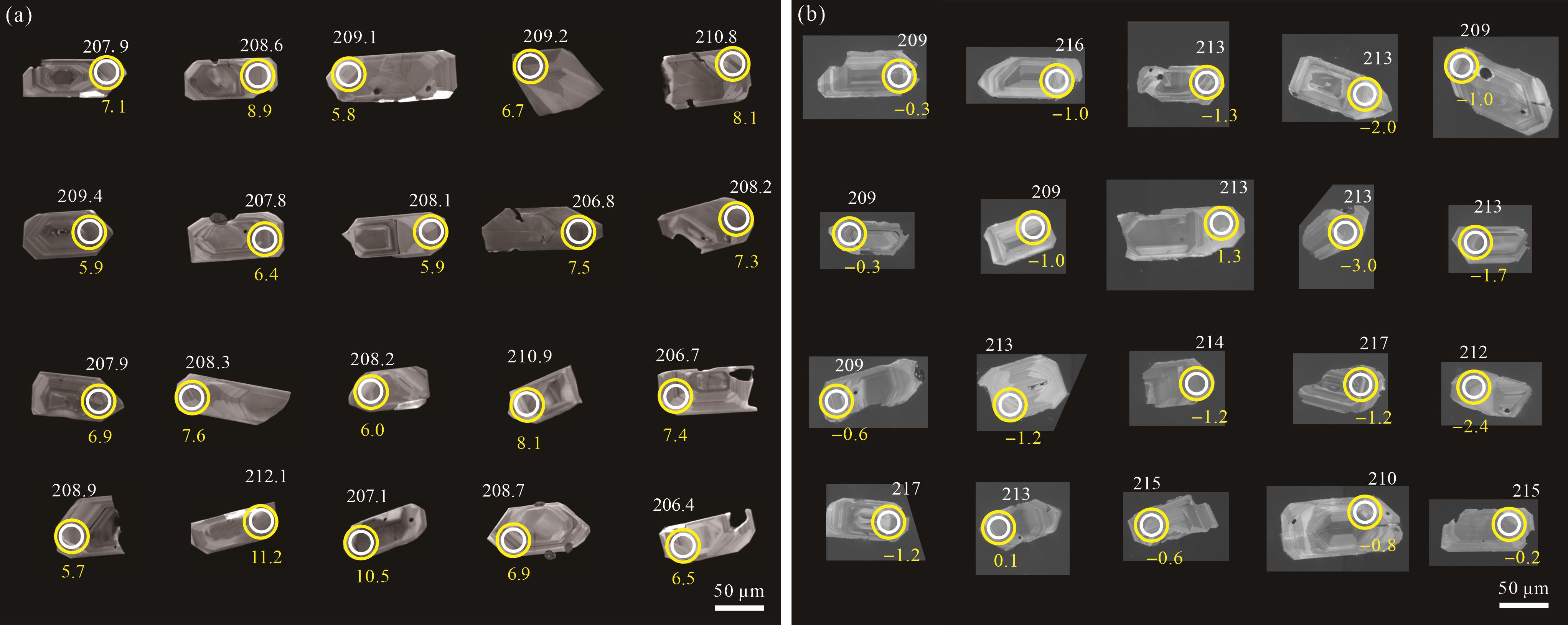
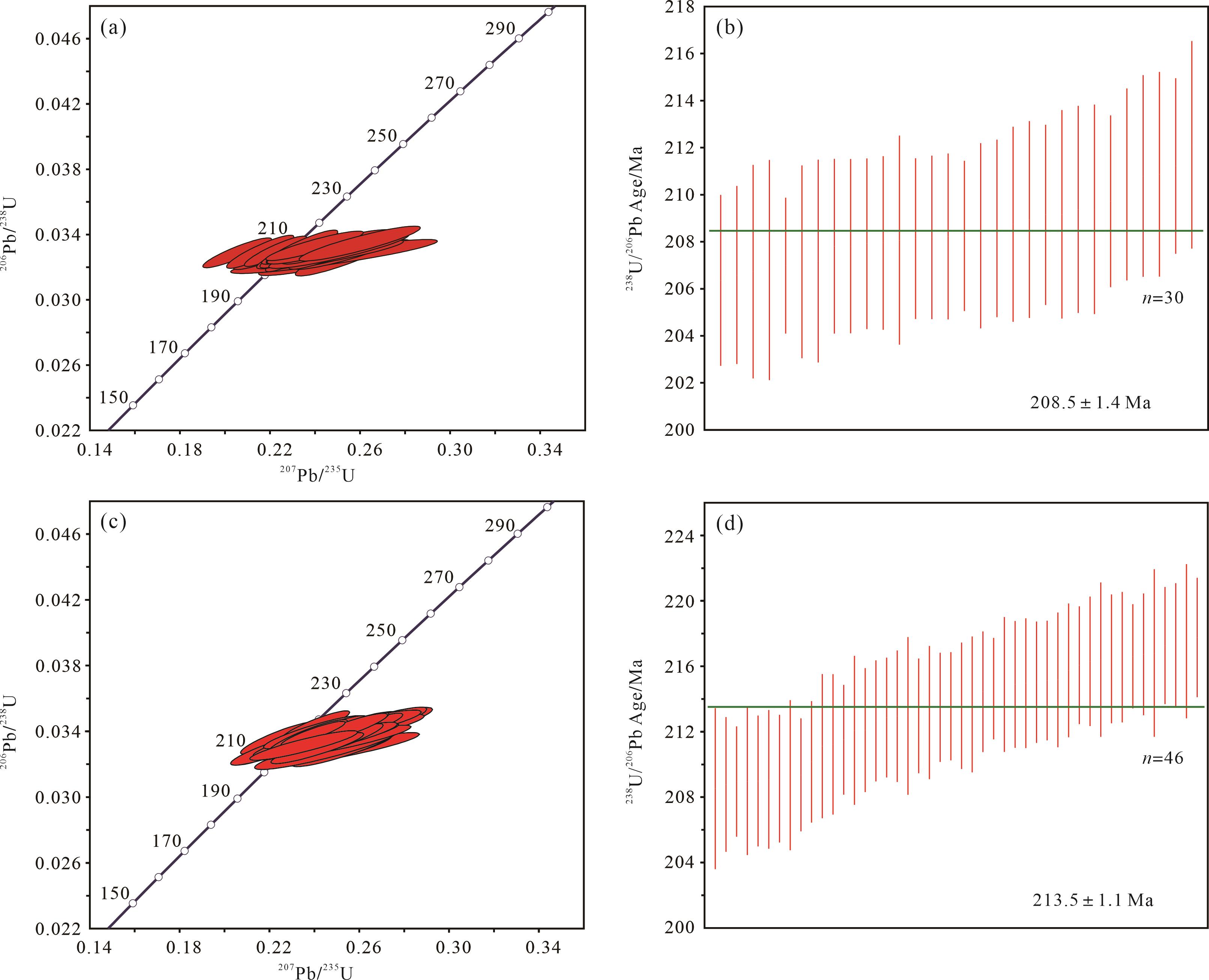
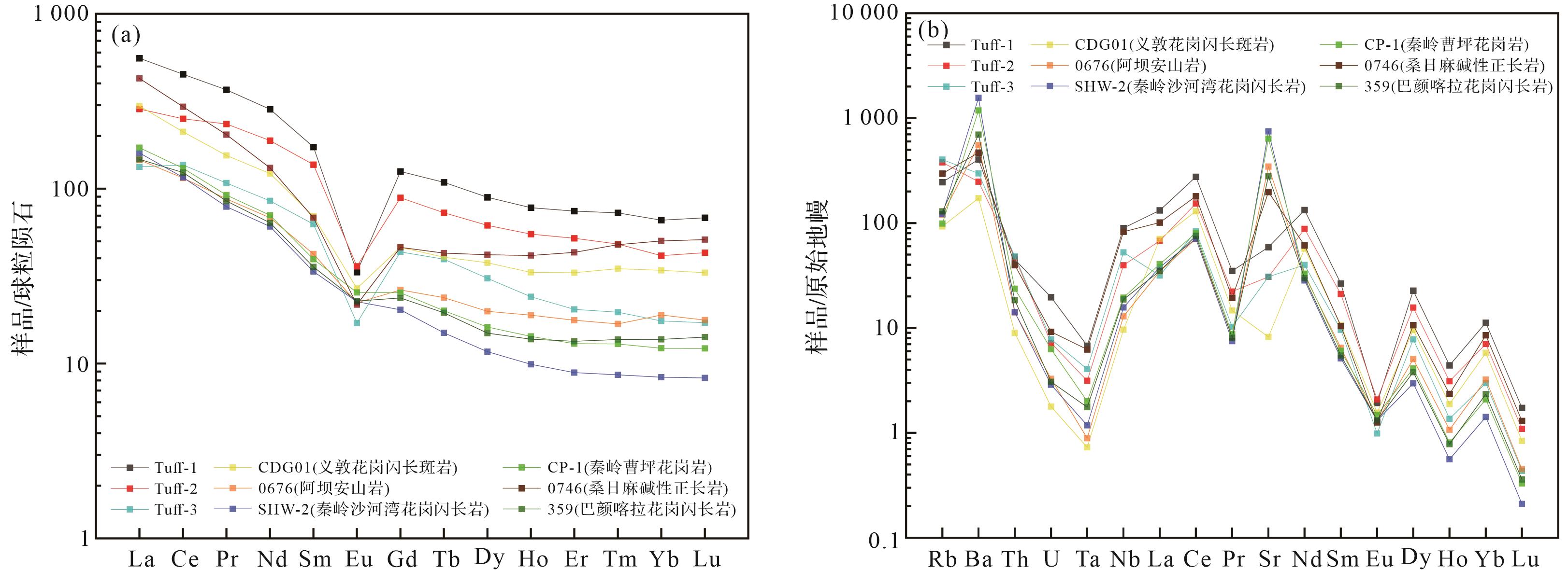
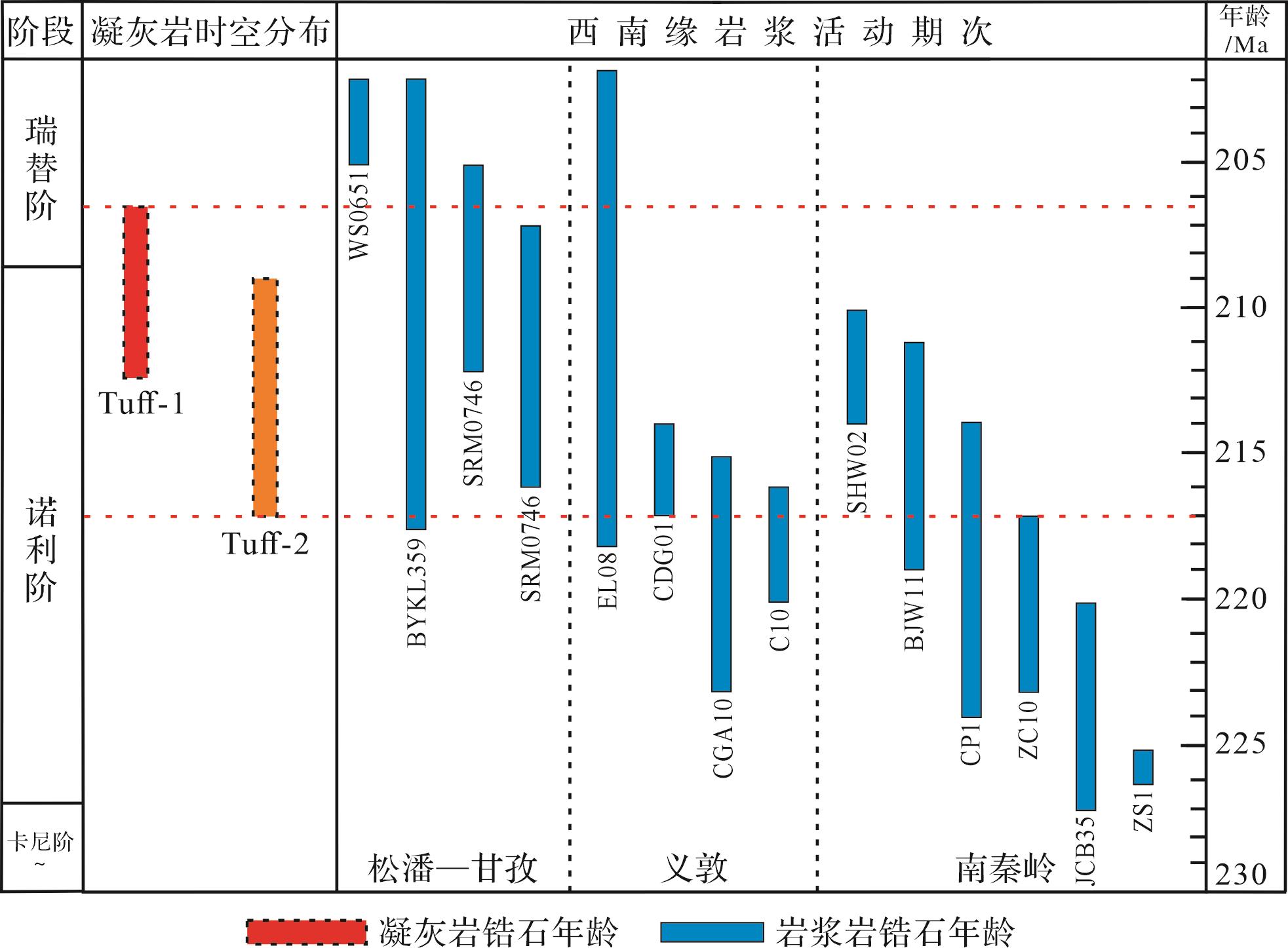
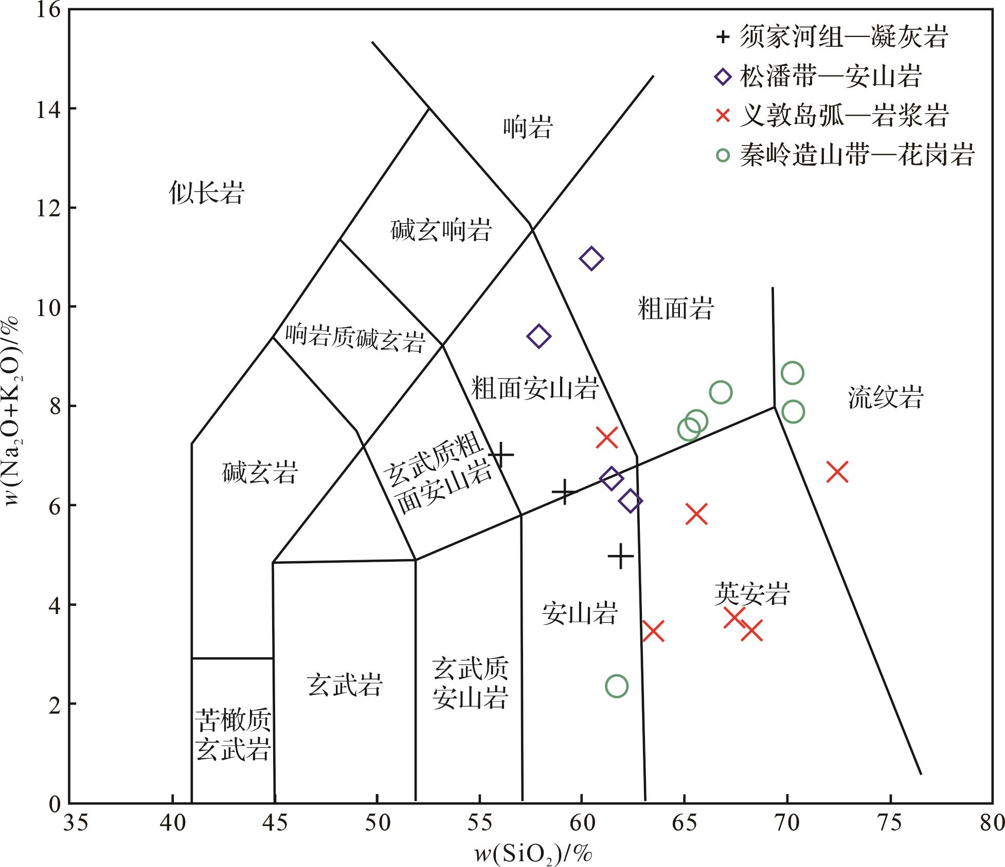
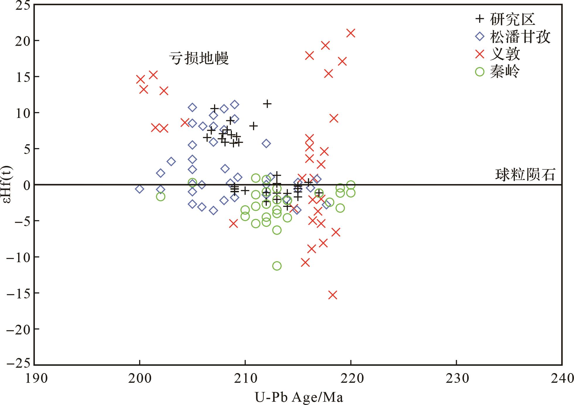
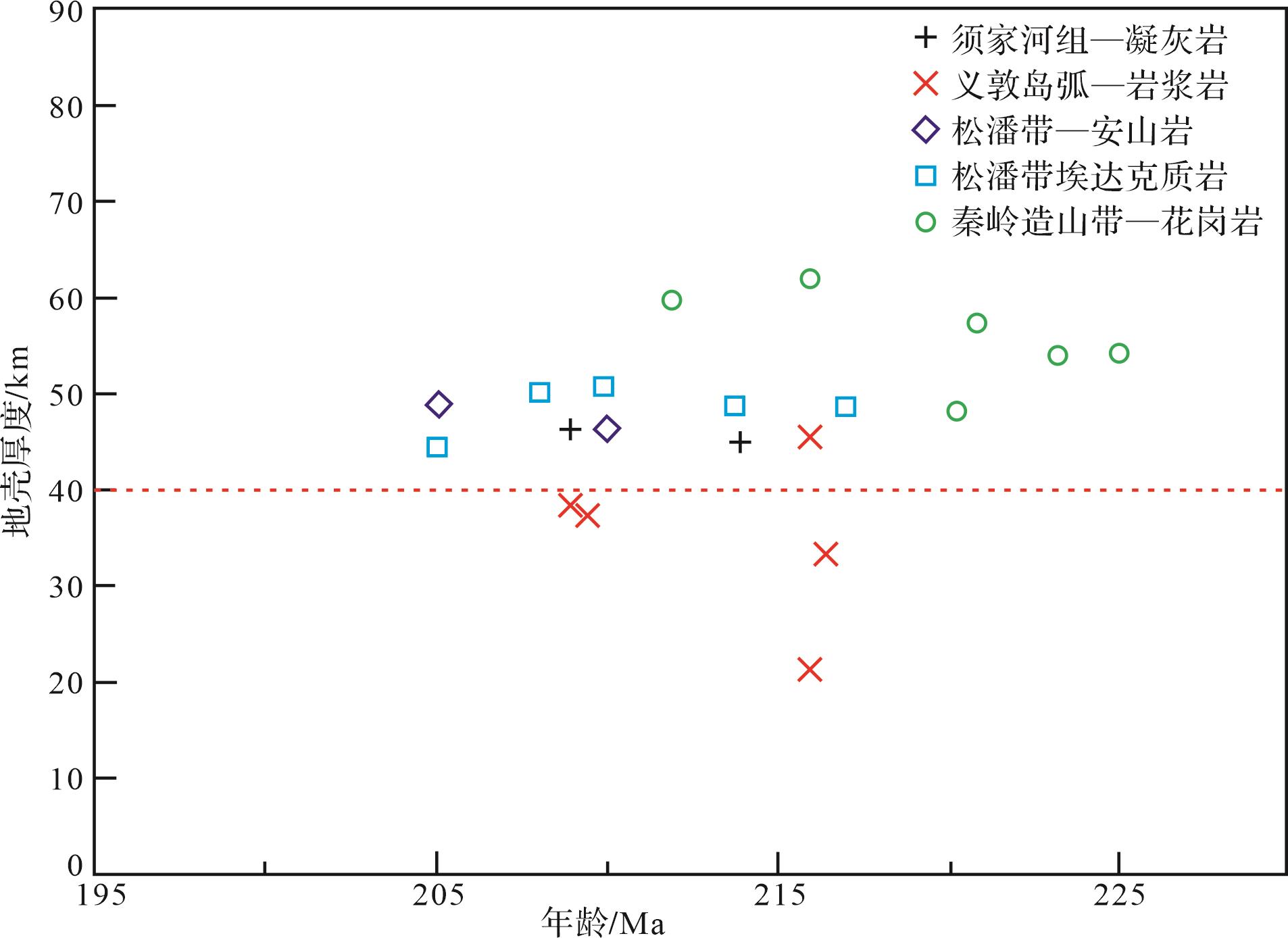
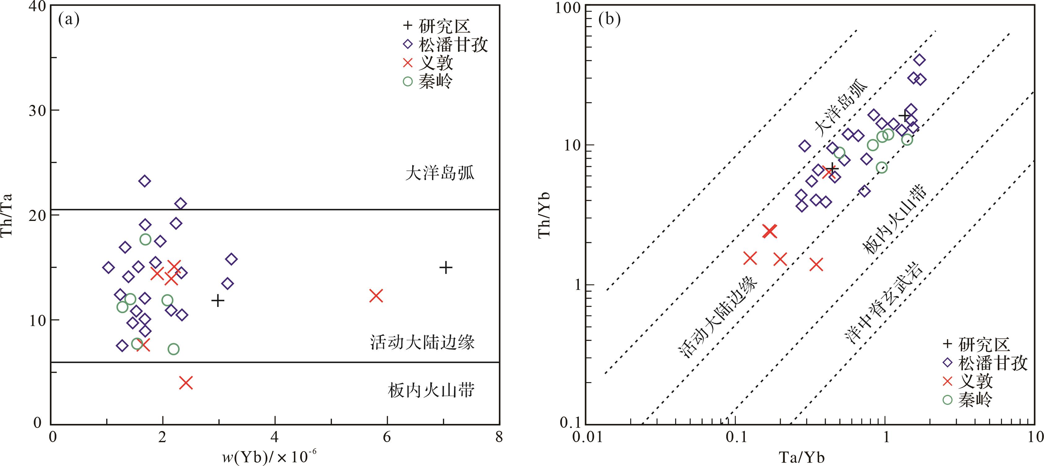
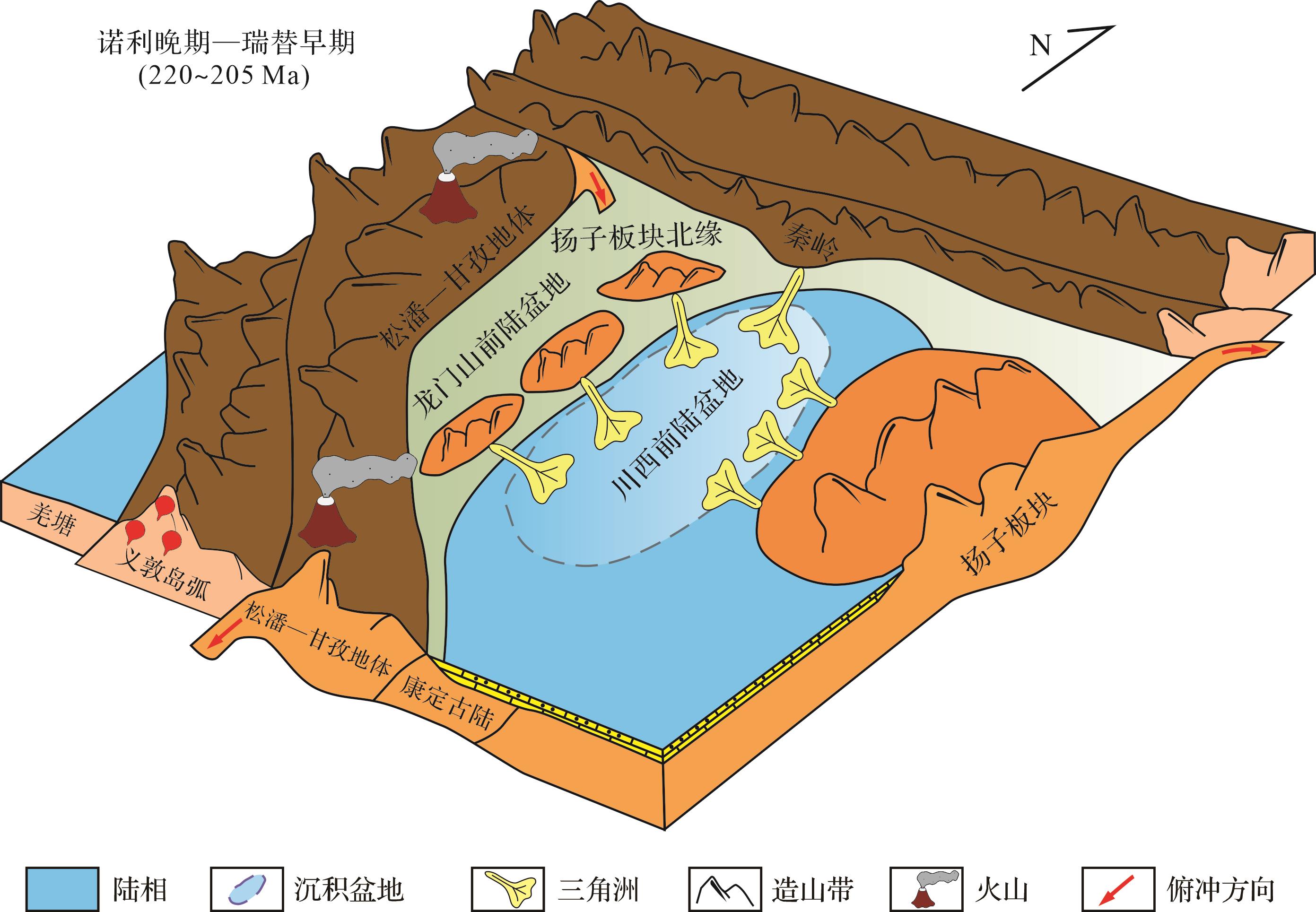
Objective The Upper Triassic epoch in the Western Sichuan foreland basin records a critical phase of the Indosinian Orogeny. The sedimentary strata formed during this period preserve the geological records of the tectonic evolution of the basin and contain key information about volcanic activity during that time. Analysis of the source materials of the tuff provides important information about the tectonic-magmatic activity patterns of the surrounding orogenic belts during the orogeny. Methods Tuff samples from the Xujia Formation in the Jiguan Mountain section of the Western Sichuan Foreland Basin were selected as the research object. A combination of petrological analysis, geochemical characteristic analysis and zircon U-Pb isotopic dating techniques revealed the sedimentation age of the tuff layer and the source of its magma. Results Zircon U-Pb dating yielded ages of 213.5 Ma and 208.5 Ma, corresponding to the Upper Triassic Norian and Rhaetian stages. The rare earth element (REE) patterns of the tuffaceous rocks exhibit a right-trending distribution characterized by enriched light rare earth elements (LREEs) and relatively flat-line for heavy rare earth elements (HREEs), along with pronounced negative Eu anomalies. Primitive mantle-normalized trace element spider diagrams show enrichment in large-ion lithophile elements (LILEs, e.g., Rb, Ba) and depletion in high-field-strength elements (HFSEs, e.g., Ta), consistent with the geochemical signatures of continental lower crust. Zircon Hf isotopic data indicate that the magmas originated from a mixture of crustal contamination and depleted mantle sources. Conclusions Building upon this foundation, and considering the regional distribution and formation age of Upper Triassic igneous rocks at the periphery of the Western Sichuan Foreland Basin, together with the geochemical characteristics of magmatic rocks, it was concluded that the volcanic tuff shares a common magmatic origin with the Upper Triassic andesite of the Songpan-Ganzi terrane. This magmatic activity is closely associated with the melting of continental crust due to bidirectional plate subduction.
Objective The Upper Triassic epoch in the Western Sichuan foreland basin records a critical phase of the Indosinian Orogeny. The sedimentary strata formed during this period preserve the geological records of the tectonic evolution of the basin and contain key information about volcanic activity during that time. Analysis of the source materials of the tuff provides important information about the tectonic-magmatic activity patterns of the surrounding orogenic belts during the orogeny. Methods Tuff samples from the Xujia Formation in the Jiguan Mountain section of the Western Sichuan Foreland Basin were selected as the research object. A combination of petrological analysis, geochemical characteristic analysis and zircon U-Pb isotopic dating techniques revealed the sedimentation age of the tuff layer and the source of its magma. Results Zircon U-Pb dating yielded ages of 213.5 Ma and 208.5 Ma, corresponding to the Upper Triassic Norian and Rhaetian stages. The rare earth element (REE) patterns of the tuffaceous rocks exhibit a right-trending distribution characterized by enriched light rare earth elements (LREEs) and relatively flat-line for heavy rare earth elements (HREEs), along with pronounced negative Eu anomalies. Primitive mantle-normalized trace element spider diagrams show enrichment in large-ion lithophile elements (LILEs, e.g., Rb, Ba) and depletion in high-field-strength elements (HFSEs, e.g., Ta), consistent with the geochemical signatures of continental lower crust. Zircon Hf isotopic data indicate that the magmas originated from a mixture of crustal contamination and depleted mantle sources. Conclusions Building upon this foundation, and considering the regional distribution and formation age of Upper Triassic igneous rocks at the periphery of the Western Sichuan Foreland Basin, together with the geochemical characteristics of magmatic rocks, it was concluded that the volcanic tuff shares a common magmatic origin with the Upper Triassic andesite of the Songpan-Ganzi terrane. This magmatic activity is closely associated with the melting of continental crust due to bidirectional plate subduction.
2026, 44(5): 1627-1635.
doi: 10.14027/j.issn.1000-0550.2025.025
Abstract:
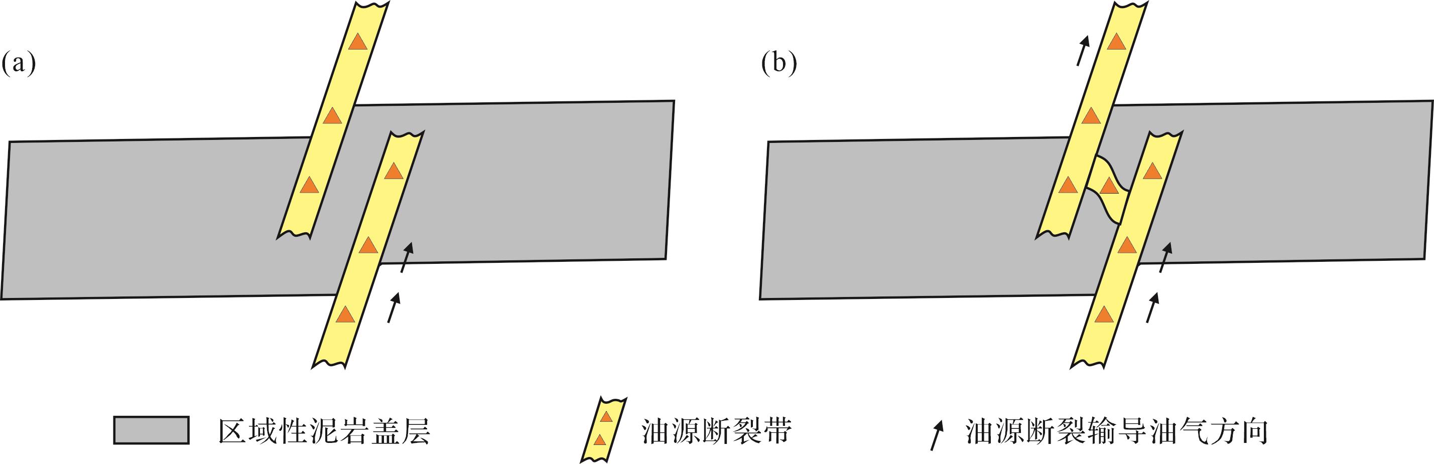
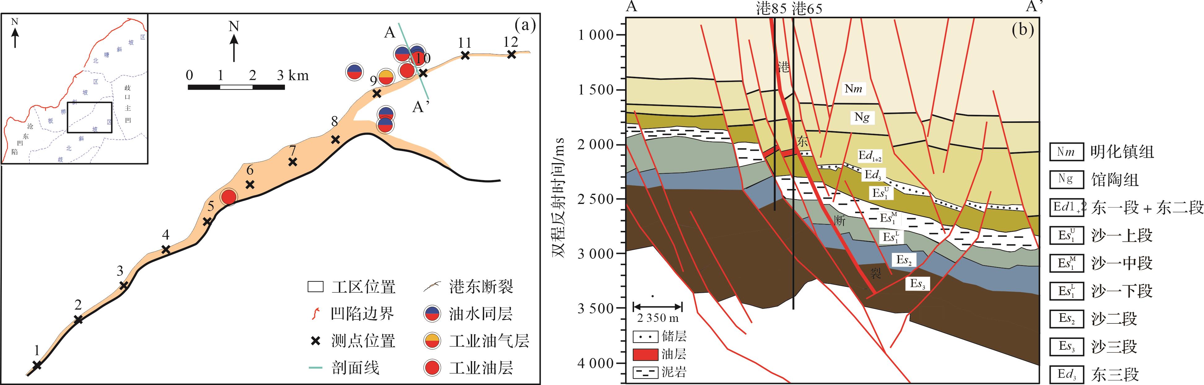
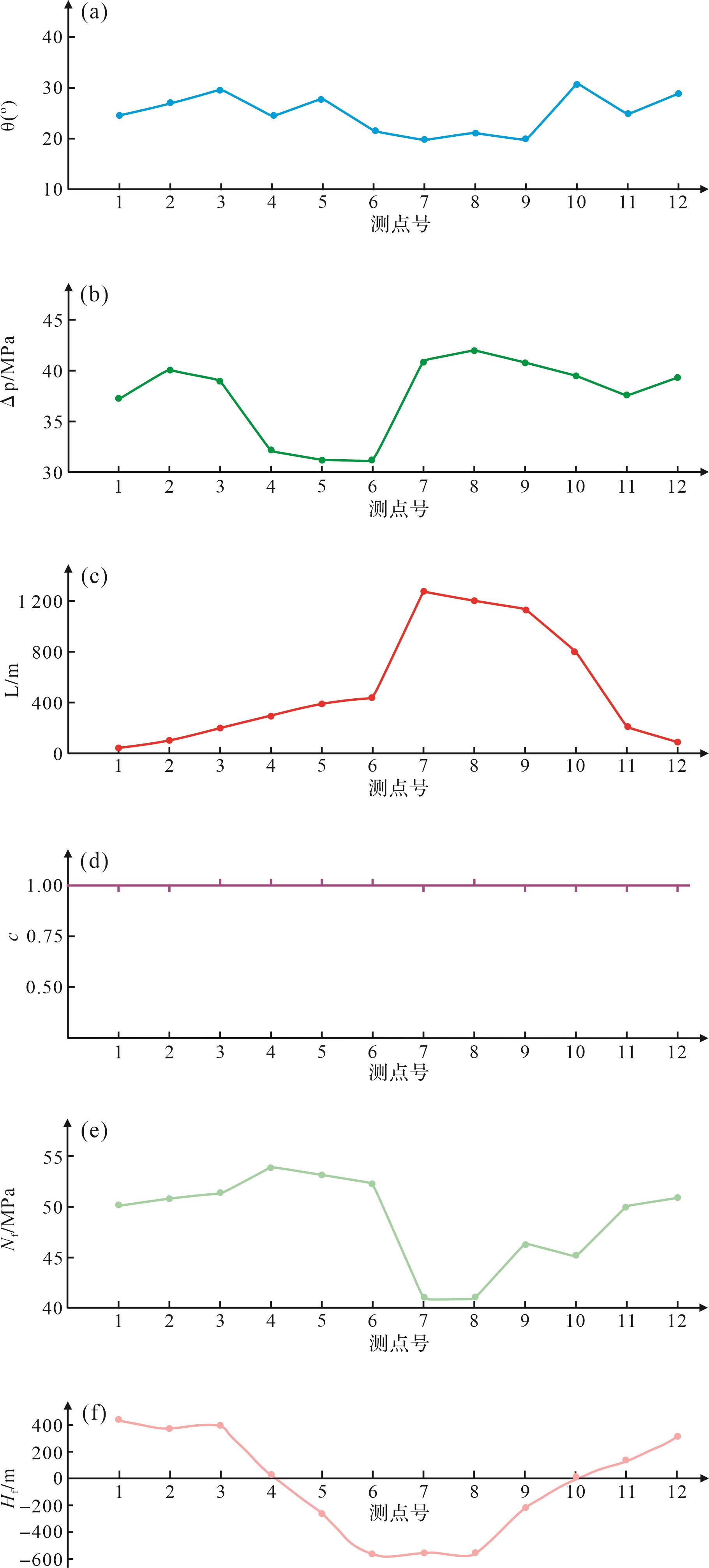
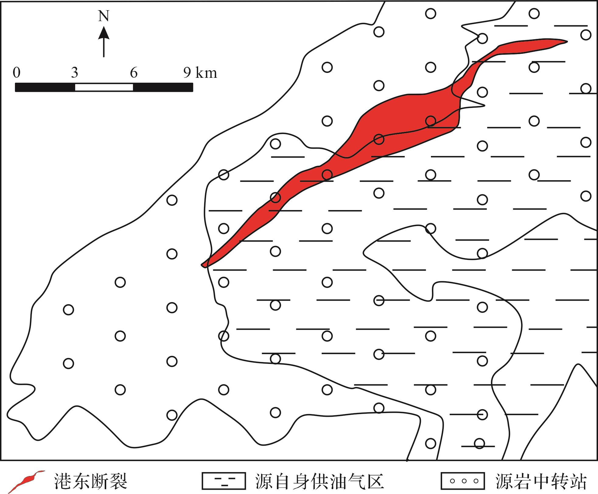
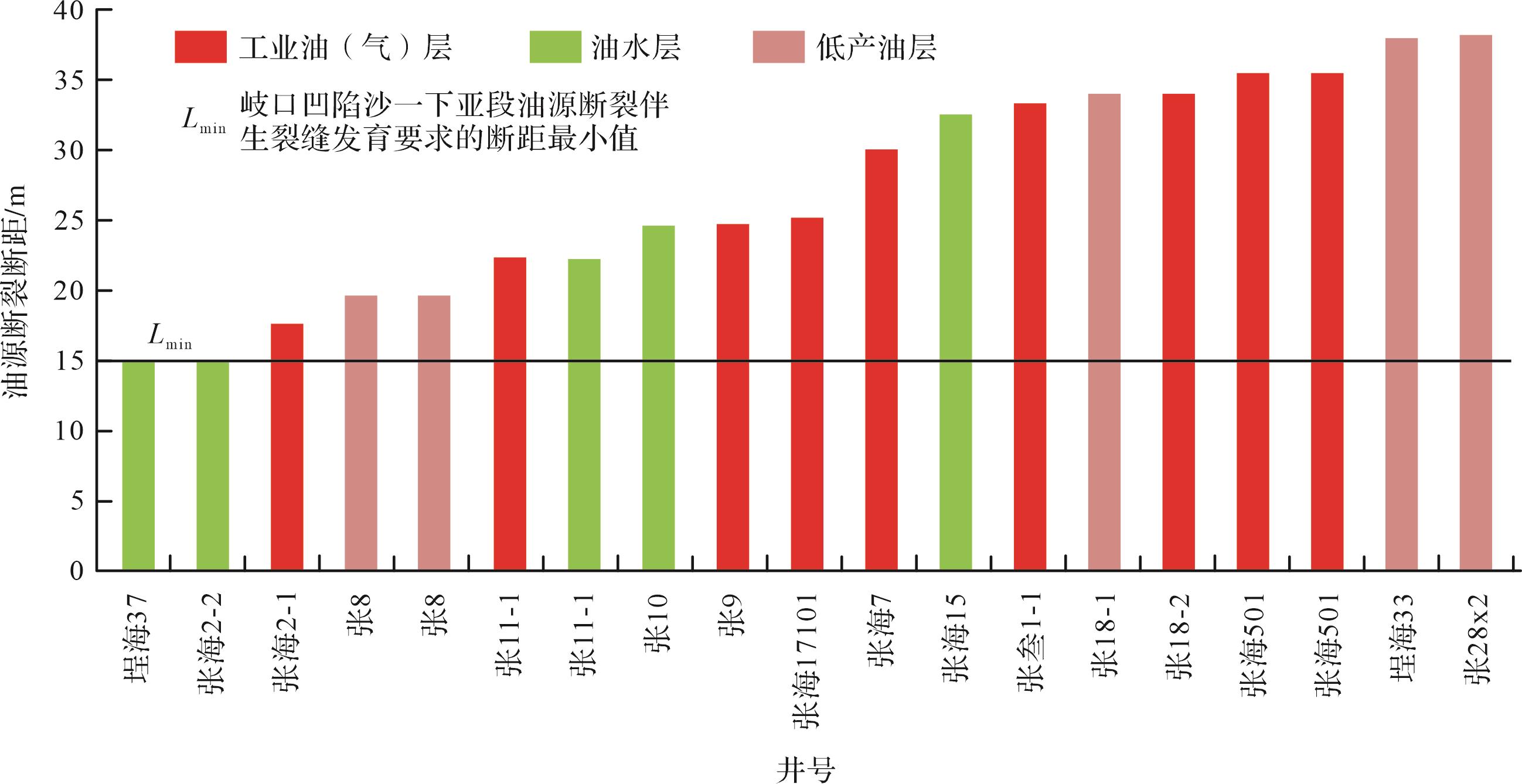
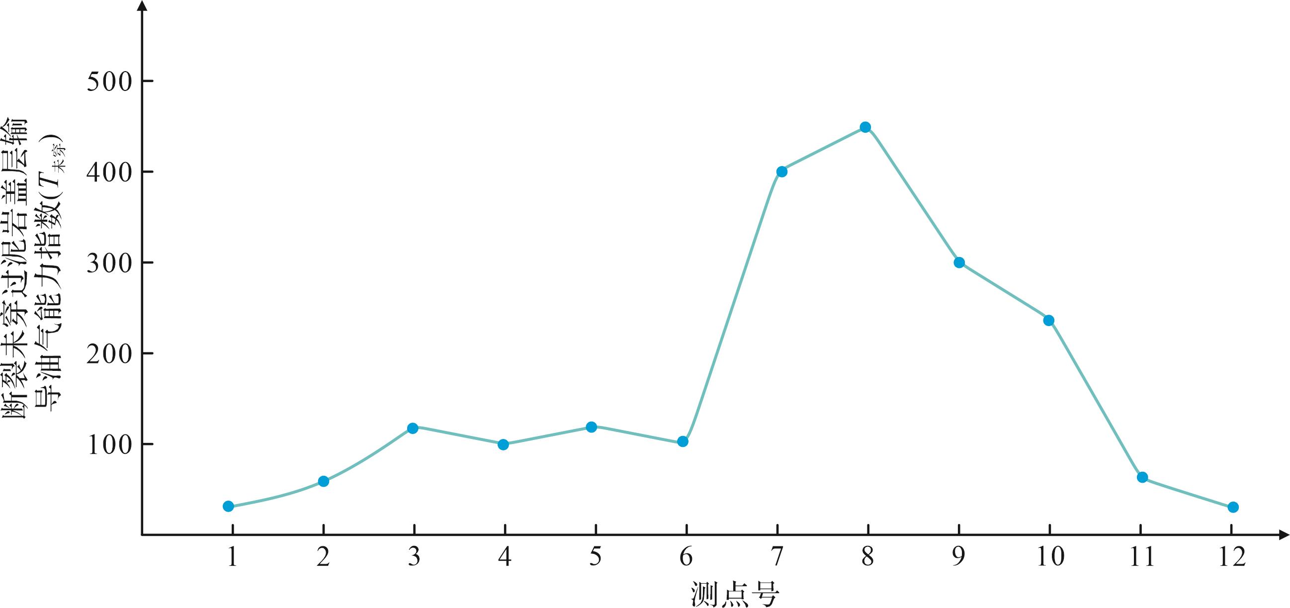
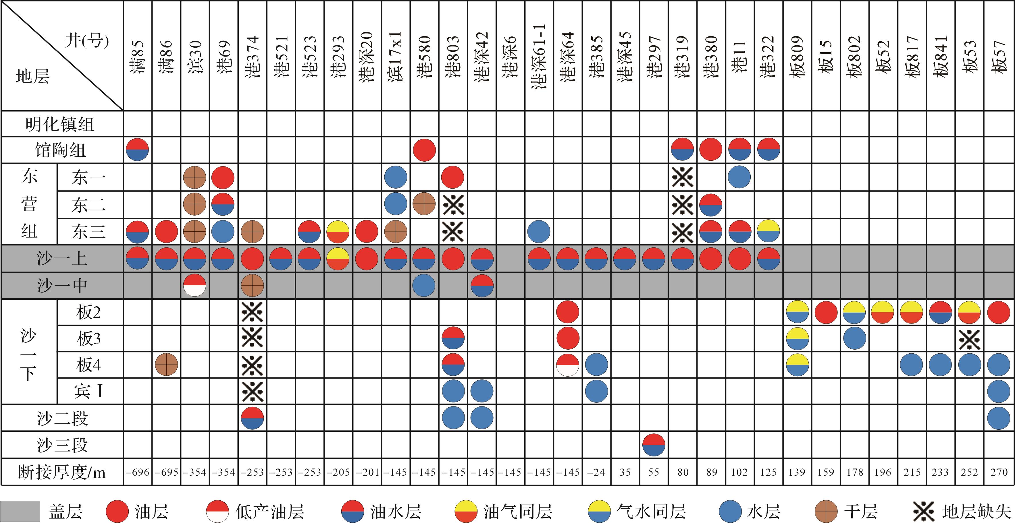
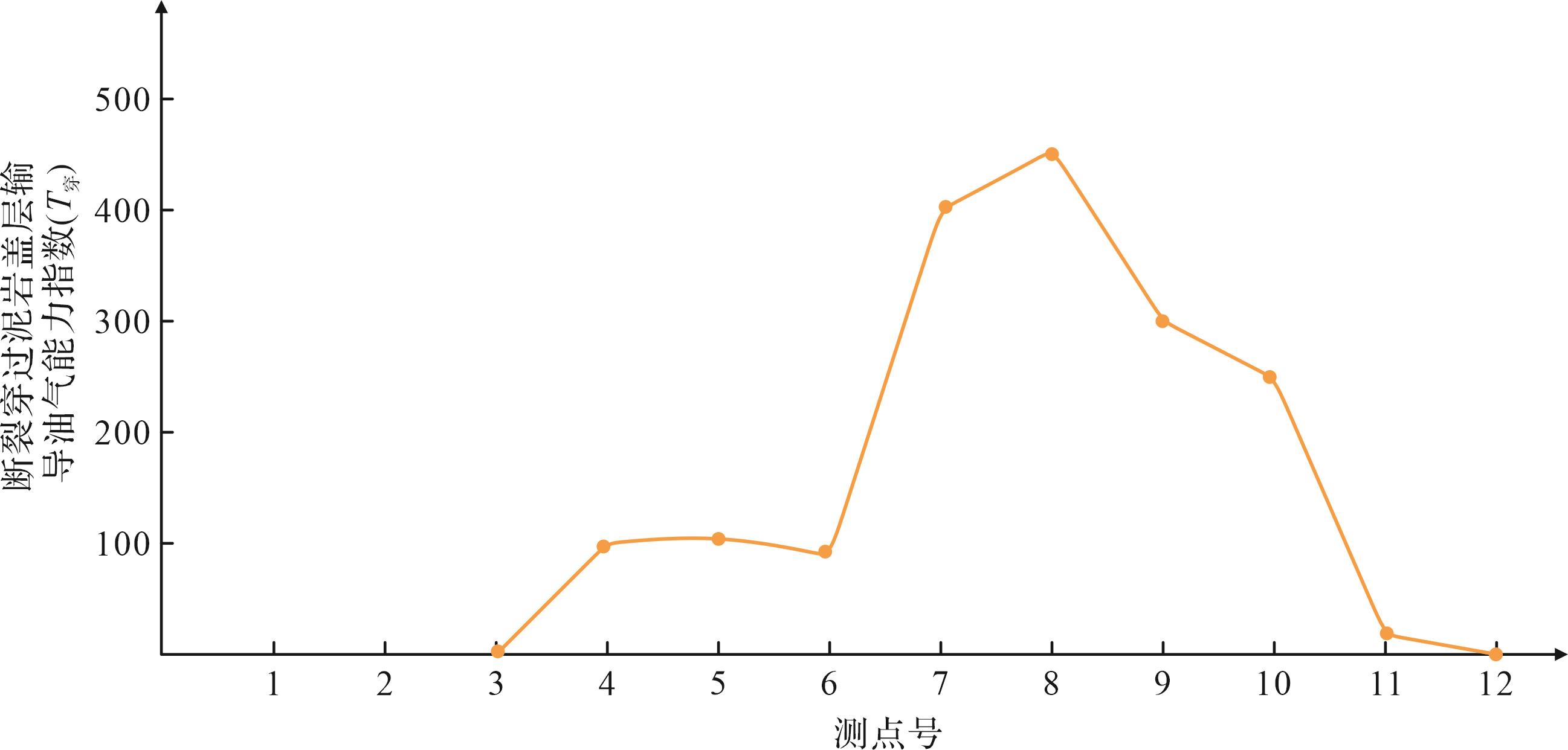
Objective Petroleum exploration practices have confirmed that hydrocarbon enrichment at oil-source faults above mudstone caprocks is significantly controlled by the weakening effect of mudstone caprocks on the hydrocarbon transport capacity of oil-source faults. Thus, the characteristics of hydrocarbon enrichment at oil-source faults above mudstone caprocks in petroliferous basins must be studied. Methods Based on the research on the mechanism and degree of weakening of hydrocarbon transport capacity of oil-source faults by mudstone caprocks, the paleo-fault throw and dip angle within the mudstone caprock, paleo-normal pressure generated by the weight of overlying sedimentary load, paleo-formation pore fluid pressure difference of source rocks, and hydrocarbon supply capacity index were used to calculate the hydrocarbon transport capacity index of oil-source faults not penetrating the mudstone caprock. The hydrocarbon transport capacity index of oil-source faults penetrating the mudstone caprock was then obtained by dividing the above value by the paleo-connection thickness of the mudstone caprock. A method for evaluating the weakening degree of hydrocarbon transport capacity of oil-source faults by mudstone caprocks was established based on the relative magnitudes of the two indices and applied to study the weakening effect of the mudstone caprock in the middle sub-member of the First Shahejie Formation (Es1 M 1 M 1 M 1 M
Objective Petroleum exploration practices have confirmed that hydrocarbon enrichment at oil-source faults above mudstone caprocks is significantly controlled by the weakening effect of mudstone caprocks on the hydrocarbon transport capacity of oil-source faults. Thus, the characteristics of hydrocarbon enrichment at oil-source faults above mudstone caprocks in petroliferous basins must be studied. Methods Based on the research on the mechanism and degree of weakening of hydrocarbon transport capacity of oil-source faults by mudstone caprocks, the paleo-fault throw and dip angle within the mudstone caprock, paleo-normal pressure generated by the weight of overlying sedimentary load, paleo-formation pore fluid pressure difference of source rocks, and hydrocarbon supply capacity index were used to calculate the hydrocarbon transport capacity index of oil-source faults not penetrating the mudstone caprock. The hydrocarbon transport capacity index of oil-source faults penetrating the mudstone caprock was then obtained by dividing the above value by the paleo-connection thickness of the mudstone caprock. A method for evaluating the weakening degree of hydrocarbon transport capacity of oil-source faults by mudstone caprocks was established based on the relative magnitudes of the two indices and applied to study the weakening effect of the mudstone caprock in the middle sub-member of the First Shahejie Formation (Es
2026, 44(5): 1636-1651.
doi: 10.14027/j.issn.1000-0550.2025.049
Abstract:
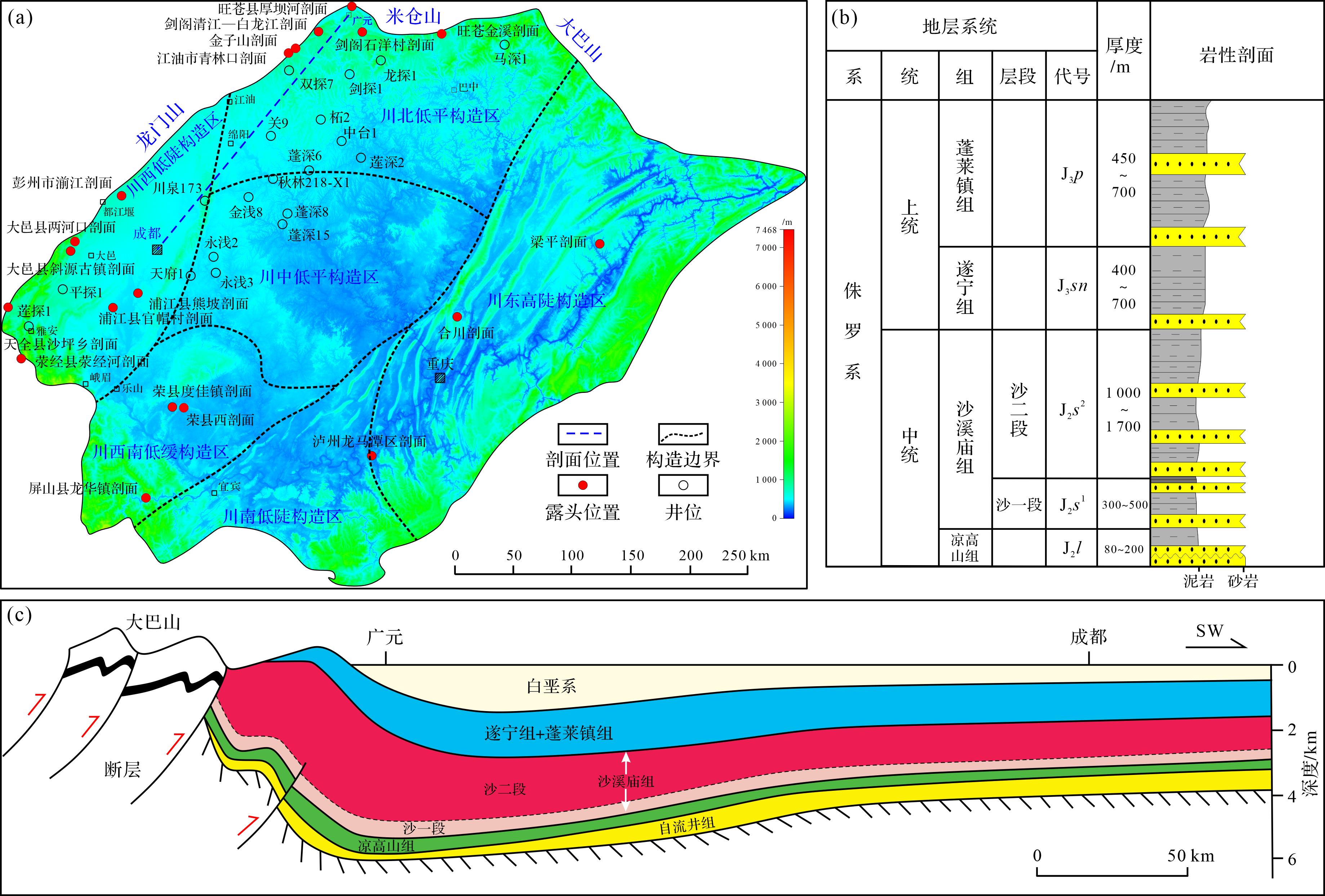
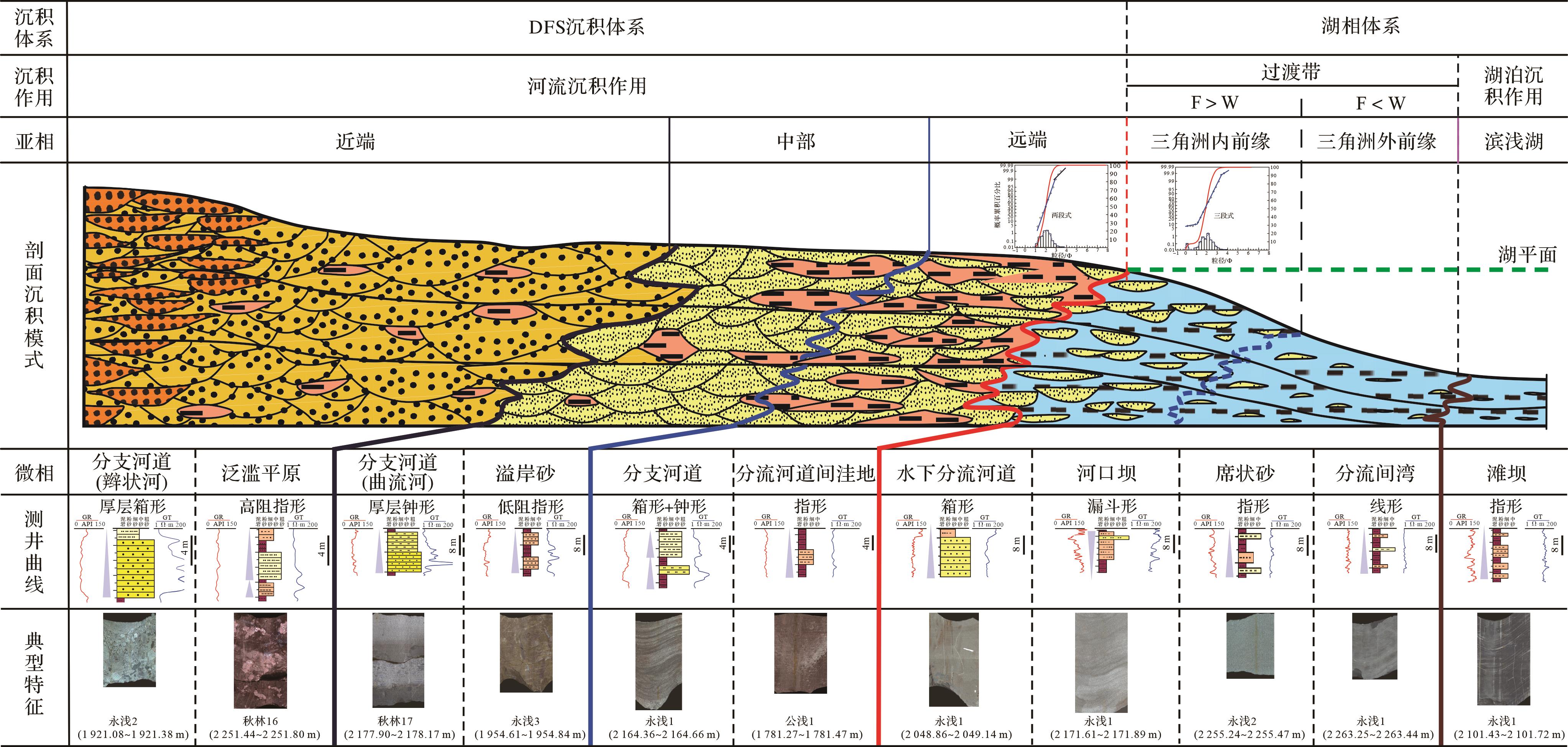
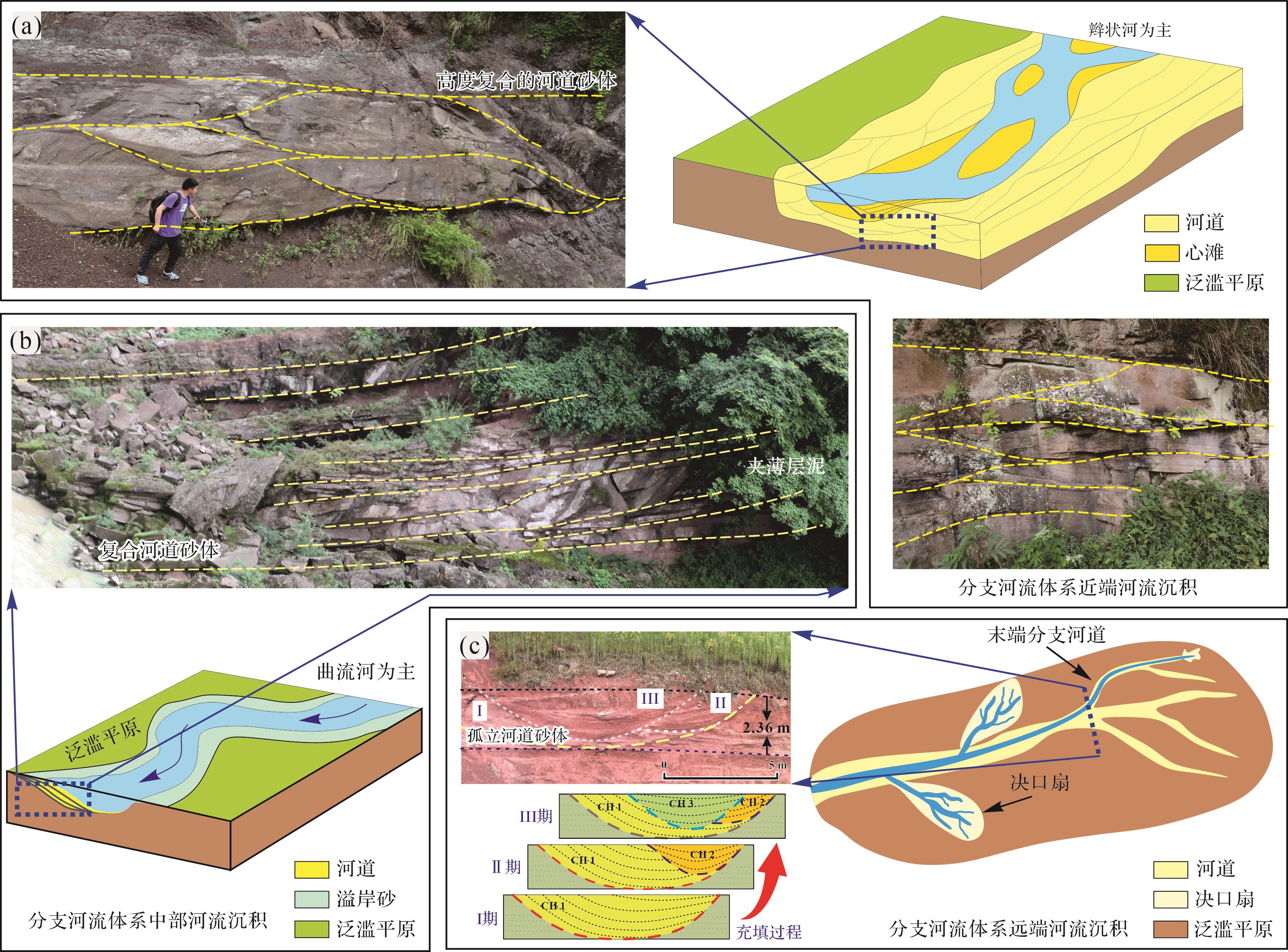
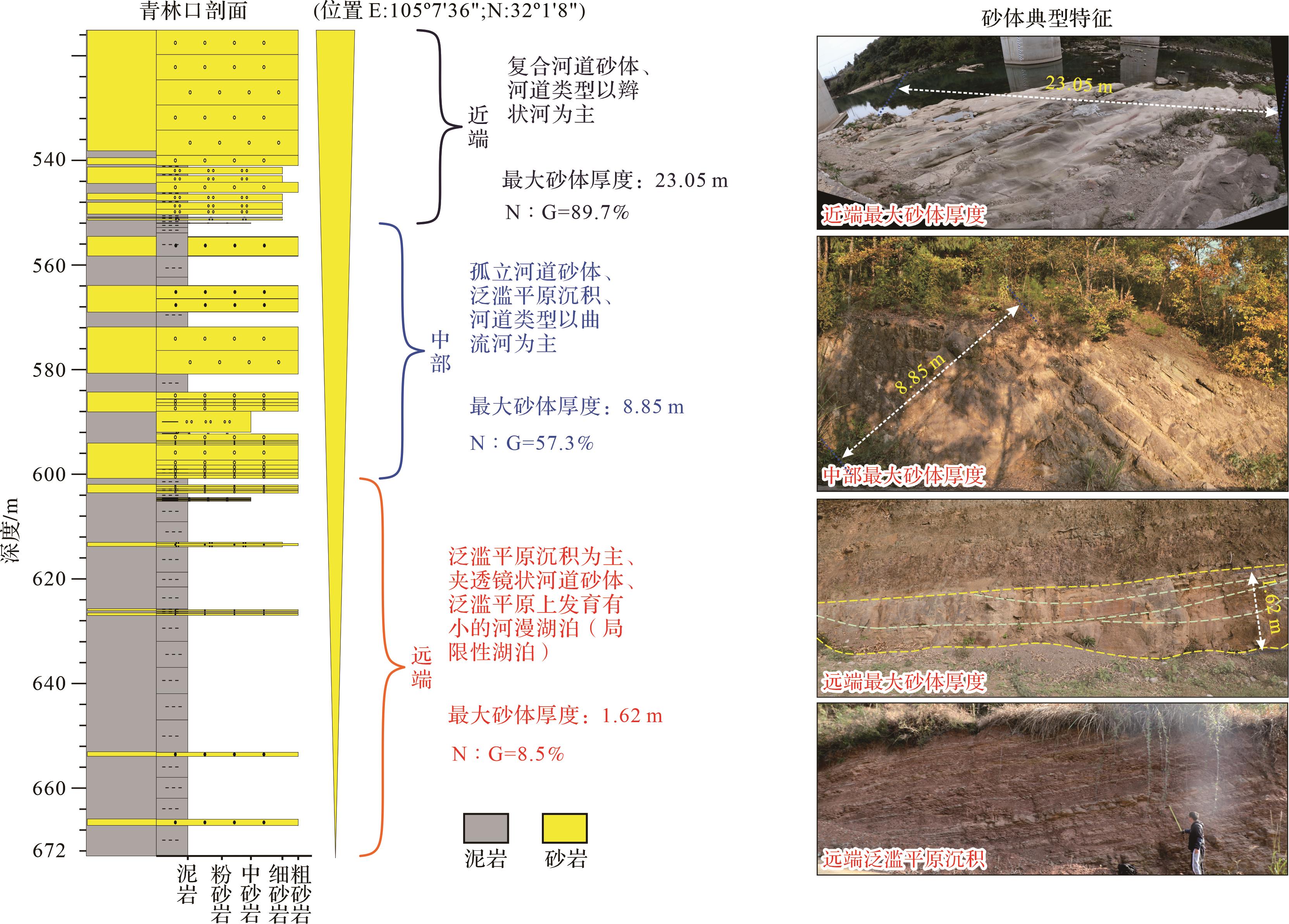
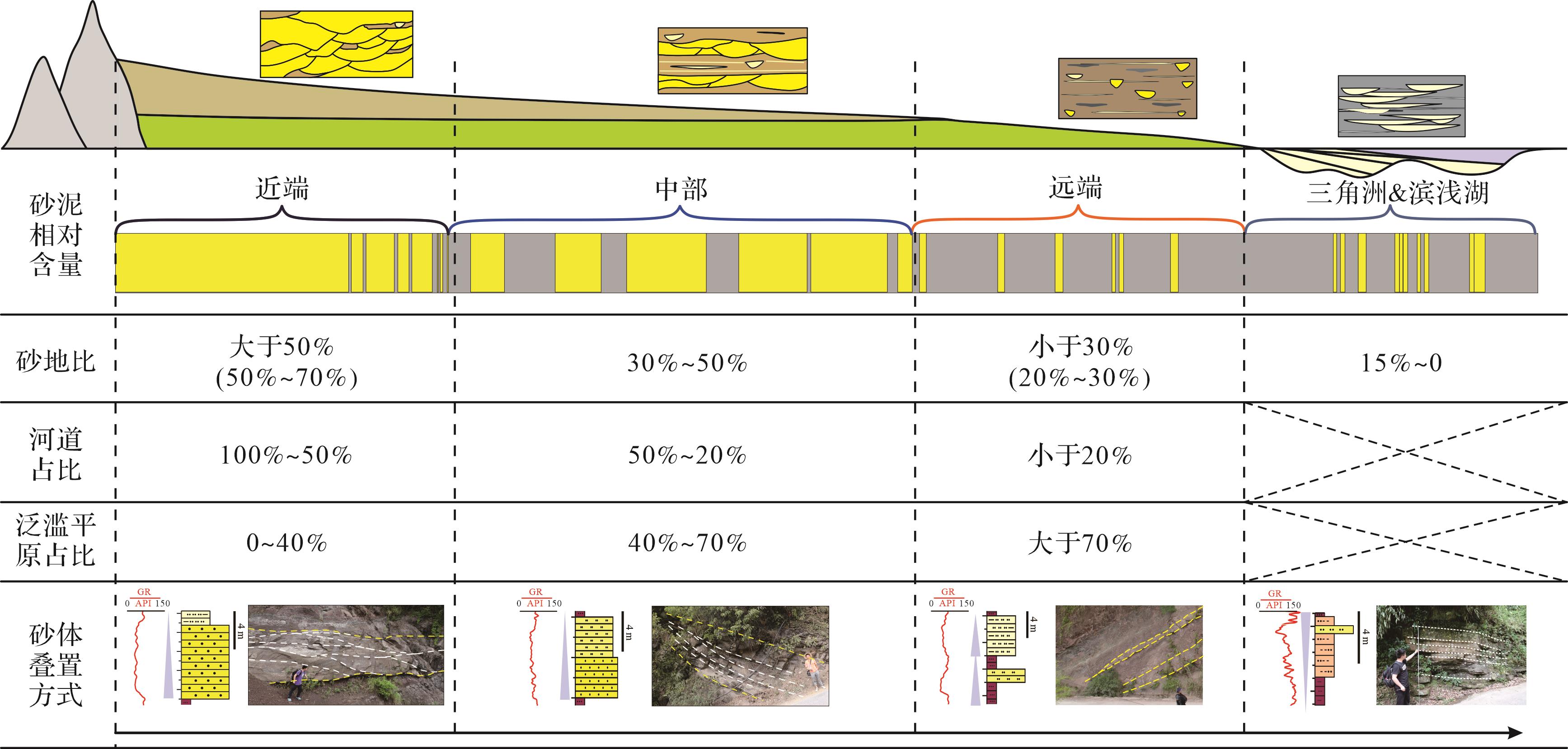
Objective This study sought to contribute to reducing oil and gas exploration costs by enhancing the understanding and prediction of sedimentary systems. Methods Based on the theory of distributive fluvial systems, this study used the Jurassic Shaximiao Formation in the northwestern Sichuan Basin as a case study. It synthesized data from field outcrops, cores, and well logs, and employed integrated surface and subsurface analyses with both quantitative and qualitative approaches. The objective was to achieve a quantitative characterization of the sedimentary system within the Shaximiao Formation. Results (1) The Shaximiao Formation in the northwestern Sichuan Basin has developed three types of sedimentary systems: distributive fluvial, delta, and lacustrine. The distributive fluvial system of the Shaximiao Formation can be further divided into three subfacies and six microfacies, the delta system into two subfacies and four microfacies, and the lacustrine system into shore-shallow lake beach-bar deposits. (2) The proximal subfacies net-to-gross ratio is 50%⁃70%, and the sand bodies are superimposed with thick layers. The medial subfacies net-to-gross ratio is between 30%⁃50%, and the sand body is distributed in thick layers. The distal subfacies net-to-gross ratio is 20%⁃30%, and the sand body is isolated. (3) The Shaximiao Formation in the study area is primarily influenced by fluvial action, with the Sha 1 member showing the distributive fluvial system terminating in a larger range of lacustrine deposits, and the Sha 2 member showing the distributive fluvial system terminating in several small temporary lakes. (4) Based on the modern sedimentary reference, in addition to the development of large high-quality reservoirs in the delta system, the medial and distal facies of the distributive fluvial system can form continuous channel sand reservoirs. Conclusions The results of the research are significant for characterizing the development scale and overlay style of different sand bodies, providing a reference basis for the study of the distribution of sedimentary systems in the context of similar fluvial deposits.
Objective This study sought to contribute to reducing oil and gas exploration costs by enhancing the understanding and prediction of sedimentary systems. Methods Based on the theory of distributive fluvial systems, this study used the Jurassic Shaximiao Formation in the northwestern Sichuan Basin as a case study. It synthesized data from field outcrops, cores, and well logs, and employed integrated surface and subsurface analyses with both quantitative and qualitative approaches. The objective was to achieve a quantitative characterization of the sedimentary system within the Shaximiao Formation. Results (1) The Shaximiao Formation in the northwestern Sichuan Basin has developed three types of sedimentary systems: distributive fluvial, delta, and lacustrine. The distributive fluvial system of the Shaximiao Formation can be further divided into three subfacies and six microfacies, the delta system into two subfacies and four microfacies, and the lacustrine system into shore-shallow lake beach-bar deposits. (2) The proximal subfacies net-to-gross ratio is 50%⁃70%, and the sand bodies are superimposed with thick layers. The medial subfacies net-to-gross ratio is between 30%⁃50%, and the sand body is distributed in thick layers. The distal subfacies net-to-gross ratio is 20%⁃30%, and the sand body is isolated. (3) The Shaximiao Formation in the study area is primarily influenced by fluvial action, with the Sha 1 member showing the distributive fluvial system terminating in a larger range of lacustrine deposits, and the Sha 2 member showing the distributive fluvial system terminating in several small temporary lakes. (4) Based on the modern sedimentary reference, in addition to the development of large high-quality reservoirs in the delta system, the medial and distal facies of the distributive fluvial system can form continuous channel sand reservoirs. Conclusions The results of the research are significant for characterizing the development scale and overlay style of different sand bodies, providing a reference basis for the study of the distribution of sedimentary systems in the context of similar fluvial deposits.
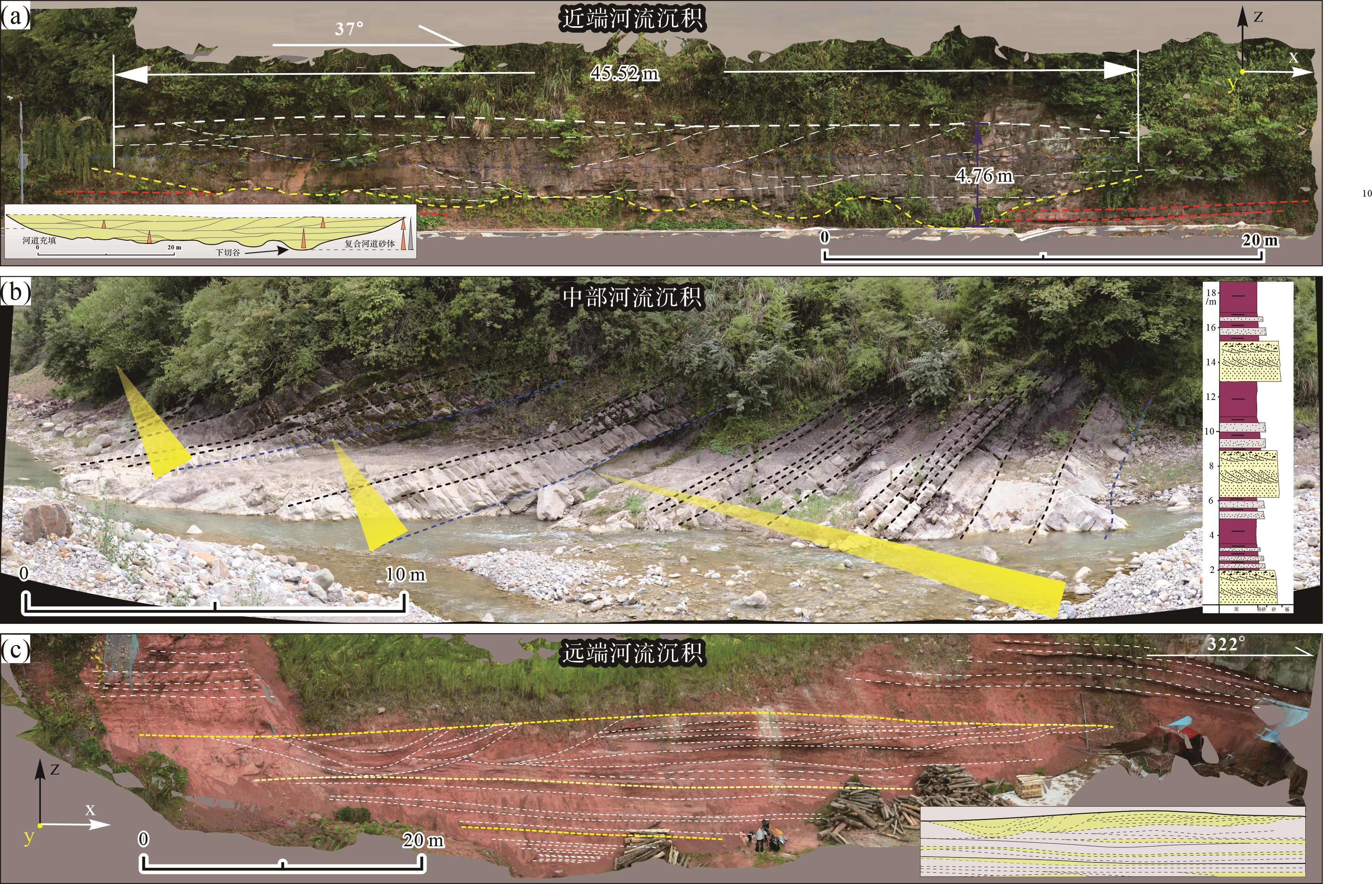
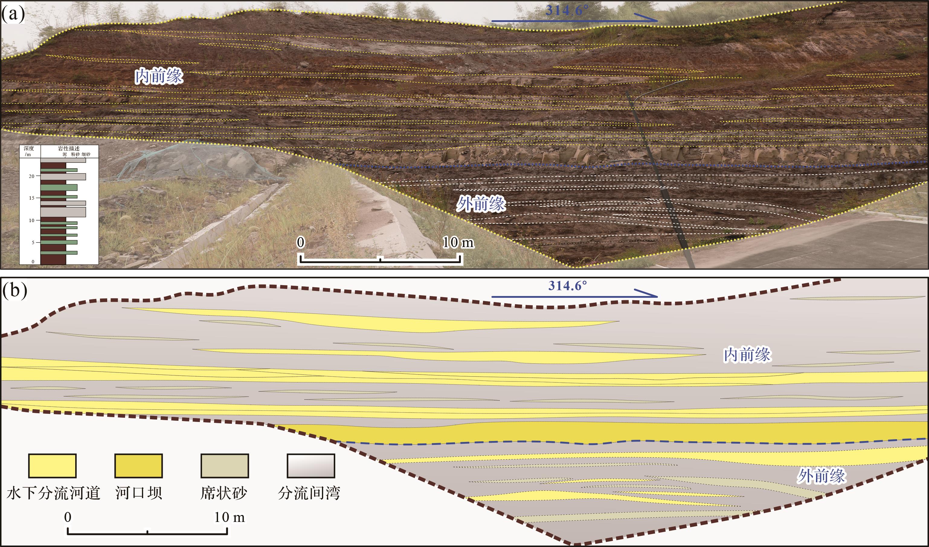
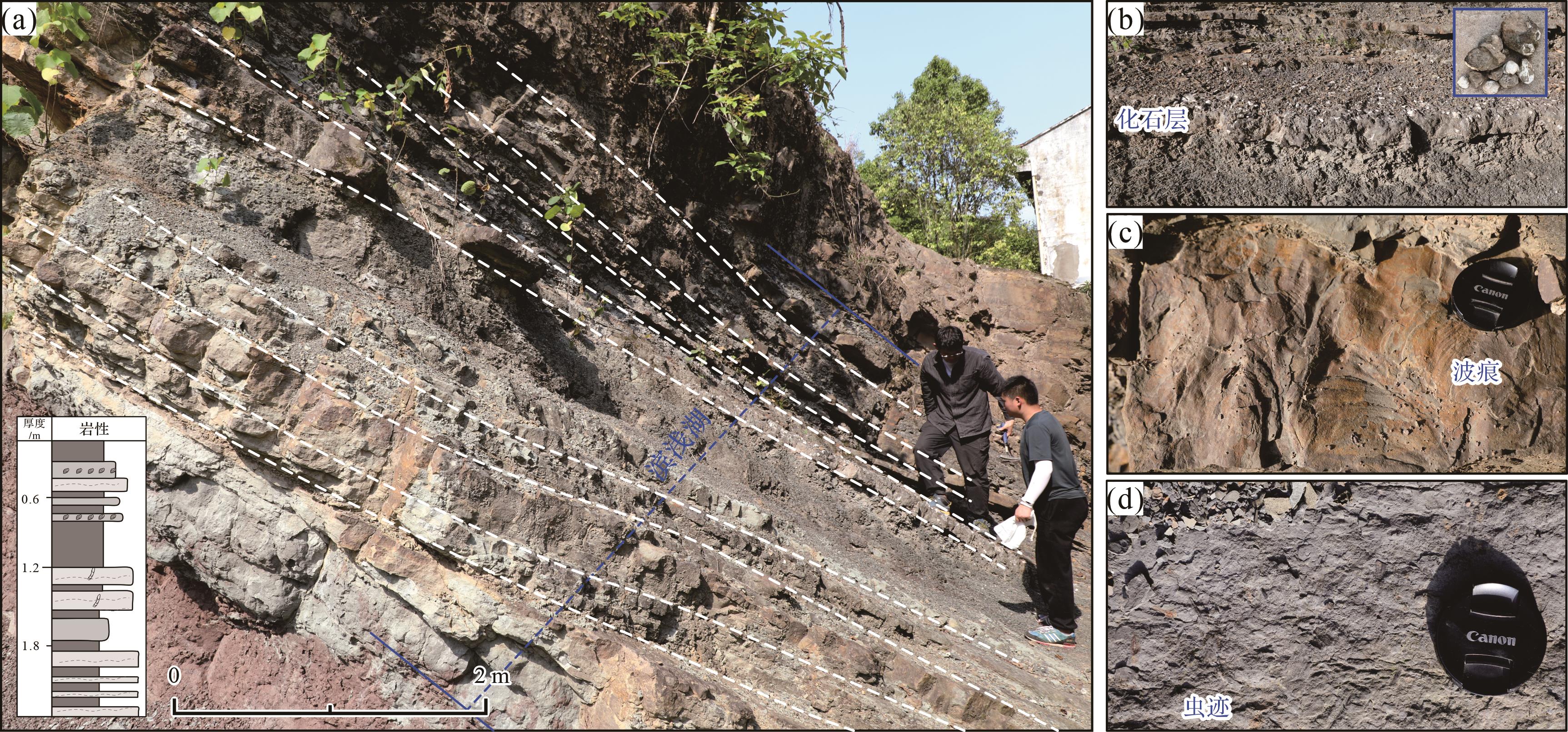
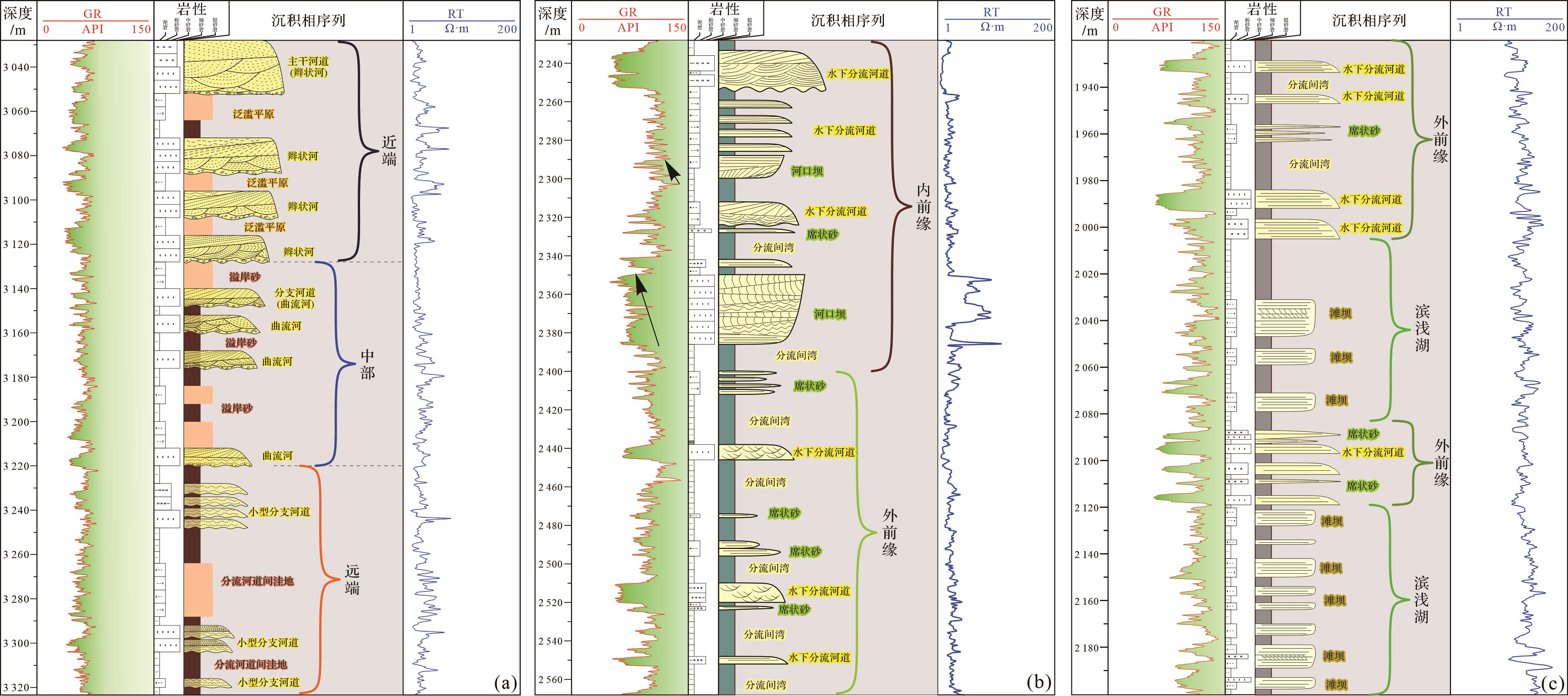
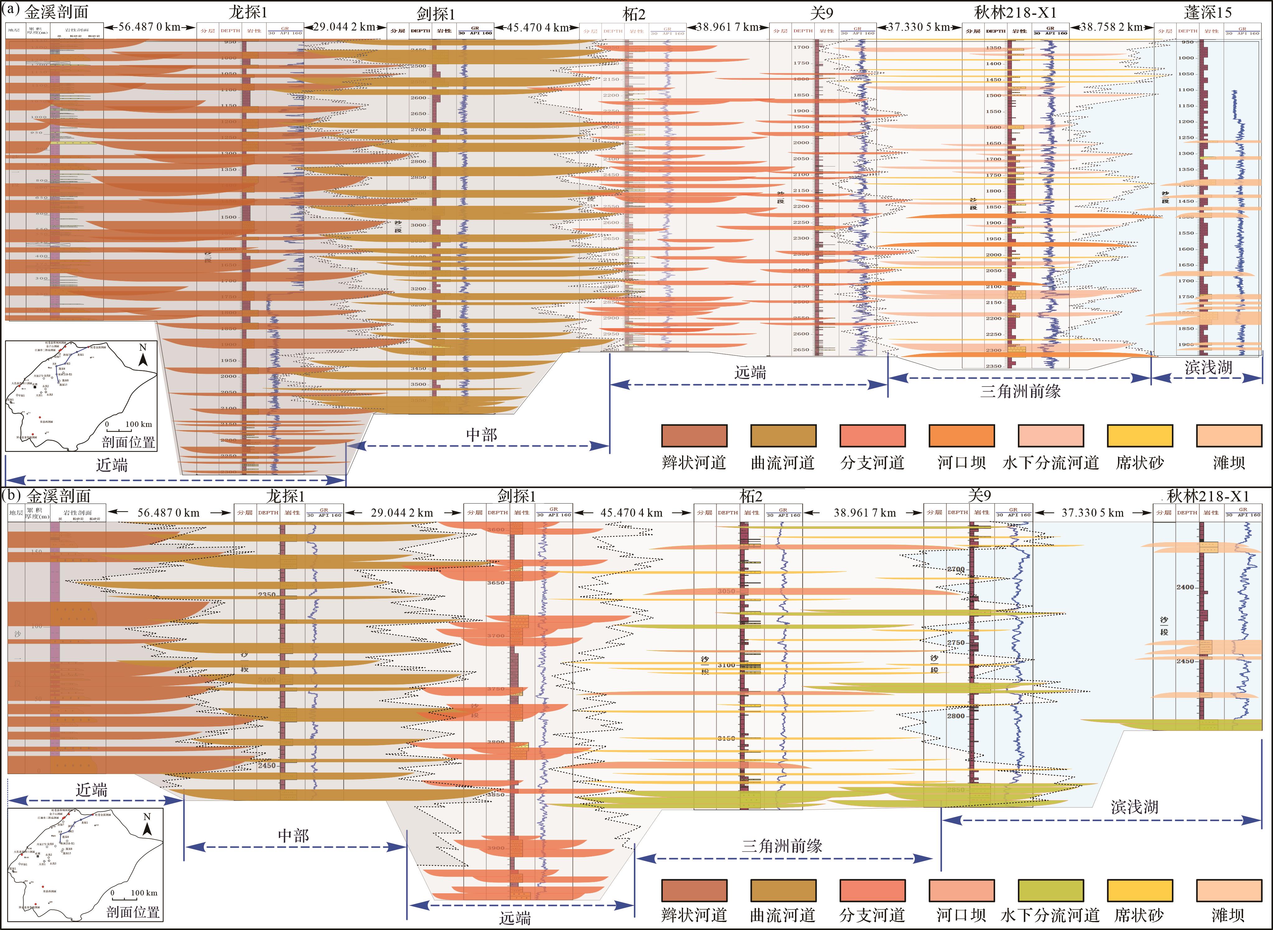
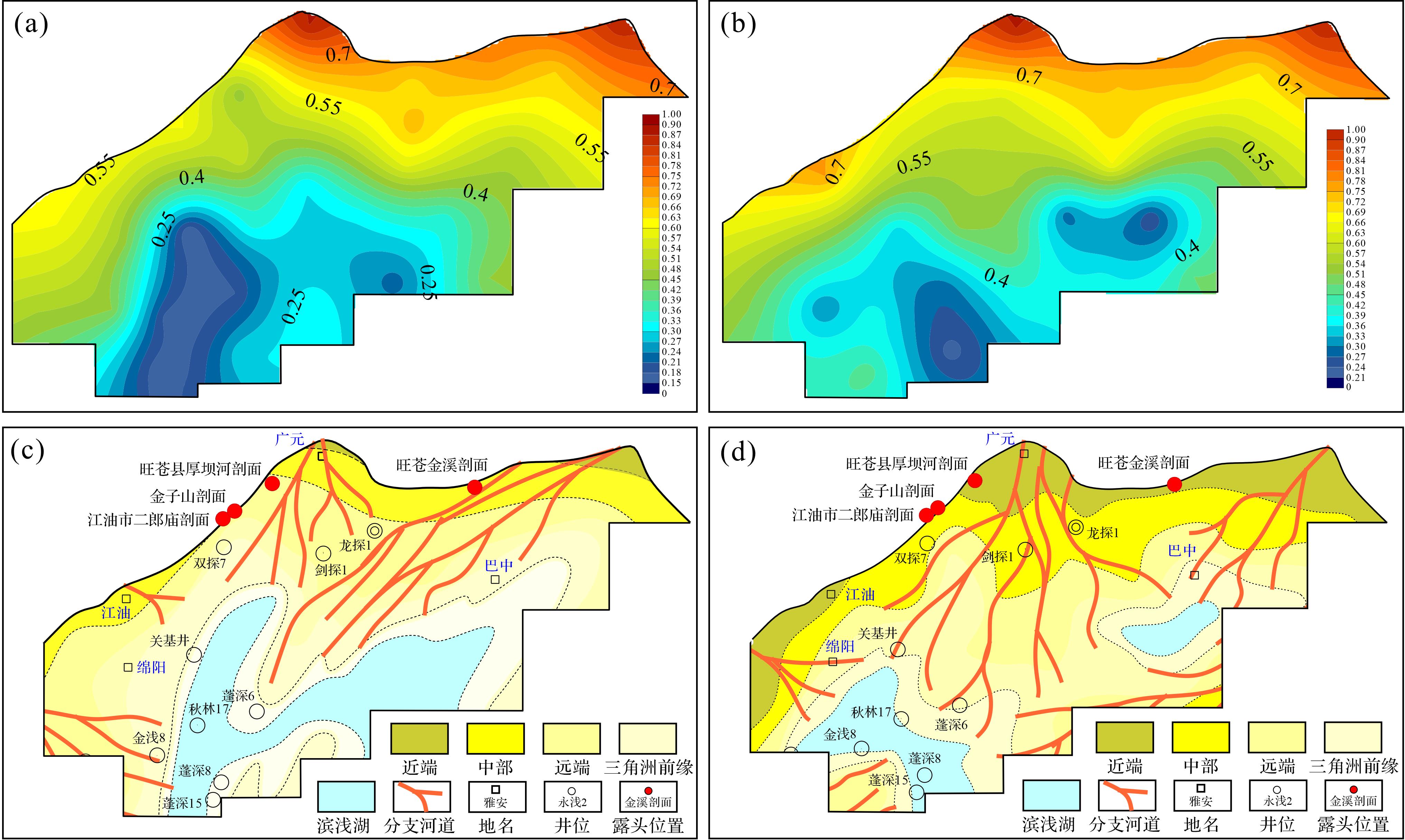

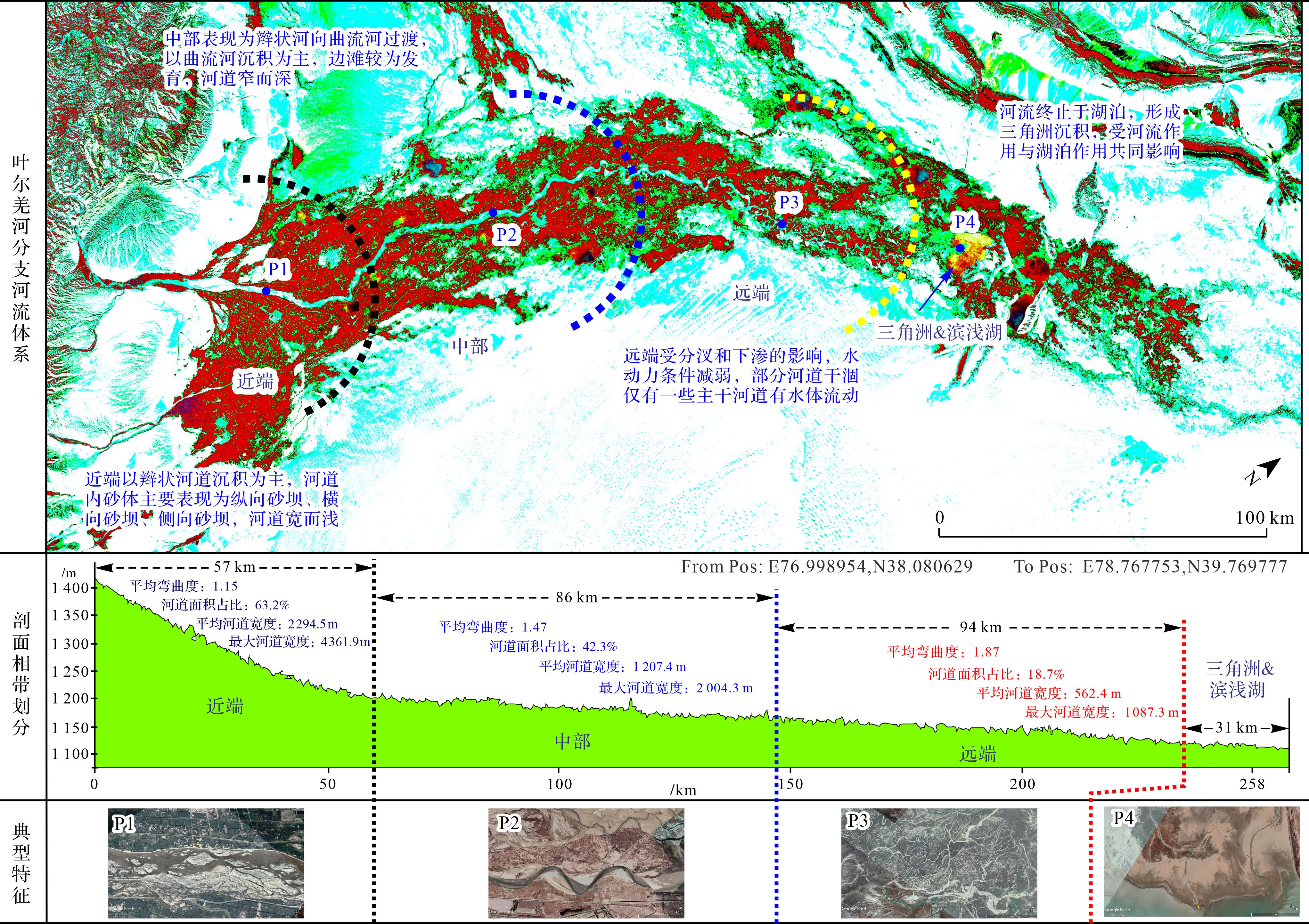
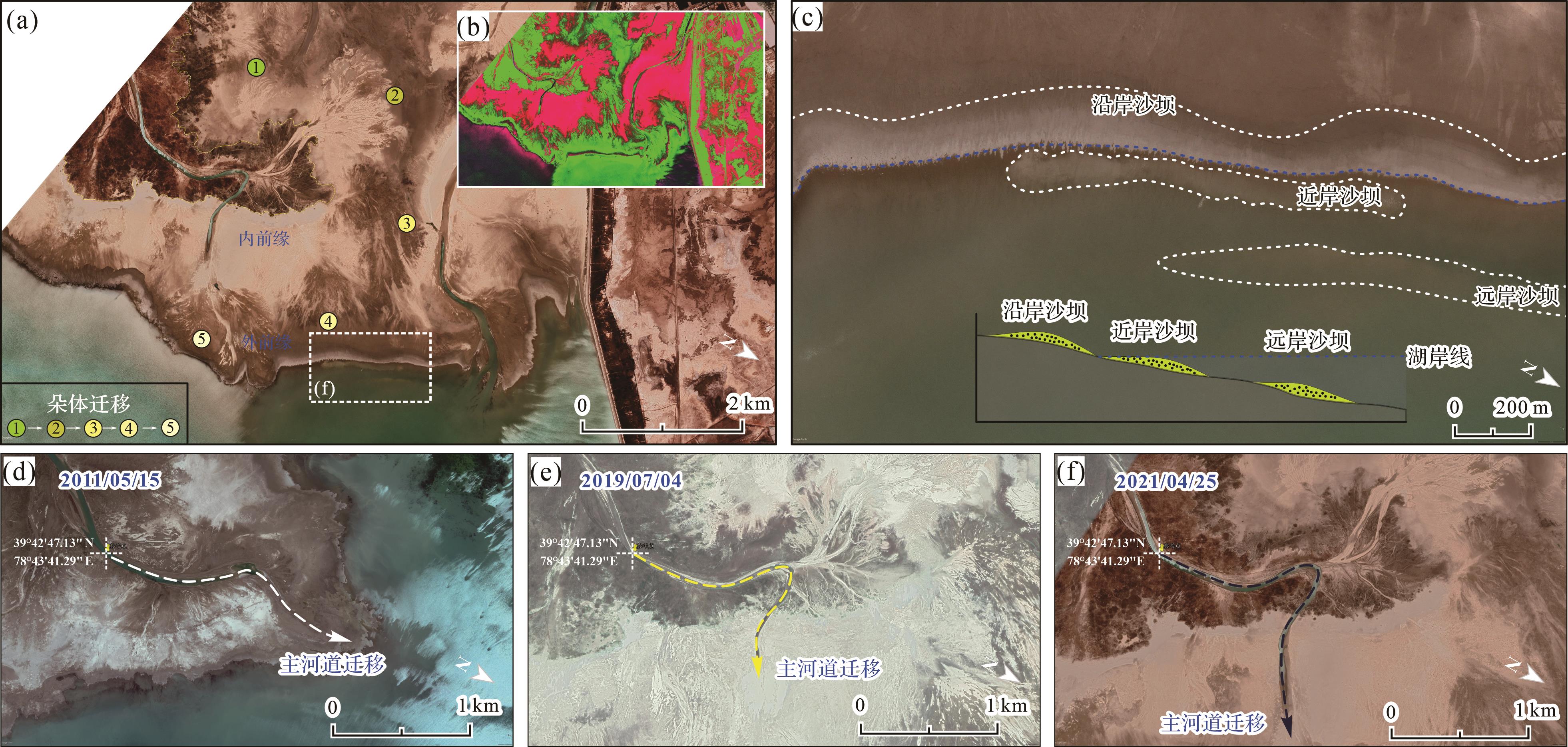
2026, 44(5): 1652-1669.
doi: 10.14027/j.issn.1000-0550.2025.027
Abstract:
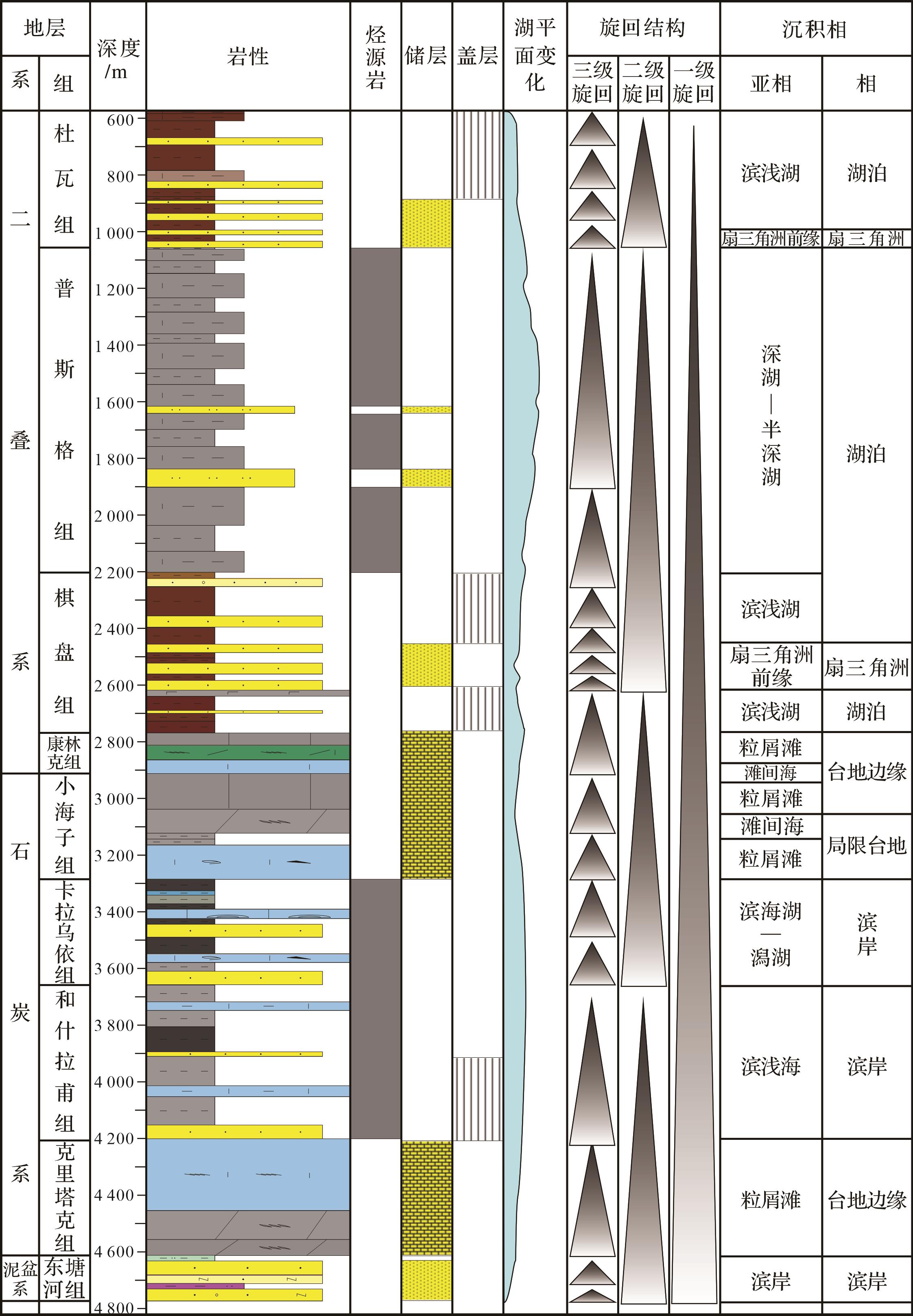
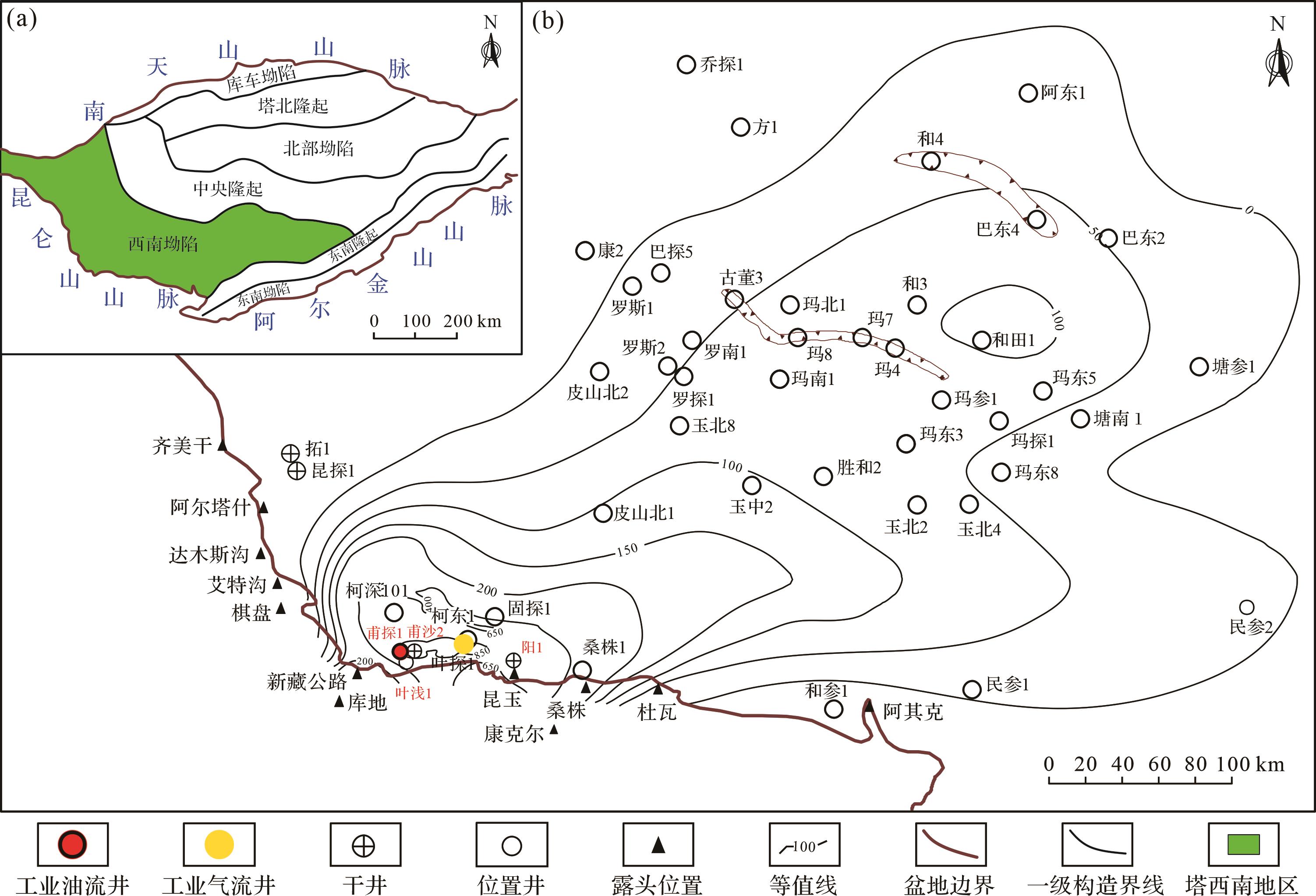
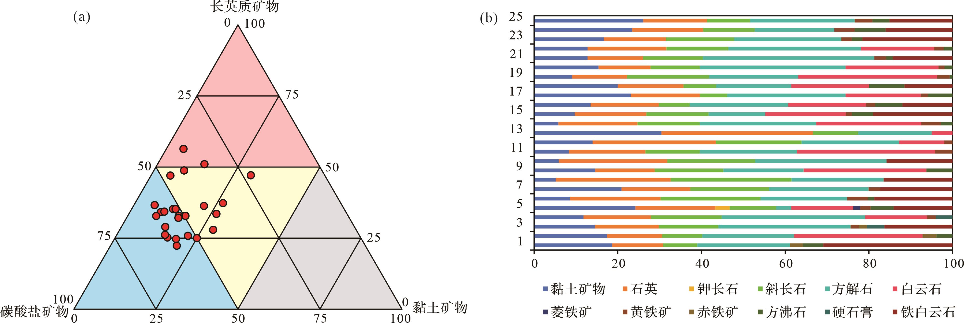
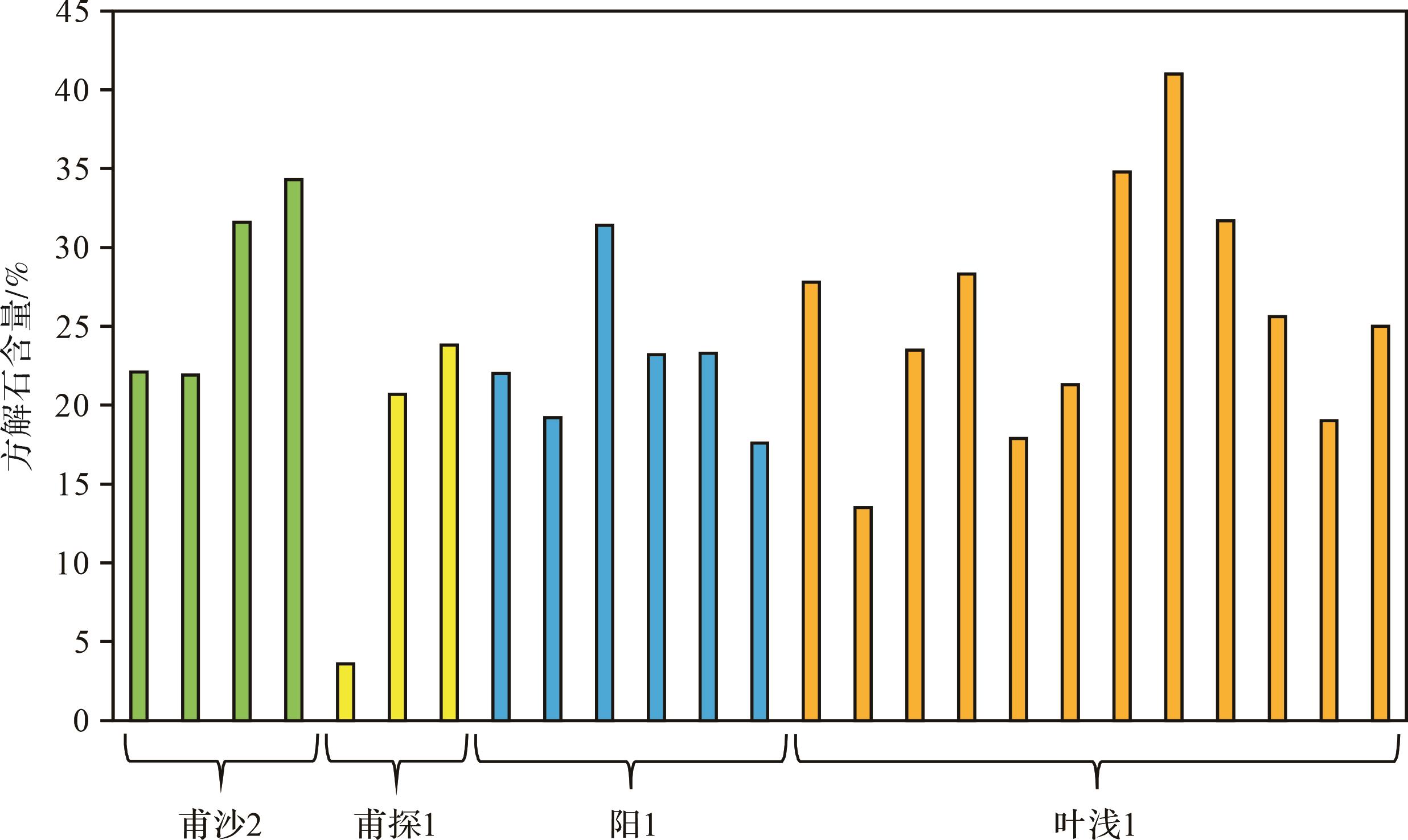
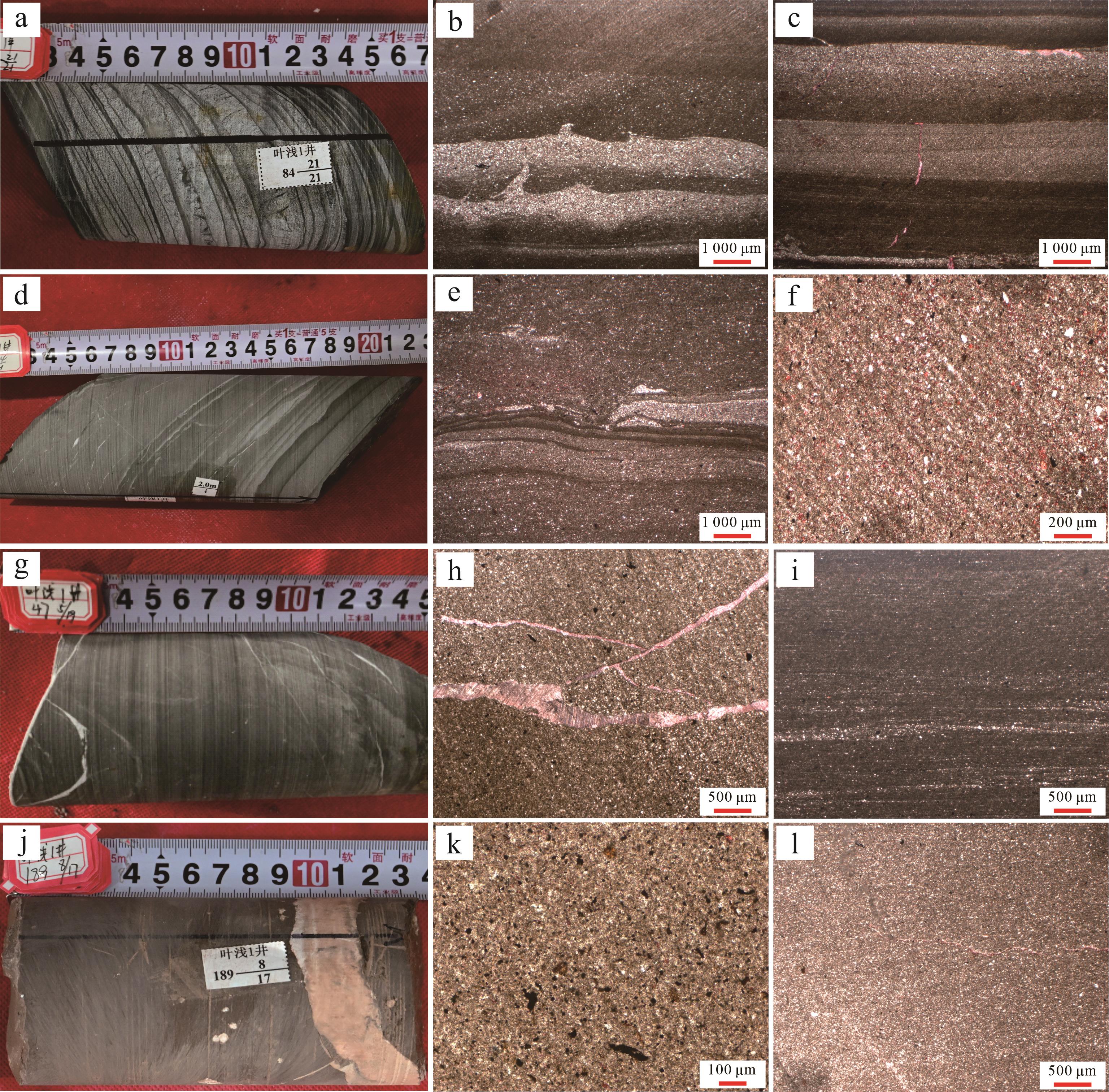
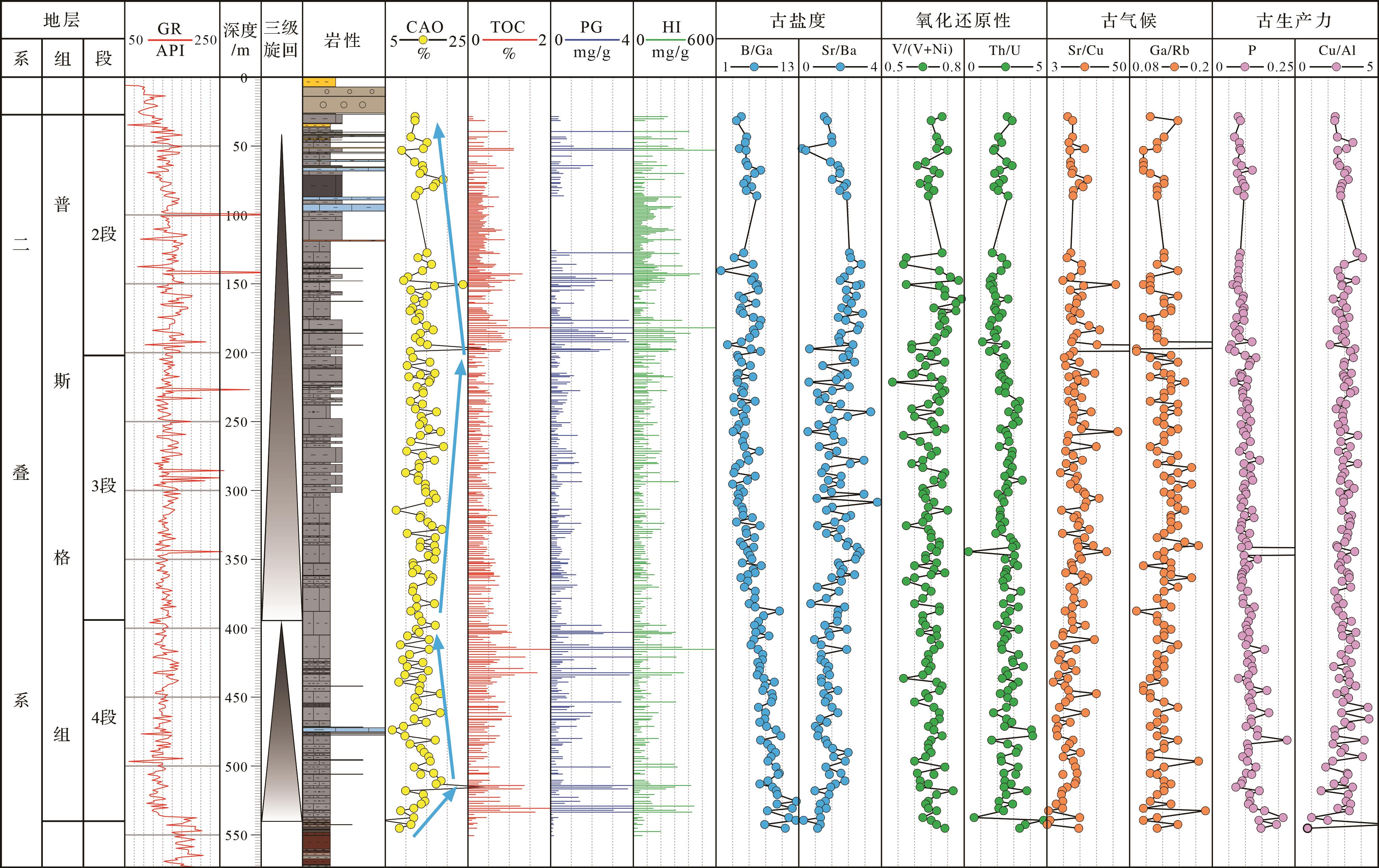
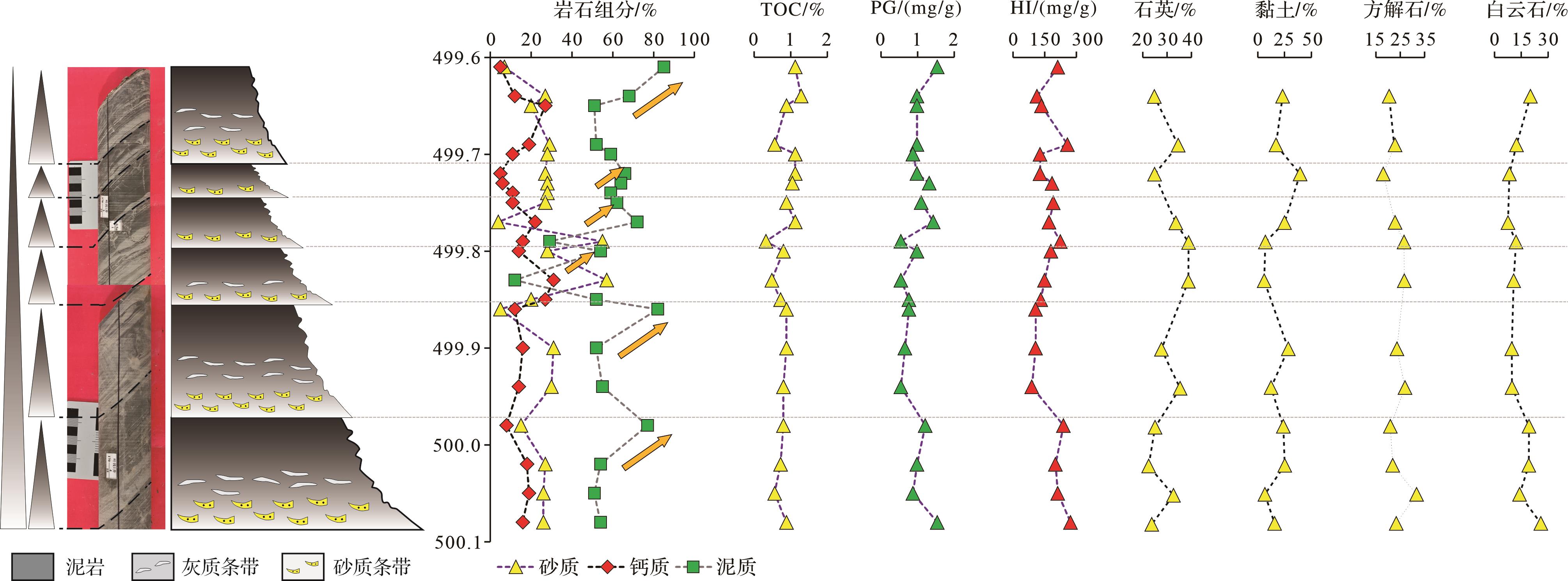
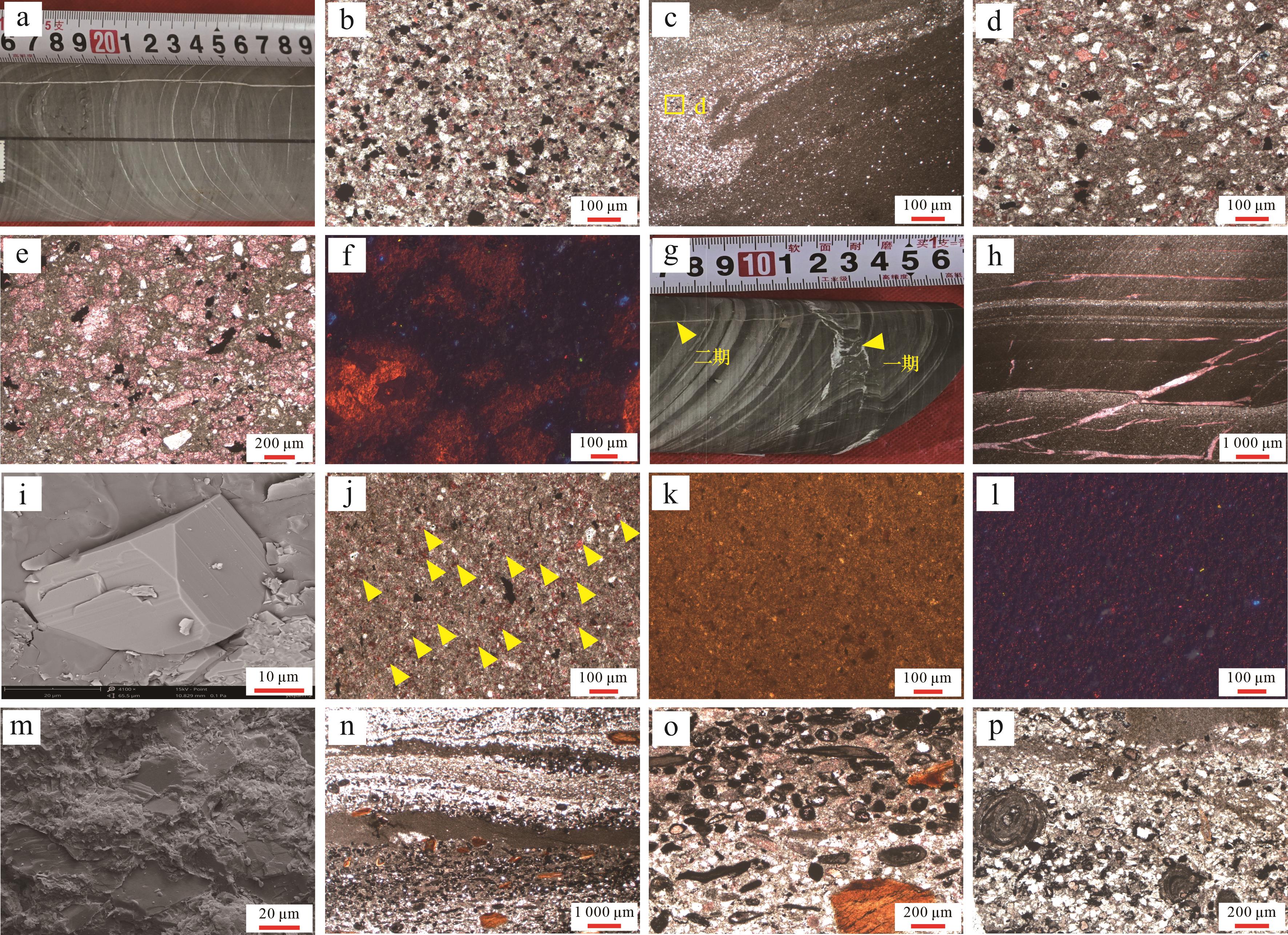
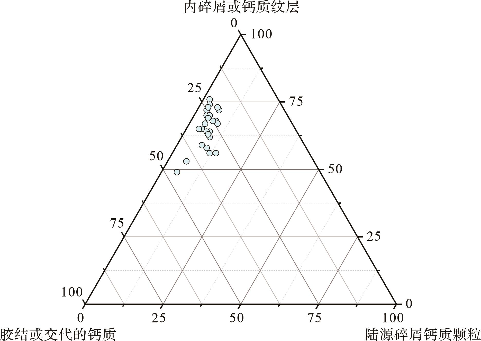
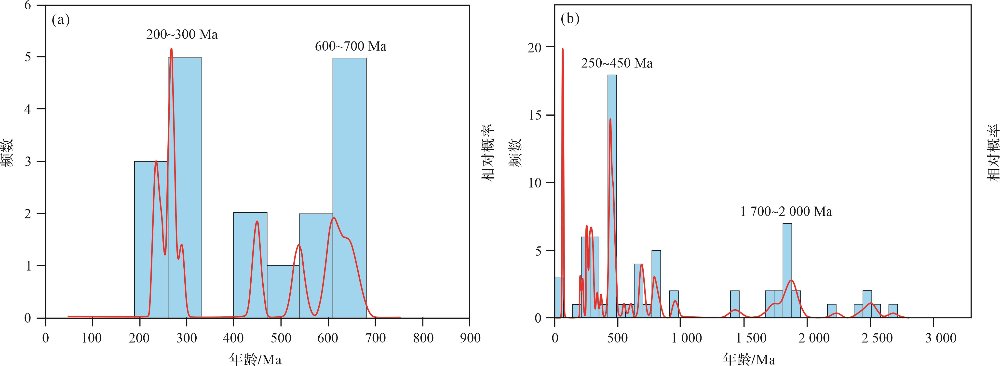
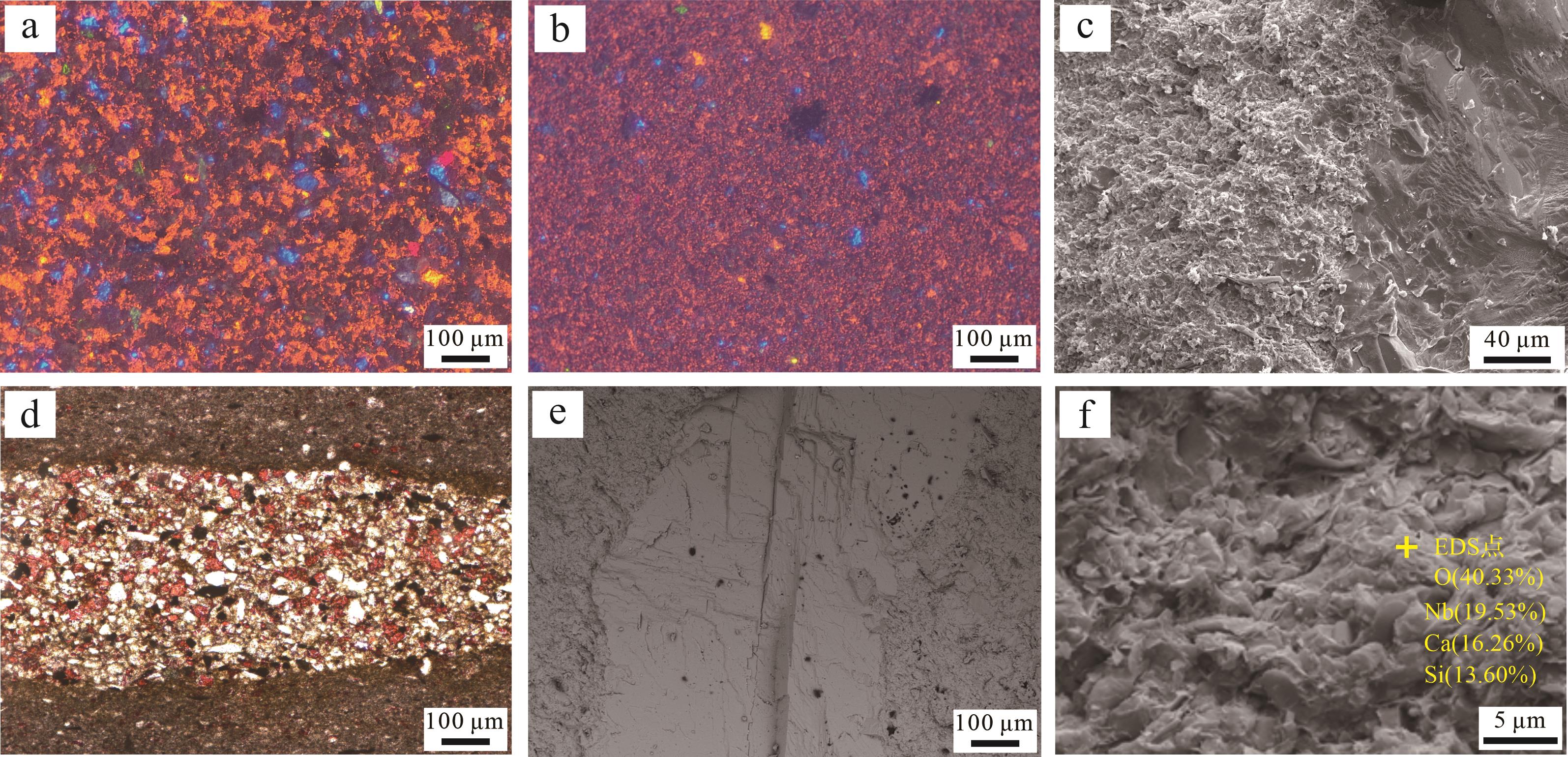
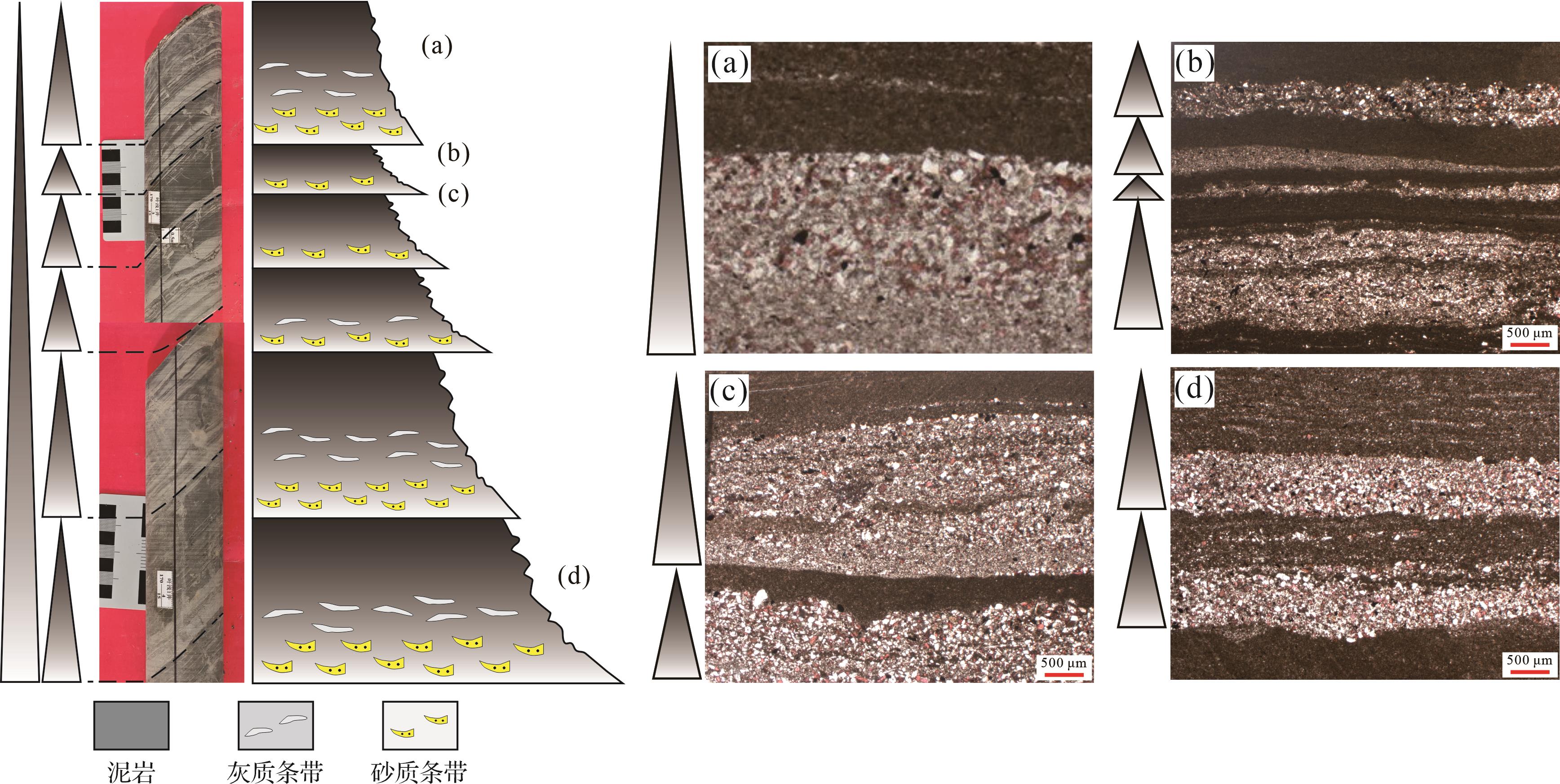
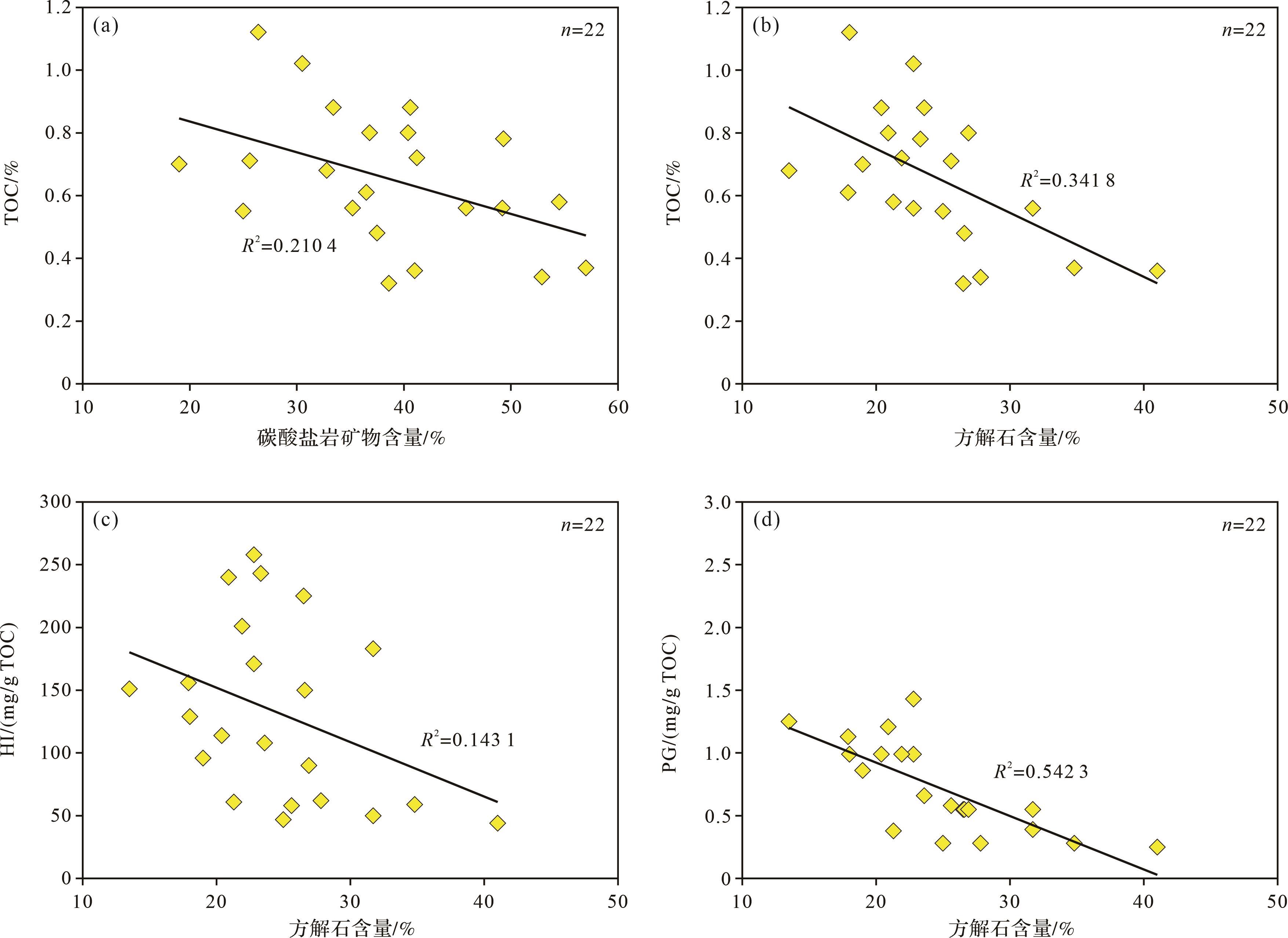
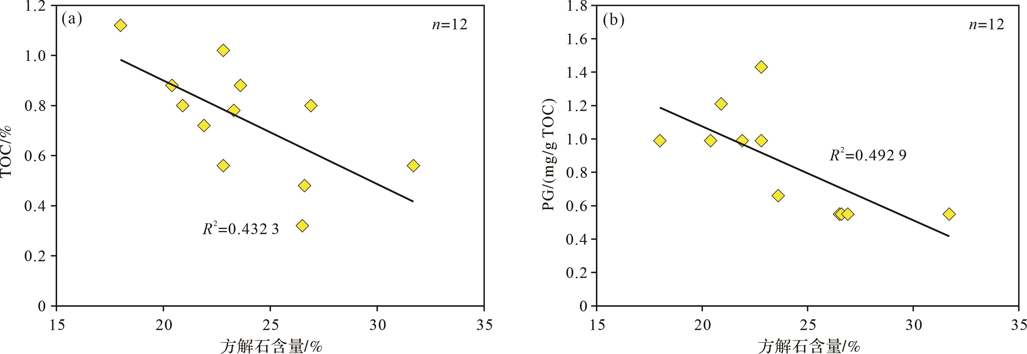
Objective The carbonate content in the source rocks of the Permian Pusige Formation in the southwestern depression of Tarim Basin is high, and the relationship between carbonate and organic matter remains unclear. This has hindered the evaluation of their potential for hydrocarbon generation. Methods Using techniques such as core examination, thin section analysis, scanning electron microscopy (SEM), whole-rock X-ray diffraction (XRD), and geochemical studies, this research investigated the storage state and origin of carbonates, distribution patterns of organic matter, and relationship between carbonates and organic matter in the source rocks of the Permian Pusige Formation located at the peripheral areas of Kekeya in the southwestern depression of Tarim Basin. Results The source rocks of the Permian Pusige Formation primarily exhibit three lithofacies associations: sand-mud, gray-mud, and sand-gray-mud. Calcite in the source rock mainly exists as cement and particles, displaying a multiscale cycloidal feature of increasing and then decreasing from bottom to top within each “sand-gray-mud” cycle. The sources of carbonate include: (1) detrital particles derived from ancient continental sediments; (2) intra-depositional detritus or carbonate laminae; and (3) cementation or replacement products formed during the diagenetic phase. By conducting detailed analysis of the multi-scale cyclothem sequences, organic matter was found to accumulate at the tops of these sequences. The main hydrocarbon-bearing intervals could be the laminites at the top of each cyclothem. Geochemical analysis revealed a strong negative correlation between carbonate minerals such as calcite and Rock-Eval parameters such as total organic carbon (TOC), pyrolytic hydrocarbon generation potential (PG), and hydrogen index (HI), reflecting a pattern of high calcium and low Rock-Eval parameters. The underlying cause is that calcium primarily resides in sandstone and calcitic layers at the base and middle sections of the cycle, where stronger hydrodynamic conditions during deposition were unfavorable for organic accumulation and preservation. Conclusions The high-calcium source rocks within multi-scale "sand-gray-mud" cycles may possess unique characteristics pertaining to hydrocarbon generation conditions, expulsion efficiency, and oil/gas migration processes, indicating a substantial potential for hydrocarbon generation in the source rocks of Permian Pusige Formation in the Kekeya.
Objective The carbonate content in the source rocks of the Permian Pusige Formation in the southwestern depression of Tarim Basin is high, and the relationship between carbonate and organic matter remains unclear. This has hindered the evaluation of their potential for hydrocarbon generation. Methods Using techniques such as core examination, thin section analysis, scanning electron microscopy (SEM), whole-rock X-ray diffraction (XRD), and geochemical studies, this research investigated the storage state and origin of carbonates, distribution patterns of organic matter, and relationship between carbonates and organic matter in the source rocks of the Permian Pusige Formation located at the peripheral areas of Kekeya in the southwestern depression of Tarim Basin. Results The source rocks of the Permian Pusige Formation primarily exhibit three lithofacies associations: sand-mud, gray-mud, and sand-gray-mud. Calcite in the source rock mainly exists as cement and particles, displaying a multiscale cycloidal feature of increasing and then decreasing from bottom to top within each “sand-gray-mud” cycle. The sources of carbonate include: (1) detrital particles derived from ancient continental sediments; (2) intra-depositional detritus or carbonate laminae; and (3) cementation or replacement products formed during the diagenetic phase. By conducting detailed analysis of the multi-scale cyclothem sequences, organic matter was found to accumulate at the tops of these sequences. The main hydrocarbon-bearing intervals could be the laminites at the top of each cyclothem. Geochemical analysis revealed a strong negative correlation between carbonate minerals such as calcite and Rock-Eval parameters such as total organic carbon (TOC), pyrolytic hydrocarbon generation potential (PG), and hydrogen index (HI), reflecting a pattern of high calcium and low Rock-Eval parameters. The underlying cause is that calcium primarily resides in sandstone and calcitic layers at the base and middle sections of the cycle, where stronger hydrodynamic conditions during deposition were unfavorable for organic accumulation and preservation. Conclusions The high-calcium source rocks within multi-scale "sand-gray-mud" cycles may possess unique characteristics pertaining to hydrocarbon generation conditions, expulsion efficiency, and oil/gas migration processes, indicating a substantial potential for hydrocarbon generation in the source rocks of Permian Pusige Formation in the Kekeya.
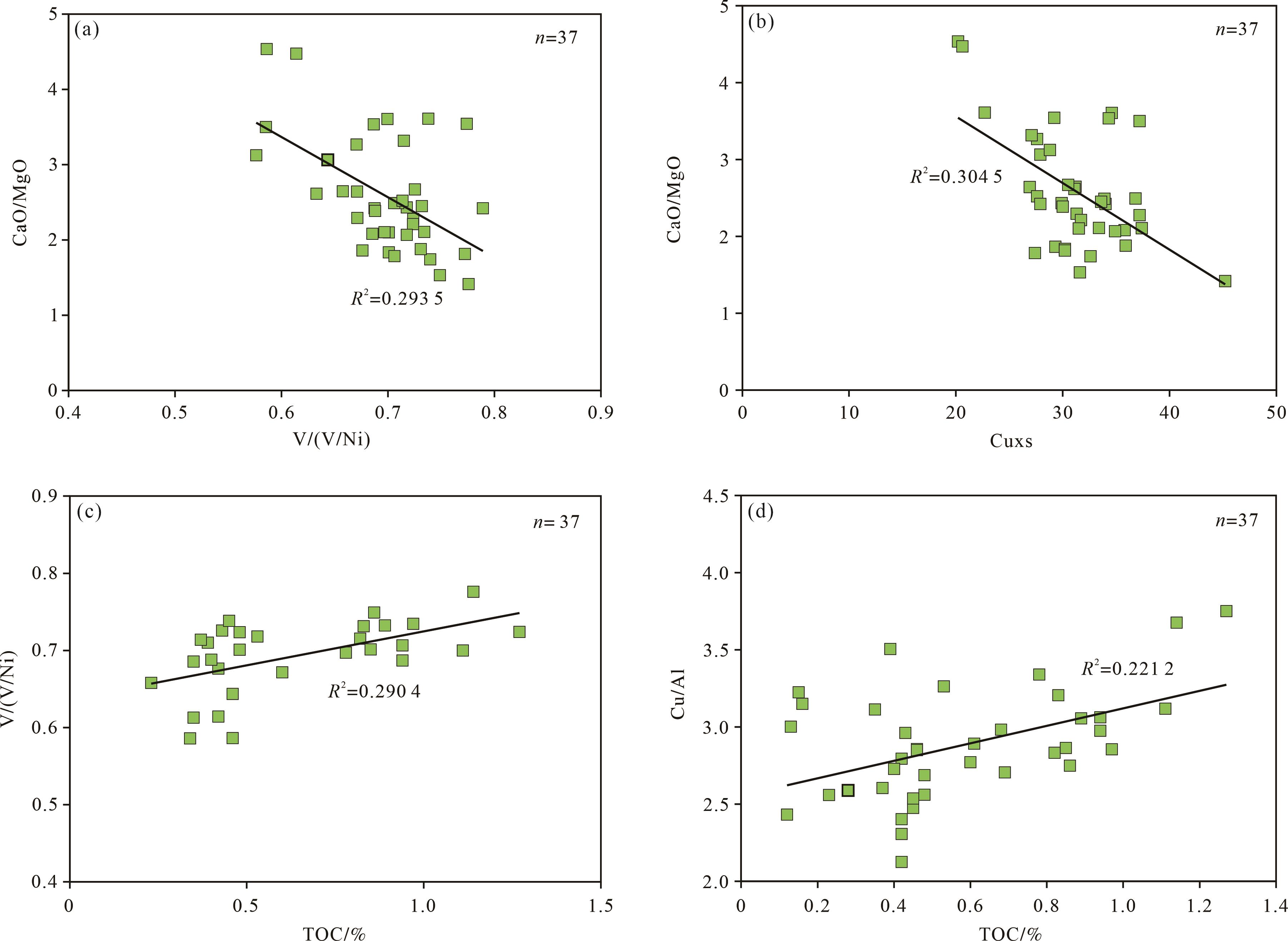
2026, 44(5): 1670-1683.
doi: 10.14027/j.issn.1000-0550.2025.033
Abstract:
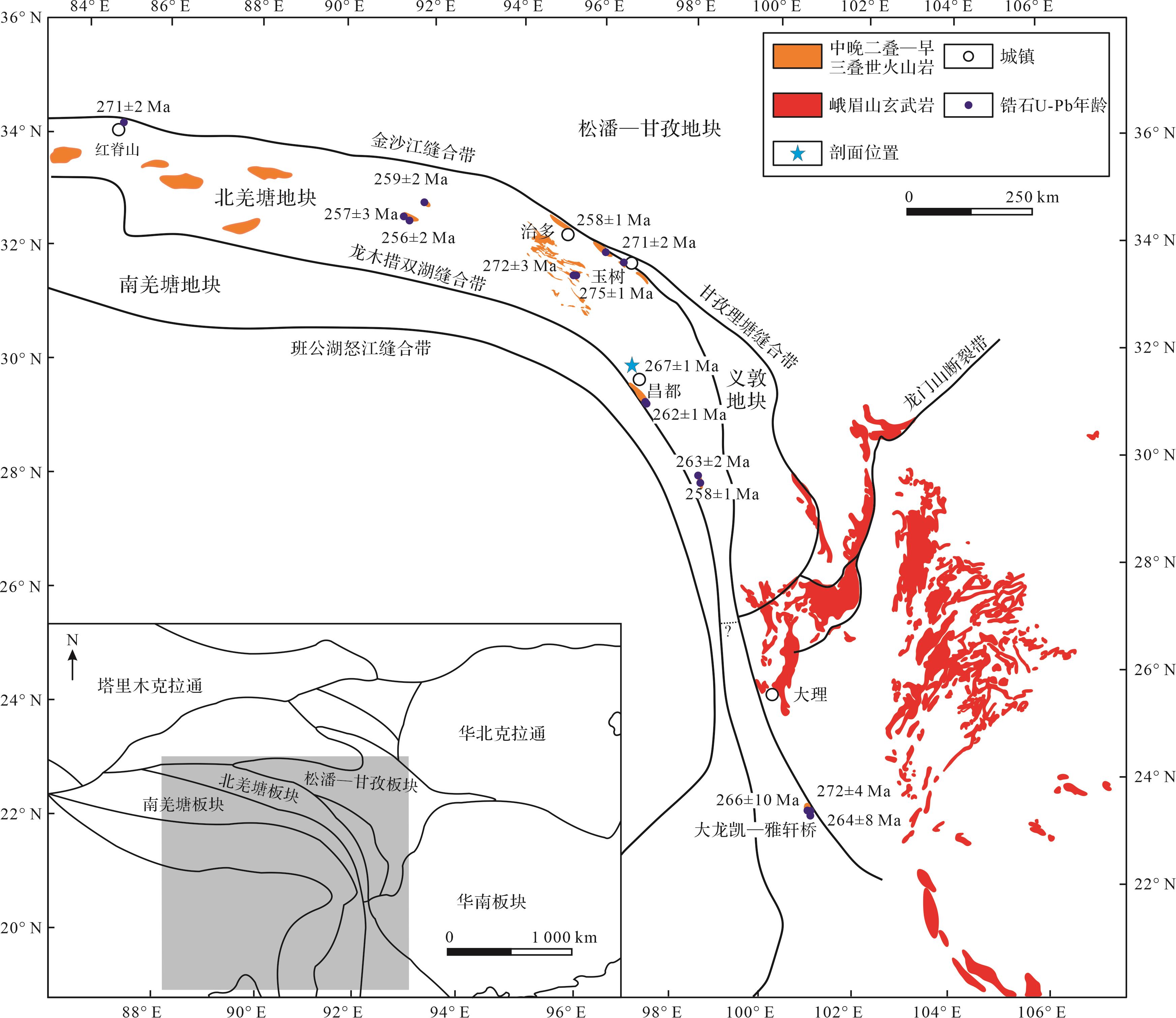
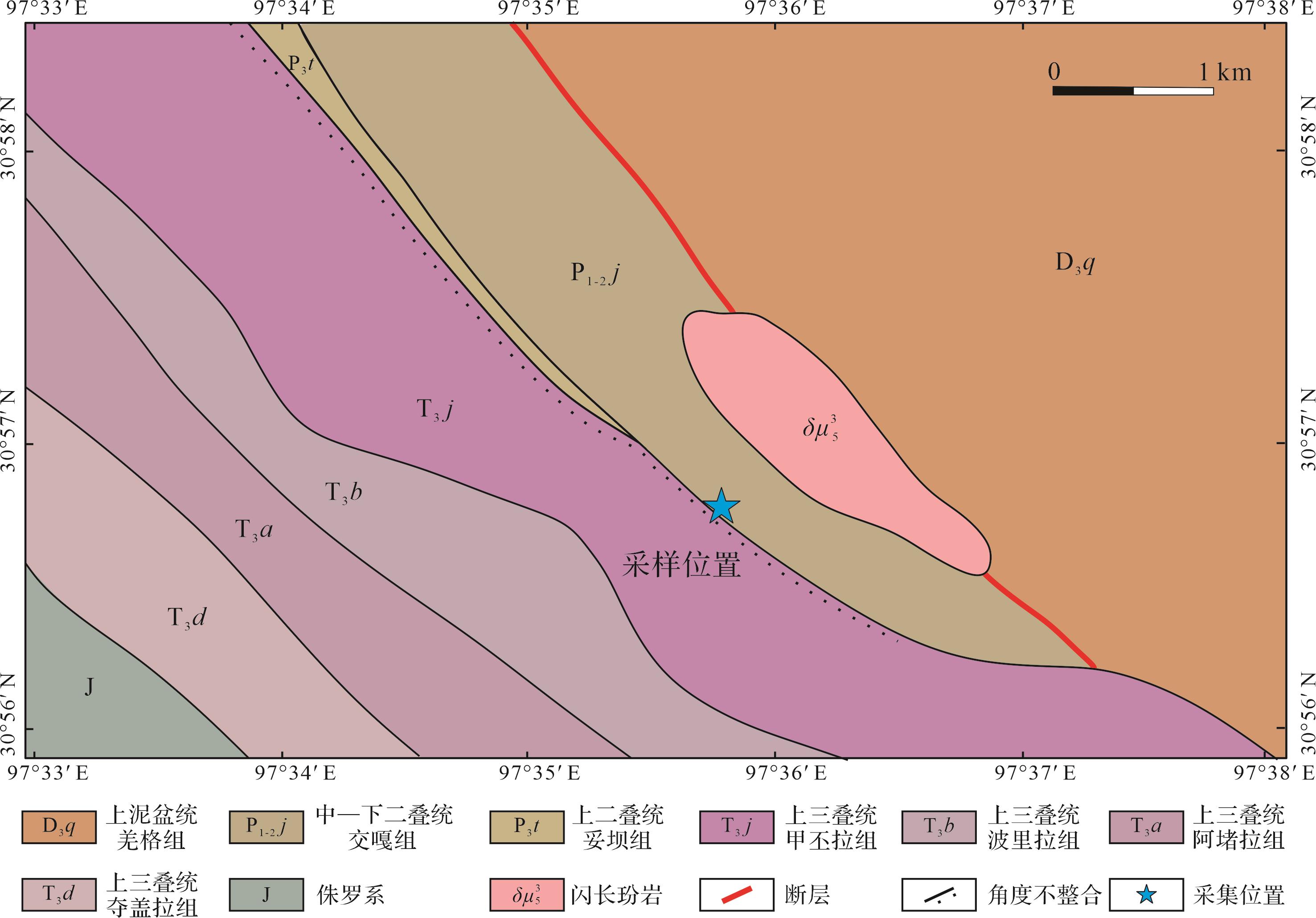
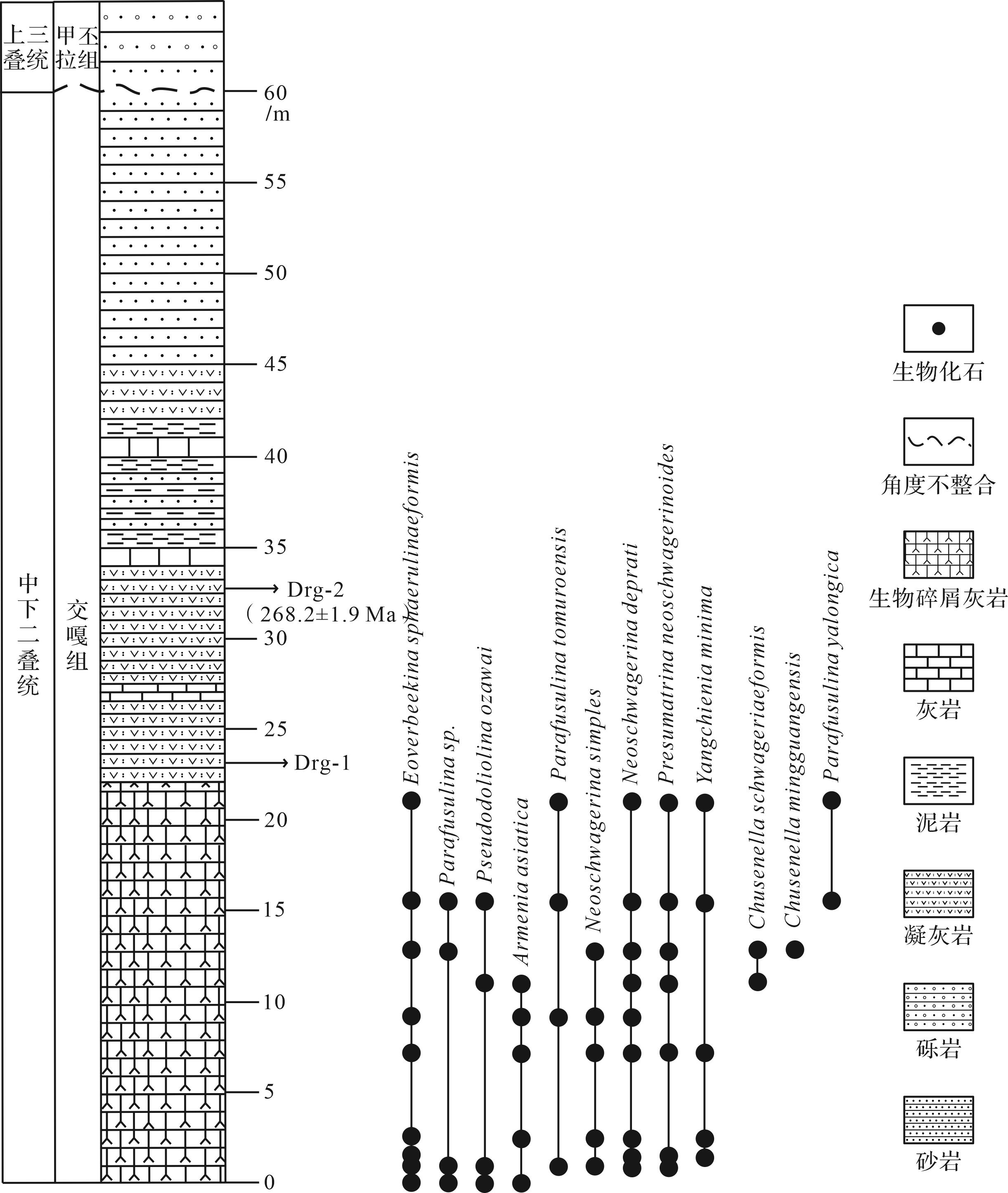
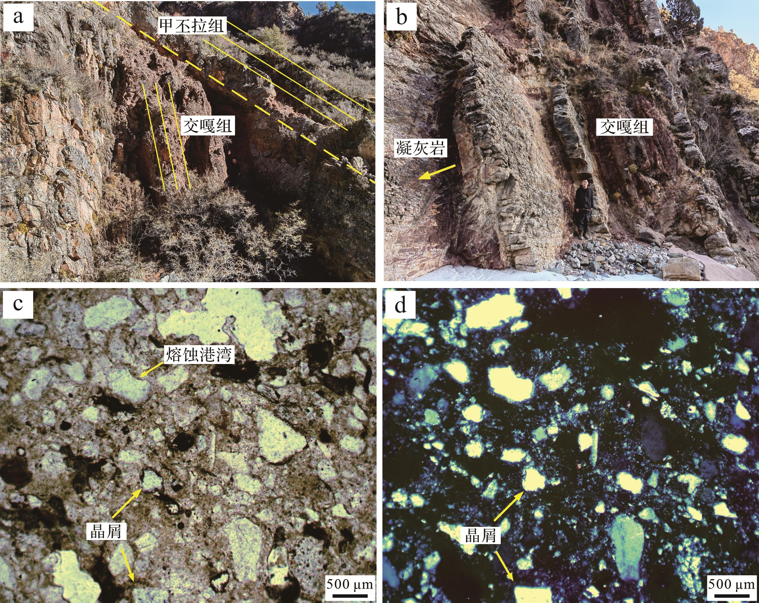
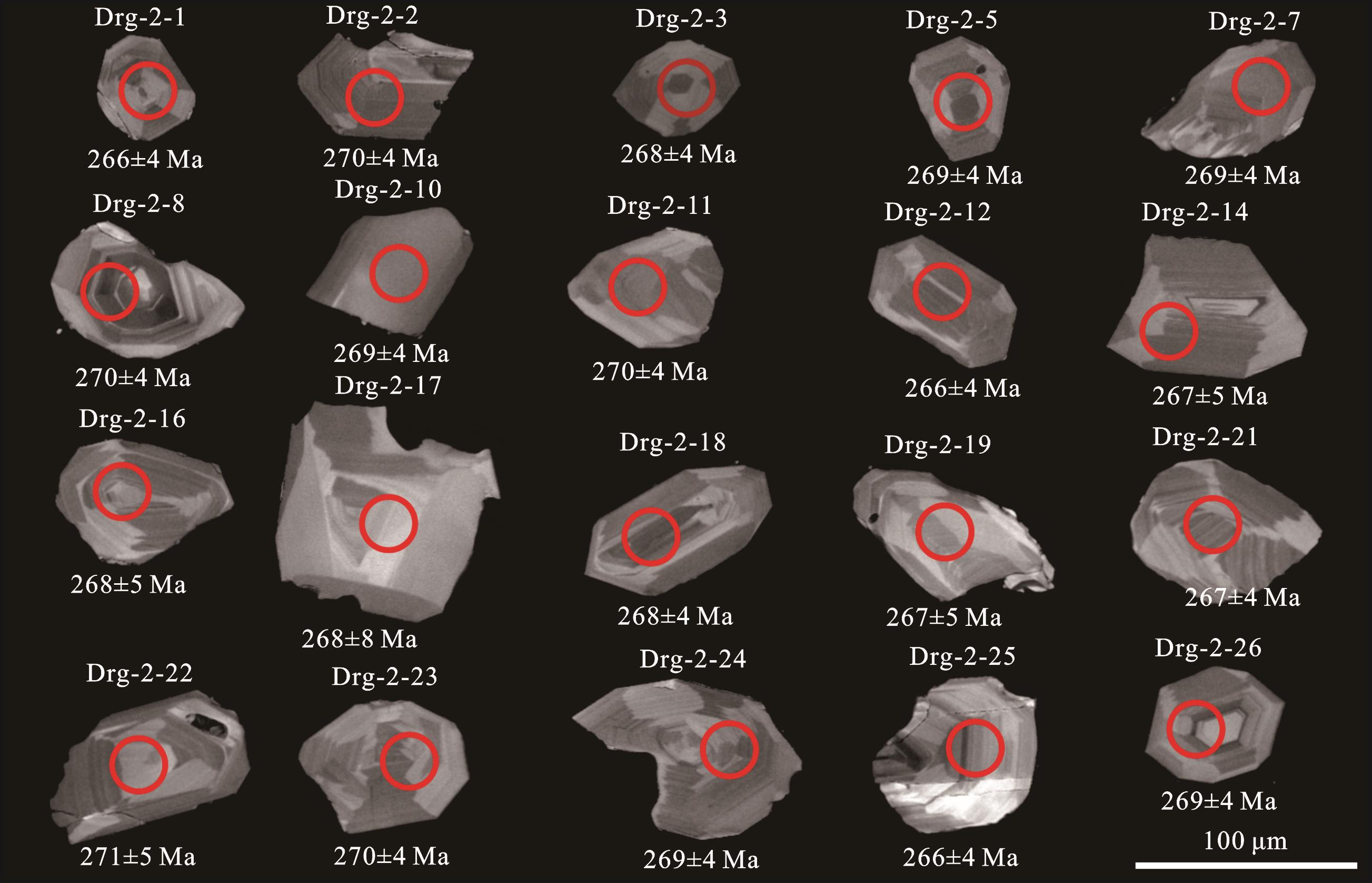
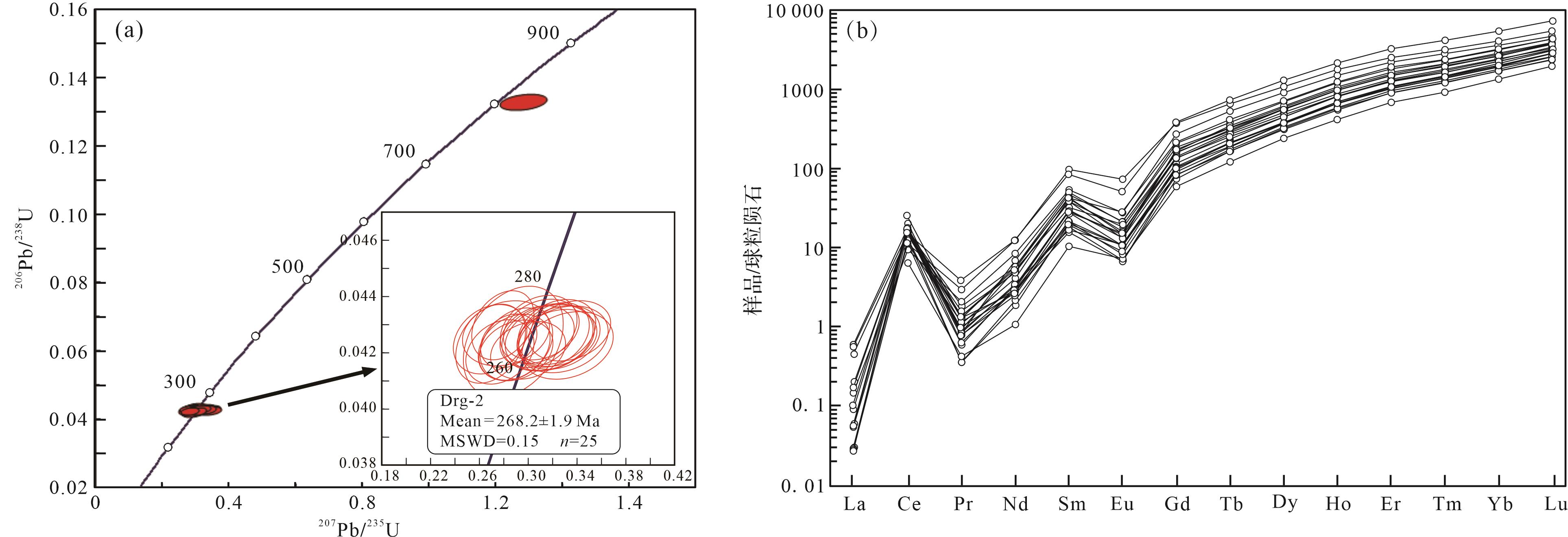
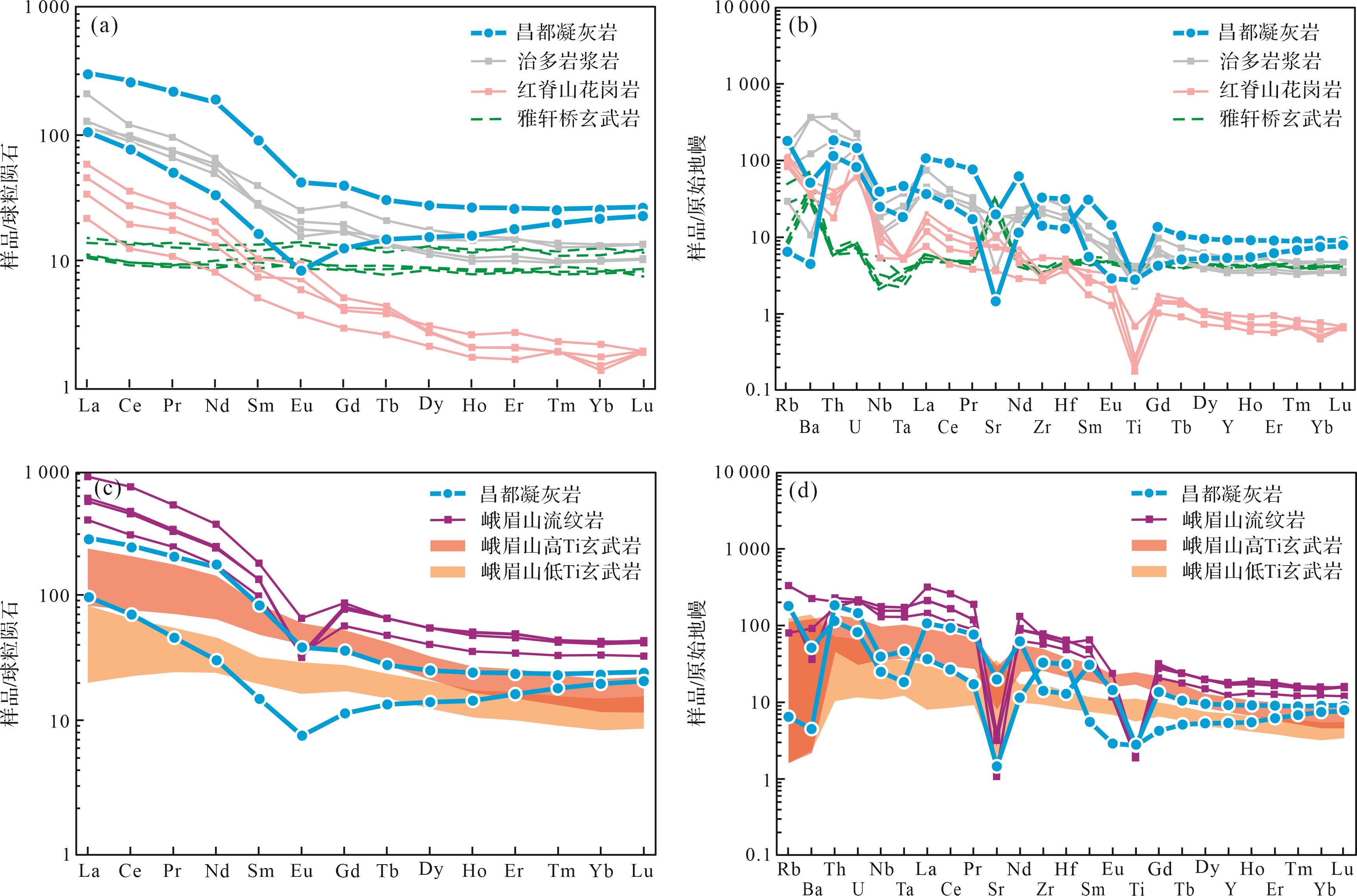
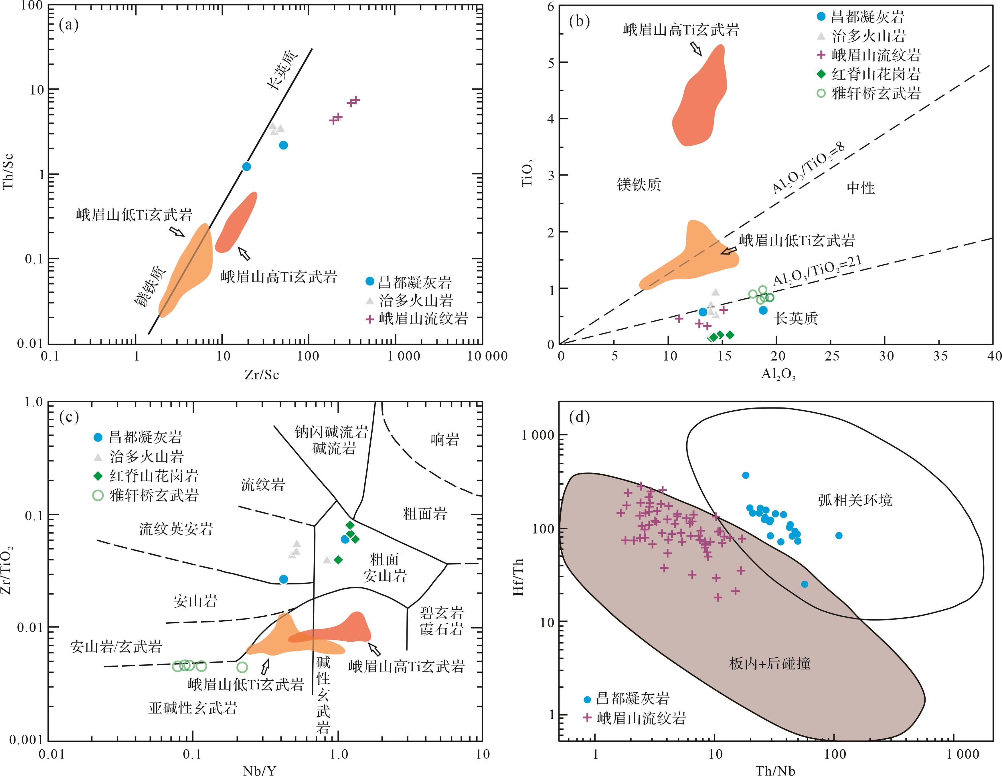
Objective The Wangka section in the Changdu area, North Qiangtang terrane, records a critical lithological transition from limestone to clastic rocks in the Early-to-Middle Permian Jiaoga Formation. The timing of this transition may hold significant implications for understanding the mechanisms driving the Permian P3 glaciation. Methods An integrated study of the Jiaoga Formation tuffs was conducted to include petrography, zircon U-Pb geochronology, zircon trace element analysis and whole-rock major/trace element geochemistry, to constrain their emplacement age and provenance. Results Zircon U-Pb dating yielded a weighted mean age of (268.2 ± 1.9) Ma for the tuffs. Zircon trace elements exhibit light rare earth element (LREE) depletion and heavy REE (HREE) enrichment. Whole-rock geochemistry shows high Al₂O₃/TiO₂, Zr/TiO₂ and Th/Sc ratios. Primitive mantle-normalized patterns indicate Nb-Ta-Ti depletion and Th-U enrichment. Conclusions The age of the Jiaoga Formation tuffs overlaps with the onset of Permian P3 glaciation within analytical uncertainty. Their geochemical signatures suggest derivation from a volcanic island arc spanning the North Qiangtang-Simao terranes. Intensive weathering of this arc system may have triggered or amplified P3 glaciation.
Objective The Wangka section in the Changdu area, North Qiangtang terrane, records a critical lithological transition from limestone to clastic rocks in the Early-to-Middle Permian Jiaoga Formation. The timing of this transition may hold significant implications for understanding the mechanisms driving the Permian P3 glaciation. Methods An integrated study of the Jiaoga Formation tuffs was conducted to include petrography, zircon U-Pb geochronology, zircon trace element analysis and whole-rock major/trace element geochemistry, to constrain their emplacement age and provenance. Results Zircon U-Pb dating yielded a weighted mean age of (268.2 ± 1.9) Ma for the tuffs. Zircon trace elements exhibit light rare earth element (LREE) depletion and heavy REE (HREE) enrichment. Whole-rock geochemistry shows high Al₂O₃/TiO₂, Zr/TiO₂ and Th/Sc ratios. Primitive mantle-normalized patterns indicate Nb-Ta-Ti depletion and Th-U enrichment. Conclusions The age of the Jiaoga Formation tuffs overlaps with the onset of Permian P3 glaciation within analytical uncertainty. Their geochemical signatures suggest derivation from a volcanic island arc spanning the North Qiangtang-Simao terranes. Intensive weathering of this arc system may have triggered or amplified P3 glaciation.
2026, 44(5): 1684-1698.
doi: 10.14027/j.issn.1000-0550.2025.023
Abstract:
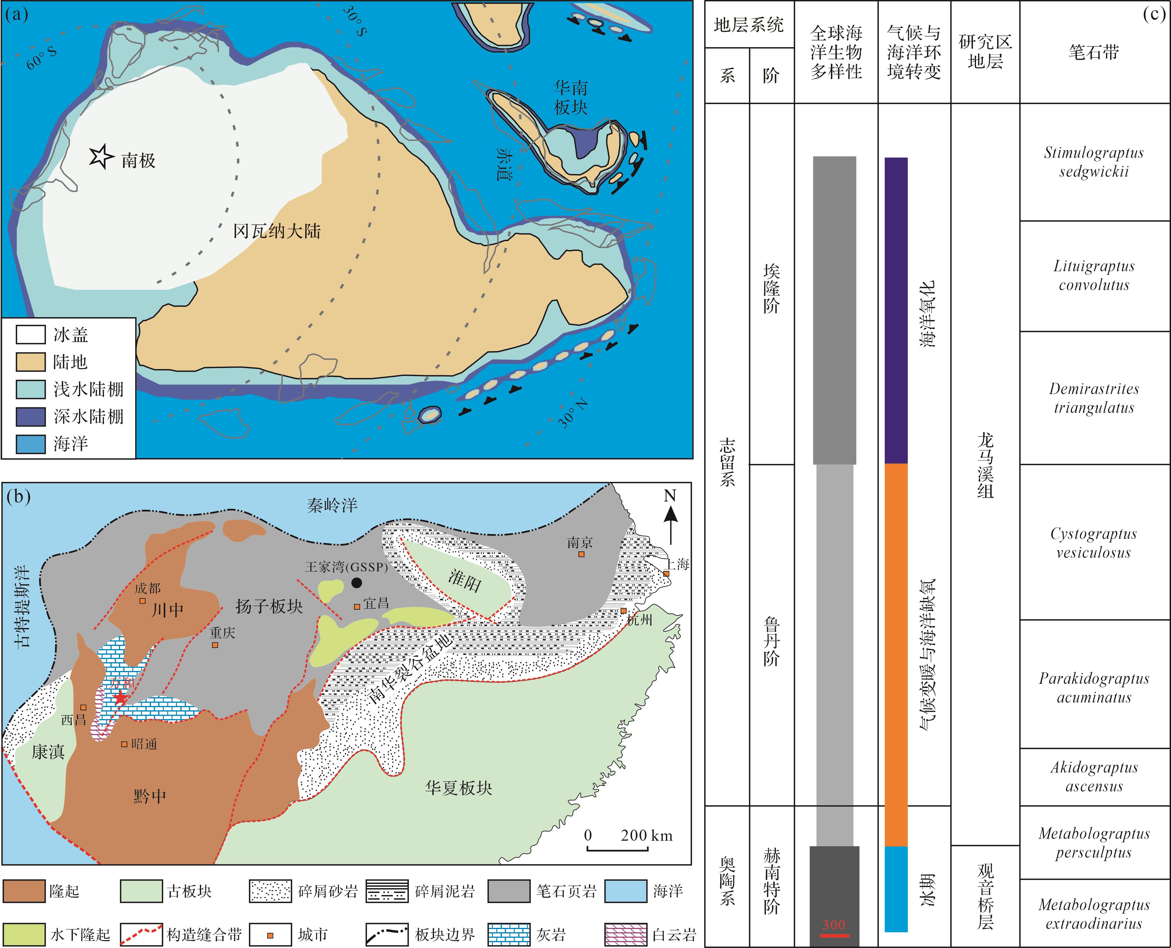
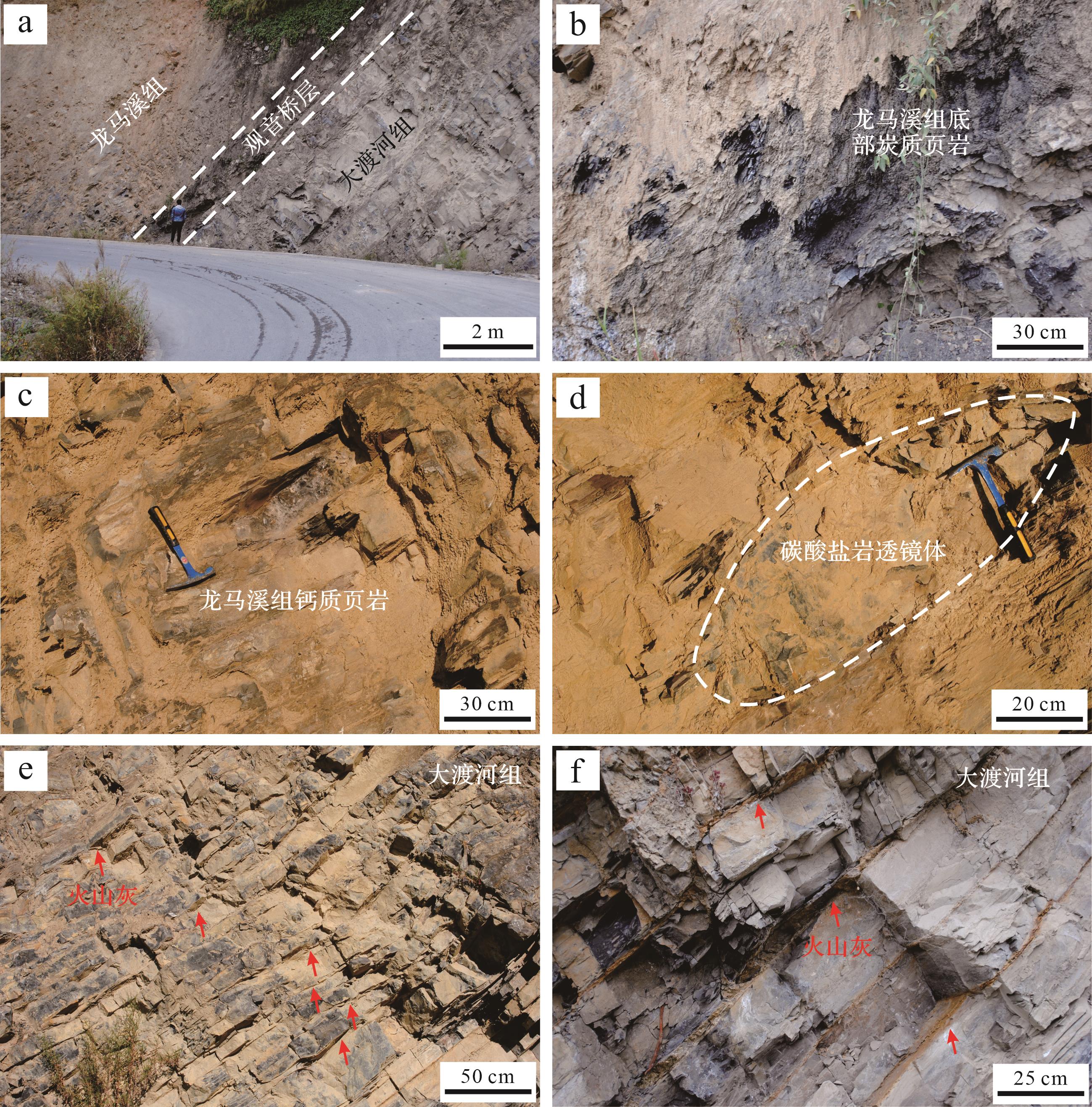
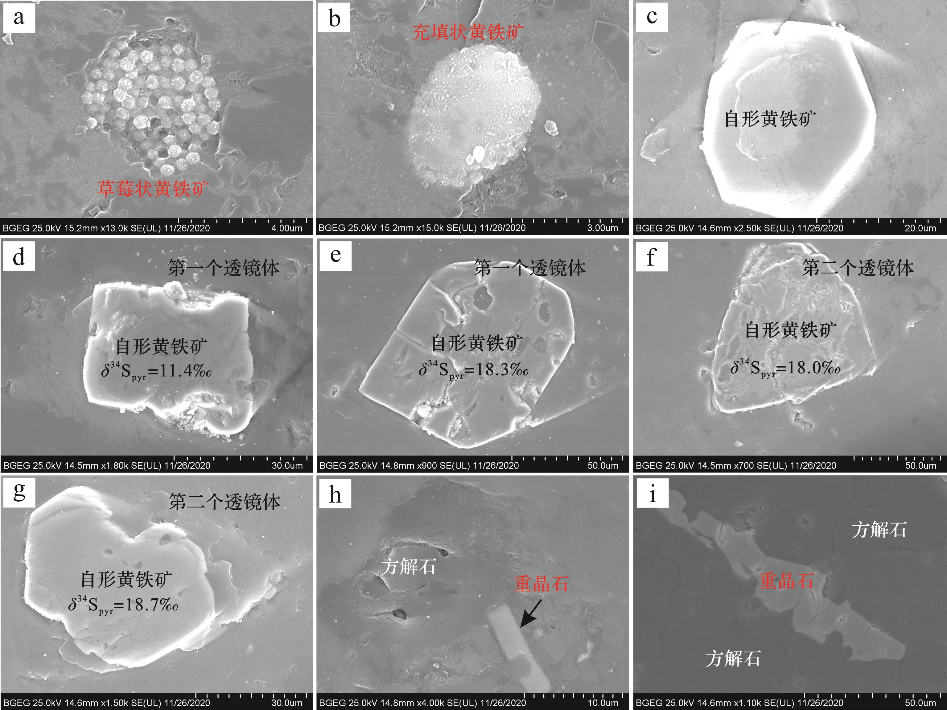
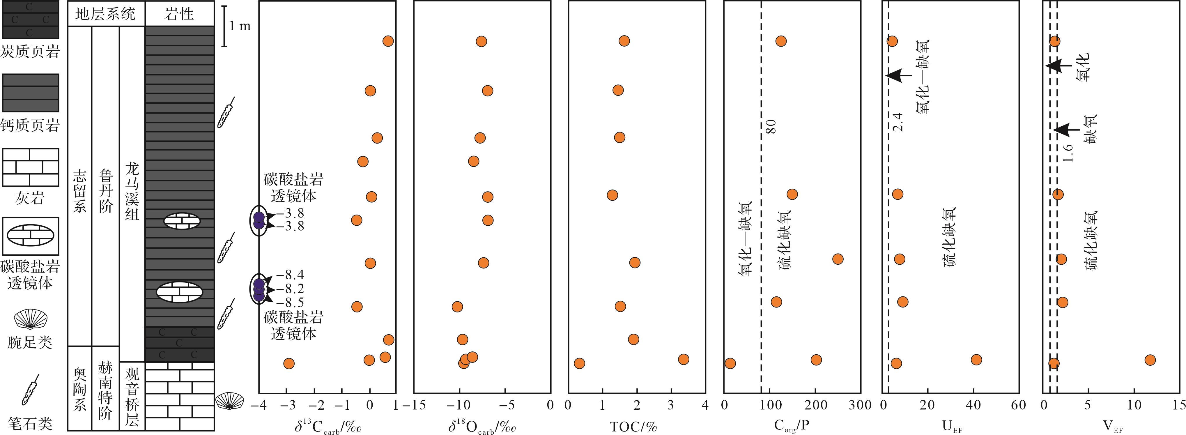
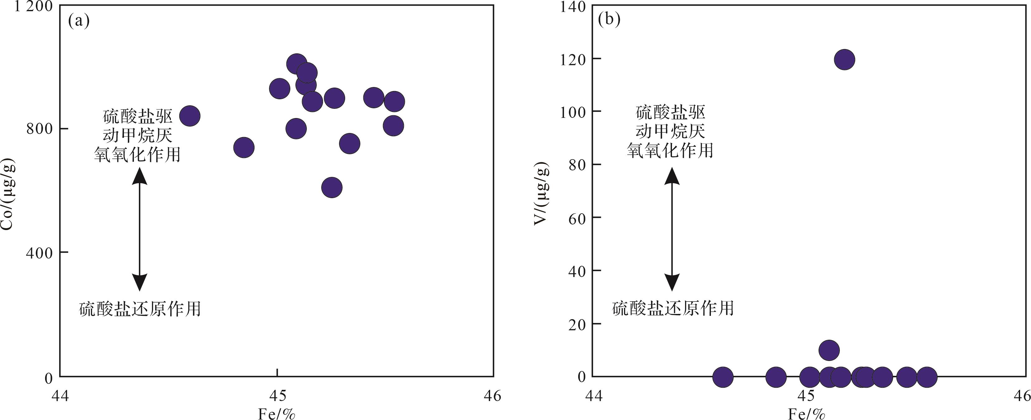
Objective Pyrite is widely developed in the organic-rich strata of the Lower Silurian in the Sichuan Basin. However, its formation mechanism and how it influenced the climatic transition during the Early Silurian remain poorly understood. Methods In this study, the Longmaxi Formation in the Wanhe section, located in southwestern Sichuan province, was selected for analysis of the depositional and diagenetic processes using sedimentological, mineralogical and geochemical methods. The study also evaluated the formation mechanism of pyrite in a carbonate lenticle found in the Longmaxi Formation, which reveals the influences of early diagenesis on the changes of climate at the time. Results The high Corg/P ratios, high UEF and VEF values in the black shales in the Longmaxi Formation indicated that they were mainly deposited in euxinic water conditions. The organic matter in the sediments was anaerobically oxidized by microbial sulfate reduction (MSR) due to the anoxia of waters above the water⁃rock interface. Conclusions The sulfate-driven anaerobic oxidation of methane (SD-AOM) resulted in the precipitation of euhedral pyrite with high Co content and high δ34Spyr values (>10‰) and low V content. The influence of thermochemical sulfate reduction (TSR) in late diagenesis on the formation of pyrite in the study areas will require further investigation. Given that methane is a greenhouse gas, the study suggests that the release of methane during early diagenesis influenced hydrochemical conditions in the seawater and/or the warming climate in the Early Silurian.
Objective Pyrite is widely developed in the organic-rich strata of the Lower Silurian in the Sichuan Basin. However, its formation mechanism and how it influenced the climatic transition during the Early Silurian remain poorly understood. Methods In this study, the Longmaxi Formation in the Wanhe section, located in southwestern Sichuan province, was selected for analysis of the depositional and diagenetic processes using sedimentological, mineralogical and geochemical methods. The study also evaluated the formation mechanism of pyrite in a carbonate lenticle found in the Longmaxi Formation, which reveals the influences of early diagenesis on the changes of climate at the time. Results The high Corg/P ratios, high UEF and VEF values in the black shales in the Longmaxi Formation indicated that they were mainly deposited in euxinic water conditions. The organic matter in the sediments was anaerobically oxidized by microbial sulfate reduction (MSR) due to the anoxia of waters above the water⁃rock interface. Conclusions The sulfate-driven anaerobic oxidation of methane (SD-AOM) resulted in the precipitation of euhedral pyrite with high Co content and high δ34Spyr values (>10‰) and low V content. The influence of thermochemical sulfate reduction (TSR) in late diagenesis on the formation of pyrite in the study areas will require further investigation. Given that methane is a greenhouse gas, the study suggests that the release of methane during early diagenesis influenced hydrochemical conditions in the seawater and/or the warming climate in the Early Silurian.
2026, 44(5): 1699-1717.
doi: 10.14027/j.issn.1000-0550.2025.040
Abstract:
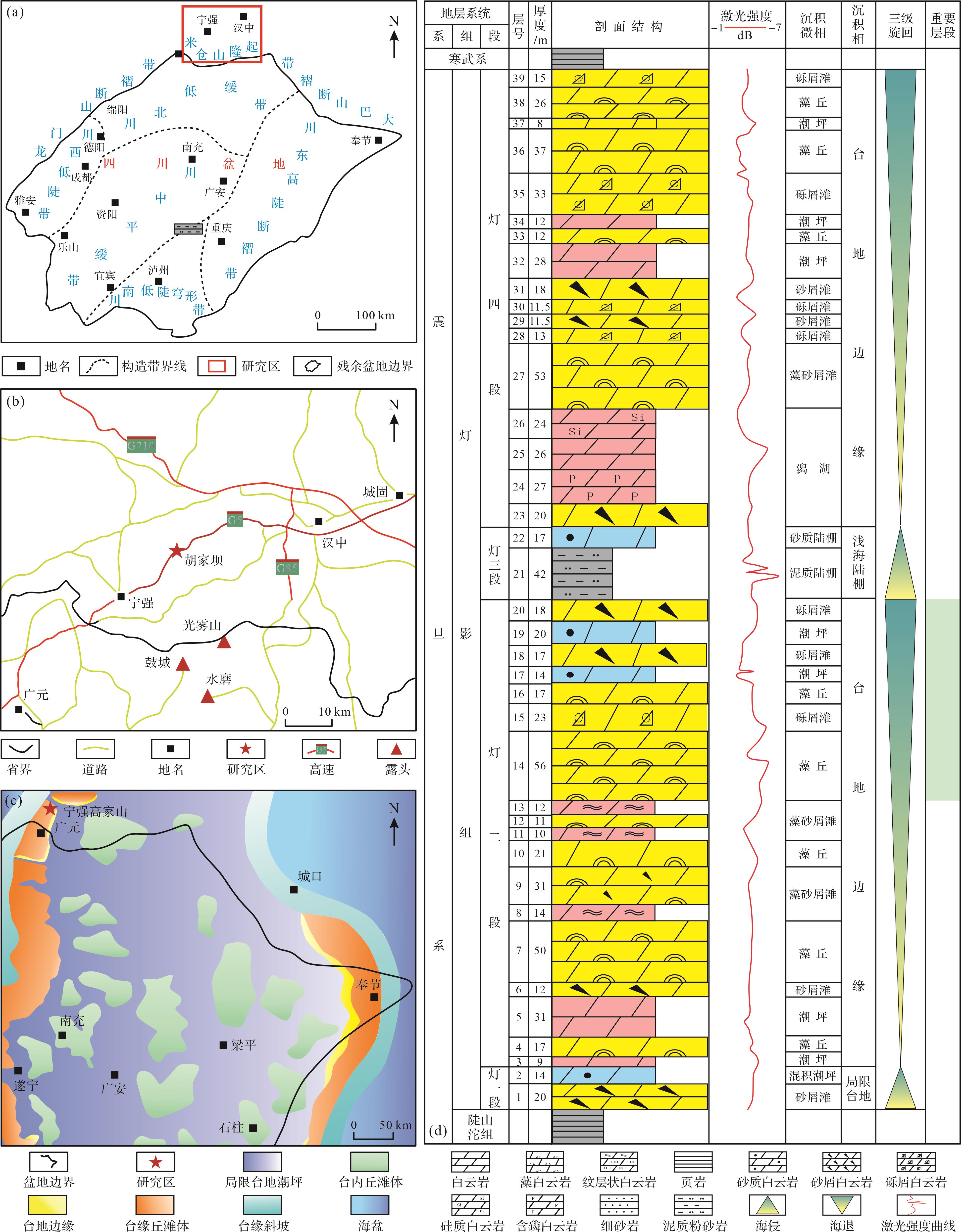
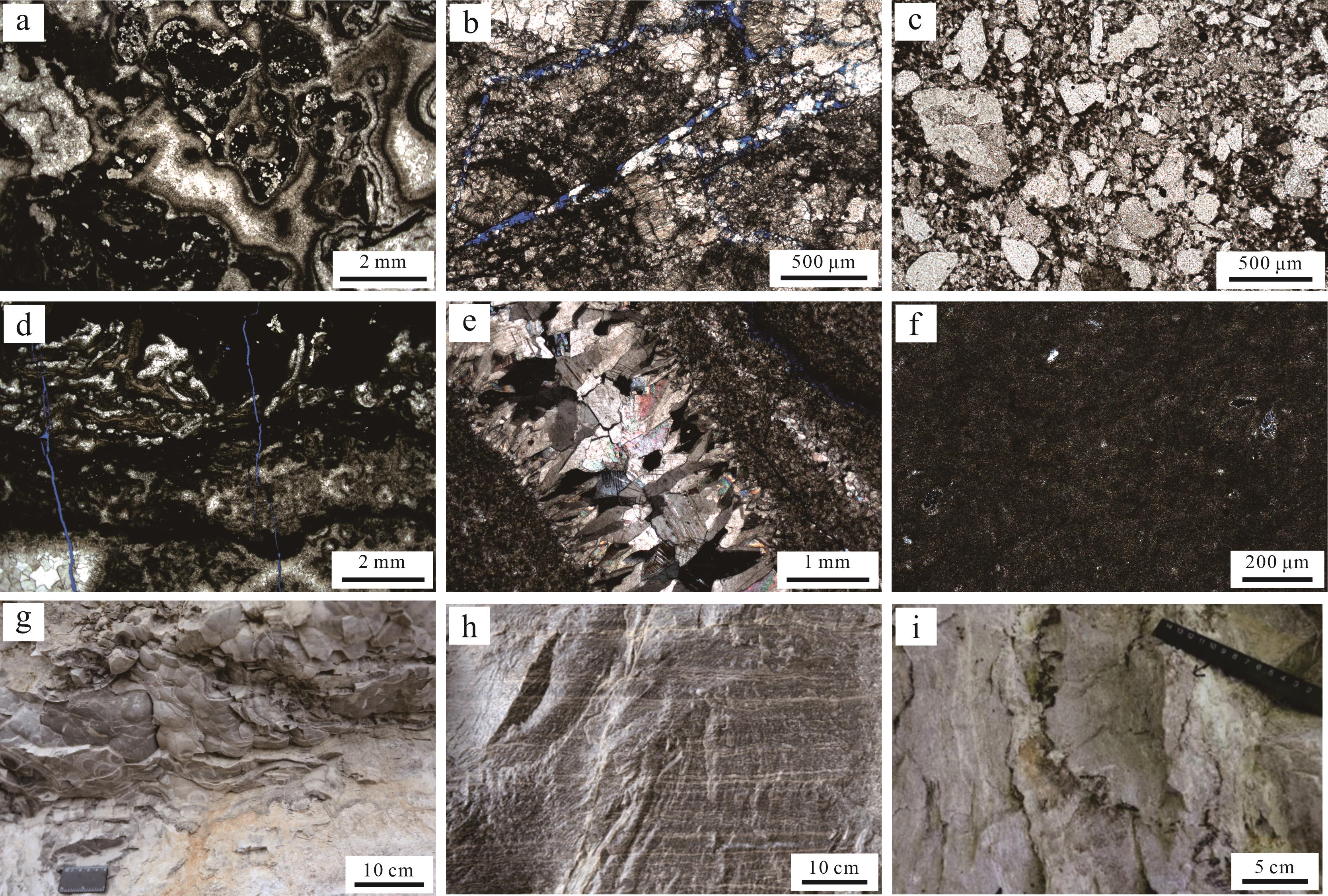
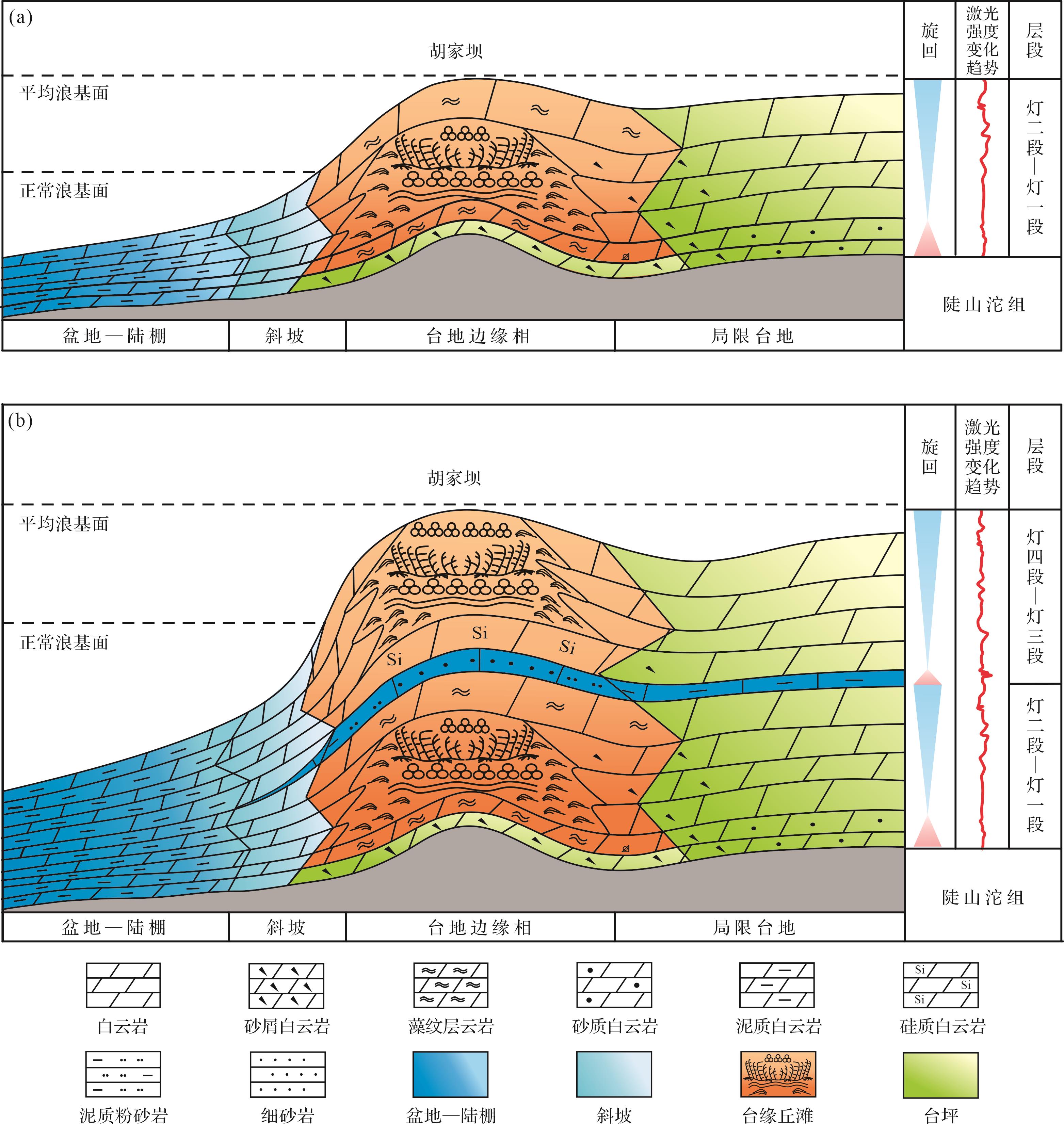
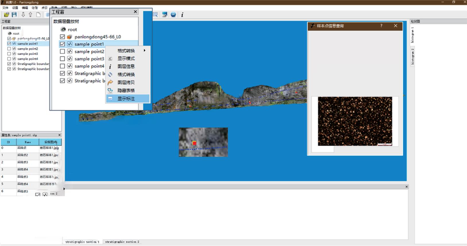
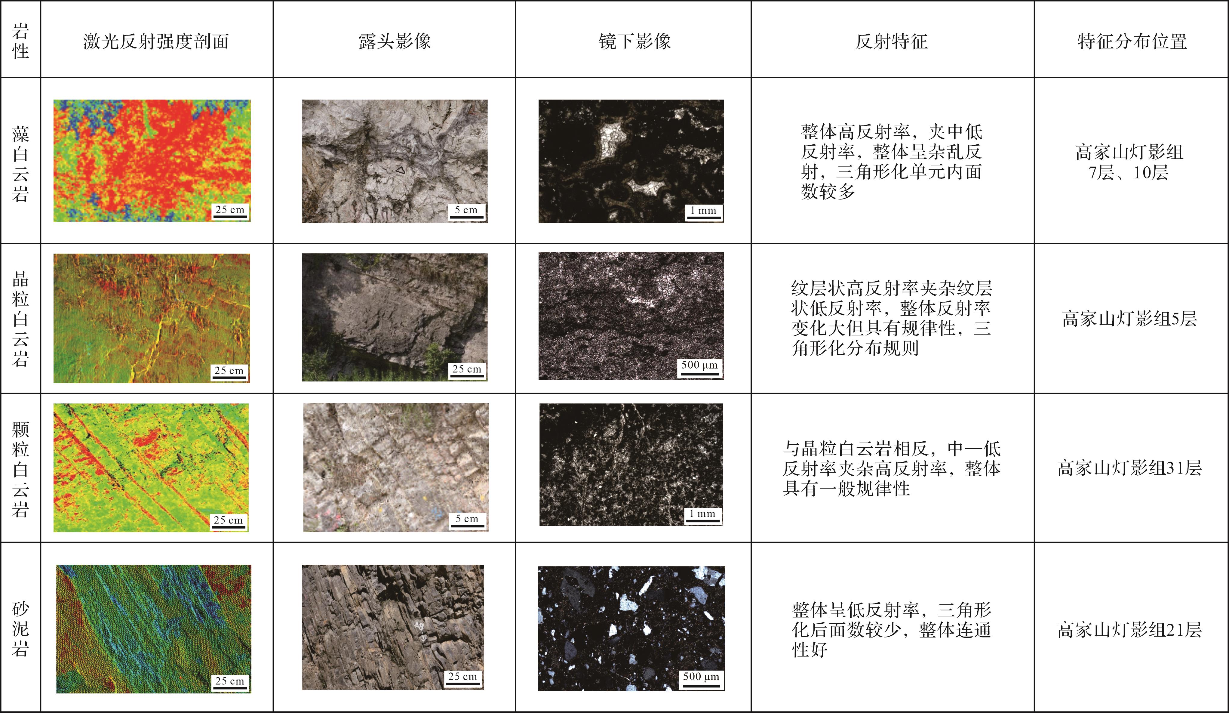
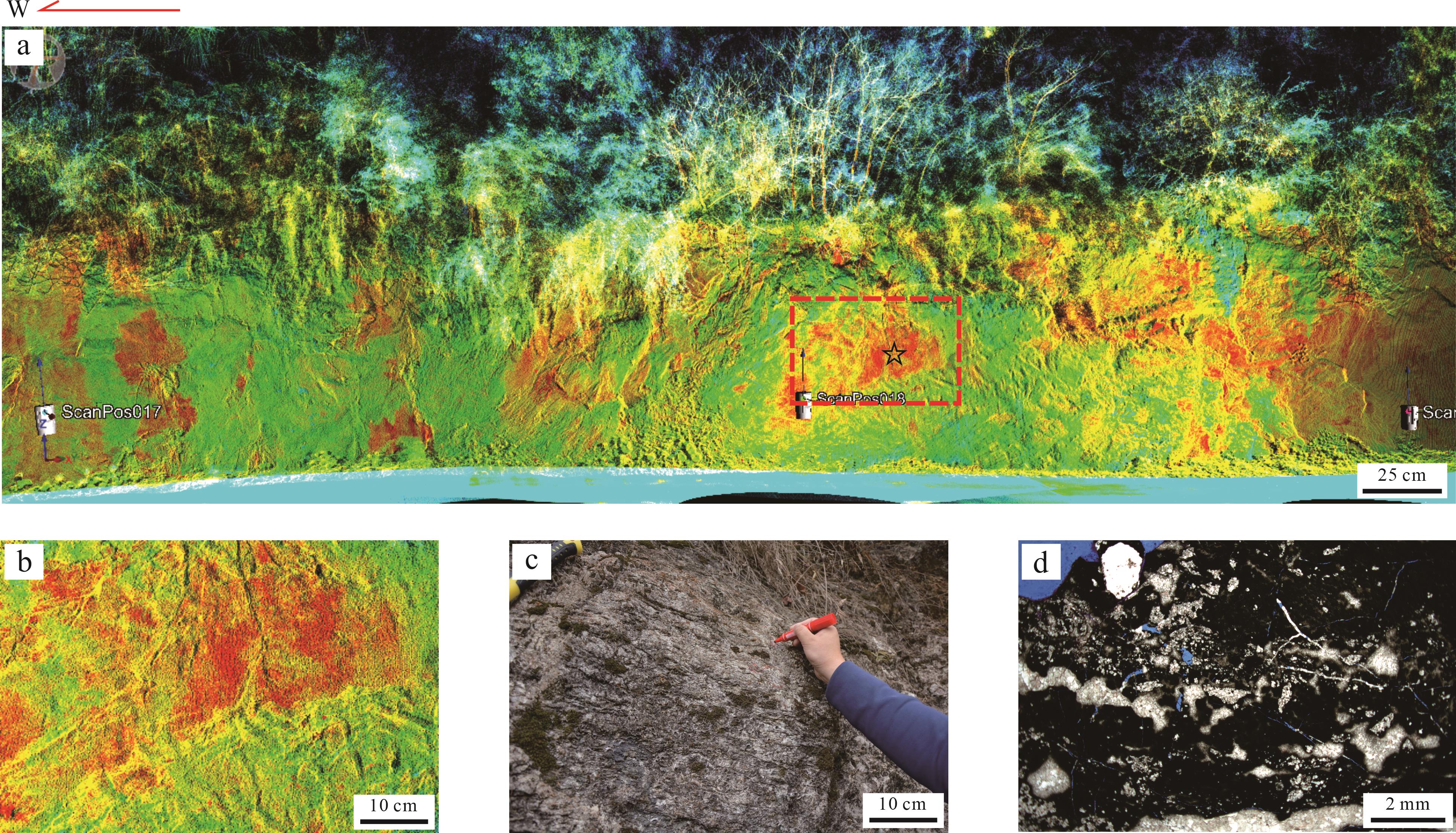
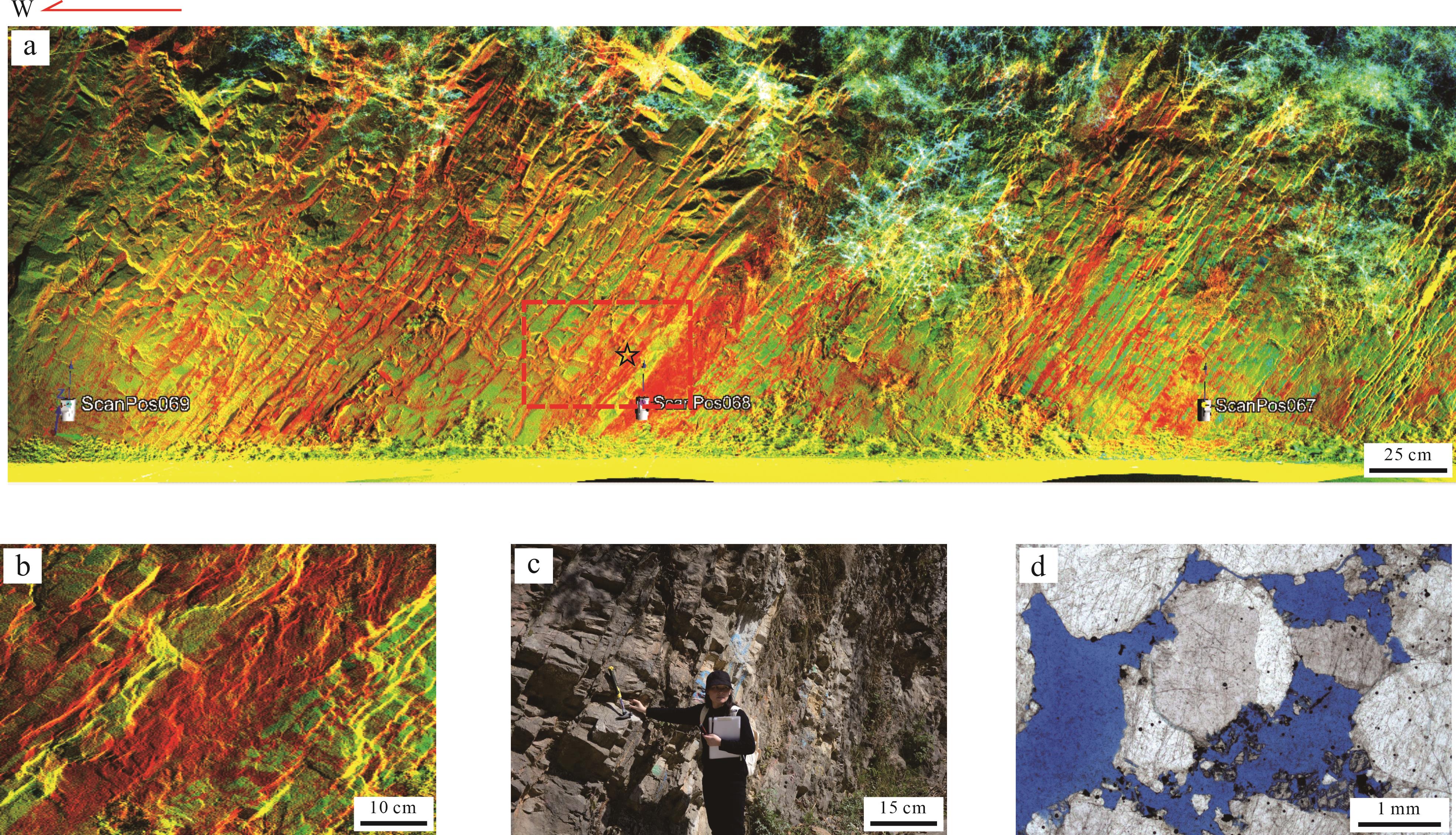
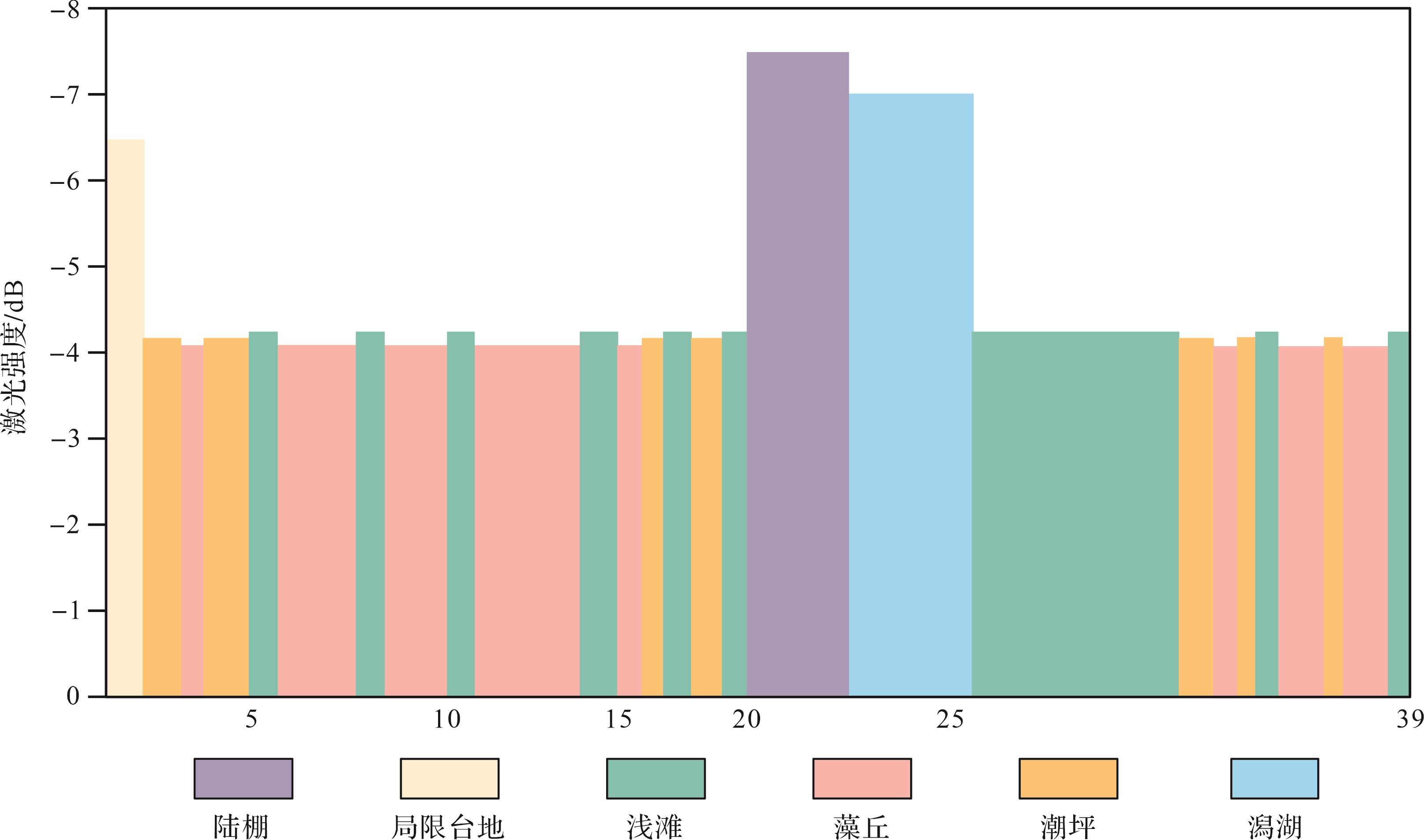
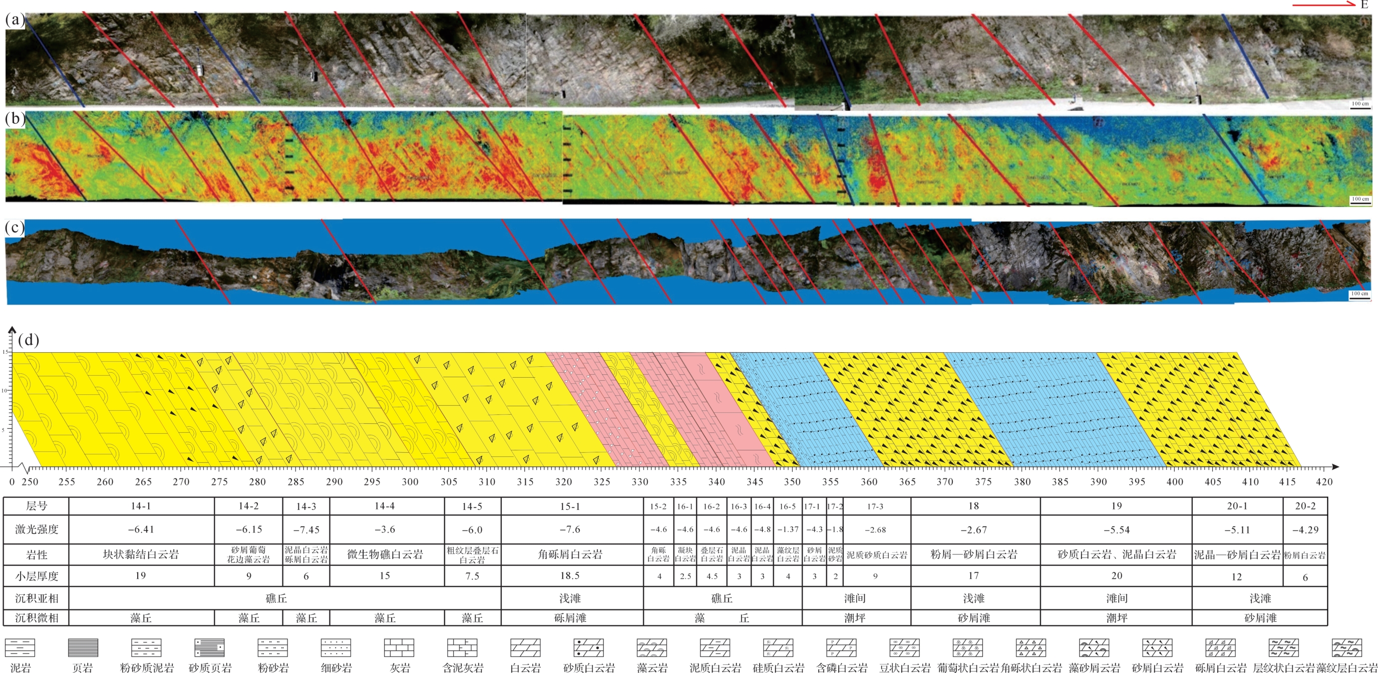
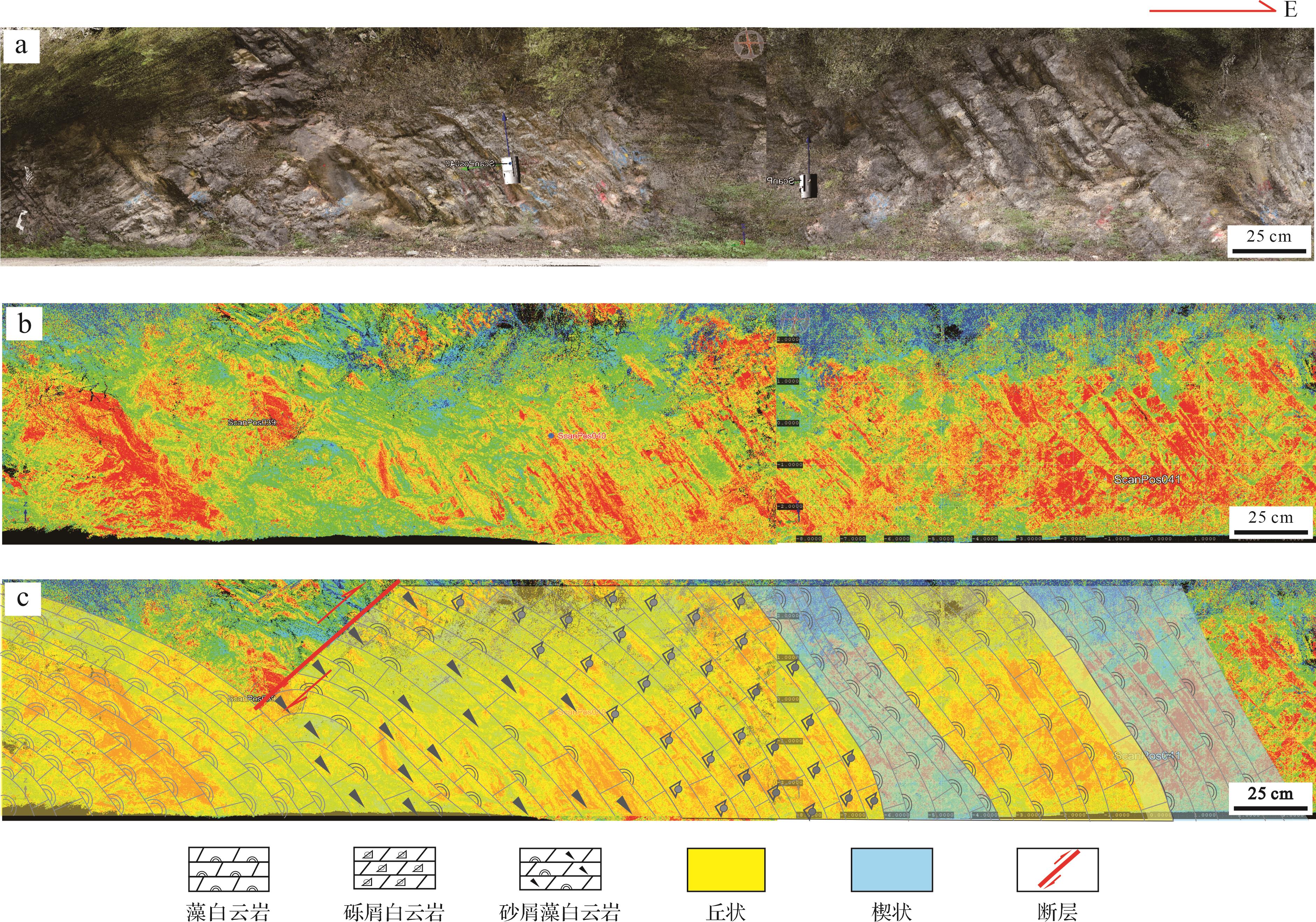
Objective Carbonate outcrops are often affected by tectonic fragmentation, weathering and vegetation cover, making it difficult to obtain complete and precise sedimentary and reservoir characteristics by traditional field survey methods. This study introduces terrestrial laser scanning (TLS) to address the challenges in high-resolution characterization of carbonate outcrops, improve lithofacies recognition accuracy and explore the applicability of the method in sedimentological and reservoir studies. Methods Taking the Gaojiashan section of the Dengying Formation in Ningqiang, Shaanxi as an example, high-precision point cloud data were acquired using TLS, and laser intensity information was analyzed quantitatively and qualitatively. Three-dimensional digital outcrop models were constructed using point cloud modeling and texture mapping. Combined with thin-section petrography, rock property physical tests and field sedimentological investigations, lithofacies recognition, sedimentary facies classification and depositional model reconstruction were carried out. Results (1) A high-resolution digital outcrop model was established, which enables full-coverage 3D visualization and interactive analysis of the outcrop, allowing geological features such as lithology and stratigraphic geometry to be accurately preserved and studied. (2) A lithology-identification chart was established to constrain the laser-intensity signatures and thickness proportions of each lithological type. Algal dolostone and crystalline dolostone generally occupy the high-intensity domain and are associated with relatively higher porosity and permeability, whereas micritic and argillaceous dolostones correspond to low-intensity values and exhibit poorer petrophysical properties. (3) Using the upper submember of the Second member of the Dengying Formation as an example, sublayer division was refined based on laser intensity, and the geometric characteristics of the 14th sublayer were intensively characterized. Analysis of depositional patterns indicated that variations in laser intensity are closely related to sea-level fluctuations, revealing cyclic depositional evolution. Conclusions The integration of TLS with traditional geological methods provides an intuitive representation of carbonate outcrop features and effectively preserves primary field data. The digital outcrop model established in this study offers valuable data support for hydrocarbon exploration and reservoir evaluation, demonstrating the broad prospects and significant potential of TLS applications in geological research.
Objective Carbonate outcrops are often affected by tectonic fragmentation, weathering and vegetation cover, making it difficult to obtain complete and precise sedimentary and reservoir characteristics by traditional field survey methods. This study introduces terrestrial laser scanning (TLS) to address the challenges in high-resolution characterization of carbonate outcrops, improve lithofacies recognition accuracy and explore the applicability of the method in sedimentological and reservoir studies. Methods Taking the Gaojiashan section of the Dengying Formation in Ningqiang, Shaanxi as an example, high-precision point cloud data were acquired using TLS, and laser intensity information was analyzed quantitatively and qualitatively. Three-dimensional digital outcrop models were constructed using point cloud modeling and texture mapping. Combined with thin-section petrography, rock property physical tests and field sedimentological investigations, lithofacies recognition, sedimentary facies classification and depositional model reconstruction were carried out. Results (1) A high-resolution digital outcrop model was established, which enables full-coverage 3D visualization and interactive analysis of the outcrop, allowing geological features such as lithology and stratigraphic geometry to be accurately preserved and studied. (2) A lithology-identification chart was established to constrain the laser-intensity signatures and thickness proportions of each lithological type. Algal dolostone and crystalline dolostone generally occupy the high-intensity domain and are associated with relatively higher porosity and permeability, whereas micritic and argillaceous dolostones correspond to low-intensity values and exhibit poorer petrophysical properties. (3) Using the upper submember of the Second member of the Dengying Formation as an example, sublayer division was refined based on laser intensity, and the geometric characteristics of the 14th sublayer were intensively characterized. Analysis of depositional patterns indicated that variations in laser intensity are closely related to sea-level fluctuations, revealing cyclic depositional evolution. Conclusions The integration of TLS with traditional geological methods provides an intuitive representation of carbonate outcrop features and effectively preserves primary field data. The digital outcrop model established in this study offers valuable data support for hydrocarbon exploration and reservoir evaluation, demonstrating the broad prospects and significant potential of TLS applications in geological research.
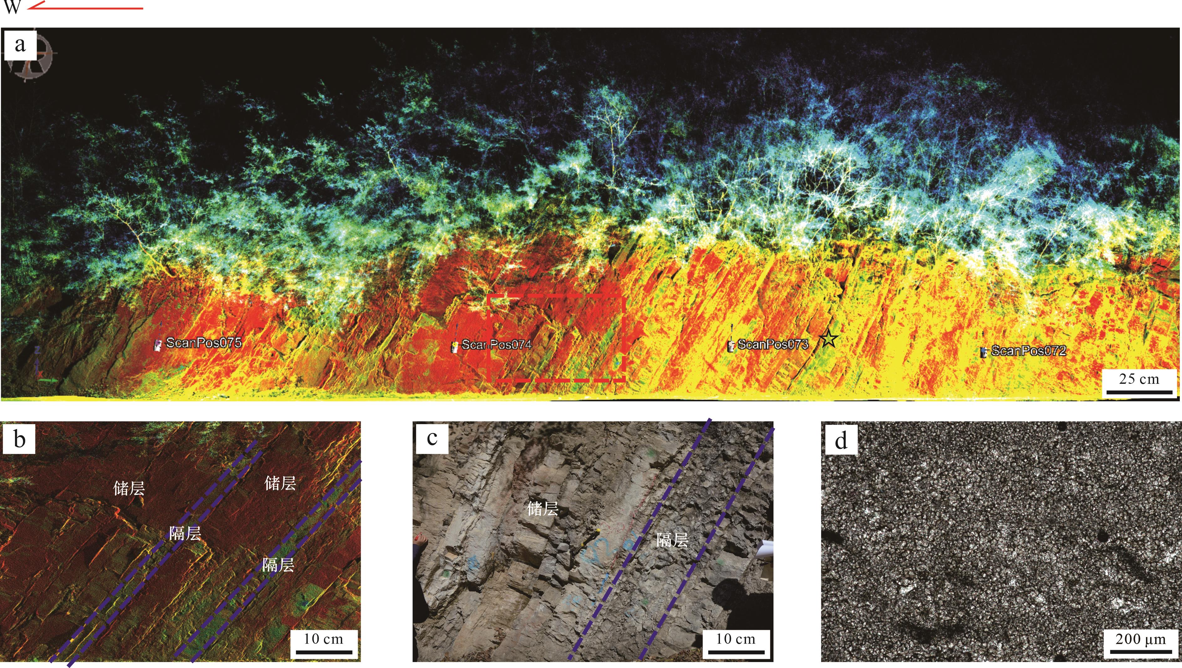
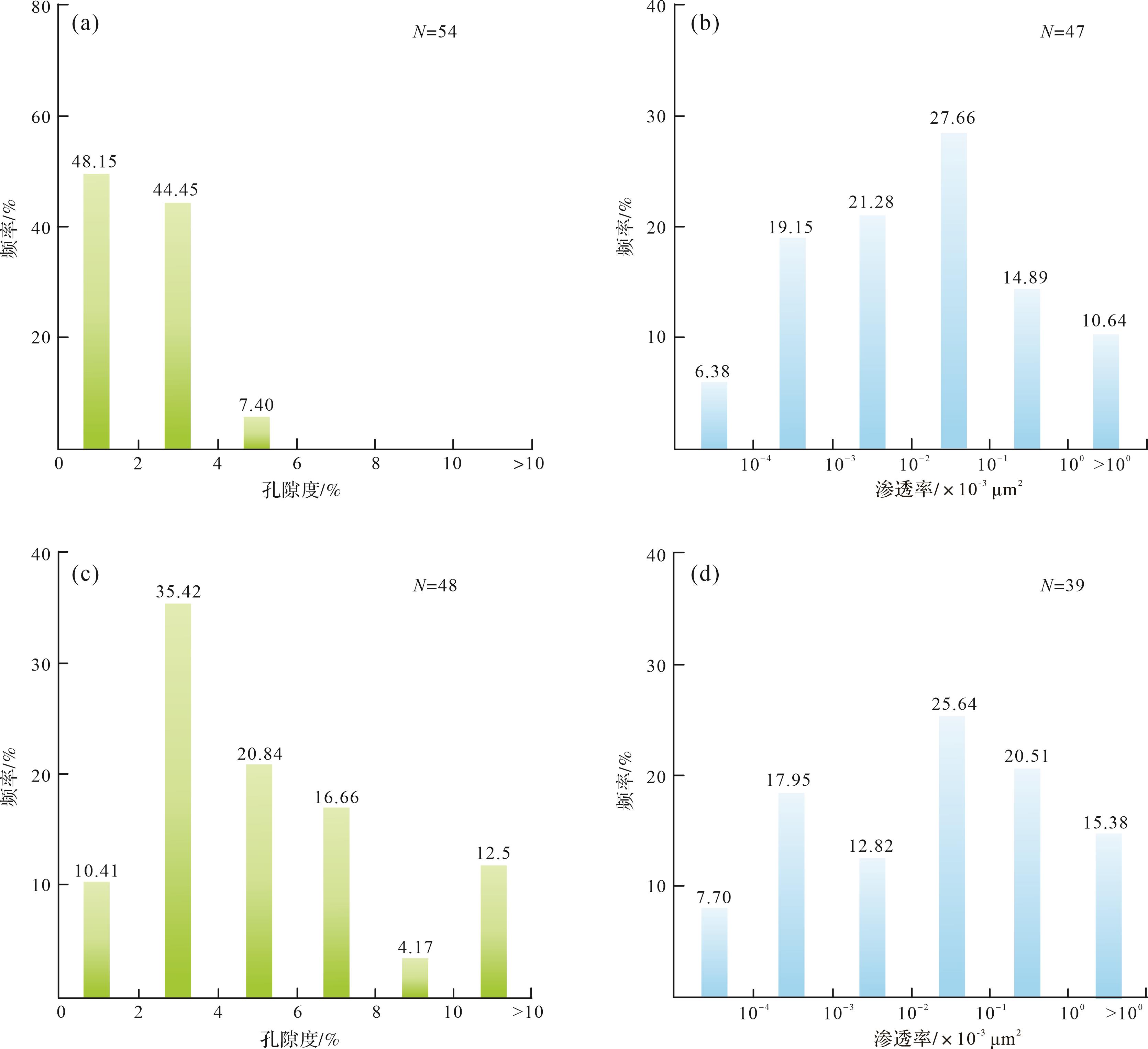
2026, 44(5): 1718-1731.
doi: 10.14027/j.issn.1000-0550.2025.042
Abstract:
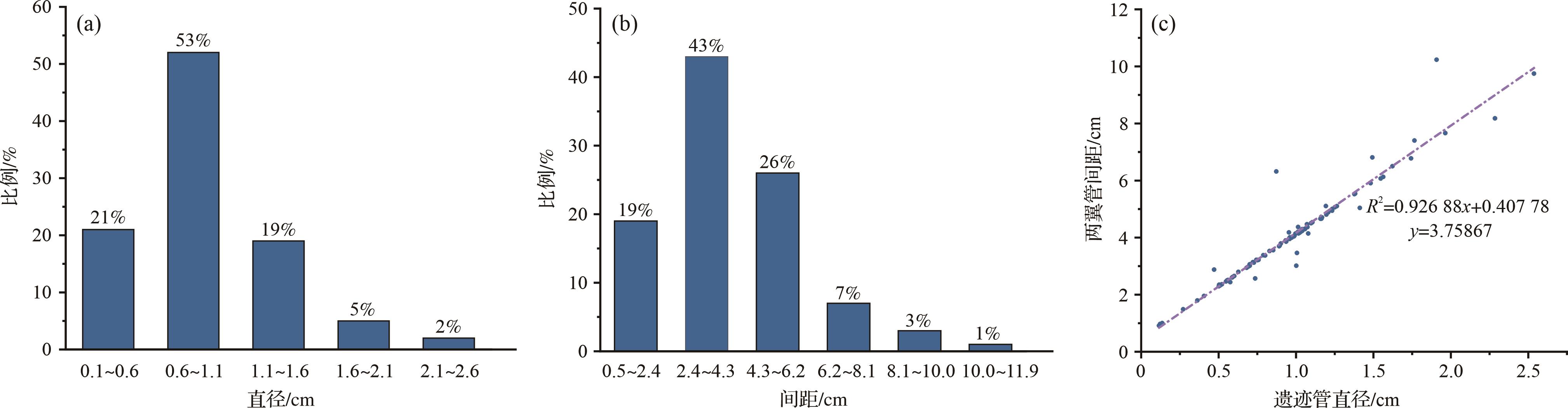
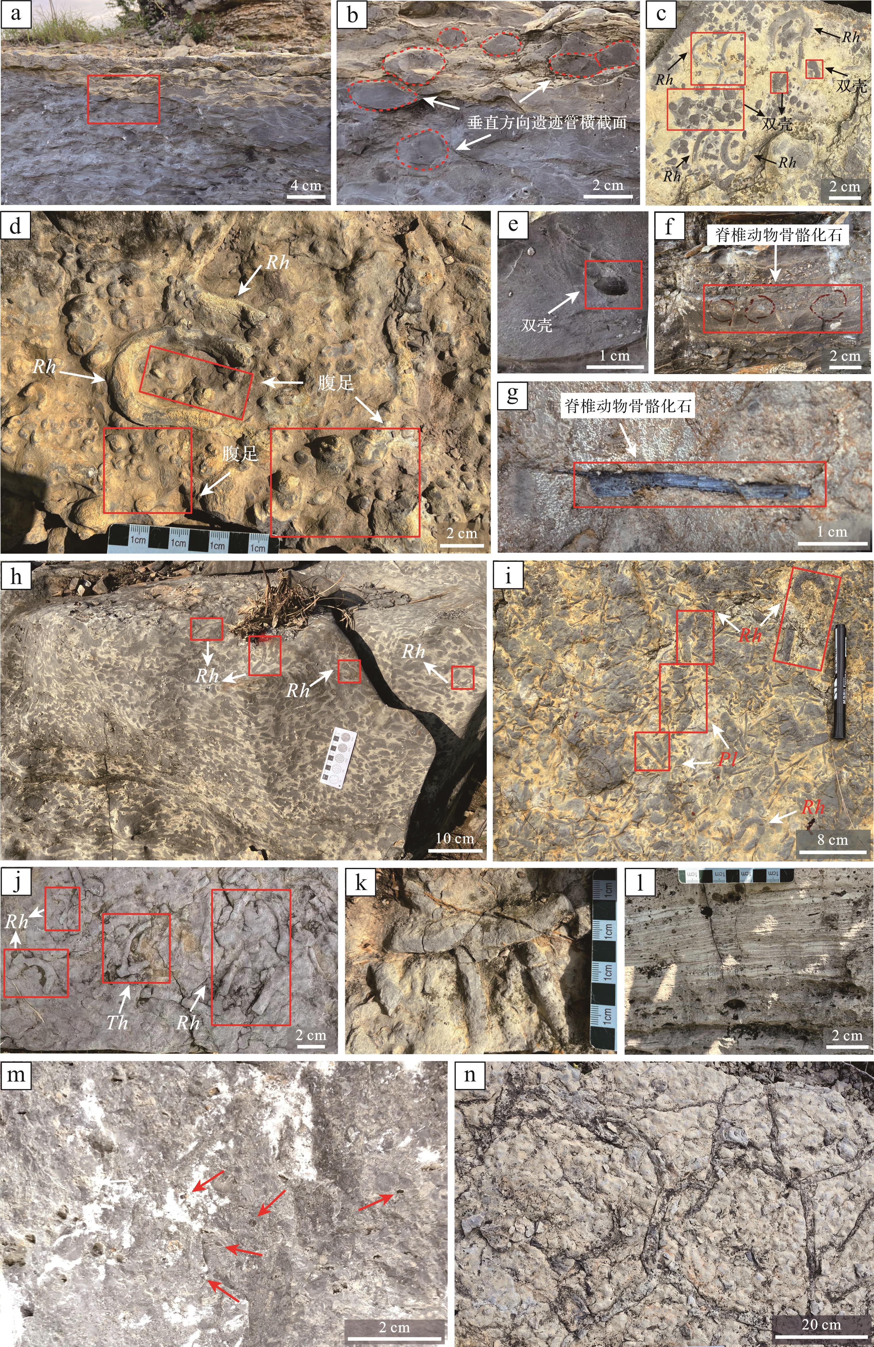
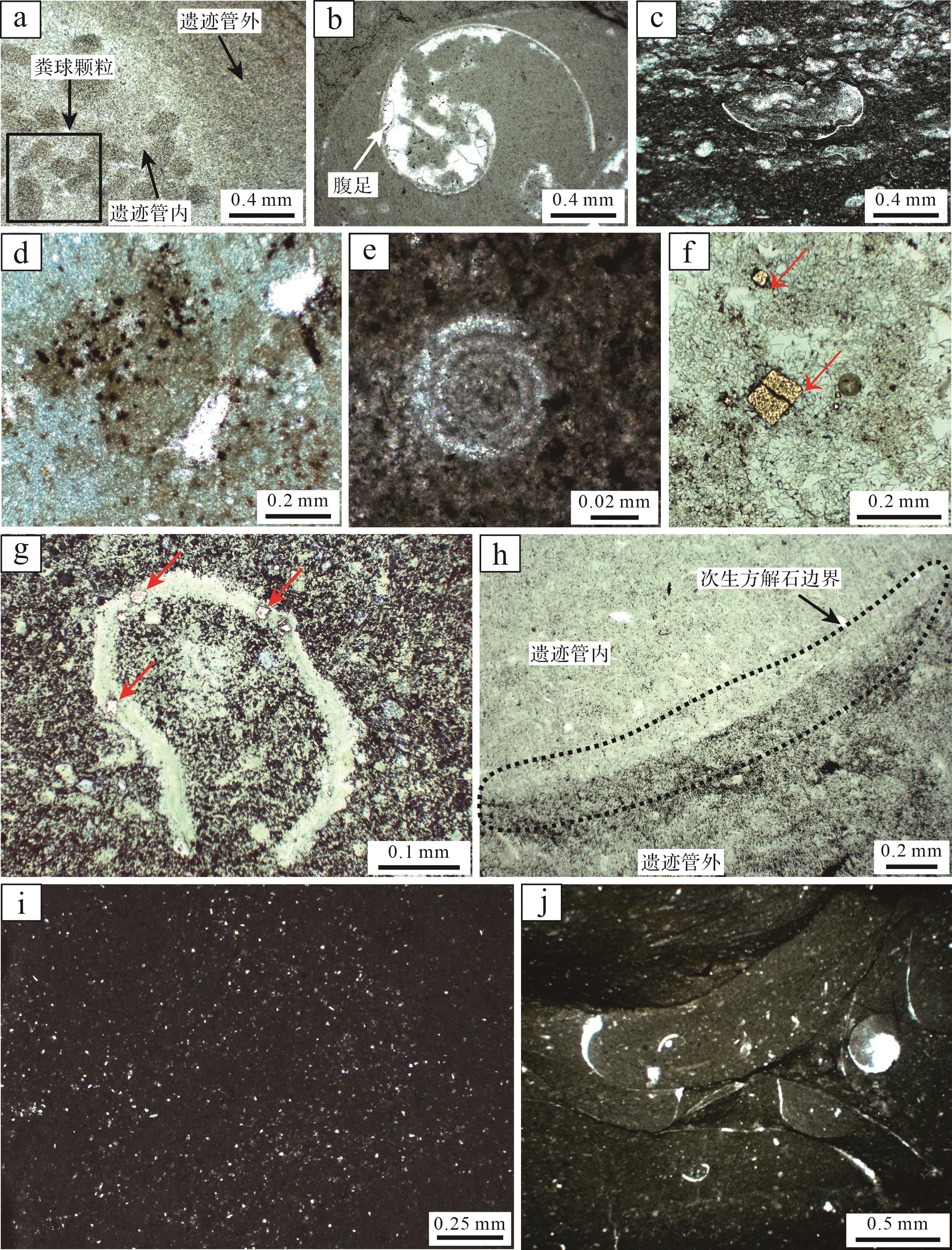
Objective The Rhizocorallium trace fossils in this study are notably well-developed and well-preserved, and therefore offer substantial research potential. The morphological composition and structural features of Rhizocorallium burrows were analyzed to elucidate the formation mechanisms of the burrow system, and the behavioral patterns of the trace-making organisms and their significance as indicators of paleosedimentary environments were clarified. Methods A total of 99 U-shaped burrows were measured to determine marginal tube diameters and burrow widths, and linear regression correlation analyses were performed to evaluate the relationship between the two variables. Building upon existing ichnological literature, a comprehensive investigation was undertaken to describe the morphology, formation mechanisms and behavior of the trace-making organisms responsible for Rhizocorallium burrows. Se-condary structures such as linear crawling trails were also identified and their spatial and functional relationships with the primary U-shaped foraging traces were evaluated. The bioturbation index (BI) was employed to quantify the extent of sediment disturbance caused by Rhizocorallium-making organisms, and lithological data was integrated with trace fossil assemblages in the Guanling Formation to develop a detailed paleoenvironmental reconstruction of their habitat preferences. Additionally, systematic paleontological analyses of trace fossil assemblages from the lower stratigraphic member were undertaken alongside examinations of body fossils from the upper member to assess biological differentiation patterns and the complexity of trophic structures throughout the depositional sequence. Results (1) The fundamental architecture of Rhizocorallium consists of U-shaped and linear burrows. Most U-shaped burrows feature a curved marginal tube enclosing spreiten lamellae and are interpreted as feeding traces generated during foraging activities, constituting the primary structural component. Linear burrows, occurring in both single and double forms, are considered to be crawling trails formed during locomotion, and represent secondary structures. (2) Marginal tube diameters of U-shaped burrows range from 0.1 cm to 2.6 cm, while burrow widths vary between 0.5 cm and 11.9 cm. These parameters exhibit a strong positive correlation (R² = 0.926 88), indicating that the behavioral patterns of the trace-making organisms remained consistent throughout ontogenetic development from larval to adult stages. This behavioral consistency aligns with an r-selected survival strategy typical of opportunistic species. Directional foraging and burrowing behaviors are maintained as core survival strategies, with burrow systems expanding proportionally with individual growth. Moreover, a subset of very small burrows is interpreted as juvenile forms of Rhizocorallium trace fossils. (3) The lower member of the Guanling Formation, primarily consisting of bioclastic limestone and micritic limestone, exhibits abundant assemblages of Rhizocorallium trace fossils, including Planolites, Palaeophycus and Thalassinoides, with bioturbation indices (BI) ranging from 3 to 5. These assemblages are associated with low-diversity trace fossil communities, suggesting deposition within a low-energy, open platform environment. In contrast, the upper member, dominated by bioclastic limestone with sparse occurrences of Rhizocorallium (BI = 1-3) and a highly diverse assemblage of body fossils (e.g., bivalves, gastropods and vertebrate remains) reflects a high-energy intertidal depositional setting. Systematic paleontological investigations have demonstrated an upward progression in biological differentiation throughout the sedimentary sequence, with the paleoecosystem’s trophic structure becoming increasingly complex and approaching a stable, balanced state. Conclusions The morphological characterization and analysis of Rhizocorallium ichnofossils provide insights into the compositional features, formation mechanisms and behavioral stability across ontogenetic stages of the trace-making organisms, indicative of an r-selected reproductive strategy. Furthermore, these traces reveal adaptive responses to environmental variability. Collectively, these results affirm the efficacy of Rhizocorallium as a reliable ichnological proxy for reconstructing paleoecological conditions and paleosedimentary environments.
Objective The Rhizocorallium trace fossils in this study are notably well-developed and well-preserved, and therefore offer substantial research potential. The morphological composition and structural features of Rhizocorallium burrows were analyzed to elucidate the formation mechanisms of the burrow system, and the behavioral patterns of the trace-making organisms and their significance as indicators of paleosedimentary environments were clarified. Methods A total of 99 U-shaped burrows were measured to determine marginal tube diameters and burrow widths, and linear regression correlation analyses were performed to evaluate the relationship between the two variables. Building upon existing ichnological literature, a comprehensive investigation was undertaken to describe the morphology, formation mechanisms and behavior of the trace-making organisms responsible for Rhizocorallium burrows. Se-condary structures such as linear crawling trails were also identified and their spatial and functional relationships with the primary U-shaped foraging traces were evaluated. The bioturbation index (BI) was employed to quantify the extent of sediment disturbance caused by Rhizocorallium-making organisms, and lithological data was integrated with trace fossil assemblages in the Guanling Formation to develop a detailed paleoenvironmental reconstruction of their habitat preferences. Additionally, systematic paleontological analyses of trace fossil assemblages from the lower stratigraphic member were undertaken alongside examinations of body fossils from the upper member to assess biological differentiation patterns and the complexity of trophic structures throughout the depositional sequence. Results (1) The fundamental architecture of Rhizocorallium consists of U-shaped and linear burrows. Most U-shaped burrows feature a curved marginal tube enclosing spreiten lamellae and are interpreted as feeding traces generated during foraging activities, constituting the primary structural component. Linear burrows, occurring in both single and double forms, are considered to be crawling trails formed during locomotion, and represent secondary structures. (2) Marginal tube diameters of U-shaped burrows range from 0.1 cm to 2.6 cm, while burrow widths vary between 0.5 cm and 11.9 cm. These parameters exhibit a strong positive correlation (R² = 0.926 88), indicating that the behavioral patterns of the trace-making organisms remained consistent throughout ontogenetic development from larval to adult stages. This behavioral consistency aligns with an r-selected survival strategy typical of opportunistic species. Directional foraging and burrowing behaviors are maintained as core survival strategies, with burrow systems expanding proportionally with individual growth. Moreover, a subset of very small burrows is interpreted as juvenile forms of Rhizocorallium trace fossils. (3) The lower member of the Guanling Formation, primarily consisting of bioclastic limestone and micritic limestone, exhibits abundant assemblages of Rhizocorallium trace fossils, including Planolites, Palaeophycus and Thalassinoides, with bioturbation indices (BI) ranging from 3 to 5. These assemblages are associated with low-diversity trace fossil communities, suggesting deposition within a low-energy, open platform environment. In contrast, the upper member, dominated by bioclastic limestone with sparse occurrences of Rhizocorallium (BI = 1-3) and a highly diverse assemblage of body fossils (e.g., bivalves, gastropods and vertebrate remains) reflects a high-energy intertidal depositional setting. Systematic paleontological investigations have demonstrated an upward progression in biological differentiation throughout the sedimentary sequence, with the paleoecosystem’s trophic structure becoming increasingly complex and approaching a stable, balanced state. Conclusions The morphological characterization and analysis of Rhizocorallium ichnofossils provide insights into the compositional features, formation mechanisms and behavioral stability across ontogenetic stages of the trace-making organisms, indicative of an r-selected reproductive strategy. Furthermore, these traces reveal adaptive responses to environmental variability. Collectively, these results affirm the efficacy of Rhizocorallium as a reliable ichnological proxy for reconstructing paleoecological conditions and paleosedimentary environments.
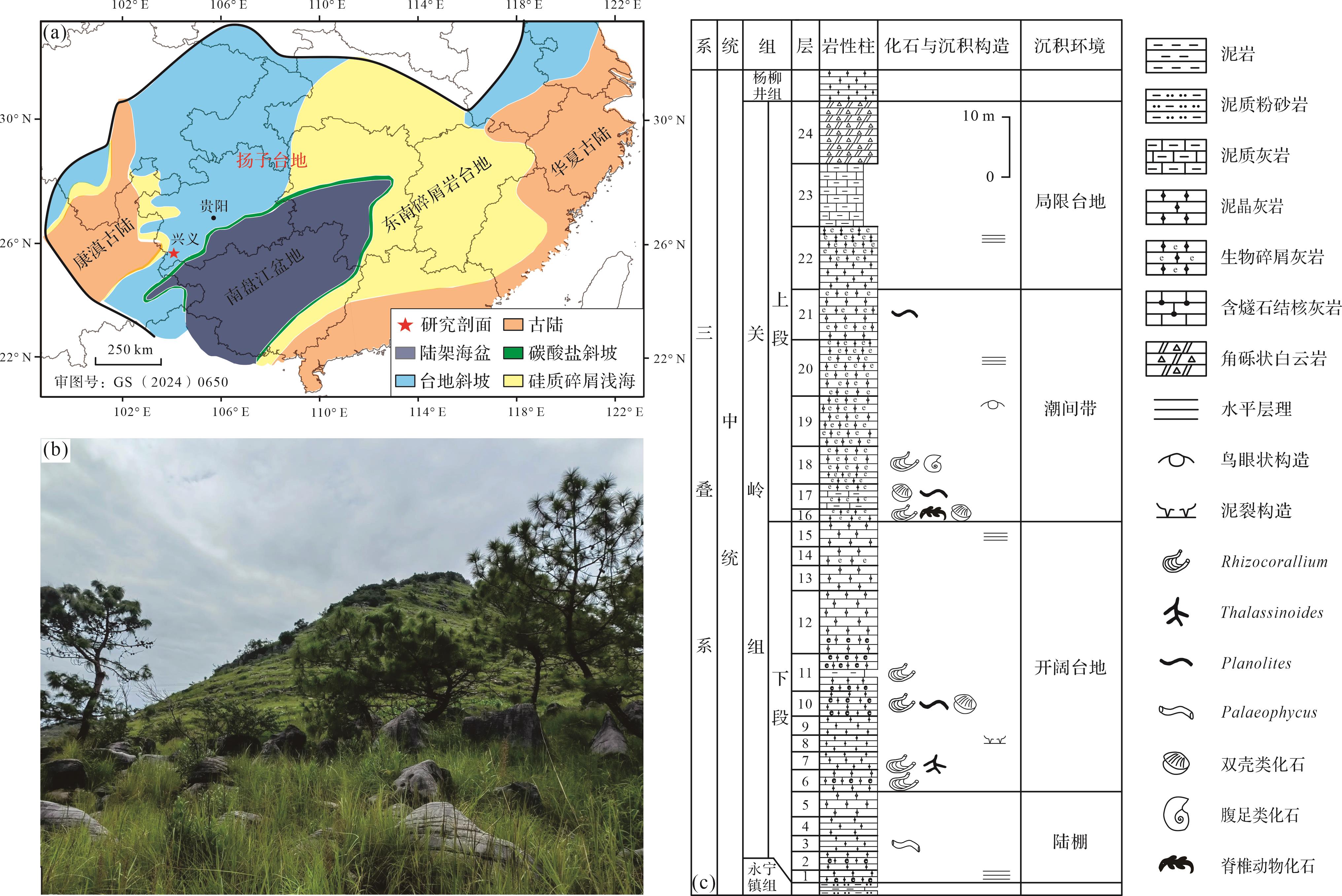
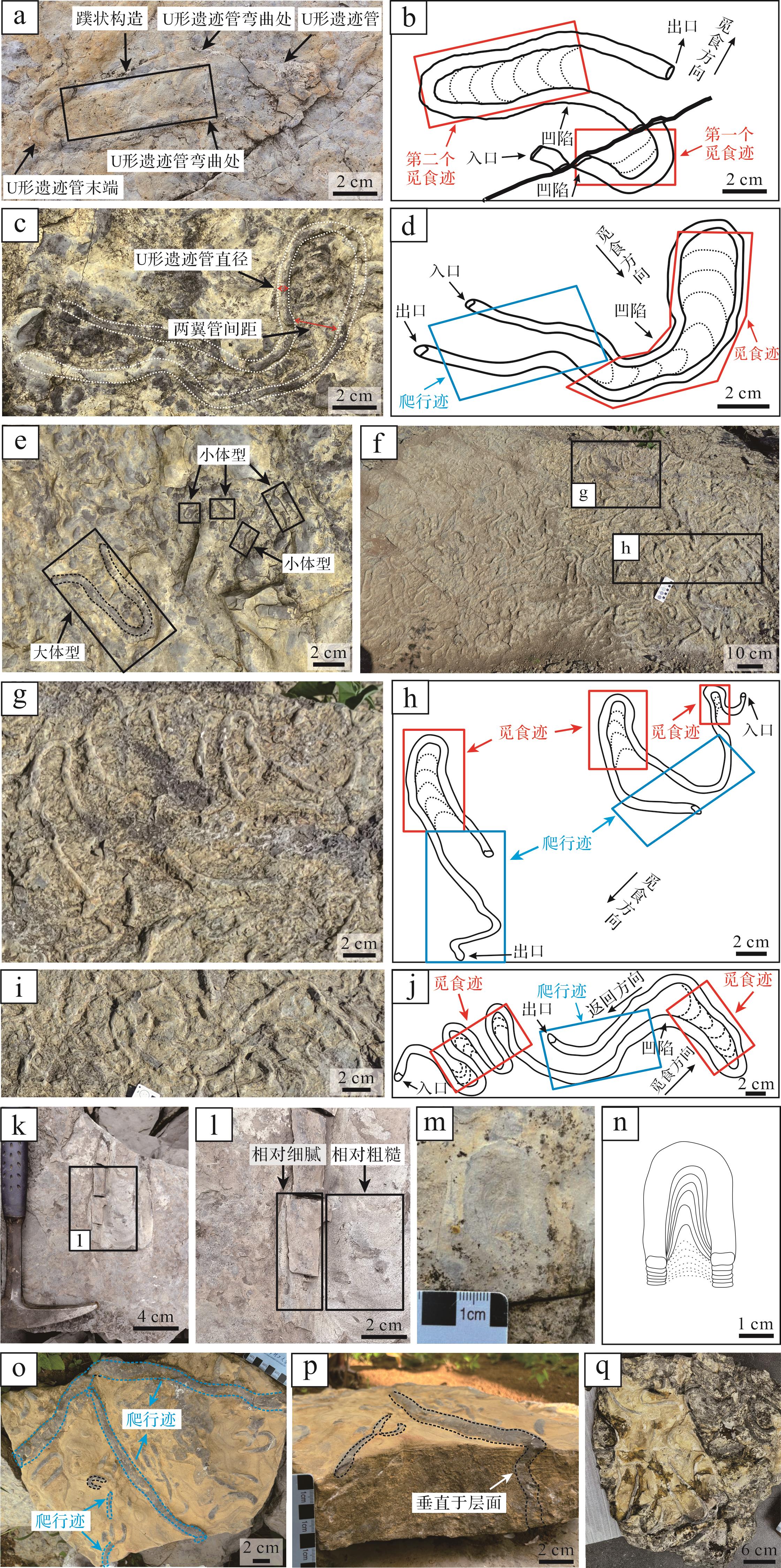
2026, 44(5): 1732-1757.
doi: 10.14027/j.issn.1000-0550.2025.035
Abstract:
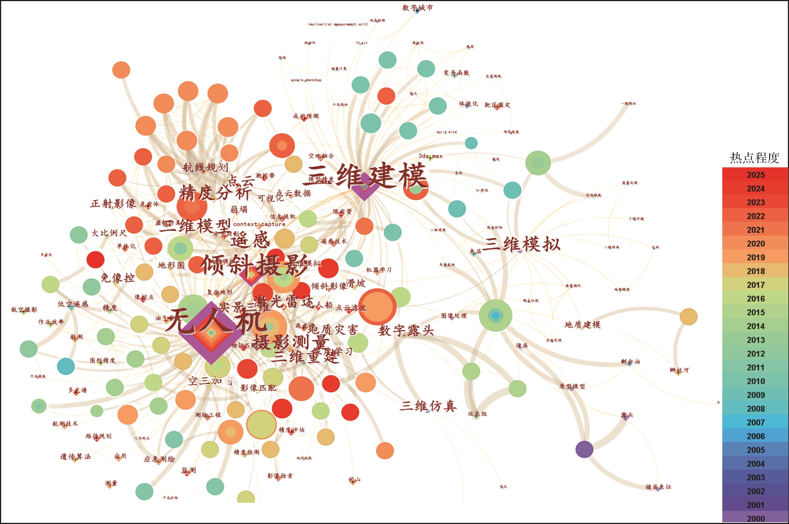
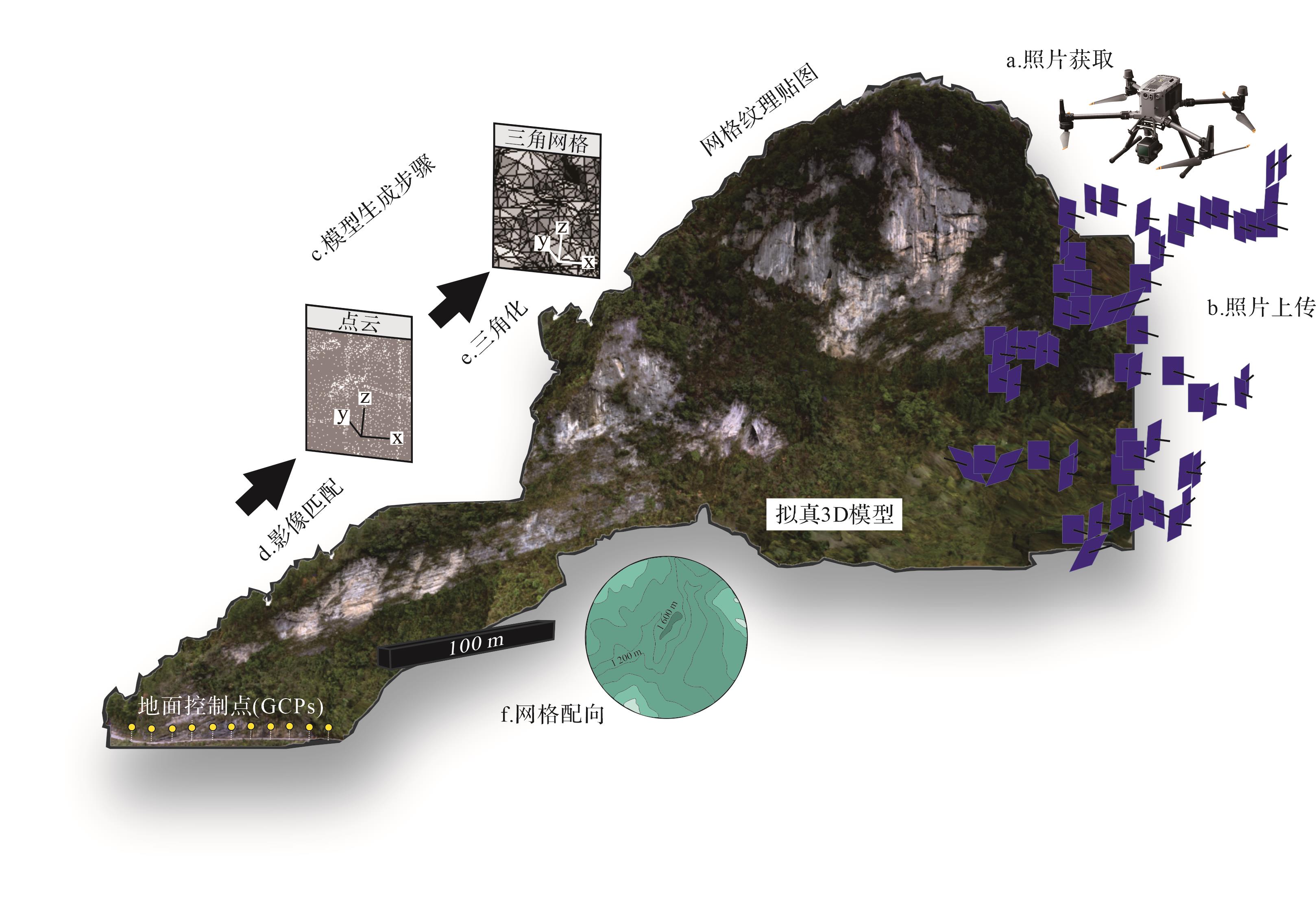
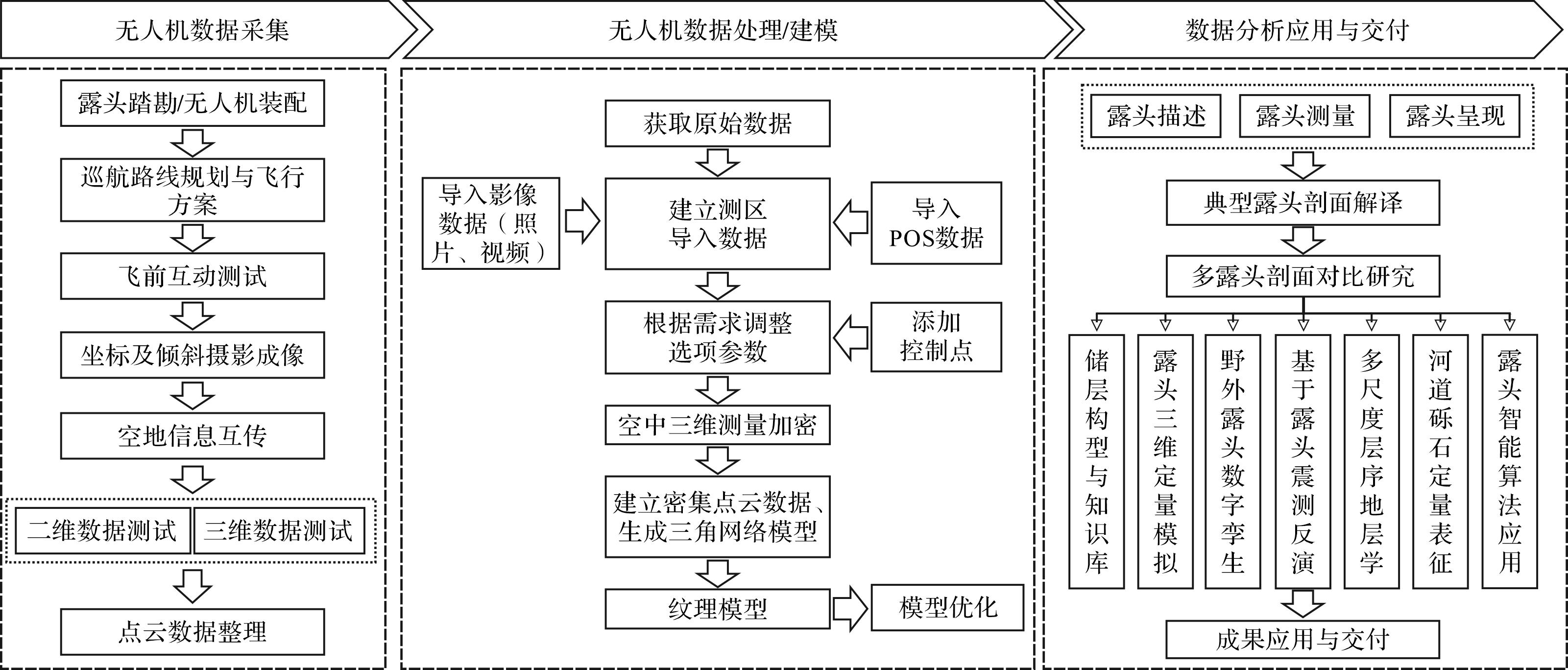
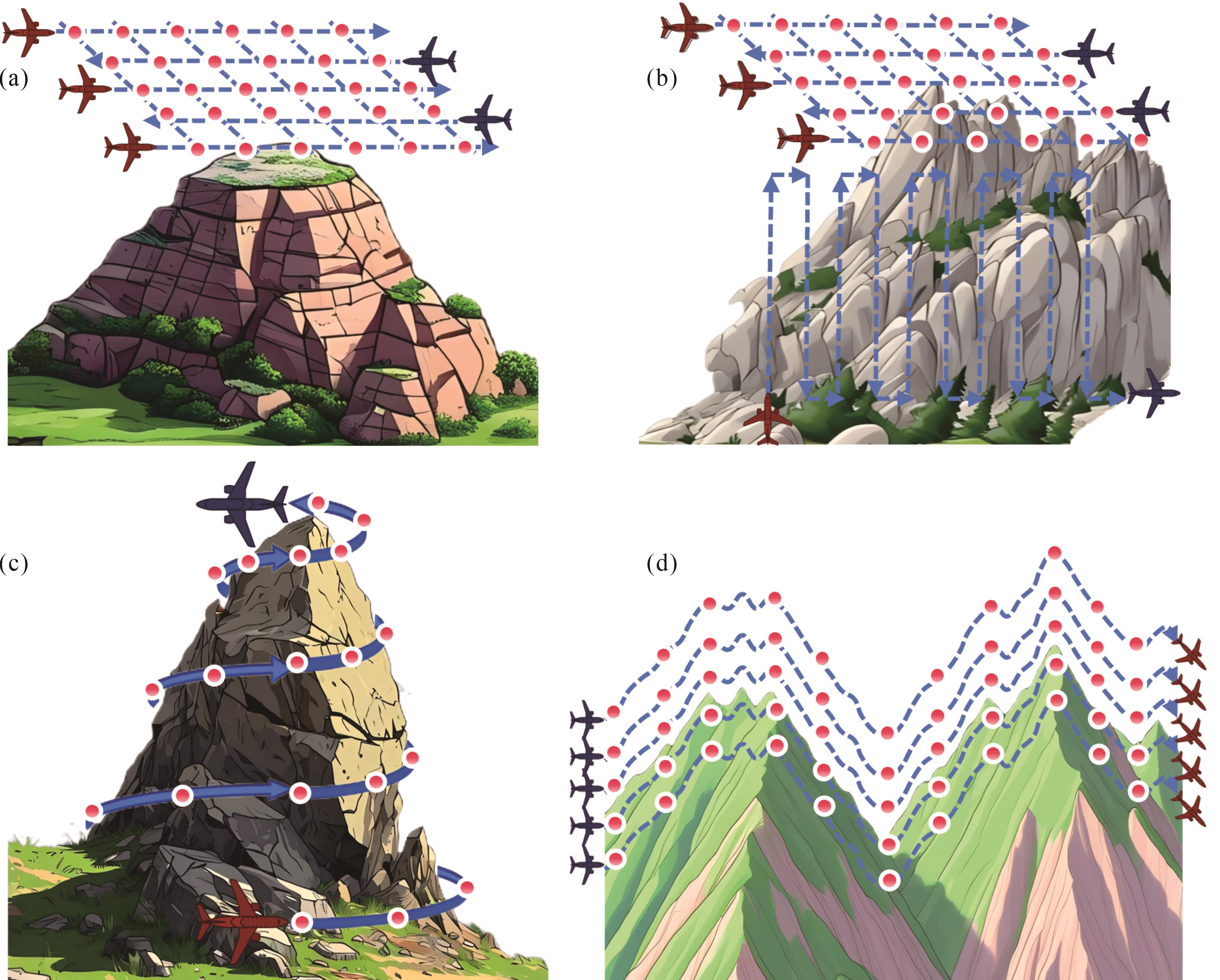
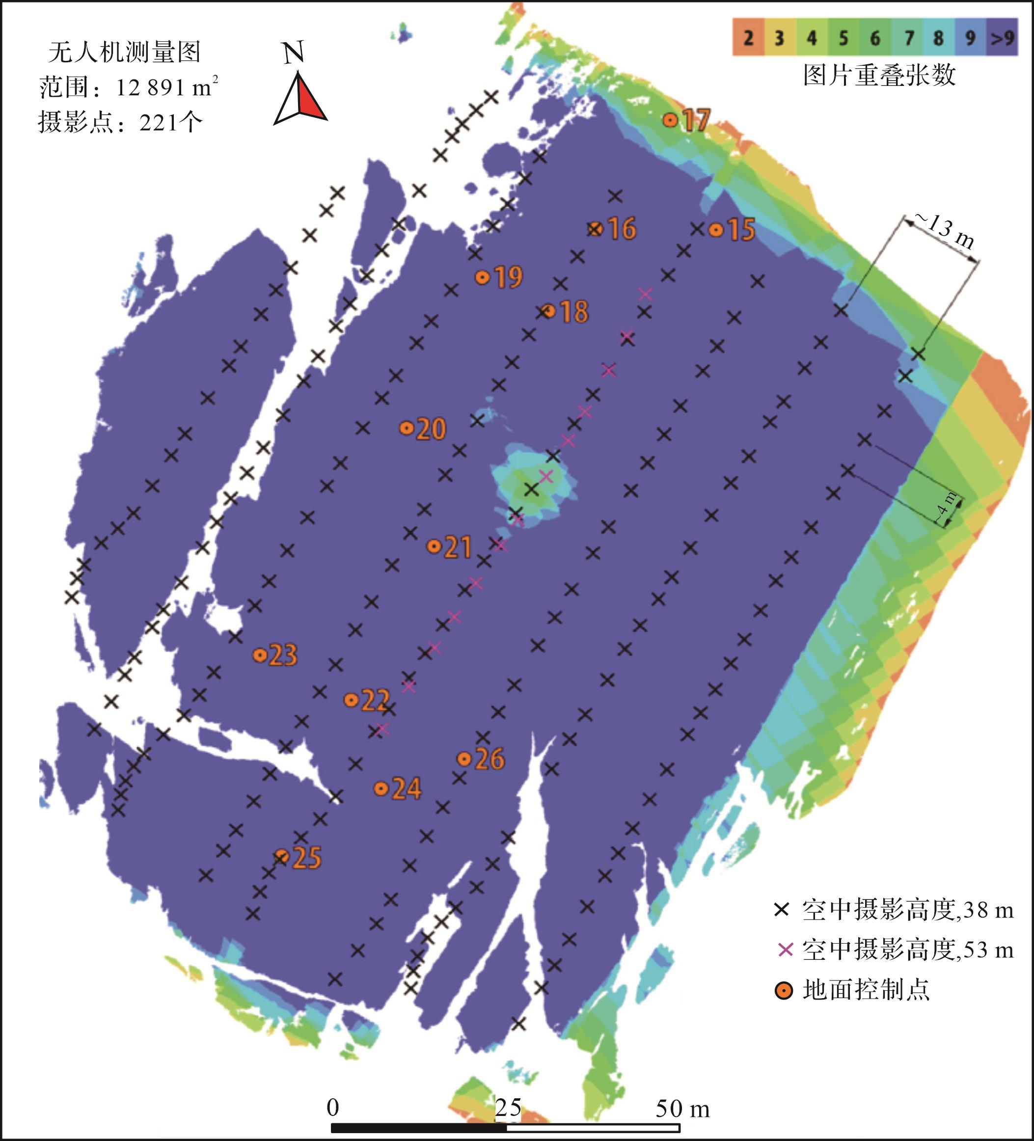
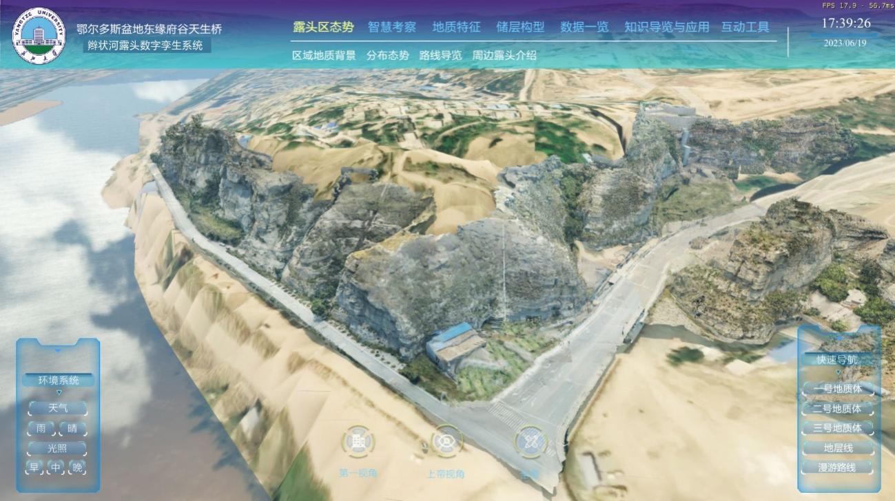
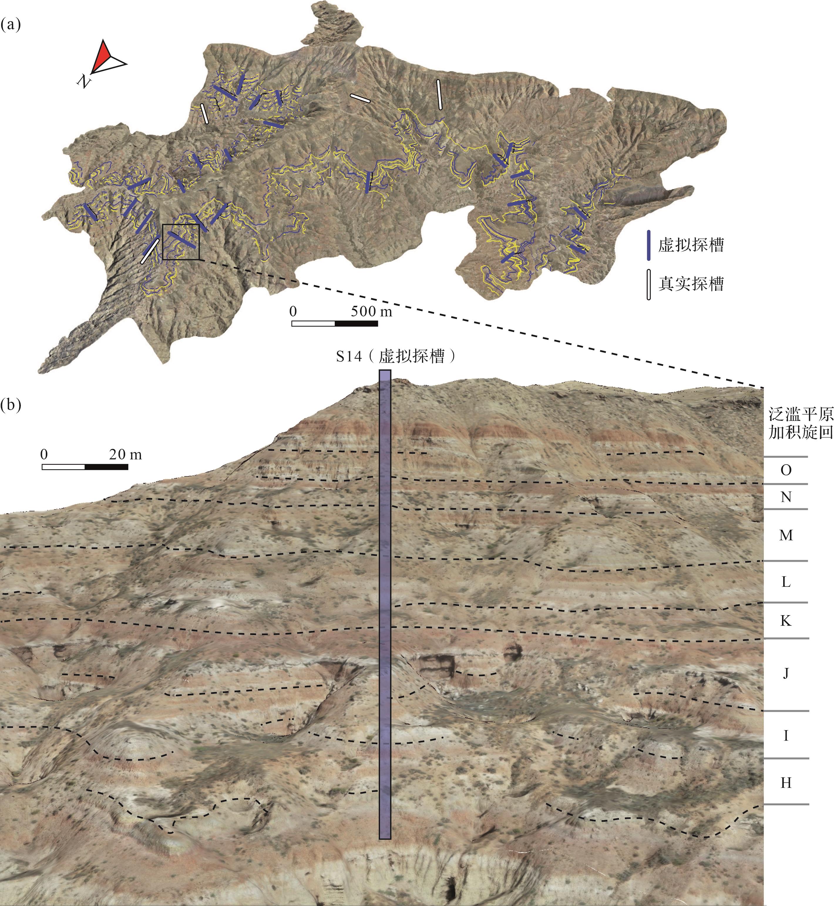
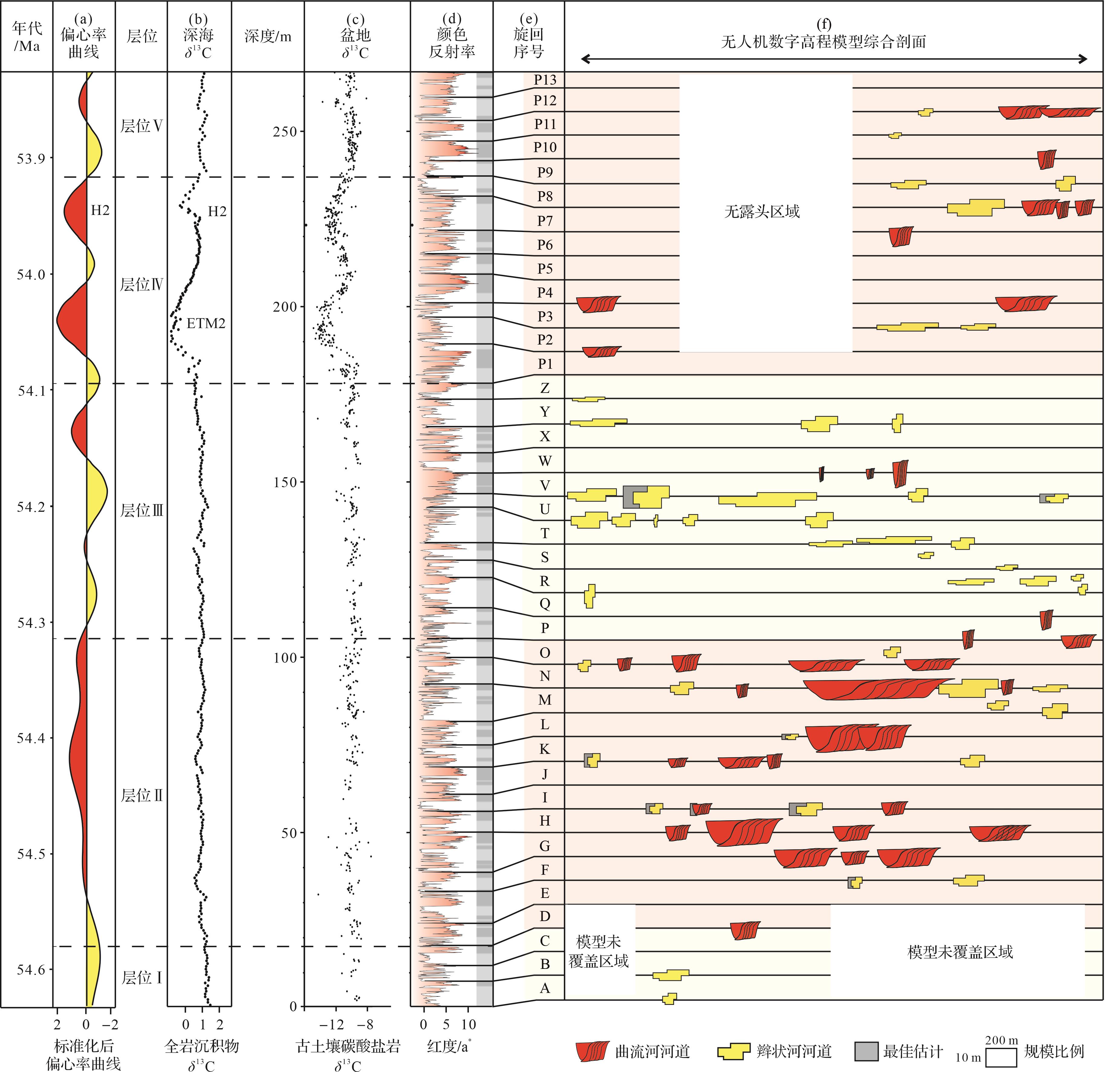
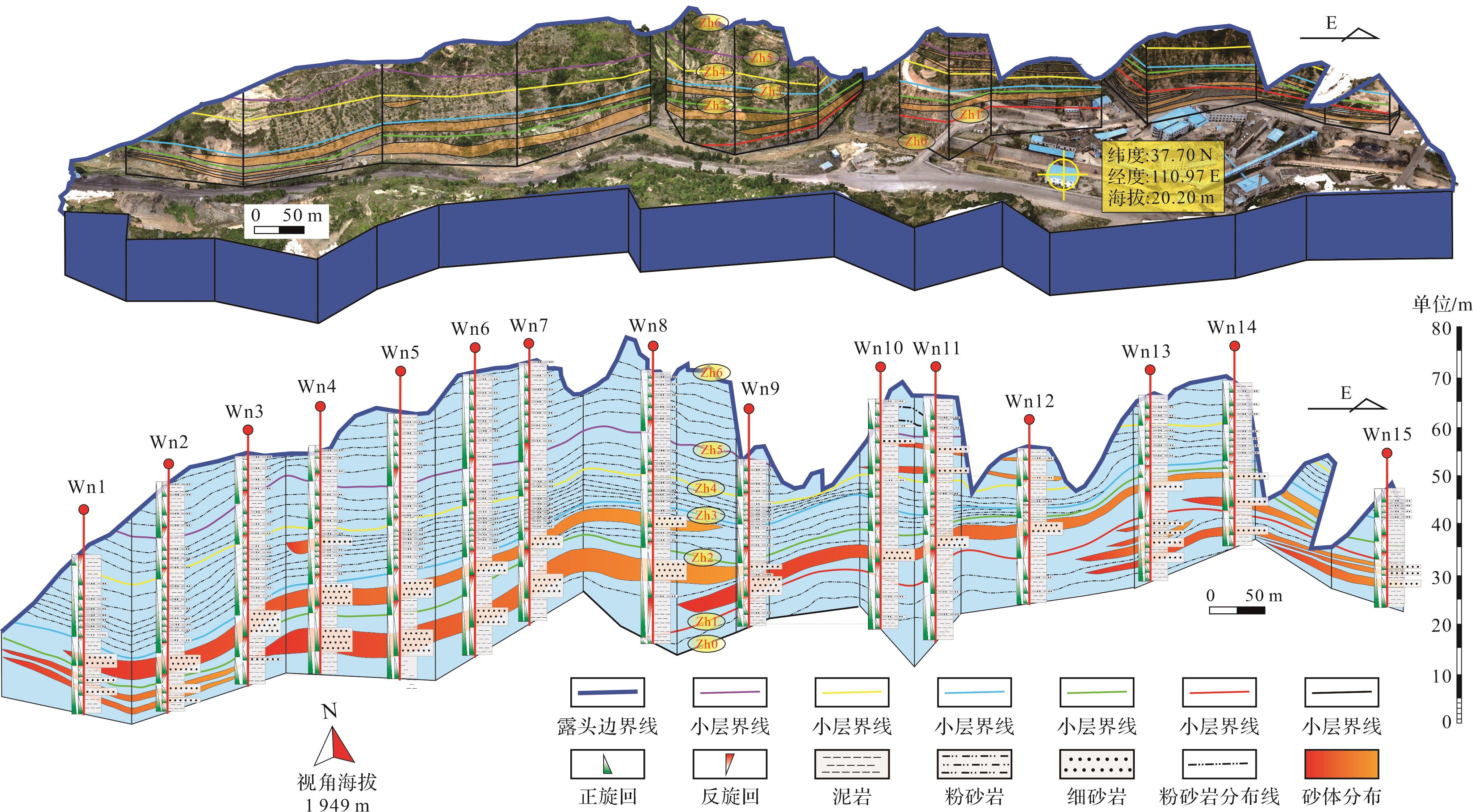
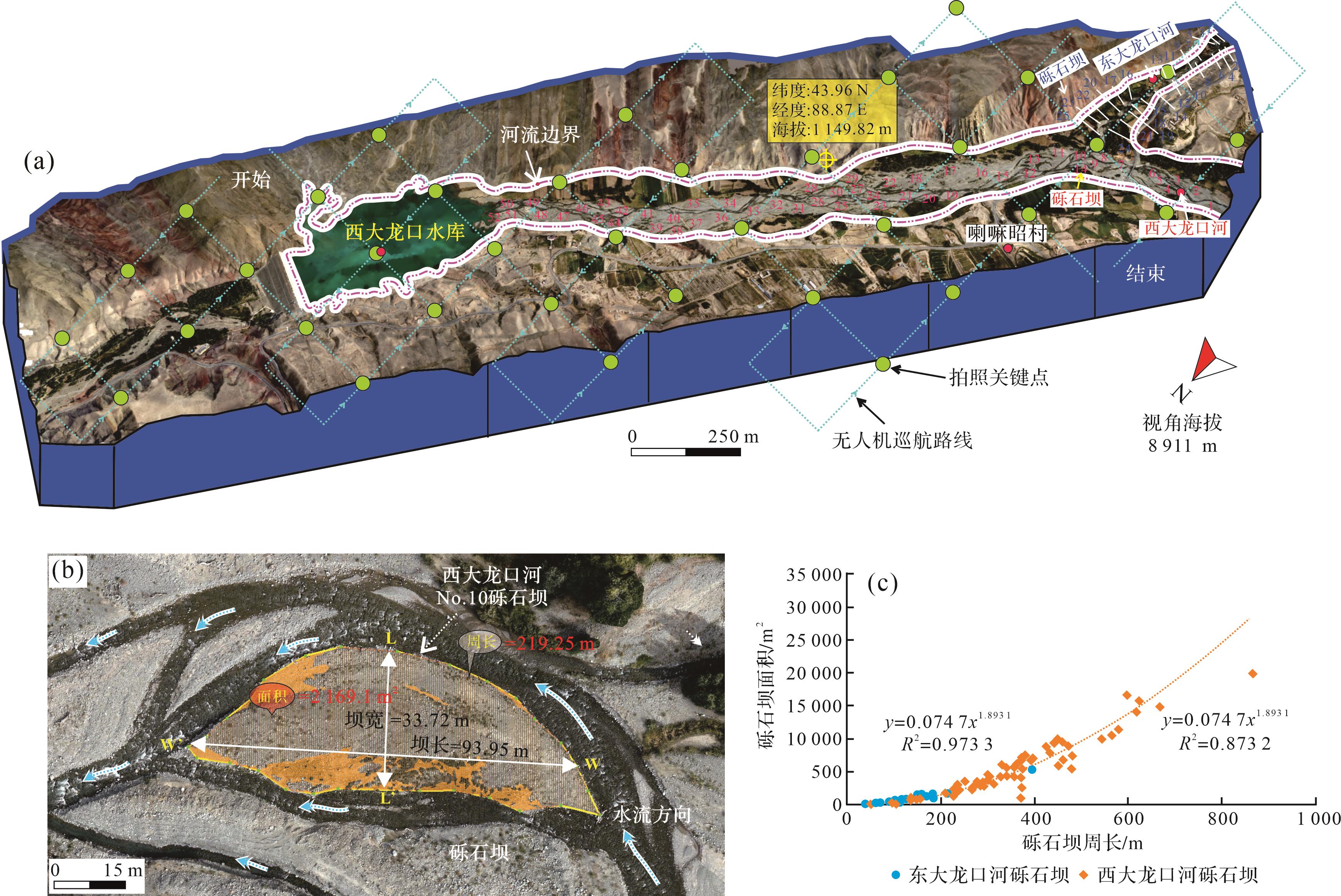
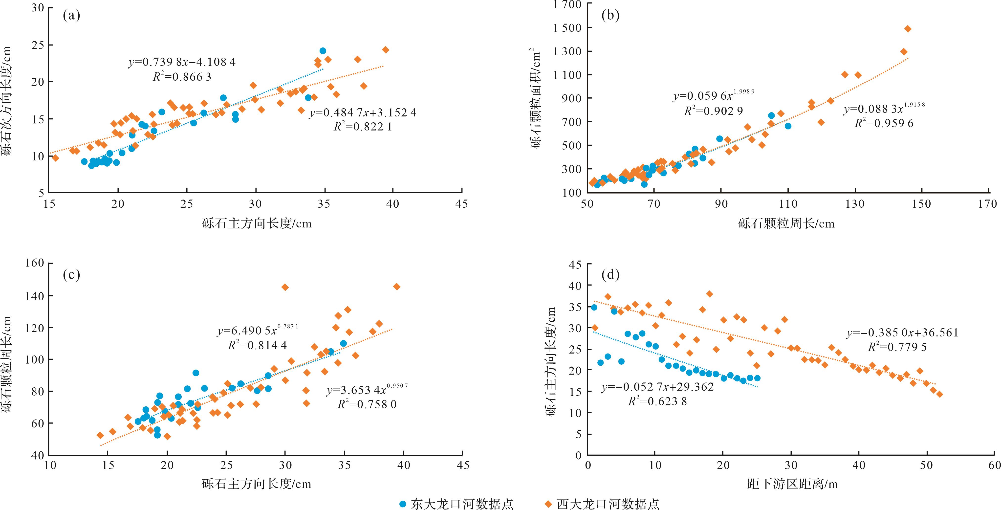
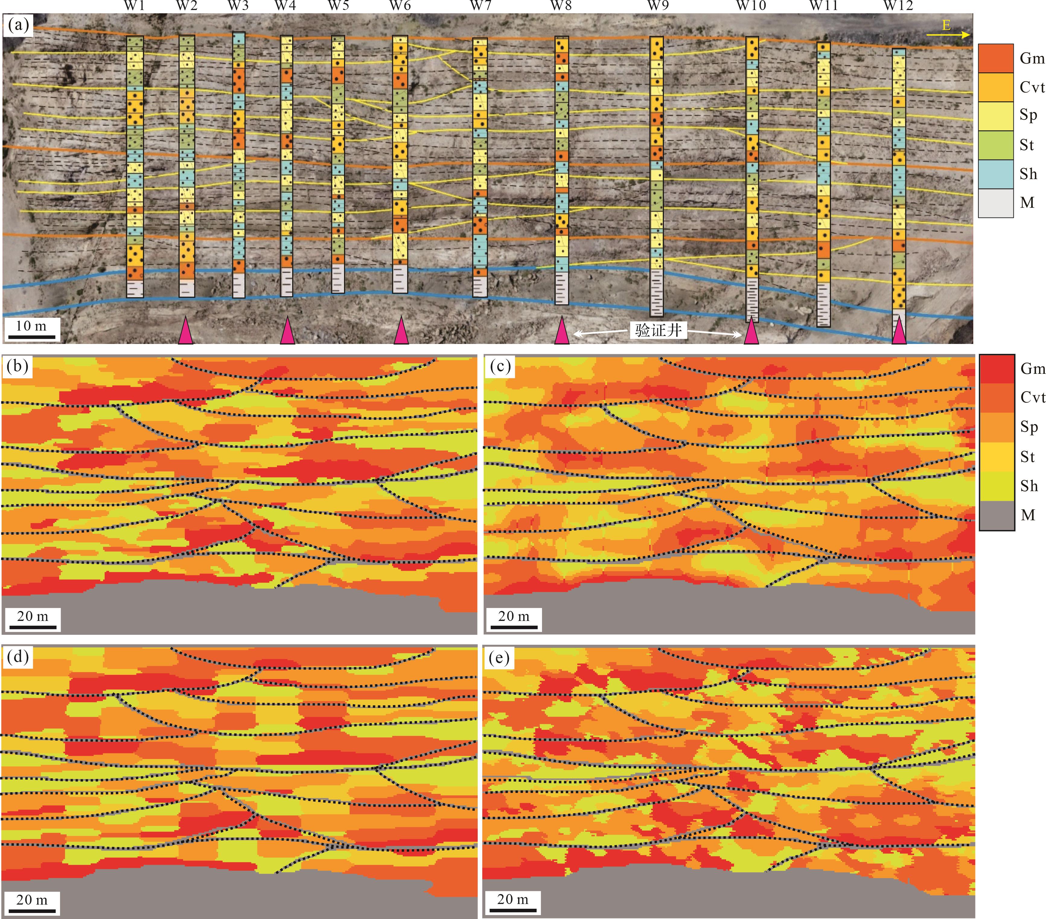
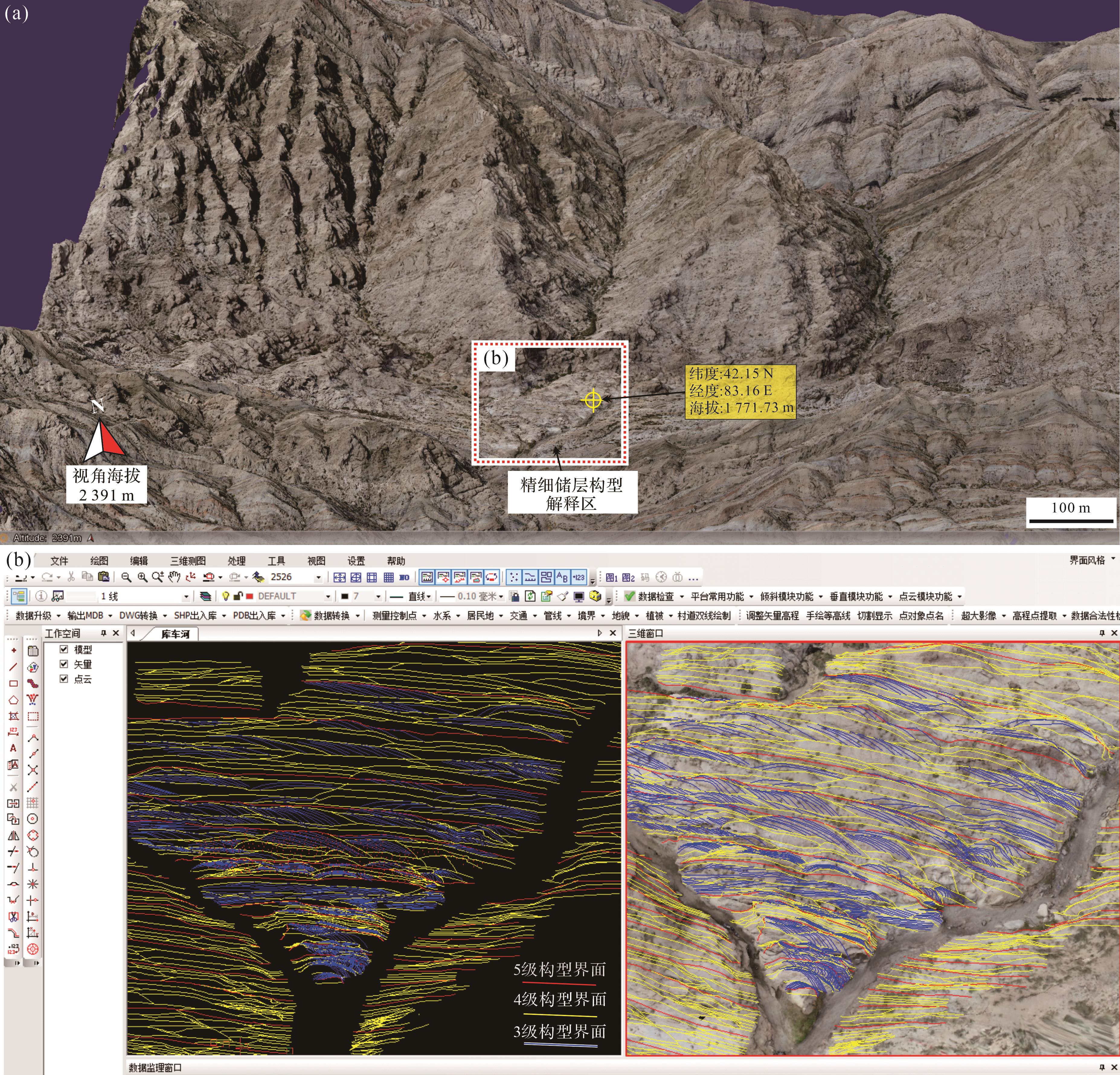
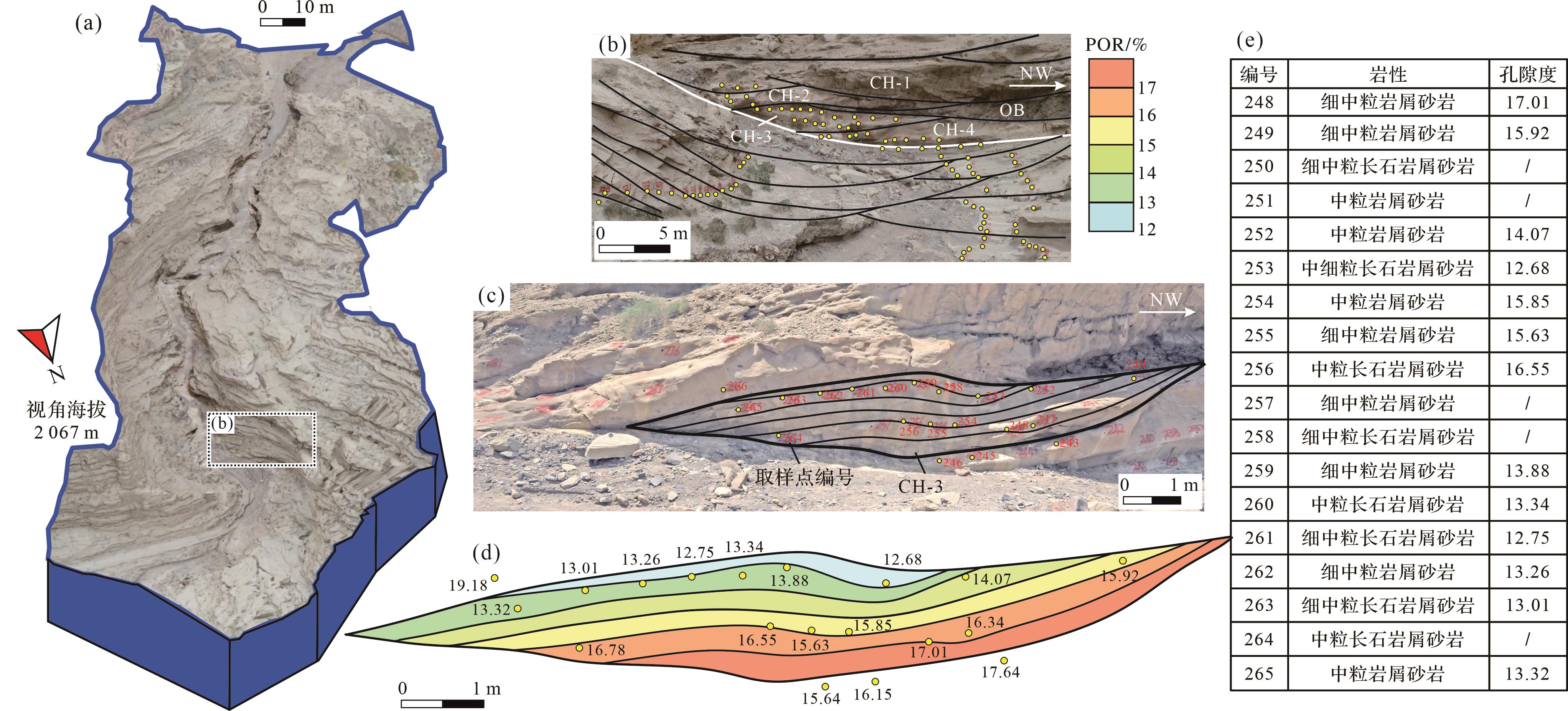
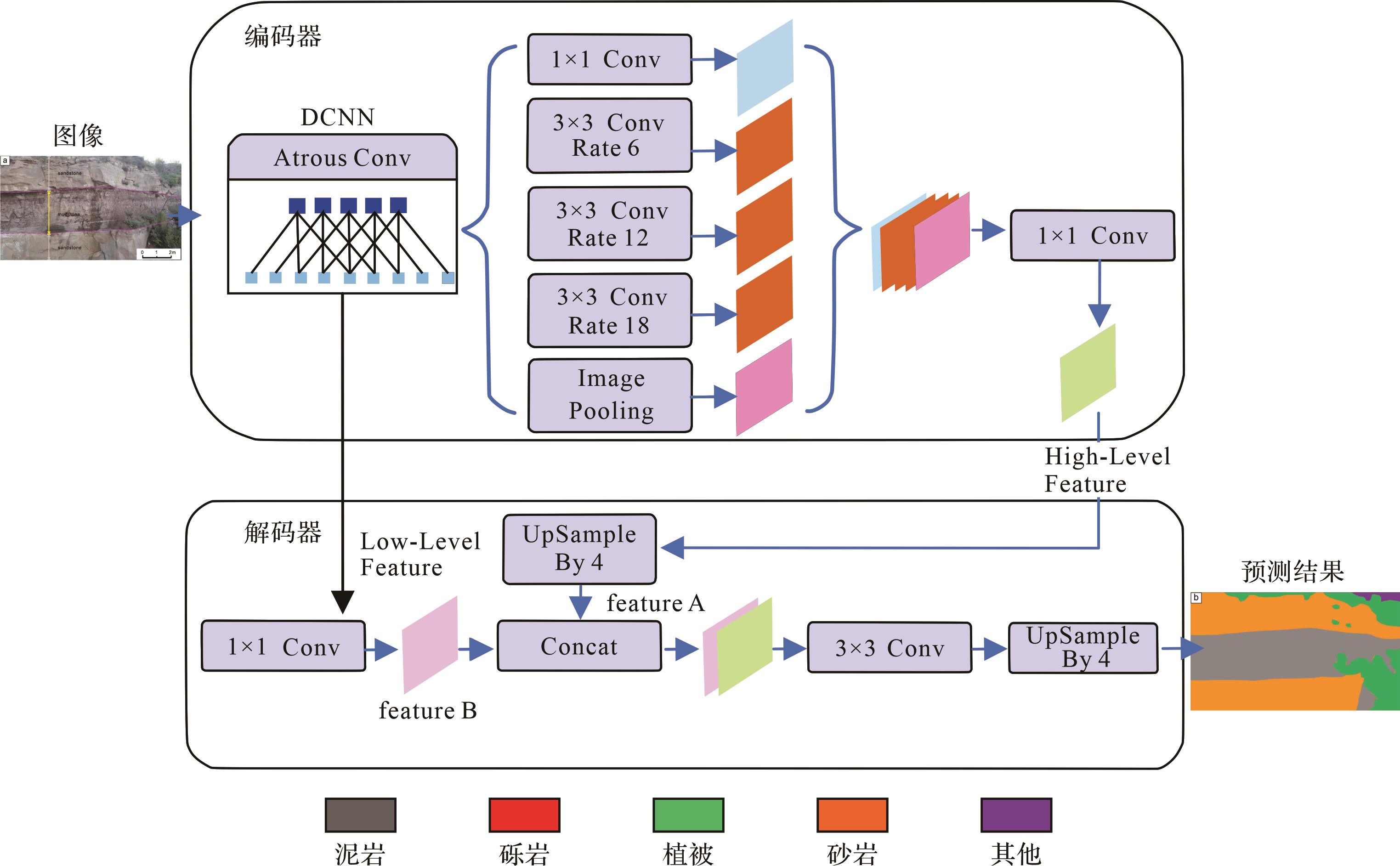
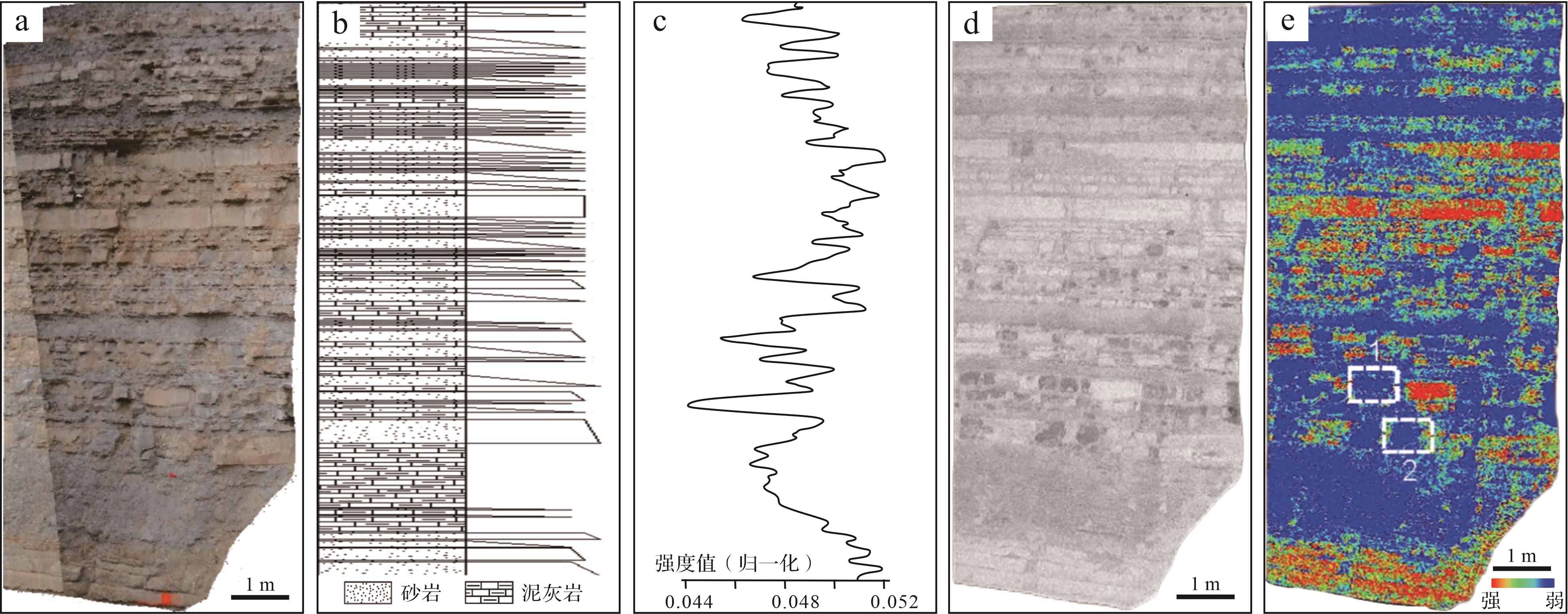
Significance Rapid advances in information, intelligence and automation technologies have significantly expanded the use of Unmanned Aerial Vehicle (UAV)-based oblique photogrammetry in geology, and its application in field geology has advanced rapidly in recent years. Progress This study reviews the principles and developments of UAV-based photogrammetry, its associated primary products and modeling technologies, and its application in sedimentology, stratigraphy and reservoir geology. Conclusions and Prospects Key advances include digital outcrop dataset collection paradigms, visual representation and digital twin technologies, sequence stratigraphy and modern sedimentary source-sink analyses, quantitative reservoir sedimentology, and 3D geological modeling. A comprehensive literature review and current technological trends indicate that future developments will be expected to focus on intelligent identification and modeling of sedimentary geological features, enhancements to digital twin systems and visualization, deeper exploration of reservoir genesis and prototype modeling, multi-scale data calibration and integration, and the expansion of geological teaching and research directions.
Significance Rapid advances in information, intelligence and automation technologies have significantly expanded the use of Unmanned Aerial Vehicle (UAV)-based oblique photogrammetry in geology, and its application in field geology has advanced rapidly in recent years. Progress This study reviews the principles and developments of UAV-based photogrammetry, its associated primary products and modeling technologies, and its application in sedimentology, stratigraphy and reservoir geology. Conclusions and Prospects Key advances include digital outcrop dataset collection paradigms, visual representation and digital twin technologies, sequence stratigraphy and modern sedimentary source-sink analyses, quantitative reservoir sedimentology, and 3D geological modeling. A comprehensive literature review and current technological trends indicate that future developments will be expected to focus on intelligent identification and modeling of sedimentary geological features, enhancements to digital twin systems and visualization, deeper exploration of reservoir genesis and prototype modeling, multi-scale data calibration and integration, and the expansion of geological teaching and research directions.
2026, 44(5): 1758-1769.
doi: 10.14027/j.issn.1000-0550.2025.039
Abstract:
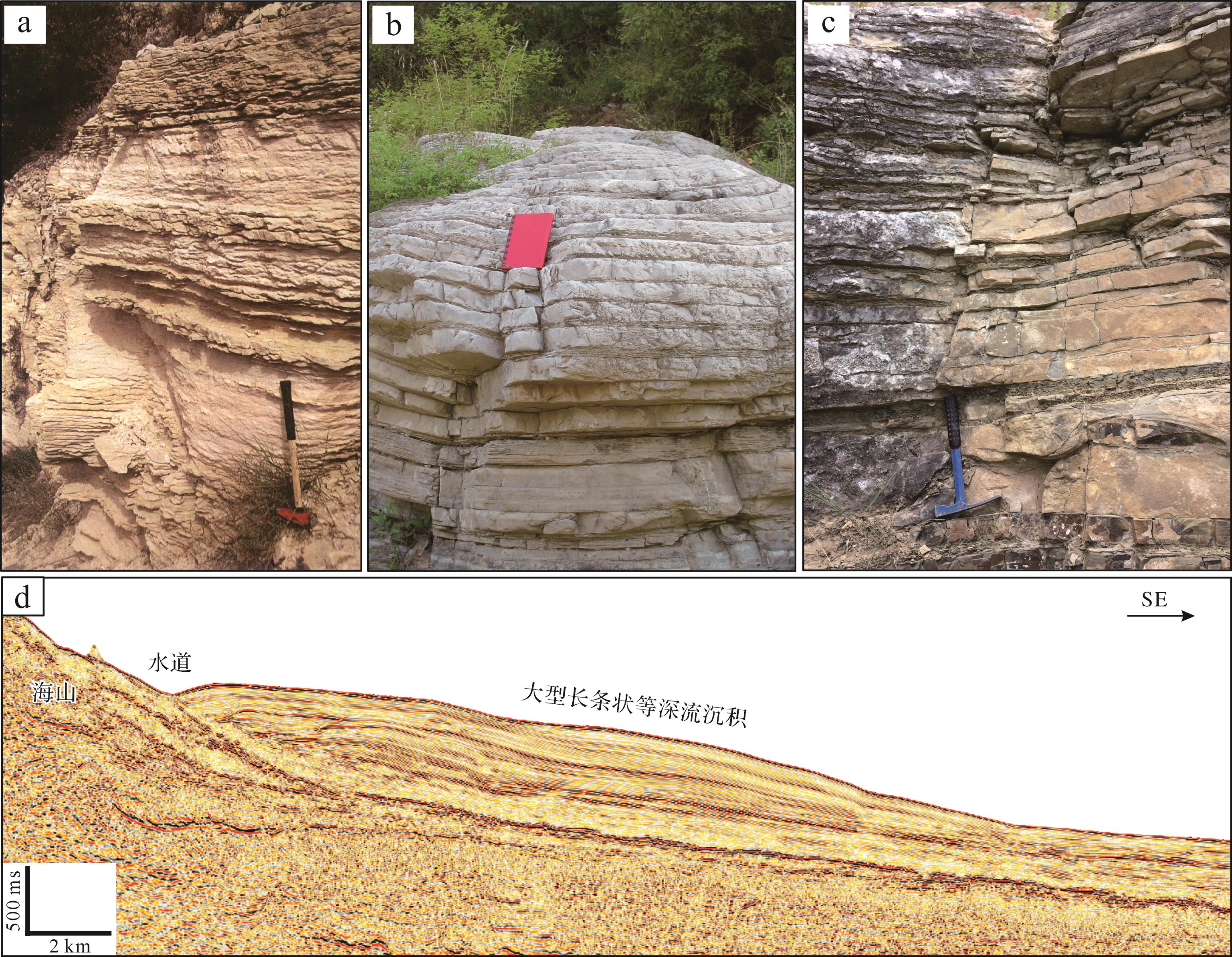
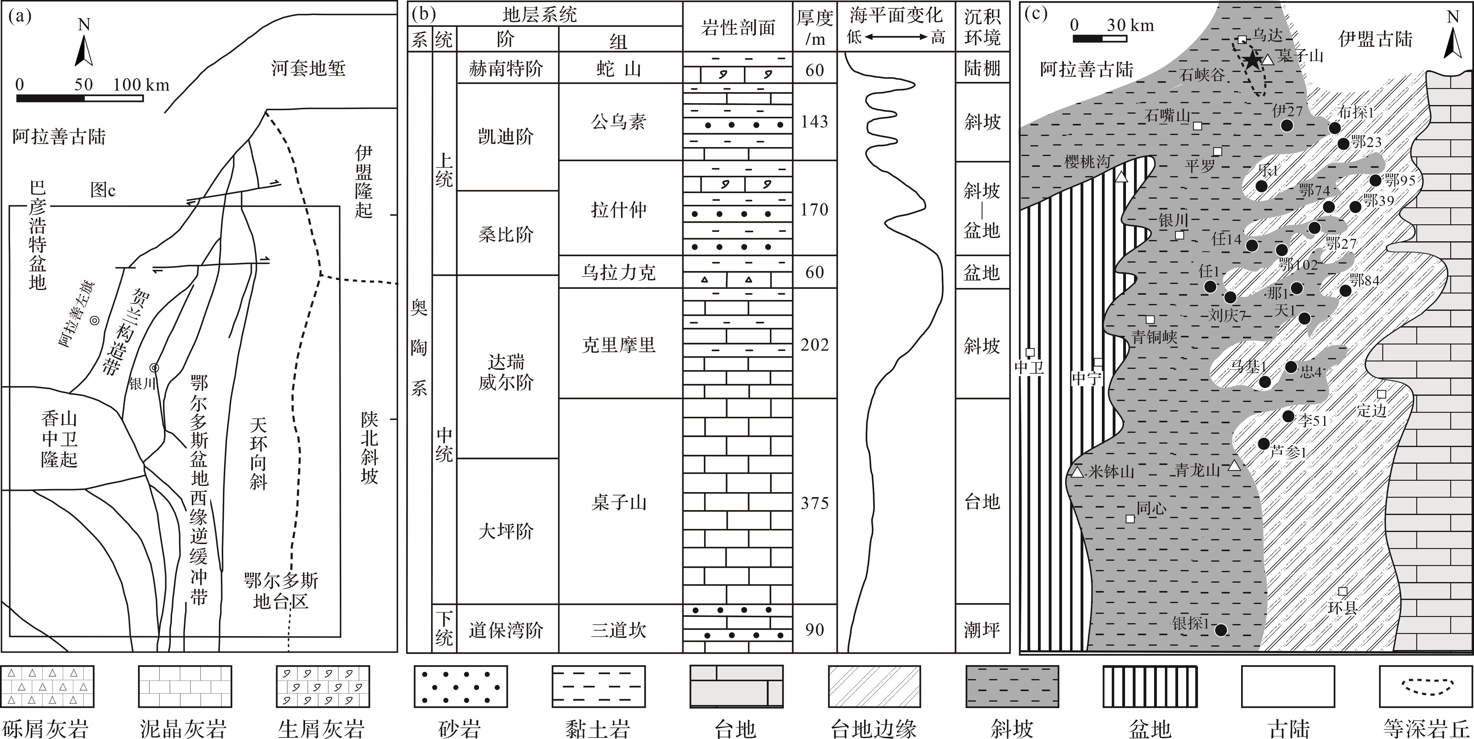
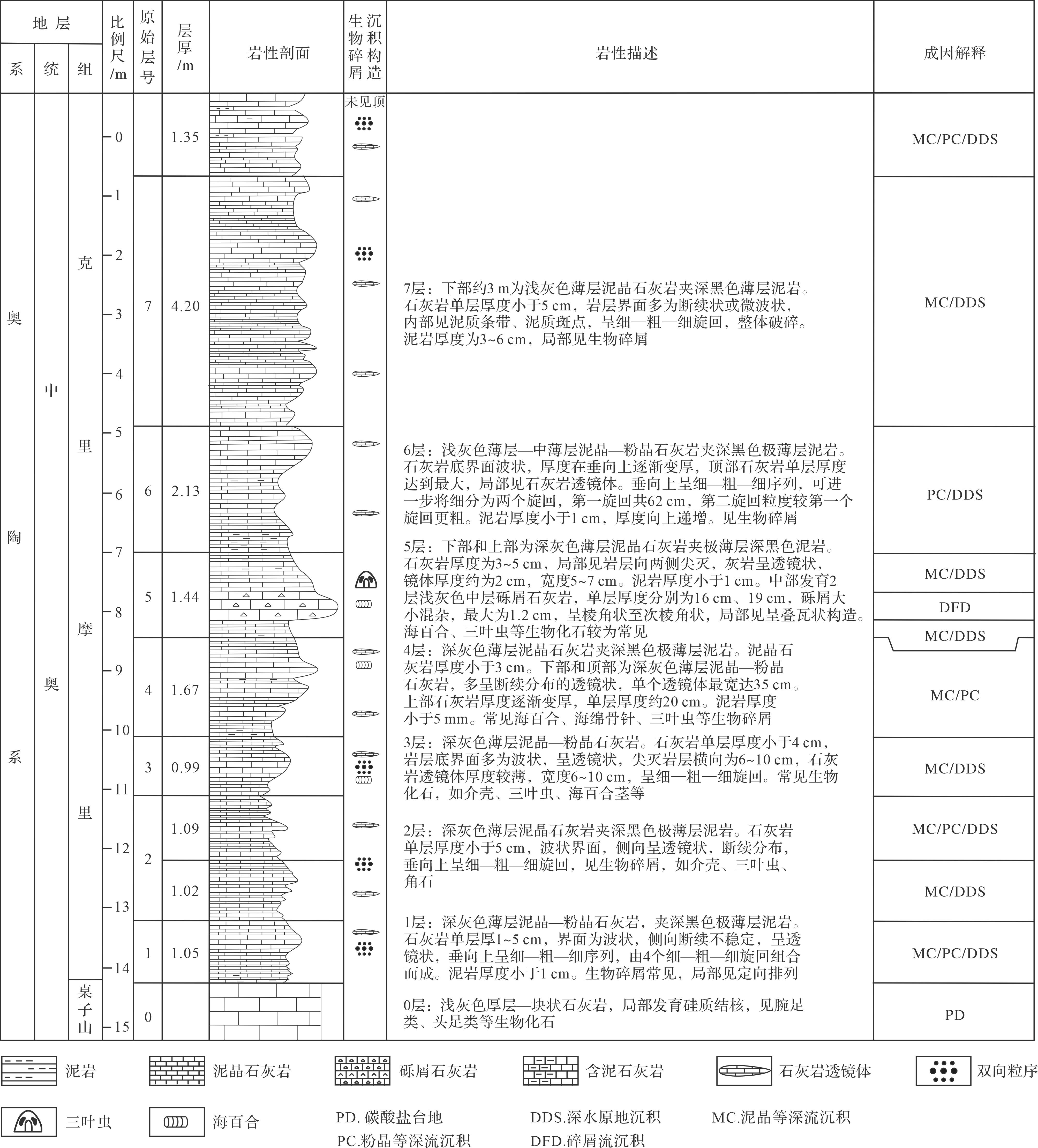
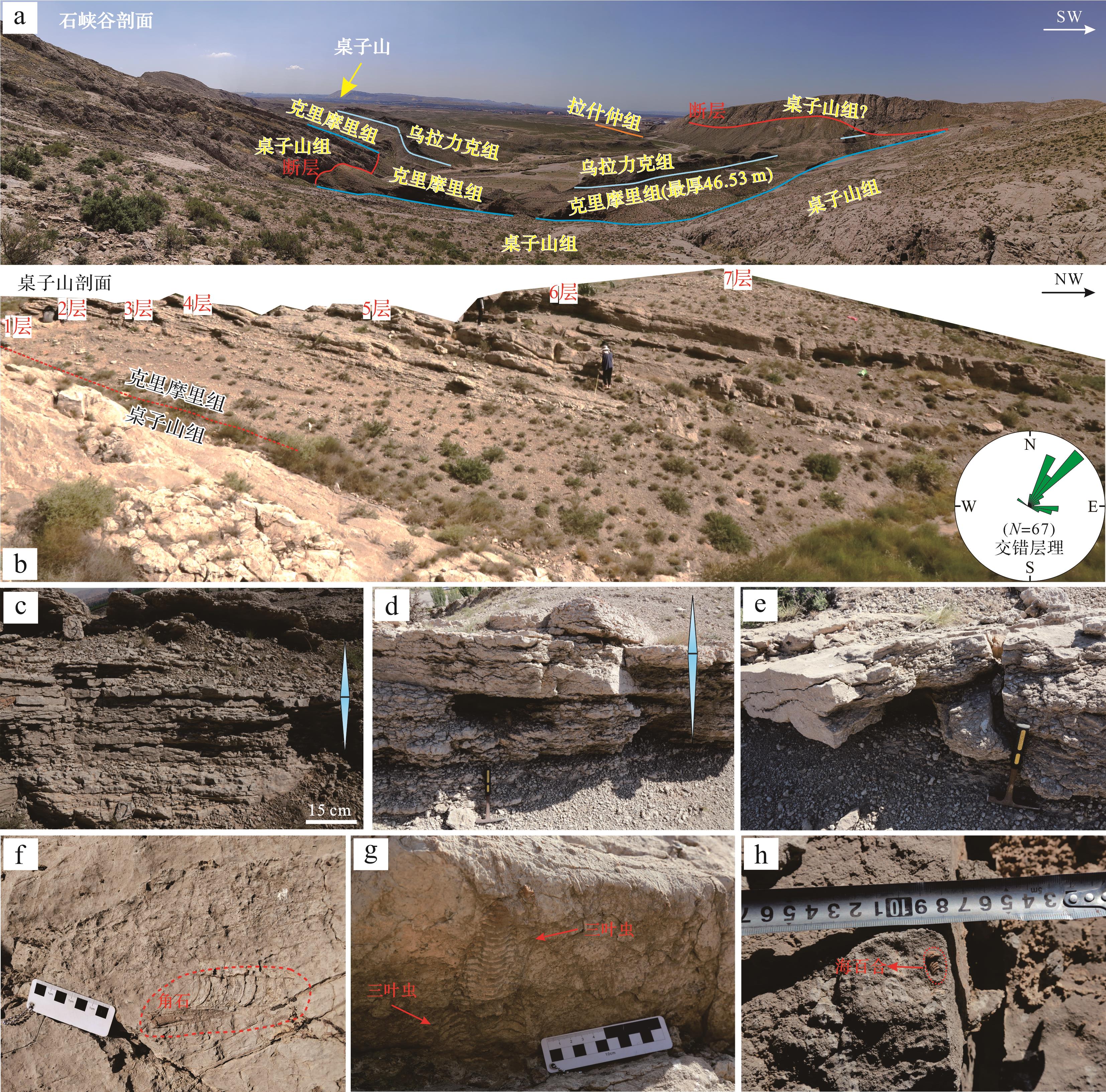
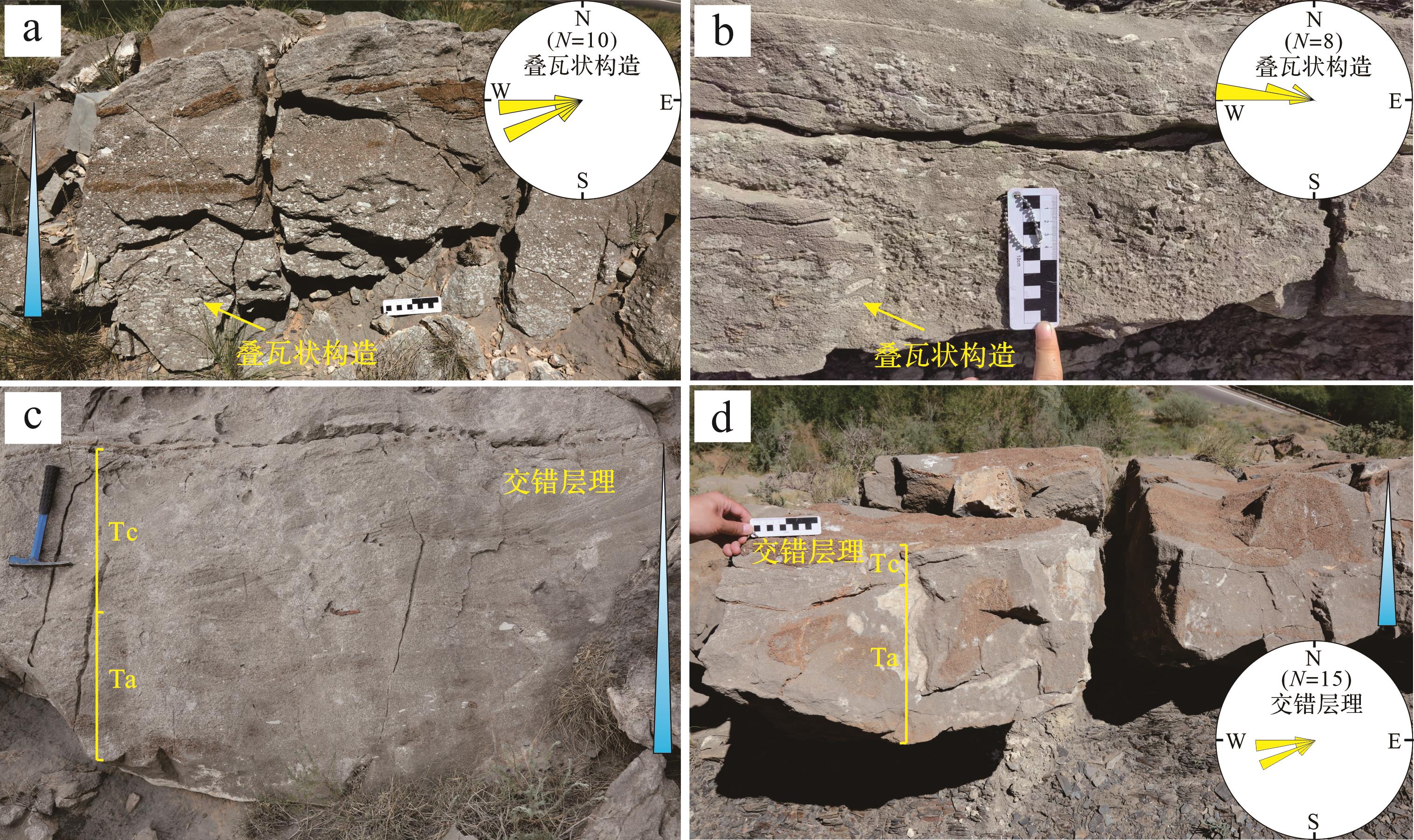
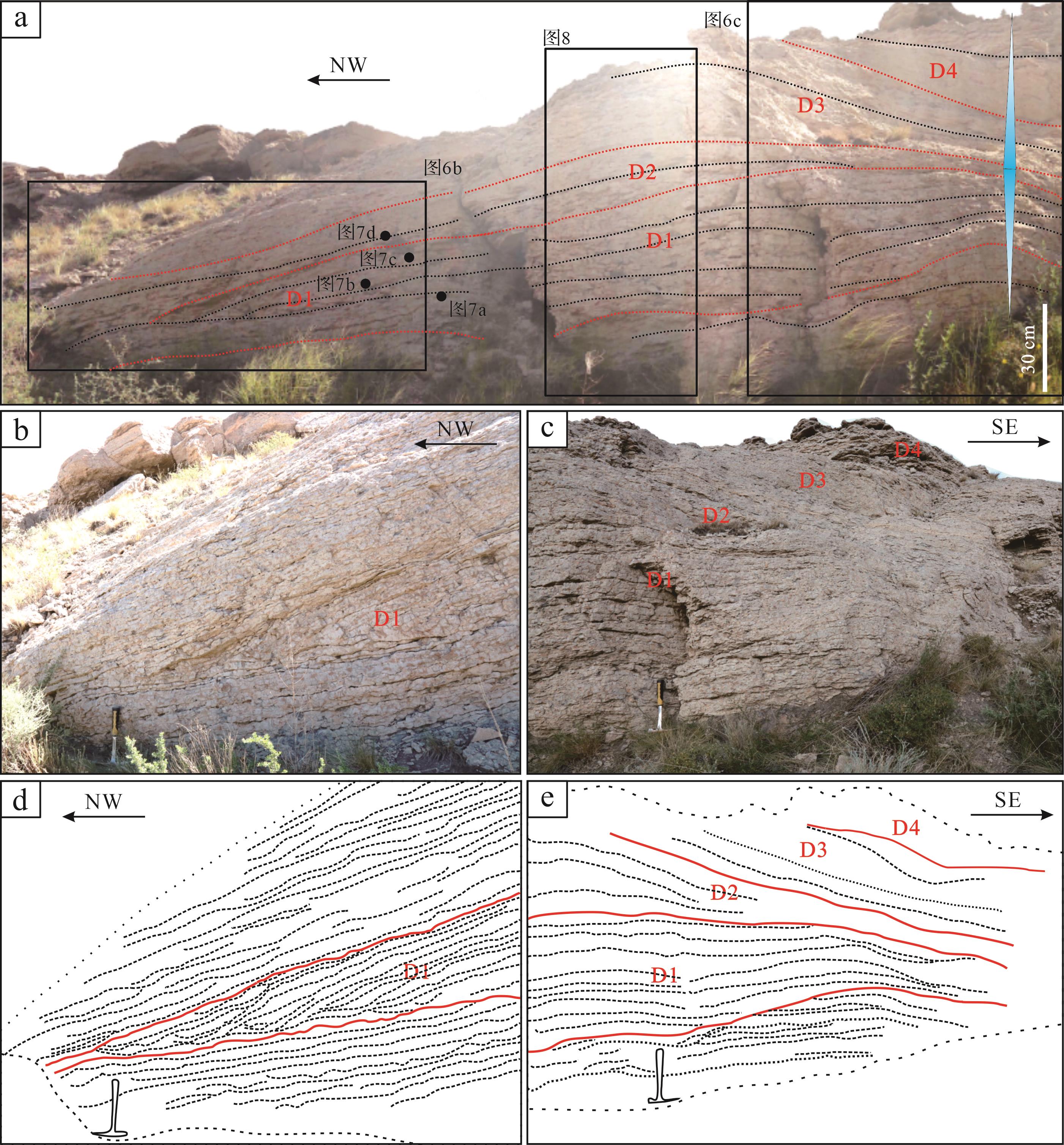
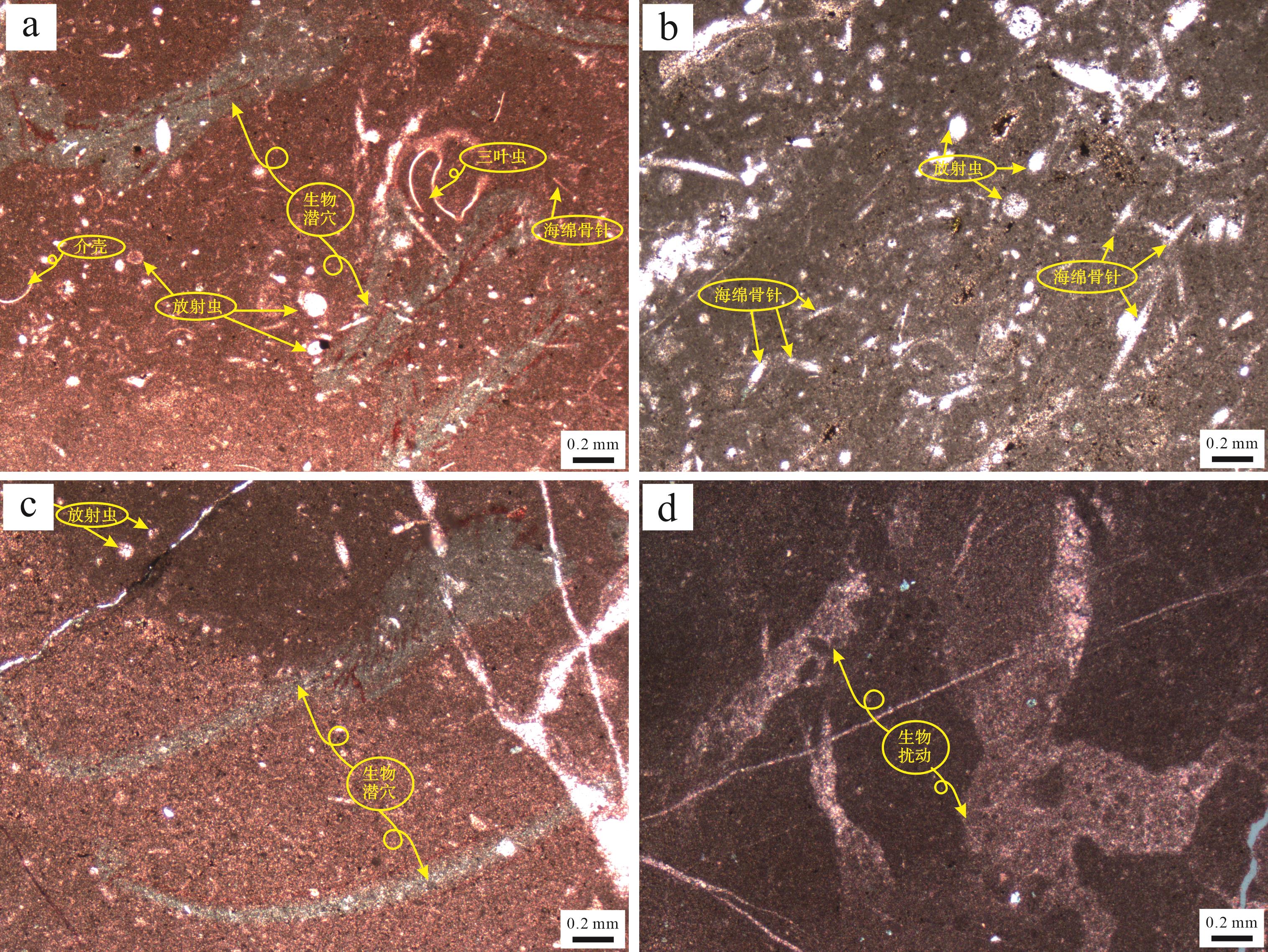
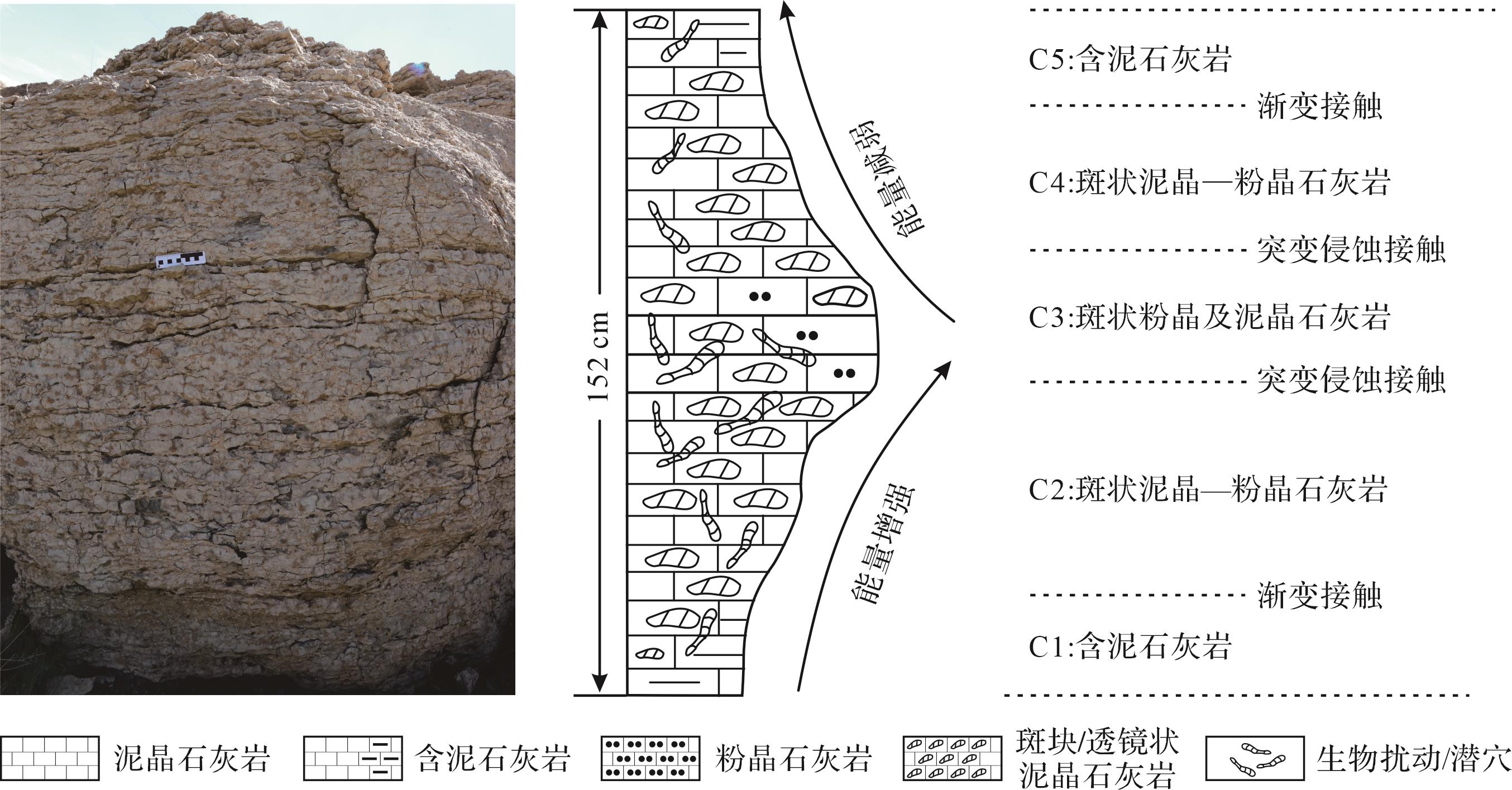
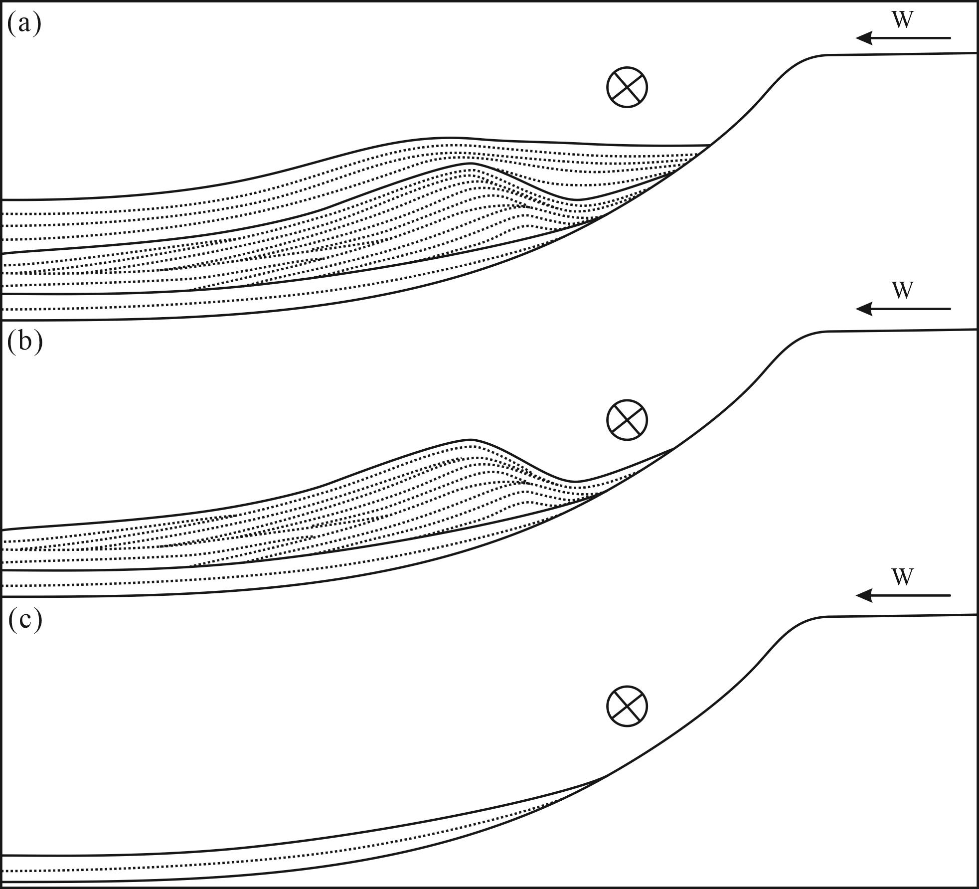
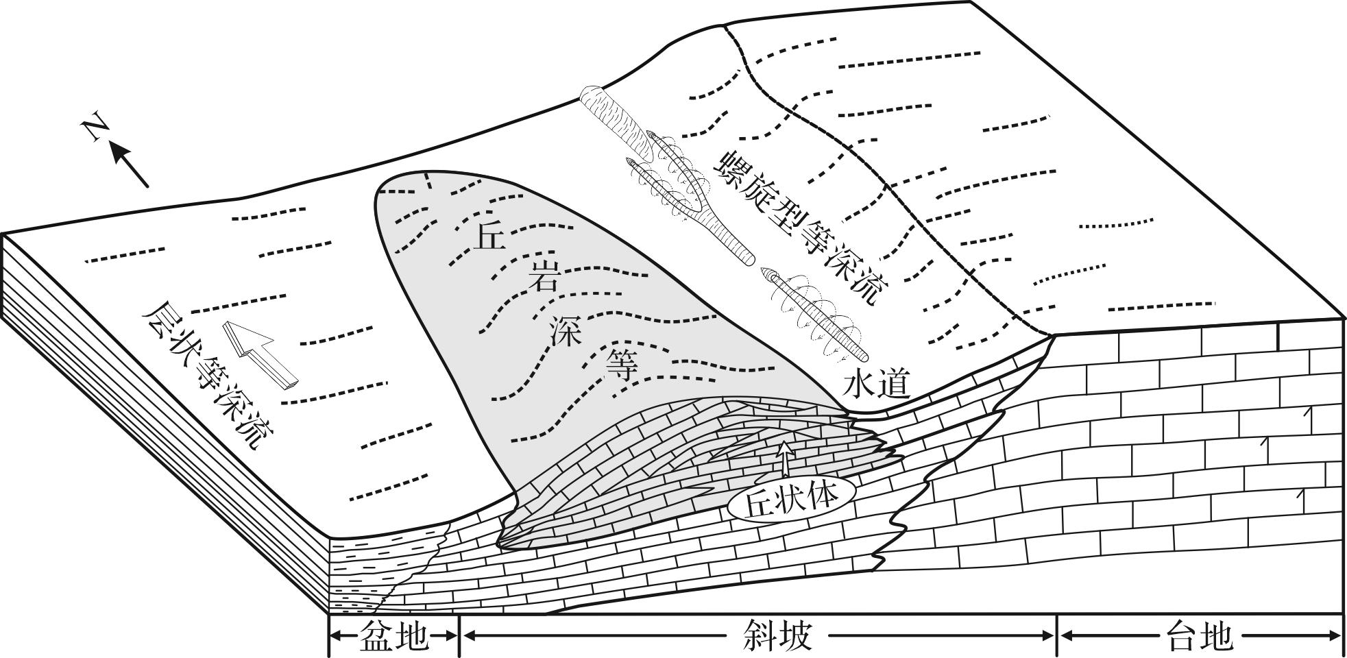
Objective Contourites are well developed along the southern and western margins of the Ordos Basin, where sedimentary characteristics are abundant, making it an ideal area for research mounded contourite is a special type of contourite formed in the Ordovician Kelimoli Formation in the western margin of the Ordos Basin. This study examined mounded contourites, reconstructed the contour current circulation, and identified the paleoenvironment. Methods Using outcrop, thin section, and paleocurrent, we systematically determined the mechanism of mounded contourites. Results (1) Micrite-, calcisiltite-, and muddy contourites are well developed in the study area. The lithology is mainly dark grey motteld thin micrtic and calcisiltitic limestone with a wavy boundary. The contourites are lenticular-shaped. Horizontal-, wavy- bedding, and erosive surfaces are observed. The contourites are rich in bioclastic fragments, and bioturbation and burrows are well developed. The paleocurrent direction is northeast, parallel to slope. (2) Mounded contourites are mounded, and elongated shape, with a NW-SE orientation, approximately parallel to the slope. (3) Contourite dunes developed in mounded contourites, showing e micrite and calcisiltite, muddy limestone interbedded with thin mudstones in the lower and upper sections. The grains of the mounded contourites range from fine-coarse-fine, with a total thickness of 152 cm, which can be divided into 11 units. Four small mounded contourites developed with series progradation. Bioturbation and burrows are observed. (4) The mounded contourite can be divided into early initial, middle formative, and late decline stages. Conclusions Mounded contourites resulted as a relatively high energy contour current moved northeastward. Helical flow can lead to erosion and deposition, forming a moat. Anticlockwise secondary flow also can transport sediment, and develop mounded contourite on the side of the moat facing the deep sea basin.
Objective Contourites are well developed along the southern and western margins of the Ordos Basin, where sedimentary characteristics are abundant, making it an ideal area for research mounded contourite is a special type of contourite formed in the Ordovician Kelimoli Formation in the western margin of the Ordos Basin. This study examined mounded contourites, reconstructed the contour current circulation, and identified the paleoenvironment. Methods Using outcrop, thin section, and paleocurrent, we systematically determined the mechanism of mounded contourites. Results (1) Micrite-, calcisiltite-, and muddy contourites are well developed in the study area. The lithology is mainly dark grey motteld thin micrtic and calcisiltitic limestone with a wavy boundary. The contourites are lenticular-shaped. Horizontal-, wavy- bedding, and erosive surfaces are observed. The contourites are rich in bioclastic fragments, and bioturbation and burrows are well developed. The paleocurrent direction is northeast, parallel to slope. (2) Mounded contourites are mounded, and elongated shape, with a NW-SE orientation, approximately parallel to the slope. (3) Contourite dunes developed in mounded contourites, showing e micrite and calcisiltite, muddy limestone interbedded with thin mudstones in the lower and upper sections. The grains of the mounded contourites range from fine-coarse-fine, with a total thickness of 152 cm, which can be divided into 11 units. Four small mounded contourites developed with series progradation. Bioturbation and burrows are observed. (4) The mounded contourite can be divided into early initial, middle formative, and late decline stages. Conclusions Mounded contourites resulted as a relatively high energy contour current moved northeastward. Helical flow can lead to erosion and deposition, forming a moat. Anticlockwise secondary flow also can transport sediment, and develop mounded contourite on the side of the moat facing the deep sea basin.
2026, 44(5): 1770-1782.
doi: 10.14027/j.issn.1000-0550.2025.058
Abstract:
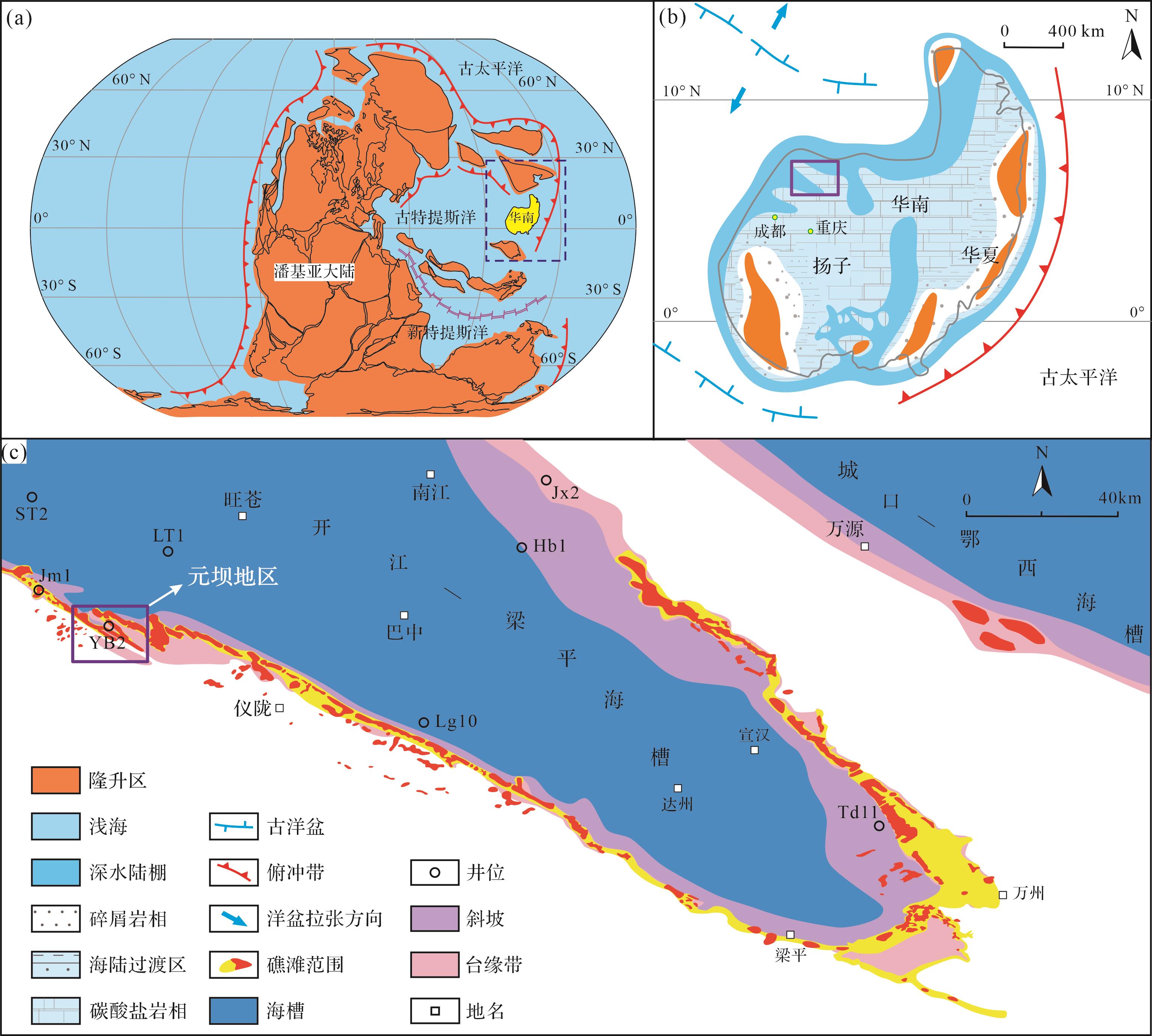
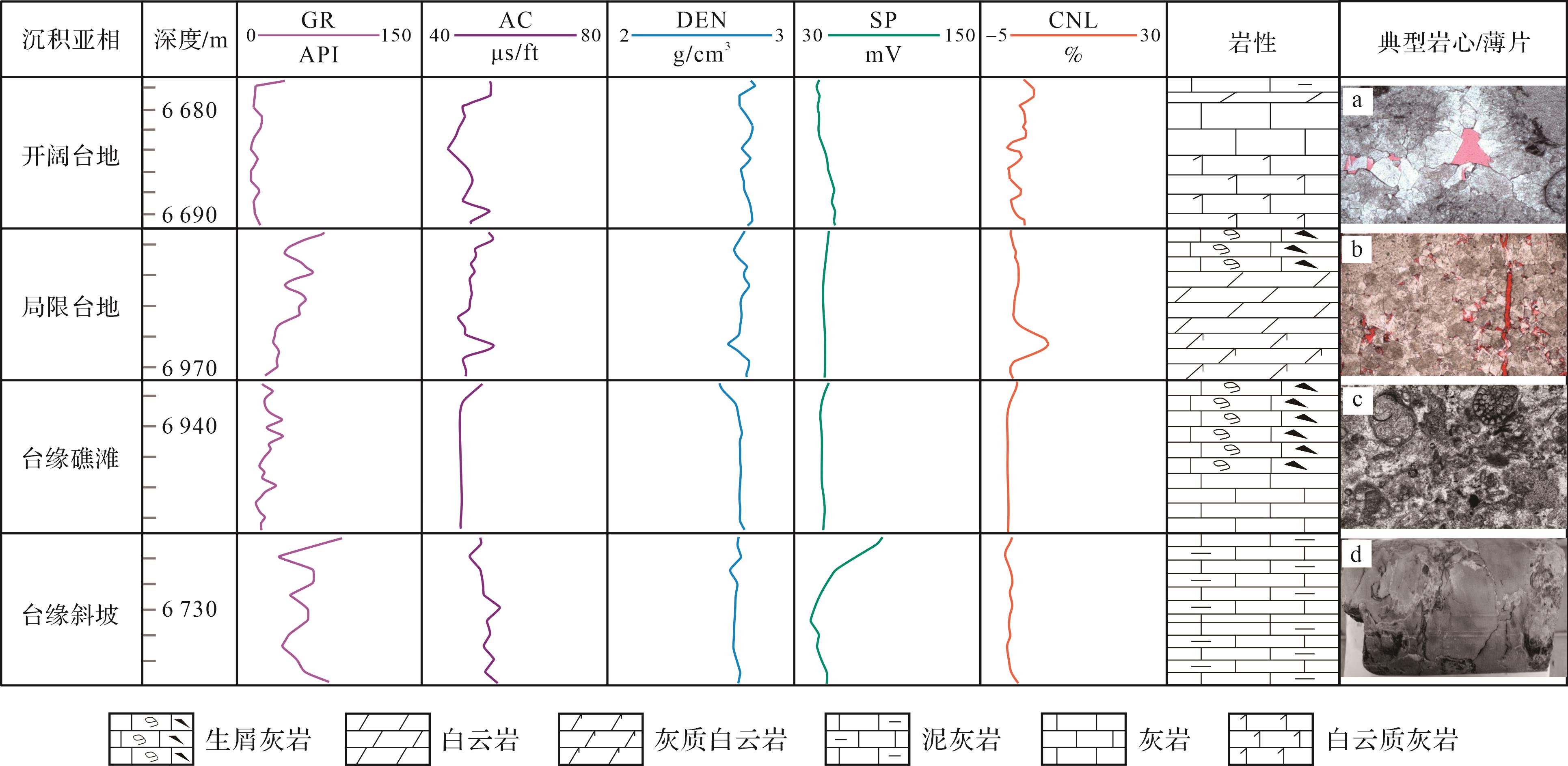
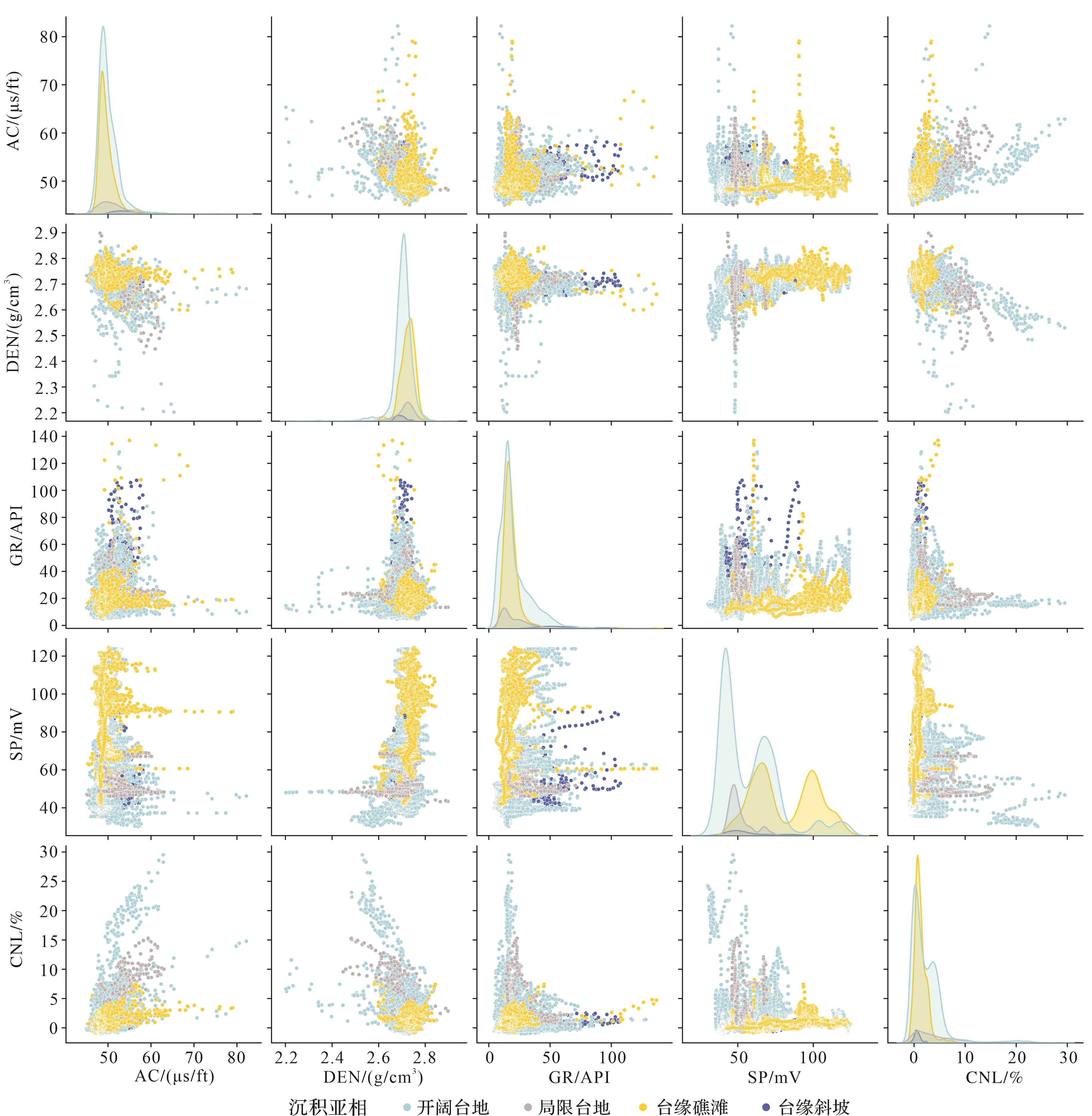
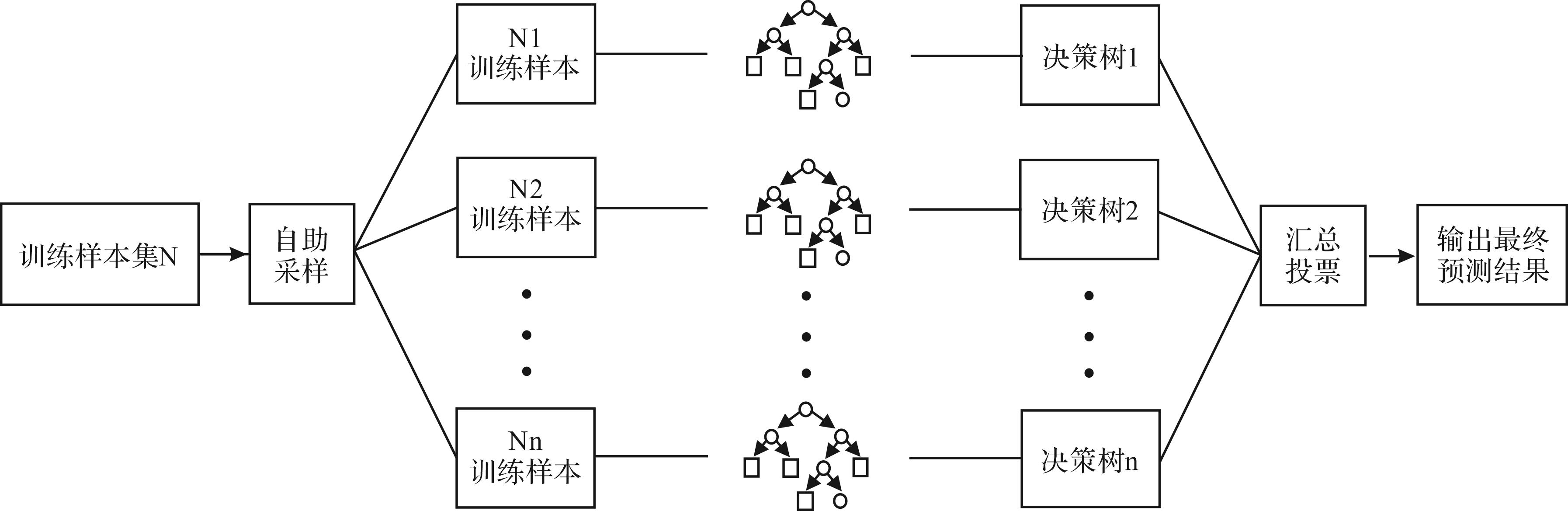
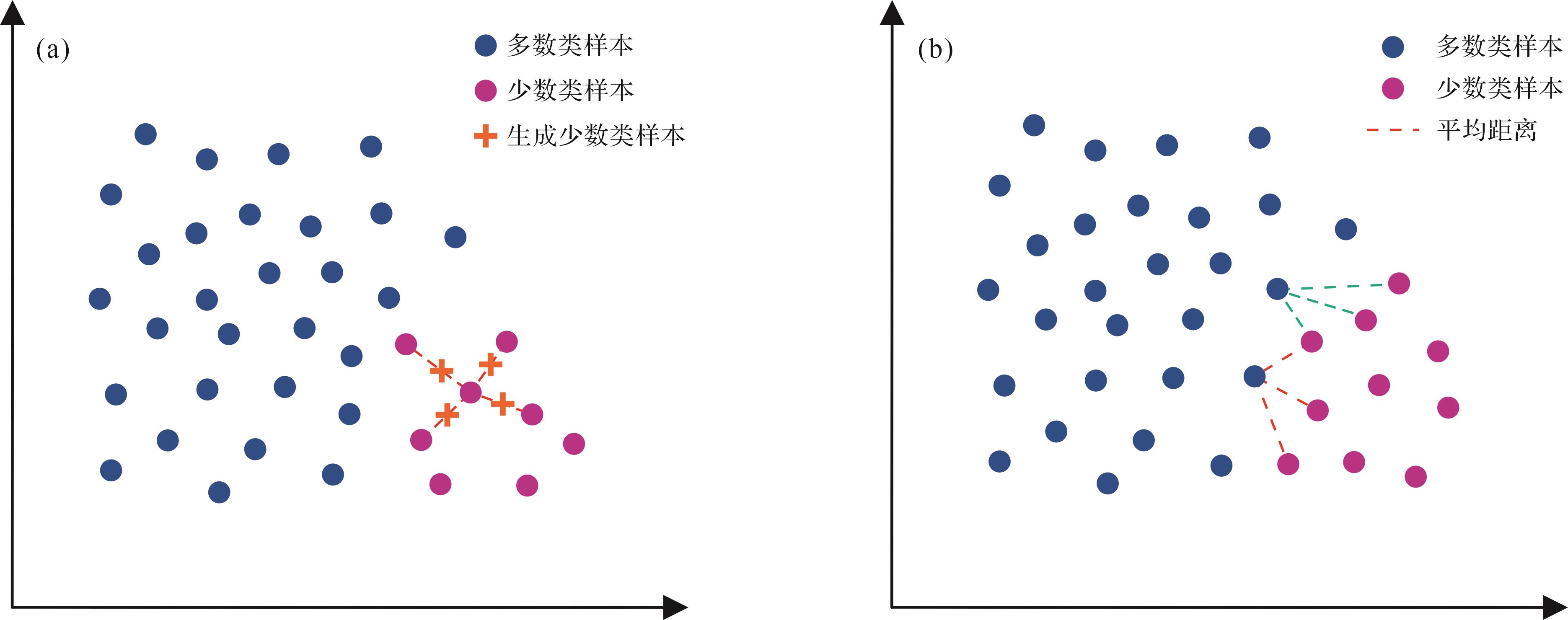
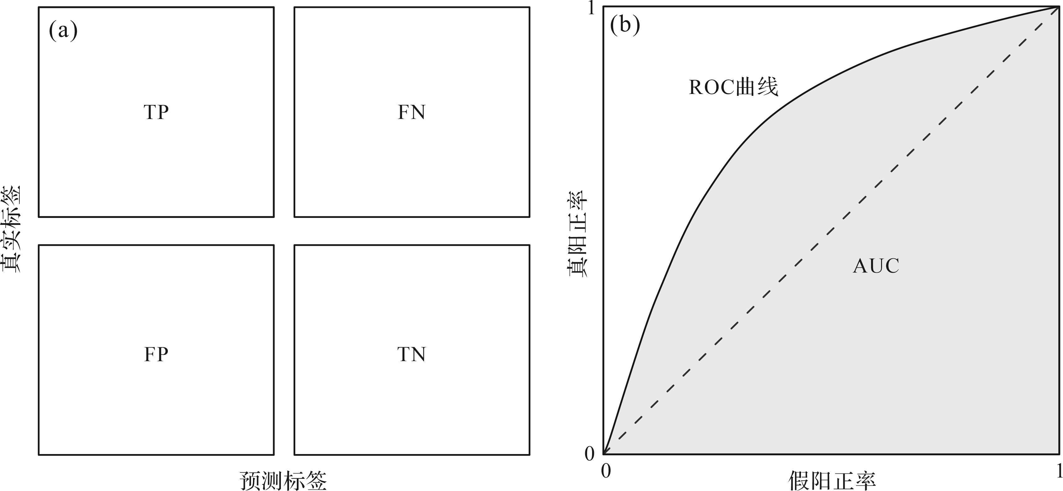
Objective Accurate identification of carbonate rock sedimentary facies is basic to conduct paleogeographic reconstruction. However, the inherently ambiguous facies characteristics coupled with the subjectivity of manual interpretation pose significant challenges in facies identification. Traditional well-log facies interpretation methods are further constrained by low efficiency and experience-dependent limitations. To address these challenges, in this study a reusable and intelligent interpretation model was developed based on machine learning algorithms with the aim of improving the precision and efficiency of sedimentary facies identification in carbonate formations. Methods Focusing on the reef-shoal facies of the Upper Permian Changxing Formation in the Yuanba area of the northeastern Sichuan Basin, well-logging data from five representative boreholes was analyzed. Various well-logging curves (e.g., acoustic travel time (AC) and natural gamma ray (GR)) were selected as feature parameters to construct an Improved Random Forest (IRF)-based facies recognition model. A hybrid sampling strategy combining the Synthetic Minority Oversampling Technique (SMOTE) and the NearMiss-1 algorithm was implemented to address the problem of classification imbalance, while grid search combined with K-fold cross-validation ensured robust hyperparameter tuning. Results Blind test results for the target well interval using the proposed improved model showed an accuracy of 87% compared to sedimentary facies interpretations by external experts, indicating a significant improvement over the initial model. The proposed model effectively identifies favorable subfacies such as open platform and platform-margin reef-shoal, accurately reflecting regional sedimentary evolution characteristics. Conclusions Machine-learning-based approaches for sedimentary facies recognition not only enhance identification accuracy but also demonstrate robustness and applicability in practical geological interpretation.
Objective Accurate identification of carbonate rock sedimentary facies is basic to conduct paleogeographic reconstruction. However, the inherently ambiguous facies characteristics coupled with the subjectivity of manual interpretation pose significant challenges in facies identification. Traditional well-log facies interpretation methods are further constrained by low efficiency and experience-dependent limitations. To address these challenges, in this study a reusable and intelligent interpretation model was developed based on machine learning algorithms with the aim of improving the precision and efficiency of sedimentary facies identification in carbonate formations. Methods Focusing on the reef-shoal facies of the Upper Permian Changxing Formation in the Yuanba area of the northeastern Sichuan Basin, well-logging data from five representative boreholes was analyzed. Various well-logging curves (e.g., acoustic travel time (AC) and natural gamma ray (GR)) were selected as feature parameters to construct an Improved Random Forest (IRF)-based facies recognition model. A hybrid sampling strategy combining the Synthetic Minority Oversampling Technique (SMOTE) and the NearMiss-1 algorithm was implemented to address the problem of classification imbalance, while grid search combined with K-fold cross-validation ensured robust hyperparameter tuning. Results Blind test results for the target well interval using the proposed improved model showed an accuracy of 87% compared to sedimentary facies interpretations by external experts, indicating a significant improvement over the initial model. The proposed model effectively identifies favorable subfacies such as open platform and platform-margin reef-shoal, accurately reflecting regional sedimentary evolution characteristics. Conclusions Machine-learning-based approaches for sedimentary facies recognition not only enhance identification accuracy but also demonstrate robustness and applicability in practical geological interpretation.
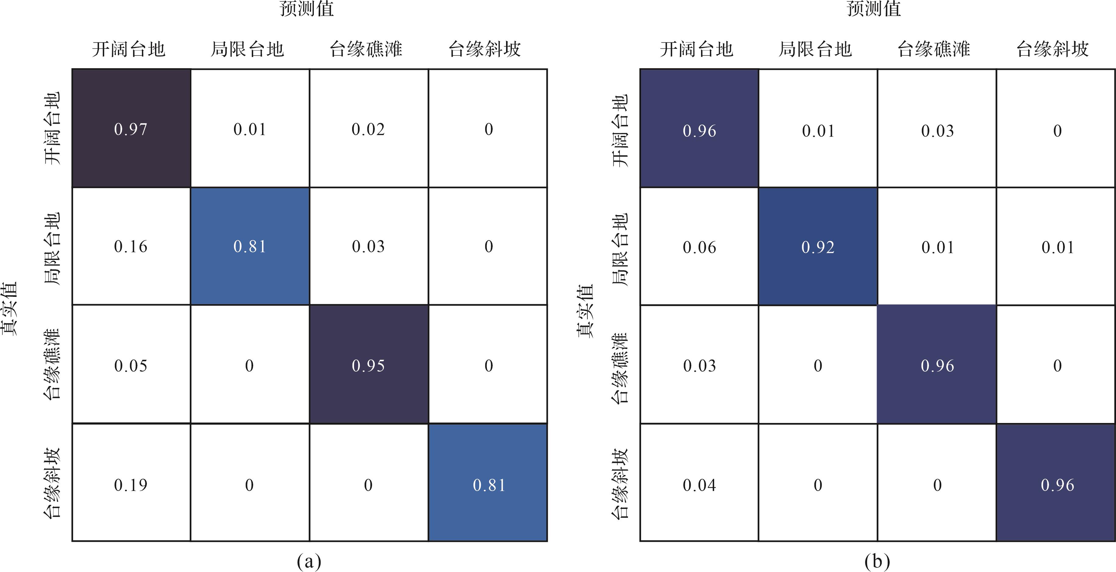
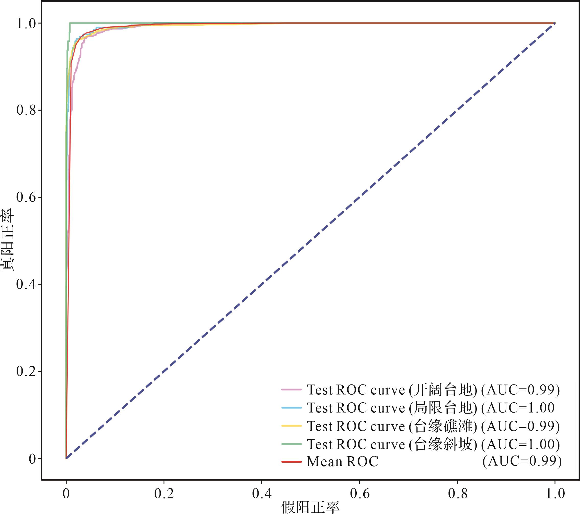
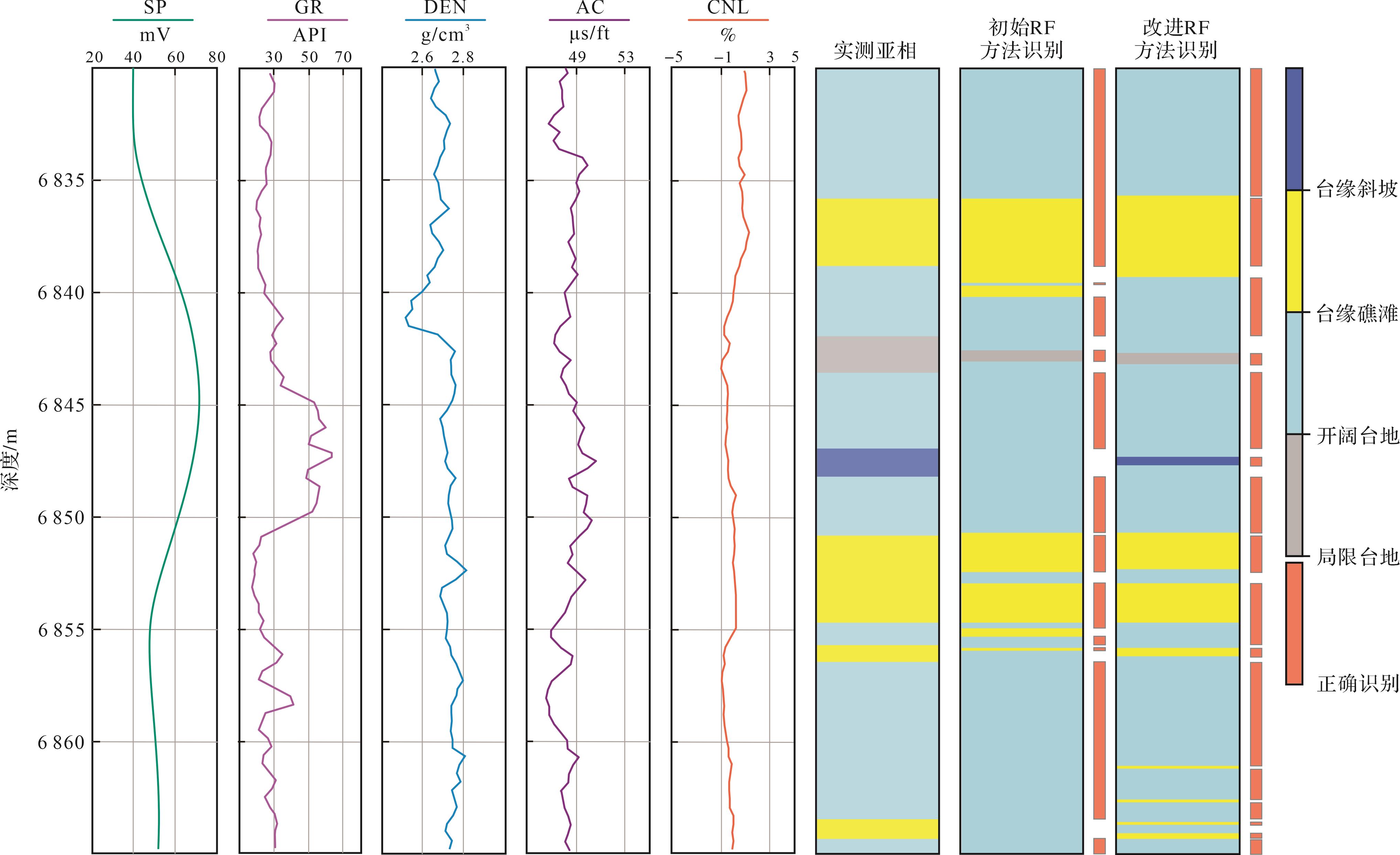
2026, 44(5): 1783-1799.
doi: 10.14027/j.issn.1000-0550.2025.041
Abstract:
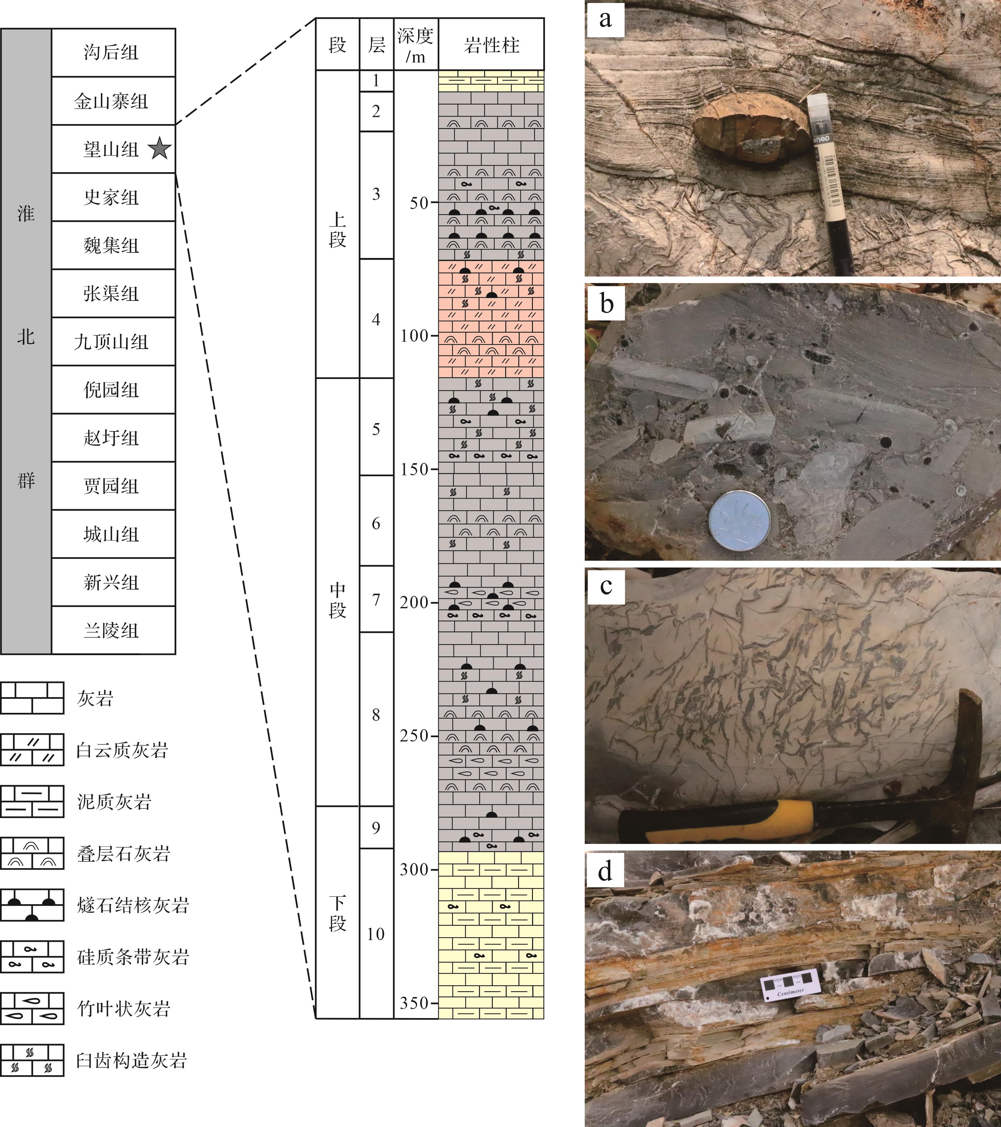
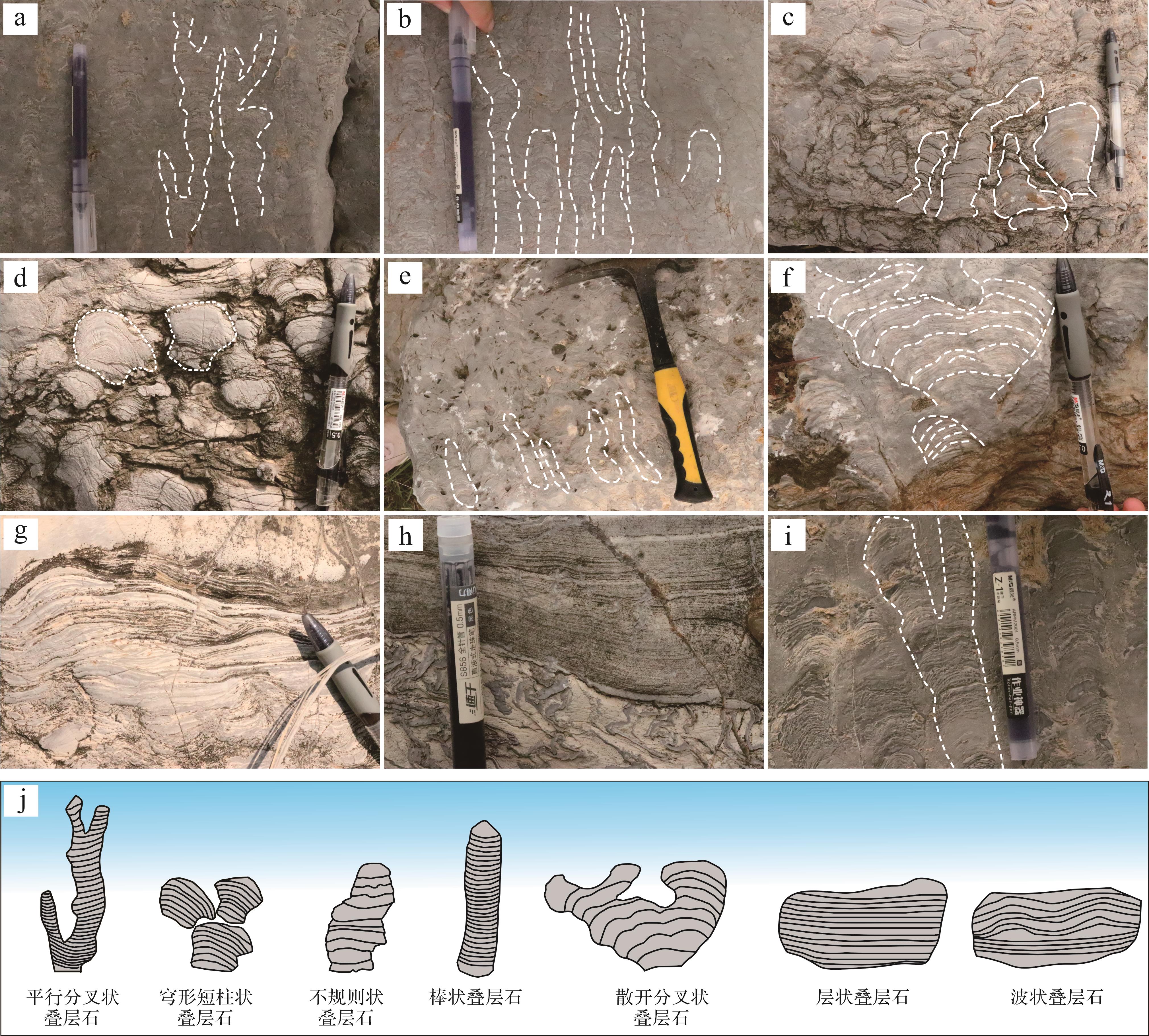
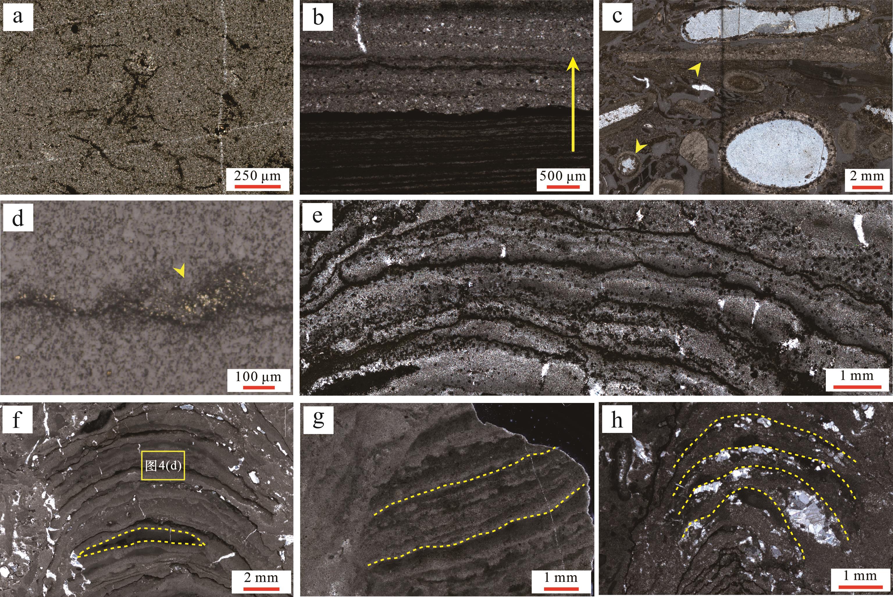
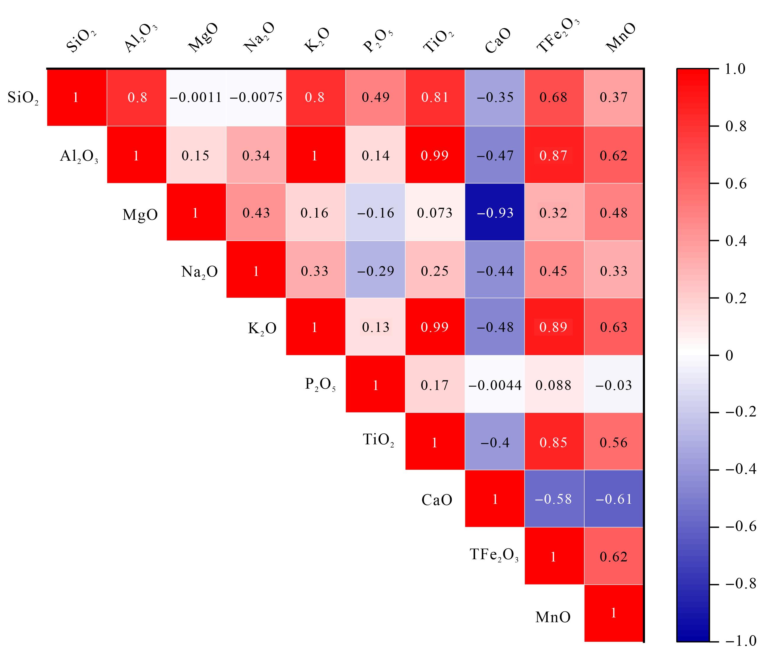
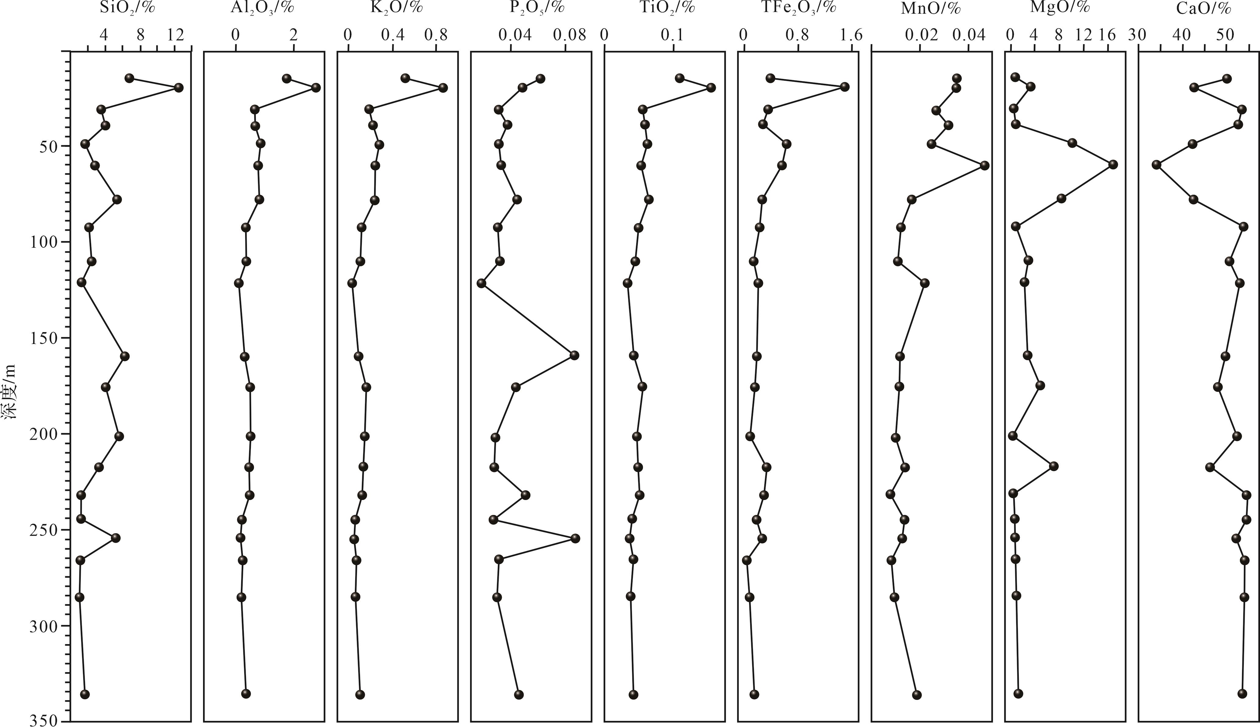
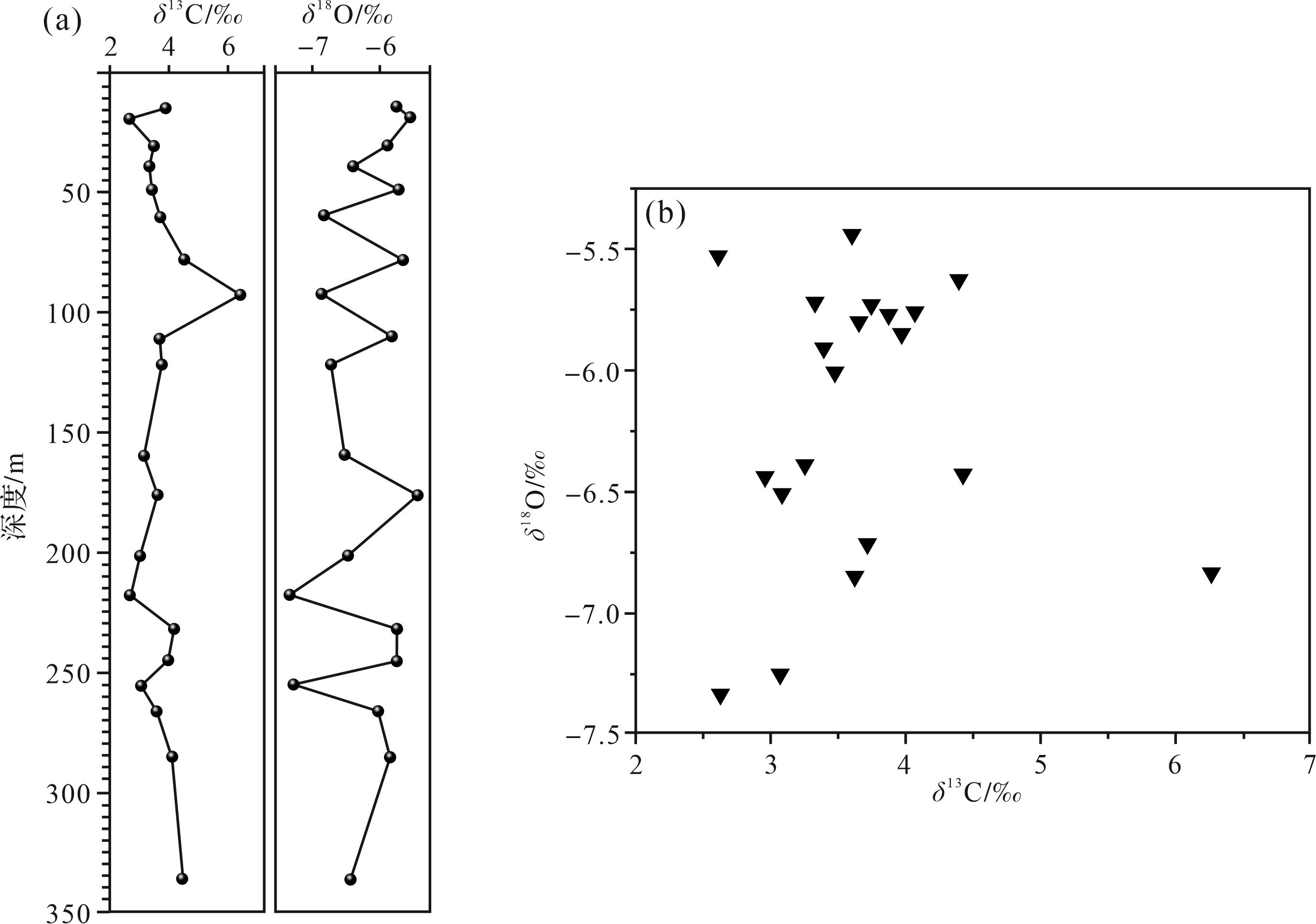
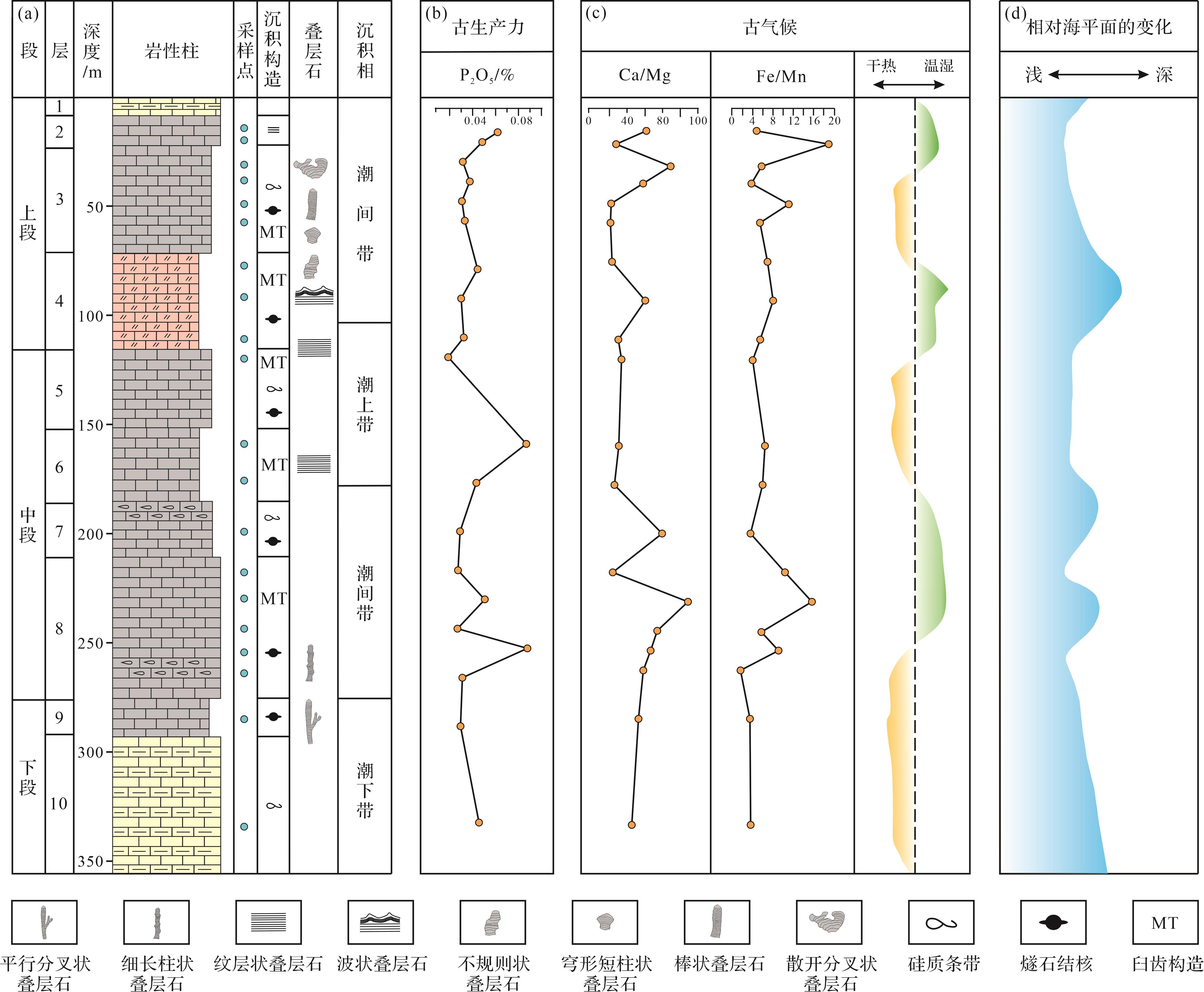
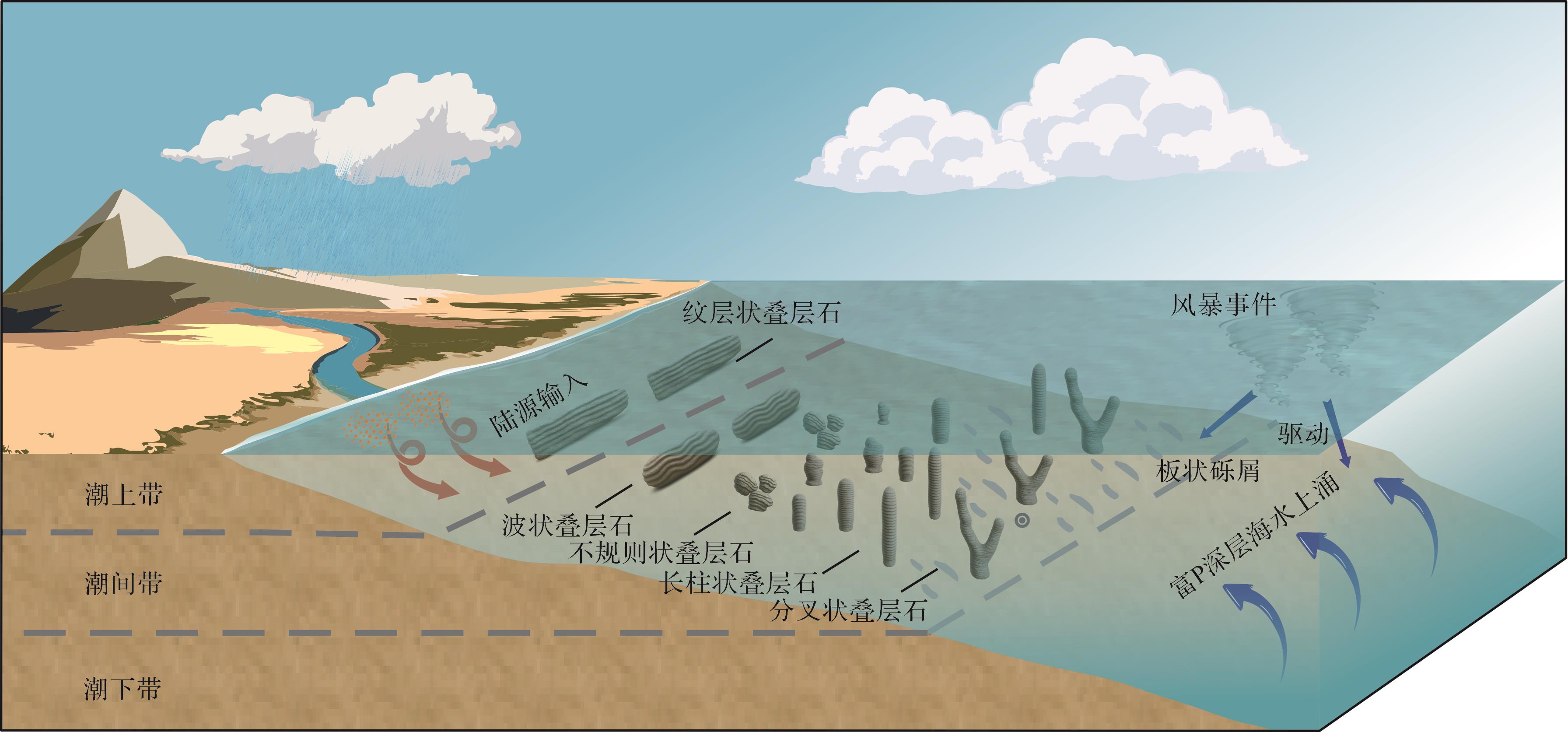
Objective Stromatolites are among the oldest microbial ecosystems on Earth, and they are profound significant for understanding the co-evolution of early life and geological environments. In the southeastern margin of the North China Craton, stromatolites were widely developed in the Neoproterozoic Wangshan Formation in the Xuhuai area. However, the macroscopic and microscopic characteristics of these stromatolites, their response mechanisms to different sedimentary environments, and their paleoclimatic implications remain insufficiently clarified. Methods This study focused on the stromatolites of the Wangshan Formation. Stratigraphic sections were systematically measured at the Heituwo outcrop in Chulan township, Suzhou city, Anhui province, and representative samples were collected for further analysis. Macroscopic observations were conducted to document the external morphology of stromatolites, and petrographic thin sections were examined under both plane-polarized and cross-polarized light to investigate microscopic characteristics. In addition, geochemical analyses were performed, including major element testing and carbon and oxygen isotope measurements. The integration of macro- and micro-scale observations with geochemical indicators made it possible to systematically classify the sedimentary facies of stromatolites in the Wangshan Formation in order to reconstruct their co-evolution with the depositional environment, and to evaluate the primary controlling factors that influenced stromatolite formation during the Neoproterozoic. Results The stromatolites of the Wangshan Formation are mainly divided into three types: columnar, wavy and laminated. Columnar and wavy stromatolites occur predominantly in high-energy intertidal environments, whereas laminated stromatolites are stably distributed in low-energy supratidal zones. Geochemical tests show δ¹³C values between +2.61‰ and +6.26‰. At the bottom of the section, the δ¹³C values decrease slightly, indicating a small-scale sea-level fall. Toward the top of the section, a significant positive increase of δ¹³C was recorded, corresponding to a rapid marine transgression. During this interval, three successive cycles of δ¹³C increase and decrease are recognized, interpreted as reflecting three complete transgression–regression events. The δ¹⁸O values of all samples are greater than –10‰, and there is no clear co-variation between δ¹³C and δ¹⁸O, suggesting that the isotope signals largely preserve primary environmental information. Furthermore, the MgO/CaO ratio of most samples is <0.125, implying that the overall diagenetic modification of the Wangshan Formation carbonates was weak and that their geochemical indicators reliably reflect original depositional conditions. The P₂O₅ content are only weakly correlated with Al₂O₃, K₂O, TiO₂ and SiO₂. It is notable that peak horizons of P₂O₅ are often associated with storm-related bamboo-leaf-shaped intraclasts and stromatolite enrichment. The Al₂O₃, K₂O and TiO₂ contents display a marked increasing trend in the middle and upper portions of the Wangshan Formation, reflecting two distinct phases of sea-level rise, and are consistent with the fluctuations indicated by δ¹³C. In addition, Fe/Mn and Ca/Mg ratios suggest that the depositional period of the Wangshan Formation was characterized by frequent climatic oscillations. Conclusions Stromatolites of the Wangshan Formation record significant paleoenvironmental changes that occurred during the depositional period. Their formation was the result of complex interactions between biological processes and environmental factors. The flourishing of stromatolites was closely coupled with shallow-water environments that developed in relatively arid climatic conditions. On the microscopic scale, the metabolic activities and interactions of microorganisms constrained stromatolite morphology, whereas on the macroscopic scale, factors such as the intensity of terrigenous clastic input and the occurrence of storm events influenced microbial ecological succession. Moreover, accommodation space, light intensity, and hydrodynamic conditions collectively shaped the external morphologies of stromatolites. These findings provide new evidence for the co-evolution of life and the environment during the Neoproterozoic.
Objective Stromatolites are among the oldest microbial ecosystems on Earth, and they are profound significant for understanding the co-evolution of early life and geological environments. In the southeastern margin of the North China Craton, stromatolites were widely developed in the Neoproterozoic Wangshan Formation in the Xuhuai area. However, the macroscopic and microscopic characteristics of these stromatolites, their response mechanisms to different sedimentary environments, and their paleoclimatic implications remain insufficiently clarified. Methods This study focused on the stromatolites of the Wangshan Formation. Stratigraphic sections were systematically measured at the Heituwo outcrop in Chulan township, Suzhou city, Anhui province, and representative samples were collected for further analysis. Macroscopic observations were conducted to document the external morphology of stromatolites, and petrographic thin sections were examined under both plane-polarized and cross-polarized light to investigate microscopic characteristics. In addition, geochemical analyses were performed, including major element testing and carbon and oxygen isotope measurements. The integration of macro- and micro-scale observations with geochemical indicators made it possible to systematically classify the sedimentary facies of stromatolites in the Wangshan Formation in order to reconstruct their co-evolution with the depositional environment, and to evaluate the primary controlling factors that influenced stromatolite formation during the Neoproterozoic. Results The stromatolites of the Wangshan Formation are mainly divided into three types: columnar, wavy and laminated. Columnar and wavy stromatolites occur predominantly in high-energy intertidal environments, whereas laminated stromatolites are stably distributed in low-energy supratidal zones. Geochemical tests show δ¹³C values between +2.61‰ and +6.26‰. At the bottom of the section, the δ¹³C values decrease slightly, indicating a small-scale sea-level fall. Toward the top of the section, a significant positive increase of δ¹³C was recorded, corresponding to a rapid marine transgression. During this interval, three successive cycles of δ¹³C increase and decrease are recognized, interpreted as reflecting three complete transgression–regression events. The δ¹⁸O values of all samples are greater than –10‰, and there is no clear co-variation between δ¹³C and δ¹⁸O, suggesting that the isotope signals largely preserve primary environmental information. Furthermore, the MgO/CaO ratio of most samples is <0.125, implying that the overall diagenetic modification of the Wangshan Formation carbonates was weak and that their geochemical indicators reliably reflect original depositional conditions. The P₂O₅ content are only weakly correlated with Al₂O₃, K₂O, TiO₂ and SiO₂. It is notable that peak horizons of P₂O₅ are often associated with storm-related bamboo-leaf-shaped intraclasts and stromatolite enrichment. The Al₂O₃, K₂O and TiO₂ contents display a marked increasing trend in the middle and upper portions of the Wangshan Formation, reflecting two distinct phases of sea-level rise, and are consistent with the fluctuations indicated by δ¹³C. In addition, Fe/Mn and Ca/Mg ratios suggest that the depositional period of the Wangshan Formation was characterized by frequent climatic oscillations. Conclusions Stromatolites of the Wangshan Formation record significant paleoenvironmental changes that occurred during the depositional period. Their formation was the result of complex interactions between biological processes and environmental factors. The flourishing of stromatolites was closely coupled with shallow-water environments that developed in relatively arid climatic conditions. On the microscopic scale, the metabolic activities and interactions of microorganisms constrained stromatolite morphology, whereas on the macroscopic scale, factors such as the intensity of terrigenous clastic input and the occurrence of storm events influenced microbial ecological succession. Moreover, accommodation space, light intensity, and hydrodynamic conditions collectively shaped the external morphologies of stromatolites. These findings provide new evidence for the co-evolution of life and the environment during the Neoproterozoic.
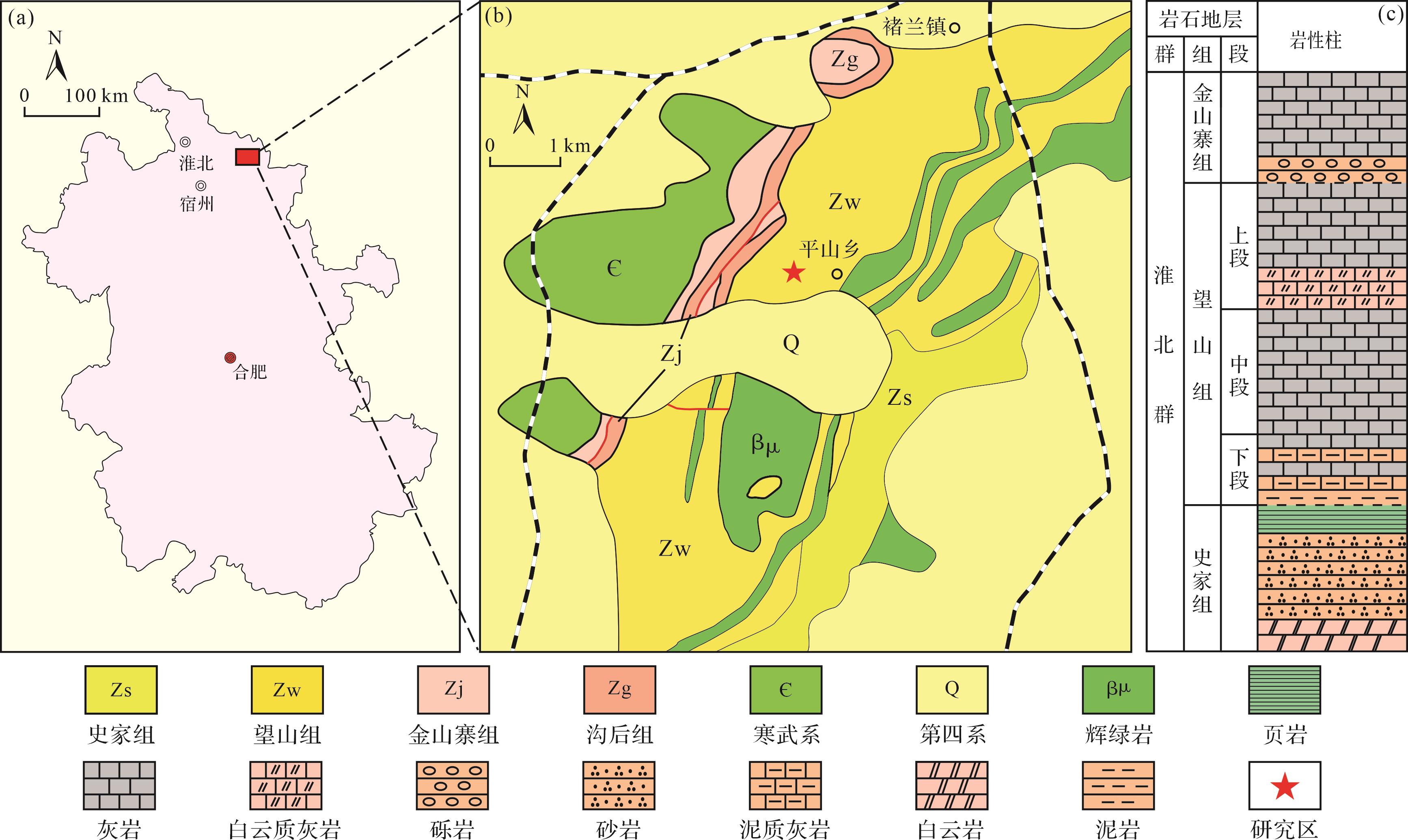
2026, 44(5): 1800-1812.
doi: 10.14027/j.issn.1000-0550.2025.050
Abstract:
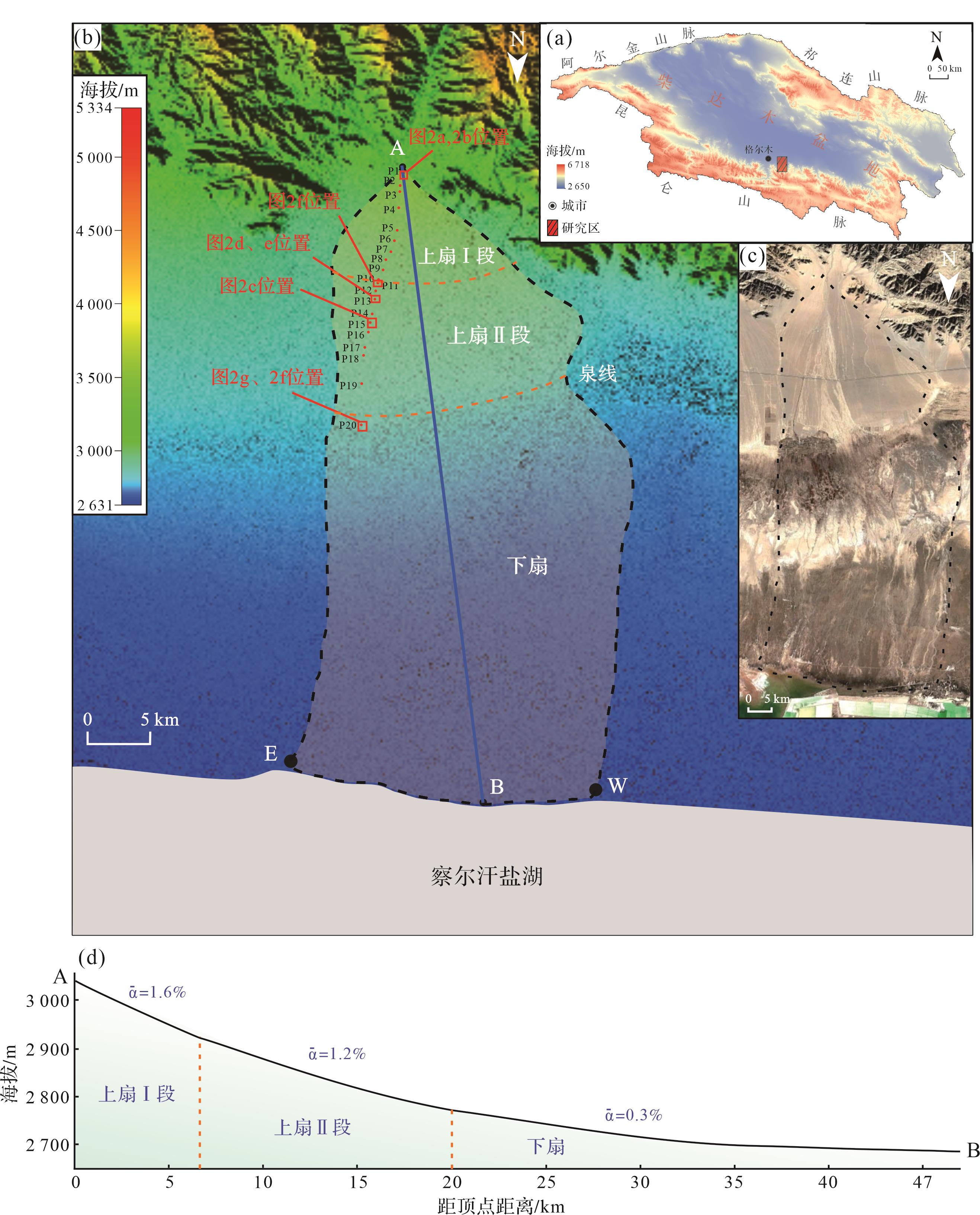
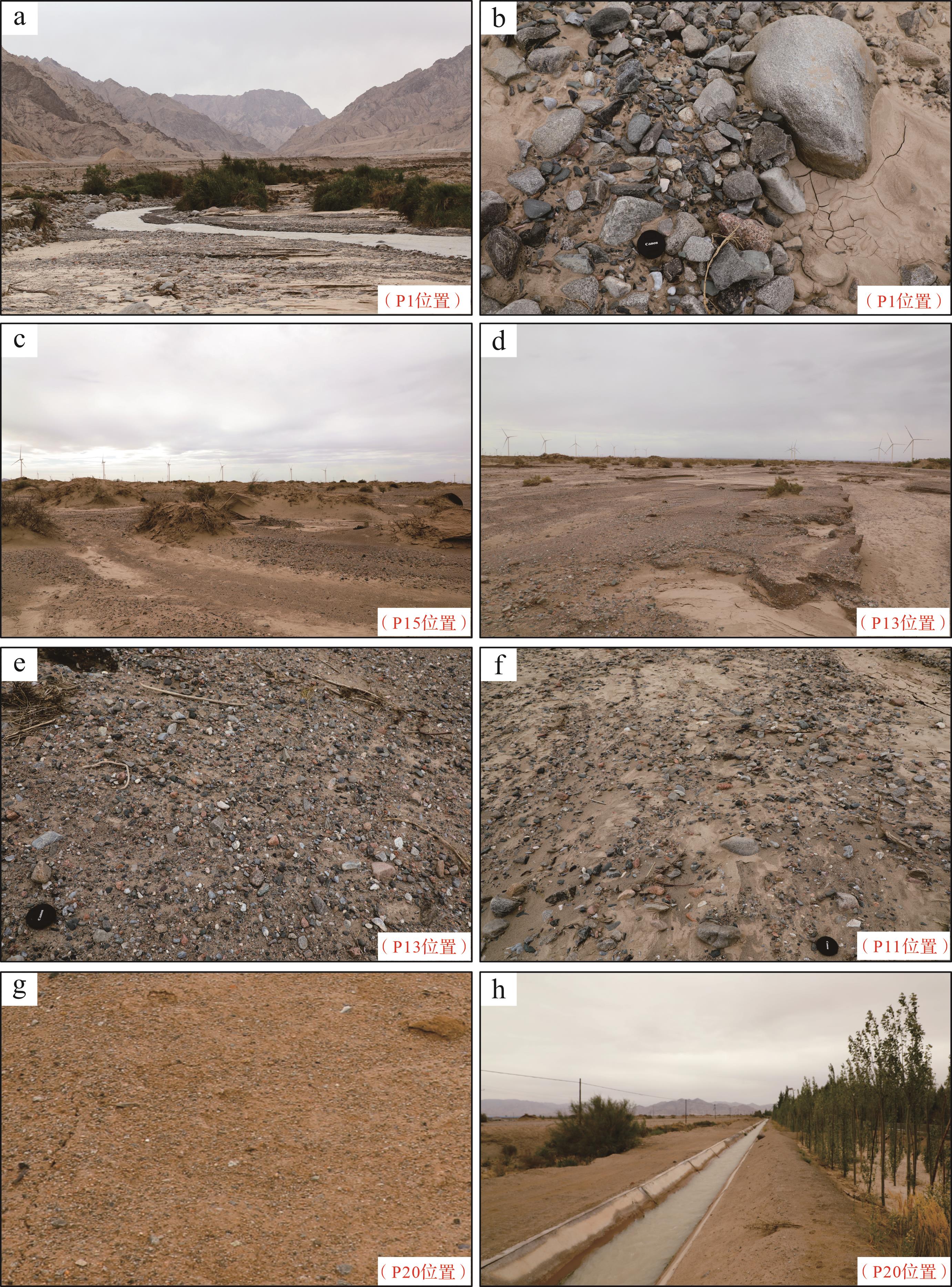
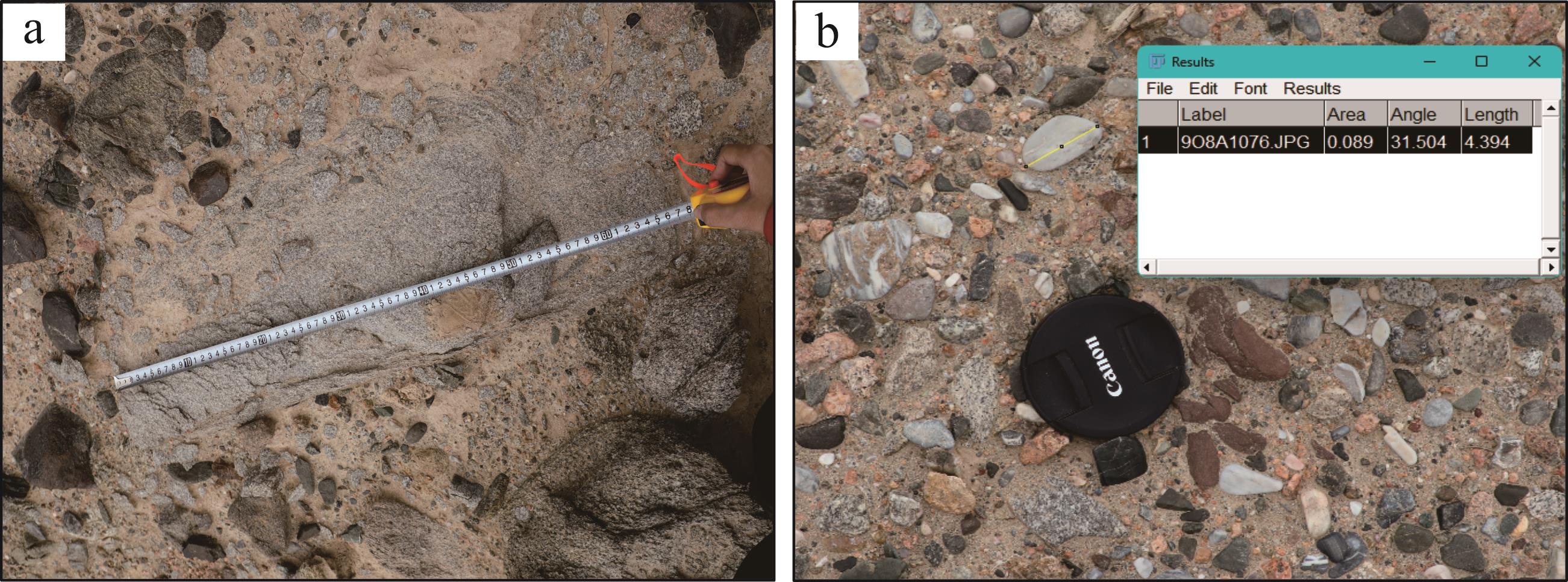
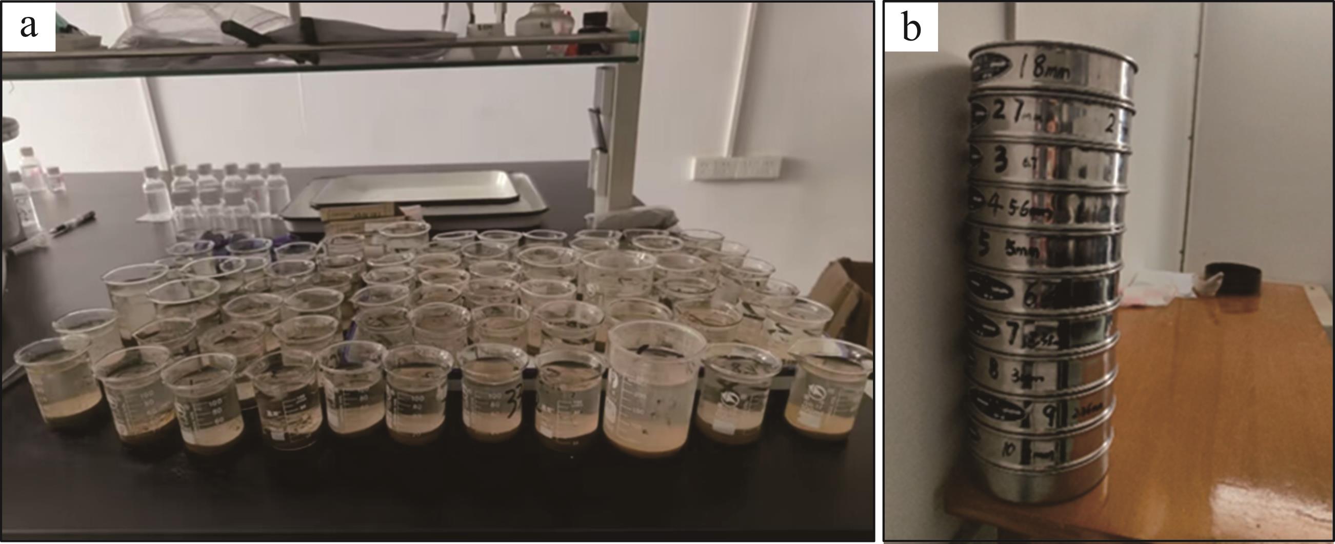
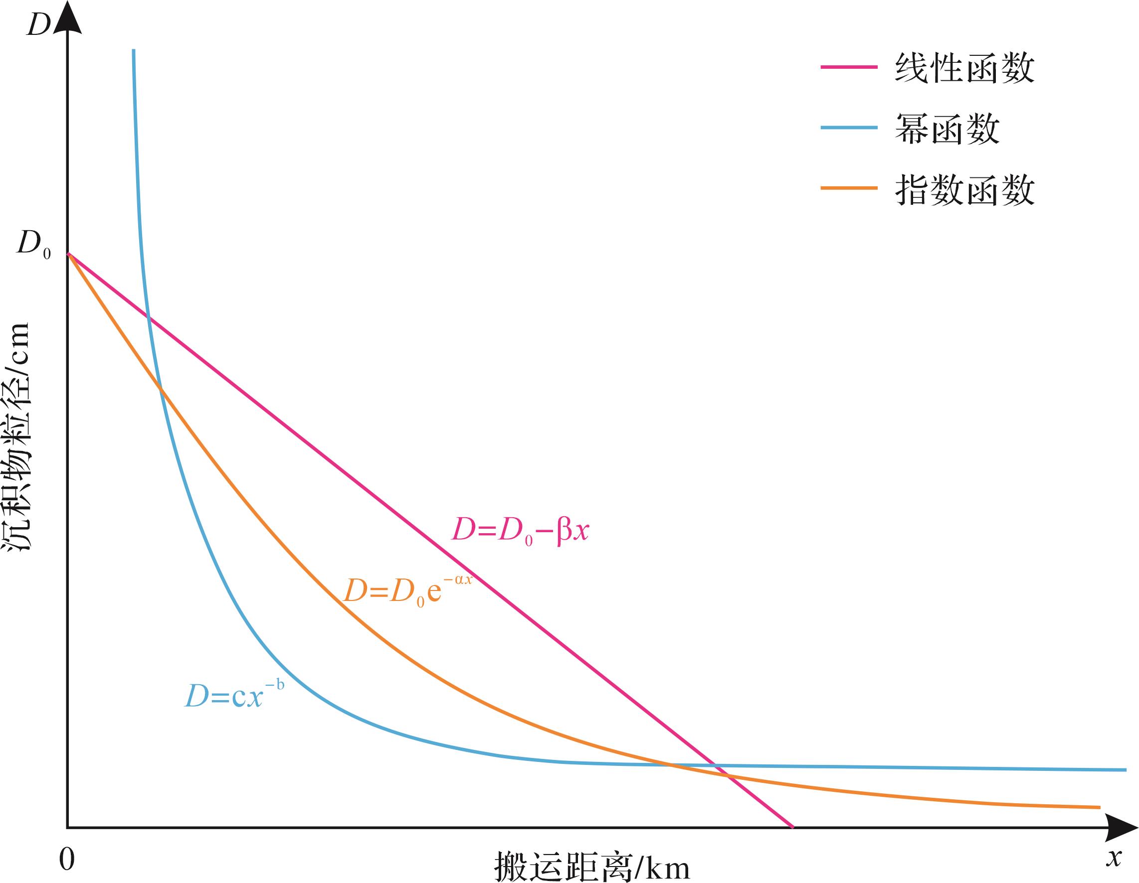
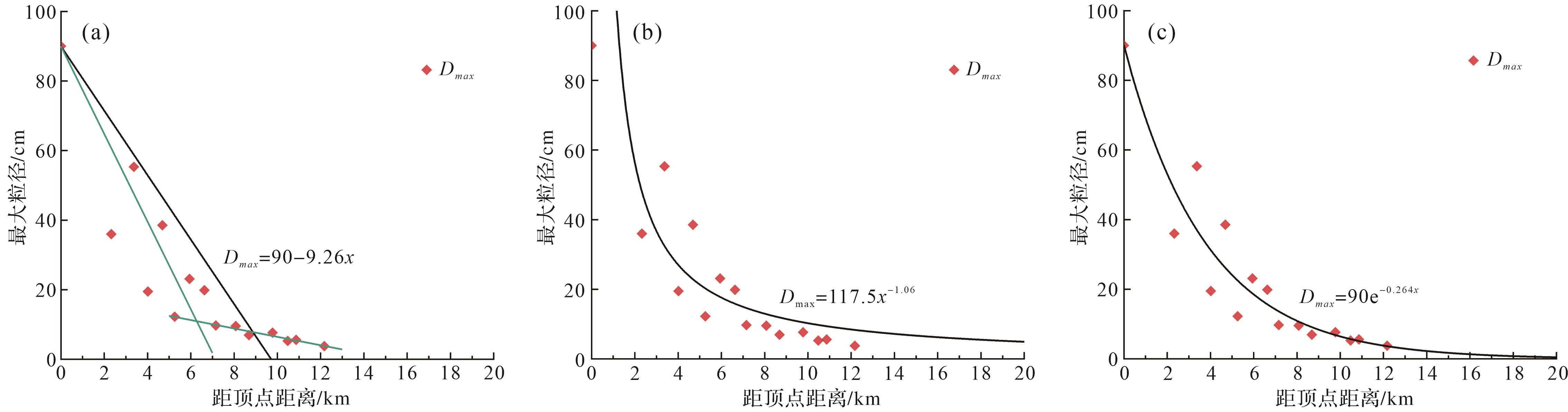
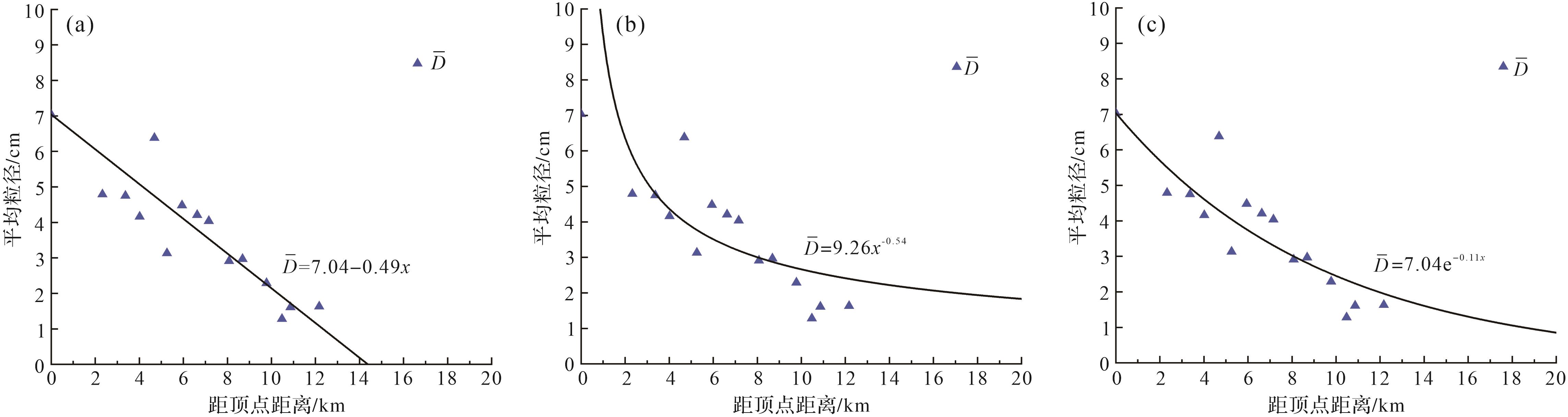
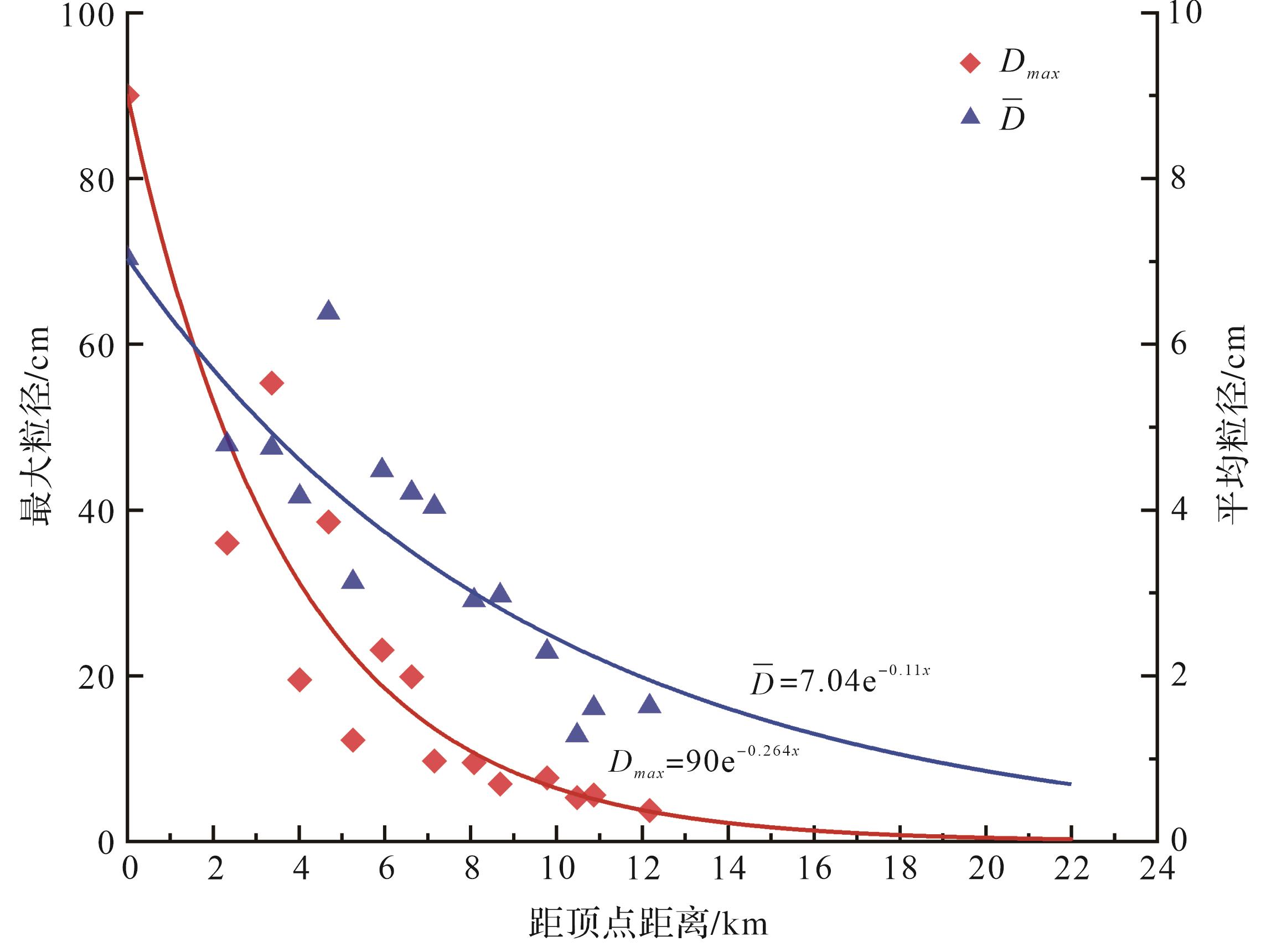
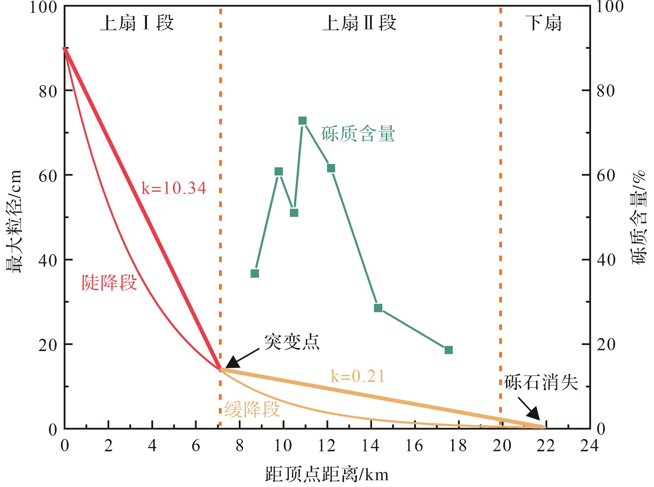
Objective The study aimed to establish a quantitative model of downstream grain-size diminution in large-scale distributive fluvial systems (fluvial fans), and thus provide a knowledge base for predicting the distribution of sedimentary systems in intelligent oil and gas exploration and development. Methods Detailed descriptions of channel morphology and sediment grain size were conducted in the Dagele fluvial fan of the Qaidam Basin, Qinghai, by combining field investigations with Google Earth, 91 Wei Tu, and ImageJ geographic information software. Appropriate methods were selected to fit grain-size variation curves, and the longitudinal changes in gravel size were summarized. Results It was found that the sediment grain size of the Dagele fluvial fan is generally coarse, being dominated by gravels with a maximum clast size up to 90 cm at the apex of the fan, and a clearly diminishing trend from the apex to the distal end. Exponential functions produced the best fit of the trend of gravel-size diminution: for maximum clast size vs. distance, Dmax= 90e-0.264x; for average clast size vs. distance,D ¯
Objective The study aimed to establish a quantitative model of downstream grain-size diminution in large-scale distributive fluvial systems (fluvial fans), and thus provide a knowledge base for predicting the distribution of sedimentary systems in intelligent oil and gas exploration and development. Methods Detailed descriptions of channel morphology and sediment grain size were conducted in the Dagele fluvial fan of the Qaidam Basin, Qinghai, by combining field investigations with Google Earth, 91 Wei Tu, and ImageJ geographic information software. Appropriate methods were selected to fit grain-size variation curves, and the longitudinal changes in gravel size were summarized. Results It was found that the sediment grain size of the Dagele fluvial fan is generally coarse, being dominated by gravels with a maximum clast size up to 90 cm at the apex of the fan, and a clearly diminishing trend from the apex to the distal end. Exponential functions produced the best fit of the trend of gravel-size diminution: for maximum clast size vs. distance, Dmax= 90e-0.264x; for average clast size vs. distance,
2026, 44(5): 1813-1832.
doi: 10.14027/j.issn.1000-0550.2026.010
Abstract:
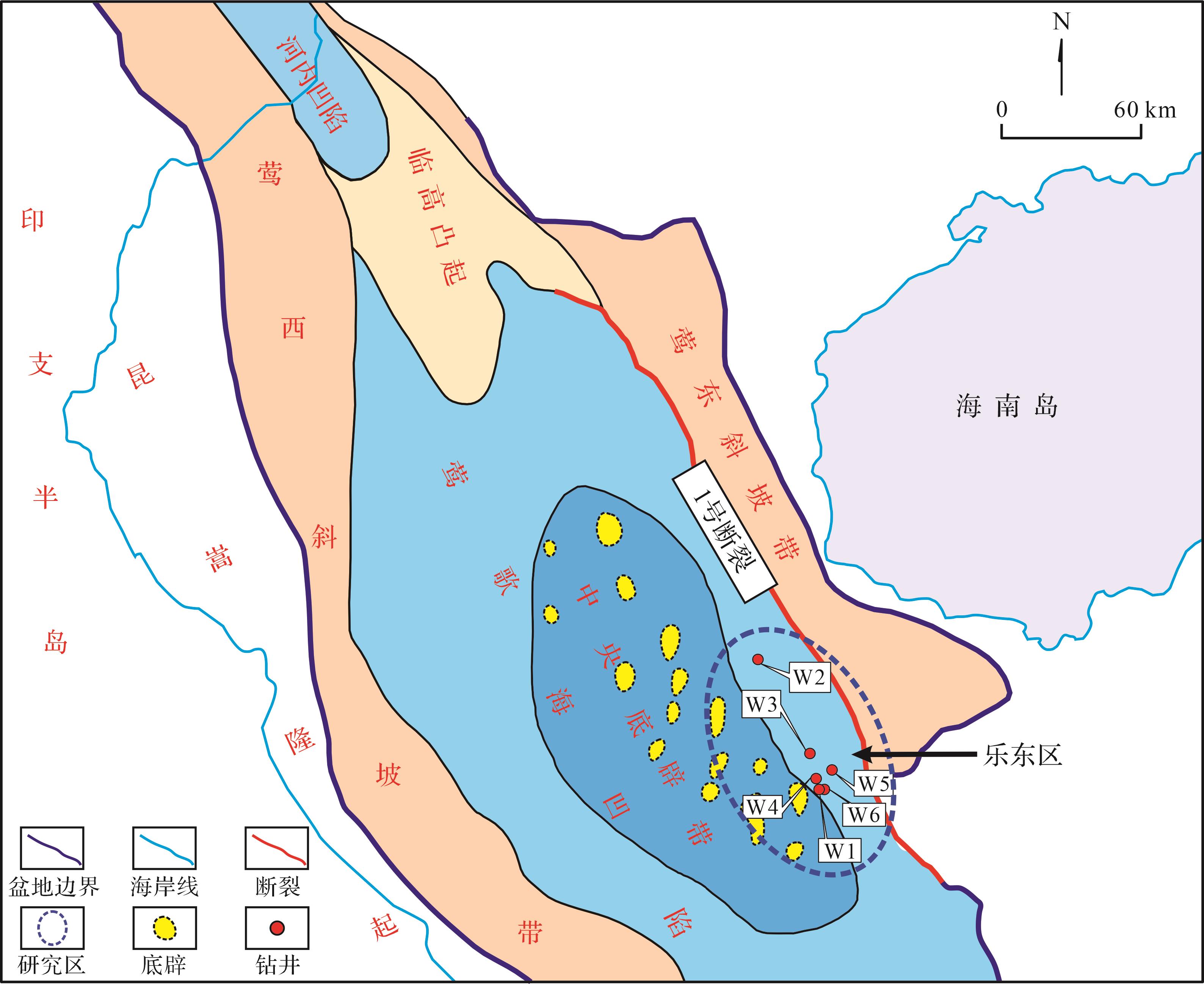
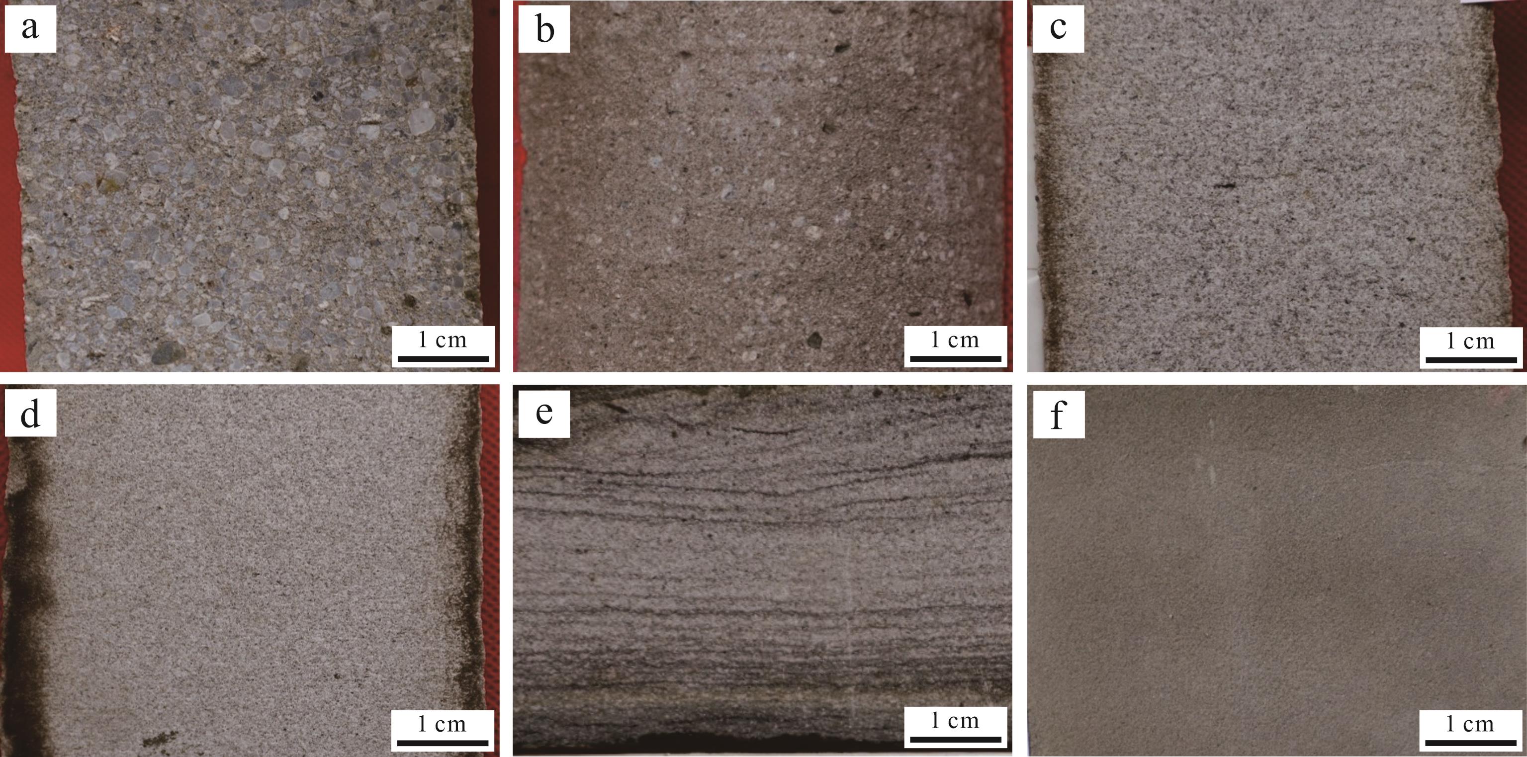
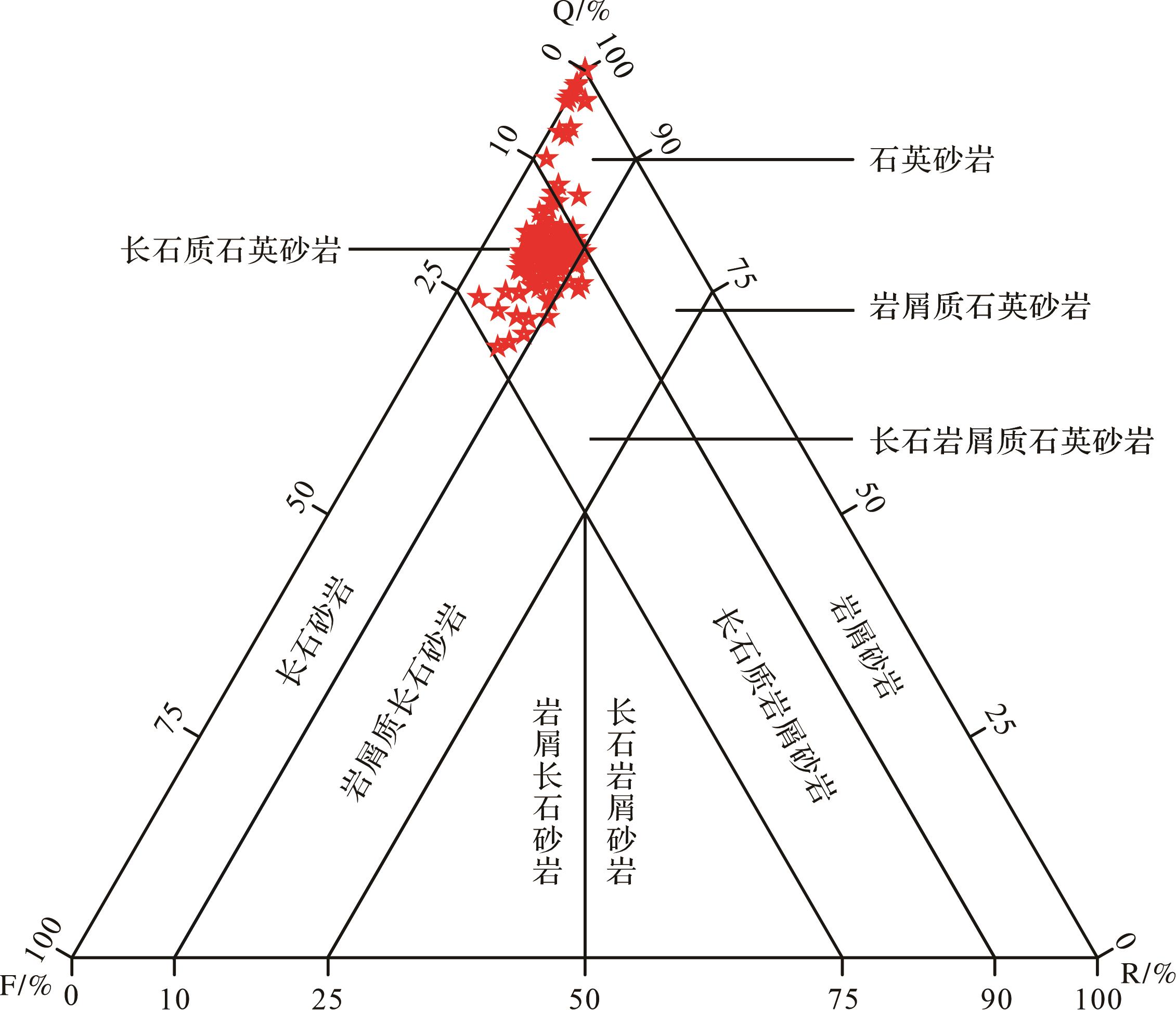
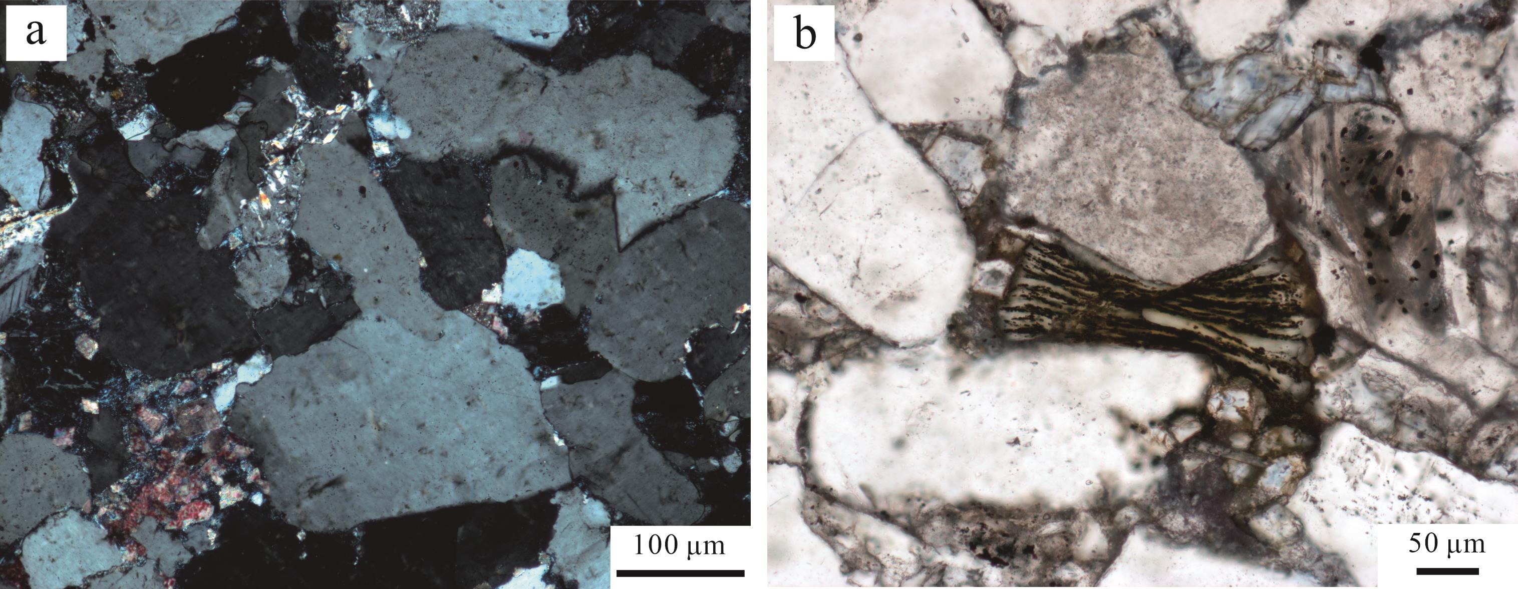
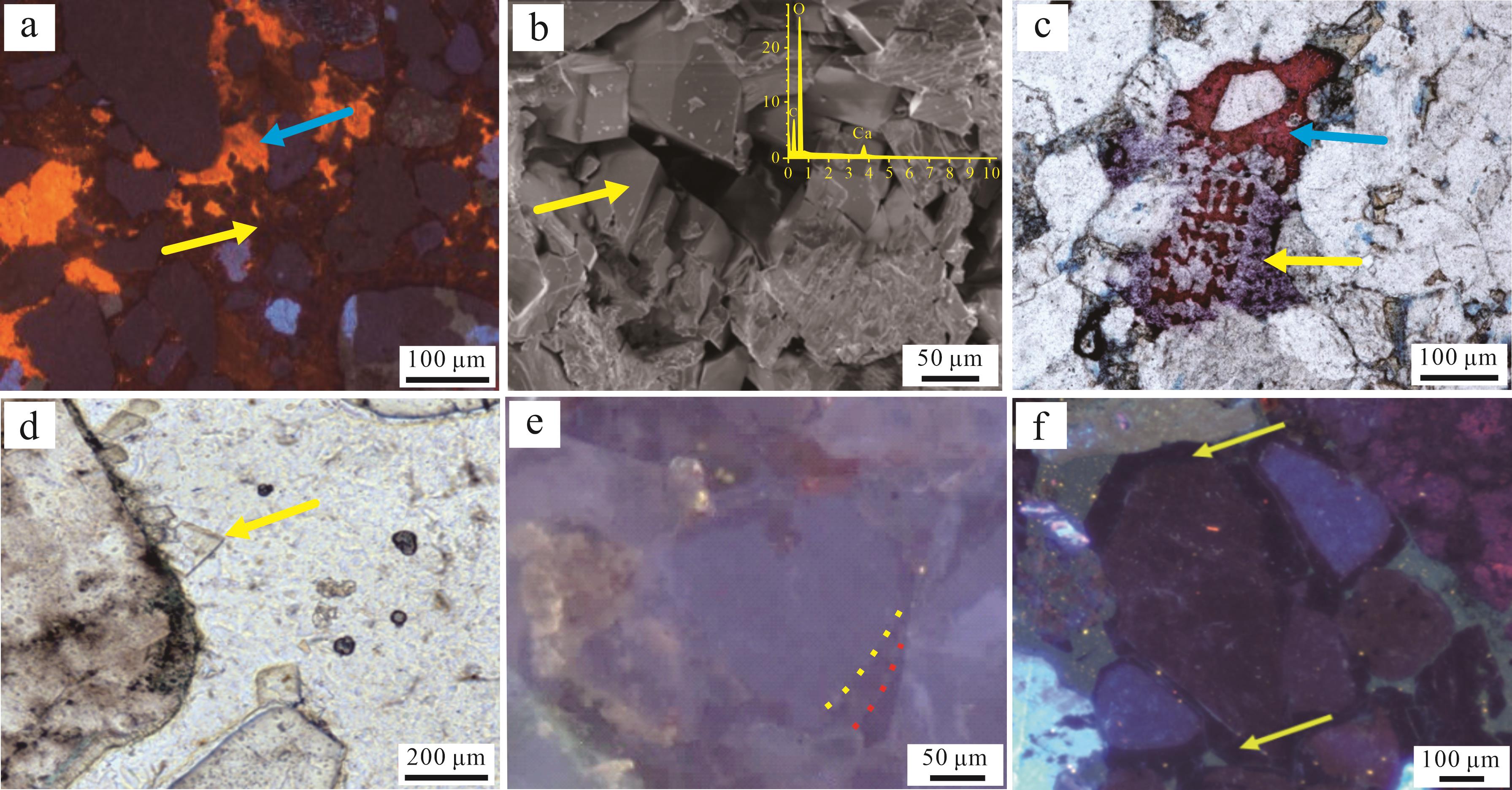
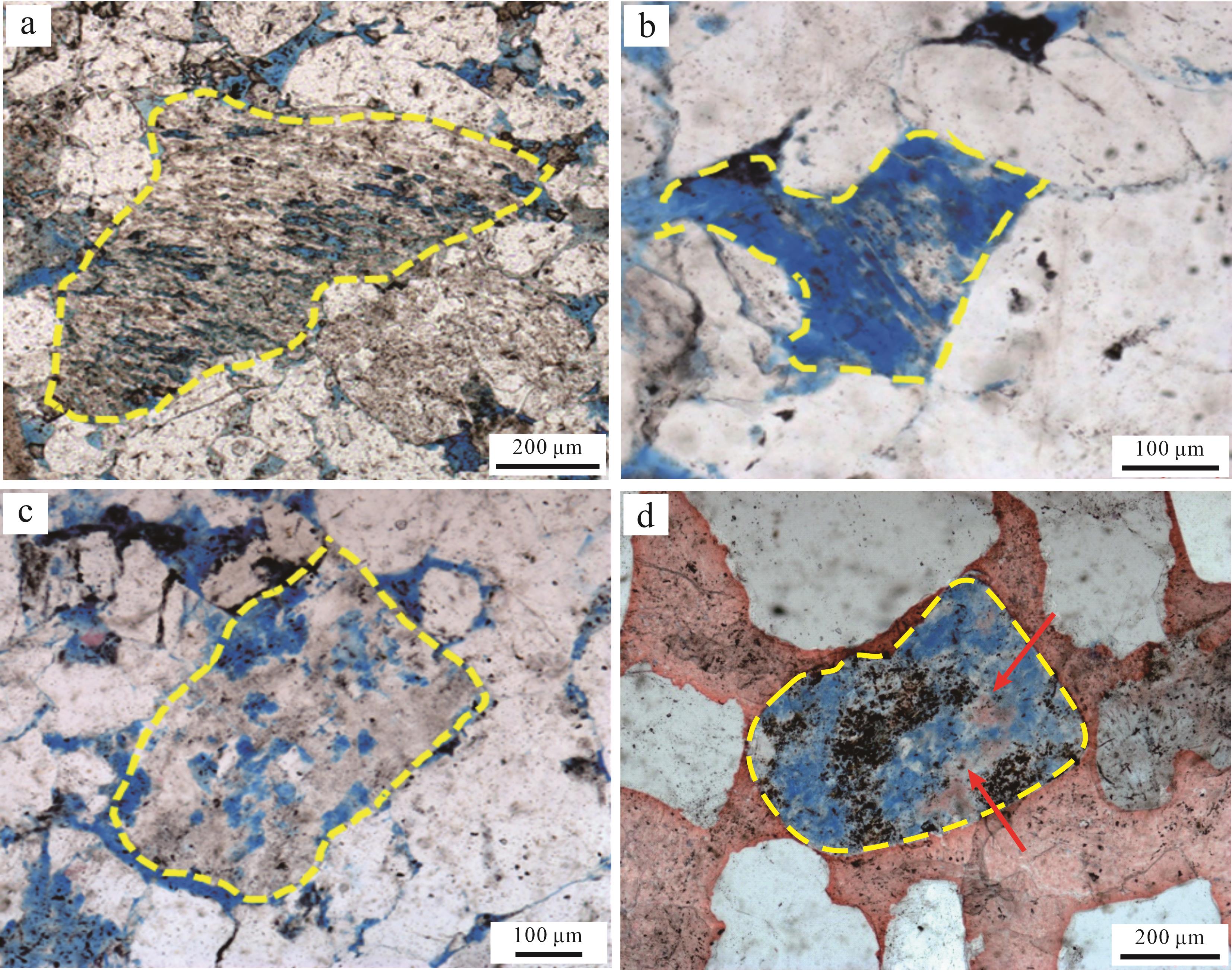
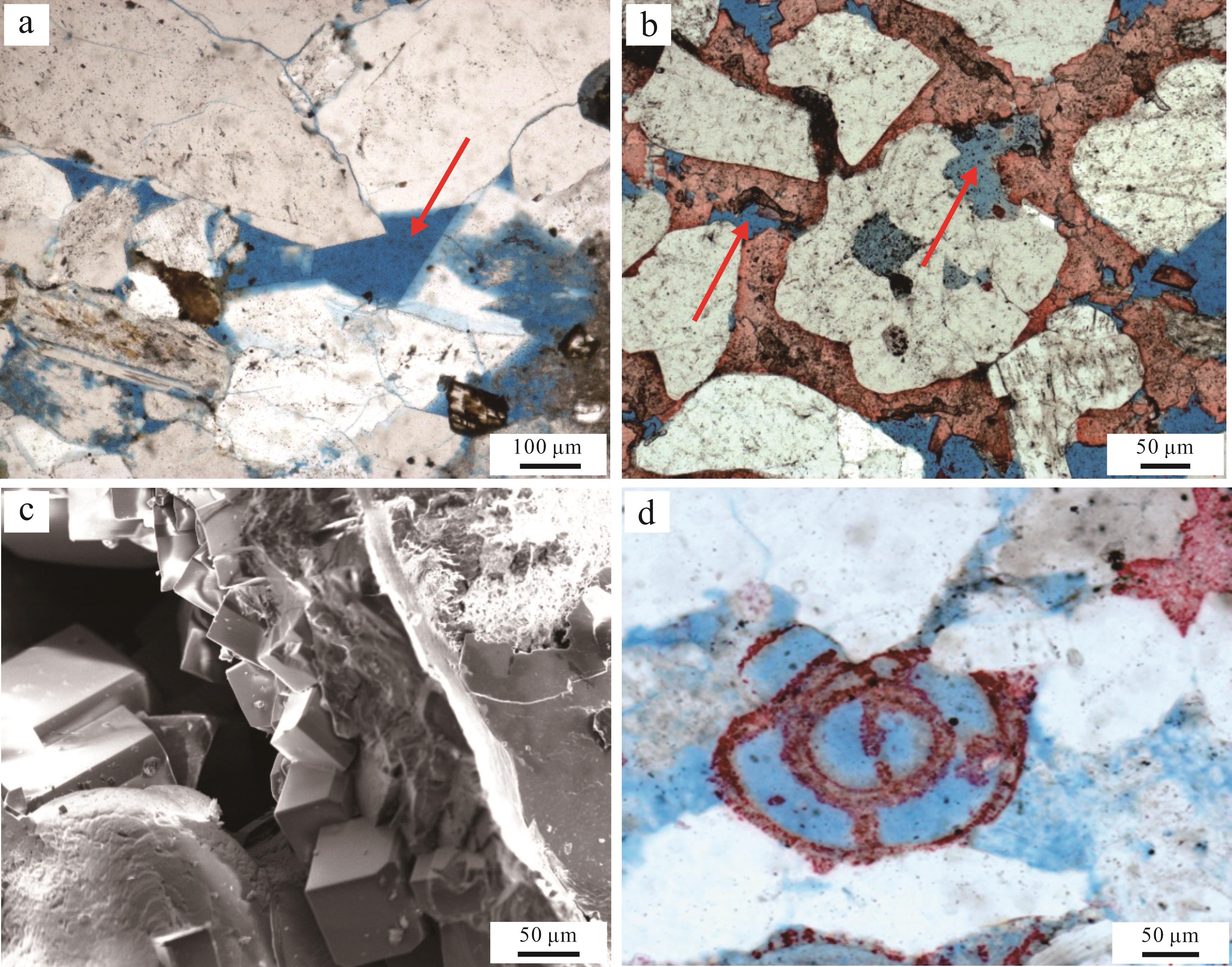
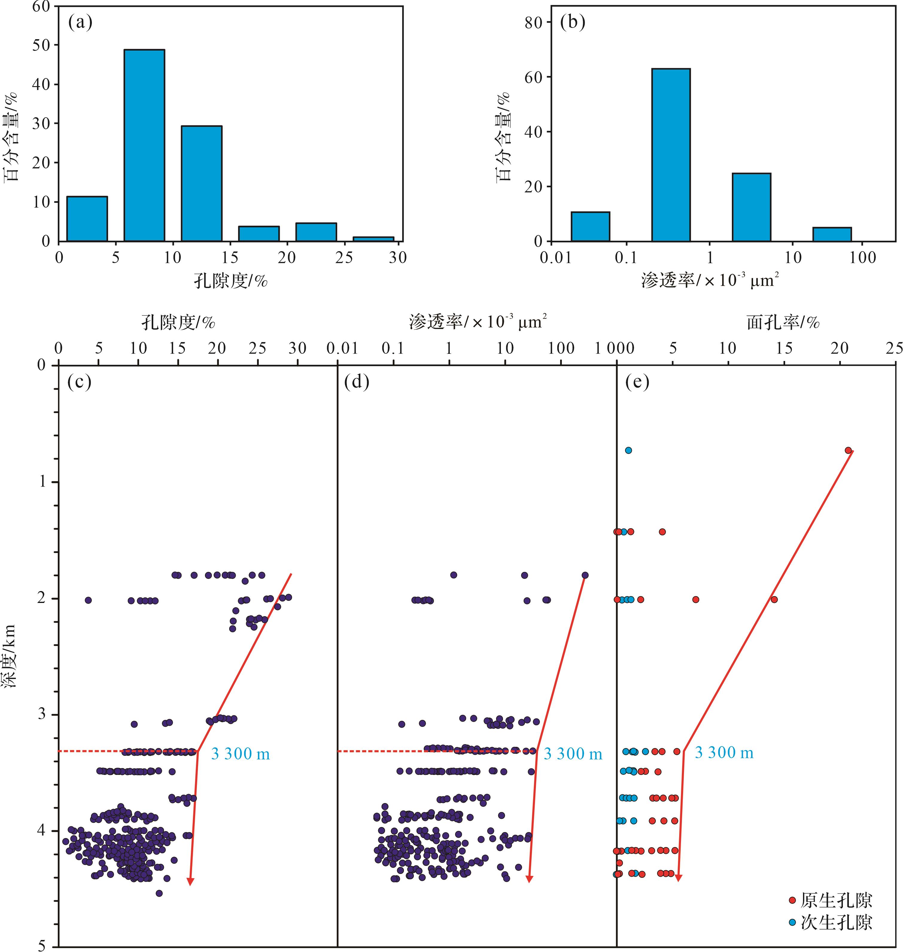
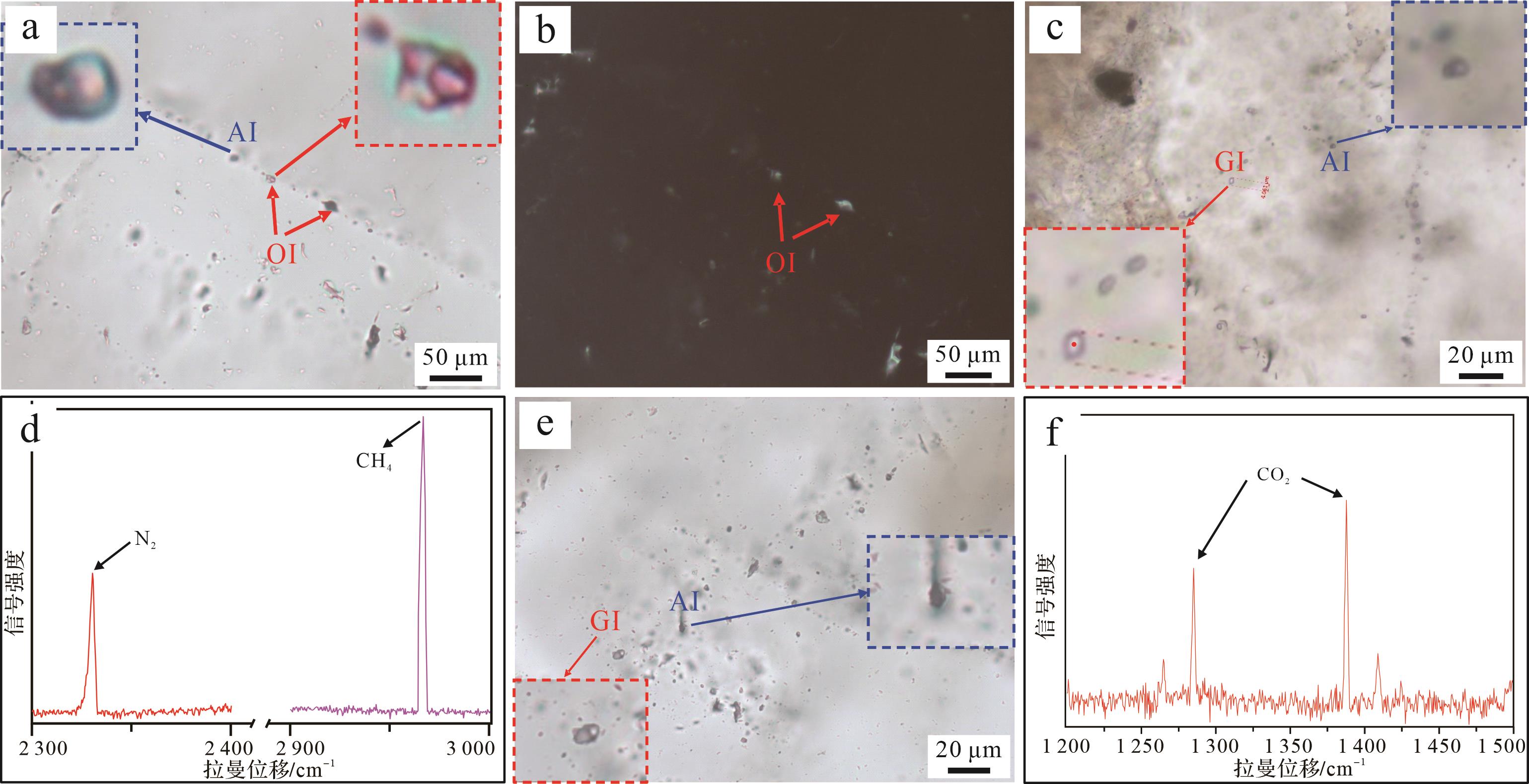
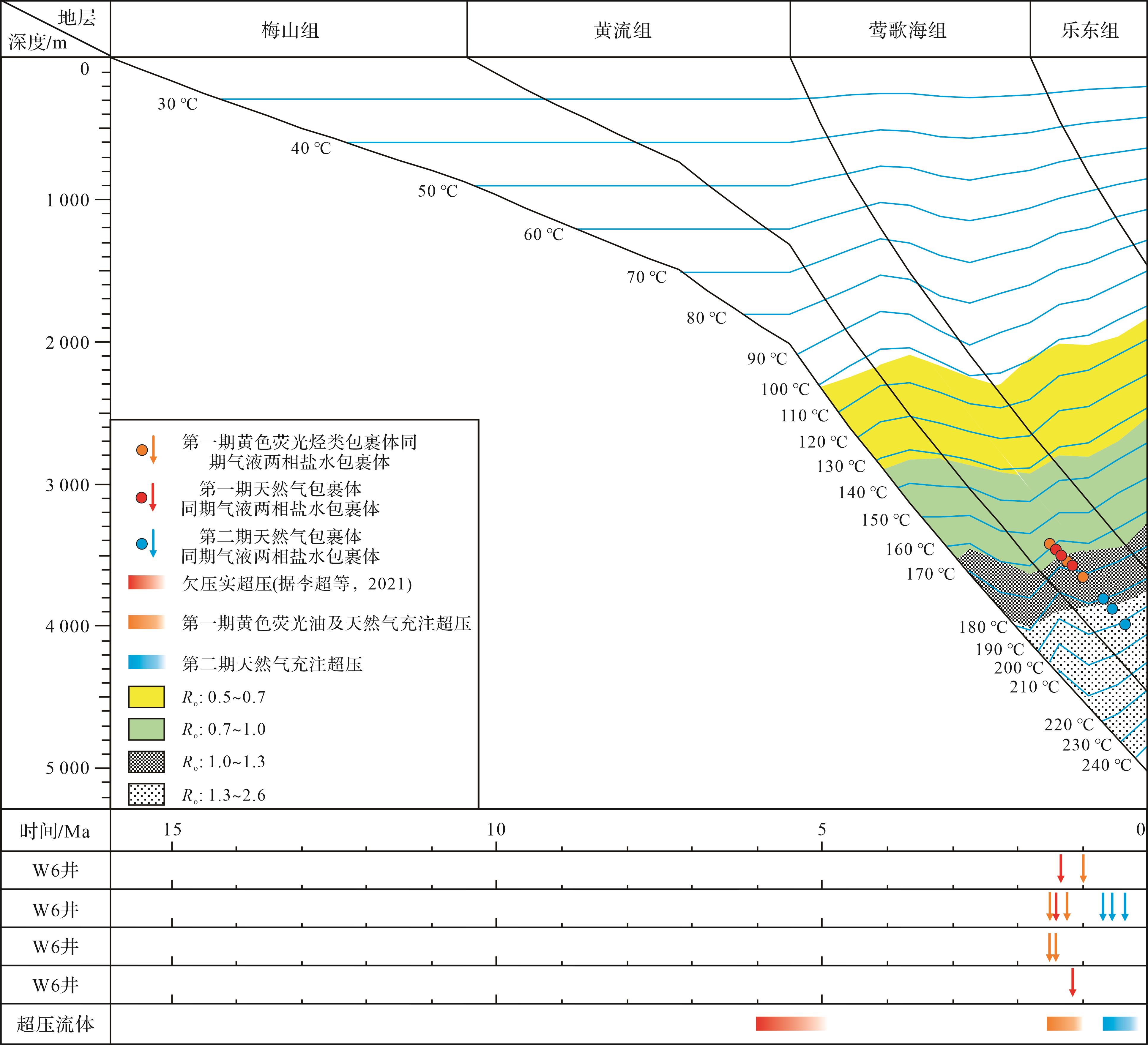
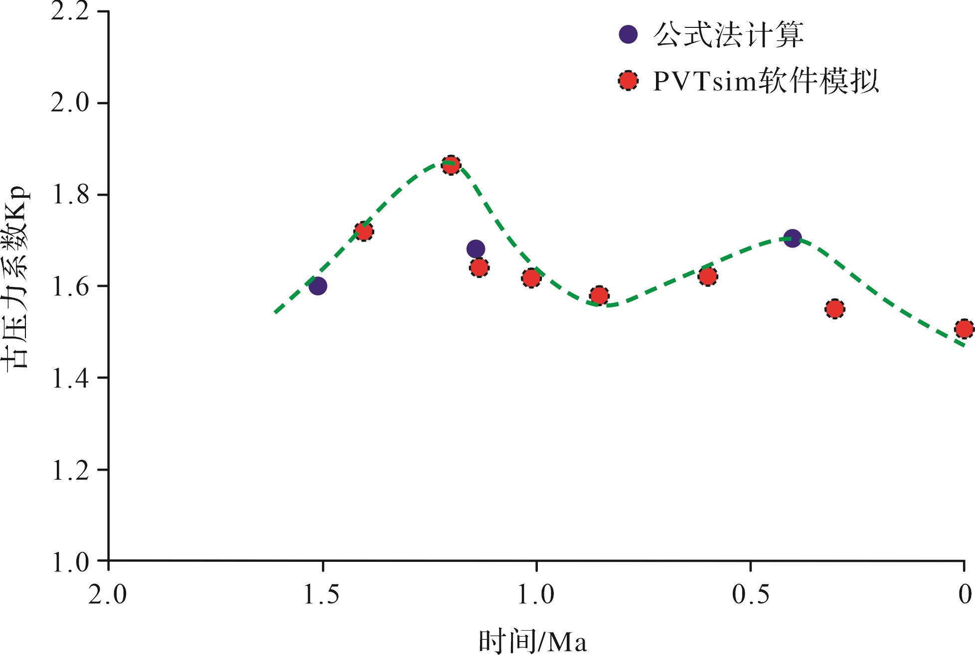
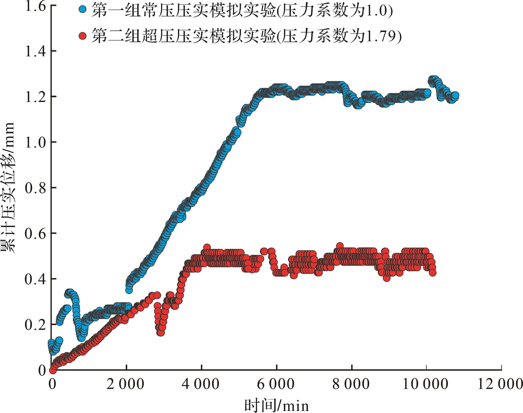
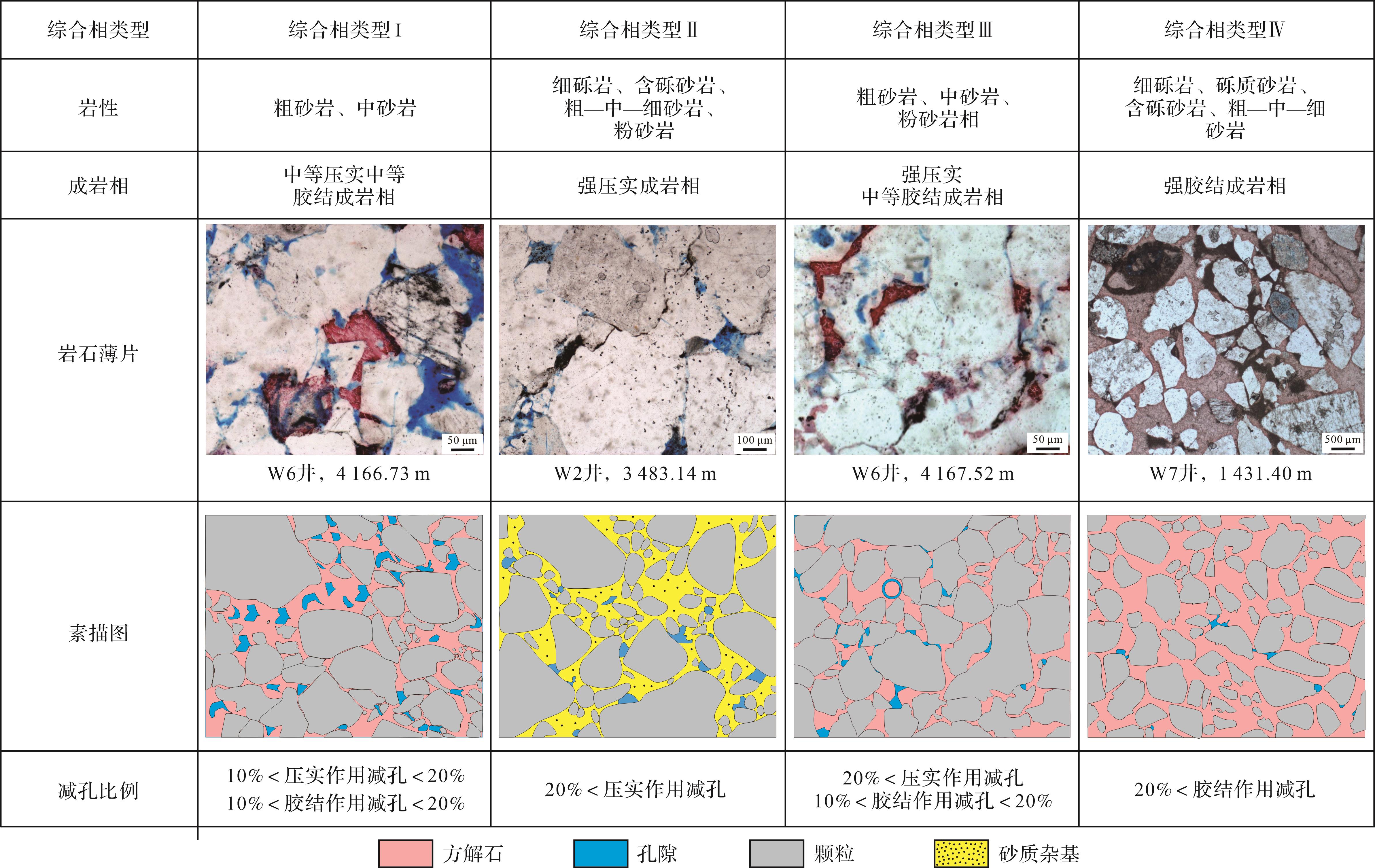
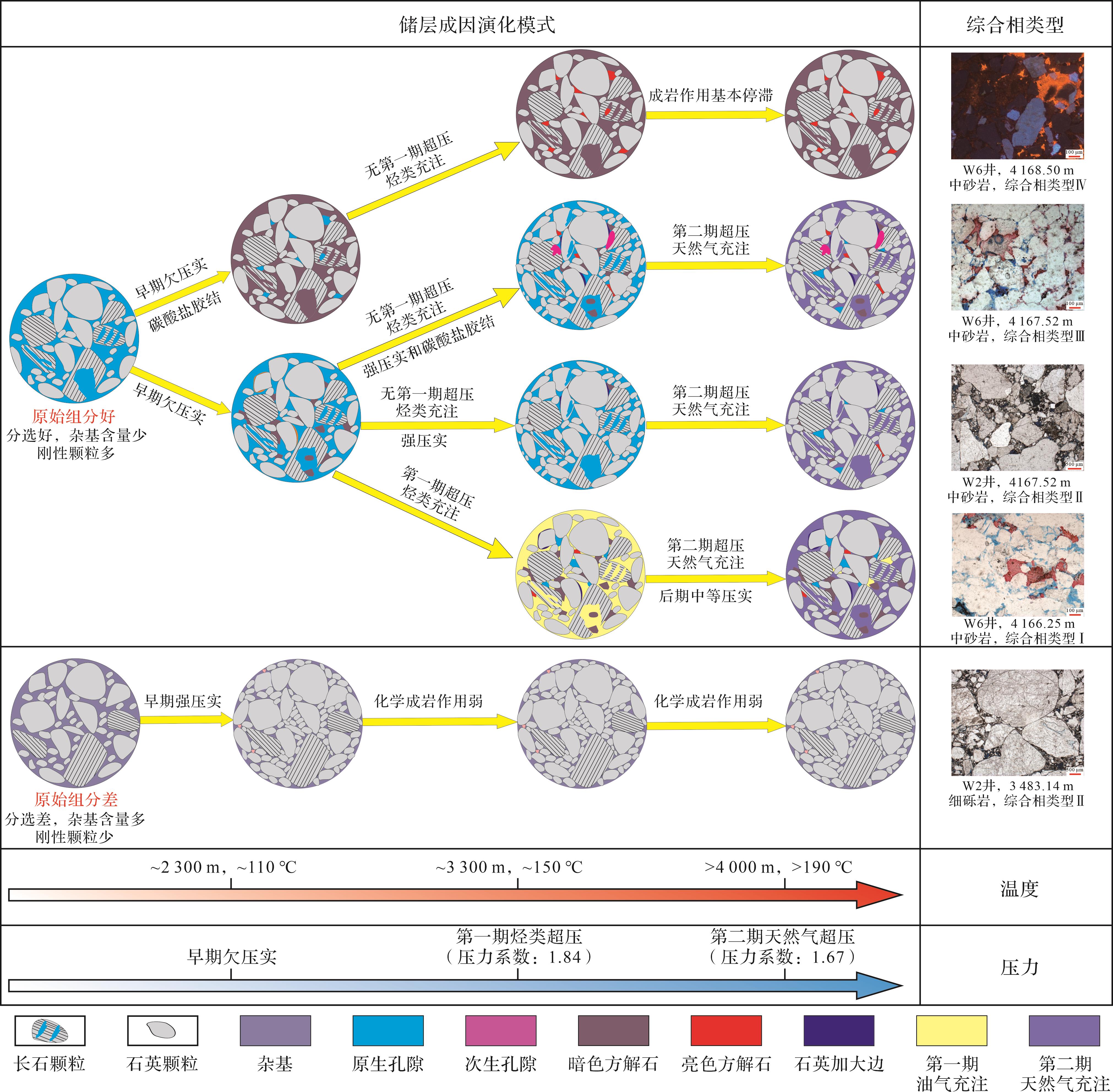
Objective The Yinggehai Basin is characterized by high heat flow, rapid sedimentation, and widespread overpressure, which together create a unique geological setting featuring a high-temperatureoverpressure coupling for the deep clastic reservoirs of the Huangliu Formation. Despite its significant exploration potential, the genesis of high-quality reservoirs under such extreme conditions remains poorly understood, restricting further hydro-carbon exploration in the deep strata. Methods To address this, a systematic investigation was conducted on the reservoir characteristics and the formation mechanisms of high-quality clastic reservoirs in the Huangliu Formation in the Ledong area, Yinggehai Basin. A multi-technique approach was employed, including detailed core observations, thin-section identification by casting, cathodoluminescence thin-section analysis, scanning electron microscopy (SEM) observations, fluid inclusion homogenization temperature measurements, paleopressure reconstruction, and quantitative compaction simulation experiments. These methods enabled comprehensive characterization of the diagenetic evolution, pore types, and controlling factors of reservoir quality under deep-burial conditions. Results The results show that the reservoir rocks are predominantly feldspathic quartz sandstones, with minor lithic fragments. Diagenesis is dominated by moderate to strong mechanical compaction and calcite cementation, followed by siliceous cementation in the form of quartz overgrowths. Dissolution is generally weak and occurs only locally, contributing little to porosity enhancement. Pore spaces are overwhelmingly dominated by primary intergranular pores, with only a minor proportion of secondary dissolution pores derived from feldspar dissolution. Lithology plays a fundamental role in determining initial porosity and resistance to compaction: medium- to coarse-grained sandstones with low matrix content and high rigid grain content exhibit the highest resistance to porosity loss during burial, thus laying the foundation for reservoir quality. Since 6 Ma, moderate to strong overpressure has developed at depths of approximately 2 300 m, which significantly suppressed both compaction and cementation. This overpressure effectively preserved large volumes of early-formed primary pores, resulting in reservoirs buried deeper than 4 000 m that still retain primary porosity as the dominant pore type. Conclusions Based on these findings, a genetic model for deep high-quality clastic reservoirs is established, summarized as “lithology as the foundation, diagenesis promoting differentiation, and overpressure preserving pores.” Within this framework, overpressure development, the presence of medium- to coarse-grained sandstones, and diagenetic facies characterized by moderate compaction and moderate cementation are identified as the main controlling factors for the formation of high-quality reservoirs in the deep Huangliu Formation in the Ledong area. This study provides a theoretical basis and practical guidance for deep natural gas exploration and development in the deep-water area of the South China Sea, highlighting the importance of integrating lithological, diagenetic, and overpressure controls to predict the distribution of high-quality reservoirs in similar geological settings.
Objective The Yinggehai Basin is characterized by high heat flow, rapid sedimentation, and widespread overpressure, which together create a unique geological setting featuring a high-temperatureoverpressure coupling for the deep clastic reservoirs of the Huangliu Formation. Despite its significant exploration potential, the genesis of high-quality reservoirs under such extreme conditions remains poorly understood, restricting further hydro-carbon exploration in the deep strata. Methods To address this, a systematic investigation was conducted on the reservoir characteristics and the formation mechanisms of high-quality clastic reservoirs in the Huangliu Formation in the Ledong area, Yinggehai Basin. A multi-technique approach was employed, including detailed core observations, thin-section identification by casting, cathodoluminescence thin-section analysis, scanning electron microscopy (SEM) observations, fluid inclusion homogenization temperature measurements, paleopressure reconstruction, and quantitative compaction simulation experiments. These methods enabled comprehensive characterization of the diagenetic evolution, pore types, and controlling factors of reservoir quality under deep-burial conditions. Results The results show that the reservoir rocks are predominantly feldspathic quartz sandstones, with minor lithic fragments. Diagenesis is dominated by moderate to strong mechanical compaction and calcite cementation, followed by siliceous cementation in the form of quartz overgrowths. Dissolution is generally weak and occurs only locally, contributing little to porosity enhancement. Pore spaces are overwhelmingly dominated by primary intergranular pores, with only a minor proportion of secondary dissolution pores derived from feldspar dissolution. Lithology plays a fundamental role in determining initial porosity and resistance to compaction: medium- to coarse-grained sandstones with low matrix content and high rigid grain content exhibit the highest resistance to porosity loss during burial, thus laying the foundation for reservoir quality. Since 6 Ma, moderate to strong overpressure has developed at depths of approximately 2 300 m, which significantly suppressed both compaction and cementation. This overpressure effectively preserved large volumes of early-formed primary pores, resulting in reservoirs buried deeper than 4 000 m that still retain primary porosity as the dominant pore type. Conclusions Based on these findings, a genetic model for deep high-quality clastic reservoirs is established, summarized as “lithology as the foundation, diagenesis promoting differentiation, and overpressure preserving pores.” Within this framework, overpressure development, the presence of medium- to coarse-grained sandstones, and diagenetic facies characterized by moderate compaction and moderate cementation are identified as the main controlling factors for the formation of high-quality reservoirs in the deep Huangliu Formation in the Ledong area. This study provides a theoretical basis and practical guidance for deep natural gas exploration and development in the deep-water area of the South China Sea, highlighting the importance of integrating lithological, diagenetic, and overpressure controls to predict the distribution of high-quality reservoirs in similar geological settings.
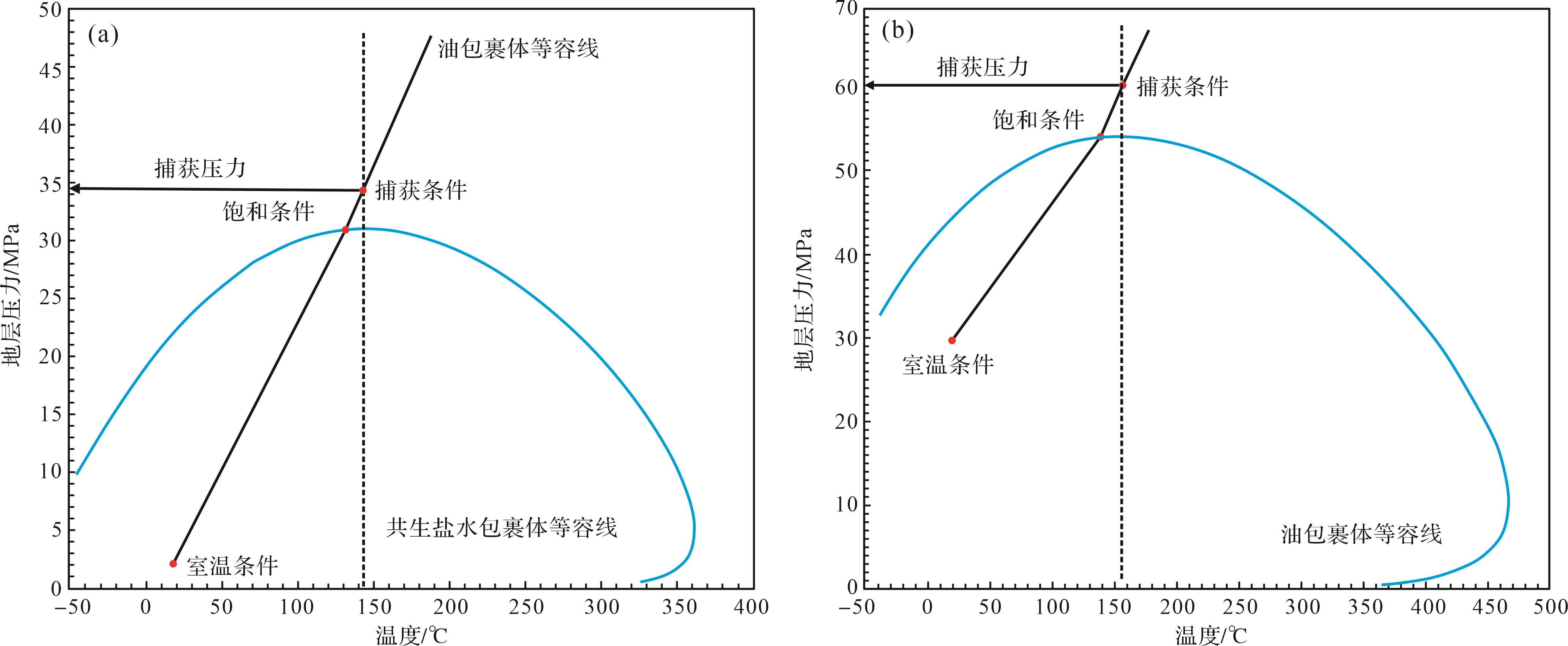
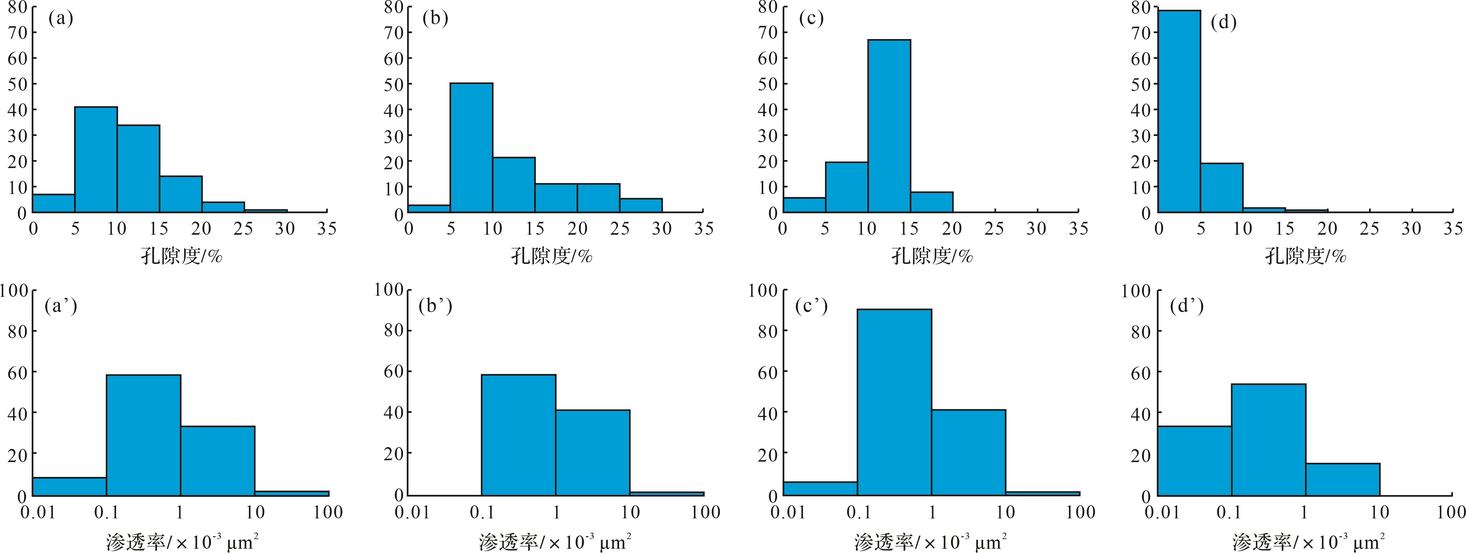
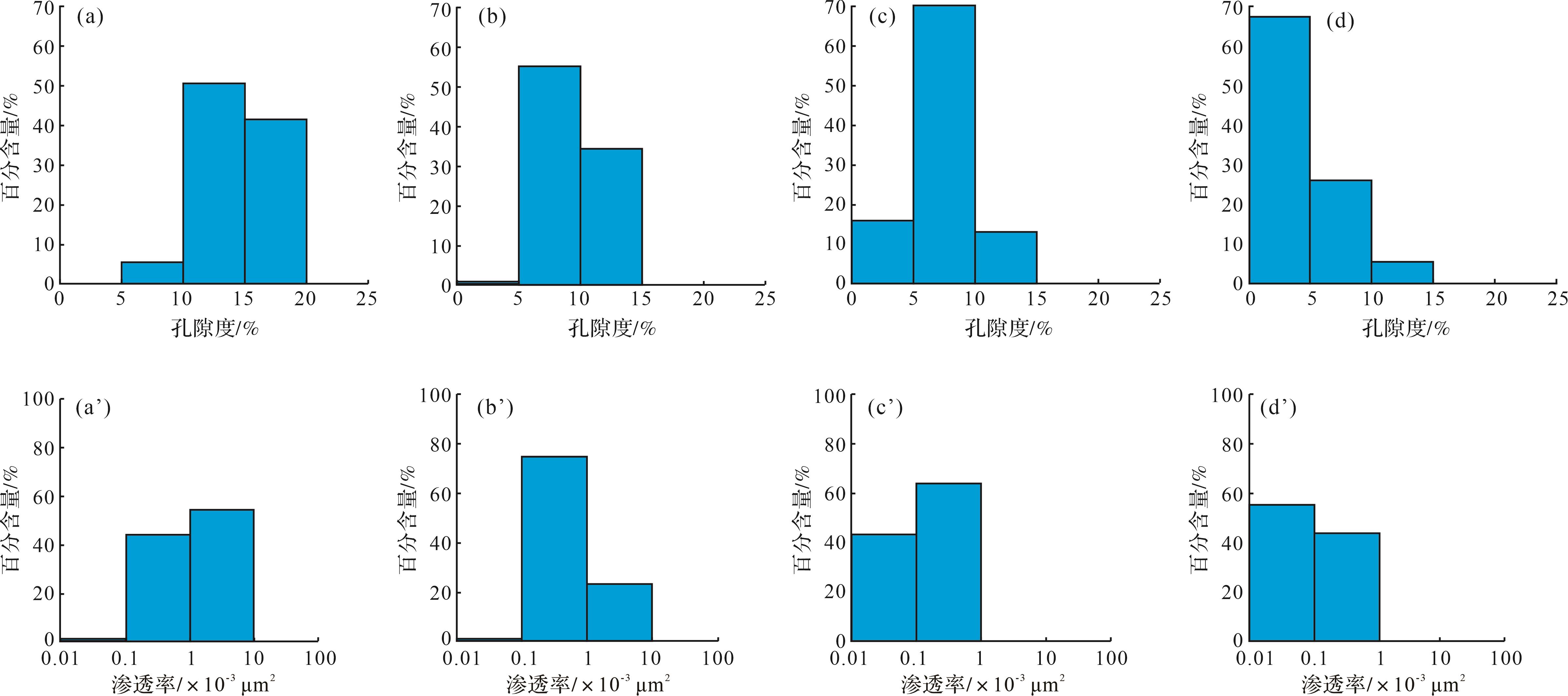
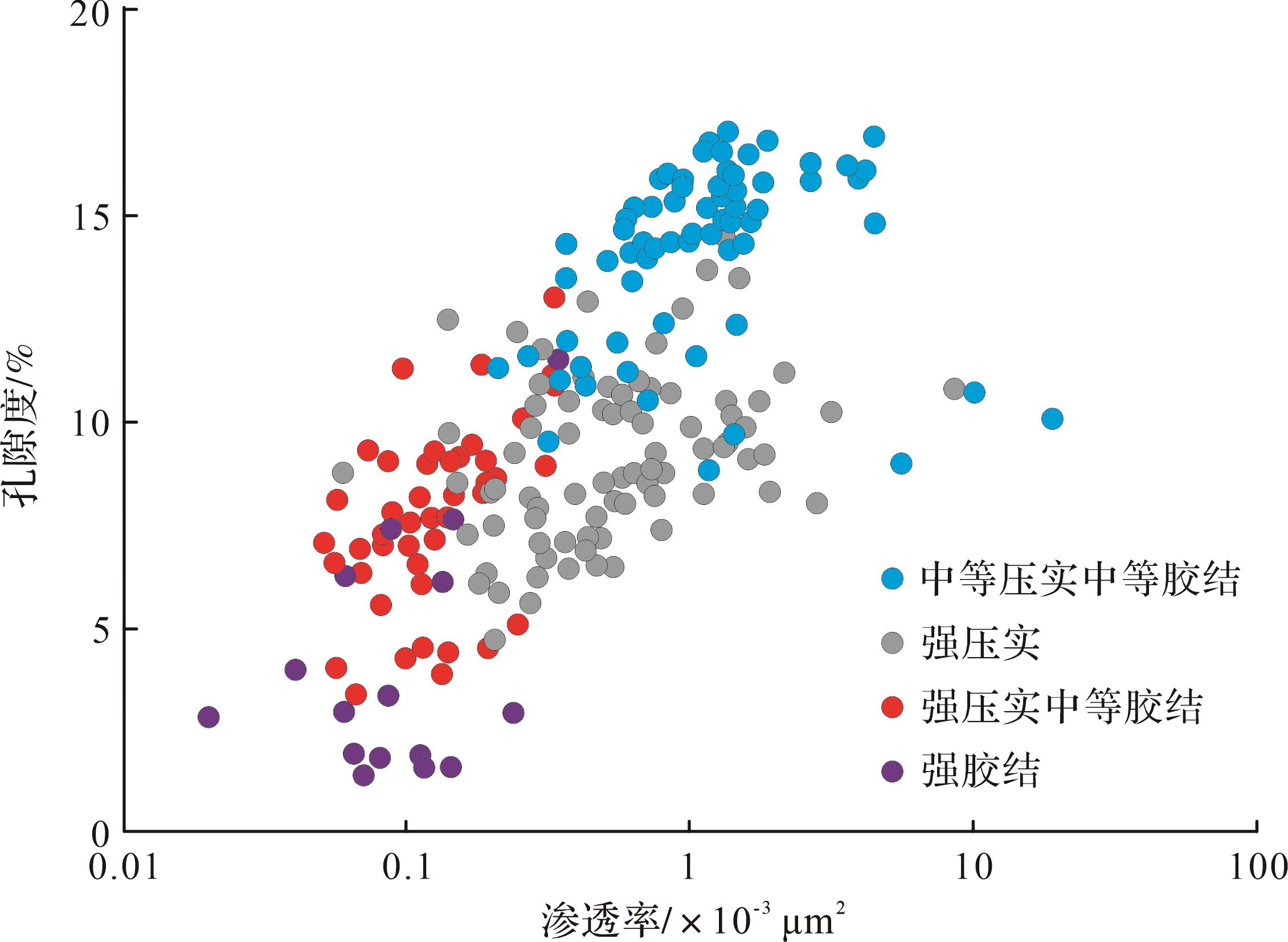
2026, 44(5): 1833-1849.
doi: 10.14027/j.issn.1000-0550.2025.057
Abstract:
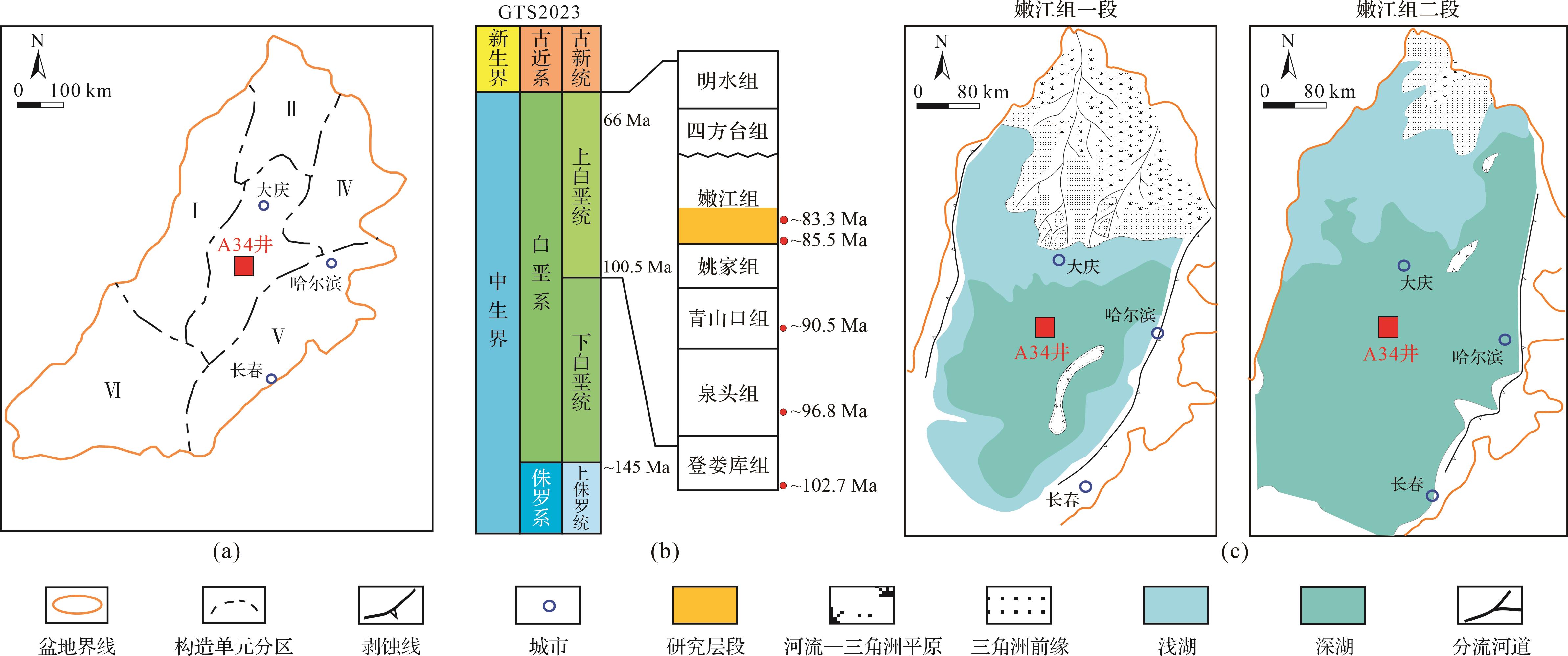
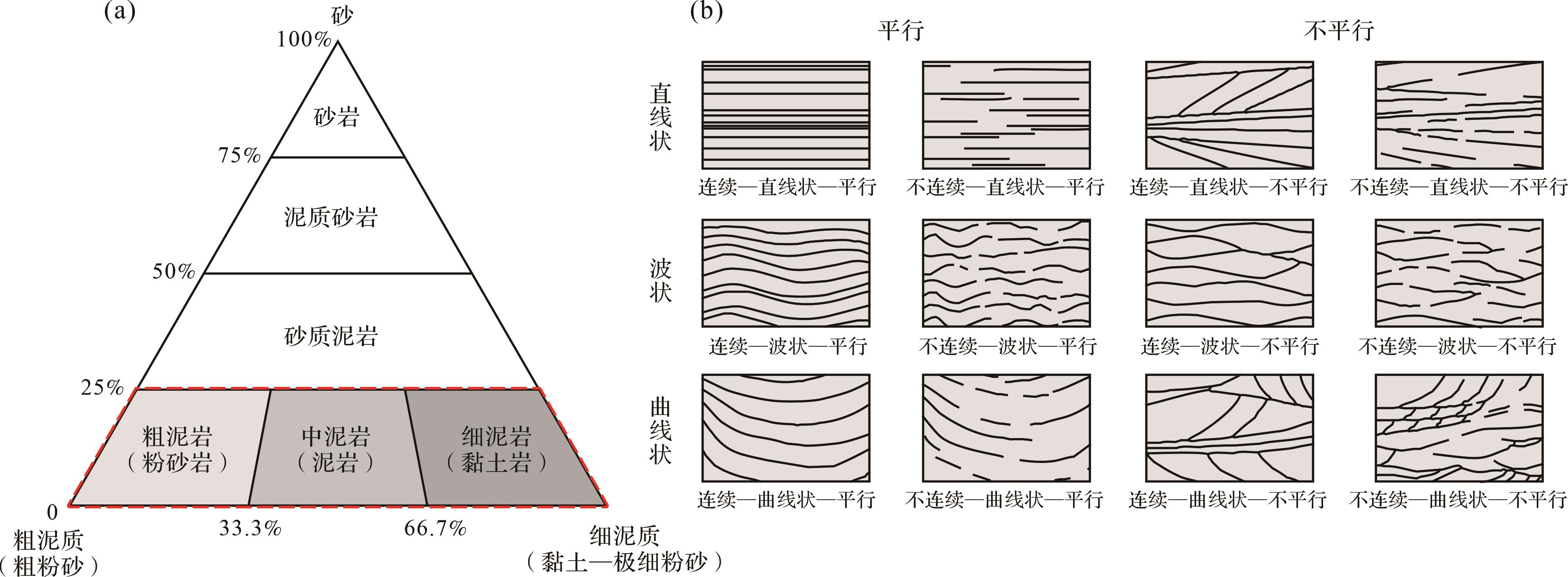
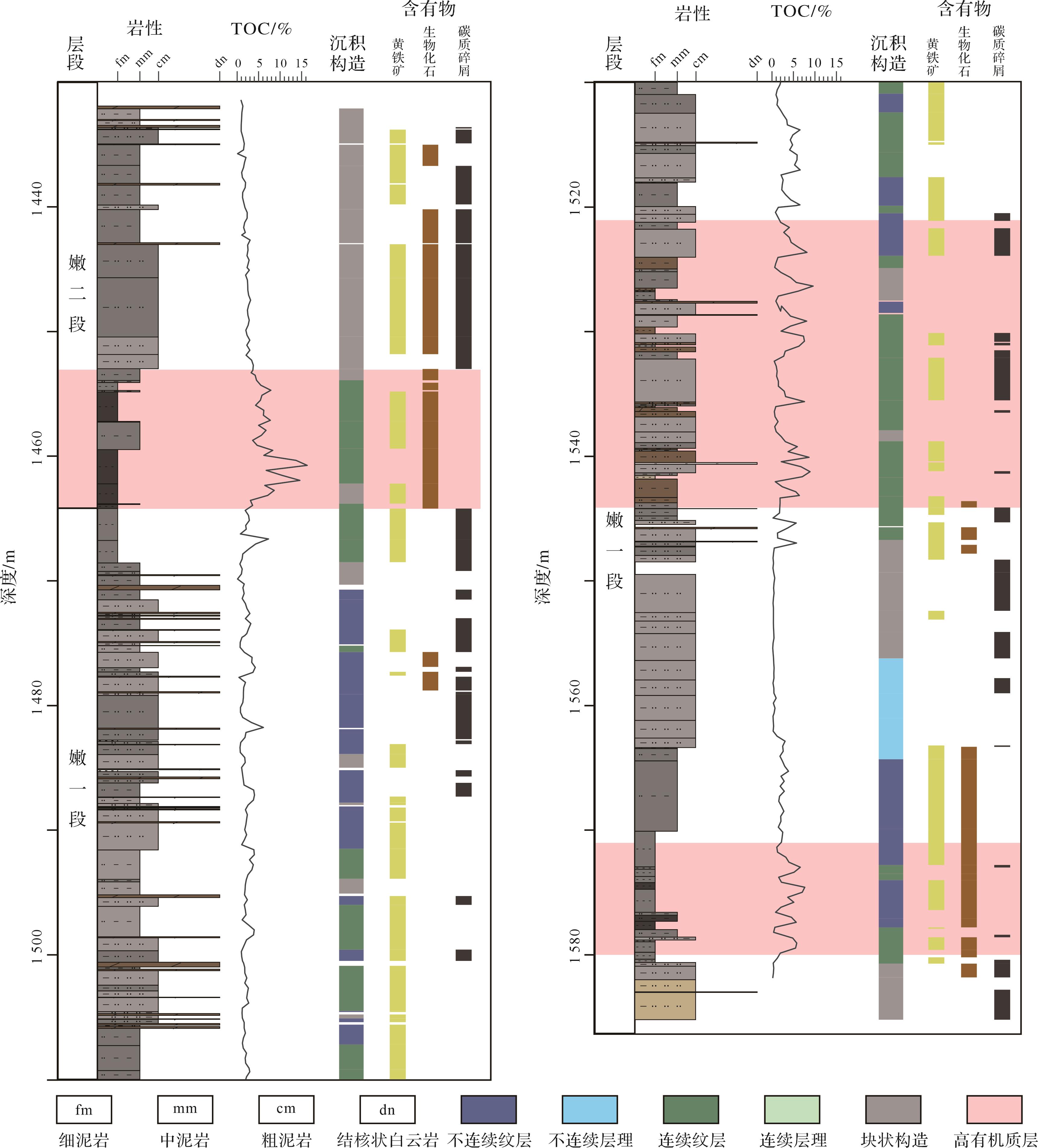
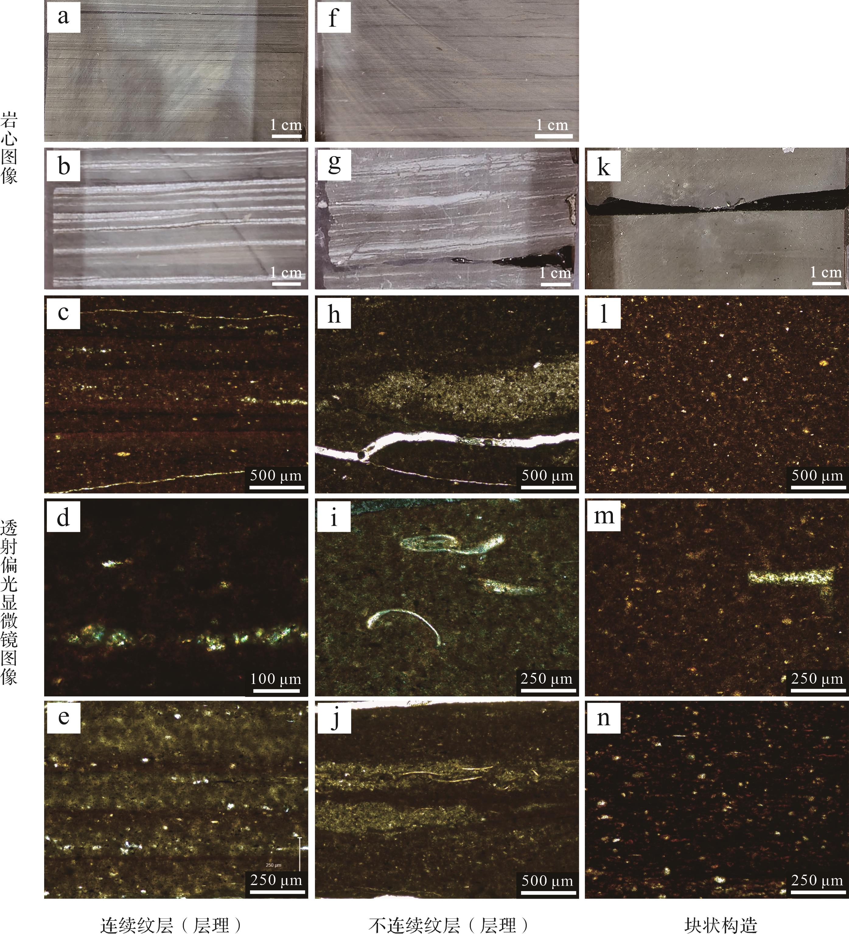
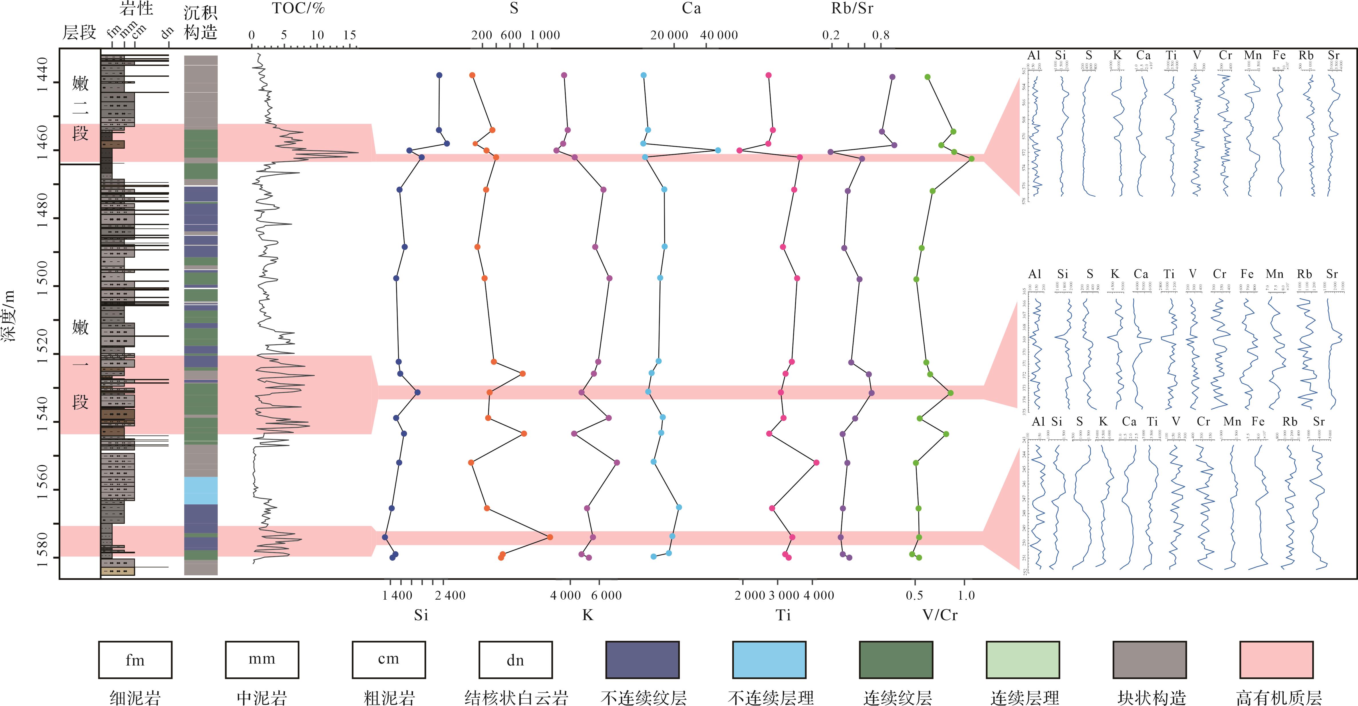
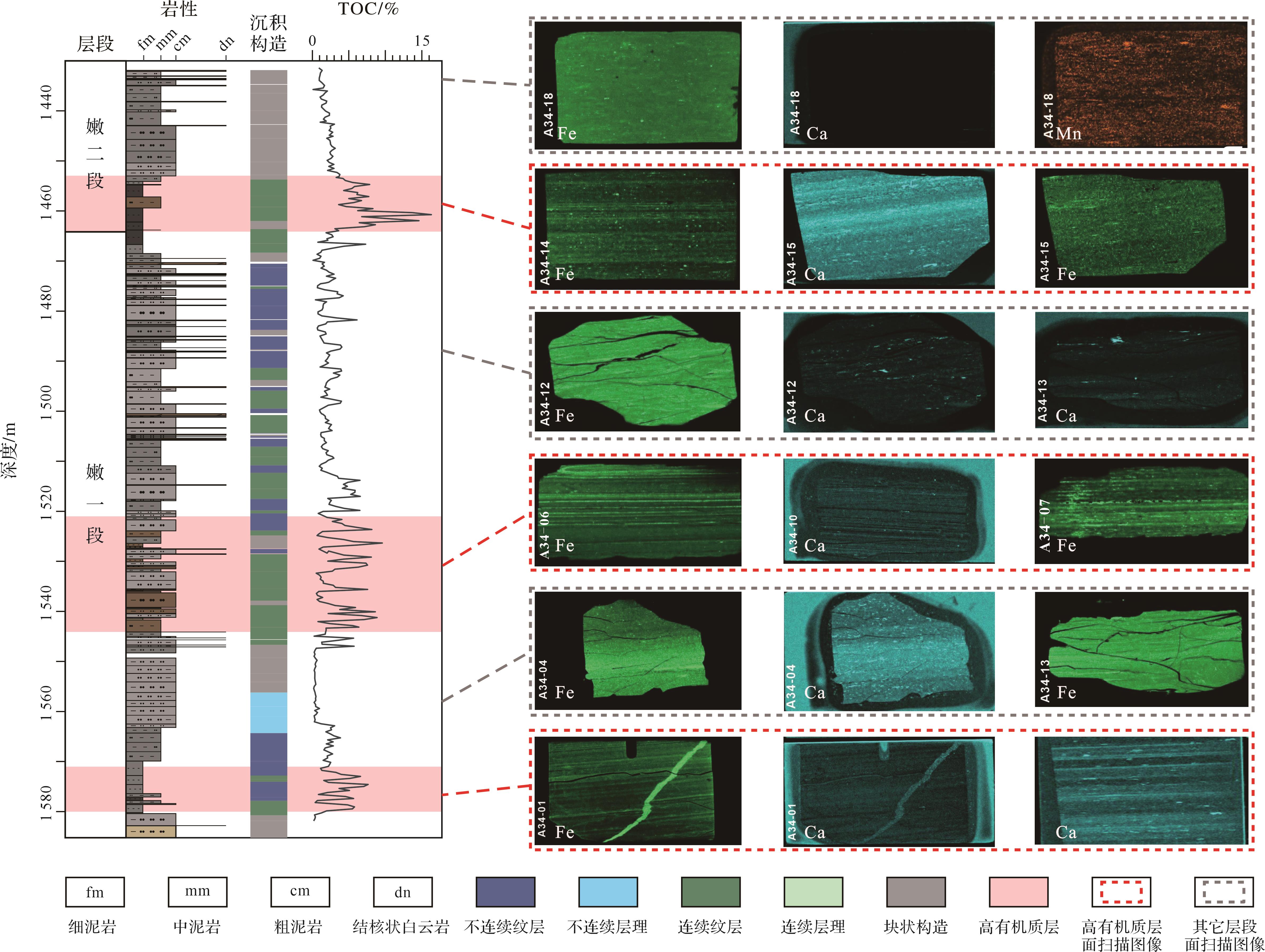
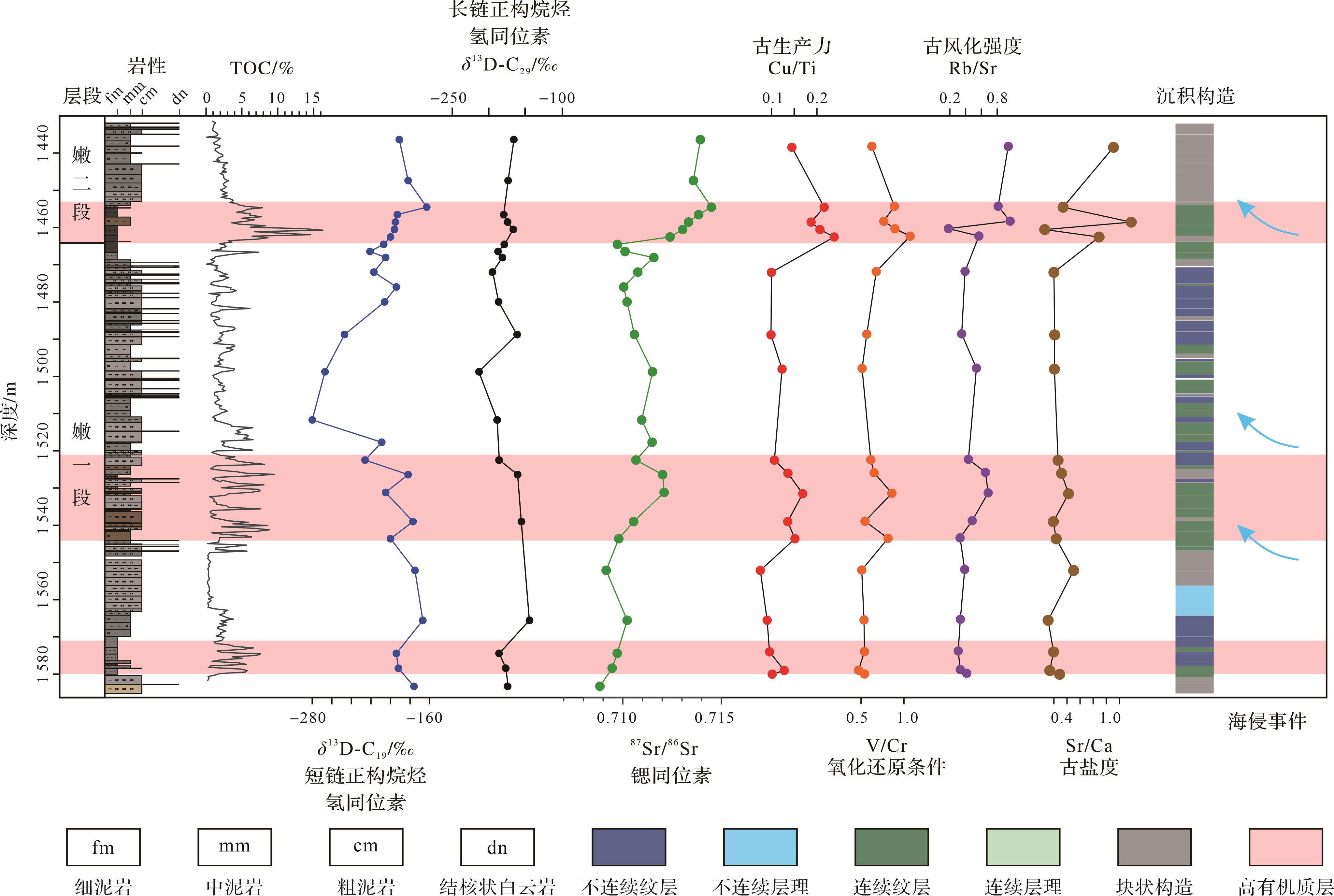
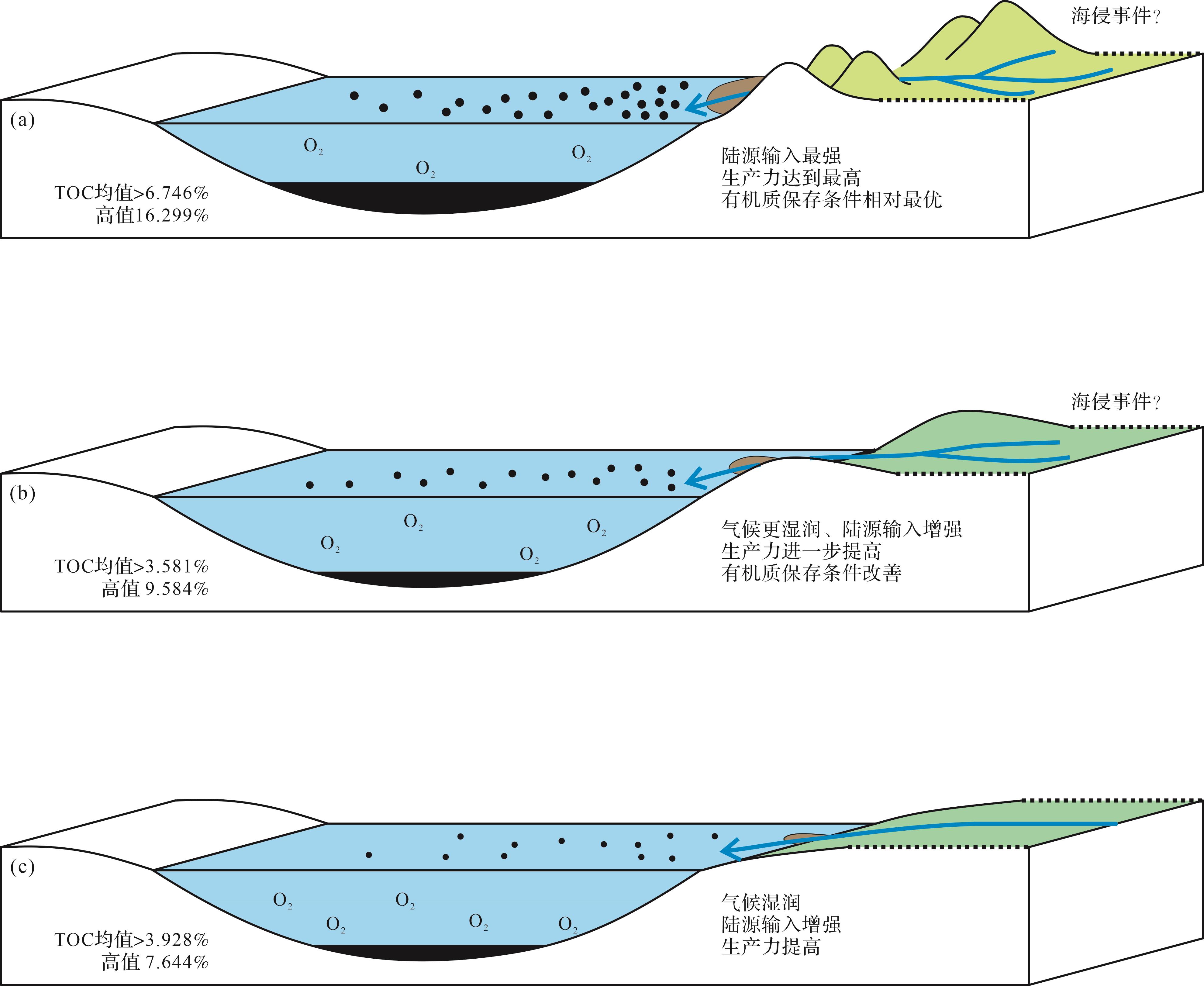
Objective The Songliao Basin is a major hydrocarbon-producing region in China. After more than 60 years of exploitation, conventional oil and gas development has entered a high-cost phase characterized by considerable technical difficulty; the basin has now fully transitioned to the stage of unconventional hydrocarbon exploitation. During the deposition of the Upper Cretaceous Qingshankou Formation and Nenjiang Formation, two large-scale lacustrine transgressions created vast potential shale oil resources. The First and Second members of the Nenjiang Formation host thick intervals of dark, organic-rich, fine-grained sedimentary rocks. Previous studies have generally classified these deposits as deep to semi-deep lacustrine facies; however, high-resolution variations in depositional environments and their relationship to organic matter enrichment remain unclear, necessitating an integrated sedimentological and geochemical investigation of the fine-grained sedimentary rocks. Methods This study, based on core data from well A34 in the Qijia-Gulong Sag of the Songliao Basin, conducted centimeter-scale high-resolution core descriptions of the First and Second members of the fine-grained sedimentary rocks in the Nenjiang Formation. Microscopic petrographic analysis, total organic carbon (TOC) content measurements and elemental line and area scanning techniques were applied to subdivide their lithofacies. Results A total of 16 fine-grained sedimentary lithofacies and five facies assemblages were identified in the First and Second members of the Nenjiang Formation, carbonate rocks occur with high frequency. Based on the sedimentological, isotope and elemental geochemical characteristics of each lithofacies, three organic-rich intervals were recognized: at the base and middle section of the First member of the Nenjiang Formation, and at the base of the Second member of the Nenjiang Formation. These intervals are dominated by medium- to fine-grained dark mudstones with continuous lamination. Conclusions Integrated isotope geochemical data suggest that a humid climate, together with nutrient influx from sediment sources, were key factors in creating the high-productivity and strongly reducing conditions in the Songliao Basin during the deposition of the First and Second members of the Nenjiang Formation. These conditions led to the formation of three intervals of organic-rich, well-laminated medium- to fine-grained dark mudstones.
Objective The Songliao Basin is a major hydrocarbon-producing region in China. After more than 60 years of exploitation, conventional oil and gas development has entered a high-cost phase characterized by considerable technical difficulty; the basin has now fully transitioned to the stage of unconventional hydrocarbon exploitation. During the deposition of the Upper Cretaceous Qingshankou Formation and Nenjiang Formation, two large-scale lacustrine transgressions created vast potential shale oil resources. The First and Second members of the Nenjiang Formation host thick intervals of dark, organic-rich, fine-grained sedimentary rocks. Previous studies have generally classified these deposits as deep to semi-deep lacustrine facies; however, high-resolution variations in depositional environments and their relationship to organic matter enrichment remain unclear, necessitating an integrated sedimentological and geochemical investigation of the fine-grained sedimentary rocks. Methods This study, based on core data from well A34 in the Qijia-Gulong Sag of the Songliao Basin, conducted centimeter-scale high-resolution core descriptions of the First and Second members of the fine-grained sedimentary rocks in the Nenjiang Formation. Microscopic petrographic analysis, total organic carbon (TOC) content measurements and elemental line and area scanning techniques were applied to subdivide their lithofacies. Results A total of 16 fine-grained sedimentary lithofacies and five facies assemblages were identified in the First and Second members of the Nenjiang Formation, carbonate rocks occur with high frequency. Based on the sedimentological, isotope and elemental geochemical characteristics of each lithofacies, three organic-rich intervals were recognized: at the base and middle section of the First member of the Nenjiang Formation, and at the base of the Second member of the Nenjiang Formation. These intervals are dominated by medium- to fine-grained dark mudstones with continuous lamination. Conclusions Integrated isotope geochemical data suggest that a humid climate, together with nutrient influx from sediment sources, were key factors in creating the high-productivity and strongly reducing conditions in the Songliao Basin during the deposition of the First and Second members of the Nenjiang Formation. These conditions led to the formation of three intervals of organic-rich, well-laminated medium- to fine-grained dark mudstones.
2026, 44(5): 1850-1865.
doi: 10.14027/j.issn.1000-0550.2025.030
Abstract:
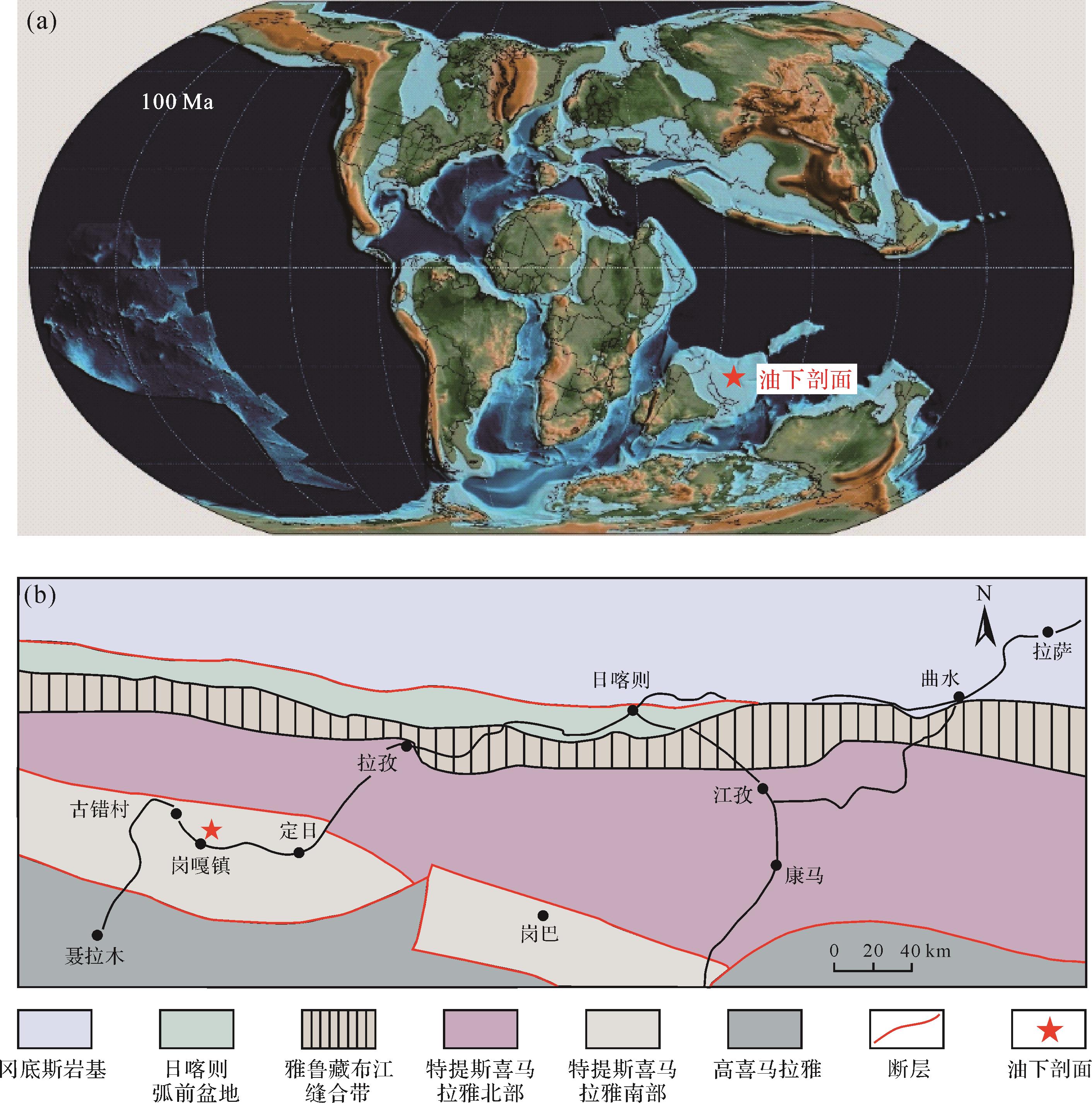
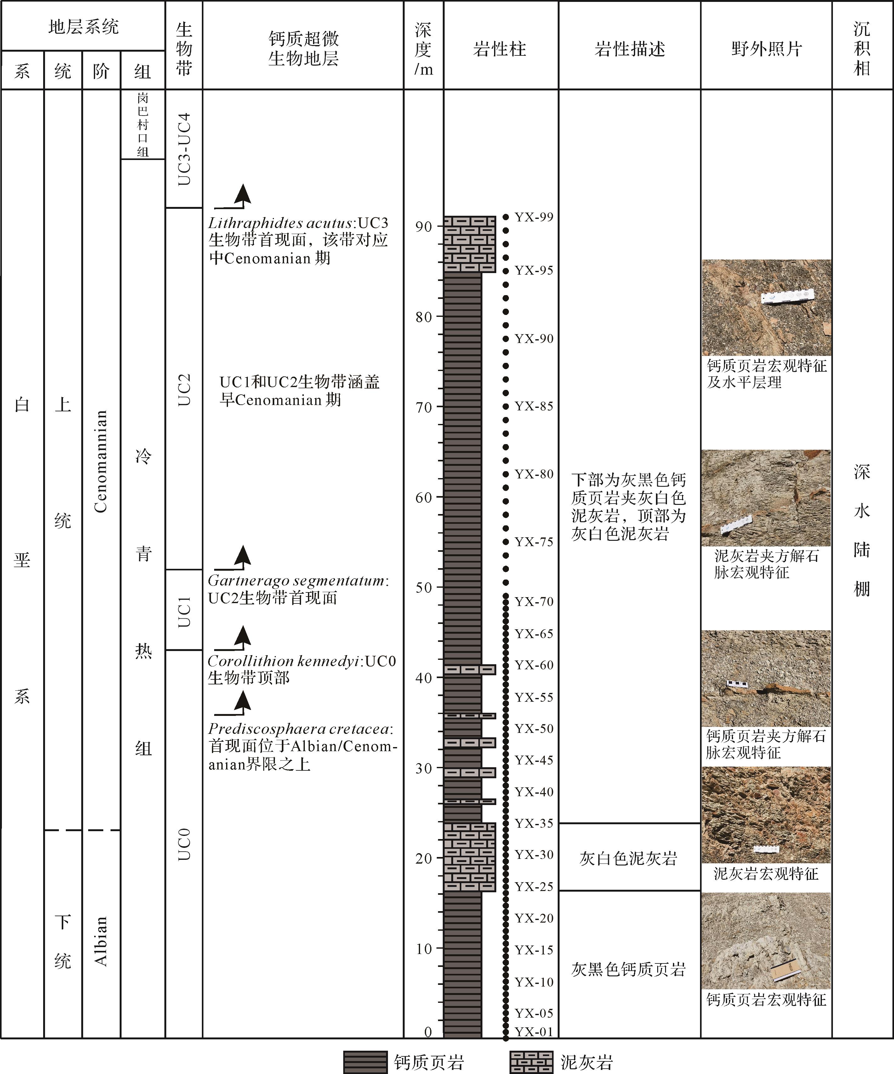
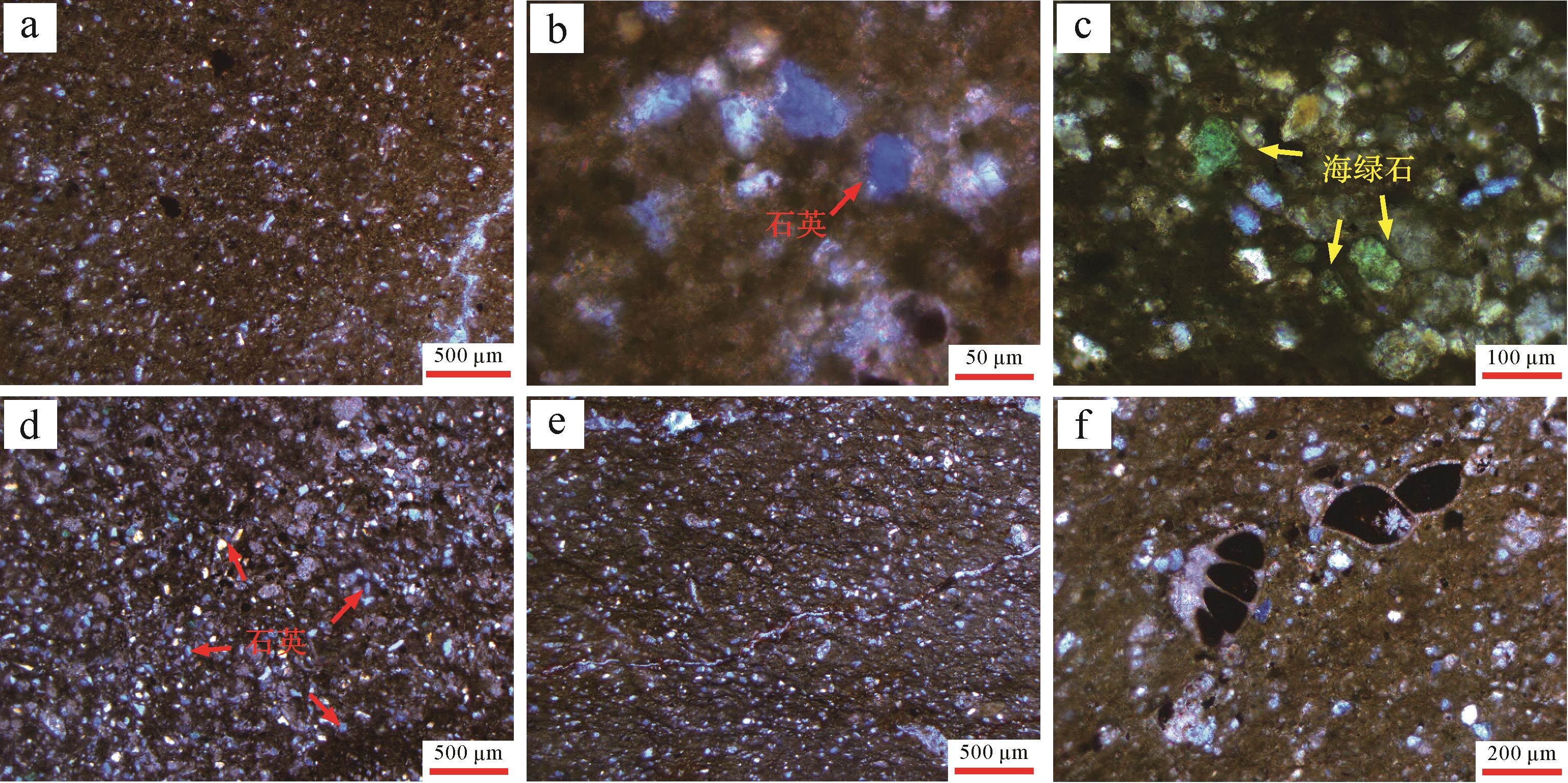
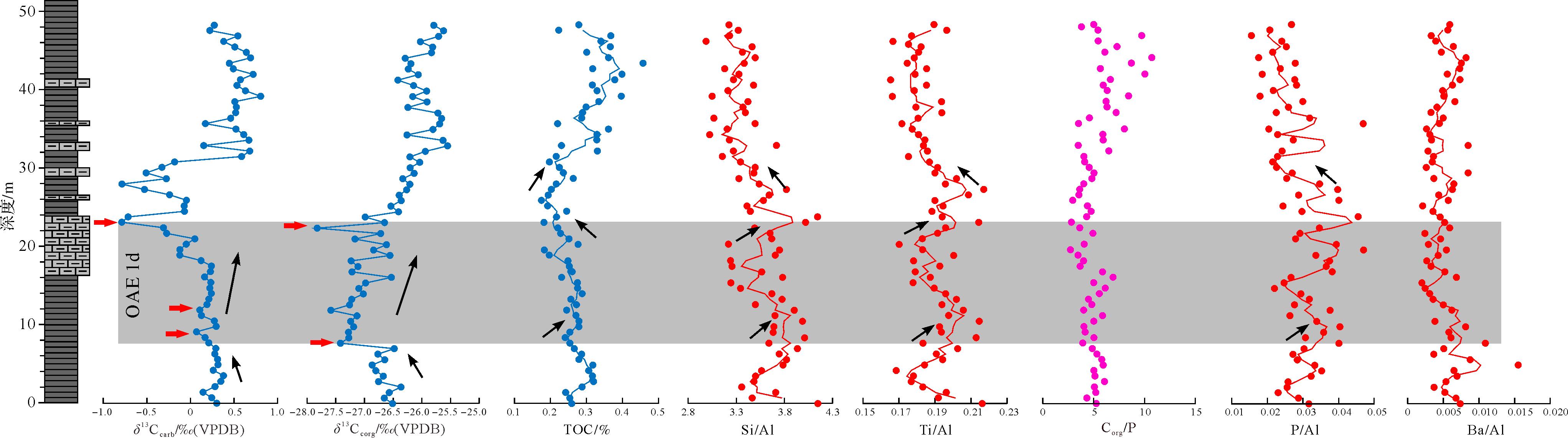
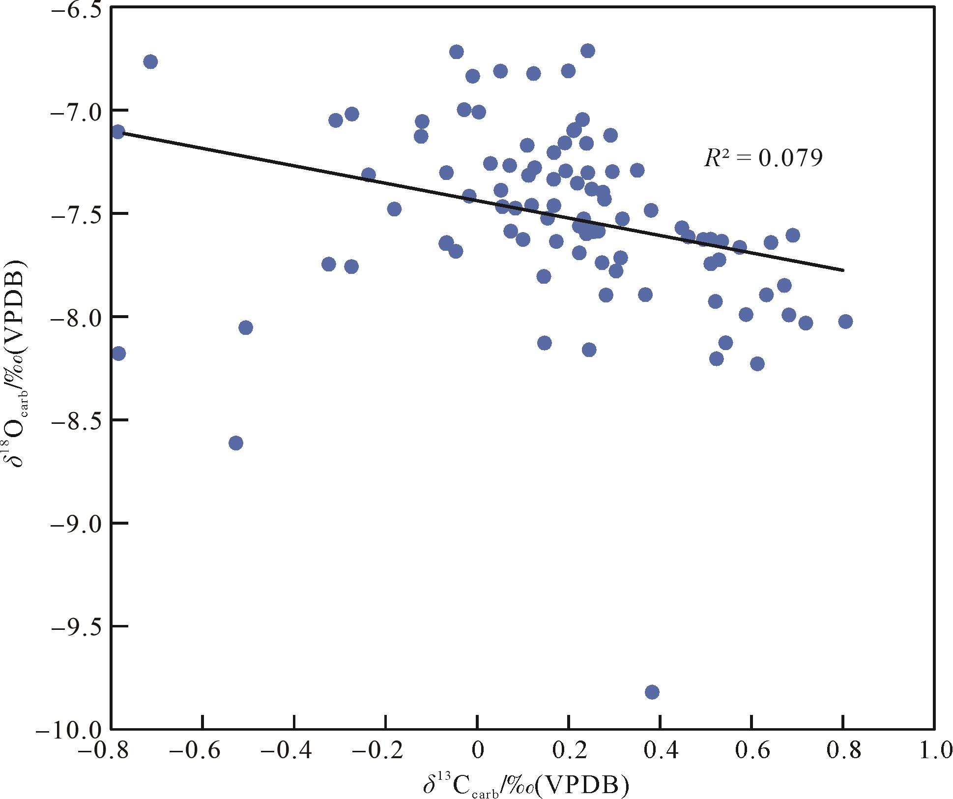
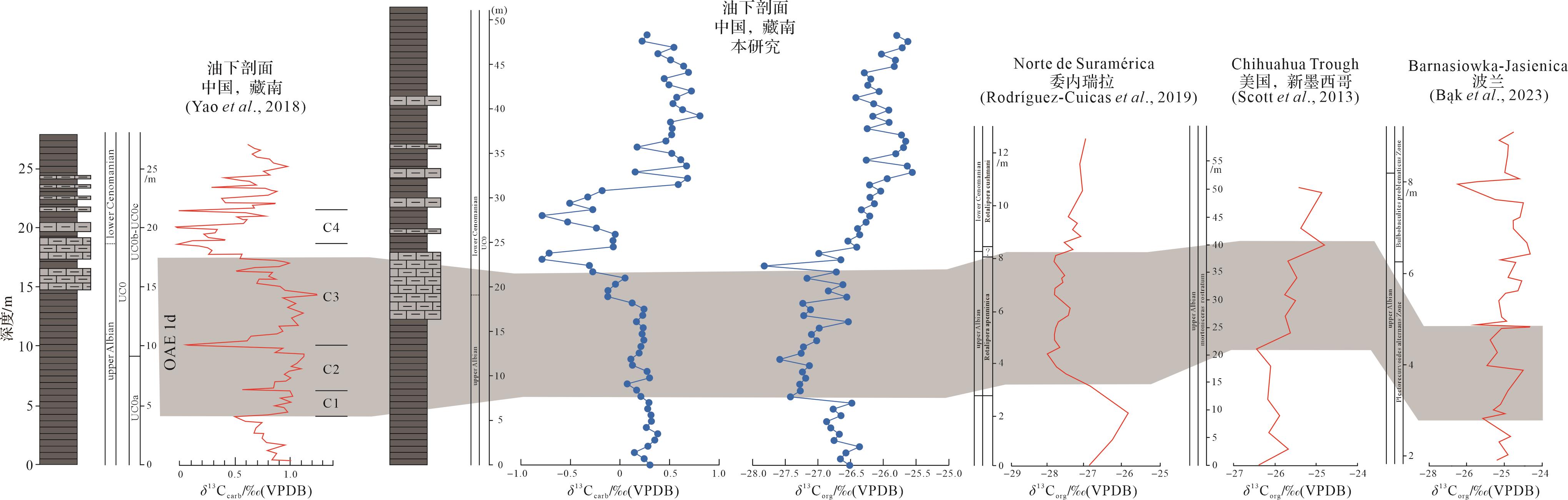
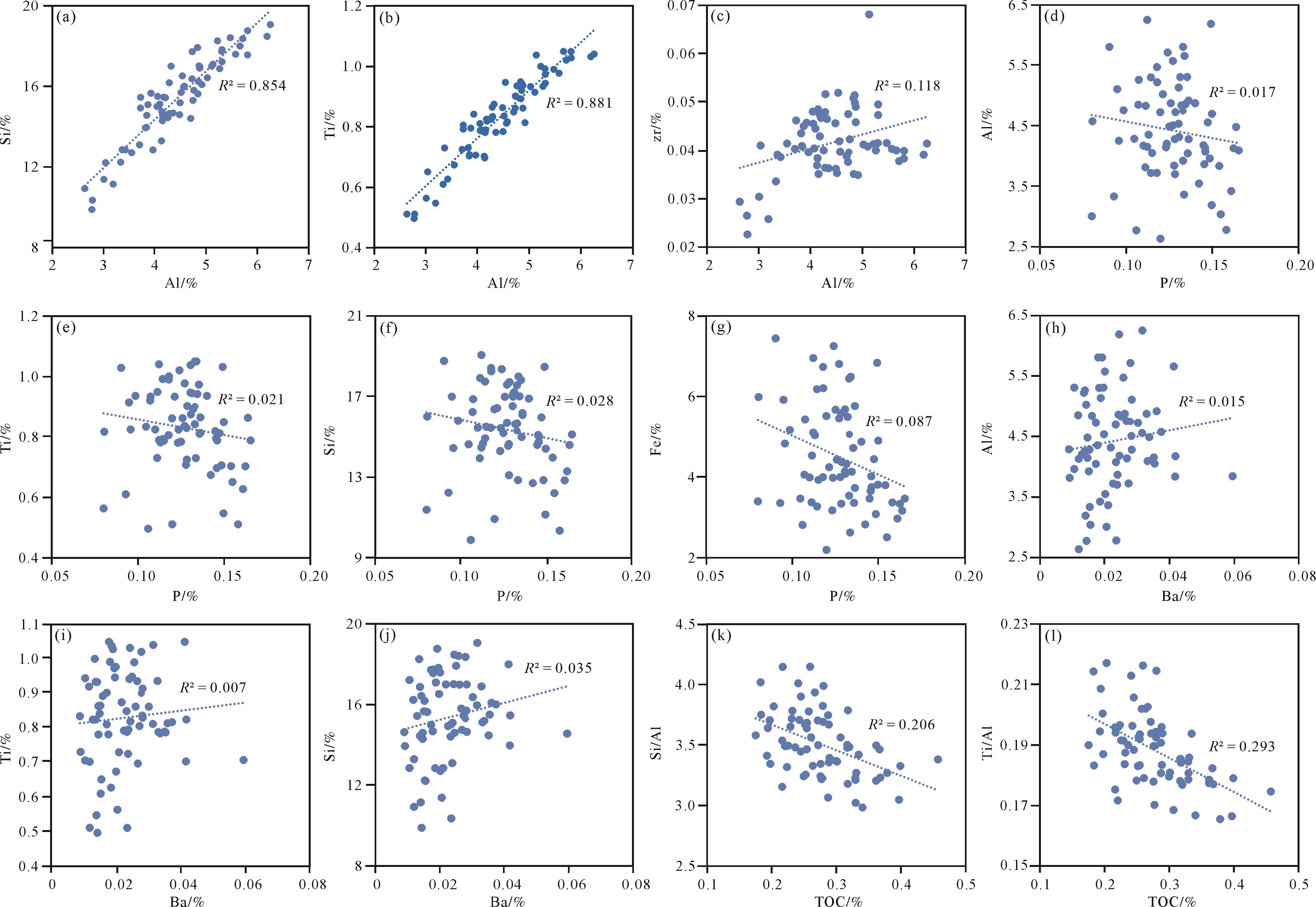
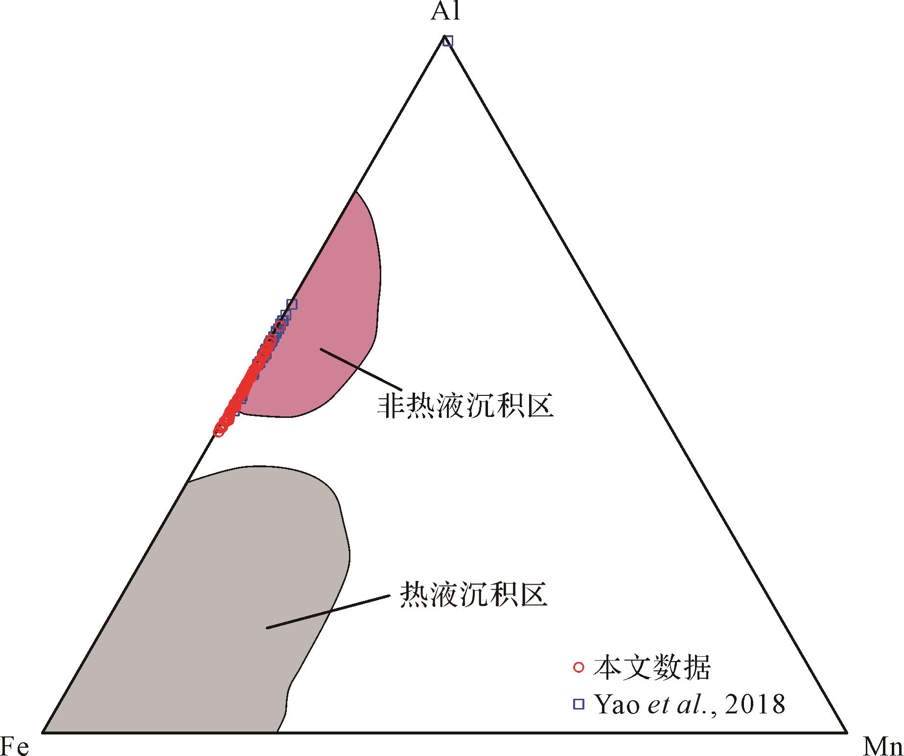
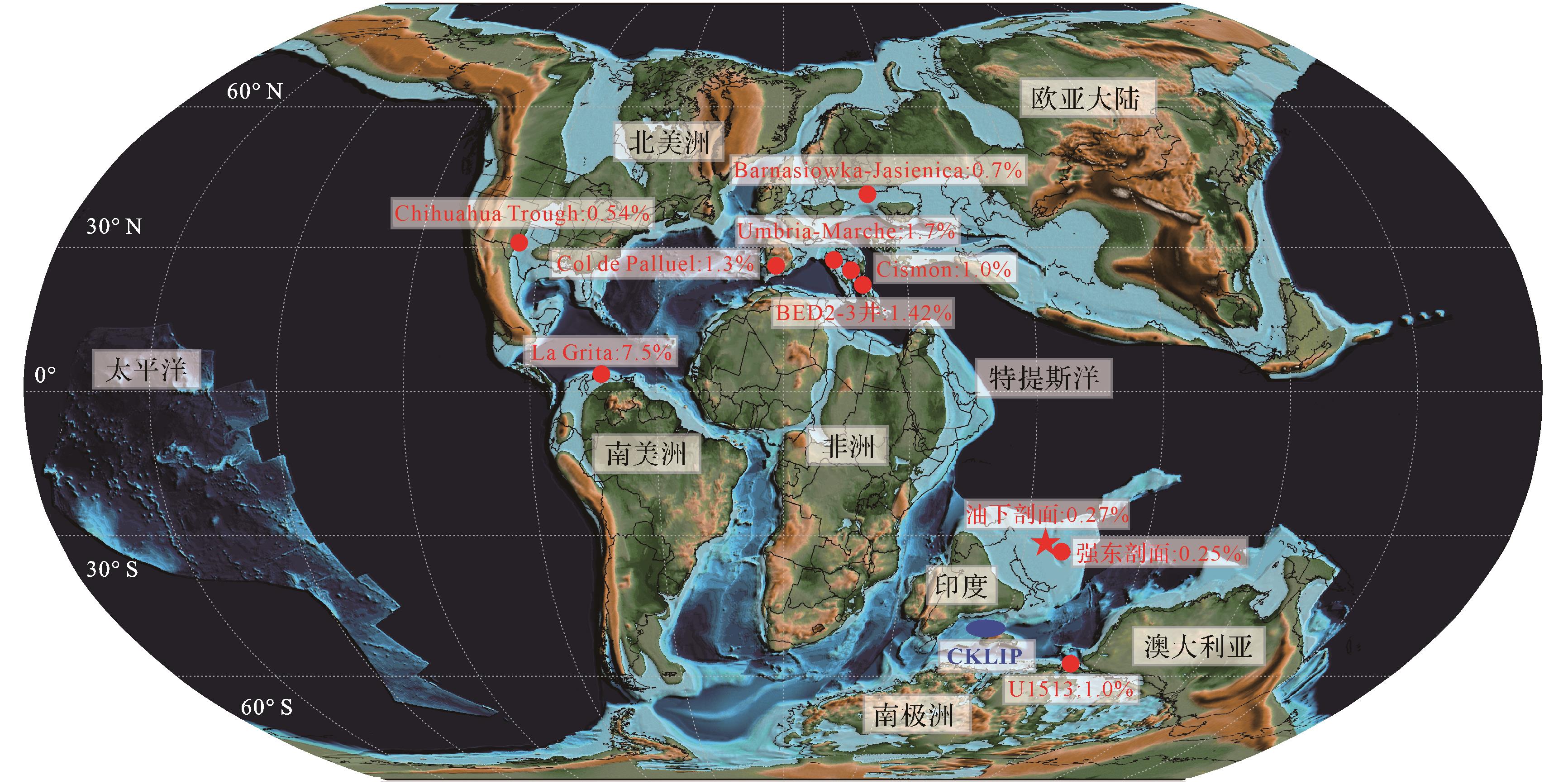
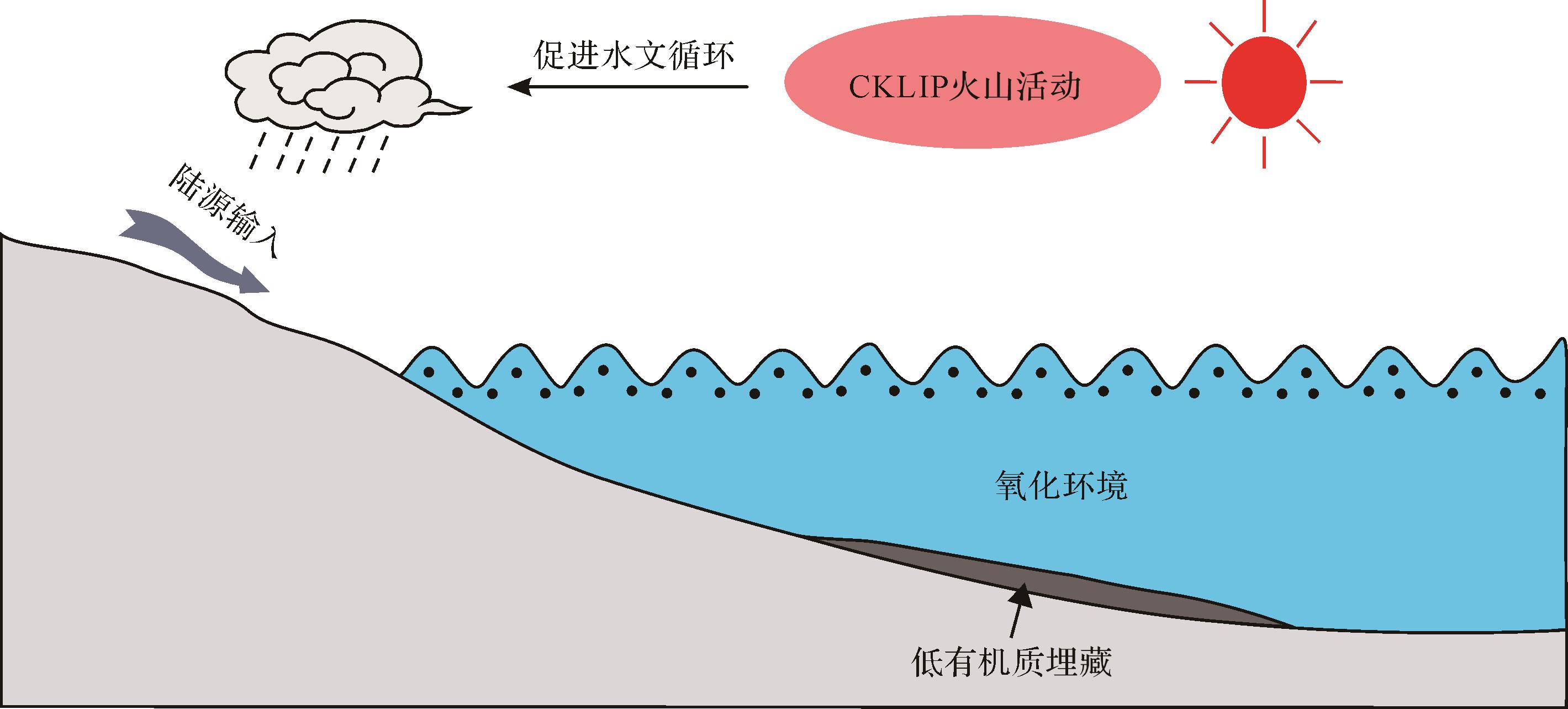
Objective The Oceanic Anoxic Event 1d (OAE 1d), which occurred during the Late Albian of the Early Cretaceous, represents a significant perturbation in the global carbon cycle associated with a greenhouse climate. Although extensive research has been conducted on the characteristics and origin of OAE 1d in the western Tethys and North Atlantic regions, the paleoenvironmental response to this event in the eastern Tethys remains poorly understood. Methods This study focused on the Lower Cretaceous Lengqingre Formation at the Youxia section in Dingri (southern Xizang) within the eastern Tethyan domain. An integrated approach of mineralogical, petrological, sedimentological, isotopic, and elemental geochemical analyses was employed to evaluate the paleoenvironmental response to OAE 1d and its distinction from coeval global patterns compared to contemporaneous global records. Results (1) Both bulk carbonate and organic carbon isotope data confirm that the Youxia section records the OAE 1d excursion, supporting the global signal of this phenomenon. (2) Thin-section observations and terrigenous input proxies (e.g., Si/Al and Ti/Al) indicate enhanced input of siliciclastic materials during OAE 1d, likely linked to accelerated hydrological cycling and intensified continental weathering related to coeval volcanic activity. (3) Corg/P and framboidal pyrite characteristics reveal that the Youxia section was deposited under oxic-to-suboxic bottom-water conditions during OAE 1d, differing significantly from the anoxic conditions observed in the western Tethys. This highlights the spatial heterogeneity in marine redox conditions during this event. (4) The absence of organic carbon-rich sediments at Youxia is attributed to a combination of oxic environmental conditions, intense terrigenous input, and dilution effects induced by rapid sedimentation rates. This suggests that organic carbon burial was suppressed by regional environmental controls in the Dingri region during OAE 1d. Conclusions The oxic-suboxic conditions and lack of organic-rich sediments in the eastern Tethys during OAE 1d underscore the regional heterogeneity in sedimentary and oceanographic responses to global OAEs. These findings provide critical insights into complexity of paleoenvironmental feedbacks during these events.
Objective The Oceanic Anoxic Event 1d (OAE 1d), which occurred during the Late Albian of the Early Cretaceous, represents a significant perturbation in the global carbon cycle associated with a greenhouse climate. Although extensive research has been conducted on the characteristics and origin of OAE 1d in the western Tethys and North Atlantic regions, the paleoenvironmental response to this event in the eastern Tethys remains poorly understood. Methods This study focused on the Lower Cretaceous Lengqingre Formation at the Youxia section in Dingri (southern Xizang) within the eastern Tethyan domain. An integrated approach of mineralogical, petrological, sedimentological, isotopic, and elemental geochemical analyses was employed to evaluate the paleoenvironmental response to OAE 1d and its distinction from coeval global patterns compared to contemporaneous global records. Results (1) Both bulk carbonate and organic carbon isotope data confirm that the Youxia section records the OAE 1d excursion, supporting the global signal of this phenomenon. (2) Thin-section observations and terrigenous input proxies (e.g., Si/Al and Ti/Al) indicate enhanced input of siliciclastic materials during OAE 1d, likely linked to accelerated hydrological cycling and intensified continental weathering related to coeval volcanic activity. (3) Corg/P and framboidal pyrite characteristics reveal that the Youxia section was deposited under oxic-to-suboxic bottom-water conditions during OAE 1d, differing significantly from the anoxic conditions observed in the western Tethys. This highlights the spatial heterogeneity in marine redox conditions during this event. (4) The absence of organic carbon-rich sediments at Youxia is attributed to a combination of oxic environmental conditions, intense terrigenous input, and dilution effects induced by rapid sedimentation rates. This suggests that organic carbon burial was suppressed by regional environmental controls in the Dingri region during OAE 1d. Conclusions The oxic-suboxic conditions and lack of organic-rich sediments in the eastern Tethys during OAE 1d underscore the regional heterogeneity in sedimentary and oceanographic responses to global OAEs. These findings provide critical insights into complexity of paleoenvironmental feedbacks during these events.
2026, 44(5): 1866-1888.
doi: 10.14027/j.issn.1000-0550.2025.022
Abstract:
Objective A successful breakthrough in the Jurassic strata of well Fusha 8 in the piedmont area of the southwestern Tarim Basin marks the emergence of a new oil-bearing series, demonstrating promising prospects for oil and gas exploration. Currently, an insufficient understanding of the provenance characteristics and sedimentary evolution of the Jurassic system has become a critical issue constraining oil and gas exploration. Methods The research object was the Jurassic in the piedmont area of the southwestern Tarim Basin. Field outcrops, drilling data and other relevant materials were investigated to determine the provenance systems, sedimentary facies types and sedimentary evolution processes of the region. Results The Jurassic strata were primarily sourced from the West Kunlun Mountains and the West Tianshan Mountains, with lesser contributions from the slope areas. Two major provenance systems are present in both the Fusha and Aketao Fault Depressions: the southern (West Kunlun Mountains) and the northern (slope area). The Kuzigongsu Fault Depression was mainly sourced from the West Tianshan Mountains. Fourteen lithofacies and fourteen lithofacies associations were found in the Jurassic, with seven sedimentary facies types being determined. The Fusha and Aketao Fault Depressions in the piedmont area of the West Kunlun Mountains evolved during the Early to Middle Jurassic, progressing from initial rifting to an intense rifting stage, and finally to a rift-sag transition stage. The steep slope zone to the south primarily resulted in the development of alluvial-fan to fan-delta sedimentary systems; the gentle slope zone to the north developed small-scale braided river deltas and fan deltas. Boundary faults remained active during the Early to Middle Jurassic in the Kuzigongsu Fault Depression anterior to the West Tianshan Mountains. An alluvial-fan to fan-delta sedimentary system developed in the main sub-depression, while a secondary subdepression was initially filled and leveled by alluvial fan conglomerates. Rifting activity expanded westward at a later stage, predominantly forming braided- to meandering-river deposits. During the Late Jurassic, compression and regional aridification triggered basin basement uplift and enhanced sediment supply, resulting in widespread development of alluvial fan deposits across the study area, and marking the terminal stage of rifted lake basin evolution. Conclusions Overall, the Jurassic strata in the piedmont area of the southwestern Tarim Basin experienced a transgression during the Early to Middle Jurassic and a regression during the Middle to Late Jurassic, reflecting a multi-stage sedimentary evolution. This study not only reconstructed the filling and evolution process of the Jurassic in the region but also provides valuable insights for the paleogeographic reconstruction of sedimentary areas in residual basins.
Objective A successful breakthrough in the Jurassic strata of well Fusha 8 in the piedmont area of the southwestern Tarim Basin marks the emergence of a new oil-bearing series, demonstrating promising prospects for oil and gas exploration. Currently, an insufficient understanding of the provenance characteristics and sedimentary evolution of the Jurassic system has become a critical issue constraining oil and gas exploration. Methods The research object was the Jurassic in the piedmont area of the southwestern Tarim Basin. Field outcrops, drilling data and other relevant materials were investigated to determine the provenance systems, sedimentary facies types and sedimentary evolution processes of the region. Results The Jurassic strata were primarily sourced from the West Kunlun Mountains and the West Tianshan Mountains, with lesser contributions from the slope areas. Two major provenance systems are present in both the Fusha and Aketao Fault Depressions: the southern (West Kunlun Mountains) and the northern (slope area). The Kuzigongsu Fault Depression was mainly sourced from the West Tianshan Mountains. Fourteen lithofacies and fourteen lithofacies associations were found in the Jurassic, with seven sedimentary facies types being determined. The Fusha and Aketao Fault Depressions in the piedmont area of the West Kunlun Mountains evolved during the Early to Middle Jurassic, progressing from initial rifting to an intense rifting stage, and finally to a rift-sag transition stage. The steep slope zone to the south primarily resulted in the development of alluvial-fan to fan-delta sedimentary systems; the gentle slope zone to the north developed small-scale braided river deltas and fan deltas. Boundary faults remained active during the Early to Middle Jurassic in the Kuzigongsu Fault Depression anterior to the West Tianshan Mountains. An alluvial-fan to fan-delta sedimentary system developed in the main sub-depression, while a secondary subdepression was initially filled and leveled by alluvial fan conglomerates. Rifting activity expanded westward at a later stage, predominantly forming braided- to meandering-river deposits. During the Late Jurassic, compression and regional aridification triggered basin basement uplift and enhanced sediment supply, resulting in widespread development of alluvial fan deposits across the study area, and marking the terminal stage of rifted lake basin evolution. Conclusions Overall, the Jurassic strata in the piedmont area of the southwestern Tarim Basin experienced a transgression during the Early to Middle Jurassic and a regression during the Middle to Late Jurassic, reflecting a multi-stage sedimentary evolution. This study not only reconstructed the filling and evolution process of the Jurassic in the region but also provides valuable insights for the paleogeographic reconstruction of sedimentary areas in residual basins.
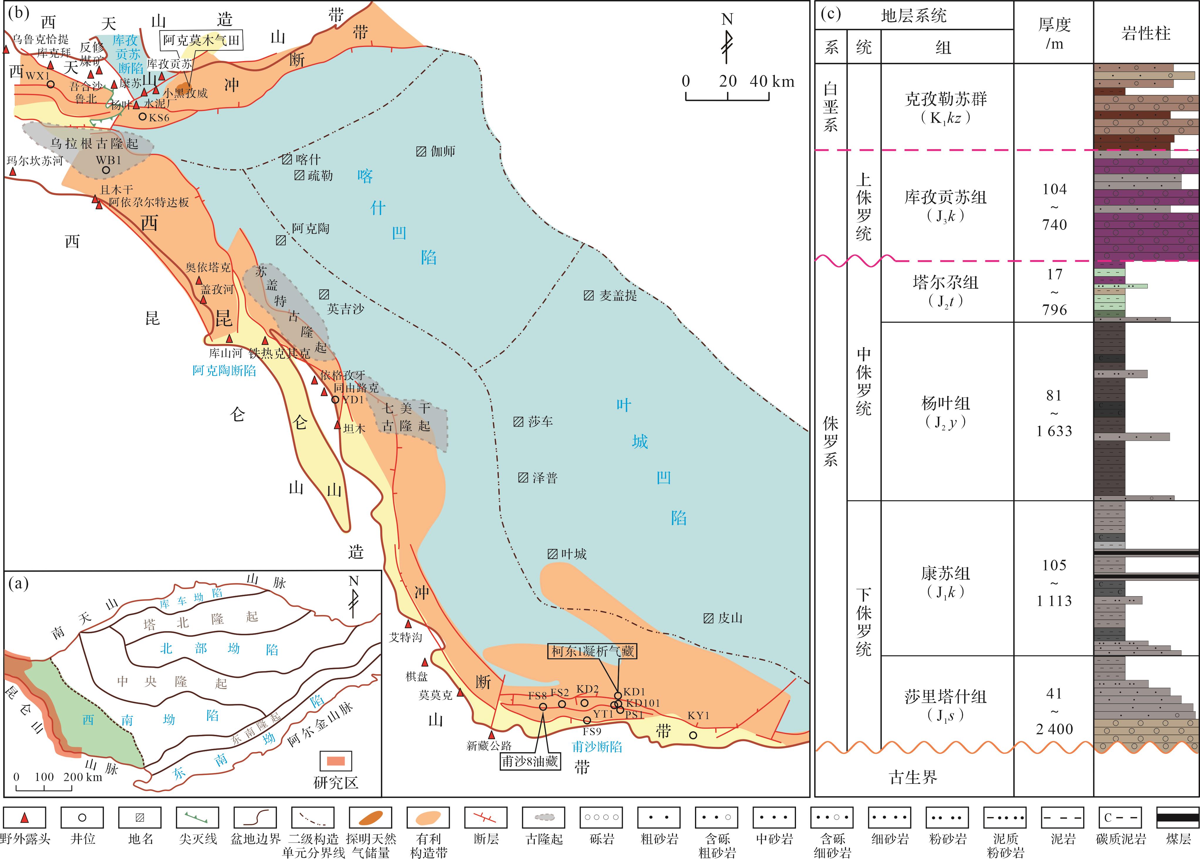
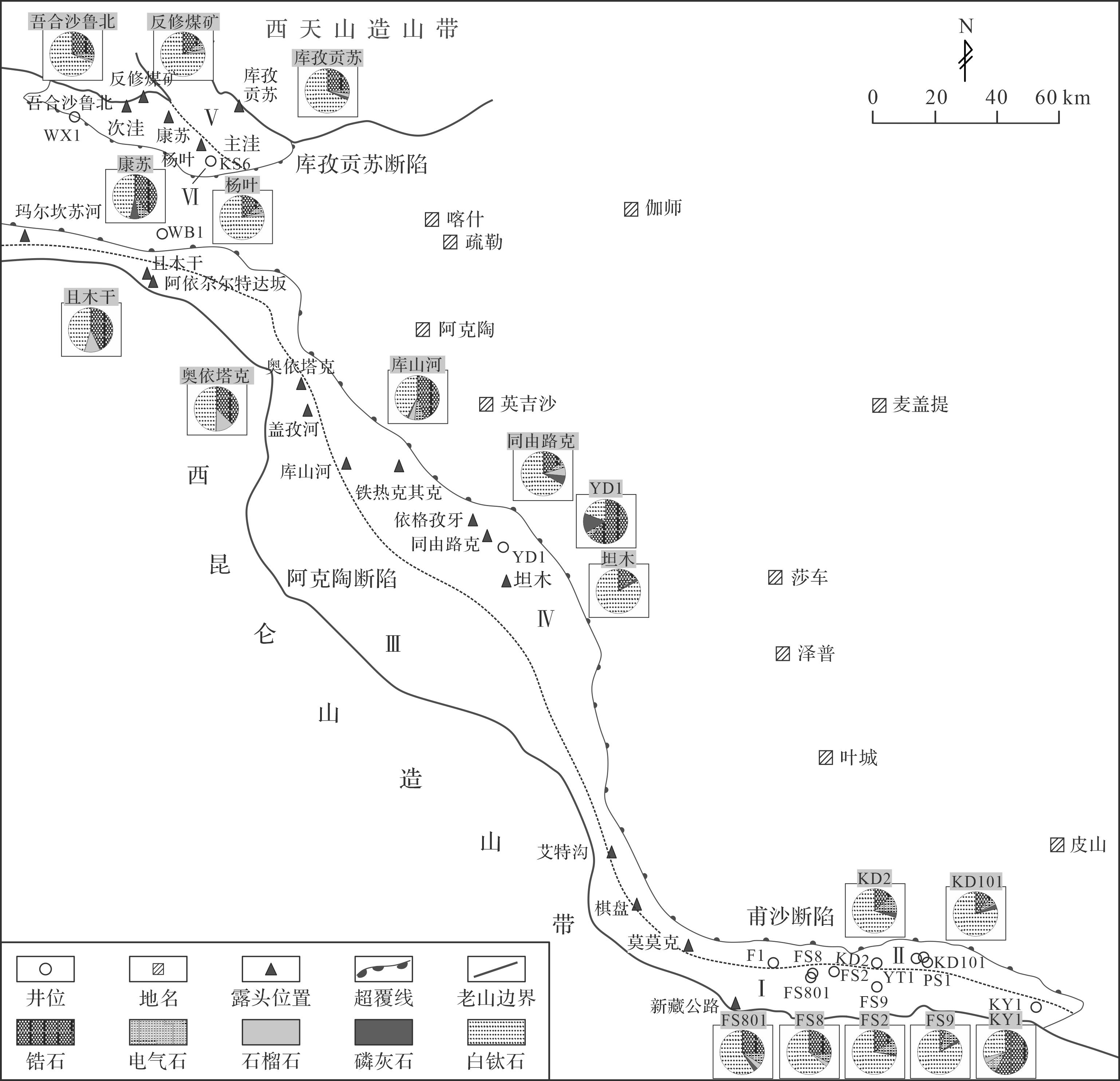
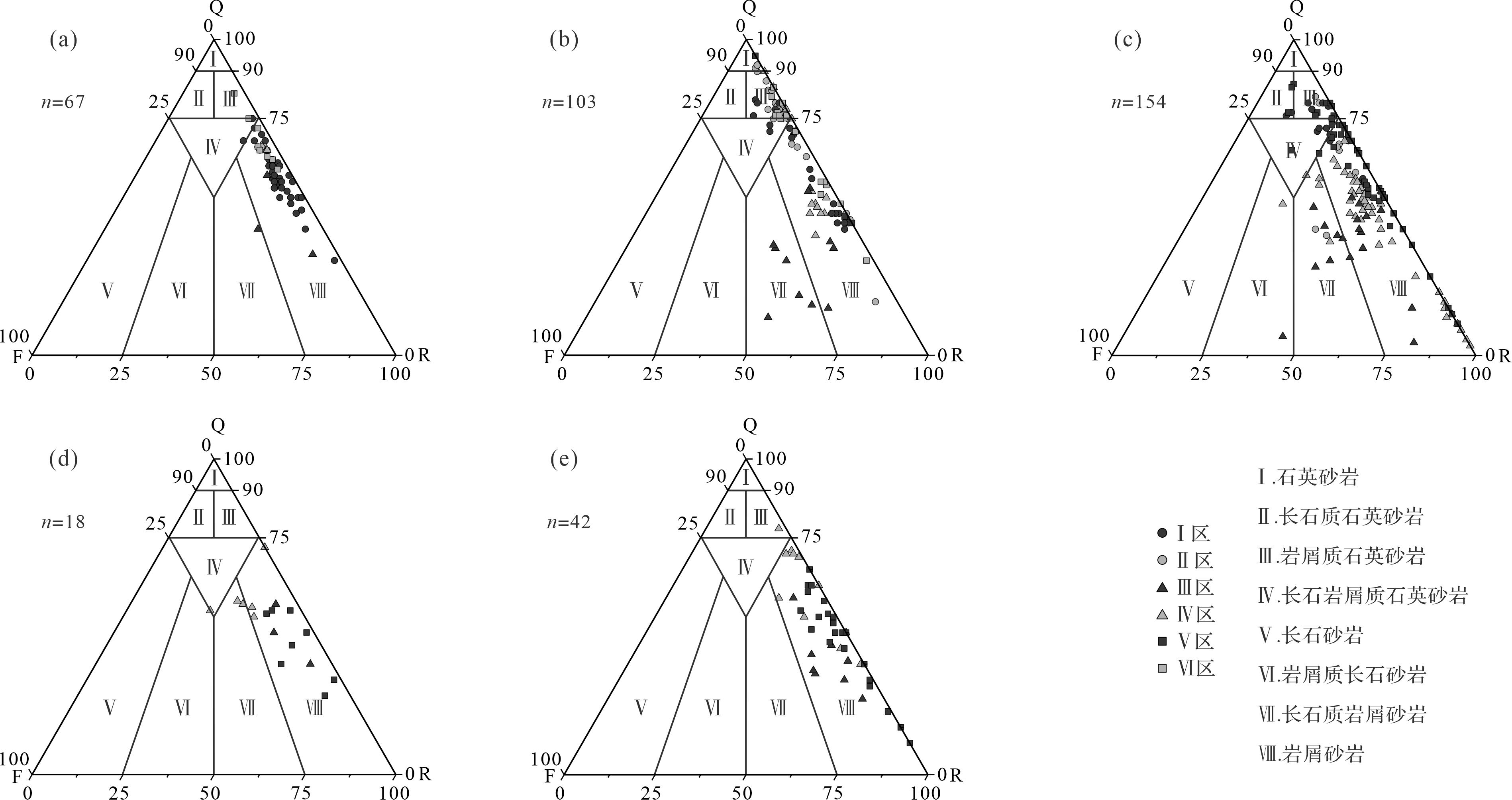
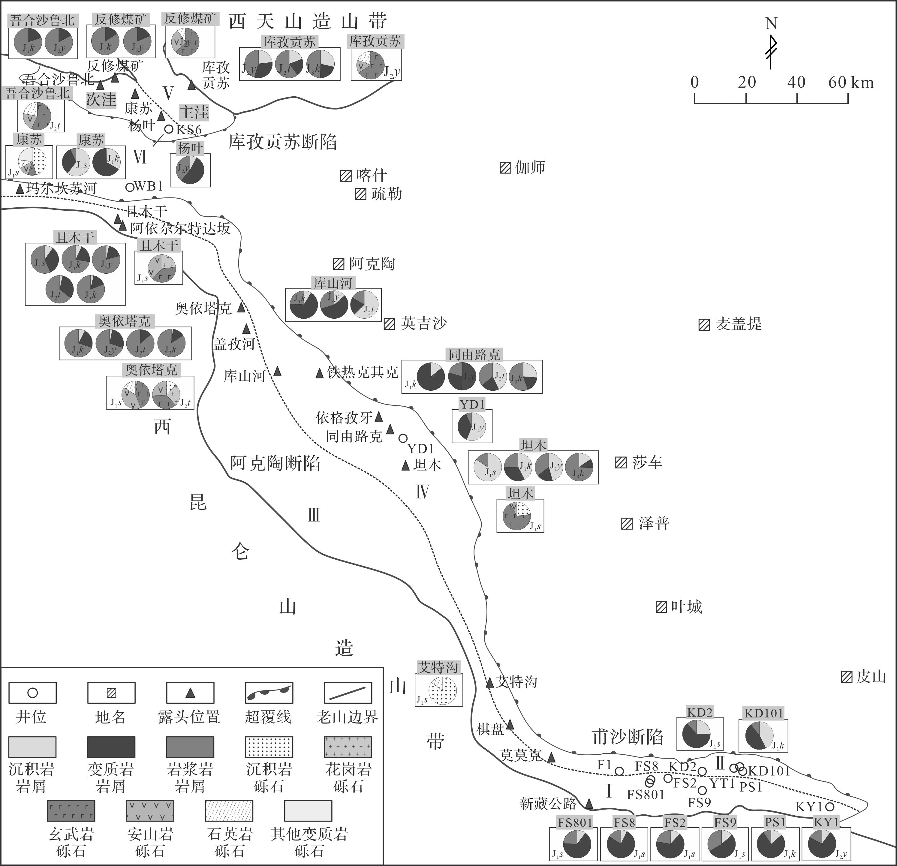
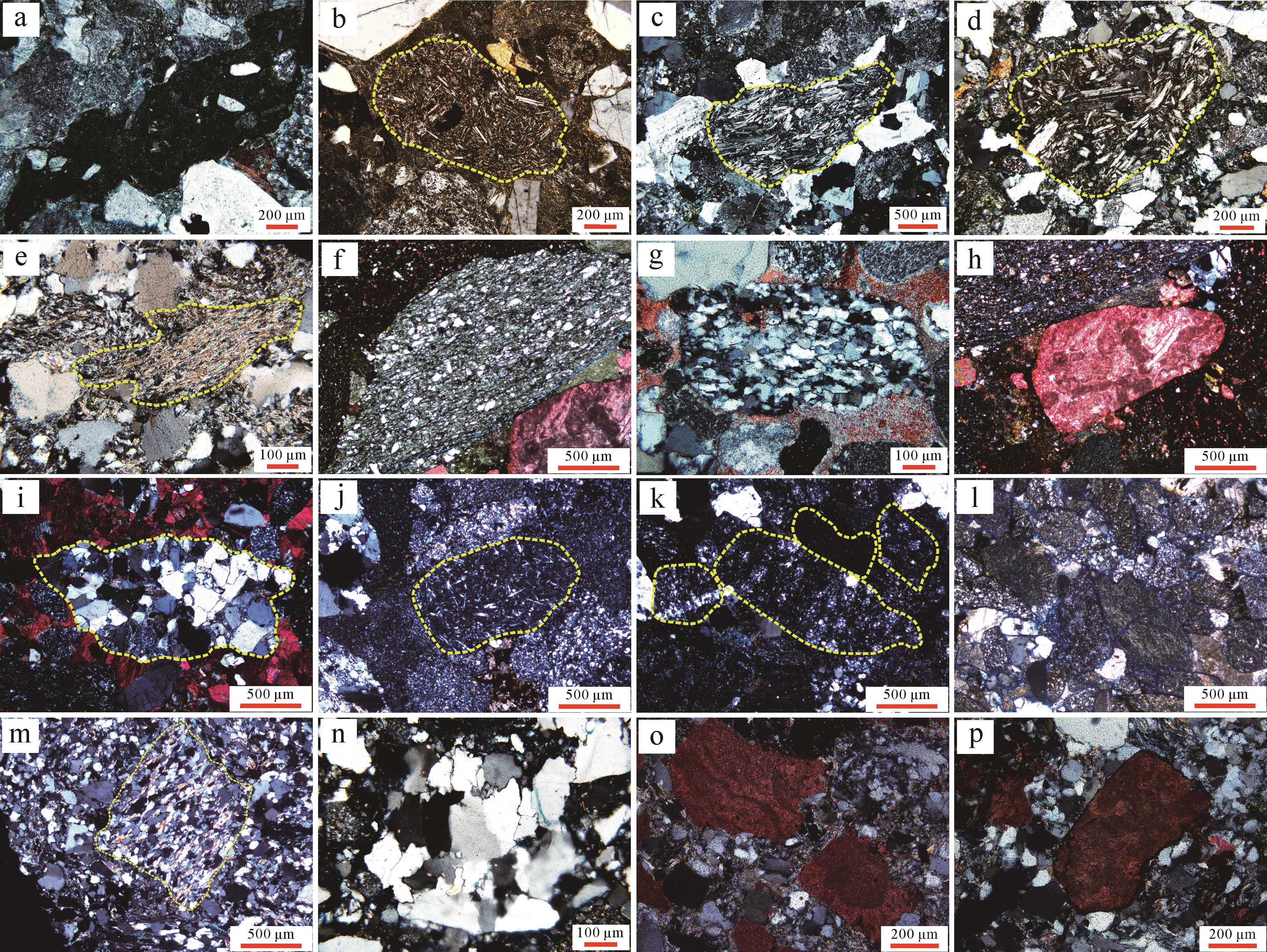
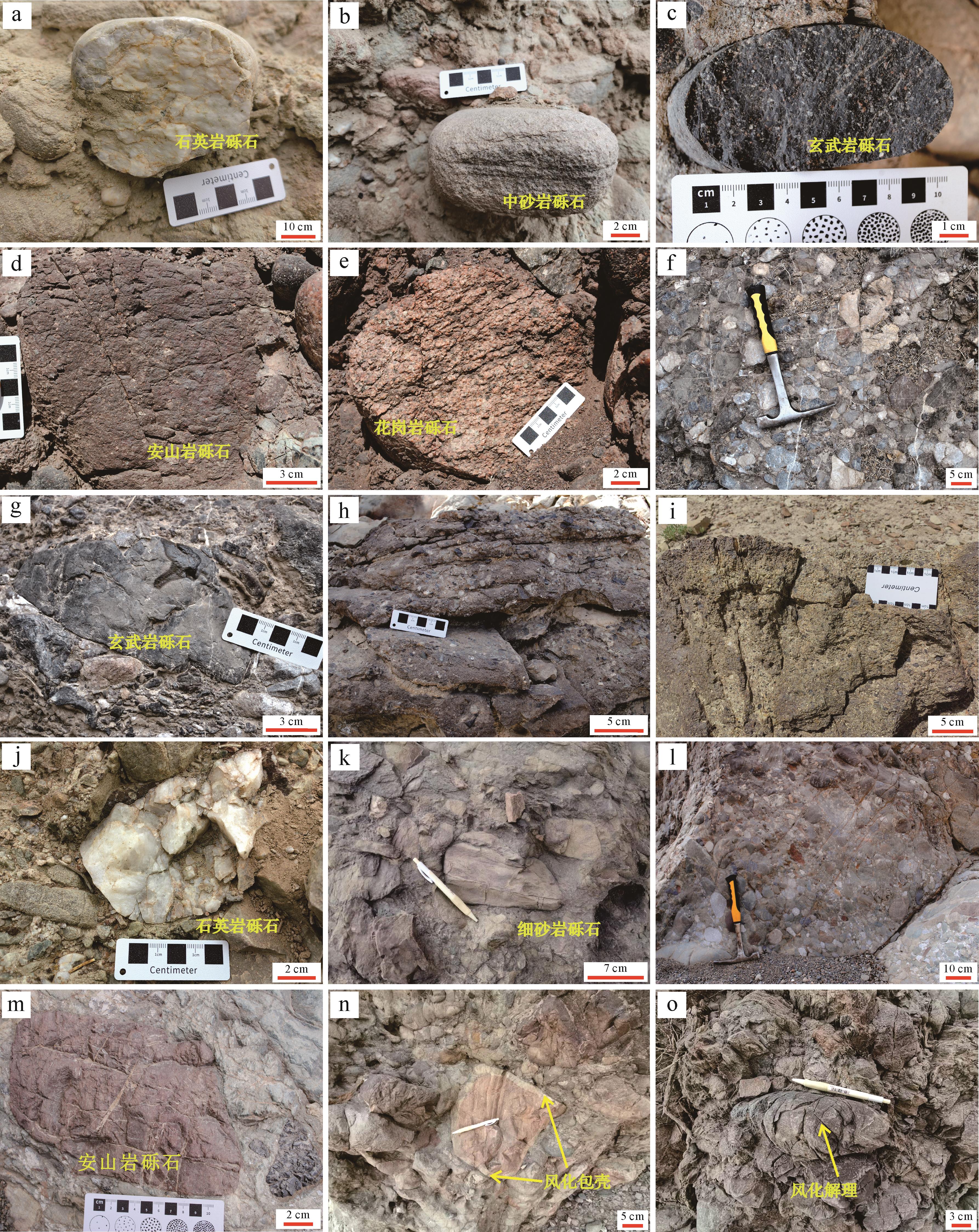
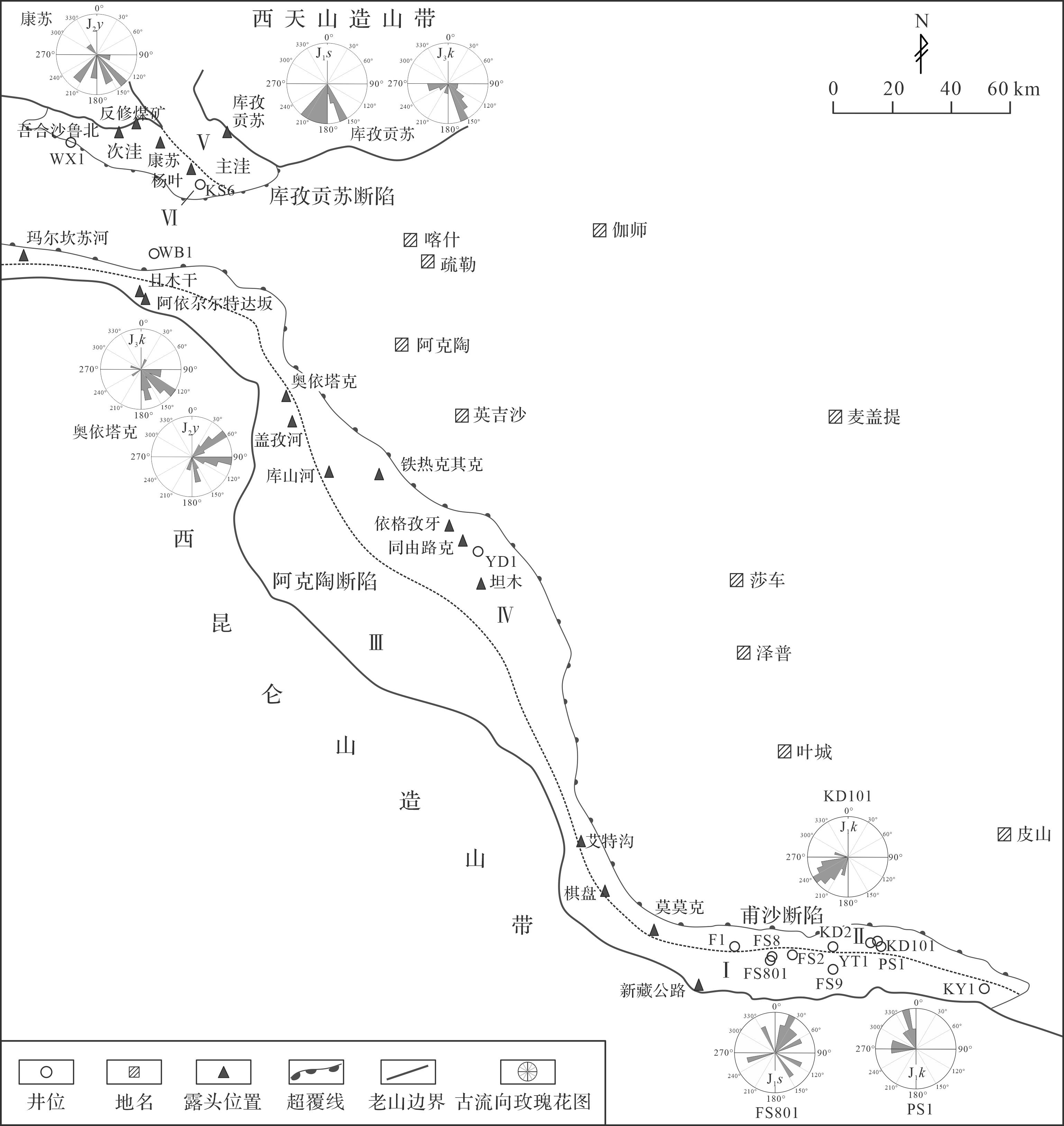
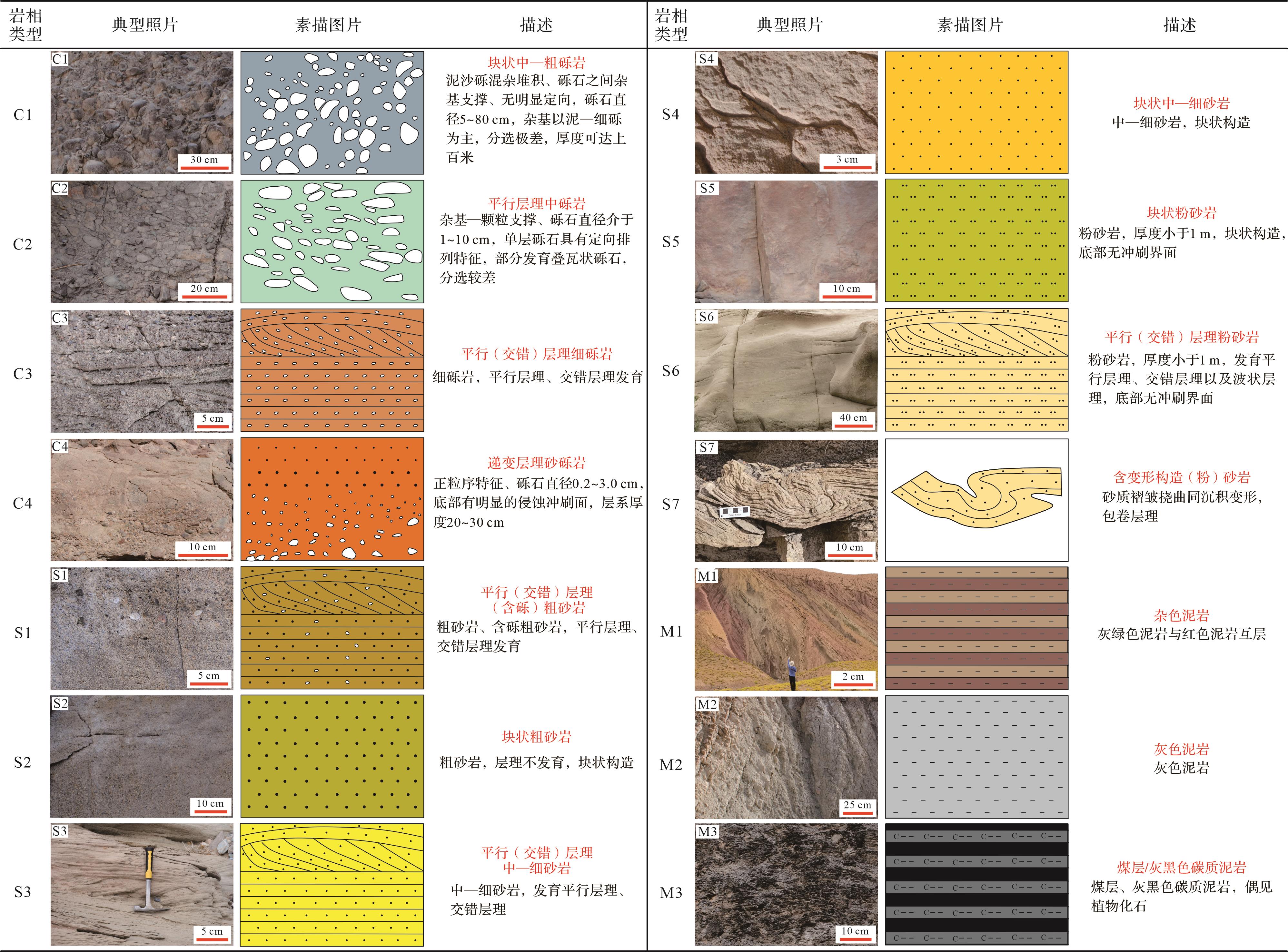
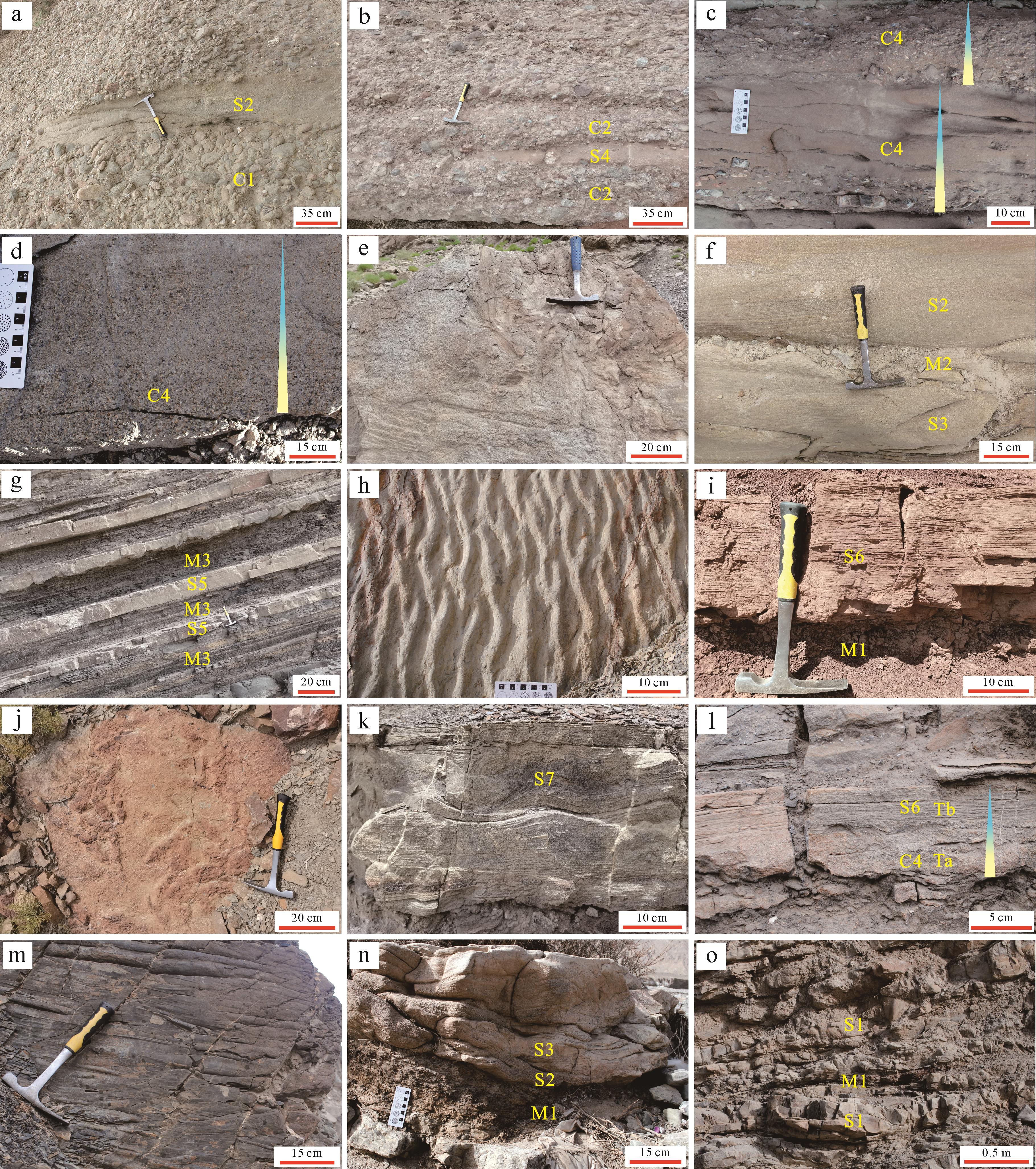
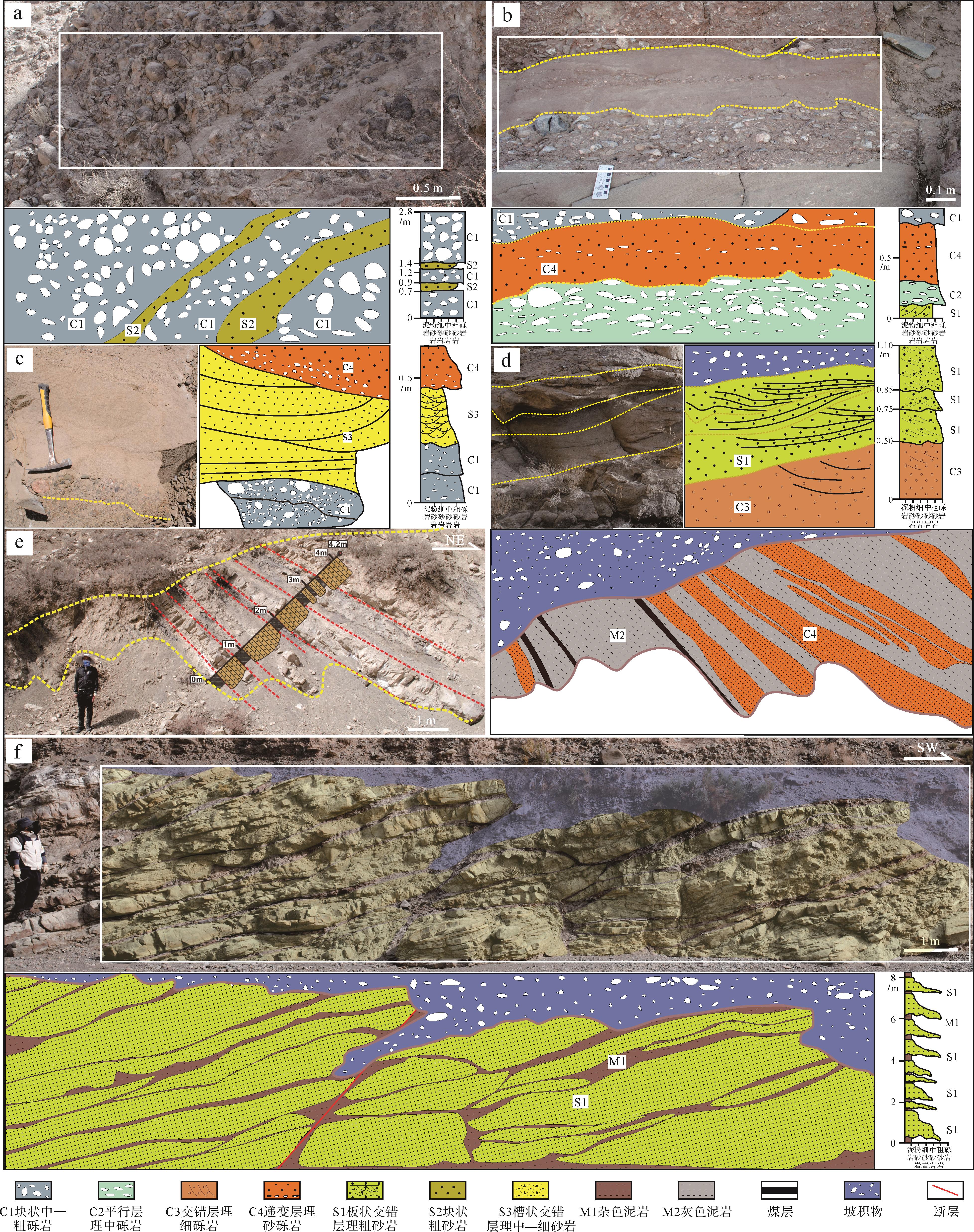
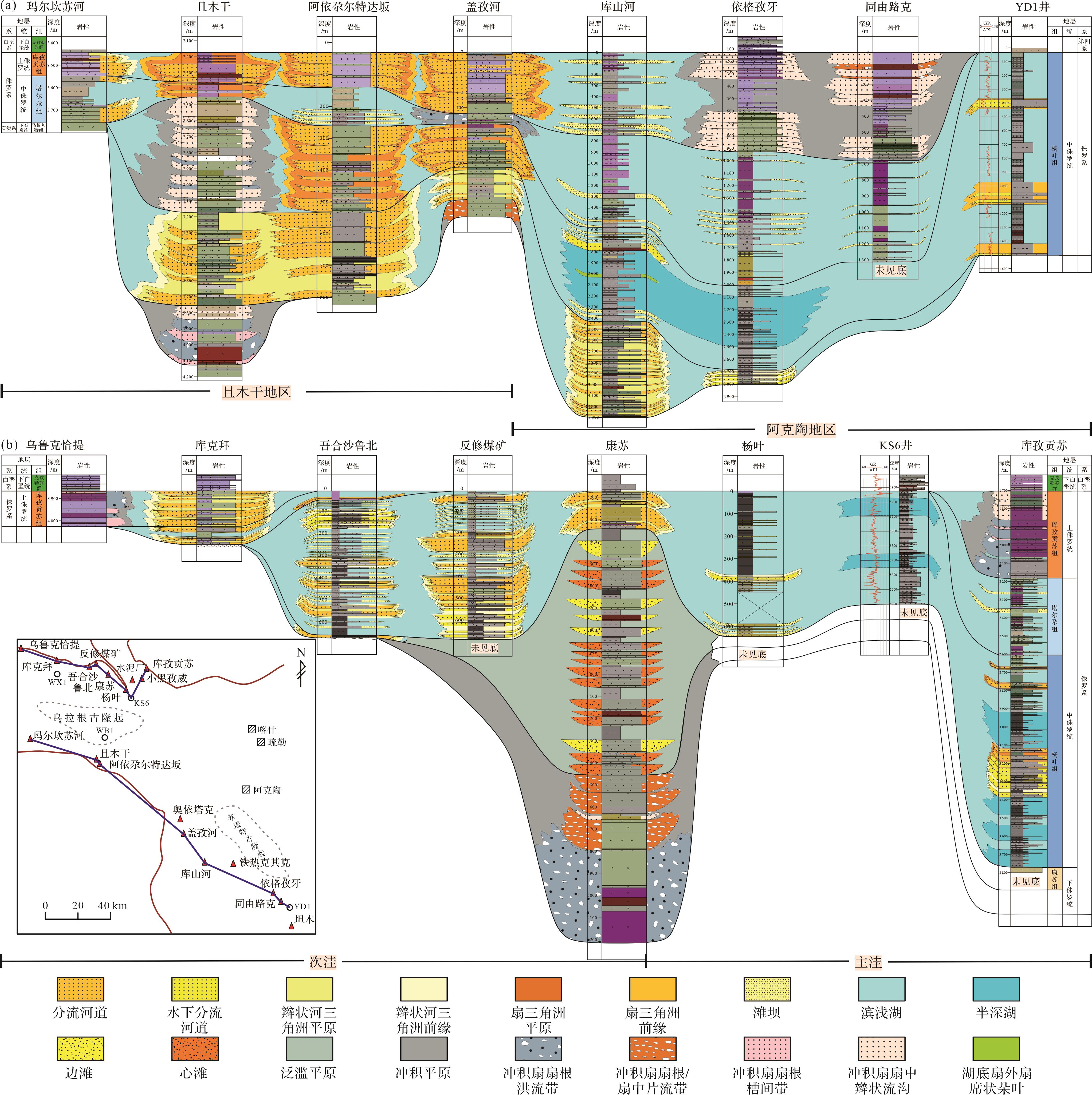
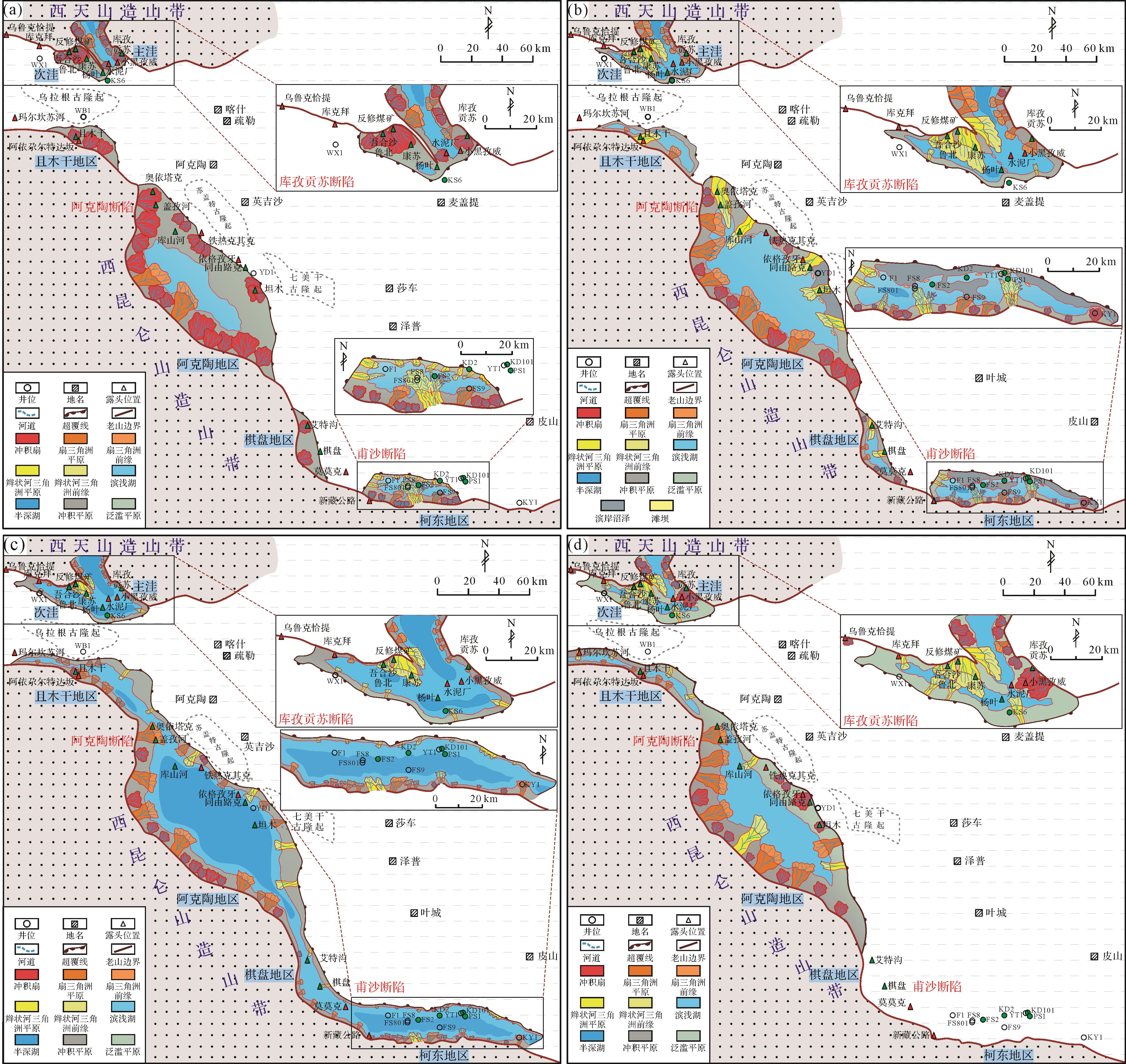
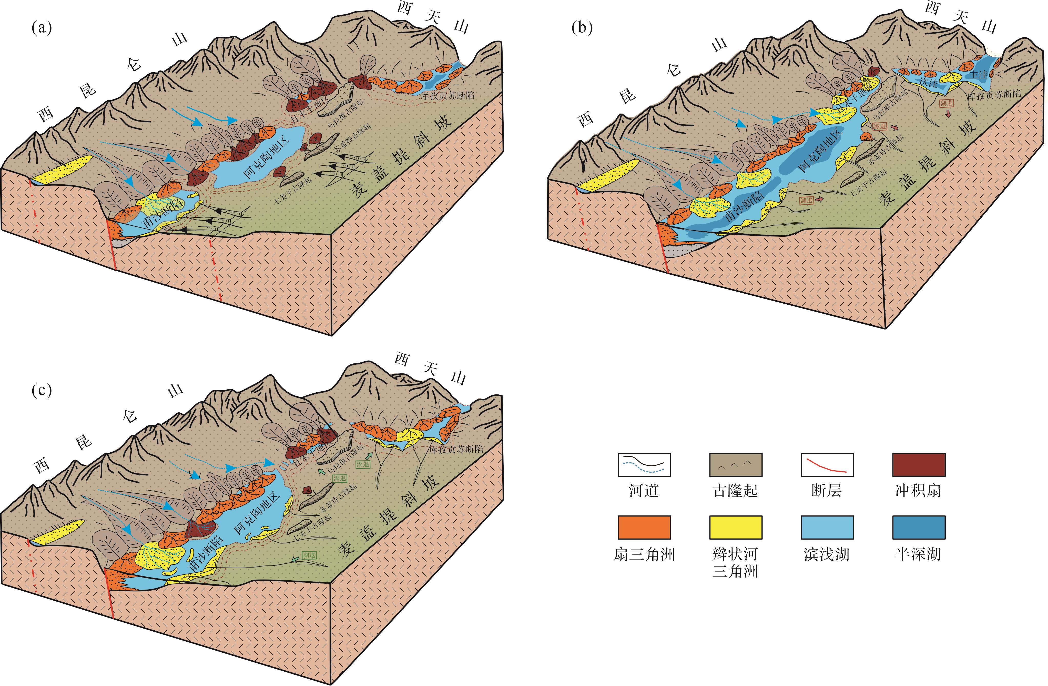
2026, 44(5): 1889-1904.
doi: 10.14027/j.issn.1000-0550.2025.015
Abstract:
Objective Clarifying the provenance and structural background of the Quaternary mudstone in the Sanhu Depression of the Qaidam Basin can provide geological basis for the exploration and development of Quaternary biogas in the Sanhu area. Methods This study conducted analysis of the major, trace, and rare earth elements on core samples from different depths of the Quaternary strata in the well Setan 1 and well Setan2 (well ST1 and well ST2) of the Sebei area. Results (1) The Quaternary mudstones in the Sebei area have low silicon (SiO2=48.17%), high aluminum (Al2O3=15.23%, aluminum index A/NK=2.54, aluminum saturation index A/NK = 1.59), rich magnesium and calcium (MgO=3.81%, CaO=7.91%), relatively rich iron (Fe2O3=4.99), and low total alkali content (K2O + Na2O=5.94%). The Ba and Cu contents are significantly enriched compared to Upper Continental Crust (UCC). Nb is deficient, and the content of other trace and rare earth elements is equivalent to that of the upper crust. (2) The samples in the research area are less affected by sedimentary sorting and recycling, chemical weathering, and diagenesis, and their elemental characteristics can indicate the source and tectonic background. The ratios of major, trace, and rare earth elements of Quaternary mudstones in the Sanhu Depression indicate that the sedimentary sources are primarily derived from the upper crustal felsic sedimentary and igneous rocks, with the tectonic background of the source areas being an active continental margin environment. (3) The potential source areas of Quaternary sediments in the Sanhu Depression are the East Kunlun and South Qilian Orogenic Belts. Among them, well ST1 is mainly sourced from the South Qilian Orogenic Belt on the north side, and well ST2 is mainly sourced from the East Kunlun Orogenic Belt on the south side. Conclusions The source of Quaternary mudstones in the Sanhu Depression has a bidirectional supply characteristic from north to south, and its geochemical parameters are reliable indicators of the mixed source area of sedimentary rocks, which came from igneous rocks under the background of active continental margins.
Objective Clarifying the provenance and structural background of the Quaternary mudstone in the Sanhu Depression of the Qaidam Basin can provide geological basis for the exploration and development of Quaternary biogas in the Sanhu area. Methods This study conducted analysis of the major, trace, and rare earth elements on core samples from different depths of the Quaternary strata in the well Setan 1 and well Setan2 (well ST1 and well ST2) of the Sebei area. Results (1) The Quaternary mudstones in the Sebei area have low silicon (SiO2=48.17%), high aluminum (Al2O3=15.23%, aluminum index A/NK=2.54, aluminum saturation index A/NK = 1.59), rich magnesium and calcium (MgO=3.81%, CaO=7.91%), relatively rich iron (Fe2O3=4.99), and low total alkali content (K2O + Na2O=5.94%). The Ba and Cu contents are significantly enriched compared to Upper Continental Crust (UCC). Nb is deficient, and the content of other trace and rare earth elements is equivalent to that of the upper crust. (2) The samples in the research area are less affected by sedimentary sorting and recycling, chemical weathering, and diagenesis, and their elemental characteristics can indicate the source and tectonic background. The ratios of major, trace, and rare earth elements of Quaternary mudstones in the Sanhu Depression indicate that the sedimentary sources are primarily derived from the upper crustal felsic sedimentary and igneous rocks, with the tectonic background of the source areas being an active continental margin environment. (3) The potential source areas of Quaternary sediments in the Sanhu Depression are the East Kunlun and South Qilian Orogenic Belts. Among them, well ST1 is mainly sourced from the South Qilian Orogenic Belt on the north side, and well ST2 is mainly sourced from the East Kunlun Orogenic Belt on the south side. Conclusions The source of Quaternary mudstones in the Sanhu Depression has a bidirectional supply characteristic from north to south, and its geochemical parameters are reliable indicators of the mixed source area of sedimentary rocks, which came from igneous rocks under the background of active continental margins.
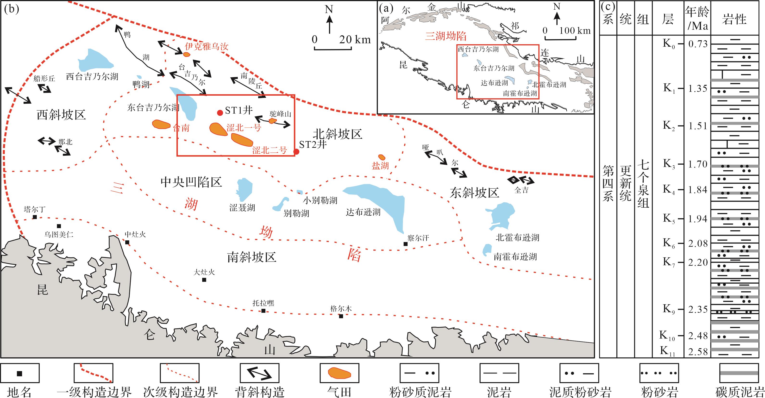
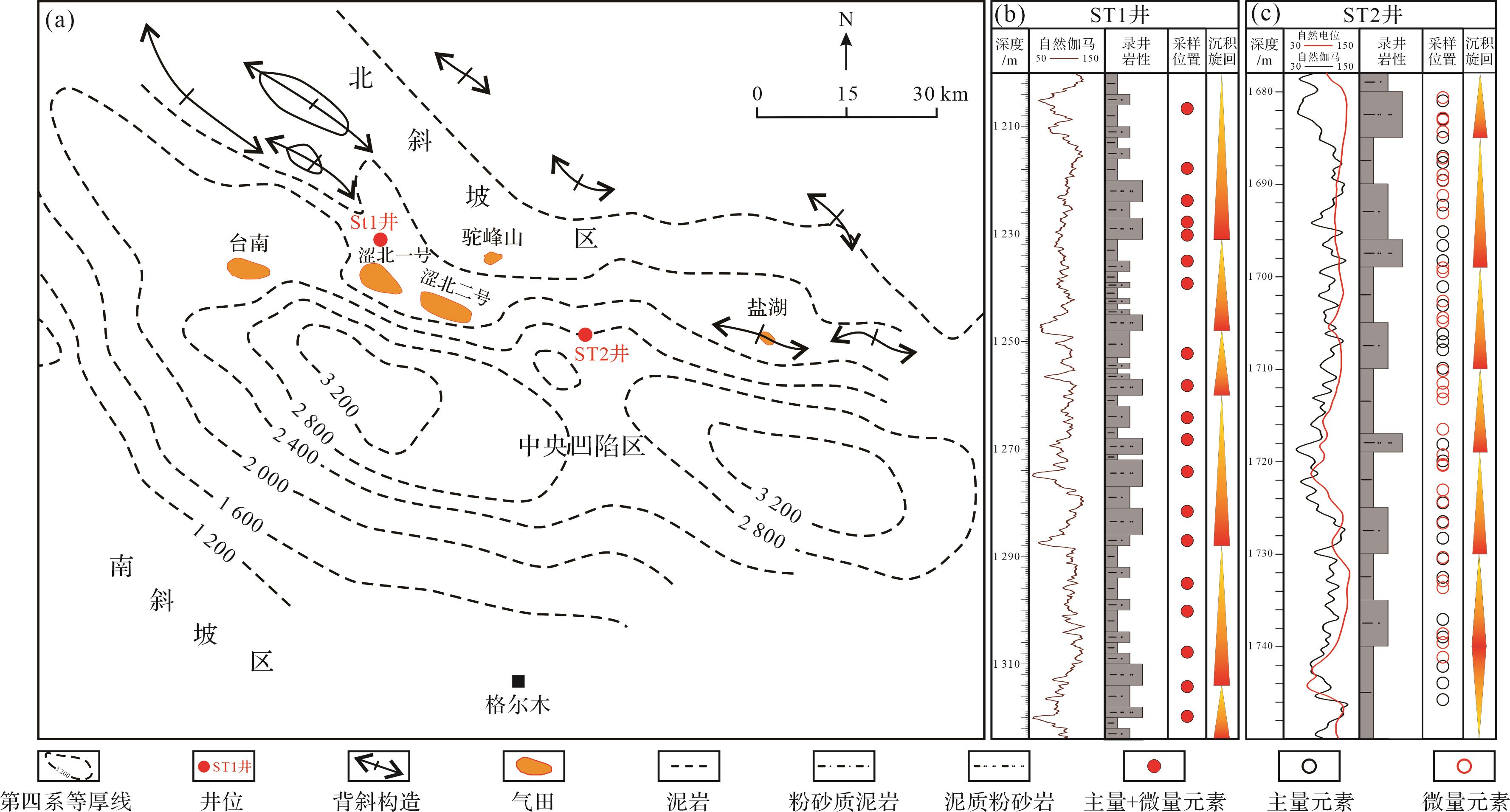
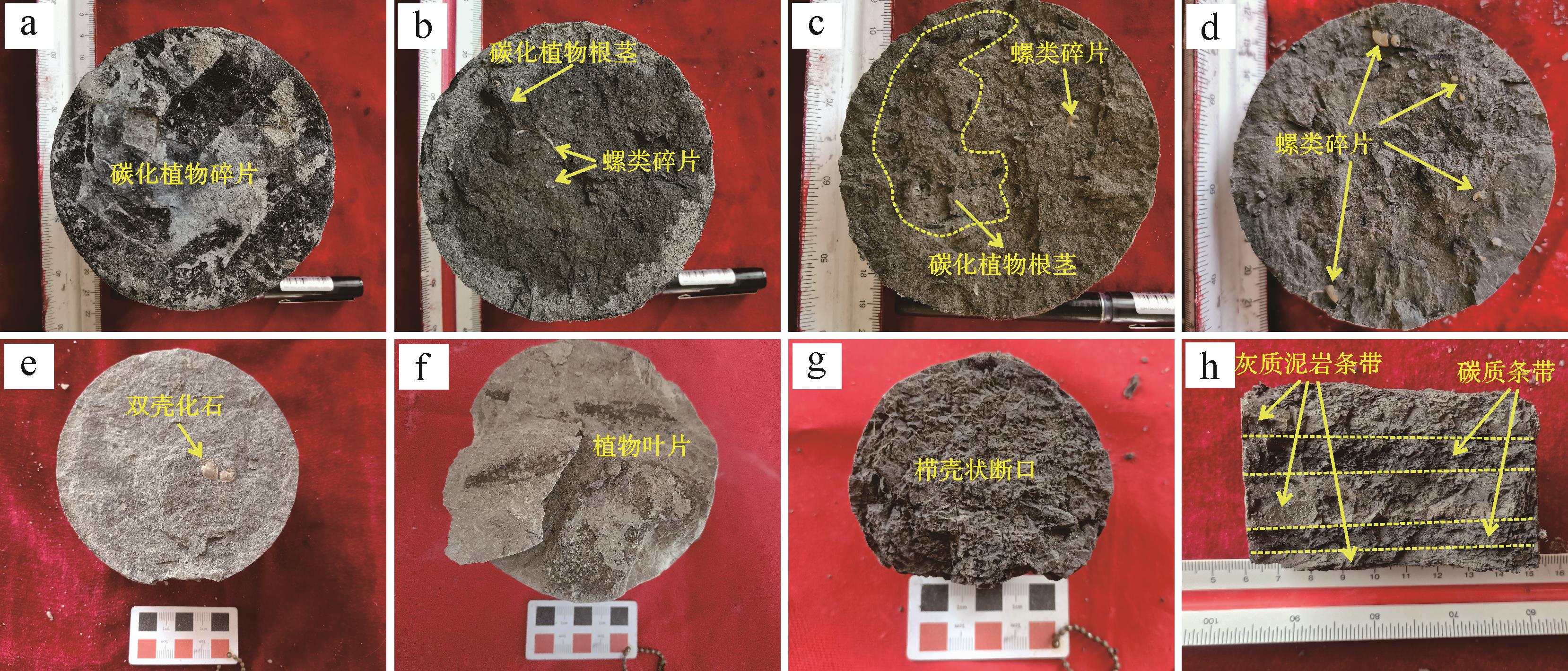
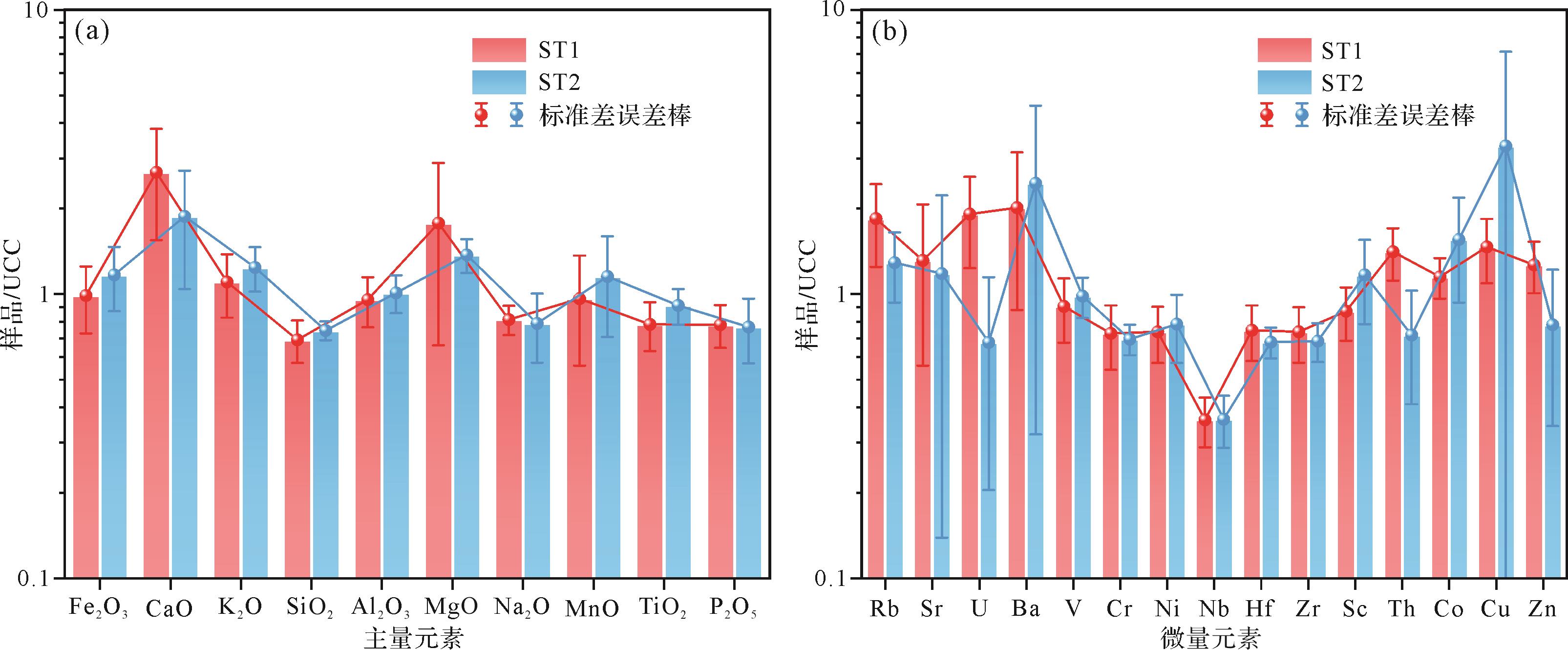
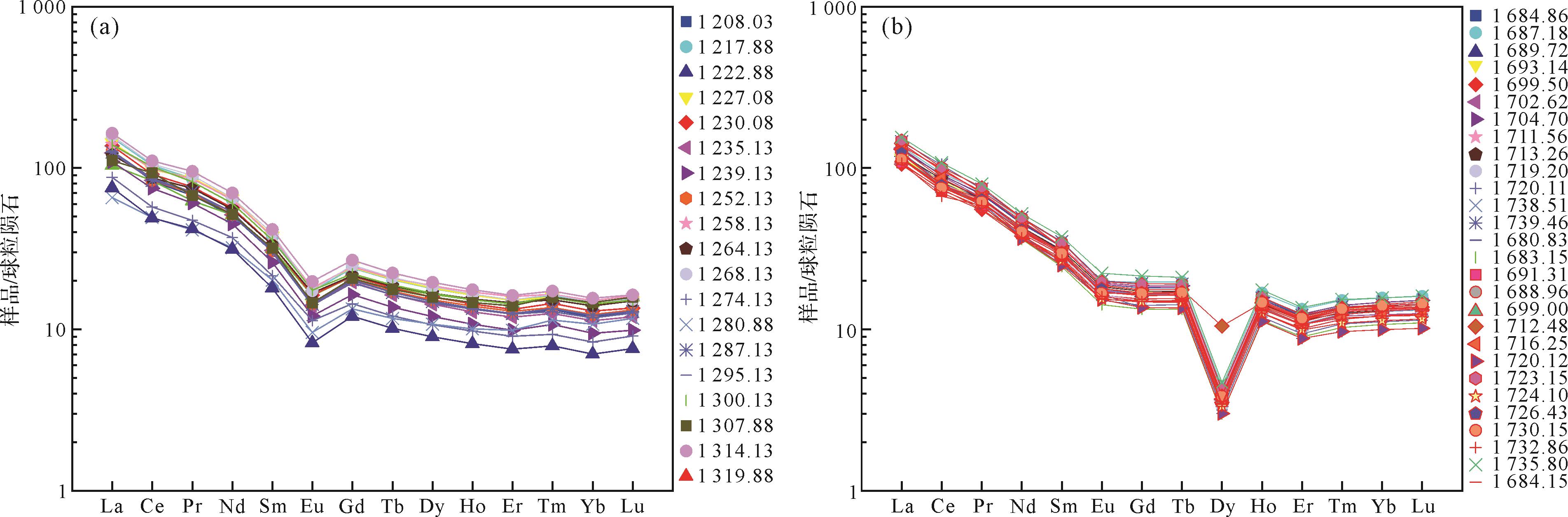
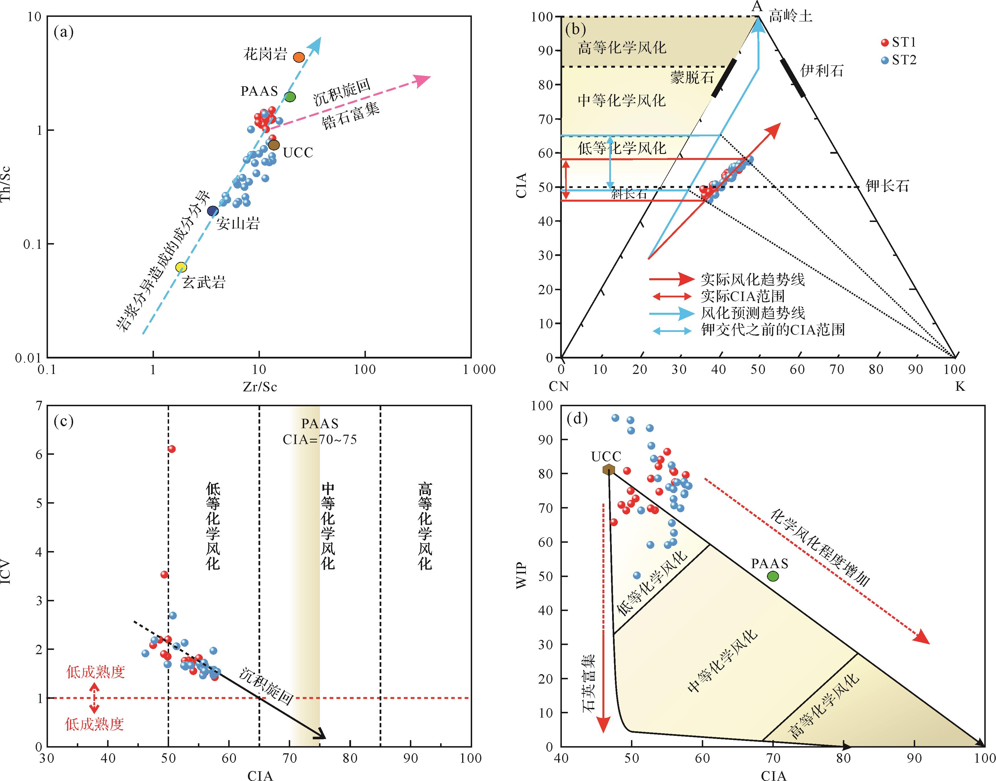
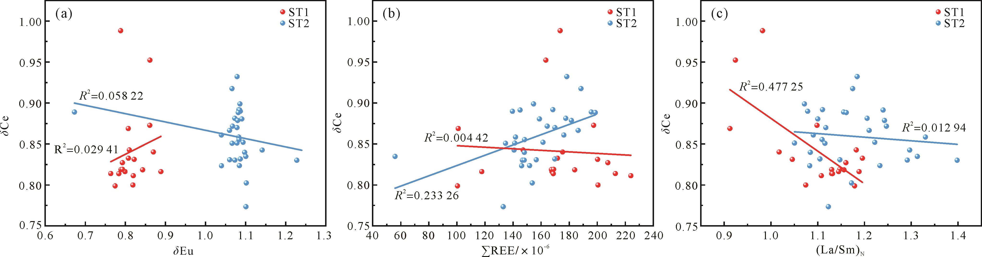
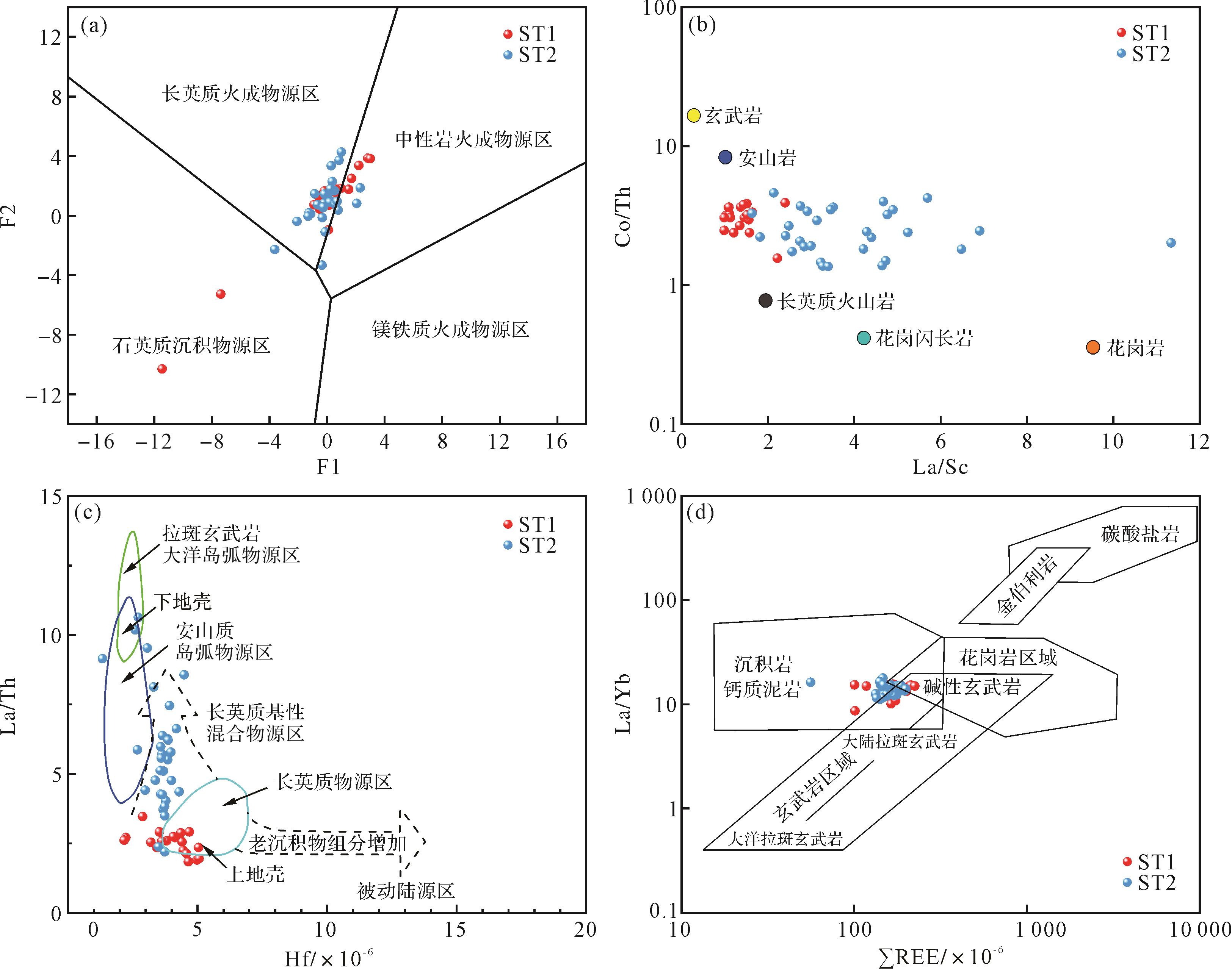
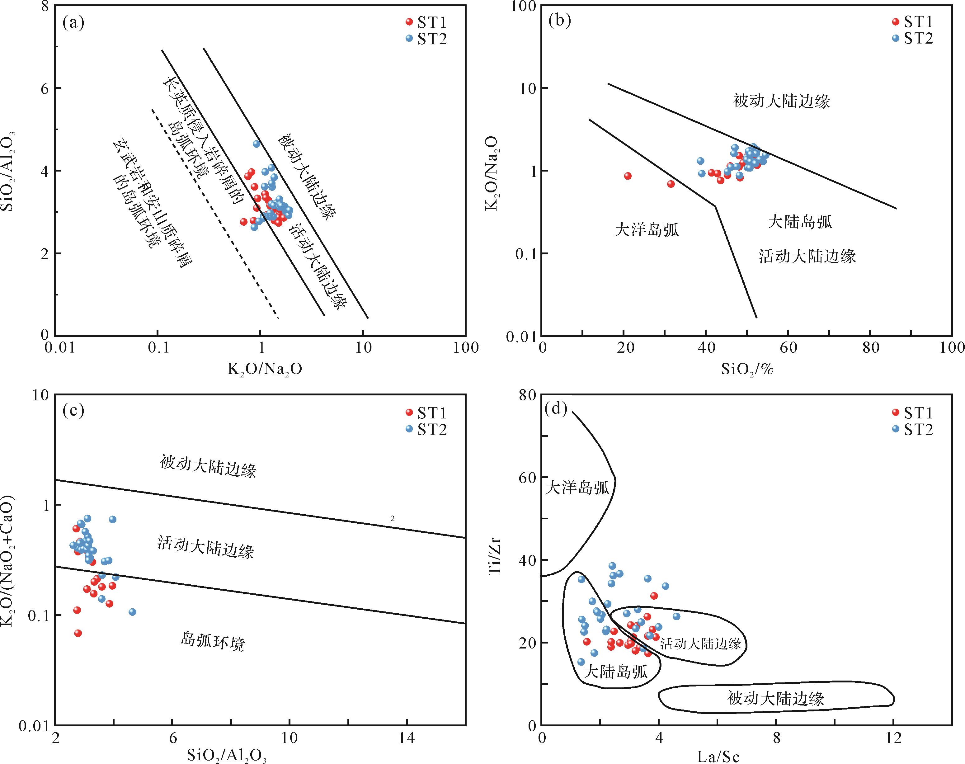
2026, 44(5): 1905-1918.
doi: 10.14027/j.issn.1000-0550.2025.021
Abstract:
Objective Pore-laminar fracture systems are important reservoir spaces and seepage channels for shale oil, since they control the distribution of the oil. Most previous studies have discussed pores and laminar fractures separately but, in fact, they are closely related genetically. This study considers the pore-laminar fracture system as a whole. Methods The shale of the Paleogene Es3 x 4 s
Objective Pore-laminar fracture systems are important reservoir spaces and seepage channels for shale oil, since they control the distribution of the oil. Most previous studies have discussed pores and laminar fractures separately but, in fact, they are closely related genetically. This study considers the pore-laminar fracture system as a whole. Methods The shale of the Paleogene Es
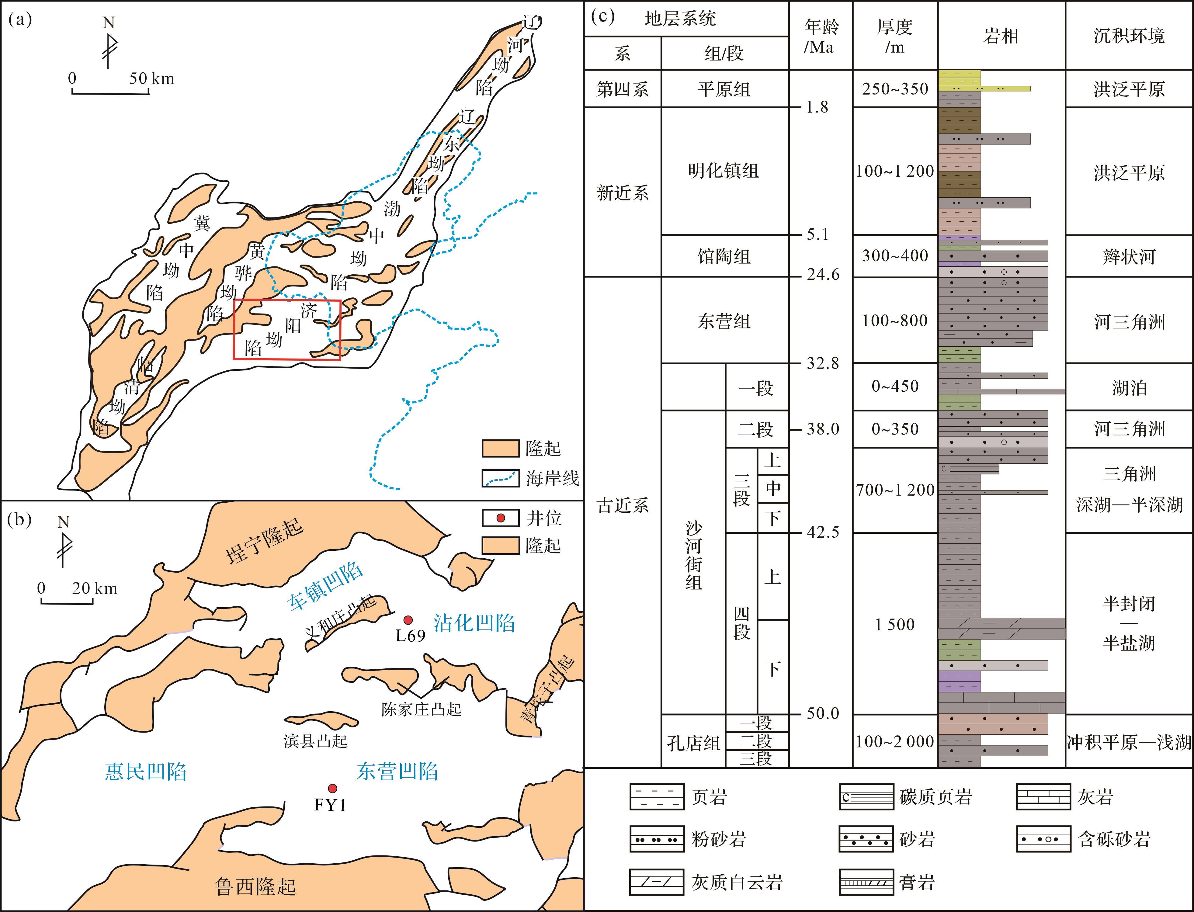
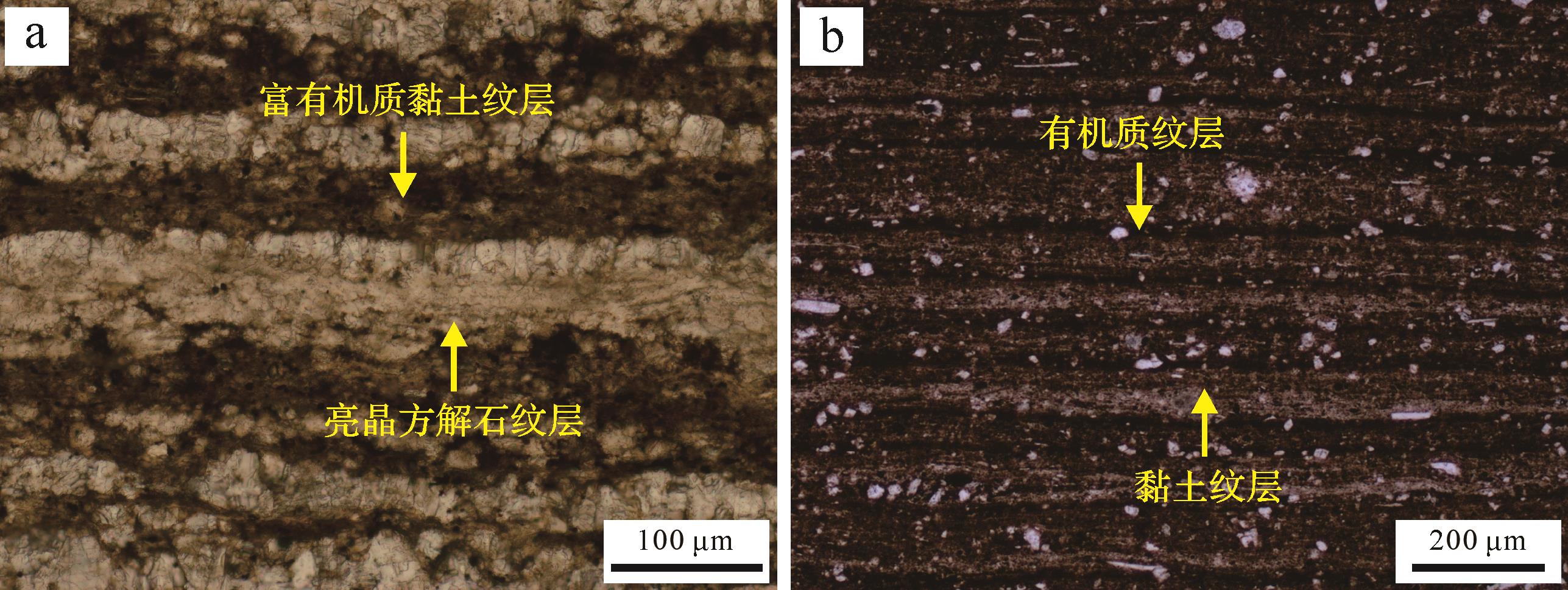
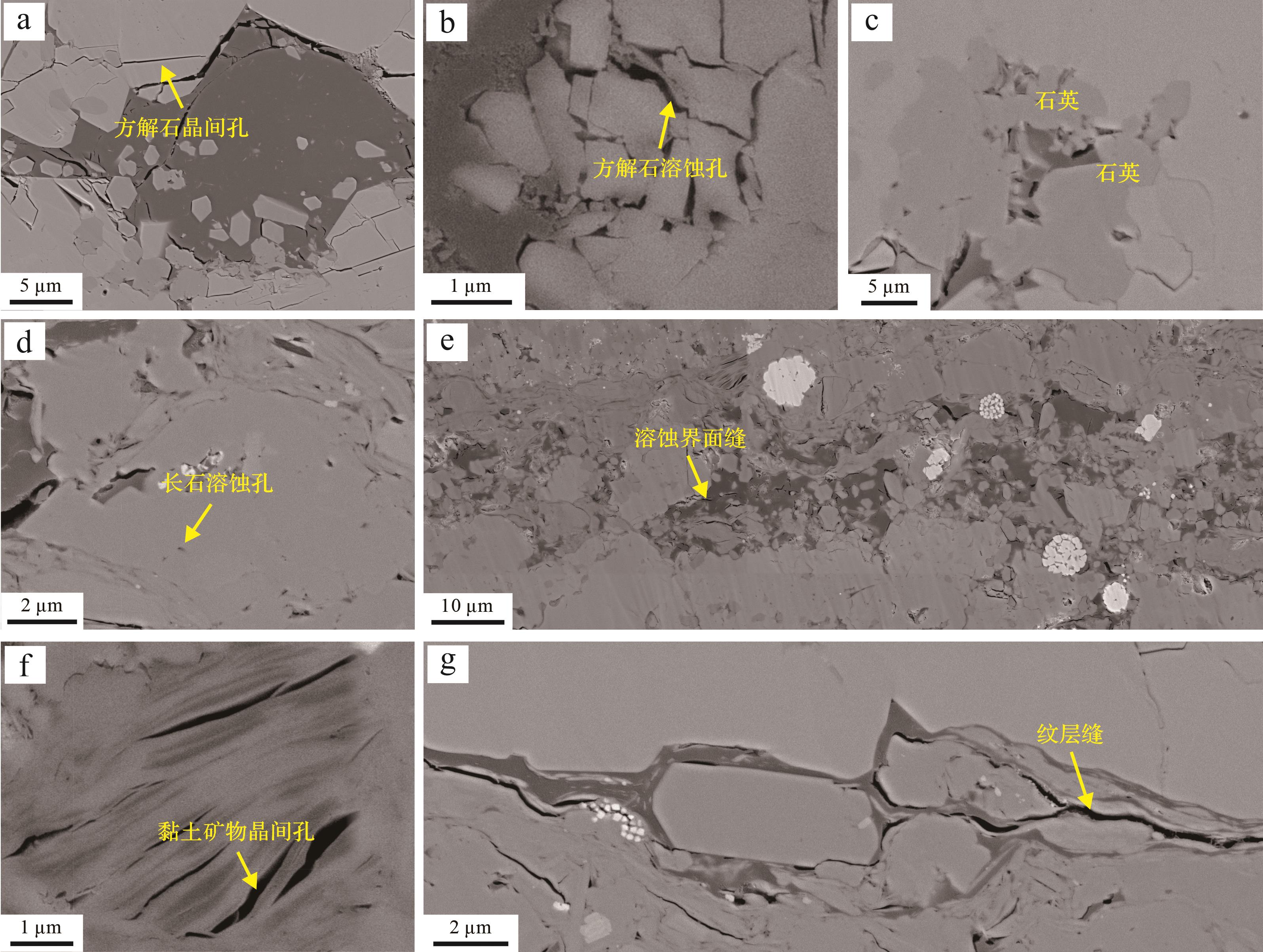
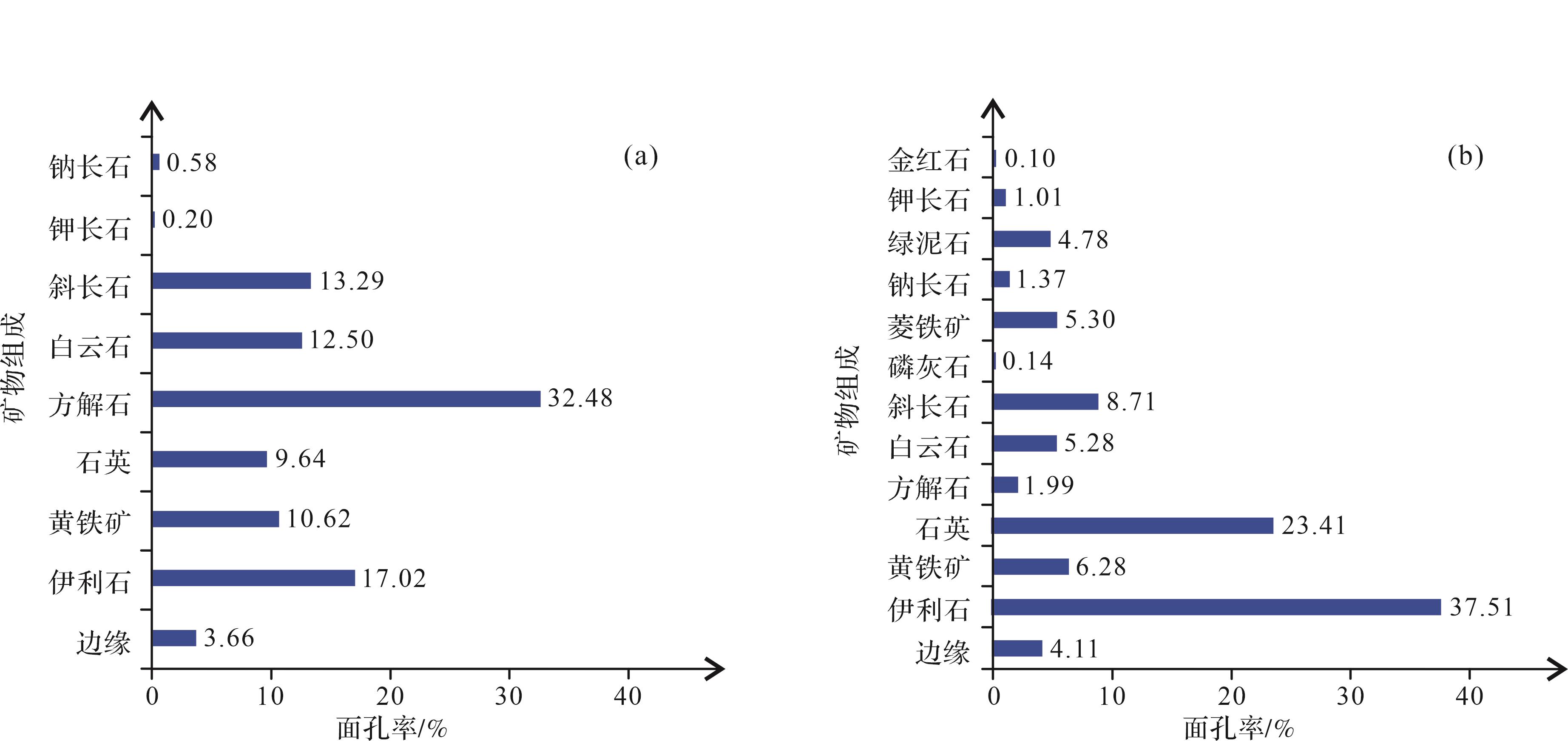
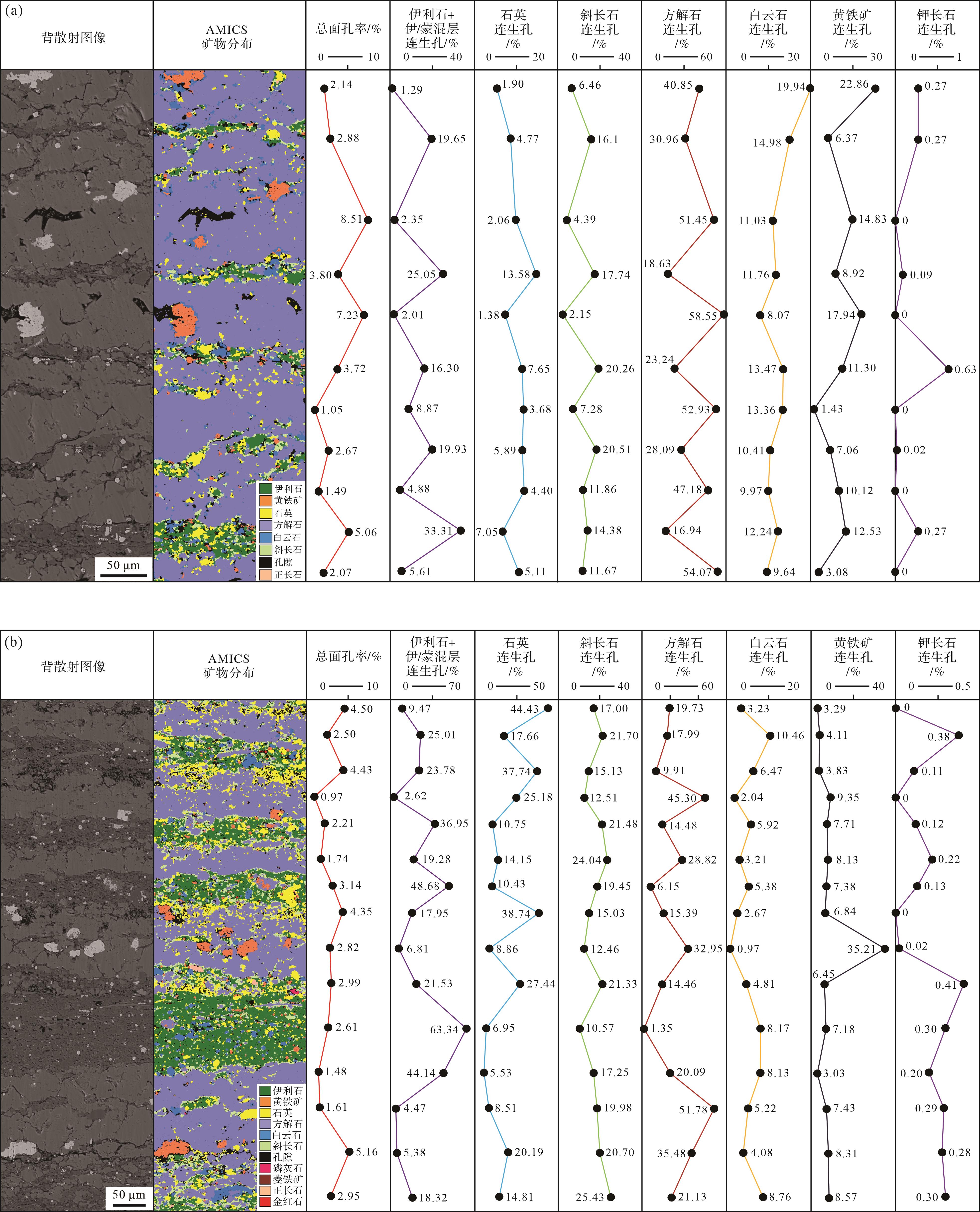
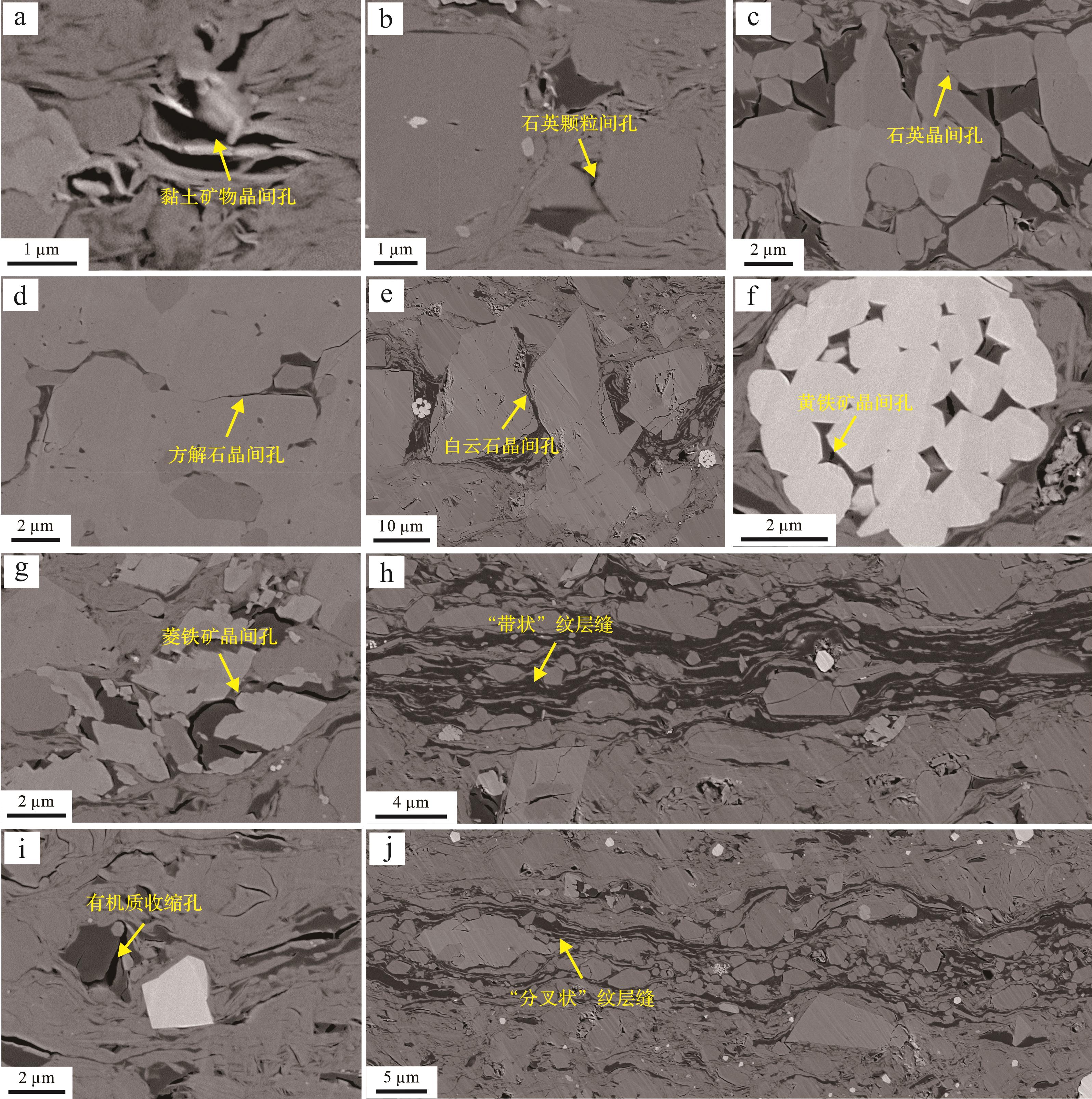
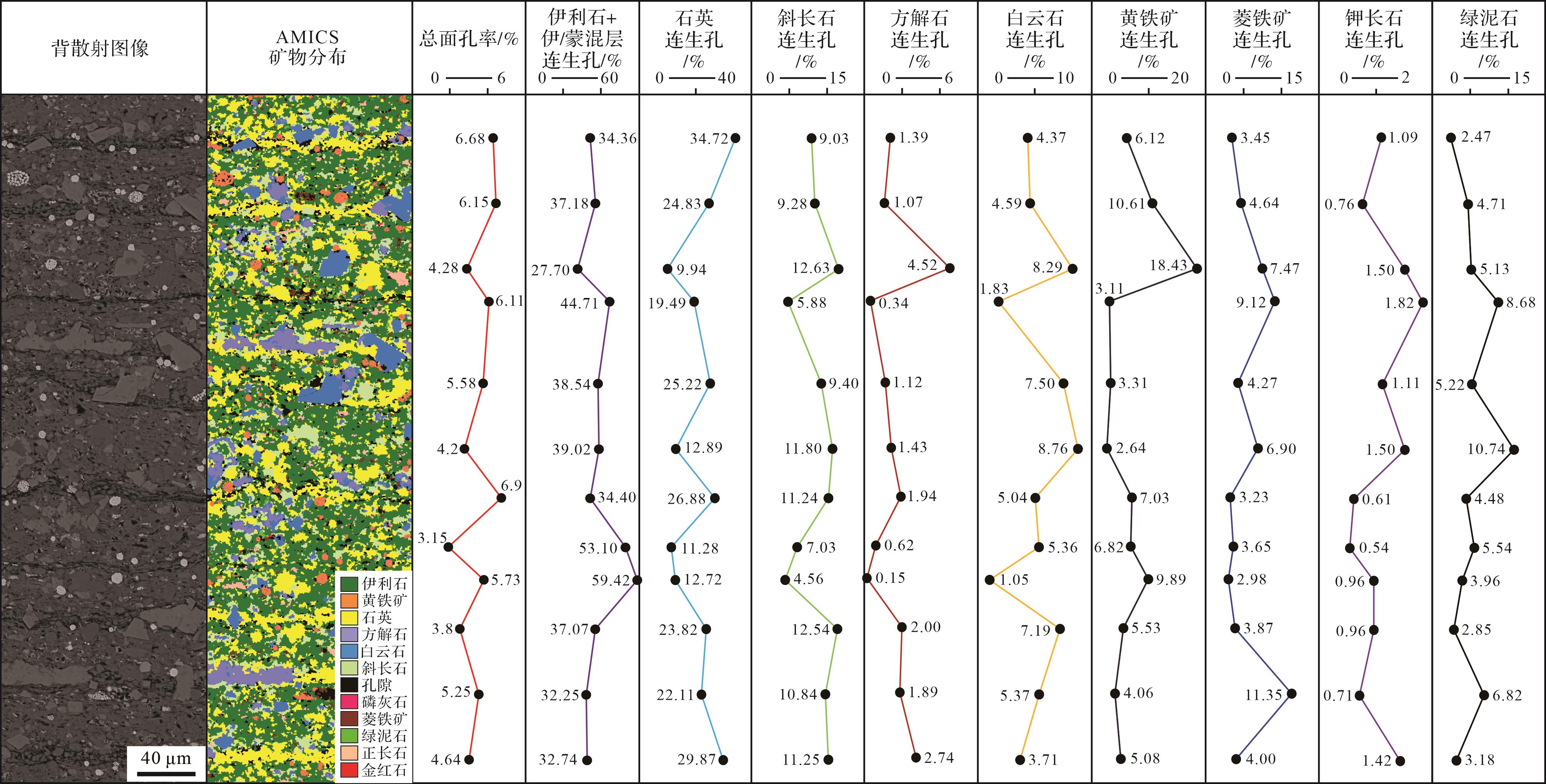
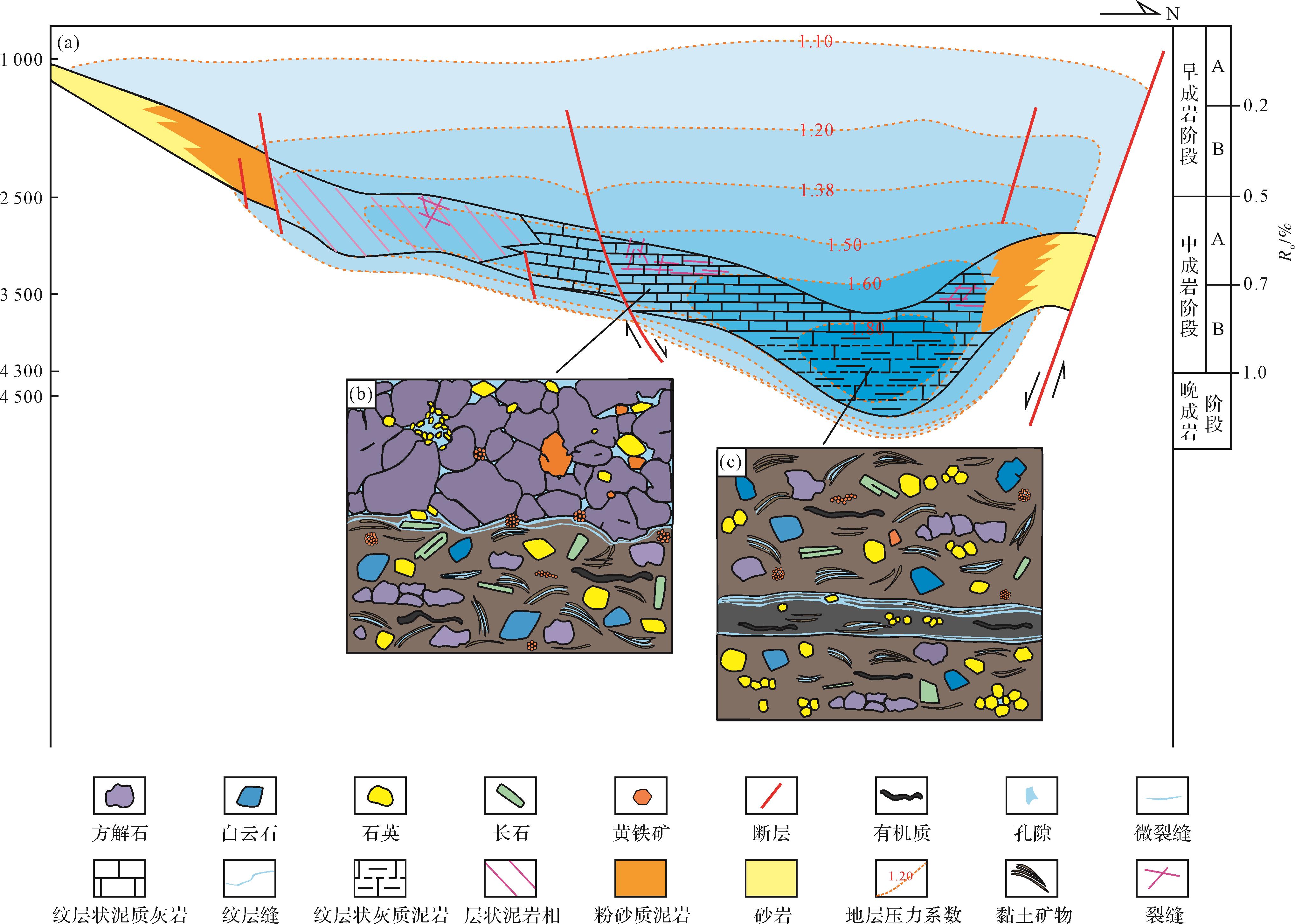
2026, 44(5): 1919-1934.
doi: 10.14027/j.issn.1000-0550.2025.016
Abstract:
Objective The tight sandstone interlayer of the Chang 71-2 sub-member of the Yanchang Formation in the Qingcheng oilfield is a typical sublacustrine fan deposit. However, research on the differences in sandstone reservoir performance on the sedimentary microfacies scale is inadequate, which restricts the screening of high-yield blocks and the analysis of horizontal sound production effects. Methods Based on core, logging and seismic data, using thin section identification, scanning electron microscopy, micro-CT, nuclear magnetic resonance, high-pressure mercury injection and constant-rate mercury injection tests, combined with oil test and production test data, the differences in tight sandstone rock and ore, microscopic pore structure, oil content and mobility, and oil test in different sedimentary microfacies are analyzed. [Results and Conclusions] The results show that under the control of multi-stage slope break zones, multi-stage sublacustrine fan sand bodies accumulate in the relatively gentle semi-deep lake-deep lake slope toe zone, and frequently interact with organic-rich shale to form a large area of "sandwich" source-reservoir symbiosis, which constitutes the primary geological descriptor of interlayer shale oil in Qingcheng oilfield. The sandstone interlayer can be divided into four sedimentary microfacies: channel, lobe, lobe side edge and slump body. The sandstone superimposed thickness of the channel, lobe, and lobe side edge is relatively large, and the logging interpretation generally indicates an oil layer, which is the main target of horizontal well development. Dissolution pores and intergranular pores dominate the reservoir space of the channel, lobe body and lobe lateral margin. The cements are mainly composed of ferrodolomite, ferrocalcite, and quartz. The channel and lobe body exhibit characteristics such as low content of interstitial materials and cements, high surface porosity, good physical properties, and a microscopic pore structure with a high proportion of connected pore volume, a large pore throat radius, and relatively high movable fluid saturation and oiliness. The saturation of movable fluid is closely related to the pore structure. Controlled by the microscopic pore structure, the channel has better microscopic pore throat parameters than the lobe, which is more conducive to the filling and seepage of oil and gas. Under the same thickness scale, the channel is easier to obtain high-yield industrial oil flow than the lobed body vertical well test. The vertical superposition of the channel and the lobed body is a high-yield sedimentary combination box. Fine characterising sublacustrine fan tight sandstone sedimentary microfacies, optimising the orientation and length of horizontal wells, and identifying favourable microfacies combinations for development are key to improving the drilling rate and development effect of horizontal well reservoirs.
Objective The tight sandstone interlayer of the Chang 71-2 sub-member of the Yanchang Formation in the Qingcheng oilfield is a typical sublacustrine fan deposit. However, research on the differences in sandstone reservoir performance on the sedimentary microfacies scale is inadequate, which restricts the screening of high-yield blocks and the analysis of horizontal sound production effects. Methods Based on core, logging and seismic data, using thin section identification, scanning electron microscopy, micro-CT, nuclear magnetic resonance, high-pressure mercury injection and constant-rate mercury injection tests, combined with oil test and production test data, the differences in tight sandstone rock and ore, microscopic pore structure, oil content and mobility, and oil test in different sedimentary microfacies are analyzed. [Results and Conclusions] The results show that under the control of multi-stage slope break zones, multi-stage sublacustrine fan sand bodies accumulate in the relatively gentle semi-deep lake-deep lake slope toe zone, and frequently interact with organic-rich shale to form a large area of "sandwich" source-reservoir symbiosis, which constitutes the primary geological descriptor of interlayer shale oil in Qingcheng oilfield. The sandstone interlayer can be divided into four sedimentary microfacies: channel, lobe, lobe side edge and slump body. The sandstone superimposed thickness of the channel, lobe, and lobe side edge is relatively large, and the logging interpretation generally indicates an oil layer, which is the main target of horizontal well development. Dissolution pores and intergranular pores dominate the reservoir space of the channel, lobe body and lobe lateral margin. The cements are mainly composed of ferrodolomite, ferrocalcite, and quartz. The channel and lobe body exhibit characteristics such as low content of interstitial materials and cements, high surface porosity, good physical properties, and a microscopic pore structure with a high proportion of connected pore volume, a large pore throat radius, and relatively high movable fluid saturation and oiliness. The saturation of movable fluid is closely related to the pore structure. Controlled by the microscopic pore structure, the channel has better microscopic pore throat parameters than the lobe, which is more conducive to the filling and seepage of oil and gas. Under the same thickness scale, the channel is easier to obtain high-yield industrial oil flow than the lobed body vertical well test. The vertical superposition of the channel and the lobed body is a high-yield sedimentary combination box. Fine characterising sublacustrine fan tight sandstone sedimentary microfacies, optimising the orientation and length of horizontal wells, and identifying favourable microfacies combinations for development are key to improving the drilling rate and development effect of horizontal well reservoirs.