Current Issue
2026 Vol. 44, No. 3
Display Method:
2026, 44(3): 799-824.
doi: 10.14027/j.issn.1000-0550.2024.117
Abstract:
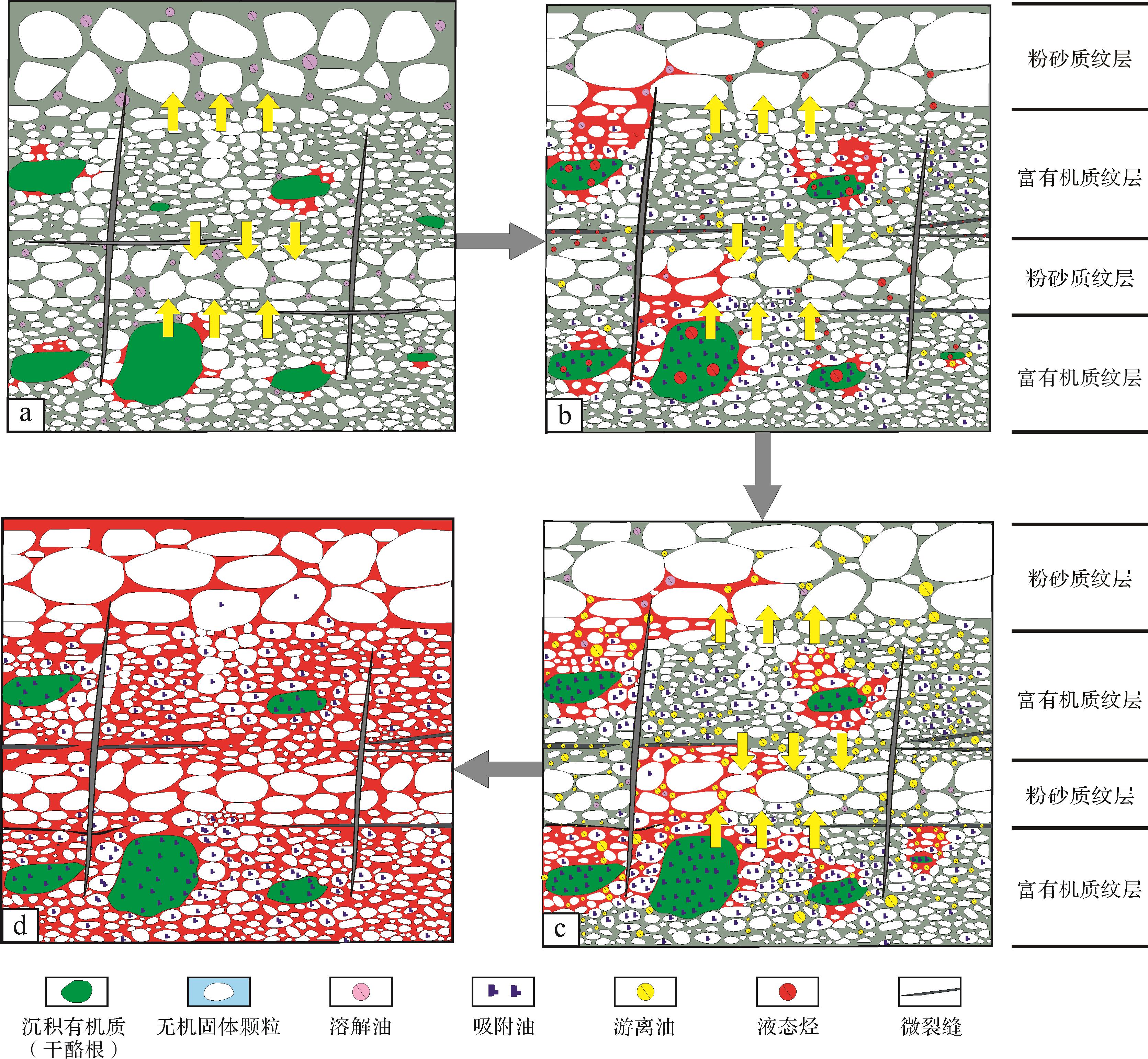
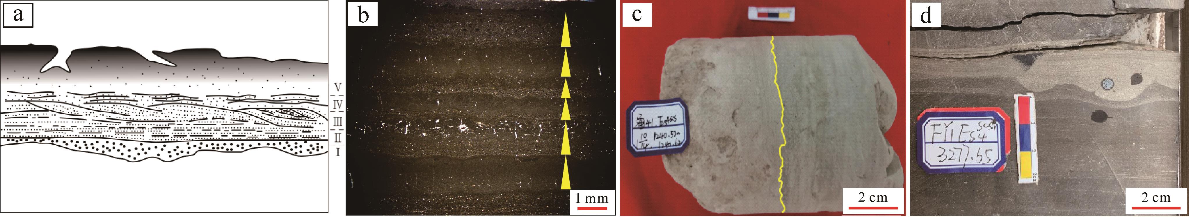
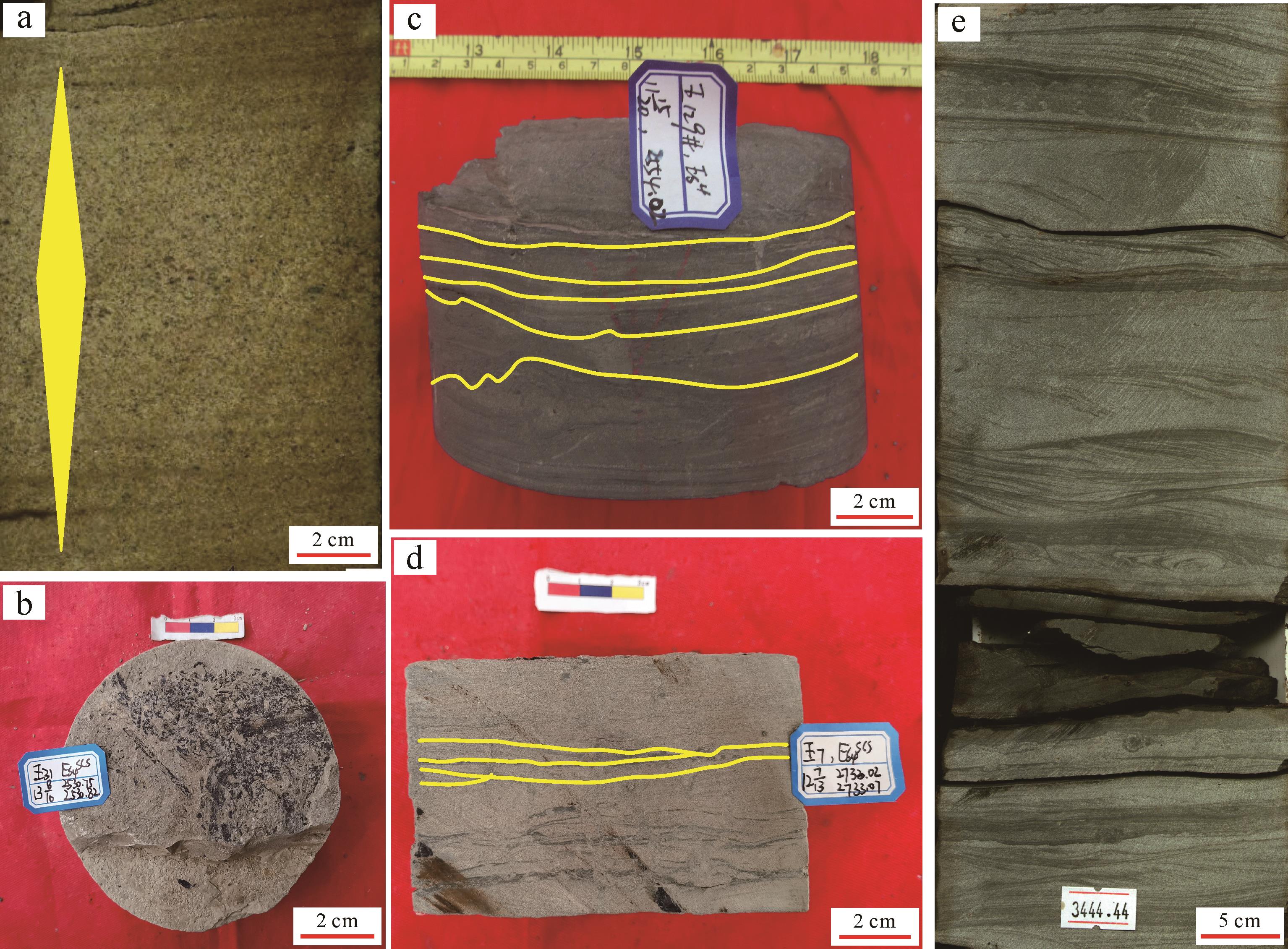
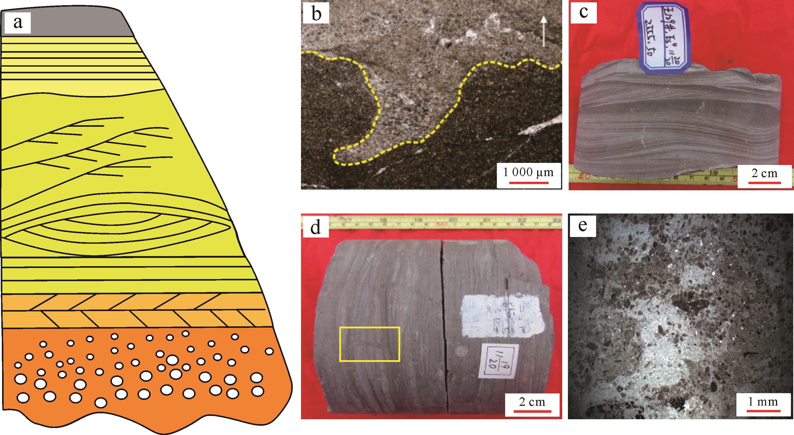
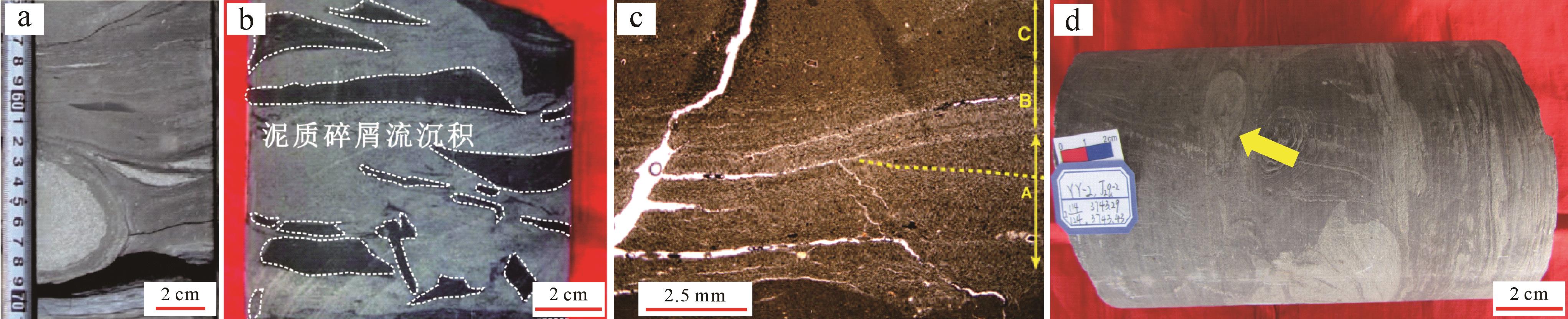
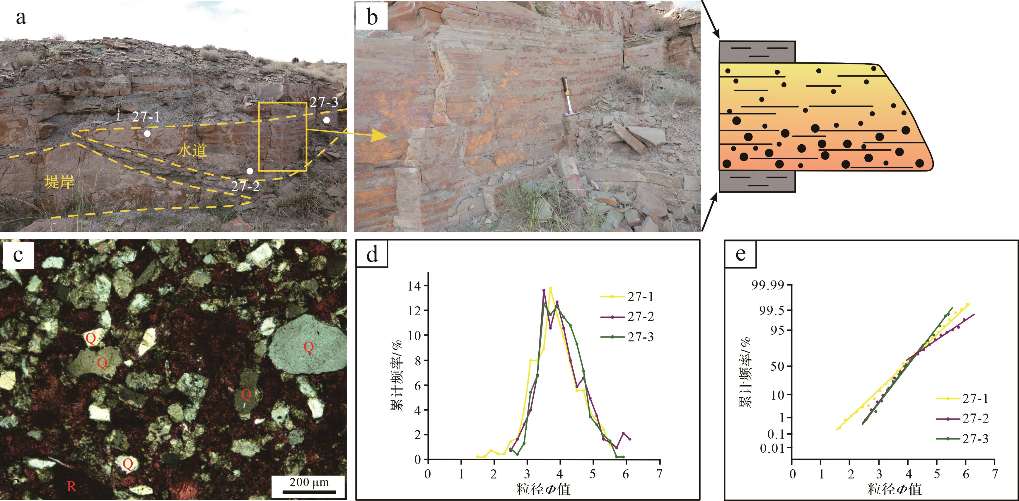
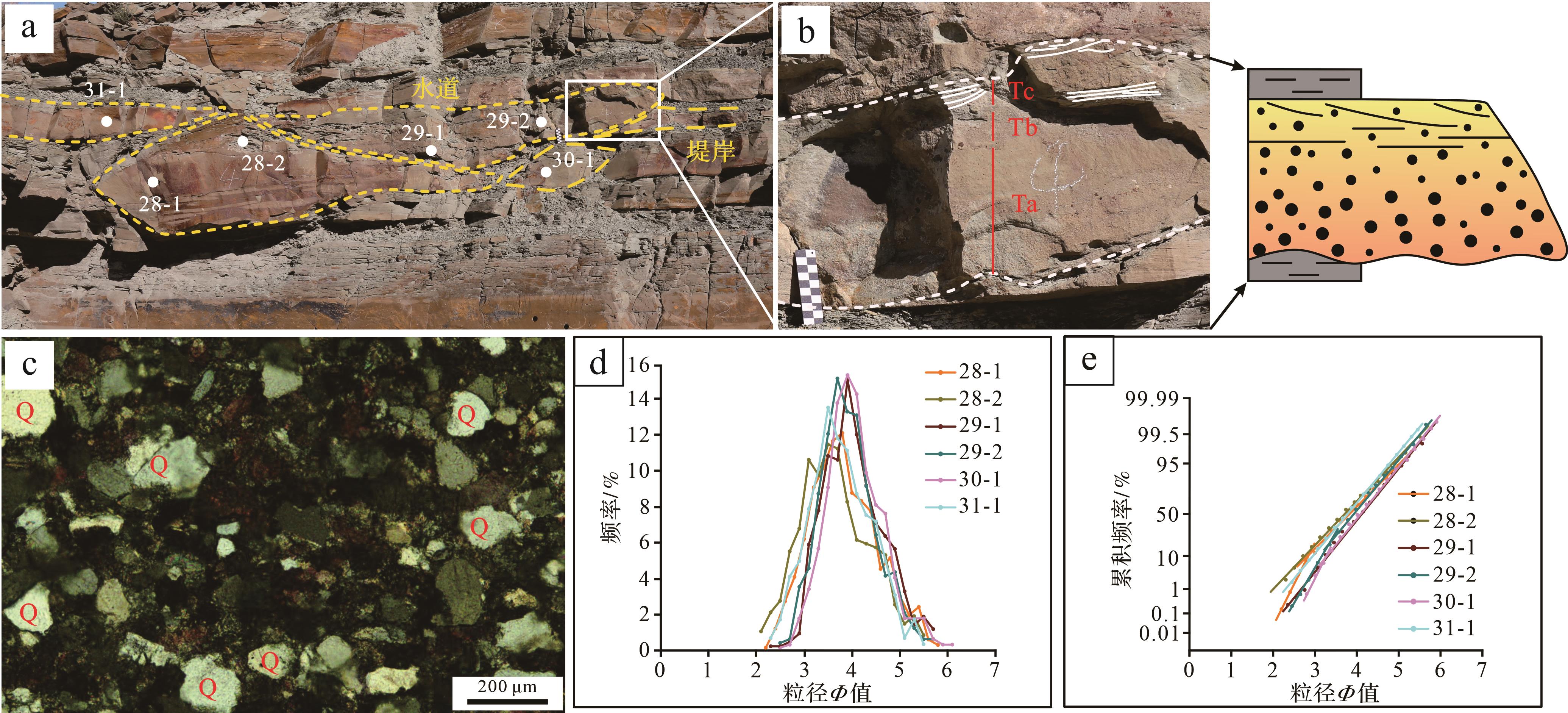
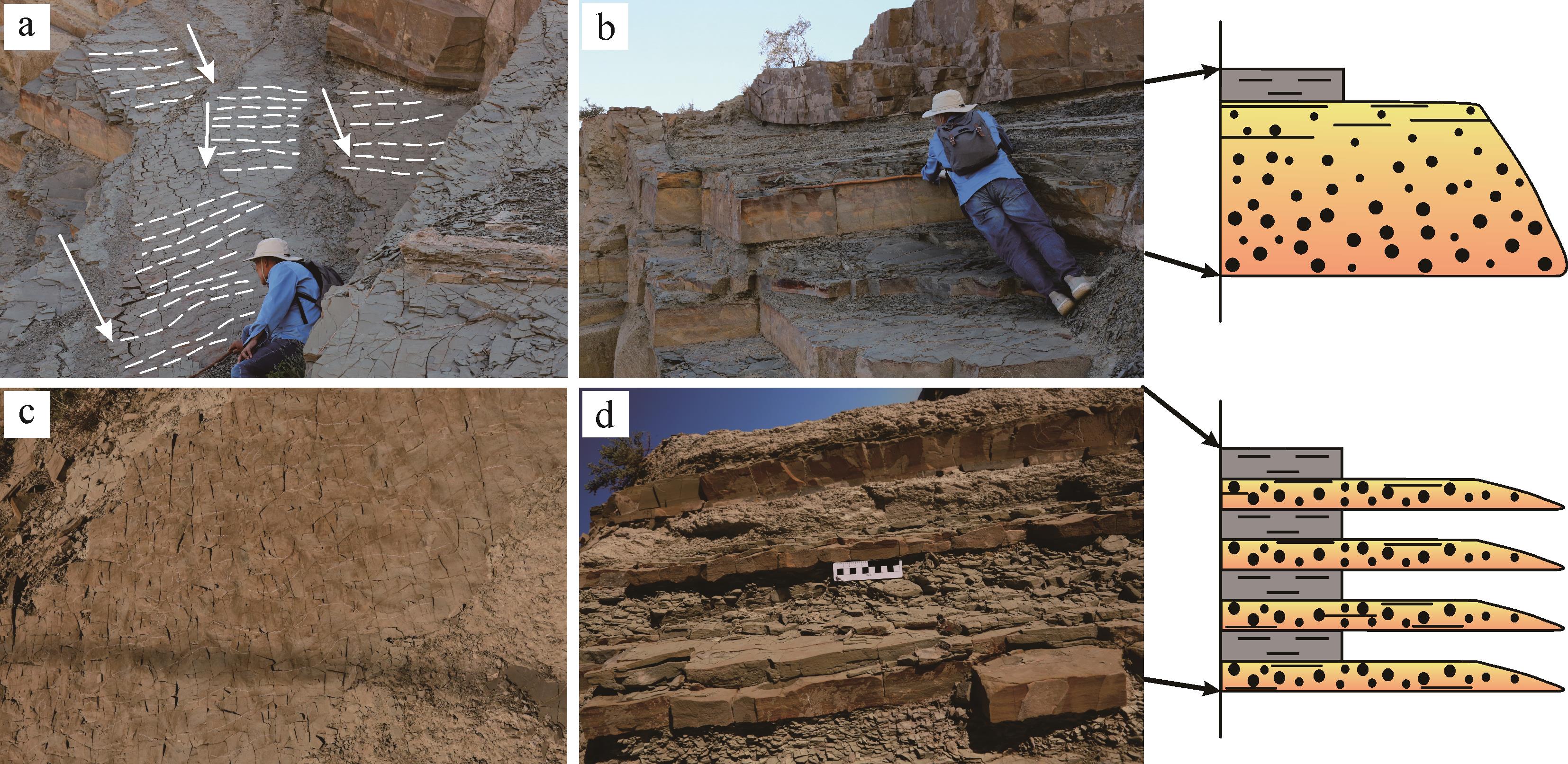
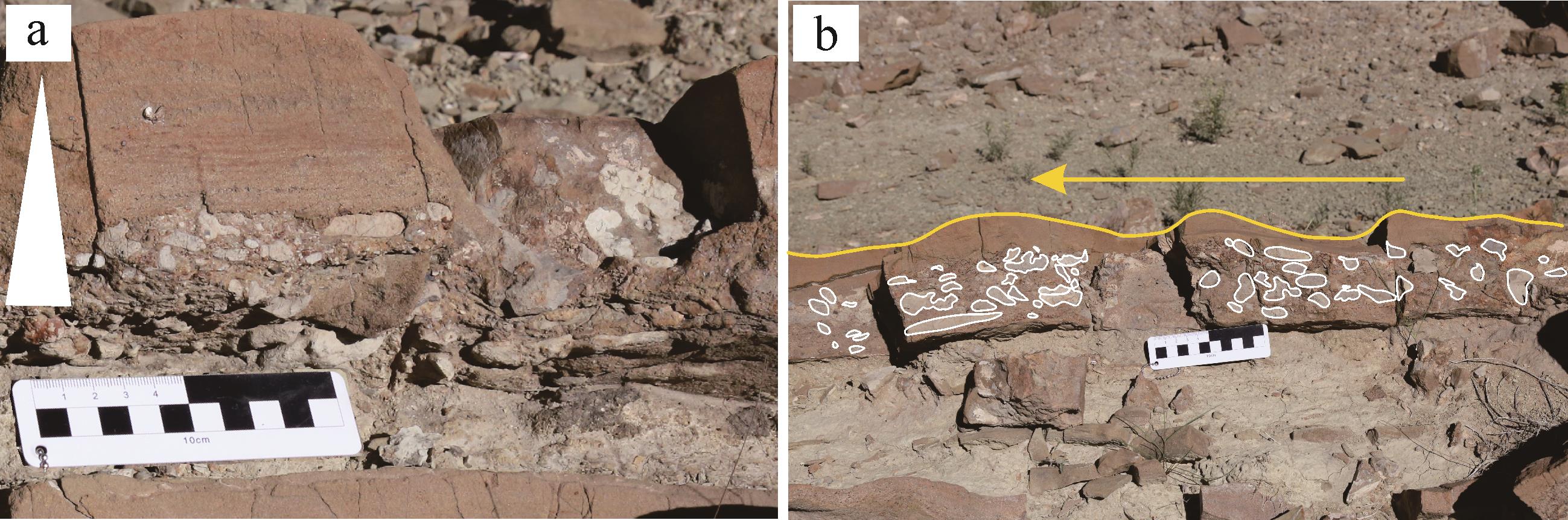
Significance The study of fine-grained sediment transport mechanisms is an important part of the “source-to-sink” system theory of fine-grained sediments, and it is significant for the restoration of sedimentary environments, understanding the distribution of fine-grained sediments and predicting the distribution of unconventional oil and gas resources. Due to the fine grain size, which makes them difficult to observe, and the diversity of transport modes, each transport mode corresponds to particular sedimentary structures. Therefore, research on the transport mechanisms of fine-grained sediments has progressed slowly. From a review of the existing research reported in China and elsewhere, it is evident that there is still a lack of sorting and summarizing research findings regarding the transport mechanisms of fine-grained sediments. Progress This study synthesizes current research, systematically sorts the transport modes and sedimentary characteristics of fine-grained sediments and classifies the transport modes of fine-grained sediments into three major categories: physical transport, chemical transport, and biological transport. Physical transport includes river water, atmosphere, bottom current, density underflow, and six types of gravity-flow transport. River water and atmospheric transport rely on the forces exerted by water flow and/or wind to overcome the gravitational force on fine-grained materials. These are mainly traction force and load force. Bottom current, density underflow, and gravity flow transport are triggered by tides, wind, earthquakes, floods, storms, volcanic eruptions and other means, with gravity being the main driving force. Clay minerals, dissolved organic carbon, carbonate minerals, iron minerals and others are transported as colloids or as true solutions. Dissolved substances are affected by environmental factors such as pH, Eh, temperature, pressure, and ion concentration or charge, and are transported by chemical means. Biological absorption and enrichment, environmental changes caused by biological activities and bioturbation all affect the formation and transport of fine-grained materials. [Conclusion and Prospect] Physical transport has diverse modes. With driving forces such as traction force, carrying capacity, and gravity, it can form a rich variety of sedimentary structures. Chemical transport mainly involves dissolved substances and is affected by environmental factors such as pH values and temperature. Biological transport influences the transport of fine-grained substances through absorption and enrichment, alteration of the environment, and bioturbation. In the future, attention should be focused on the interactions among the transport mechanisms of fine-grained sediments, the accuracy of identifying sedimentary structures should be improved, importance should be attached to simulation experiment research, and the quantitative analysis of chemical and biological effects should be strengthened, so as to enhance the understanding of the transport processes of fine-grained sediments and promote the development of the theory of fine-grained sedimentology.
Significance The study of fine-grained sediment transport mechanisms is an important part of the “source-to-sink” system theory of fine-grained sediments, and it is significant for the restoration of sedimentary environments, understanding the distribution of fine-grained sediments and predicting the distribution of unconventional oil and gas resources. Due to the fine grain size, which makes them difficult to observe, and the diversity of transport modes, each transport mode corresponds to particular sedimentary structures. Therefore, research on the transport mechanisms of fine-grained sediments has progressed slowly. From a review of the existing research reported in China and elsewhere, it is evident that there is still a lack of sorting and summarizing research findings regarding the transport mechanisms of fine-grained sediments. Progress This study synthesizes current research, systematically sorts the transport modes and sedimentary characteristics of fine-grained sediments and classifies the transport modes of fine-grained sediments into three major categories: physical transport, chemical transport, and biological transport. Physical transport includes river water, atmosphere, bottom current, density underflow, and six types of gravity-flow transport. River water and atmospheric transport rely on the forces exerted by water flow and/or wind to overcome the gravitational force on fine-grained materials. These are mainly traction force and load force. Bottom current, density underflow, and gravity flow transport are triggered by tides, wind, earthquakes, floods, storms, volcanic eruptions and other means, with gravity being the main driving force. Clay minerals, dissolved organic carbon, carbonate minerals, iron minerals and others are transported as colloids or as true solutions. Dissolved substances are affected by environmental factors such as pH, Eh, temperature, pressure, and ion concentration or charge, and are transported by chemical means. Biological absorption and enrichment, environmental changes caused by biological activities and bioturbation all affect the formation and transport of fine-grained materials. [Conclusion and Prospect] Physical transport has diverse modes. With driving forces such as traction force, carrying capacity, and gravity, it can form a rich variety of sedimentary structures. Chemical transport mainly involves dissolved substances and is affected by environmental factors such as pH values and temperature. Biological transport influences the transport of fine-grained substances through absorption and enrichment, alteration of the environment, and bioturbation. In the future, attention should be focused on the interactions among the transport mechanisms of fine-grained sediments, the accuracy of identifying sedimentary structures should be improved, importance should be attached to simulation experiment research, and the quantitative analysis of chemical and biological effects should be strengthened, so as to enhance the understanding of the transport processes of fine-grained sediments and promote the development of the theory of fine-grained sedimentology.
2026, 44(3): 825-840.
doi: 10.14027/j.issn.1000-0550.2024.123
Abstract:
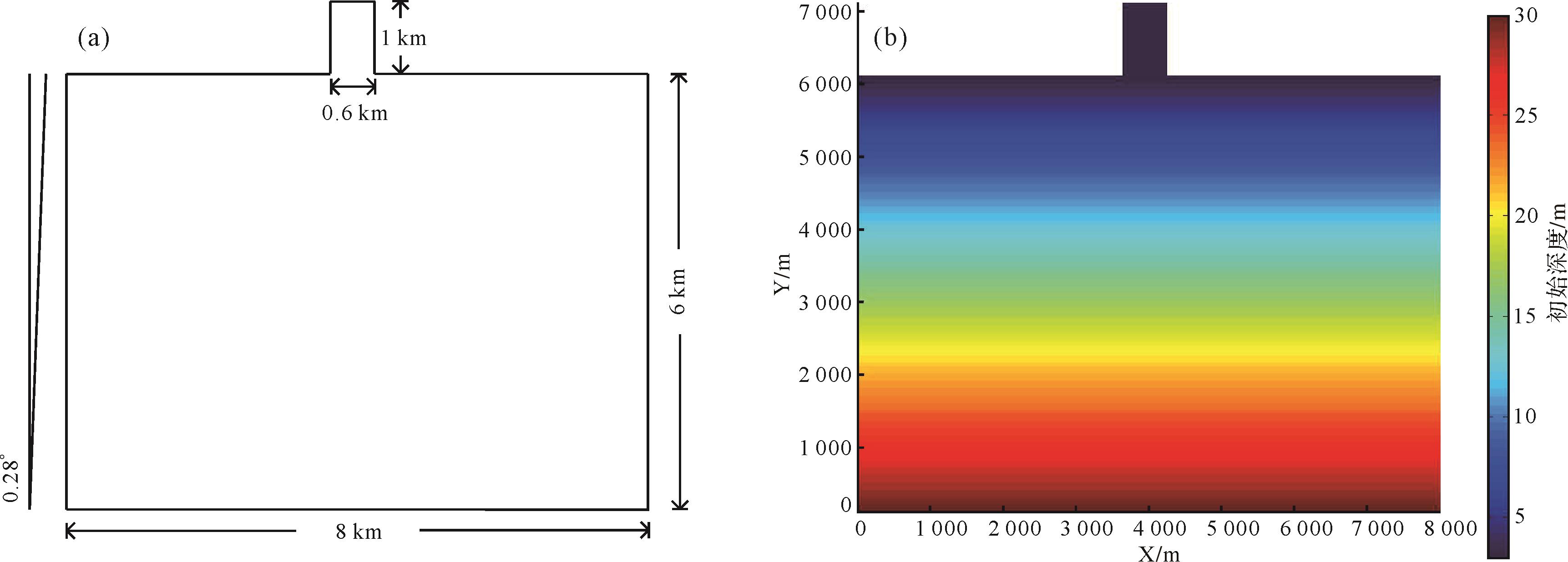
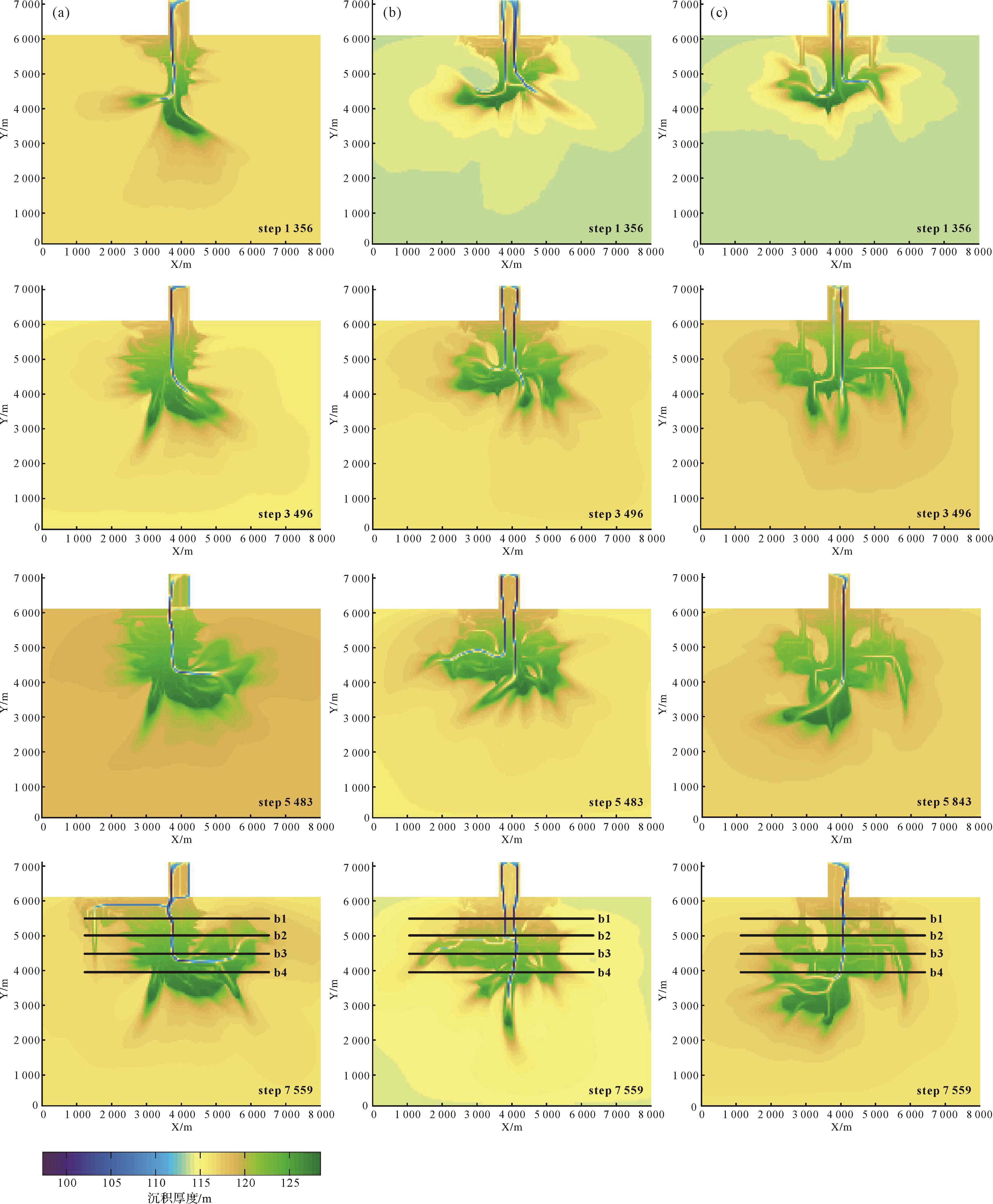
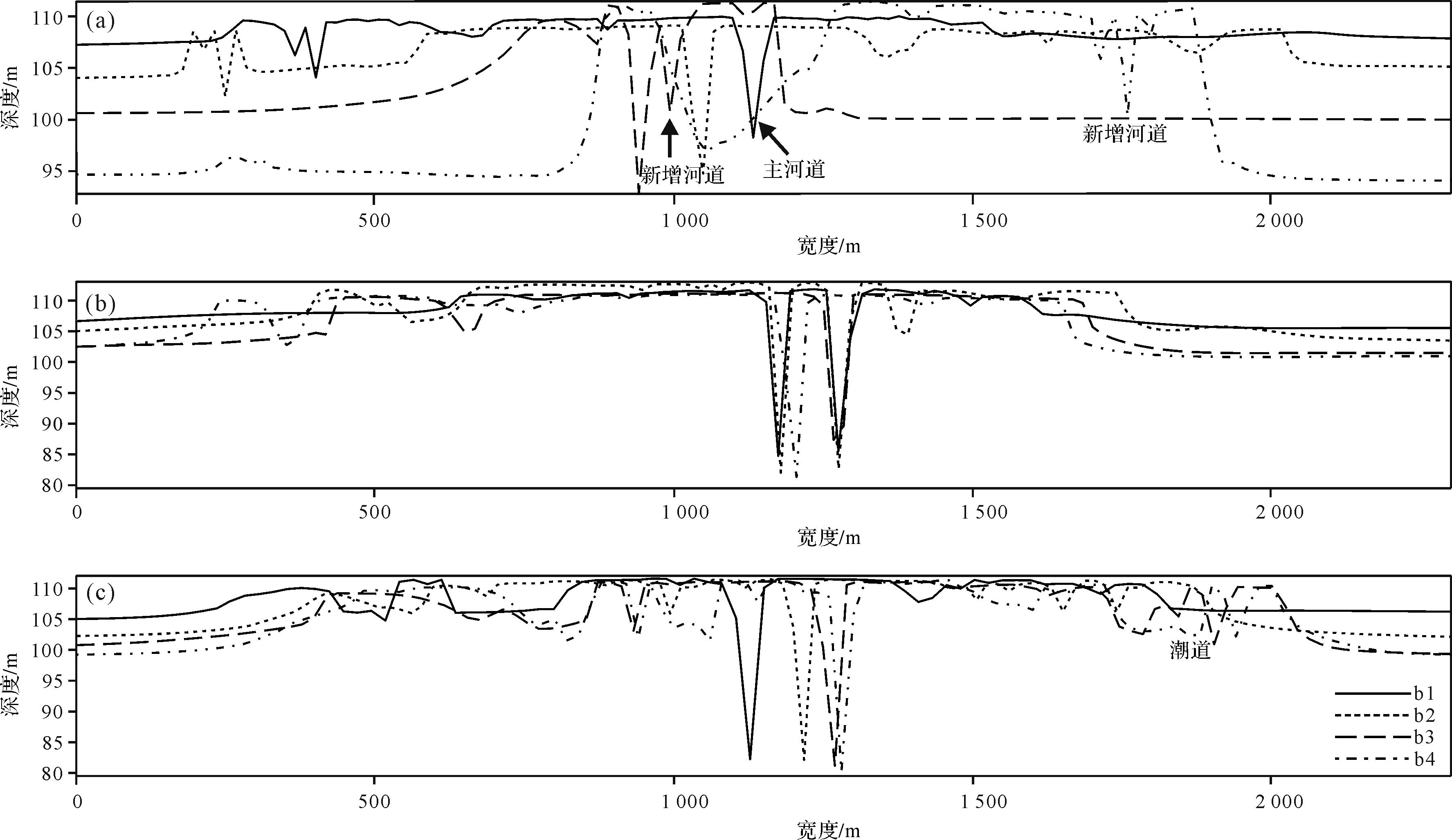
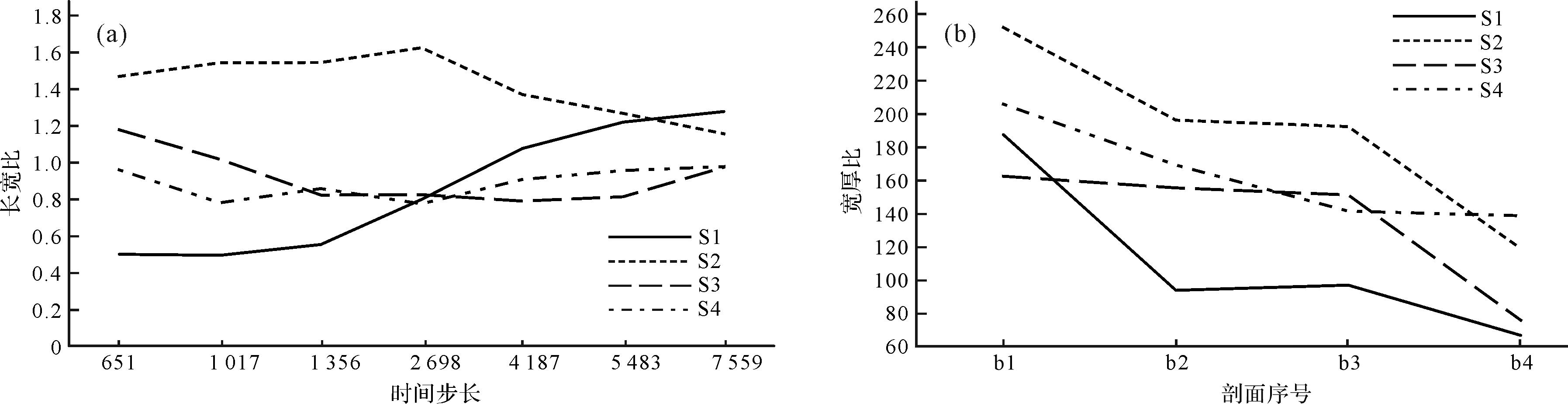
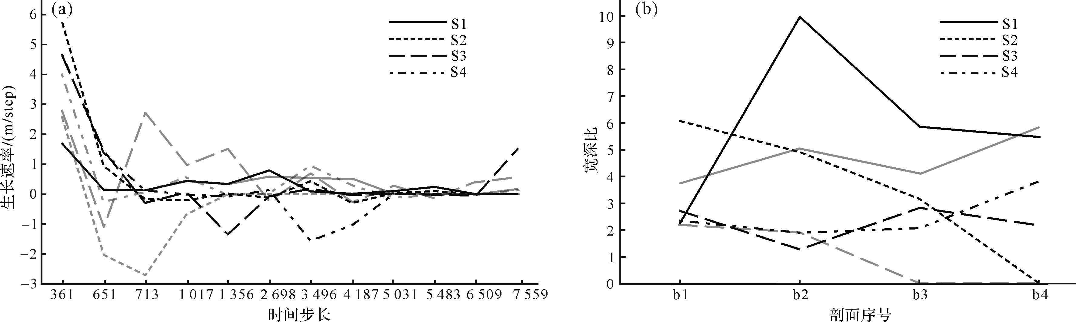
Objective Tidal forces influence the form and scale of marine shelf deltas and the development and evolution of branch channels. The quantitative control mechanism of different amplitude tidal ranges on the dam body and branch channels of continental shelf deltas has garnered significant scientific interest. Methods In this study, a single factor control method was used to analyze the evolution of the key geologic bodies in the continental shelf delta under different tidal ranges using Delft3D hydrodynamic simulation software to establish four control groups: no, small, medium, and spring difference. Results The experimental results show that the down-cut depth and width of the branch channel decrease with the increase of the flow distance when there is no tidal effect. When tidal action is added, the number of distributary channels decreases with the increase of tidal range, but the down-cut degree and width of the distributary channels increase. The width-to-depth ratio of the branch channel ranges from 2-10 when there is no tidal action, and decreases to zero when there is a low tidal range. Under the influence of middle and spring tidal ranges, the width-to-depth ratio of the branch channel corresponds to 0-3 and 2-4, respectively. Conclusions The results show that tidal action is beneficial for increasing the broad-to-thickness ratio of sand bodies, and the delta morphology changes become more stable with the increase of tidal range. The number of branch channels in the delta under the influence of tides decreases significantly owing to the periodic influx and retreat of tides in the lateral direction. This promotes the formation of lateral channels and tidal channels. Under the influence of middle-spring difference, the lateral migration distance of the branch channel is shorter, the branch channel is more stable, and the dam body is more isolated, providing an important reference for reservoir configuration analysis of similar underground sediments.
Objective Tidal forces influence the form and scale of marine shelf deltas and the development and evolution of branch channels. The quantitative control mechanism of different amplitude tidal ranges on the dam body and branch channels of continental shelf deltas has garnered significant scientific interest. Methods In this study, a single factor control method was used to analyze the evolution of the key geologic bodies in the continental shelf delta under different tidal ranges using Delft3D hydrodynamic simulation software to establish four control groups: no, small, medium, and spring difference. Results The experimental results show that the down-cut depth and width of the branch channel decrease with the increase of the flow distance when there is no tidal effect. When tidal action is added, the number of distributary channels decreases with the increase of tidal range, but the down-cut degree and width of the distributary channels increase. The width-to-depth ratio of the branch channel ranges from 2-10 when there is no tidal action, and decreases to zero when there is a low tidal range. Under the influence of middle and spring tidal ranges, the width-to-depth ratio of the branch channel corresponds to 0-3 and 2-4, respectively. Conclusions The results show that tidal action is beneficial for increasing the broad-to-thickness ratio of sand bodies, and the delta morphology changes become more stable with the increase of tidal range. The number of branch channels in the delta under the influence of tides decreases significantly owing to the periodic influx and retreat of tides in the lateral direction. This promotes the formation of lateral channels and tidal channels. Under the influence of middle-spring difference, the lateral migration distance of the branch channel is shorter, the branch channel is more stable, and the dam body is more isolated, providing an important reference for reservoir configuration analysis of similar underground sediments.
2026, 44(3): 841-855.
doi: 10.14027/j.issn.1000-0550.2024.088
Abstract:
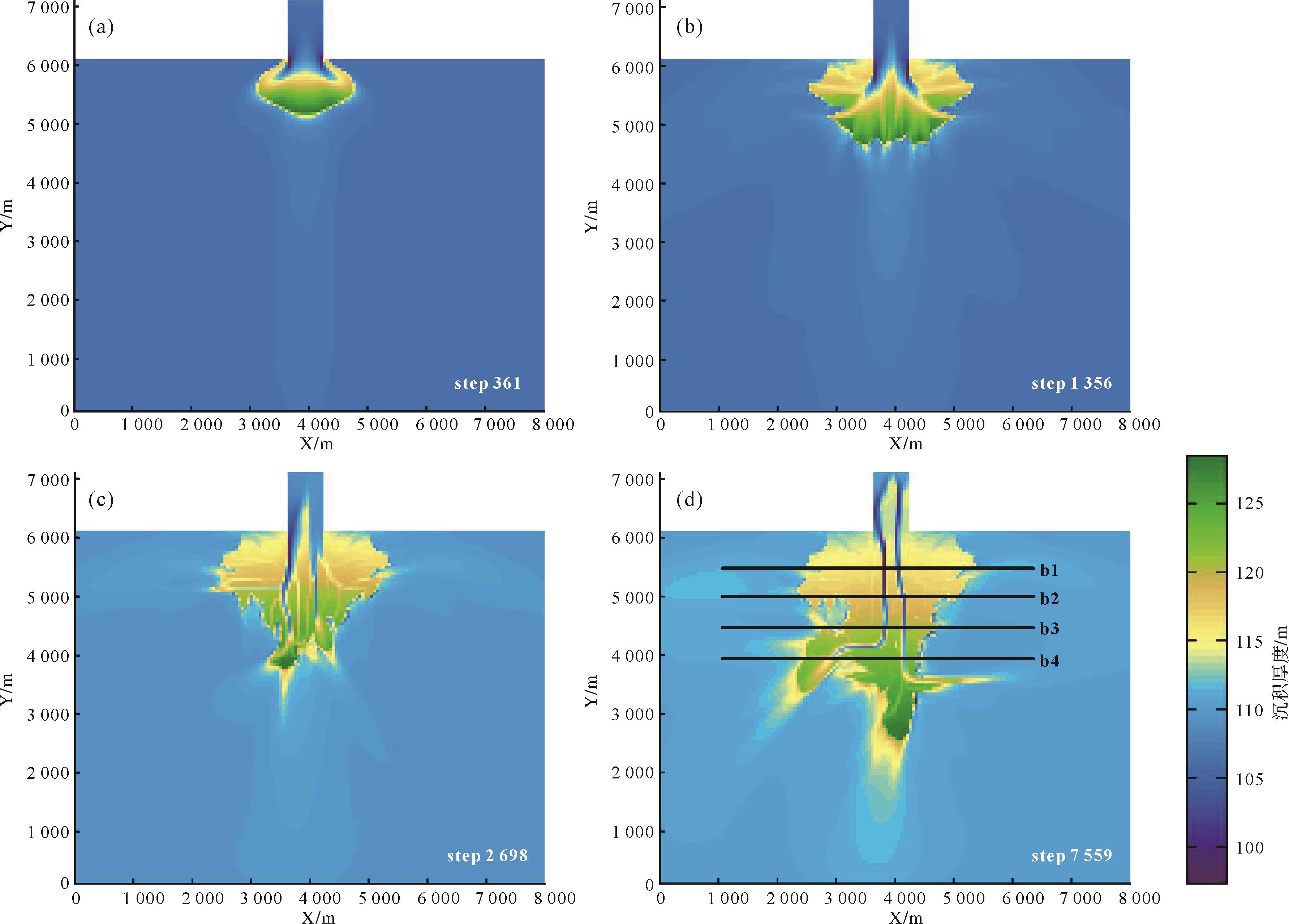
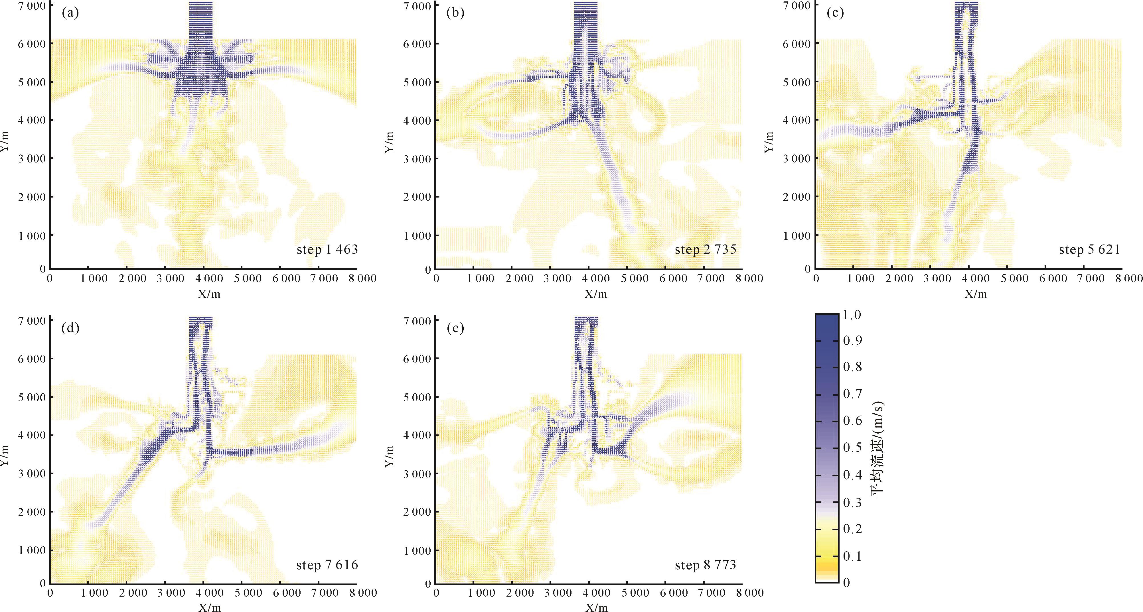
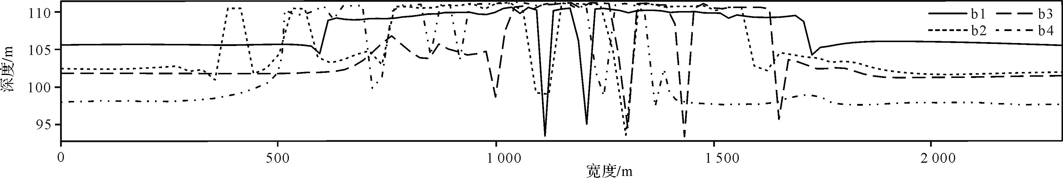
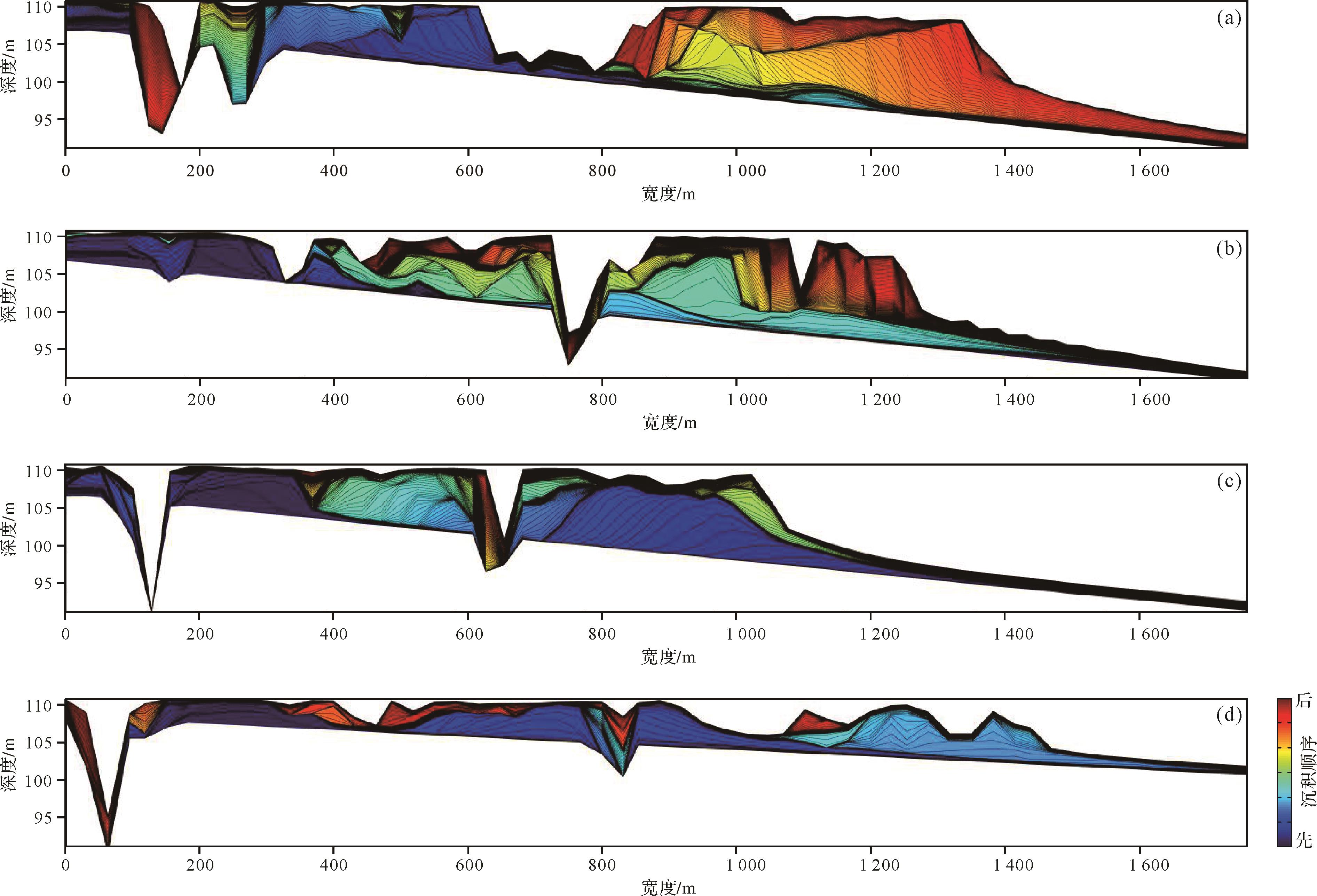
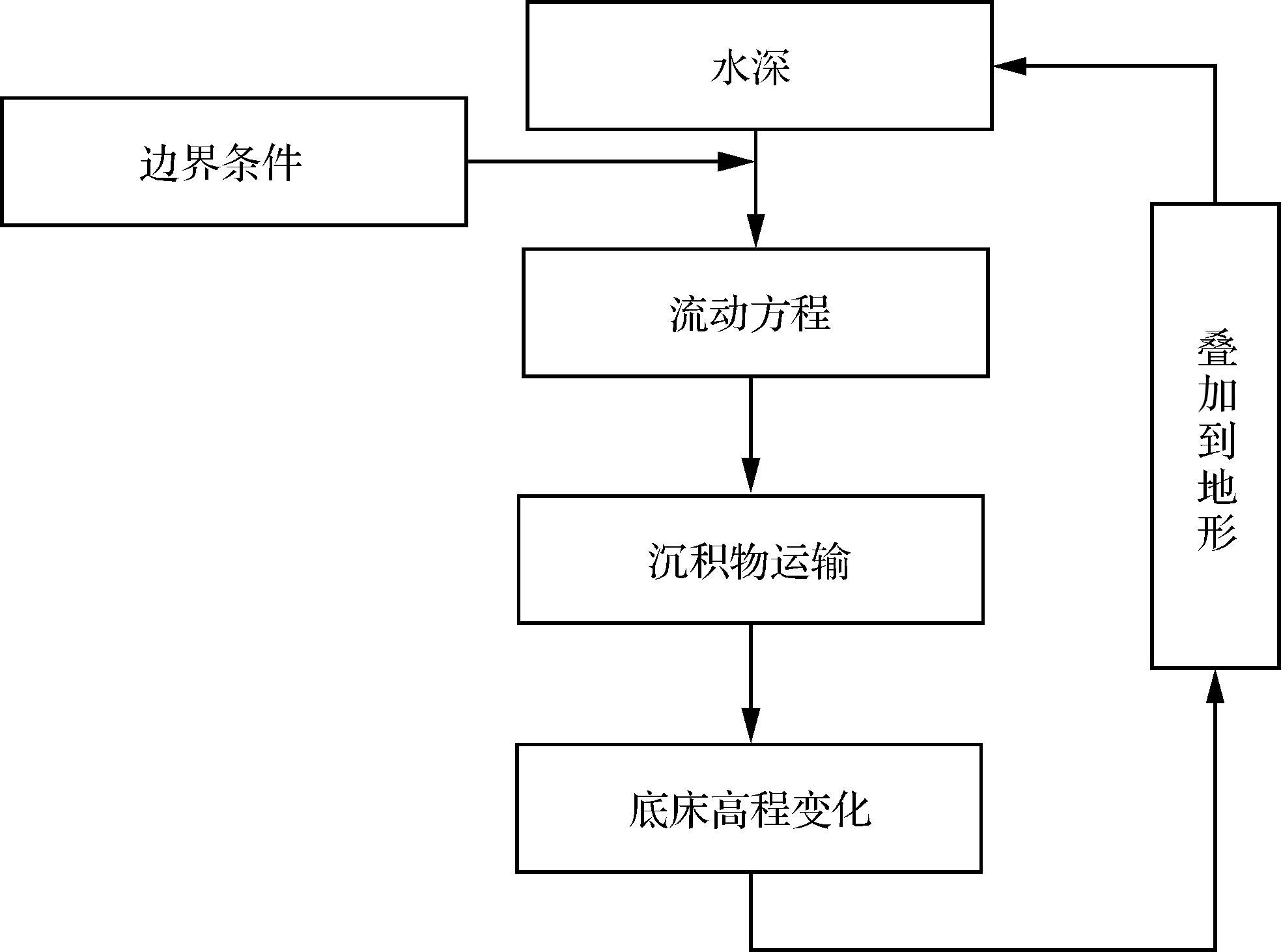
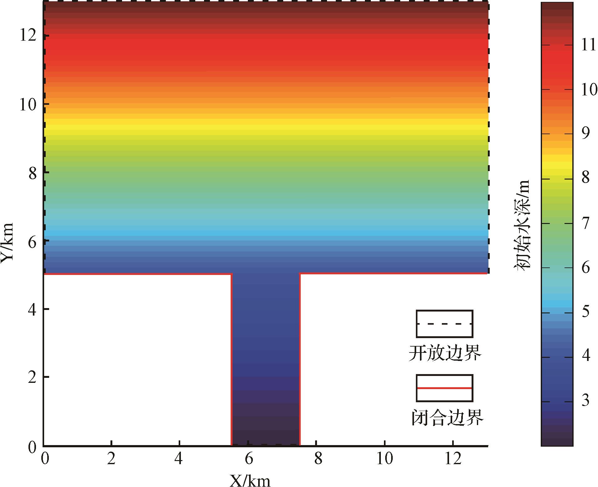
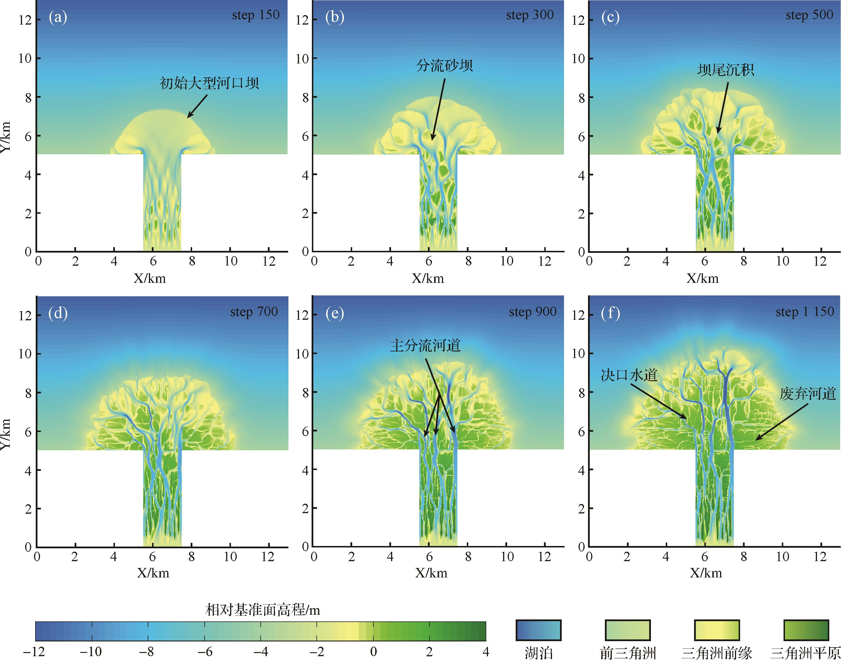
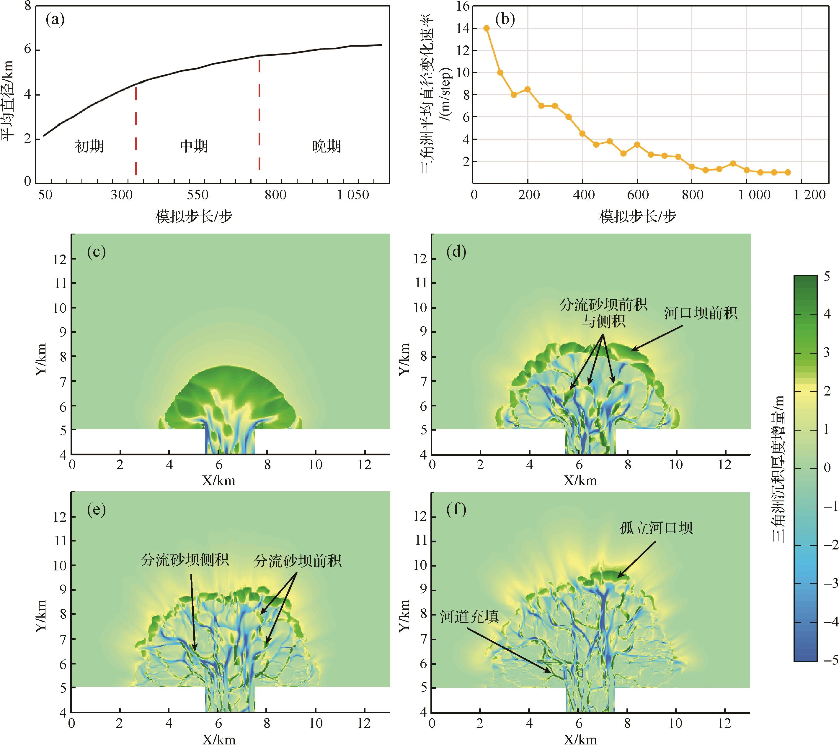
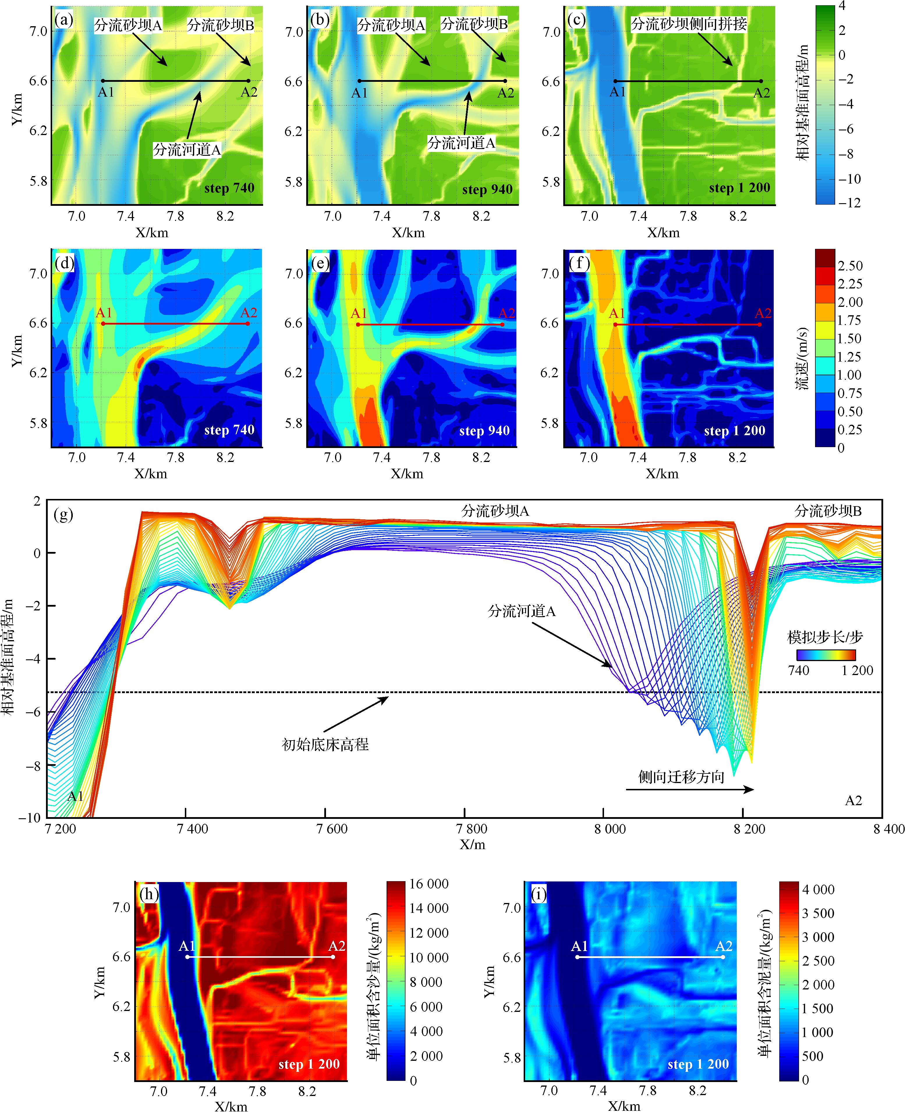
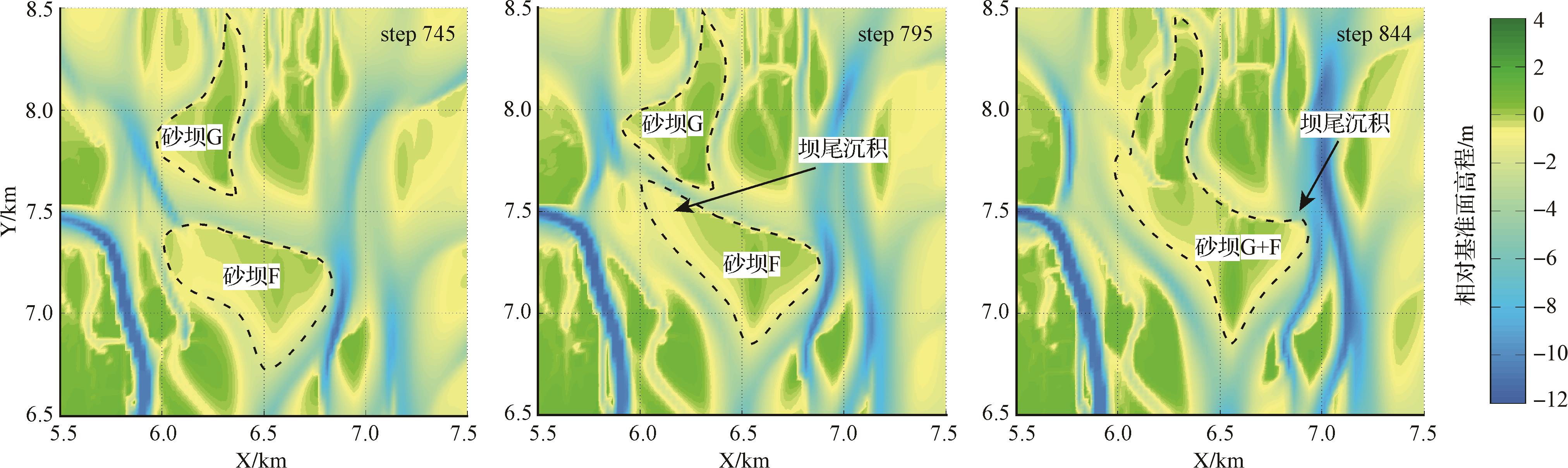
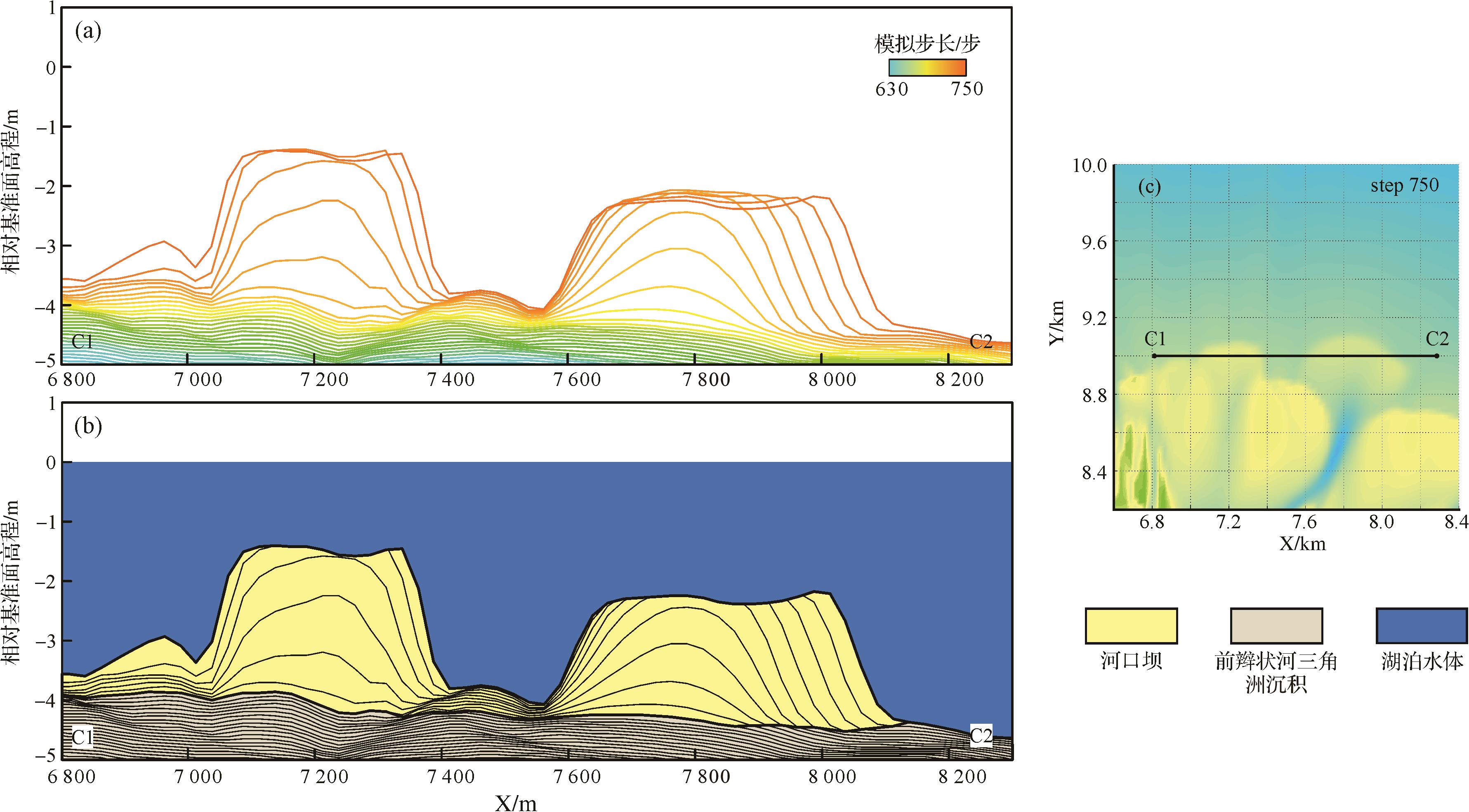
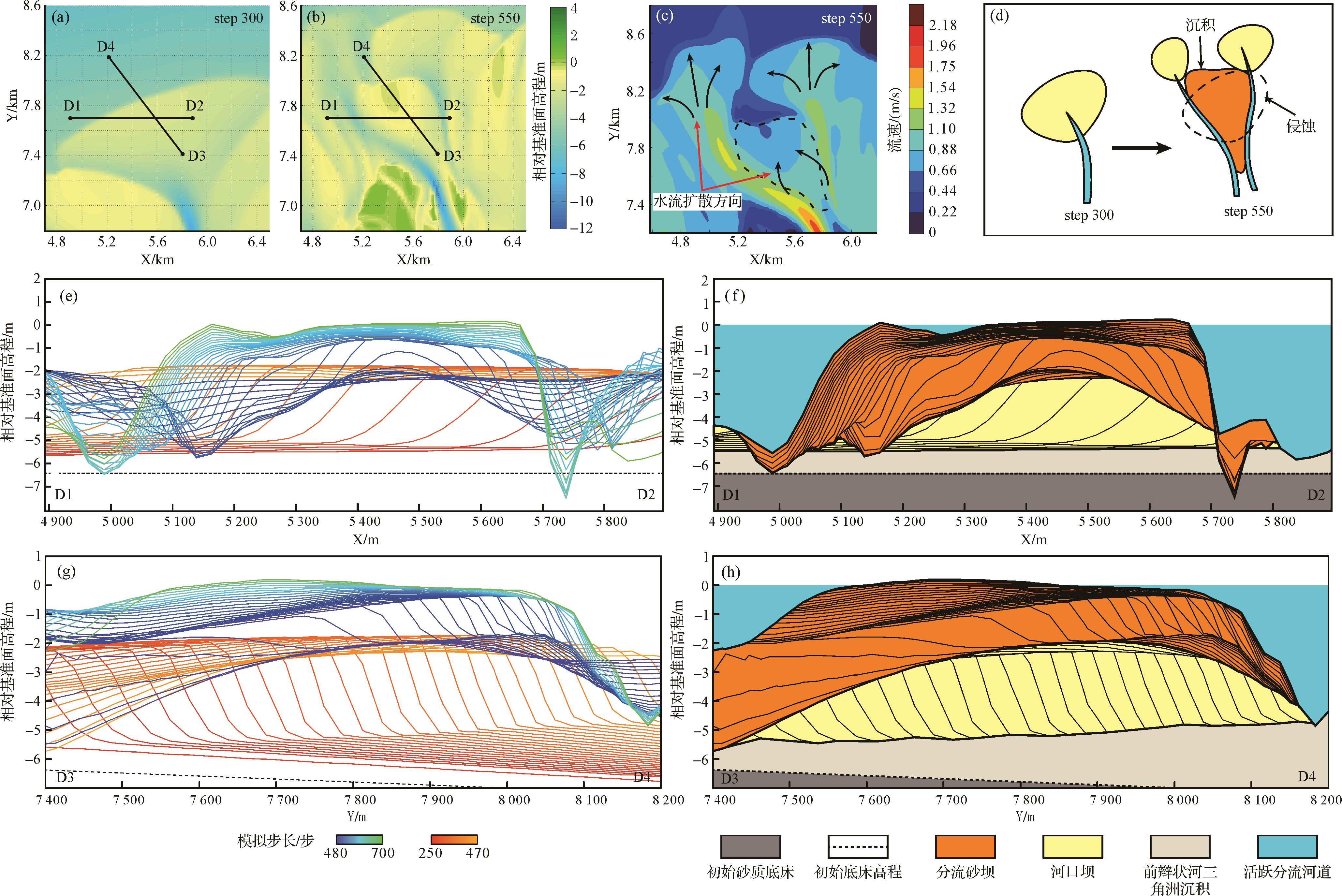
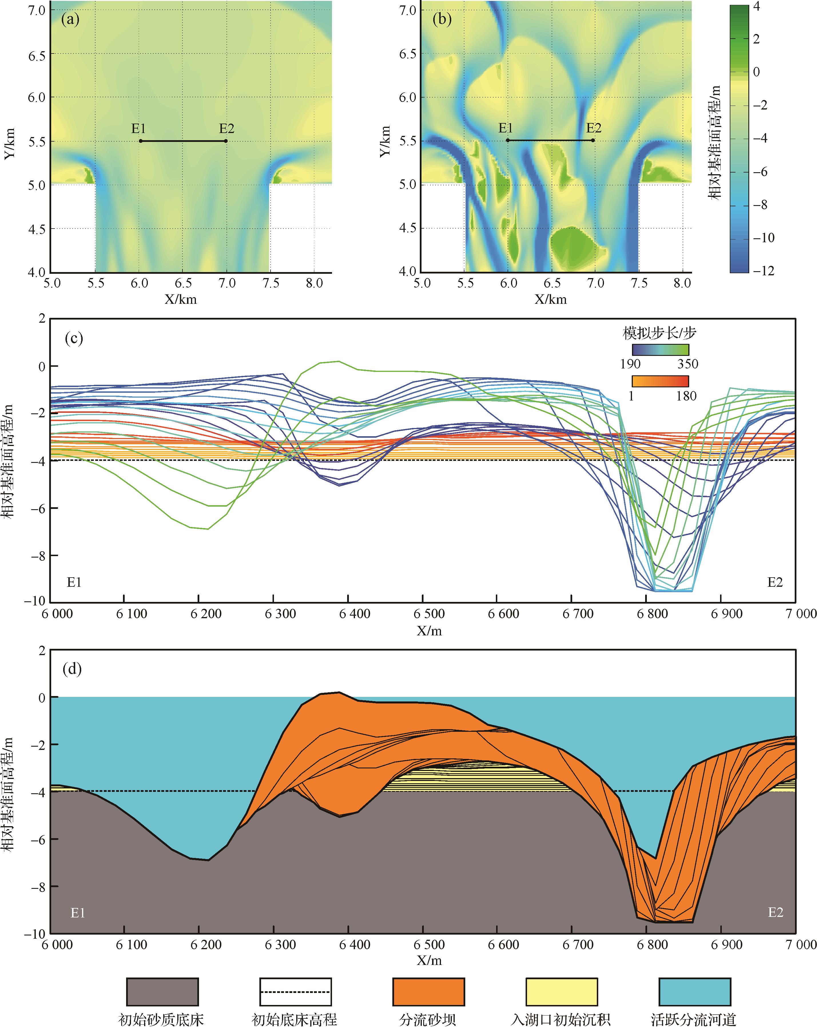
Objective Significant advancements have been made in the research of sandy braided river deltas, but the sedimentary characteristics and evolution laws of sandy braided river deltas require further study, particularly the understanding of mouth bars and distributary sand bars. Methods Based on the underground reservoir data, this study used the Delft3D software to show the growth and evolution of a sandy braided river delta into a lake, summarizing its sedimentary characteristics and evolution laws. Results The evolution of a sandy braided river delta has three stages. In the early stage, the delta grows fastest, and the average diameter growth rate was greater than 6 m/step. Sediments are carried into the lake and quickly unloaded, forming a large flower-shaped mouth bar under the water. In the middle stage, the delta plain continues growing, and the delta front remains large, accounting for more than 50% of the delta area. Contiguous sand bodies are built. In the late stage, the delta grows slowly, the average diameter growth rate is maintained at 1m/step. The front area is small, less than 20% of the overall area. The delta plain has many distributary channels and ditches, leading to multiple paths for transforming the distributary sand bars. The delta front sand bars have different degrees of superposition and rhythm combination characteristics, and the distributary sand bars are built on the residual mouth bar. Conclusions A sedimentary model of a sandy braided river delta was established, providing reference for the genetic identification of distributary sand bar and mouth bar, and laying the foudation for advancing underground reservoir architecture research.
Objective Significant advancements have been made in the research of sandy braided river deltas, but the sedimentary characteristics and evolution laws of sandy braided river deltas require further study, particularly the understanding of mouth bars and distributary sand bars. Methods Based on the underground reservoir data, this study used the Delft3D software to show the growth and evolution of a sandy braided river delta into a lake, summarizing its sedimentary characteristics and evolution laws. Results The evolution of a sandy braided river delta has three stages. In the early stage, the delta grows fastest, and the average diameter growth rate was greater than 6 m/step. Sediments are carried into the lake and quickly unloaded, forming a large flower-shaped mouth bar under the water. In the middle stage, the delta plain continues growing, and the delta front remains large, accounting for more than 50% of the delta area. Contiguous sand bodies are built. In the late stage, the delta grows slowly, the average diameter growth rate is maintained at 1m/step. The front area is small, less than 20% of the overall area. The delta plain has many distributary channels and ditches, leading to multiple paths for transforming the distributary sand bars. The delta front sand bars have different degrees of superposition and rhythm combination characteristics, and the distributary sand bars are built on the residual mouth bar. Conclusions A sedimentary model of a sandy braided river delta was established, providing reference for the genetic identification of distributary sand bar and mouth bar, and laying the foudation for advancing underground reservoir architecture research.
2026, 44(3): 856-868.
doi: 10.14027/j.issn.1000-0550.2024.124
Abstract:
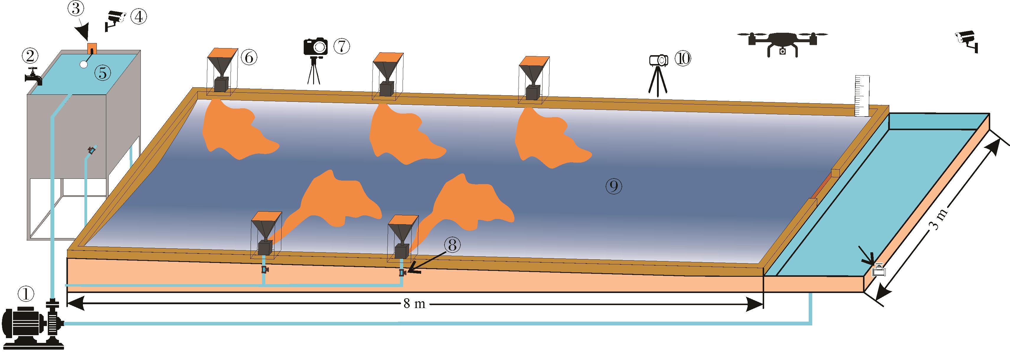
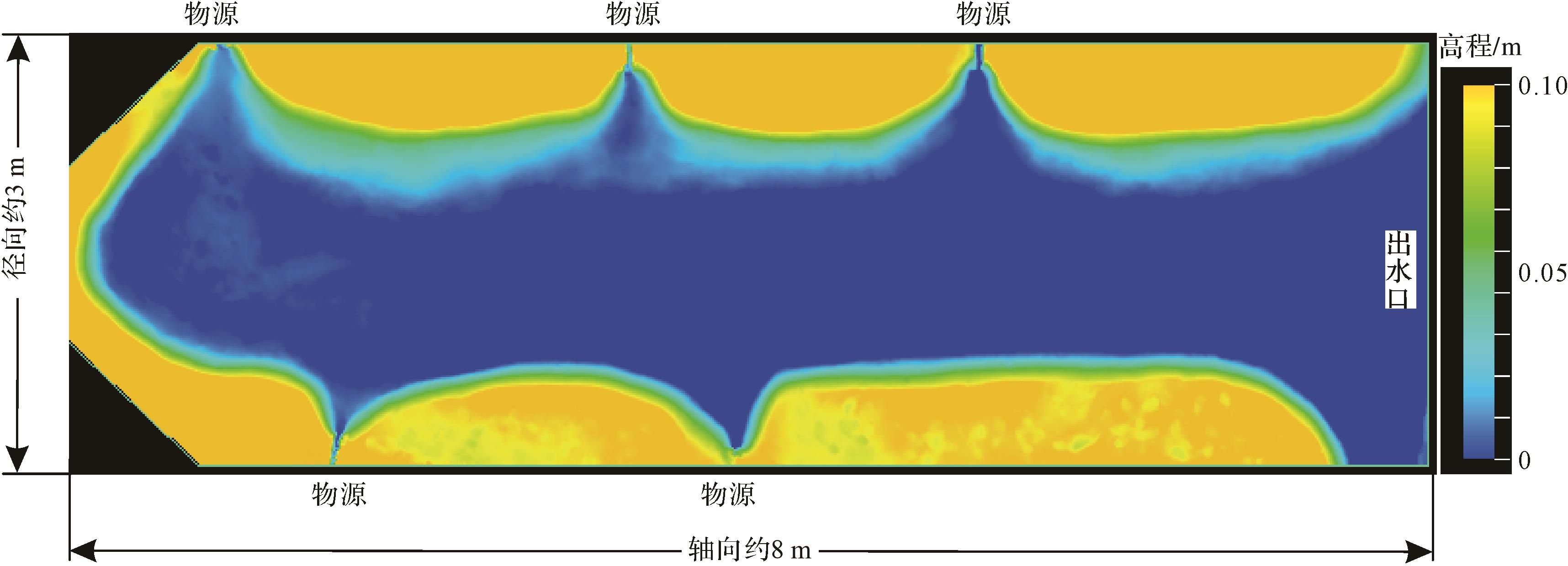
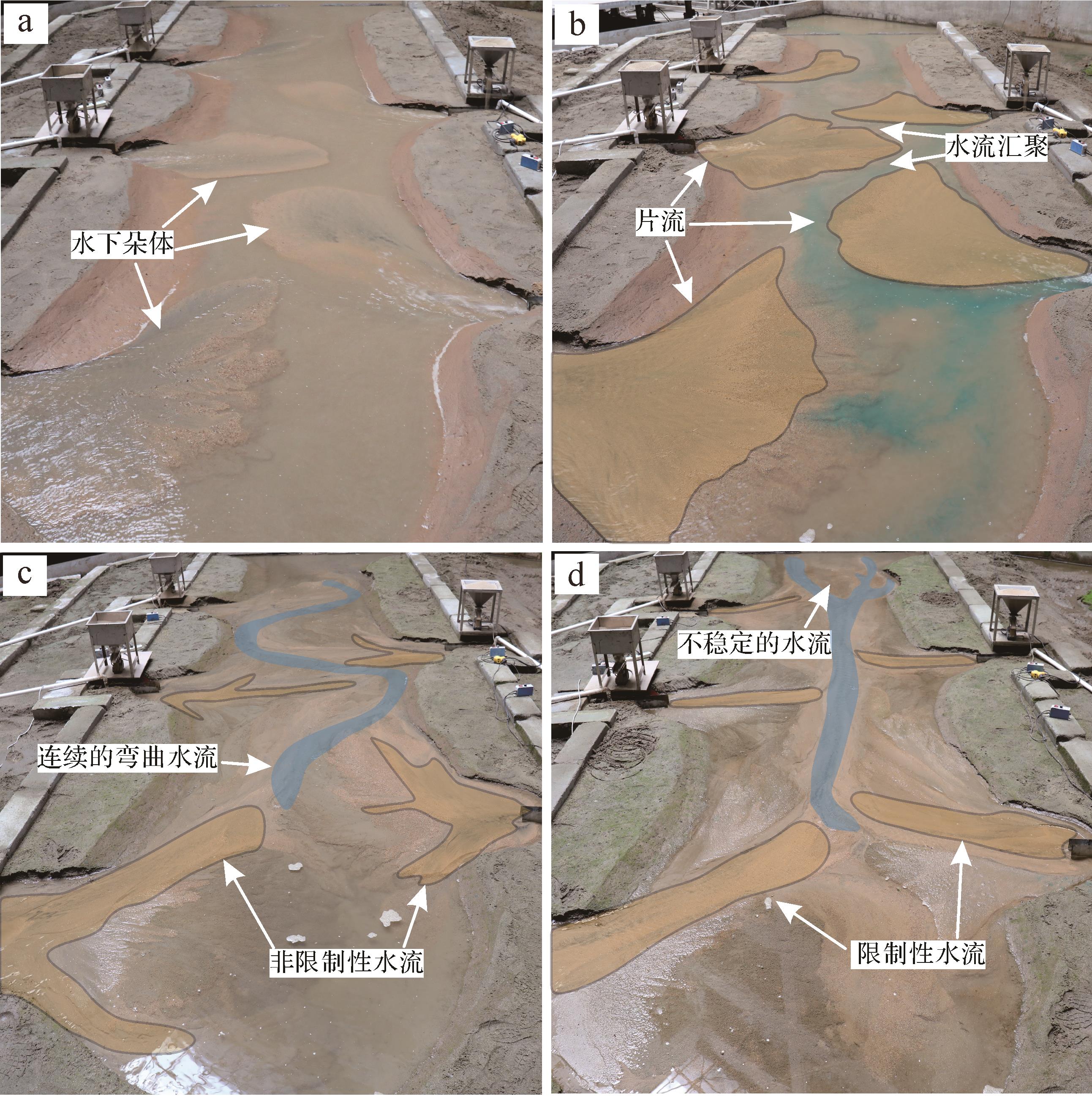
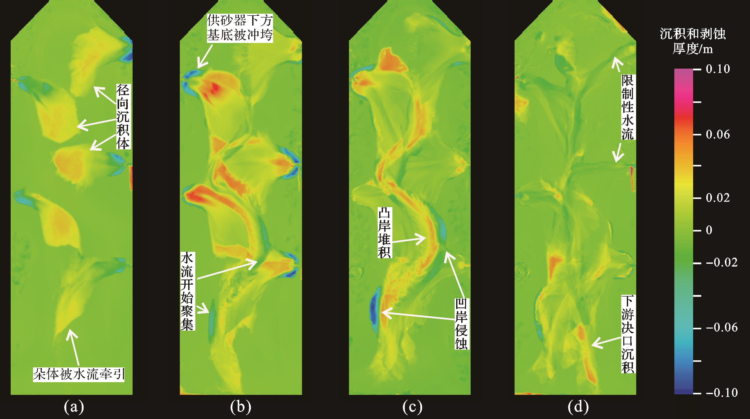
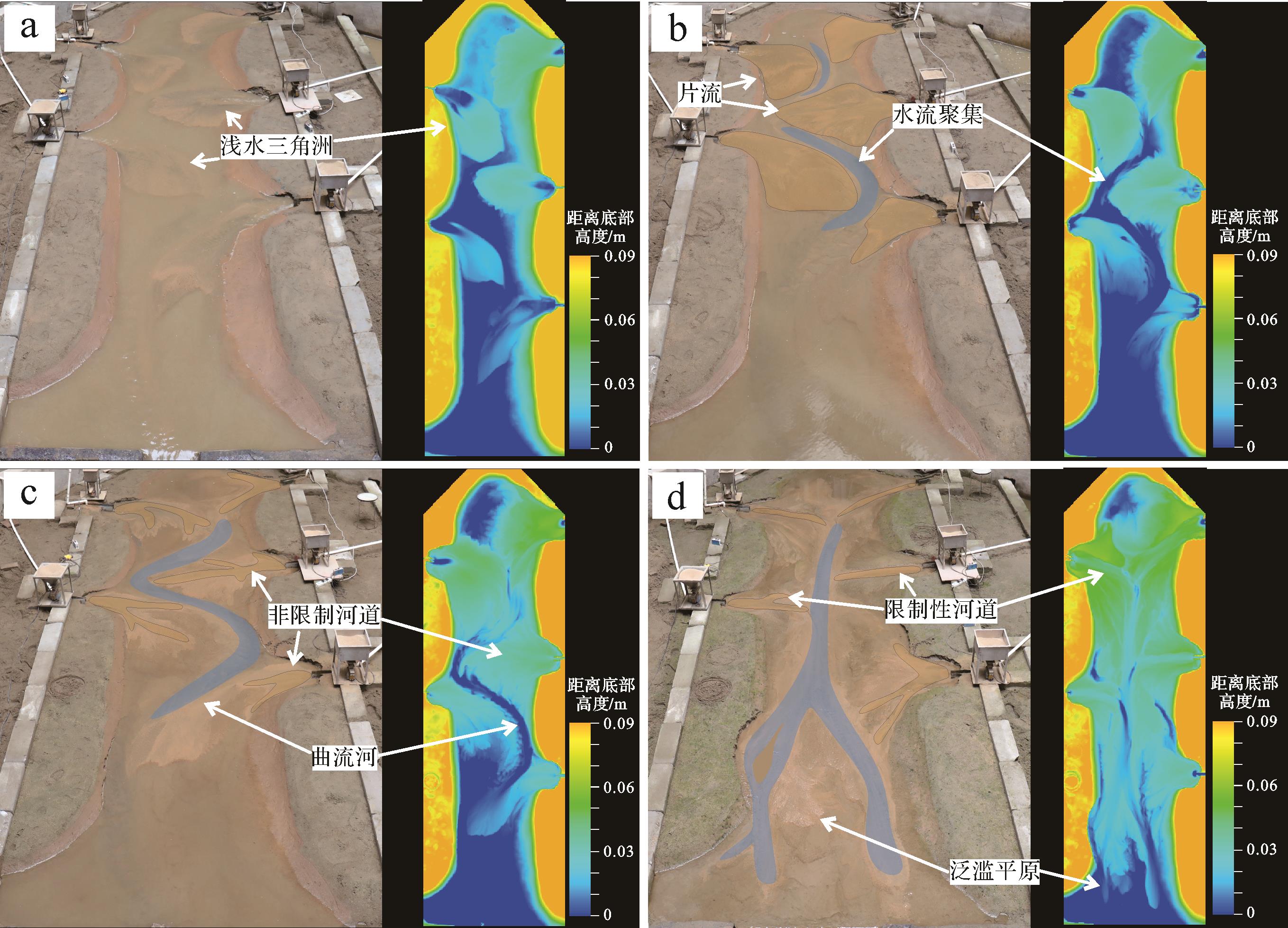
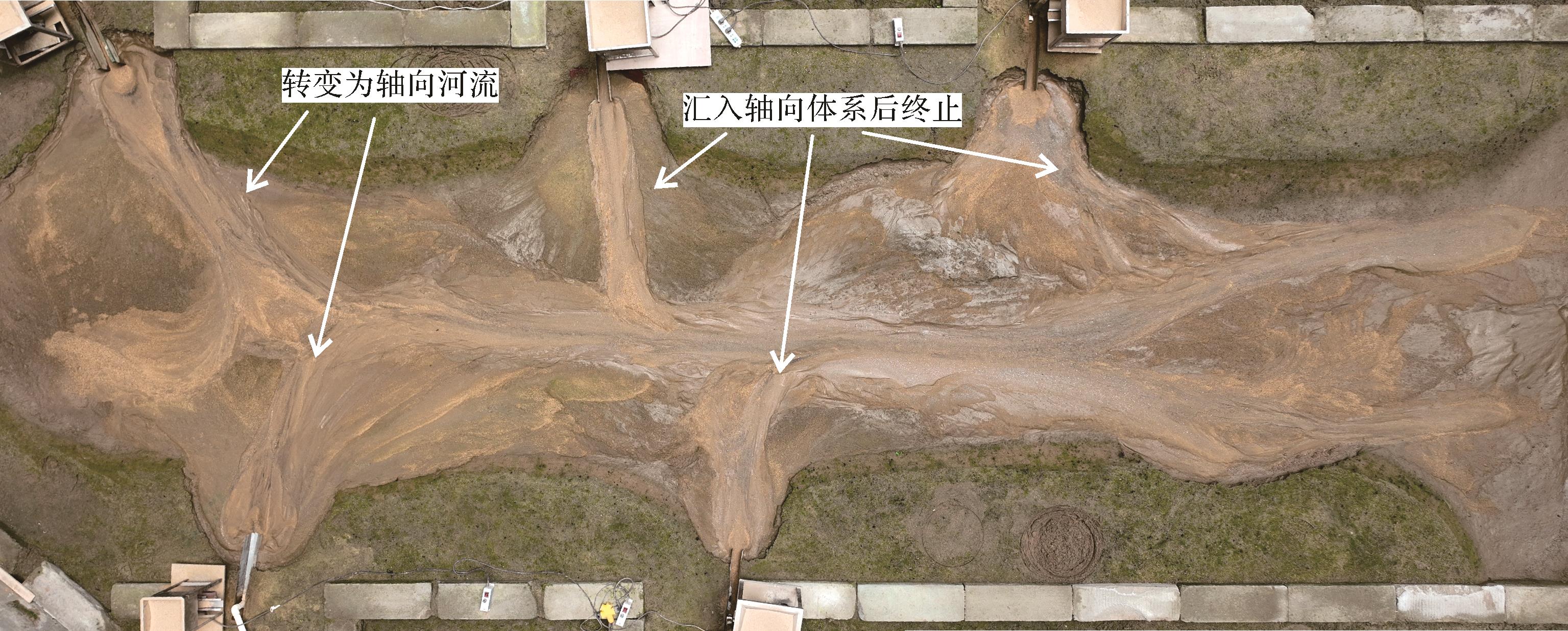
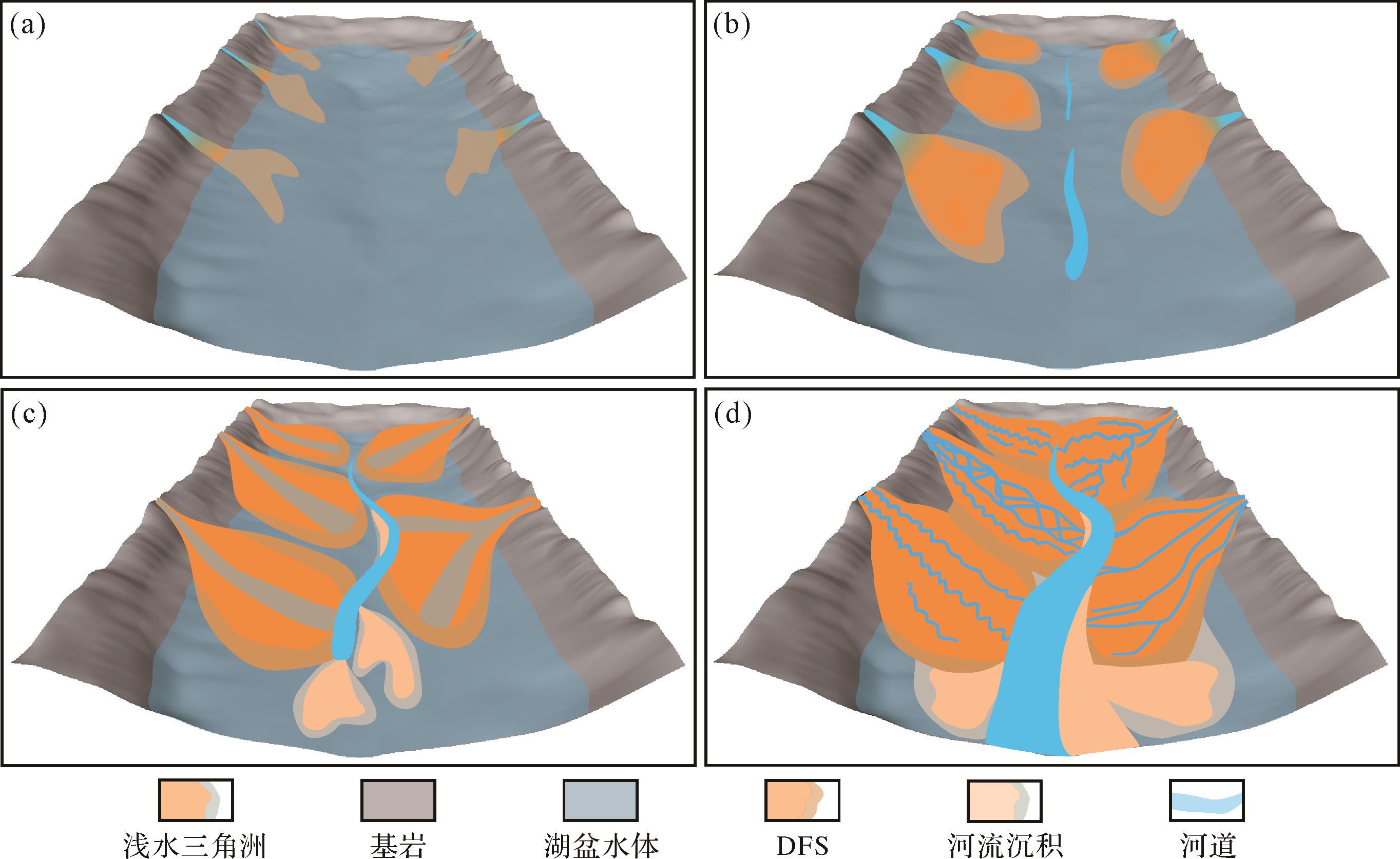
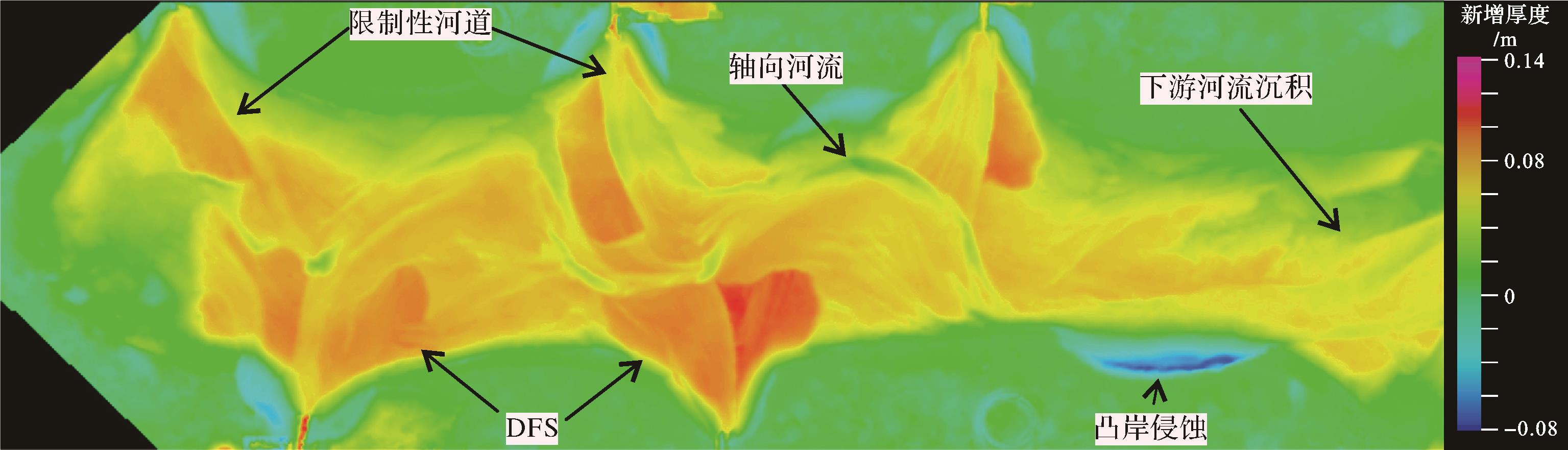
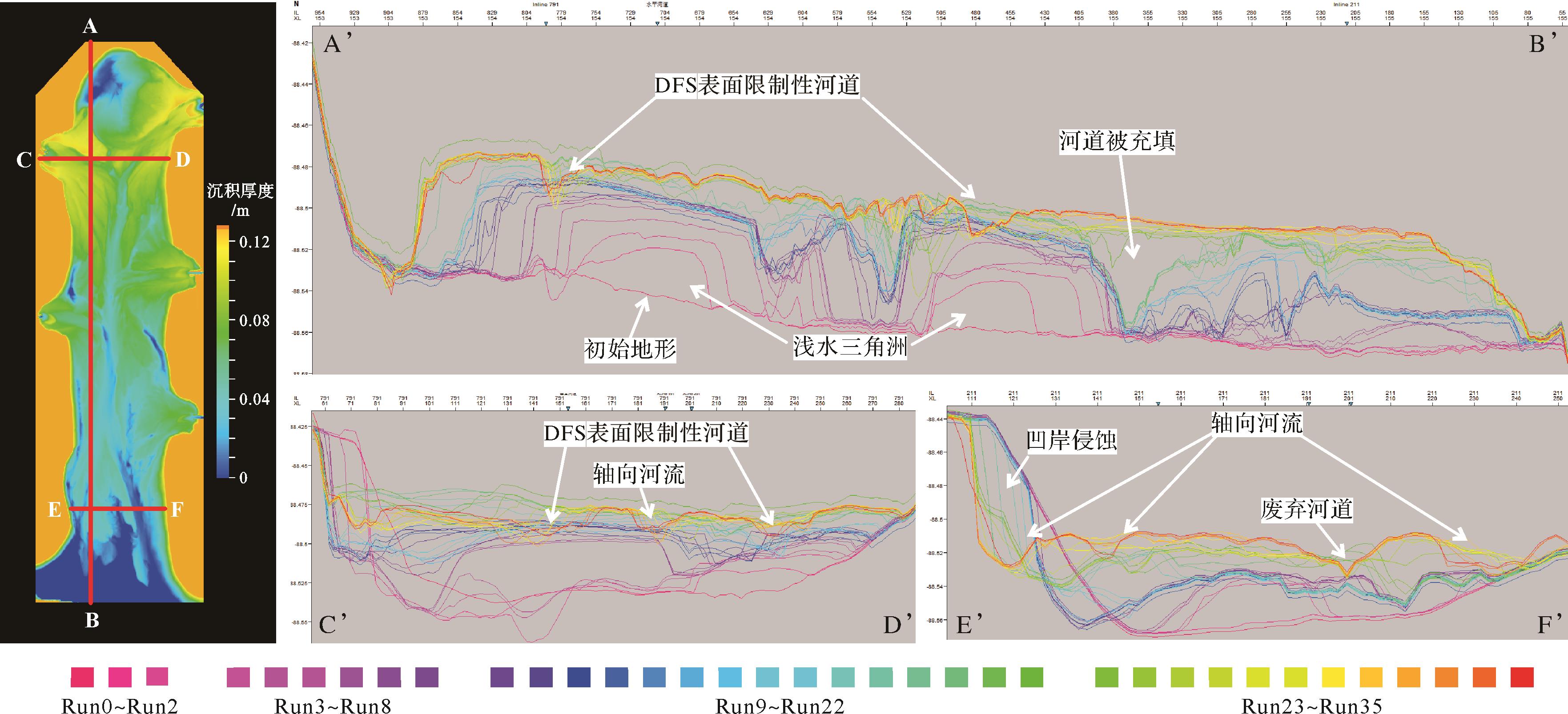
Objective Distributive fluvial systems (DFS) are widely developed in modern and ancient sedimentary strata and they are important hydrocarbon reservoirs. Multiple interacting DFS and evolving axial rivers may be developed in a narrow, shallow lacustrine basin with low accommodation. Methods Reproducing the deposition process through flume simulation experiments, this study used a high-precision three-dimensional (3D) scanner with a self-developed program to visual analyze the deposition area and clarify the stage-by-stage evolution characteristics of the DFS. Results ( 1) With the expansion of the DFS scale, the water flow on its surface gradually aggregates; the initial flow pattern is sheet flow, which then evolves into unrestricted and restricted flow; (2) as the basin can accommodate less space, the axial water flow in the basin gradually aggregates into an axial river, which has a destructive effect on the two sides of the DFS and constantly breaks, forming a large-scale fluvial deposition; (3) when multiple DFS are developed in a narrow, shallow lacustrine basin, the sedimentary sands are concentrated at the DFS near the source and downstream of the axial river, and the longer basin development time indicates a larger scale of fluvial deposition. Conclusions This study describes the developmental processes and sand body spreading patterns of multiple DFS and axial rivers developed in a narrow, shallow lacustrine basin with low accommodation and sufficient supply of material sources at the basin scale, providing theoretical support for oil and gas exploration and the study of distributive fluvial systems.
Objective Distributive fluvial systems (DFS) are widely developed in modern and ancient sedimentary strata and they are important hydrocarbon reservoirs. Multiple interacting DFS and evolving axial rivers may be developed in a narrow, shallow lacustrine basin with low accommodation. Methods Reproducing the deposition process through flume simulation experiments, this study used a high-precision three-dimensional (3D) scanner with a self-developed program to visual analyze the deposition area and clarify the stage-by-stage evolution characteristics of the DFS. Results ( 1) With the expansion of the DFS scale, the water flow on its surface gradually aggregates; the initial flow pattern is sheet flow, which then evolves into unrestricted and restricted flow; (2) as the basin can accommodate less space, the axial water flow in the basin gradually aggregates into an axial river, which has a destructive effect on the two sides of the DFS and constantly breaks, forming a large-scale fluvial deposition; (3) when multiple DFS are developed in a narrow, shallow lacustrine basin, the sedimentary sands are concentrated at the DFS near the source and downstream of the axial river, and the longer basin development time indicates a larger scale of fluvial deposition. Conclusions This study describes the developmental processes and sand body spreading patterns of multiple DFS and axial rivers developed in a narrow, shallow lacustrine basin with low accommodation and sufficient supply of material sources at the basin scale, providing theoretical support for oil and gas exploration and the study of distributive fluvial systems.
2026, 44(3): 869-882.
doi: 10.14027/j.issn.1000-0550.2024.106
Abstract:
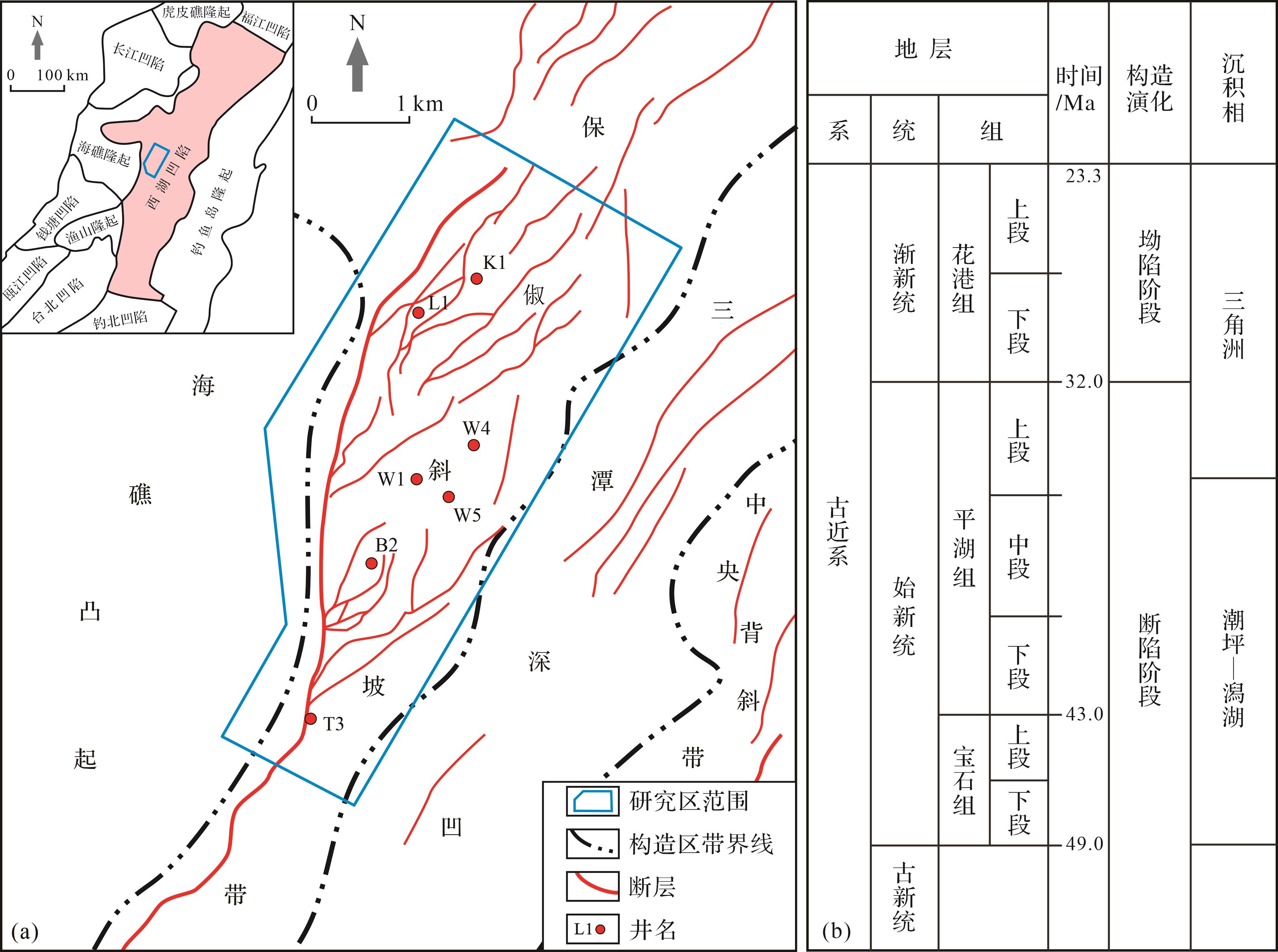
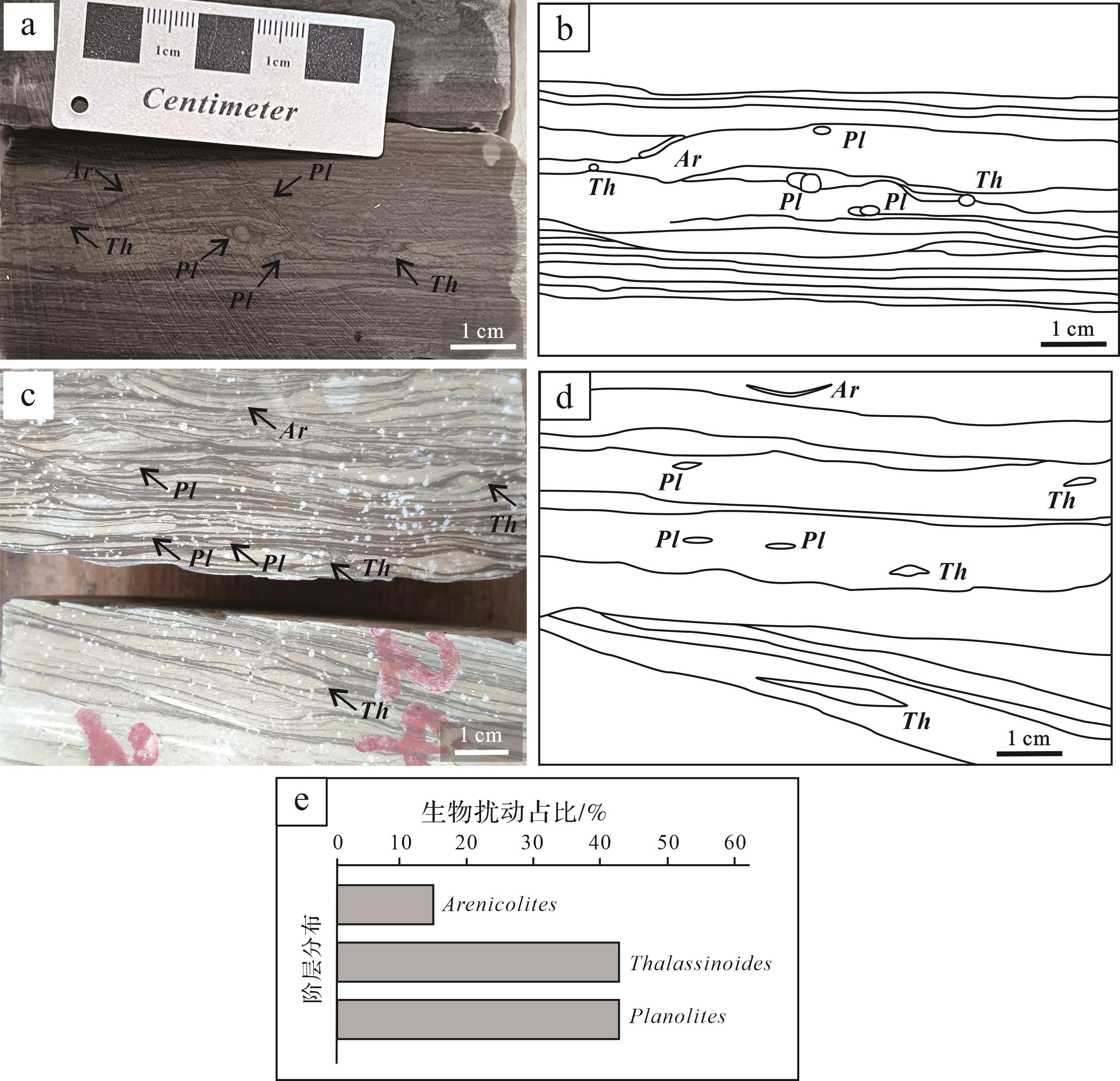
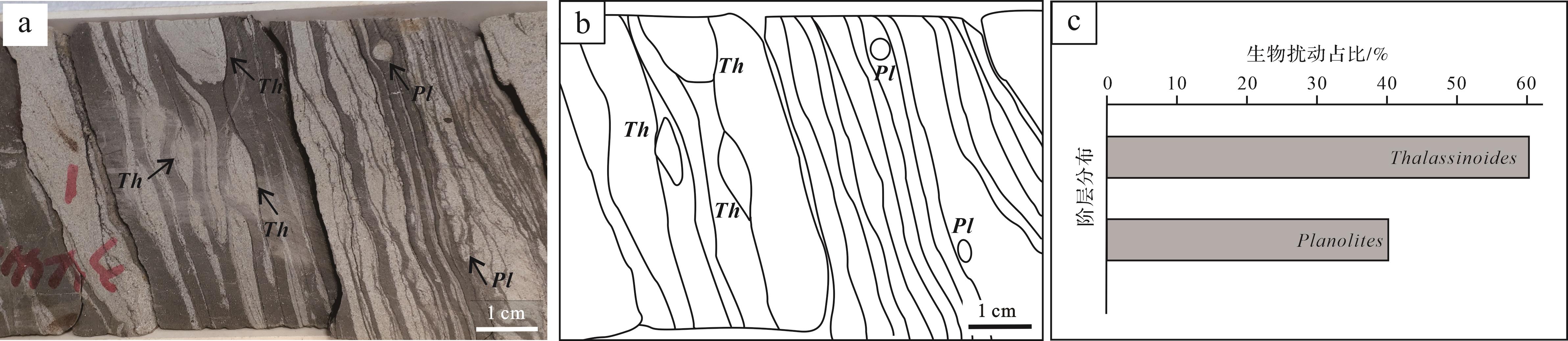
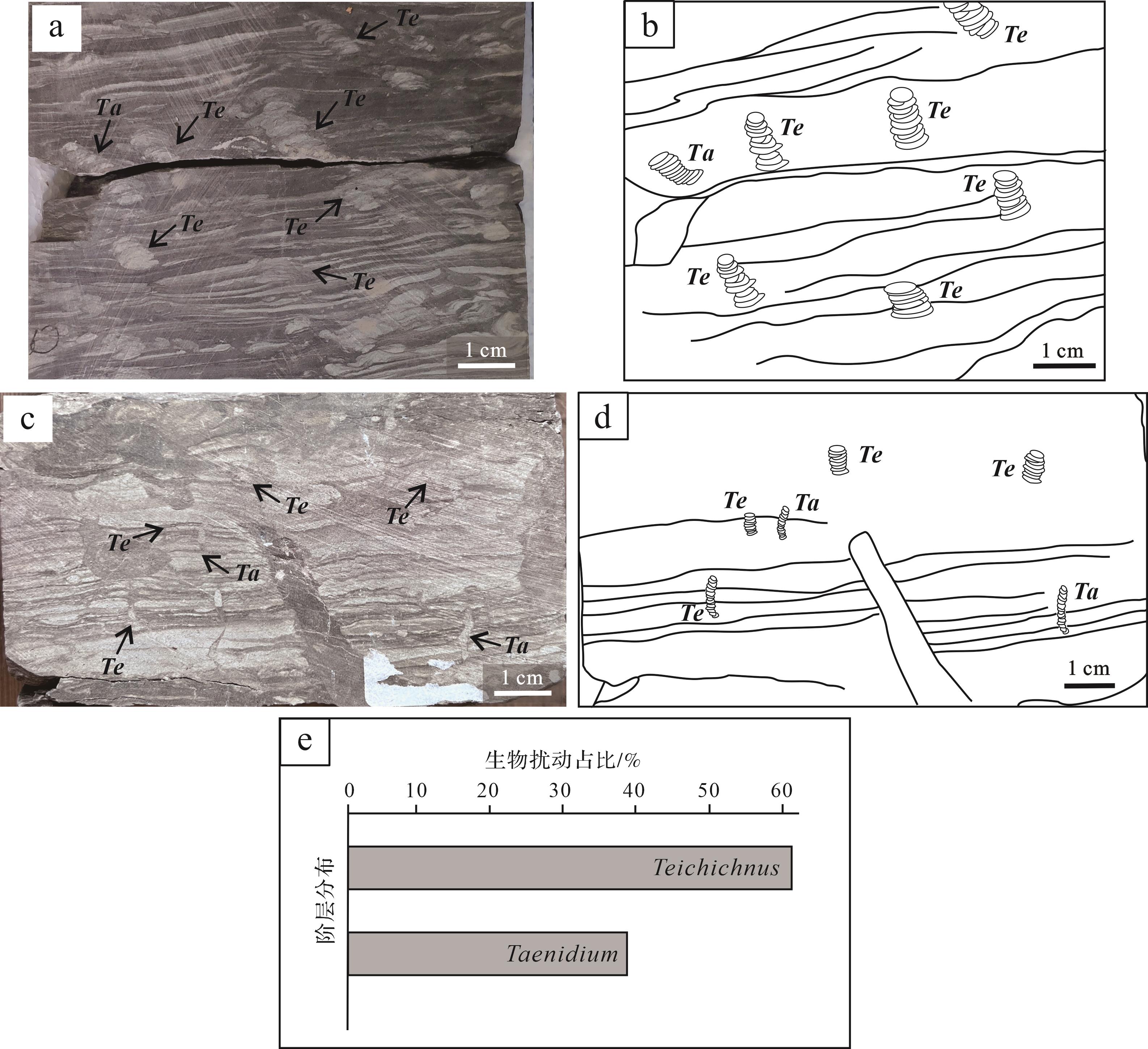
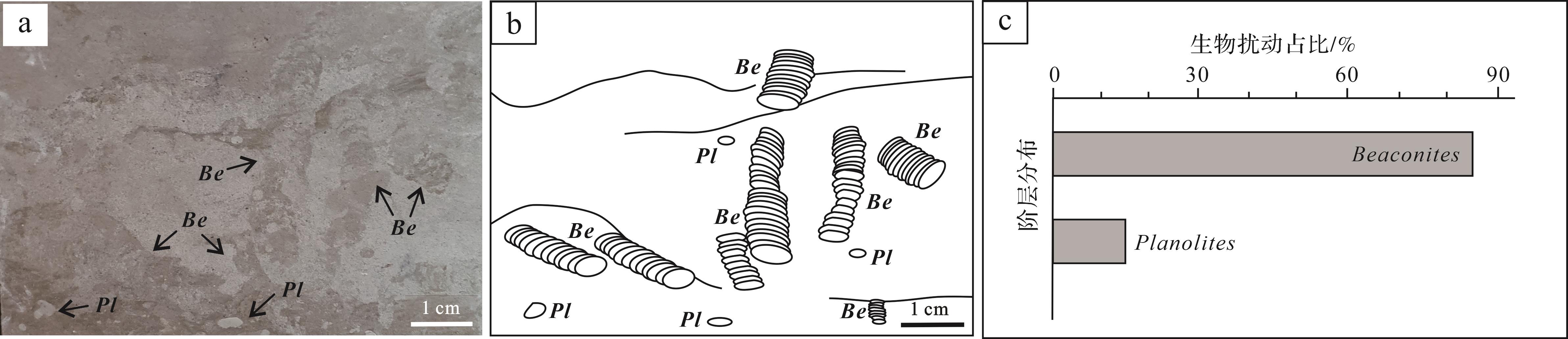
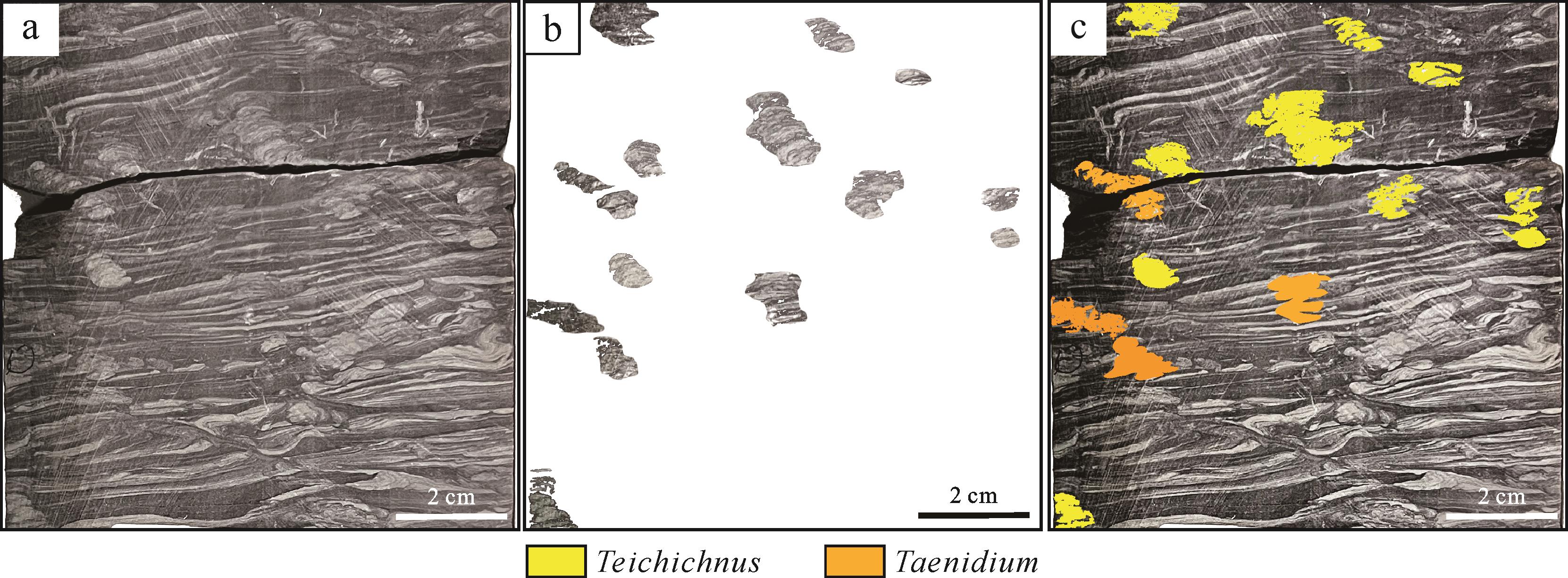
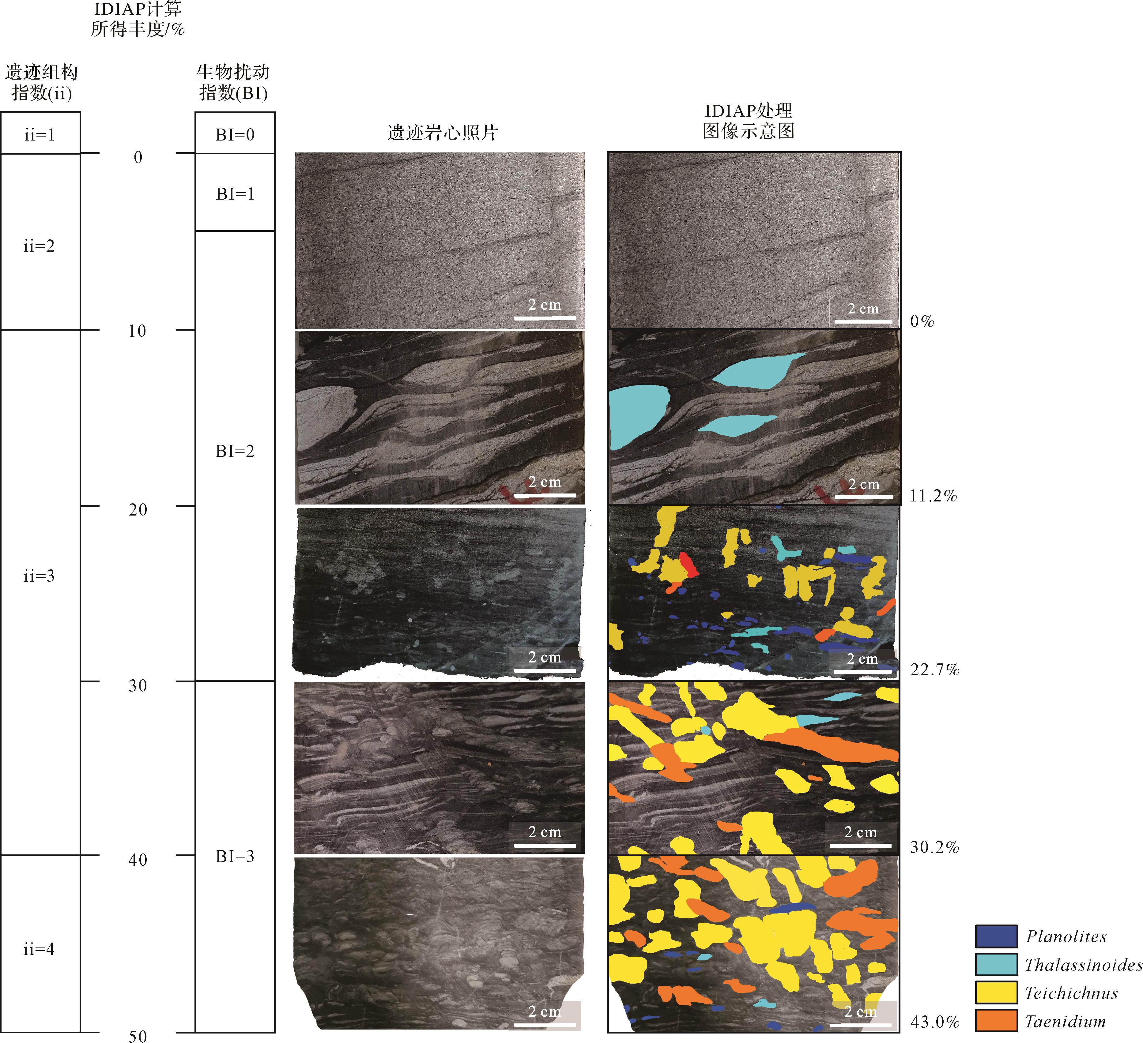
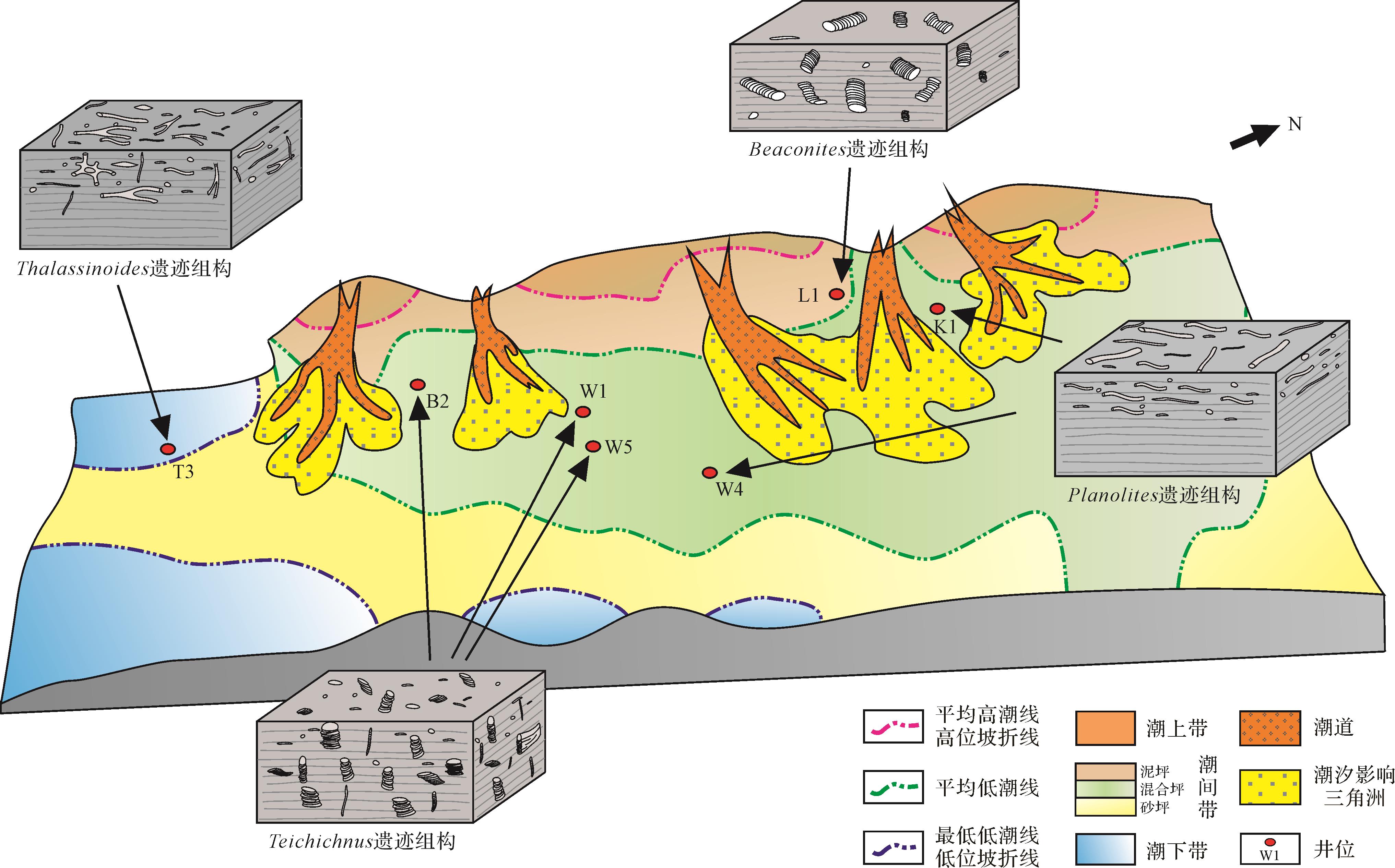
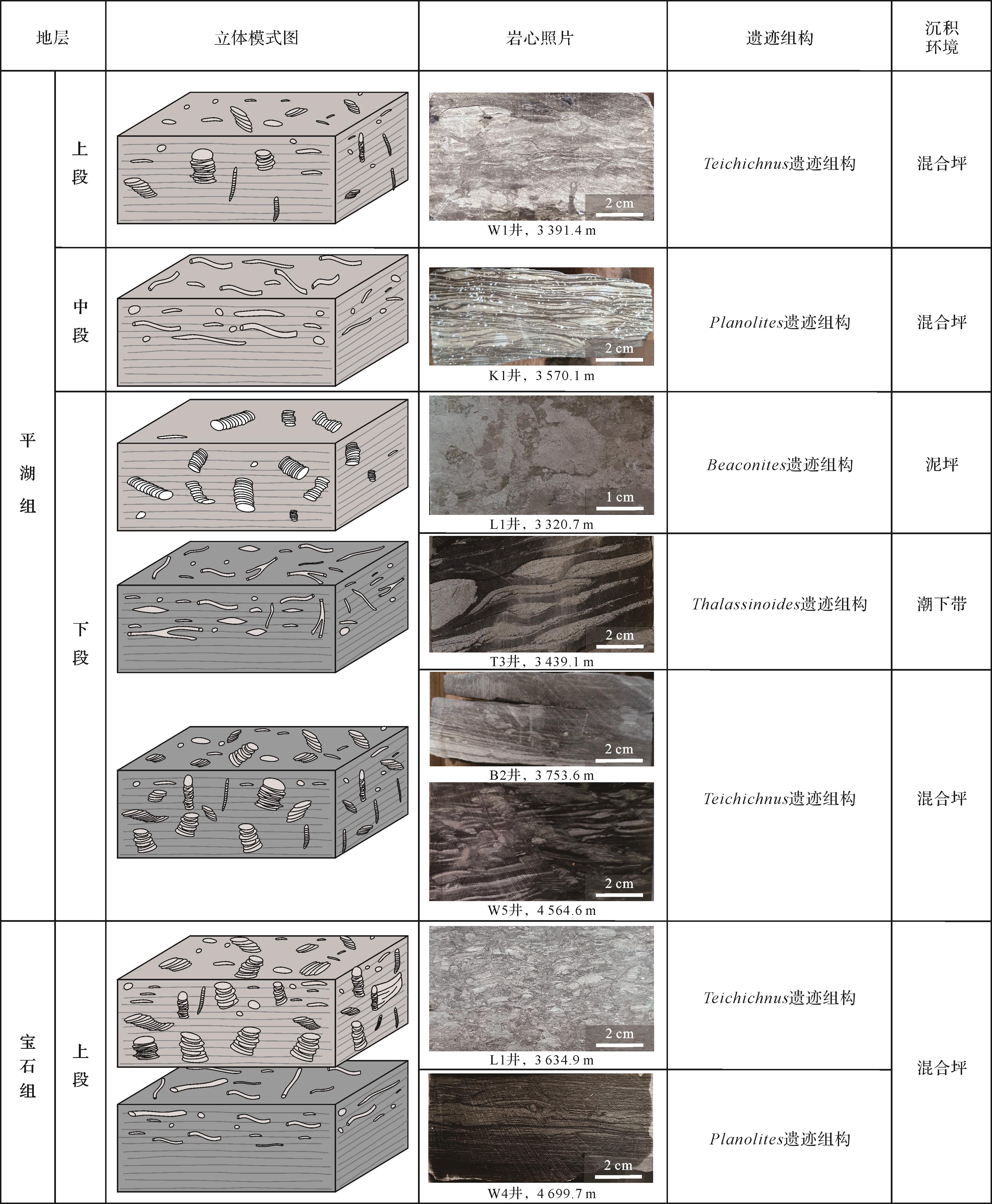
Objective Abundant ichnofossils present in the Eocene Pinghu Formation and Baoshi Formation in the Pingbei area, Xihu Sag. It is of practical significance for the division of sedimentary systems in the Xihu Sag to study the characteristics and distribution of its ichnofabrics and their indication of sedimentary environment. Methods Using core observations, the study identified ichnofossils and ichnofabrics in the Pingbei area. The IDIPA technique was employed to objectively quantify ichnofossil abundance and accurately determine both the bioturbation index and the ichnofabric index. By integrating these findings with ichnological indices, this study summarizes the characteristics of the planar distribution and vertical evolution of ichnofabric in the study area. Results (1) The study identified six ichnogenera of ichnofossils and divided them into four types of ichnofabrics: Planolites ichnofabric, Thalassinoides ichnofabric, Teichichnus ichnofabric and Beaconites ichnofabric. (2) The study area features a high landform in the northwest and a low landform in the southeast. Seawater invades from south to north, and the sedimentary environment transitions from a subtidal zone to an intertidal zone, and finally to a supratidal zone in the northwest where the highest terrain is located. The evolution pattern of the corresponding ichnofabrics follows the sequence Thalassinoides → Teichichnus → Planolites → Beaconites, consistent with regional sedimentary zoning and paleoclimate analysis. (3) From the Pinghu Formation to the Baoshi Formation in the study area, the study found an increase in the size, diversity and abundance of ichnofossils. The tiering transitioned from simple and shallow to complex and deep. The variety of organisms and the degree of bioturbation increased, and the biological habits evolved continuously, indicating that the sedimentary environment changed from anoxic to oxic. Conclusions Based on the characteristics of ichnofossils, ichnofabrics and sedimentary structures, the response relationship between the ichnofabrics and the sedimentary environment was established in the Pinghu Formation⁃Baoshi Formation in the Pingbei area. These findings provide new evidence for the changes in sedimentary environment from the perspective of ichnology in the Xihu Sag during the Eocene.
Objective Abundant ichnofossils present in the Eocene Pinghu Formation and Baoshi Formation in the Pingbei area, Xihu Sag. It is of practical significance for the division of sedimentary systems in the Xihu Sag to study the characteristics and distribution of its ichnofabrics and their indication of sedimentary environment. Methods Using core observations, the study identified ichnofossils and ichnofabrics in the Pingbei area. The IDIPA technique was employed to objectively quantify ichnofossil abundance and accurately determine both the bioturbation index and the ichnofabric index. By integrating these findings with ichnological indices, this study summarizes the characteristics of the planar distribution and vertical evolution of ichnofabric in the study area. Results (1) The study identified six ichnogenera of ichnofossils and divided them into four types of ichnofabrics: Planolites ichnofabric, Thalassinoides ichnofabric, Teichichnus ichnofabric and Beaconites ichnofabric. (2) The study area features a high landform in the northwest and a low landform in the southeast. Seawater invades from south to north, and the sedimentary environment transitions from a subtidal zone to an intertidal zone, and finally to a supratidal zone in the northwest where the highest terrain is located. The evolution pattern of the corresponding ichnofabrics follows the sequence Thalassinoides → Teichichnus → Planolites → Beaconites, consistent with regional sedimentary zoning and paleoclimate analysis. (3) From the Pinghu Formation to the Baoshi Formation in the study area, the study found an increase in the size, diversity and abundance of ichnofossils. The tiering transitioned from simple and shallow to complex and deep. The variety of organisms and the degree of bioturbation increased, and the biological habits evolved continuously, indicating that the sedimentary environment changed from anoxic to oxic. Conclusions Based on the characteristics of ichnofossils, ichnofabrics and sedimentary structures, the response relationship between the ichnofabrics and the sedimentary environment was established in the Pinghu Formation⁃Baoshi Formation in the Pingbei area. These findings provide new evidence for the changes in sedimentary environment from the perspective of ichnology in the Xihu Sag during the Eocene.
2026, 44(3): 883-902.
doi: 10.14027/j.issn.1000-0550.2024.133
Abstract:
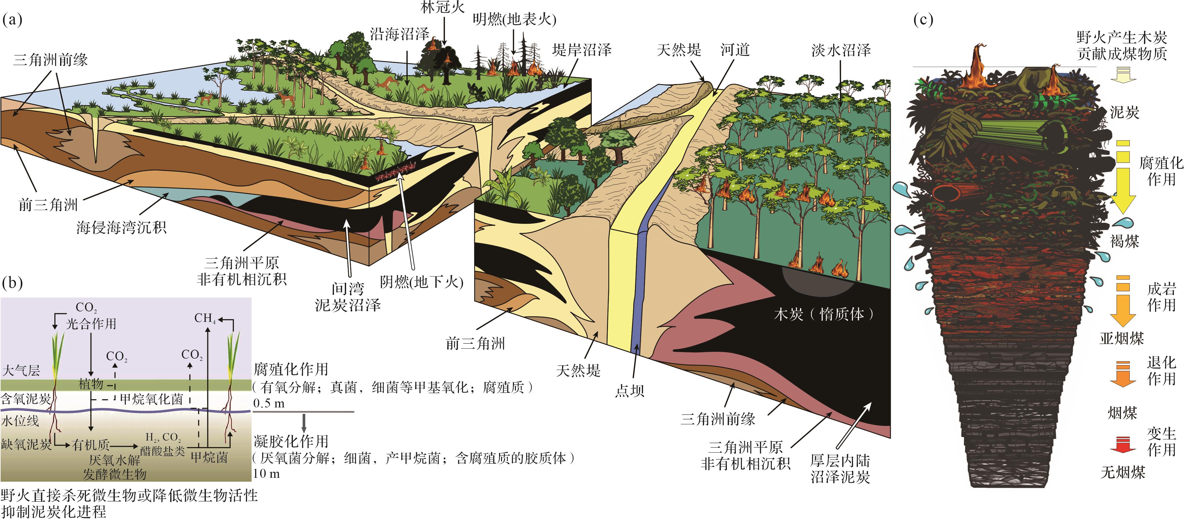
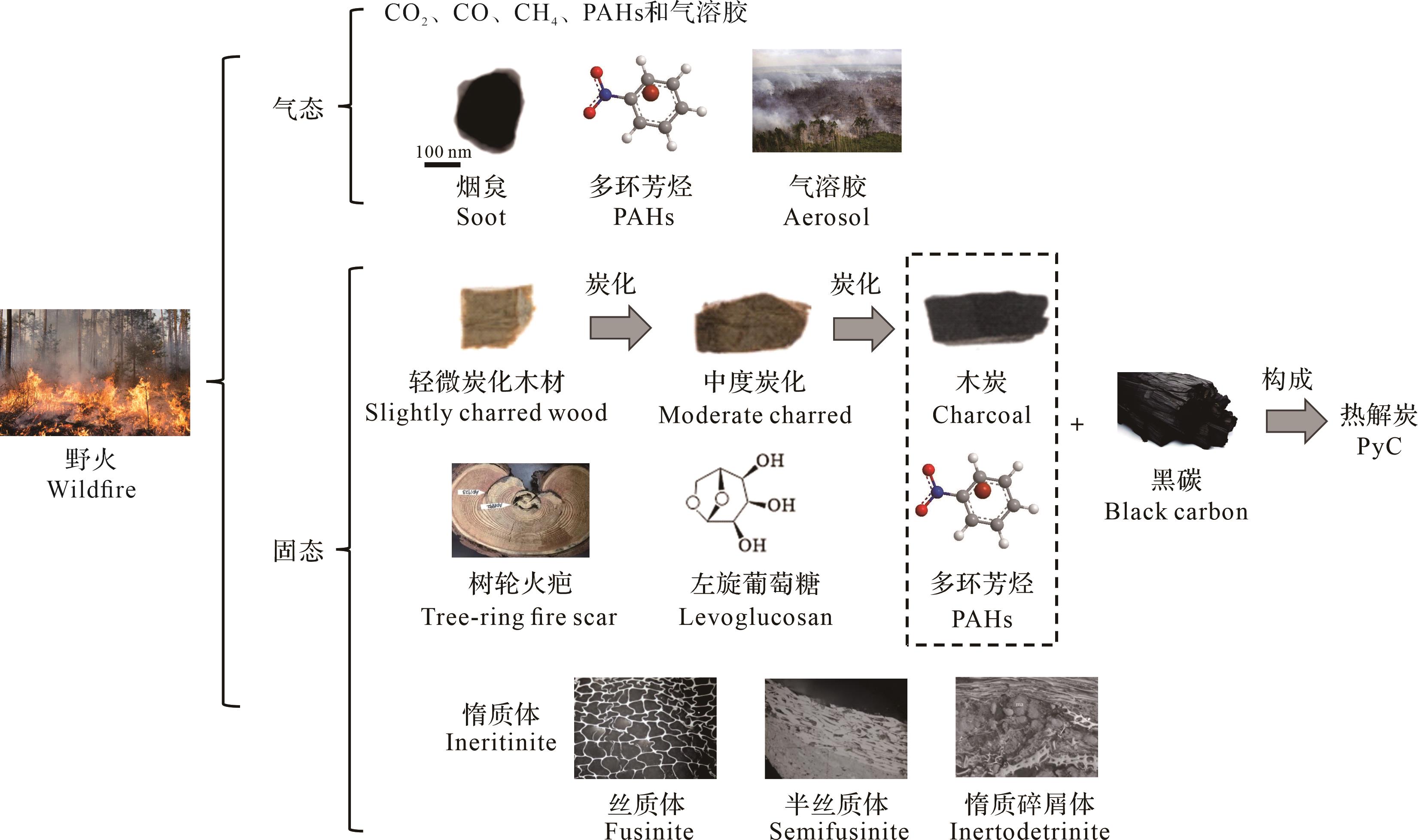
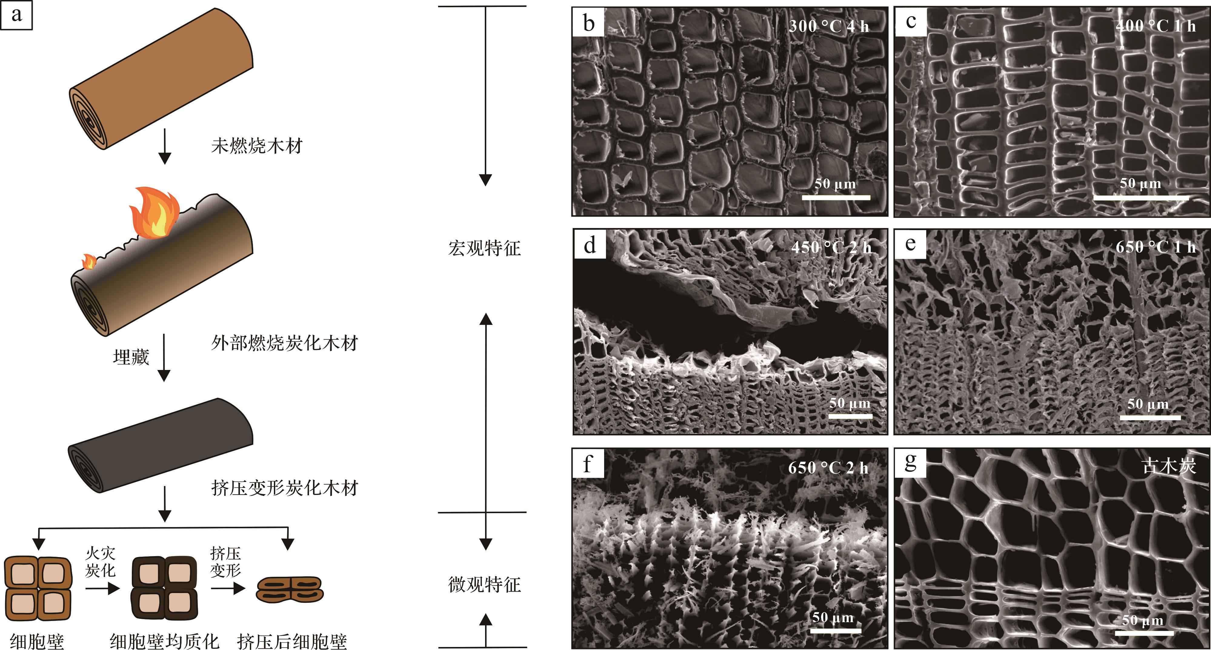
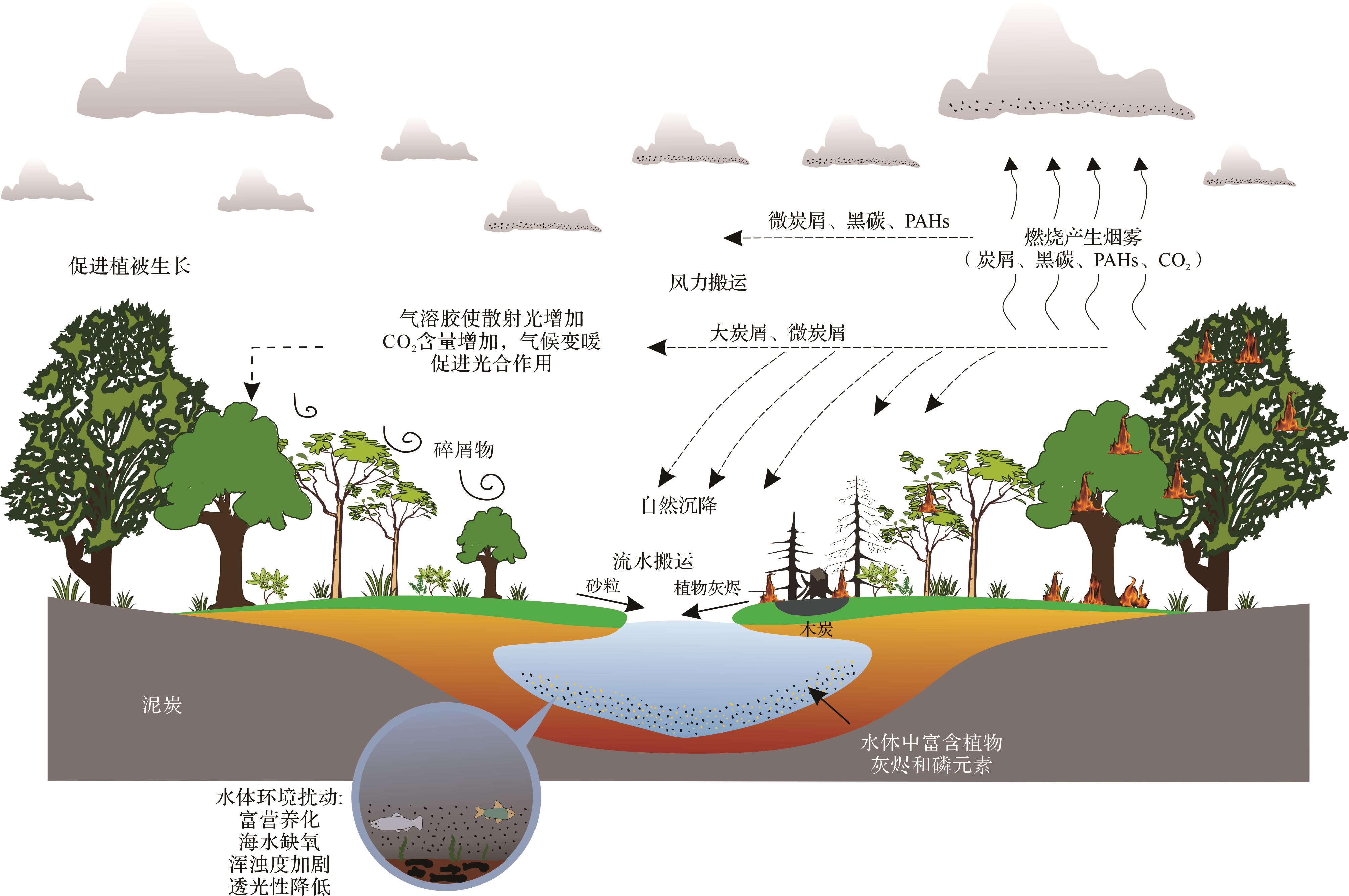
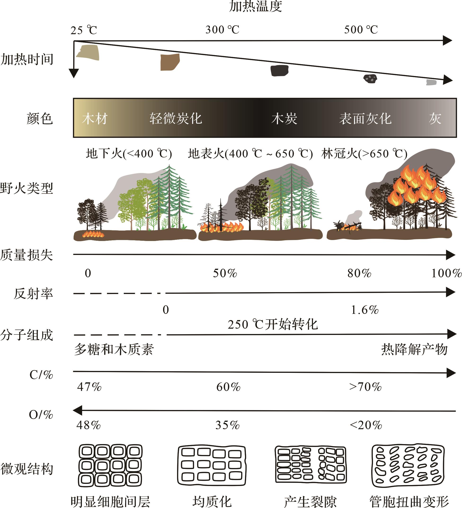
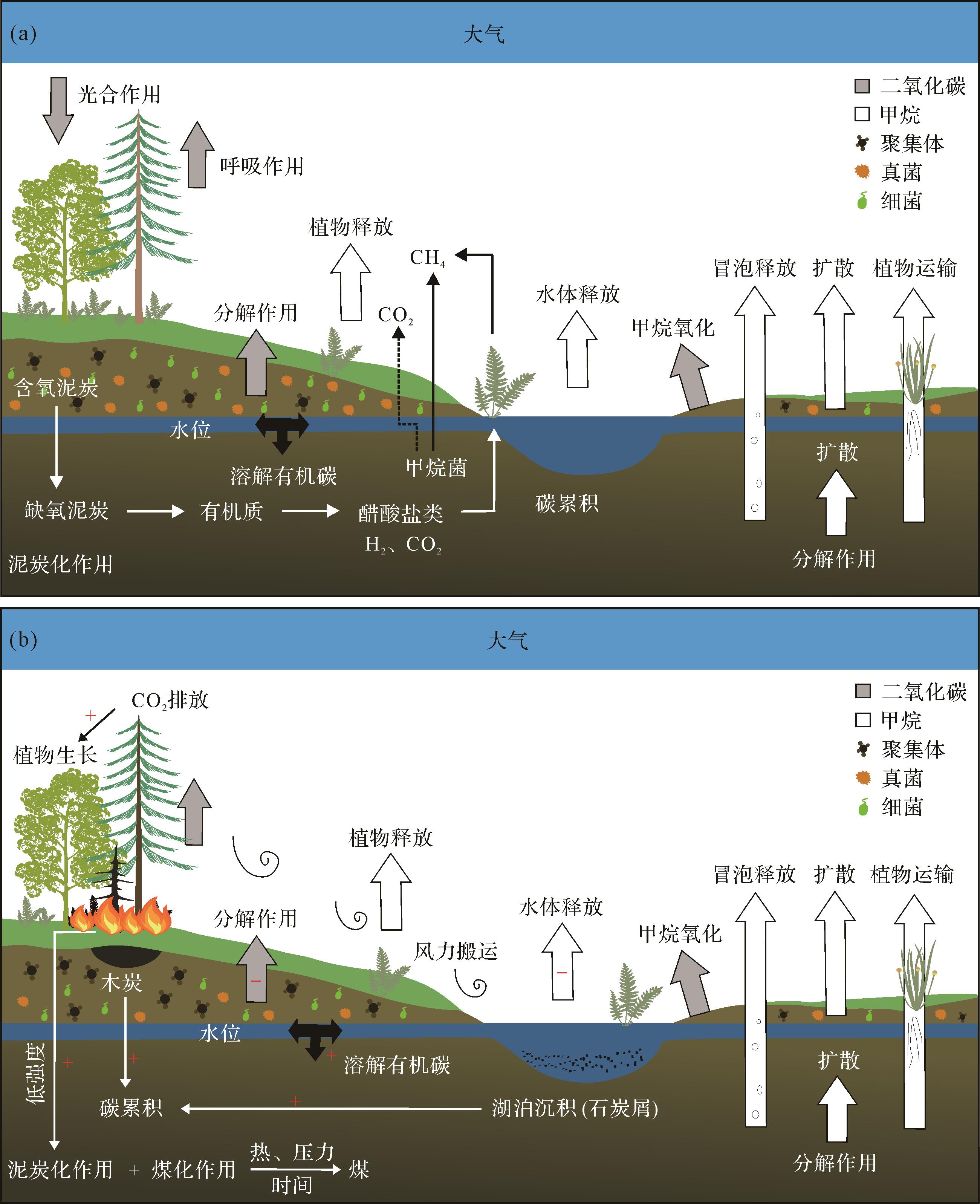
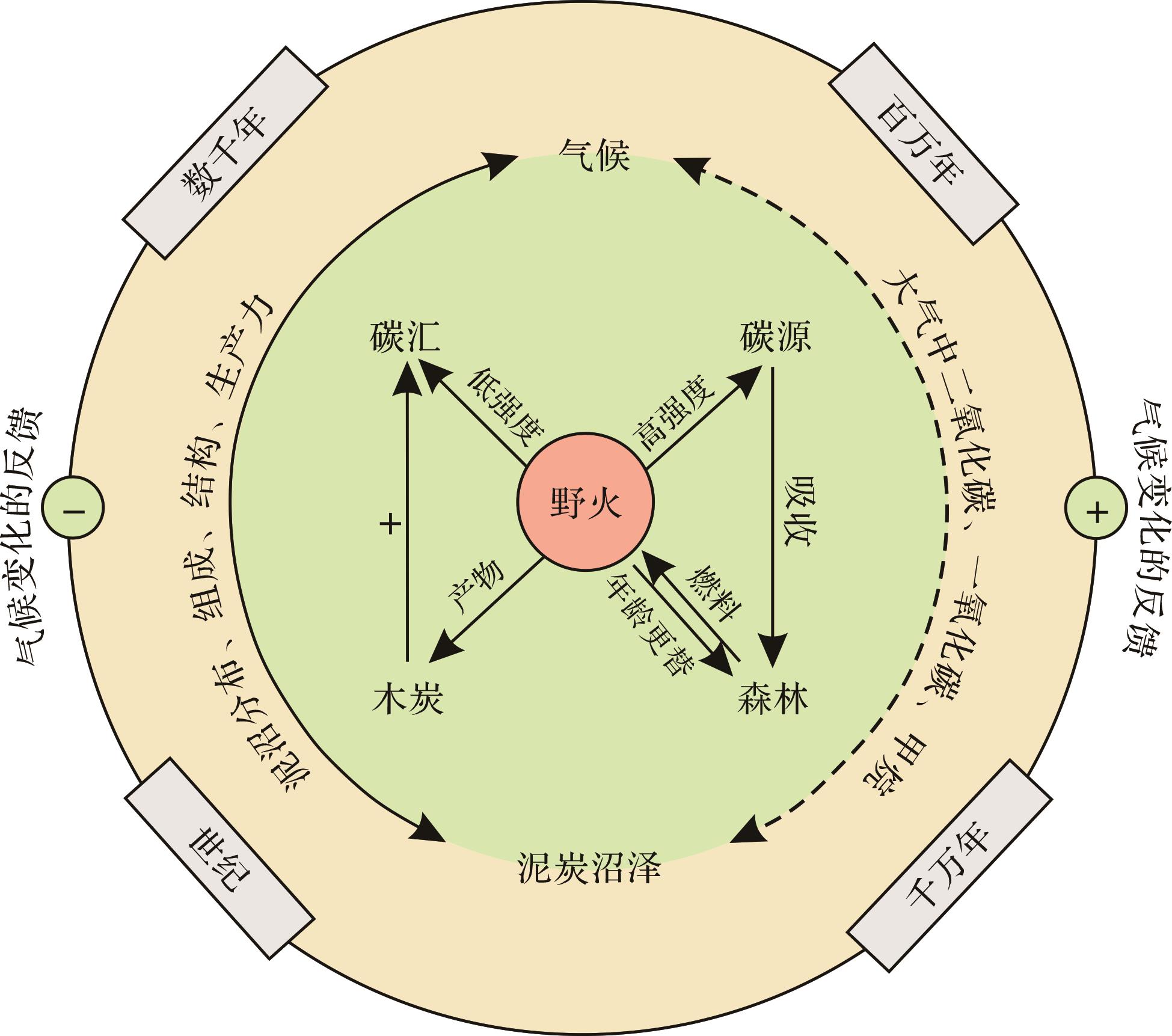
Significance Peat bogs play an important role in the global carbon cycle as a depositional carrier of paleo-wildfire events and paleoclimate information. By systematically sorting wildfires types in peat bogs and clarifying the academic terminology related to wildfire products such as charcoal, the carbon source and sink effects of wildfires in peat bogs were discussed. This information is useful for the study of the carbon cycle in deep time. Progress Wildfire product charcoal, approximately equivalent to the inertinite in coal, is a relatively stable carbon store of plant-incomplete combustion residues, which can provide a record of wildfire activities in geological history, from millennia to billions of years. Changes in charcoal material composition (e.g., polysaccharides and lignin) and microstructure (e.g., cell wall homogenization) can reflect the temperature range of paleo-wildfires. Wildfire types can be recovered and atmospheric oxygen content can be constrained using inertinite reflectance and content. The impacts of wildfires on the global carbon cycle include both short-term carbon source and long-term carbon sink effects. Wildfires lead to direct large carbon emissions and carbon release from deep peat burning. However, wildfire-driven persistent changes in soil microorganisms, aggregates, and organic matter can directly offset certain carbon losses, and charcoal provides a stable carbon store. Conclusions and Prospects Based on the carbon cycle model of peatland under normal burial conditions, the influence factors of wildfire, soil aggregates, fungi, and bacteria were introduced to propose a post-fire peatland carbon cycle model. Using the inertinite wildfire genesis and greenhouse gas emission models, and taking the carbon emission and carbon storage of wildfires in Early Cretaceous peat (coal-forming) bogs in Northeast China as an example, the results show that the long-term (million-year time scale) carbon sinks of forest vegetation growth and peatland are fully capable of neutralizing the short-term (year time scale) carbon source effect brought by wildfires. In the future, when evaluating the deep-time carbon cycle response to wildfires, it is necessary to consider the length of the time period and wildfire intensity, improving our understanding of climate change and environmental evolution caused by wildfire to promote the in-depth integration of deep-time and present-day climate change and carbon cycle research.
Significance Peat bogs play an important role in the global carbon cycle as a depositional carrier of paleo-wildfire events and paleoclimate information. By systematically sorting wildfires types in peat bogs and clarifying the academic terminology related to wildfire products such as charcoal, the carbon source and sink effects of wildfires in peat bogs were discussed. This information is useful for the study of the carbon cycle in deep time. Progress Wildfire product charcoal, approximately equivalent to the inertinite in coal, is a relatively stable carbon store of plant-incomplete combustion residues, which can provide a record of wildfire activities in geological history, from millennia to billions of years. Changes in charcoal material composition (e.g., polysaccharides and lignin) and microstructure (e.g., cell wall homogenization) can reflect the temperature range of paleo-wildfires. Wildfire types can be recovered and atmospheric oxygen content can be constrained using inertinite reflectance and content. The impacts of wildfires on the global carbon cycle include both short-term carbon source and long-term carbon sink effects. Wildfires lead to direct large carbon emissions and carbon release from deep peat burning. However, wildfire-driven persistent changes in soil microorganisms, aggregates, and organic matter can directly offset certain carbon losses, and charcoal provides a stable carbon store. Conclusions and Prospects Based on the carbon cycle model of peatland under normal burial conditions, the influence factors of wildfire, soil aggregates, fungi, and bacteria were introduced to propose a post-fire peatland carbon cycle model. Using the inertinite wildfire genesis and greenhouse gas emission models, and taking the carbon emission and carbon storage of wildfires in Early Cretaceous peat (coal-forming) bogs in Northeast China as an example, the results show that the long-term (million-year time scale) carbon sinks of forest vegetation growth and peatland are fully capable of neutralizing the short-term (year time scale) carbon source effect brought by wildfires. In the future, when evaluating the deep-time carbon cycle response to wildfires, it is necessary to consider the length of the time period and wildfire intensity, improving our understanding of climate change and environmental evolution caused by wildfire to promote the in-depth integration of deep-time and present-day climate change and carbon cycle research.
2026, 44(3): 903-920.
doi: 10.14027/j.issn.1000-0550.2024.126
Abstract:
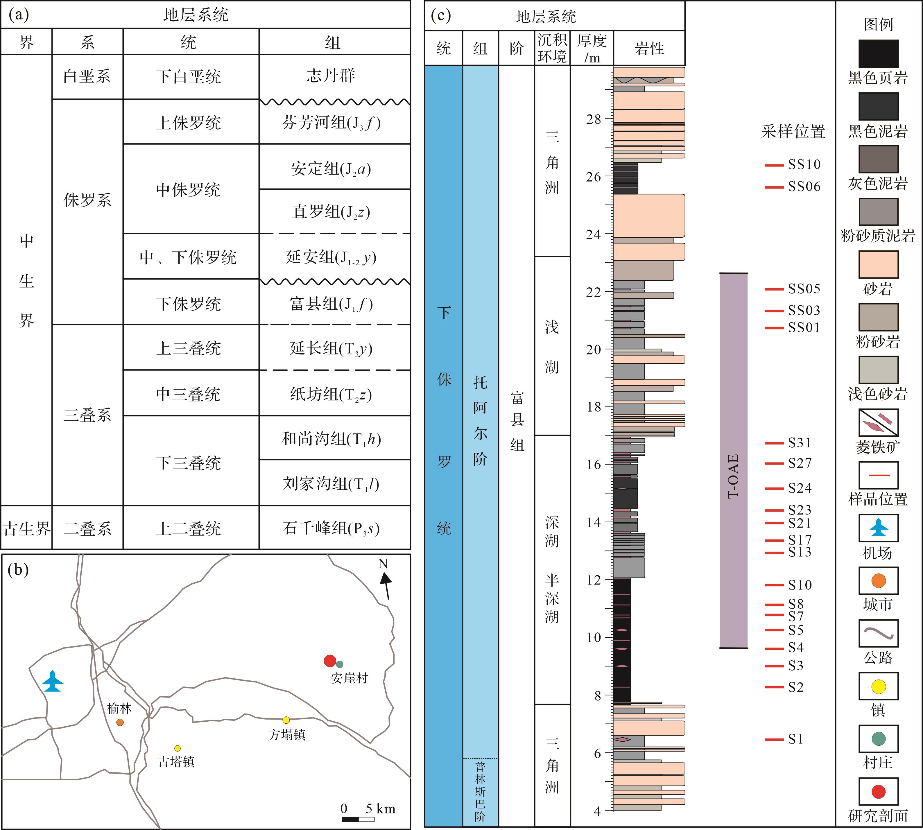
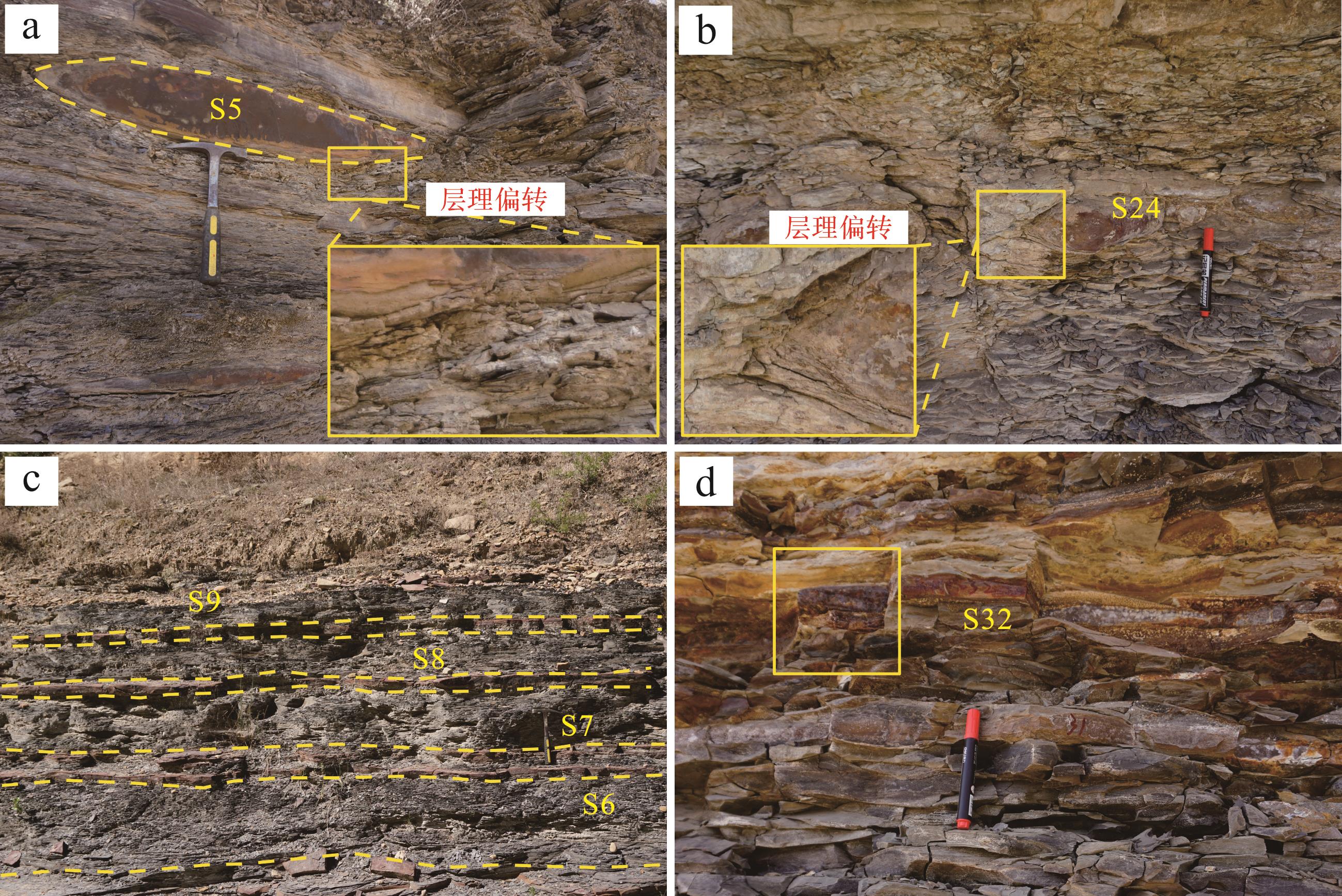
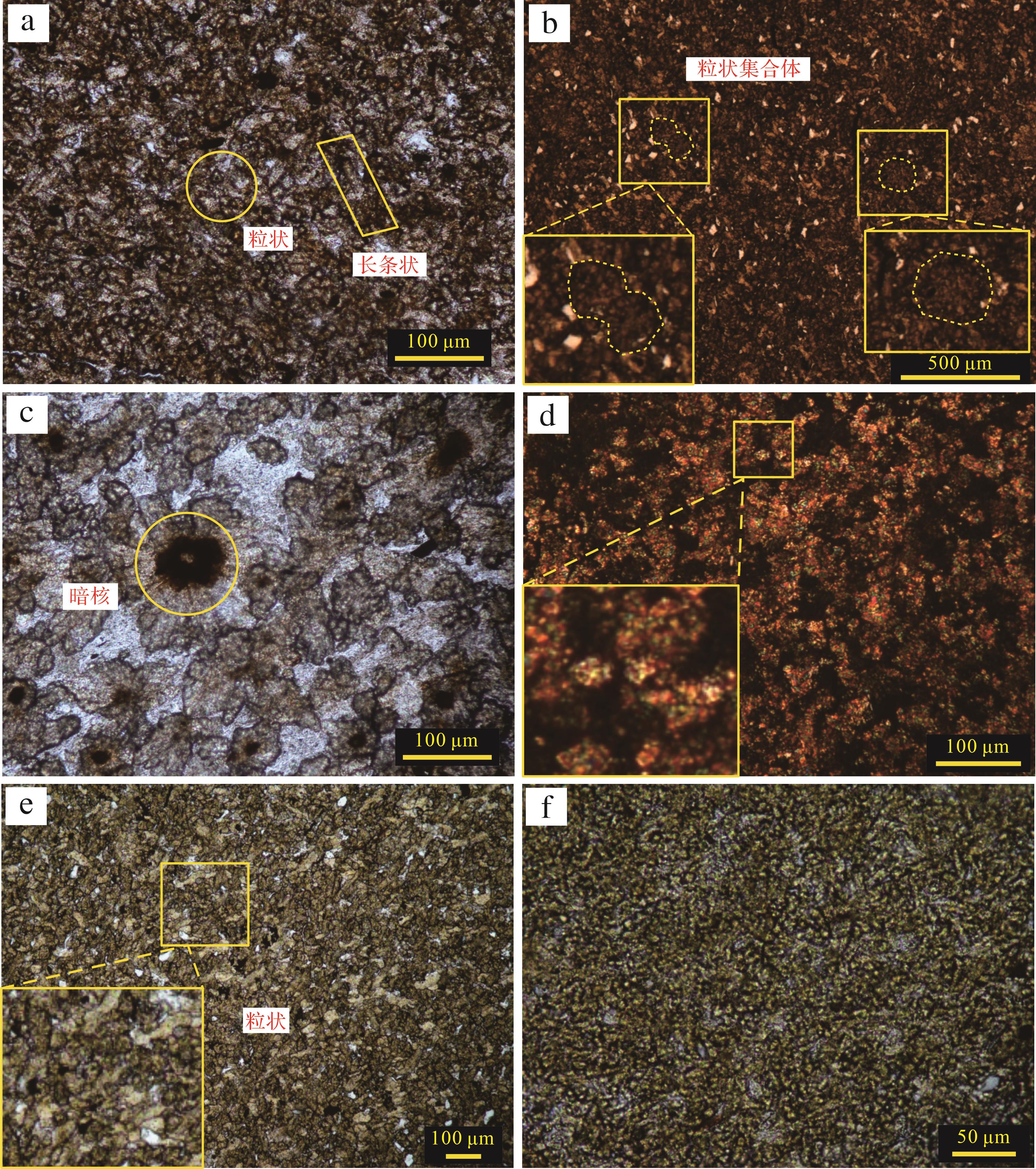
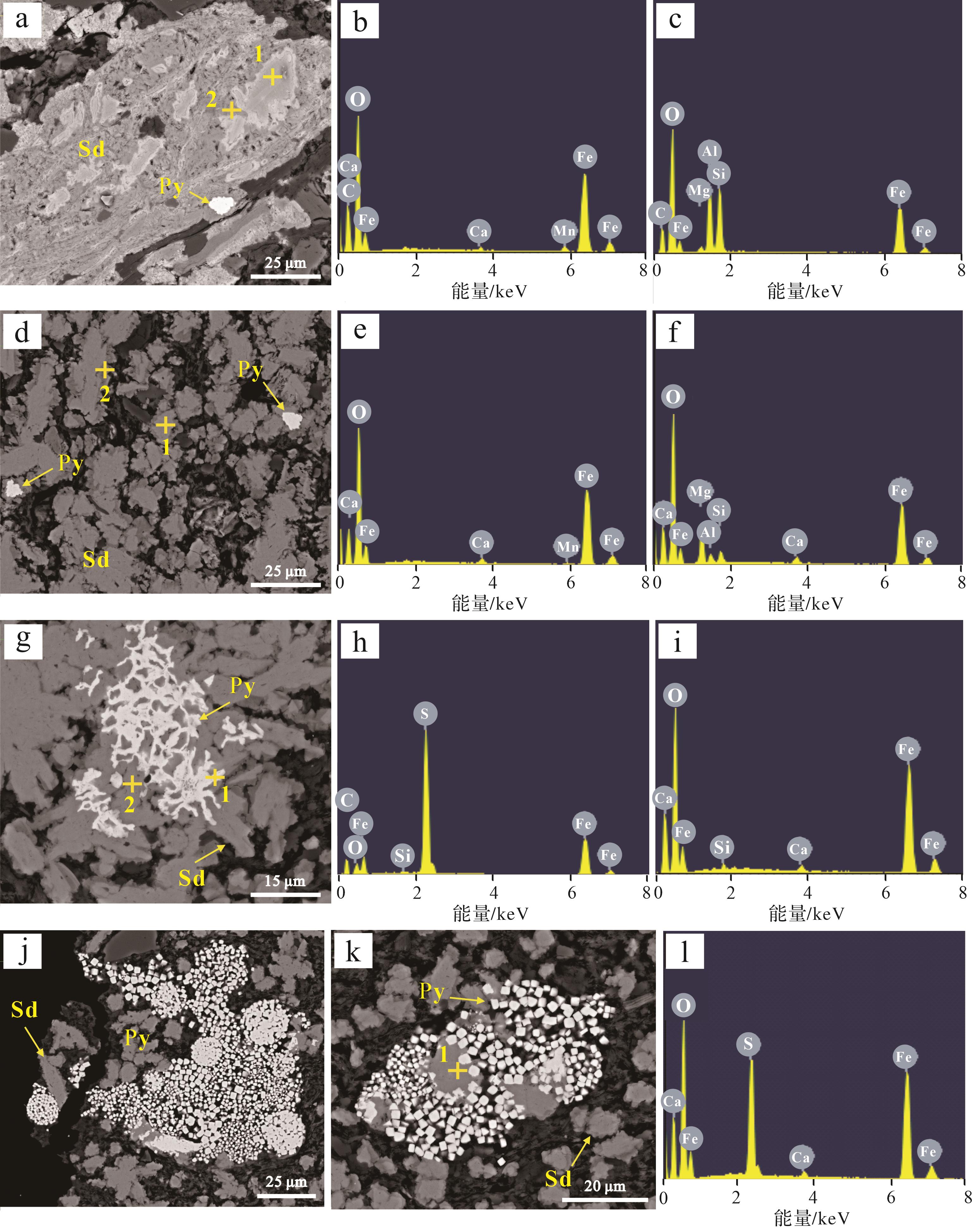
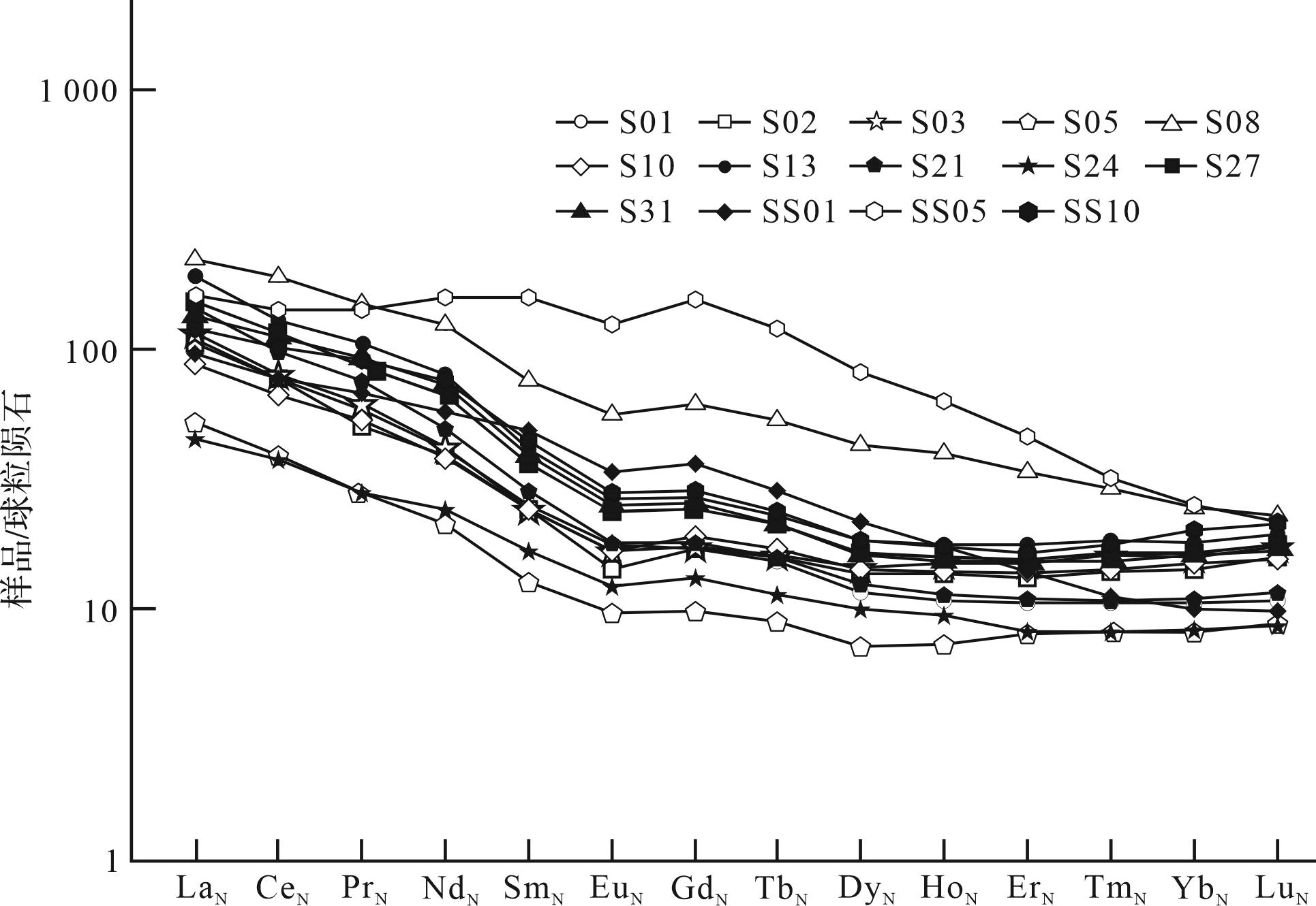
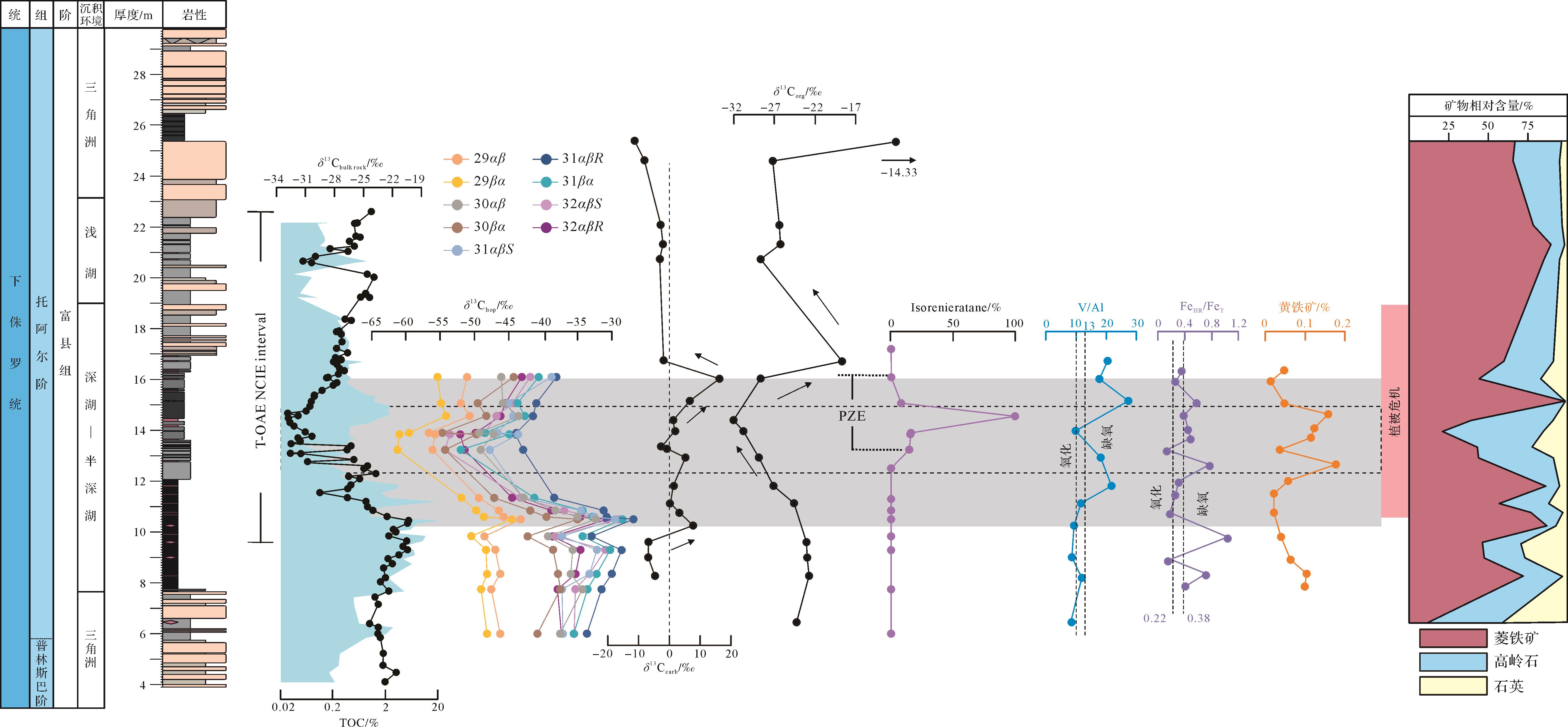
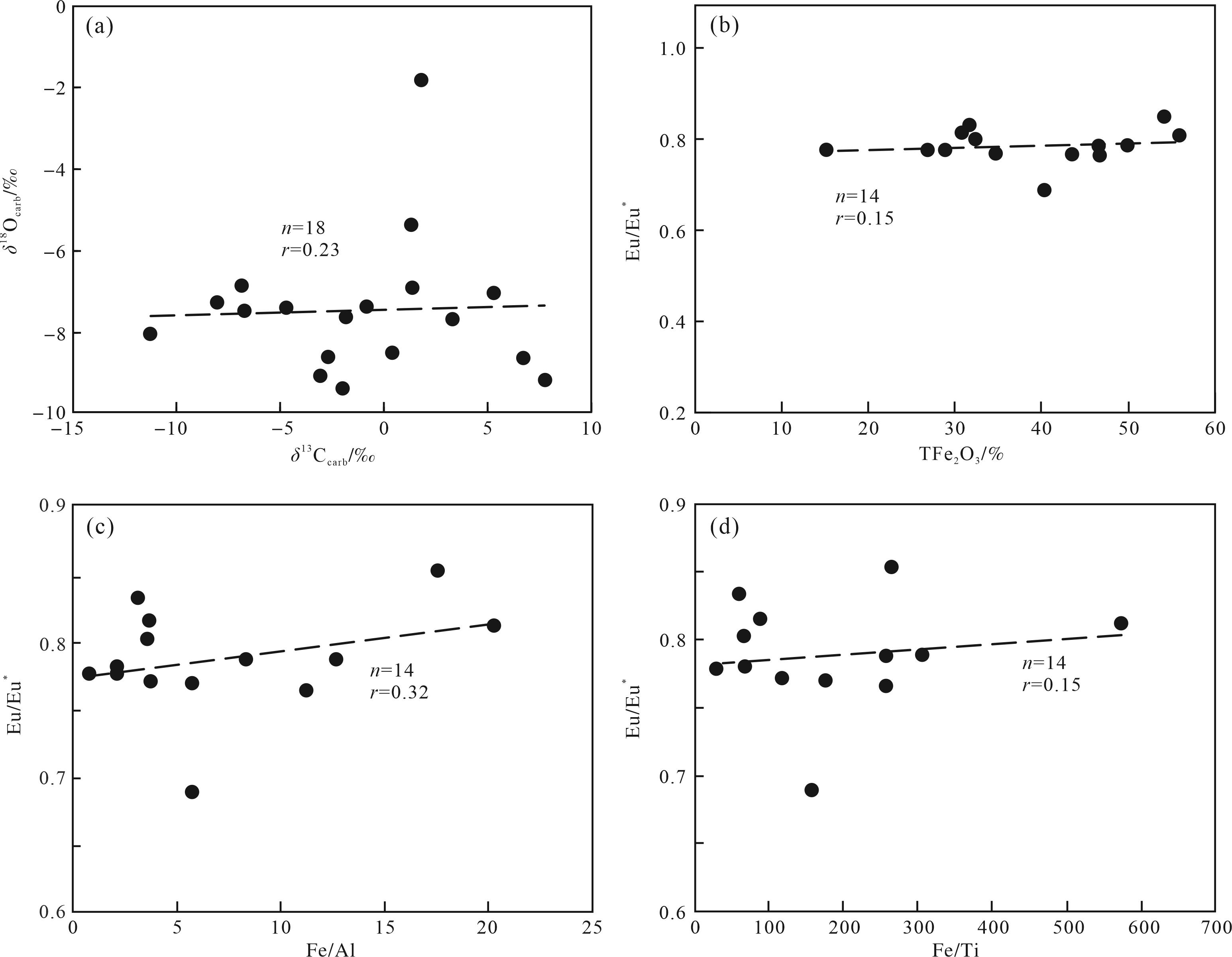
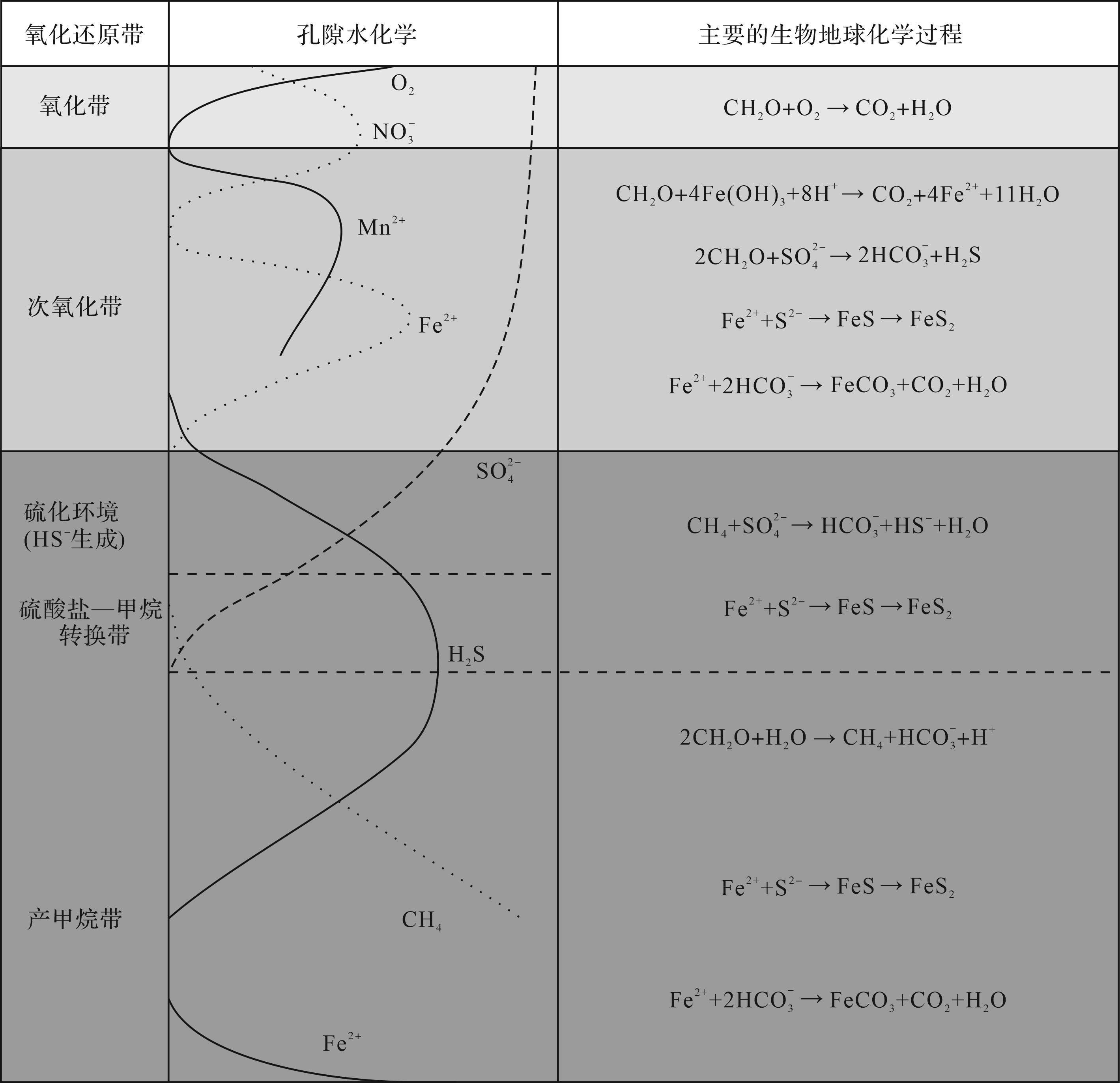
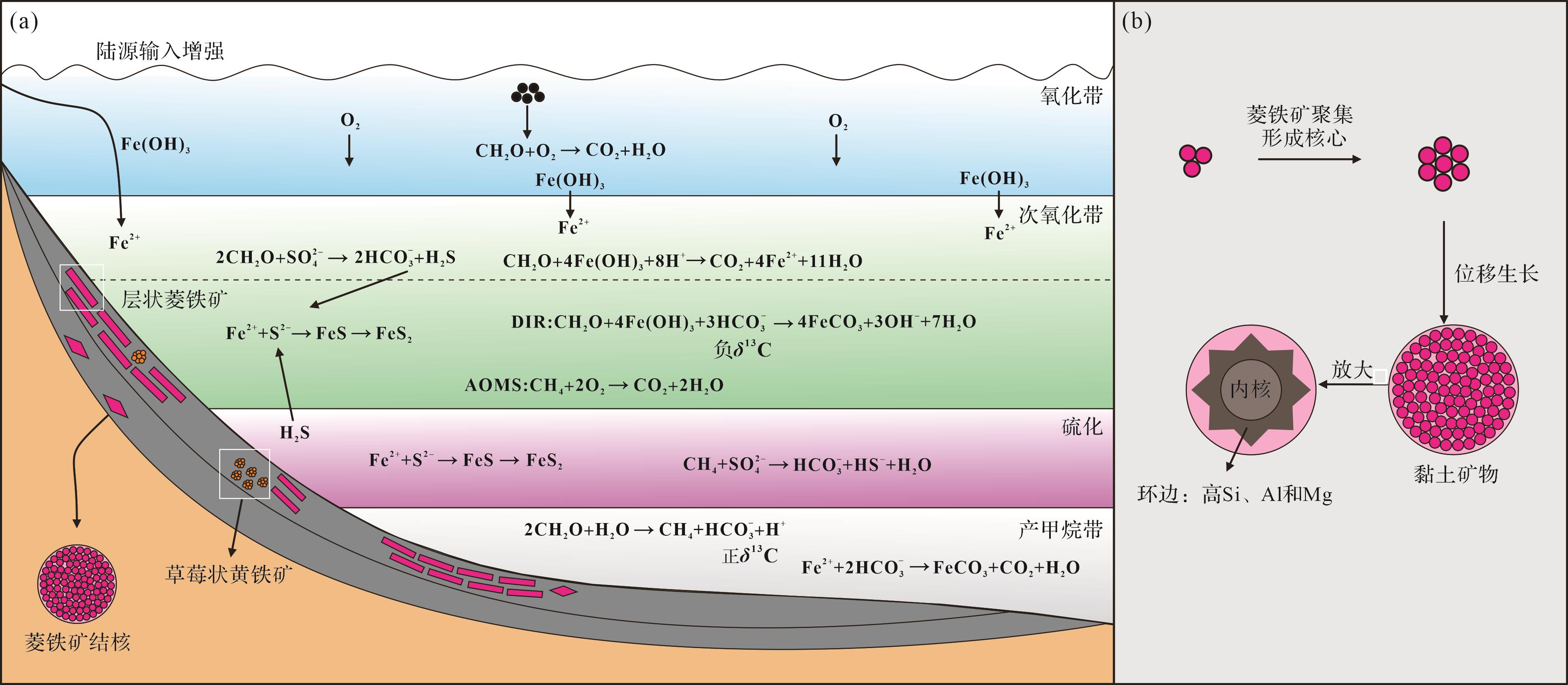
Objective The widespread siderites in the marine strata of the Toarcian Oceanic Anoxic Event (T-OAE) are believed to have resulted from a low sulfate concentration and increased terrestrial iron supply. Similar large amounts of siderite have also been reported in paleolakes in the same period. However, the mechanism of lacustrine siderite development and its connection with the T-OAE remain unexplored, but is crucial to a better comprehension of lacustrine biogeochemical cycling in the early Toarcian. Methods Mineralogical and carbon isotope geochemical analyses were performed on siderite samples from the lacustrine Anya section of the Ordos paleolake. The sources of iron and carbon, as well as the sedimentary environment, were investigated by integrating major and trace element data, which allowed exploration of the formation mechanism of siderites during the T-OAE period of climatic change. Results The coexistence of pyrites and siderites was observed by scanning electron microscopy (SEM). The value of inorganic carbon isotopes (δ13Ccarb) varies from -11.25‰ to +16.32‰, and the organic carbon isotope (δ13Corg) value ranges between -32.03‰ and +14.33‰. Light rare earth elements (REEs) are enriched and heavy REEs are depleted, with Eu anomalies ranging from 0.69 to 0.85. Conclusions The iron in the Anya siderites is derived from terrestrial inputs; the carbon included HCO3– produced by methanogenesis, as well as carbon released by organic matter decomposition and aerobic methane oxidation, either bacterially in the suboxic zone or archaeally below the oxic-anoxic interface immediately after methane production. The pore fluids during siderite formation were a suboxic to anoxic environment. During the T-OAE, intensified continental weathering and increased surface runoff transported abundant Fe2+ ions into basin lakes whose widespread anoxia, abundant organic matter and low sulfate concentrations created favorable conditions for extensive siderite deposition.
Objective The widespread siderites in the marine strata of the Toarcian Oceanic Anoxic Event (T-OAE) are believed to have resulted from a low sulfate concentration and increased terrestrial iron supply. Similar large amounts of siderite have also been reported in paleolakes in the same period. However, the mechanism of lacustrine siderite development and its connection with the T-OAE remain unexplored, but is crucial to a better comprehension of lacustrine biogeochemical cycling in the early Toarcian. Methods Mineralogical and carbon isotope geochemical analyses were performed on siderite samples from the lacustrine Anya section of the Ordos paleolake. The sources of iron and carbon, as well as the sedimentary environment, were investigated by integrating major and trace element data, which allowed exploration of the formation mechanism of siderites during the T-OAE period of climatic change. Results The coexistence of pyrites and siderites was observed by scanning electron microscopy (SEM). The value of inorganic carbon isotopes (δ13Ccarb) varies from -11.25‰ to +16.32‰, and the organic carbon isotope (δ13Corg) value ranges between -32.03‰ and +14.33‰. Light rare earth elements (REEs) are enriched and heavy REEs are depleted, with Eu anomalies ranging from 0.69 to 0.85. Conclusions The iron in the Anya siderites is derived from terrestrial inputs; the carbon included HCO3– produced by methanogenesis, as well as carbon released by organic matter decomposition and aerobic methane oxidation, either bacterially in the suboxic zone or archaeally below the oxic-anoxic interface immediately after methane production. The pore fluids during siderite formation were a suboxic to anoxic environment. During the T-OAE, intensified continental weathering and increased surface runoff transported abundant Fe2+ ions into basin lakes whose widespread anoxia, abundant organic matter and low sulfate concentrations created favorable conditions for extensive siderite deposition.
2026, 44(3): 921-944.
doi: 10.14027/j.issn.1000-0550.2024.118
Abstract:
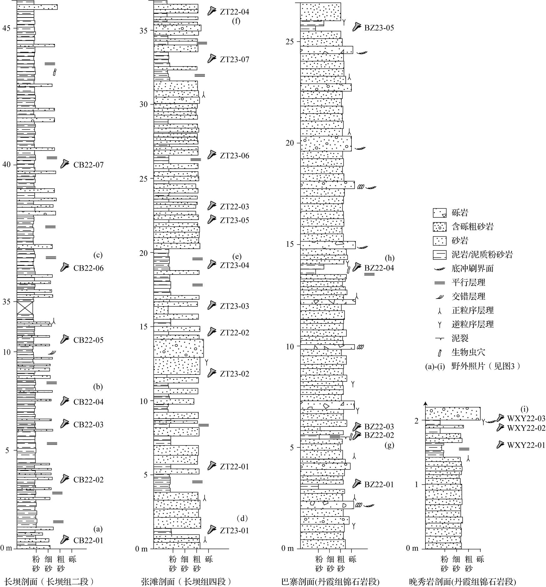
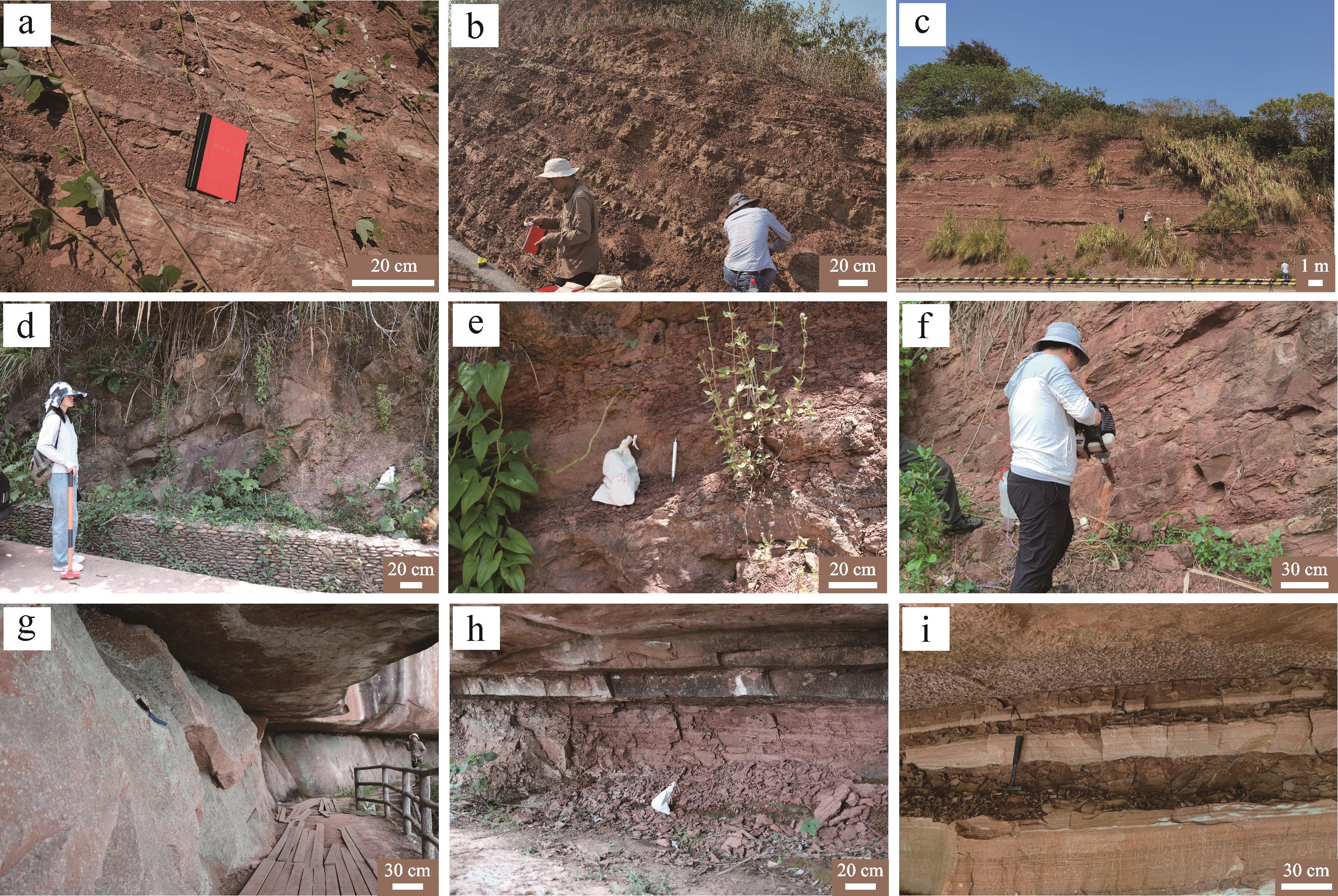
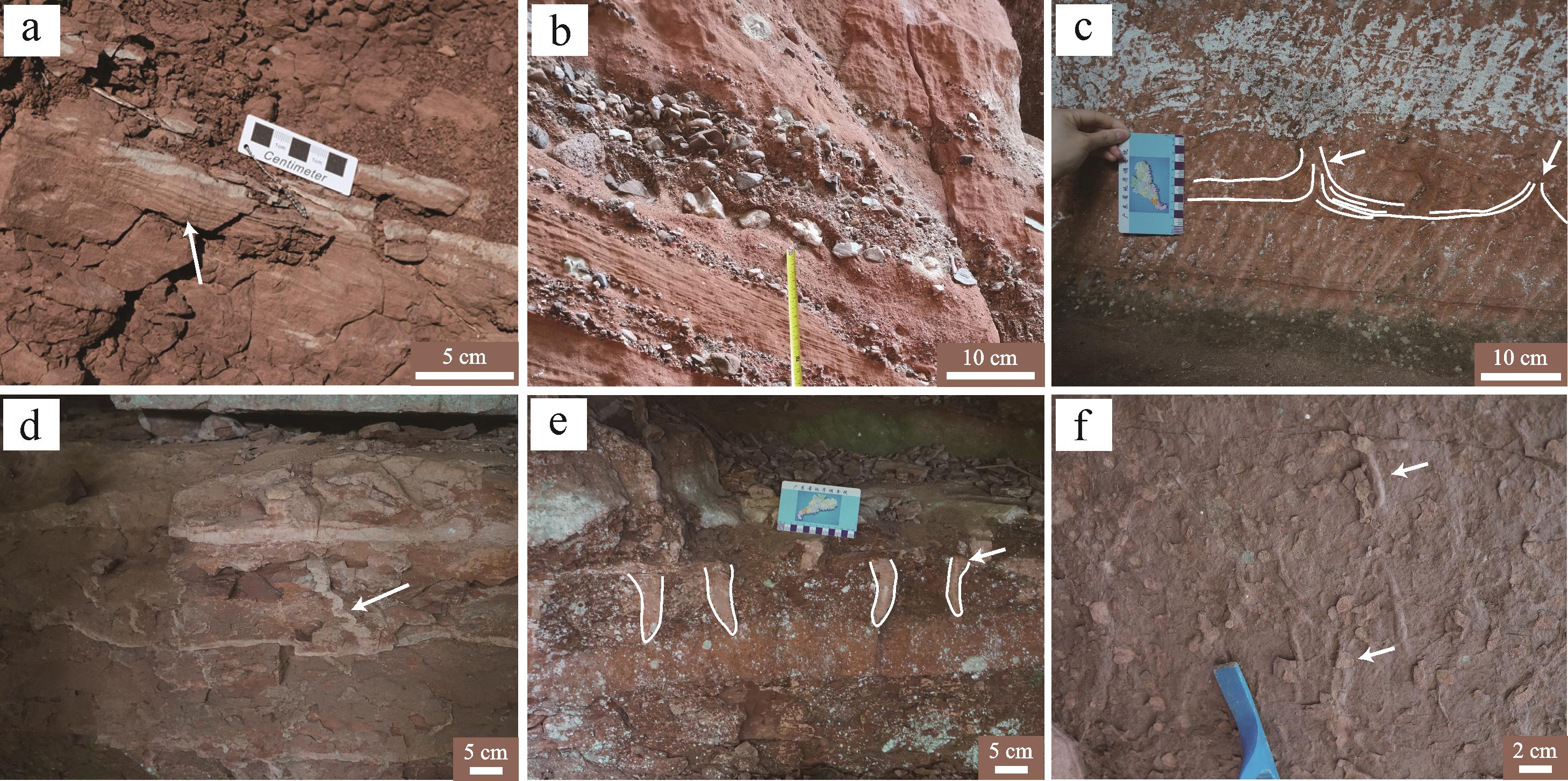
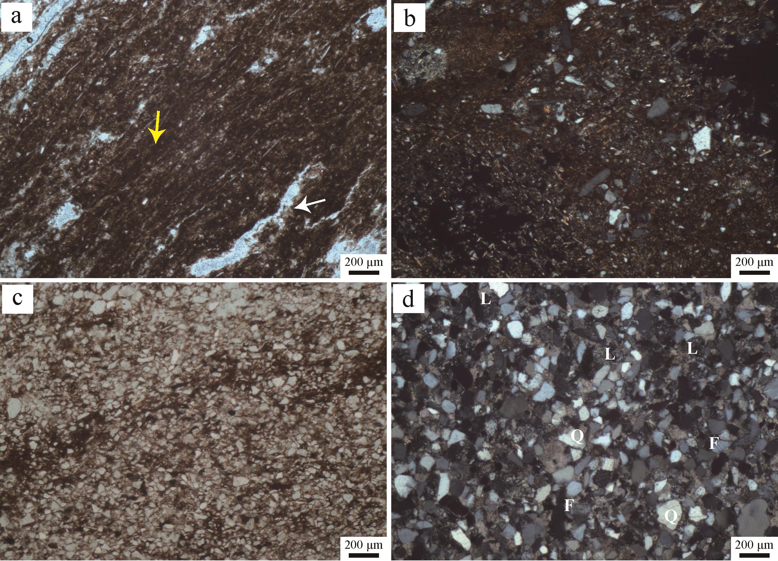
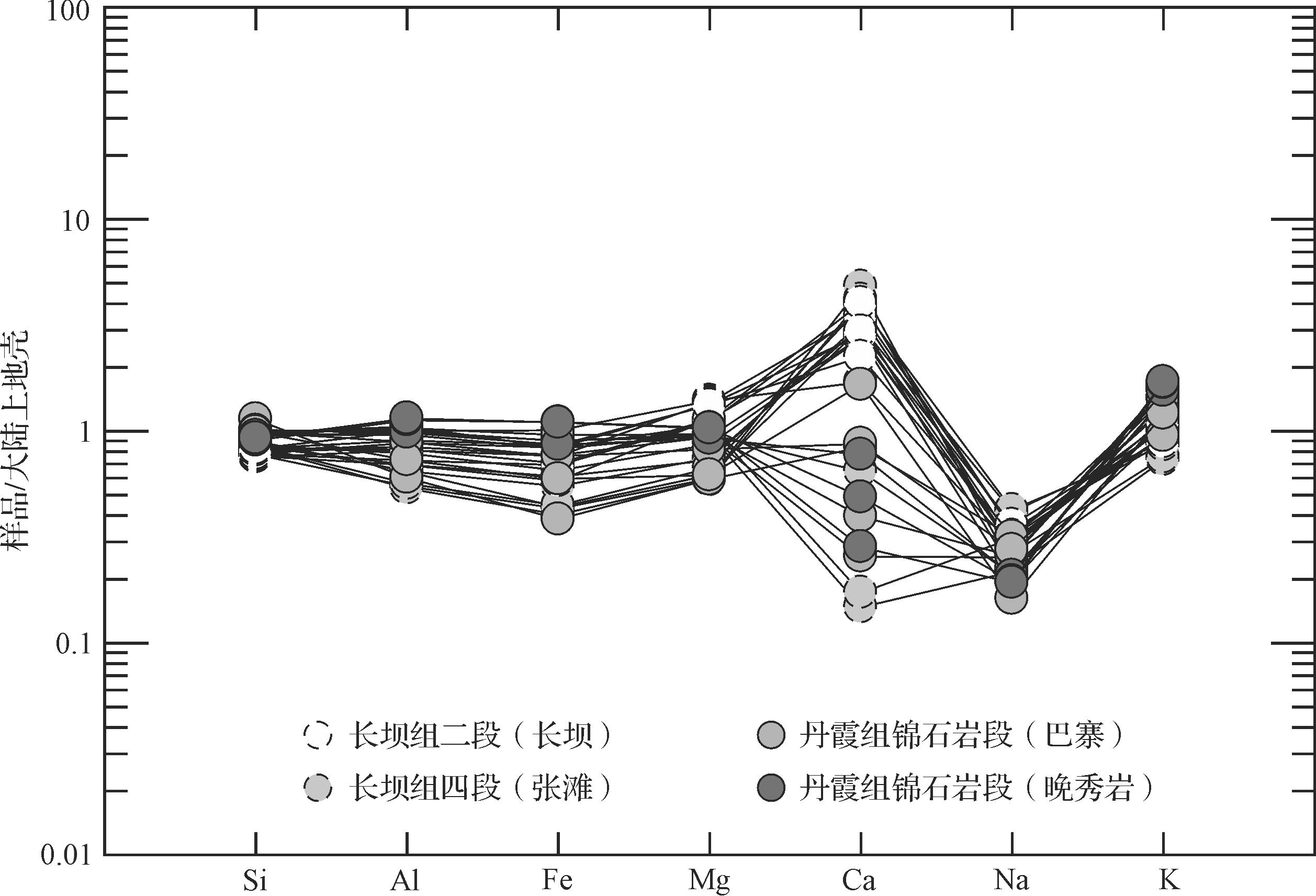
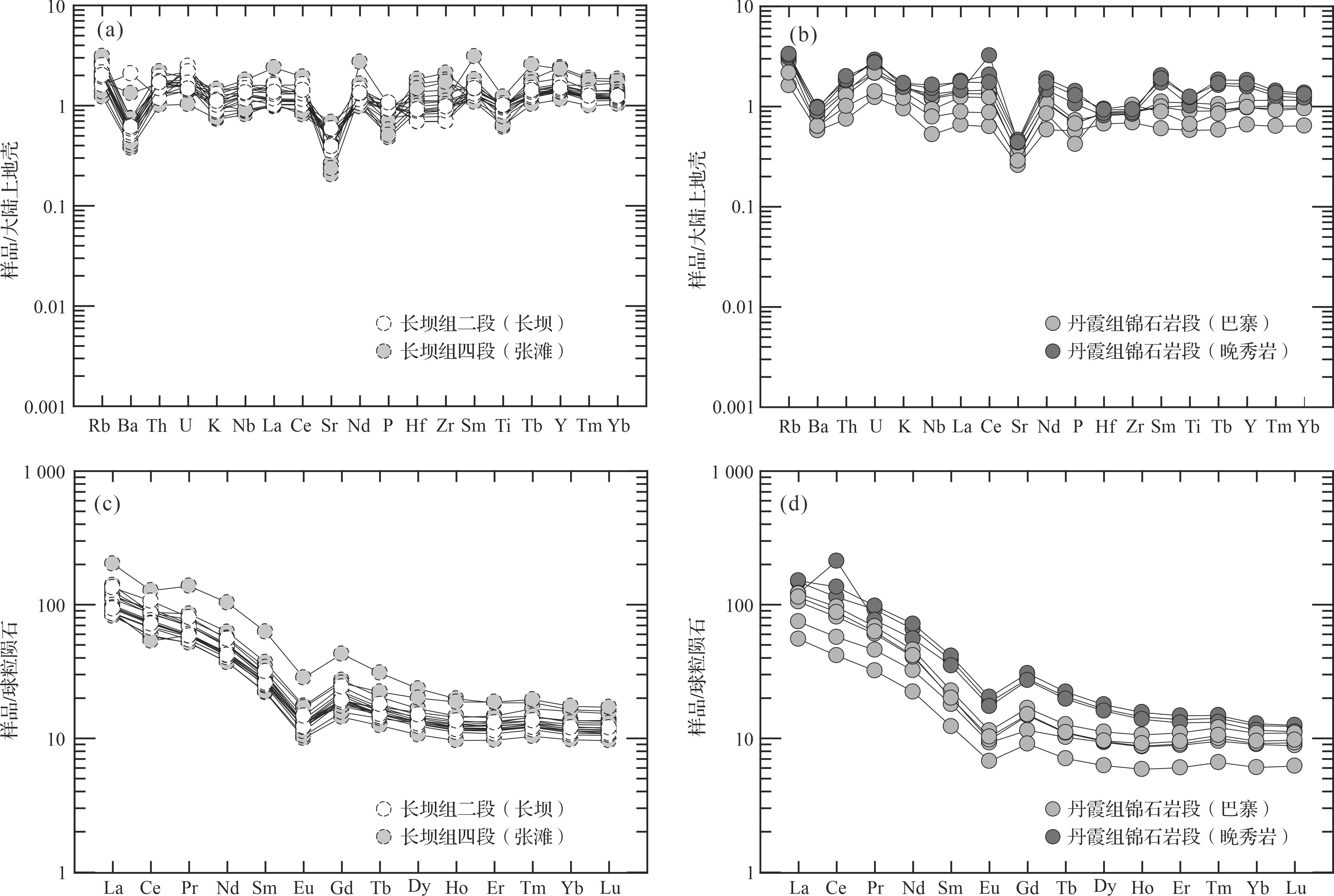
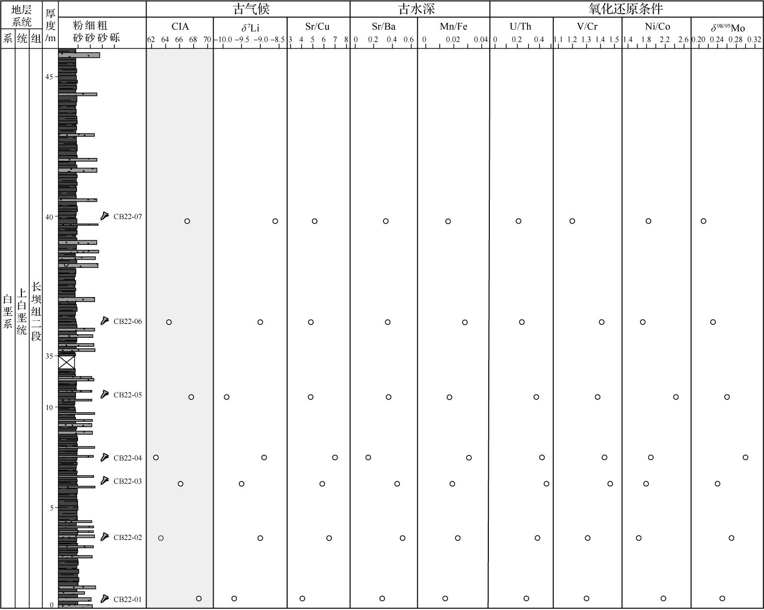
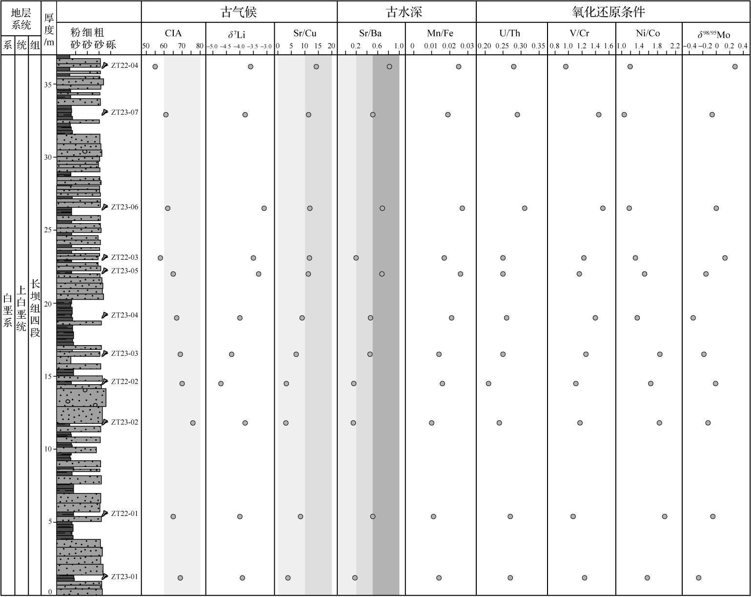
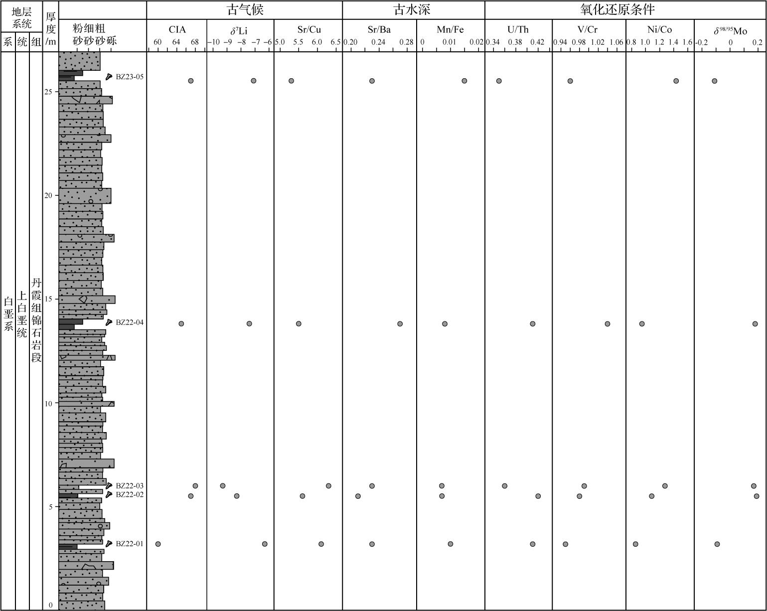
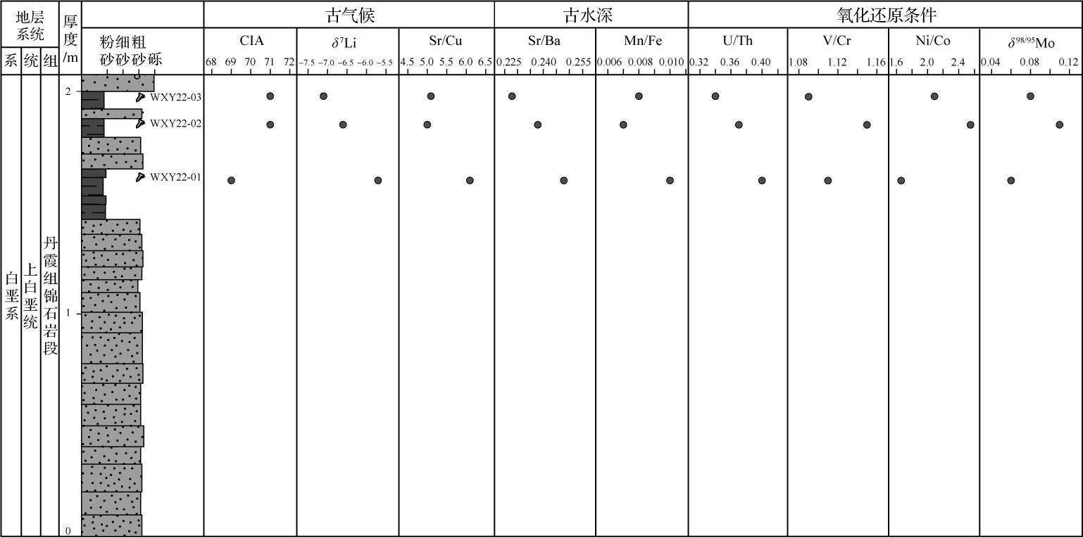
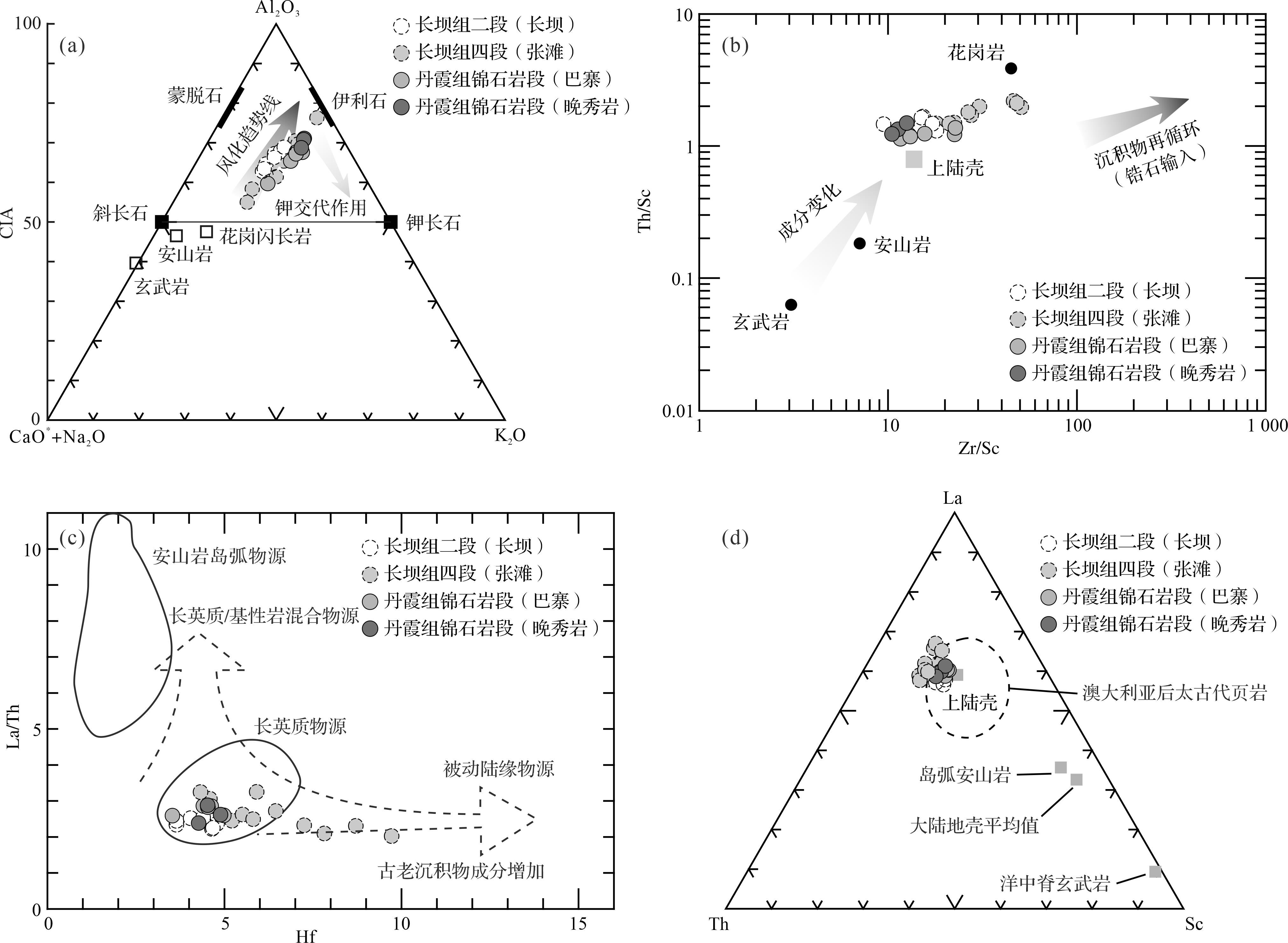
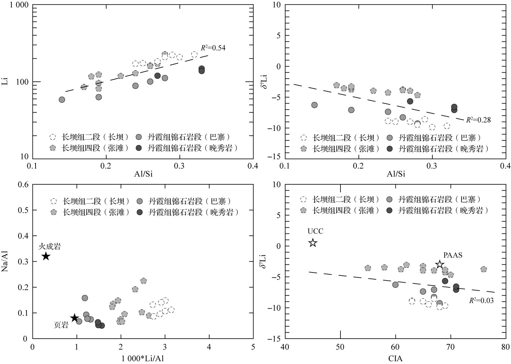
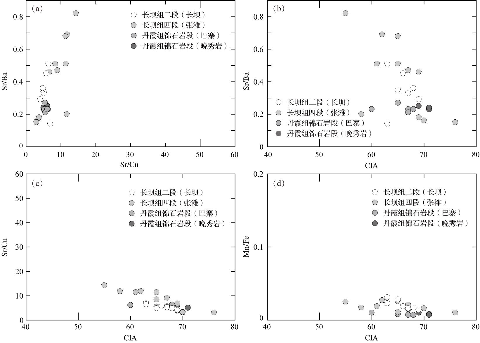
Objective The climate signals of the Danxia strata, a representative of Cretaceous continental red beds, offers key insights into red-bed sedimentation and Cretaceous geological events. Methods This study examined fine-grained clastic rocks in the Upper Cretaceous Danxia Basin, specifically the Second member and Fourth member of the Changba Formation and the Jinshiyan member of the Danxia Formation. Sedimentology, elemental and isotopic geochemistry were used to investigate the sedimentary environment and paleoclimate significance during key Upper Cretaceous stages (Cenomanian, Turonian, Campanian). Results It was found that the fine-grained clastic rocks of these formations were deposited during a warm and humid climate phase, with suboxic to oxic water conditions. The water bodies were predominantly brackish, while localized high-salinity brackish and low-oxygen environments (e.g., the Fourth member of the Changba Formation) were associated with lake shrinkage and climatic aridification. Water depth variations exhibit trends of initial contraction followed by expansion, gradual contraction, then initial expansion followed by contraction, which align with the changes in sedimentary facies and environment. Conclusions The Upper Cretaceous terrestrial sedimentary records of the Danxia Basin illustrate the climatic evolution of intermontane basins, shaped by global climate patterns of the Upper Cretaceous, as well as by significant influences from local topographic and geomorphic features.
Objective The climate signals of the Danxia strata, a representative of Cretaceous continental red beds, offers key insights into red-bed sedimentation and Cretaceous geological events. Methods This study examined fine-grained clastic rocks in the Upper Cretaceous Danxia Basin, specifically the Second member and Fourth member of the Changba Formation and the Jinshiyan member of the Danxia Formation. Sedimentology, elemental and isotopic geochemistry were used to investigate the sedimentary environment and paleoclimate significance during key Upper Cretaceous stages (Cenomanian, Turonian, Campanian). Results It was found that the fine-grained clastic rocks of these formations were deposited during a warm and humid climate phase, with suboxic to oxic water conditions. The water bodies were predominantly brackish, while localized high-salinity brackish and low-oxygen environments (e.g., the Fourth member of the Changba Formation) were associated with lake shrinkage and climatic aridification. Water depth variations exhibit trends of initial contraction followed by expansion, gradual contraction, then initial expansion followed by contraction, which align with the changes in sedimentary facies and environment. Conclusions The Upper Cretaceous terrestrial sedimentary records of the Danxia Basin illustrate the climatic evolution of intermontane basins, shaped by global climate patterns of the Upper Cretaceous, as well as by significant influences from local topographic and geomorphic features.
2026, 44(3): 945-960.
doi: 10.14027/j.issn.1000-0550.2024.097
Abstract:
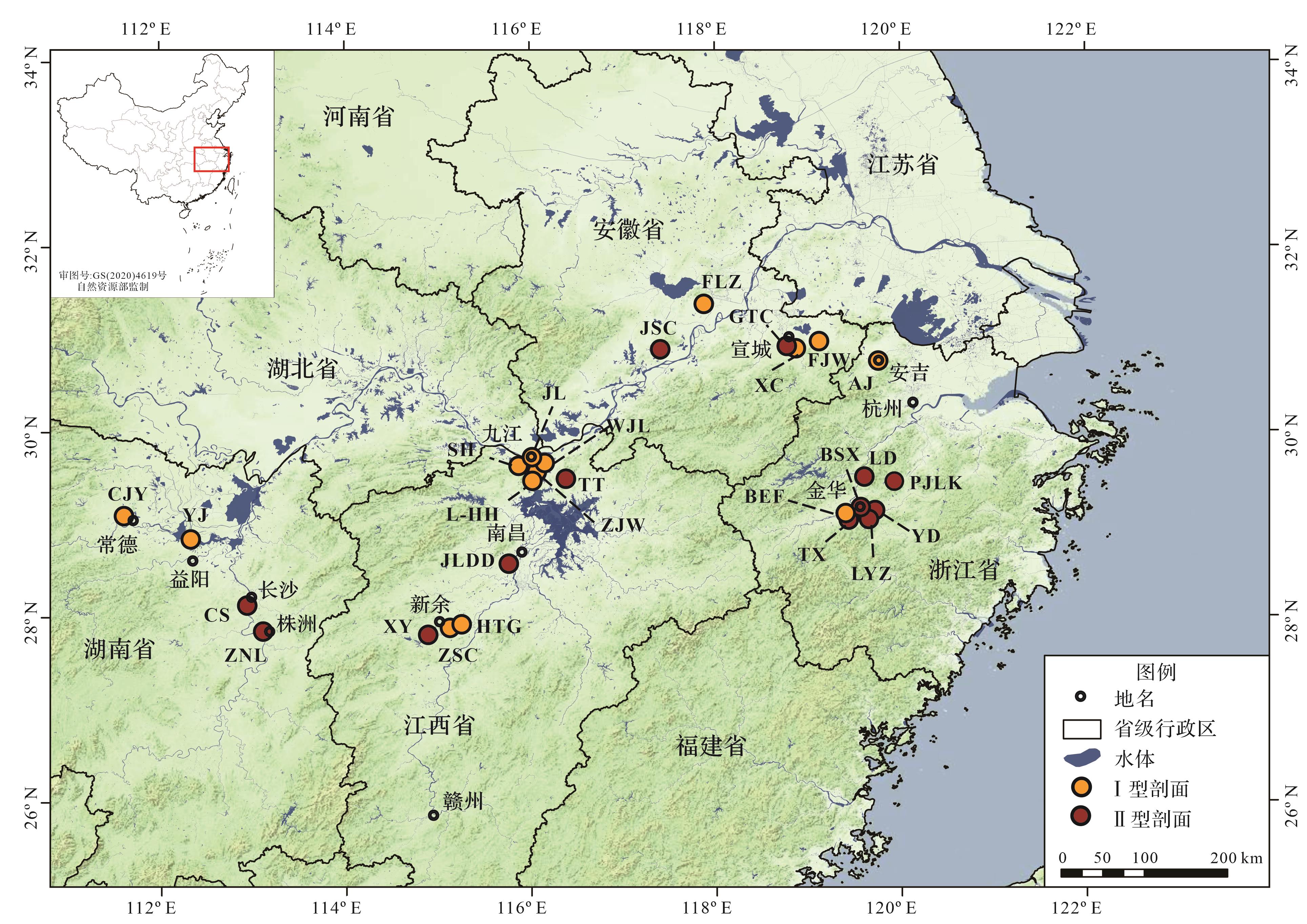
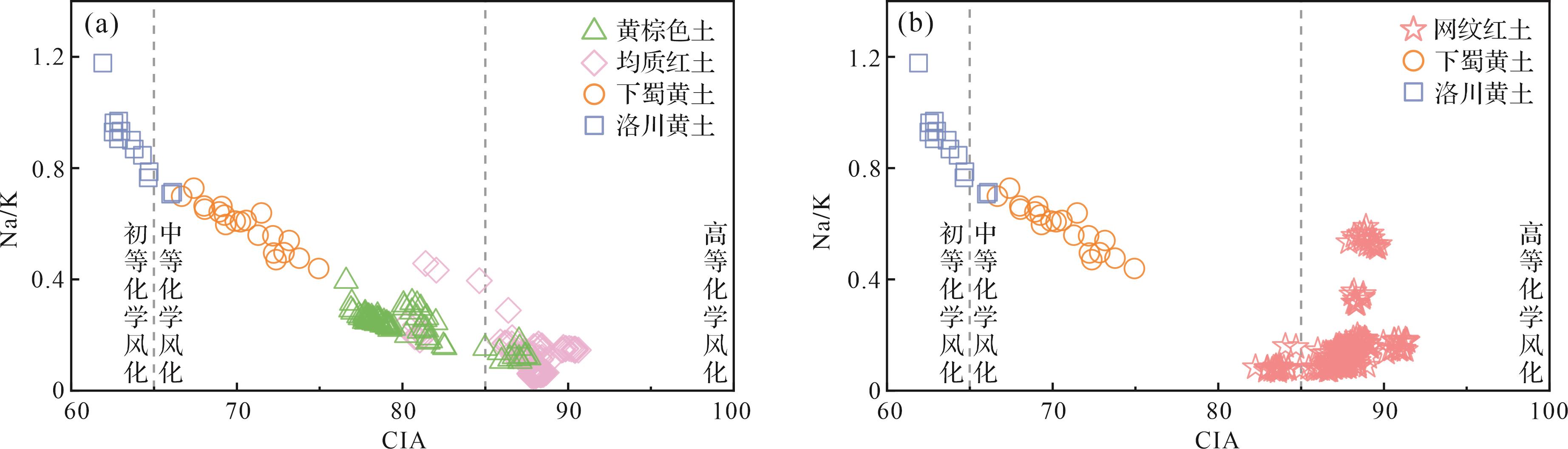
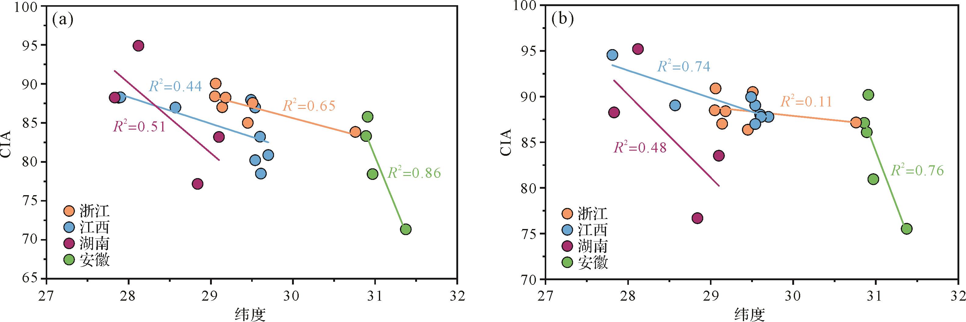
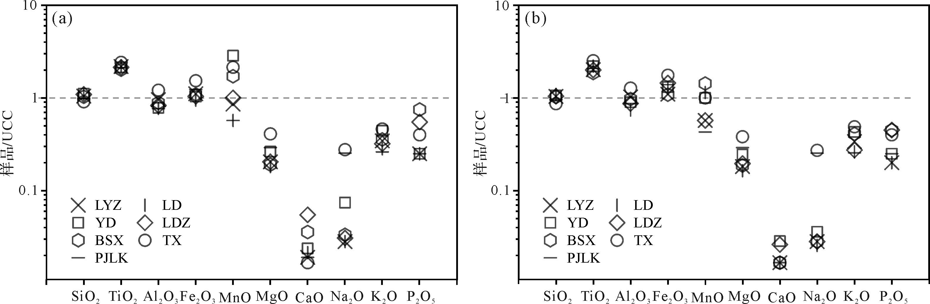
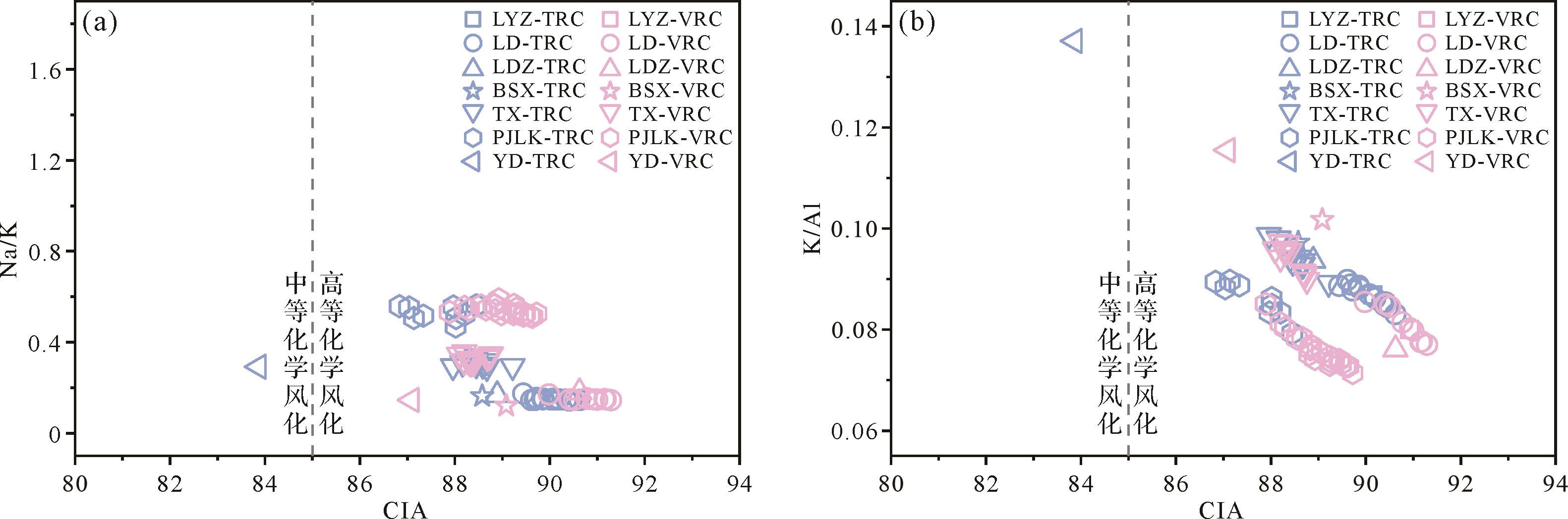
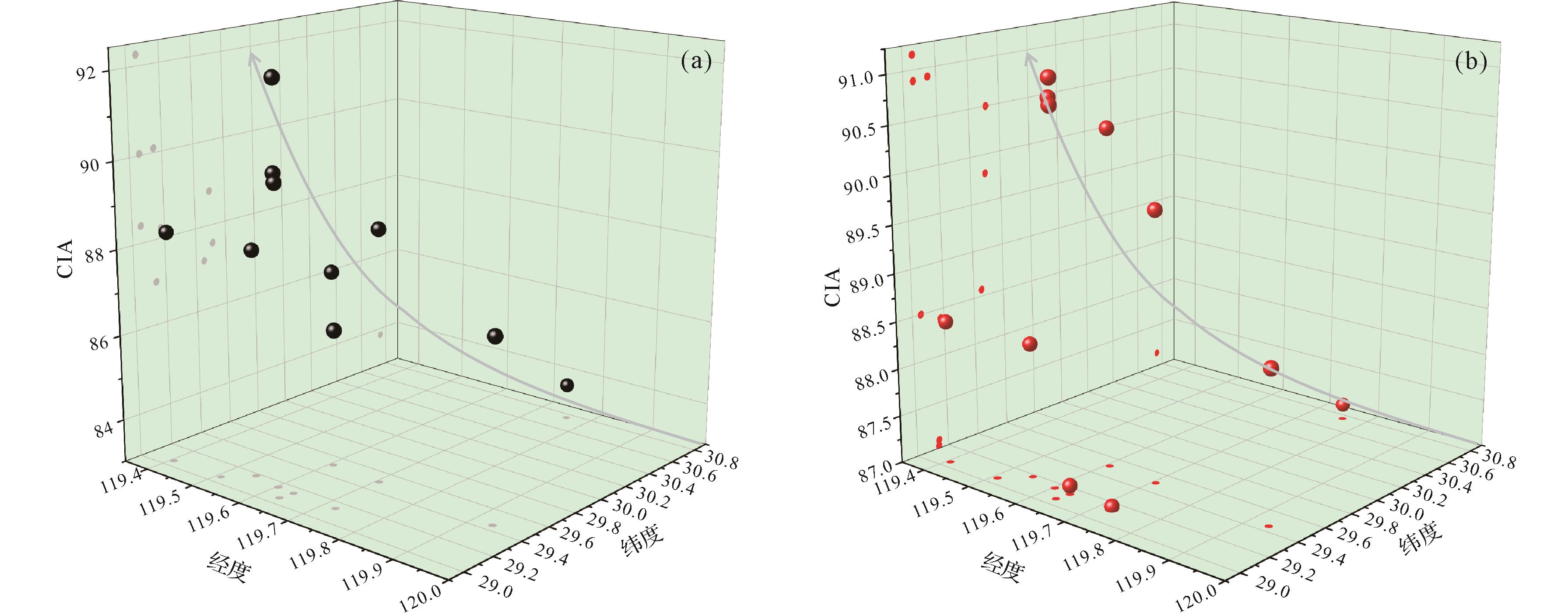
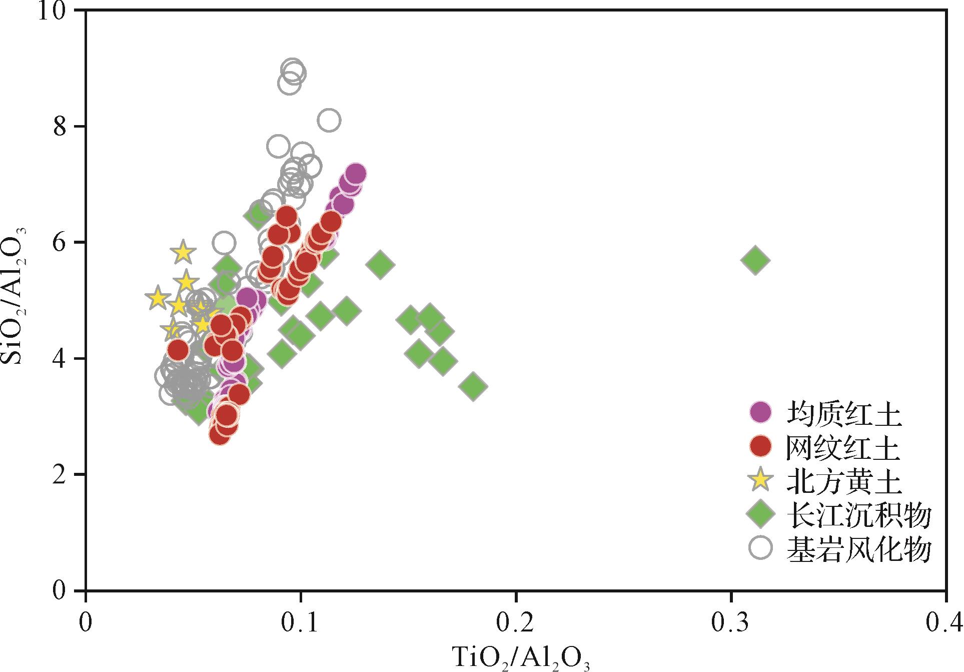
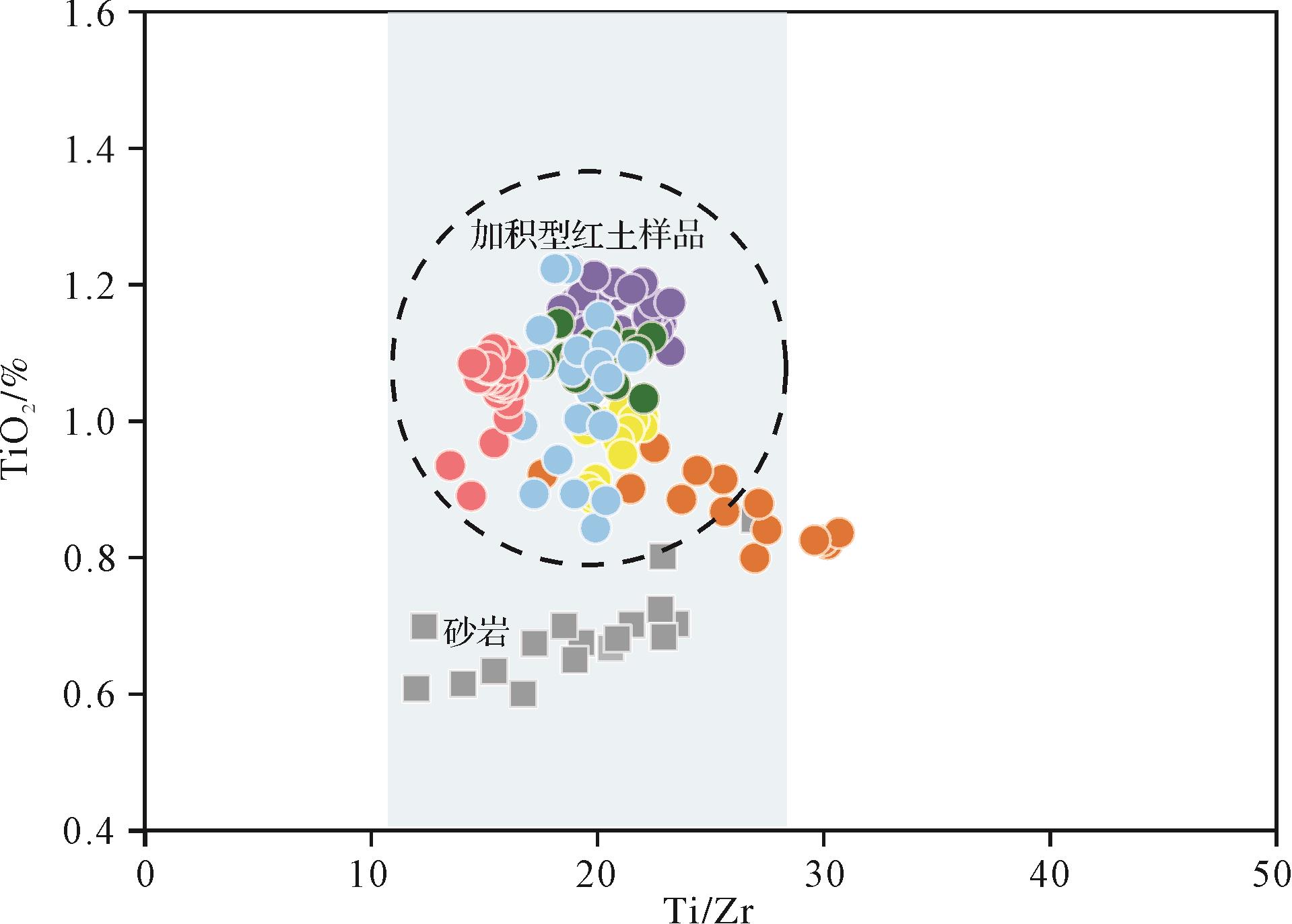
Objective Research on the weathering process of the aggradation red earth in subtropical China has long been crucial for understanding the evolution of the Quaternary environment. However, a comprehensive know-ledge of the weathering environment of the aggradation red earth is hampered by the infrequent reporting of research on the weathering characteristics of the aggradation red earth at the spatial scale. Methods Based on a systematic analysis of the weathering characteristics of the aggradational red earth sections in southern China, this study focused on the Jinqu Basin, where non-zonal factors have a significant impact. The research primarily explored the chemical weathering characteristics and formation mechanisms of red earth within the basin, to deepen our understanding of the weathering features of aggradational red earth. Results (1) On a large scale, the weathering intensity of aggradational red earth in southern China is strongly correlated with hydrothermal conditions, with weathering intensifying as latitude decreases. However, the chemical weathering of red earth in certain locations or specific sections does not entirely conform to the latitudinal zonality in the mid-subtropical region between 25° N and 31° N, where aggradational red earth is widely spread. (2) The geochemical composition of aggradational red earth in the Jinqu Basin exhibits good consistency, with minimal differences in element enrichment or depletion among samples. However, there is regional variability in the degree of chemical weathering in the developmental stages of vermicular and typical red earth following the stagnation of vermicularization in the Jinqu Basin, compared with the chemical weathering characteristics of other aggradational red earth sections at the same latitude. (3) Influenced by a combination of factors such as provenance, topography, and local climate, the weathering characteristics of the aggradational red earth in the Jinqu Basin exhibit certain non-latitudinal zonal features. Conclusions The weathering characteristics of the aggradational red earth in southern China primarily follow a latitudinal zonal pattern under the large-scale monsoon evolution pattern. However, owing to the influence of non-zonal factors including topography, water, and differences in the geographic features of potential provenance, the chemical weathering of aggradational red earth also exhibits certain non-zonal characteristics within the mid-subtropical region between 25° N and 31° N. The relatively small and enclosed basin terrain of the Jinqu Basin, along with local microclimate conditions and contribution of bedrock weathering products to the red earth provenance, plays a significant role in interpreting the chemical weathering information of the red earth. Therefore, it is crucial to consider regional impacts while discussing the chemical weathering characteristics in different areas.
Objective Research on the weathering process of the aggradation red earth in subtropical China has long been crucial for understanding the evolution of the Quaternary environment. However, a comprehensive know-ledge of the weathering environment of the aggradation red earth is hampered by the infrequent reporting of research on the weathering characteristics of the aggradation red earth at the spatial scale. Methods Based on a systematic analysis of the weathering characteristics of the aggradational red earth sections in southern China, this study focused on the Jinqu Basin, where non-zonal factors have a significant impact. The research primarily explored the chemical weathering characteristics and formation mechanisms of red earth within the basin, to deepen our understanding of the weathering features of aggradational red earth. Results (1) On a large scale, the weathering intensity of aggradational red earth in southern China is strongly correlated with hydrothermal conditions, with weathering intensifying as latitude decreases. However, the chemical weathering of red earth in certain locations or specific sections does not entirely conform to the latitudinal zonality in the mid-subtropical region between 25° N and 31° N, where aggradational red earth is widely spread. (2) The geochemical composition of aggradational red earth in the Jinqu Basin exhibits good consistency, with minimal differences in element enrichment or depletion among samples. However, there is regional variability in the degree of chemical weathering in the developmental stages of vermicular and typical red earth following the stagnation of vermicularization in the Jinqu Basin, compared with the chemical weathering characteristics of other aggradational red earth sections at the same latitude. (3) Influenced by a combination of factors such as provenance, topography, and local climate, the weathering characteristics of the aggradational red earth in the Jinqu Basin exhibit certain non-latitudinal zonal features. Conclusions The weathering characteristics of the aggradational red earth in southern China primarily follow a latitudinal zonal pattern under the large-scale monsoon evolution pattern. However, owing to the influence of non-zonal factors including topography, water, and differences in the geographic features of potential provenance, the chemical weathering of aggradational red earth also exhibits certain non-zonal characteristics within the mid-subtropical region between 25° N and 31° N. The relatively small and enclosed basin terrain of the Jinqu Basin, along with local microclimate conditions and contribution of bedrock weathering products to the red earth provenance, plays a significant role in interpreting the chemical weathering information of the red earth. Therefore, it is crucial to consider regional impacts while discussing the chemical weathering characteristics in different areas.
2026, 44(3): 961-976.
doi: 10.14027/j.issn.1000-0550.2024.129
Abstract:
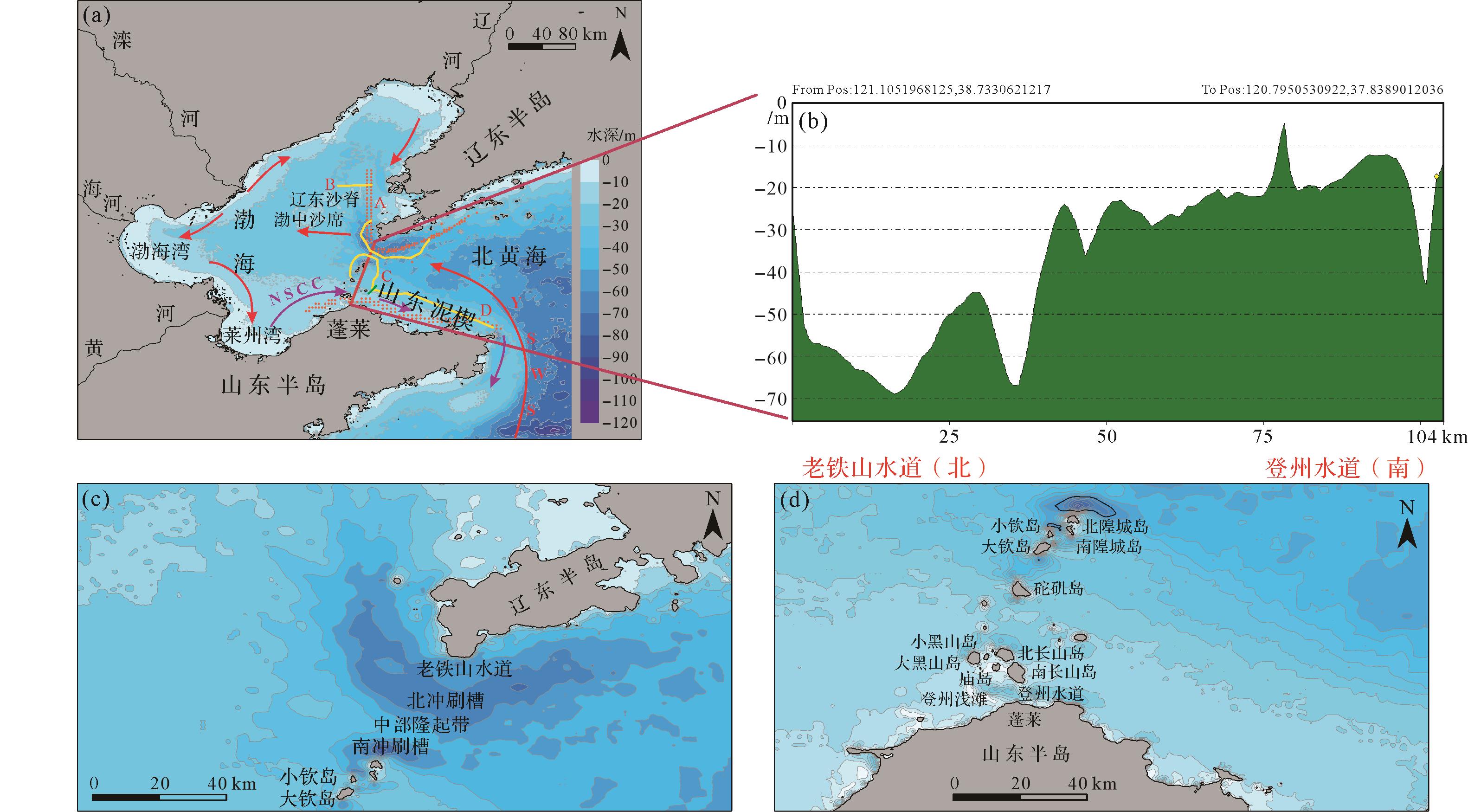
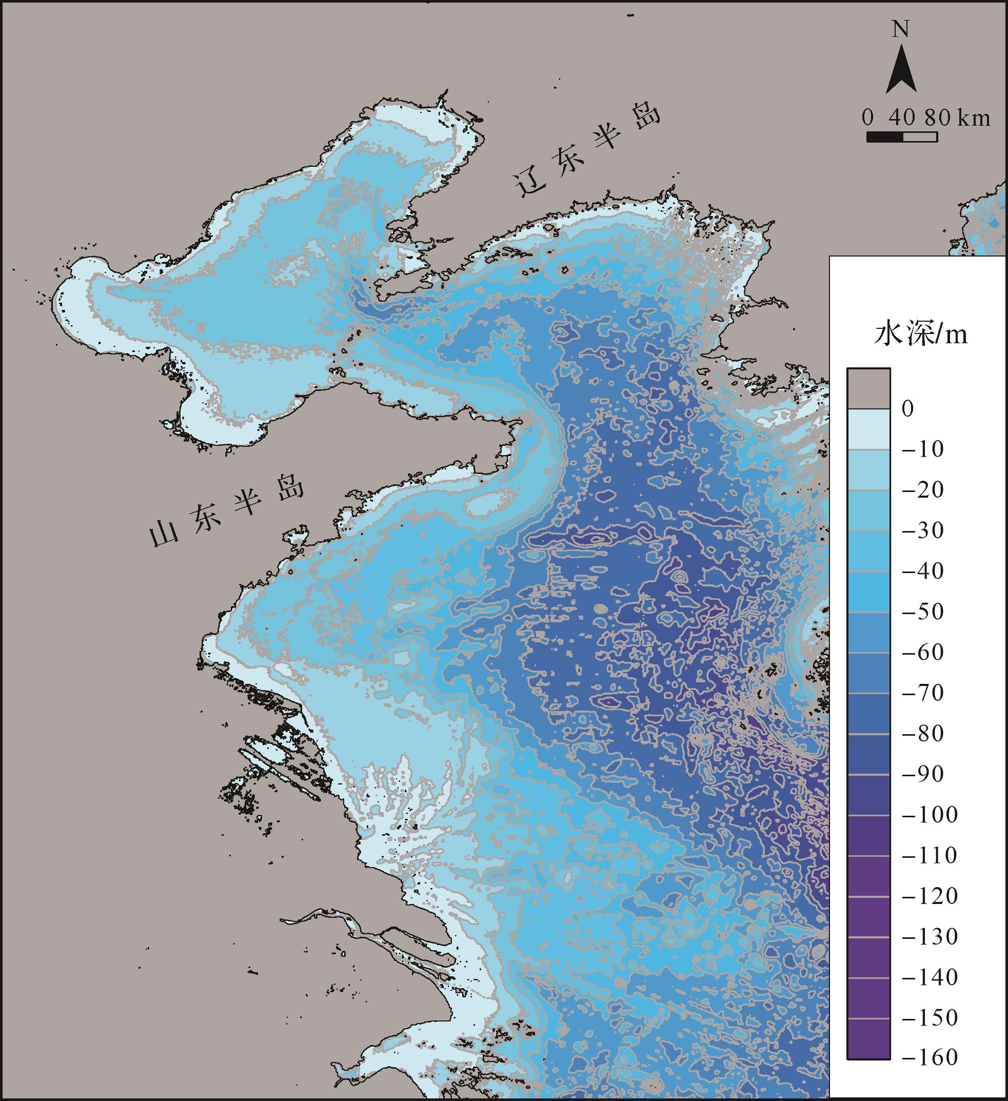
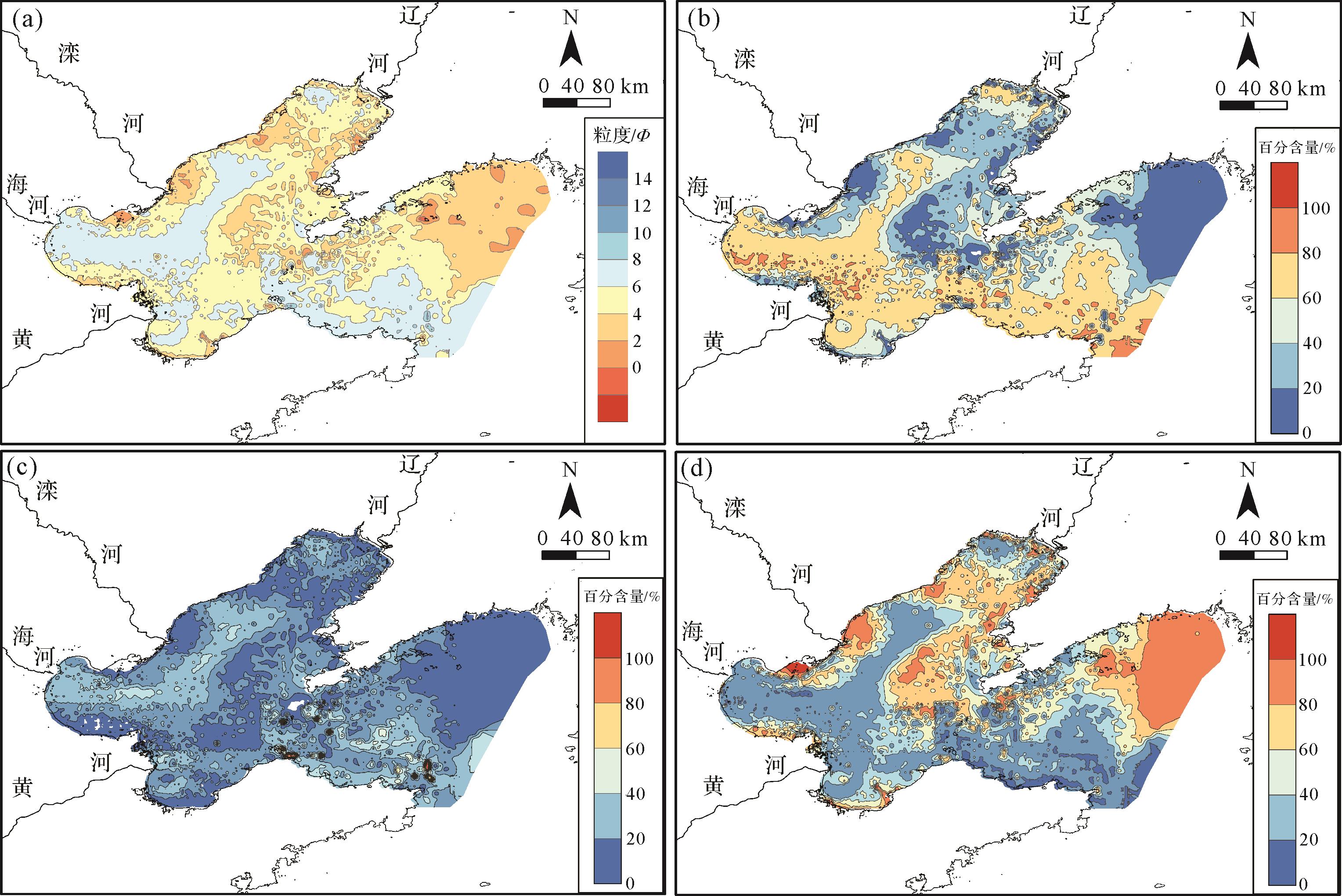
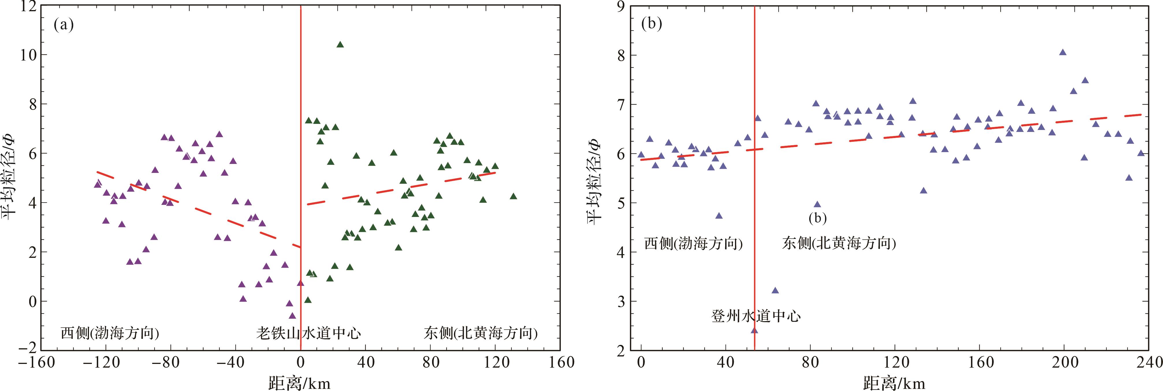
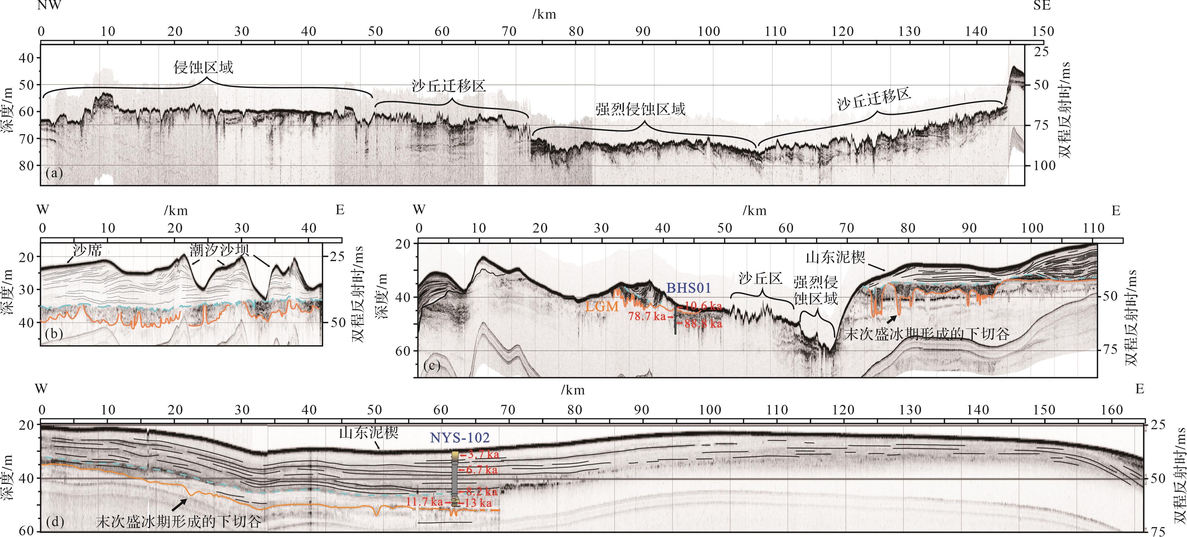
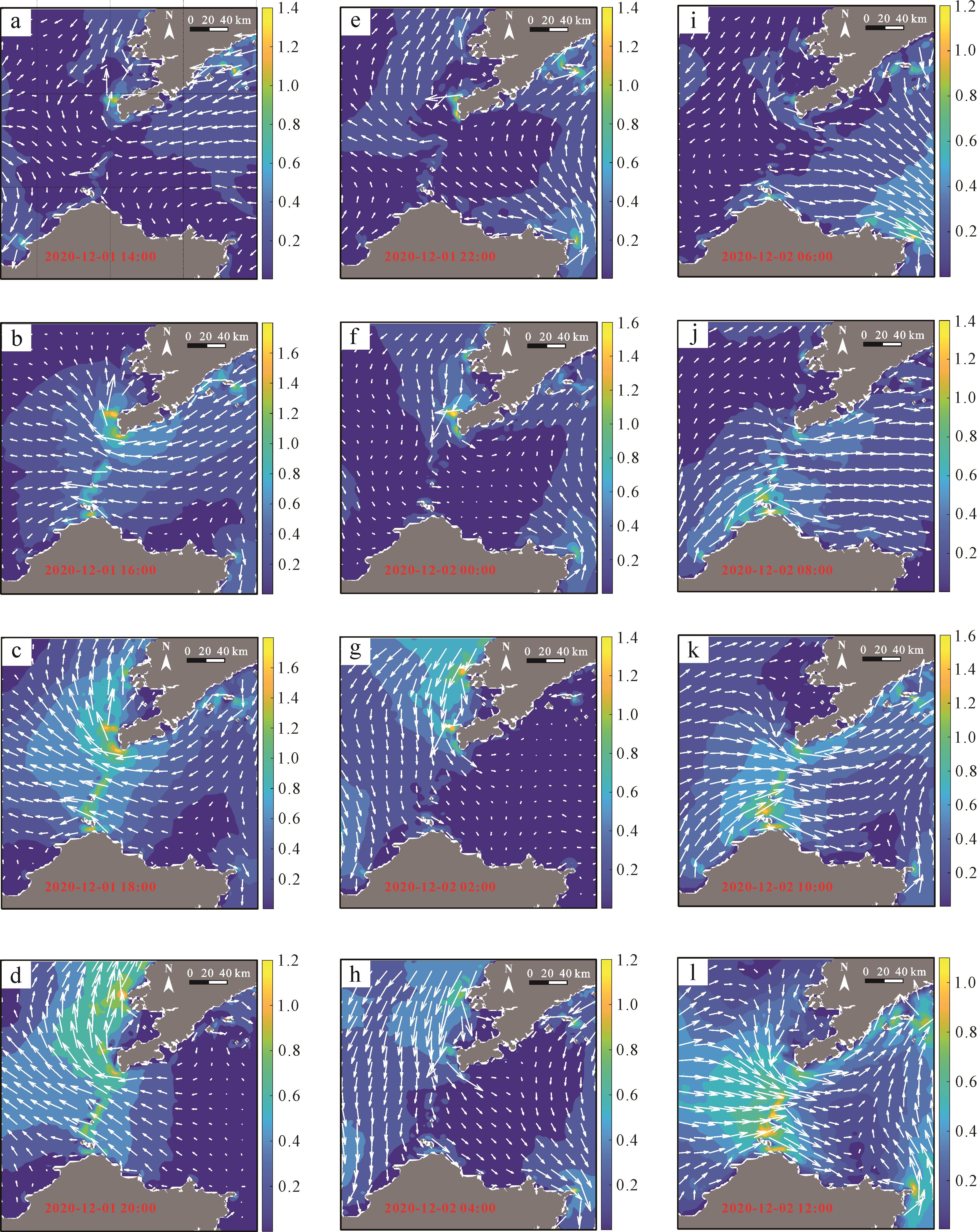
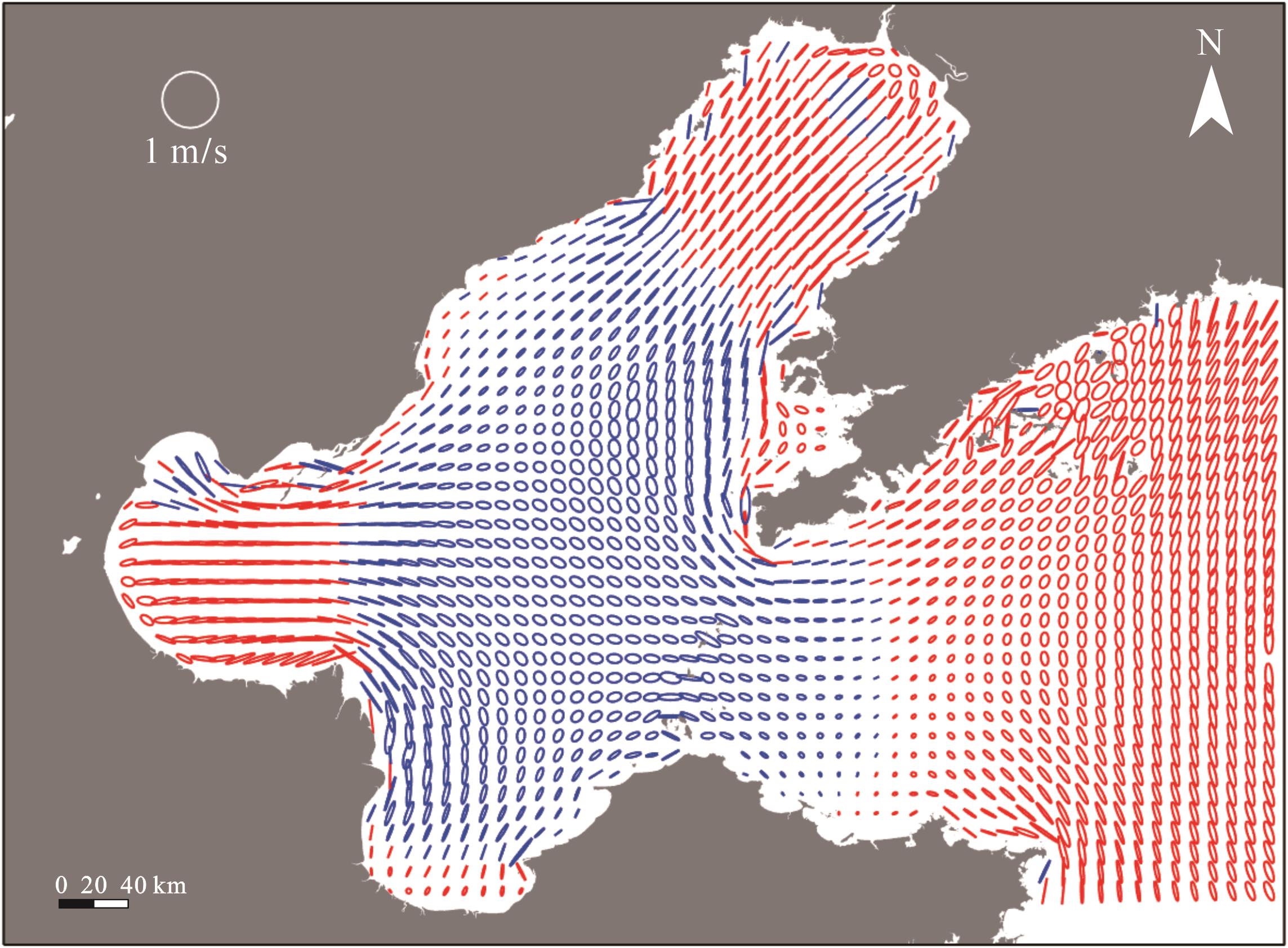
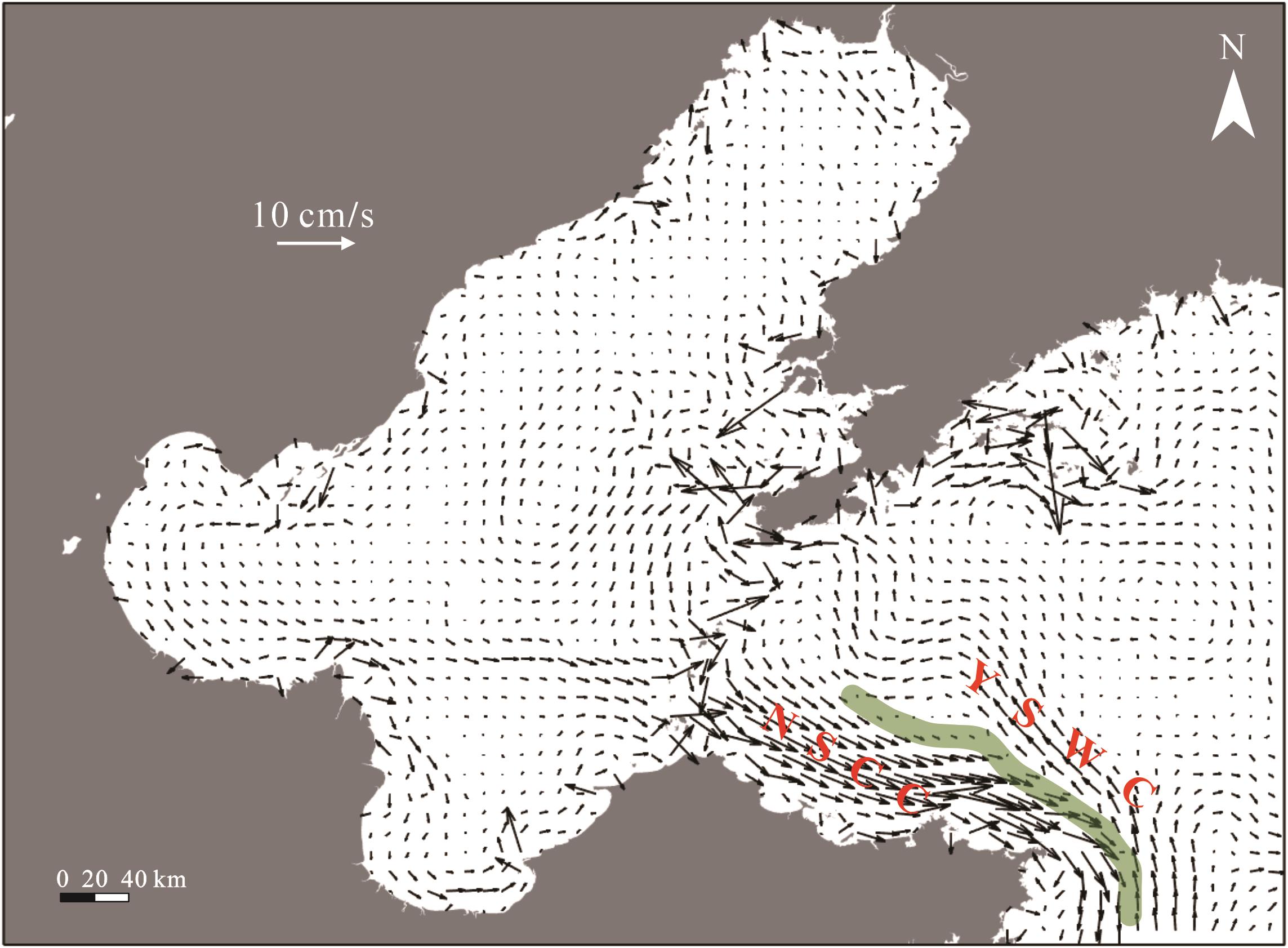
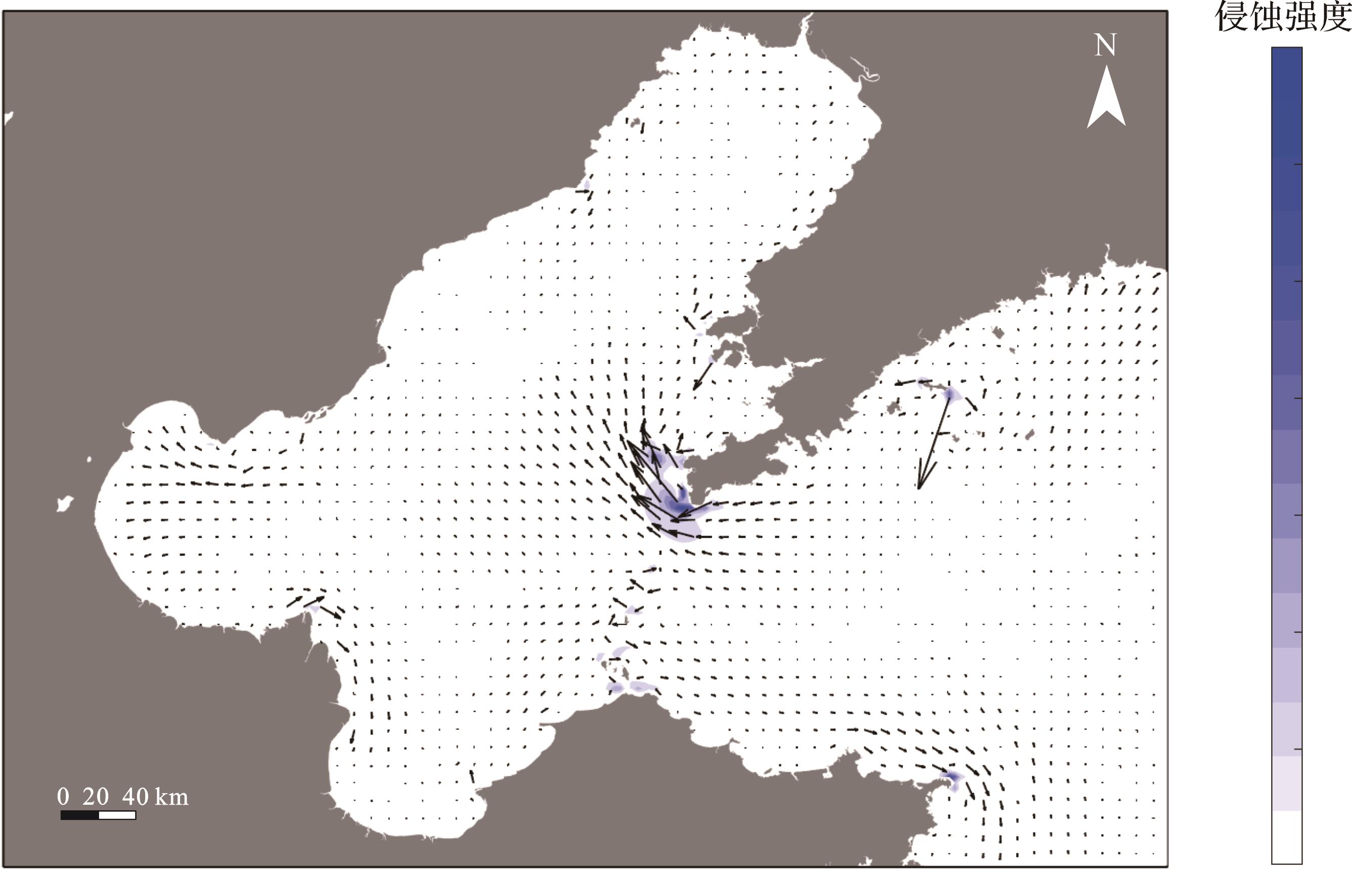
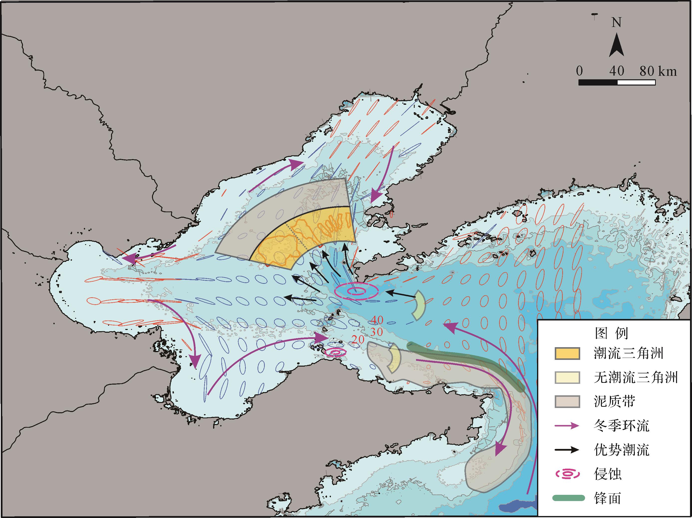
Objective The formation of sedimentary systems within straits is intricately linked to the unique topographical constraints that influence both facies characteristics and sediment distribution patterns. Although current research mainly focuses on narrow straits (less than 50 km wide) , where sedimentation is dominated by tidal processes, wider straits introduce more complex hydrodynamic dynamics, leaving many aspects of the sedimentation processes yet to be fully understood. Methods This study focuses on the Bohai Strait (a shallow strait with a width of 106 km) and is based on an extensive dataset of surface sediment grain sizes, combined with four shallow seismic profiles, to characterize the sedimentary environment within the Bohai Strait. Additionally, a regional ocean modeling system (ROMS) simulation was employed for winter (December 2020⁃February 2021) to better understand the hydrodynamic processes influencing sediment dynamics and control over sediment distribution within and surrounding the Bohai Strait. Results Our results reveal significant differences in sediment dynamics between the northern and southern parts of the strait. The northern region exhibits a high-energy environment dominated by erosion, whereas the southern region displays a lower-energy environment conducive to deposition. Surface sediment types vary spatially, with coarser grains predominating in the north and narrow regions, with finer grains observed on both sides (east⁃west) and in the south. A large-scale, sandy flood-tidal delta appears around the Laotieshan Channel in the north. The asymmetric tidal currents flowing in and out of the channel are likely responsible for this feature, and ebb-tidal delta is not prominent. In contrast, the southern part of the strait exhibits two distinct sedimentary systems:(1) Shandong mud wedge: This system lies along the coast of the Shandong Peninsula, shaped by the substantial sediment supply from the Yellow River and the influence of coastal currents. (2) Scour troughs and sandy tidal deltas: These smaller features are attributed to the protective effect of islands present in the southern strait, combined with the abundant supply of fine-grained sediments. Conclusions This study highlights the critical role of the complex topography of the strait in the confinement in shaping regional sediment transport dynamics and the resulting distribution of sedimentary systems.
Objective The formation of sedimentary systems within straits is intricately linked to the unique topographical constraints that influence both facies characteristics and sediment distribution patterns. Although current research mainly focuses on narrow straits (less than 50 km wide) , where sedimentation is dominated by tidal processes, wider straits introduce more complex hydrodynamic dynamics, leaving many aspects of the sedimentation processes yet to be fully understood. Methods This study focuses on the Bohai Strait (a shallow strait with a width of 106 km) and is based on an extensive dataset of surface sediment grain sizes, combined with four shallow seismic profiles, to characterize the sedimentary environment within the Bohai Strait. Additionally, a regional ocean modeling system (ROMS) simulation was employed for winter (December 2020⁃February 2021) to better understand the hydrodynamic processes influencing sediment dynamics and control over sediment distribution within and surrounding the Bohai Strait. Results Our results reveal significant differences in sediment dynamics between the northern and southern parts of the strait. The northern region exhibits a high-energy environment dominated by erosion, whereas the southern region displays a lower-energy environment conducive to deposition. Surface sediment types vary spatially, with coarser grains predominating in the north and narrow regions, with finer grains observed on both sides (east⁃west) and in the south. A large-scale, sandy flood-tidal delta appears around the Laotieshan Channel in the north. The asymmetric tidal currents flowing in and out of the channel are likely responsible for this feature, and ebb-tidal delta is not prominent. In contrast, the southern part of the strait exhibits two distinct sedimentary systems:(1) Shandong mud wedge: This system lies along the coast of the Shandong Peninsula, shaped by the substantial sediment supply from the Yellow River and the influence of coastal currents. (2) Scour troughs and sandy tidal deltas: These smaller features are attributed to the protective effect of islands present in the southern strait, combined with the abundant supply of fine-grained sediments. Conclusions This study highlights the critical role of the complex topography of the strait in the confinement in shaping regional sediment transport dynamics and the resulting distribution of sedimentary systems.
2026, 44(3): 977-993.
doi: 10.14027/j.issn.1000-0550.2024.105
Abstract:
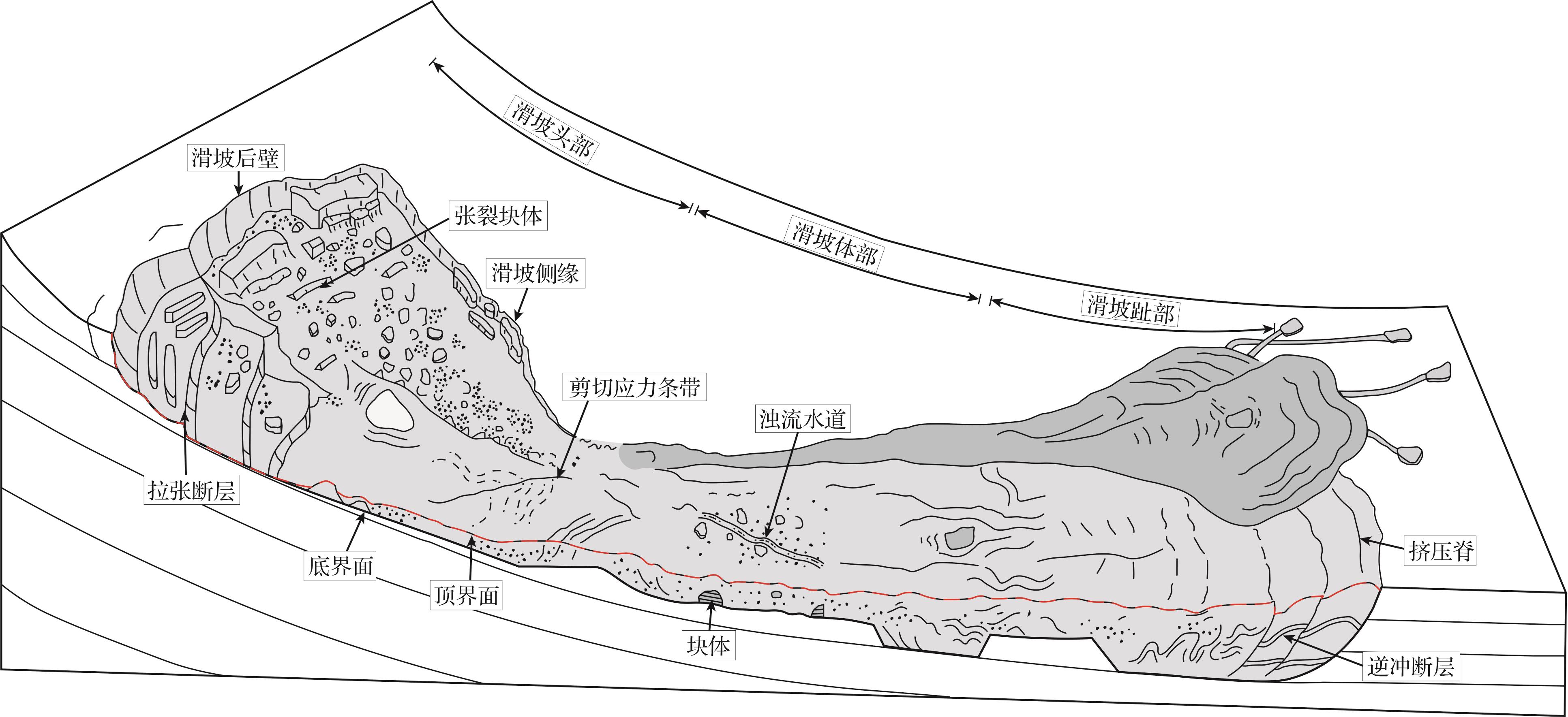
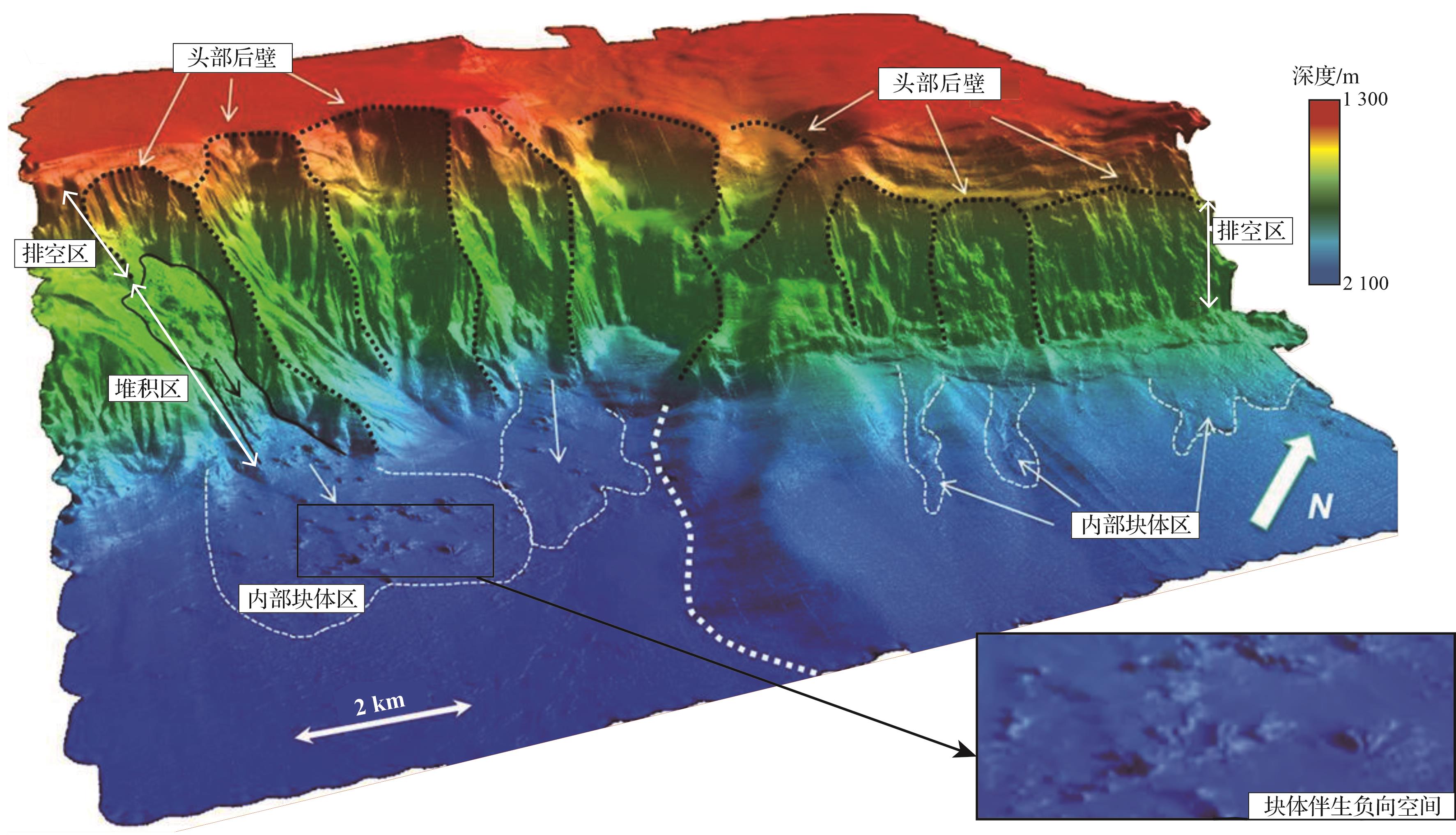
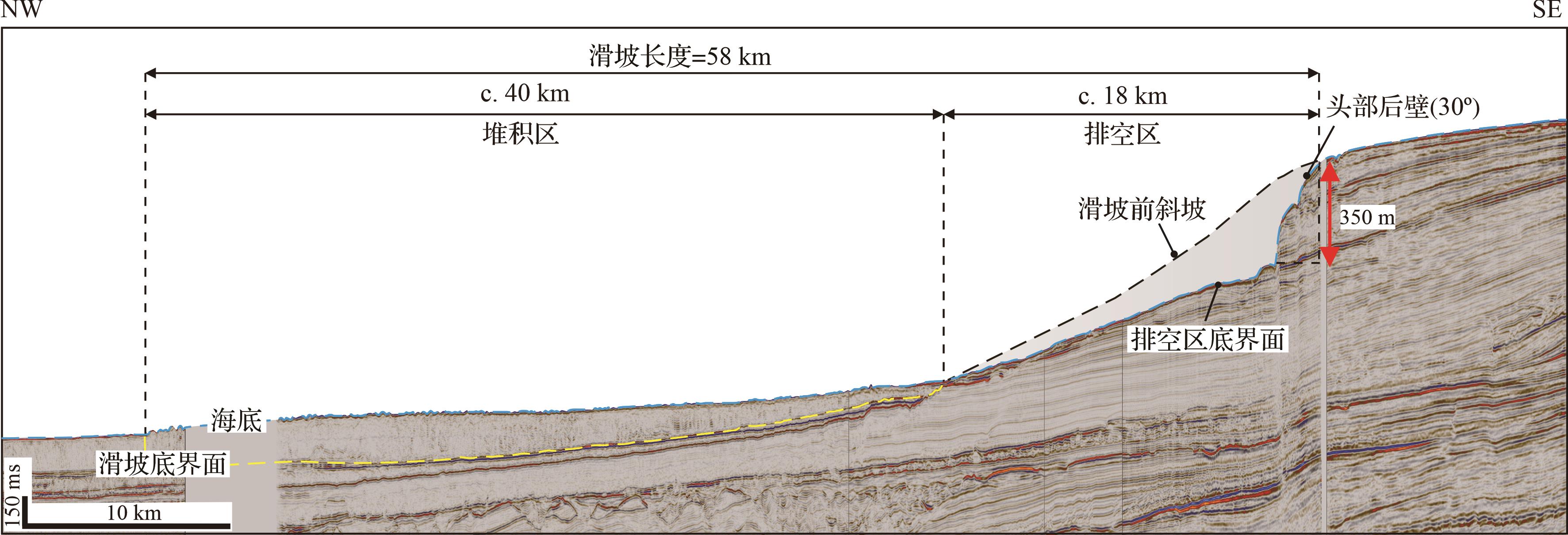
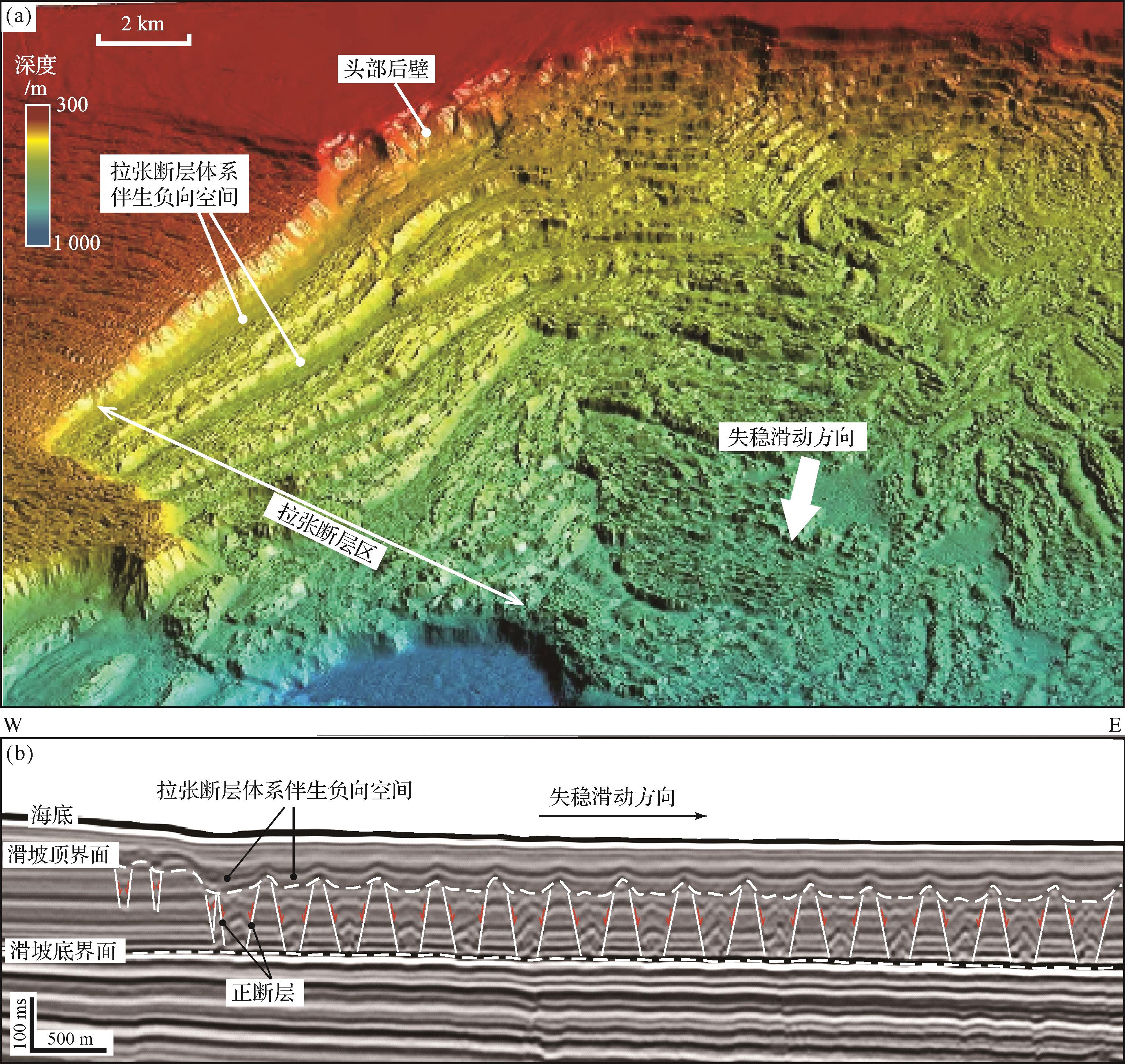
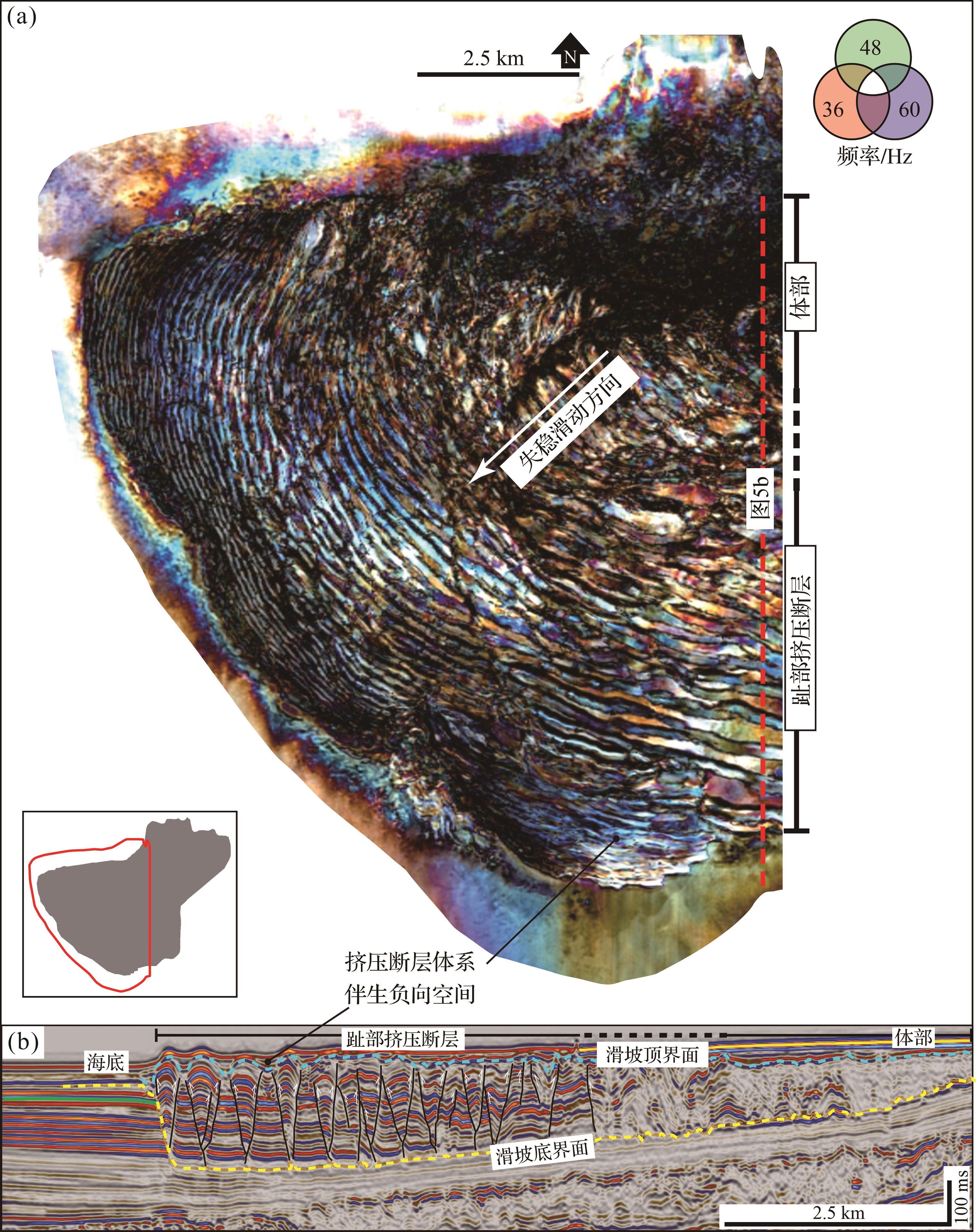
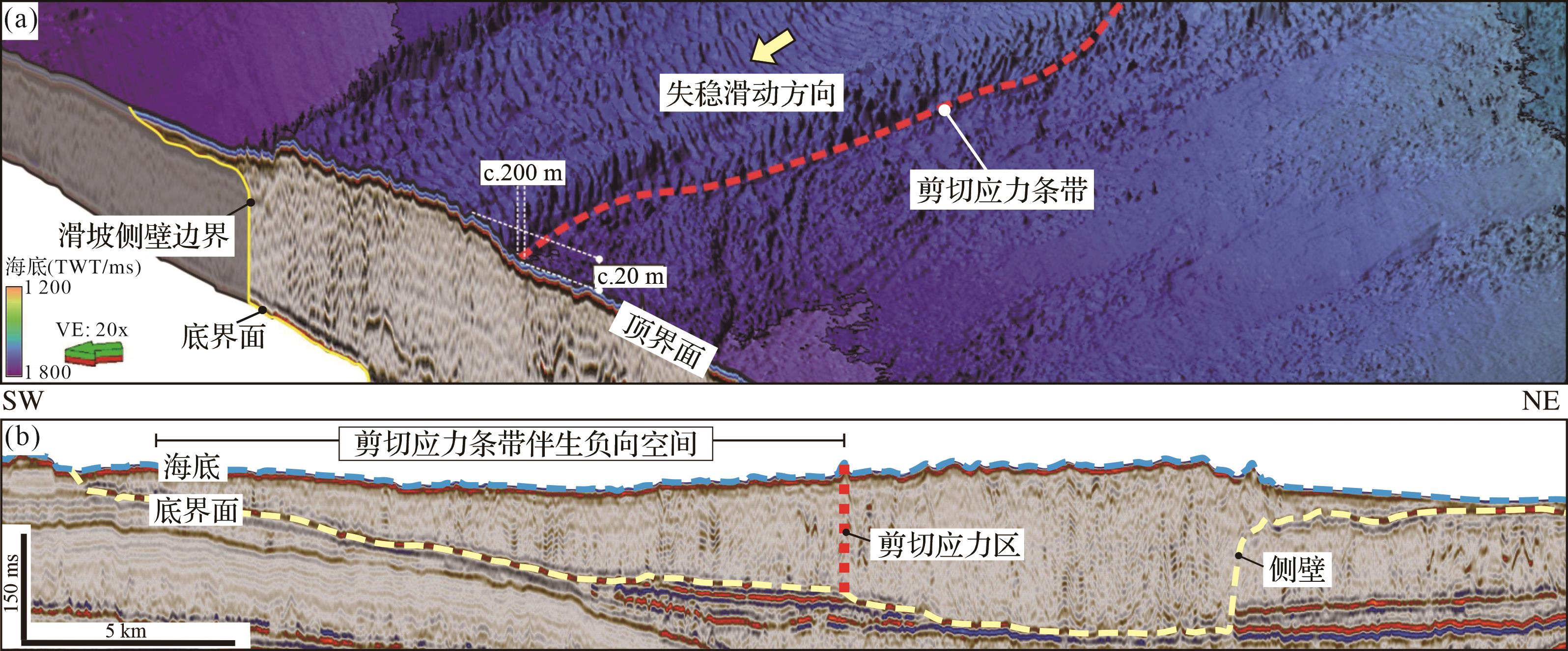
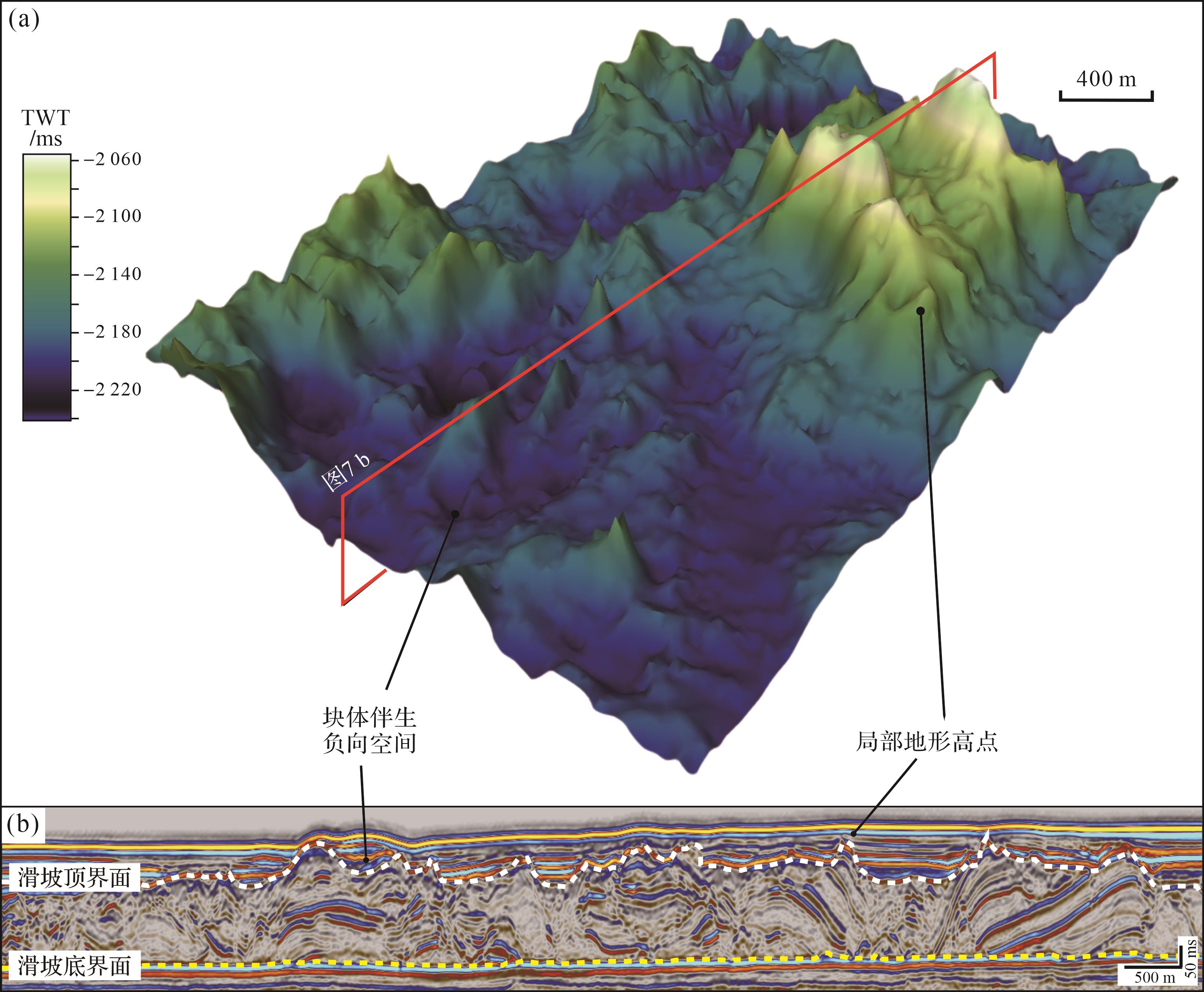
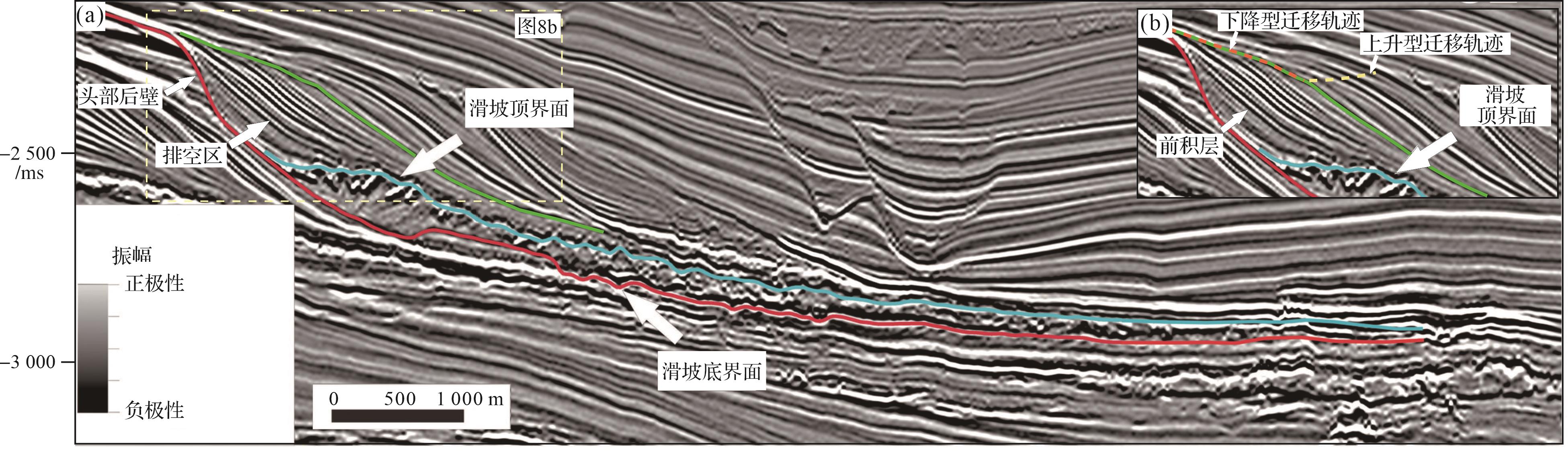
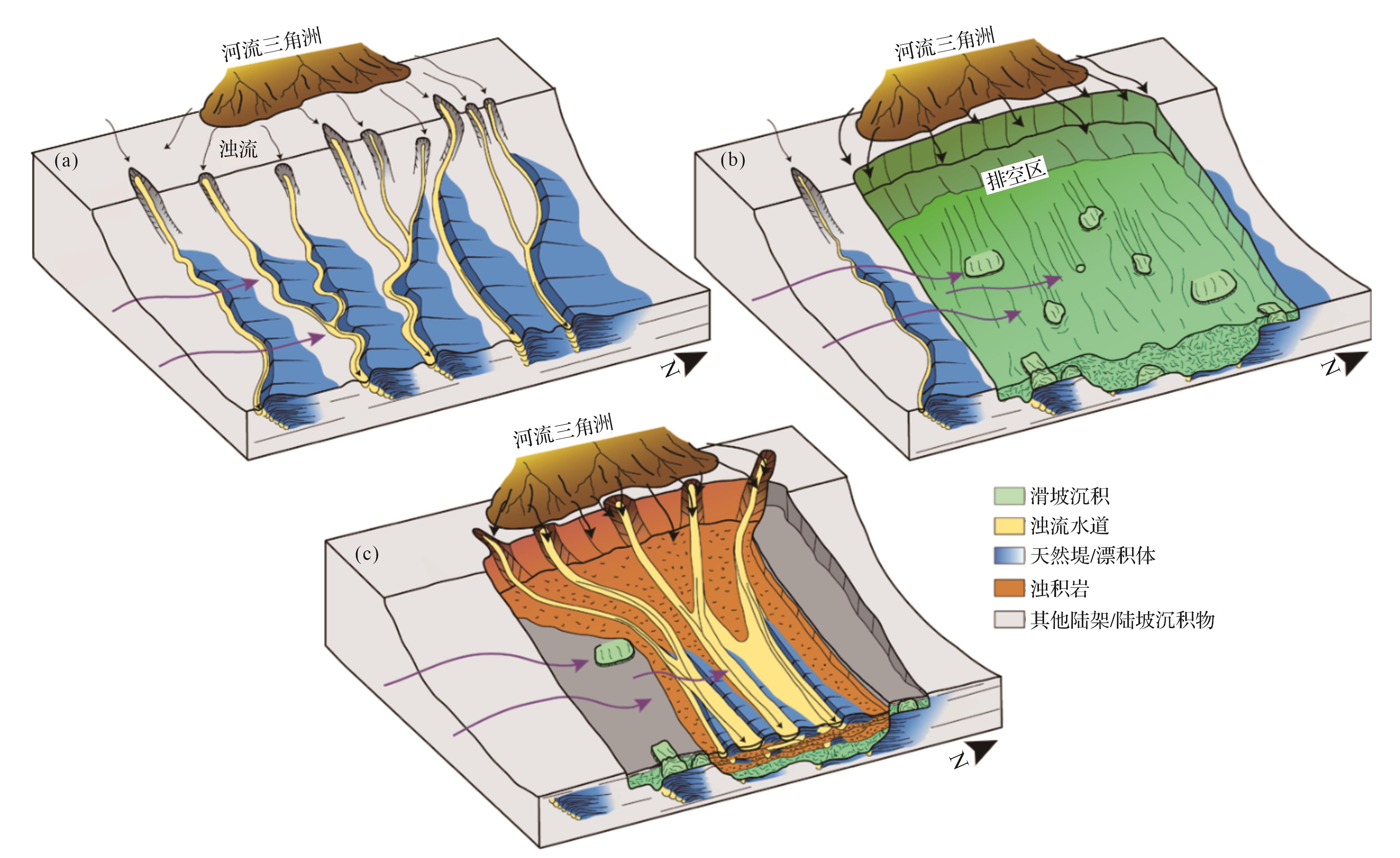
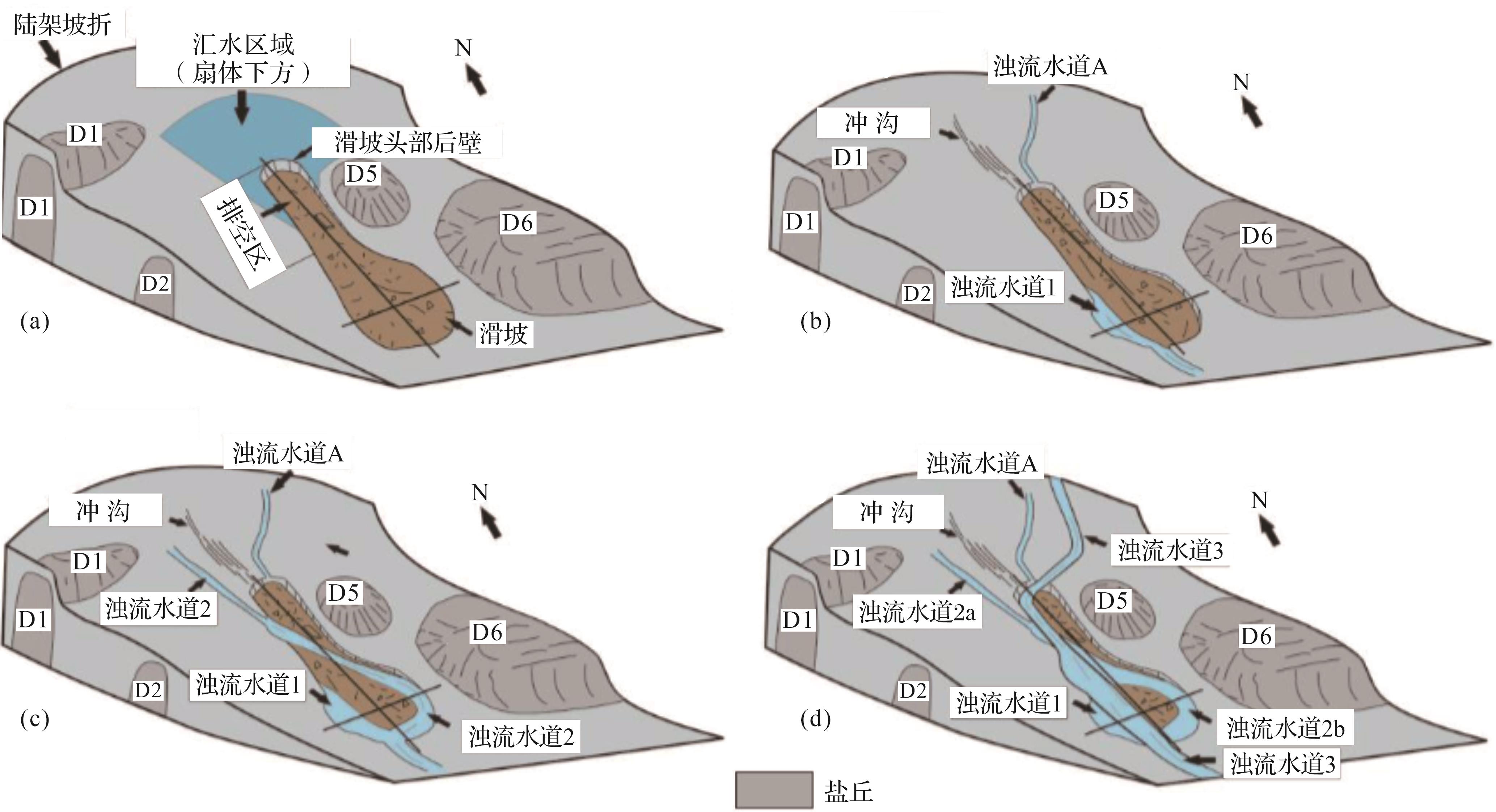
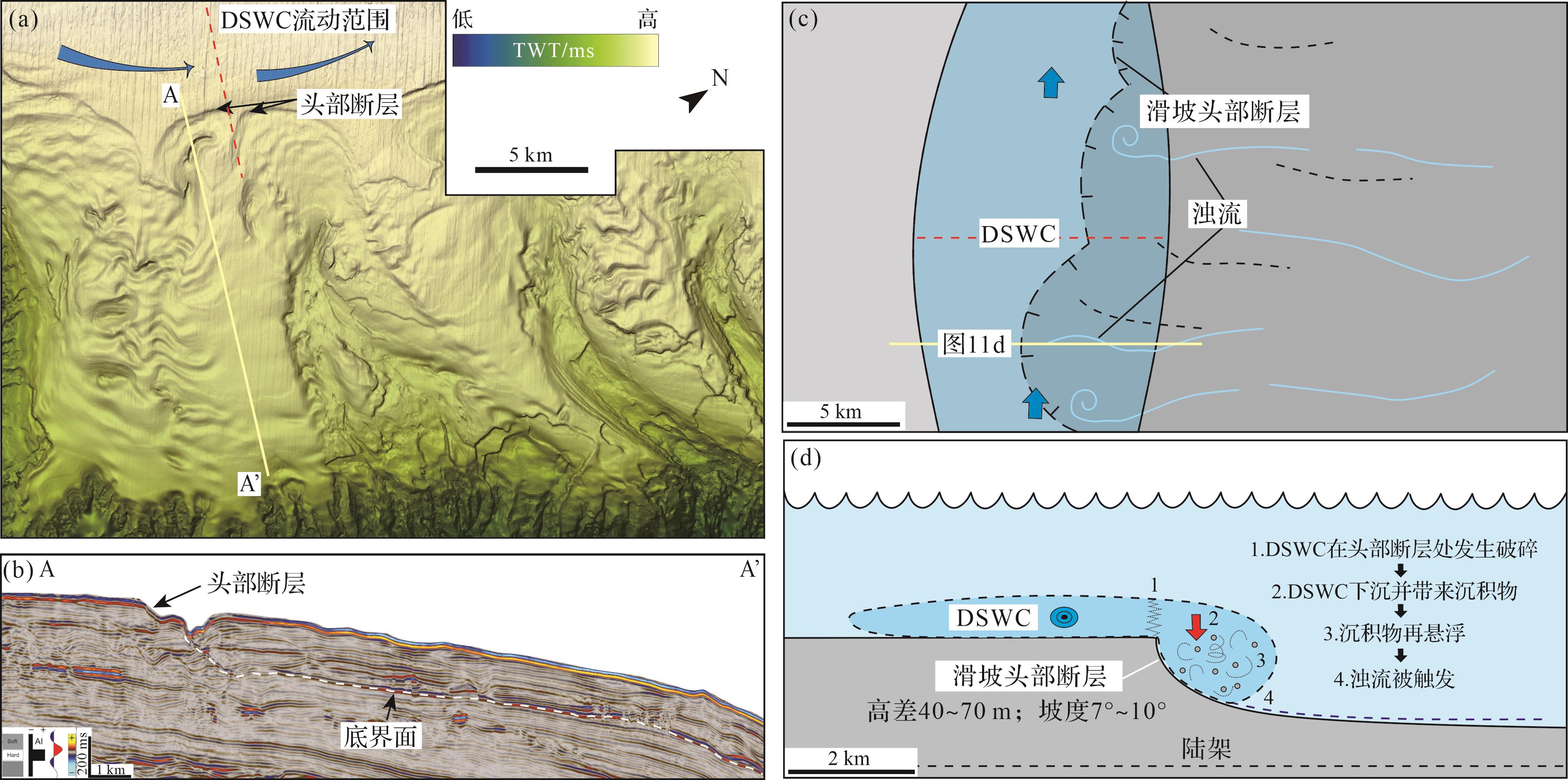
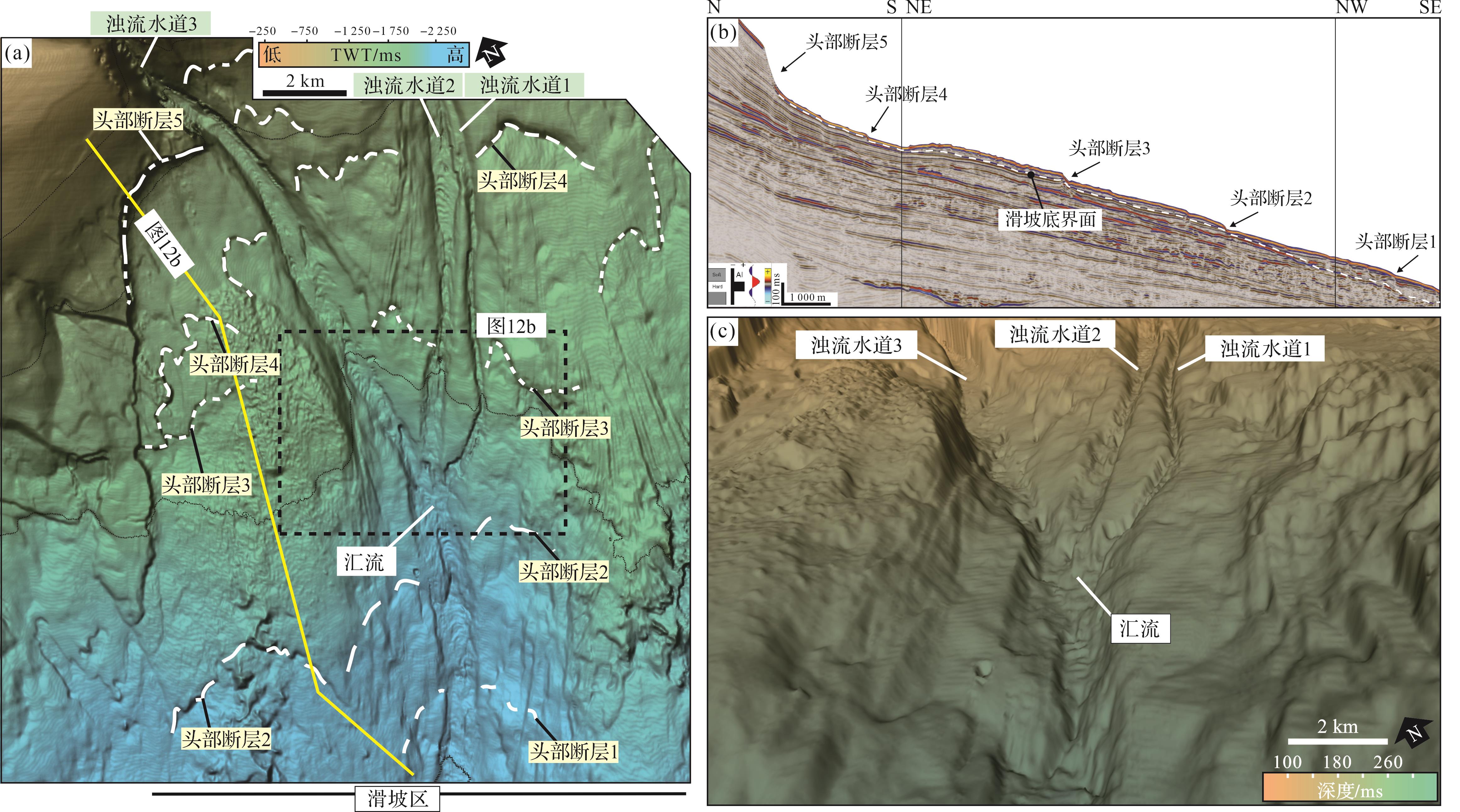
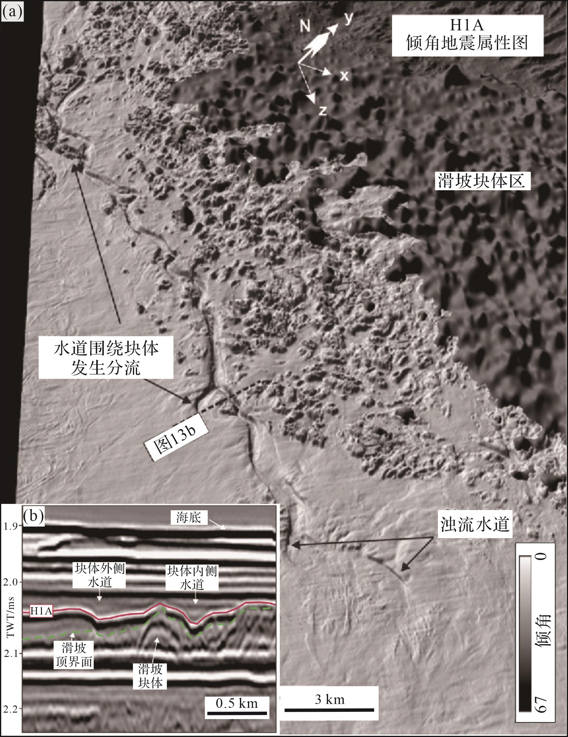
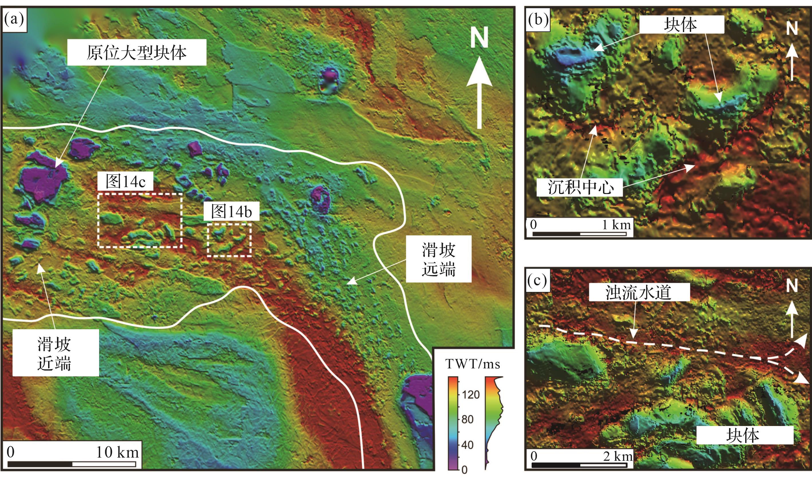
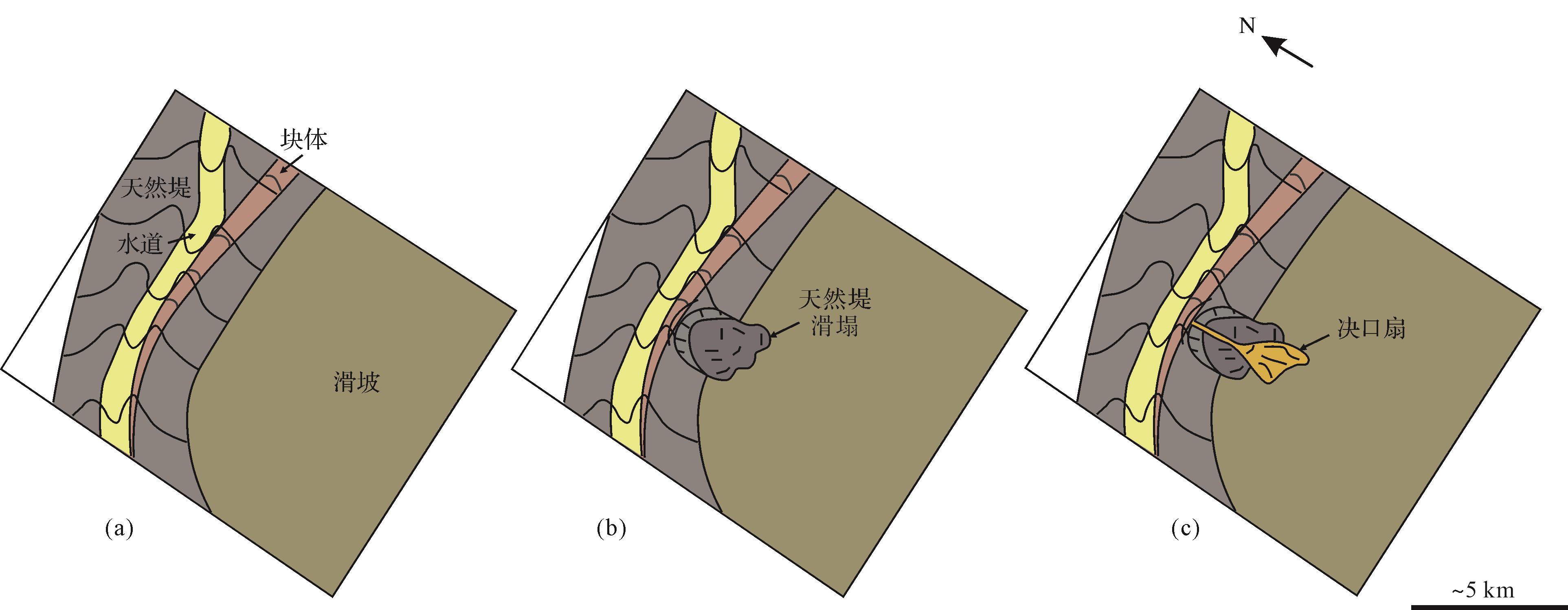
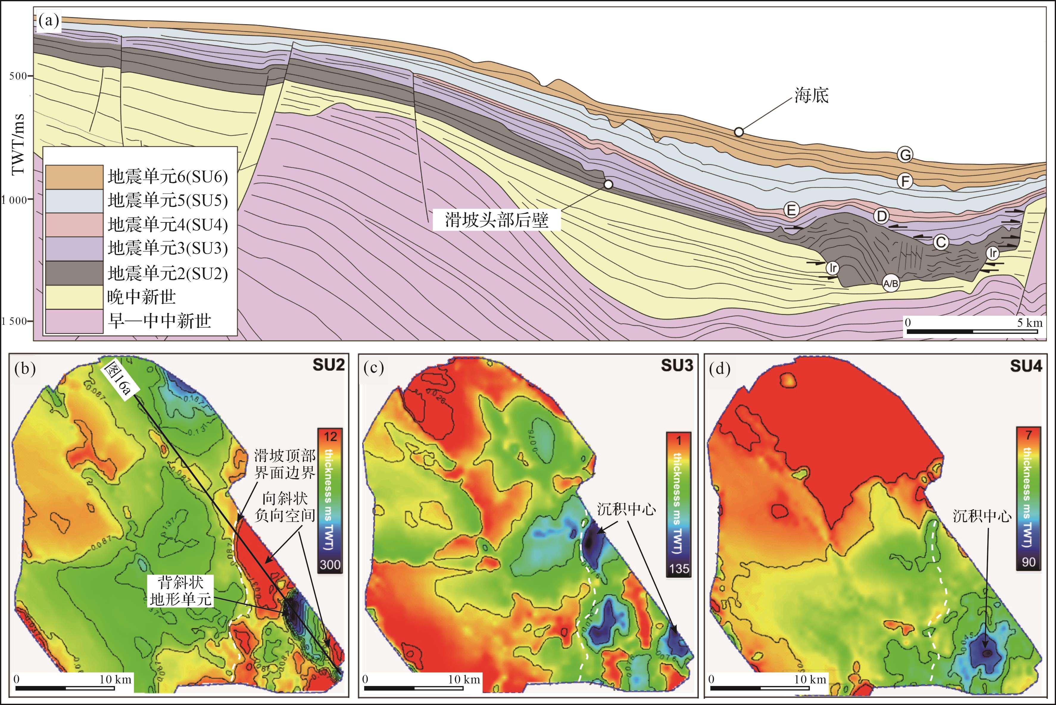
Objective The catastrophic failure of large submarine landslides can result in the deformation and destruction of thousands of square kilometers of seafloor, transporting hundreds to thousands of cubic kilometers of submarine sediments. This process dramatically reconstructs the seafloor topography of the continental shelf-slope region and has a profound impact on subsequent submarine sedimentation processes. Methods The topographic features of different large submarine landslides were qualitatively described using multibeam bathymetric and seismic reflection data, and the key geometric parameters of the submarine landslide top surface, such as area and volume, were quantitatively characterized. Based on the scale, morphological features, and formation mechanisms of the associated reliefs on the submarine landslide top surface, these landslides were separated into three categories: head evacuation zone, locally negative accommodation associated with internal fault systems, and locally negative accommodation associated with internal deformation blocks. The mechanisms of the three types of negative accommodation on the subsequent turbidity current system are then discussed separately. Results Firstly, the head evacuation zone is typically associated with hundreds to thousands of square kilometers of negative accommodation, which acts as a "funnel" during sediment transport along the continental margin, effectively capturing and concentrating subsequent turbidity currents while enhancing the transport efficiency of gravel and coarse sand and playing a crucial role in the accumulation of marine organic matter. Secondly, the striped negative accommodation associated with internal fault systems and the irregular negative accommodation associated with internal deformation blocks can regulate the sedimentation dynamics of subsequent turbidity currents, such as constraining flow direction, enhancing erosion intensity, and forcing channels to avulse. Finally, the negative accommodations associated with the submarine landslide top surface may produce synergistic effects, influencing the sediment filling and evolution of sedimentary basins and the distribution of sedimentary centers over millions of years. Conclusions The investigation of the morphological characteristics of submarine landslide top surfaces and their controlling effects on the subsequent turbidity currents sedimentary dynamic process can provide key geological information for clarifying the transport process of marginal sediments, identifying the distribution of sand-rich reservoirs in deep-sea sedimentary basins, and predicting the development range of catastrophic turbidity currents.
Objective The catastrophic failure of large submarine landslides can result in the deformation and destruction of thousands of square kilometers of seafloor, transporting hundreds to thousands of cubic kilometers of submarine sediments. This process dramatically reconstructs the seafloor topography of the continental shelf-slope region and has a profound impact on subsequent submarine sedimentation processes. Methods The topographic features of different large submarine landslides were qualitatively described using multibeam bathymetric and seismic reflection data, and the key geometric parameters of the submarine landslide top surface, such as area and volume, were quantitatively characterized. Based on the scale, morphological features, and formation mechanisms of the associated reliefs on the submarine landslide top surface, these landslides were separated into three categories: head evacuation zone, locally negative accommodation associated with internal fault systems, and locally negative accommodation associated with internal deformation blocks. The mechanisms of the three types of negative accommodation on the subsequent turbidity current system are then discussed separately. Results Firstly, the head evacuation zone is typically associated with hundreds to thousands of square kilometers of negative accommodation, which acts as a "funnel" during sediment transport along the continental margin, effectively capturing and concentrating subsequent turbidity currents while enhancing the transport efficiency of gravel and coarse sand and playing a crucial role in the accumulation of marine organic matter. Secondly, the striped negative accommodation associated with internal fault systems and the irregular negative accommodation associated with internal deformation blocks can regulate the sedimentation dynamics of subsequent turbidity currents, such as constraining flow direction, enhancing erosion intensity, and forcing channels to avulse. Finally, the negative accommodations associated with the submarine landslide top surface may produce synergistic effects, influencing the sediment filling and evolution of sedimentary basins and the distribution of sedimentary centers over millions of years. Conclusions The investigation of the morphological characteristics of submarine landslide top surfaces and their controlling effects on the subsequent turbidity currents sedimentary dynamic process can provide key geological information for clarifying the transport process of marginal sediments, identifying the distribution of sand-rich reservoirs in deep-sea sedimentary basins, and predicting the development range of catastrophic turbidity currents.
2026, 44(3): 994-1006.
doi: 10.14027/j.issn.1000-0550.2025.009
Abstract:
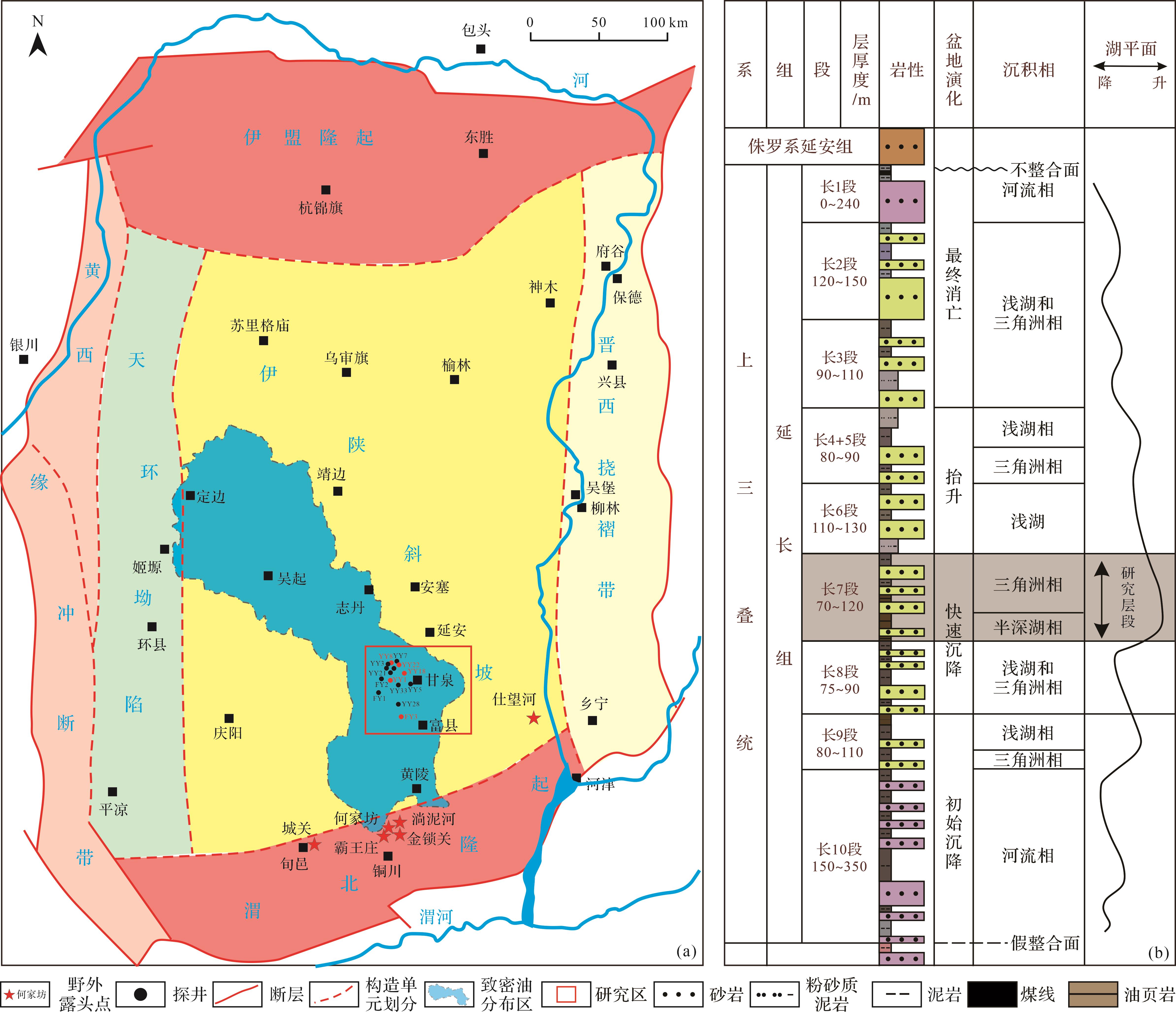
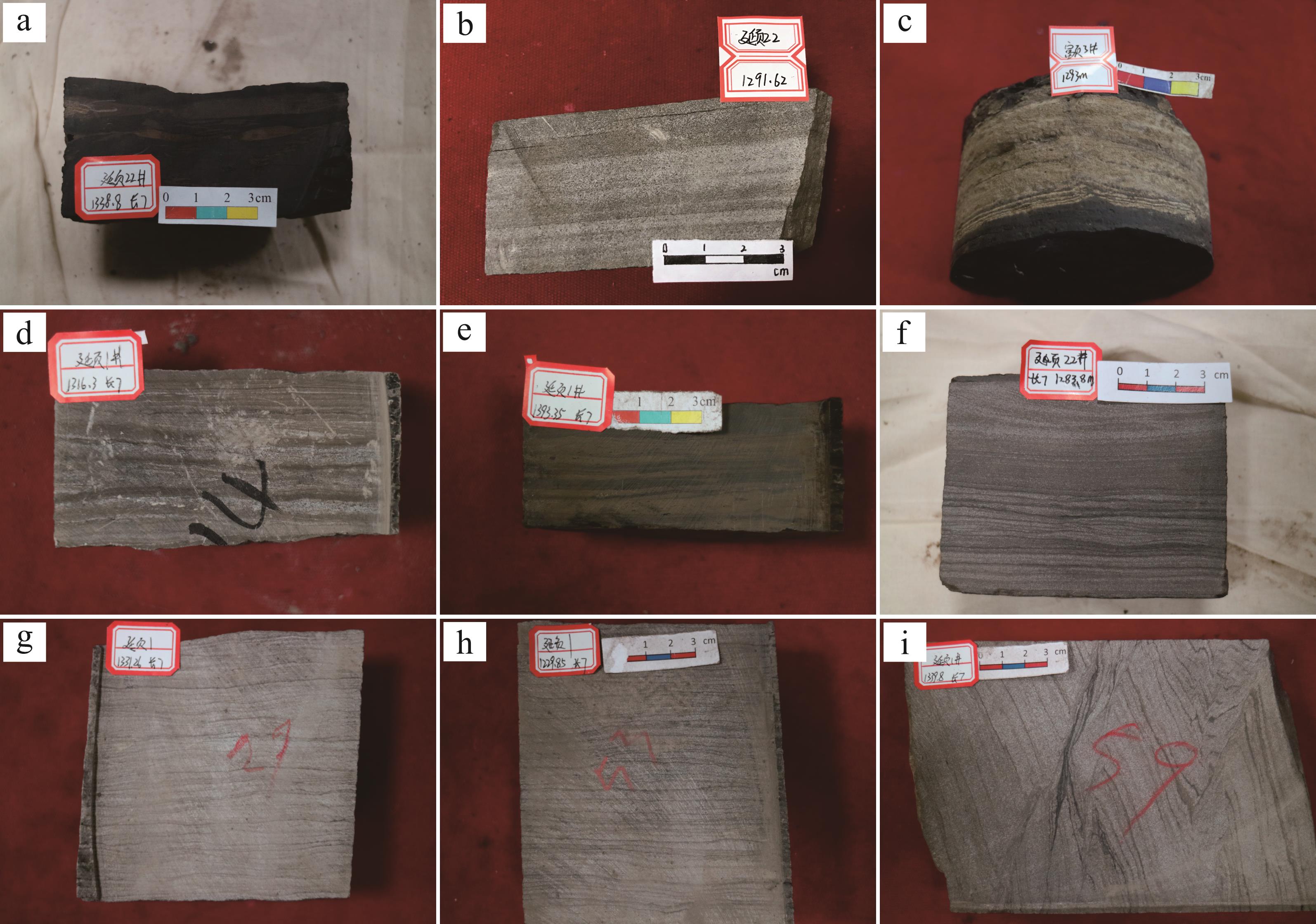
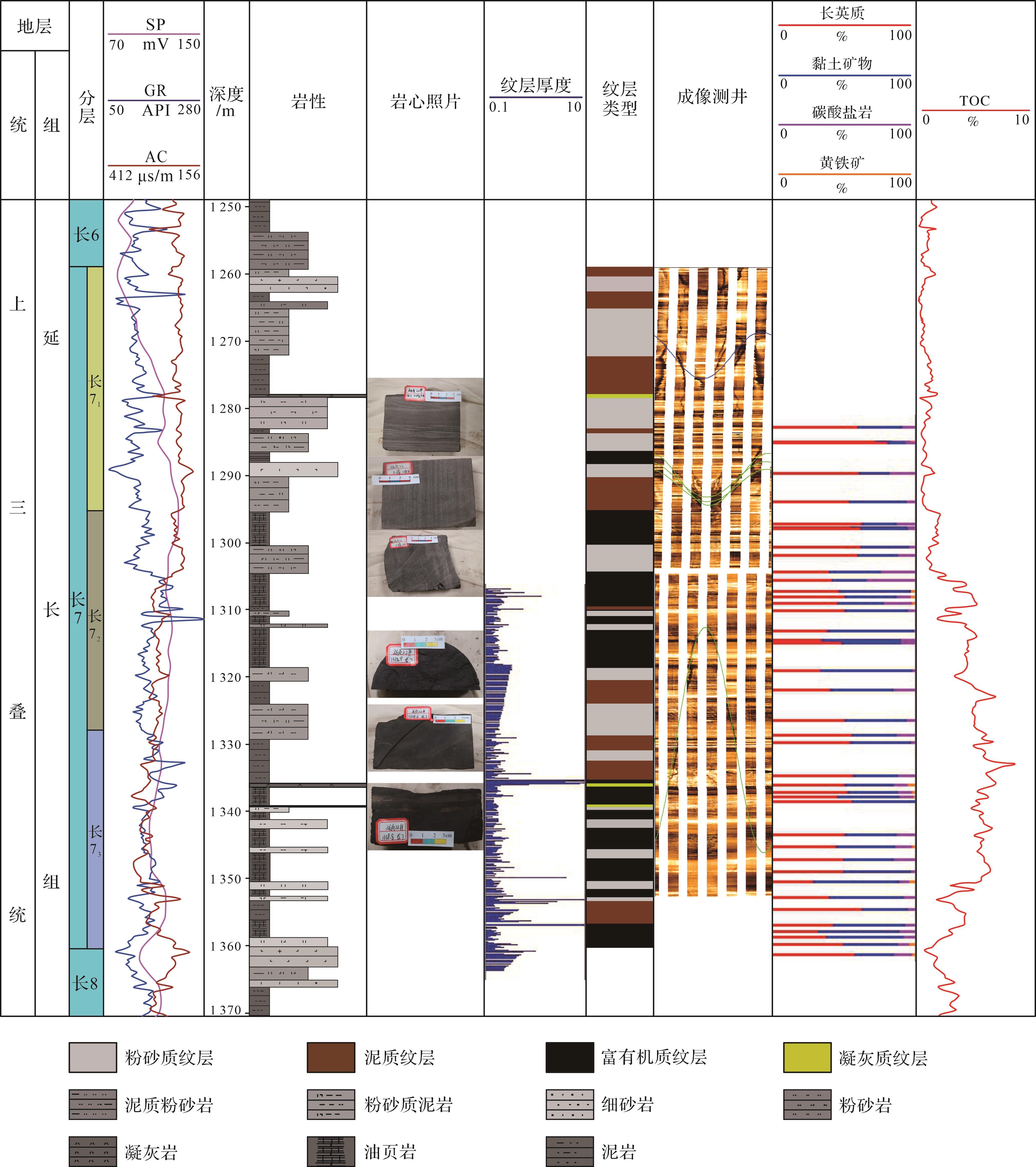
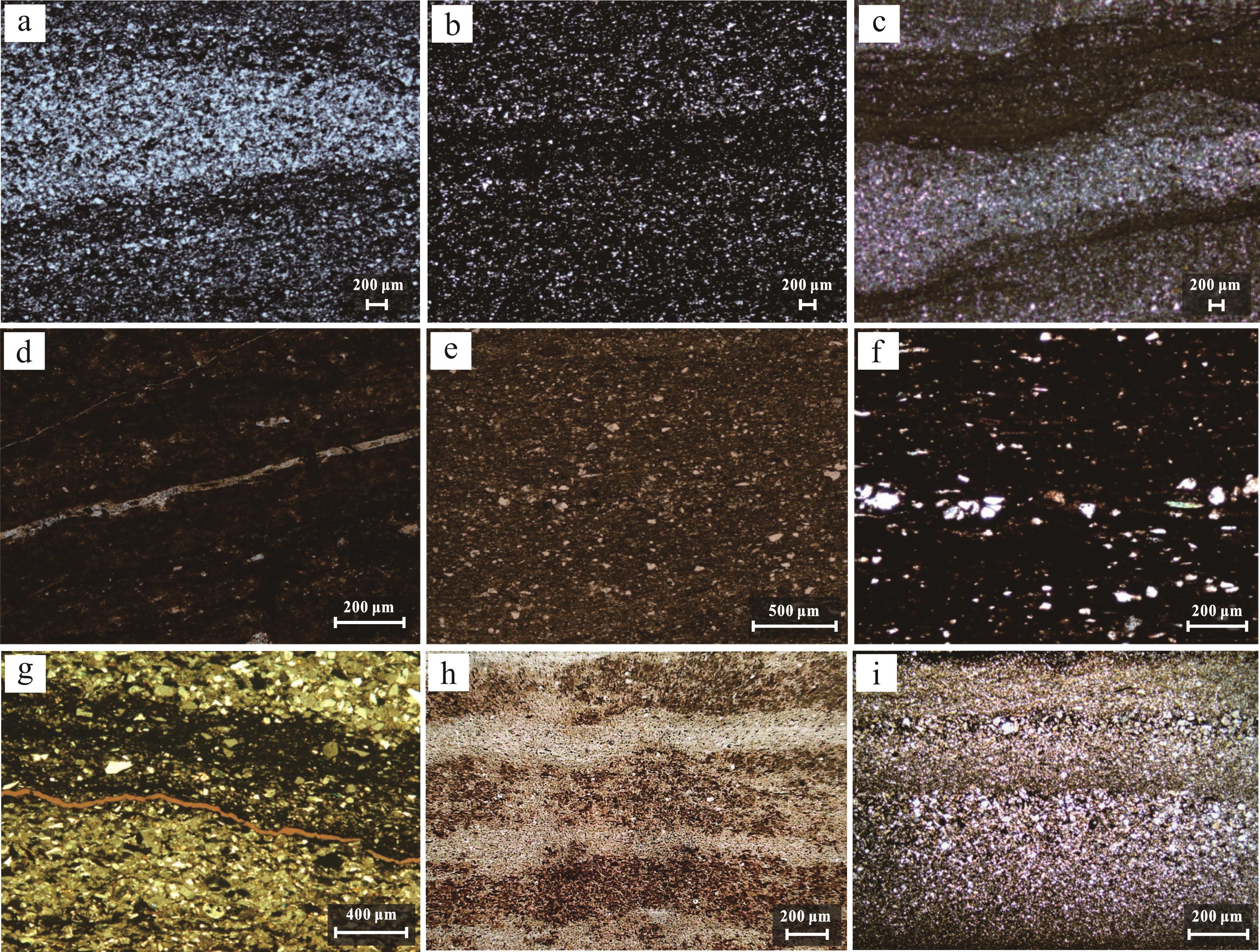
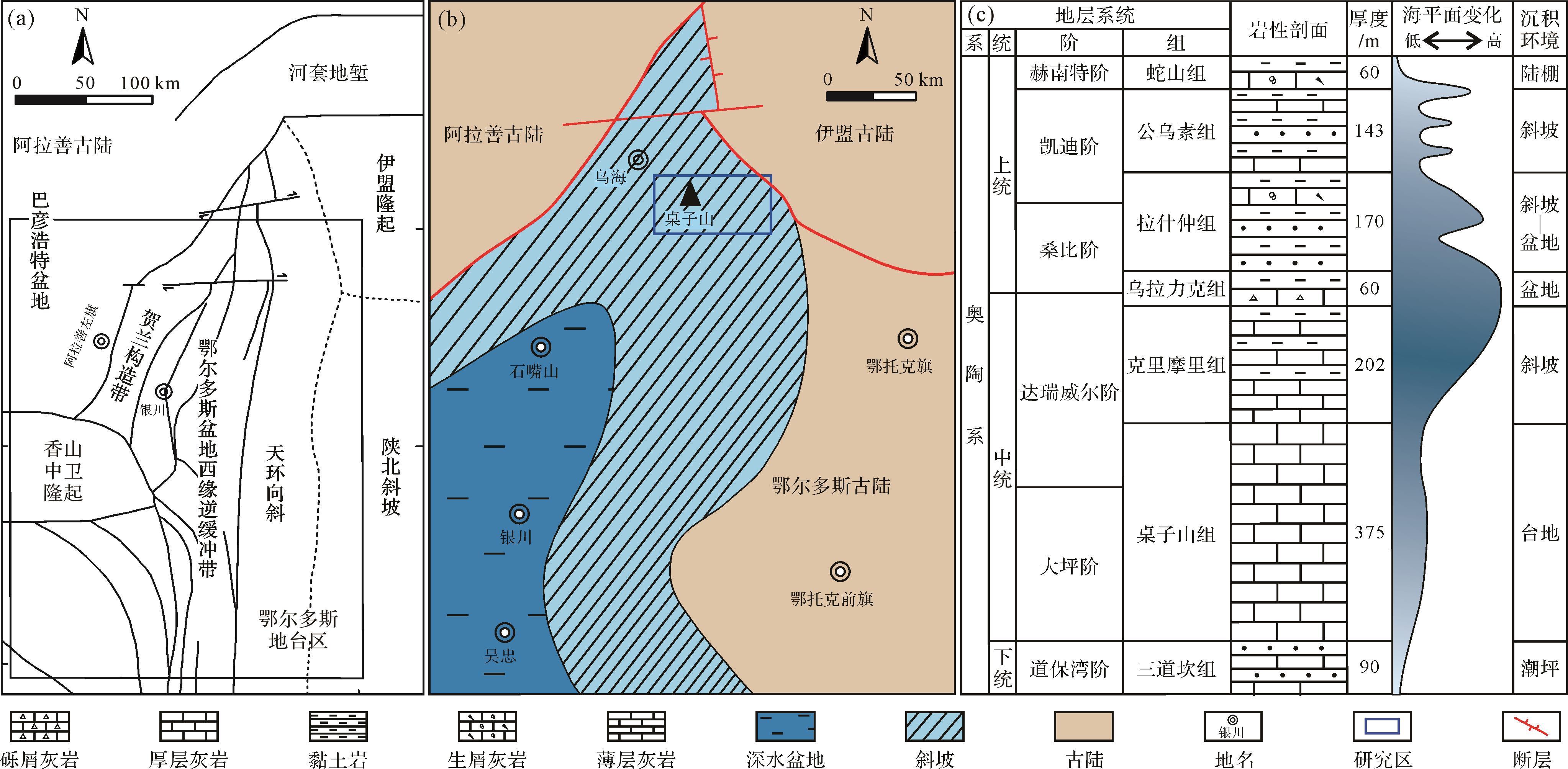
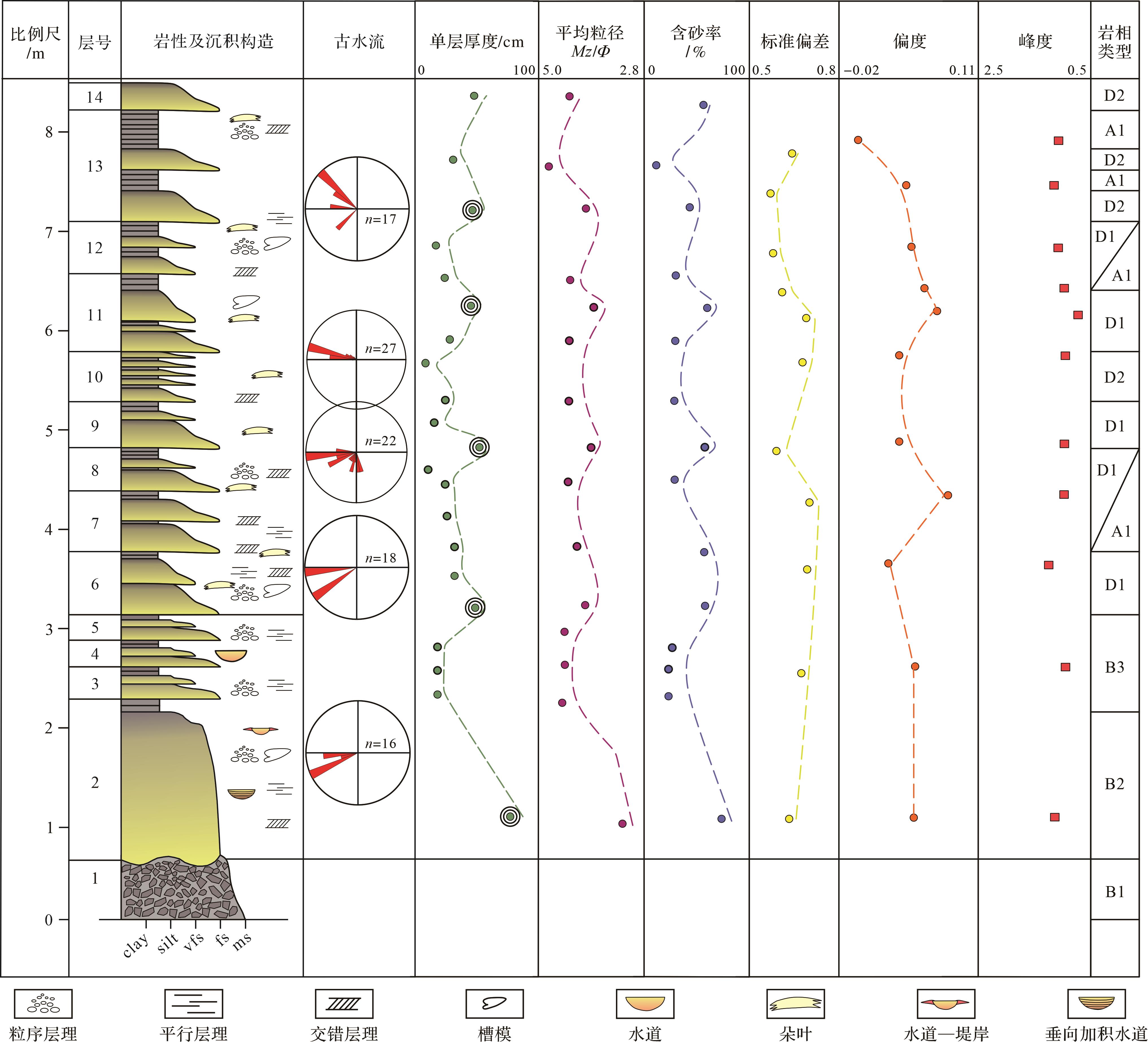
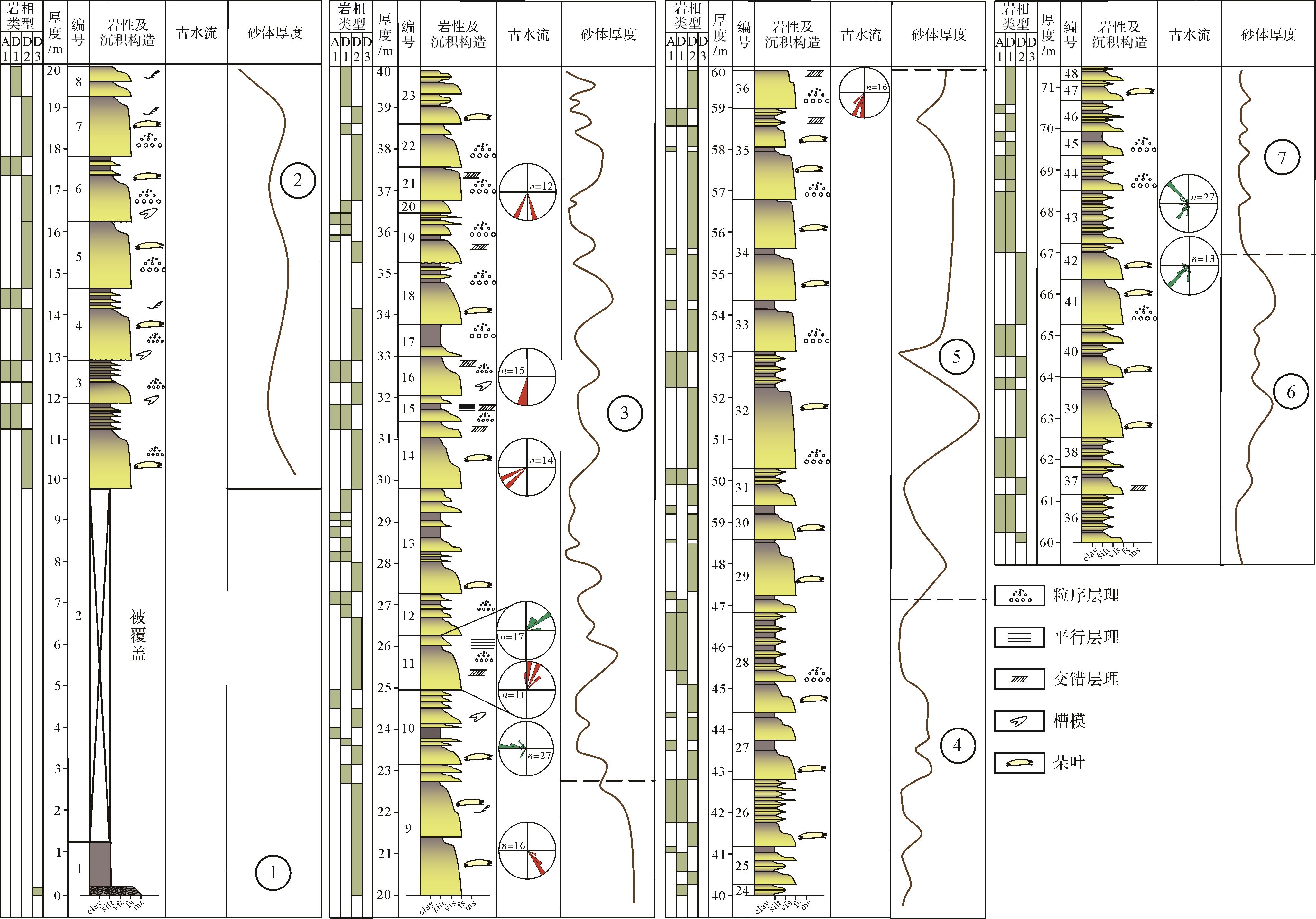
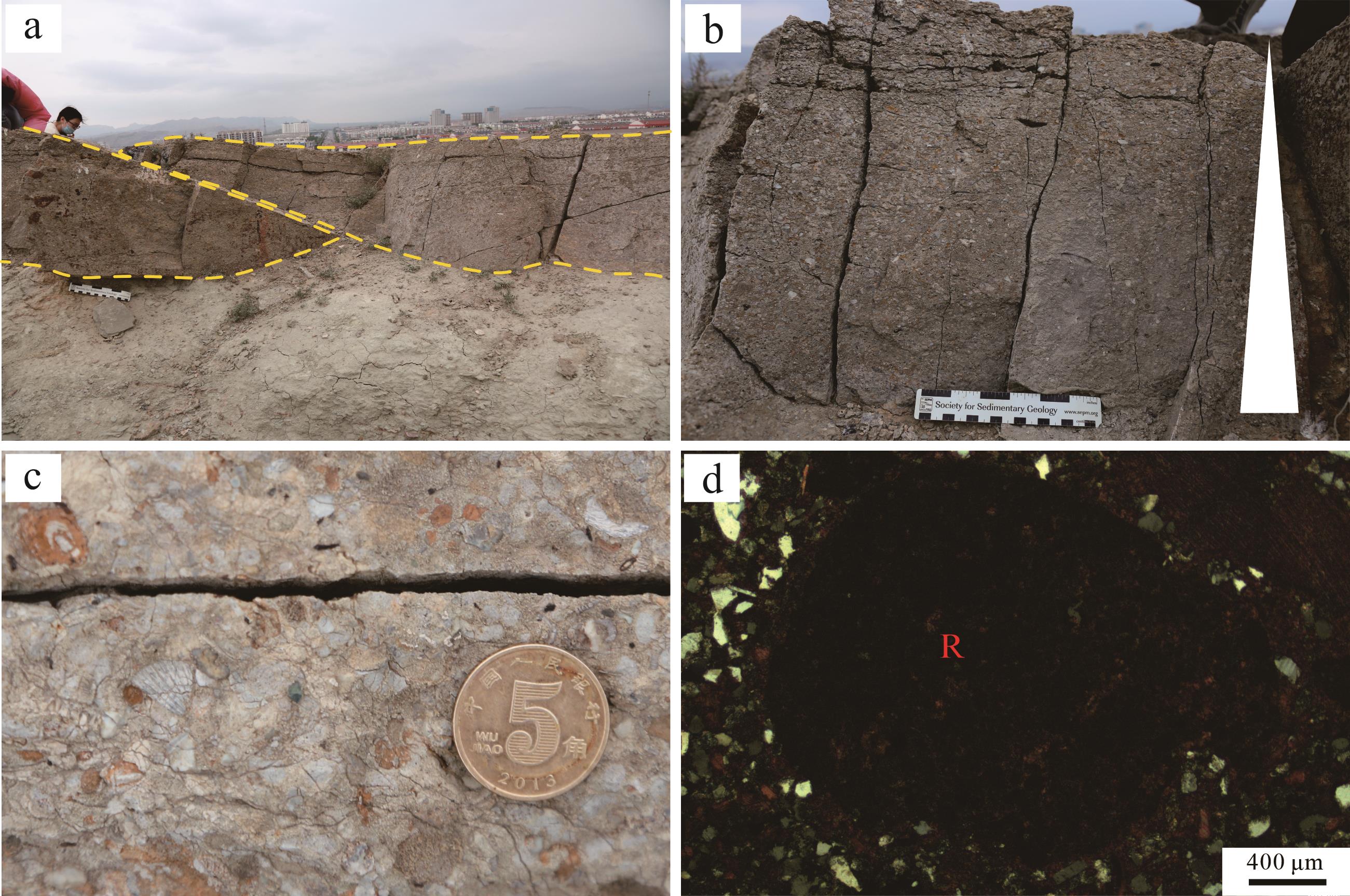
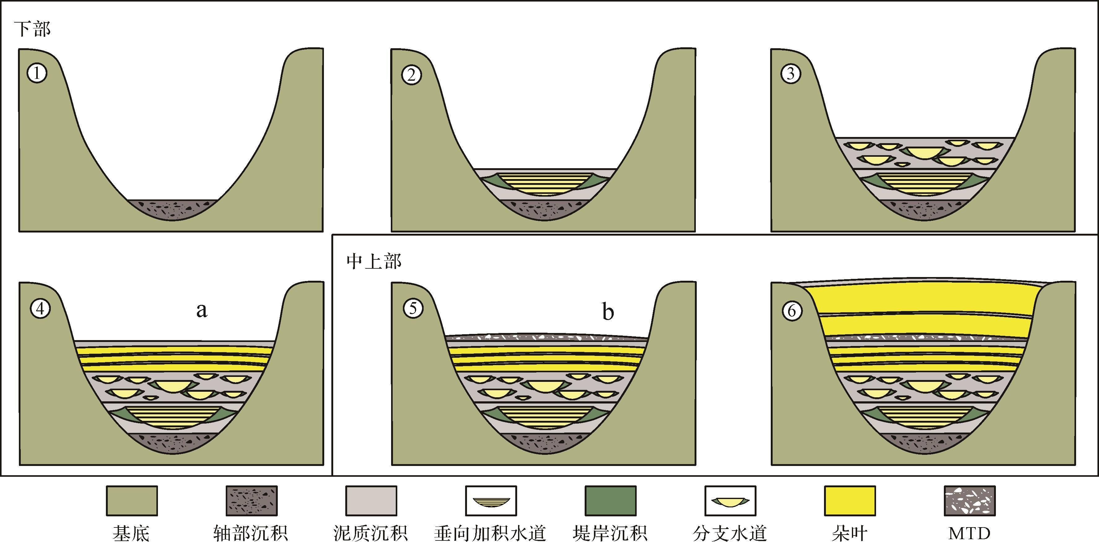
Objective A typical gravity-flow sedimentation set is present in the Ordovician Lashizhong Formation at the western margin of the Ordos Basin. This study investigated the formation process of gravity flows in the third member of the Lashizhong Formation with the aim of summarizing the sedimentary characteristics and evolutionary pattern, and to establish a sedimentary model. Methods Outcrop observation, thin-section examination, grain size analysis and paleocurrent measurement were used in the analysis. Results Eight kinds of lithofacies and six litho-facies associations were found in the study area: horizontal bedded shale (A1); lens-shaped massive bedded calcirudite (B1); lens-shaped parallel-bedded sandstone (B2); lens-shaped cross-bedded sandstone-siltstone (B3), wedges of cross-bedded sandstone-siltstone (C1), graded beds of sandstone-siltstone (D1), parallel-bedded siltstone (D2), and bedded pebbly sandstone (D3). These indicate channel axis deposition (B1), vertical aggradation channels (B2, C1, A1), distributary channels (B3, C1, A1), proximal lobes (D1, A1), distal lobes (D2, A1) and mass transport deposits (D3). Channel axis deposition, vertical aggradation channels, distributary channels, proximal lobes and distal lobes have been successively developed in the lowest part of the Third member of the Lashizhong Formation, which is divided into five stages. The middle and upper parts of the Third member of the Lashizhong Formation show the development of mass transport deposits, proximal lobes and distal lobes, and is divided into seven stages. Conclusions The evolution of these strata is closely related to the type and energy of gravity flow. At the initial stage, gravity flow was dominated by debris flow, then, as the debris flow energy weakened, turbidity current dominated. The vertical aggradation channels were developed during multi-stage periods of erosion and sedimentation. Distributary channels and lobes then developed with further weakening of the turbidity flow. Tectonic movement increased the sand content of sediment supply, leading to the initial development of massive transport deposition followed by large-scale lobes with higher sand content. The vertical evolution of gravity flow sedimentation was governed by a combination of factors, including sea-level fluctuations, sediment supply and its composition, as well as tectonic movement. An initial rise in sea level followed by a sub-sequent fall are suggested by a decrease and then increase in the scale of gravity flow development. Variations in sediment supply types gave rise to diverse sedimentary units, including channel-axis deposition composed mainly of calcirudite, as well as vertical aggradation channels, distributary channels, proximal lobes and distal lobes mainly comprising fine sandstone and siltstone. Moreover, the magnitude of sediment supply significantly impacted the morphological features, dimensions and sand-to-mud ratio of these sedimentary units. During the depositional period of the Lashizhong Formation, relatively subdued tectonic activity facilitated the formation of a channel-lobe system that is relatively modest in size compared to the scale typically encountered in exploration contexts. The interplay of the above factors ⁃ sea-level changes, sediment-supply dynamics, and tectonic setting ⁃ together shaped the architectural complexity and distribution patterns of the gravity flow deposits in the basin. Understanding these controls is crucial for accurate reservoir characterization and prediction in hydrocarbon exploration and production. This study helps in the understanding of gravity-flow evolution in the study area, and provides a theoretical reference for oil and gas exploration.
Objective A typical gravity-flow sedimentation set is present in the Ordovician Lashizhong Formation at the western margin of the Ordos Basin. This study investigated the formation process of gravity flows in the third member of the Lashizhong Formation with the aim of summarizing the sedimentary characteristics and evolutionary pattern, and to establish a sedimentary model. Methods Outcrop observation, thin-section examination, grain size analysis and paleocurrent measurement were used in the analysis. Results Eight kinds of lithofacies and six litho-facies associations were found in the study area: horizontal bedded shale (A1); lens-shaped massive bedded calcirudite (B1); lens-shaped parallel-bedded sandstone (B2); lens-shaped cross-bedded sandstone-siltstone (B3), wedges of cross-bedded sandstone-siltstone (C1), graded beds of sandstone-siltstone (D1), parallel-bedded siltstone (D2), and bedded pebbly sandstone (D3). These indicate channel axis deposition (B1), vertical aggradation channels (B2, C1, A1), distributary channels (B3, C1, A1), proximal lobes (D1, A1), distal lobes (D2, A1) and mass transport deposits (D3). Channel axis deposition, vertical aggradation channels, distributary channels, proximal lobes and distal lobes have been successively developed in the lowest part of the Third member of the Lashizhong Formation, which is divided into five stages. The middle and upper parts of the Third member of the Lashizhong Formation show the development of mass transport deposits, proximal lobes and distal lobes, and is divided into seven stages. Conclusions The evolution of these strata is closely related to the type and energy of gravity flow. At the initial stage, gravity flow was dominated by debris flow, then, as the debris flow energy weakened, turbidity current dominated. The vertical aggradation channels were developed during multi-stage periods of erosion and sedimentation. Distributary channels and lobes then developed with further weakening of the turbidity flow. Tectonic movement increased the sand content of sediment supply, leading to the initial development of massive transport deposition followed by large-scale lobes with higher sand content. The vertical evolution of gravity flow sedimentation was governed by a combination of factors, including sea-level fluctuations, sediment supply and its composition, as well as tectonic movement. An initial rise in sea level followed by a sub-sequent fall are suggested by a decrease and then increase in the scale of gravity flow development. Variations in sediment supply types gave rise to diverse sedimentary units, including channel-axis deposition composed mainly of calcirudite, as well as vertical aggradation channels, distributary channels, proximal lobes and distal lobes mainly comprising fine sandstone and siltstone. Moreover, the magnitude of sediment supply significantly impacted the morphological features, dimensions and sand-to-mud ratio of these sedimentary units. During the depositional period of the Lashizhong Formation, relatively subdued tectonic activity facilitated the formation of a channel-lobe system that is relatively modest in size compared to the scale typically encountered in exploration contexts. The interplay of the above factors ⁃ sea-level changes, sediment-supply dynamics, and tectonic setting ⁃ together shaped the architectural complexity and distribution patterns of the gravity flow deposits in the basin. Understanding these controls is crucial for accurate reservoir characterization and prediction in hydrocarbon exploration and production. This study helps in the understanding of gravity-flow evolution in the study area, and provides a theoretical reference for oil and gas exploration.
2026, 44(3): 1007-1018.
doi: 10.14027/j.issn.1000-0550.2024.100
Abstract:
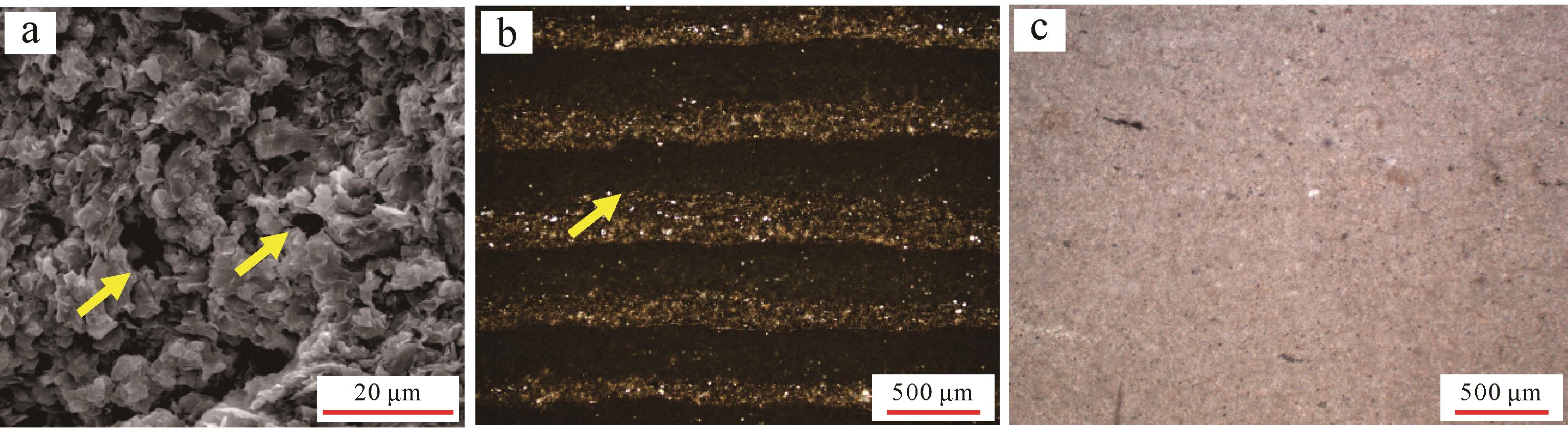
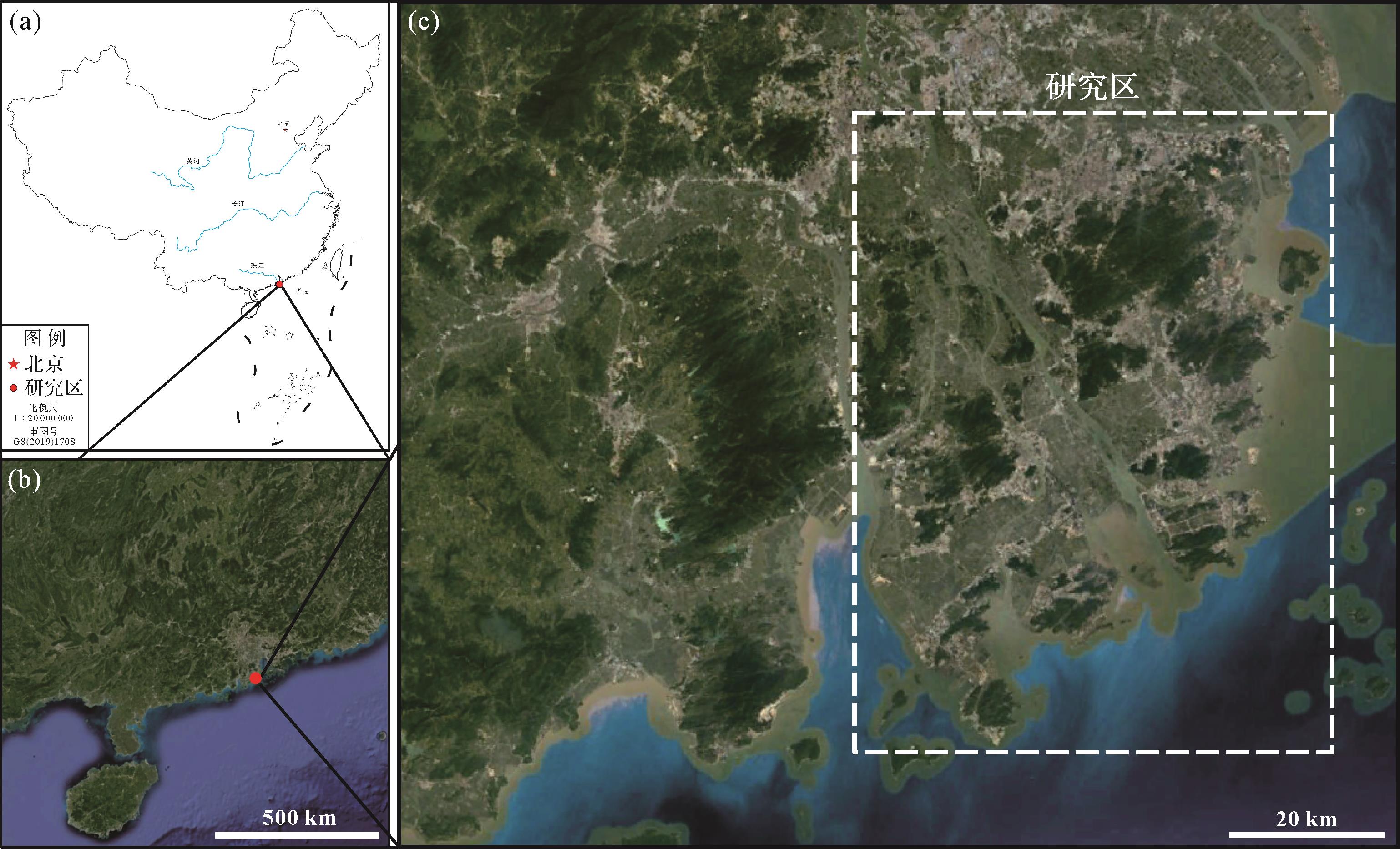
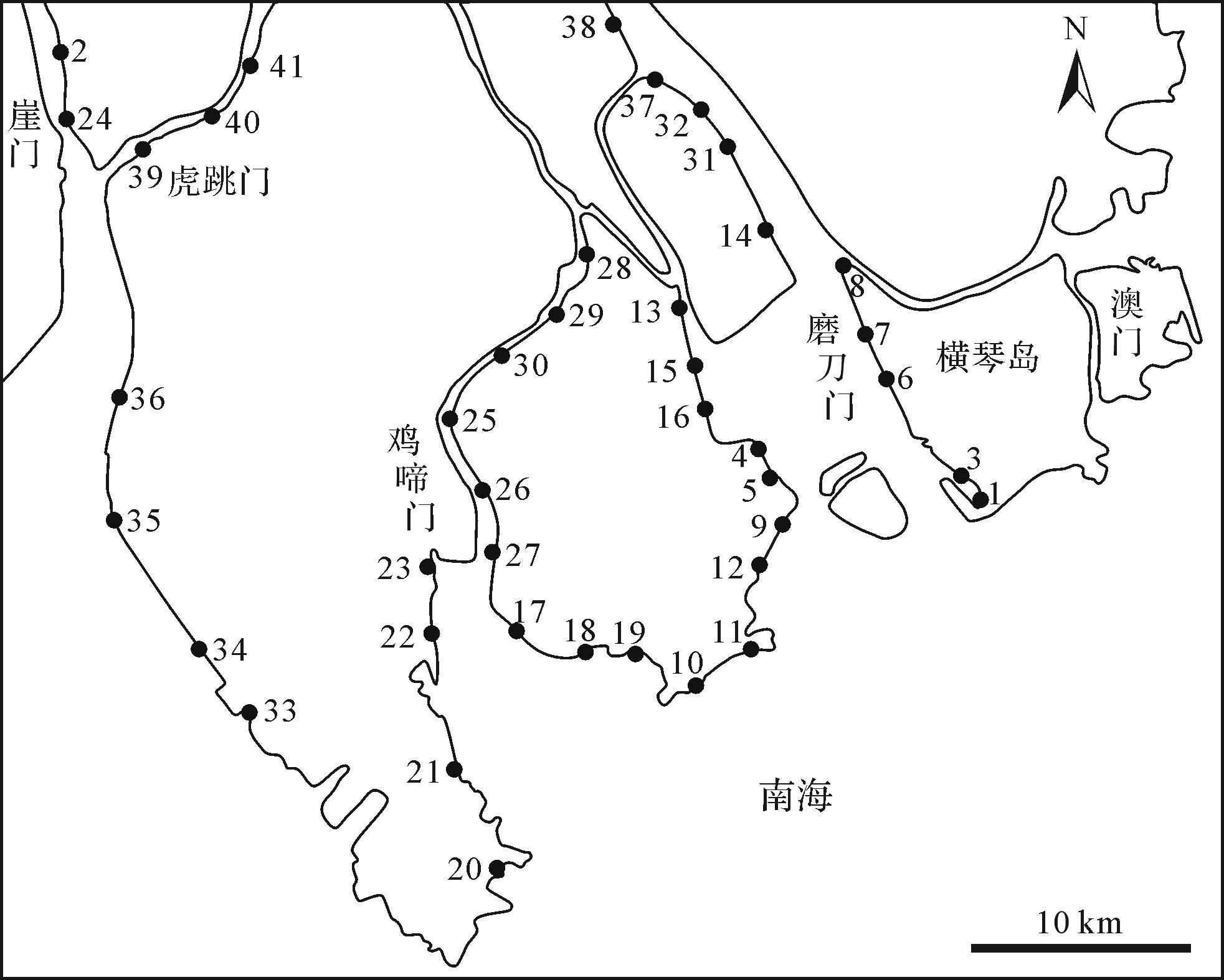
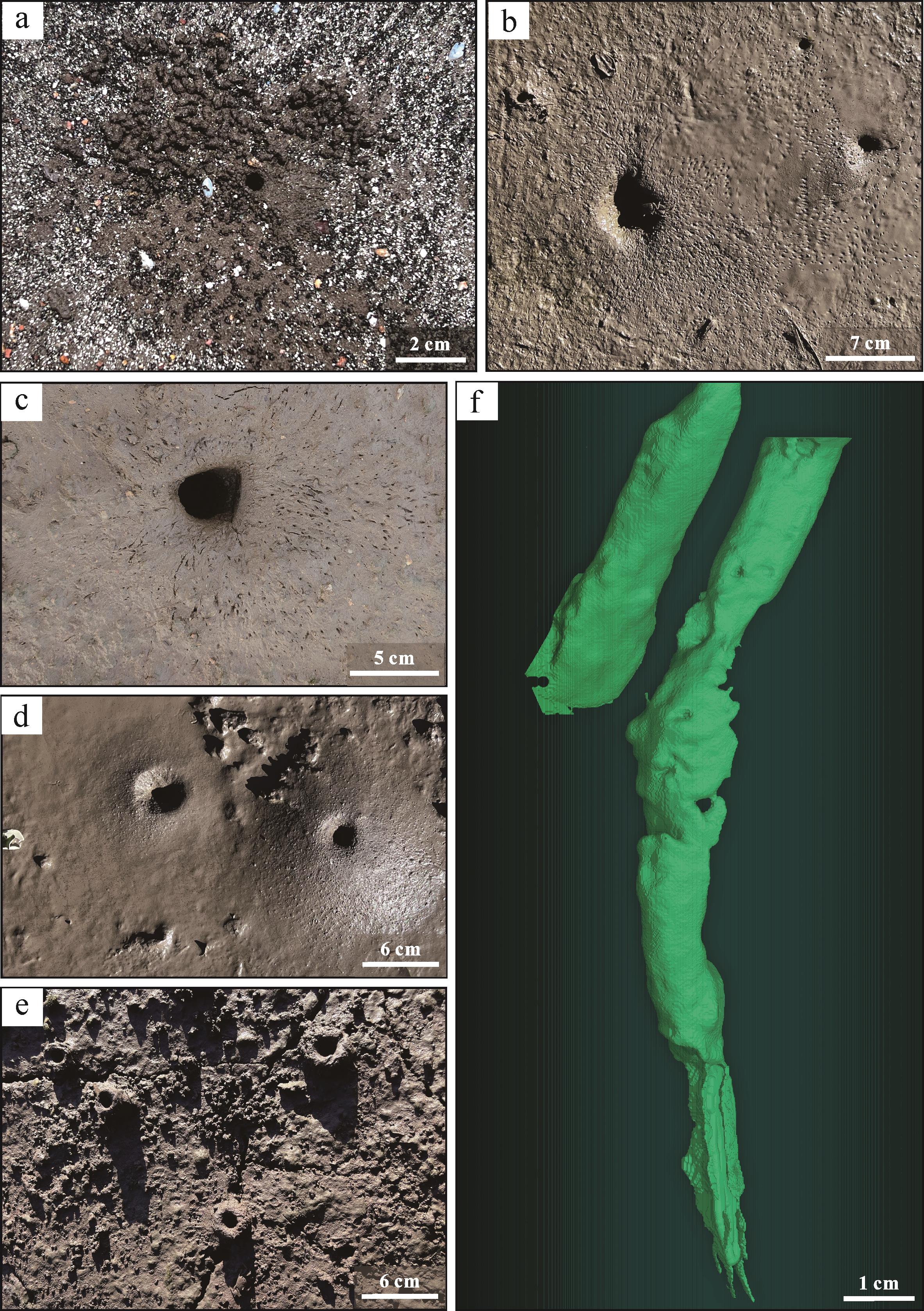
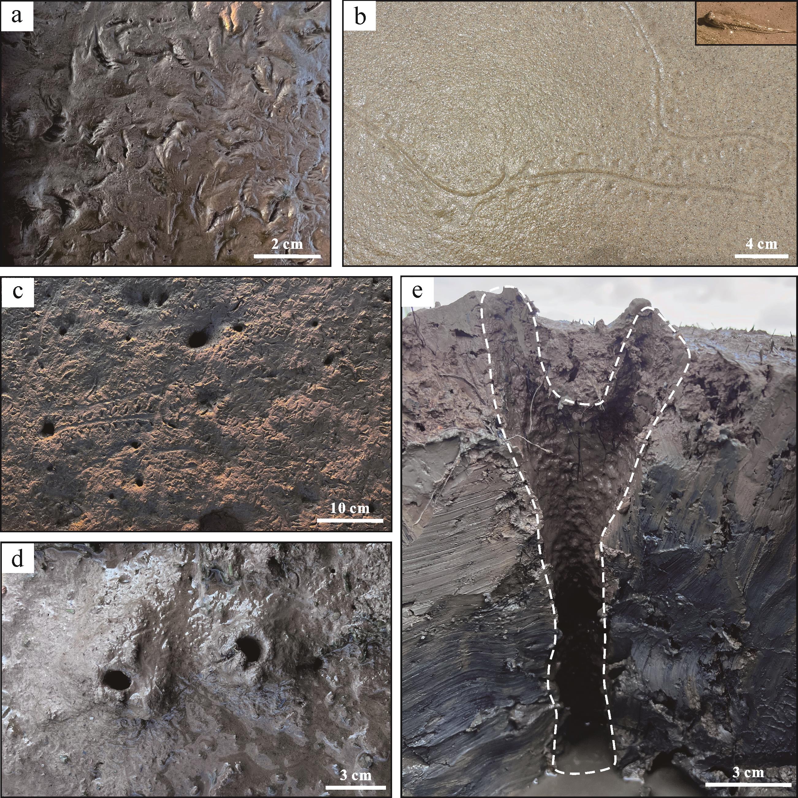
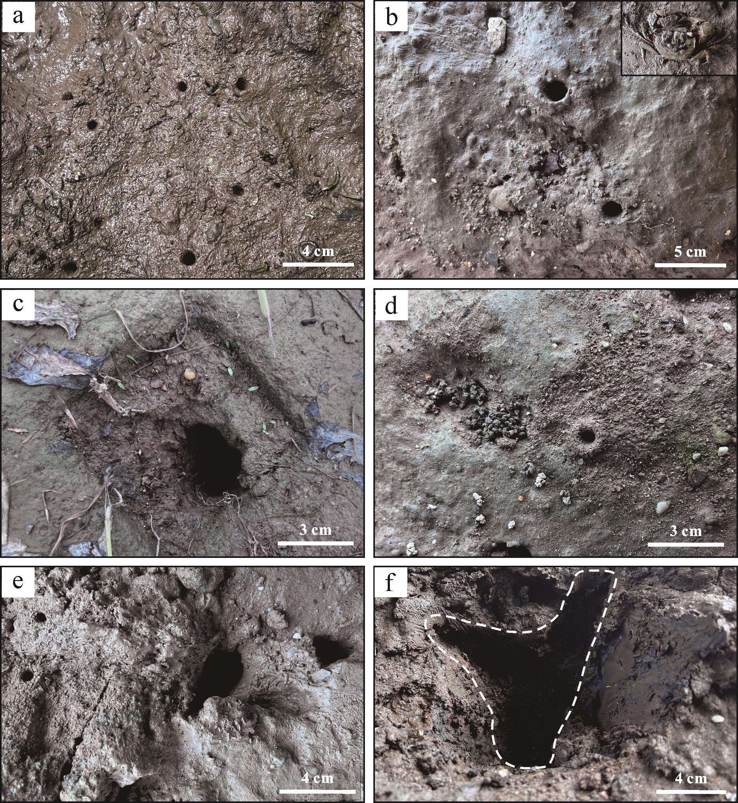
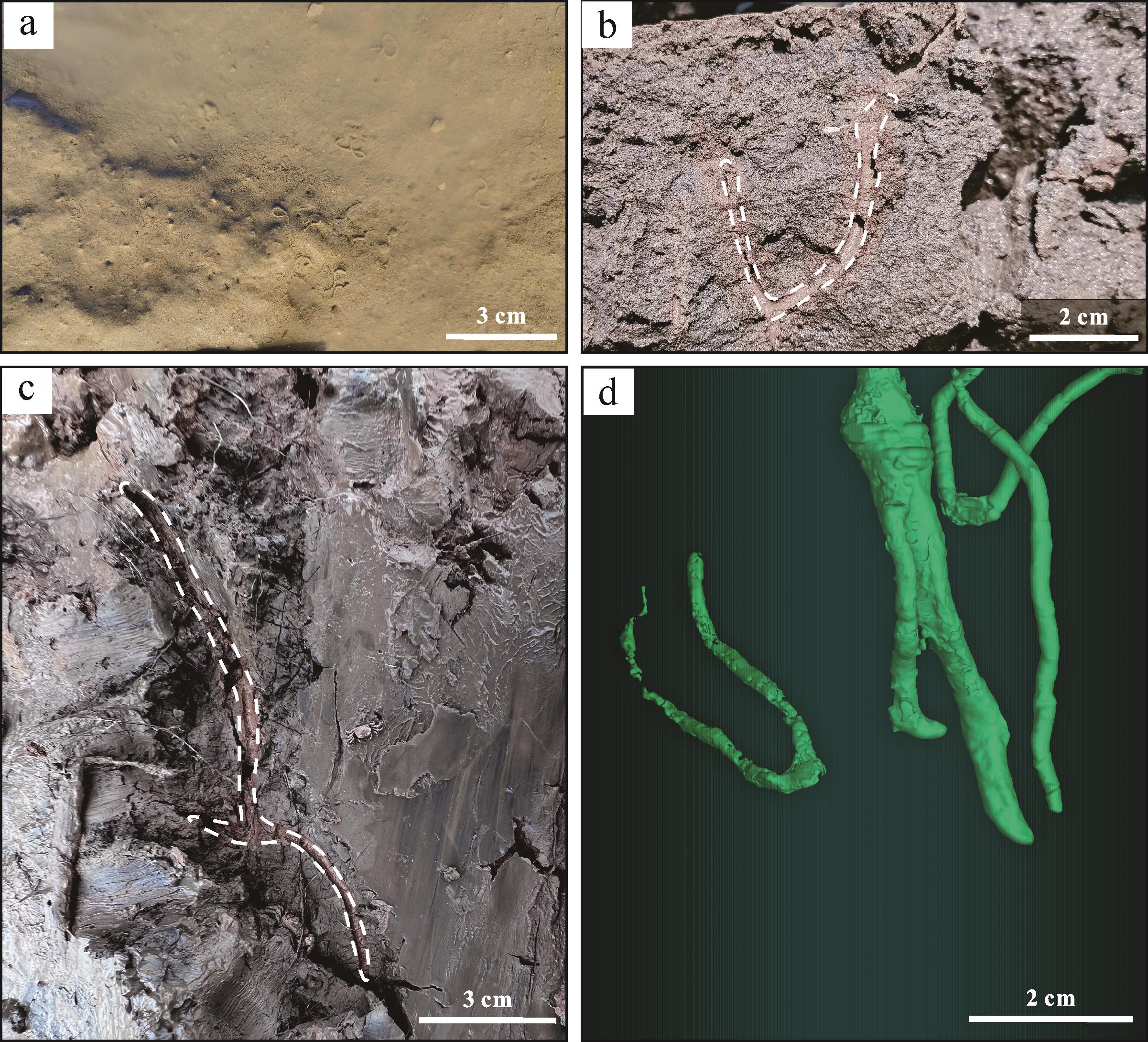
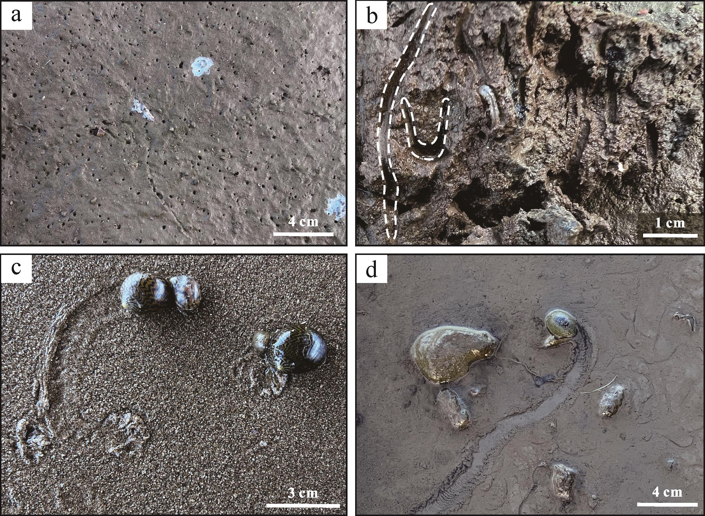
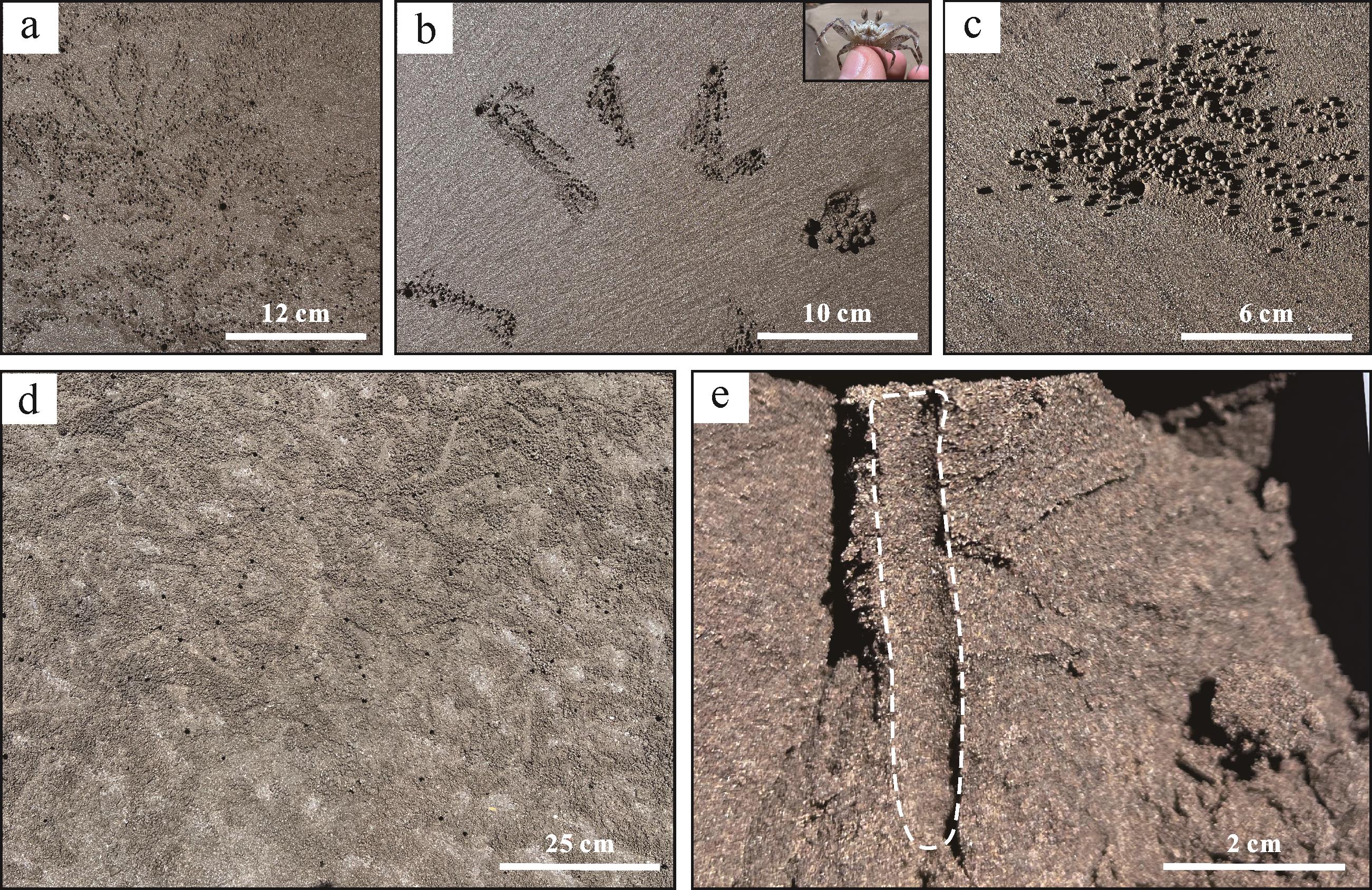
Objective Organisms are extremely responsive to the environments in which they live, and the traces they create are the result of interactions between organisms and their environment. To a certain extent, the traces reflect the properties of the depositional environment. Biological sedimentary structures are a powerful tool in understanding the ecology and depositional processes of modern coastal sedimentary environments. Methods The composition and distribution of modern biological traces in the tidal flat environments of the Pearl River Delta were studied by field observations and 3D reconstruction. Results The key understanding obtained by the study was that the distribution of organisms in the supratidal, intertidal and subtidal varies greatly, and the biological traces are mainly distributed in the intertidal zone. In the supratidal zone, mainly Ligia oceanica and Uca arcuata are present. The main traces are Uca arcuata level feeding traces, excretion traces, trackways, and intra-layer I-shaped dwelling burrows. Biological traces in the intertidal mud flat environment mainly include feeding, excretion, trackways and I-shaped dwelling burrows of Uca arcuata, crawling traces and Y-, U- and I-shaped dwelling burrows of Periophthalmus cantonensis, and trackways and I- and Y-shaped dwelling burrows of Orisarma dehaani. Biological traces in the mixed intertidal flat environment mainly include excretion traces and intra-layer I-, U-, and Y-shaped dwelling burrows of Perinereis aibuhitensis, Y-, U- and I-shaped dwelling burrows of Ligia oceanica, and crawling traces of Vittina coromandeliana and Neritina pulligera. Biological traces in the sandy intertidal environment include feeding and excretion traces of Ocypode cordimand and intra-layer I-shaped dwelling traces. The subtidal environment was not accessible for observation and no biological traces were found. Conclusions The study of modern intertidal biological traces in the Pearl River Delta supplements modern sedimentological data on tidal flat environments in the Pearl River Delta, and provides modern empirical evidence for palaeoichnology and palaeoenvironmental reconstruction.
Objective Organisms are extremely responsive to the environments in which they live, and the traces they create are the result of interactions between organisms and their environment. To a certain extent, the traces reflect the properties of the depositional environment. Biological sedimentary structures are a powerful tool in understanding the ecology and depositional processes of modern coastal sedimentary environments. Methods The composition and distribution of modern biological traces in the tidal flat environments of the Pearl River Delta were studied by field observations and 3D reconstruction. Results The key understanding obtained by the study was that the distribution of organisms in the supratidal, intertidal and subtidal varies greatly, and the biological traces are mainly distributed in the intertidal zone. In the supratidal zone, mainly Ligia oceanica and Uca arcuata are present. The main traces are Uca arcuata level feeding traces, excretion traces, trackways, and intra-layer I-shaped dwelling burrows. Biological traces in the intertidal mud flat environment mainly include feeding, excretion, trackways and I-shaped dwelling burrows of Uca arcuata, crawling traces and Y-, U- and I-shaped dwelling burrows of Periophthalmus cantonensis, and trackways and I- and Y-shaped dwelling burrows of Orisarma dehaani. Biological traces in the mixed intertidal flat environment mainly include excretion traces and intra-layer I-, U-, and Y-shaped dwelling burrows of Perinereis aibuhitensis, Y-, U- and I-shaped dwelling burrows of Ligia oceanica, and crawling traces of Vittina coromandeliana and Neritina pulligera. Biological traces in the sandy intertidal environment include feeding and excretion traces of Ocypode cordimand and intra-layer I-shaped dwelling traces. The subtidal environment was not accessible for observation and no biological traces were found. Conclusions The study of modern intertidal biological traces in the Pearl River Delta supplements modern sedimentological data on tidal flat environments in the Pearl River Delta, and provides modern empirical evidence for palaeoichnology and palaeoenvironmental reconstruction.
2026, 44(3): 1019-1030.
doi: 10.14027/j.issn.1000-0550.2024.127
Abstract:
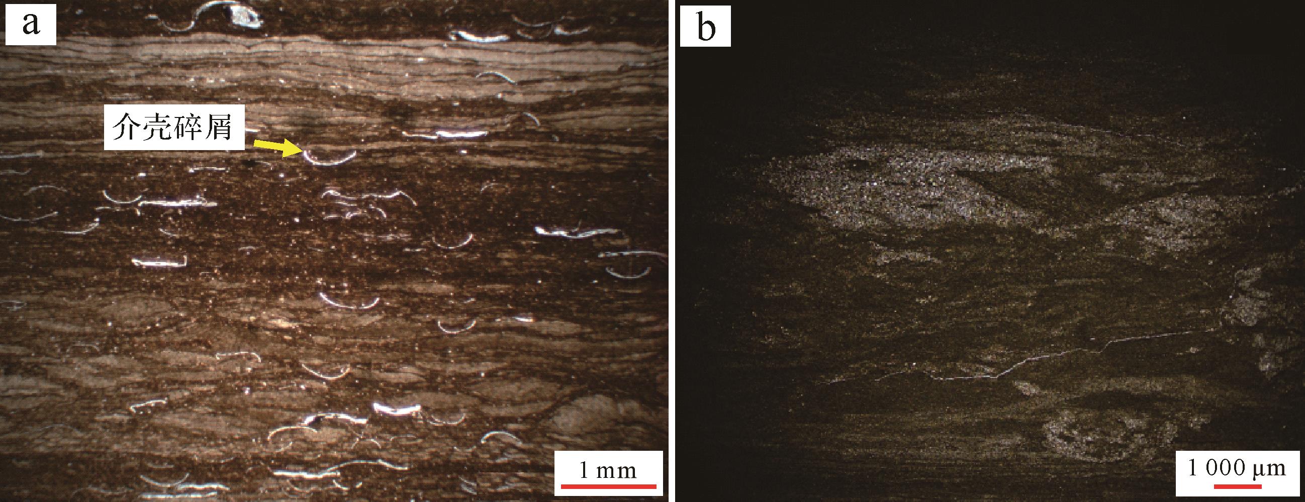
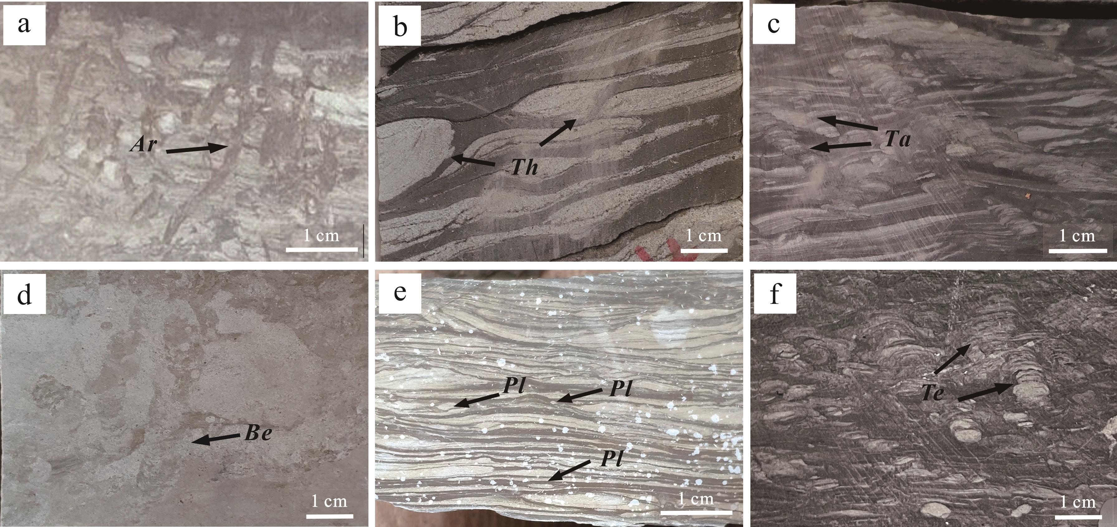
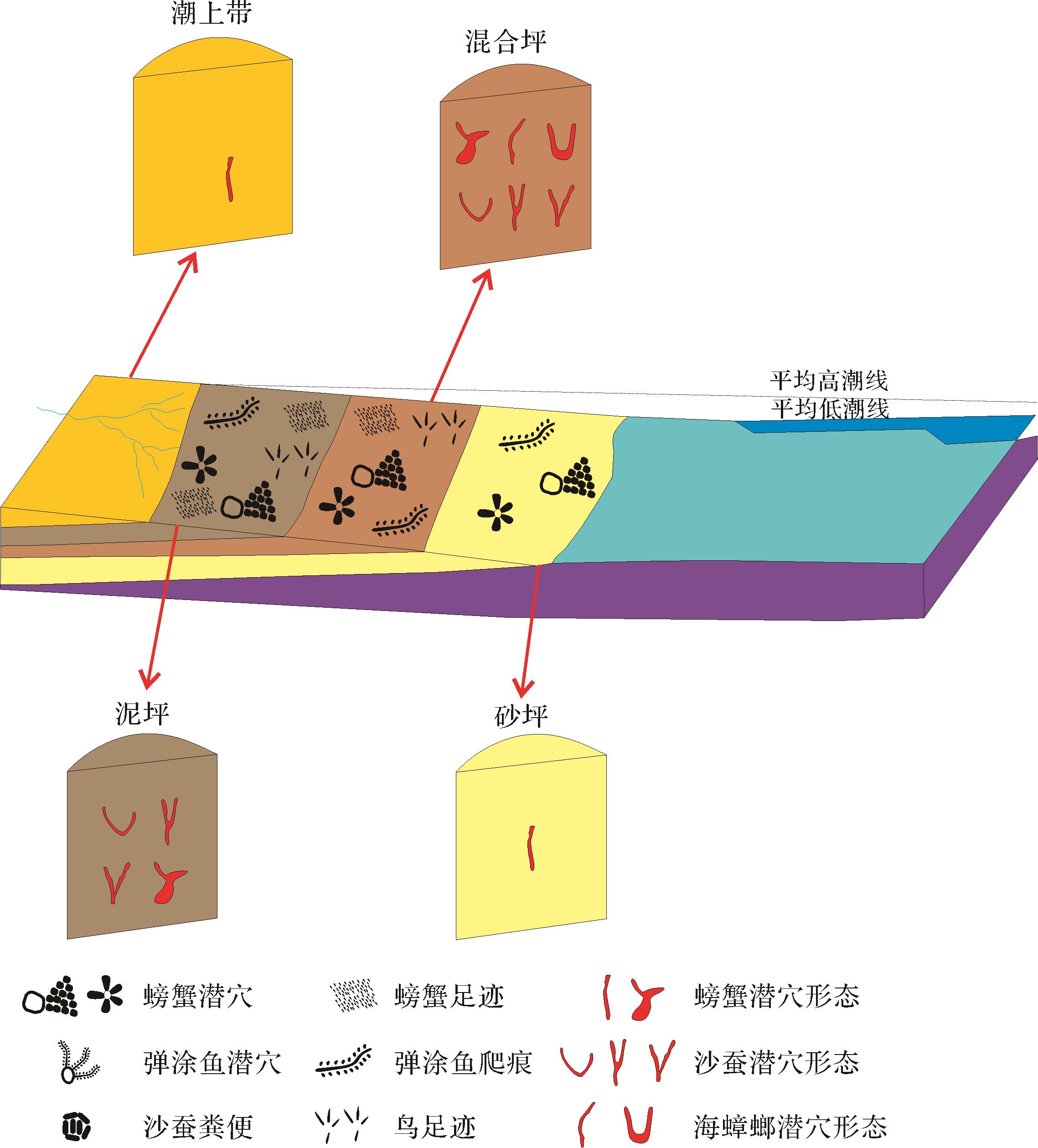
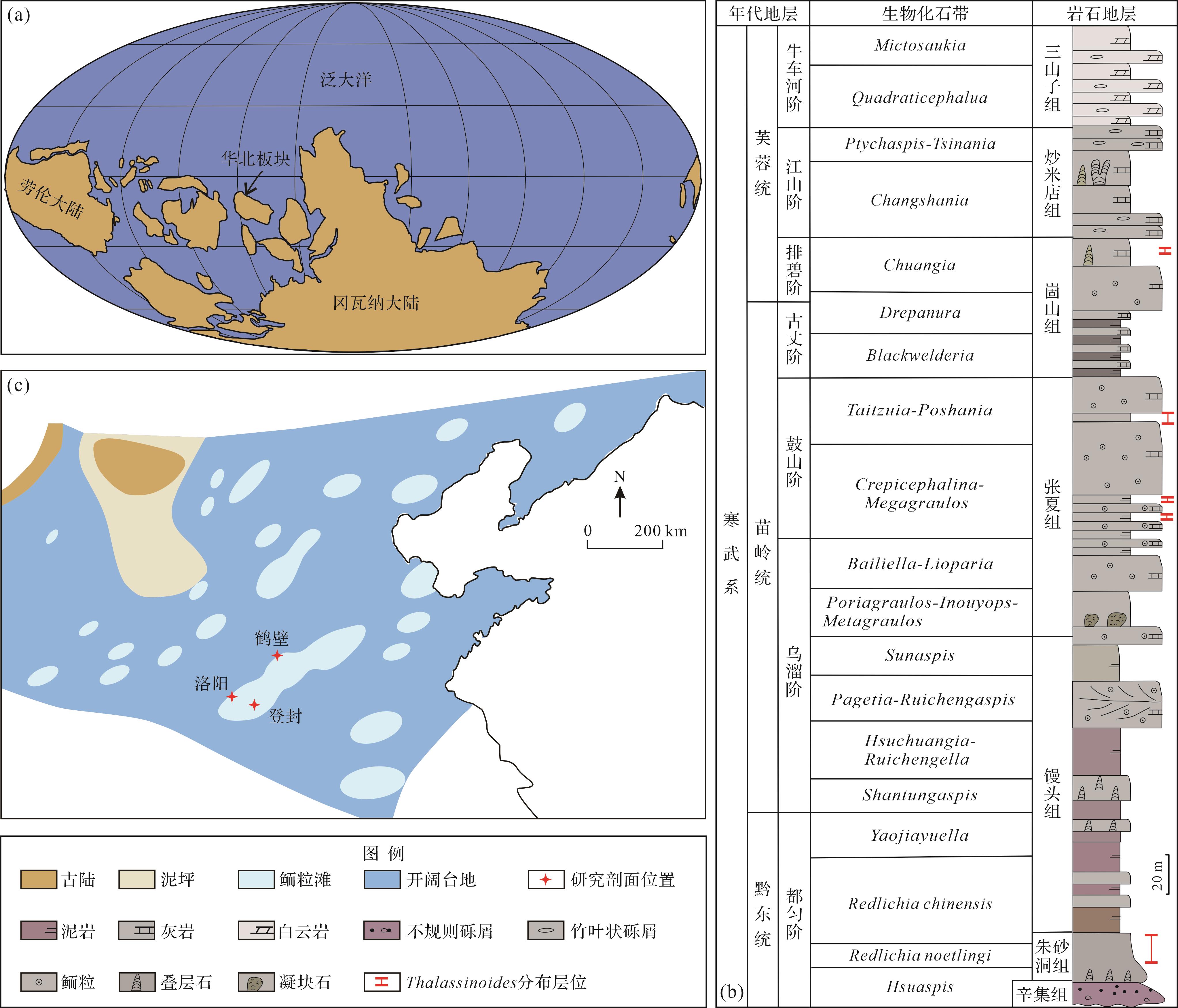
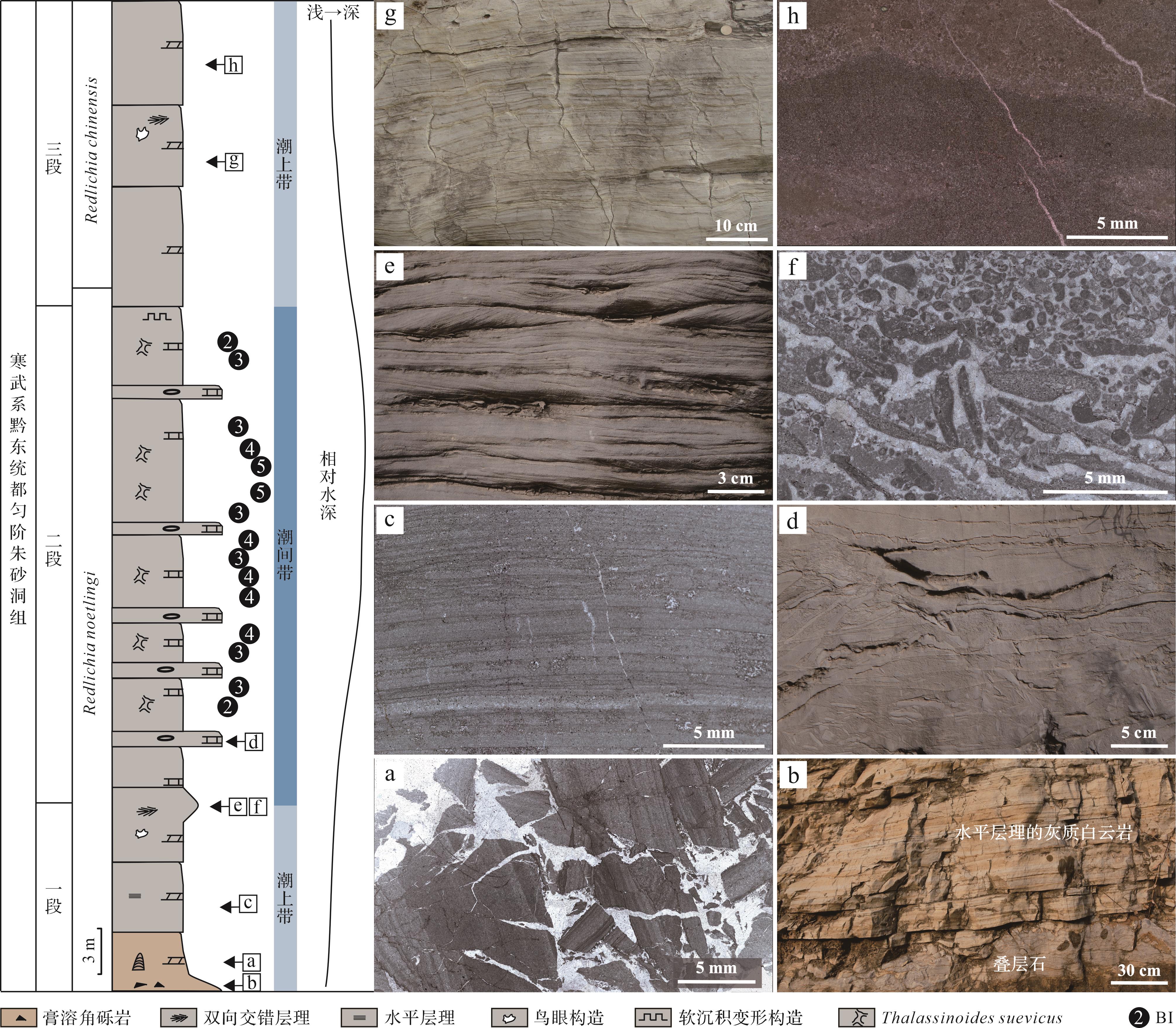
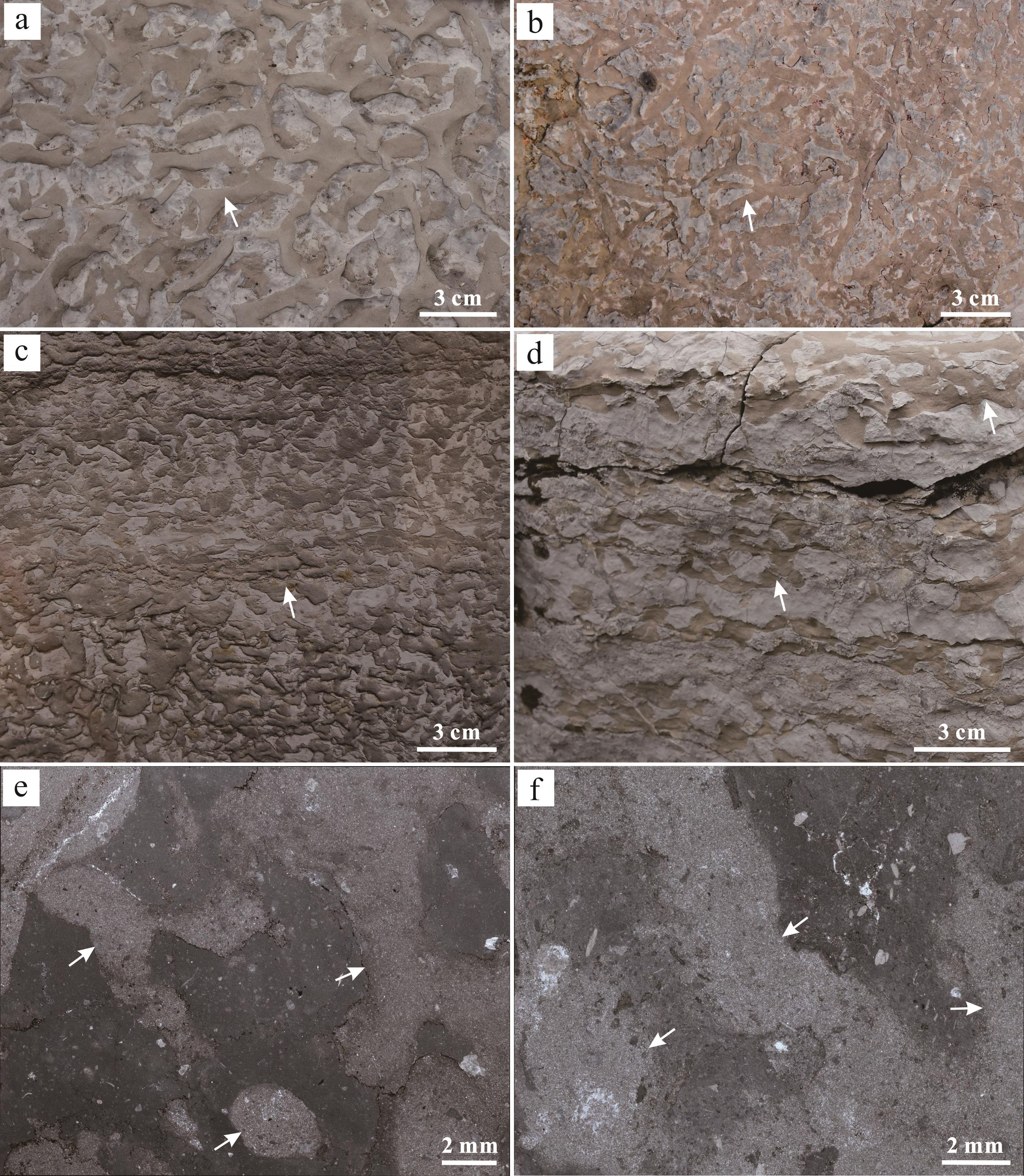
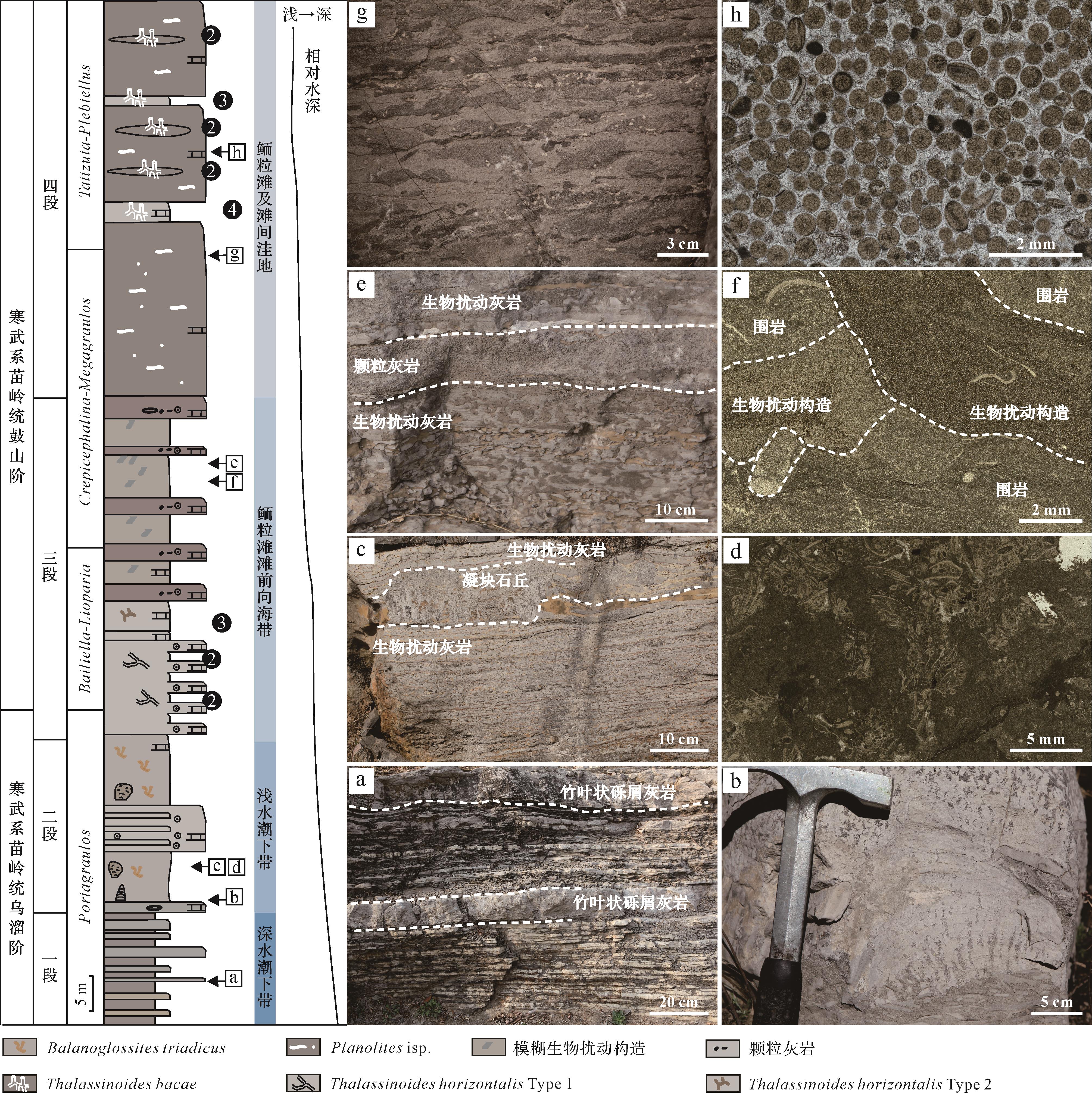
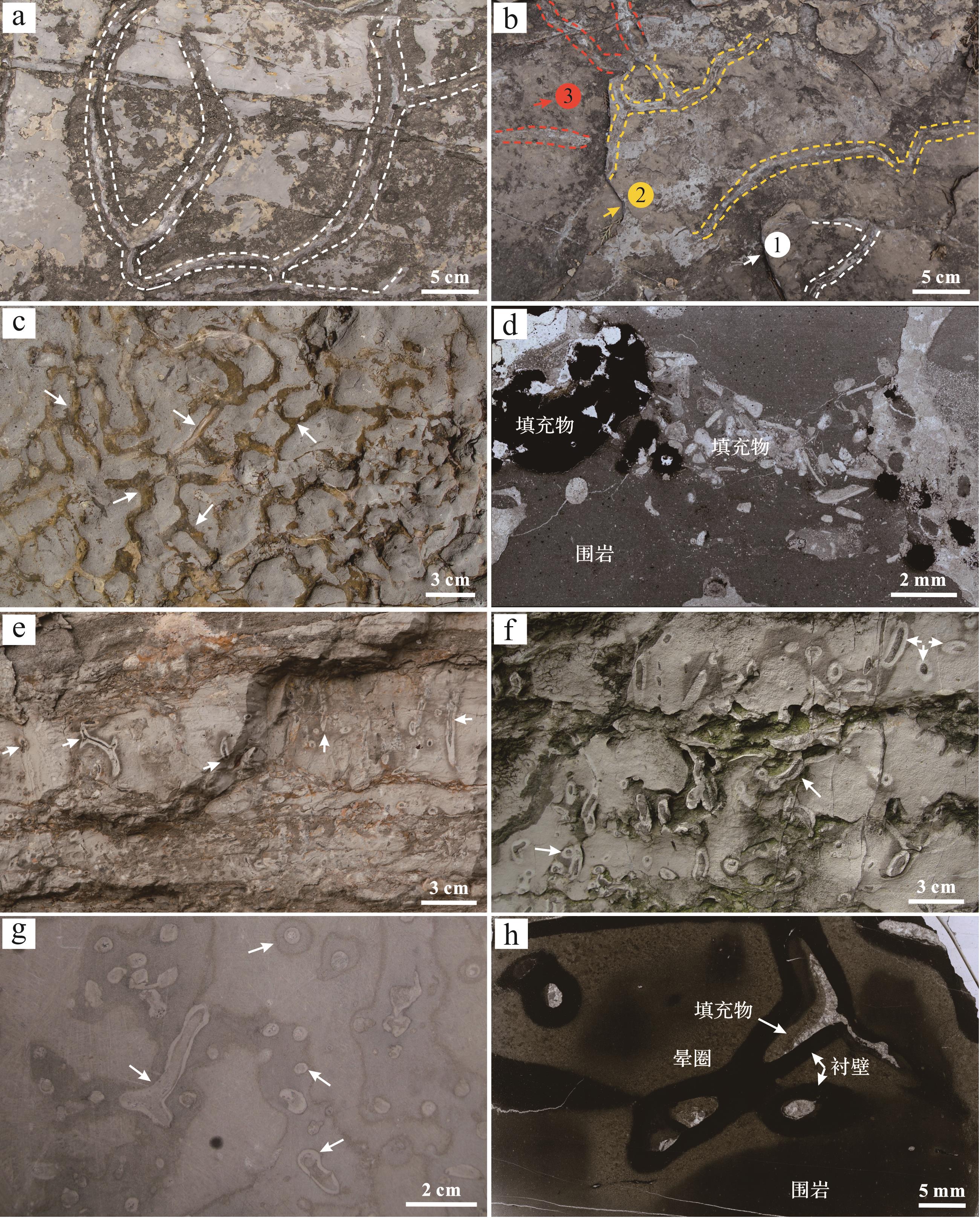
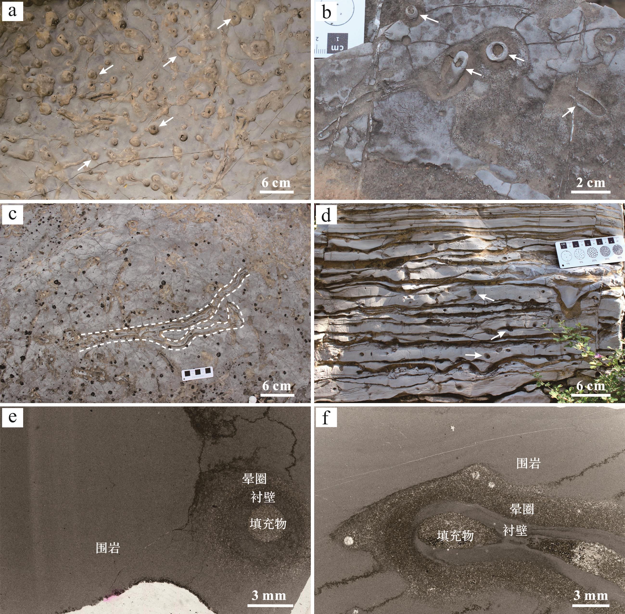
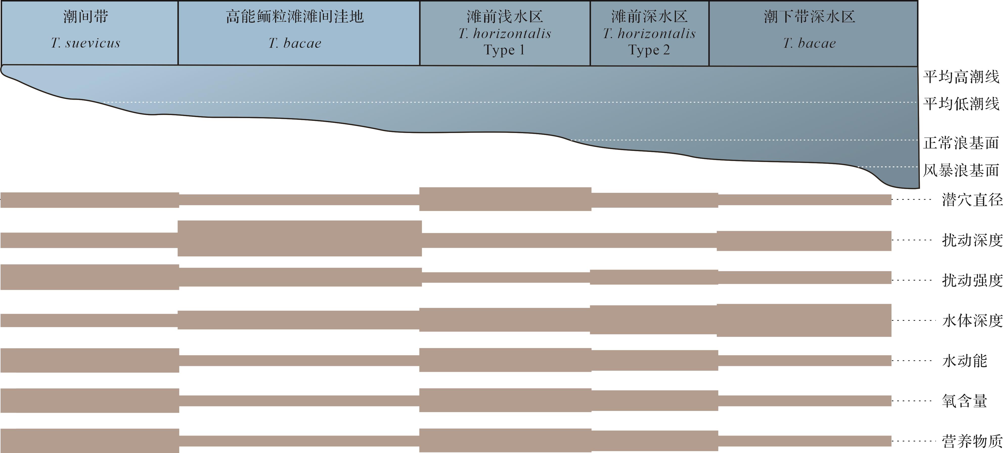
Objective A large number of Thalassinoides trace fossils developed in the Cambrian strata of Henan province. We studied the morphology and distribution characteristics of different ichnospecies and analyzed the sedimentary environment-controlling factors. Methods Based on lithology and ichnography, the morphology, size, disturbance depth, and disturbance intensity of Thalassinoides in this area were combined with sedimentary environment parameters. Results The dense network Thalassinoides suevicus features
Objective A large number of Thalassinoides trace fossils developed in the Cambrian strata of Henan province. We studied the morphology and distribution characteristics of different ichnospecies and analyzed the sedimentary environment-controlling factors. Methods Based on lithology and ichnography, the morphology, size, disturbance depth, and disturbance intensity of Thalassinoides in this area were combined with sedimentary environment parameters. Results The dense network Thalassinoides suevicus features
2026, 44(3): 1031-1047.
doi: 10.14027/j.issn.1000-0550.2024.104
Abstract:
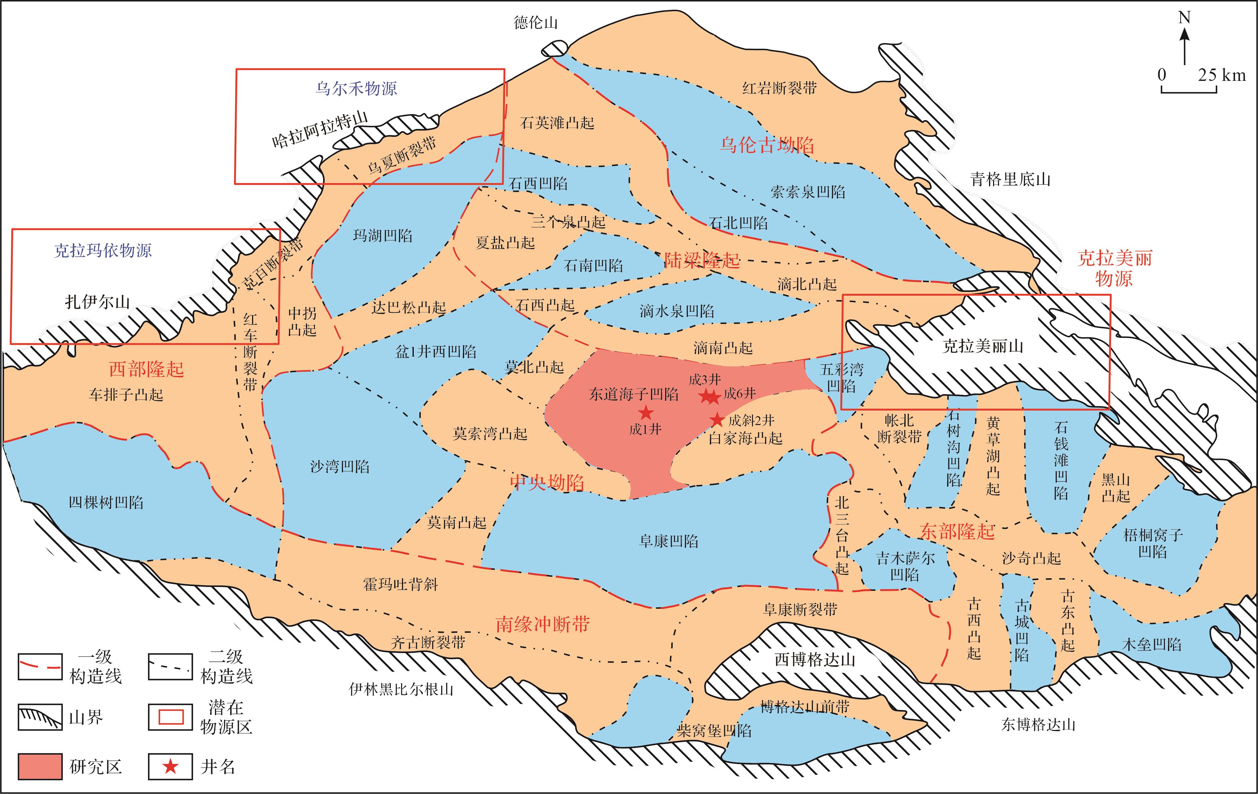
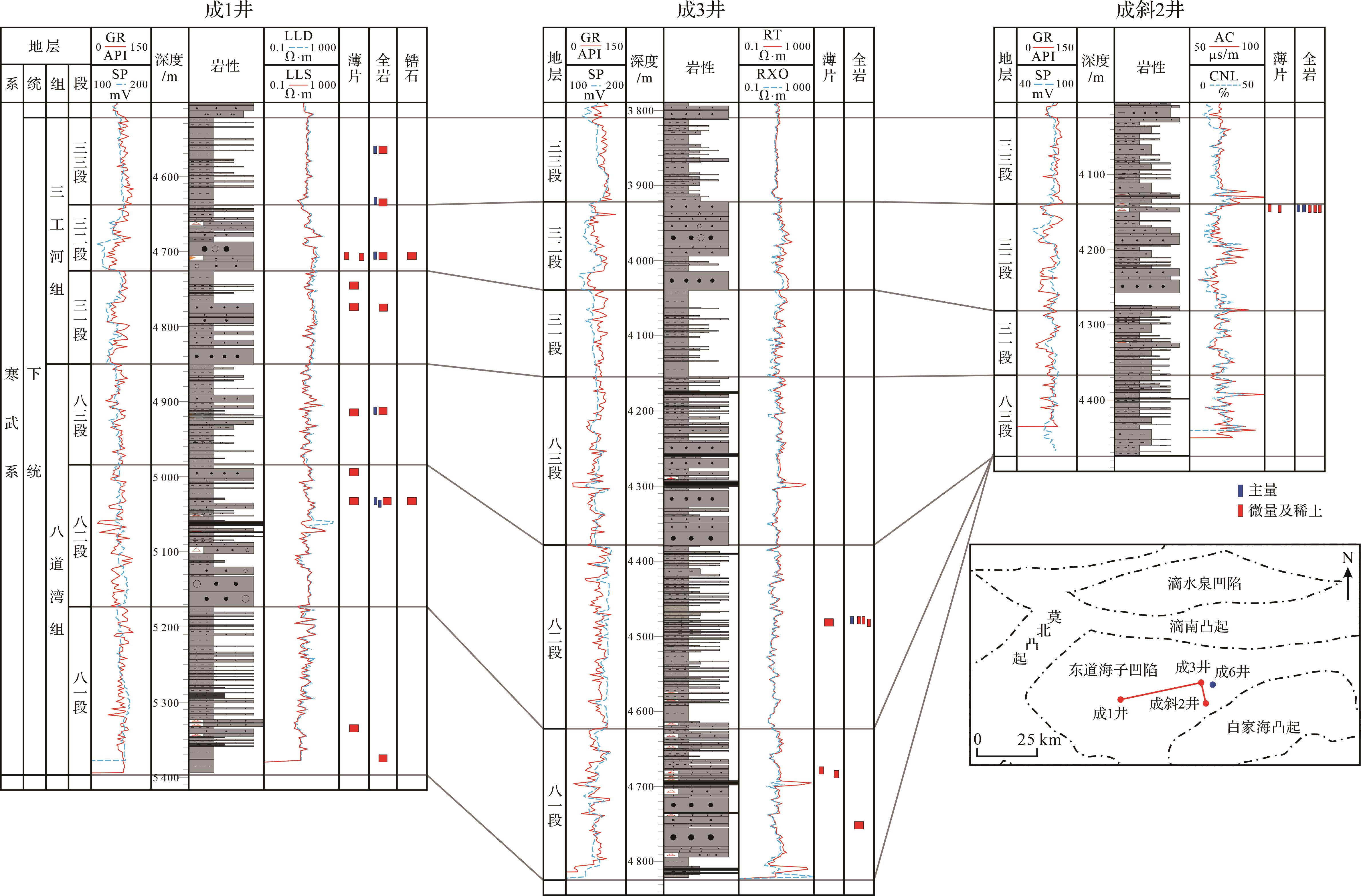
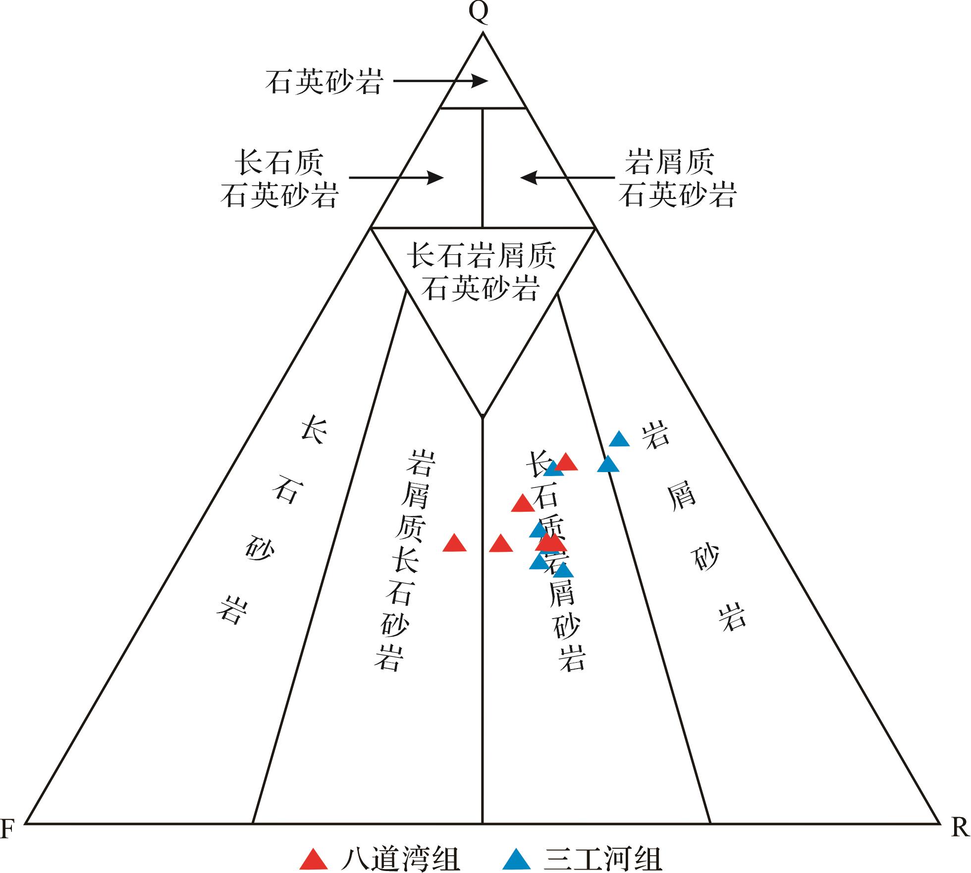
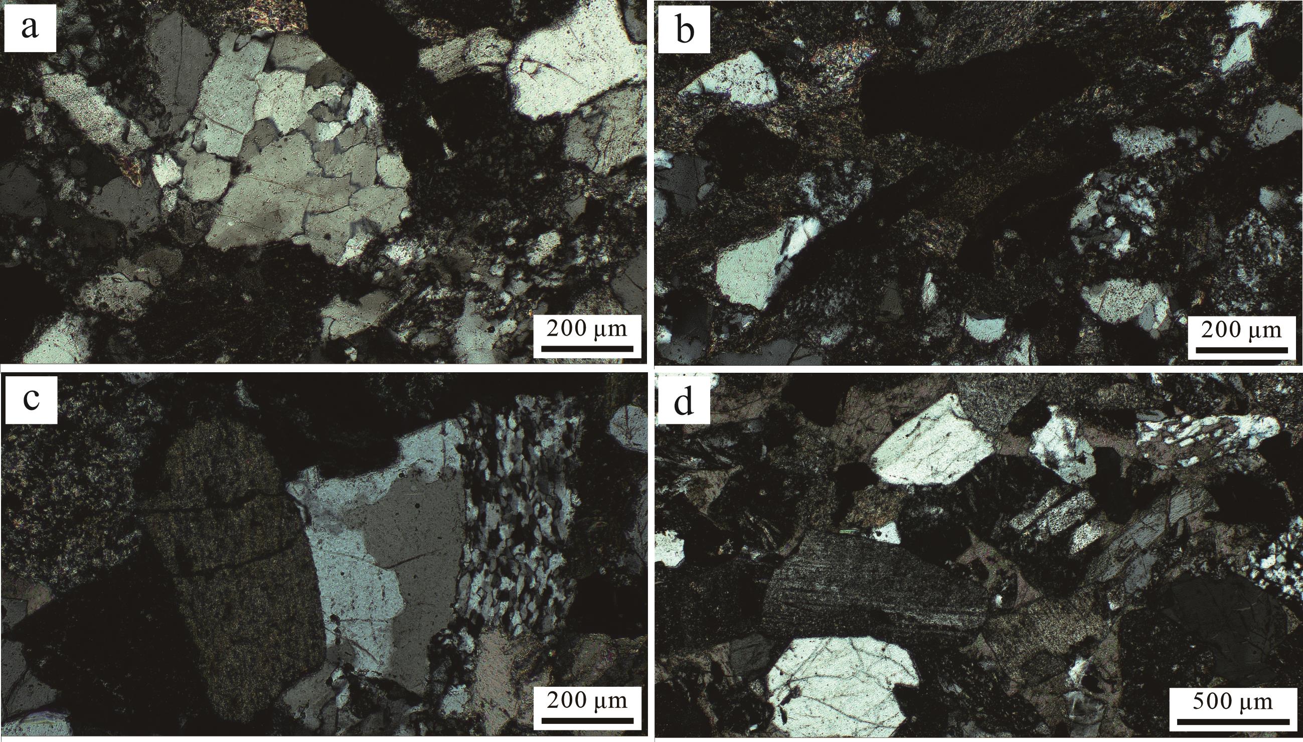
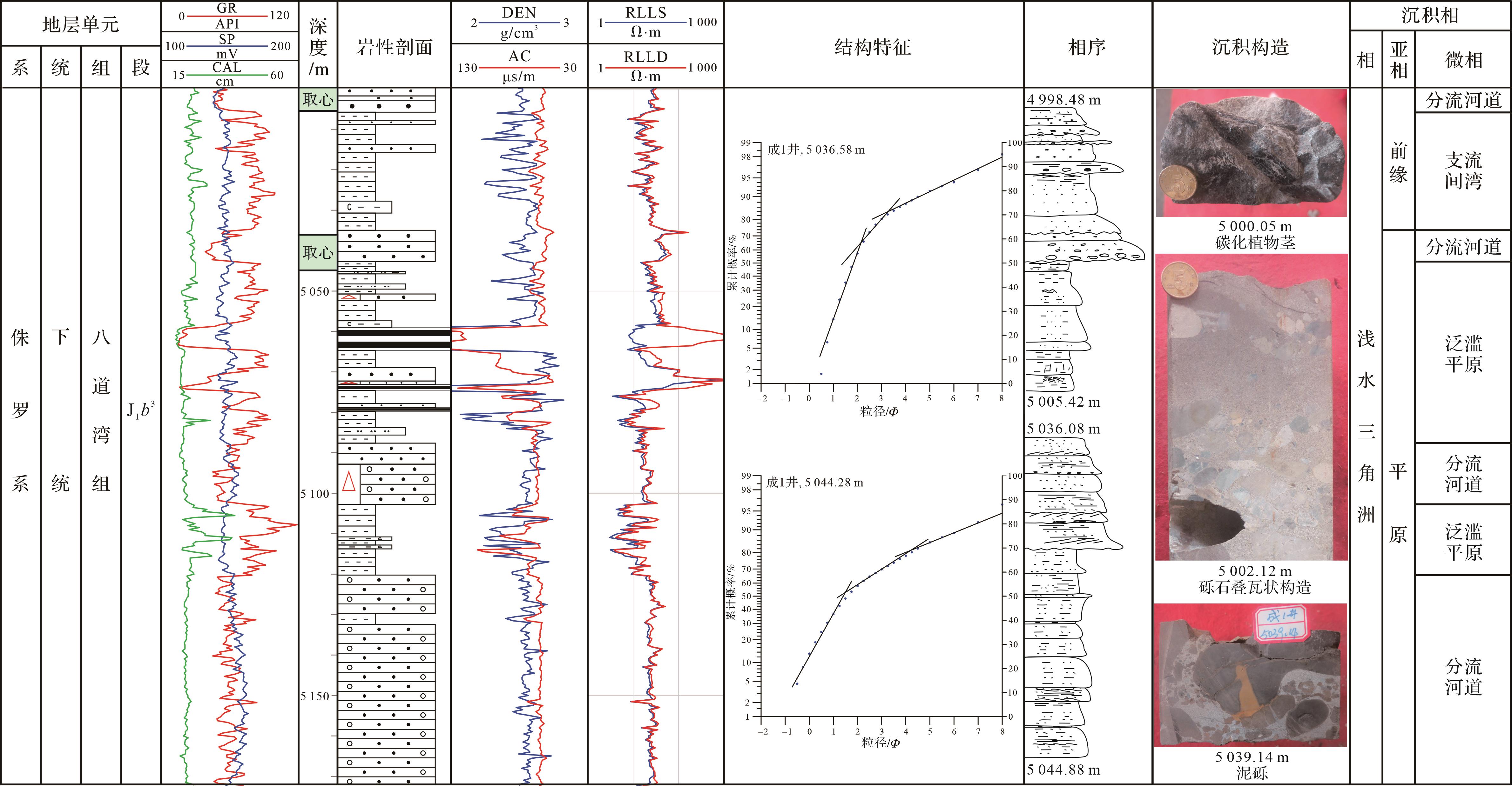
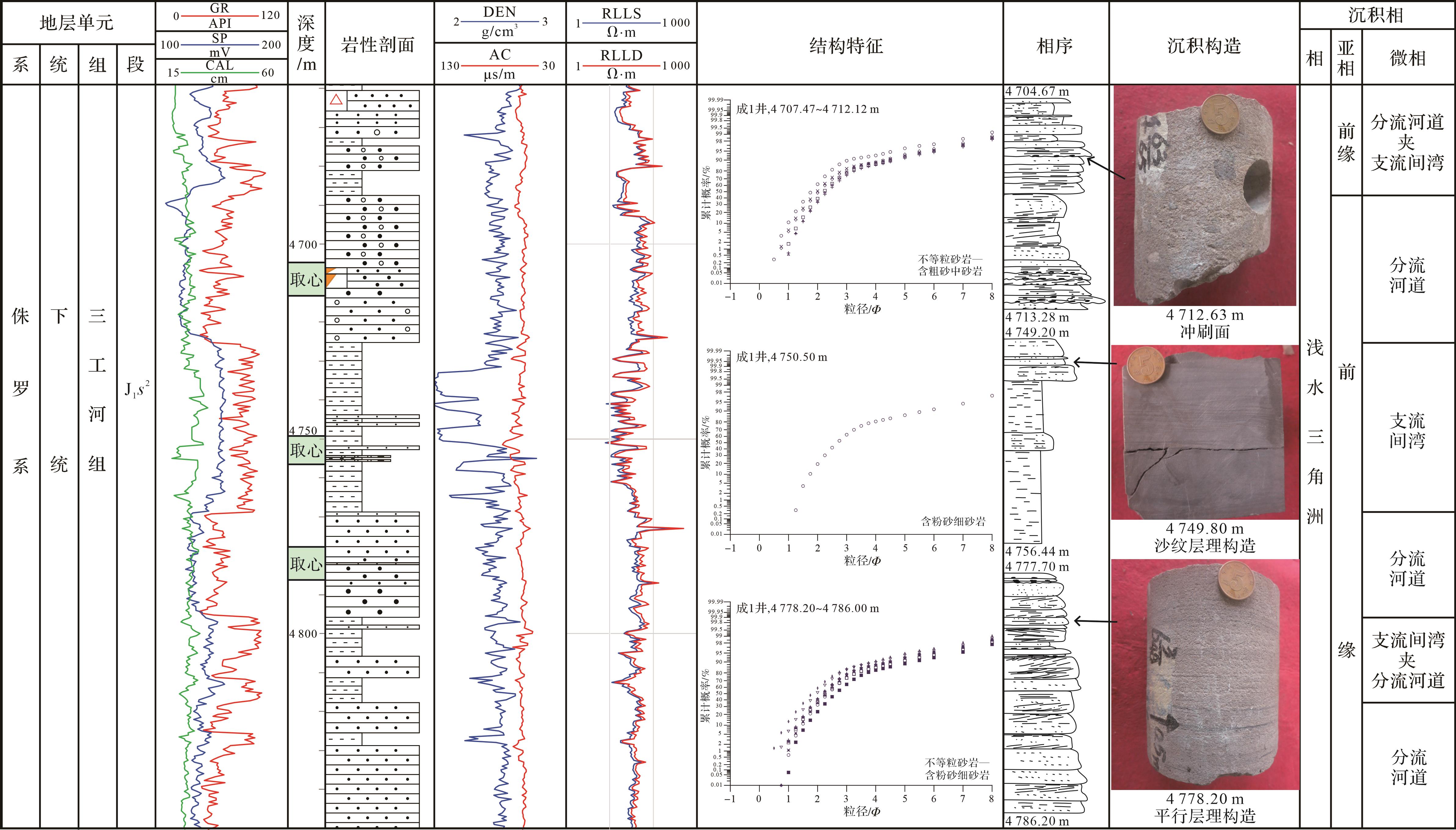
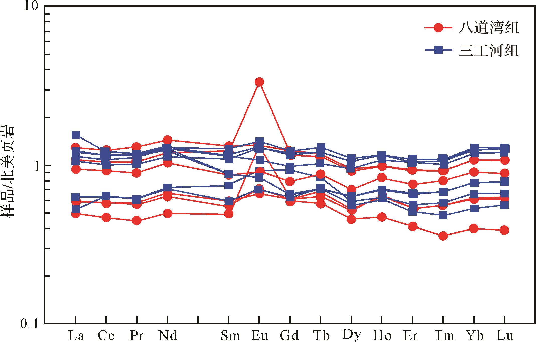
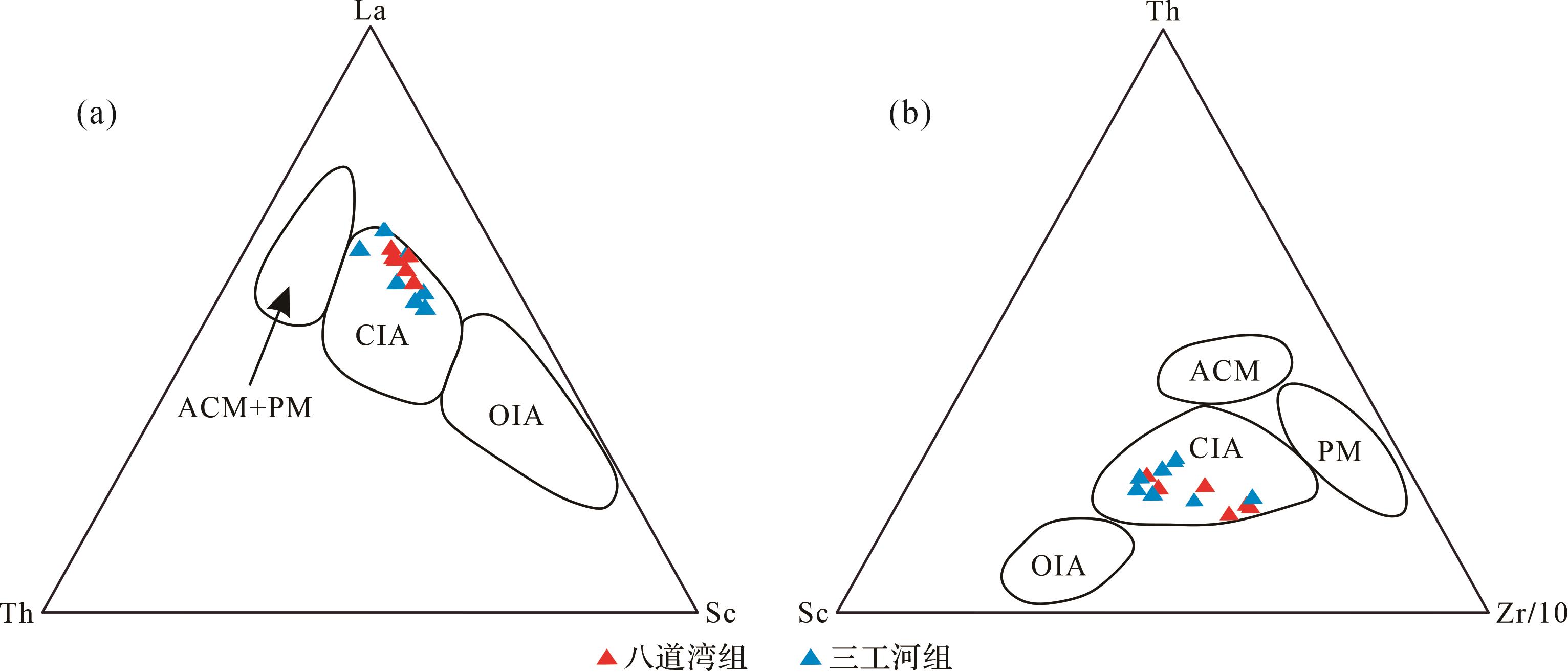
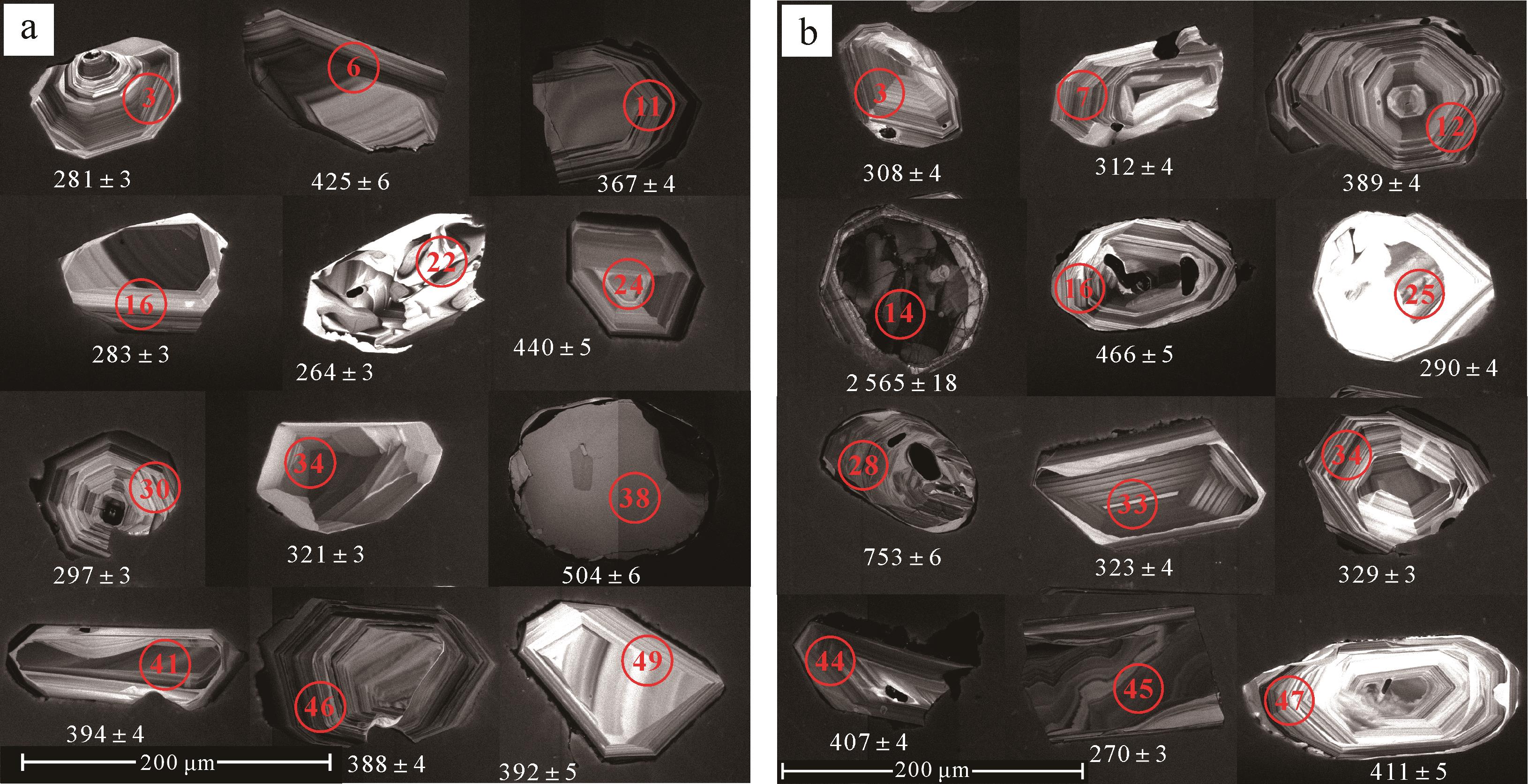
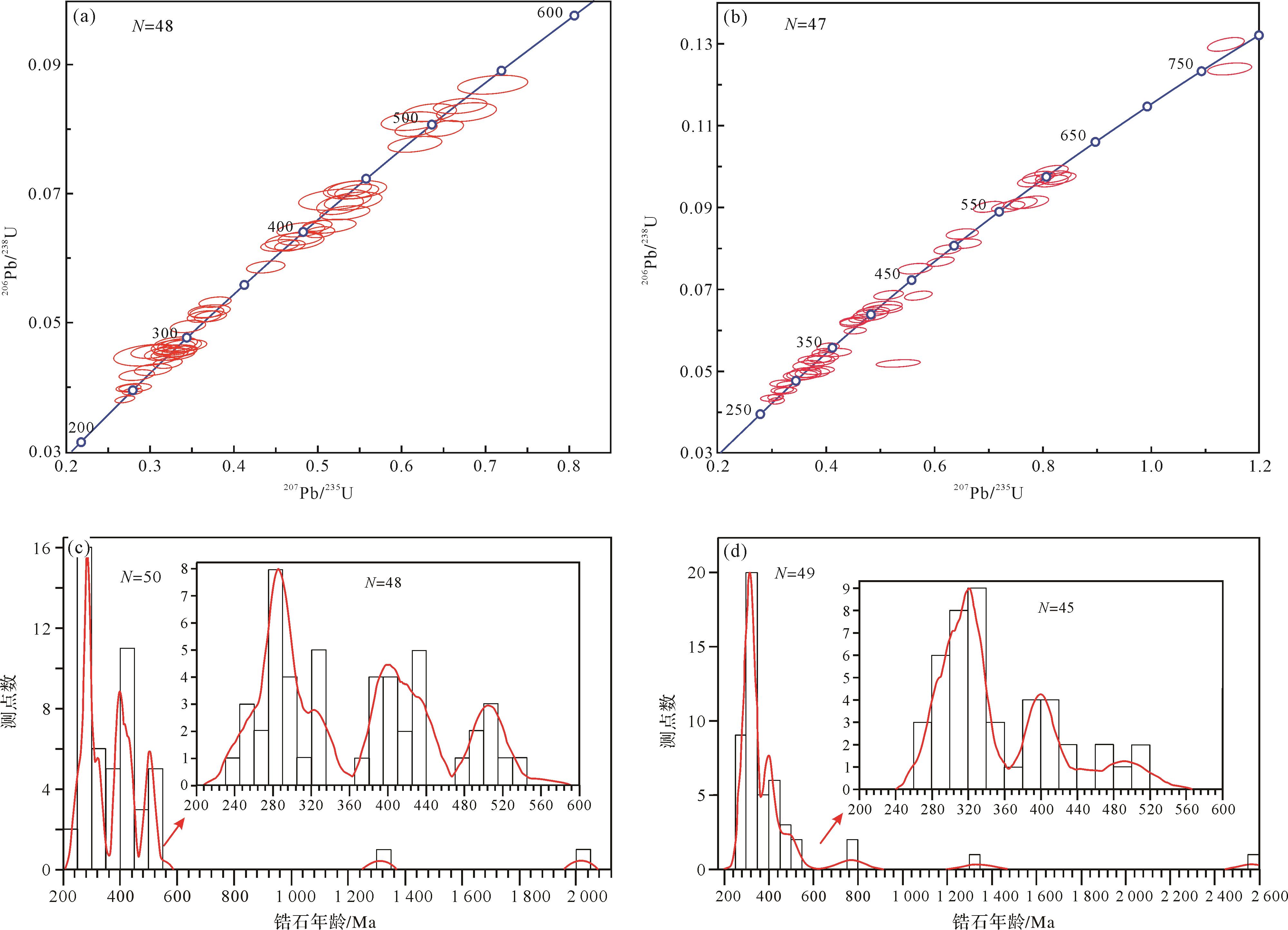
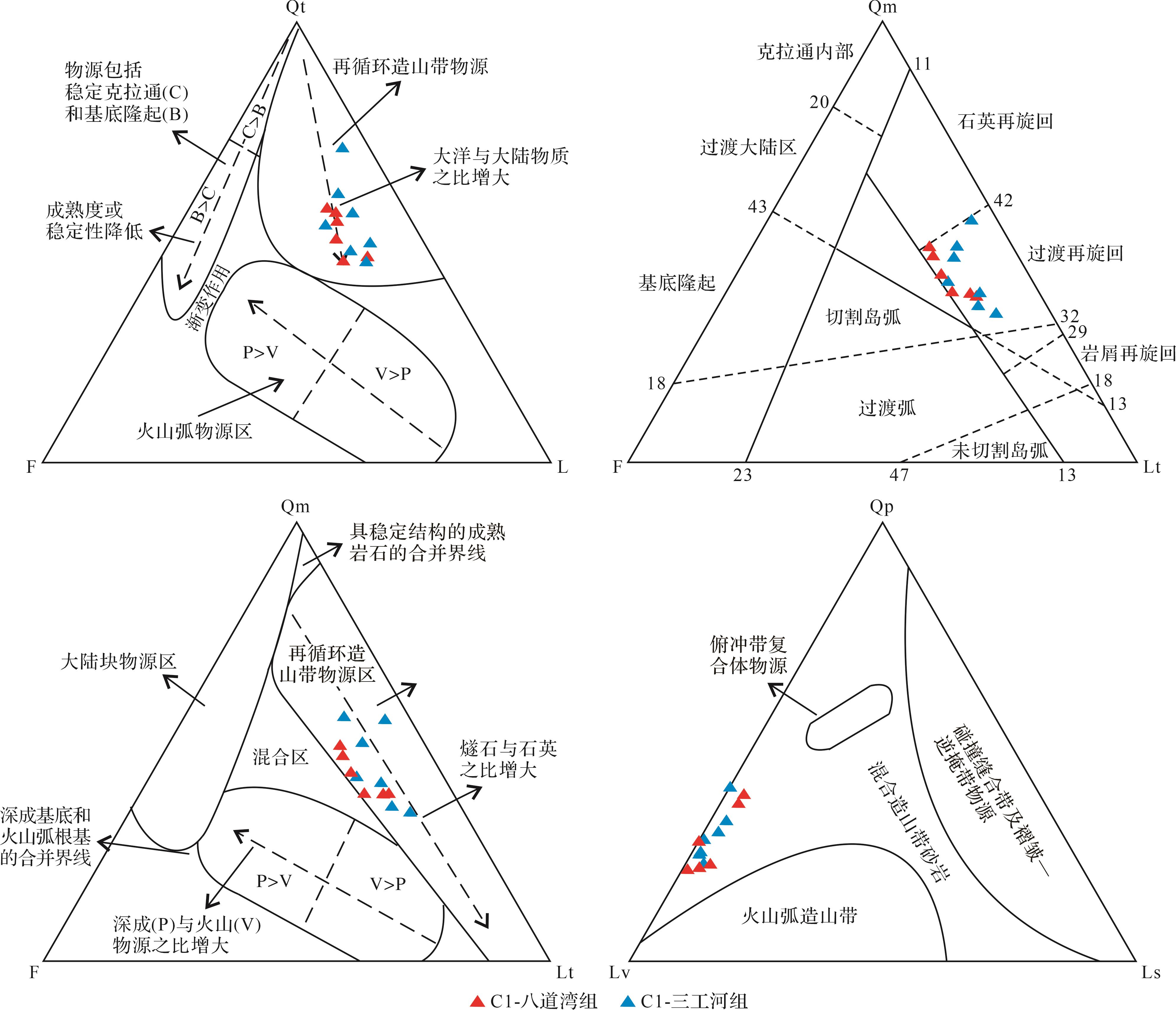
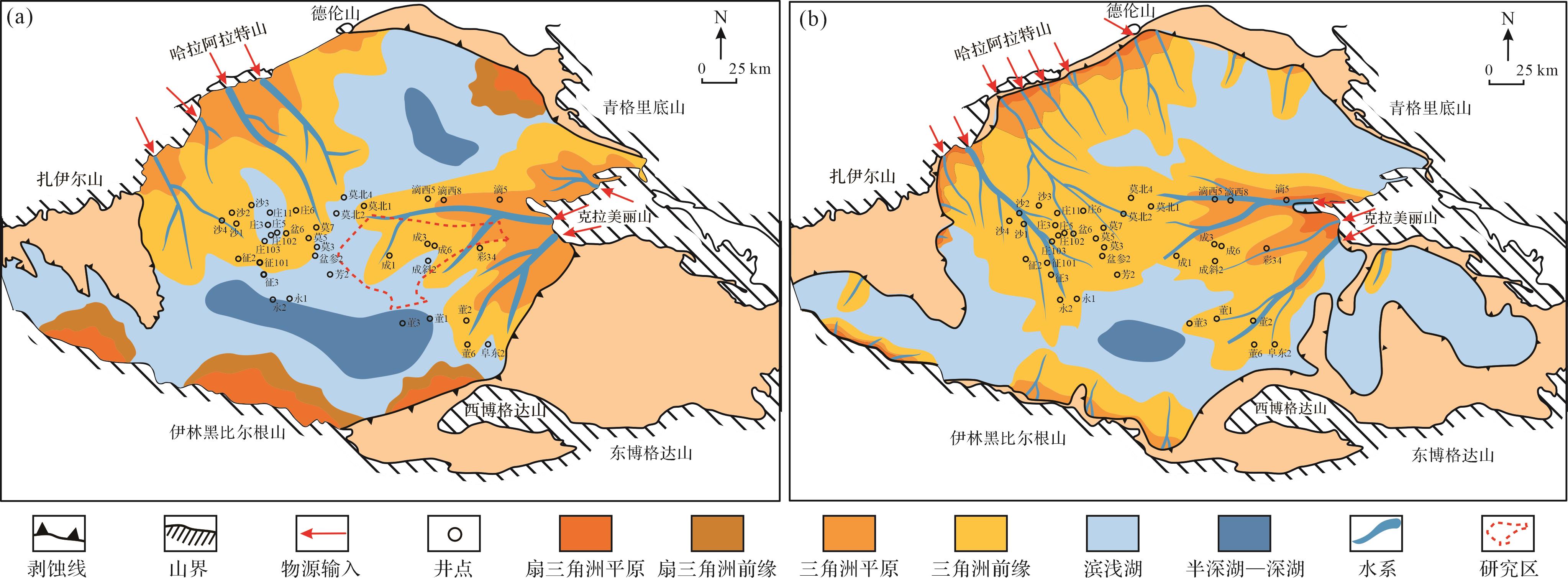
Objective Clarifying the provenance composition and evolution of the Lower Jurassic Badaowan Formation and Sangonghe Formation in the Dongdaohaizi Sag, Junggar Basin, has important guiding significance for studies of the sedimentary filling response in this region of the Lower Jurassic. Methods A detailed analysis was conducted on the source characteristics and evolutionary processes of the Badaowan Formation and Sangonghe Formation based on the composition of sandstone debris, the geochemical characteristics of whole-rock elements, and U-Pb ages of detrital zircons. Results It was found that the sandstone samples from the Lower Jurassic in the study area were mainly composed of feldspathic lithic sandstone, with an average content of 37.7% of tuff and basalt lithic debris in the thin sections, along with a small amount of metamorphic rock debris. After standardization of shale samples in North America, the Badaowan Formation samples showed no significant differentiation between light and heavy rare earth elements. The Sangonghe Formation exhibited slight enrichment of light rare earths and depletion of heavy rare earths. The age distribution of detrital zircons in the sandstone samples in the Badaowan Formation is mainly concentrated in three ranges: 280-330 Ma, 400-440 Ma and 490-520 Ma; the Sangonghe Formation is dominated by three peak age ranges: 280-350 Ma, 380-430 Ma and 460-520 Ma, with similar age compositions. Conclusions A comprehensive analysis of provenance characteristics indicated that the Badaowan Formation in the Dongdaohaizi Sag is mainly sourced from the Kela Meili provenance system in the eastern Junggar Basin, and the western Urho and Karamay provenance regions had little influence. During the depositional period of the Sangonghe Formation, the western region began to supply resources, but the eastern Kela Meili provenance system remained the main source of materials in the study area. In the Middle Jurassic, the influence of the western provenance increased, and the Che-Mo paleo-uplift was formed. The Donghaizi Sag was jointly influenced by two major provenance systems. The parent rocks in the Lower Jurassic provenance area of the Dongdaohaizi Sag are mainly intermediate acid magmatic rocks and basic magmatic rocks, and the provenance is mainly from the transitional and recirculating zones of the recycled orogenic belt. The tectonic setting is dominated by continental island arcs, which is consistent with the mixed-source background formed by oceanic continental subduction around the Junggar Basin, and following closure of the ocean basin. In the context of this tectonic setting, during the sedimentation period of the Badaowan Formation the Dongdaohaizi Sag was influenced by the East Kela Meili source, forming a shallow-water delta lake sedimentary system. Distributary channel sand bodies were extensively developed, but the physical properties were poor, with few favoring hydrocarbon accumulation. During the sedimentation period of the Sangonghe Formation, the Dongdaohaizi Sag was influenced by two major source systems, east and west, and a shallow-water delta lake system developed together with underwater distributary channel microfacies composed mainly of medium and fine sandstones, as well as a small amount of estuarine dam microfacies with physical properties favorable to hydrocarbon reservoir development.
Objective Clarifying the provenance composition and evolution of the Lower Jurassic Badaowan Formation and Sangonghe Formation in the Dongdaohaizi Sag, Junggar Basin, has important guiding significance for studies of the sedimentary filling response in this region of the Lower Jurassic. Methods A detailed analysis was conducted on the source characteristics and evolutionary processes of the Badaowan Formation and Sangonghe Formation based on the composition of sandstone debris, the geochemical characteristics of whole-rock elements, and U-Pb ages of detrital zircons. Results It was found that the sandstone samples from the Lower Jurassic in the study area were mainly composed of feldspathic lithic sandstone, with an average content of 37.7% of tuff and basalt lithic debris in the thin sections, along with a small amount of metamorphic rock debris. After standardization of shale samples in North America, the Badaowan Formation samples showed no significant differentiation between light and heavy rare earth elements. The Sangonghe Formation exhibited slight enrichment of light rare earths and depletion of heavy rare earths. The age distribution of detrital zircons in the sandstone samples in the Badaowan Formation is mainly concentrated in three ranges: 280-330 Ma, 400-440 Ma and 490-520 Ma; the Sangonghe Formation is dominated by three peak age ranges: 280-350 Ma, 380-430 Ma and 460-520 Ma, with similar age compositions. Conclusions A comprehensive analysis of provenance characteristics indicated that the Badaowan Formation in the Dongdaohaizi Sag is mainly sourced from the Kela Meili provenance system in the eastern Junggar Basin, and the western Urho and Karamay provenance regions had little influence. During the depositional period of the Sangonghe Formation, the western region began to supply resources, but the eastern Kela Meili provenance system remained the main source of materials in the study area. In the Middle Jurassic, the influence of the western provenance increased, and the Che-Mo paleo-uplift was formed. The Donghaizi Sag was jointly influenced by two major provenance systems. The parent rocks in the Lower Jurassic provenance area of the Dongdaohaizi Sag are mainly intermediate acid magmatic rocks and basic magmatic rocks, and the provenance is mainly from the transitional and recirculating zones of the recycled orogenic belt. The tectonic setting is dominated by continental island arcs, which is consistent with the mixed-source background formed by oceanic continental subduction around the Junggar Basin, and following closure of the ocean basin. In the context of this tectonic setting, during the sedimentation period of the Badaowan Formation the Dongdaohaizi Sag was influenced by the East Kela Meili source, forming a shallow-water delta lake sedimentary system. Distributary channel sand bodies were extensively developed, but the physical properties were poor, with few favoring hydrocarbon accumulation. During the sedimentation period of the Sangonghe Formation, the Dongdaohaizi Sag was influenced by two major source systems, east and west, and a shallow-water delta lake system developed together with underwater distributary channel microfacies composed mainly of medium and fine sandstones, as well as a small amount of estuarine dam microfacies with physical properties favorable to hydrocarbon reservoir development.
2026, 44(3): 1048-1065.
doi: 10.14027/j.issn.1000-0550.2024.099
Abstract:
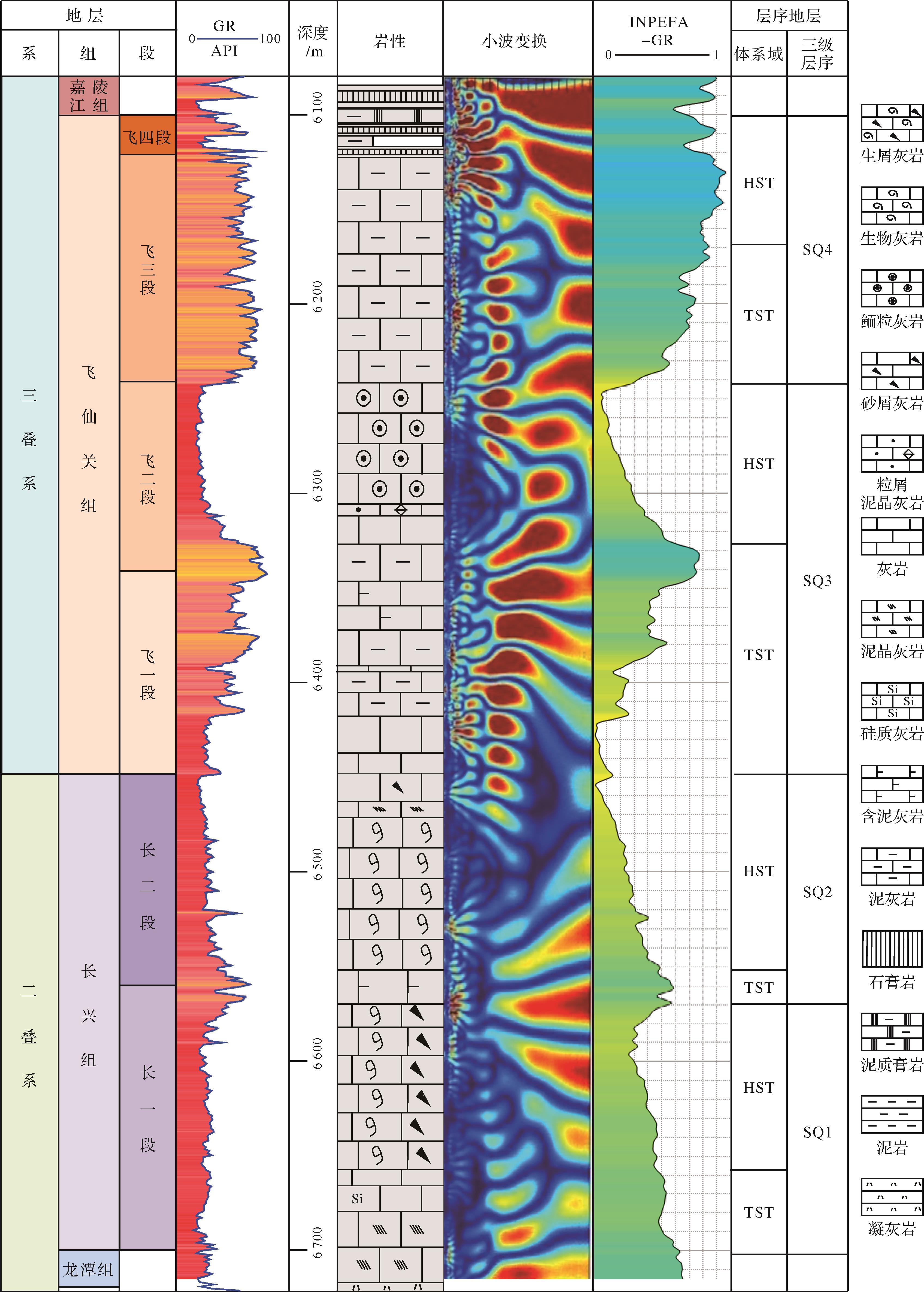
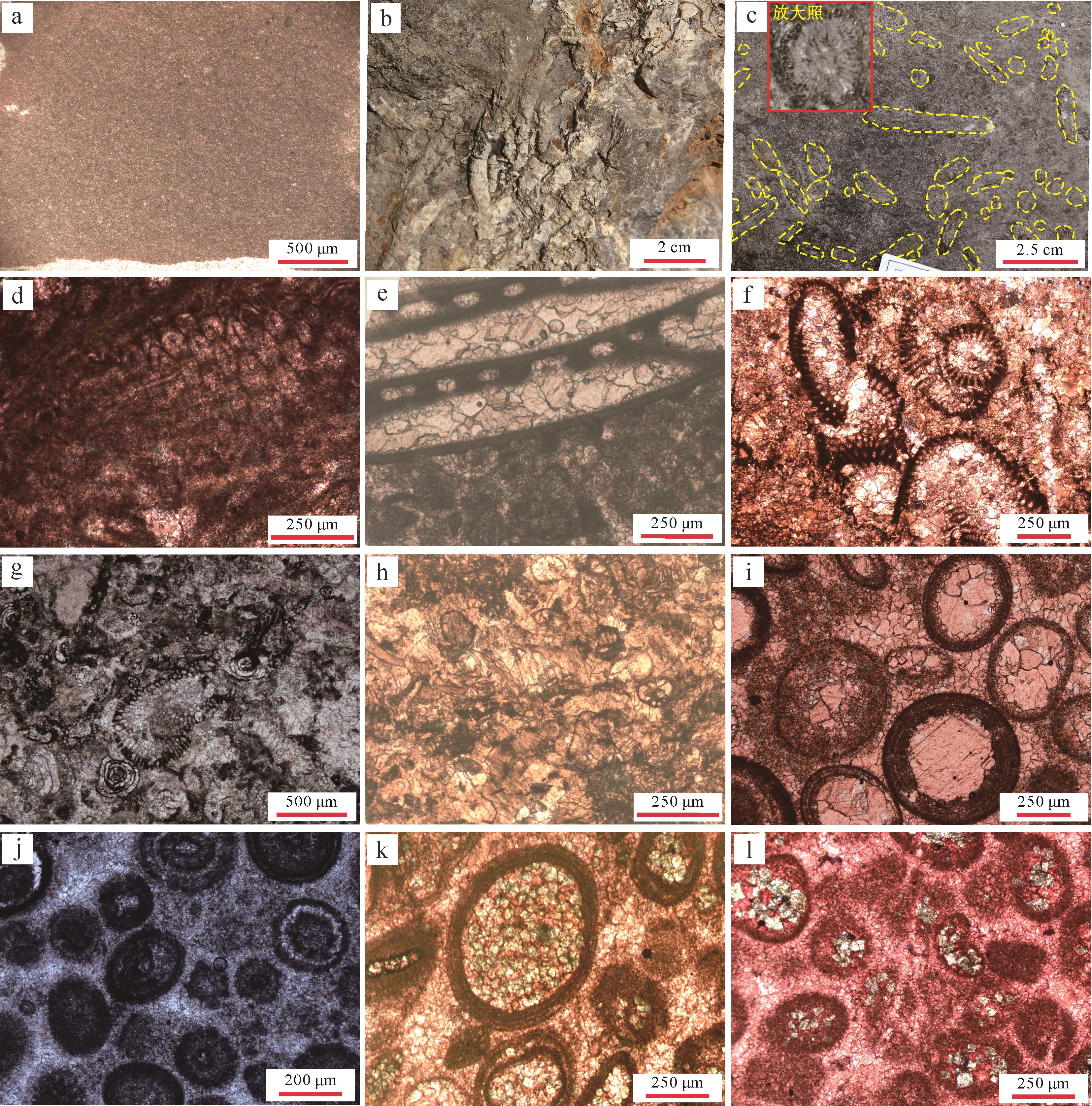
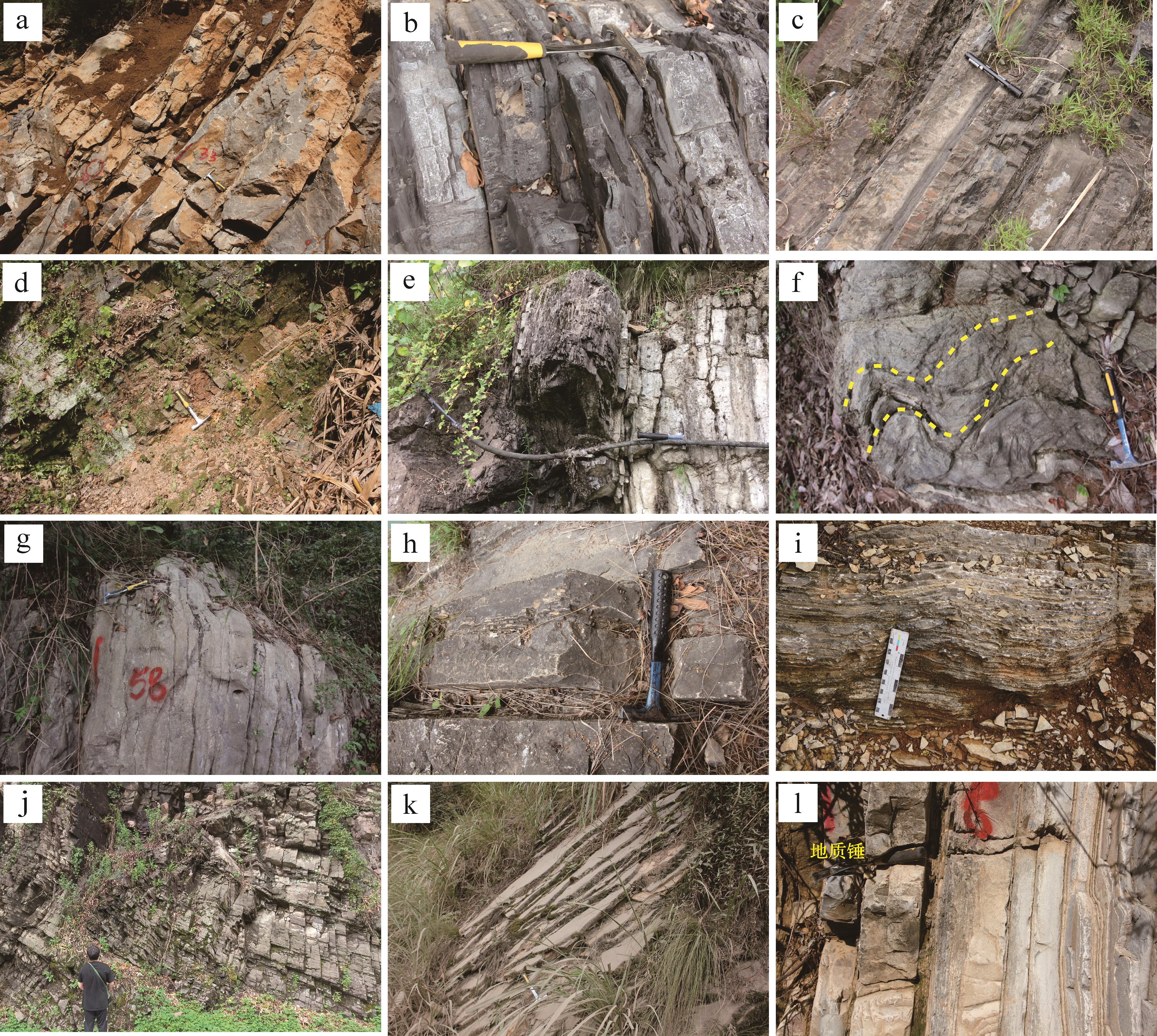
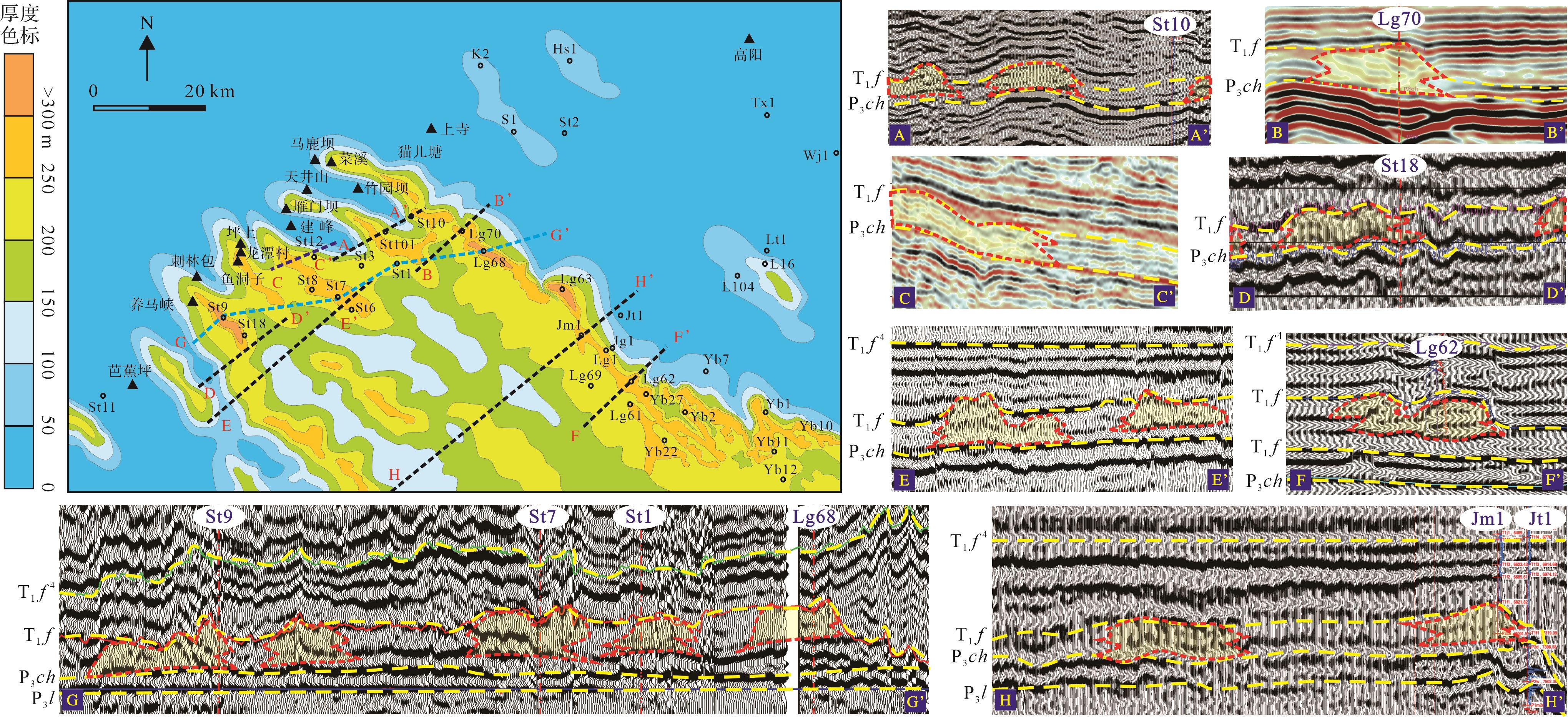
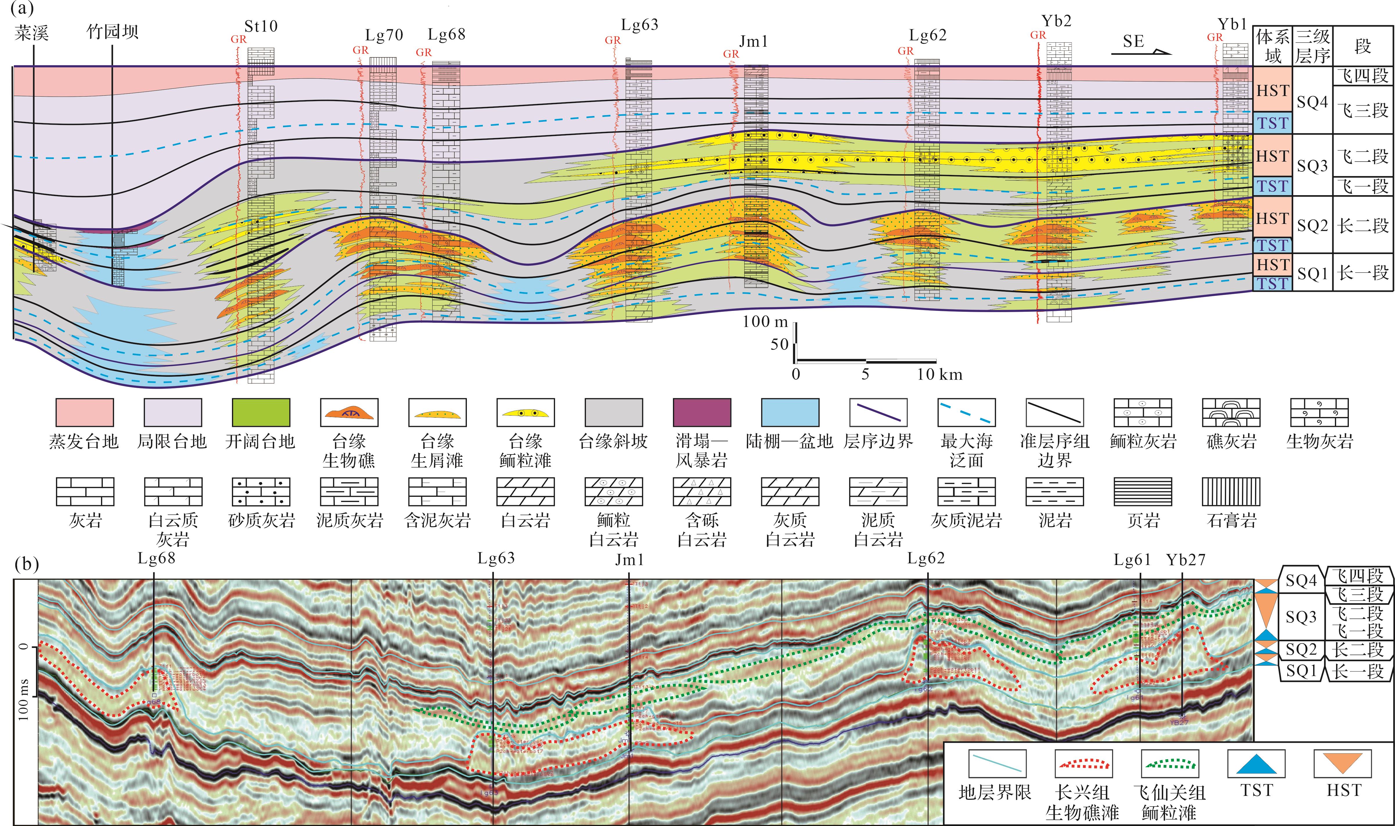
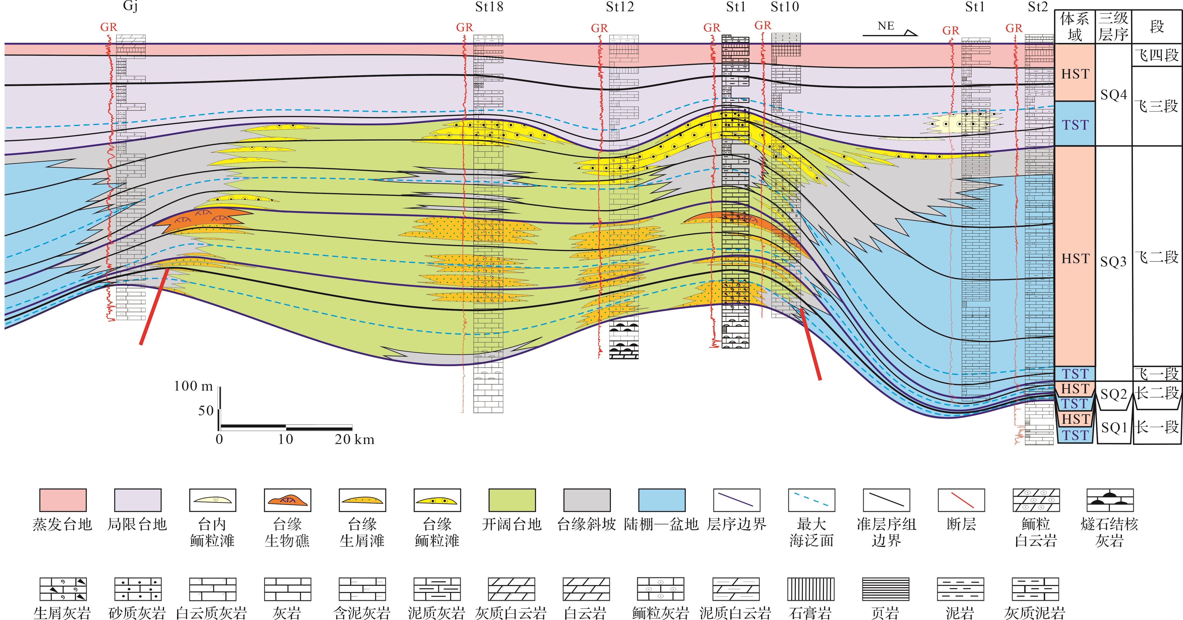
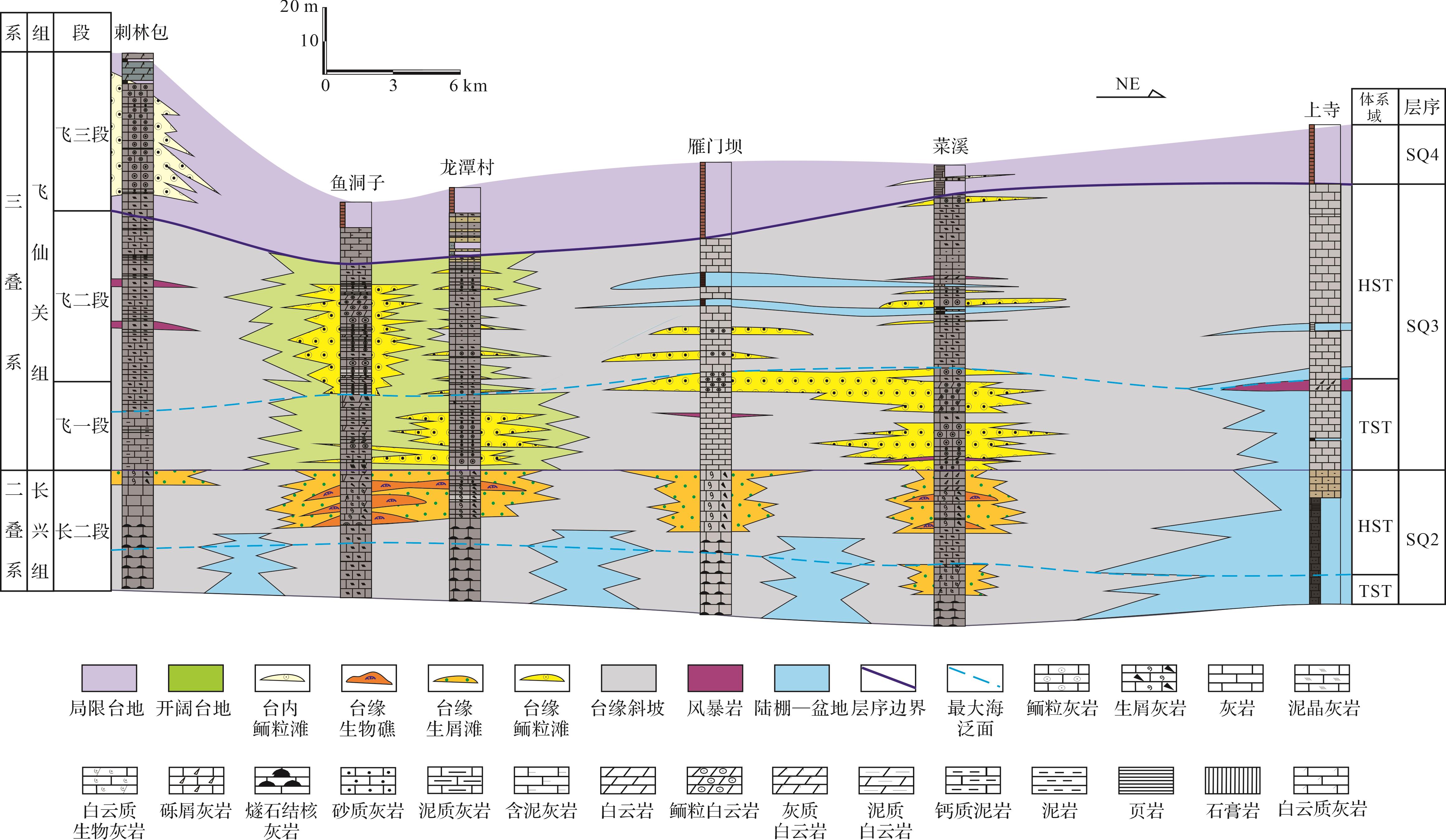
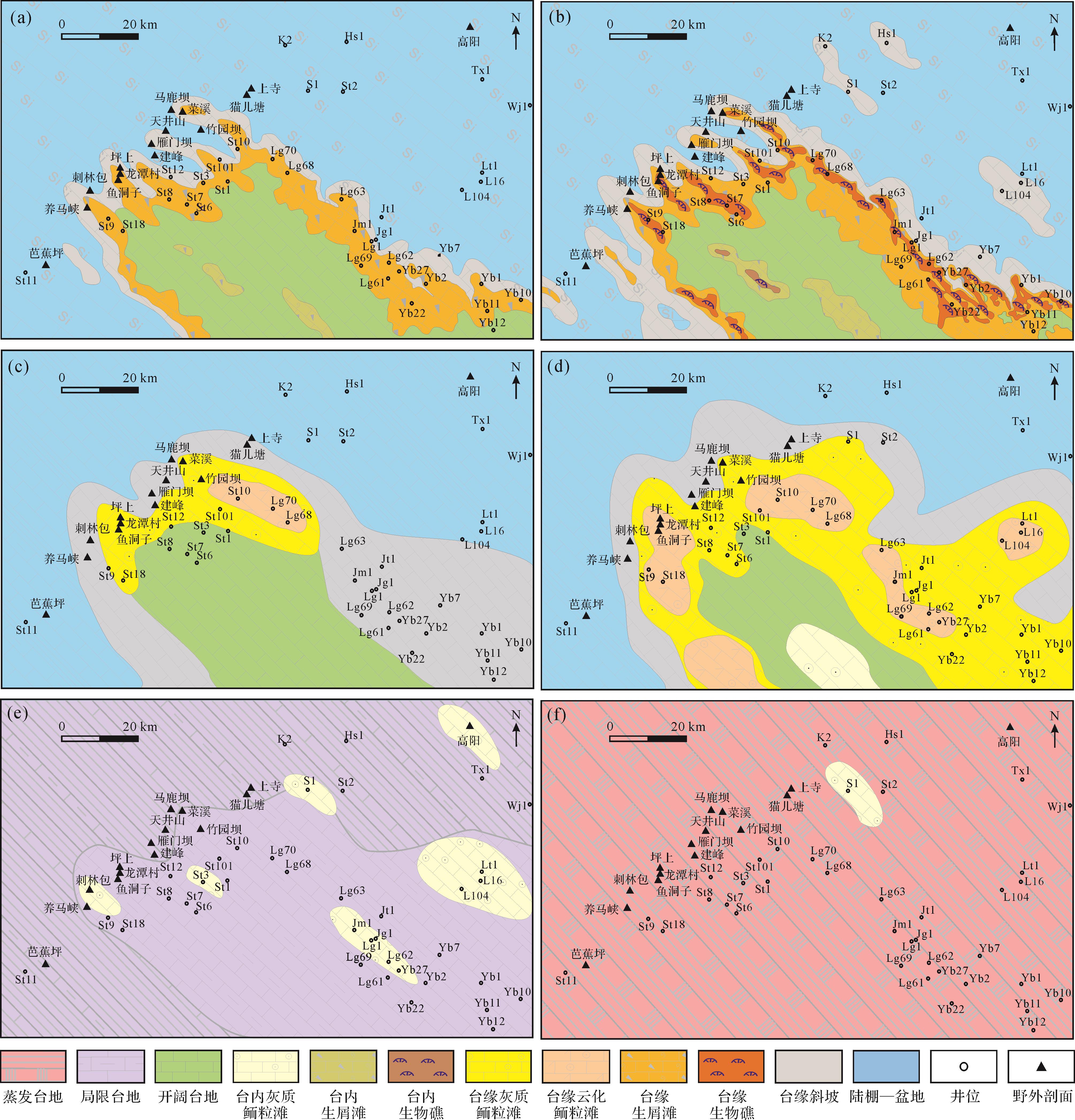
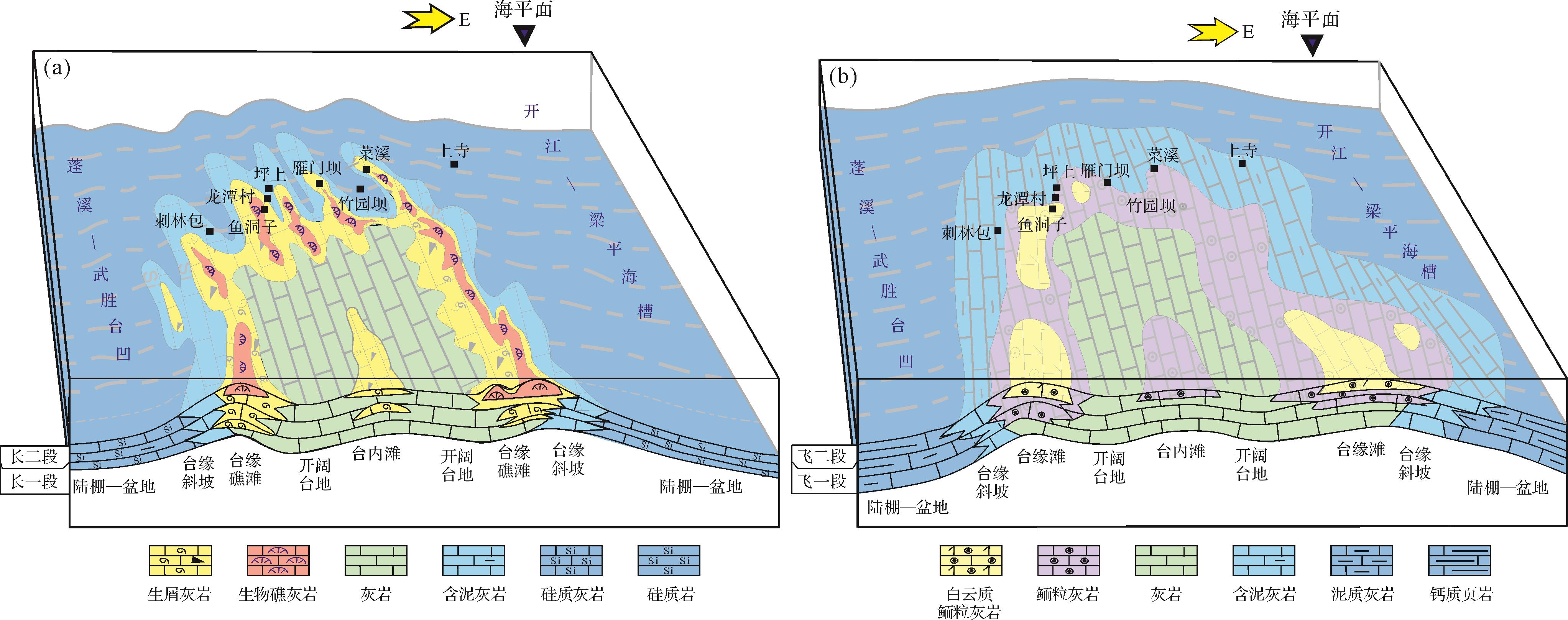
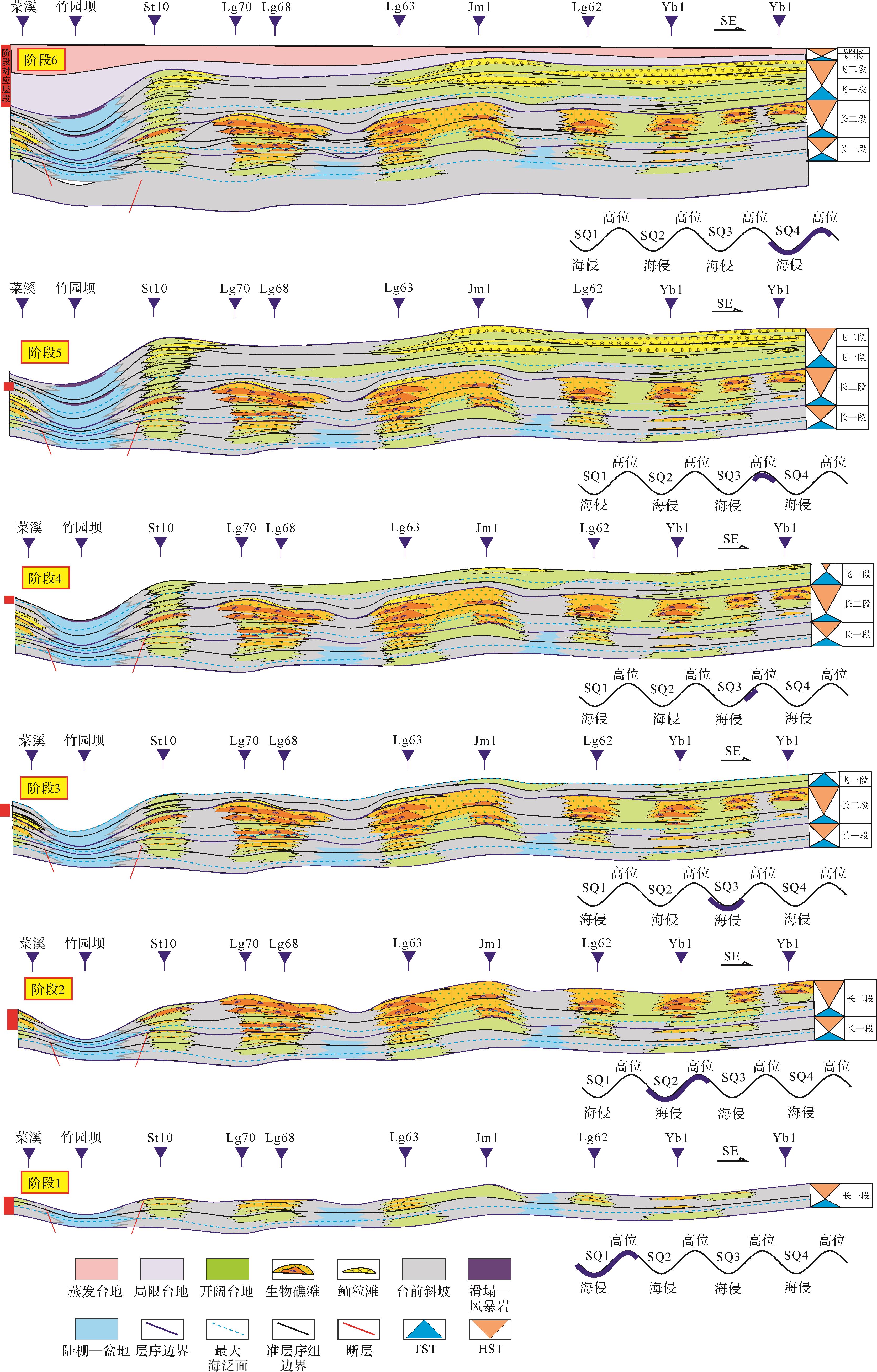
Objective To clarify whether the western edge of the Kaijiang-Liangping trough is connected to the eastern platform margin of the Pengxi-Wushengtai Depression in the north of the Late Permian Changxing-Early Triassic Feixianguan period in northwestern Sichuan Basin, and to determine the sedimentary facies distribution pattern of the Jiangyou-Jiange Formation in northwestern Sichuan Basin and the Changxing Formation-Feixianguan Formation in the periphery area, and to analyse the evolution process of sedimentary filling to indicate further oil and gas exploration work. Methods Based on the latest drilling, field outcrop, and seismic data, this study systematically analyzed the distribution of lithofacies and paleogeography during the deposition of the Changxing Formation-Feixianguan Formation in the Guangyuan-Jiangyou area, based on the stratigraphic and sedimentary facies division and comparison. Results The intersection area of the Changxing Formation-Feixianguan Formation can identify six sedimentary facies: shelf basin, slope, platform edge, open platform, restricted platform, and evaporative platform. Based on the sedimentary records of the front slope of the platform, the western edge of the Kaijiang-Liangping trough and eastern edge of the Pengxi-Wusheng intra-platform depression were clearly merged to form a unified platform edge belt in the Cilinbao-Shangsi area in northwestern Sichuan Basin. The platform edge belt and front slope show a northwest finger shaped interdistribution, rather than a simple smooth belt distribution. The intersection area of the two troughs in the Changxing Formation presents a sedimentary pattern of two troughs interlocking from southwest to northeast. The connecting area of the platform margin zone developed a northwestern fingered reef beach, developing bioclastic shoals in the 1st member and biological reefs and shoals in the 2nd member of the Changxing Formation at the platform edge zone. During the sedimentary period of the 1st and 2nd members of the Feixianguan Formation, the sedimentary pattern of Changxing depositional period was inherited; however, in the 1st member of Feixianguan Formation, only local platform edge oolitic beaches were formed owing to sea flooding. In the stage of the late 1st to 2nd member Feixianguan Formation, platform edge oolitic beaches gradually developed and expanded in scope with an overall eastward migration. The slope in front of the platform was prone to sliding and sedimentation. During the sedimentation period of the 3rd member of the Feixianguan Formation, the sea trough gradually filled, and the finger shaped platform edge zone disappeared, forming a unified restricted platform. Only the local development of oolitic beach. The research area was filled and flattened during the depositional period of the 4th member of the Feixianguan Formation, forming an evaporative platform facies. The platform margin zone in this region did not migrate northwestward along the finger shaped platform margin zone, but rather exhibited eastward migration characteristics. Conclusions The determination of the Changxing-Feixianguan connectivity and the definition of five sedimentary filling evolution stages in the Kaijiang-Liangping trough and Pengxi-Wusheng intra-platform depression supplements a new understanding of the sedimentary pattern and filling evolution process in the intersection area of the Changxing-Feixianguan trough. It also provides ideas and references for oil and gas exploration in this area.
Objective To clarify whether the western edge of the Kaijiang-Liangping trough is connected to the eastern platform margin of the Pengxi-Wushengtai Depression in the north of the Late Permian Changxing-Early Triassic Feixianguan period in northwestern Sichuan Basin, and to determine the sedimentary facies distribution pattern of the Jiangyou-Jiange Formation in northwestern Sichuan Basin and the Changxing Formation-Feixianguan Formation in the periphery area, and to analyse the evolution process of sedimentary filling to indicate further oil and gas exploration work. Methods Based on the latest drilling, field outcrop, and seismic data, this study systematically analyzed the distribution of lithofacies and paleogeography during the deposition of the Changxing Formation-Feixianguan Formation in the Guangyuan-Jiangyou area, based on the stratigraphic and sedimentary facies division and comparison. Results The intersection area of the Changxing Formation-Feixianguan Formation can identify six sedimentary facies: shelf basin, slope, platform edge, open platform, restricted platform, and evaporative platform. Based on the sedimentary records of the front slope of the platform, the western edge of the Kaijiang-Liangping trough and eastern edge of the Pengxi-Wusheng intra-platform depression were clearly merged to form a unified platform edge belt in the Cilinbao-Shangsi area in northwestern Sichuan Basin. The platform edge belt and front slope show a northwest finger shaped interdistribution, rather than a simple smooth belt distribution. The intersection area of the two troughs in the Changxing Formation presents a sedimentary pattern of two troughs interlocking from southwest to northeast. The connecting area of the platform margin zone developed a northwestern fingered reef beach, developing bioclastic shoals in the 1st member and biological reefs and shoals in the 2nd member of the Changxing Formation at the platform edge zone. During the sedimentary period of the 1st and 2nd members of the Feixianguan Formation, the sedimentary pattern of Changxing depositional period was inherited; however, in the 1st member of Feixianguan Formation, only local platform edge oolitic beaches were formed owing to sea flooding. In the stage of the late 1st to 2nd member Feixianguan Formation, platform edge oolitic beaches gradually developed and expanded in scope with an overall eastward migration. The slope in front of the platform was prone to sliding and sedimentation. During the sedimentation period of the 3rd member of the Feixianguan Formation, the sea trough gradually filled, and the finger shaped platform edge zone disappeared, forming a unified restricted platform. Only the local development of oolitic beach. The research area was filled and flattened during the depositional period of the 4th member of the Feixianguan Formation, forming an evaporative platform facies. The platform margin zone in this region did not migrate northwestward along the finger shaped platform margin zone, but rather exhibited eastward migration characteristics. Conclusions The determination of the Changxing-Feixianguan connectivity and the definition of five sedimentary filling evolution stages in the Kaijiang-Liangping trough and Pengxi-Wusheng intra-platform depression supplements a new understanding of the sedimentary pattern and filling evolution process in the intersection area of the Changxing-Feixianguan trough. It also provides ideas and references for oil and gas exploration in this area.
2026, 44(3): 1066-1081.
doi: 10.14027/j.issn.1000-0550.2024.128
Abstract:
Objective The beach facies dolomite reservoir in the Middle Permian Qixia Formation, central Sichuan Basin, has significant potential for oil and gas exploration, but relatively little systematic study has been reported on its diagenetic sequence and pore evolution . Methods The petrology and pore genesis of the Qixia Formation were investigated by core observation, thin section analysis, cathodoluminescence examination and image recognition techniques, to delineate diagenetic variations and pore evolution in the different lithologies. Results In the Gaoshiti area, four types of rock are identified in the Qixia Formation: micrite limestone, micrite grain limestone, sparite grain limestone, and residual grain dolostone. Four types of reservoir space are observed: intergranular dissolved pores, intragranular dissolved pores, fractures and vugs. Each rock type has undergone distinctive diagenesis: the type and intensity of dissolution vary in the different lithologies. The two kinds of granular limestone are mainly dissolved by meteoric water, and the residual granular dolomite is more strongly dissolved by meteoric water. On this basis, dolomitization and burial period dissolution occur. Recrystallization is more pronounced in the residual grain dolomite, whereas compaction and pressure dissolution is more evident in micrite grain limestone. The key diagenesis and stages influencing pore development vary between the different rock types: the pores in the two types of granular limestone are mainly formed by quasi-syngenetic dissolution, then partially destroyed by compaction and cementation during the burial stage. The dissolution and dolomitization in the parasyngenetic stage result in the formation and preservation of the pores in the residual granular dolomites; dissolution and tectonic fracture at the burial stage are beneficial supplements, but cementation during the shallow burial stage destroys the pores. Conclusions The varied diagenesis has caused different pore evolution, forming four lithologies with a decreasing extent of pore development: residual grain dolostone (plane porosity: 2.10%), sparite grain limestone (plane porosity: 1.24%), micrite grain limestone (plane porosity: 0.41%) and micrite limestone (compact).
Objective The beach facies dolomite reservoir in the Middle Permian Qixia Formation, central Sichuan Basin, has significant potential for oil and gas exploration, but relatively little systematic study has been reported on its diagenetic sequence and pore evolution . Methods The petrology and pore genesis of the Qixia Formation were investigated by core observation, thin section analysis, cathodoluminescence examination and image recognition techniques, to delineate diagenetic variations and pore evolution in the different lithologies. Results In the Gaoshiti area, four types of rock are identified in the Qixia Formation: micrite limestone, micrite grain limestone, sparite grain limestone, and residual grain dolostone. Four types of reservoir space are observed: intergranular dissolved pores, intragranular dissolved pores, fractures and vugs. Each rock type has undergone distinctive diagenesis: the type and intensity of dissolution vary in the different lithologies. The two kinds of granular limestone are mainly dissolved by meteoric water, and the residual granular dolomite is more strongly dissolved by meteoric water. On this basis, dolomitization and burial period dissolution occur. Recrystallization is more pronounced in the residual grain dolomite, whereas compaction and pressure dissolution is more evident in micrite grain limestone. The key diagenesis and stages influencing pore development vary between the different rock types: the pores in the two types of granular limestone are mainly formed by quasi-syngenetic dissolution, then partially destroyed by compaction and cementation during the burial stage. The dissolution and dolomitization in the parasyngenetic stage result in the formation and preservation of the pores in the residual granular dolomites; dissolution and tectonic fracture at the burial stage are beneficial supplements, but cementation during the shallow burial stage destroys the pores. Conclusions The varied diagenesis has caused different pore evolution, forming four lithologies with a decreasing extent of pore development: residual grain dolostone (plane porosity: 2.10%), sparite grain limestone (plane porosity: 1.24%), micrite grain limestone (plane porosity: 0.41%) and micrite limestone (compact).
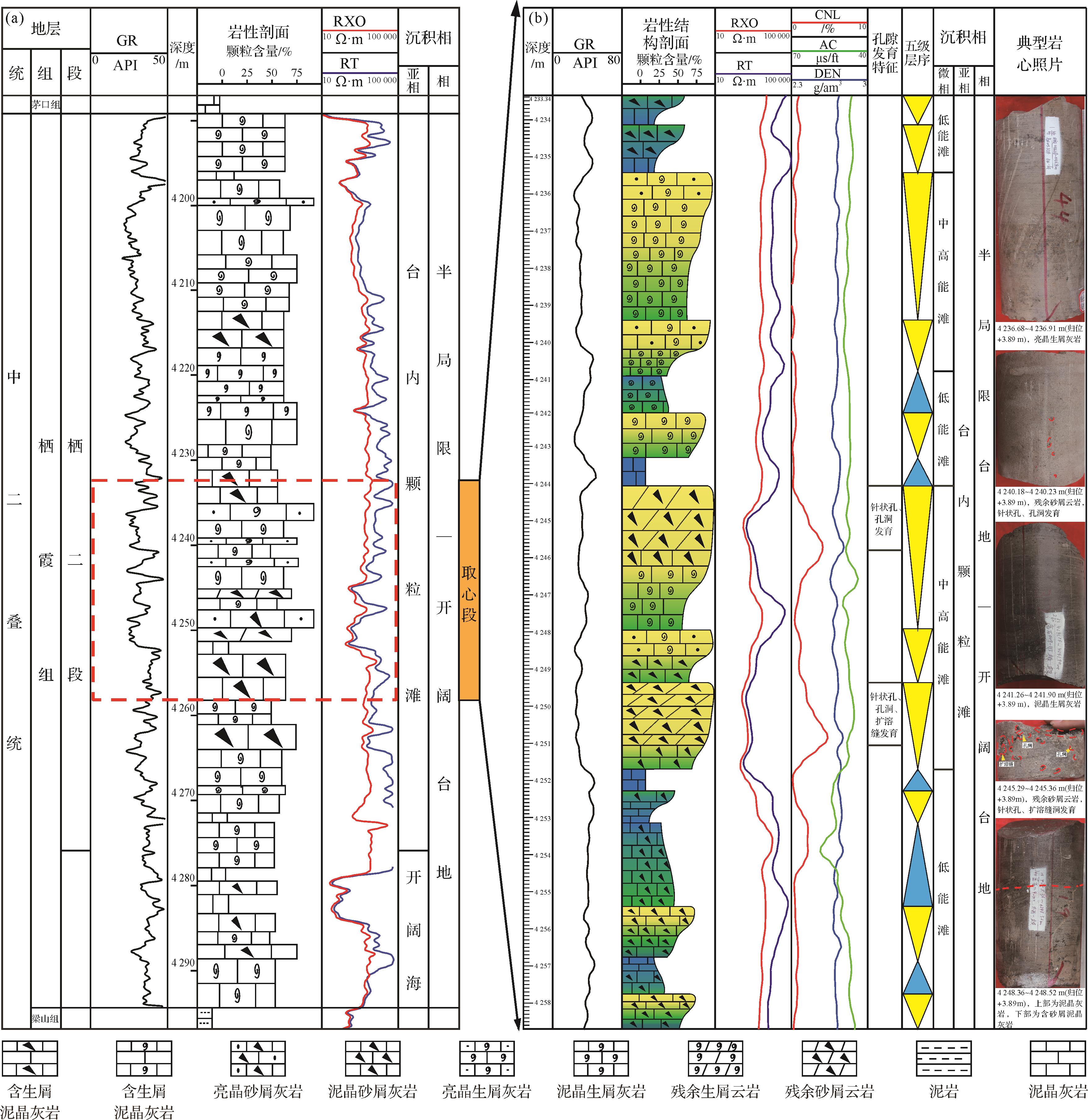
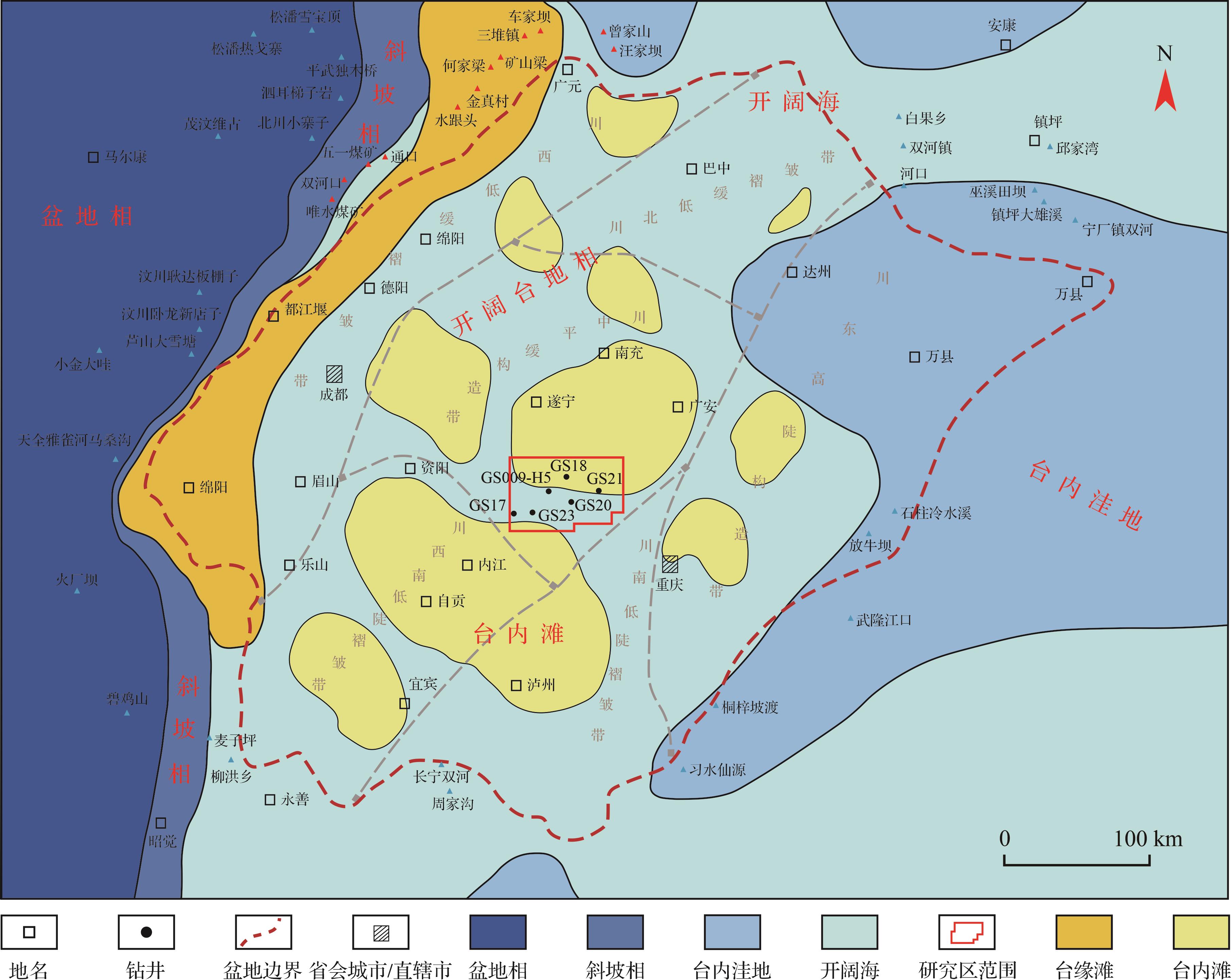
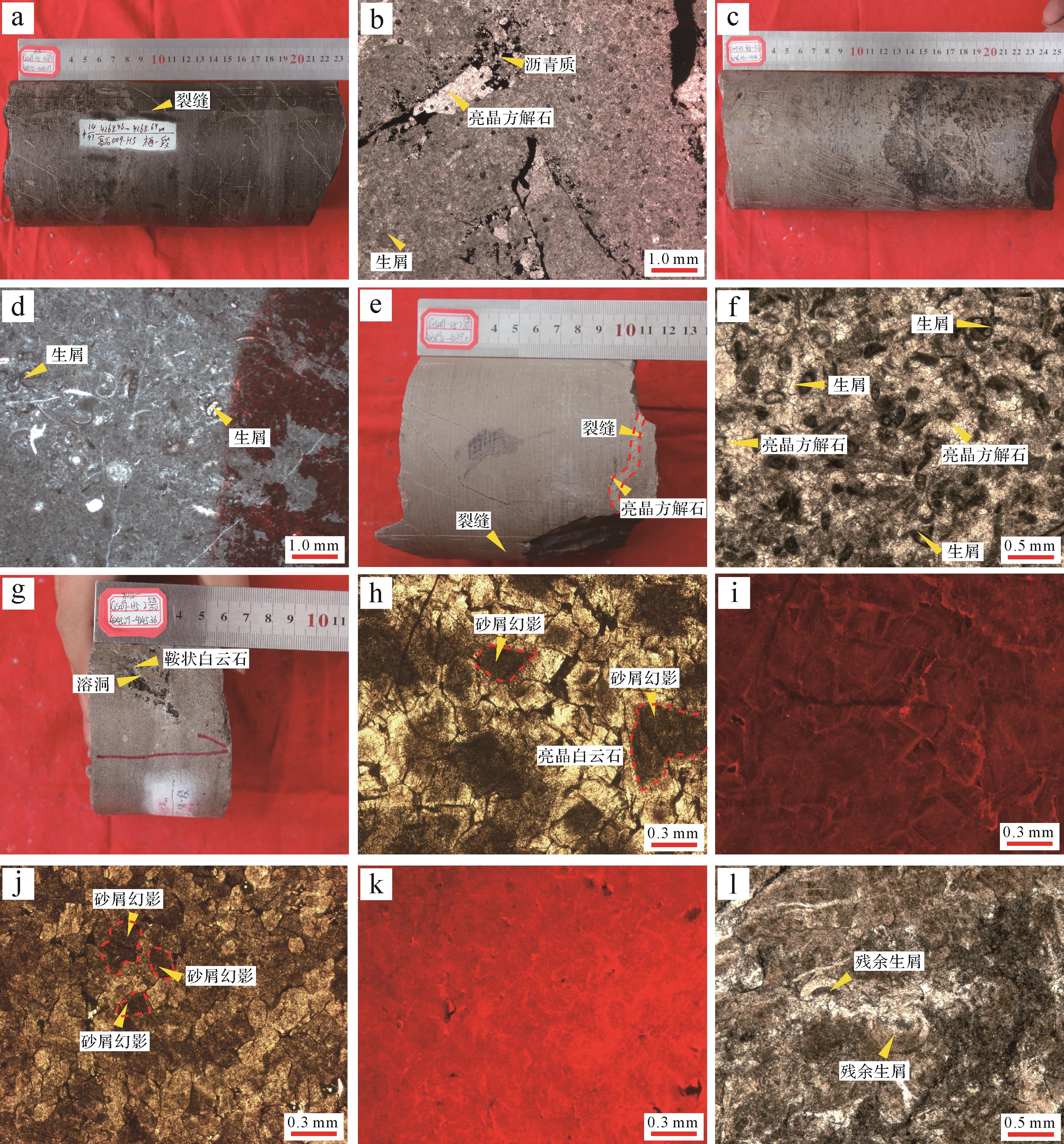
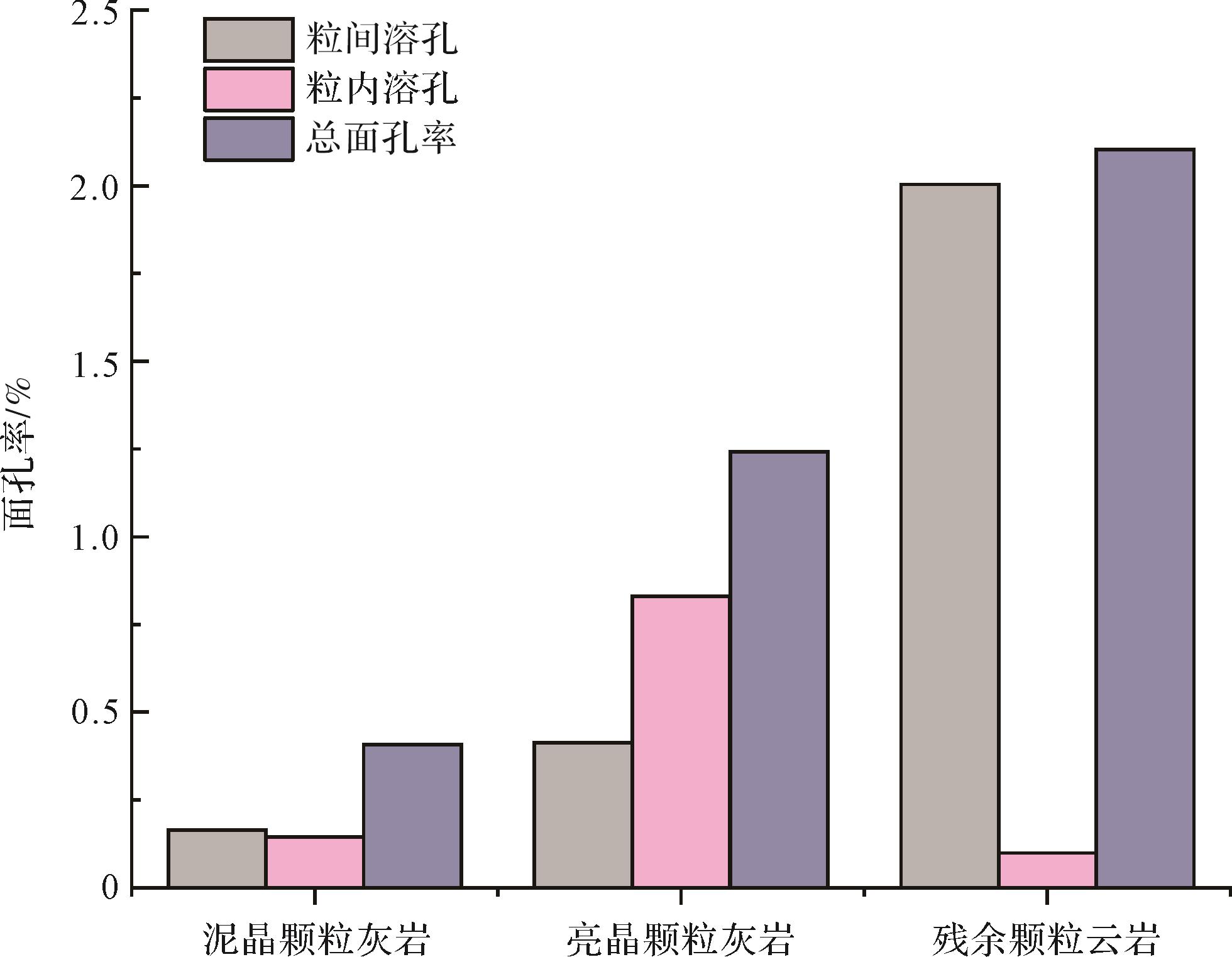
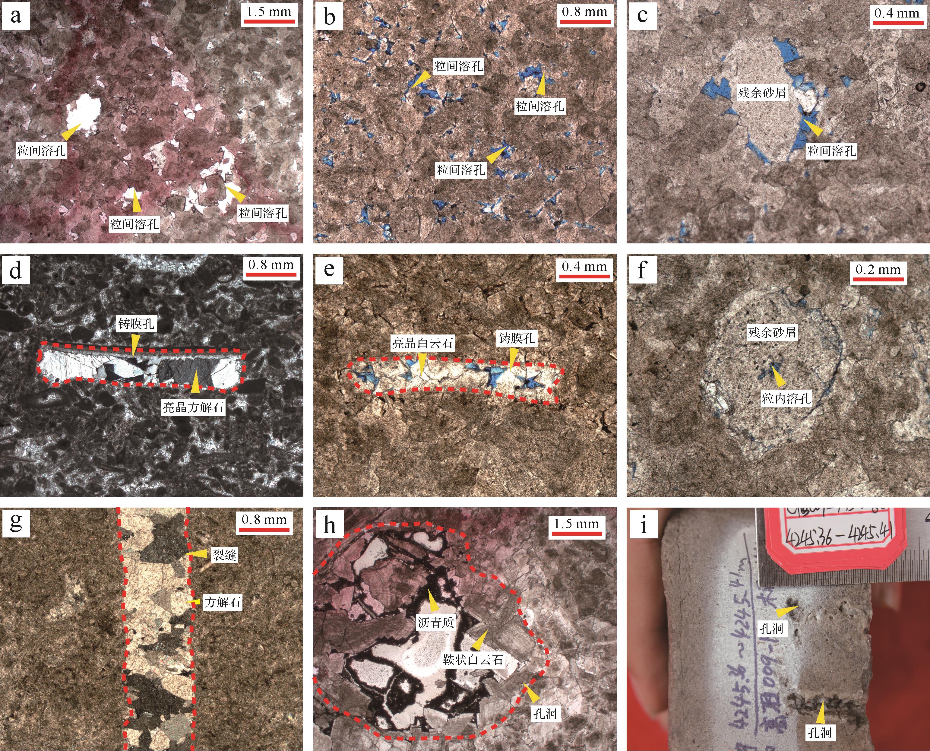
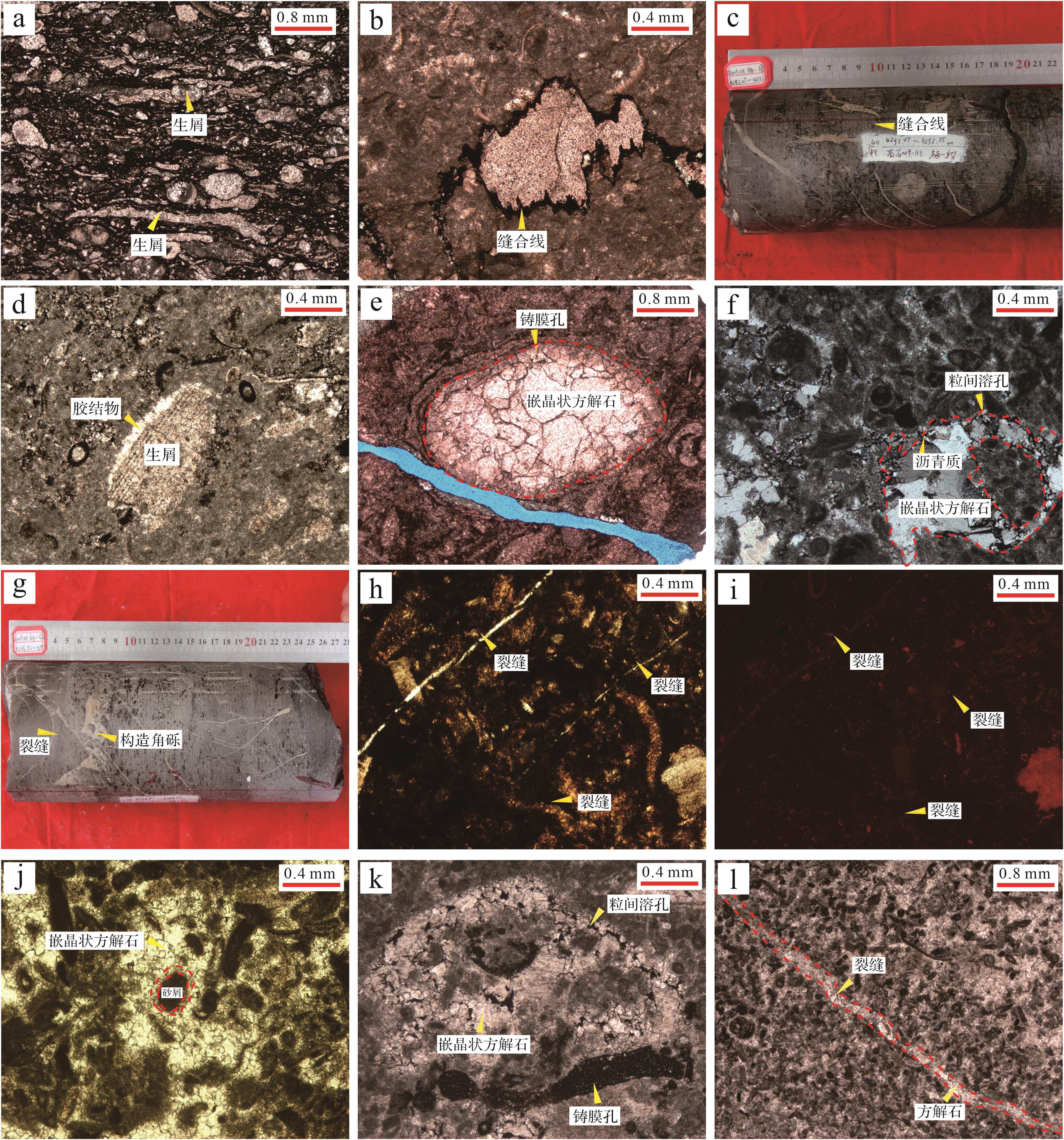
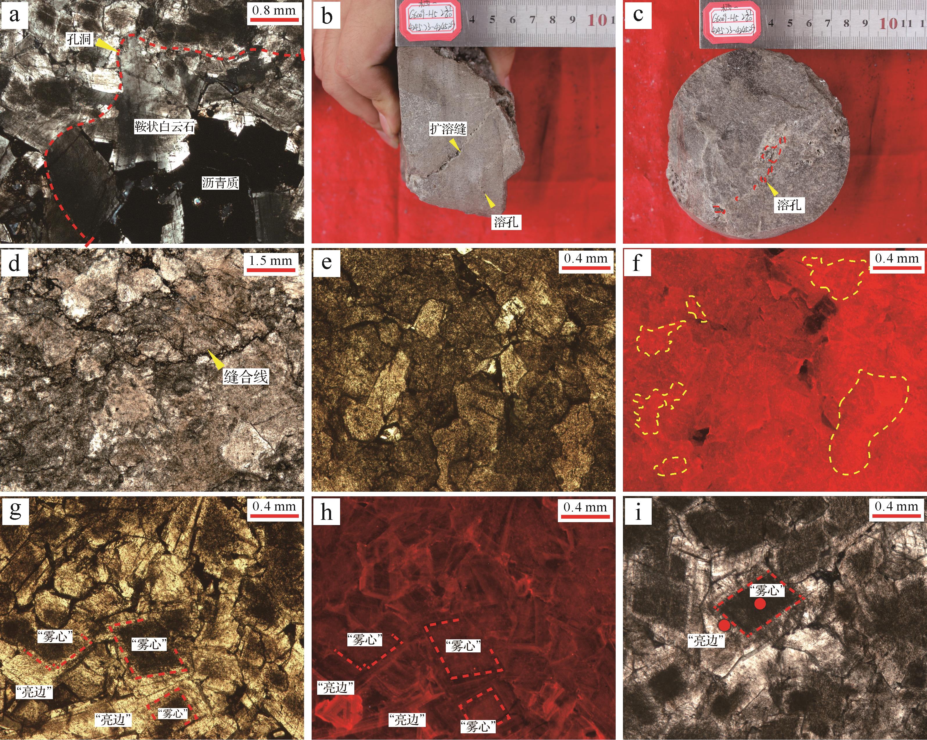
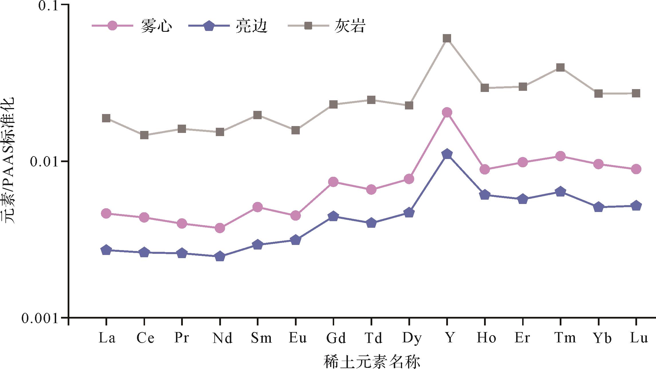
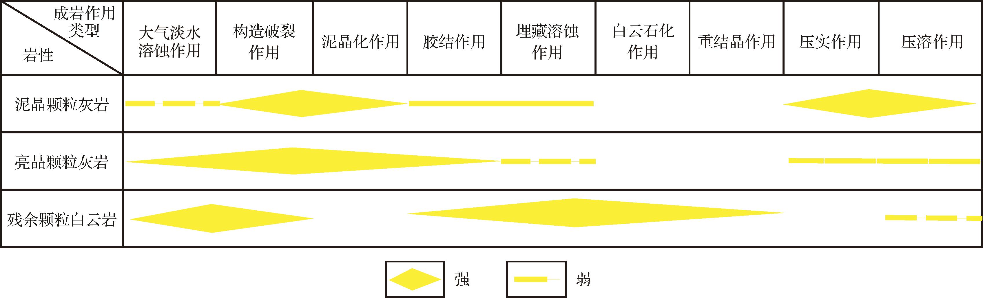
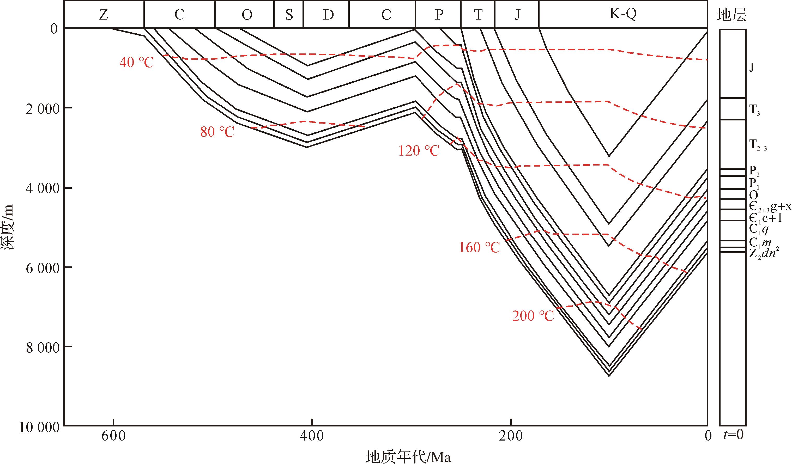
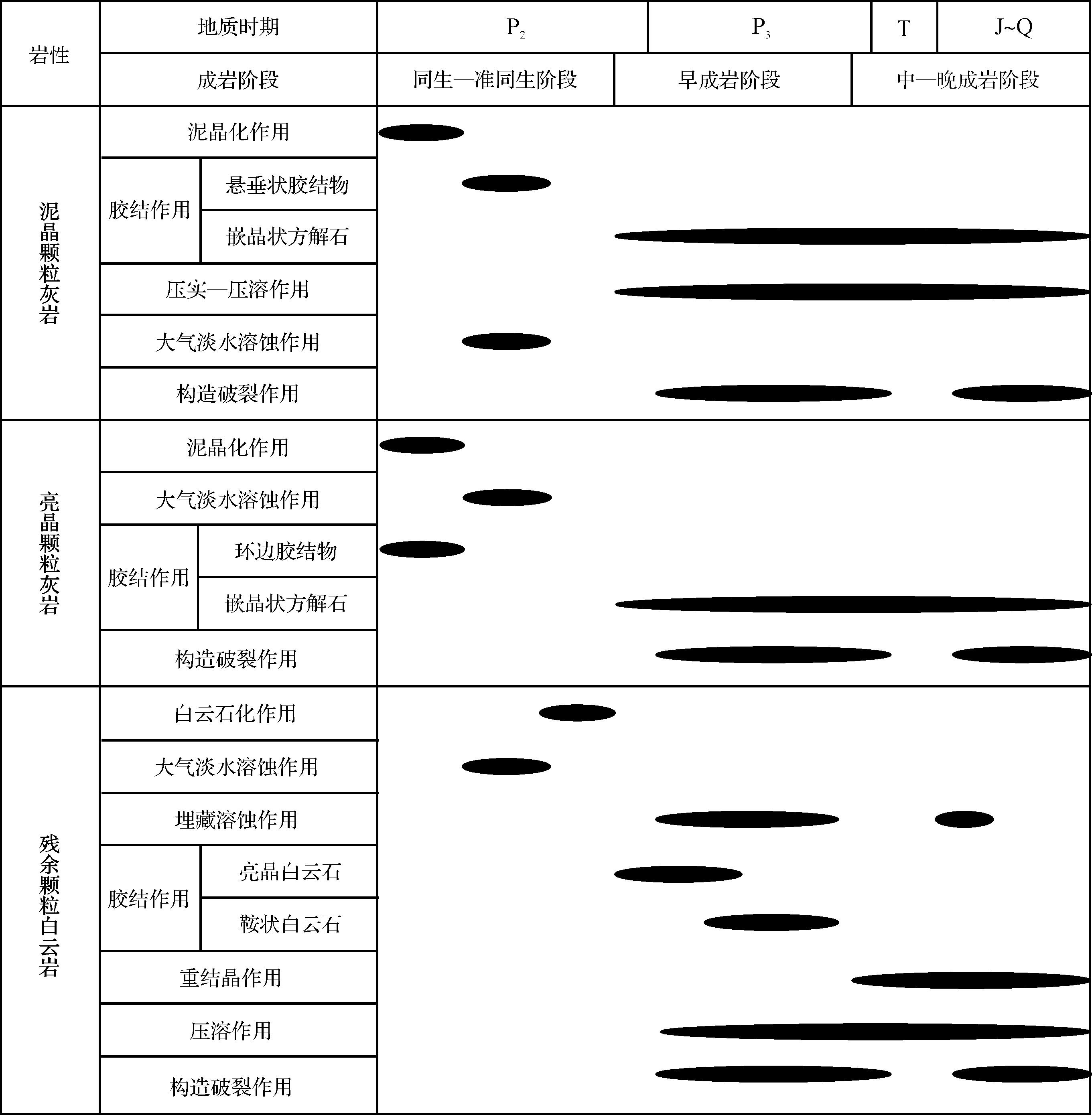
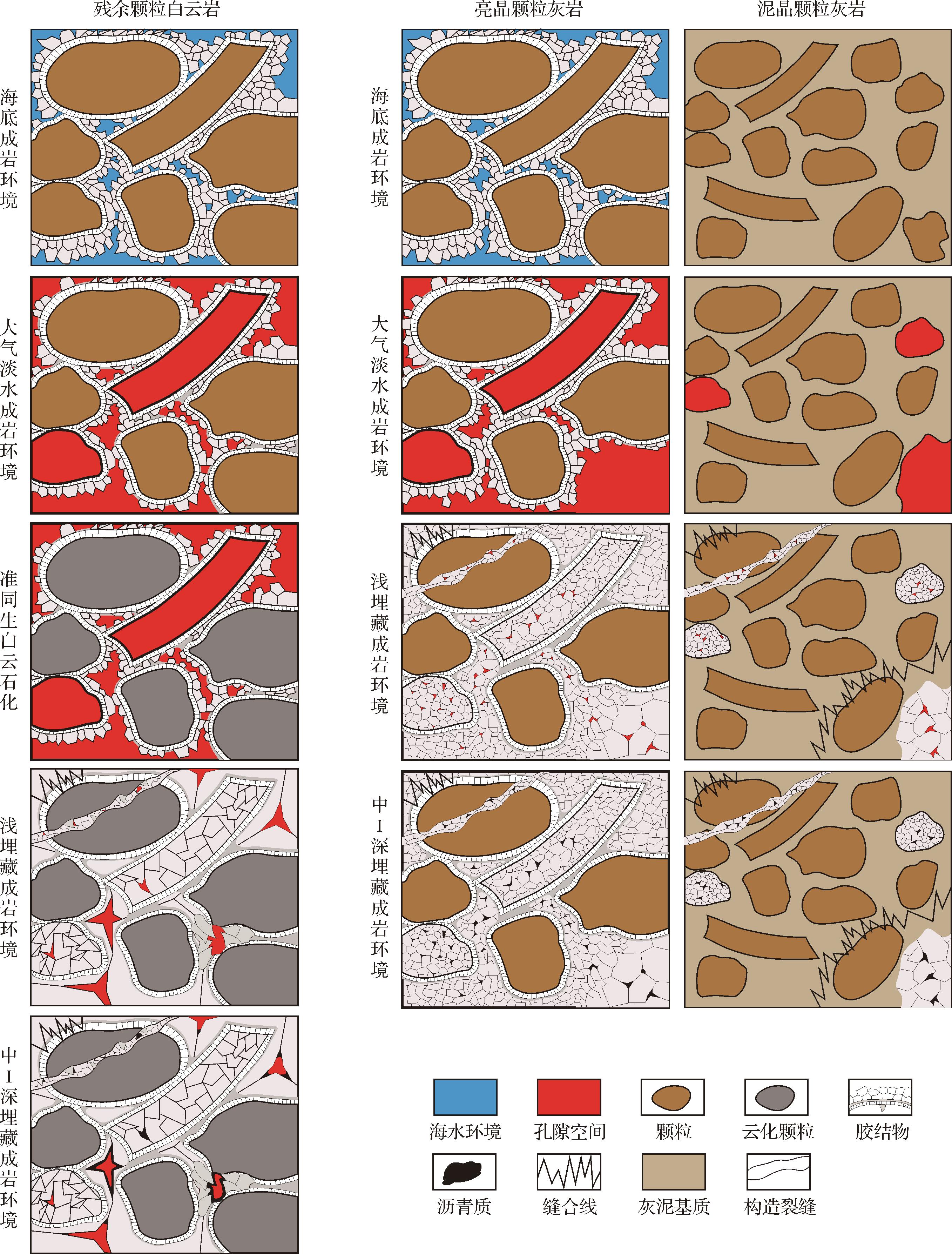
2026, 44(3): 1082-1095.
doi: 10.14027/j.issn.1000-0550.2024.110
Abstract:
Objective Current domestic and international research on bauxite oil and gas reservoirs is limited in scope. The bauxite reservoir with high-yield industrial gas flow discovered in the Taiyuan Formation, Longdong area, southwestern Ordos Basin, represents a significant advance in the exploration for bauxite gas reservoirs, and the recent identification and production tests of bauxite rock series in the Benxi Formation in the Linxing area at the northeastern margin of the basin suggests promising exploration potential.Further natural gas exploration and development in the bauxite series in the Linxing area requires a comprehensive analysis of the fundamental geology of the sedimentary environment, including the mineral composition, reservoir pore properties and the structure of the bauxite series. In addition, it is essential to identify the factors that control the development of bauxite and which areas are most conducive to such activity. Methods A comprehensive analysis of the sedimentary environment, reservoir characteristics and sedimentary model of the Benxi Formation bauxite rock series in the Linxing area was conducted using logging, seismic data, X-ray diffraction, casting thin sections, scanning electron microscopy, major and trace elements, high-pressure mercury injection, N2 and CO2 adsorption and conventional physical properties, and other experimental methods. Results The bauxite rock series in the study area is characterized by a high concentration of diaspore and clay minerals, and has a distinctive three-stage vertical structure. The lower portion is rich in iron, the middle zone contains a higher aluminum content, and the upper section has a lower iron concentration. The pore types include predominantly dissolution pores typically ranging between 2 nm and 50 nm, along with intercrystalline pores, organic pores and microfractures. The sorting and connectivity of the pores are relatively good, with average porosity 3.64% and average permeability 7.24×10⁻³ μm2. Conclusions The thickness of a bauxite rock series depends upon the sedimentary environment and karst paleogeomorphology. A shallow-water sedimentary environment with high temperature and high humidity, low oxygen levels and alternating marine and terrestrial conditions is optimal for its formation and preservation. A slope, or buried pit, is a crucial area for exploration and development. This understanding provides a geological foundation for the exploration and development of natural gas in bauxite with comparable geological background in this region.
Objective Current domestic and international research on bauxite oil and gas reservoirs is limited in scope. The bauxite reservoir with high-yield industrial gas flow discovered in the Taiyuan Formation, Longdong area, southwestern Ordos Basin, represents a significant advance in the exploration for bauxite gas reservoirs, and the recent identification and production tests of bauxite rock series in the Benxi Formation in the Linxing area at the northeastern margin of the basin suggests promising exploration potential.Further natural gas exploration and development in the bauxite series in the Linxing area requires a comprehensive analysis of the fundamental geology of the sedimentary environment, including the mineral composition, reservoir pore properties and the structure of the bauxite series. In addition, it is essential to identify the factors that control the development of bauxite and which areas are most conducive to such activity. Methods A comprehensive analysis of the sedimentary environment, reservoir characteristics and sedimentary model of the Benxi Formation bauxite rock series in the Linxing area was conducted using logging, seismic data, X-ray diffraction, casting thin sections, scanning electron microscopy, major and trace elements, high-pressure mercury injection, N2 and CO2 adsorption and conventional physical properties, and other experimental methods. Results The bauxite rock series in the study area is characterized by a high concentration of diaspore and clay minerals, and has a distinctive three-stage vertical structure. The lower portion is rich in iron, the middle zone contains a higher aluminum content, and the upper section has a lower iron concentration. The pore types include predominantly dissolution pores typically ranging between 2 nm and 50 nm, along with intercrystalline pores, organic pores and microfractures. The sorting and connectivity of the pores are relatively good, with average porosity 3.64% and average permeability 7.24×10⁻³ μm2. Conclusions The thickness of a bauxite rock series depends upon the sedimentary environment and karst paleogeomorphology. A shallow-water sedimentary environment with high temperature and high humidity, low oxygen levels and alternating marine and terrestrial conditions is optimal for its formation and preservation. A slope, or buried pit, is a crucial area for exploration and development. This understanding provides a geological foundation for the exploration and development of natural gas in bauxite with comparable geological background in this region.
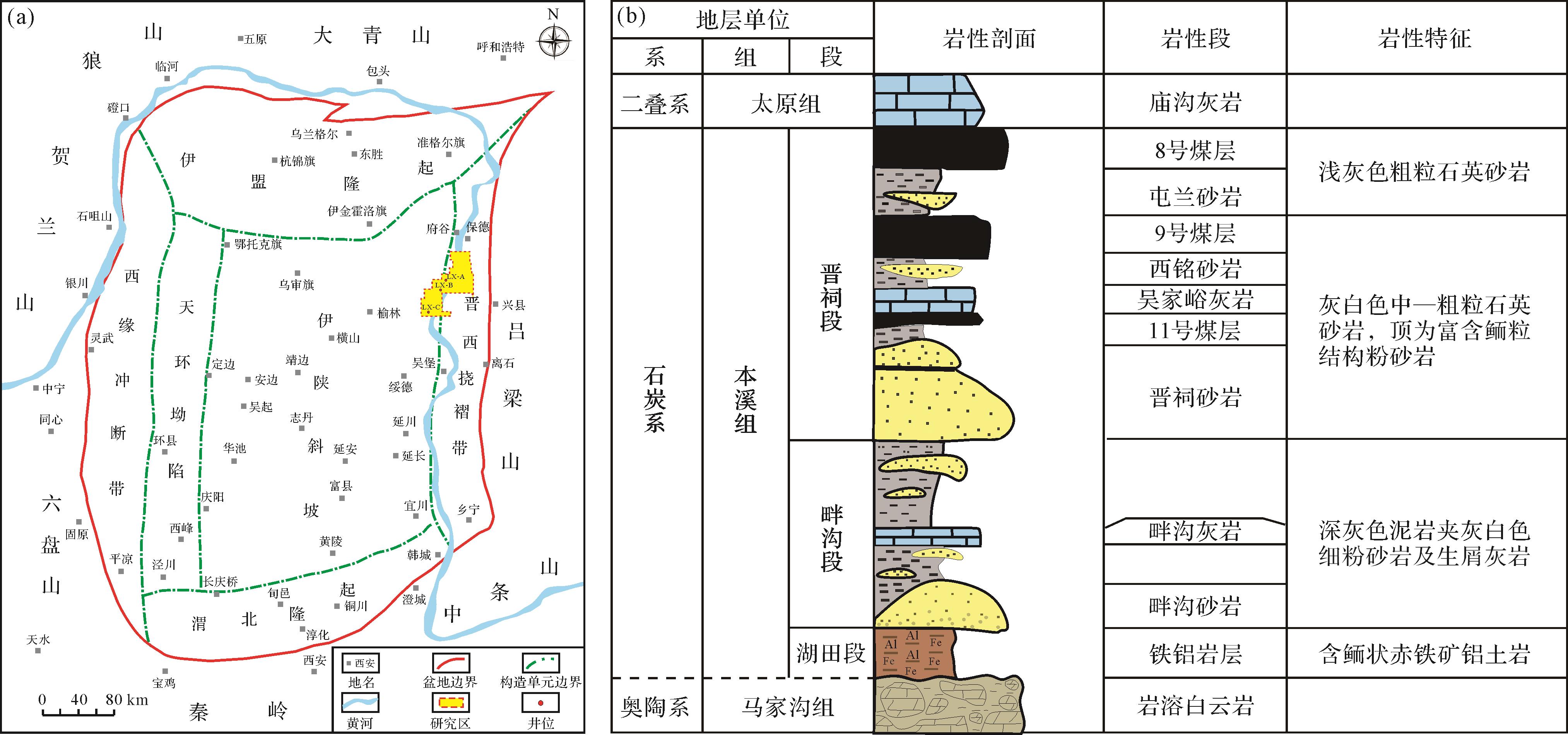
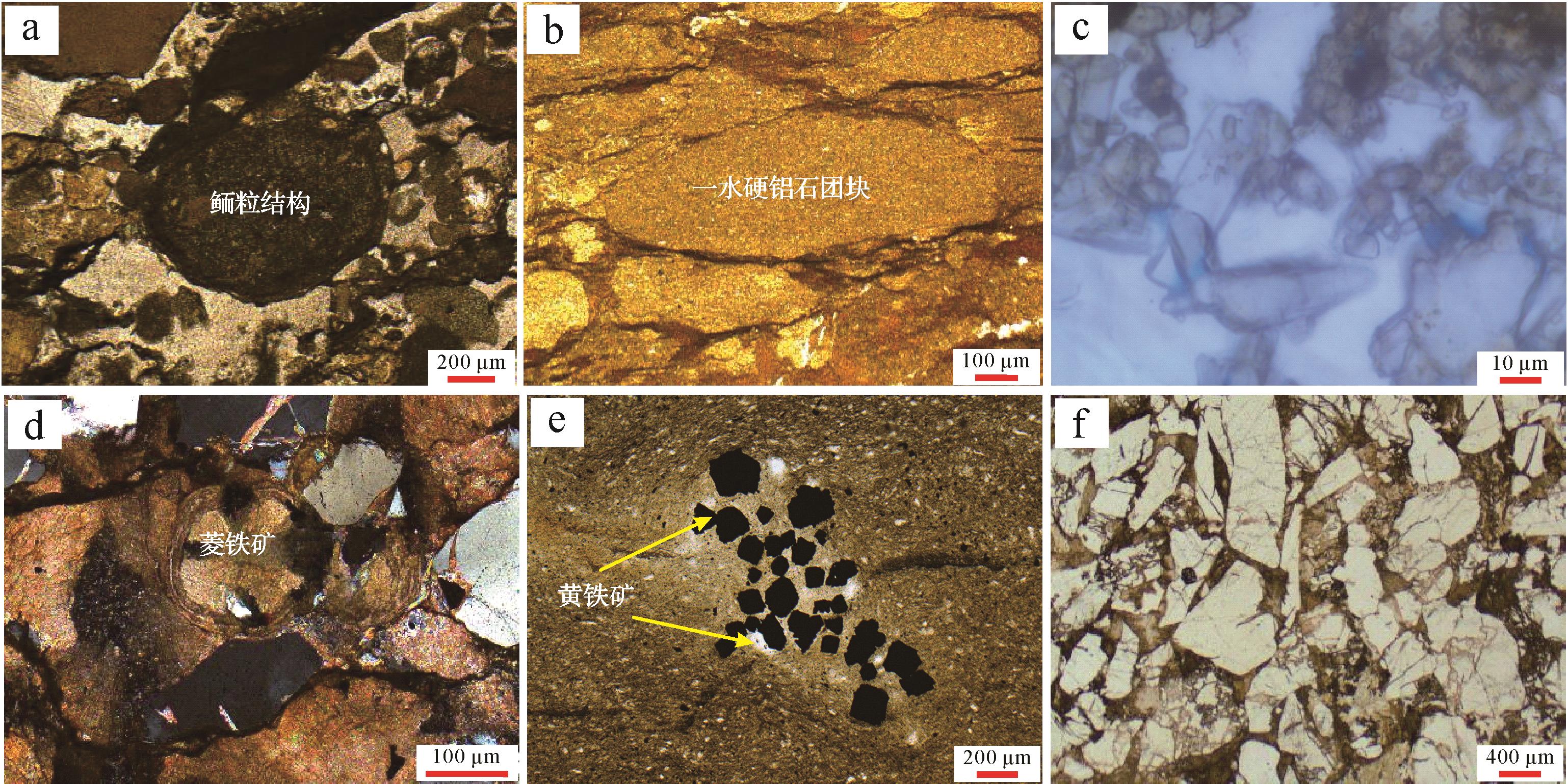
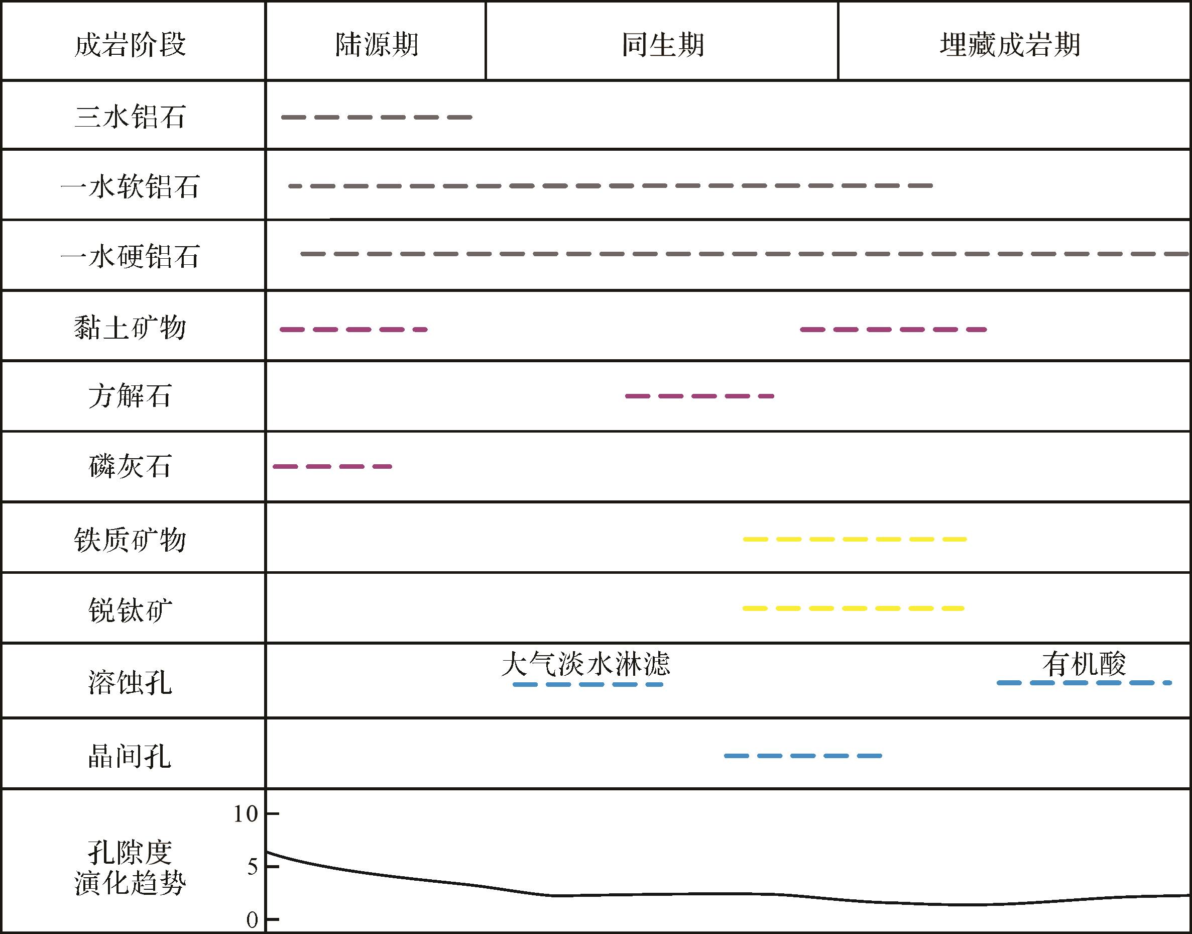
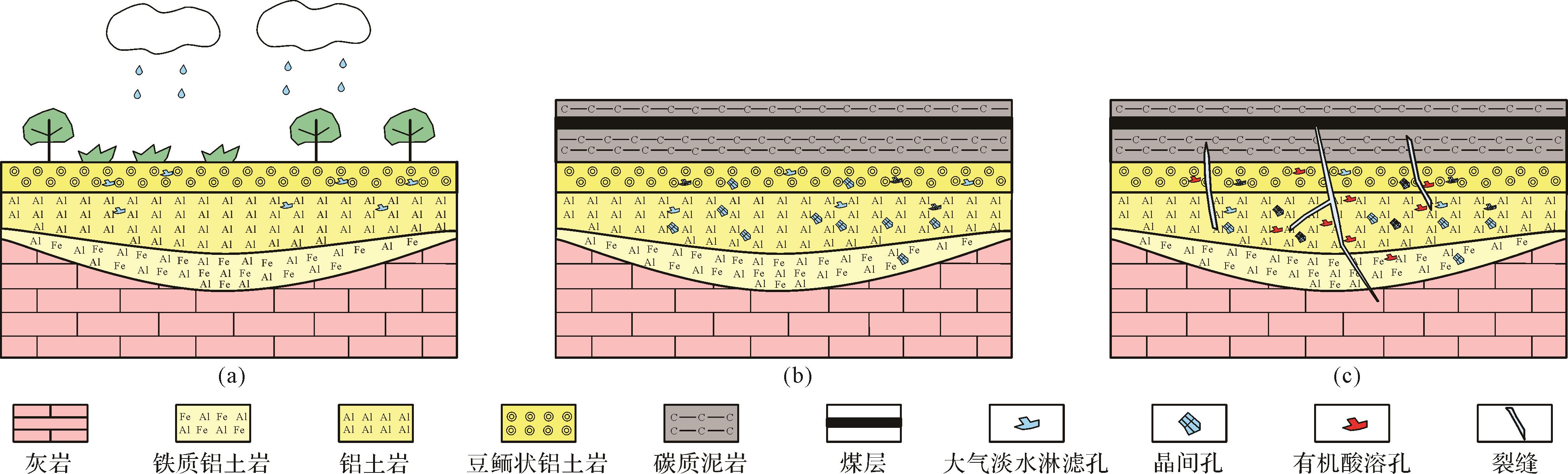
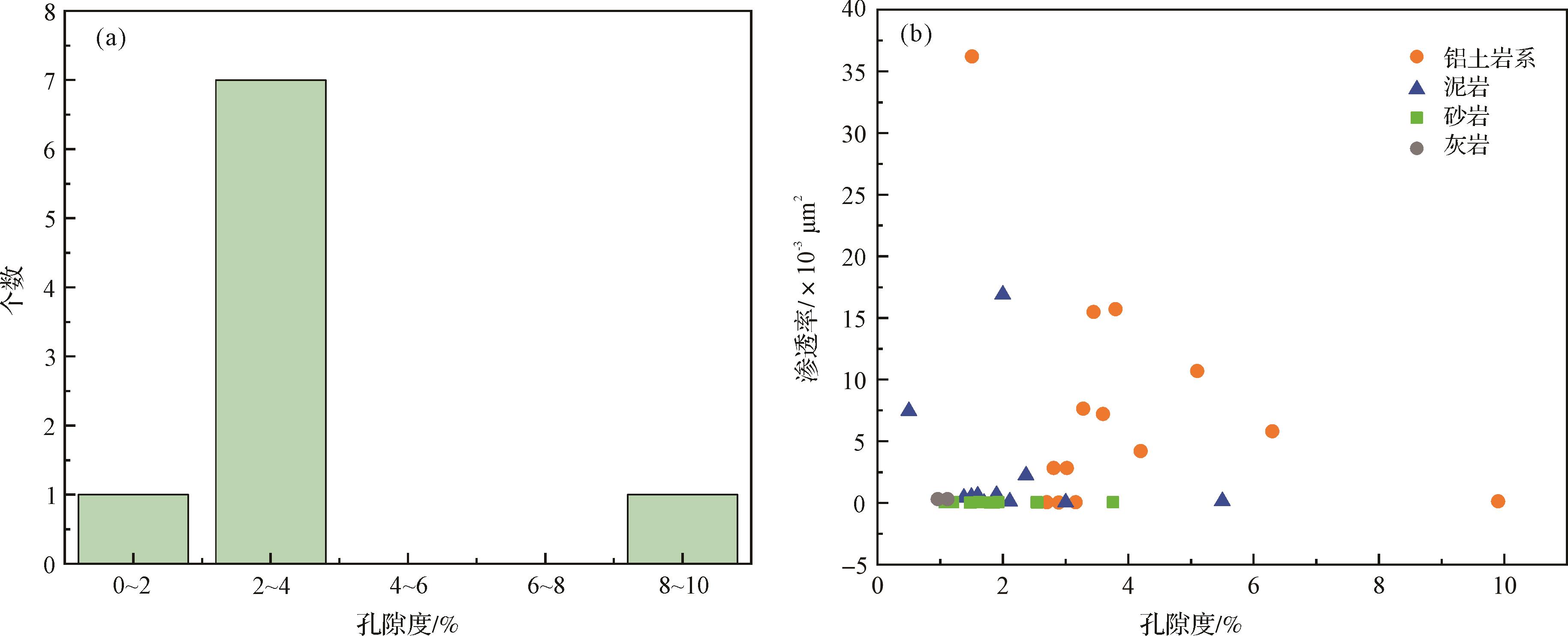
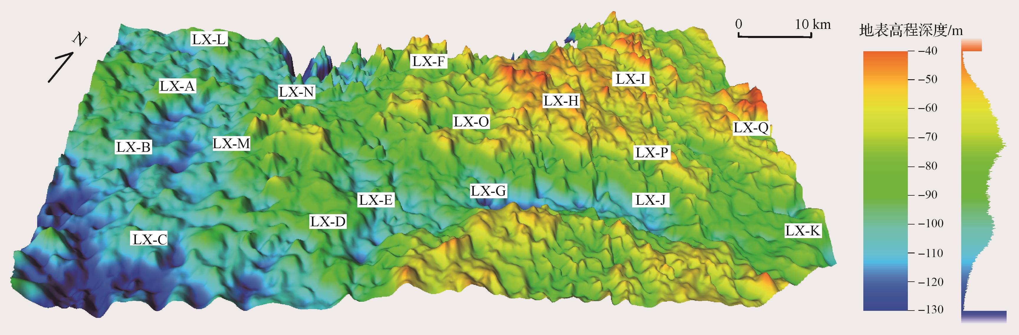
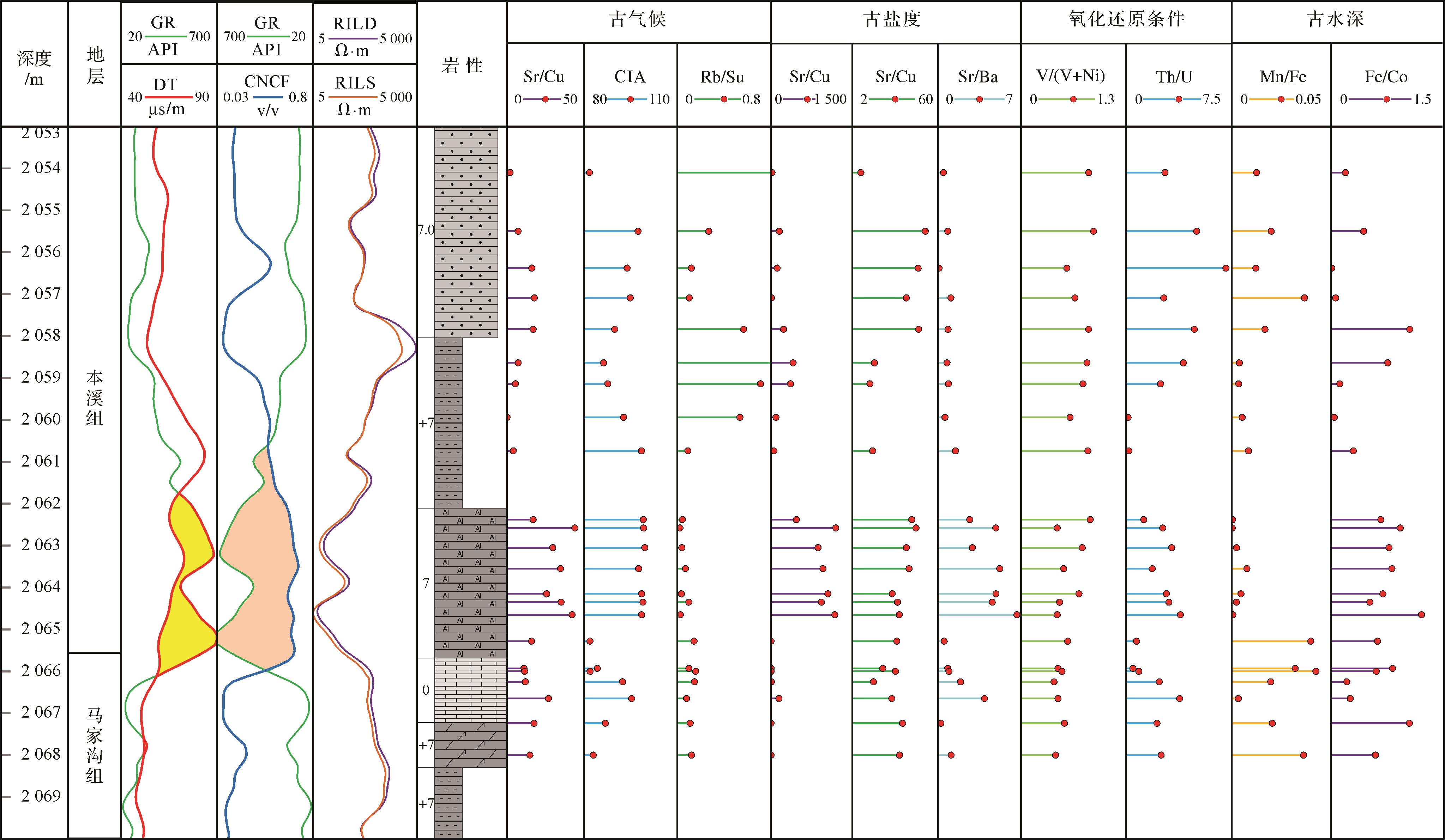
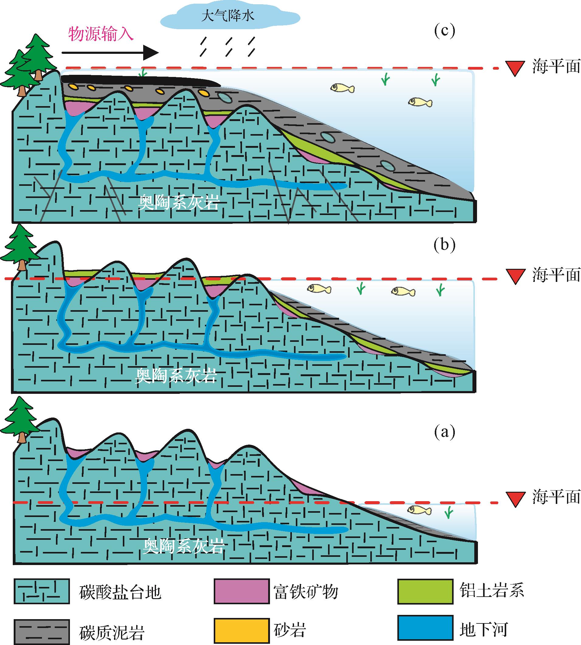
2026, 44(3): 1096-1116.
doi: 10.14027/j.issn.1000-0550.2024.114
Abstract:
Objective The 5th member of the Ordovician Majiagou Formation in the southern Sulige gas field primarily consists of karst reservoirs, with proven reserves exceeding 100 billion cubic meters. However, during development, severe water production and complex gas-water relationships have been observed, and the distribution patterns and controlling factors of gas and water remain unclear, significantly constraining the release of the gas production potential of the region. Methods Based on formation water geochemical analysis, various chemical parameters (i.e., Na+/Cl-, desulfurization, Mg2+/Ca2+, Na+/Ca2+ and Na+ + Cl-/Mg2+ coefficients) were analyzed to determine the formation environment of the water. The distribution patterns of gas and water were then studied by identifying the water-bearing intervals in individual wells, and by cross-well gas reservoir profile comparisons and the planar distribution of different formation water types. Finally, the controlling factors of gas-water distribution were explored in relation to the hydrocarbon source rock, karst reservoir heterogeneity and structural features. Results The total salinity of formation water (total dissolved solids) in the 5th member of the southern Sulige gas field is relatively concentrated (mean 83 598.7 mg/L), with slightly acidic pH. The water type is predominantly CaCl2, and exhibits low chloride-sodium coefficients, low desulfurization coefficients, low magnesium-calcium coefficients, low sodium-calcium coefficients and high metamorphism coefficients, all indicating good formation sealing favorable for gas reservoir preservation. These parameters show similar characteristics over the area, controlled by the karst reservoirs. The formation water is classified into three types, based on genetic differences, spatial distribution and reservoir properties: Type I (structural low-position water), Type II (isolated lenticular water) and Type III (low-permeability trapped water). Type I is mainly developed in karst areas, controlled by karst residual hill units, with a unified gas-water interface, and is the primary region for high-efficiency wells. Type II is sporadically distributed and influenced by the planar distribution of karst depressions and troughs, with moderate reservoir properties, representing a potentially favorable exploitation zone. Type III indicates poor reservoir properties. Conclusions The distribution of formation water is controlled by three factors: hydrocarbon source rock, karst reservoir heterogeneity and local structures within individual karst units. Insufficient hydrocarbon supply from the source rock is the fundamental reason for the development of formation water. The heterogeneity of the karst reservoir dictates the gas-water distribution pattern, and local structures have resulted in gas-water differentiation, with a unified gas-water interface within the same karst unit.
Objective The 5th member of the Ordovician Majiagou Formation in the southern Sulige gas field primarily consists of karst reservoirs, with proven reserves exceeding 100 billion cubic meters. However, during development, severe water production and complex gas-water relationships have been observed, and the distribution patterns and controlling factors of gas and water remain unclear, significantly constraining the release of the gas production potential of the region. Methods Based on formation water geochemical analysis, various chemical parameters (i.e., Na+/Cl-, desulfurization, Mg2+/Ca2+, Na+/Ca2+ and Na+ + Cl-/Mg2+ coefficients) were analyzed to determine the formation environment of the water. The distribution patterns of gas and water were then studied by identifying the water-bearing intervals in individual wells, and by cross-well gas reservoir profile comparisons and the planar distribution of different formation water types. Finally, the controlling factors of gas-water distribution were explored in relation to the hydrocarbon source rock, karst reservoir heterogeneity and structural features. Results The total salinity of formation water (total dissolved solids) in the 5th member of the southern Sulige gas field is relatively concentrated (mean 83 598.7 mg/L), with slightly acidic pH. The water type is predominantly CaCl2, and exhibits low chloride-sodium coefficients, low desulfurization coefficients, low magnesium-calcium coefficients, low sodium-calcium coefficients and high metamorphism coefficients, all indicating good formation sealing favorable for gas reservoir preservation. These parameters show similar characteristics over the area, controlled by the karst reservoirs. The formation water is classified into three types, based on genetic differences, spatial distribution and reservoir properties: Type I (structural low-position water), Type II (isolated lenticular water) and Type III (low-permeability trapped water). Type I is mainly developed in karst areas, controlled by karst residual hill units, with a unified gas-water interface, and is the primary region for high-efficiency wells. Type II is sporadically distributed and influenced by the planar distribution of karst depressions and troughs, with moderate reservoir properties, representing a potentially favorable exploitation zone. Type III indicates poor reservoir properties. Conclusions The distribution of formation water is controlled by three factors: hydrocarbon source rock, karst reservoir heterogeneity and local structures within individual karst units. Insufficient hydrocarbon supply from the source rock is the fundamental reason for the development of formation water. The heterogeneity of the karst reservoir dictates the gas-water distribution pattern, and local structures have resulted in gas-water differentiation, with a unified gas-water interface within the same karst unit.
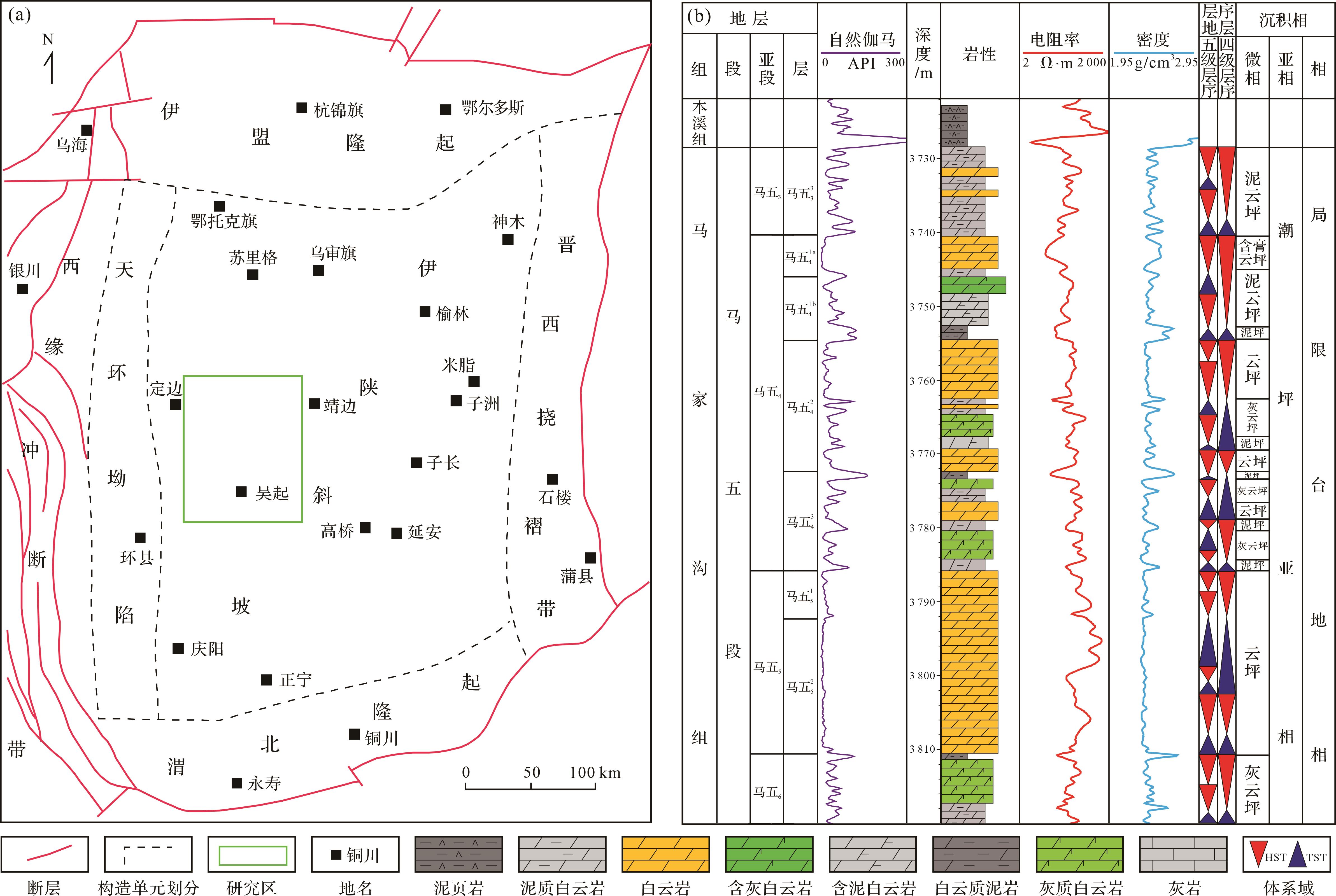
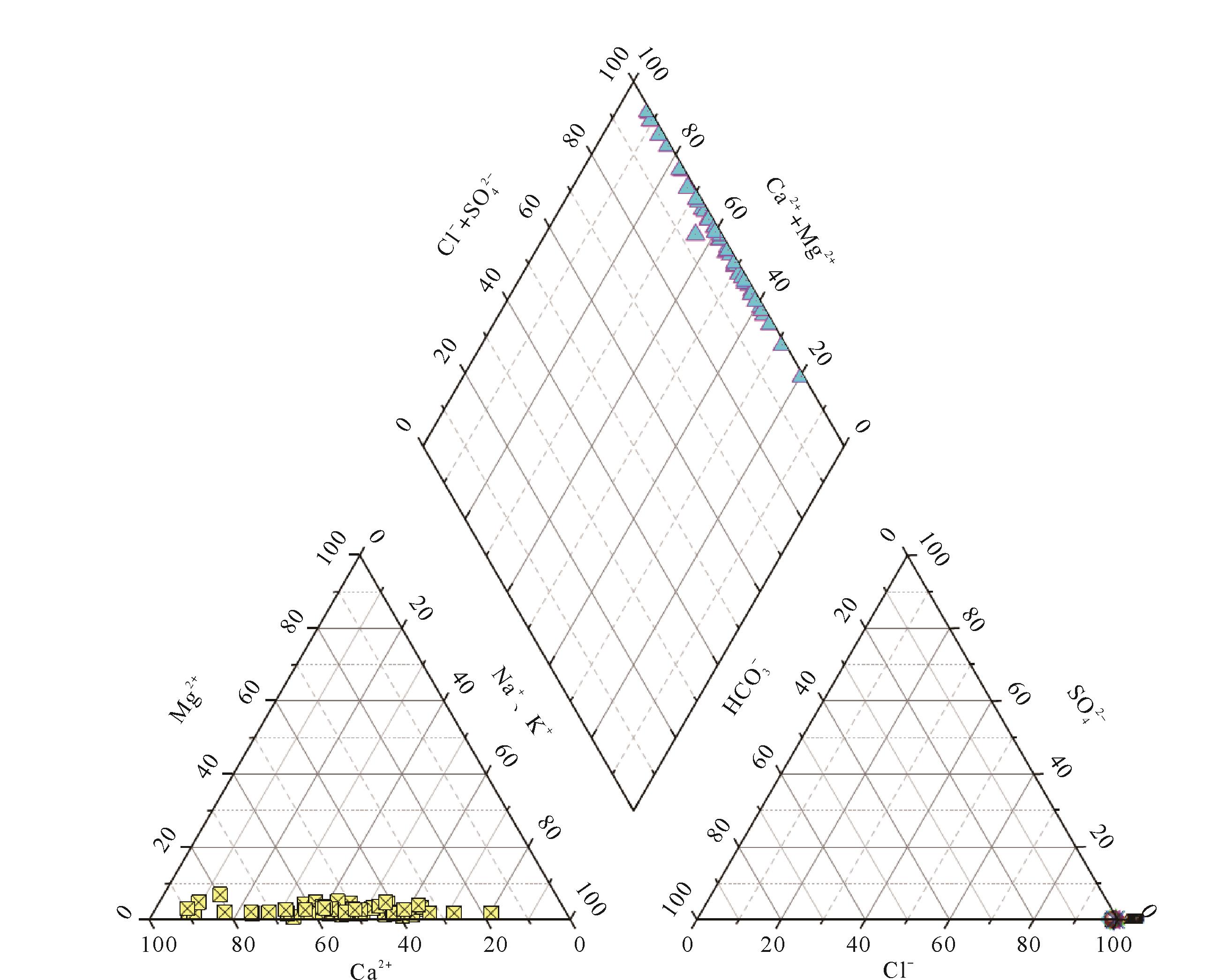
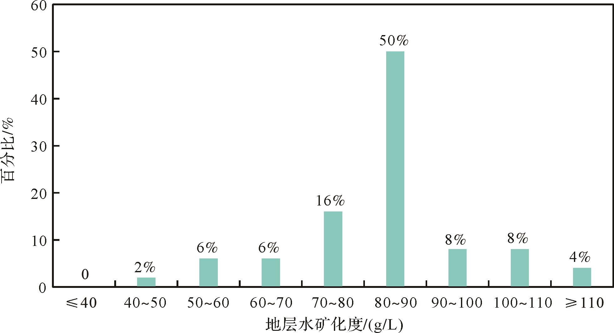
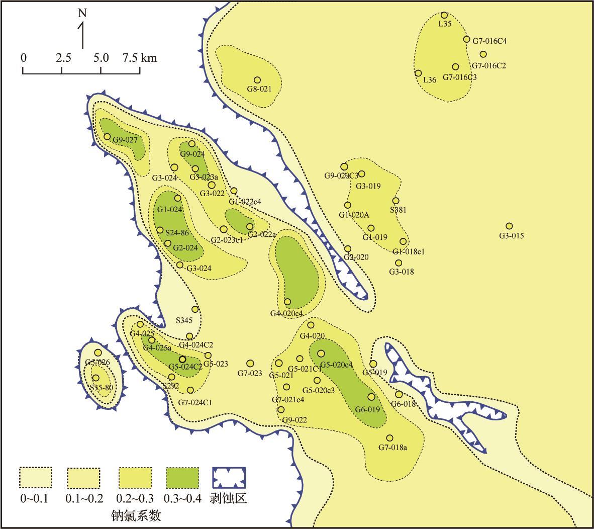
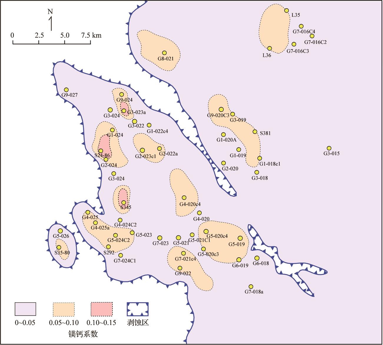
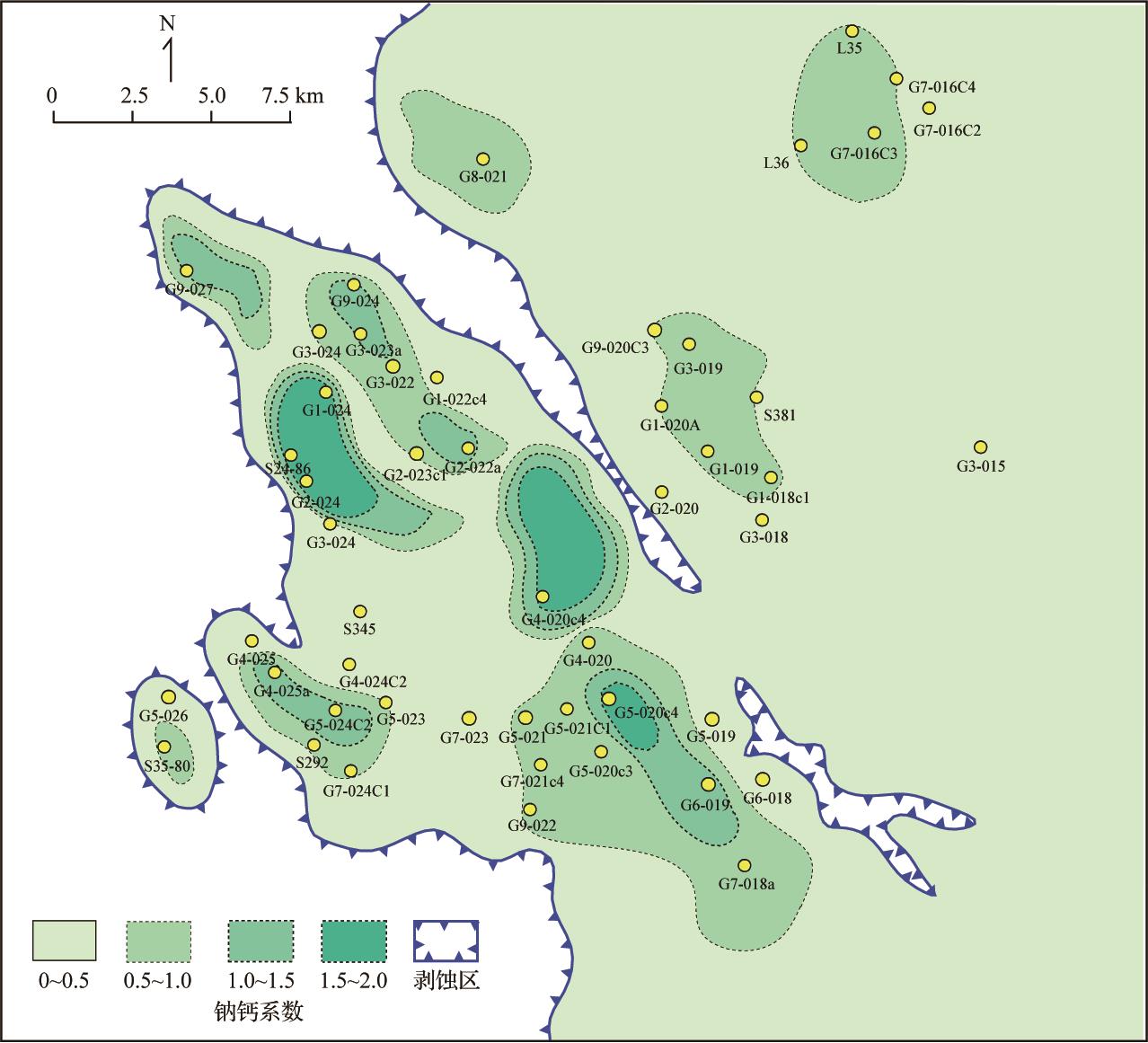
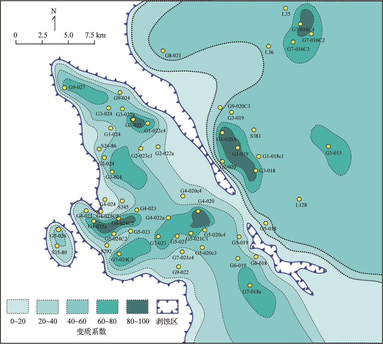
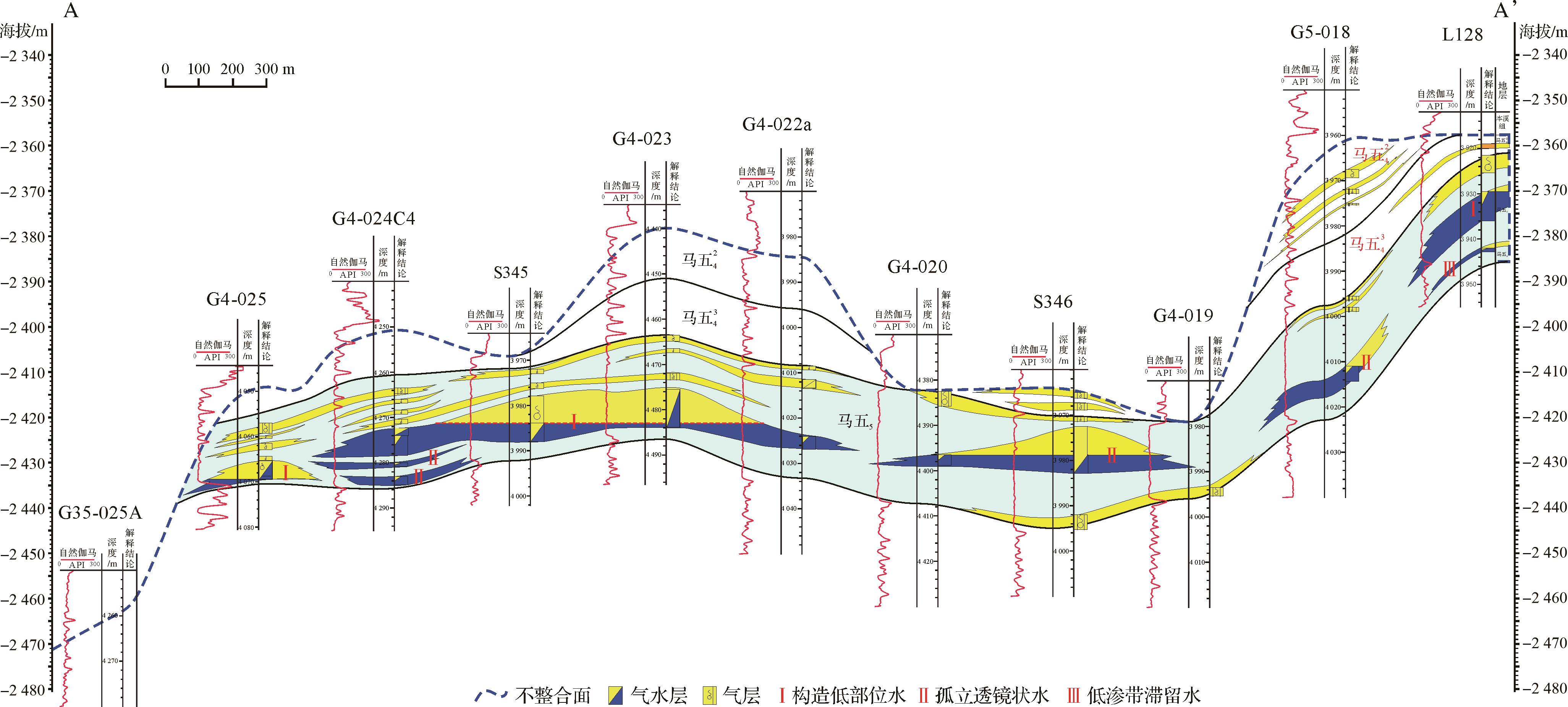
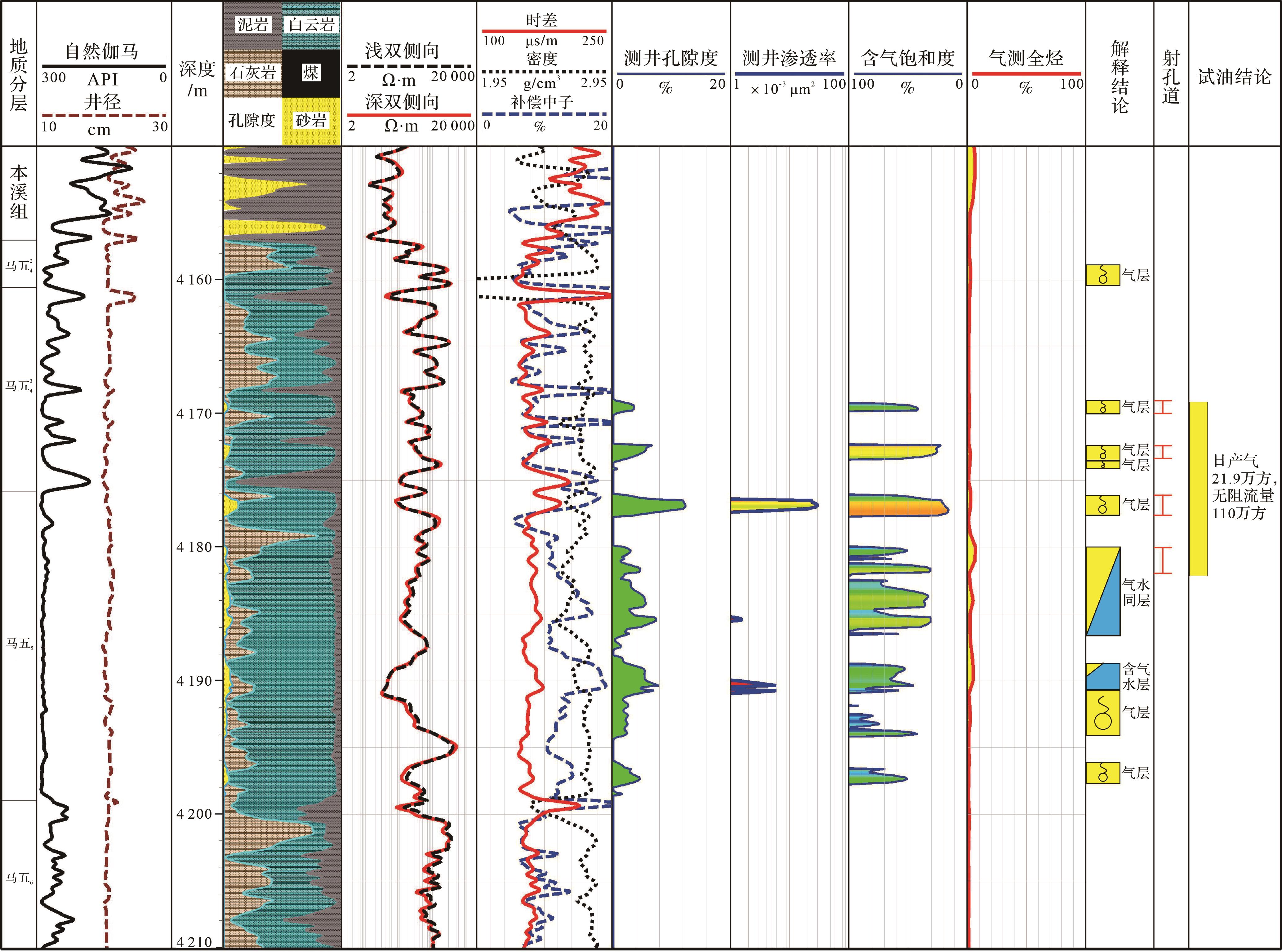
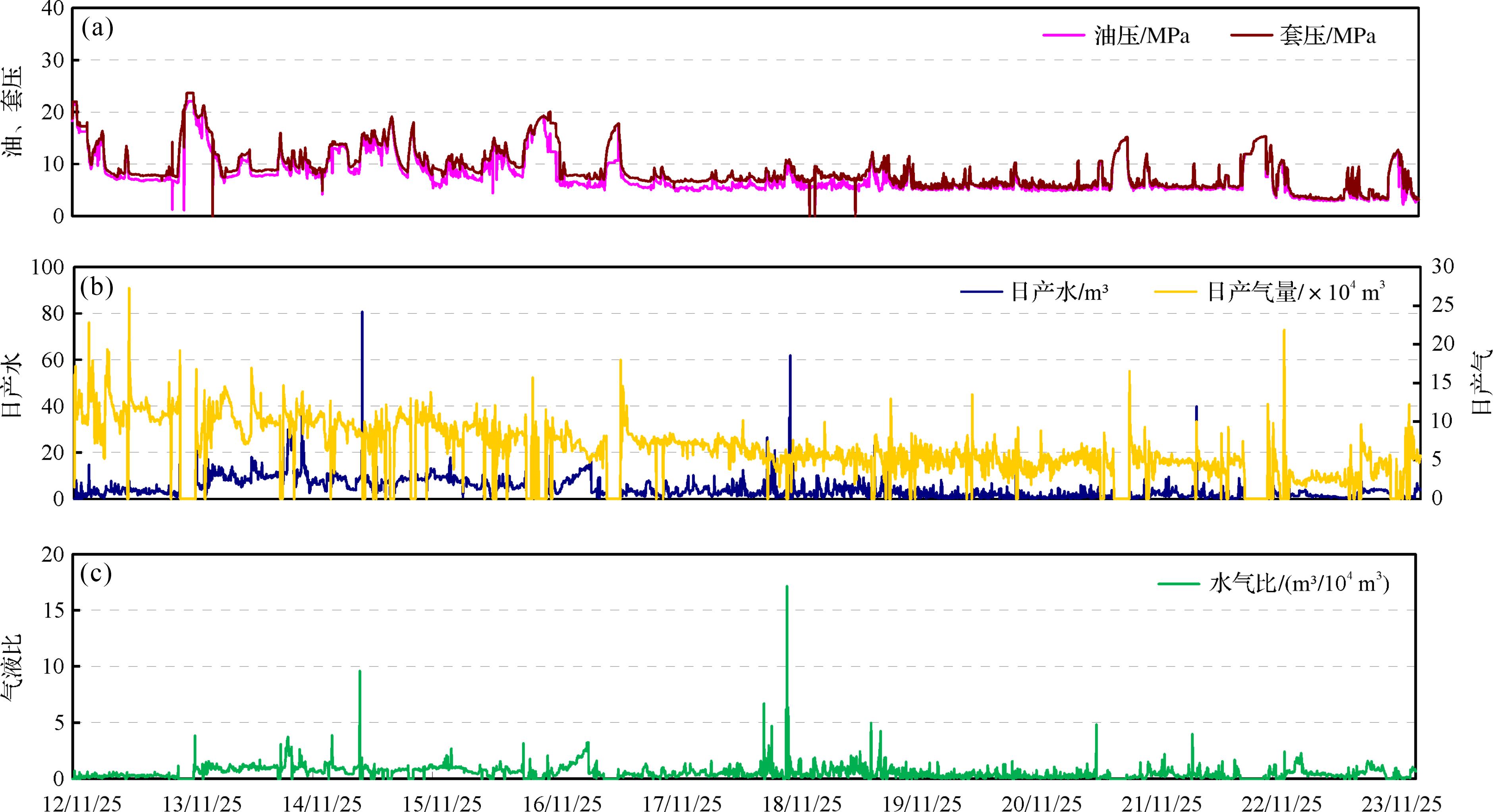
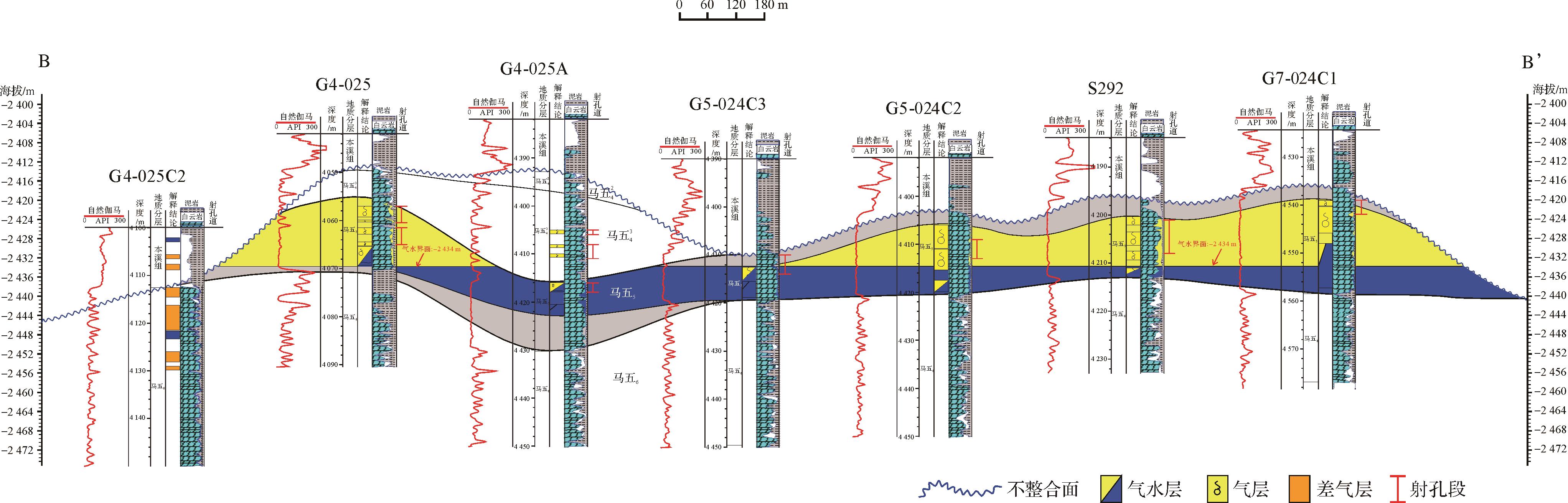
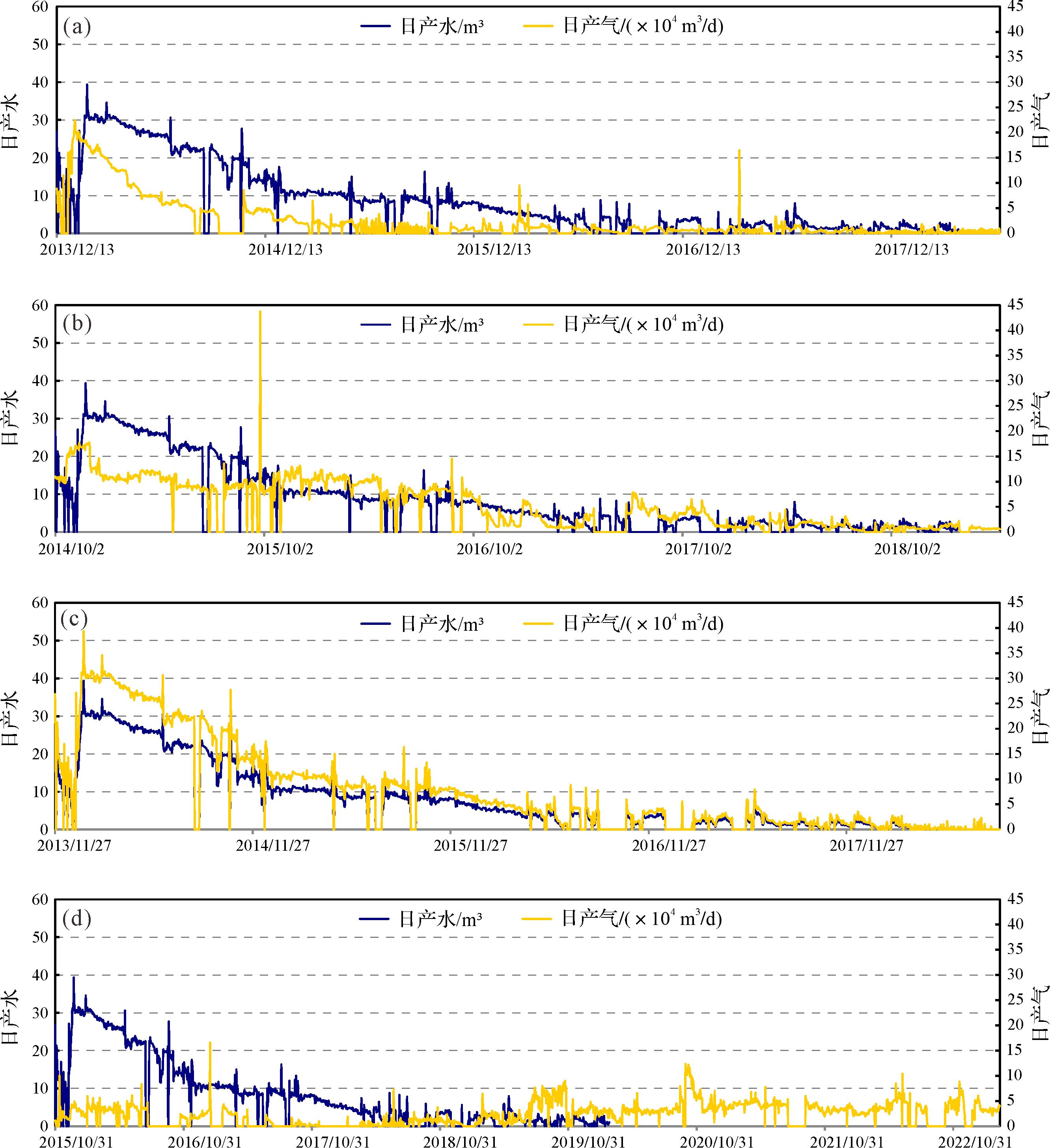
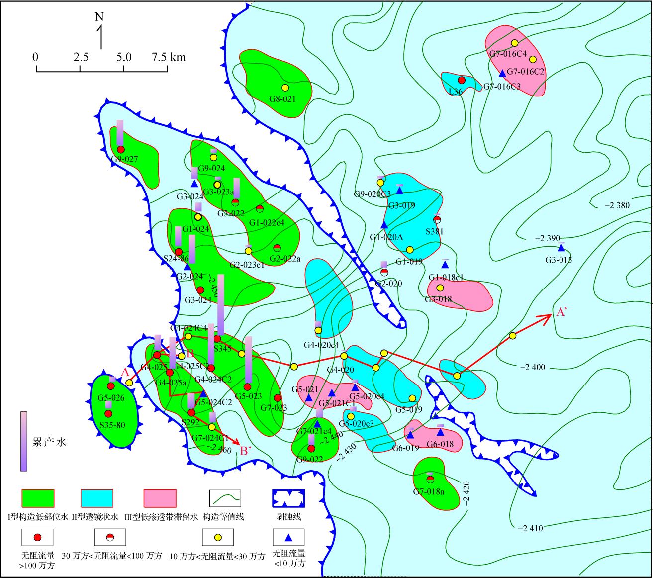
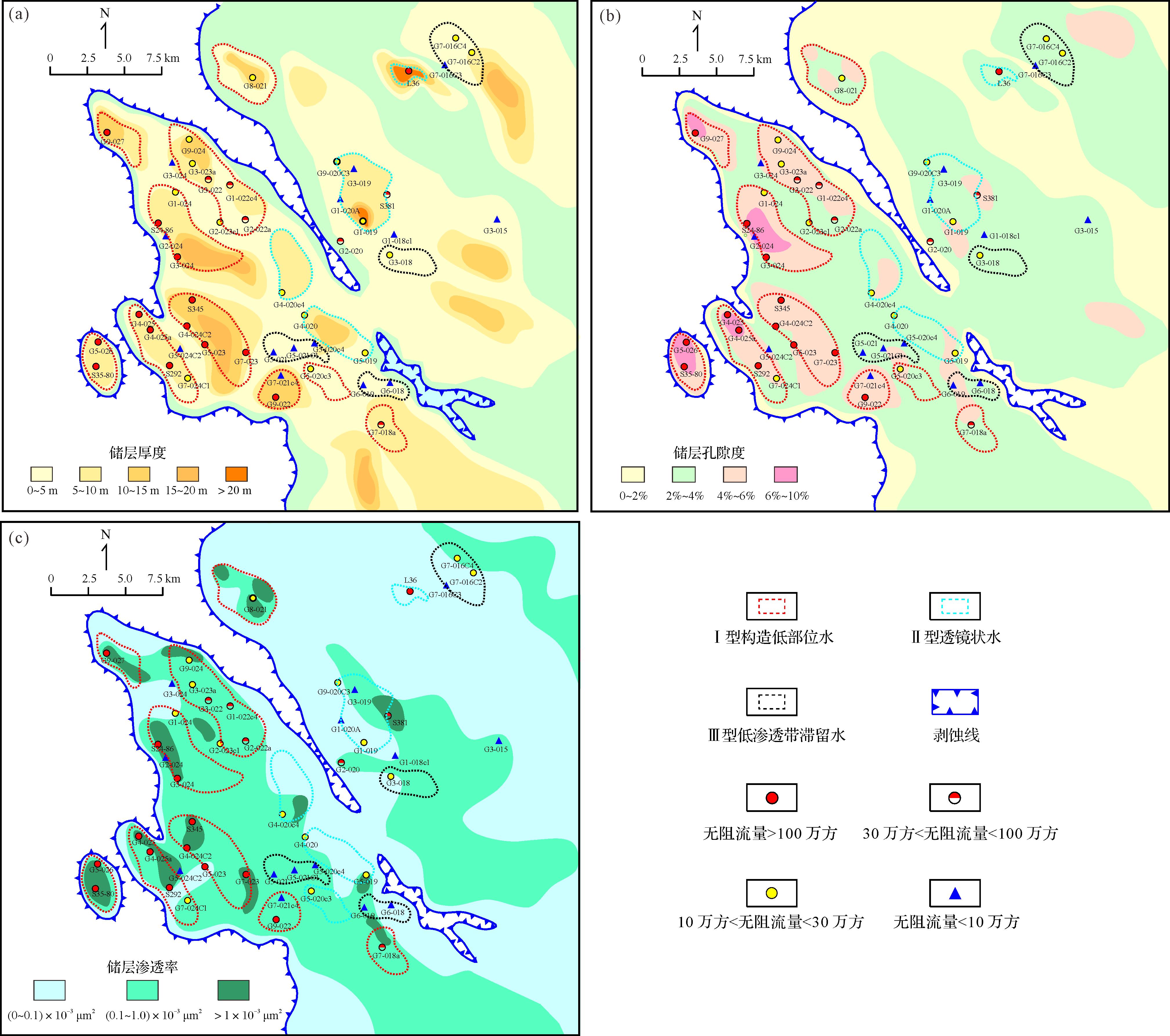
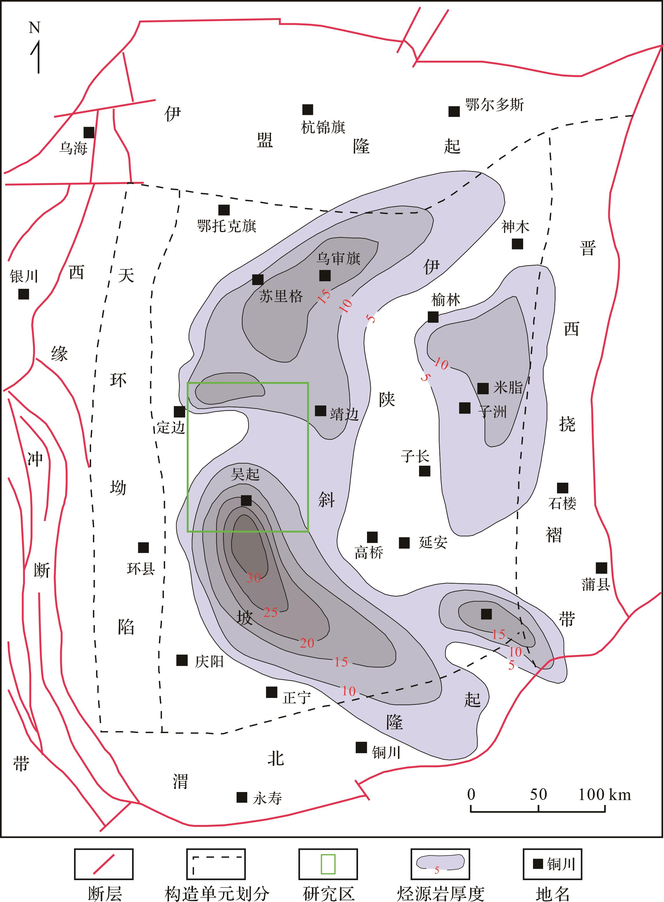
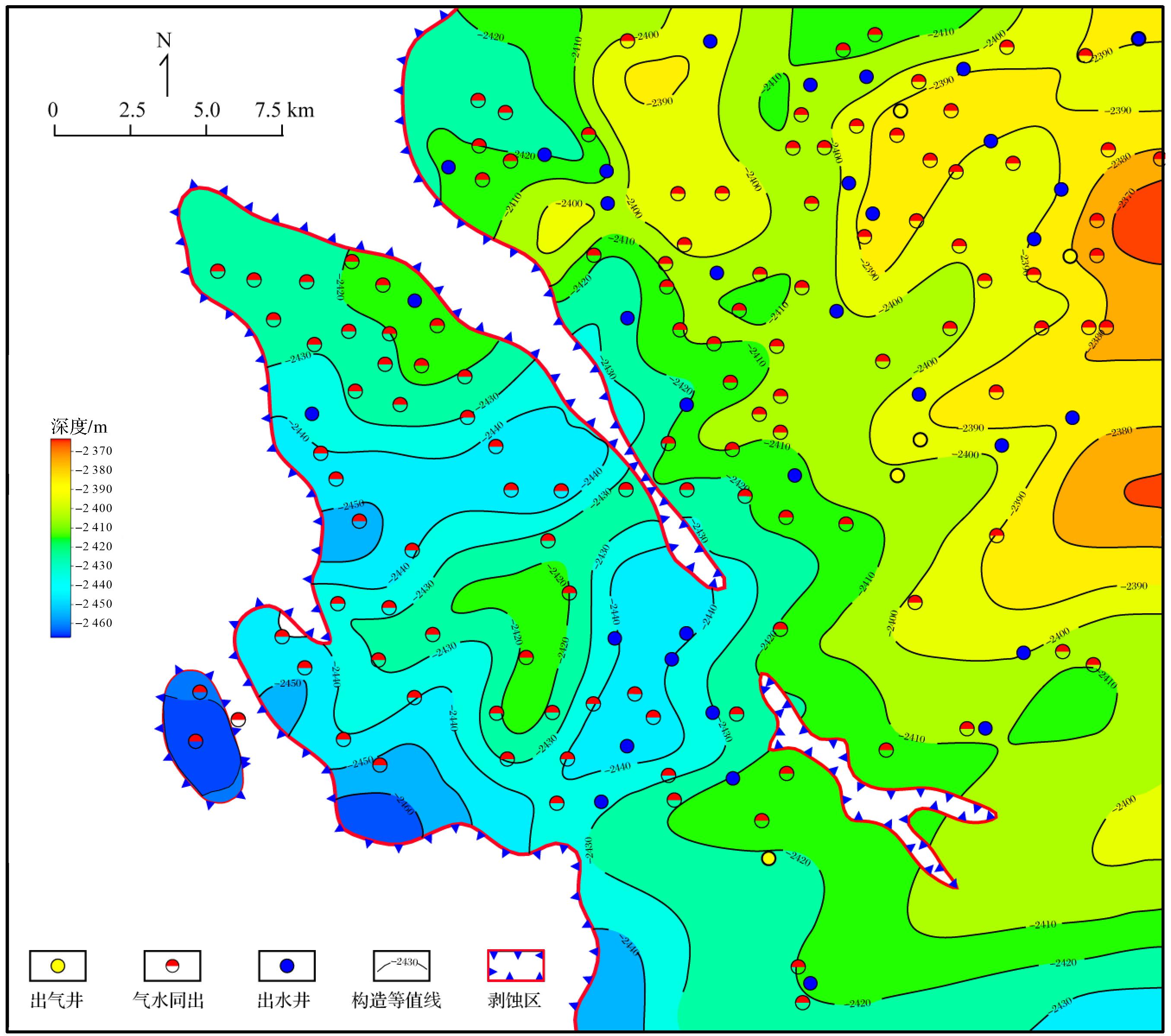
2026, 44(3): 1117-1131.
doi: 10.14027/j.issn.1000-0550.2024.112
Abstract:
Objective The cathodoluminescence (CL) characteristics of carbonate minerals are closely related to their major/trace and rare earth element (REE) contents. Existing studies primarily focus on the effects of Mn and Fe on CL, often neglecting the role of REEs. This study aims to investigate the influence of major/trace and rare earth elements on the CL characteristics of carbonate minerals, thereby providing geological evidence for inferring mineral genesis, depositional environments, and diagenetic processes. Methods CL and laser ablation inductively coupled plasma mass spectrometry (LA-ICP-MS) were used to test carbonate rock samples from the Lower and Middle Ordovician on the southern margin of the Ordos Basin. Statistical methods and classification algorithms were applied to analyze the test data, and common REE indicators were used to evaluate the properties of diagenetic fluids. Results The study reveals that matrix dolomite exhibits weak to moderate red luminescence under CL, with both zoned and uniform luminescence. Dolomite cements, with high Mn and Fe contents, are often zoned or non-luminescent. Analysis of variance (ANOVA) and Tukey's Honestly Significant Difference (HSD) post-hoc tests indicate that Fe, Mn, La, Ce, Pr, Nd, Sm, Eu, Gd, and Tb contents, and the Fe/Mn value significantly influence the CL of carbonate minerals. Non-luminescent and strongly luminescent groups are relatively easy to distinguish: non-luminescent minerals have Fe contents greater than 10,000×10-6 or Mn contents less than 40×10-6 . Additionally, the non-luminescent group with Fe contents over 10,000×10-6 displays REE distribution patterns enriched in Middle Rare Earth Elements (MREE), whereas the strongly luminescent group shows Light Rare Earth Elements (LREE) depletion and low Fe/Mn values. Using comprehensive dimensionality-reduced parameters of major/trace elements and REEs, in conjunction with Mn content, effectively distinguishes the extremely weakly luminescent, weakly luminescent, and moderately luminescent groups. The nature of diagenetic fluids during diagenesis impacts carbonate sediment composition, mineral content, and major/trace element and REE variations, directly influencing carbonate mineral CL. Conclusions By combining in situ major/trace element testing with various data processing methods, this study provides a more quantitative understanding of the impact of major/trace element and REE contents on CL intensity. These findings offer valuable insights for scholars studying the factors affecting CL.
Objective The cathodoluminescence (CL) characteristics of carbonate minerals are closely related to their major/trace and rare earth element (REE) contents. Existing studies primarily focus on the effects of Mn and Fe on CL, often neglecting the role of REEs. This study aims to investigate the influence of major/trace and rare earth elements on the CL characteristics of carbonate minerals, thereby providing geological evidence for inferring mineral genesis, depositional environments, and diagenetic processes. Methods CL and laser ablation inductively coupled plasma mass spectrometry (LA-ICP-MS) were used to test carbonate rock samples from the Lower and Middle Ordovician on the southern margin of the Ordos Basin. Statistical methods and classification algorithms were applied to analyze the test data, and common REE indicators were used to evaluate the properties of diagenetic fluids. Results The study reveals that matrix dolomite exhibits weak to moderate red luminescence under CL, with both zoned and uniform luminescence. Dolomite cements, with high Mn and Fe contents, are often zoned or non-luminescent. Analysis of variance (ANOVA) and Tukey's Honestly Significant Difference (HSD) post-hoc tests indicate that Fe, Mn, La, Ce, Pr, Nd, Sm, Eu, Gd, and Tb contents, and the Fe/Mn value significantly influence the CL of carbonate minerals. Non-luminescent and strongly luminescent groups are relatively easy to distinguish: non-luminescent minerals have Fe contents greater than 10,000×10-6 or Mn contents less than 40×10-6 . Additionally, the non-luminescent group with Fe contents over 10,000×10-6 displays REE distribution patterns enriched in Middle Rare Earth Elements (MREE), whereas the strongly luminescent group shows Light Rare Earth Elements (LREE) depletion and low Fe/Mn values. Using comprehensive dimensionality-reduced parameters of major/trace elements and REEs, in conjunction with Mn content, effectively distinguishes the extremely weakly luminescent, weakly luminescent, and moderately luminescent groups. The nature of diagenetic fluids during diagenesis impacts carbonate sediment composition, mineral content, and major/trace element and REE variations, directly influencing carbonate mineral CL. Conclusions By combining in situ major/trace element testing with various data processing methods, this study provides a more quantitative understanding of the impact of major/trace element and REE contents on CL intensity. These findings offer valuable insights for scholars studying the factors affecting CL.
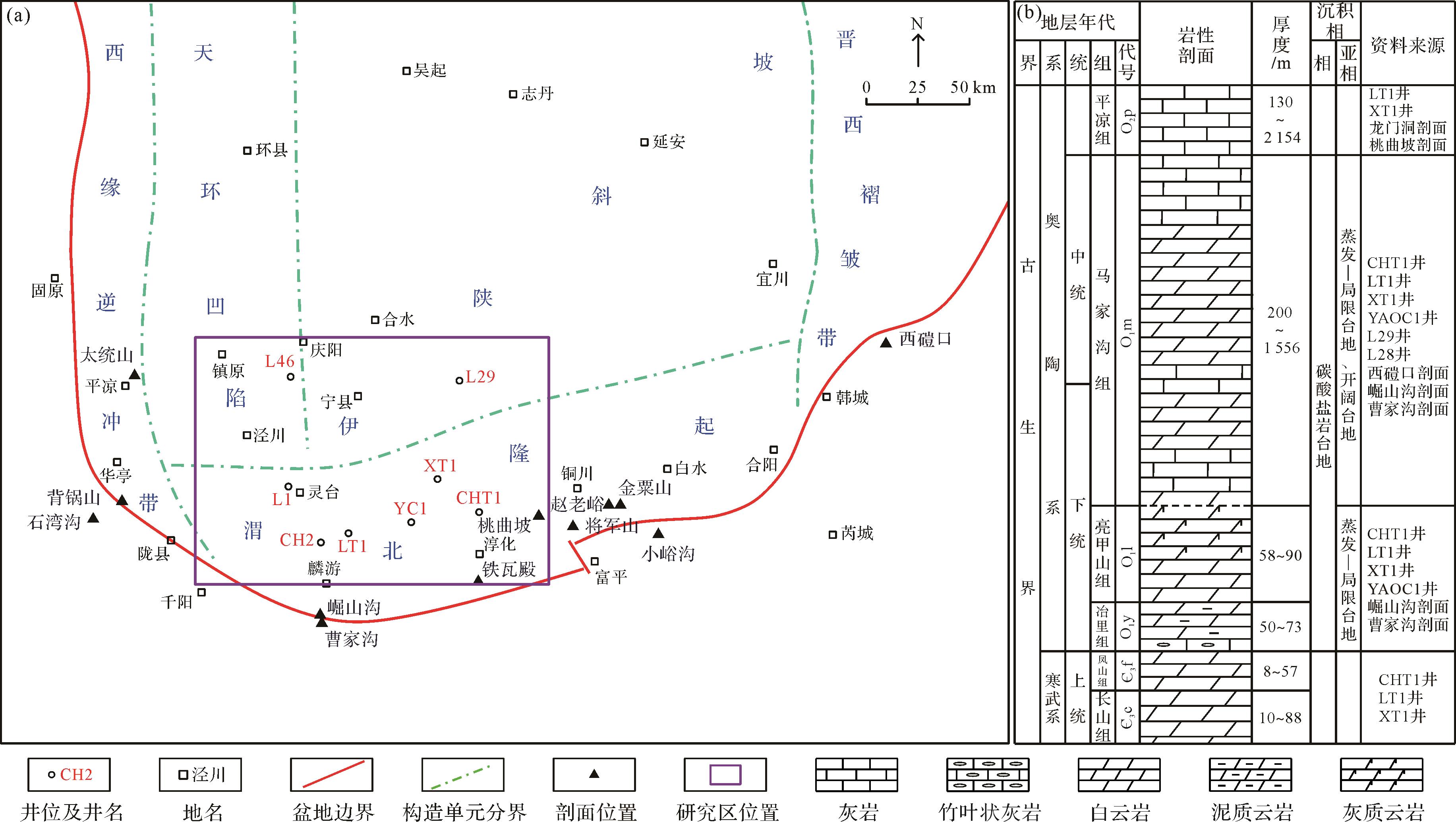
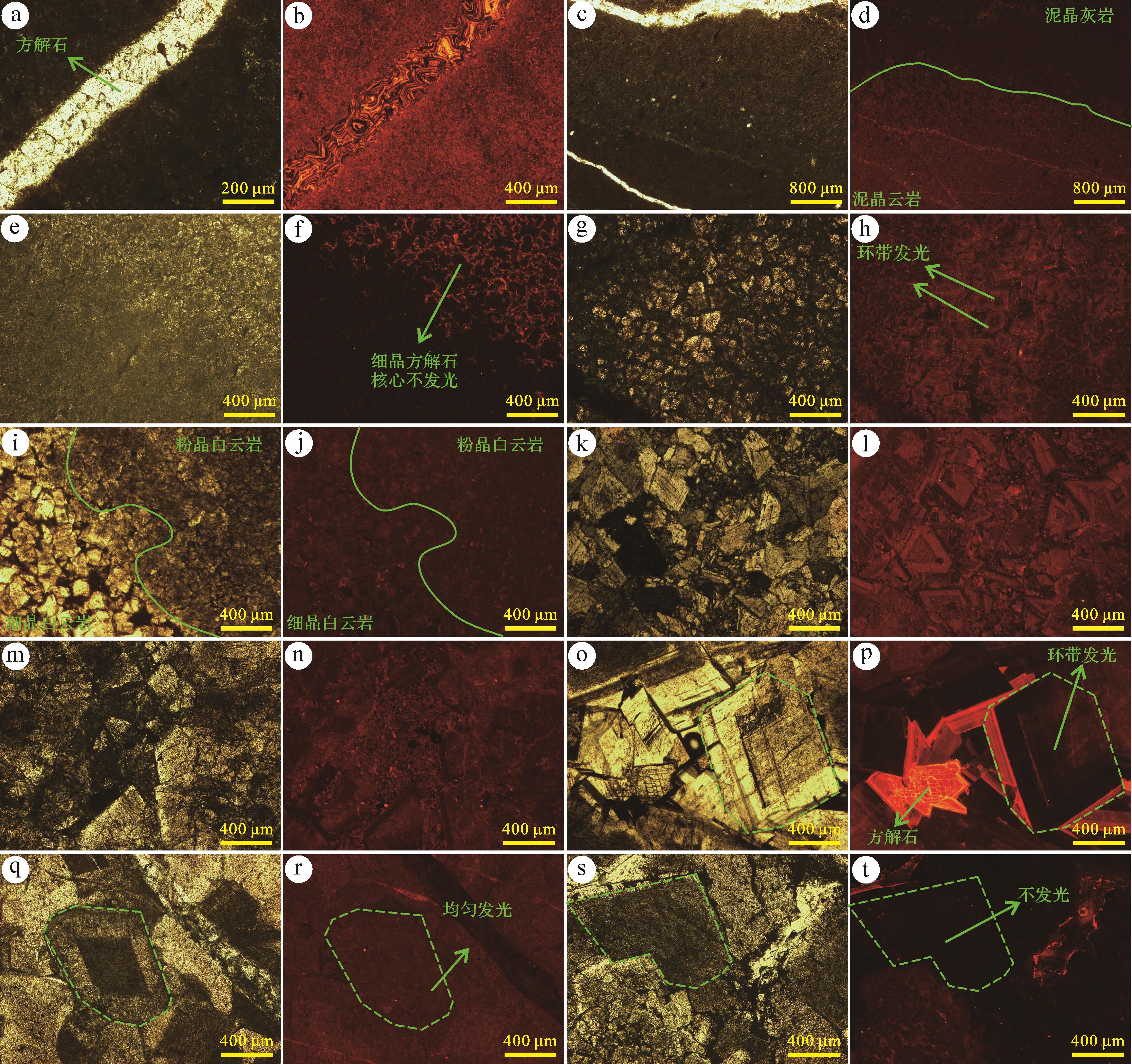
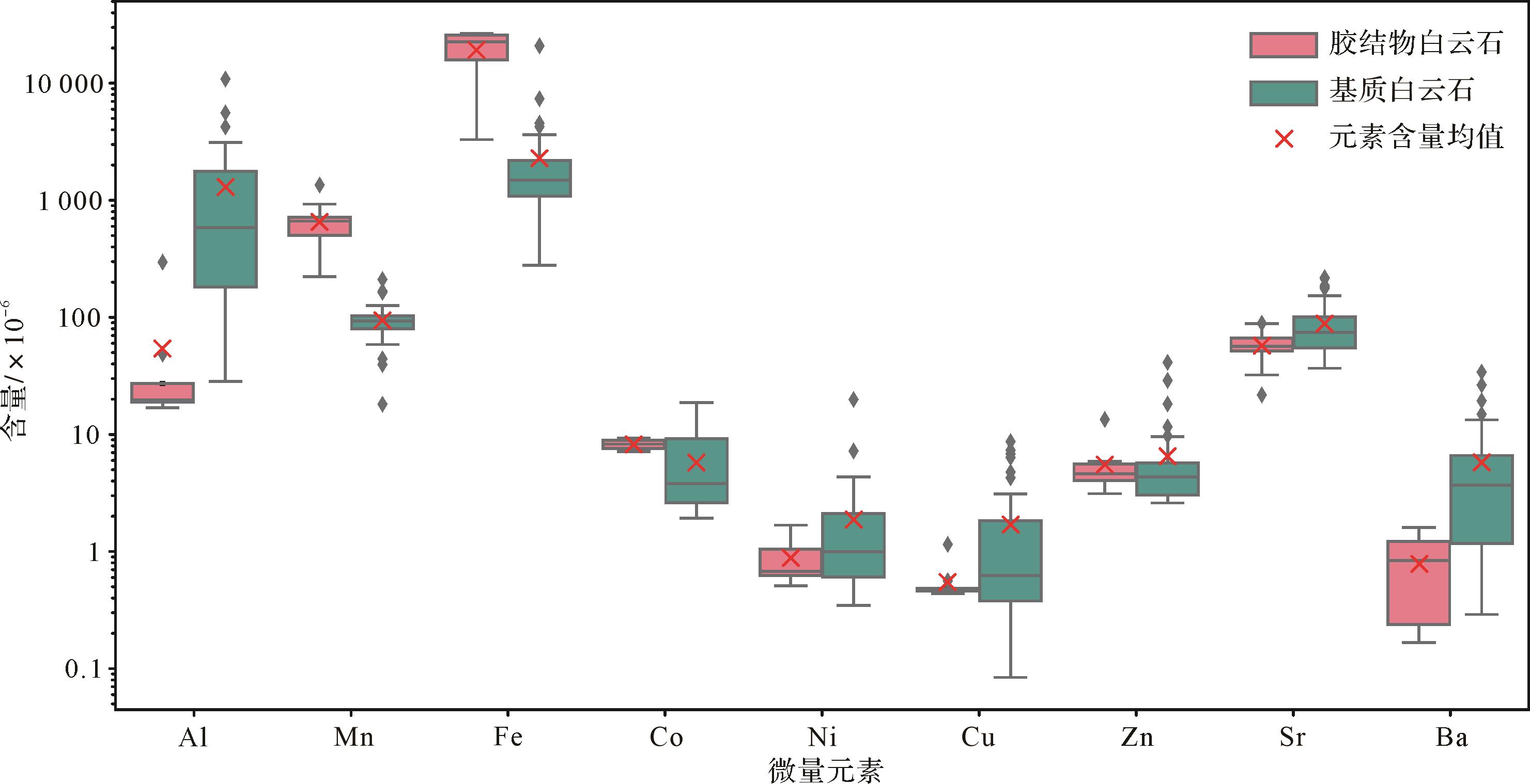
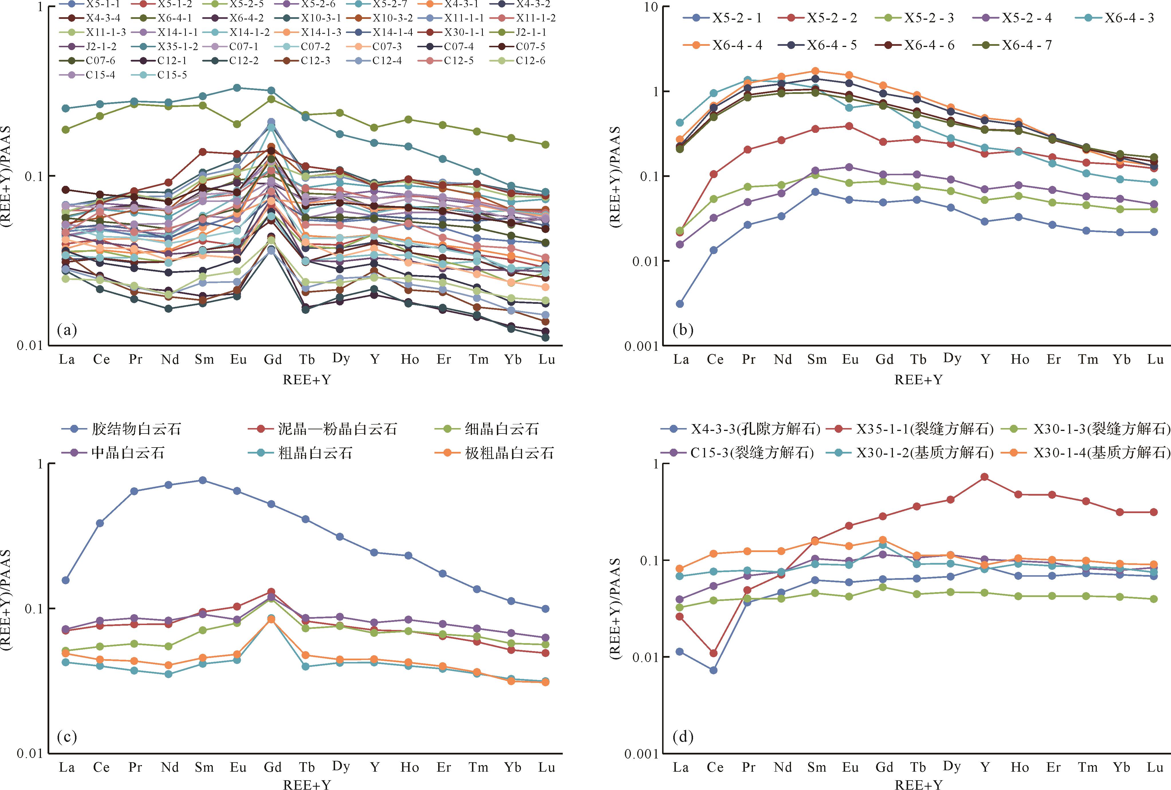
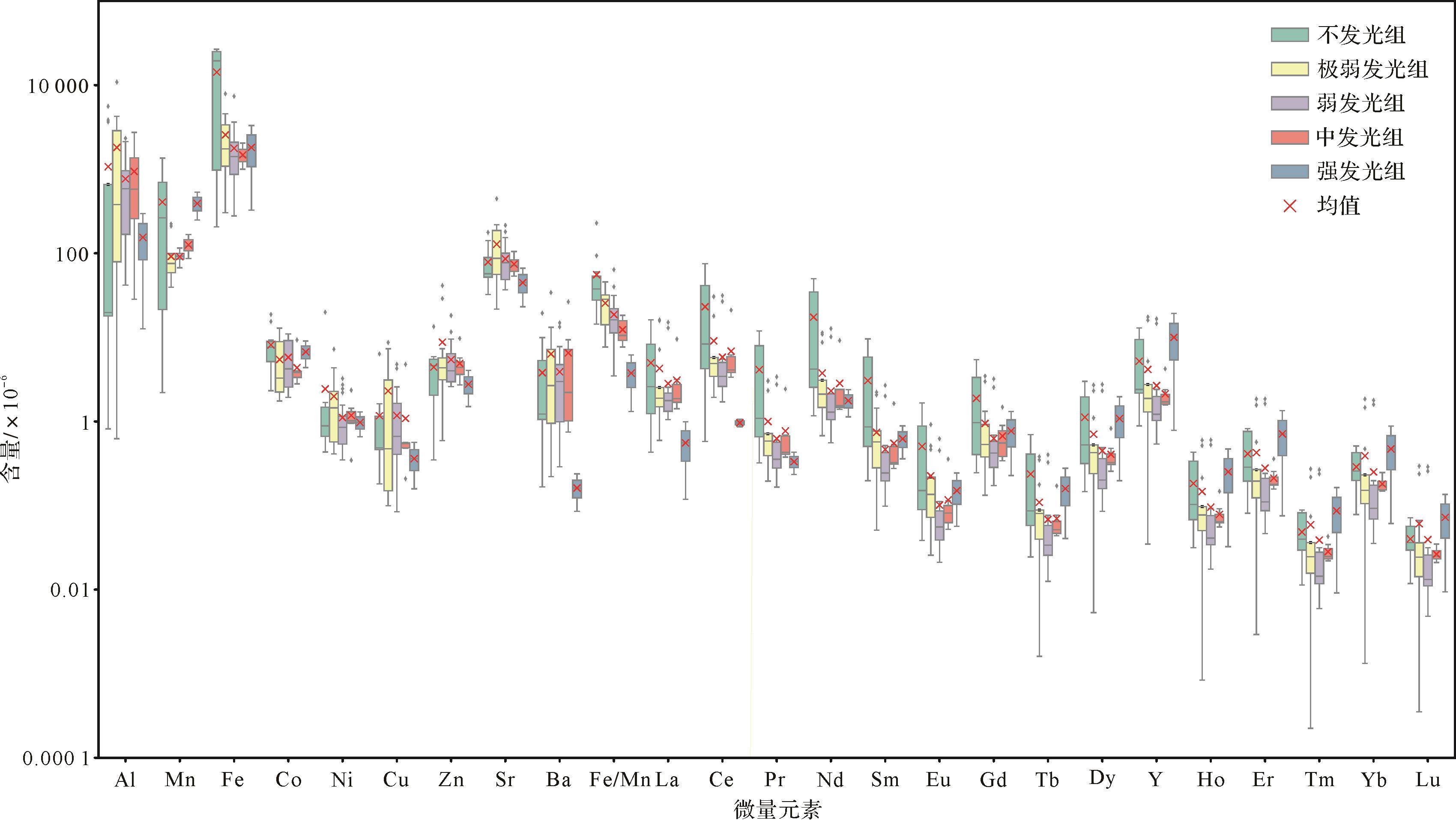
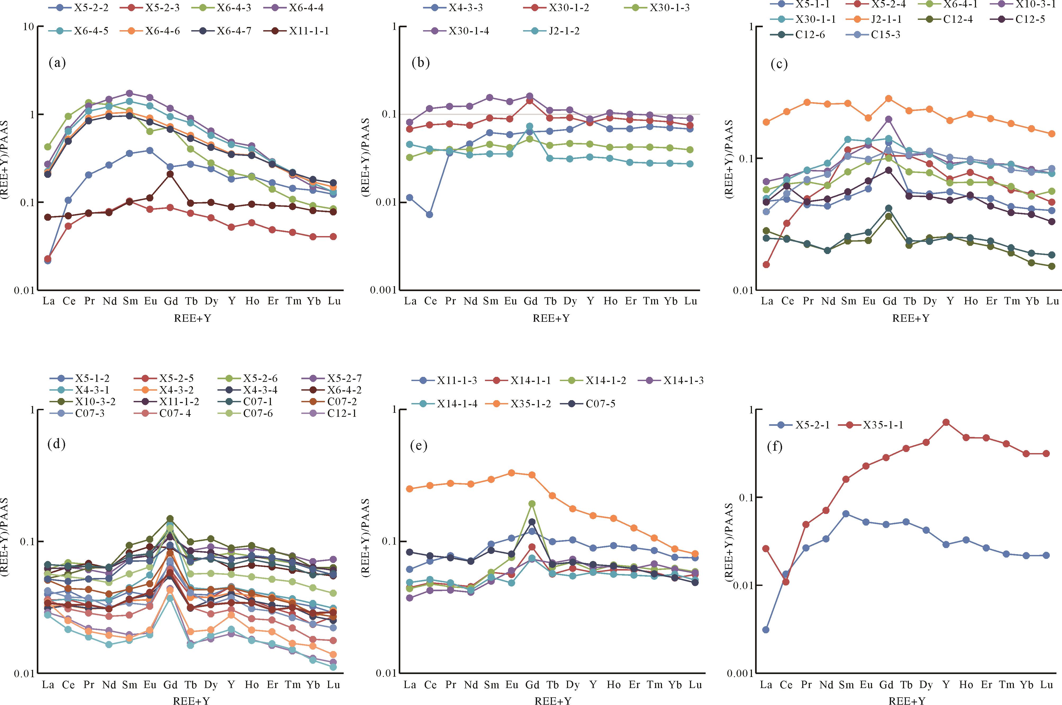
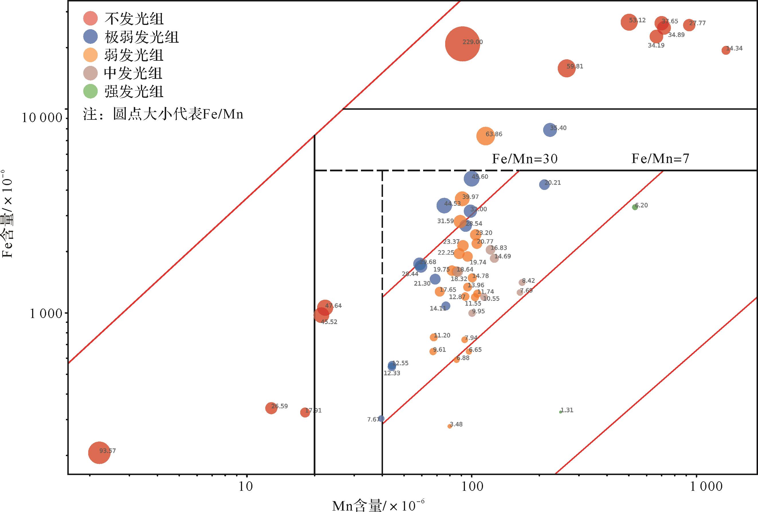
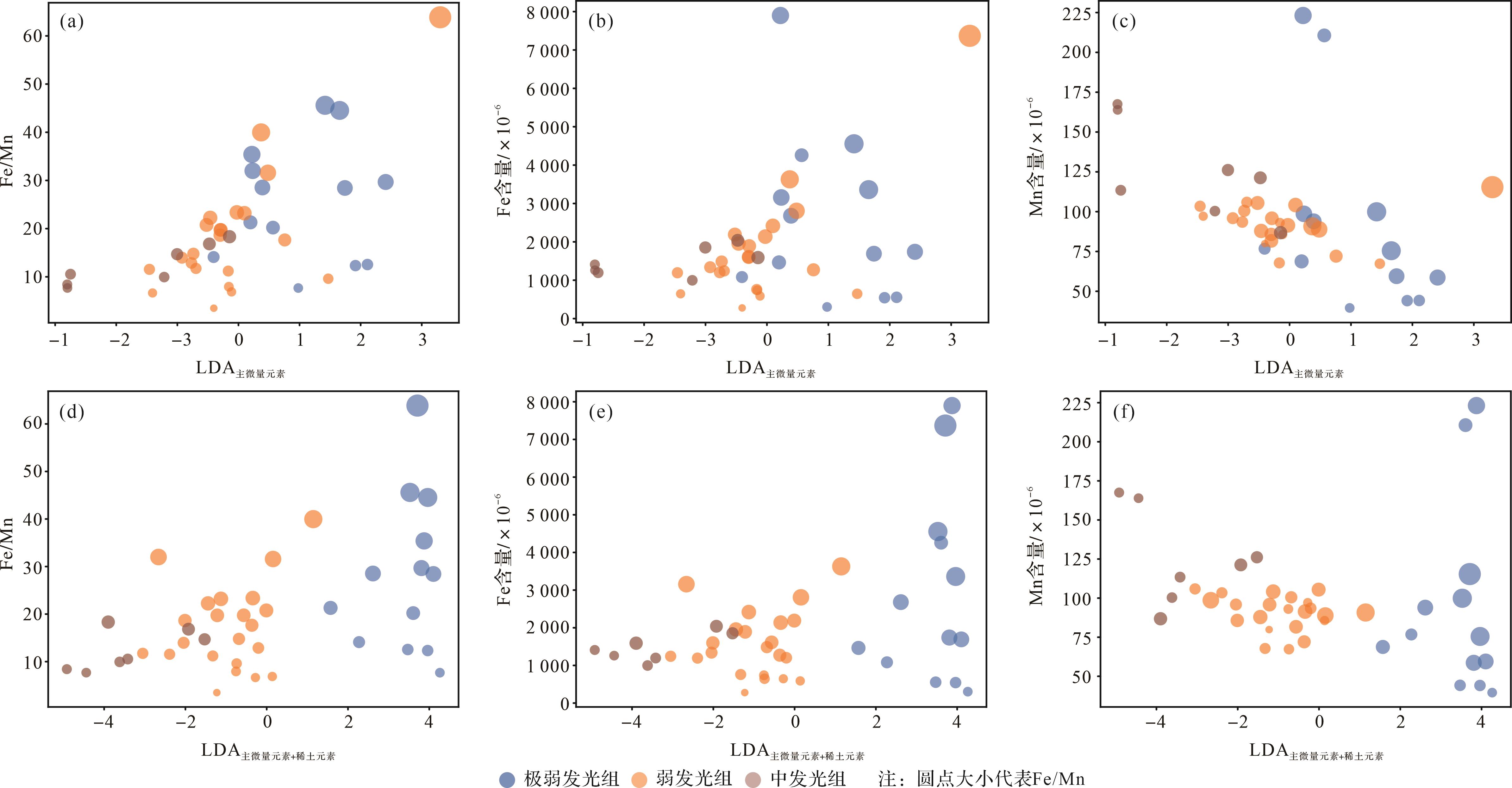
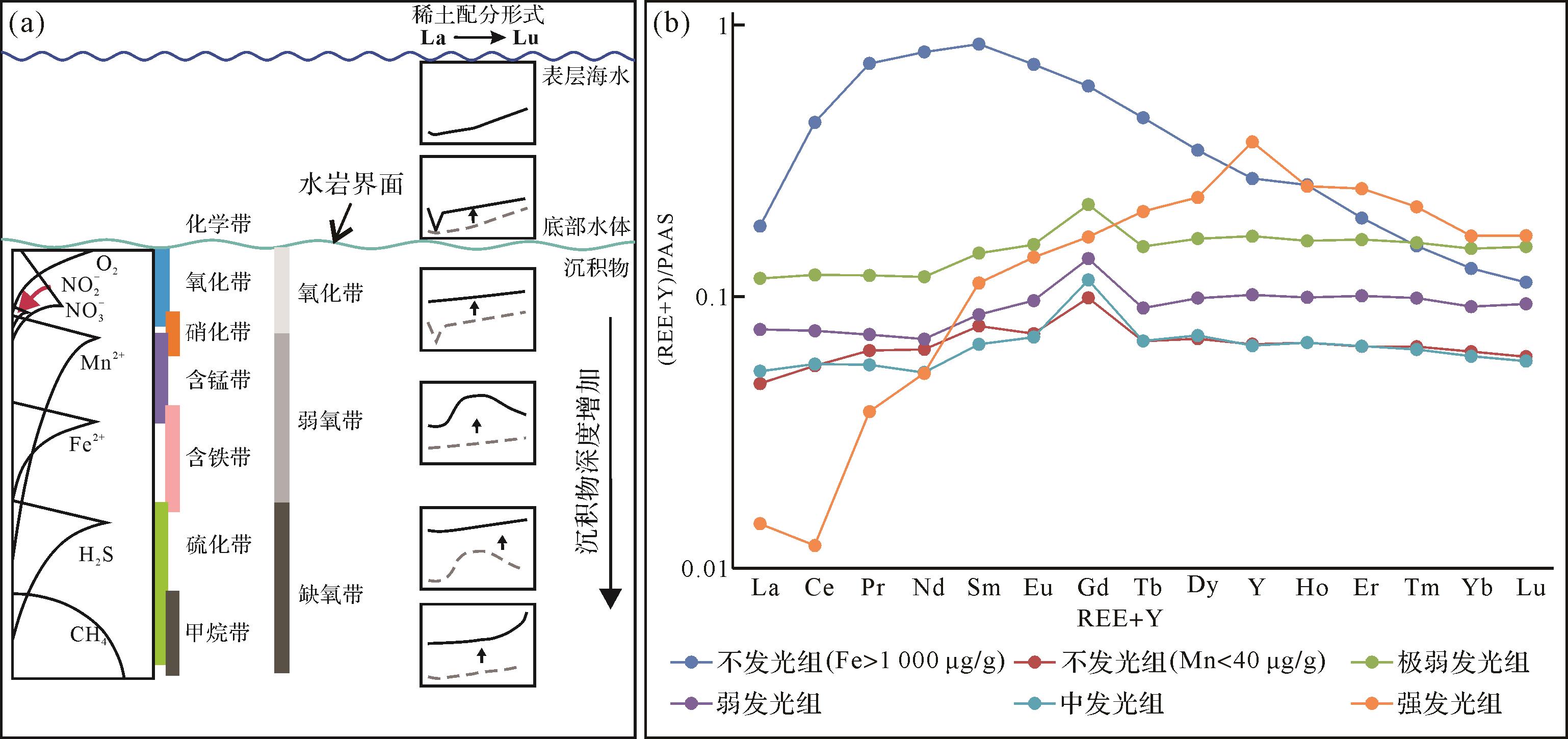
2026, 44(3): 1132-1147.
doi: 10.14027/j.issn.1000-0550.2024.108
Abstract:
Objective During the Late Triassic depositional period of the Chang 7 member of the Yanchang Formation in the Ordos Basin, a set of continuously traceable shales was deposited, and the shale is currently the main stratigraphic strata for unconventional oil exploration and development. The laminated-type shale oil reservoir at the Chang 73 sub-member features fast lateral changing, which introduces problems such as unclear reservoir distribution, high exploration difficulty, and low drilling rate. Therefore, it is urgent to study and clarify the distribution pattern of laminated-type shale oil reservoirs. Methods First, through the latest three-dimensional (3D) seismic data, the stratigraphic dip flipping method was used to recover sedimentary paleogeomorphology. Then, we marked the seismic reflection of lacustrine mudstones, identified seismic stratigraphic comparison and division, and proposed four-stage progradational clinoforms and distribution patterns of shale oil reservoirs based on sedimentary paleogeomorphology. [Results and Conclusions] Combining seismic progradational sequences with palaeotopography of the lake basin, the distribution pattern of the Chang 73 sub-member shale oil reservoir and the genesis of shale oil gravity flow sedimentation have been clarified. The laminated-type shale oil reservoir in the Chang 73 sub-member is a gravity flow deposit developed on the lake paleo-uplift, located at the end of the progradational clinoforms, with poor connectivity and complex stacking relationships. In actual production, it should be explored as a "box body". The above perspective has assisted in the deployment of risky well locations and exploration discoveries for laminated-type shale oil reservoirs. It provides technical support for the scale and efficiency development of interbedded-type shale oil reservoirs.
Objective During the Late Triassic depositional period of the Chang 7 member of the Yanchang Formation in the Ordos Basin, a set of continuously traceable shales was deposited, and the shale is currently the main stratigraphic strata for unconventional oil exploration and development. The laminated-type shale oil reservoir at the Chang 73 sub-member features fast lateral changing, which introduces problems such as unclear reservoir distribution, high exploration difficulty, and low drilling rate. Therefore, it is urgent to study and clarify the distribution pattern of laminated-type shale oil reservoirs. Methods First, through the latest three-dimensional (3D) seismic data, the stratigraphic dip flipping method was used to recover sedimentary paleogeomorphology. Then, we marked the seismic reflection of lacustrine mudstones, identified seismic stratigraphic comparison and division, and proposed four-stage progradational clinoforms and distribution patterns of shale oil reservoirs based on sedimentary paleogeomorphology. [Results and Conclusions] Combining seismic progradational sequences with palaeotopography of the lake basin, the distribution pattern of the Chang 73 sub-member shale oil reservoir and the genesis of shale oil gravity flow sedimentation have been clarified. The laminated-type shale oil reservoir in the Chang 73 sub-member is a gravity flow deposit developed on the lake paleo-uplift, located at the end of the progradational clinoforms, with poor connectivity and complex stacking relationships. In actual production, it should be explored as a "box body". The above perspective has assisted in the deployment of risky well locations and exploration discoveries for laminated-type shale oil reservoirs. It provides technical support for the scale and efficiency development of interbedded-type shale oil reservoirs.
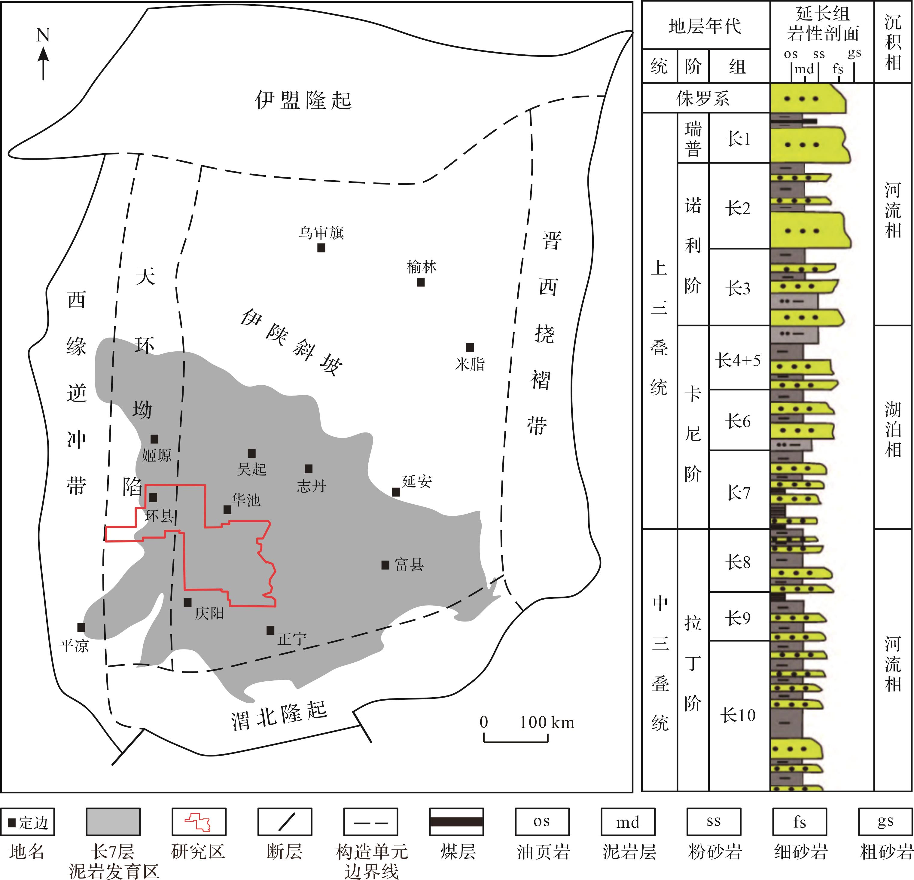
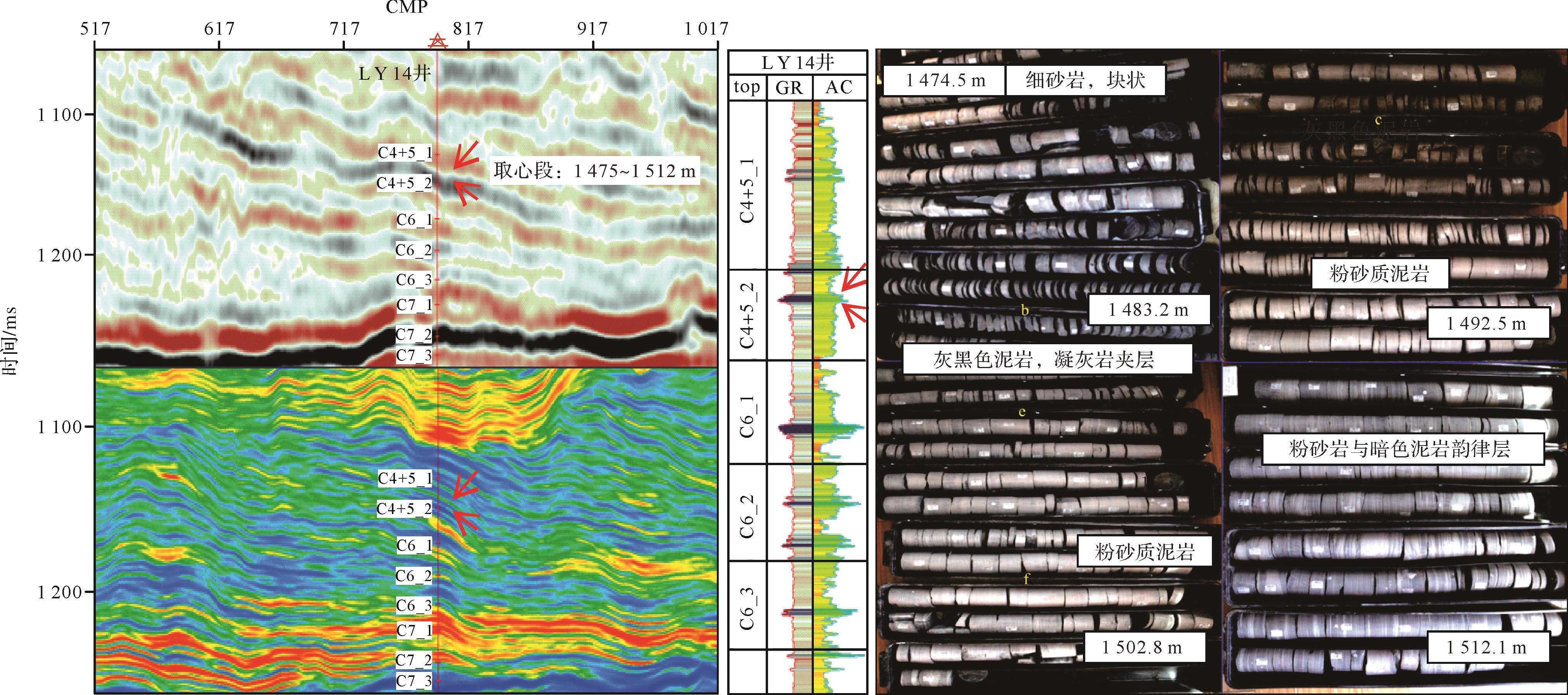
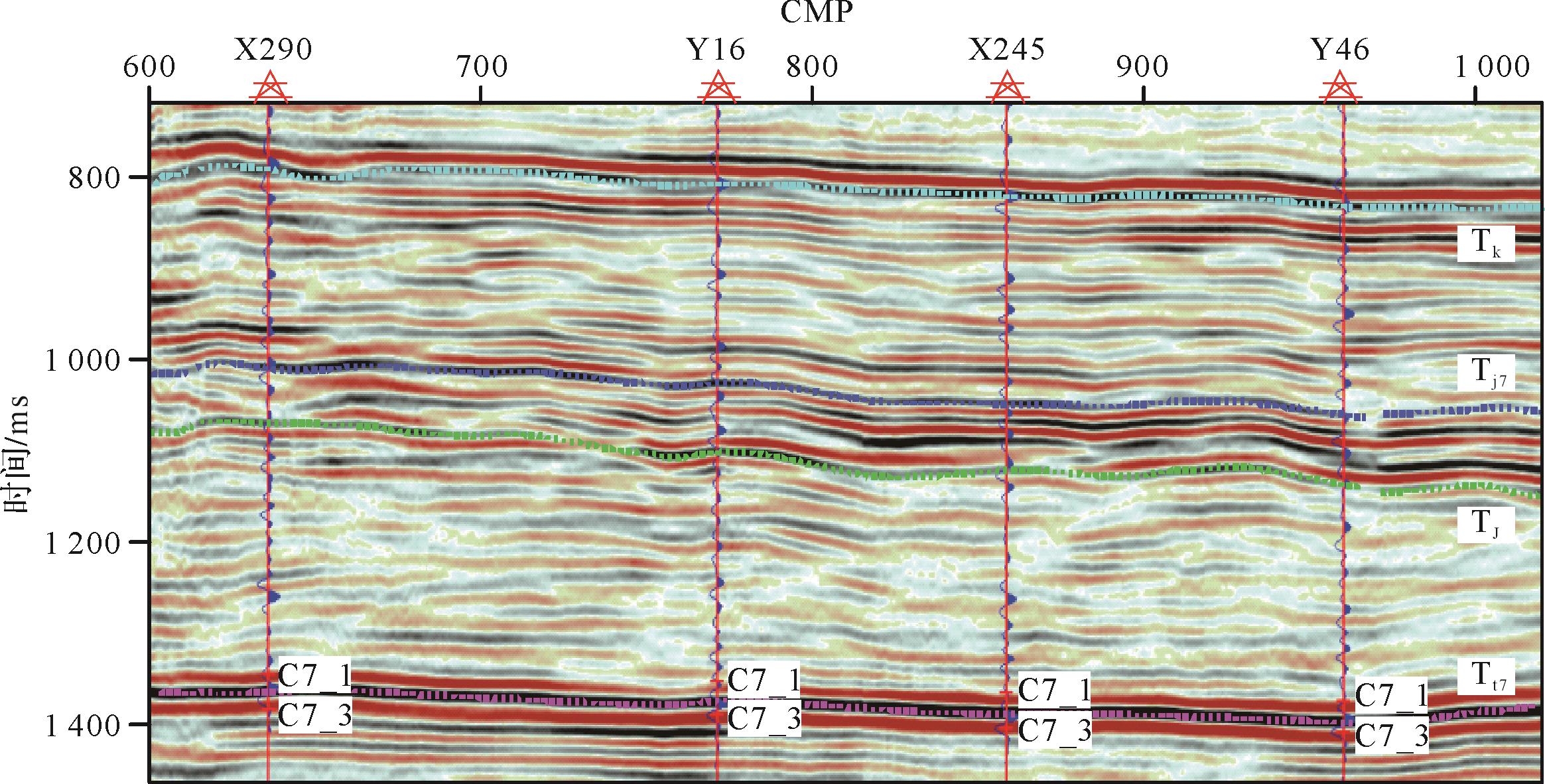
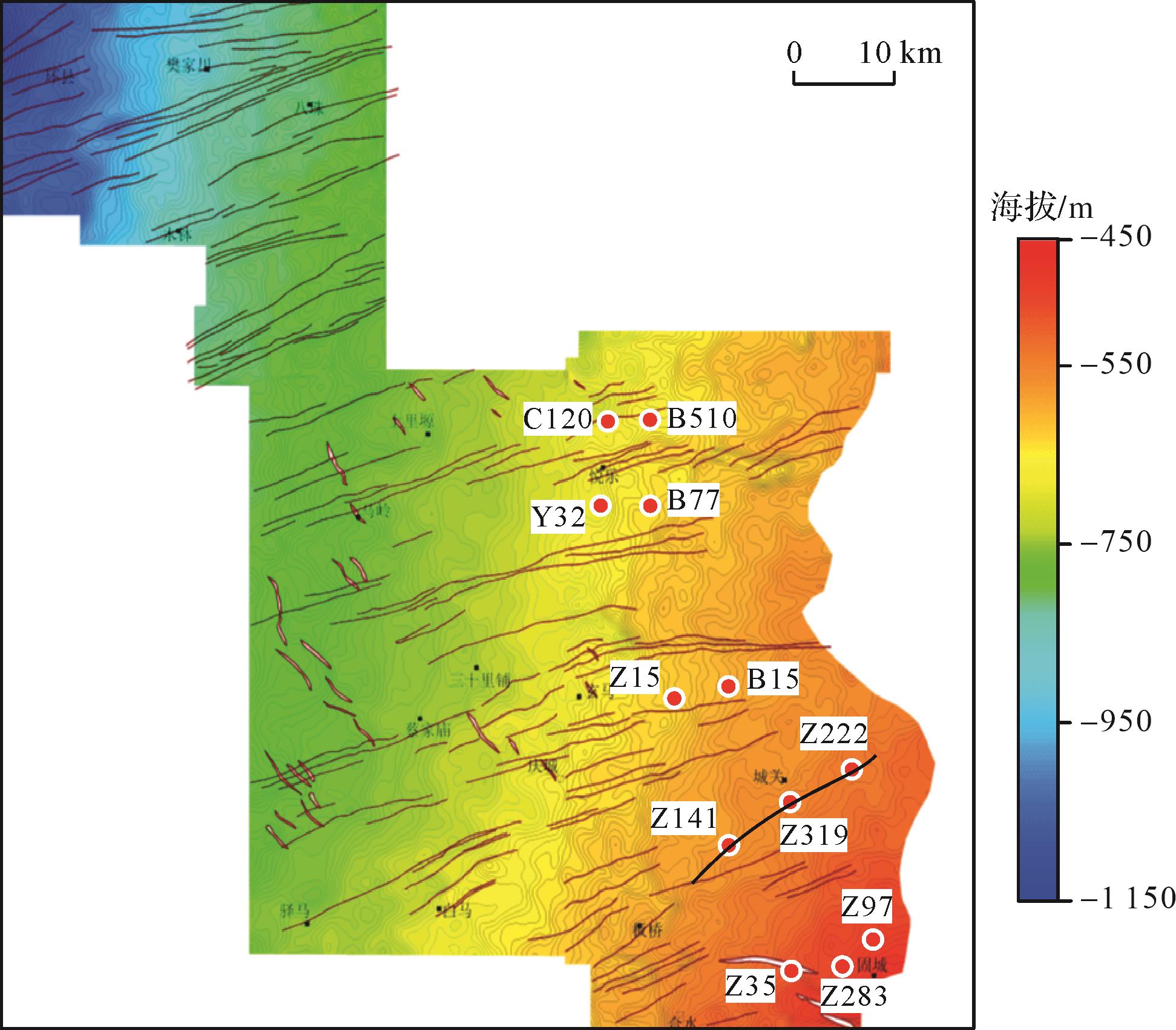
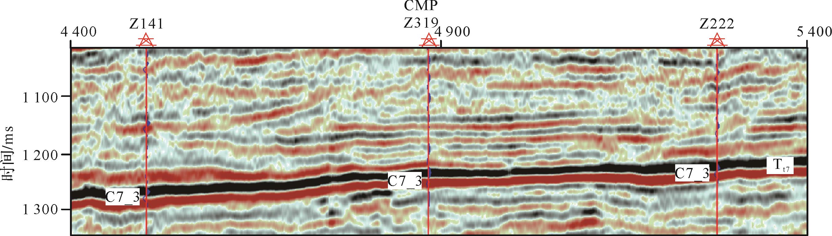
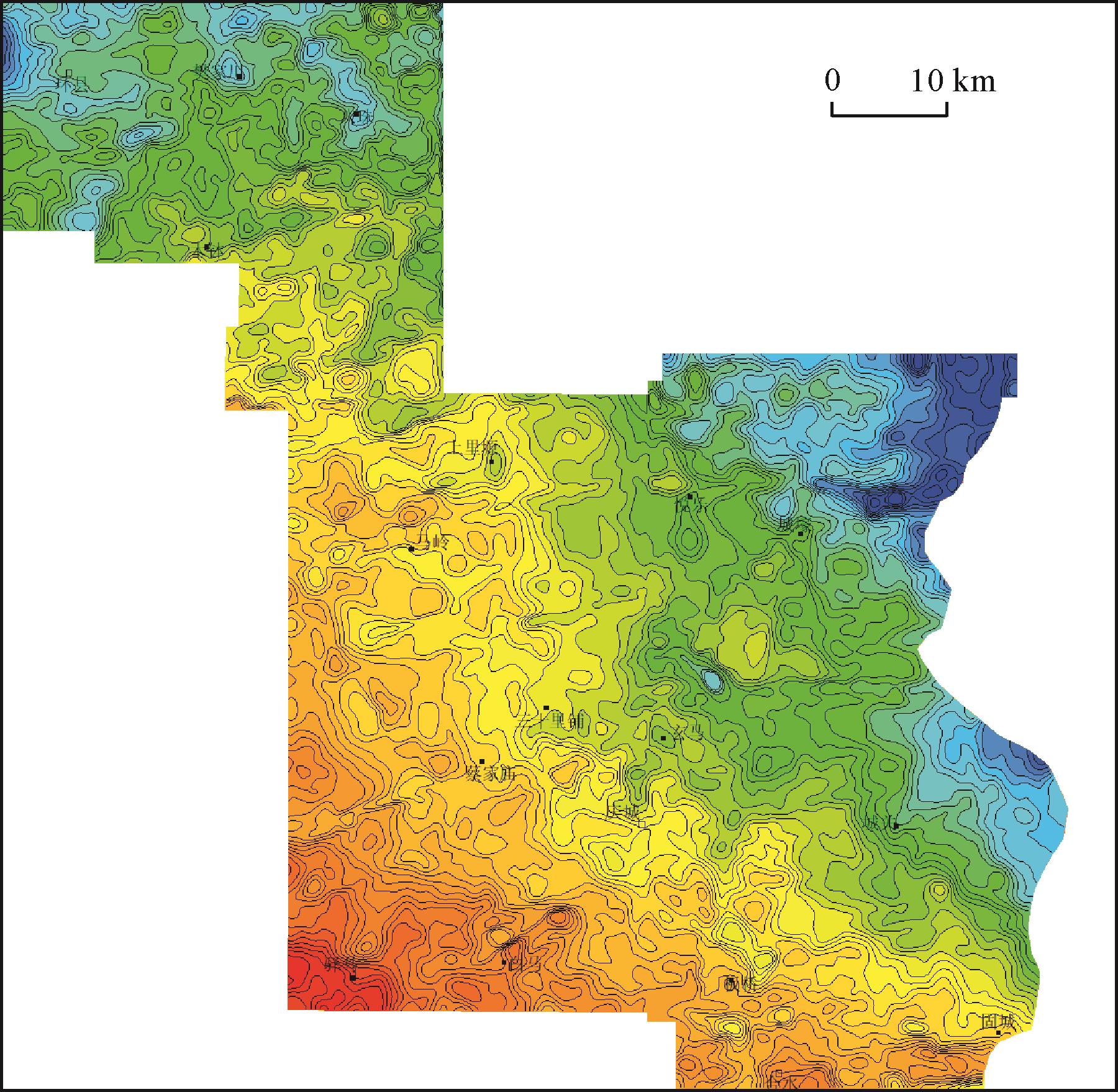
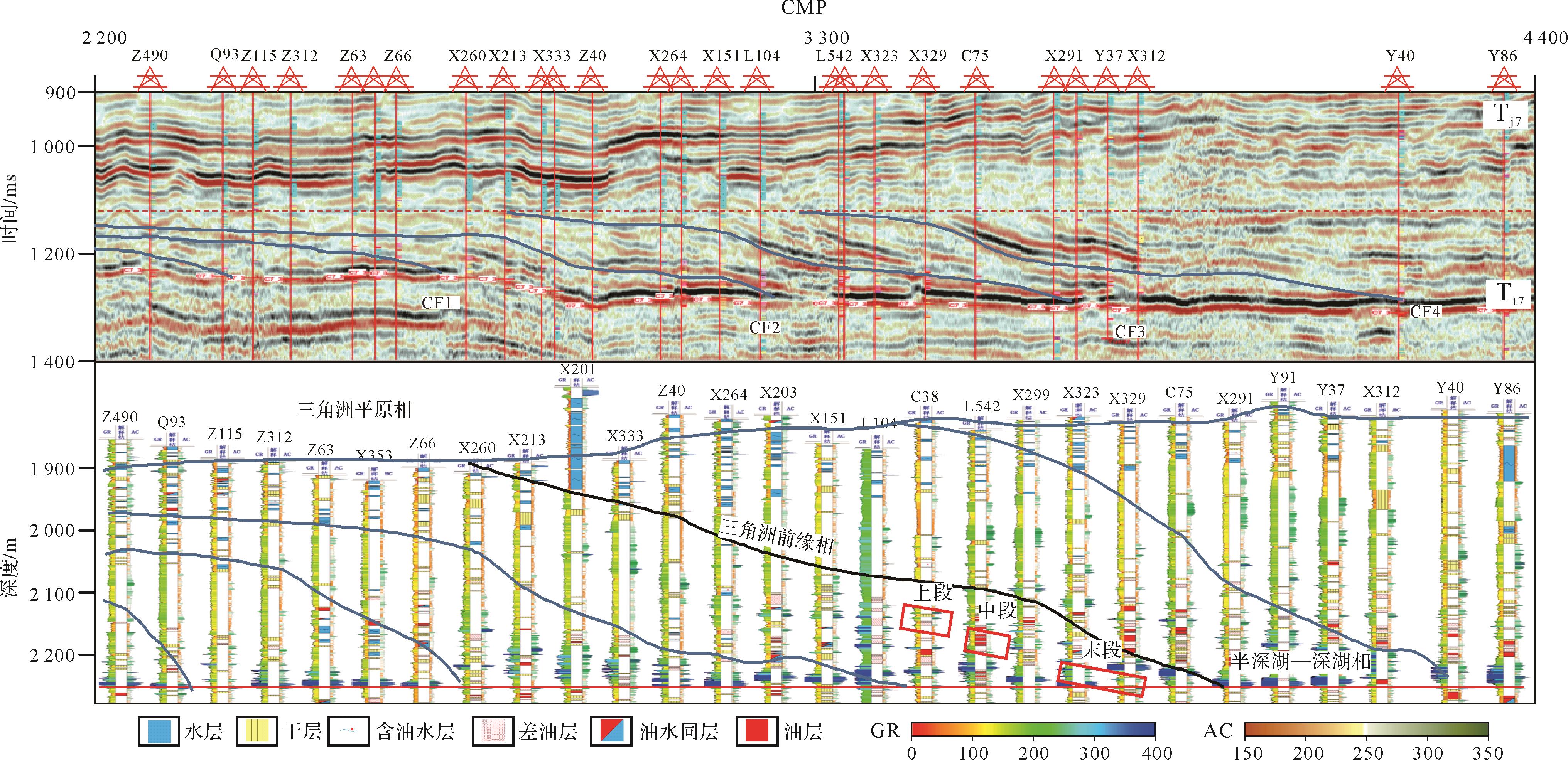
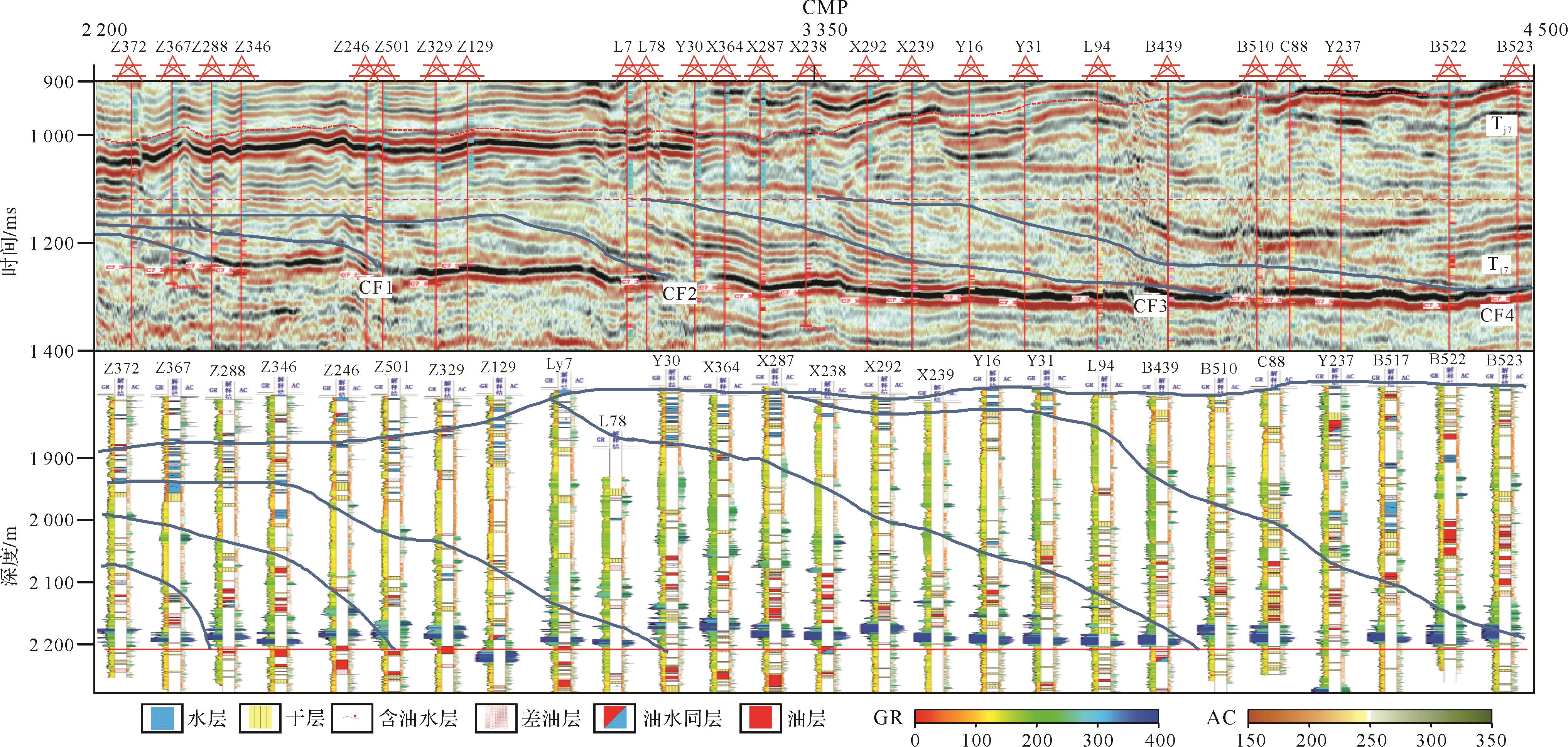
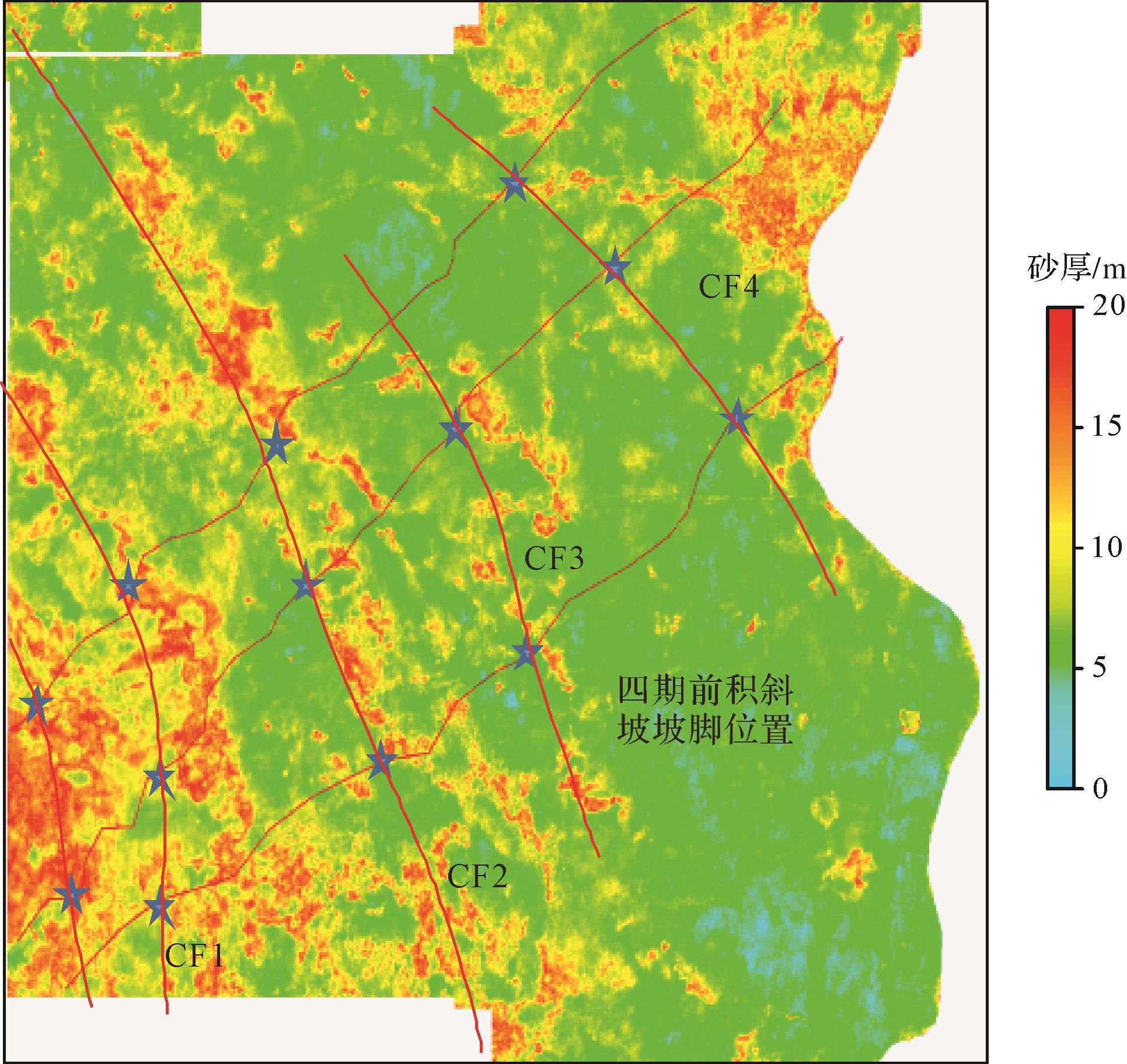
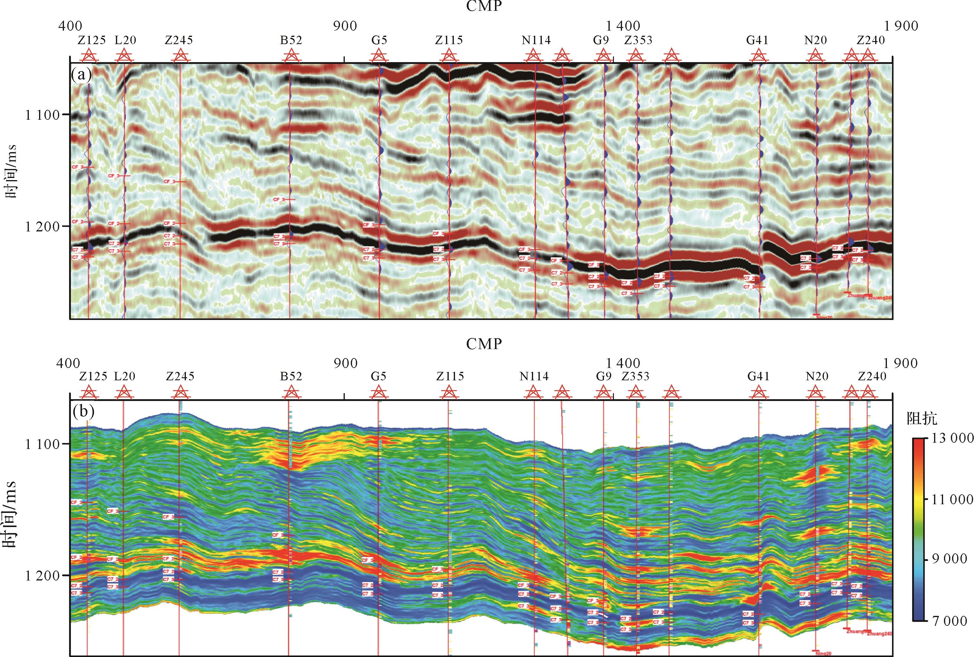
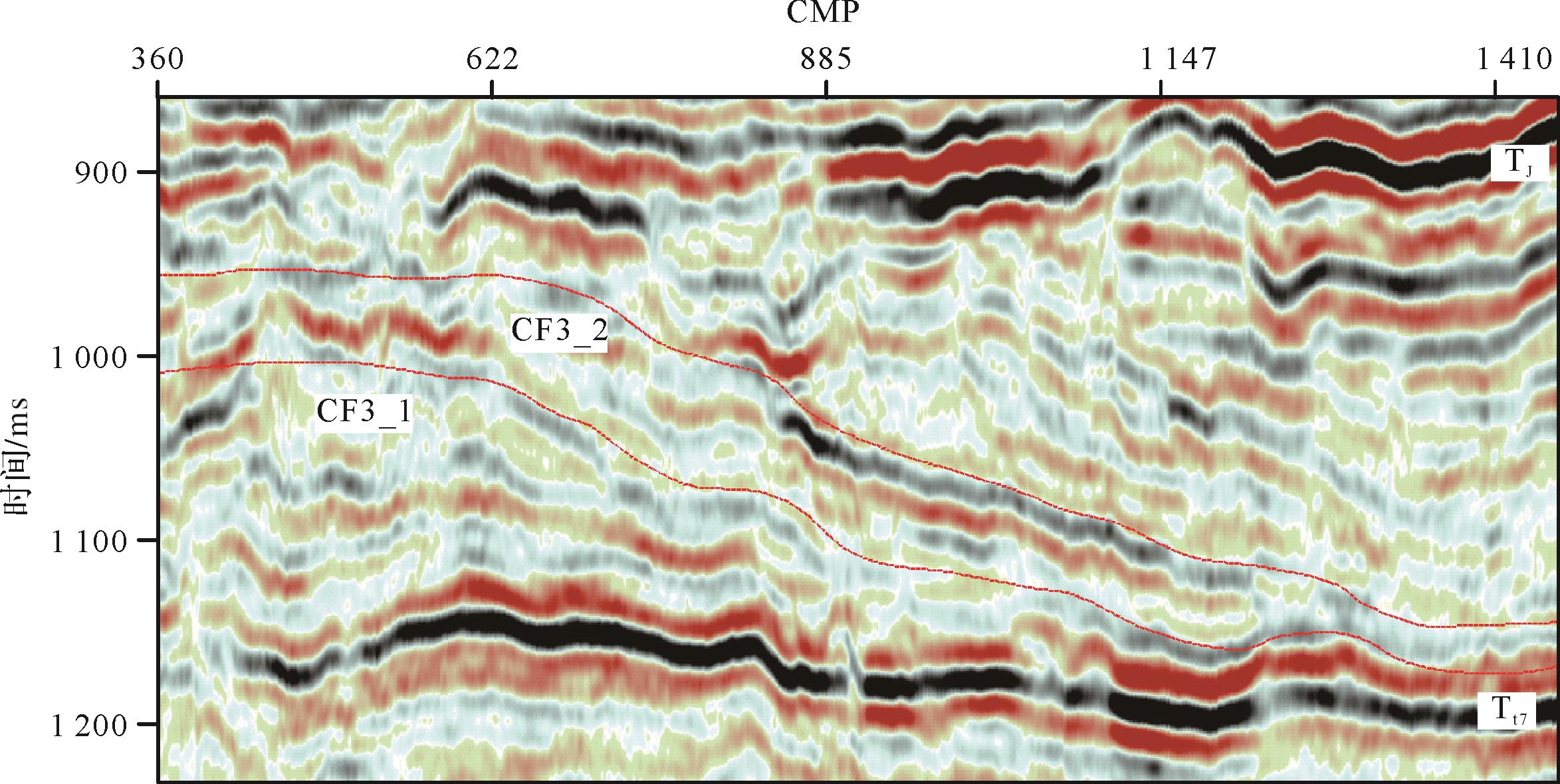
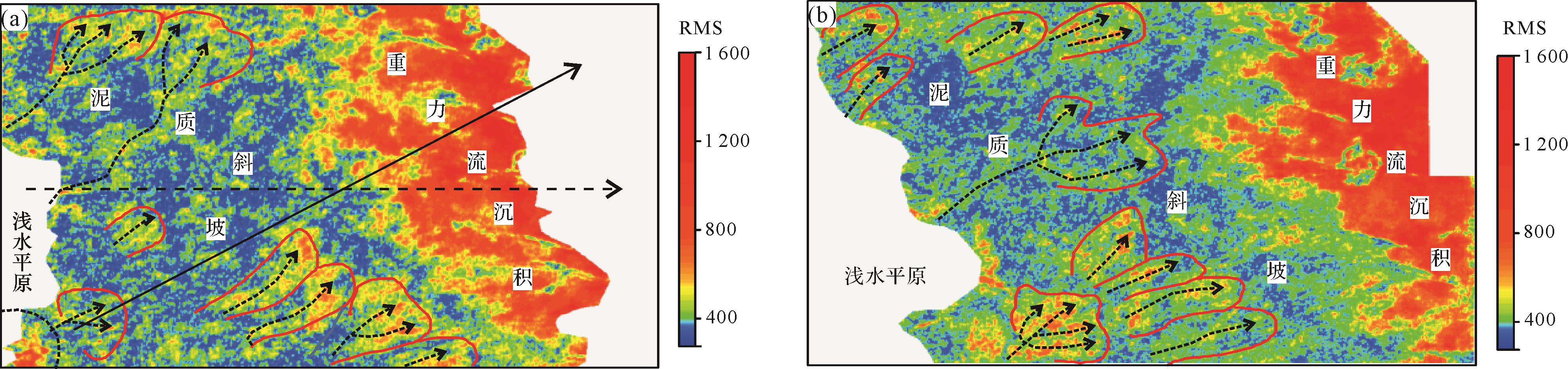
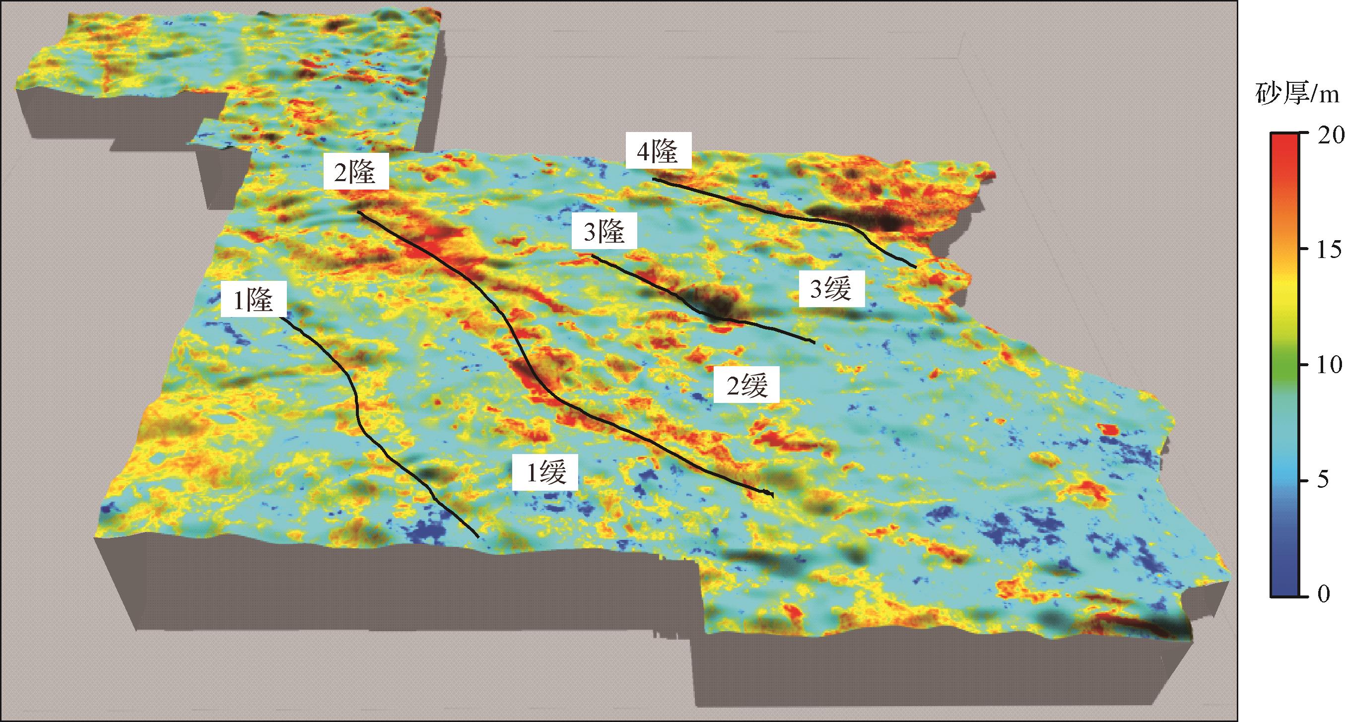
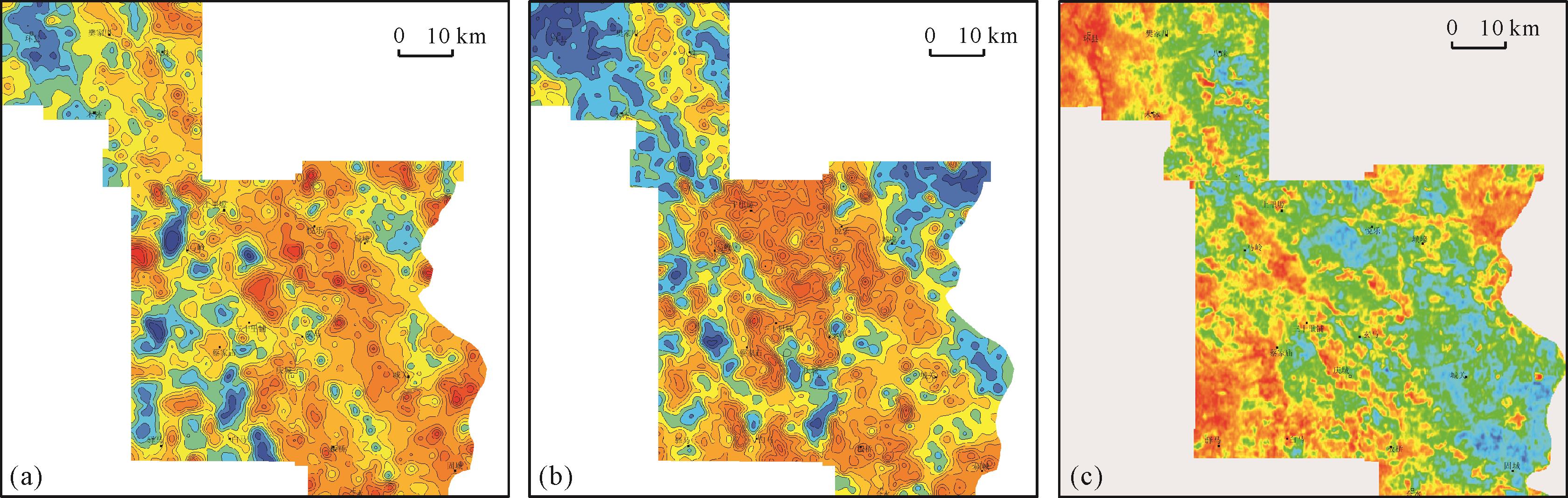
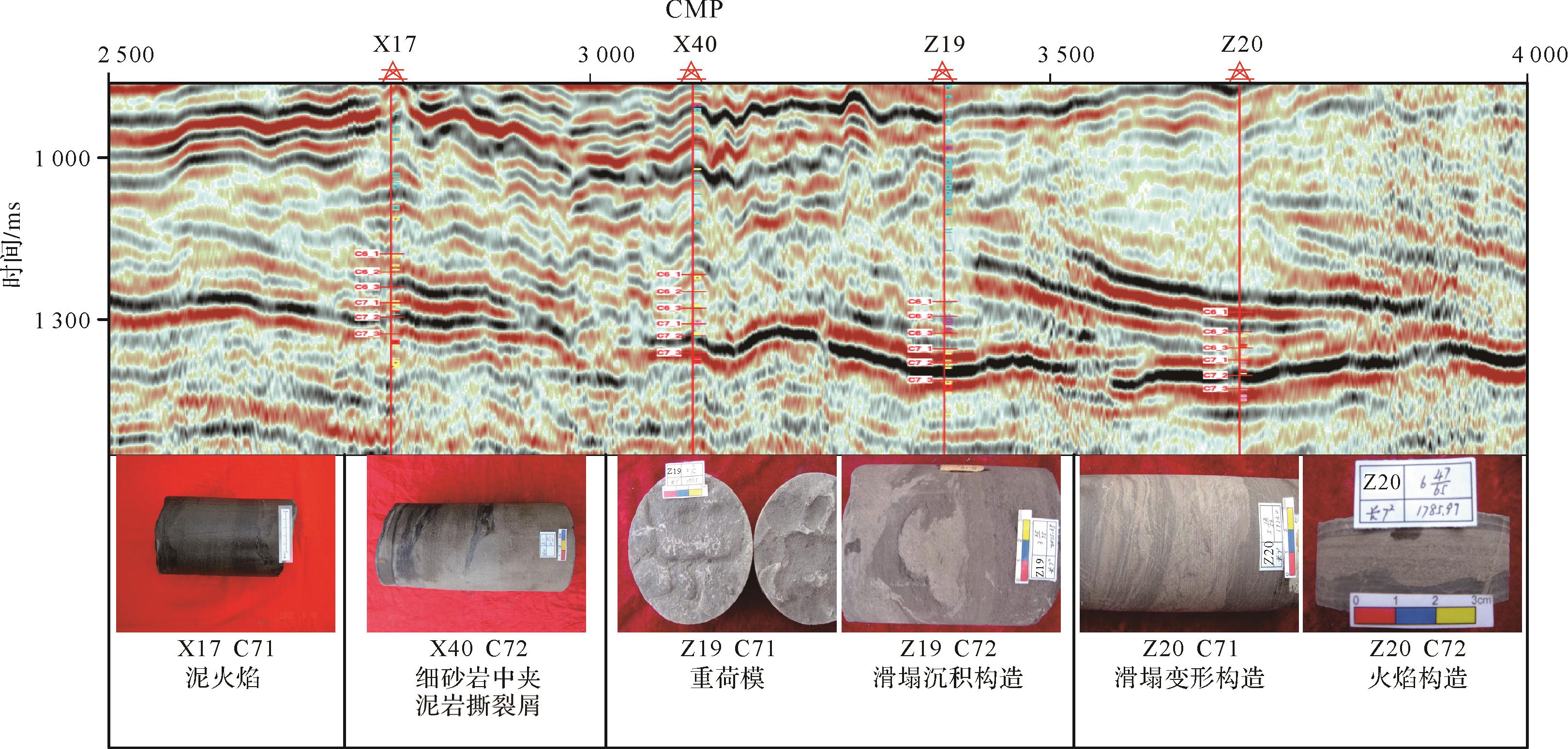
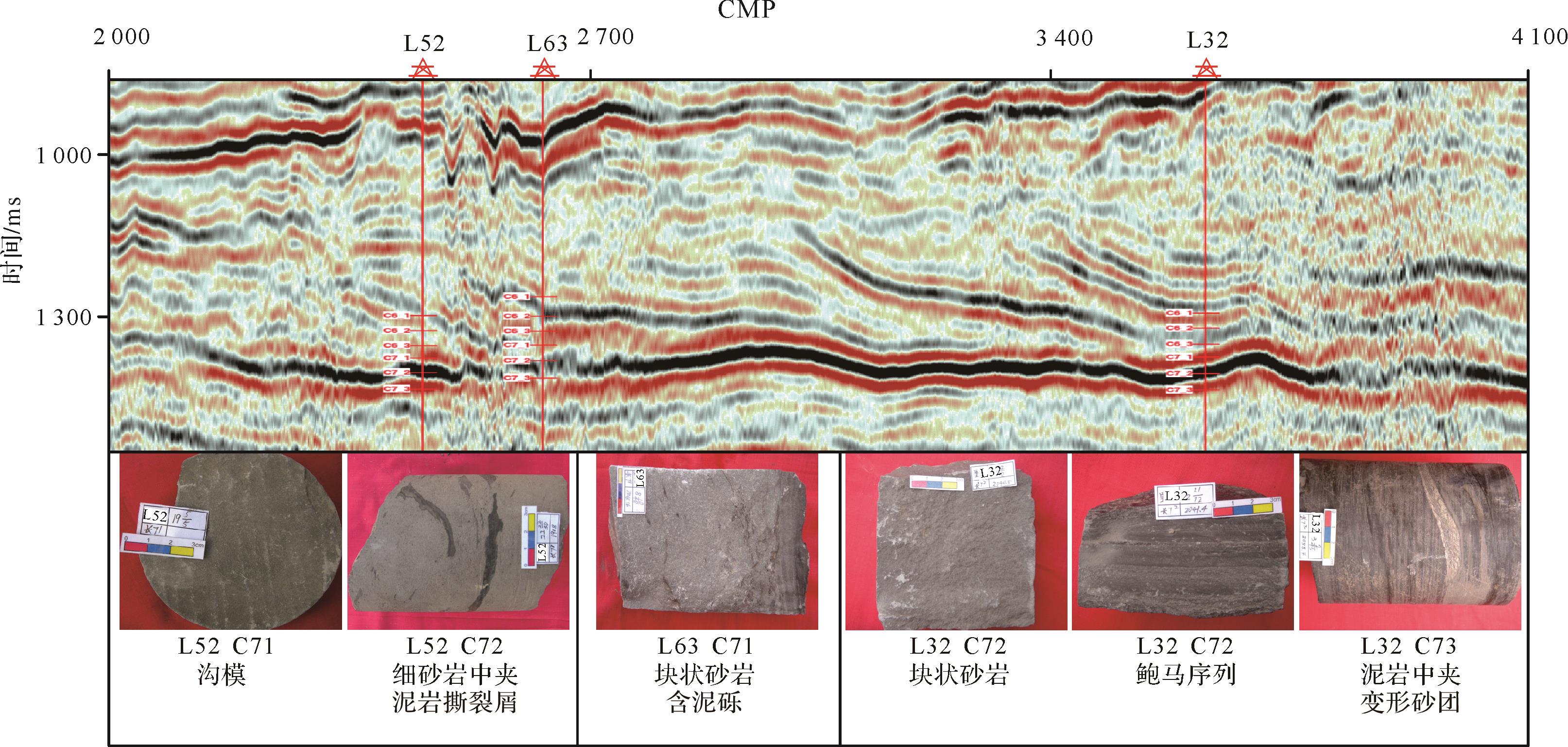
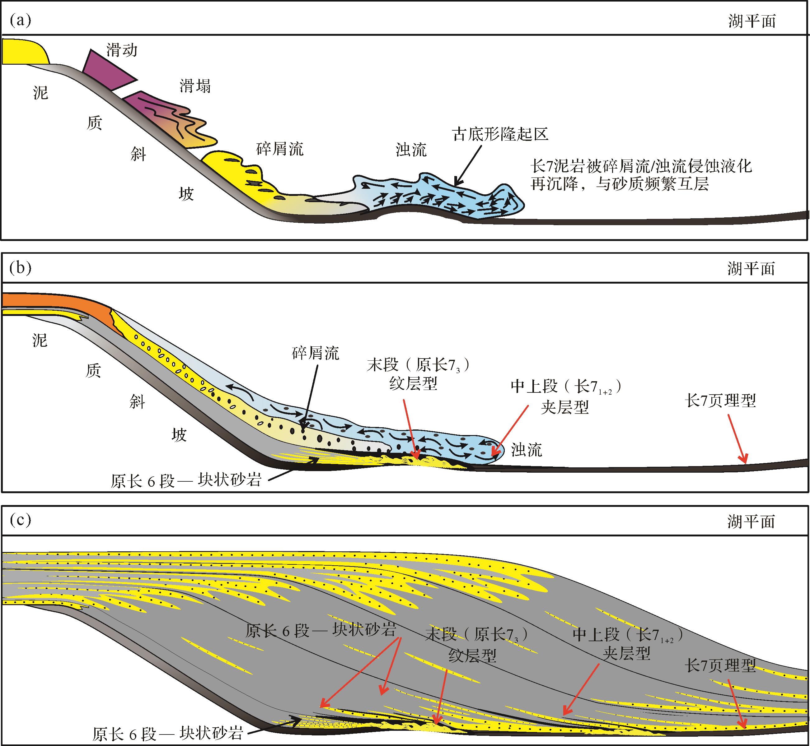
2026, 44(3): 1148-1163.
doi: 10.14027/j.issn.1000-0550.2024.090
Abstract:
Objective The Lower Triassic Feixianguan Formation in the Sichuan Basin contains thick oolitic beach reservoirs, which is the key layer of present oil and gas exploration. As the reserve strategic replacement field of the Sichuan Basin, the sedimentary system, reservoir properties and favorable zones in the Tieshanpo and Qilibei areas of the Feixianguan Formation are not clear, which restricts the potential deployment of oil and gas exploration in this area. Methods This study adopted comprehensive analysis of core, thin section, logging and seismic data to determine sedimentary facies types and the evolution of favorable reservoir zones in the region. Results In the study area, the Feixianguan Formation is a rimmed platform structure comprising five sedimentary facies: restricted platform, open platform, platform margin, slope and basin facies. The platform margin largely consists of oolitic beach development with obvious aggradational⁃lateral accretionary characteristics. These are mainly superimposed in the ssq2 to ssq4 periods vertically, with the largest in ssq2. Horizontally, the beach body was unstable and tended to migrate into the basin. The reservoir rock types are mainly (residual) oolitic limestone, (residual) oolitic dolomite and powder-fine crystalline dolomite. Conclusions The platform margin oolitic beach microfacies favors reservoir development in the Feixianguan Formation, and the porosity and permeability conditions are promising. well Po 5-well Poxi 1-well Po 2-well Po 1 in the Tieshanpo area and well Qilibei 1-well Qibei 102 in the Qilibei area are potentially favorable reservoir development zones. The spatial and temporal distribution and migration behavior of the beach bodies in the fourth-order sequence framework and the predicted favorable reservoir zones provide a basis for deepening the exploration and development of oolitic beach reservoirs in this region.
Objective The Lower Triassic Feixianguan Formation in the Sichuan Basin contains thick oolitic beach reservoirs, which is the key layer of present oil and gas exploration. As the reserve strategic replacement field of the Sichuan Basin, the sedimentary system, reservoir properties and favorable zones in the Tieshanpo and Qilibei areas of the Feixianguan Formation are not clear, which restricts the potential deployment of oil and gas exploration in this area. Methods This study adopted comprehensive analysis of core, thin section, logging and seismic data to determine sedimentary facies types and the evolution of favorable reservoir zones in the region. Results In the study area, the Feixianguan Formation is a rimmed platform structure comprising five sedimentary facies: restricted platform, open platform, platform margin, slope and basin facies. The platform margin largely consists of oolitic beach development with obvious aggradational⁃lateral accretionary characteristics. These are mainly superimposed in the ssq2 to ssq4 periods vertically, with the largest in ssq2. Horizontally, the beach body was unstable and tended to migrate into the basin. The reservoir rock types are mainly (residual) oolitic limestone, (residual) oolitic dolomite and powder-fine crystalline dolomite. Conclusions The platform margin oolitic beach microfacies favors reservoir development in the Feixianguan Formation, and the porosity and permeability conditions are promising. well Po 5-well Poxi 1-well Po 2-well Po 1 in the Tieshanpo area and well Qilibei 1-well Qibei 102 in the Qilibei area are potentially favorable reservoir development zones. The spatial and temporal distribution and migration behavior of the beach bodies in the fourth-order sequence framework and the predicted favorable reservoir zones provide a basis for deepening the exploration and development of oolitic beach reservoirs in this region.
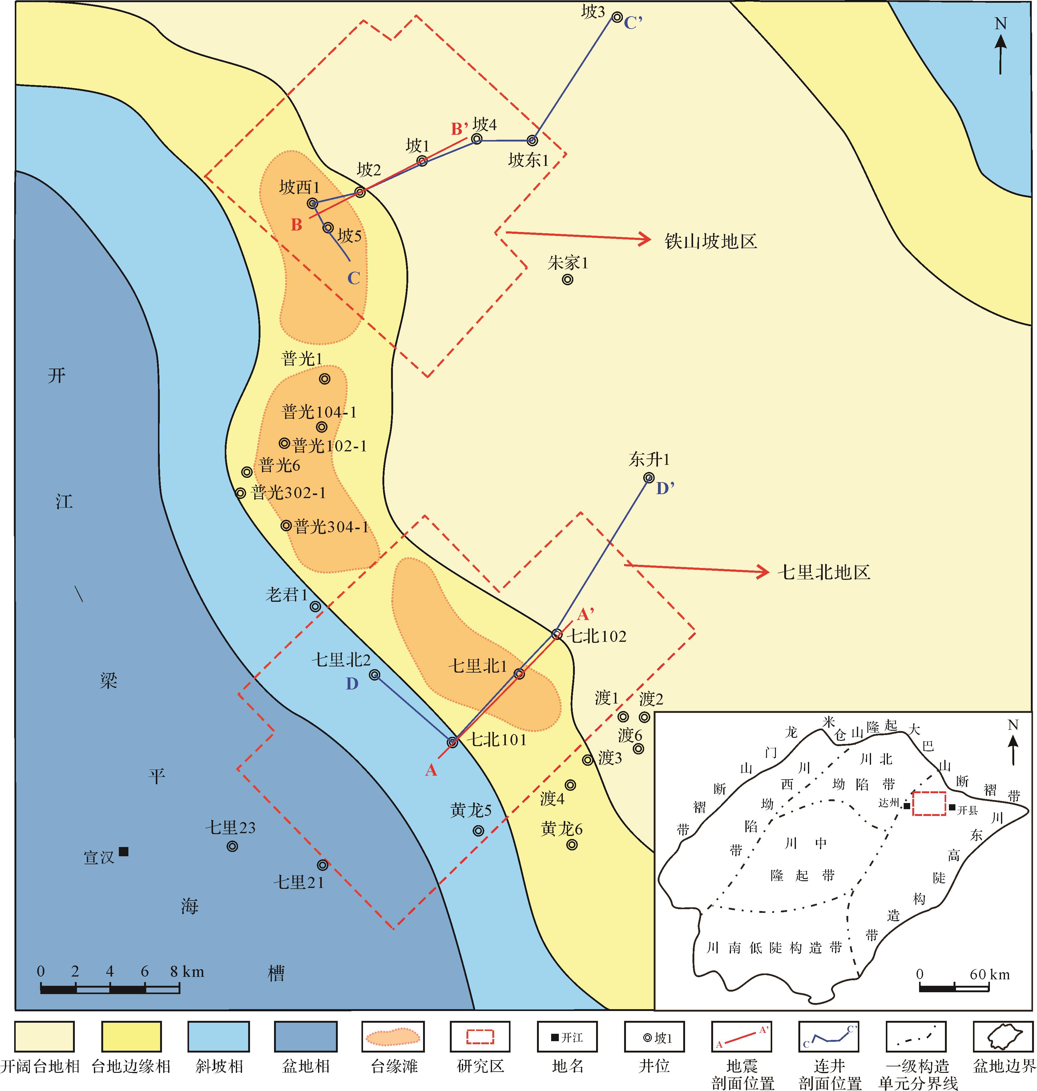
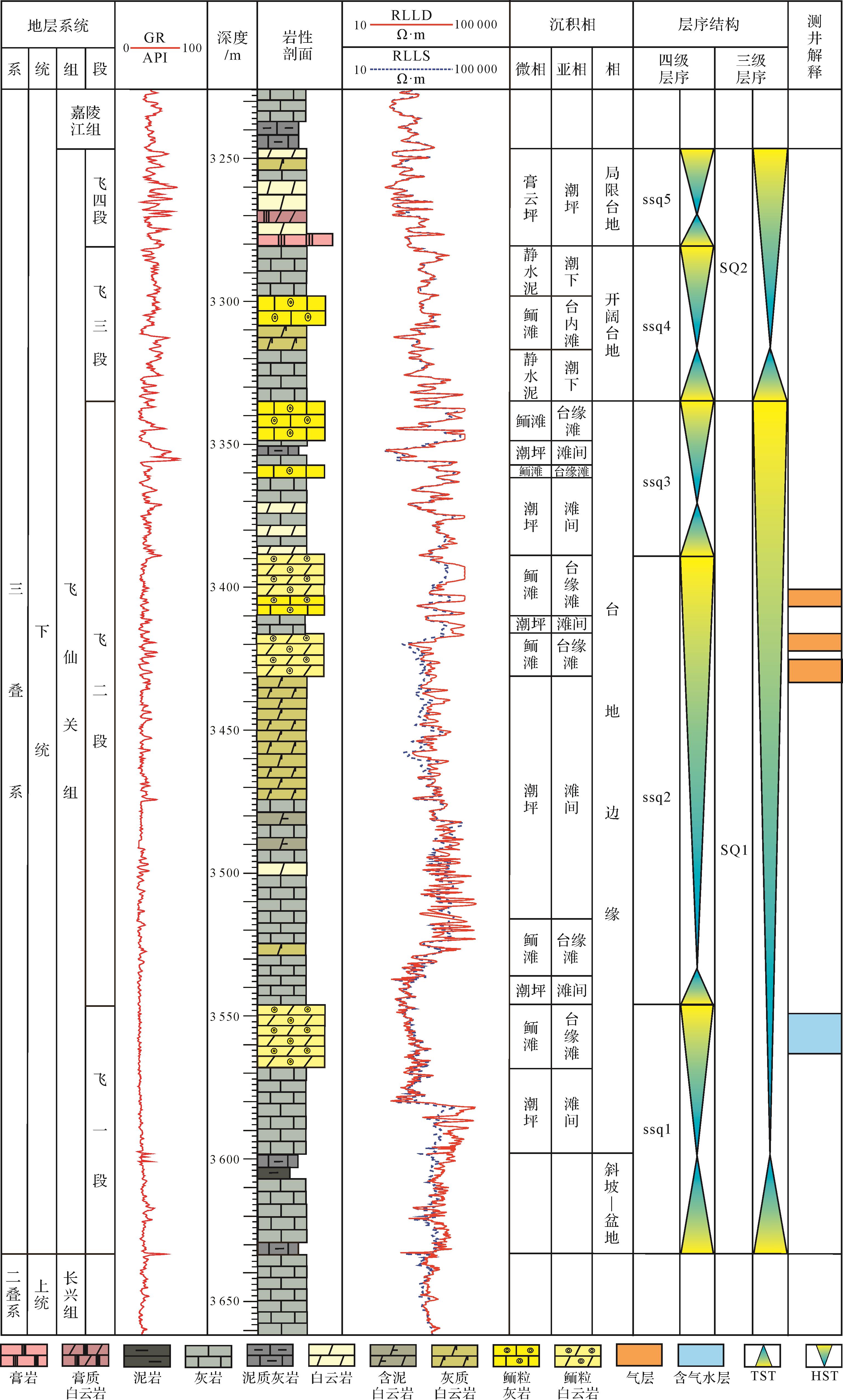
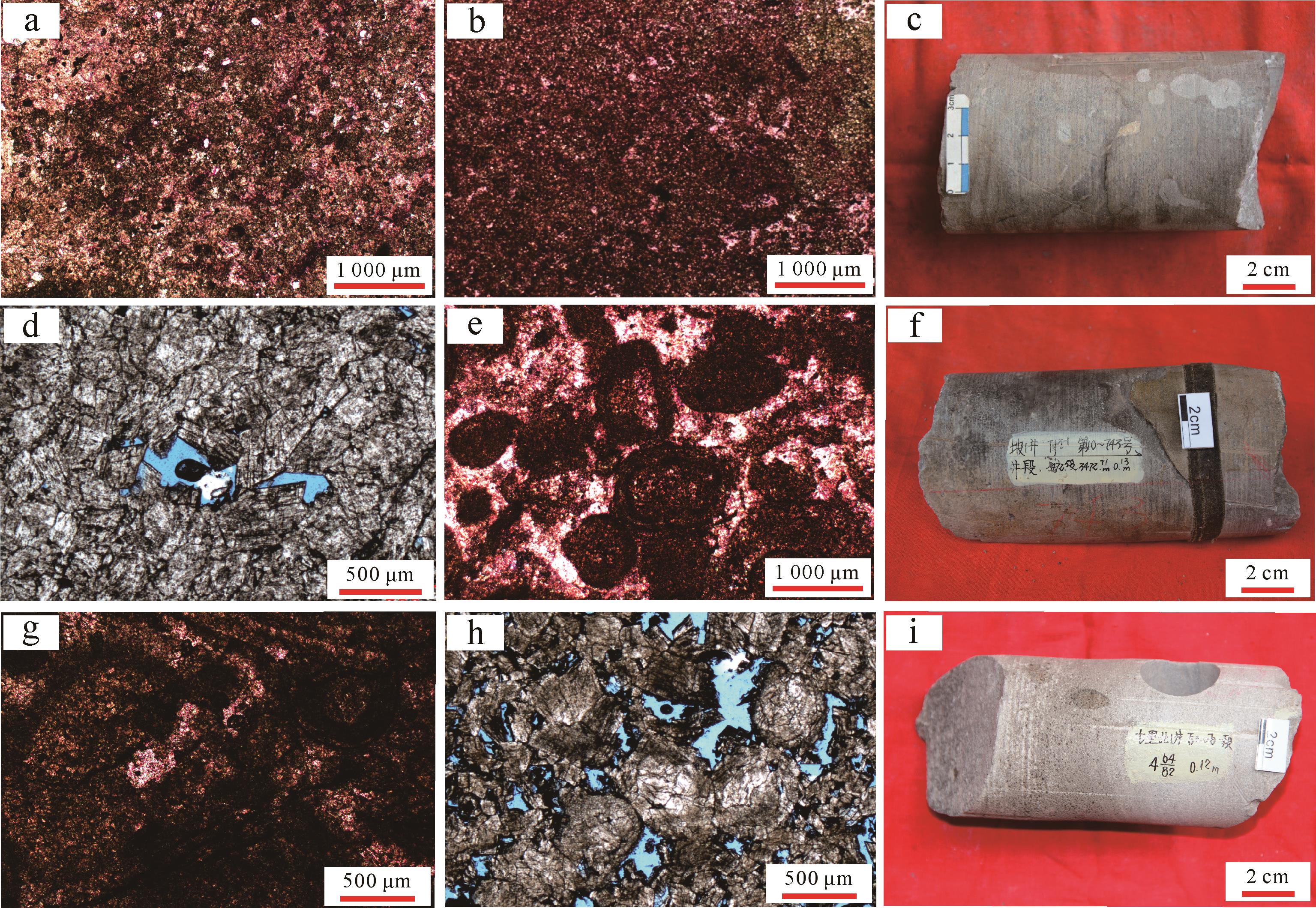
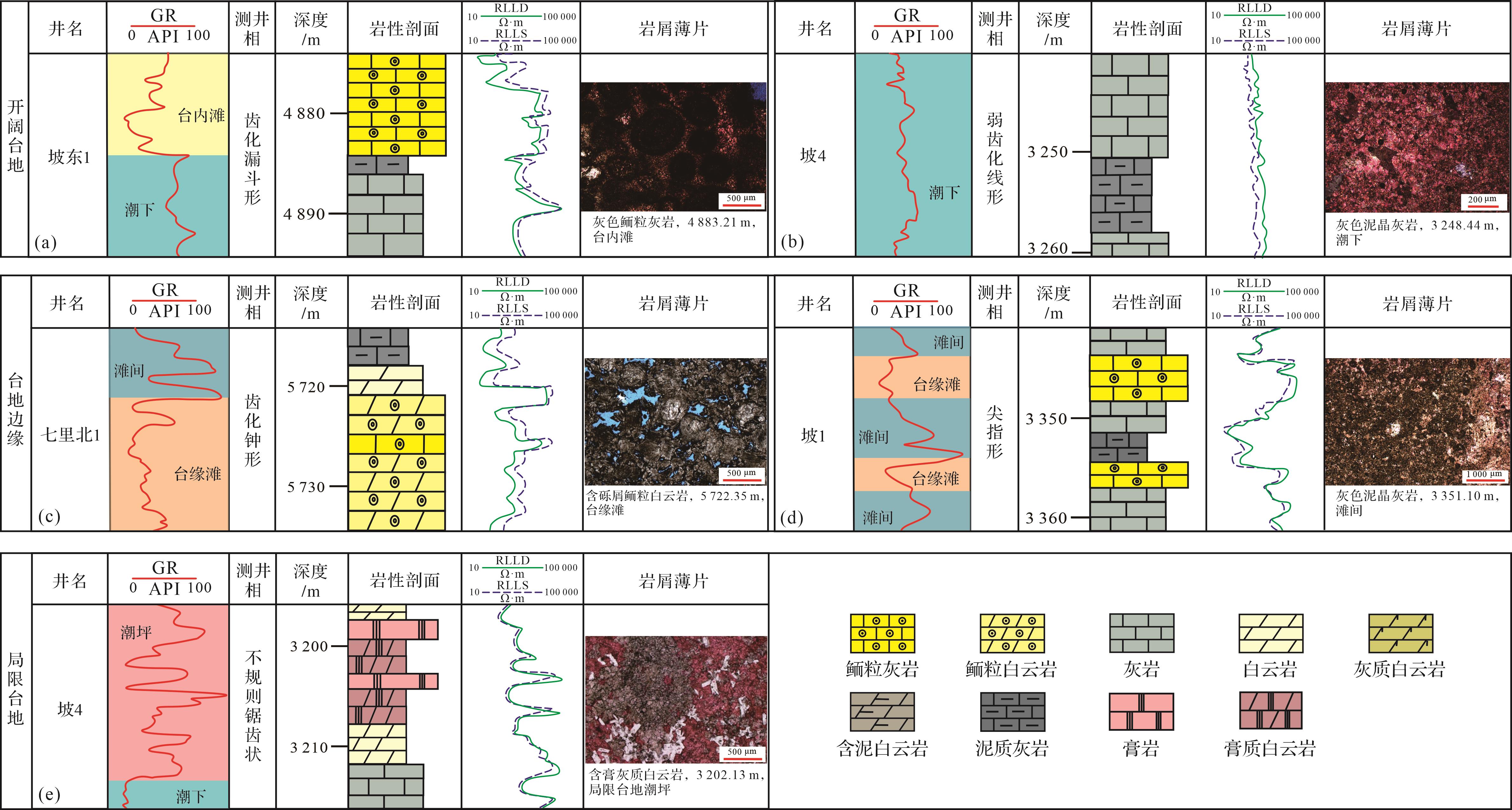
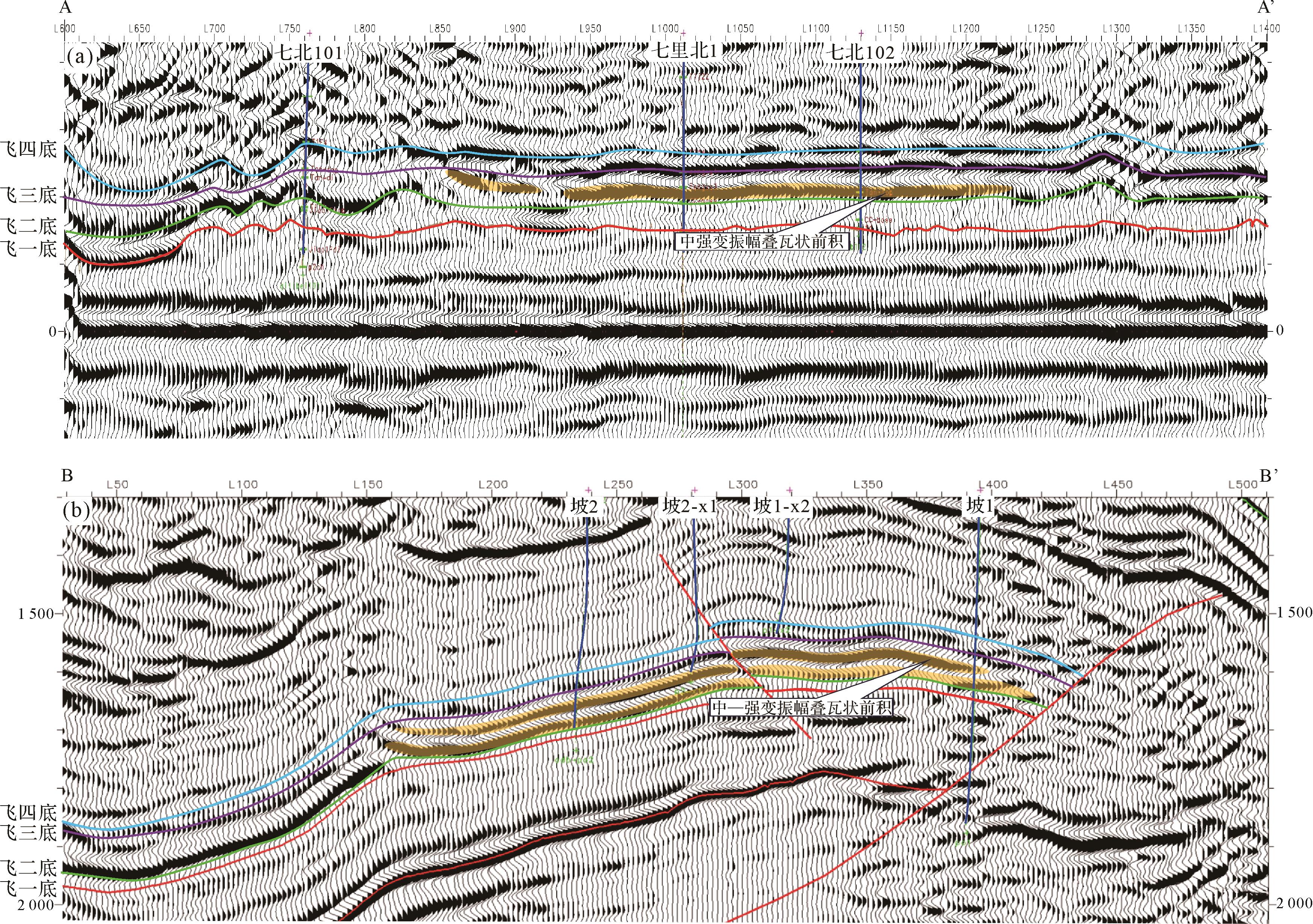
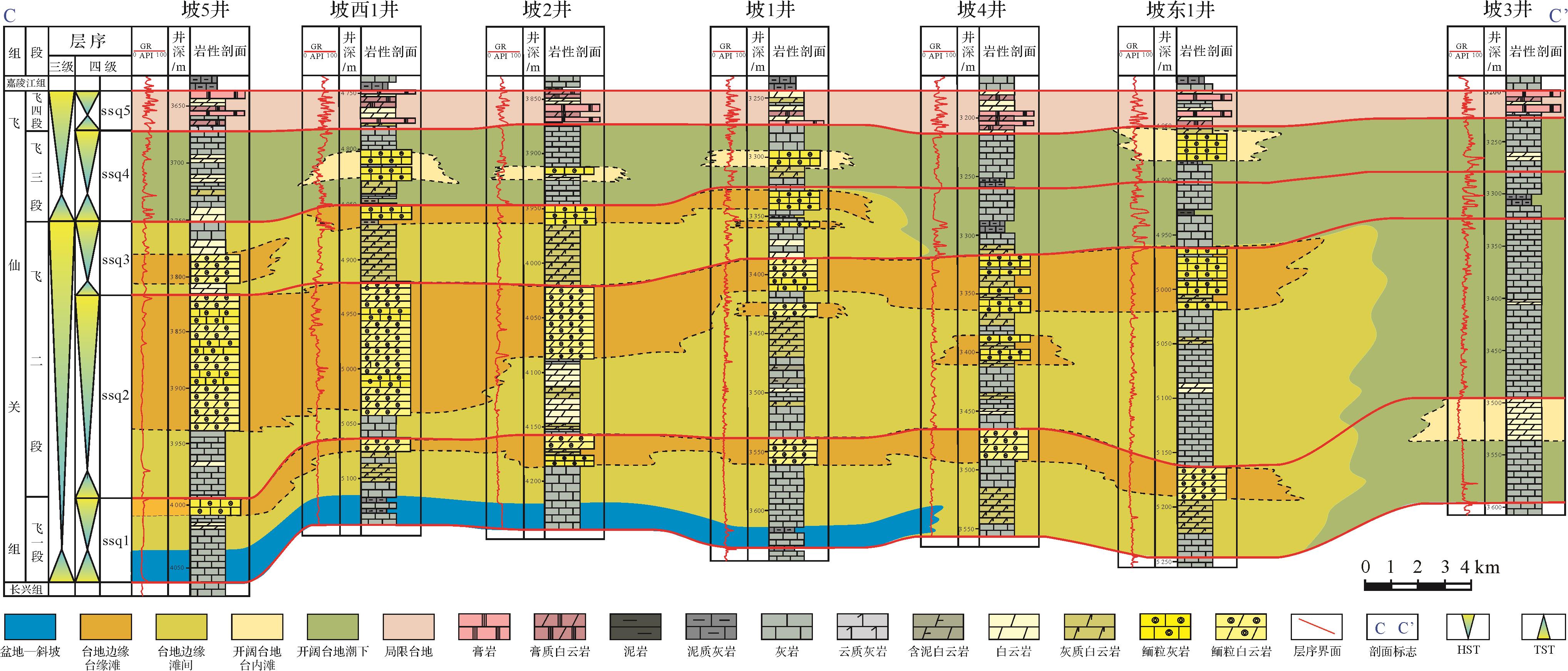
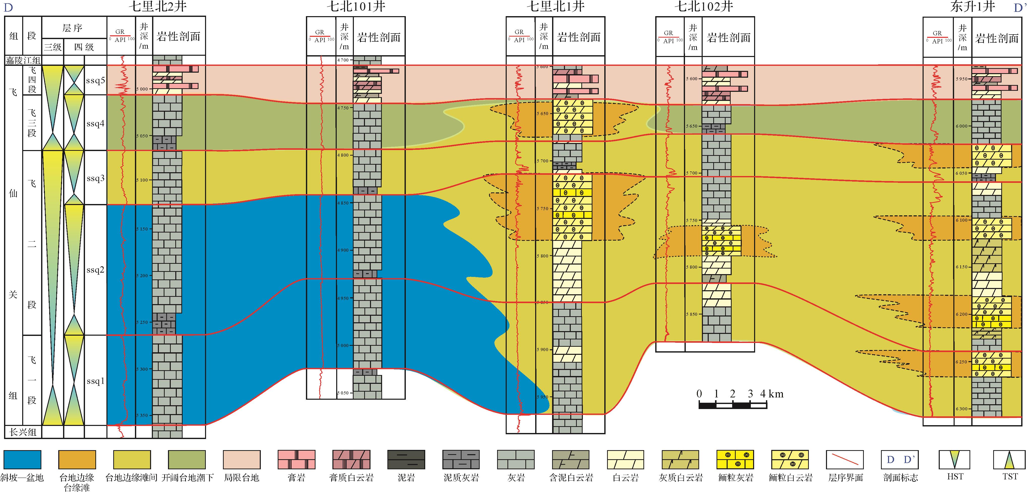
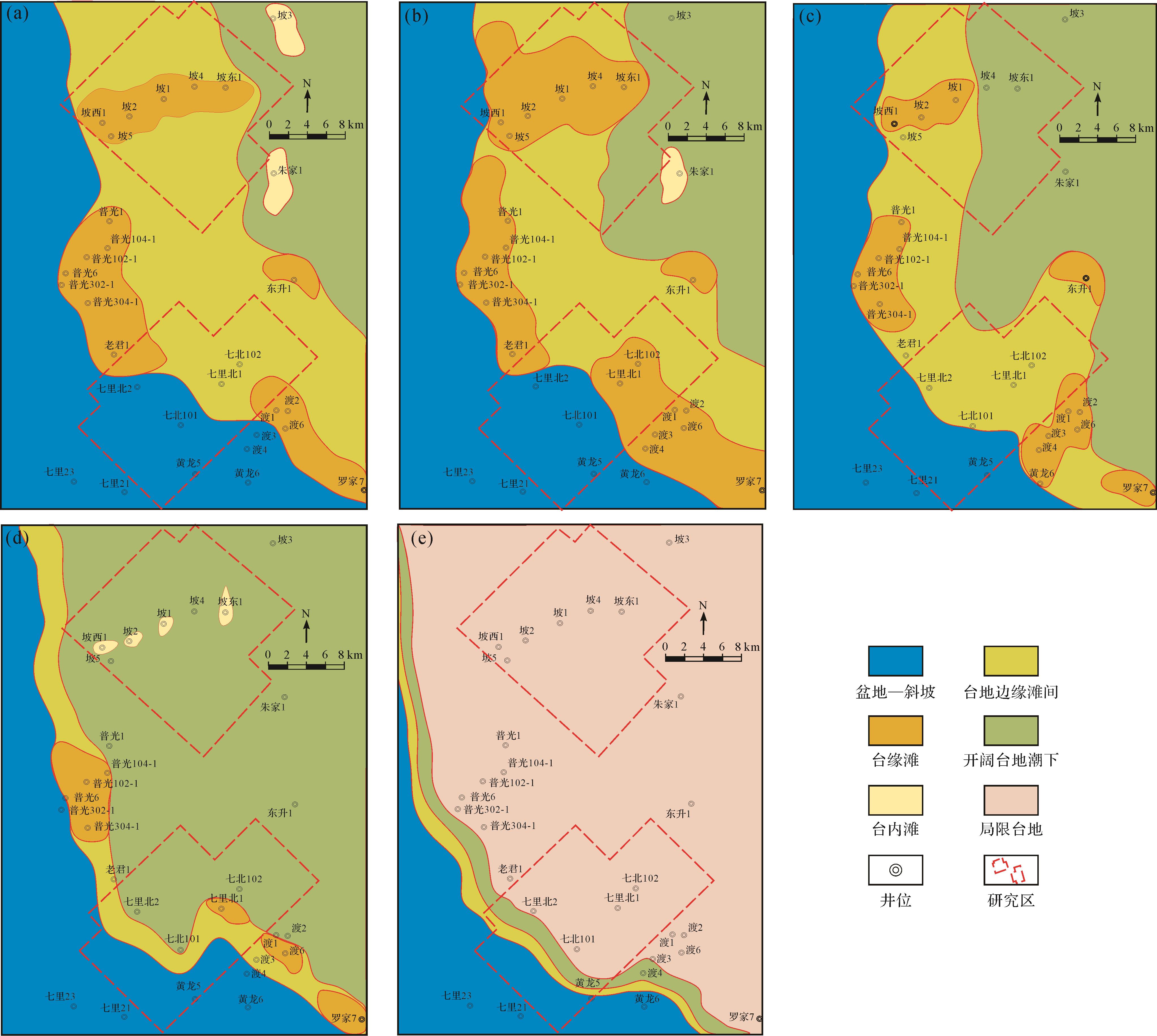
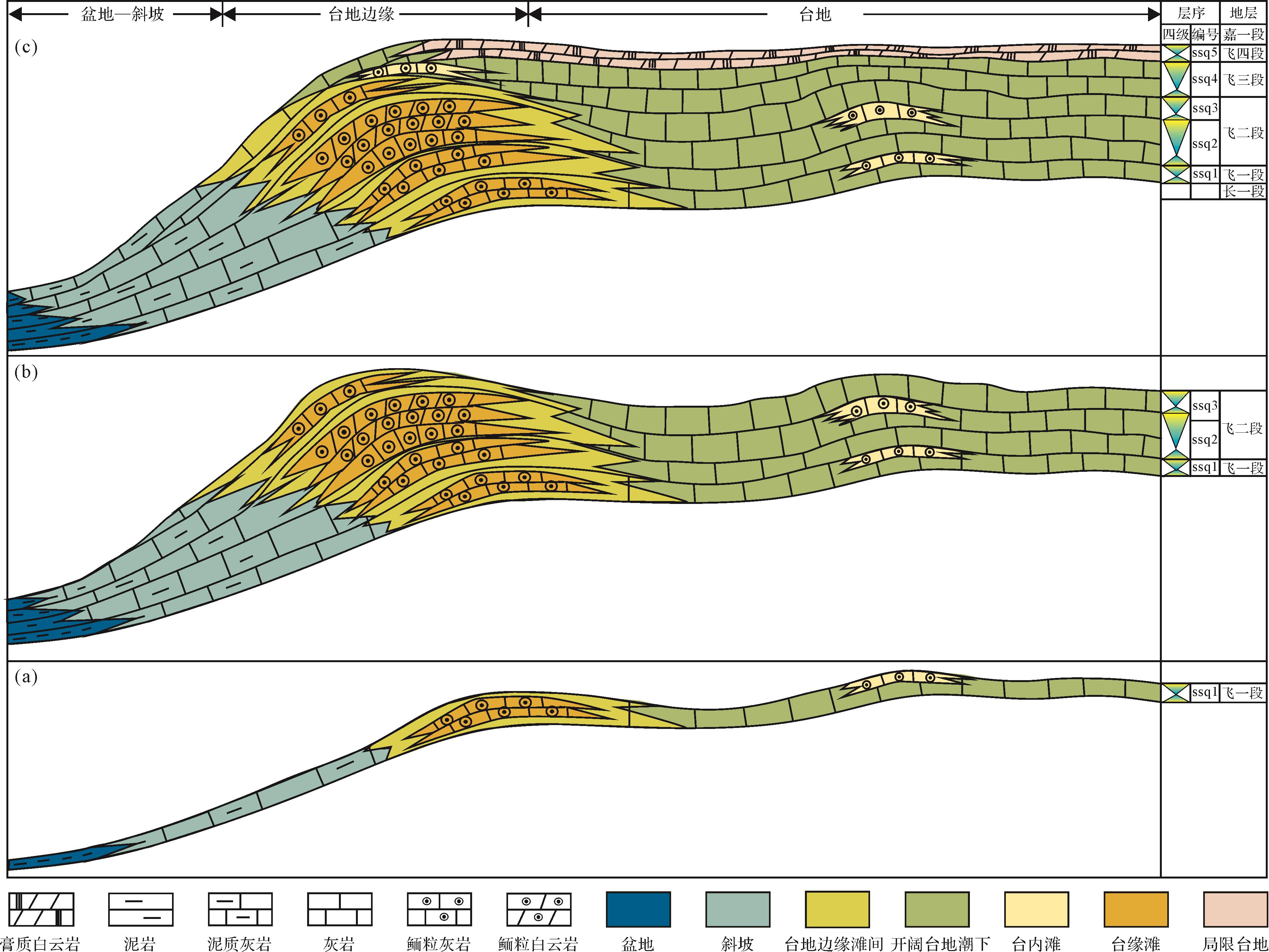
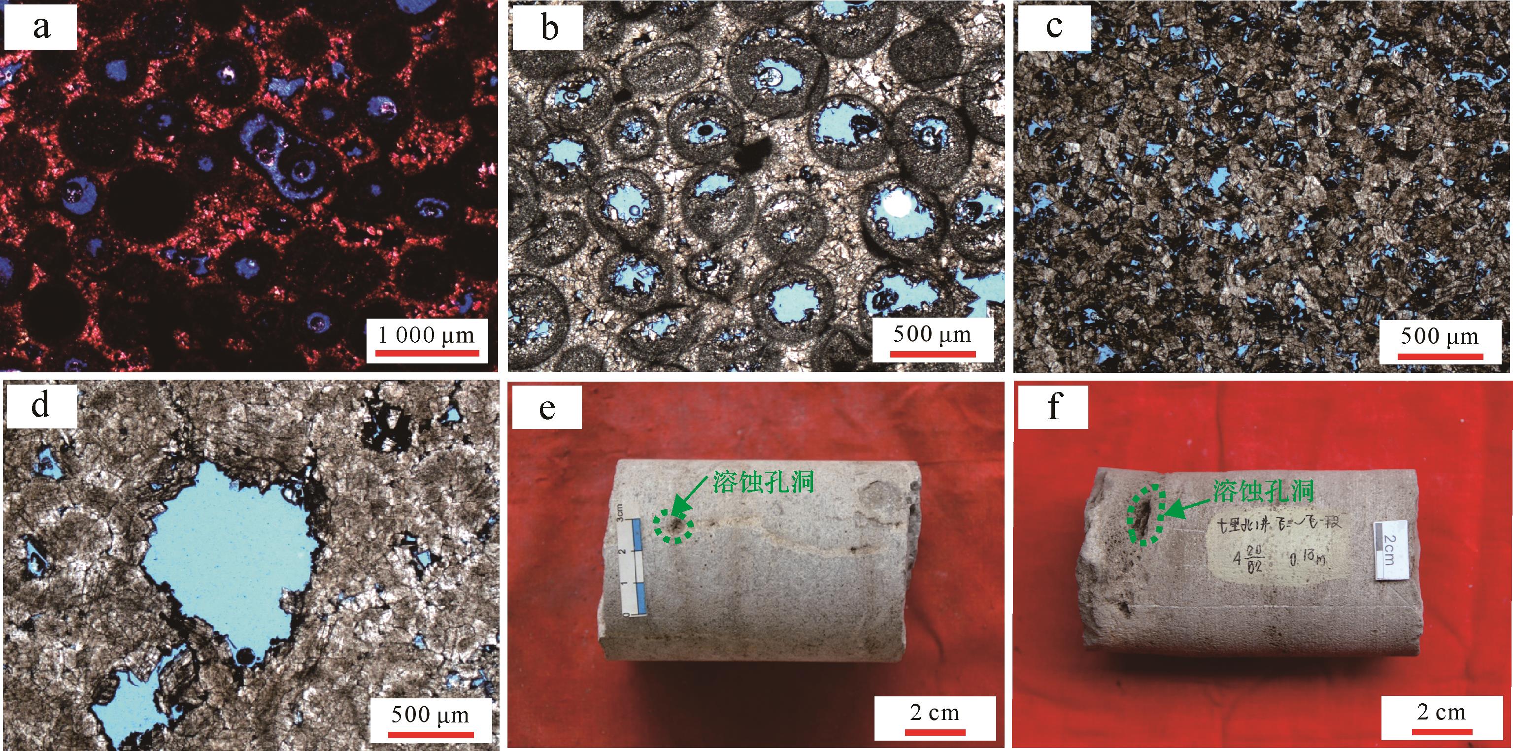
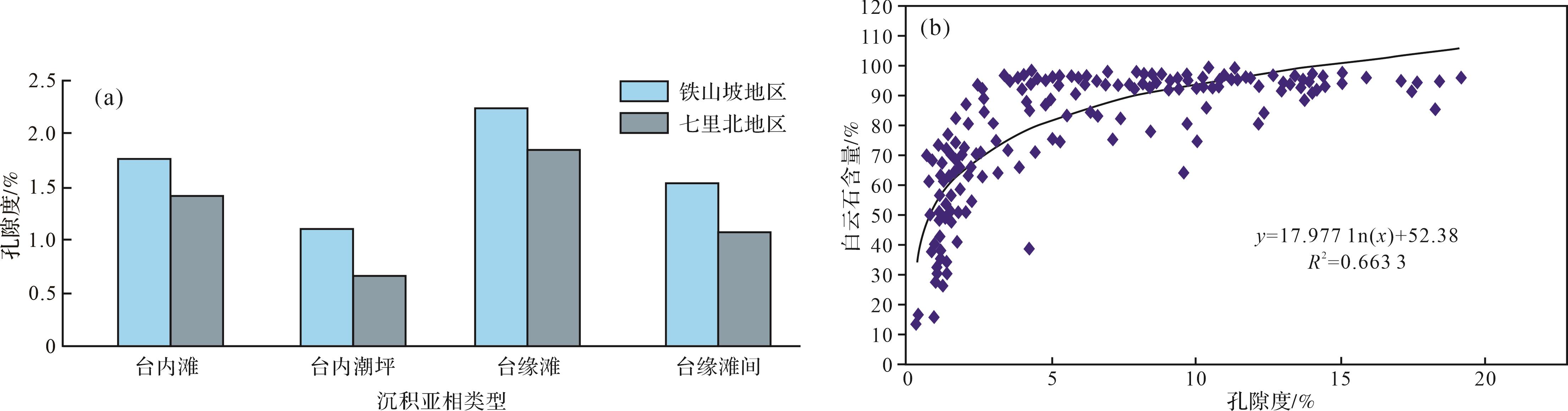
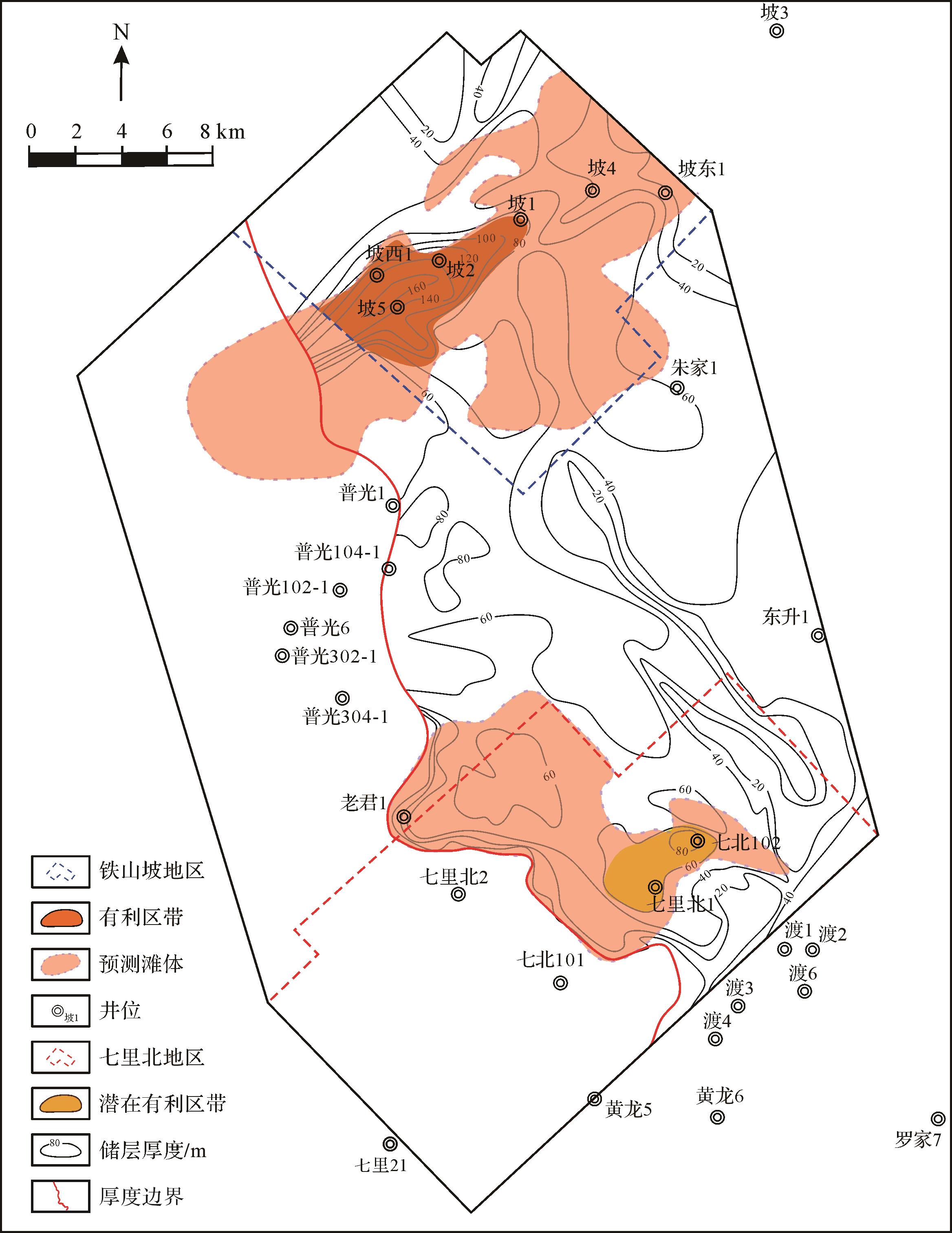
2026, 44(3): 1164-1175.
doi: 10.14027/j.issn.1000-0550.2024.132
Abstract:
Objective Ordovician Kukersite oil shale is composed almost exclusively of Gloeocapsomorpha prisca (G. prisca) alginite. It is an important source rock from the Paleozoic, but it has only sporadically been detected and reported in the Tarim Basin in China. Therefore, rapid identification of G. prisca in source rocks is important geochemical work. Methods Here, kerogen from Estonian oil shale was analyzed using sequential stepwise pyrolysis at 50 °C intervals from 310 °C to 610 °C to investigate its chemical constitutions. Results We found that the pyrolyzed hydrocarbons formed by sequential stepwise pyrolysis were dominated by 5-n-alkyl-1,3-benzenediols. This probably reflects the major contribution of selectively preserved, highly resistant biomacromolecules from the outer cell walls of G. prisca. The kerogen was also characterized by a high content of short-chain alkanes, but abnormally high-carbon-number (>nC29) n-alkane/enes appeared at 560 °C. A consistent formation of alkyl benzenes, alkyl thiophenes, and alkyl ketones also appeared at the middle to high temperature points (460 °C-560 °C). All pyrolyzates had a lower carbon number and alkyl side chains with a distinct distribution of weak odd-over-even carbon numbers. The abundant and continuous generation of 5-n-alkyl-1,3-benzenediols and its homologues in the pyrolyzates can help to quickly identify whether source rocks contain G. Prisca. In addition, the composition characteristics, product changes, and product correlation of the pyrolyzates at different temperatures are helpful when investigating the structure of kerogen. The results of sequential stepwise pyrolysis suggested that the macromolecules of kerogen were formed mainly by the polymerization of 5-n-alkyl-1,3-benzenediols in G. prisca. The units in polymer macromolecules—including phenol rings, thiophene rings, and normal alkyl chains—are inter-molecularly connected by C-C and C-O bonds. Conclusions The distribution changes of different series of compounds obtained at different temperatures by sequential stepwise pyrolysis can be applied to other organic-rich oil shales. This approach can be used to reveal the details of algal evolution and determine the various sources of organic matter in kerogen.
Objective Ordovician Kukersite oil shale is composed almost exclusively of Gloeocapsomorpha prisca (G. prisca) alginite. It is an important source rock from the Paleozoic, but it has only sporadically been detected and reported in the Tarim Basin in China. Therefore, rapid identification of G. prisca in source rocks is important geochemical work. Methods Here, kerogen from Estonian oil shale was analyzed using sequential stepwise pyrolysis at 50 °C intervals from 310 °C to 610 °C to investigate its chemical constitutions. Results We found that the pyrolyzed hydrocarbons formed by sequential stepwise pyrolysis were dominated by 5-n-alkyl-1,3-benzenediols. This probably reflects the major contribution of selectively preserved, highly resistant biomacromolecules from the outer cell walls of G. prisca. The kerogen was also characterized by a high content of short-chain alkanes, but abnormally high-carbon-number (>nC29) n-alkane/enes appeared at 560 °C. A consistent formation of alkyl benzenes, alkyl thiophenes, and alkyl ketones also appeared at the middle to high temperature points (460 °C-560 °C). All pyrolyzates had a lower carbon number and alkyl side chains with a distinct distribution of weak odd-over-even carbon numbers. The abundant and continuous generation of 5-n-alkyl-1,3-benzenediols and its homologues in the pyrolyzates can help to quickly identify whether source rocks contain G. Prisca. In addition, the composition characteristics, product changes, and product correlation of the pyrolyzates at different temperatures are helpful when investigating the structure of kerogen. The results of sequential stepwise pyrolysis suggested that the macromolecules of kerogen were formed mainly by the polymerization of 5-n-alkyl-1,3-benzenediols in G. prisca. The units in polymer macromolecules—including phenol rings, thiophene rings, and normal alkyl chains—are inter-molecularly connected by C-C and C-O bonds. Conclusions The distribution changes of different series of compounds obtained at different temperatures by sequential stepwise pyrolysis can be applied to other organic-rich oil shales. This approach can be used to reveal the details of algal evolution and determine the various sources of organic matter in kerogen.
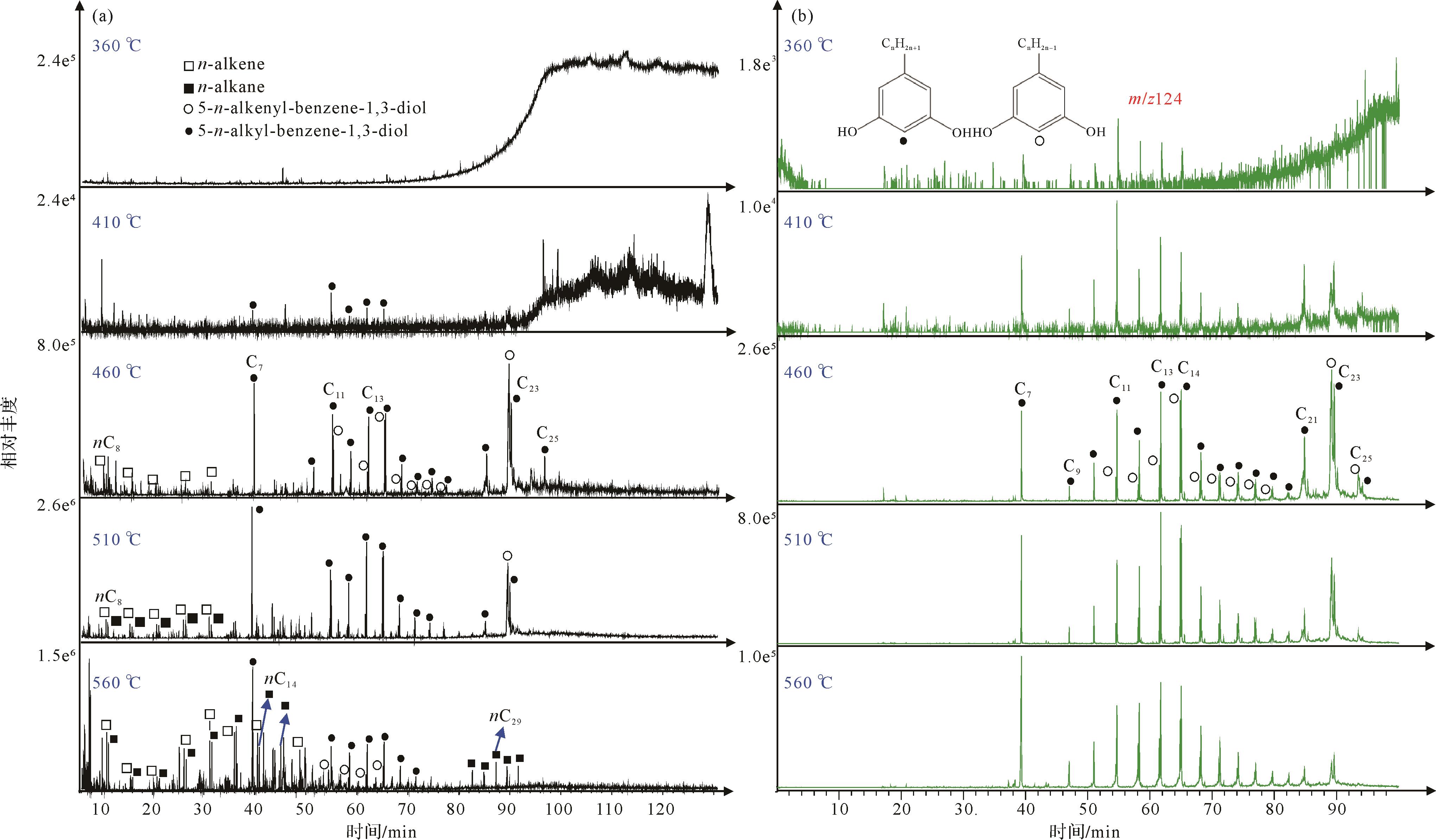
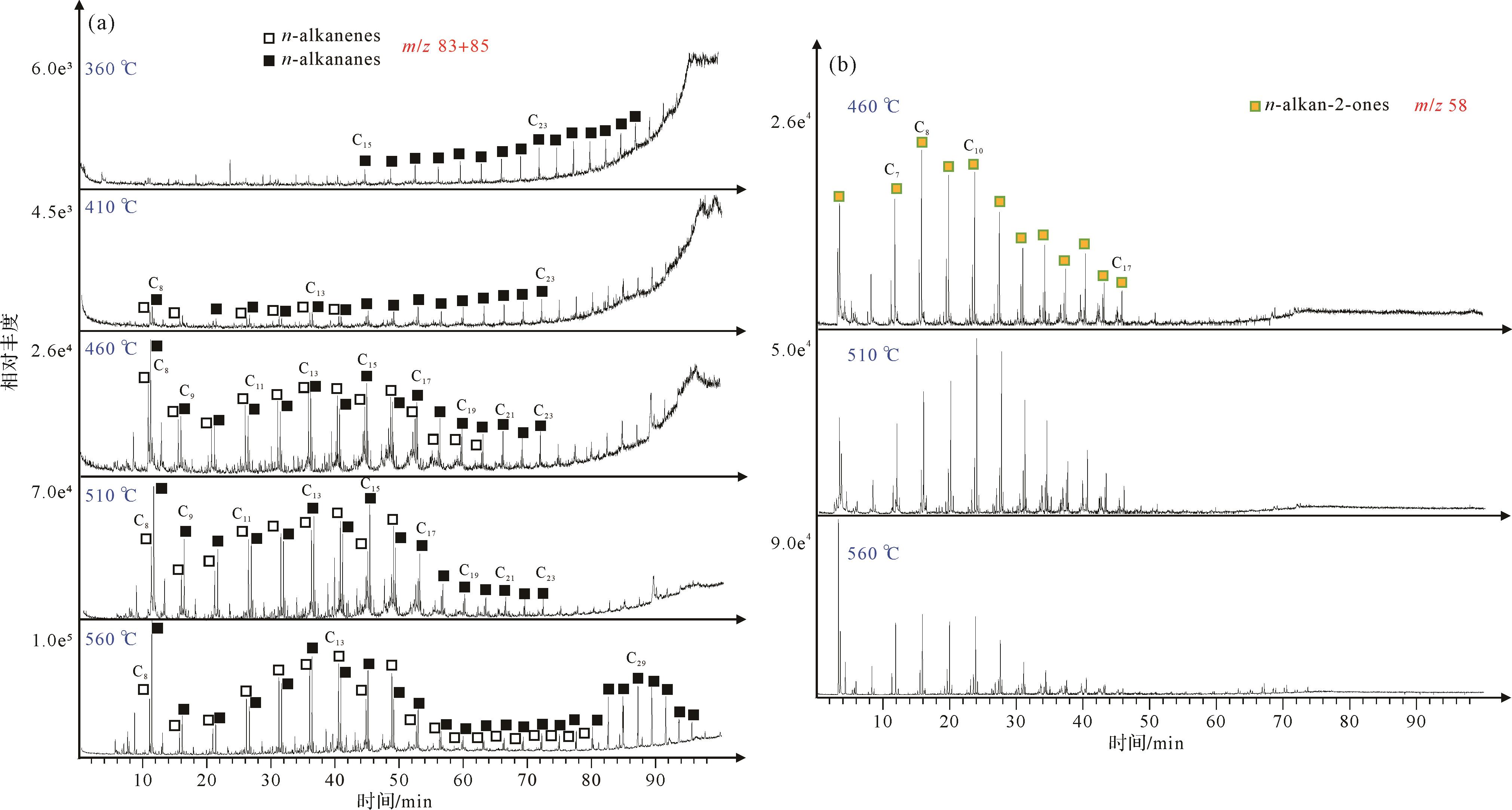
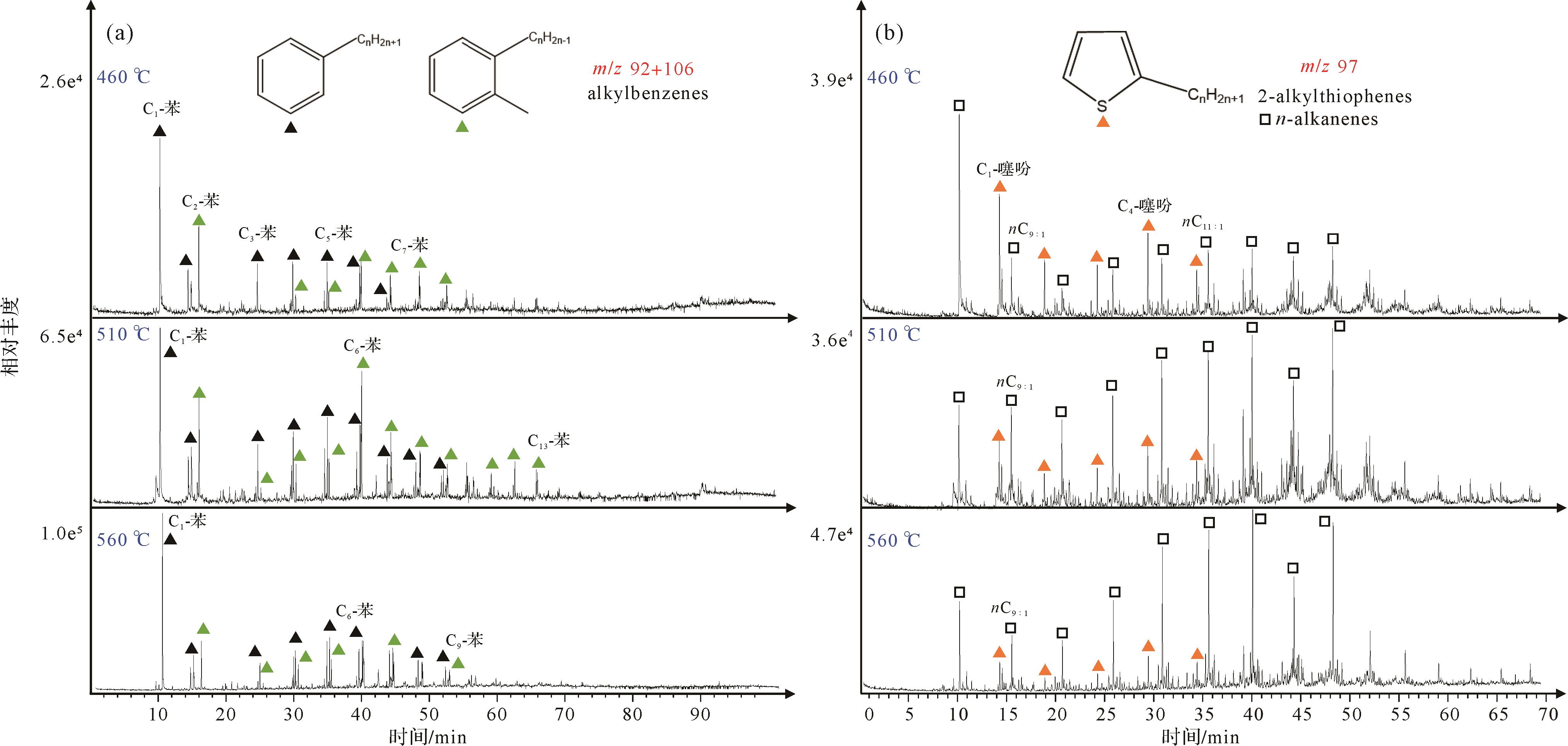
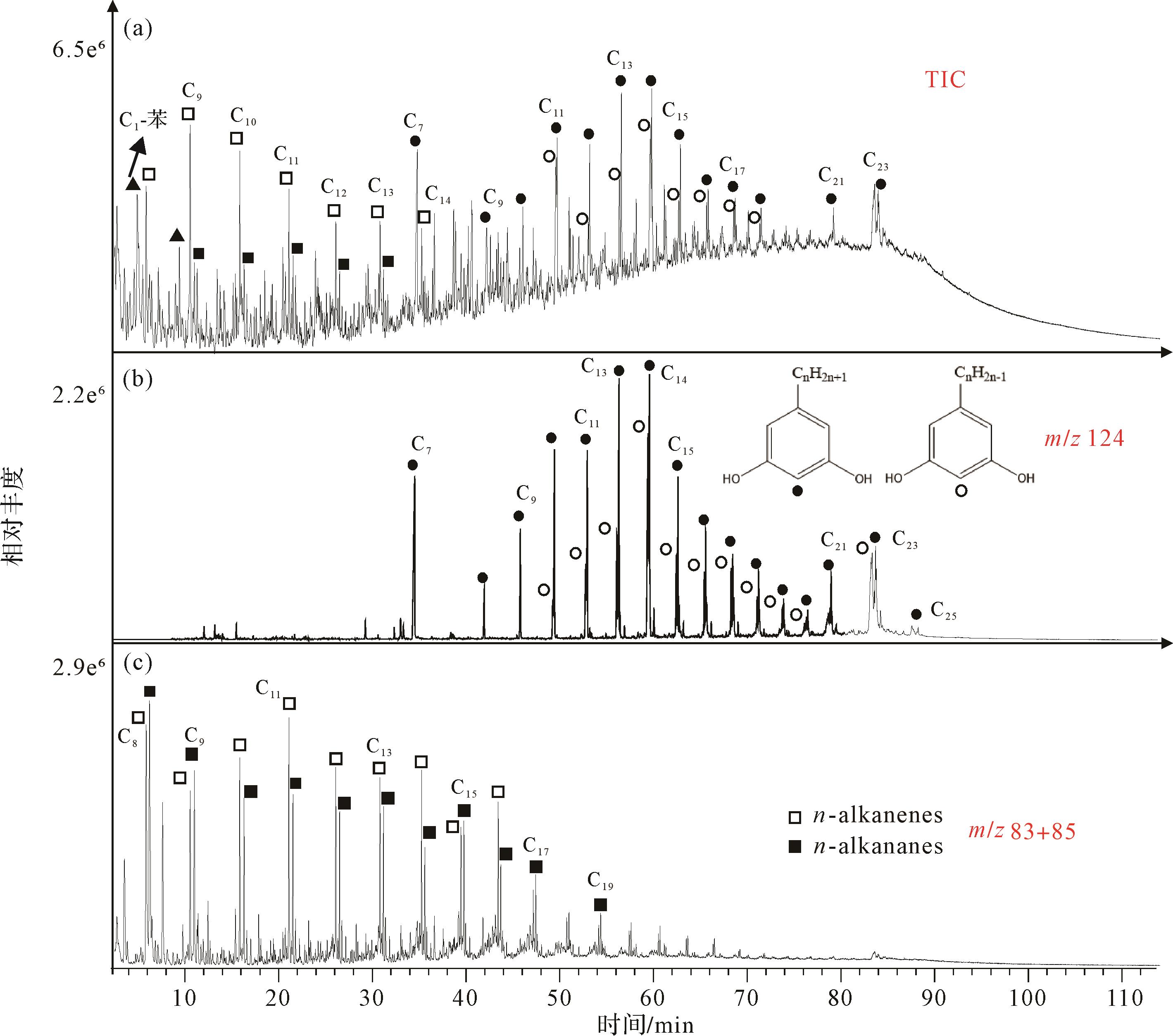
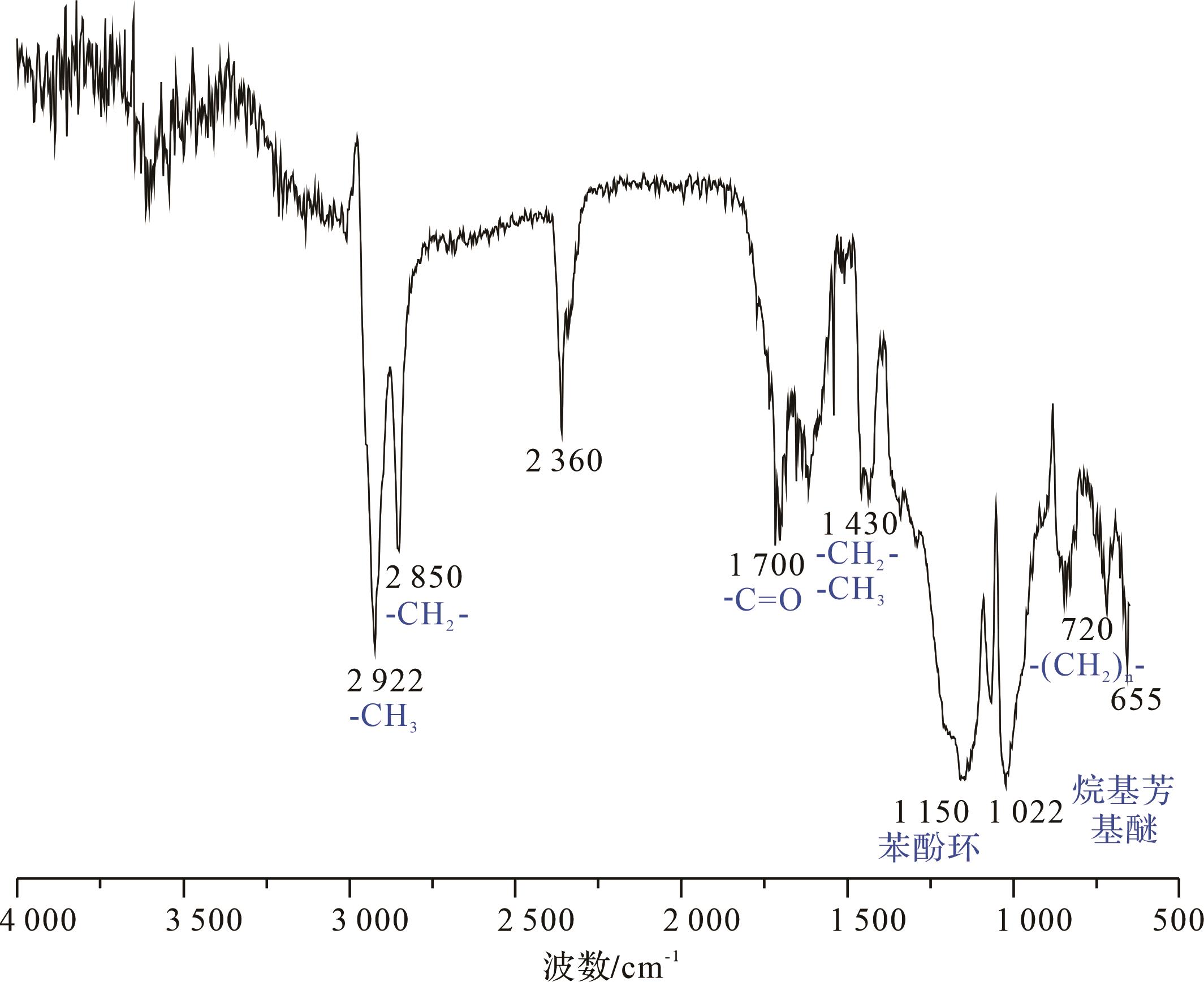
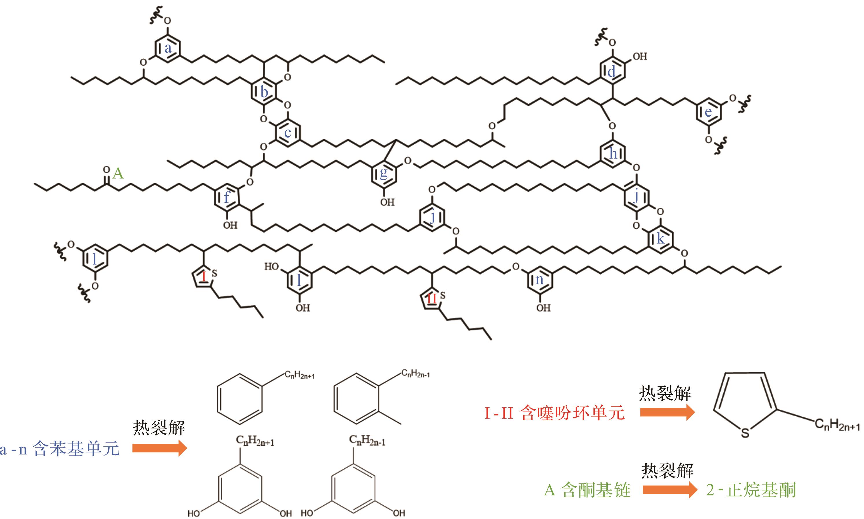
2026, 44(3): 1176-1197.
doi: 10.14027/j.issn.1000-0550.2025.018
Abstract:
Objective Following the mass extinction at the end of the Permian, microbialites were widely distributed in southern China, indicating a microbial bloom in the Lower Triassic following the cataclysm. However, microbialites generally exhibit low paleo-productivity, which seems to contradict the microbial explosion. This study analyzed the microbialites at the base of the Triassic Tianwan section in the Luodian area of Guizhou province, focusing on the petrological characteristics of micritic pellets and their thermal metamorphic evolution and sources of organic matter. The study clarifies the respective influences of microbially derived and seawater-trapped organic matter on pellet formation, with the aim of providing empirical evidence for exploring carbon cycling mechanisms in post-extinction microbialite systems. Methods In situ micro-area analytical techniques (optical microscopy, fluorescence microscopy, scanning electron microscopy (SEM) with energy-dispersive spectroscopy (EDS), and laser Raman spectroscopy) were used to conduct a detailed analysis of various types of peloids within the microbialites from the Tianwan section. These reveal the distribution patterns and thermal metamorphic evolutionary characteristics of internal organic matter. Results Based on morphology and infill materials, the various peloids were classified into six types: type I (microbially-induced peloid, MIP); type II (recrystallized microbially-induced peloid, RMIP); type III (aggregated detrital peloid, ADP); type IV (intraskeletal peloid, ISP); type V (dolomitized peloid, DP); and type VI (aggregated microbially-induced peloid, AMIP). Raman spectroscopy-derived metamorphic roasting temperatures provide insights into the thermal history and transformation of these peloids. The organic matter in types I, II, IV and VI (MIP, RMIP, ISP and AMIP) shows thermal maturity similar to that found in primary cyanobacteria in microbialites and shell fragments, indicating a common diagenetic history and microbial origin. Of these, peloids I, II and VI exhibit low thermal maturation temperatures, with organic matter mainly derived from the photosynthetic and metabolic processes of primary cyanobacteria and other microorganisms within microbialite systems. Specifically, peloid VI formed when micritic particles wrapped around peloid I, linked to bioclastic micritization. peloid IV shows moderate thermal maturation temperatures, resulting from a mix of microbial micritization and siliceous clastic material. By contrast, peloids III and V (ADP and DP) evidenced significantly higher metamorphic temperatures, suggesting multiple thermal alteration events. Peloid III may have been formed by neomorphism; peloid V was primarily shaped by bioclastic micritization. Conclusions In summary, after the end-Permian mass extinction, microbial blooms, especially cyanobacterial photosynthesis, led to the generation of large amounts of dissolved organic carbon (DOC) in the oceans. Due to frequent fluctuations in seawater redox conditions and rapid temperature increases, the DOC was typically oxidized into CO2 and released into the atmosphere, with only a small fraction being preserved as particulate organic carbon (POC) and deposited on the seafloor. Raman geothermometric analysis shows that most of the organic matter in the microbialite peloids, particularly in those associated with bioclastic peloidal envelopes, originated from the metabolic activity of primary cyanobacteria, which was the original organic matter in the microbialite system. A small portion of the organic matter may have been sourced from long-stored terrestrial organic matter in seawater, which underwent multiple diagenetic thermal alterations and shows higher thermal maturation temperatures. The thermal maturation of organic matter and mineral recrystallization during diagenesis had a significant impact on the efficiency of organic matter preservation, ultimately resulting in a low total organic carbon (TOC) content in the microbialites.
Objective Following the mass extinction at the end of the Permian, microbialites were widely distributed in southern China, indicating a microbial bloom in the Lower Triassic following the cataclysm. However, microbialites generally exhibit low paleo-productivity, which seems to contradict the microbial explosion. This study analyzed the microbialites at the base of the Triassic Tianwan section in the Luodian area of Guizhou province, focusing on the petrological characteristics of micritic pellets and their thermal metamorphic evolution and sources of organic matter. The study clarifies the respective influences of microbially derived and seawater-trapped organic matter on pellet formation, with the aim of providing empirical evidence for exploring carbon cycling mechanisms in post-extinction microbialite systems. Methods In situ micro-area analytical techniques (optical microscopy, fluorescence microscopy, scanning electron microscopy (SEM) with energy-dispersive spectroscopy (EDS), and laser Raman spectroscopy) were used to conduct a detailed analysis of various types of peloids within the microbialites from the Tianwan section. These reveal the distribution patterns and thermal metamorphic evolutionary characteristics of internal organic matter. Results Based on morphology and infill materials, the various peloids were classified into six types: type I (microbially-induced peloid, MIP); type II (recrystallized microbially-induced peloid, RMIP); type III (aggregated detrital peloid, ADP); type IV (intraskeletal peloid, ISP); type V (dolomitized peloid, DP); and type VI (aggregated microbially-induced peloid, AMIP). Raman spectroscopy-derived metamorphic roasting temperatures provide insights into the thermal history and transformation of these peloids. The organic matter in types I, II, IV and VI (MIP, RMIP, ISP and AMIP) shows thermal maturity similar to that found in primary cyanobacteria in microbialites and shell fragments, indicating a common diagenetic history and microbial origin. Of these, peloids I, II and VI exhibit low thermal maturation temperatures, with organic matter mainly derived from the photosynthetic and metabolic processes of primary cyanobacteria and other microorganisms within microbialite systems. Specifically, peloid VI formed when micritic particles wrapped around peloid I, linked to bioclastic micritization. peloid IV shows moderate thermal maturation temperatures, resulting from a mix of microbial micritization and siliceous clastic material. By contrast, peloids III and V (ADP and DP) evidenced significantly higher metamorphic temperatures, suggesting multiple thermal alteration events. Peloid III may have been formed by neomorphism; peloid V was primarily shaped by bioclastic micritization. Conclusions In summary, after the end-Permian mass extinction, microbial blooms, especially cyanobacterial photosynthesis, led to the generation of large amounts of dissolved organic carbon (DOC) in the oceans. Due to frequent fluctuations in seawater redox conditions and rapid temperature increases, the DOC was typically oxidized into CO2 and released into the atmosphere, with only a small fraction being preserved as particulate organic carbon (POC) and deposited on the seafloor. Raman geothermometric analysis shows that most of the organic matter in the microbialite peloids, particularly in those associated with bioclastic peloidal envelopes, originated from the metabolic activity of primary cyanobacteria, which was the original organic matter in the microbialite system. A small portion of the organic matter may have been sourced from long-stored terrestrial organic matter in seawater, which underwent multiple diagenetic thermal alterations and shows higher thermal maturation temperatures. The thermal maturation of organic matter and mineral recrystallization during diagenesis had a significant impact on the efficiency of organic matter preservation, ultimately resulting in a low total organic carbon (TOC) content in the microbialites.
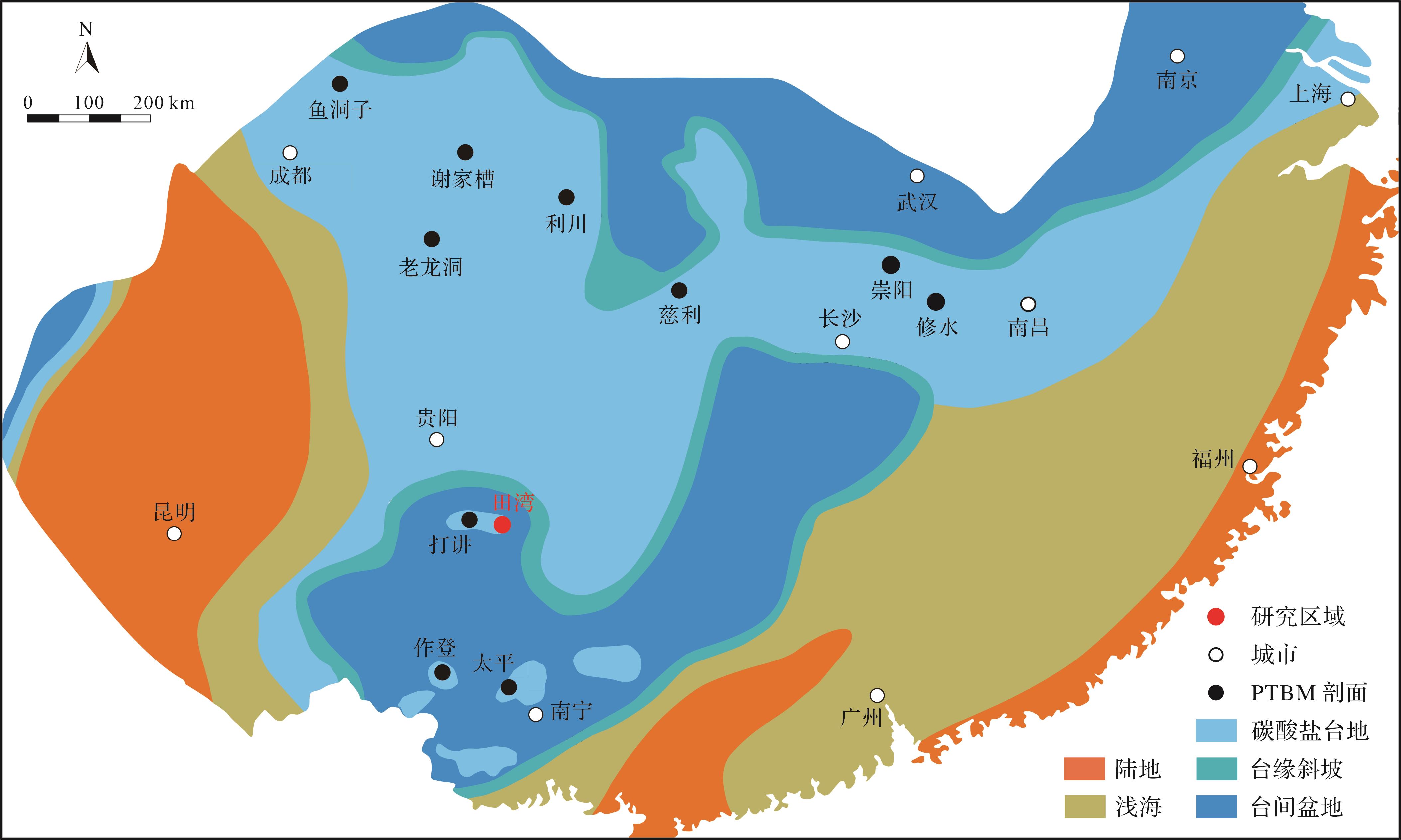
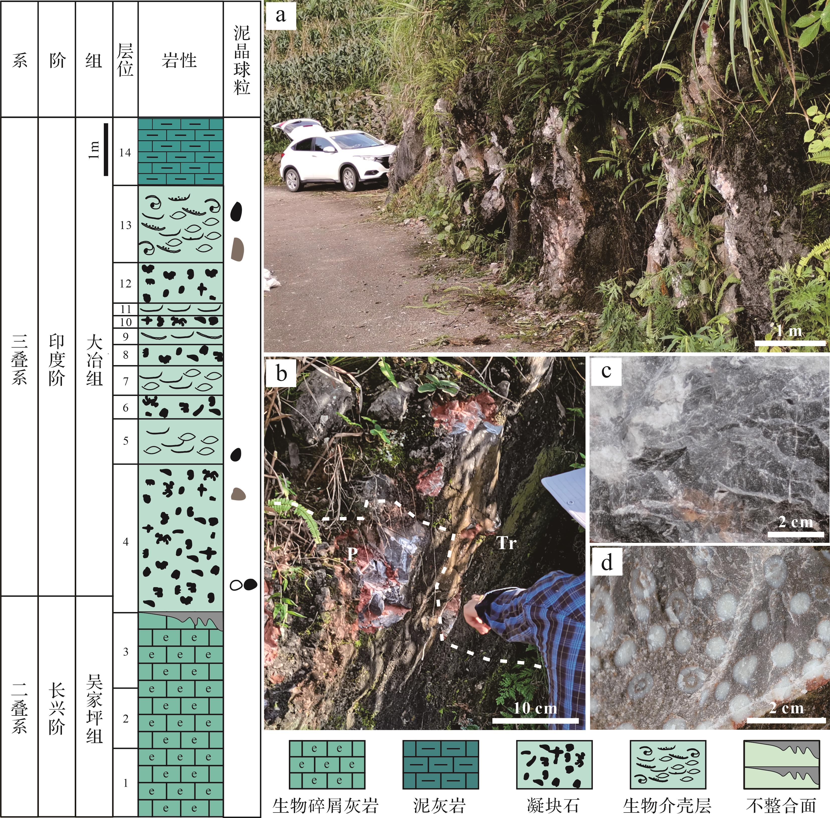
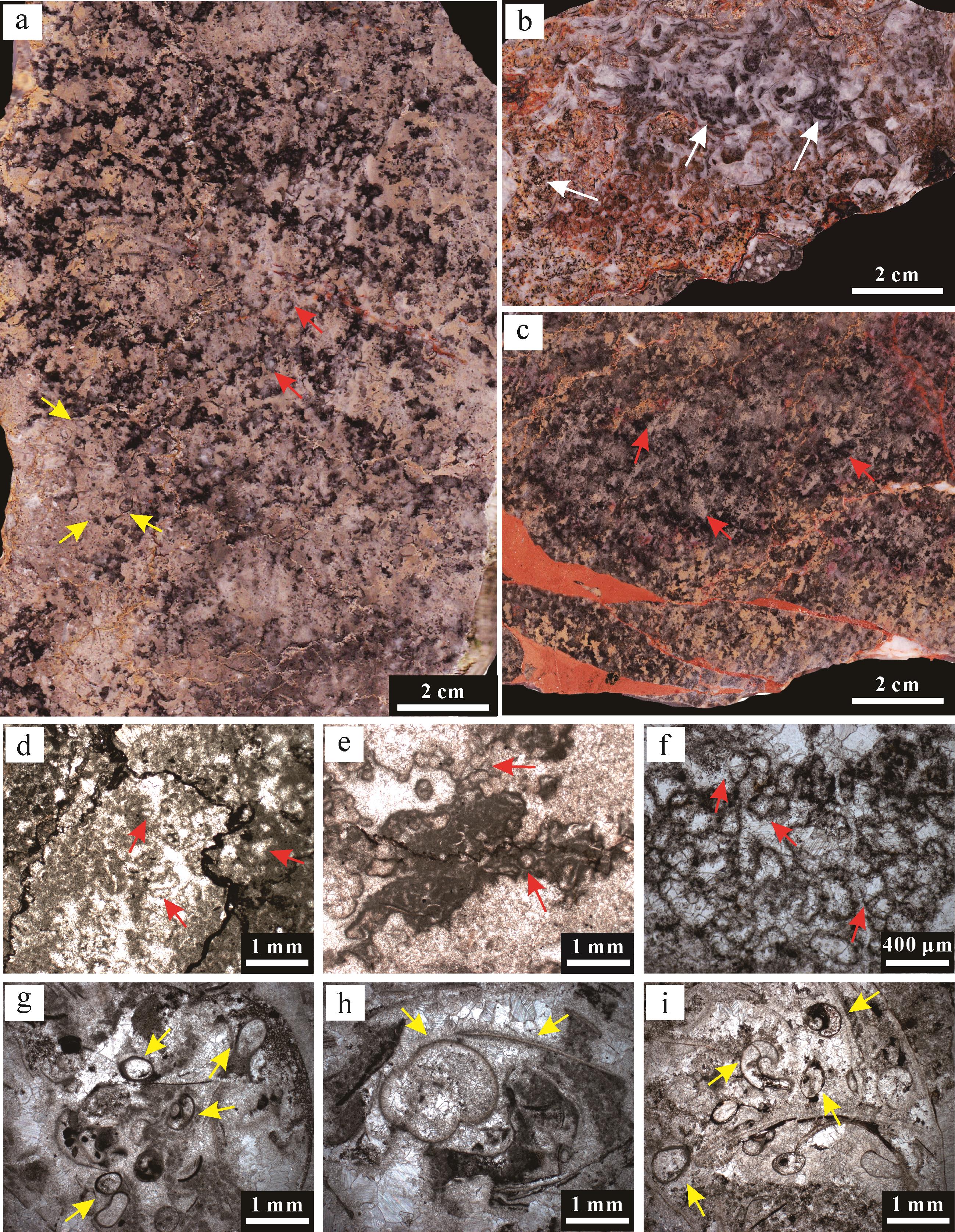
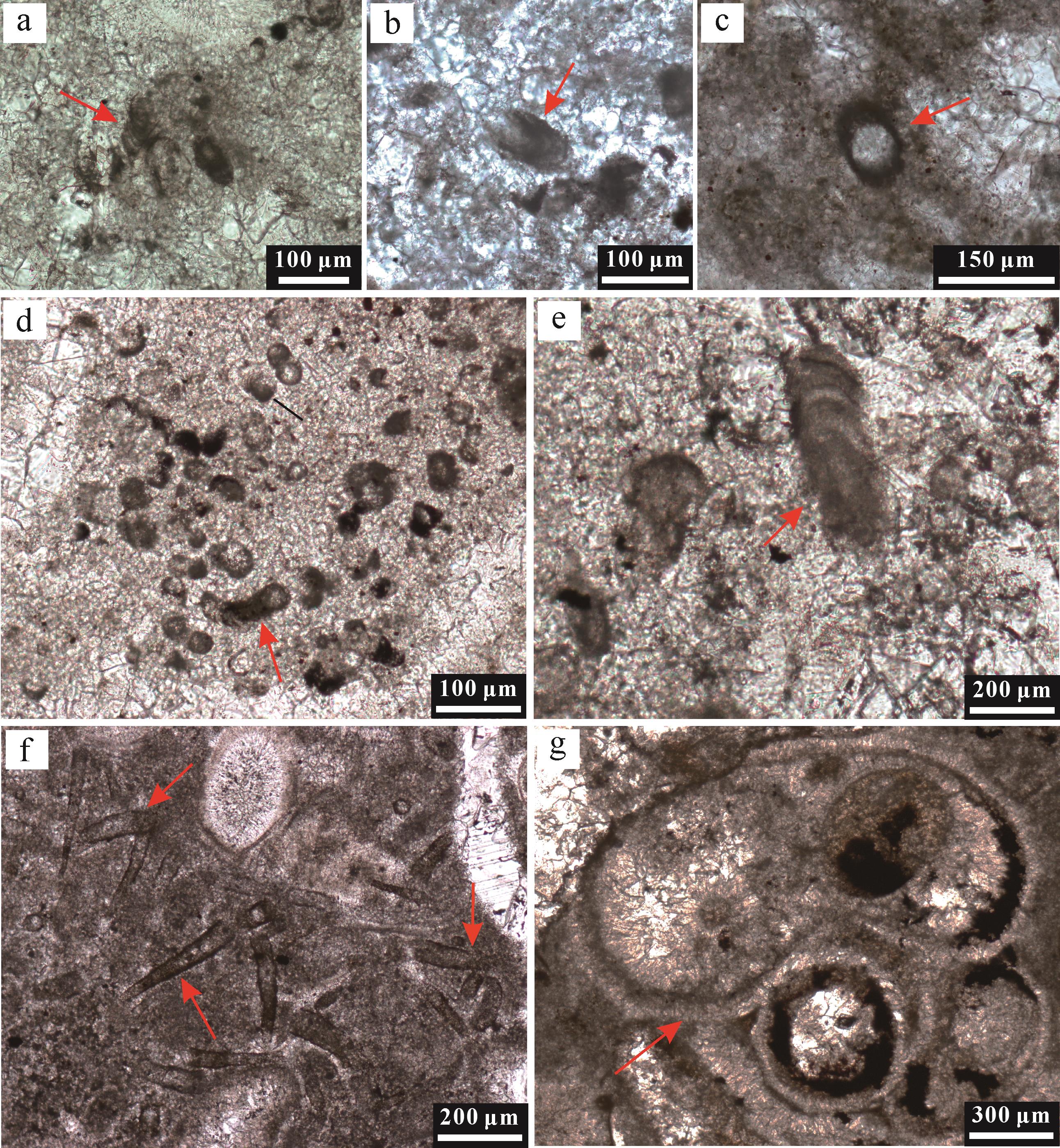
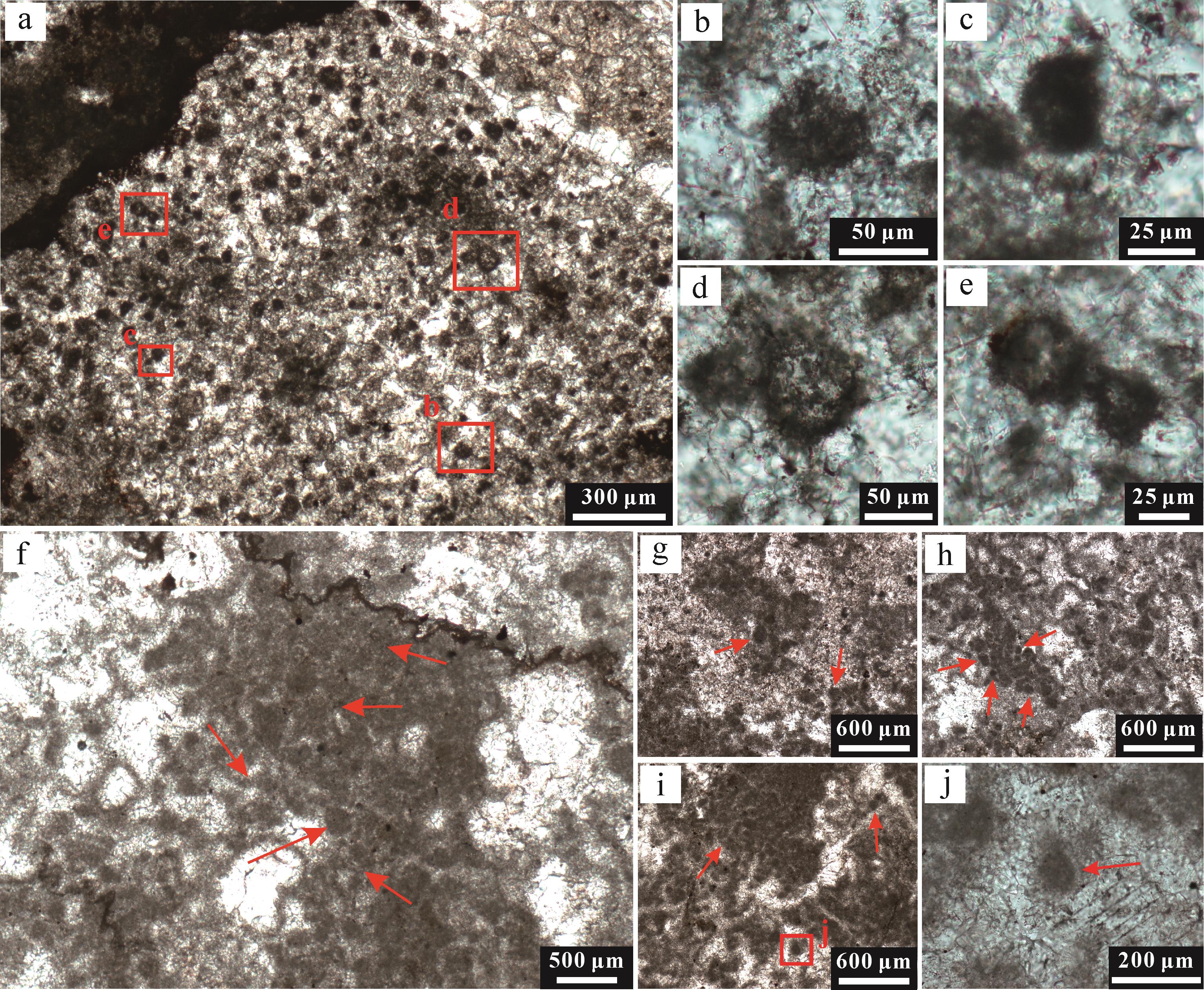
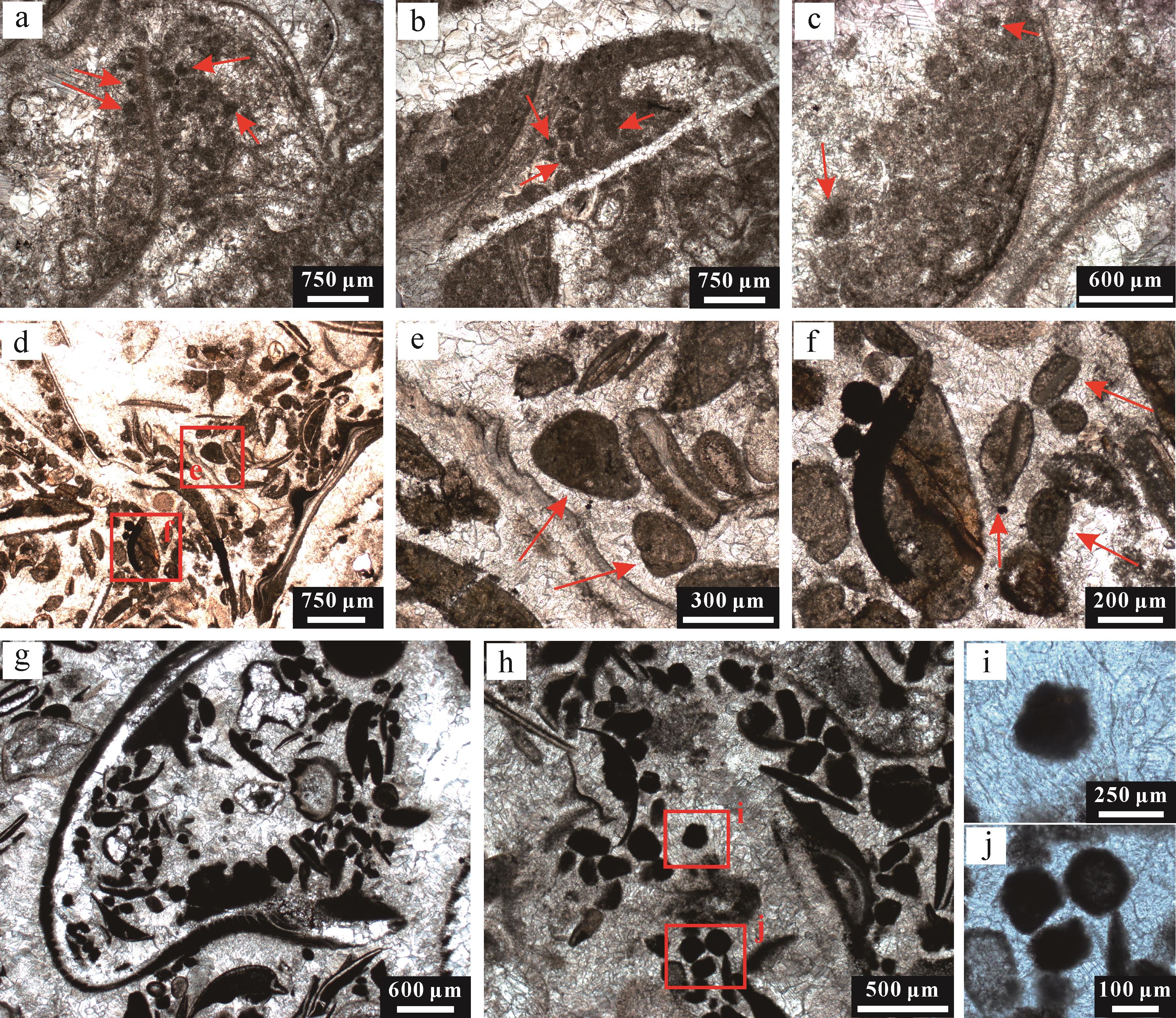
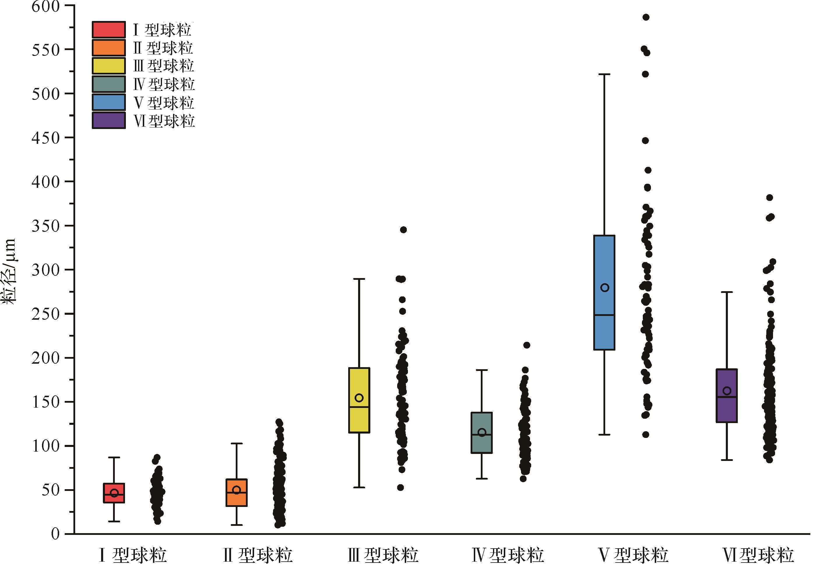
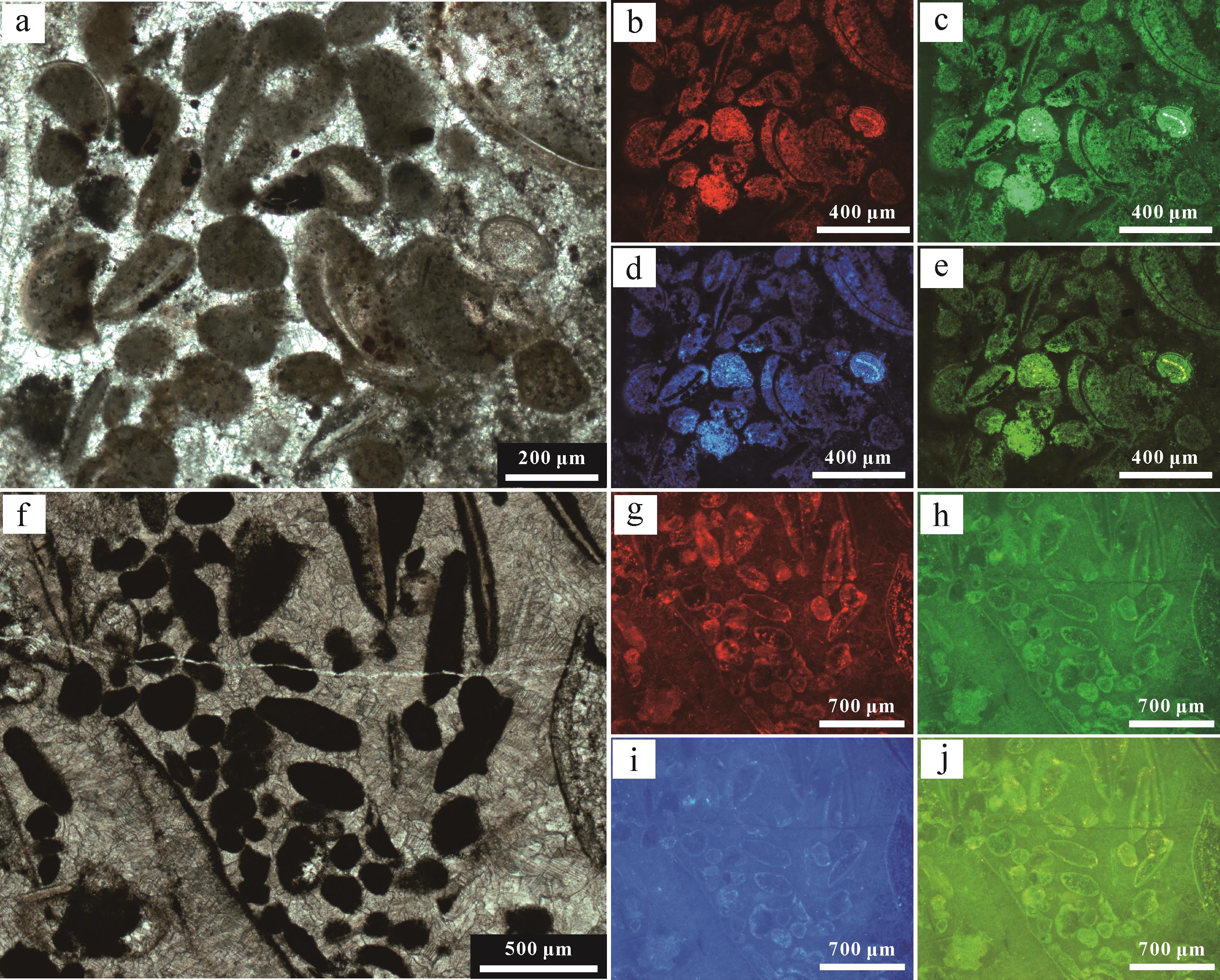
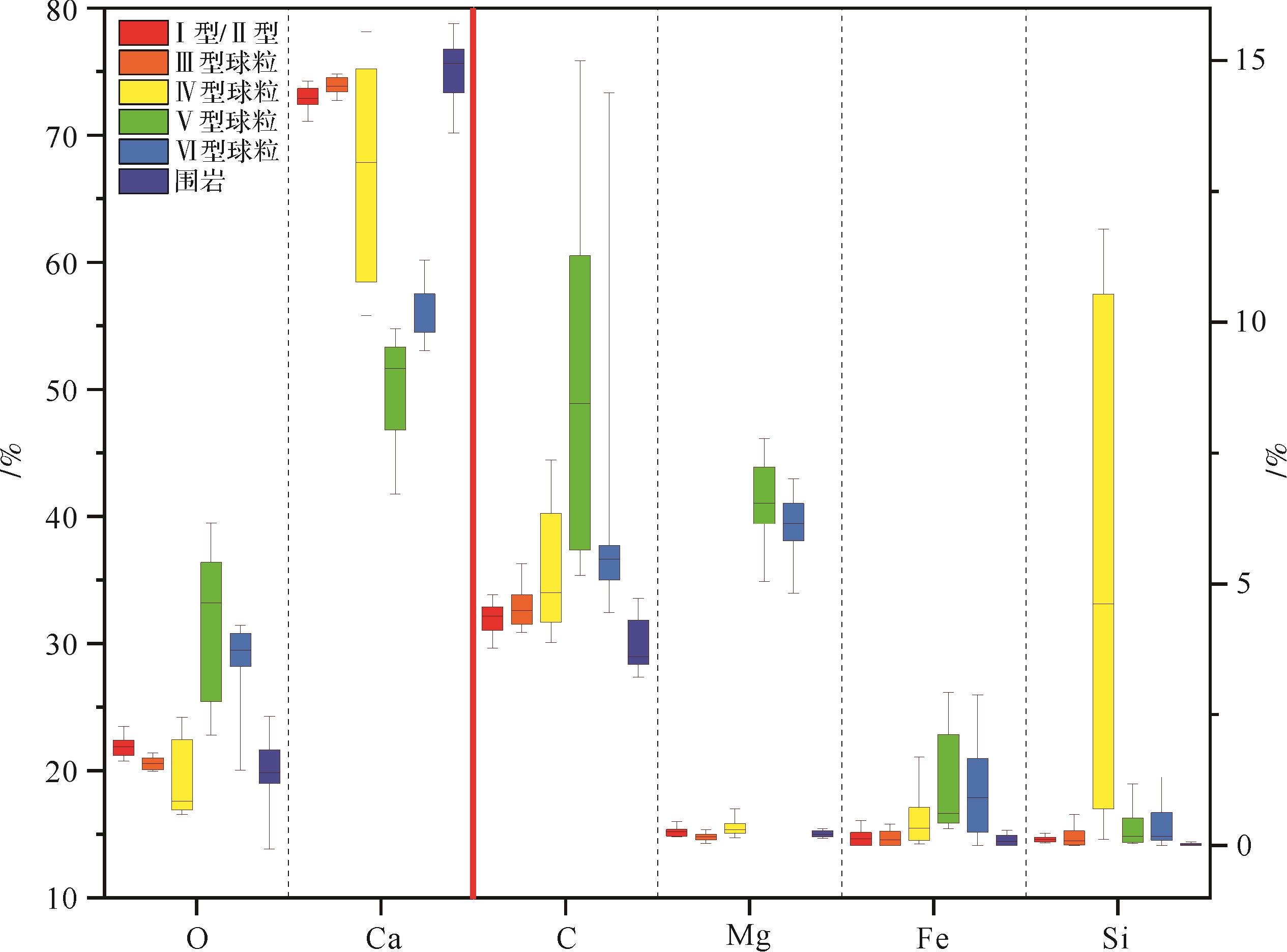
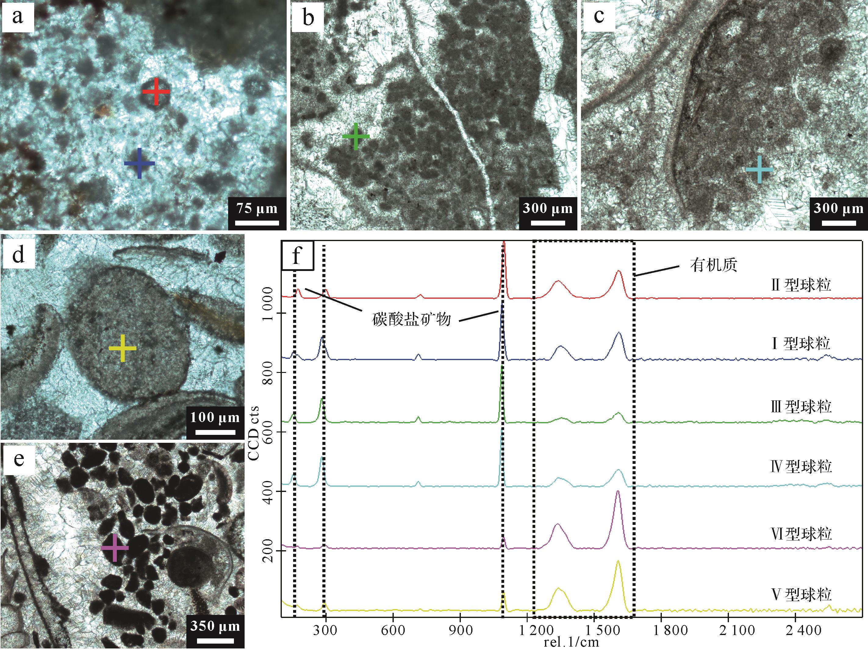
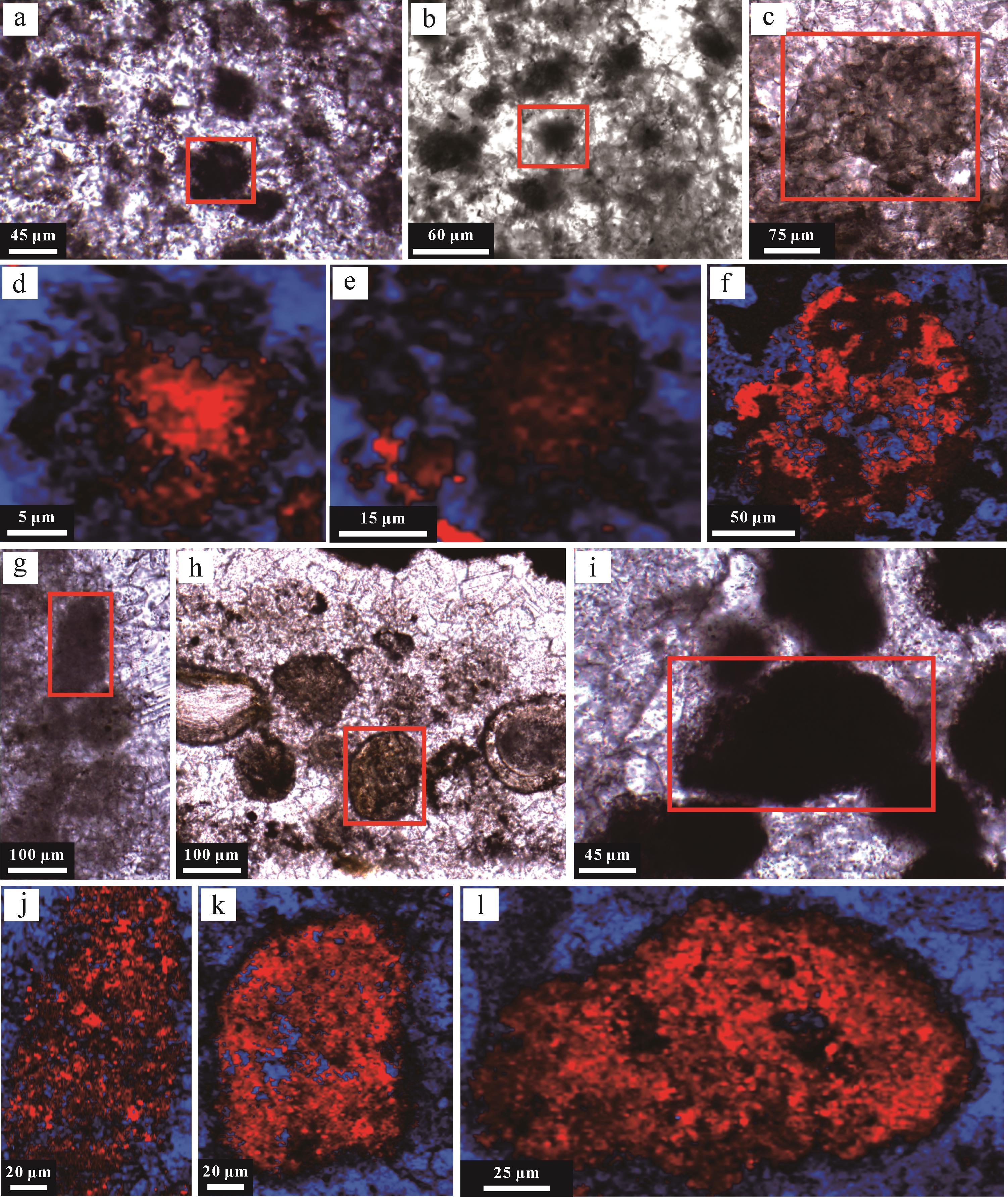
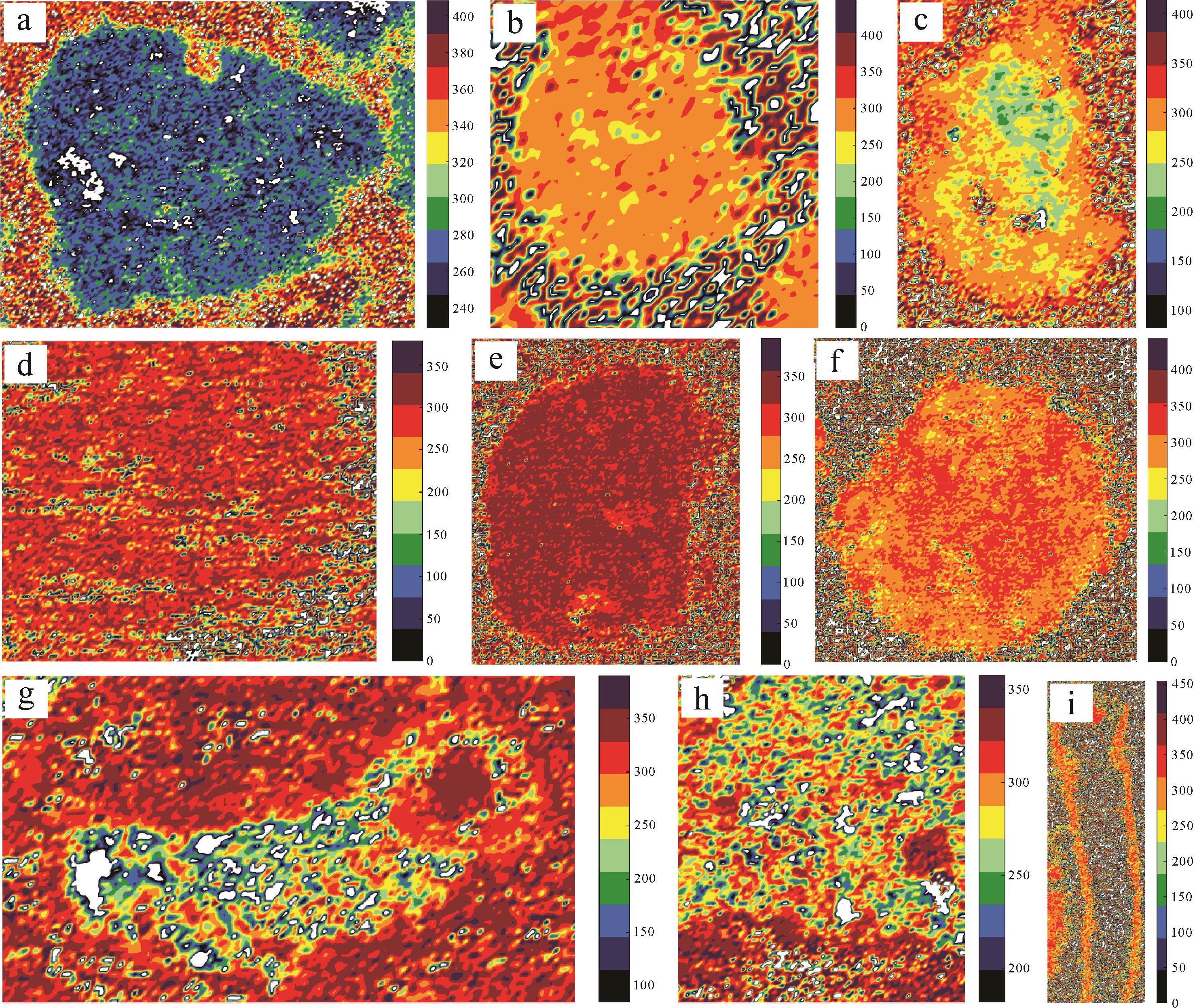
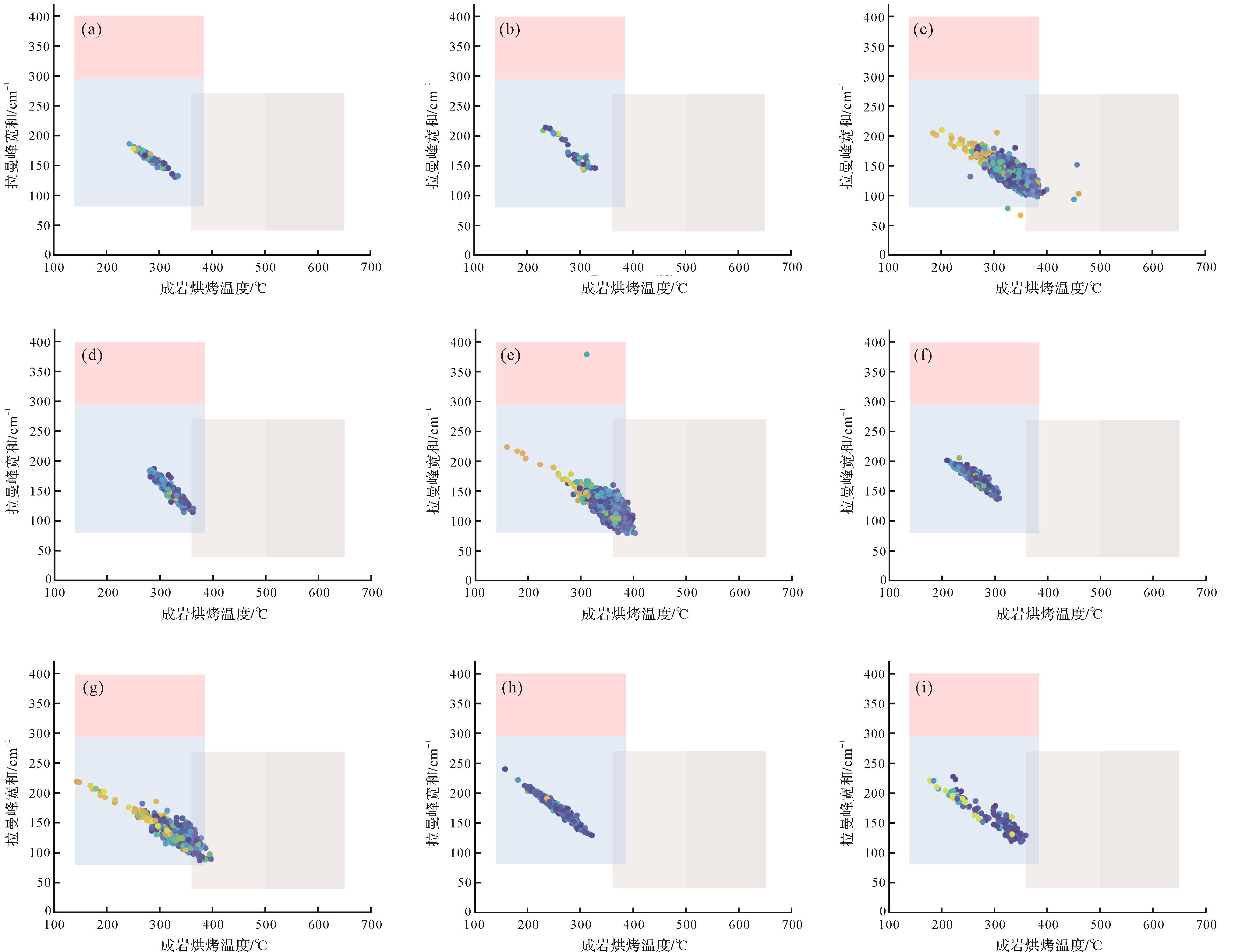
2026, 44(3): 1198-1214.
doi: 10.14027/j.issn.1000-0550.2024.071
Abstract:
Objective With the continuous breakthroughs in oil and gas exploration and development technology, shale oil is expected to become an important replacement for traditional petroleum resources.It is of great significance for the exploration and development of shale oil laminae to clarify the development characteristics of shale laminae, quantitative characterization of pore structure, occurrence characteristics of shale oil and oil-bearing properties. Methods The organic-rich shale of the Chang 7 member of Yanchang Formation in the southeastern Ordos Basin was studied for its development characteristics, reservoir performance and the oiliness of different shale types. Thin section observation, scanning electron microscopy and high-pressure mercury intrusion and nitrogen adsorption were used to classify the types of shale laminae and clarify the diagnostic properties of oil-bearing shale. Results Laminae are developed in silty mudstone, argillaceous siltstone, siltstone, black shale and tuff in the study area. These were found to be macroscopically divided into three types: thick laminated shale (The thickness is between 1-10 cm), medium-thickness laminated shale (The thickness is between 1 mm~1 cm), and thin laminated shale (The thickness is less than 1 mm). Felsic minerals (27.7%-79.0%) and clay minerals (12.0%-63.0%) dominate the mineral composition of the Chang 7 shale laminae, with a small content of carbonate minerals (3.2%-27.0%). Microscopically, depending on the mineral composition, the shale occurs in four layer units (Silty, argillaceous, organic-rich and tuff laminae) and two layer combinations(Combination of highly siliceous laminae and high clay laminae.). Silty laminae have rich pore types, good reservoir physical properties, good pore connectivity, high oil saturation, accounting for 46% of the whole, and good oil-bearing properties; argillaceous and organic-rich laminae have medium physical properties and poor pore connectivity, oil saturation accounts for 32% and 22% of the whole, and the oil-bearing property is poor; The reservoir physical properties and oil-bearing properties of tuff laminae are the worst, and there are few pore structures with good reservoir properties in the study area. The high-clay laminae combination has more nanopores and micropores with small pore size, which have medium reservoir performance and poor oil-bearing properties. The highly siliceous laminae combination has a range of pore sizes and good reservoir performance, and would provide more reservoir space for oil migration and good oil-bearing. Conclusions The combination of silty laminae and highly siliceous laminae is significantly superior to the other laminae types in terms of reservoir space, reservoir performance and oil content. These findings provide an important reference for shale oil evaluation.
Objective With the continuous breakthroughs in oil and gas exploration and development technology, shale oil is expected to become an important replacement for traditional petroleum resources.It is of great significance for the exploration and development of shale oil laminae to clarify the development characteristics of shale laminae, quantitative characterization of pore structure, occurrence characteristics of shale oil and oil-bearing properties. Methods The organic-rich shale of the Chang 7 member of Yanchang Formation in the southeastern Ordos Basin was studied for its development characteristics, reservoir performance and the oiliness of different shale types. Thin section observation, scanning electron microscopy and high-pressure mercury intrusion and nitrogen adsorption were used to classify the types of shale laminae and clarify the diagnostic properties of oil-bearing shale. Results Laminae are developed in silty mudstone, argillaceous siltstone, siltstone, black shale and tuff in the study area. These were found to be macroscopically divided into three types: thick laminated shale (The thickness is between 1-10 cm), medium-thickness laminated shale (The thickness is between 1 mm~1 cm), and thin laminated shale (The thickness is less than 1 mm). Felsic minerals (27.7%-79.0%) and clay minerals (12.0%-63.0%) dominate the mineral composition of the Chang 7 shale laminae, with a small content of carbonate minerals (3.2%-27.0%). Microscopically, depending on the mineral composition, the shale occurs in four layer units (Silty, argillaceous, organic-rich and tuff laminae) and two layer combinations(Combination of highly siliceous laminae and high clay laminae.). Silty laminae have rich pore types, good reservoir physical properties, good pore connectivity, high oil saturation, accounting for 46% of the whole, and good oil-bearing properties; argillaceous and organic-rich laminae have medium physical properties and poor pore connectivity, oil saturation accounts for 32% and 22% of the whole, and the oil-bearing property is poor; The reservoir physical properties and oil-bearing properties of tuff laminae are the worst, and there are few pore structures with good reservoir properties in the study area. The high-clay laminae combination has more nanopores and micropores with small pore size, which have medium reservoir performance and poor oil-bearing properties. The highly siliceous laminae combination has a range of pore sizes and good reservoir performance, and would provide more reservoir space for oil migration and good oil-bearing. Conclusions The combination of silty laminae and highly siliceous laminae is significantly superior to the other laminae types in terms of reservoir space, reservoir performance and oil content. These findings provide an important reference for shale oil evaluation.